bobspirko.ca | Home | Canada Trips | US Trips | Hiking | Snowshoeing | MAP | About
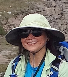 |
In Memoriam: Becky Mansour On September 11, 2015, Becky Mansour, 59, passed away following a tragic fall on Mount Daly on August 23. An avid hiker and scrambler, she completed hundreds of trips. Dinah and I had the pleasure of knowing her on a few trips and would like her to be remembered. As well as joining her on Noseeum Peak, we were with her on Crystal Ridge, Crystal Ridge GR, Quartzite Peak and Twin Cairns. |
Noseeum Peak
Banff National Park, Alberta
August 9, 2014
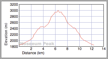
Distance: 12.2 km (7.6 mi)
Cumulative Elevation Gain: 1227 m (4026 ft)
Although the mountains on the Icefields Parkway are known for great alpine scenery, Noseeum Peak appears to hold a lion's share of stunning surroundings. The climb is filled with wonders around every corner. From hiking up Noseeum Creek and ascending alongside a tall waterfall to skirting a cobalt lake and traversing the summit ridge, there's scarcely a stretch that doesn't tantalize.
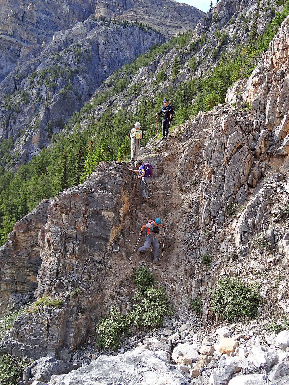
We have Marko Stravic to thank for finding a nearly hands-free route to the summit of Noseeum Peak. After parking at a pullout, Sonny Bou and I followed an intermittent trail on the right bank of Noseeum Creek. An hour after starting, we reached the headwall at the end of a valley. Somehow we missed the trail at the bottom. The gully we took looked easy – even inviting – but it turned out to be surprisingly steep. However, after scrambling up we found the trail that climbs the headwall. (The start of the headwall trail, as we learned on our descent, is left of the gully, up a steep, dirt slope.)
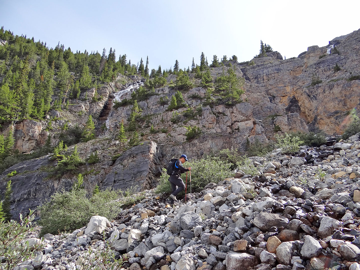
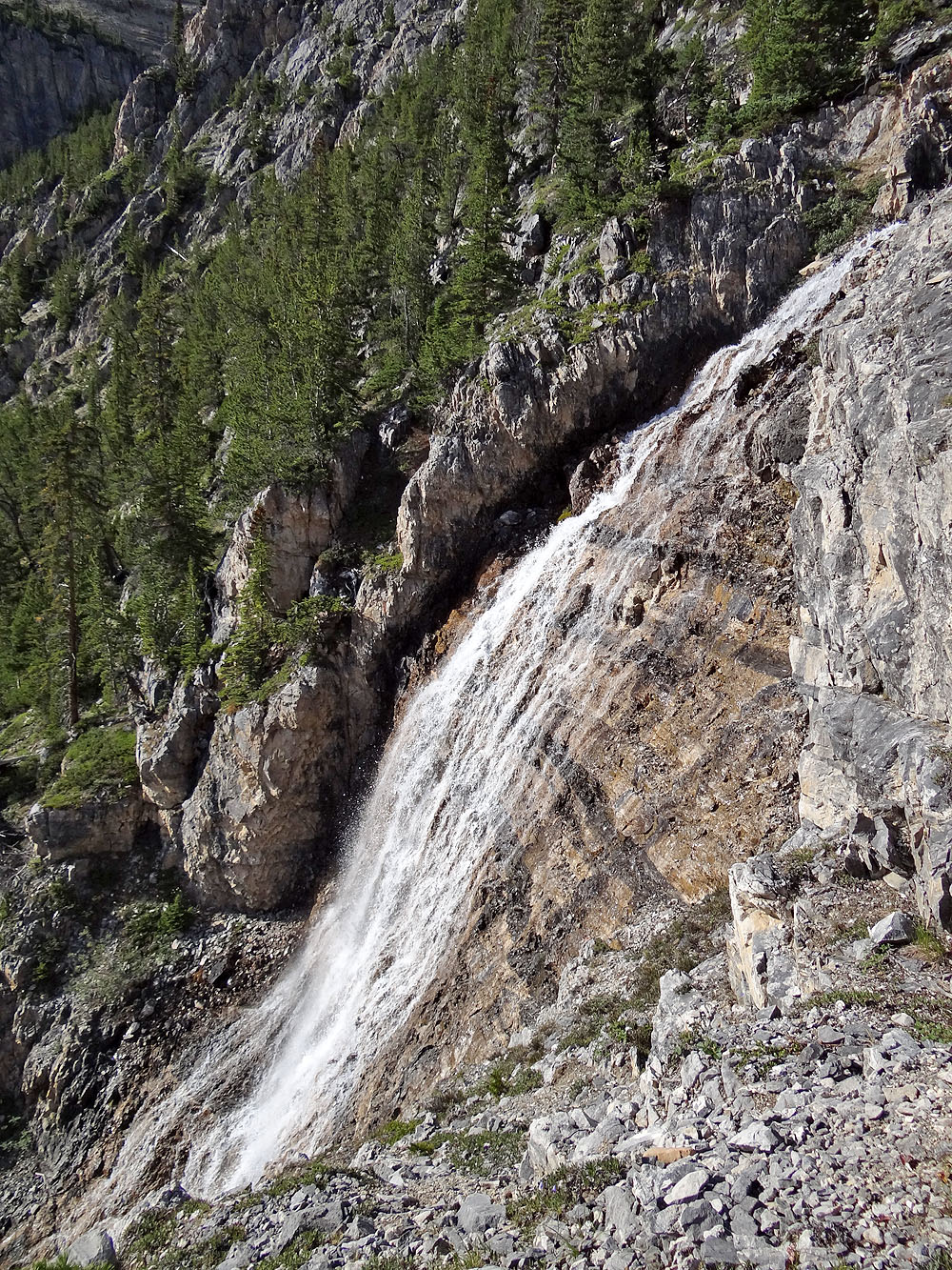
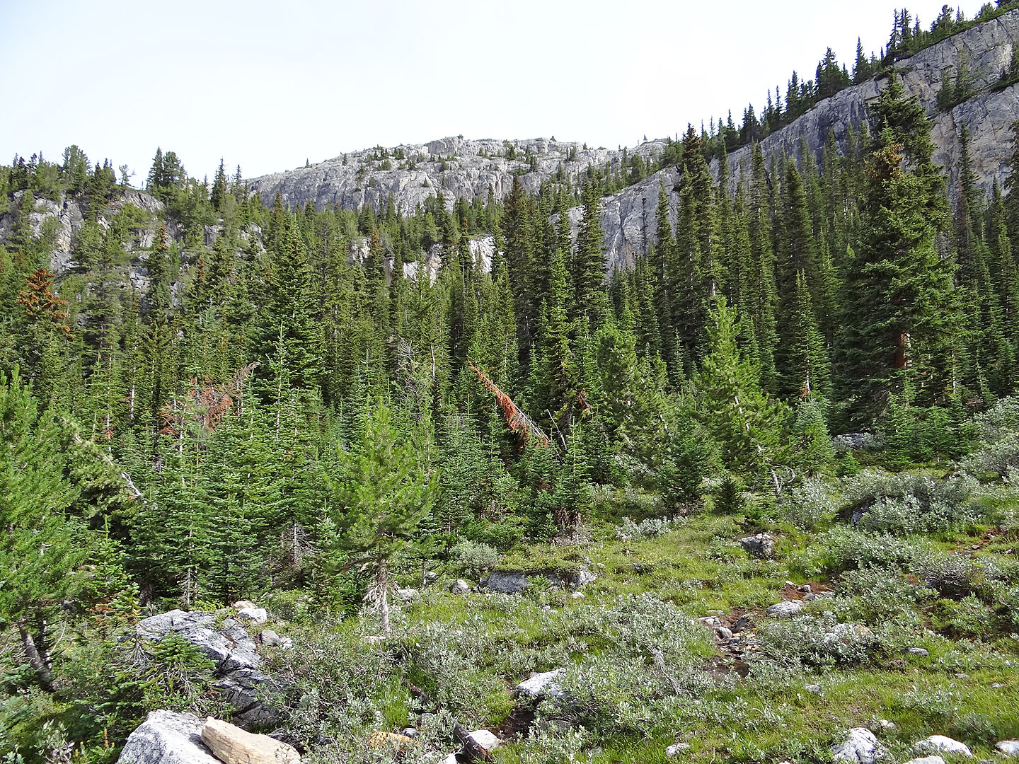
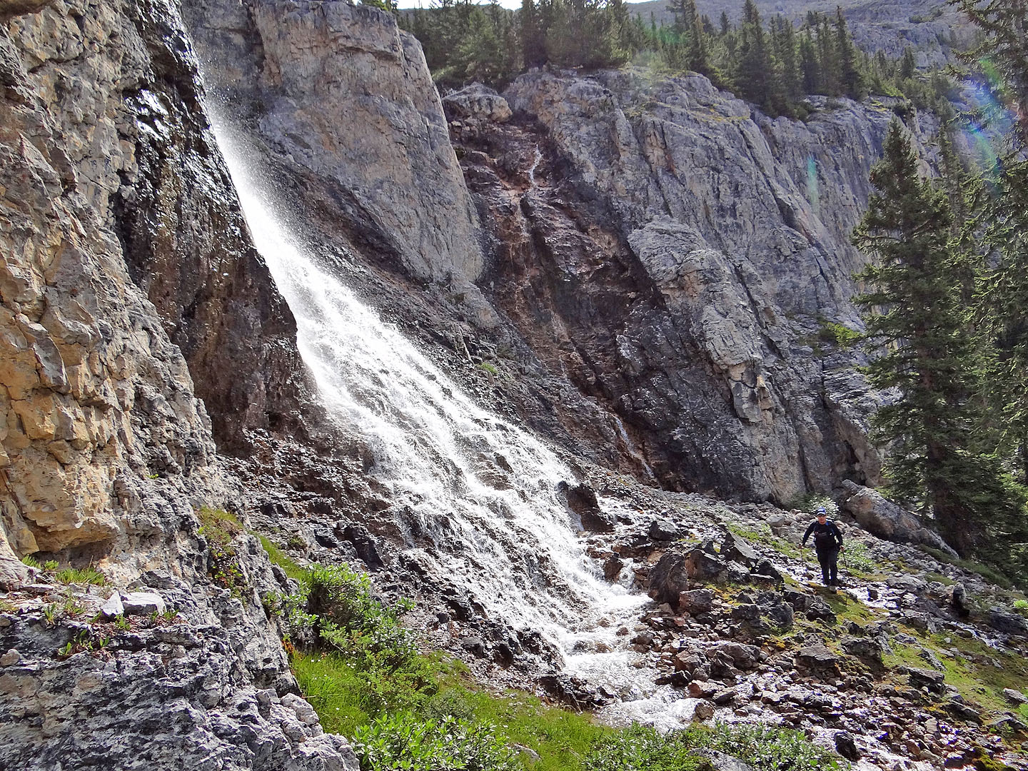
We followed the trail as it zig-zagged up the headwall before fading into a small, forested plateau lined by cliffs. Through the trees, we could make out the upper waterfall of Noseeum Creek. That was our next objective. After crossing a tiny glade, we hit a rocky stream and followed it up to the impressive falls. Flowing down rough rock, the water begins as a narrow torrent only to disperse into a magnificent broad curtain. Who could resist taking a photo?
After passing the falls, we turned a corner – a break in the cliffs – and started up a forested slope. We soon ran into a party of six also headed to Noseeum Peak. I knew most of them. Zora, Jonathan and Wendy were hiking partners in my bygone days with the Hostel Outdoor Group. I met Becky four years ago when I teamed up with Zora's group to snowshoe up Crystal Ridge. Rounding out their group were Jonathan's wife Bernadette and his work associate Hanna. Zora and her group didn't find a way up the headwall but had little trouble going up the wooded slope left of the lower waterfall. The eight of us finished the trip together.
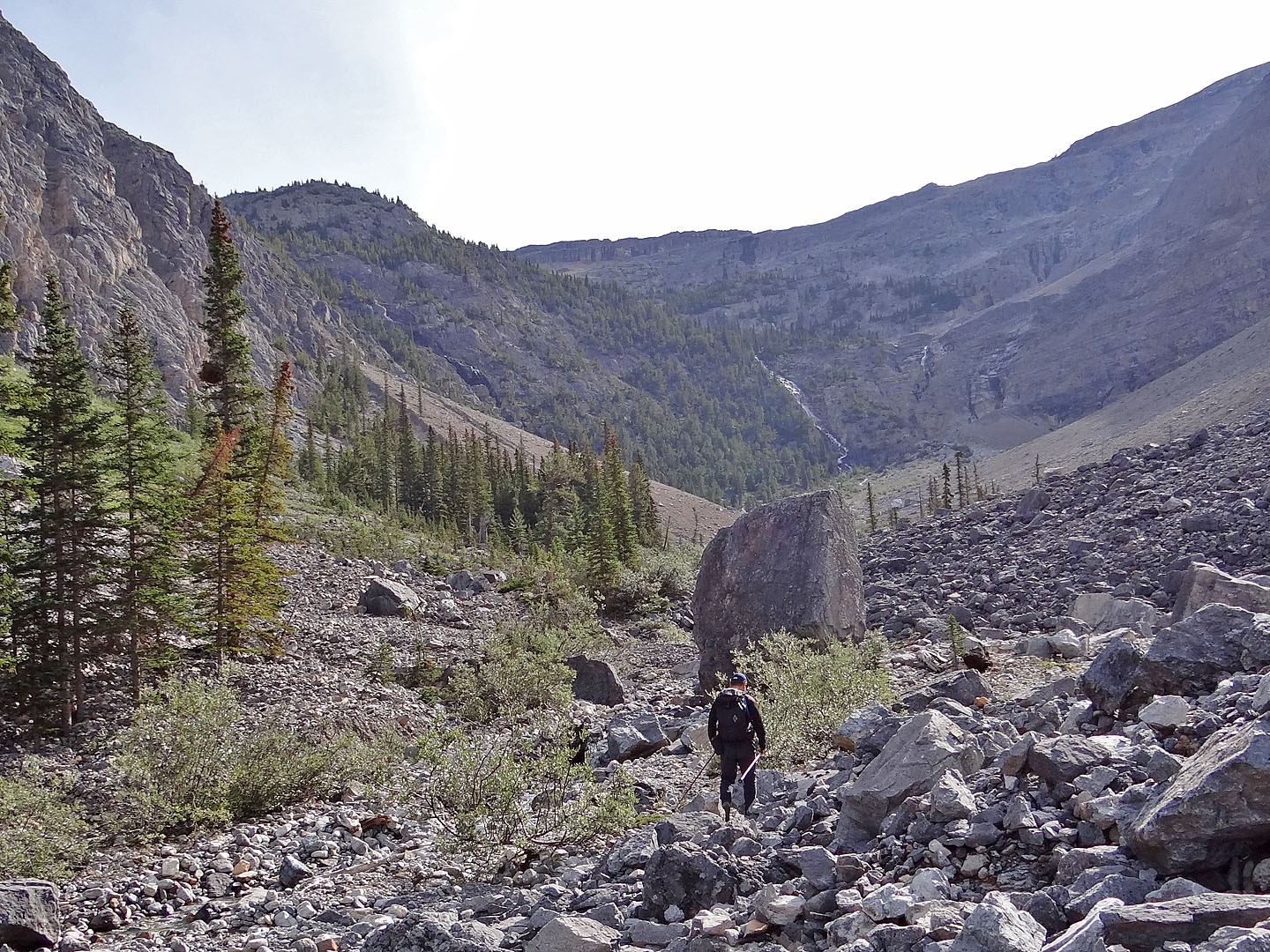
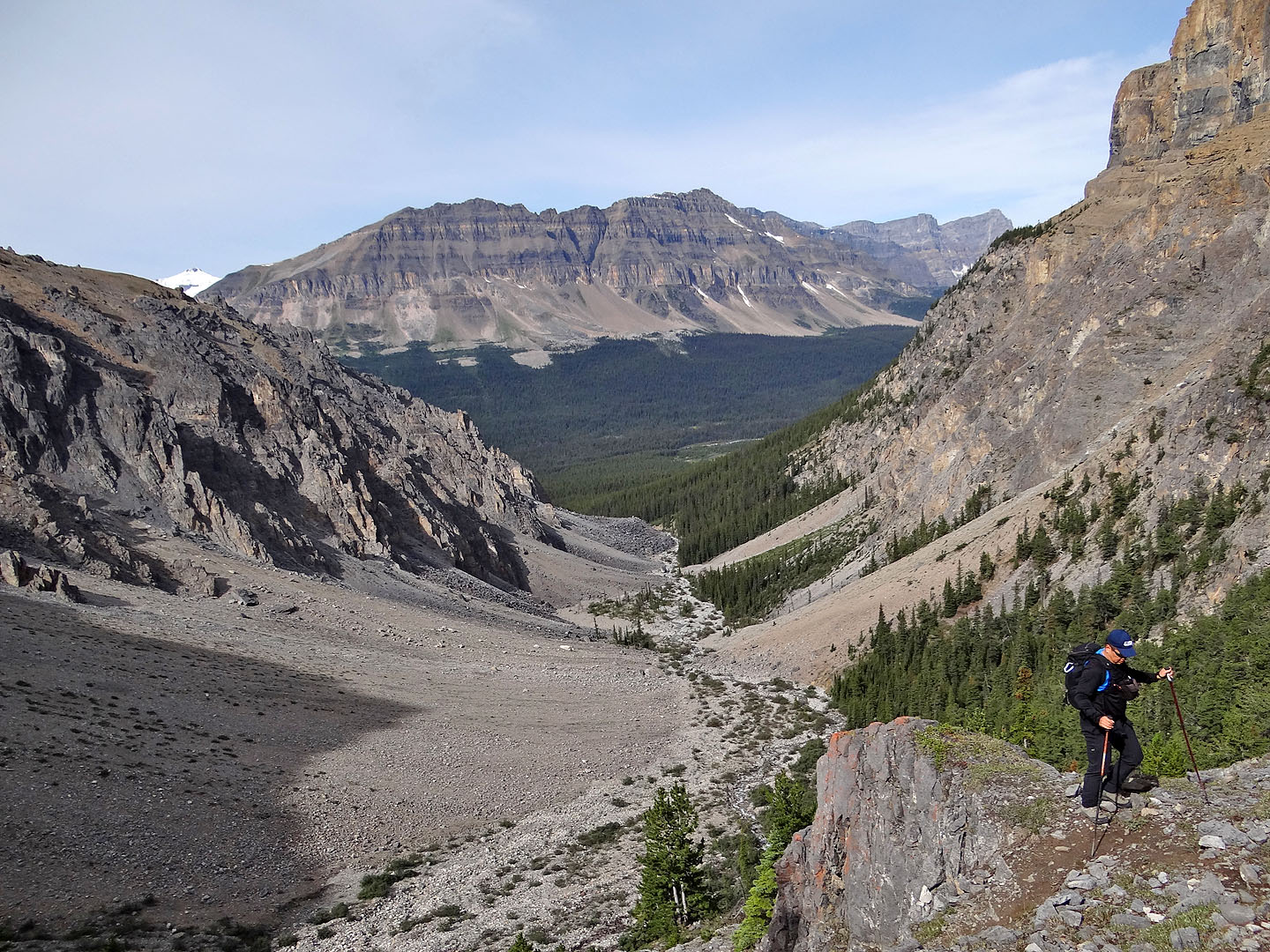
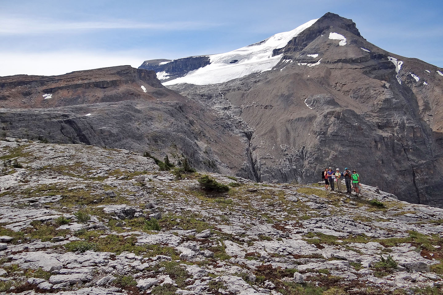
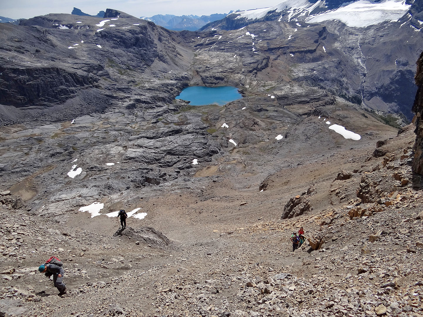
Continuing on, we climbed above the treeline, up a rocky slope to reach an immense plateau of rock bordered by cliffs on the far side. Although the views opened up, we could see nothing of our two objectives: Noseeum Peak and the lake below it. By skirting left of the cliffs, we could reach the mountain directly, but we wanted to see the lake first. We turned right, crossed the plateau and climbed breaks in the cliffs. At the top we were hit by a spectacular sight: a large alpine lake nestled in an expansive rock basin. Noseeum Peak rose on the other side of the lake, but to reach it we would have to gain the ridge on the far left using a scree chute.
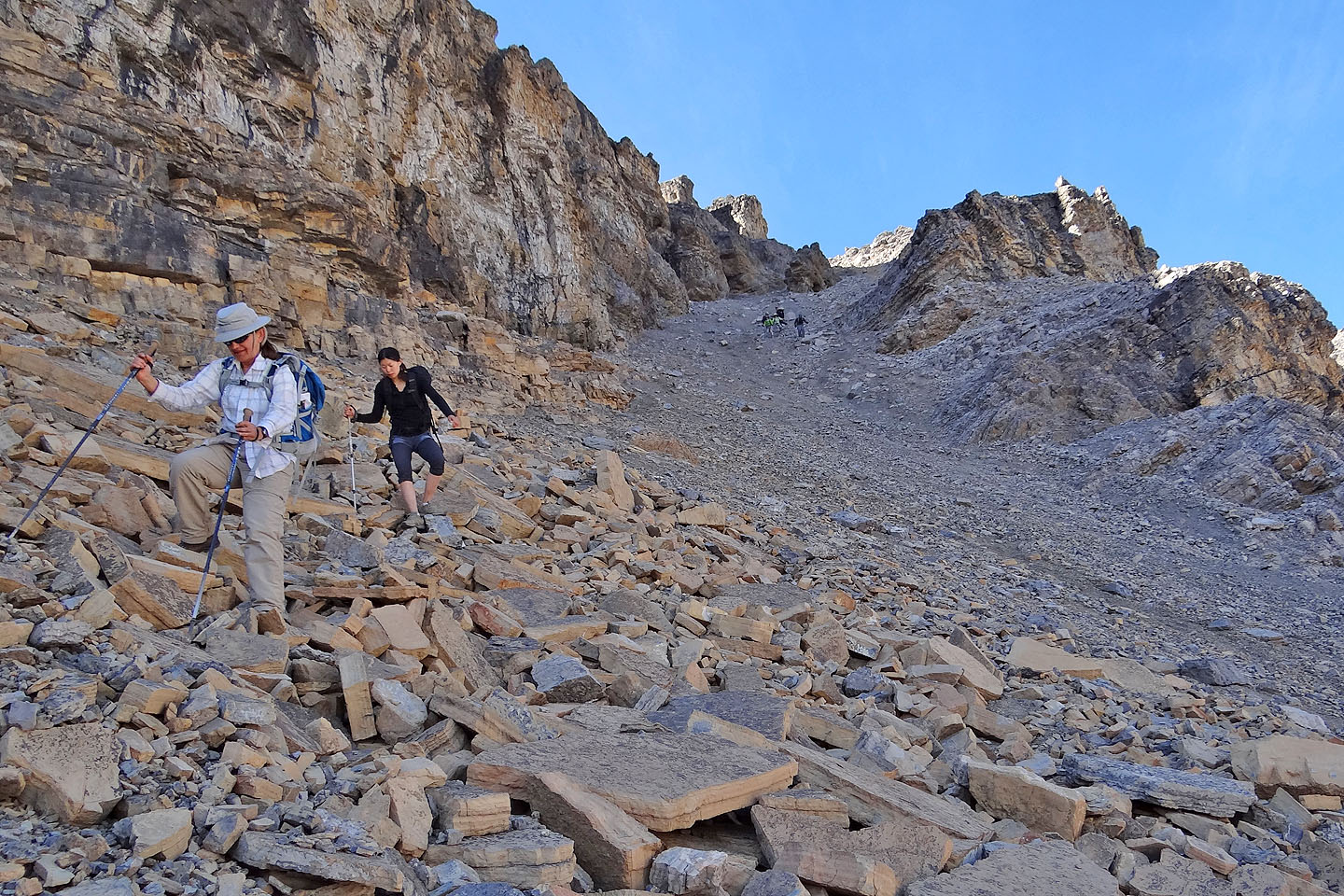
The ascent up the chute was not only the most miserable part of our trip, but it was also the most dangerous. On the steep grade, rocks dislodged easily and bounced down the chute. Since we were spread out, those below risked serious injury, especially since most of us didn't bring helmets. I happened to be the only one with a brain bucket. (I only wore on the descent when there were people above me.) For everyone's safety, however, we carefully choreographed our movements while in the chute. It was time-consuming, but we made it up and down without mishap.
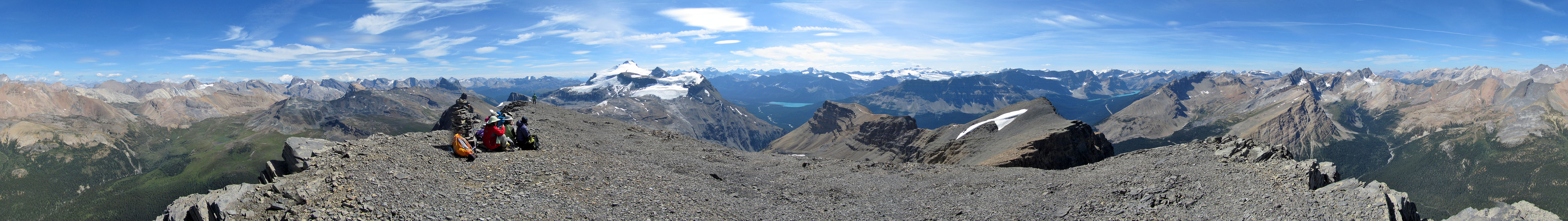
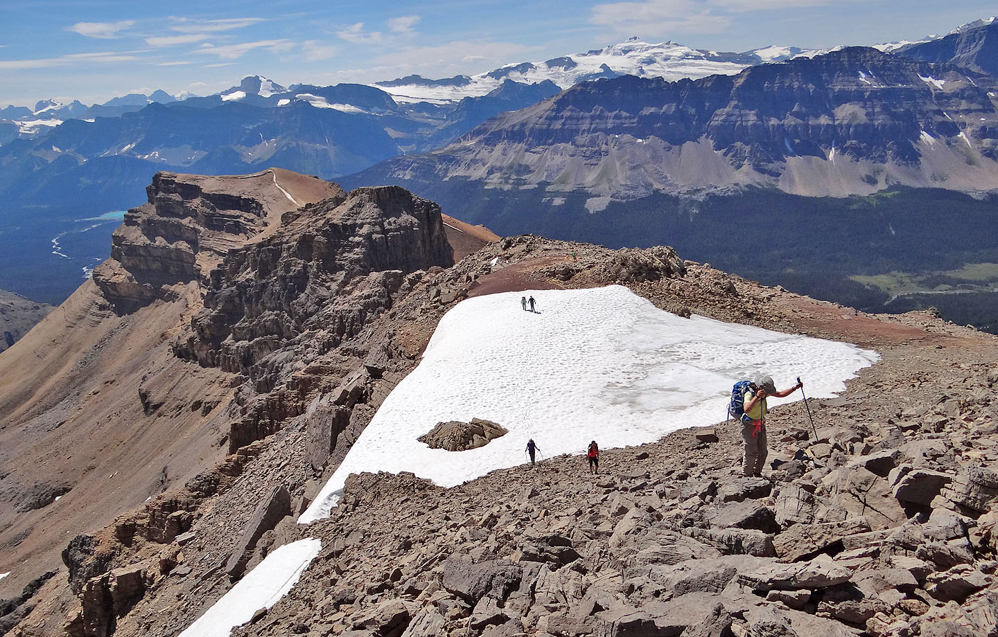
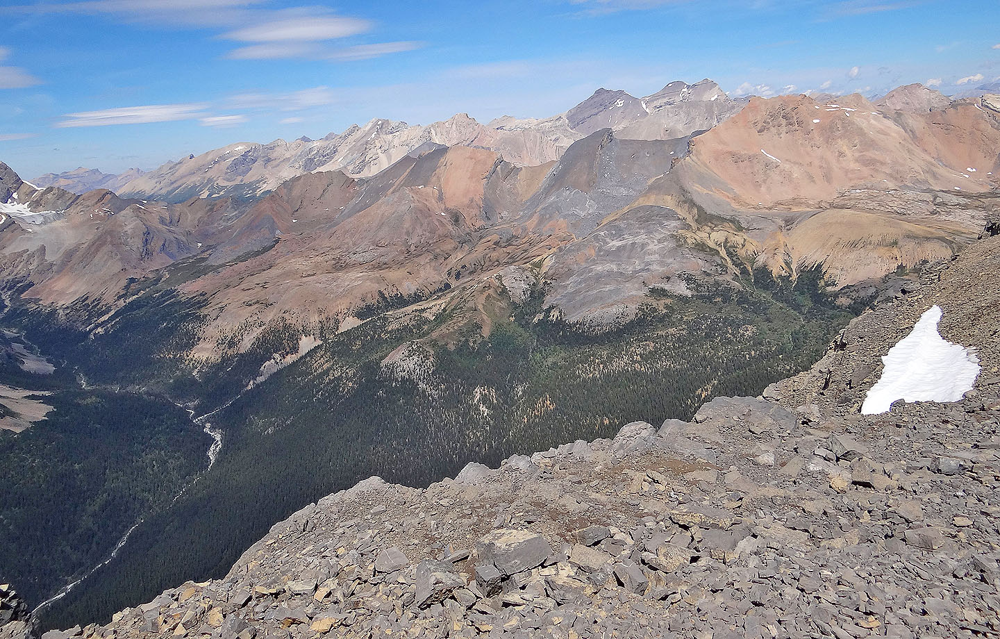
From the col at the top of the chute we made our way along the ridge. There was some easy scrambling at the start, but then the traverse relaxed as boulders gave way to rubble and scree as we neared the summit. From our alpine perch, we recognized peaks dozens of miles away.
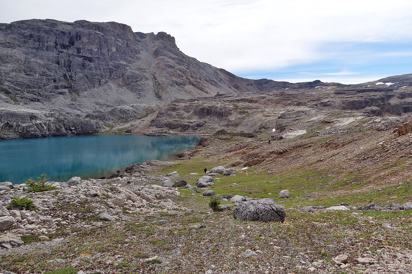
After a lengthy stay, we headed back down. We retraced our steps, although we bypassed both the lake and the gully Sonny and I had scrambled up; we followed the headwall trail right to the bottom. Back at the trailhead, everyone was all smiles. I was delighted, of course, to hike with Sonny and my old friends, as well as make new ones, but for me the alpine setting held the greatest satisfaction. There is much to see on Noseeum Peak.
KML and GPX Tracks
Sonny's Trip Report
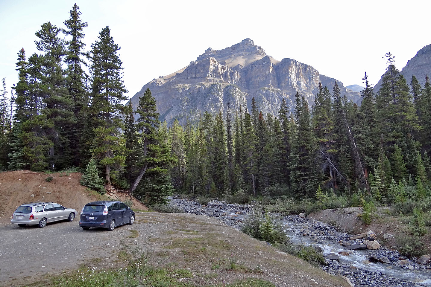
Parked at the pullout next to Noseeum Creek (Noseeum Peak cannot be seen from here)
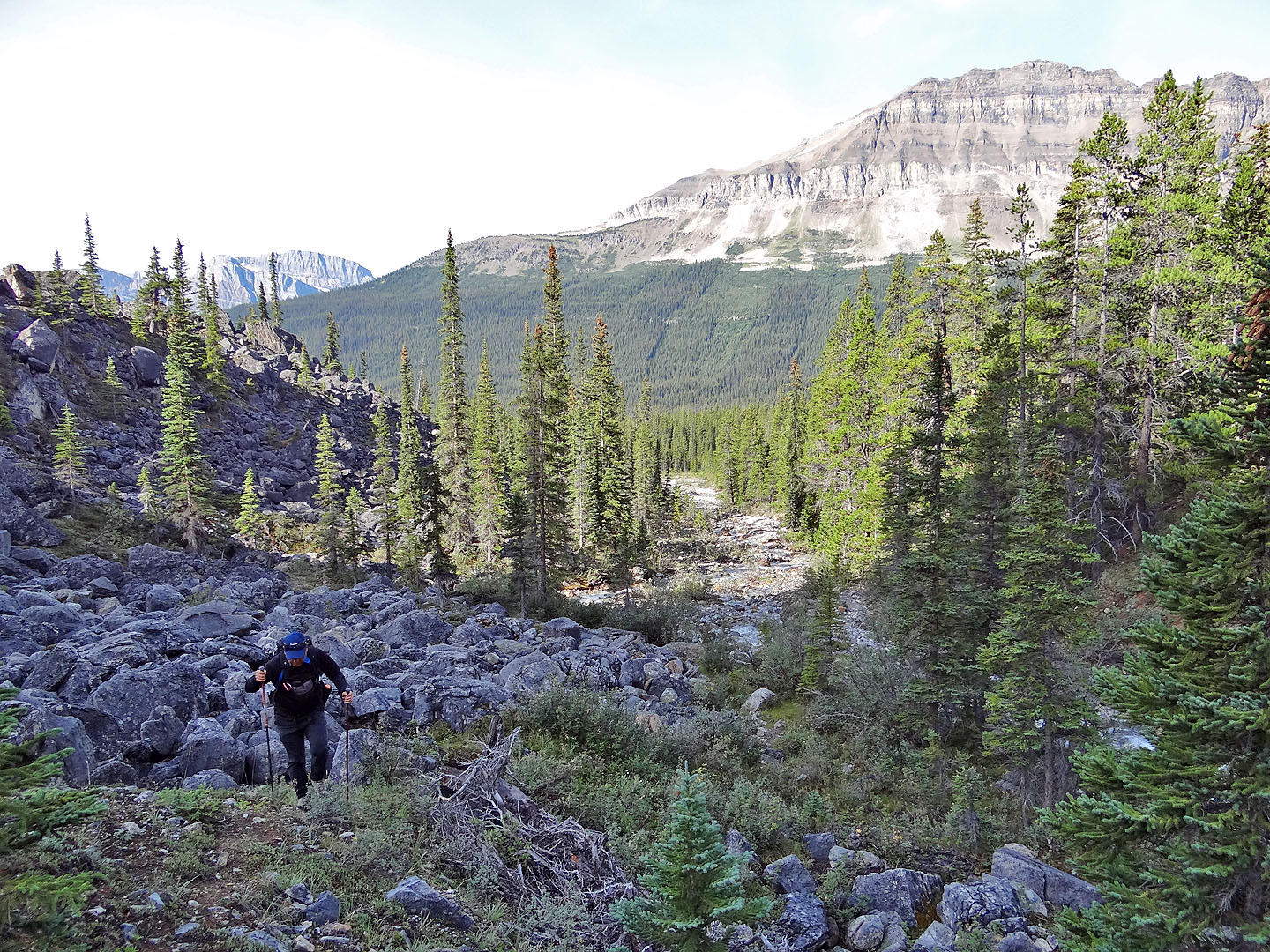
Hiking up alongside Noseeum Creek
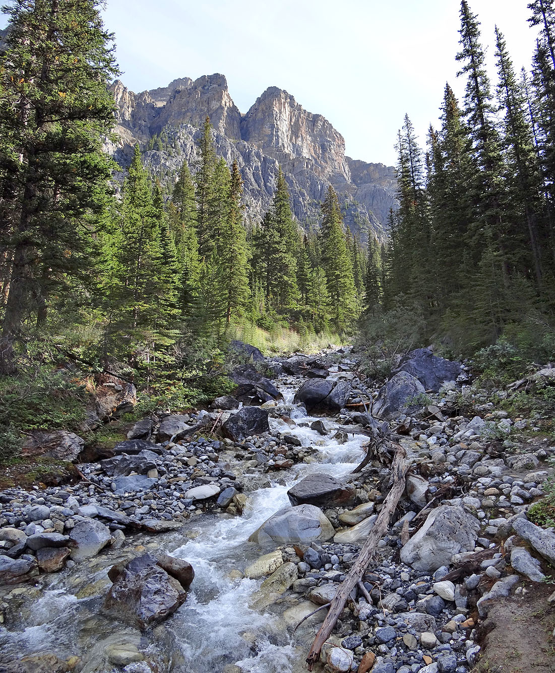
Some nice scenery can be found along the creek
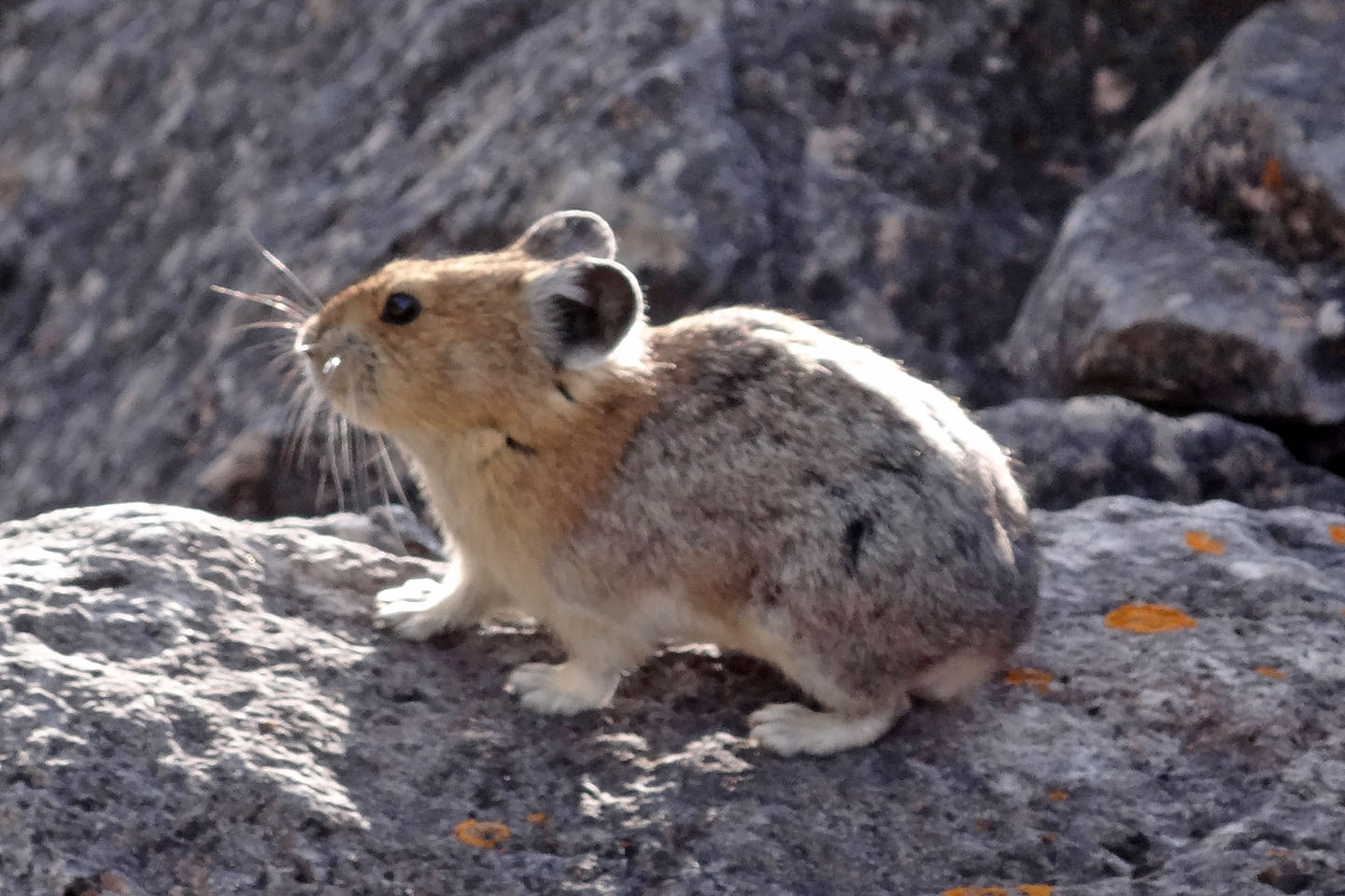
And pikas too!
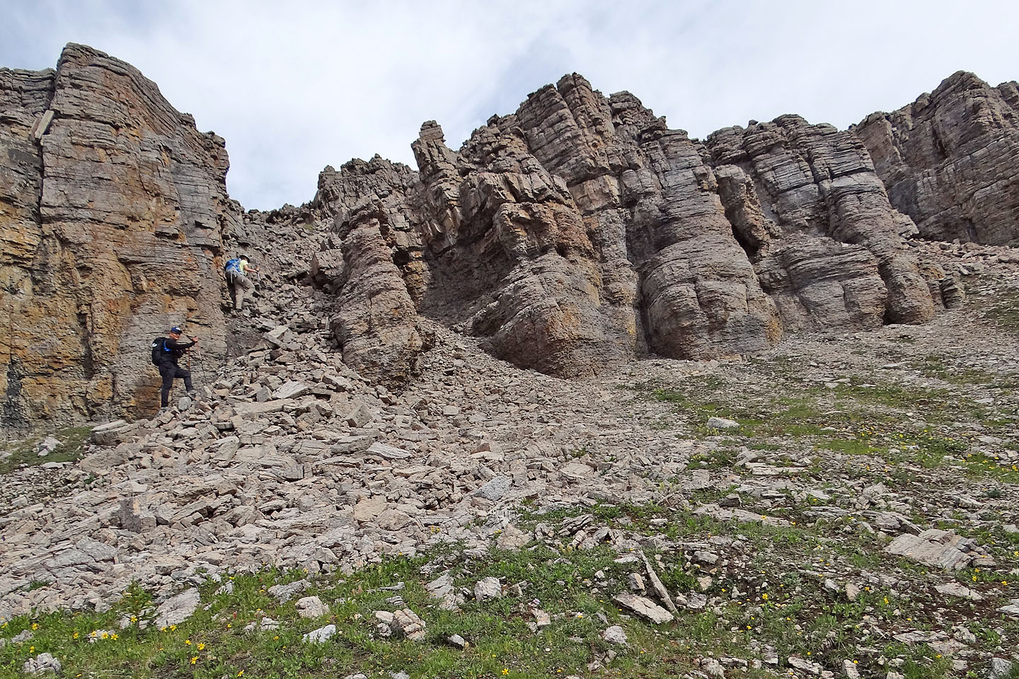
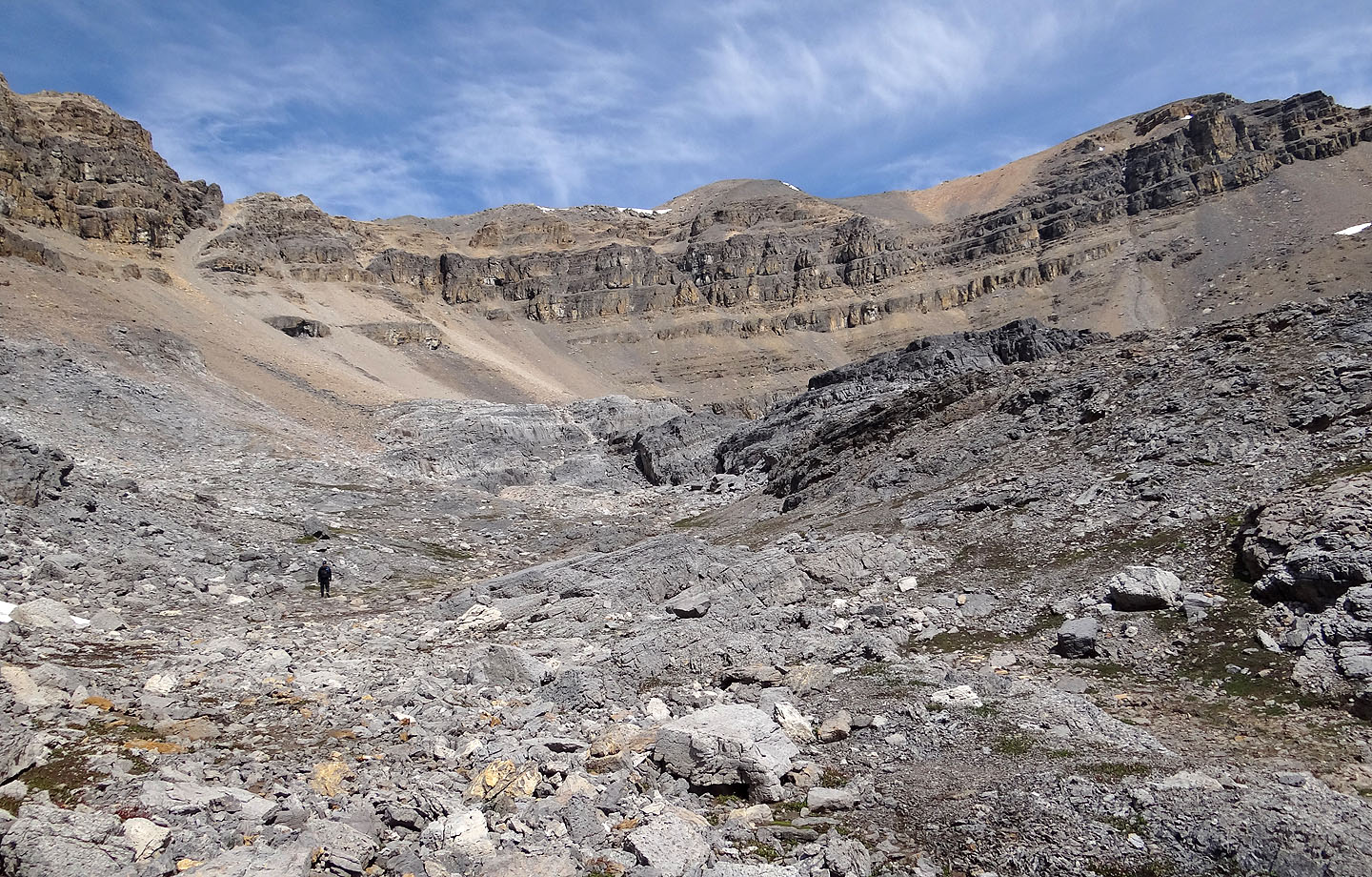
The headwall at the end of the valley
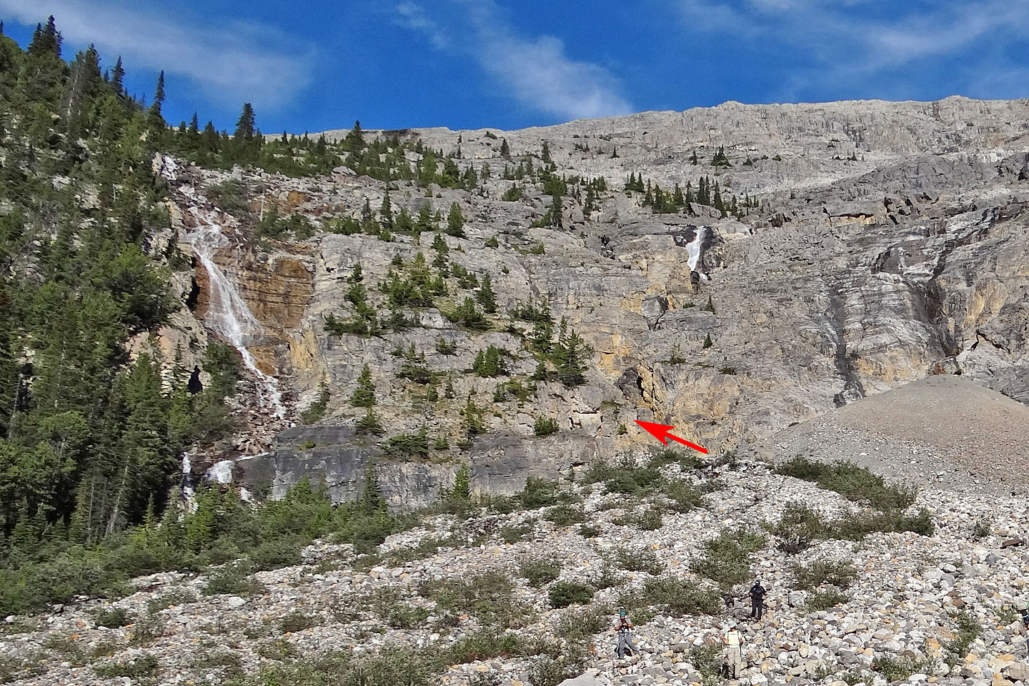
A dirt trail winds up the sparsely treed cliffs in the centre. It begins on
the bottom right, left of
a gully (arrow). (Zora's party ascended the treed slope left.)
We missed the trail, and after going around a corner of the cliffs, we ascended a steep gully
The gully was more difficult than it looked. The start of the trail is just left of here.
Hiking up the headwall trail with Bow Peak in the background
Waterfalls on our left
After reaching the top of the headwall, the upper falls (the white patch in the centre) can be
seen through the trees
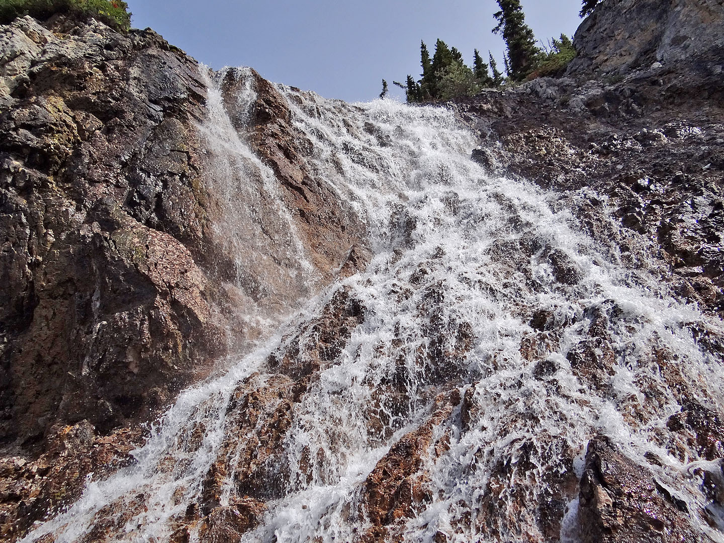
Looking up at the falls
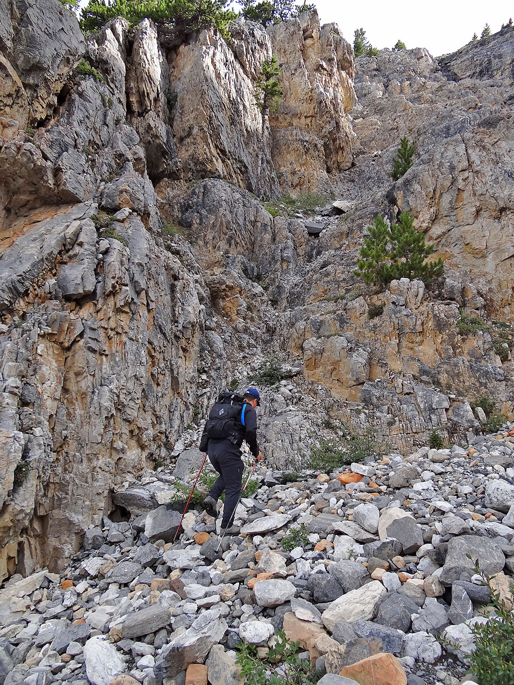
After passing the falls, we turned right and climbed up a wooded slope
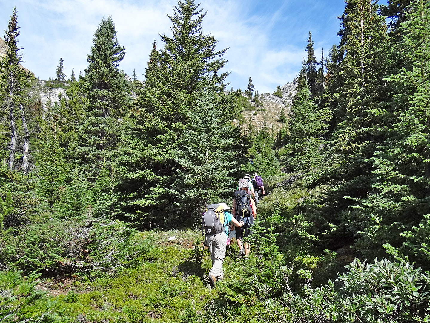
Our party of two suddenly became eight. The rocky slope above
leads to the plateau.
On the edge of the plateau
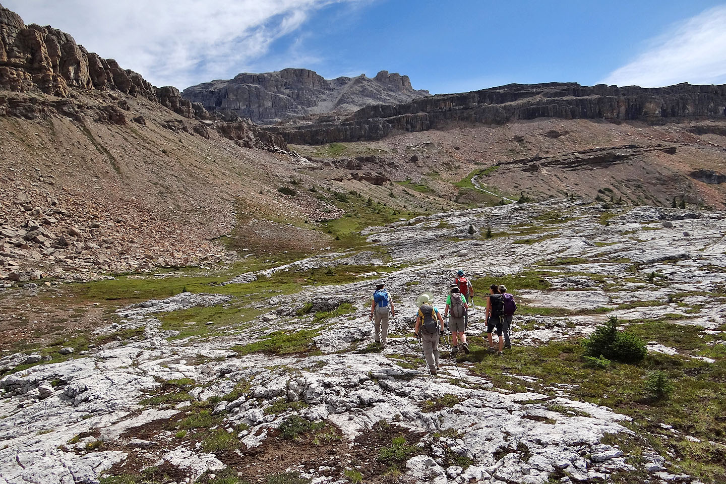
We made our way across the plateau toward the lake
Zora goes up a break in the first cliffs
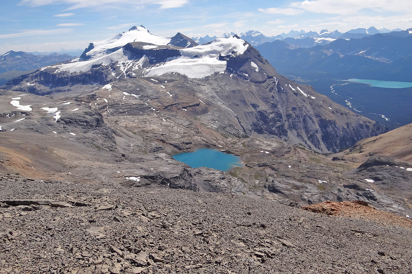
Above the next cliffs, we'll see the lake
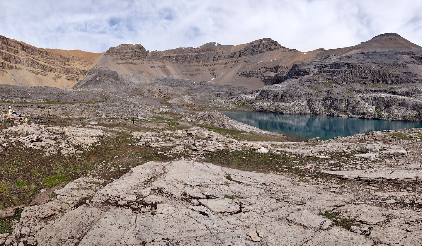
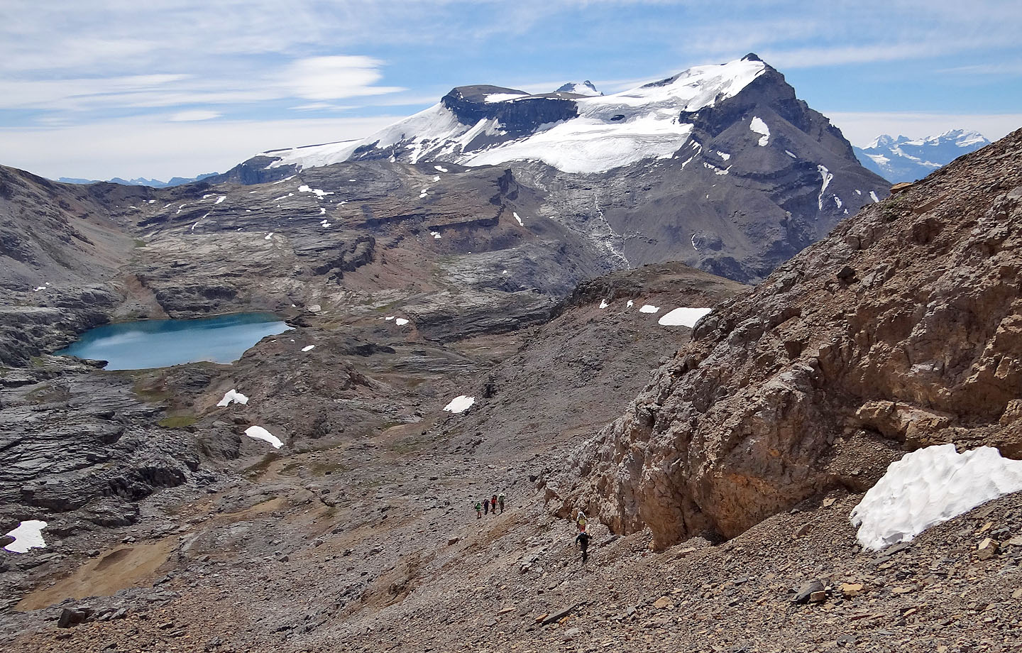
The summit of Noseeum Peak is in the centre
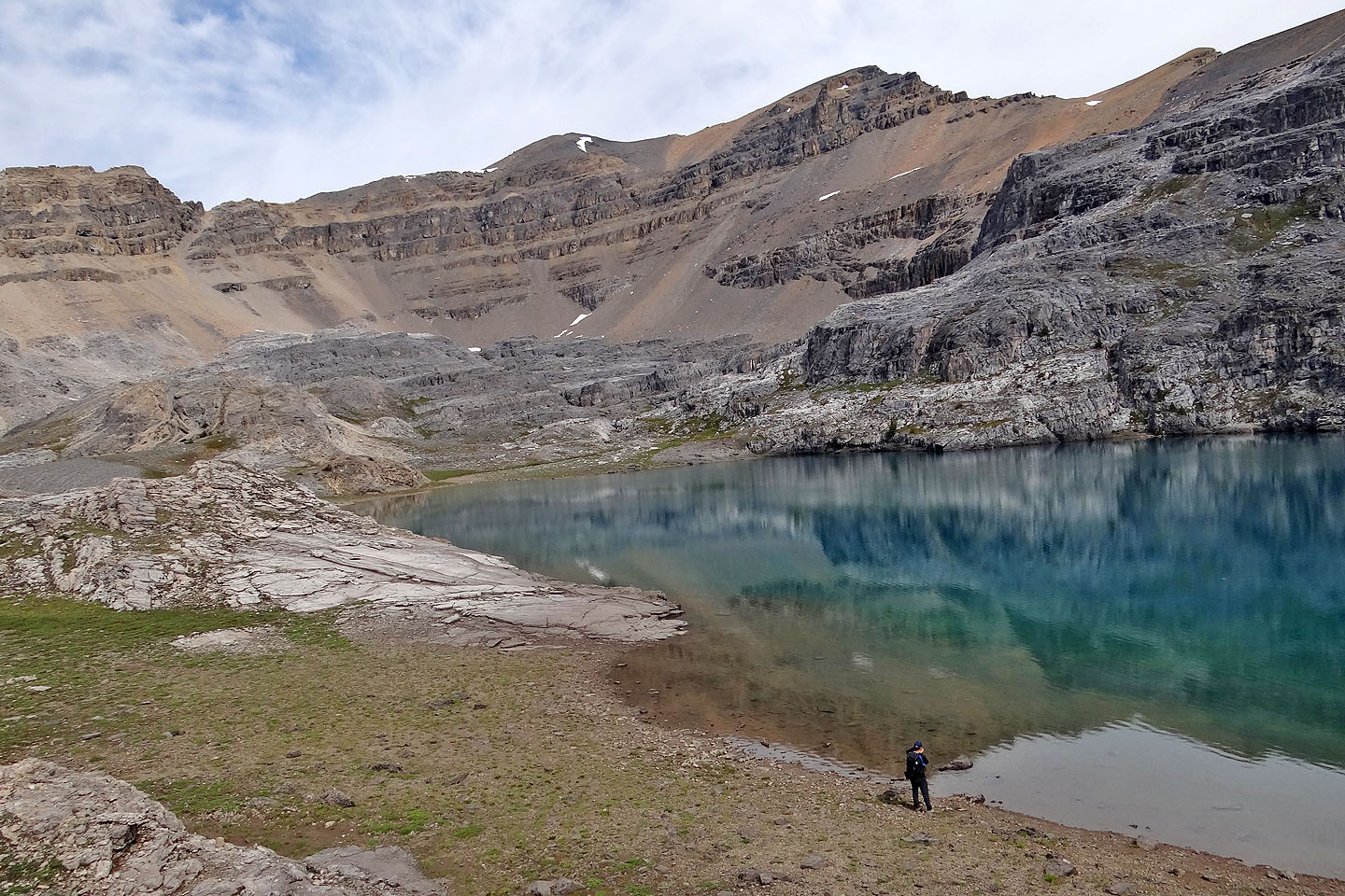
From the lake we'll make our way to a scree chute on the left that leads to the ridgeline
Looking back as we made our way to the chute
On track to reach the base of the scree chute (upper left)
Looking back from just below the chute
After starting up we became aware of the danger of rockfall and tried to keep to the sides
Sonny is well up the chute
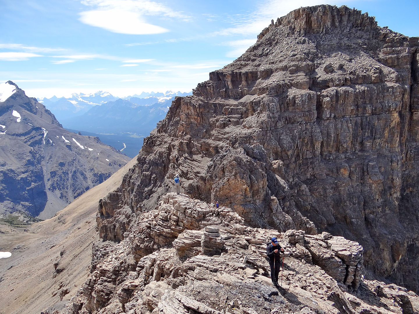
After coming up the chute, we arrived on the ridge
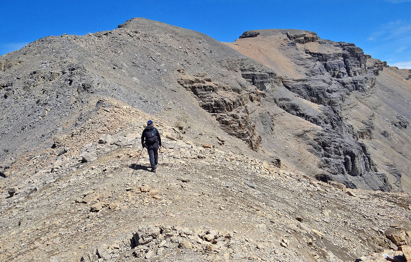
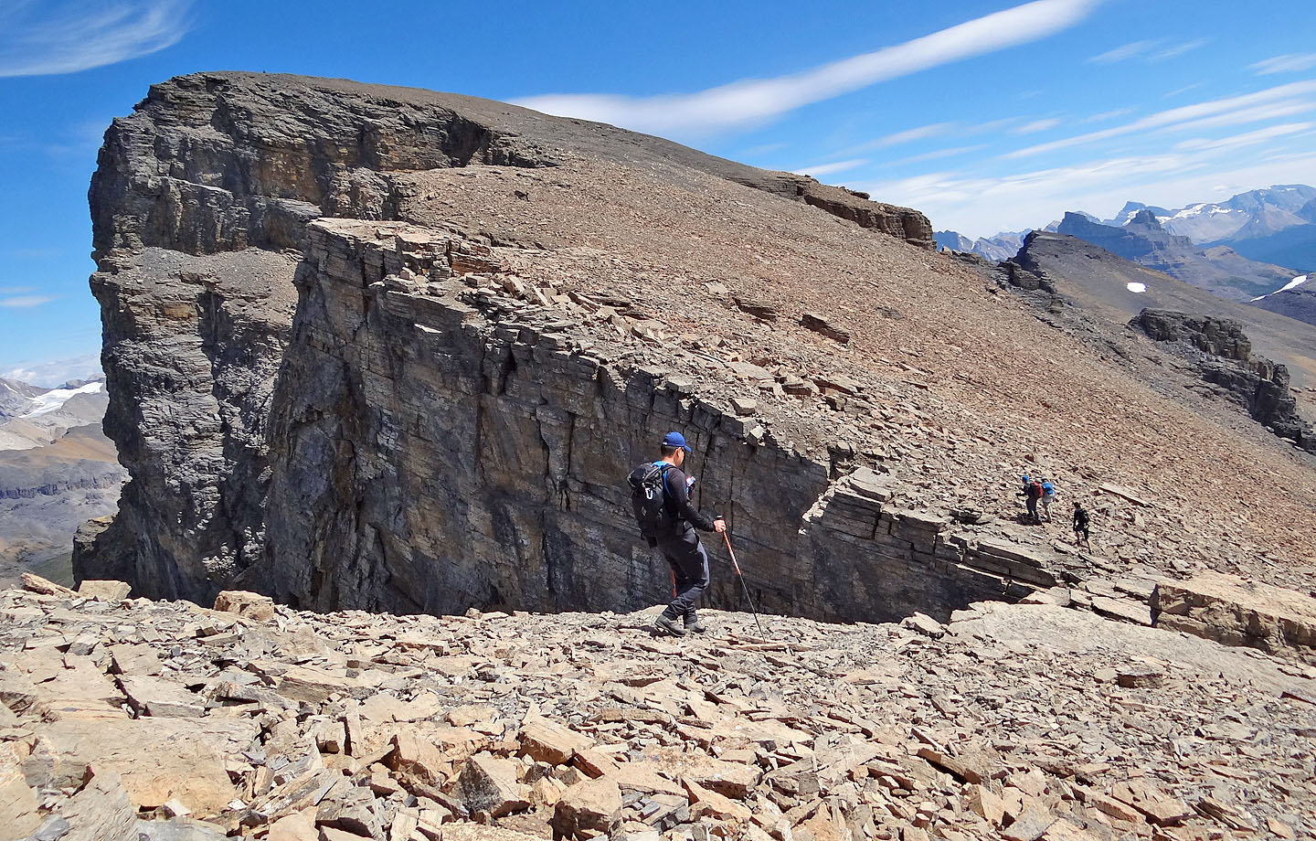
The summit is still far off
We're well along the ridge now
The nearest neighbours north are Quartzite Peak, Ramp Peak and Mosquito Mountain
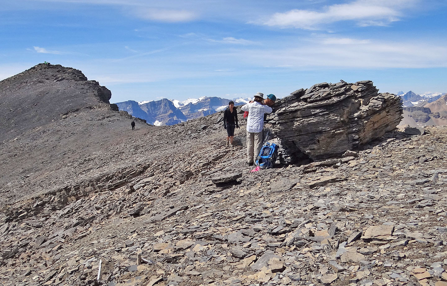
Taking a break at a boulder
We finally neared the summit
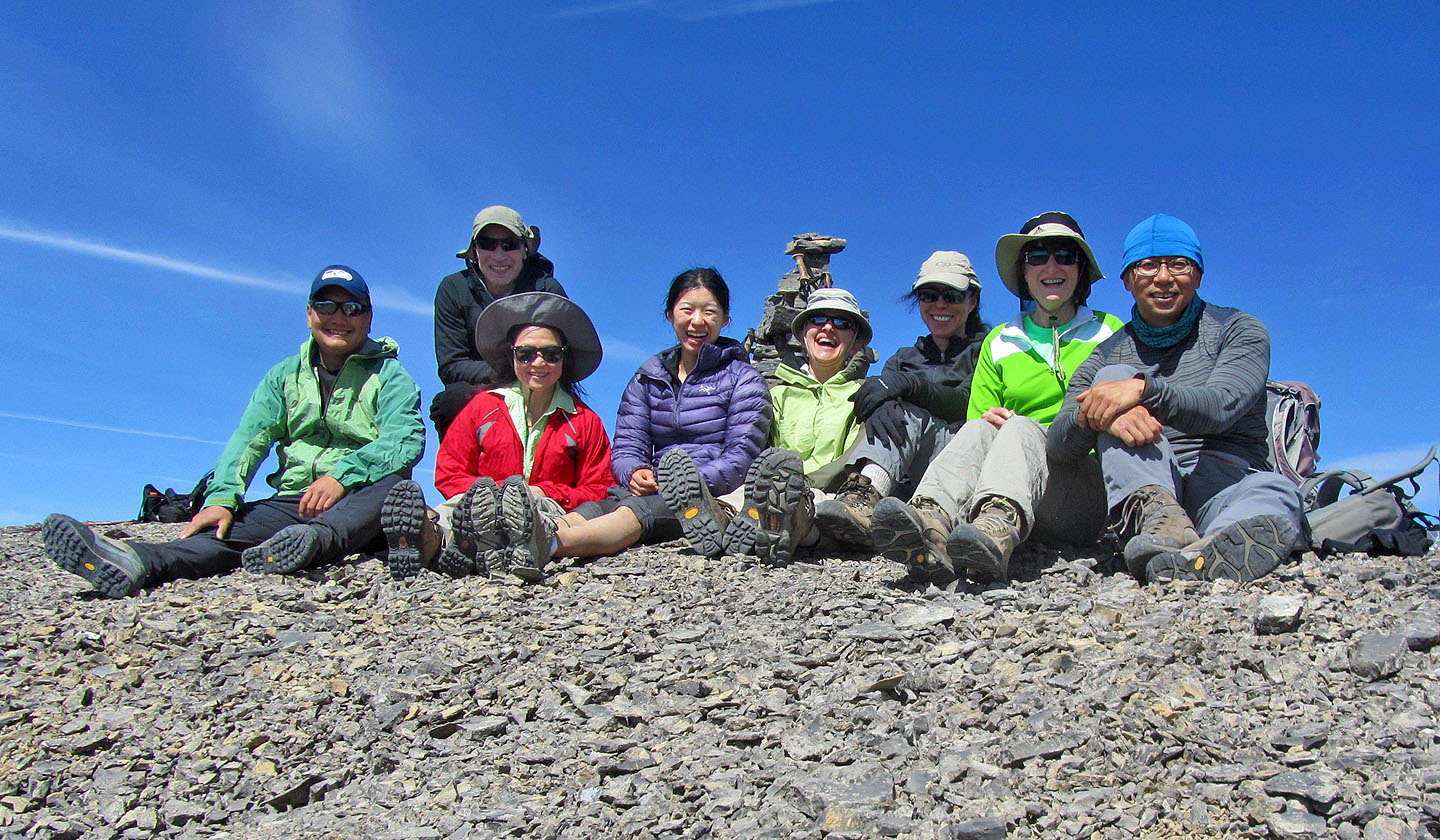
On the summit, left to right: Sonny, me, Becky, Hanna, Zora, Wendy, Bernadette and Jonathan
Mount Hector, Little Hector and Mount Andromache to the south
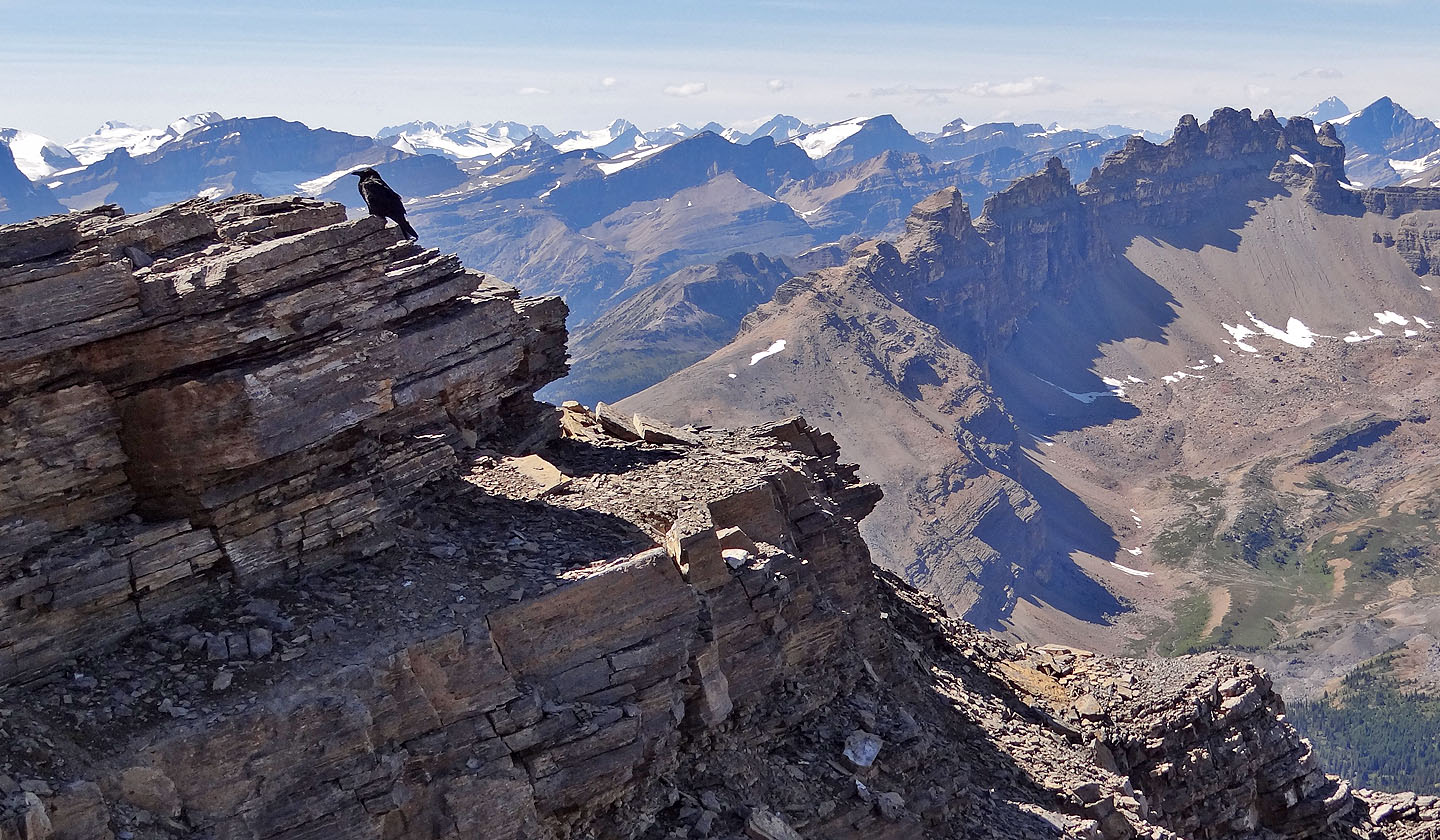
Heading back along the ridge, the sawtooth points of Dolomite Peak come into view as well as
countless peaks in the background. A raven (mouse over) is oblivious to it all.
Coming down the scree chute
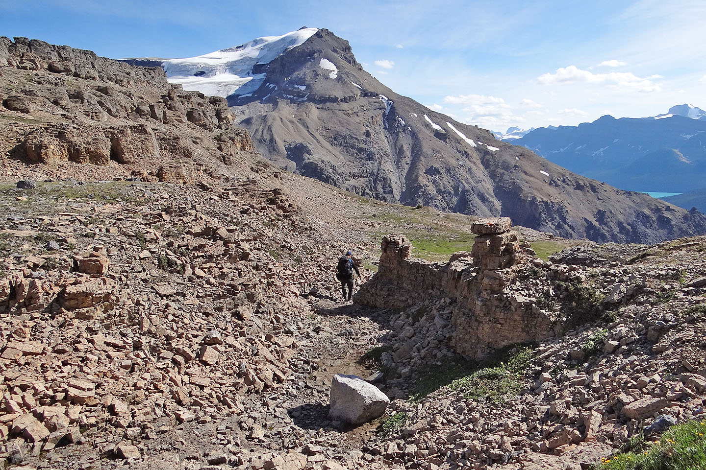
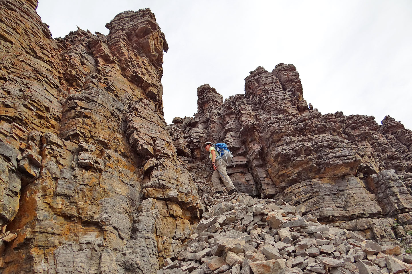
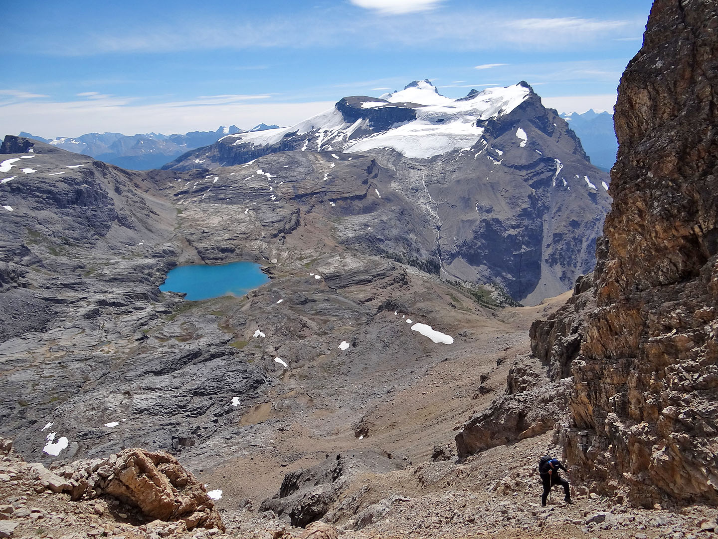
Skirting cliffs on our left, we head back to the plateau
Following the steep headwall trail
The bottom of the trail
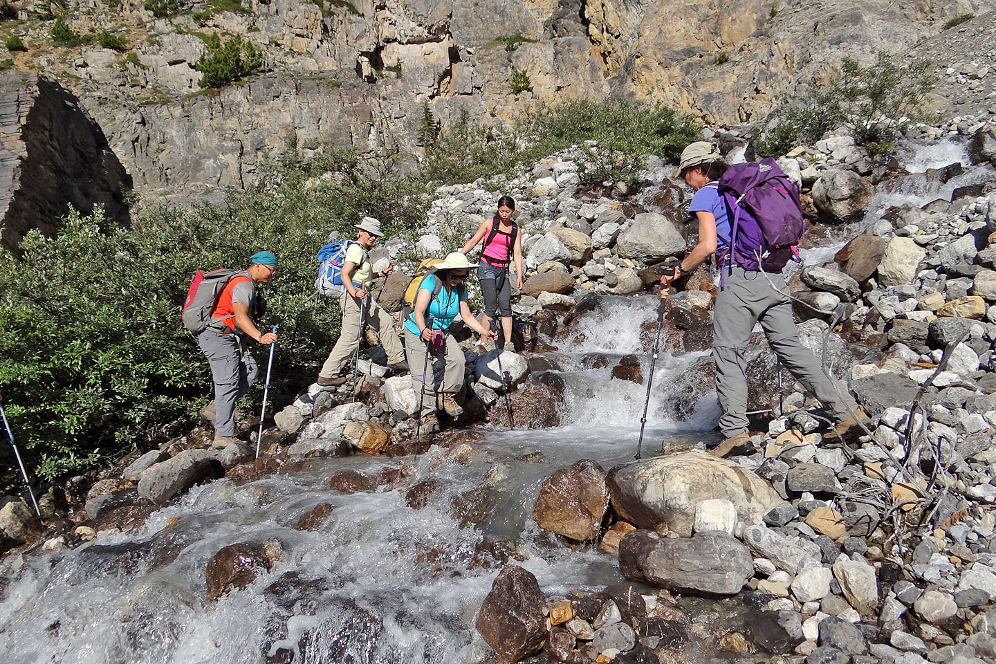
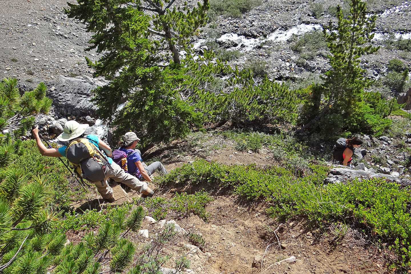
Crossing Noseeum Creek below the headwall
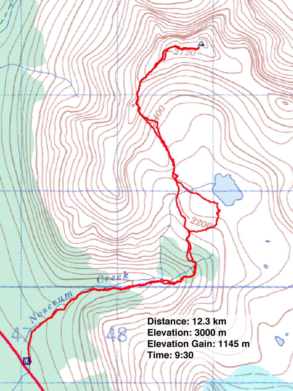
82 J/9 Hector Lake