bobspirko.ca | Home | Canada Trips | US Trips | Hiking | Snowshoeing | MAP | About
View from Spionkop Ridge
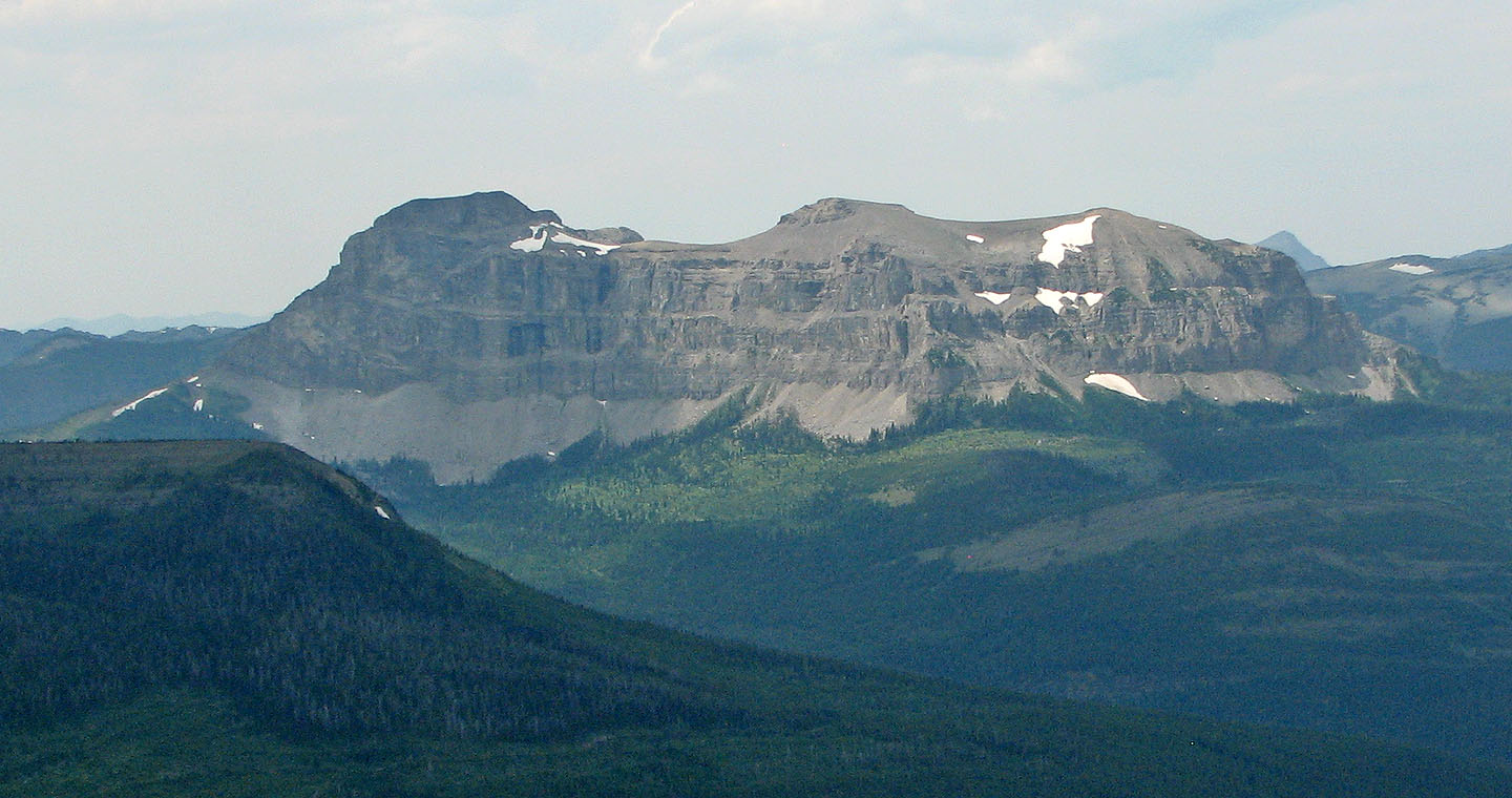
Loaf Mountain and Spionkop Ridge
Castle Provincial Park, Alberta
July 26, 2008
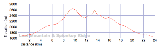
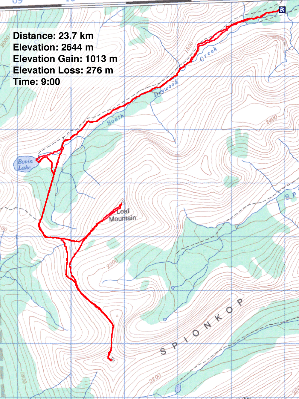
Distance: 23.7 km (14.7 mi)
Cumulative Elevation Gain: 1350 m (4429 ft)
We spent an enjoyable day summiting Loaf Mountain and Spionkop Ridge albeit on a route that added a bit of distance. On our Loaf Mountain 2005 attempt with Andrew Nugara and Linda Breton, we tried to reach Loaf Mountain via Spionkop Creek in miserable conditions. Now Dinah and I, along with Grant Myers, wanted to try Loaf Mountain from Spionkop Creek again and bag Spionkop Ridge too. Unfortunately, and like our attempt, the road was gated and made for a long approach.
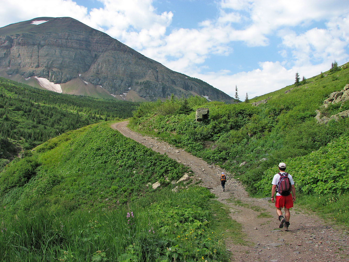
Our backup plan was to ascend Loaf Mountain using Andrew's route in his Scrambles book. We drove to the South Drywood Creek trailhead and parked at the parking lot at the end of the gravel road where a rocky 4x4 road begins. Andrew says to hike up the road “several kilometres” so we didn't pay much attention to our surroundings until after 3.5 km. When we checked the route photo in the book, it didn't match our view so we continued. We soon realized we had passed the ascent route. Had we paid more attention to his map than his text, we probably would not have missed the exit point.
Now committed to a longer approach, we continued up the road. Grant had an inordinate interest in flowers, snapping pictures of them every few minutes and then running to catch up to Dinah and me. Meanwhile I concentrated on finding a fork that led to Loaf Mountain. But we missed the turn-off and we found ourselves on the shores of Bovin Lake. We bushwhacked south to get back on track.
We soon stumbled on the trail, straight as an arrow, leading to the col northeast of Loaf Mountain. At the col, we could see our way clear to the false summit on the west end of the mountain. From the col, it's mostly a hike to reach the summit. After making so many errors, I was willing to settle on summiting only Loaf Mountain. Grant had changed his mind about doing Spionkop as well and was now looking forward to taking Andrew's ascent route back.
But Dinah was of a different mind. She was keen on going on to Spionkop Ridge, forcing us to reconsider. Although it meant backtracking down Loaf Mountain, we decided to go for it.
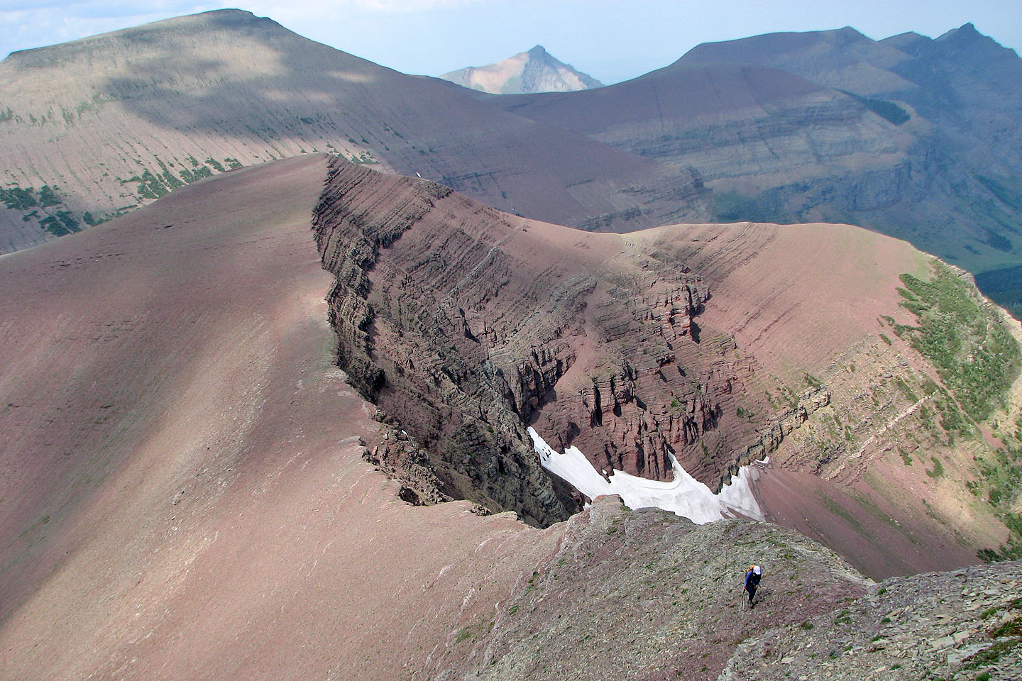
In about an hour, we were at the base of Spionkop and 300 m below the summit of Loaf (the two peaks are almost the same elevation). According to Andrew, the traverse between Loaf Mountain and Spionkop Ridge can be done “quite easily.” This is what we were expecting so we hadn't brought helmets. Instead, we faced a ridge that was a mix of crumbling cliff bands and steep scree slopes. We carefully made our way up, staying mostly on the right side of the ridge. It was a moderate scramble with some exposure. An hour and a half after leaving Loaf Mountain, we reached the top of Spionkop Ridge.
Spionkop Ridge is topped by a short, narrow rock block. We walked along its flat top to the summit. Apparently this isn't a popular destination as there was no cairn. Newman Peak was close by, but we weren't interested in continuing.
The descent back down Spionkop was easier than we expected. When we reached the base of Loaf Mountain, we contoured around it to avoid gaining elevation. Travelling on the scree was irksome, but on the last third section we hiked on a good sheep track. At the col, we followed the road back to the car.
This trip would have been shorter and more interesting if we hadn't missed Andrew's ascent route. If I were to return to do his ascent route, I would leave the trail soon after hiking two kilometres. Here the road is close to the creek, and there is little elevation loss. On the other side of the creek, we noticed a trail, so there would be no off-trail penalty for leaving the road prematurely. And I would bring a helmet for Spionkop's north ridge!
Postscript: The gate that we passed through to reach the trailhead no longer opens on June 15. To reach the trailhead, you need to walk or bike an additional 4 km. See Par's Bovine Lake trip.
Hiking up the road, we unwittingly passed the exit point for Andrew's route. We should have been on the
other side of the creek at this point
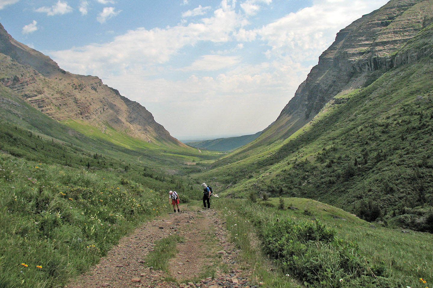
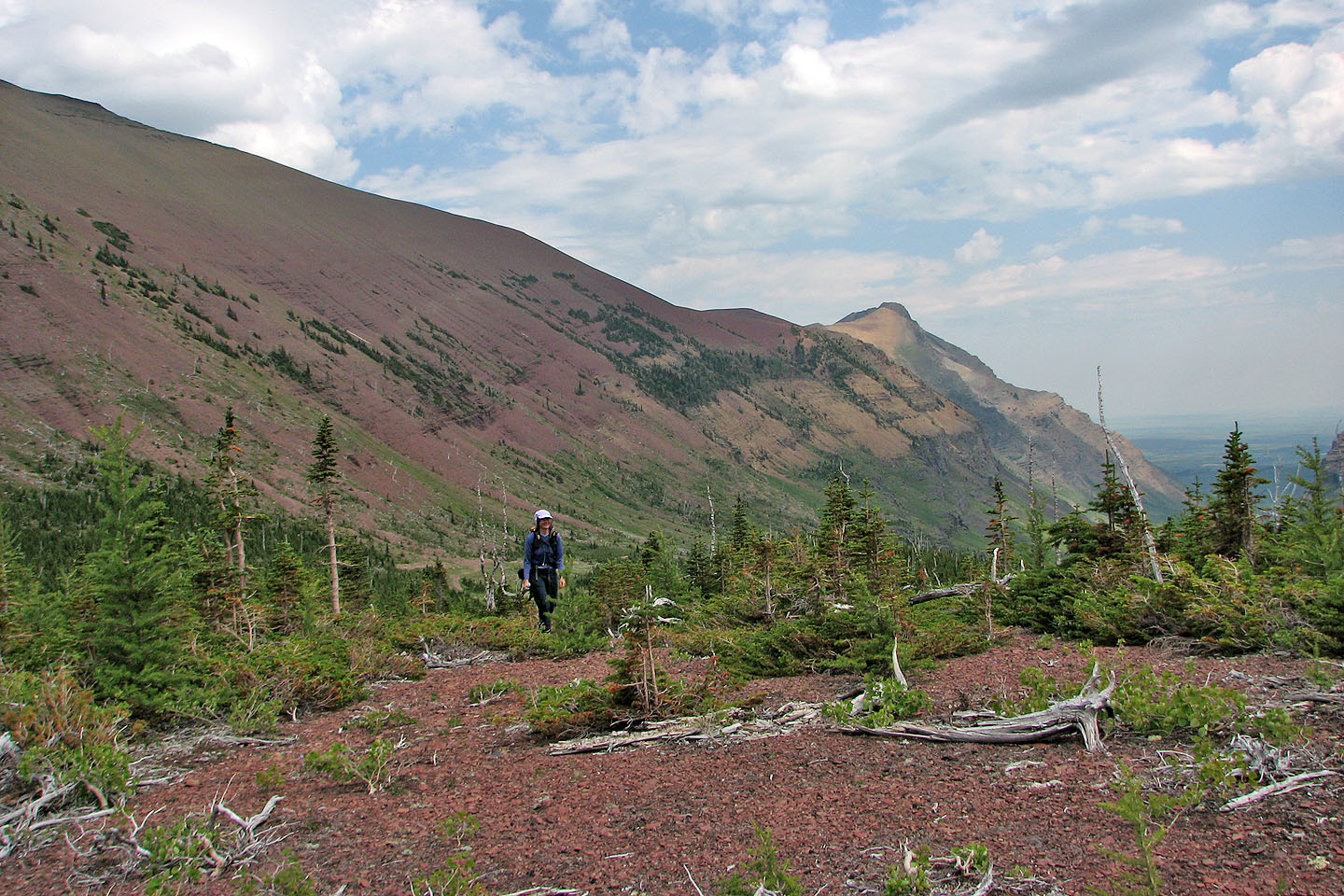
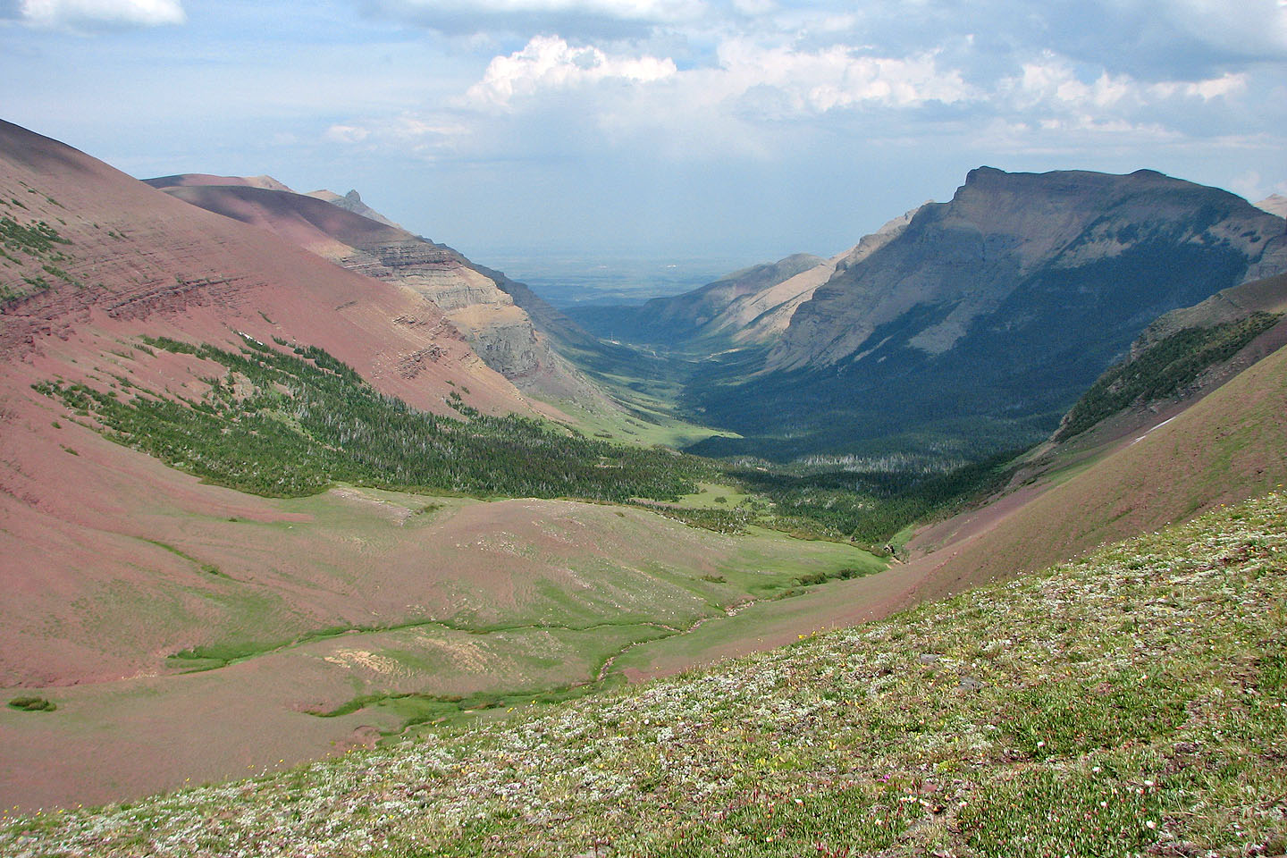
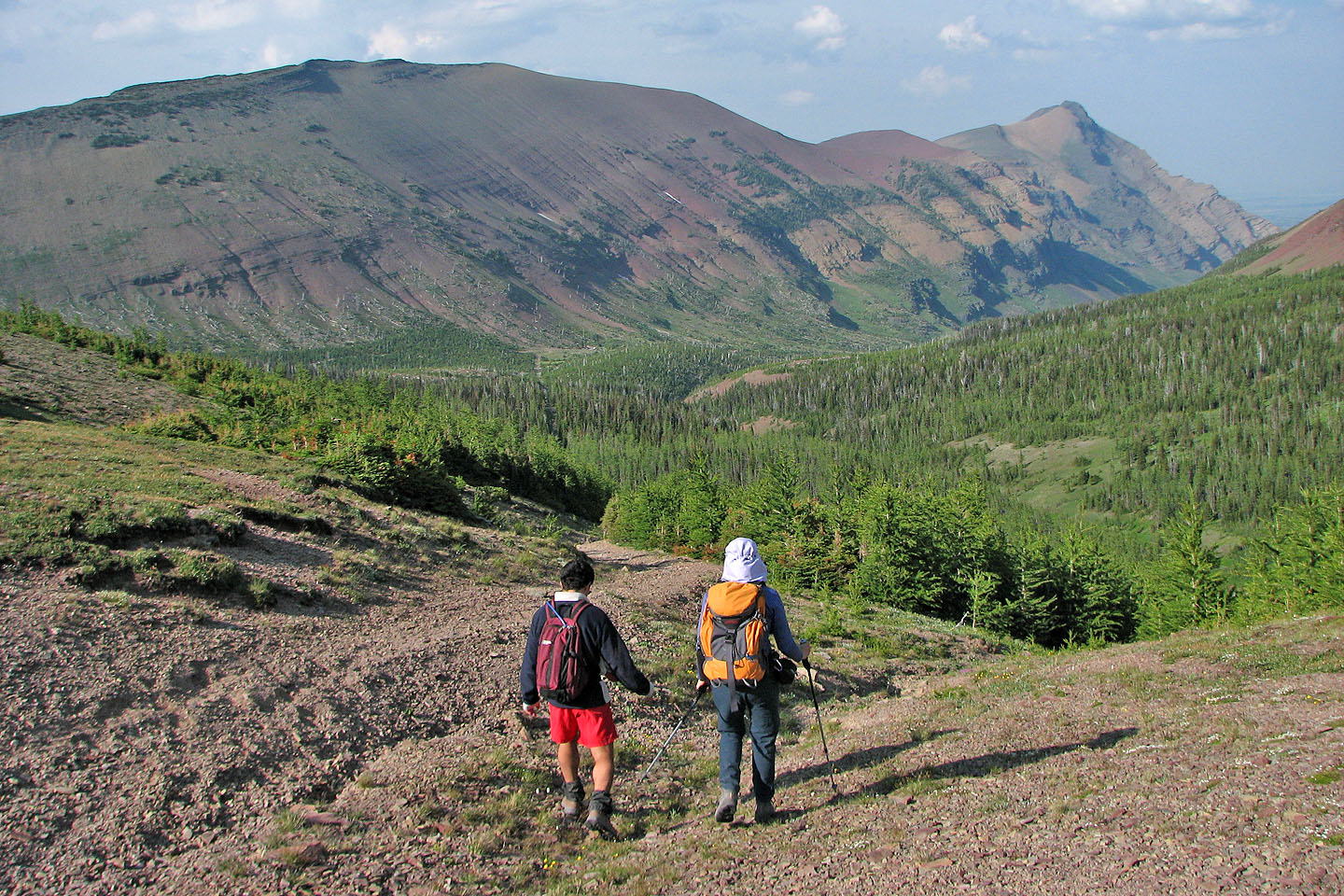
Looking back down the valley
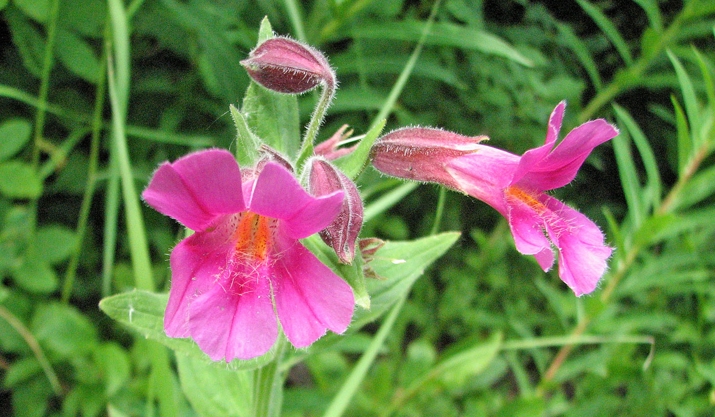
Red and yellow (mouse over) monkey flowers grew beside a tiny brook
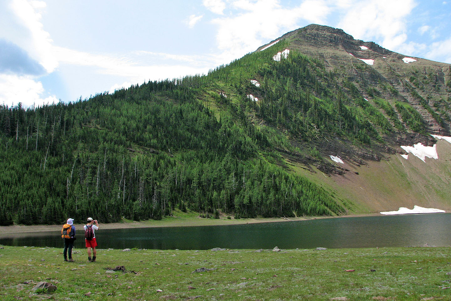
An unnamed peak rises above Bovin Lake (mouse over for another view of the lake)
After leaving Bovin Lake we went searching for the road we missed.
Drywood Mountain behind.
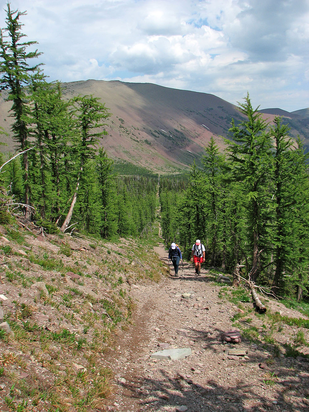
Back on track: this road leads to a col next to Loaf Mountain
Mount Matkin to the west
Grant stayed behind to take photos from the col
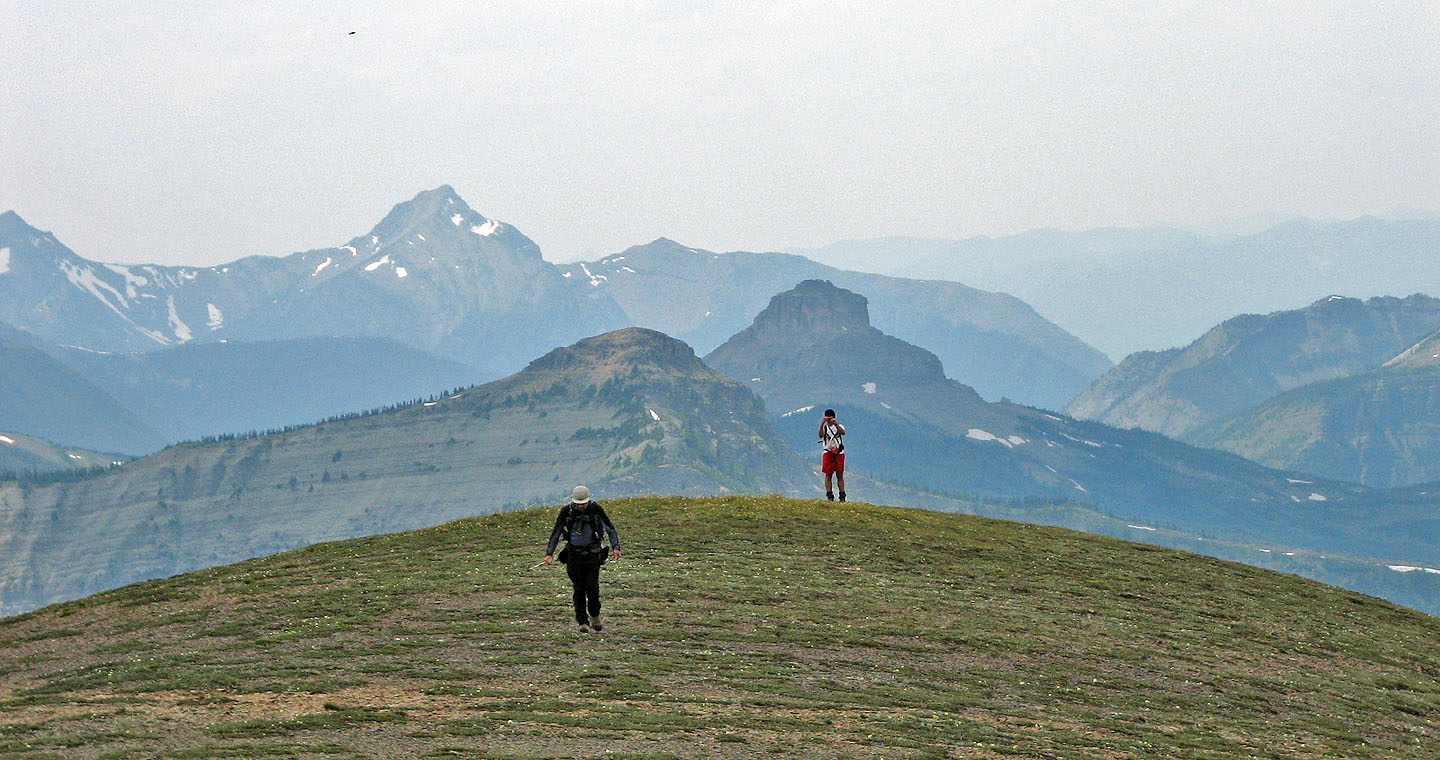
Spionkop Ridge in the background
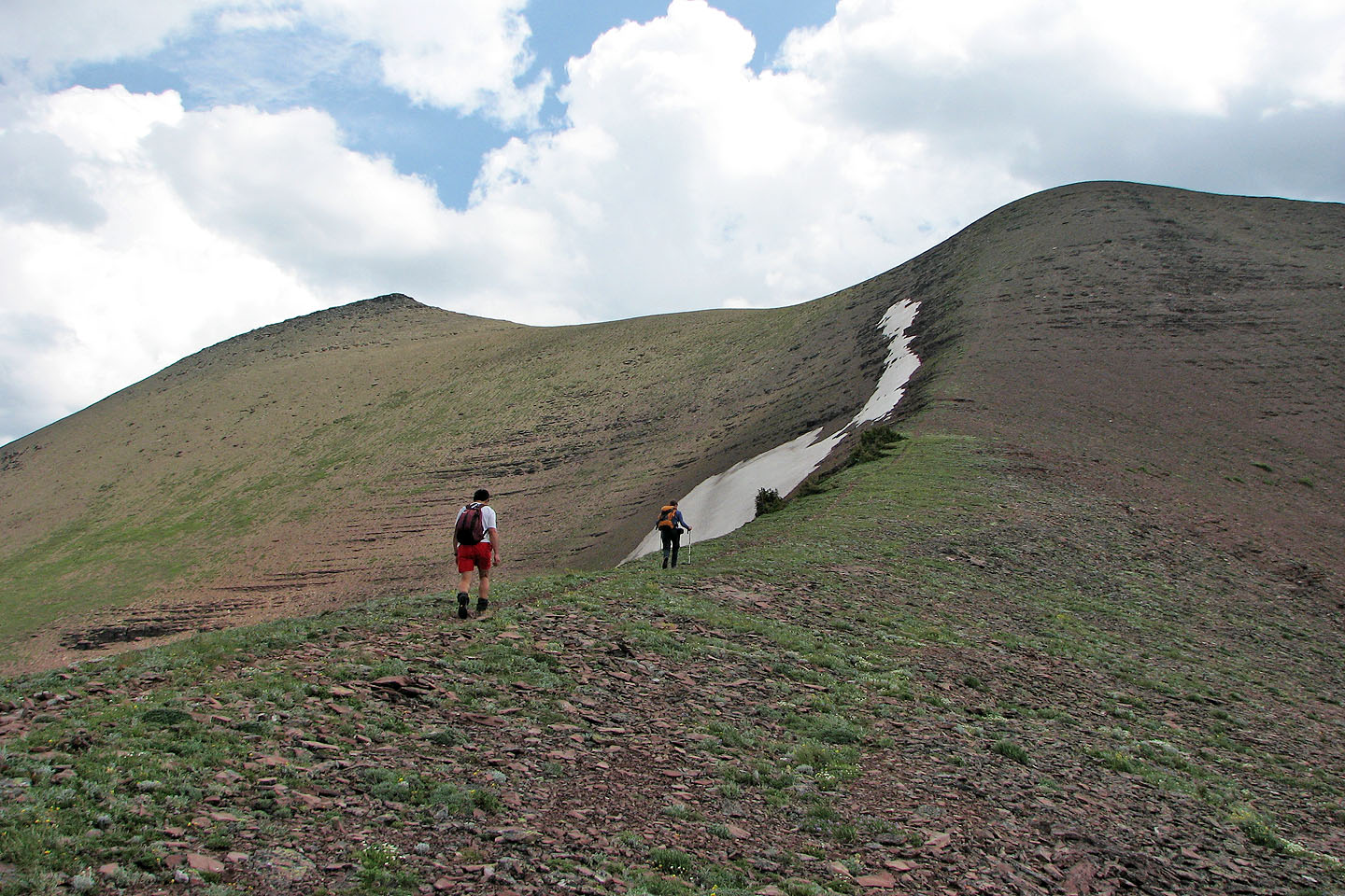
We headed to the false summit on the left
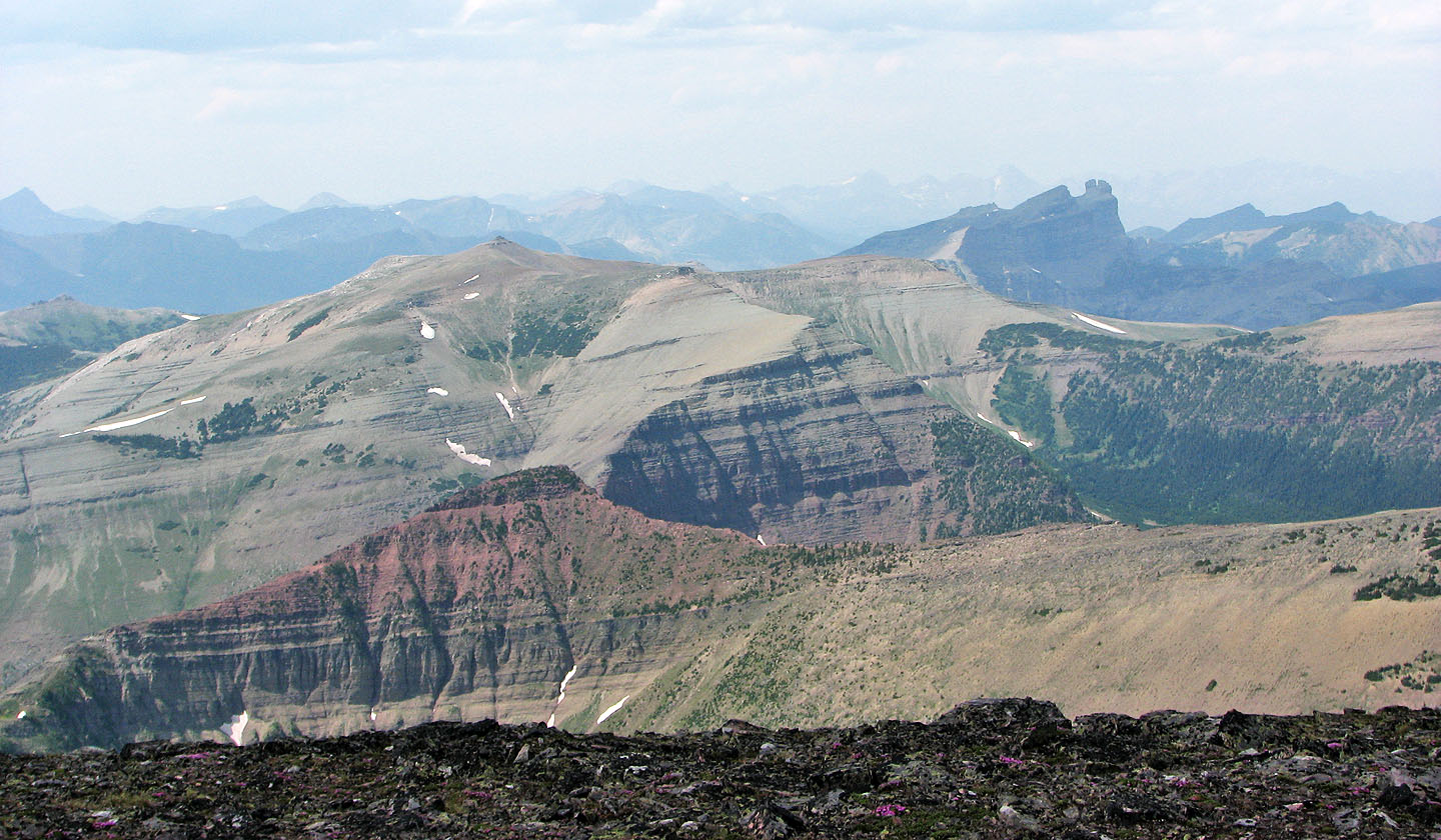
Sage and Font Mountains are directly behind. The mountain on the left is probably Langemarck.
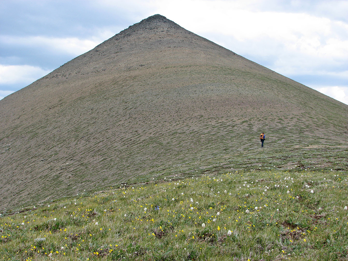
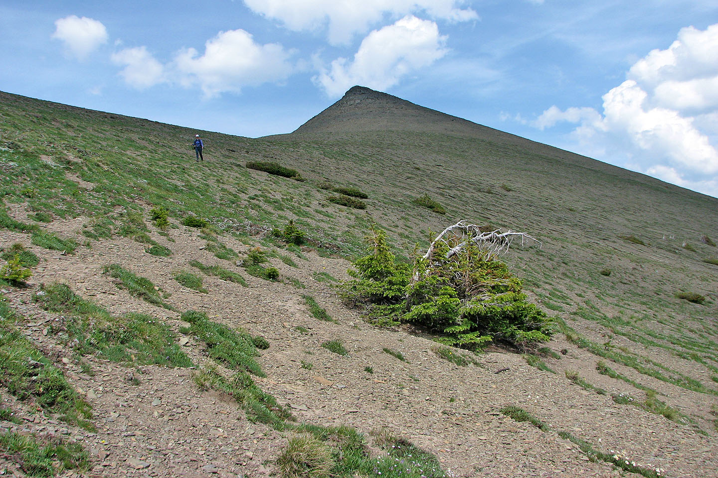
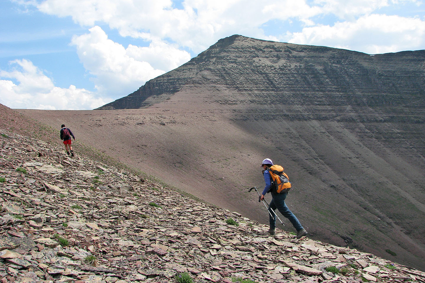
The false summit looms large in front of us
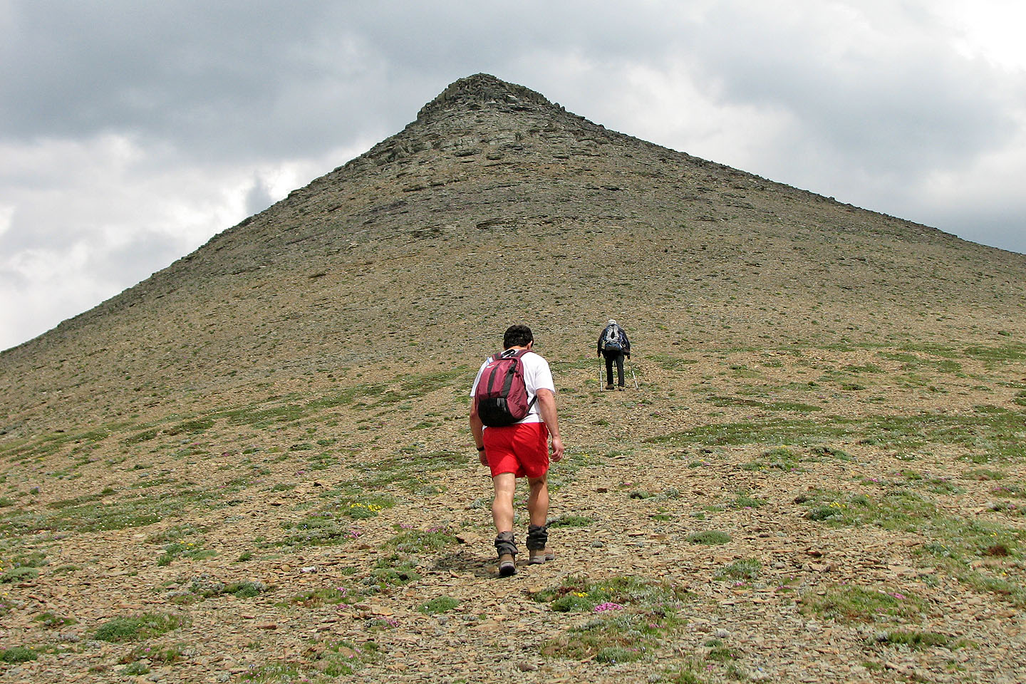
Except for the last few metres, it's a hike to reach it
Interesting rock below the false summit
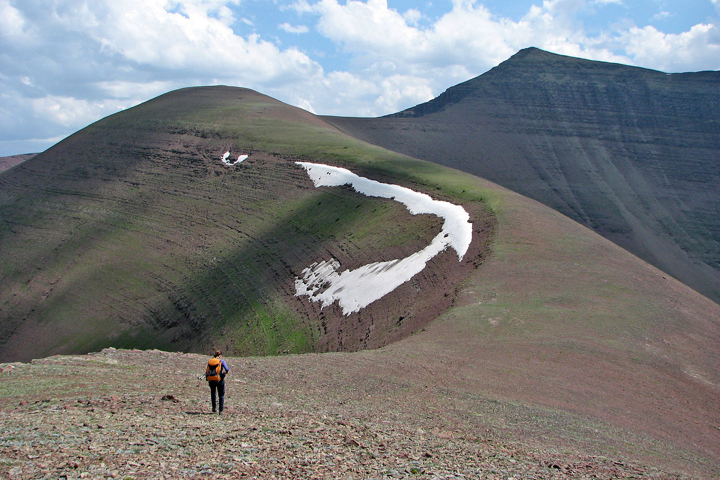
Dinah nears the false summit
The false summit: the true summit is 500 m away
Taking in the view.
Spread Eagle Mountain in the
background.
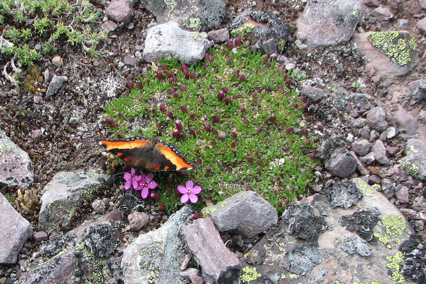
Fire-rim Tortoise Shell butterfly on campion moss
Looking at the
east end of Loaf Mountain
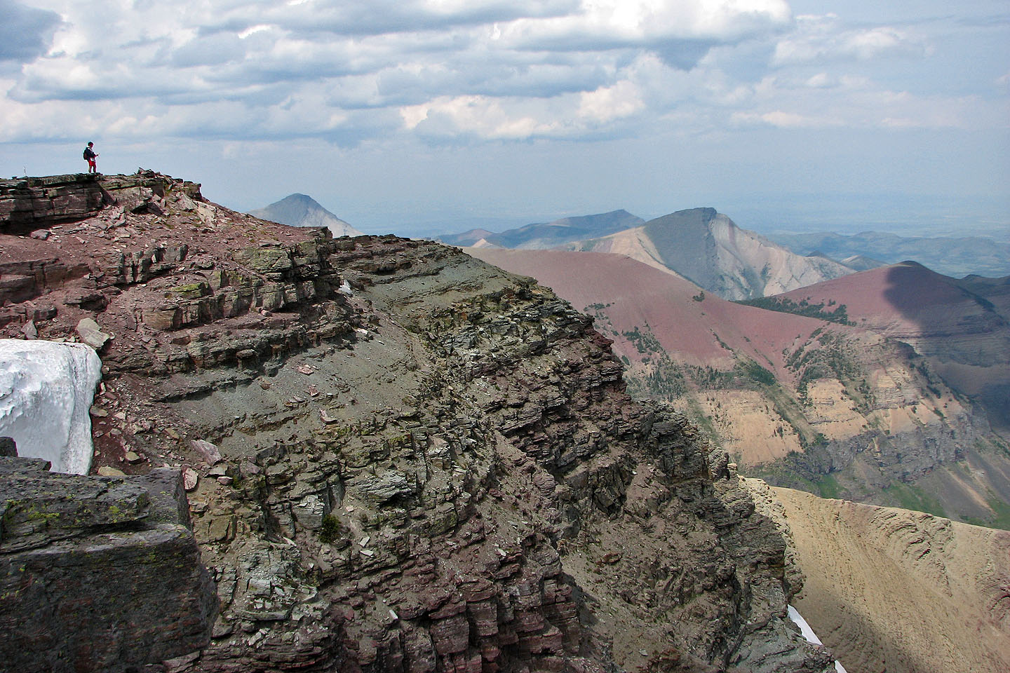
Grant on the summit
Victoria Ridge fills the middle of the photo. Windsor
Mountain and Castle Peak are on the right.
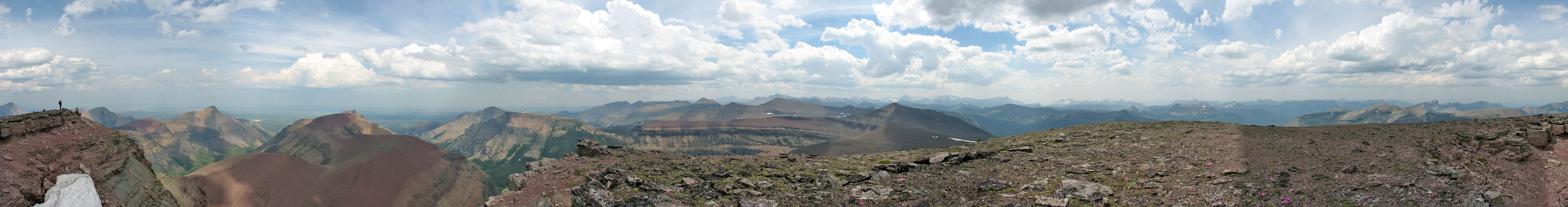
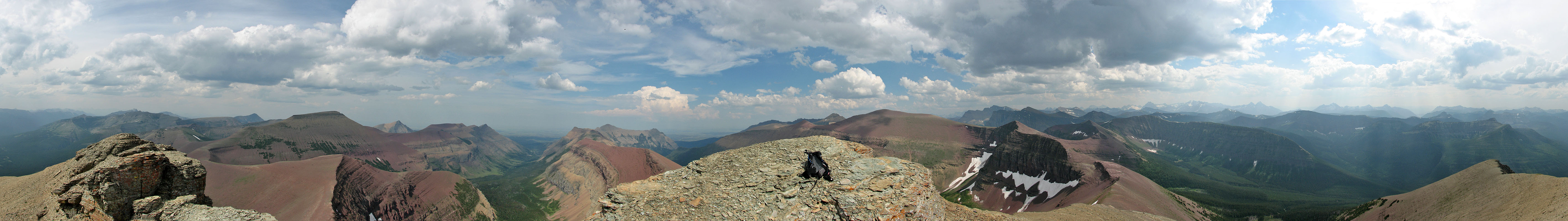
Panorama from Loaf Mountain
We left the summit and headed to Spionkop Ridge
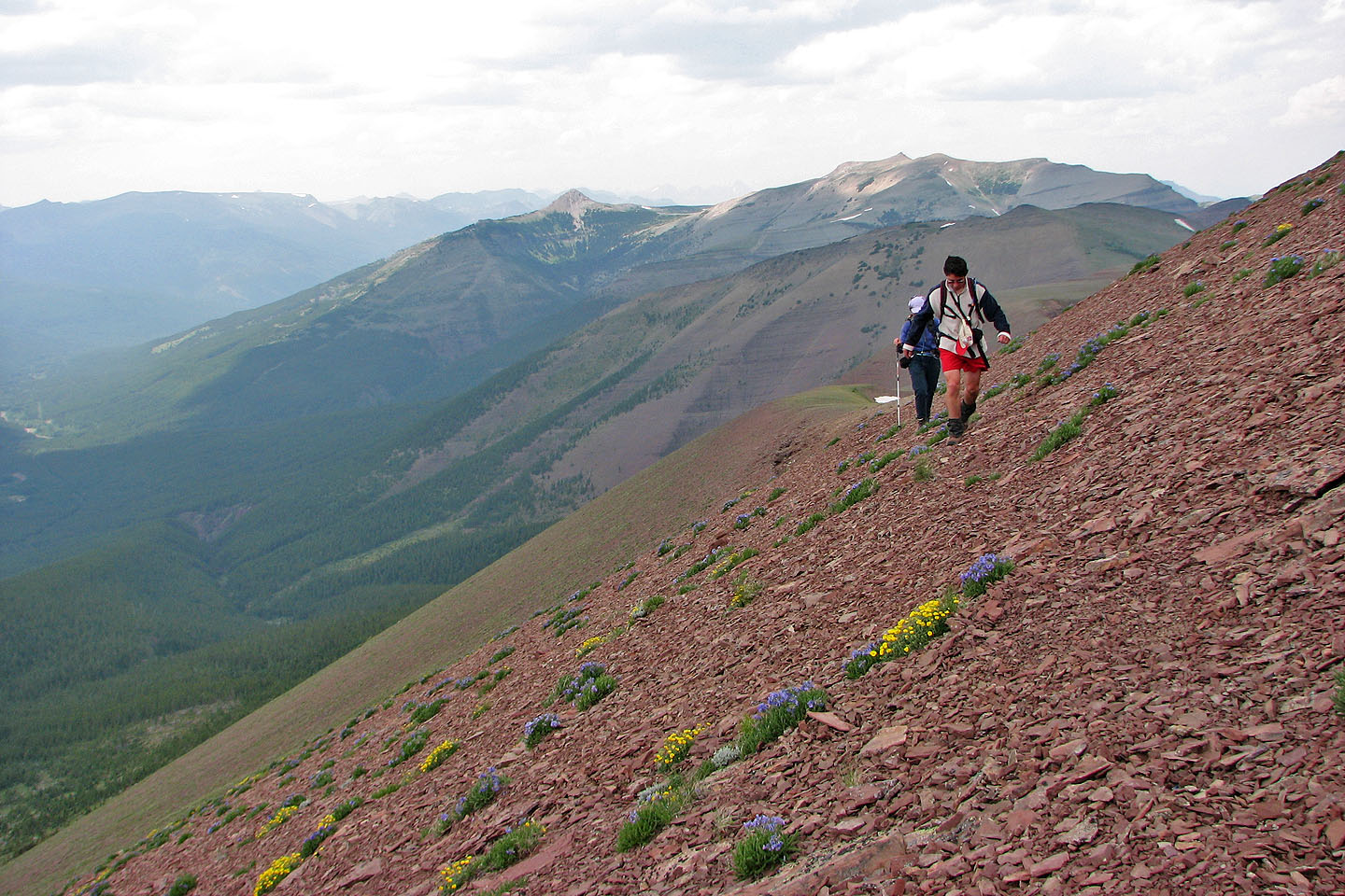
Last look at the false summit
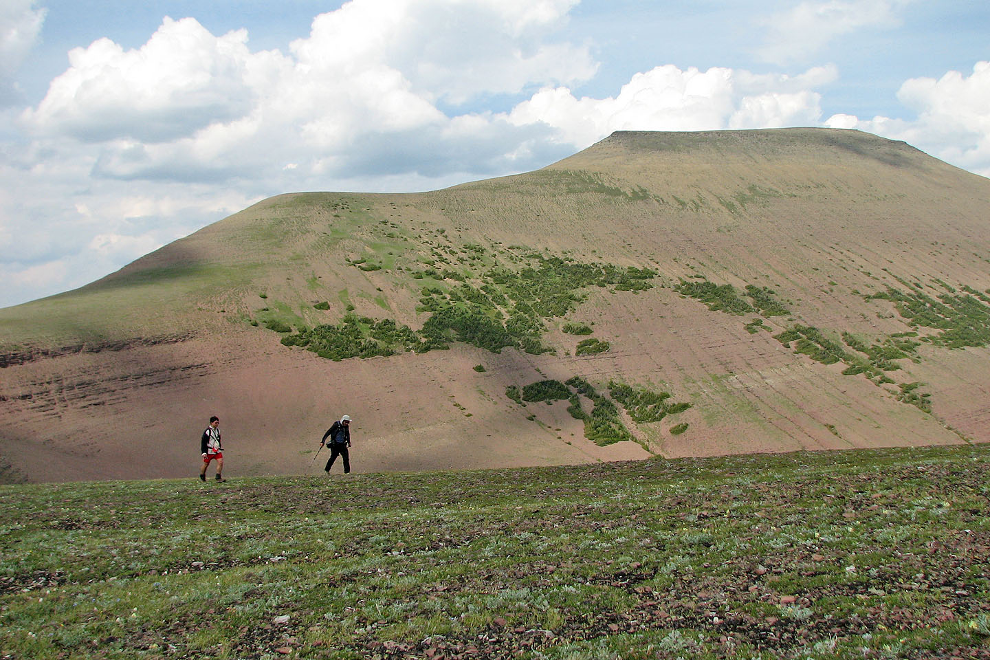
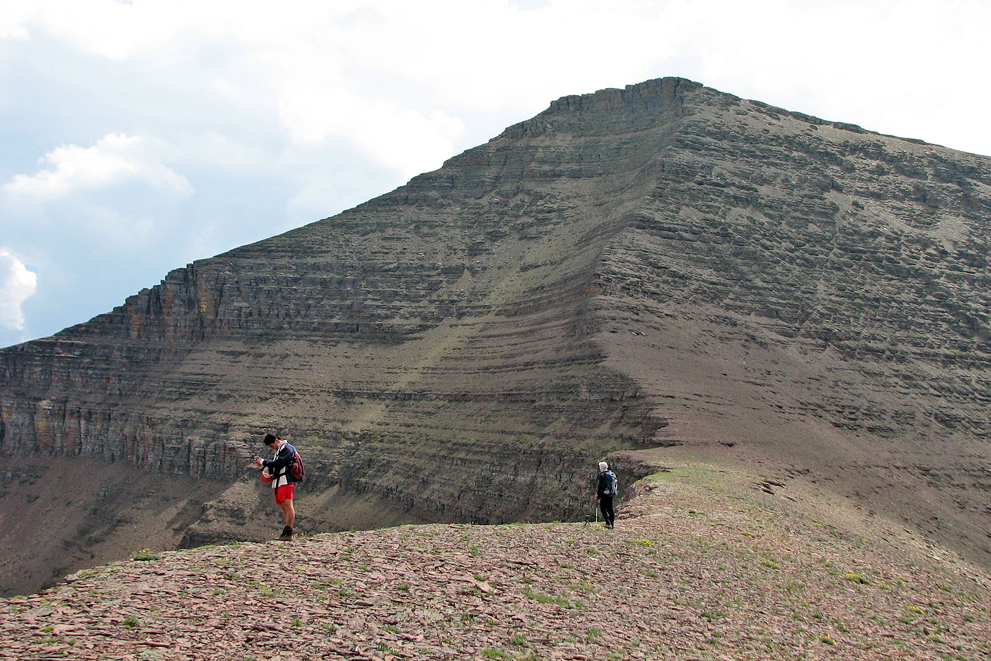
Loaf Mountain: the summit is on the right
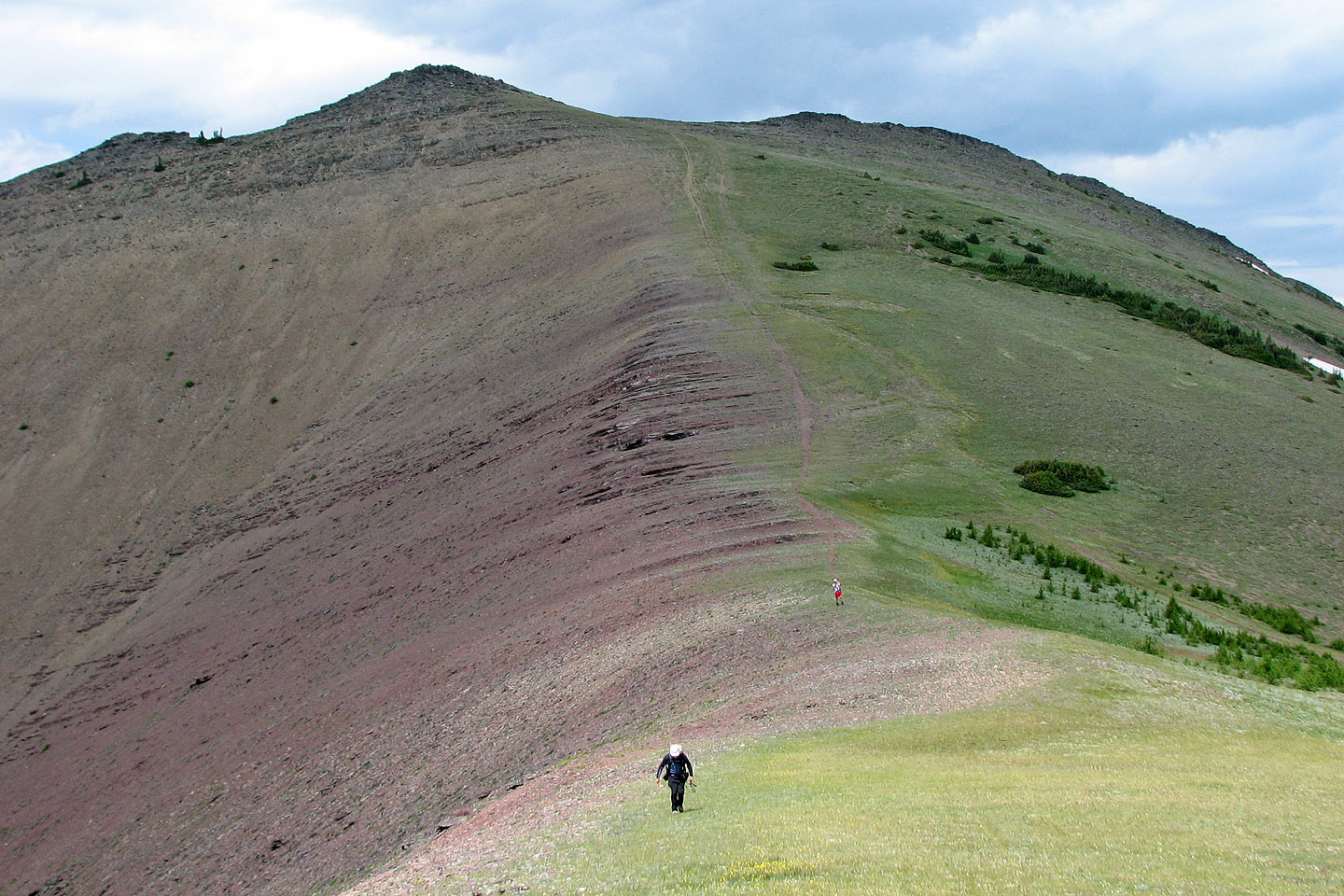
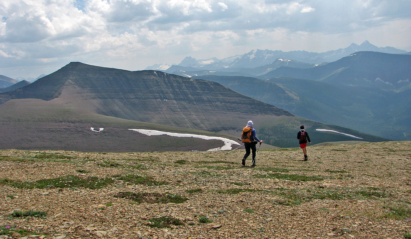
A connecting ridge snakes to Spionkop Ridge. We traversed around the rise ahead by using a sheep track.
Looking down Spionkop Creek valley
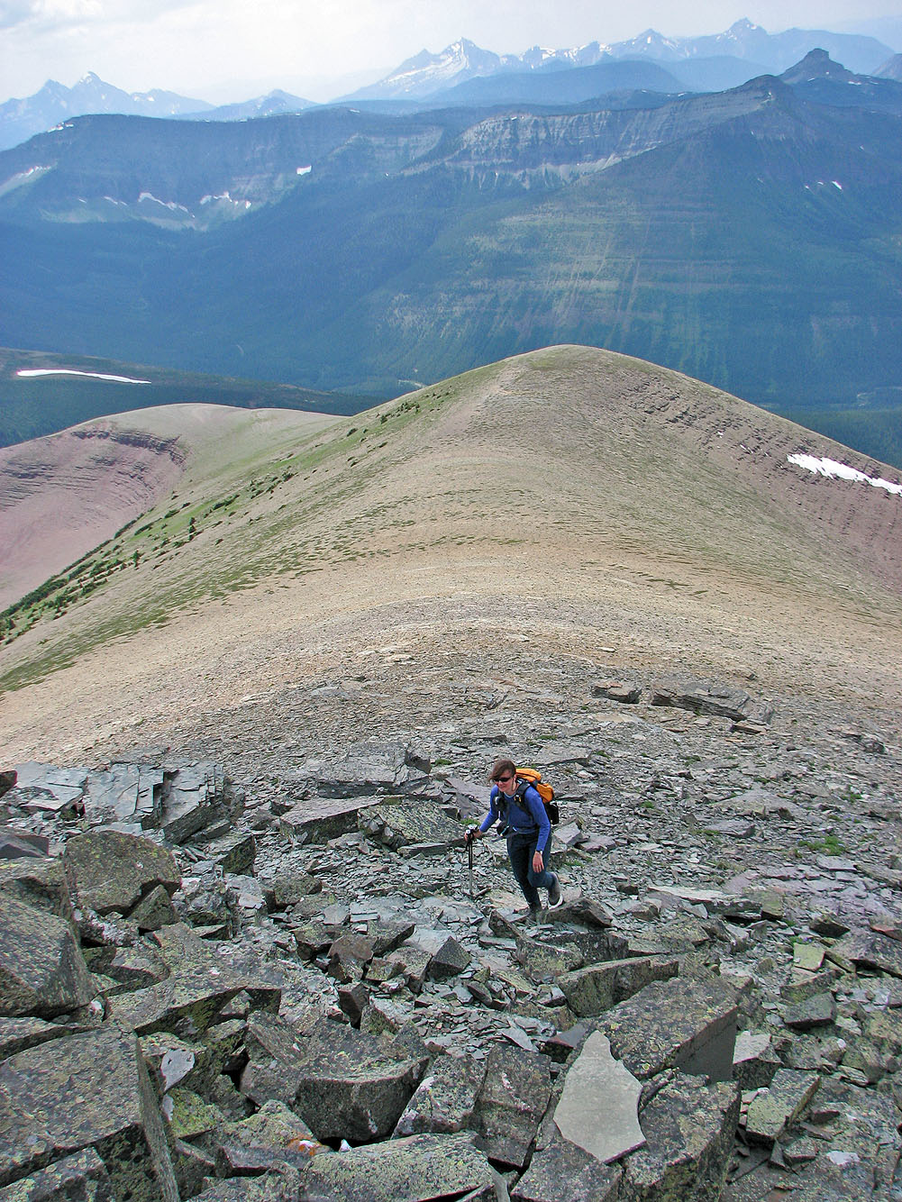
We start sidehilling but soon come across the sheep track
Following the sheep track
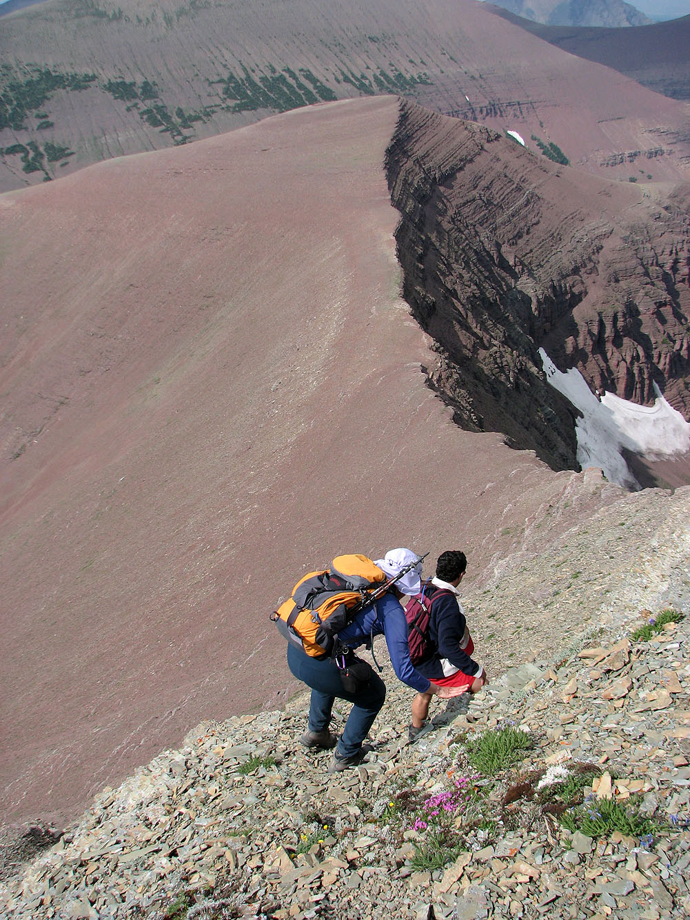
The ascent to the top of Spionkop won't be easy
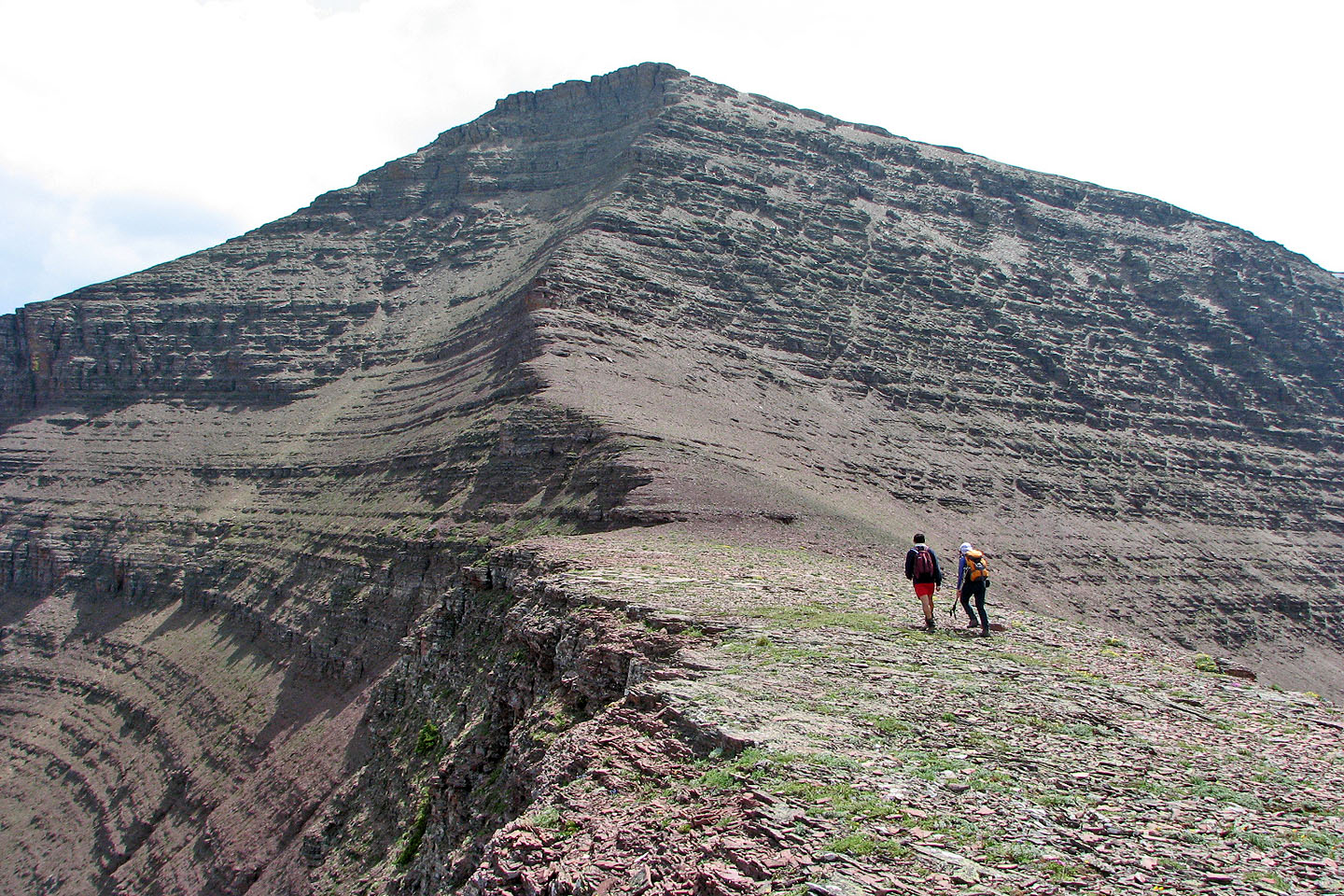
The summit looms above us
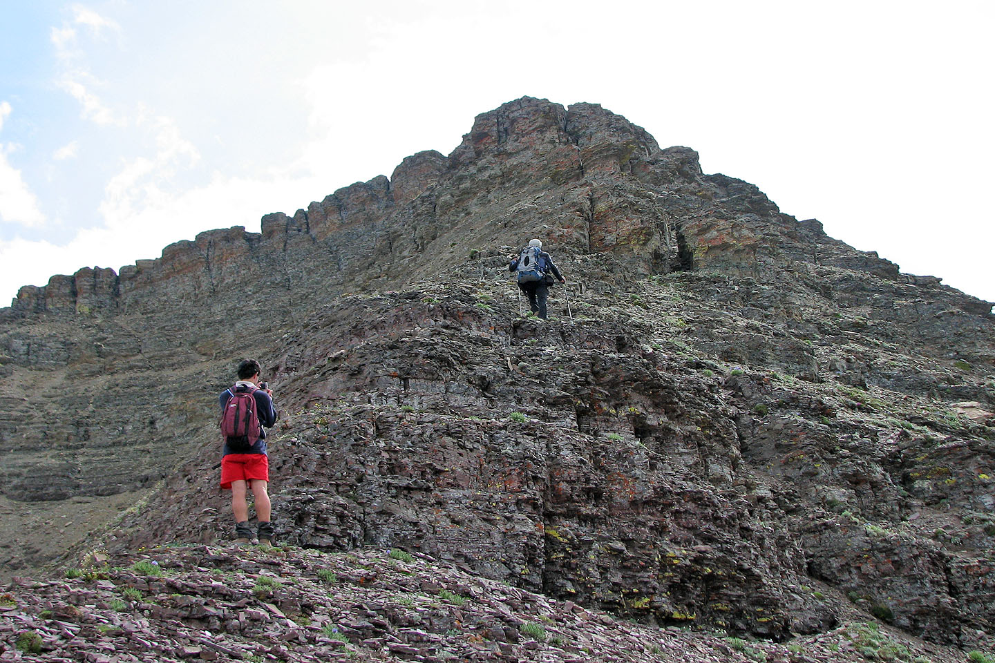
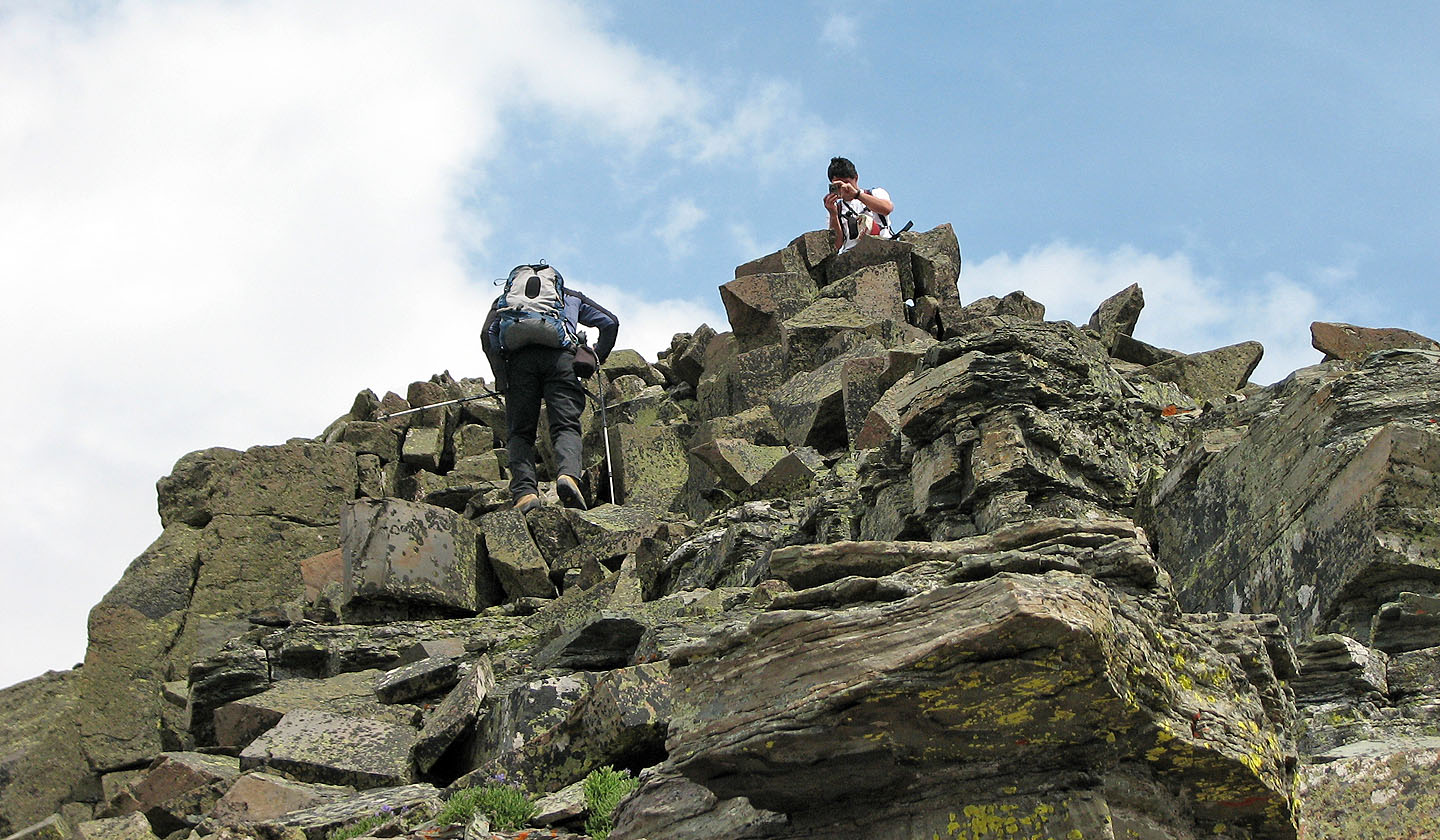
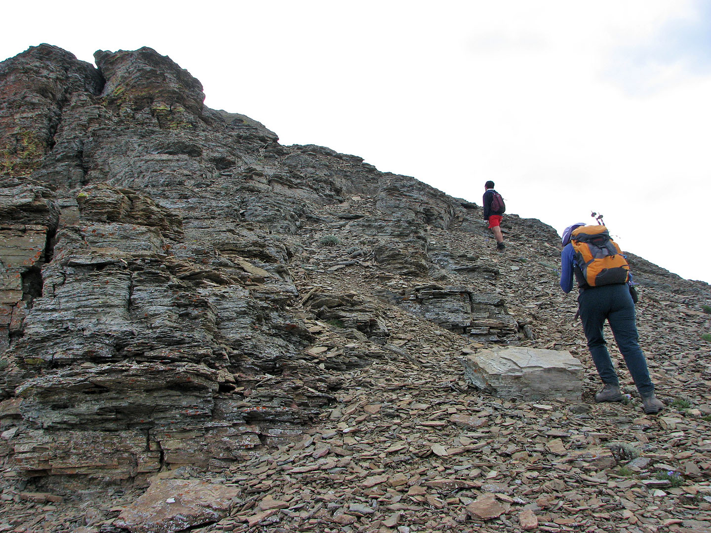
Starting up the cliff bands
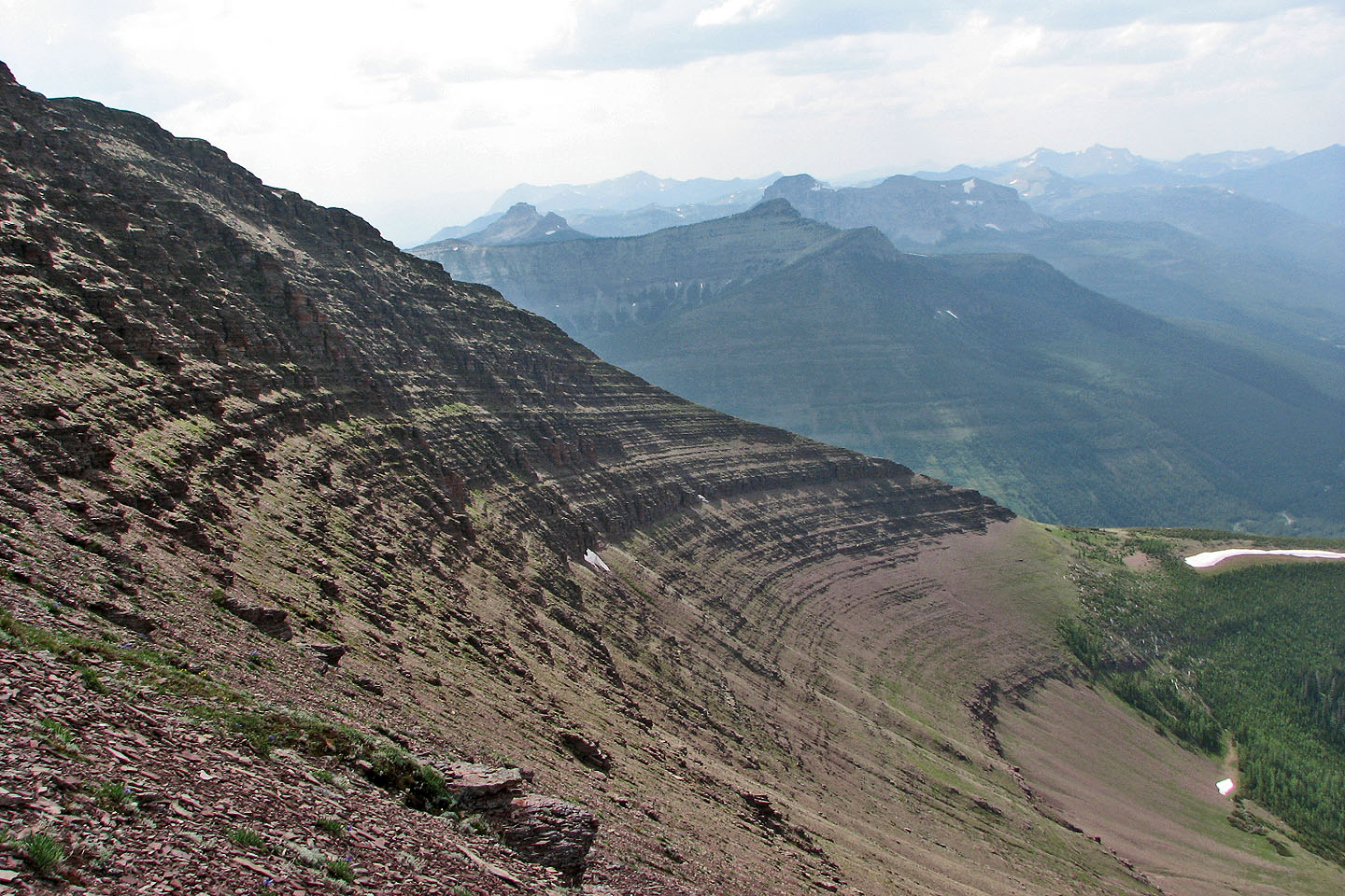
The view west shows how the grade increases as we climb
Scrambling was easy at first
Dinah follows behind
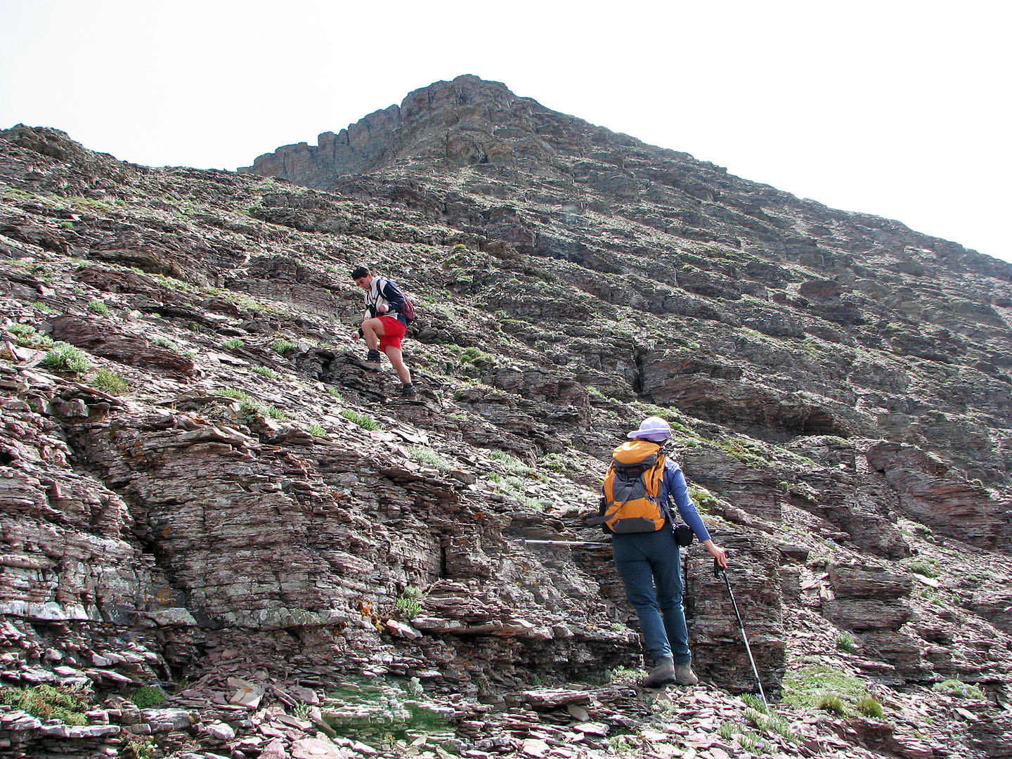
We reached a spot where we can walk for a bit
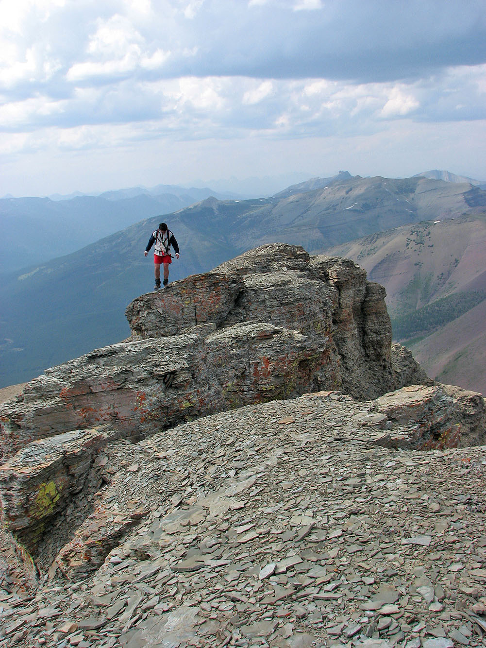
Grant on the summit block
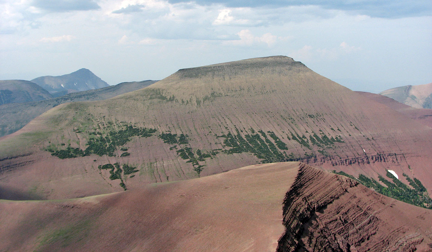
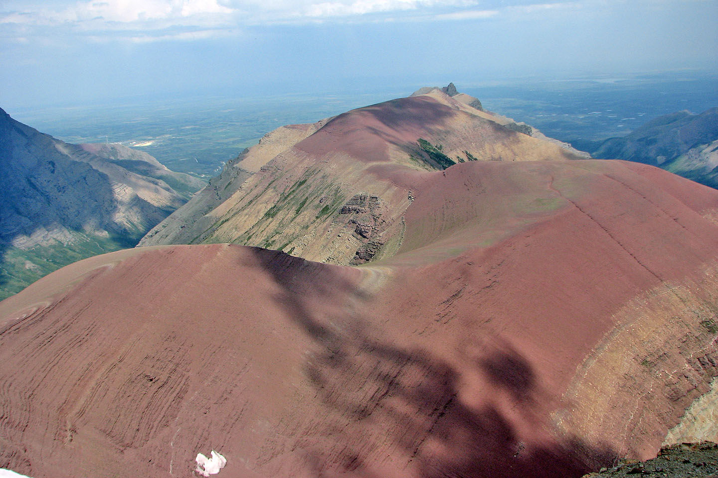
Loaf Mountain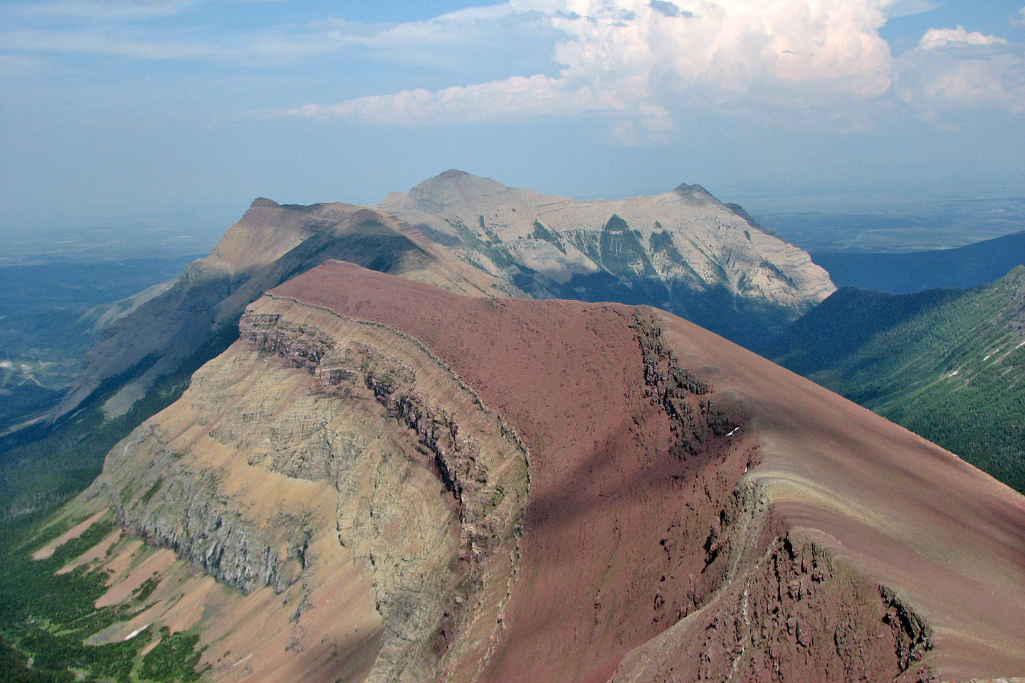
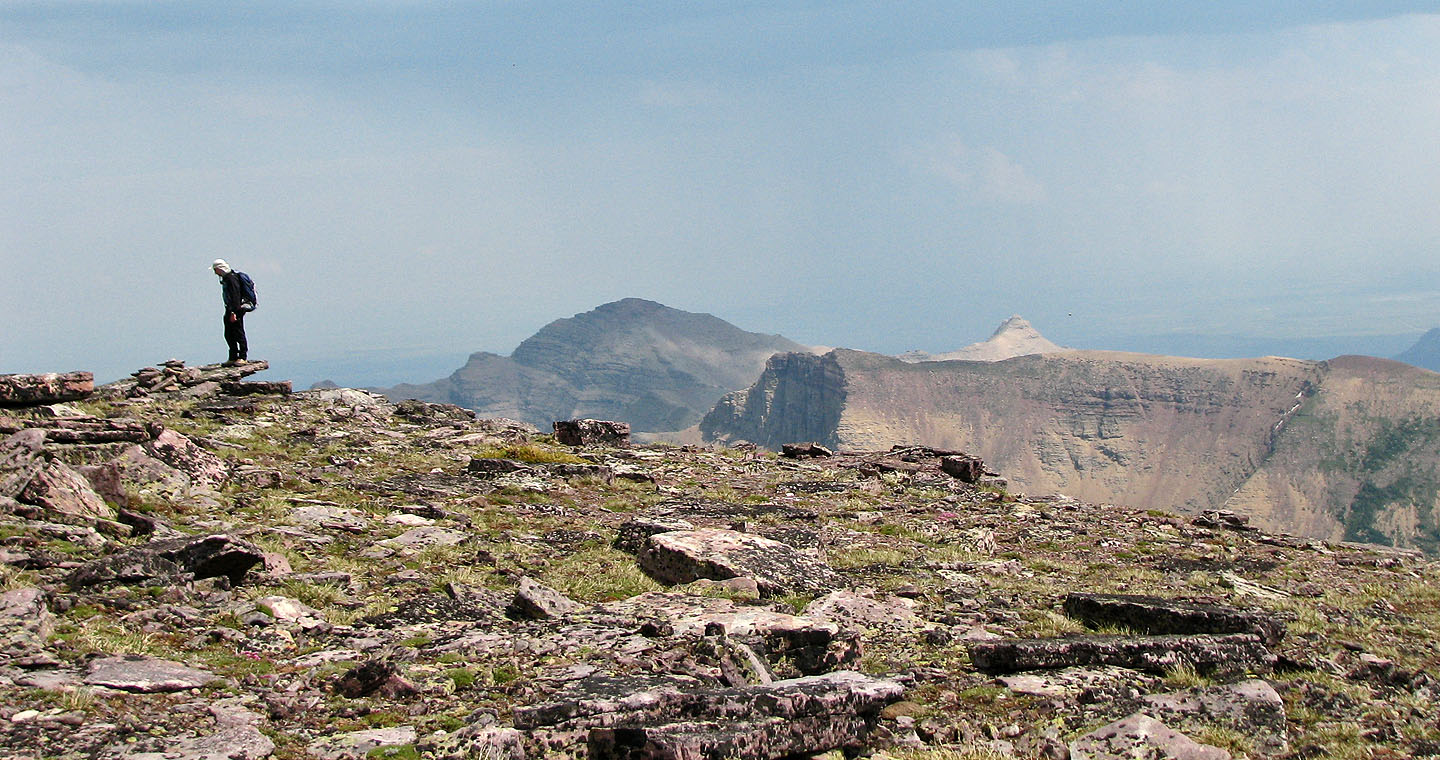
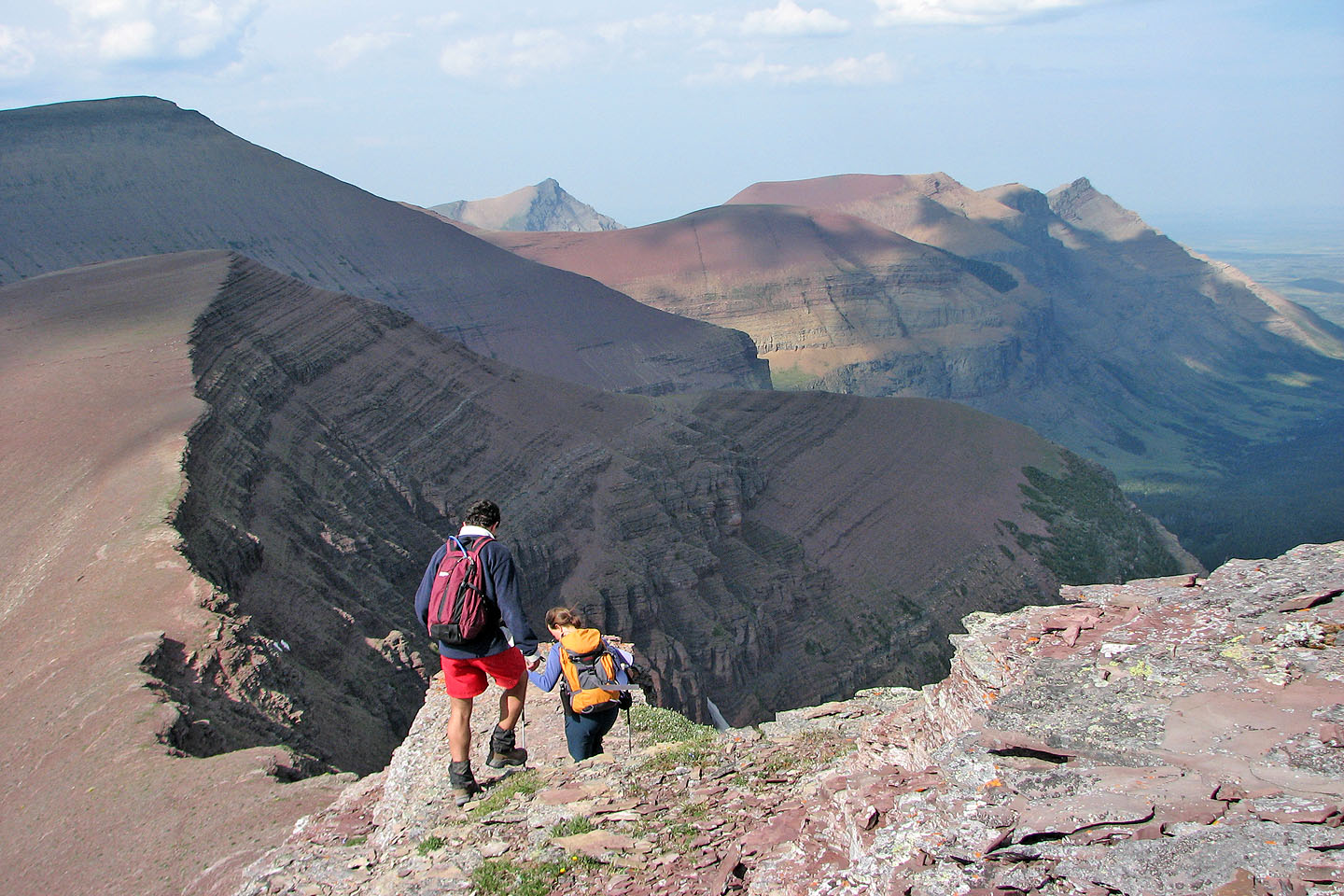
Viewing the end end of Spionkop,
Spread Eagle Mountain in the centre
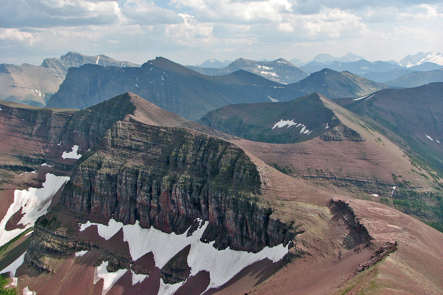
In the foreground, Newman Peak, unnamed peak and
Avion Ridge
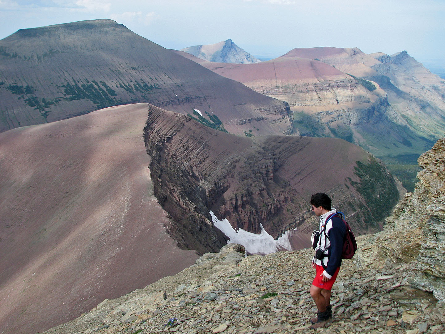
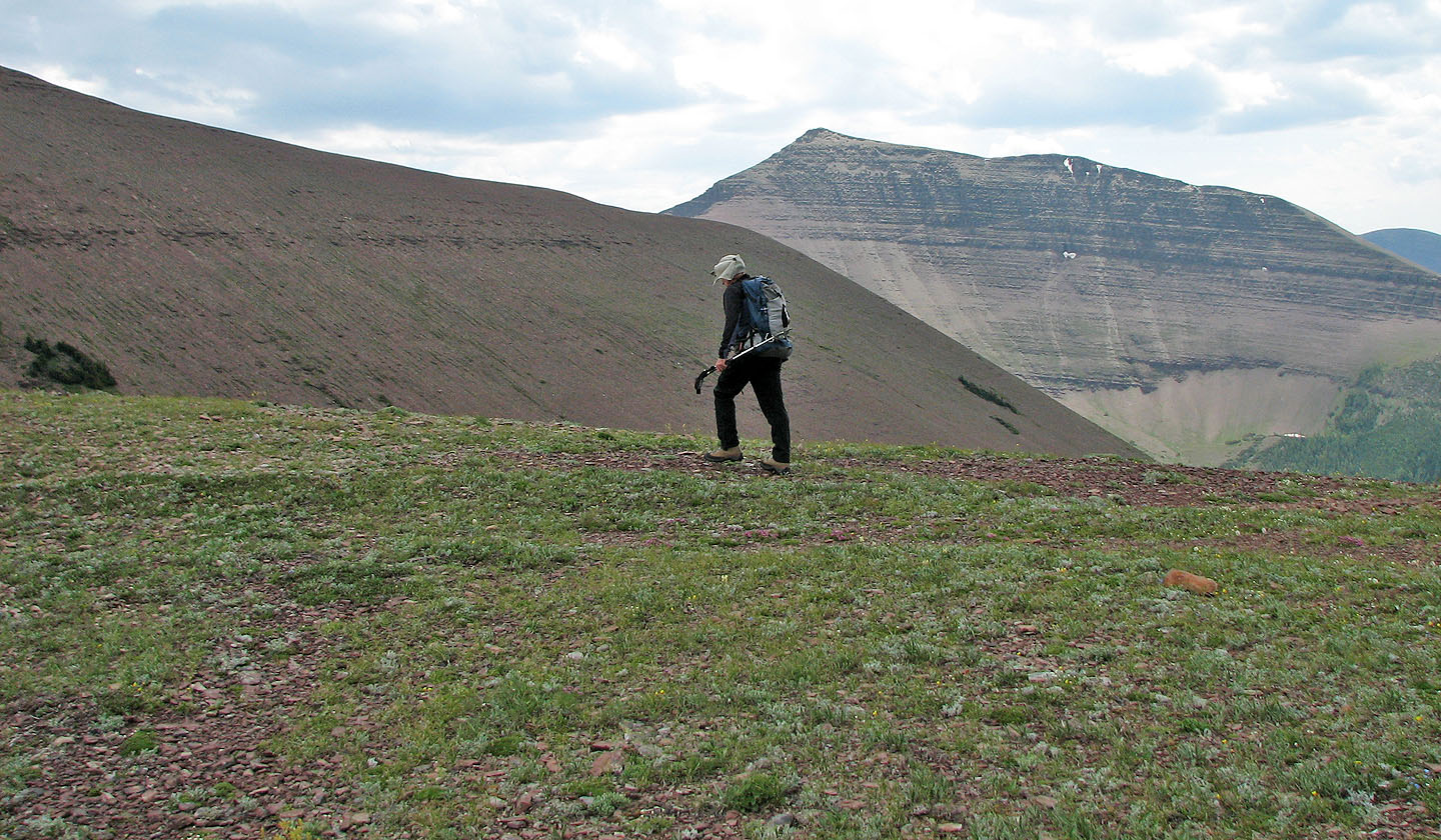
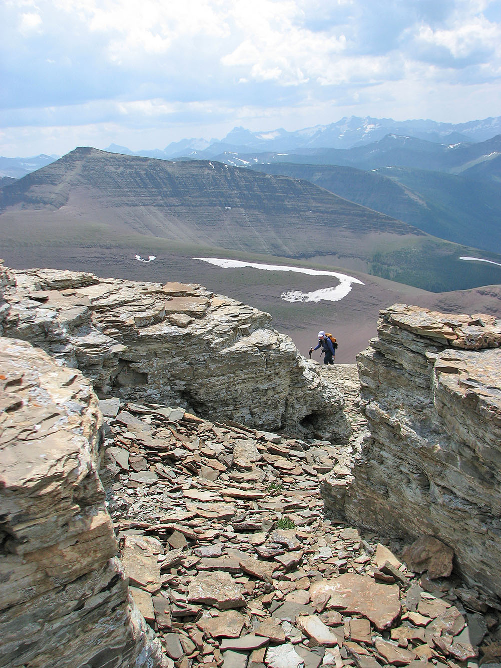
We paused to study the route down. The cliff bands below can't be seen from this angle.
After starting our descent, we reached a cairn we built. We marked our ascent so routefinding wasn't a problem
on the way down.
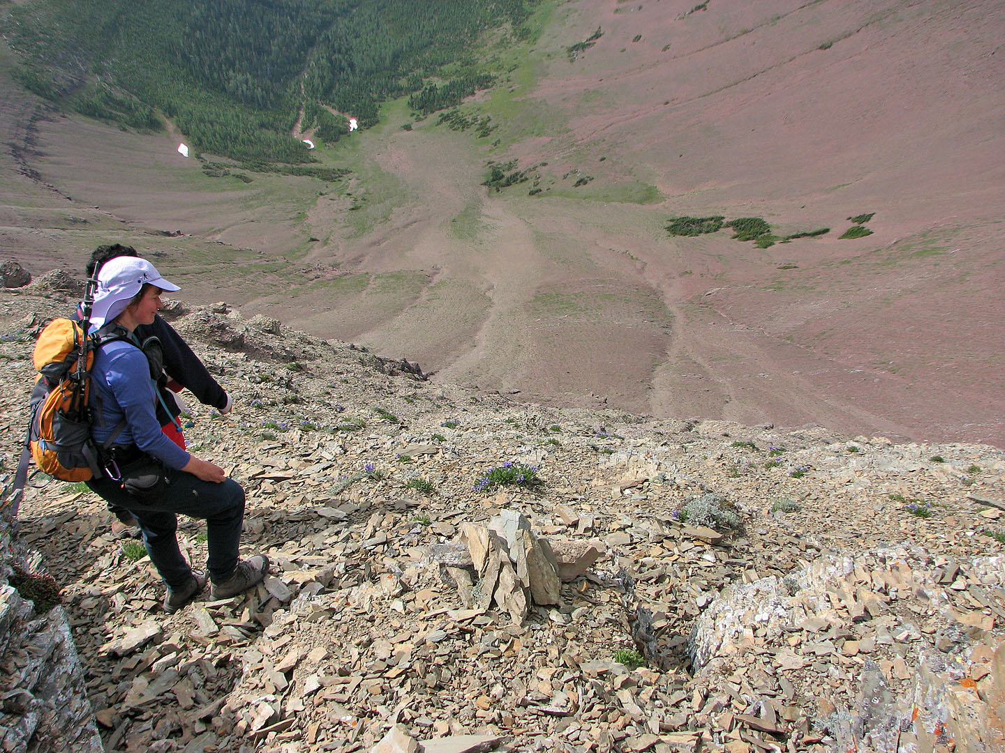
The slope drops off sharply in some places
More scrambling ahead before we bottomed out
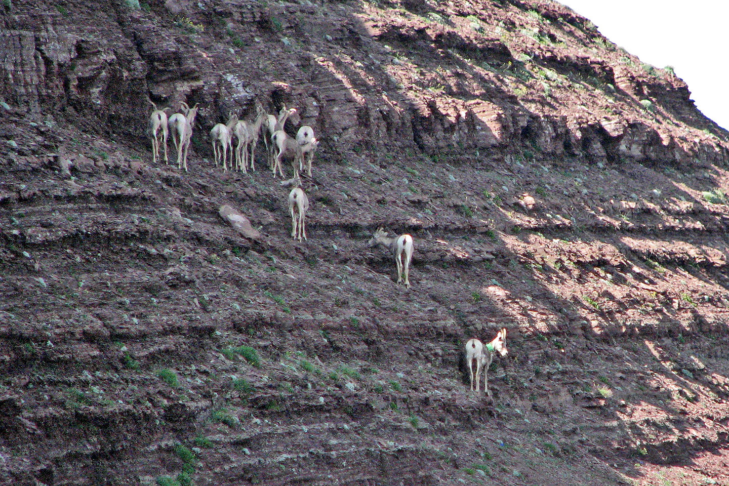
Bighorn sheep gathered on a steep slope
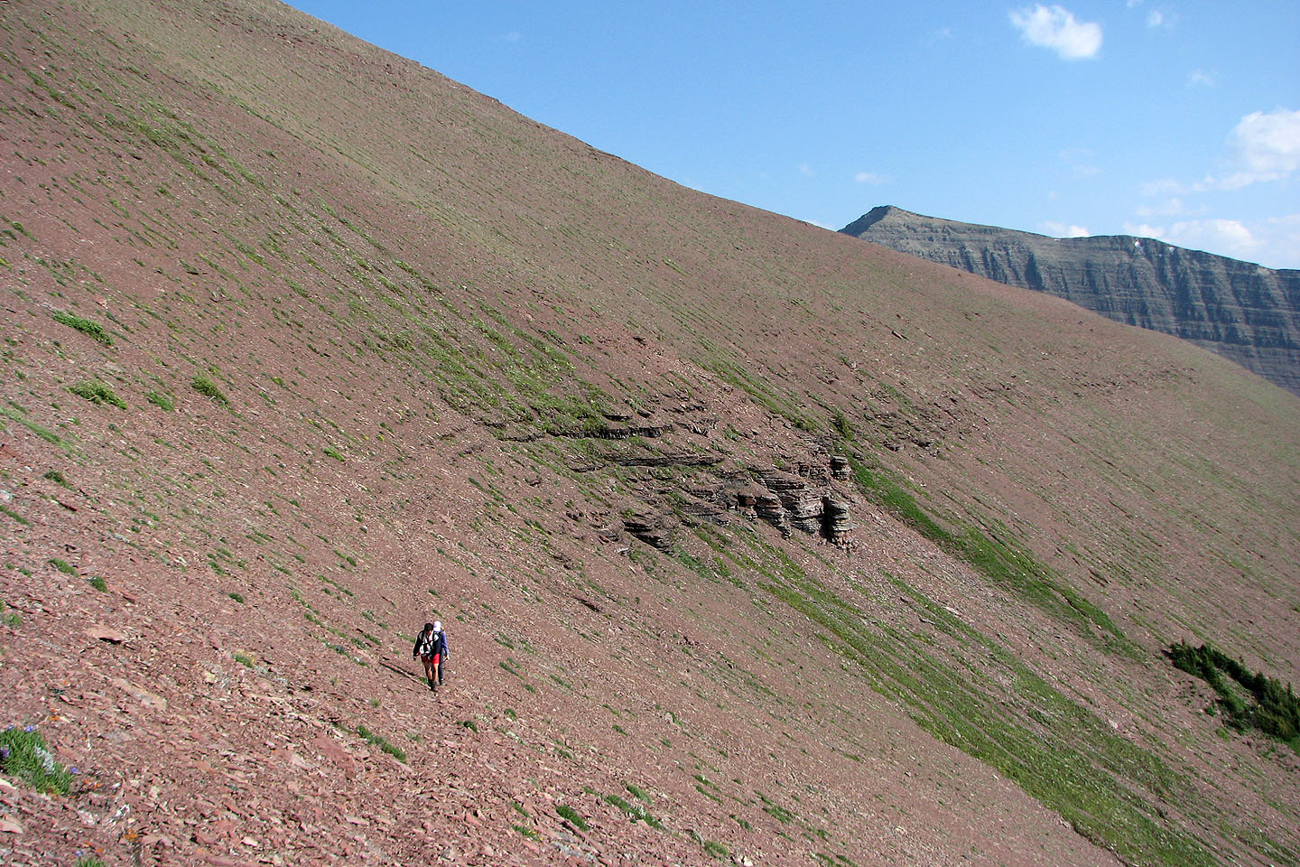
Traversing below the west end of Loaf Mountain on a sheep track
We reached the trail at the col
82 G/1 Sage Creek