bobspirko.ca | Home | Canada Trips | US Trips | Hiking | Snowshoeing | MAP | About
Little Mythic Tower
Kananaskis, Alberta
July 5, 2008
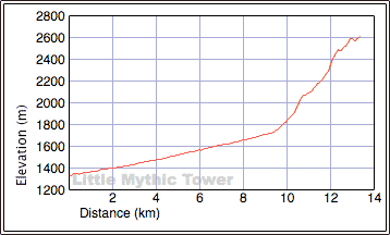
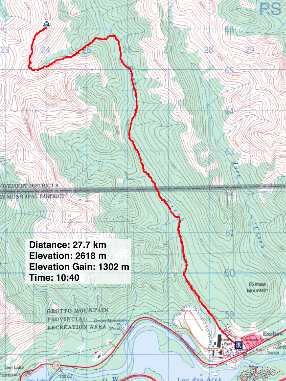
Distance: 27.7 km (17.2 mi)
Cumulative Elevation Gain: 1341 m (4400 ft)
Ever since I read about the Mythic Towers in Kananaskis Country Trail Guide, I have been curious about them. The author Gillean Daffern mentions that John Martin was the first to traverse the Mythic Towers. Her guidebook shows roughly where they are – north of Mount Fable and west of Exshaw Creek – but their exact location, what they look like and how to get to them were nowhere to be found on the Internet.
After studying the map I guessed where the Mythic Towers were and how to reach them. Along with Dinah, I set off on a quest for the Mythic Towers.
Surprisingly, nothing foiled our mission: no fire-breathing dragons, not even a cliff band stopped us. We reached the summit we set out for, but when we saw two rocky peaks to the north, I doubted we were standing on one of the Mythic Towers. We didn't attempt them as the day was already long (six hours to our summit).
Unsure about our Mythic bid, I emailed Gillean Daffern after the trip. I sent a map with our route and some photos and asked her if we had reached one of the Towers. As it turns out, she wasn't sure either, so she emailed John Martin. After exchanging emails, I had more information on the Mythic Towers.
I learned that The Mythic Towers are best observed from the headwaters of Cougar Creek. I checked my Cougar Creek Loop trip and realized we had seen the Mythic Towers from an unnamed peak. The north peak is called "Epic Tower," while the south peak is called "Mythic Tower." John Martin calls the drainage we ascended "Mythic Creek." (Read John Martin's route.)
I knew nothing of this before the trip. We planned to hike up Exshaw Creek and ascend the drainage (Mythic Creek) north of Mount Fable. After driving to Exshaw, we found that the trailhead for the Exshaw Creek trail had been moved. It was now west of Exshaw Creek on Mt Allan Dr. It falls short of the original trailhead, adding 500 m to the trail. That added time, as did the high water level: the creek crossings slowed us. The 9.4 km hike to Mythic Creek took 2:40 hours.
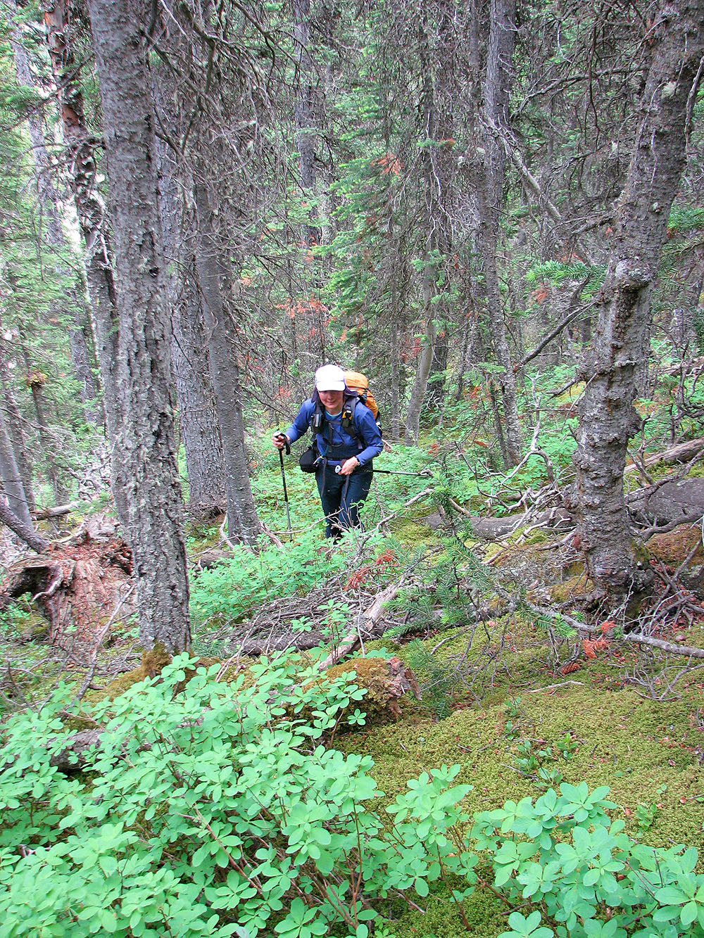
The lower section of the creek was braided and treed. We hiked up the right side where travel was easy. Eventually the drainage resolved into a rock-strewn gully. The grade was gentle at first, and for the most part, large rocks provided solid purchase. At one point, the drainage was too steep to ascend and we bypassed the section by ducking into the trees.
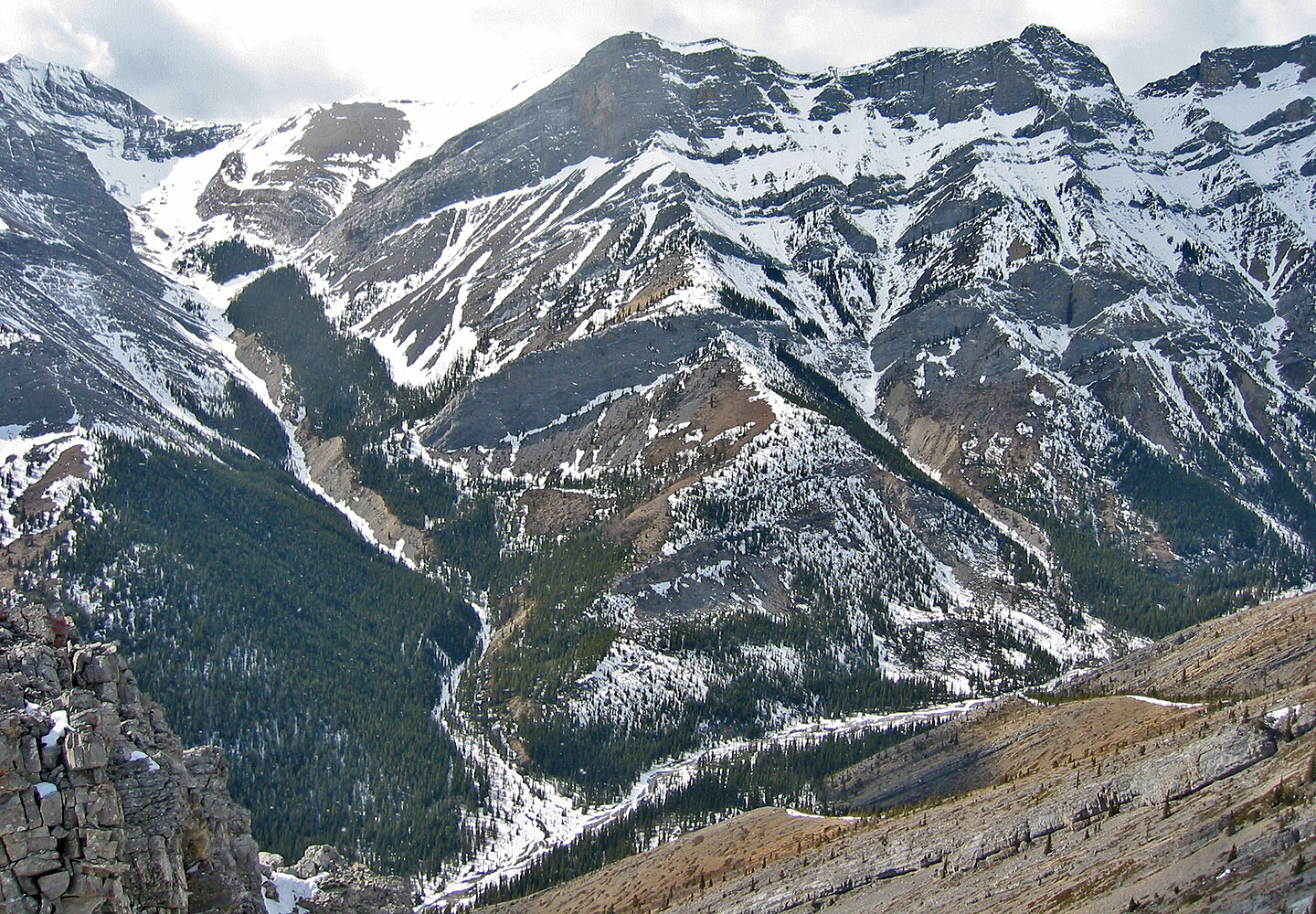
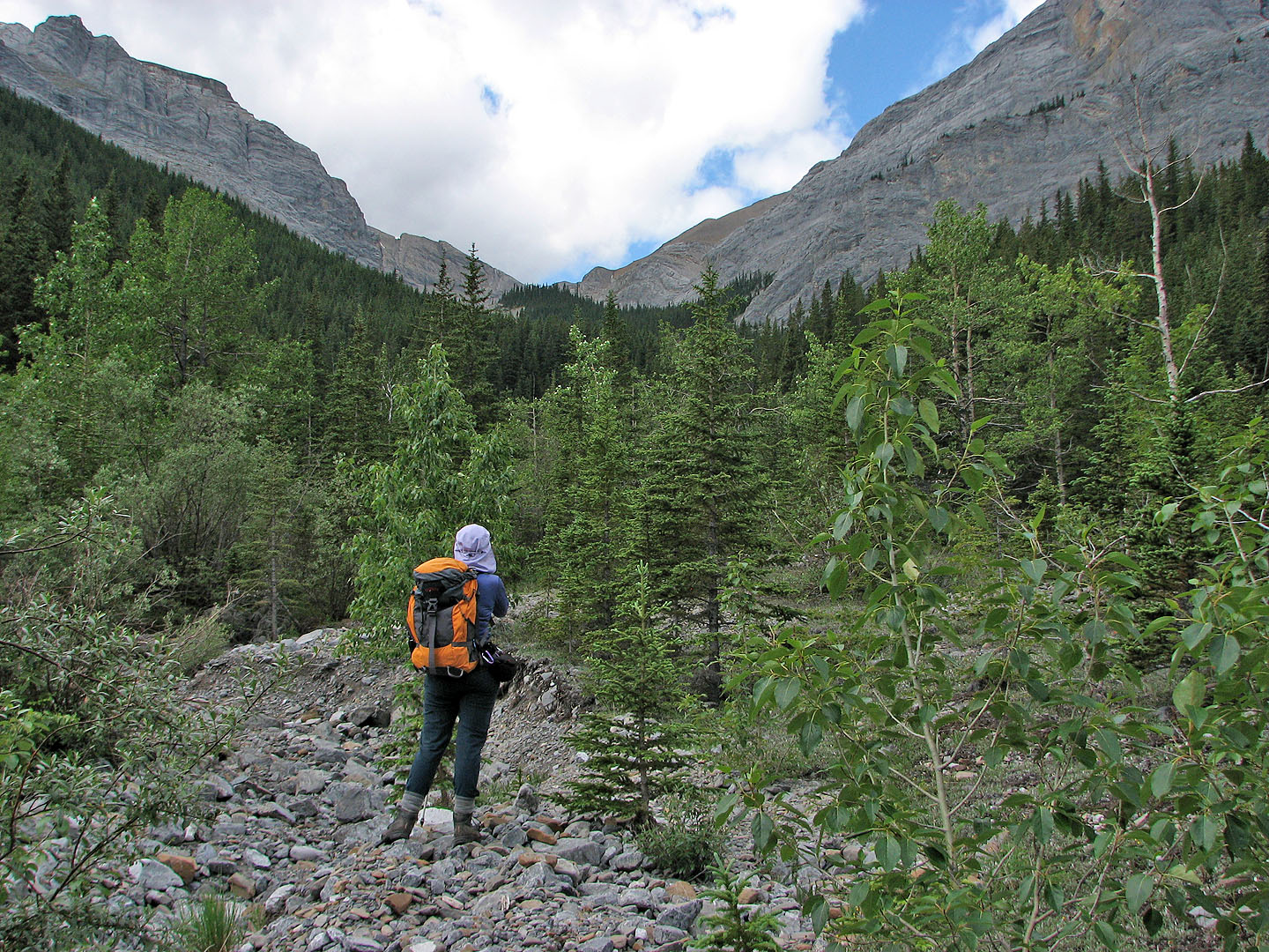
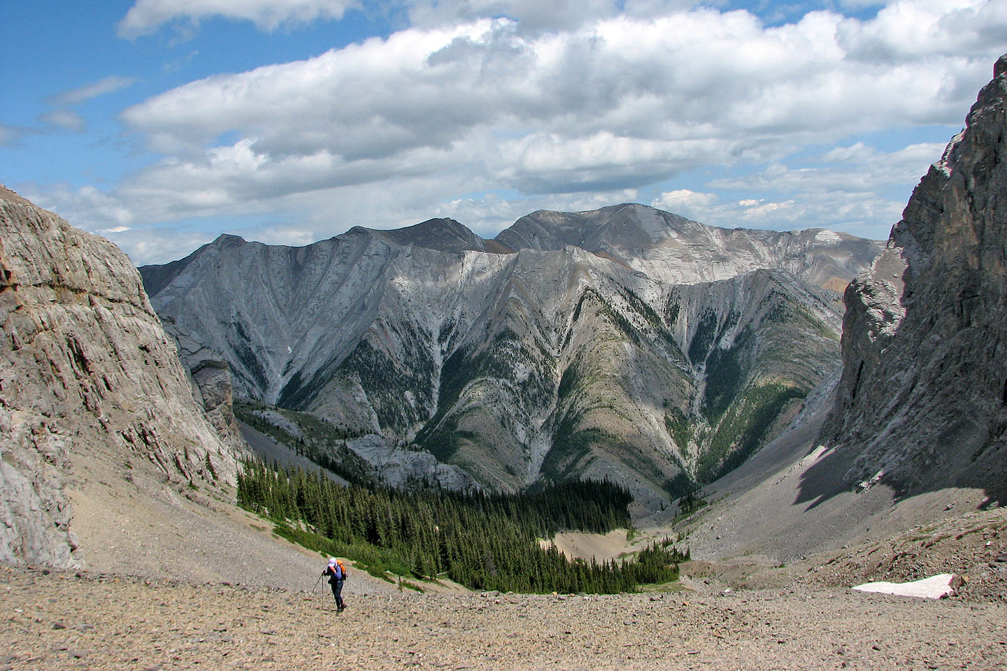
After returning to the drainage, it soon flattened and then disappeared. Ahead of us, a valley led to a cirque. The cliffs of the cirque suggested a dead end, but scree spilling out from behind a rock buttress gave hope that there was a way out.
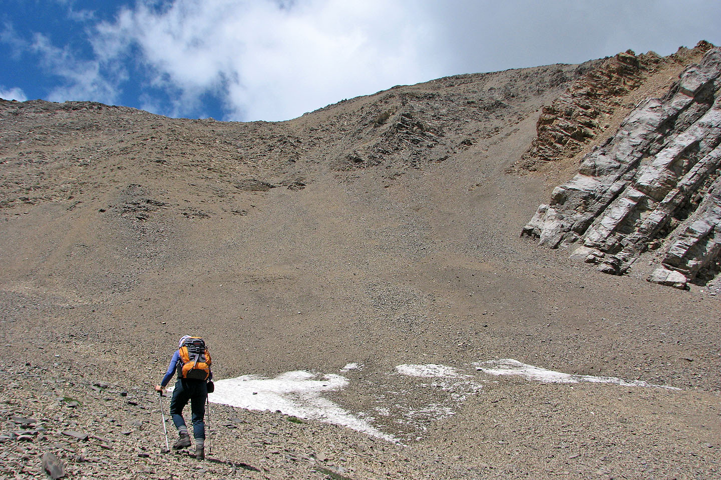
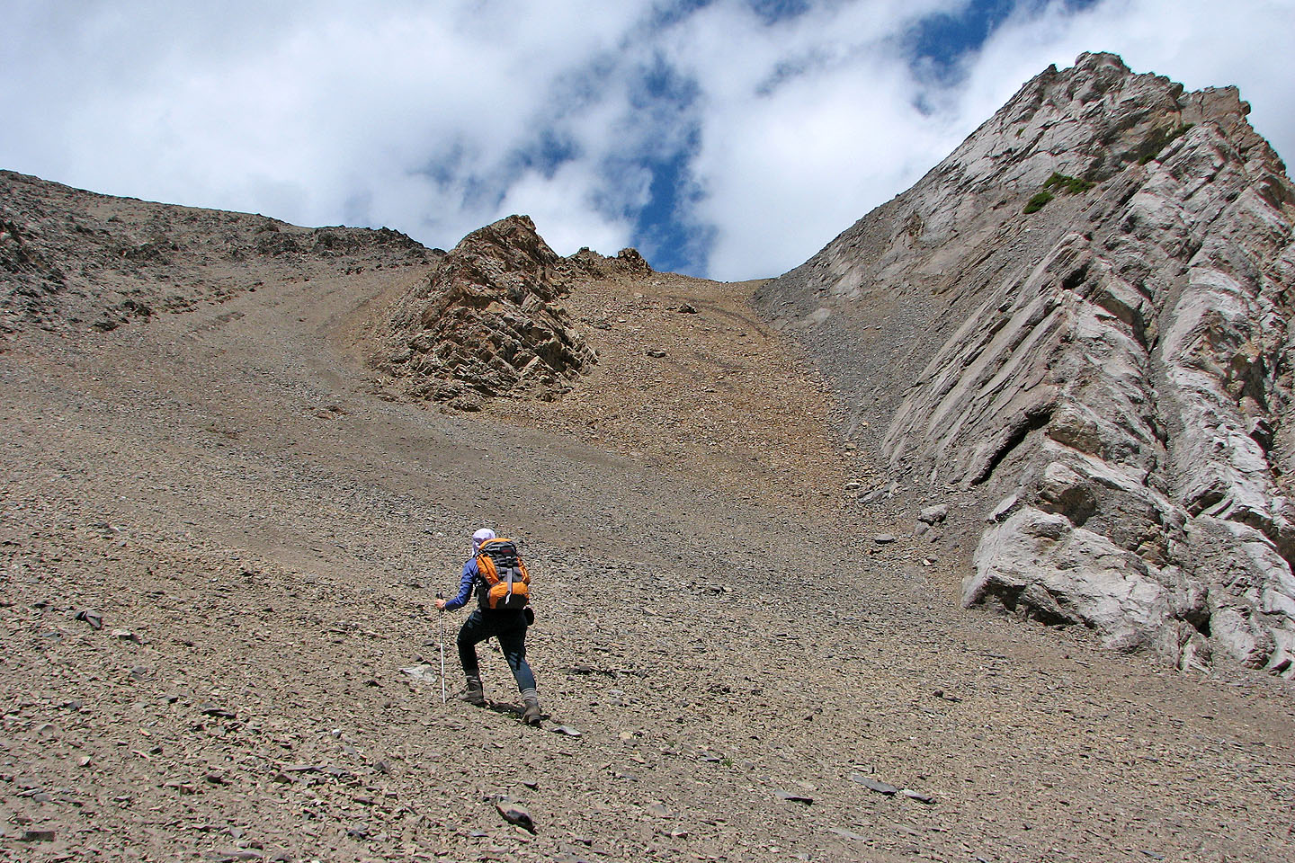
Once in the cirque, we saw we could reach the ridge directly. But a scree gully on our right would save time and elevation loss if it worked. We took it. After climbing up the gully, I thought we would be on the ridge, but instead we reached a small saddle. After ascending more scree, we were finally on the ridge looking down the other side at the headwaters of Cougar Creek. We followed the ridge to the summit.
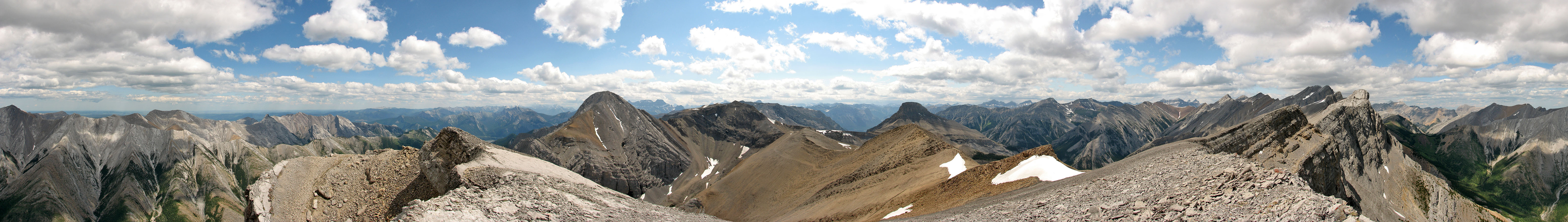
As we hiked along the ridge, we soaked in the breathtaking scenery. Familiar peaks were all around us, but the centrepieces were the Mythic Towers: great chunks of rock rising from the ridge on our left.
The point we reached, which I called “Little Mythic Tower," is ridge-like. We went to the south high point first, but when we hiked to the north high point, we found it was marginally higher. It provided a stunning view of Mythic Tower only 700 m away. It appeared to be a technical climb, beyond our abilities. After staying half an hour on the summit, we returned the same way.
We were successful in finding the Mythic Towers, and with help from Gillean Daffern and John Martin, identified them. I won't be knighted for bagging an unnamed peak, but it was no small achievement, and the scenery was incredible! Ironically, Little Mythic Tower appears more tower-like than the Mythic Towers!
Little Mythic Tower from Exshaw Ridge (mouse over to see our route)
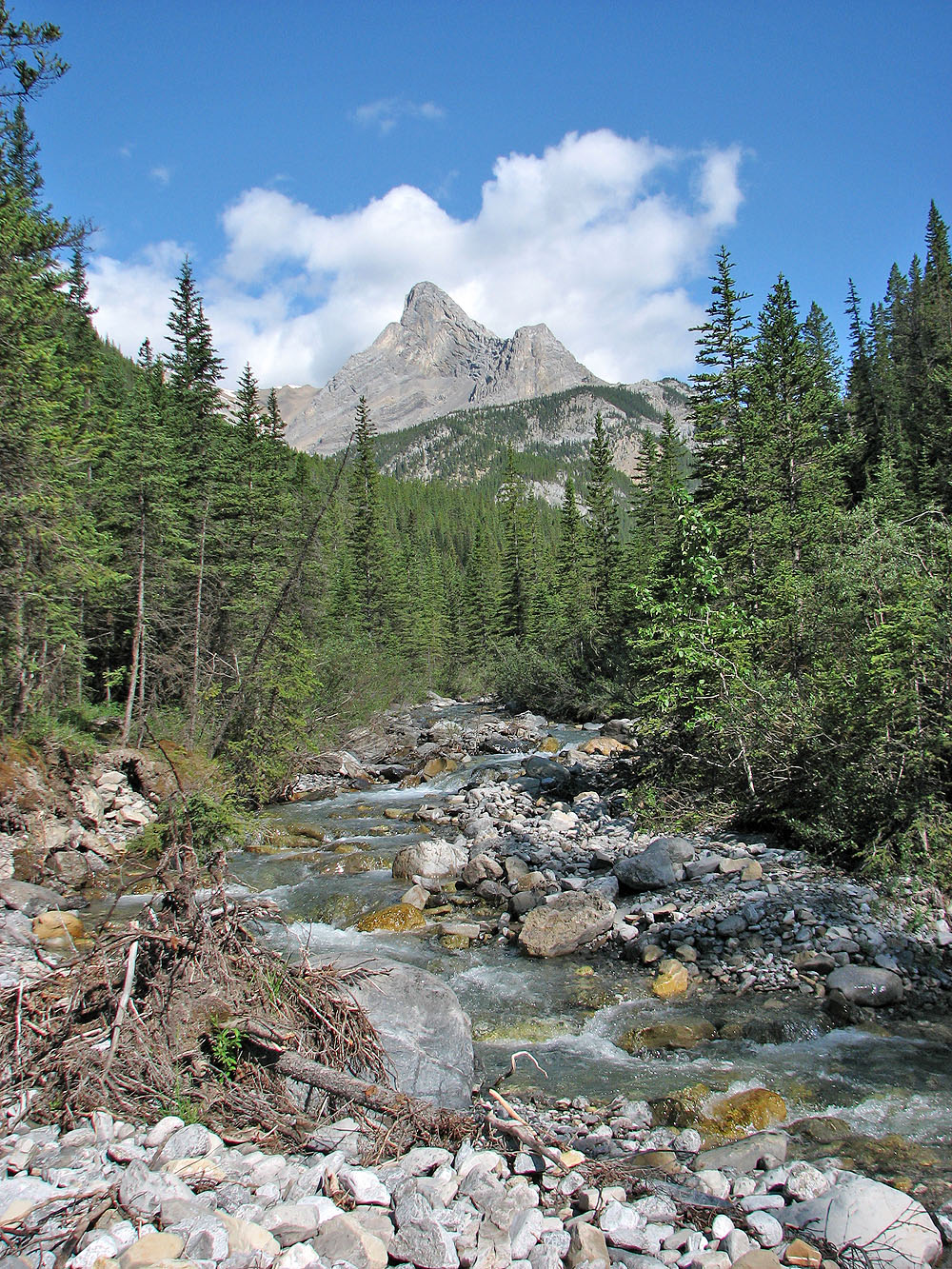
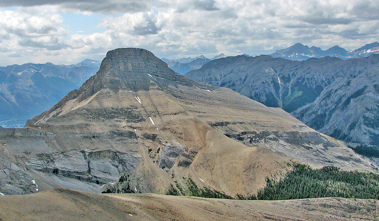
Mount Fable from Exshaw Creek
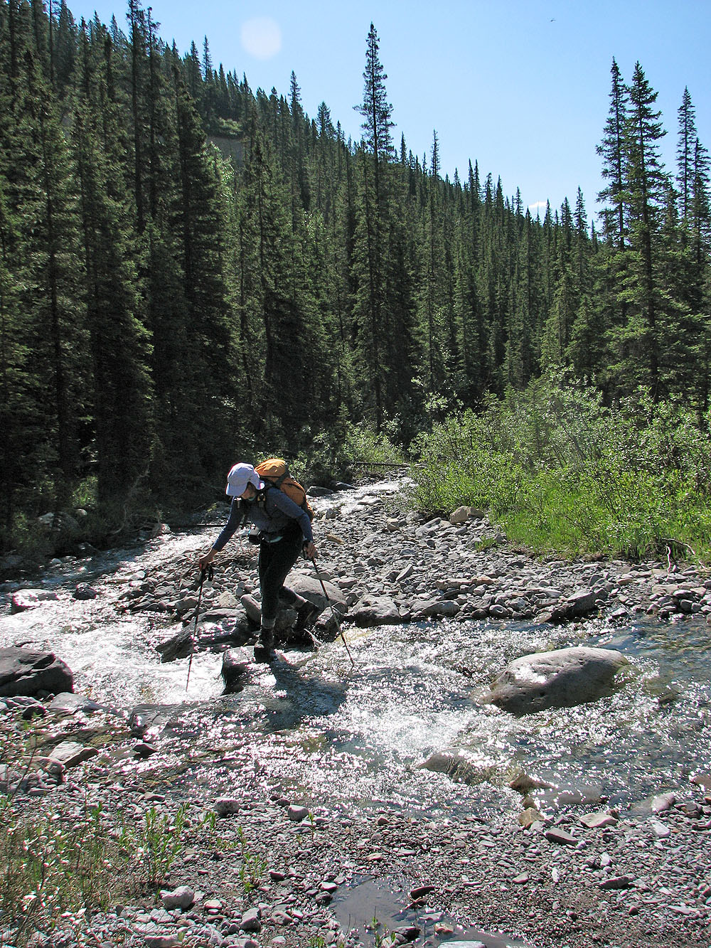
We had to cross the creek several times
Little Mythic (left) from Exshaw Creek
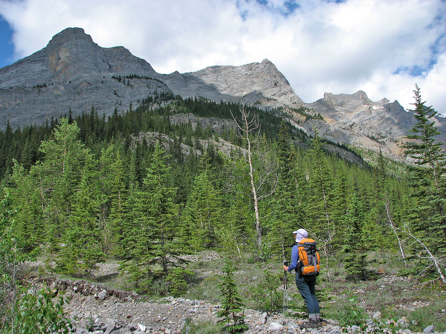
Looking up the drainage gave no clue as to what lay ahead
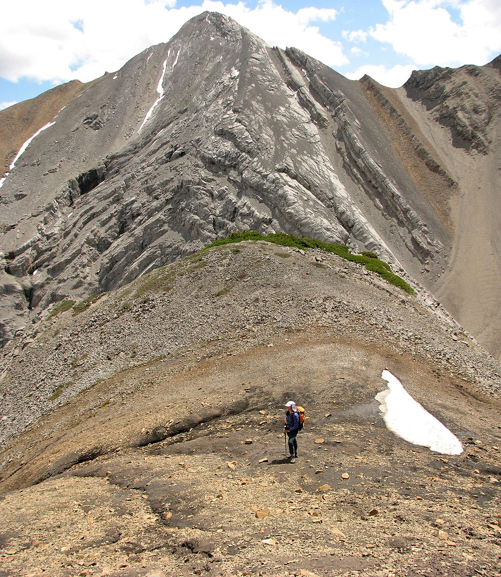
Our trip went half way around Little Mythic, so we would see its three sides
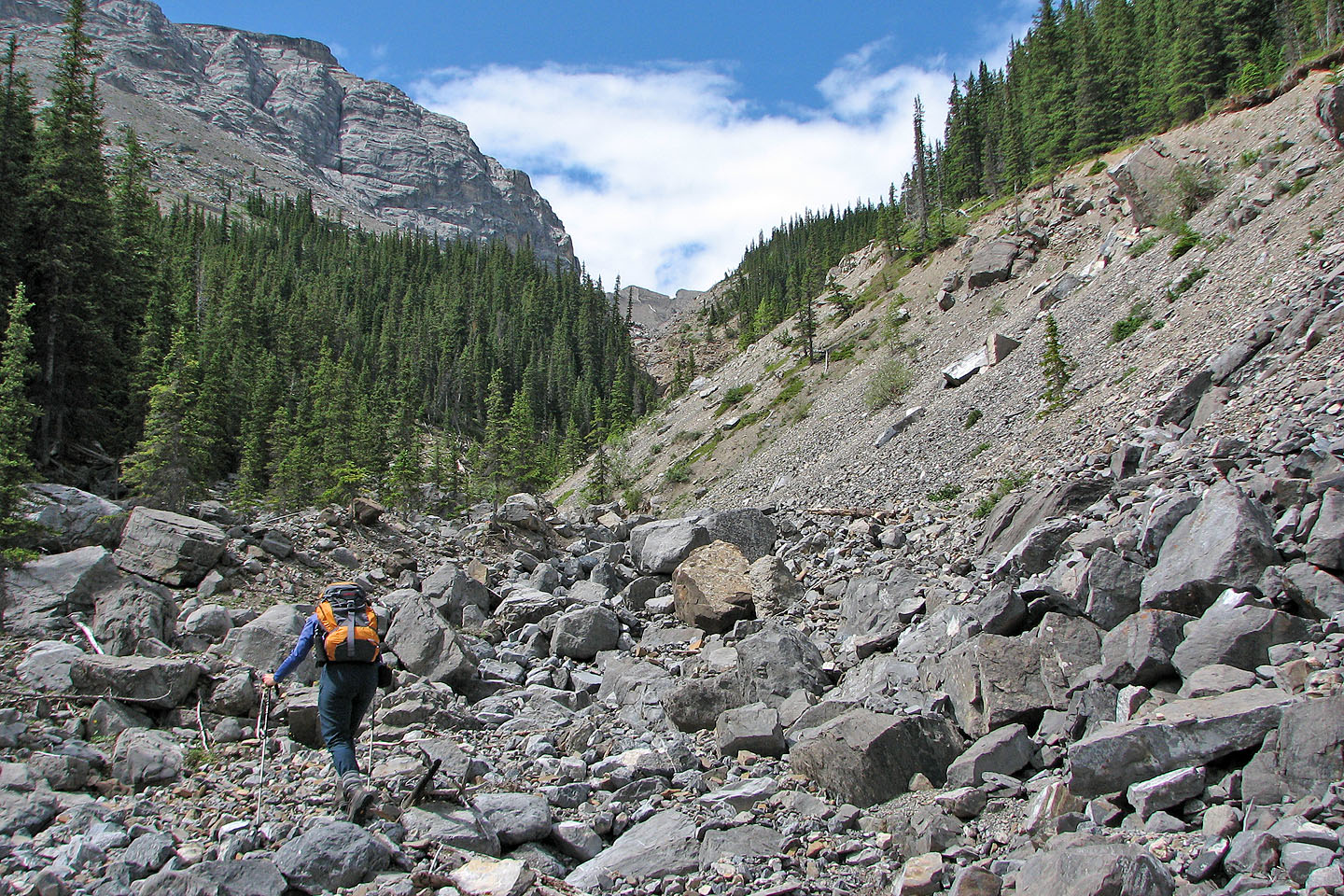
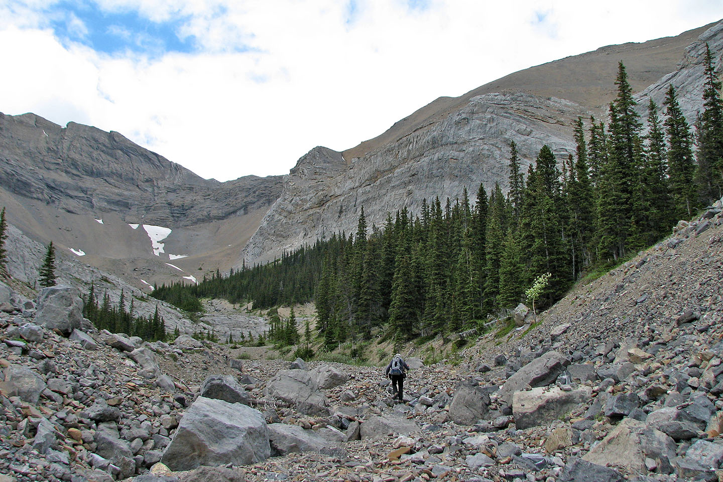
Typical travel up the drainage
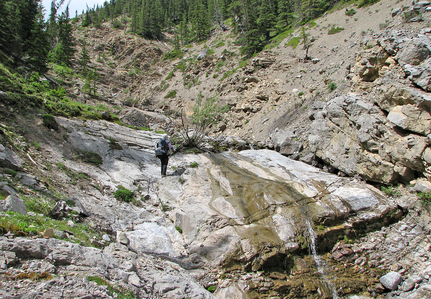
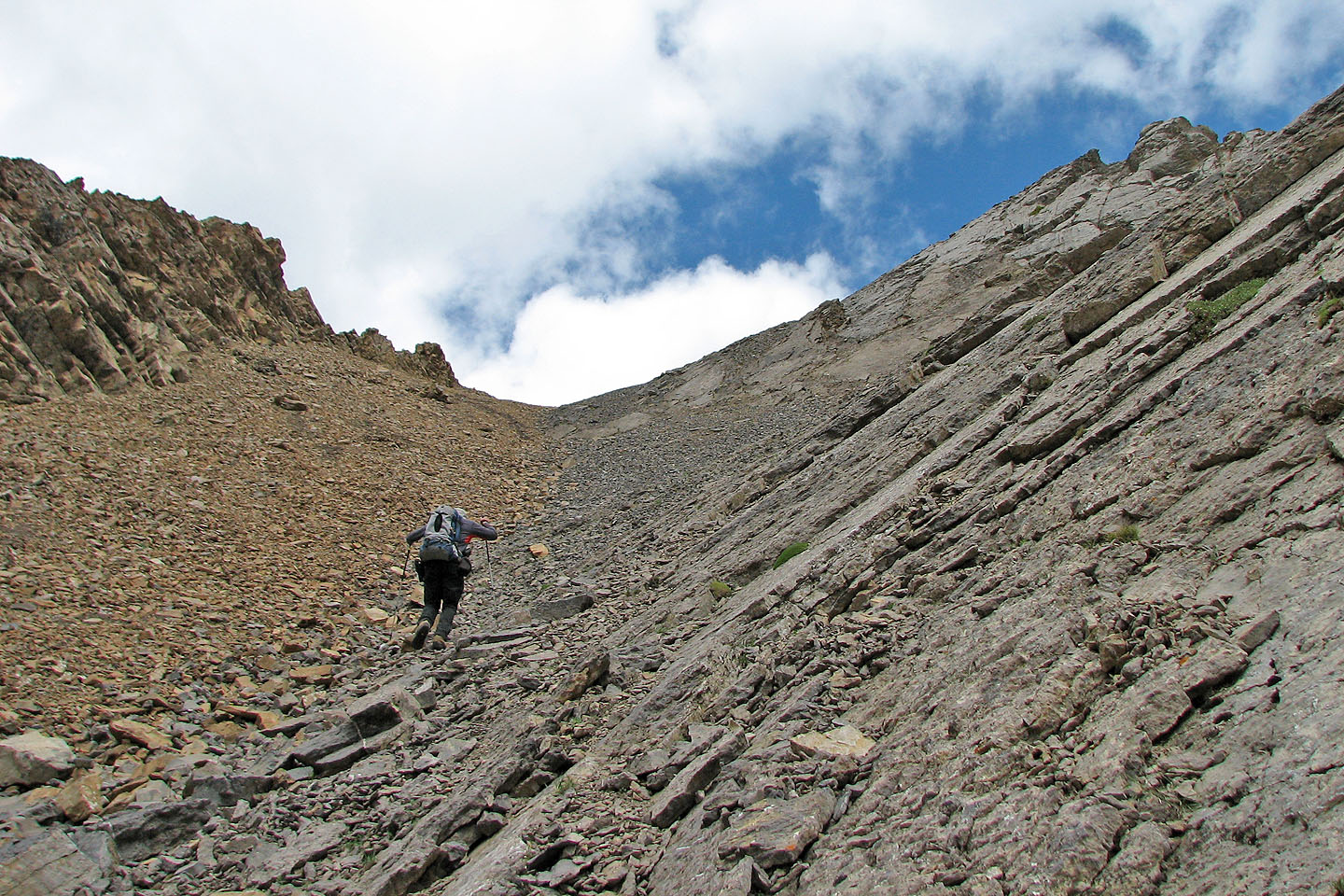
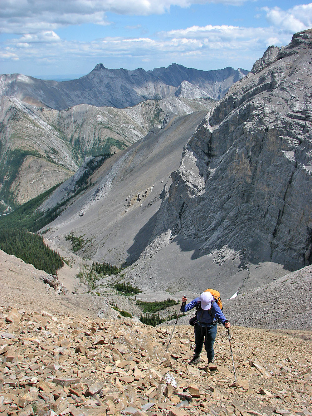
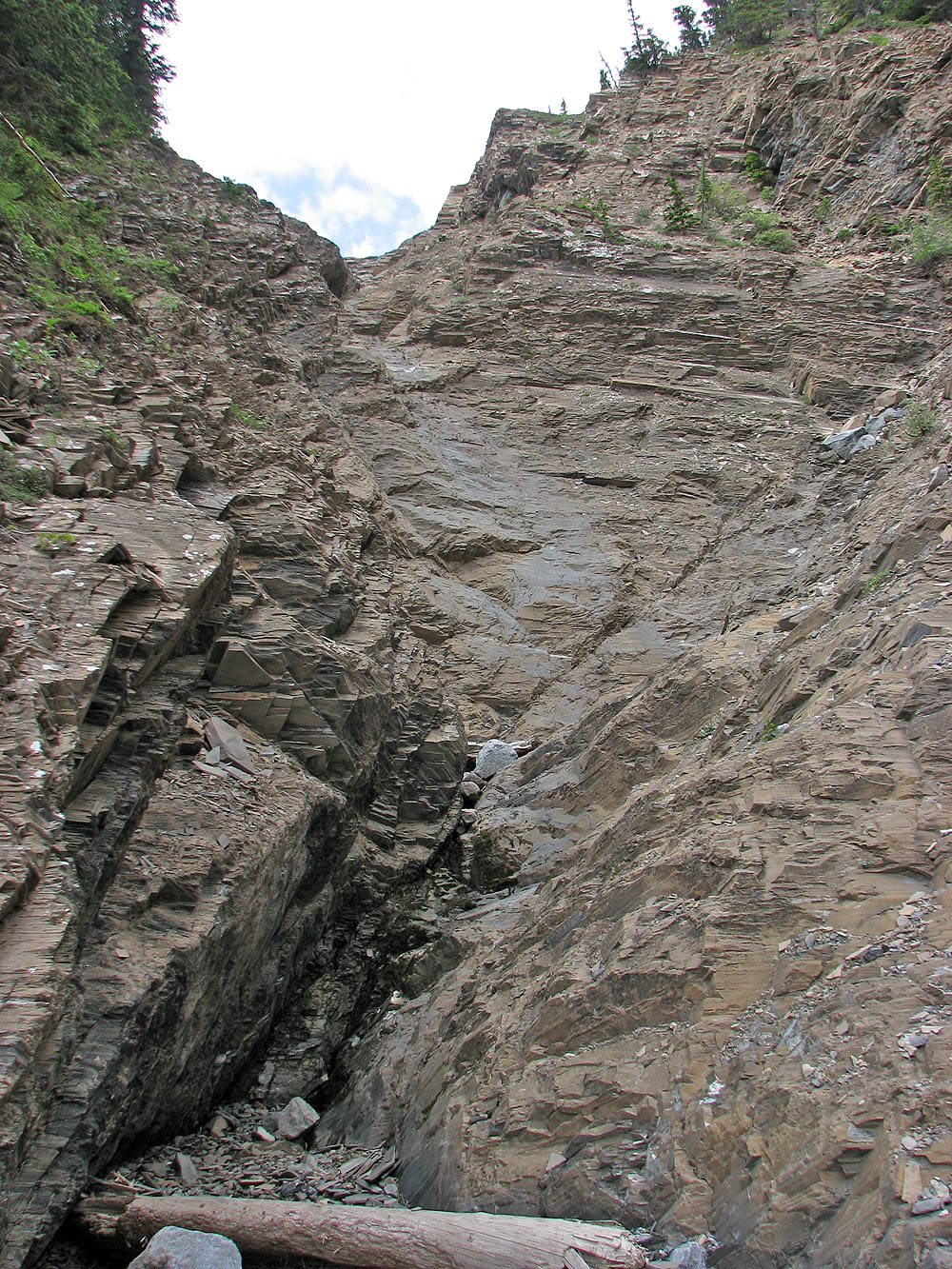
The grade steepens and we hit bare rock in the drainage
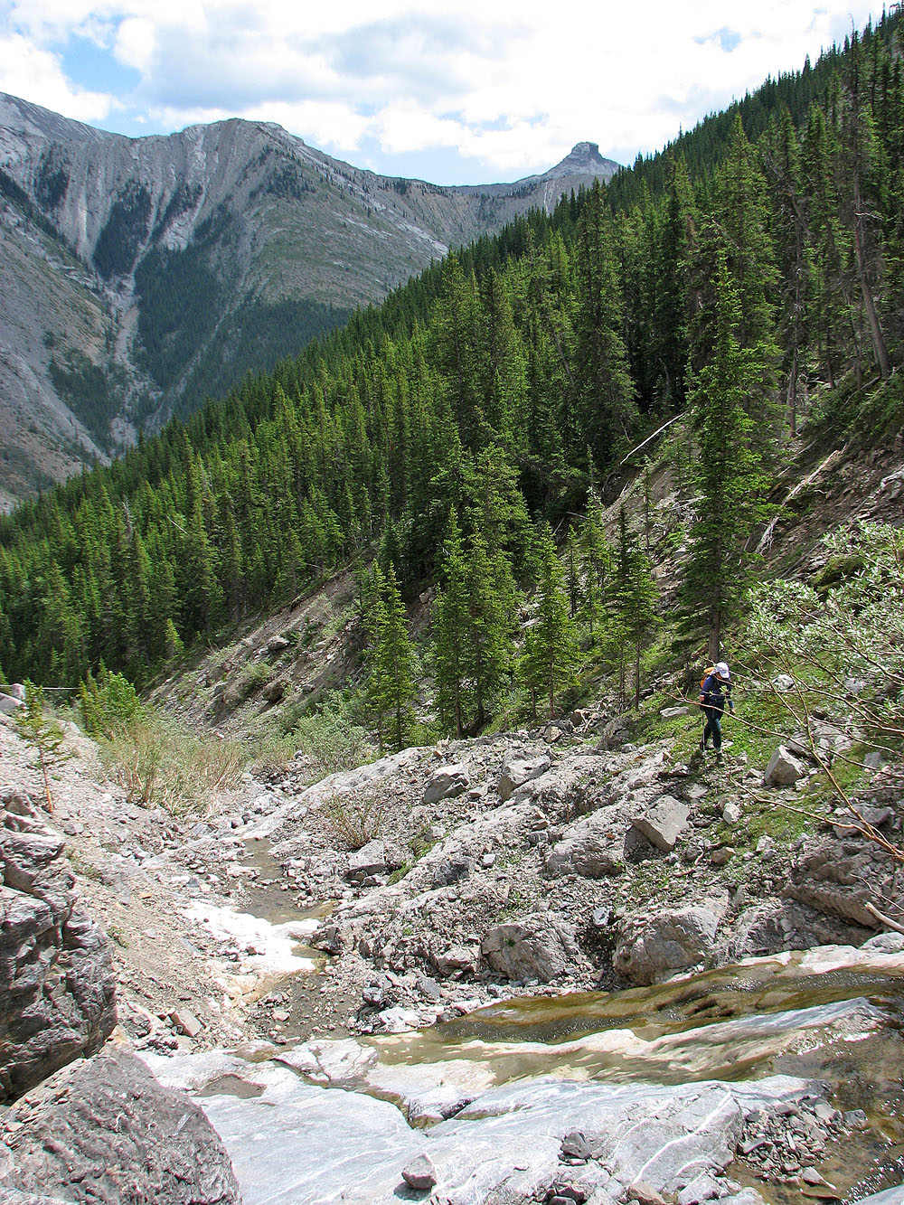
The creek had been dry but now we found water
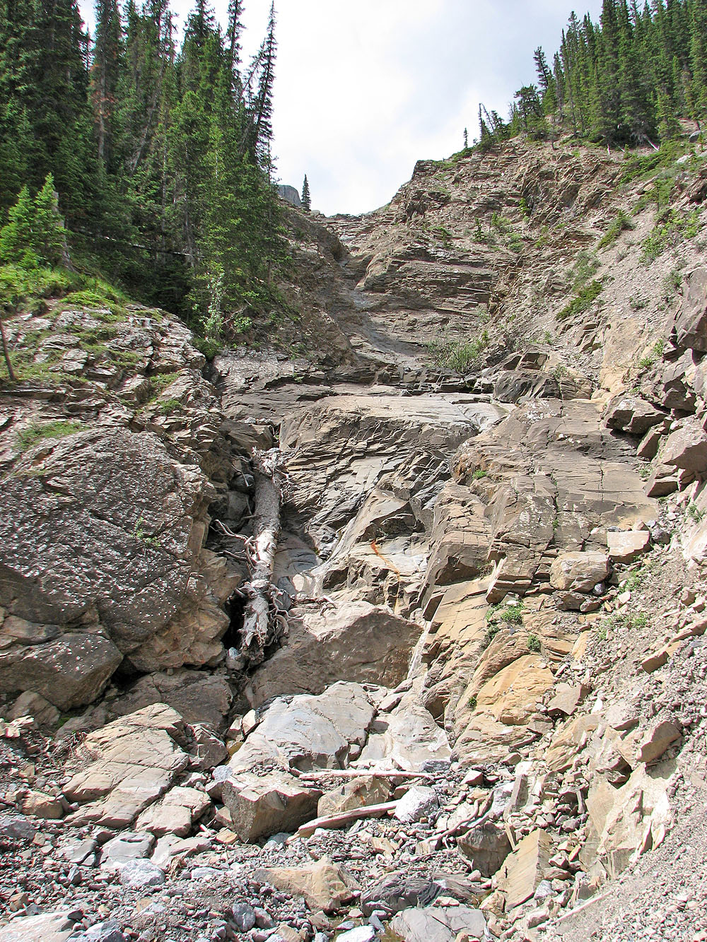
The rock ahead (mouse over) is steep and smooth so we headed into the trees
The hike through the trees is a pleasant change from the loose rock in the drainage
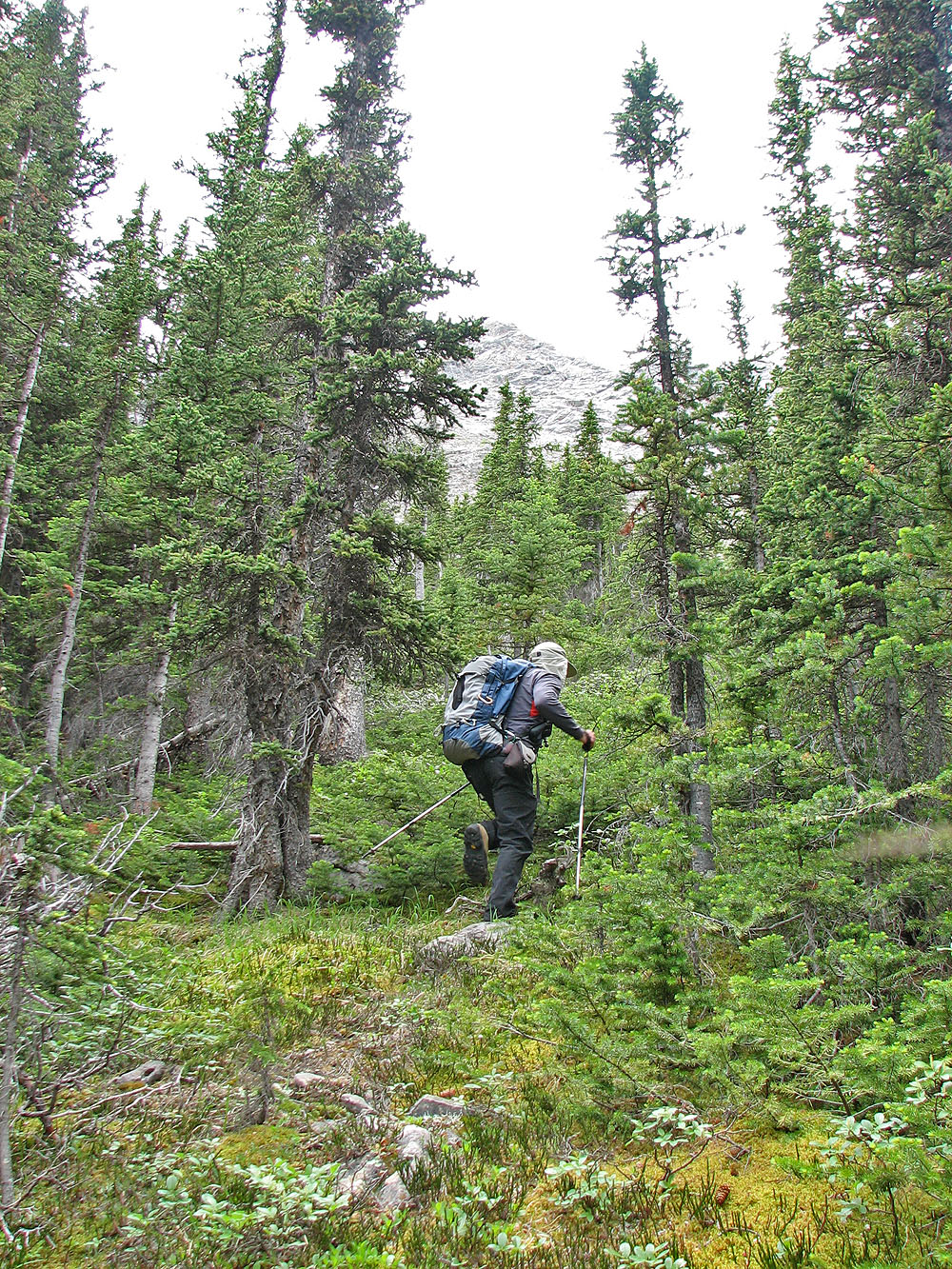
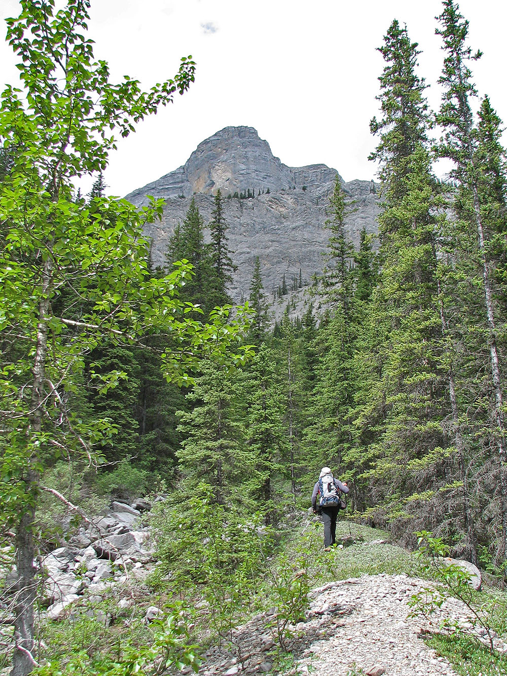
The trees thinned and we headed back to the drainage
Andrew Nugara calls the unnamed peak in the centre "Morrowshaw Peak"
The striking side view of Little Mythic
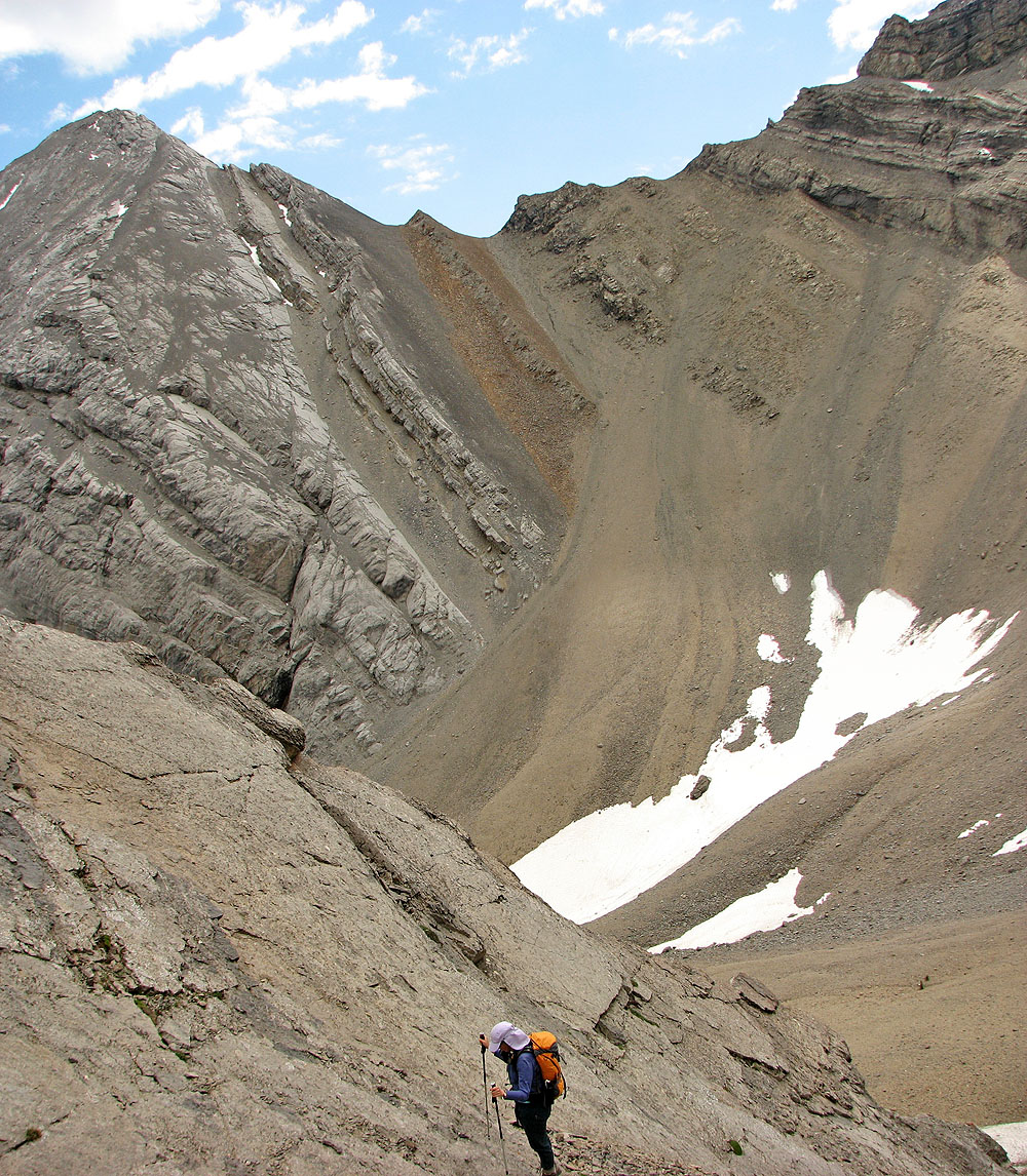
The drainage leads to a valley that ends in a cirque
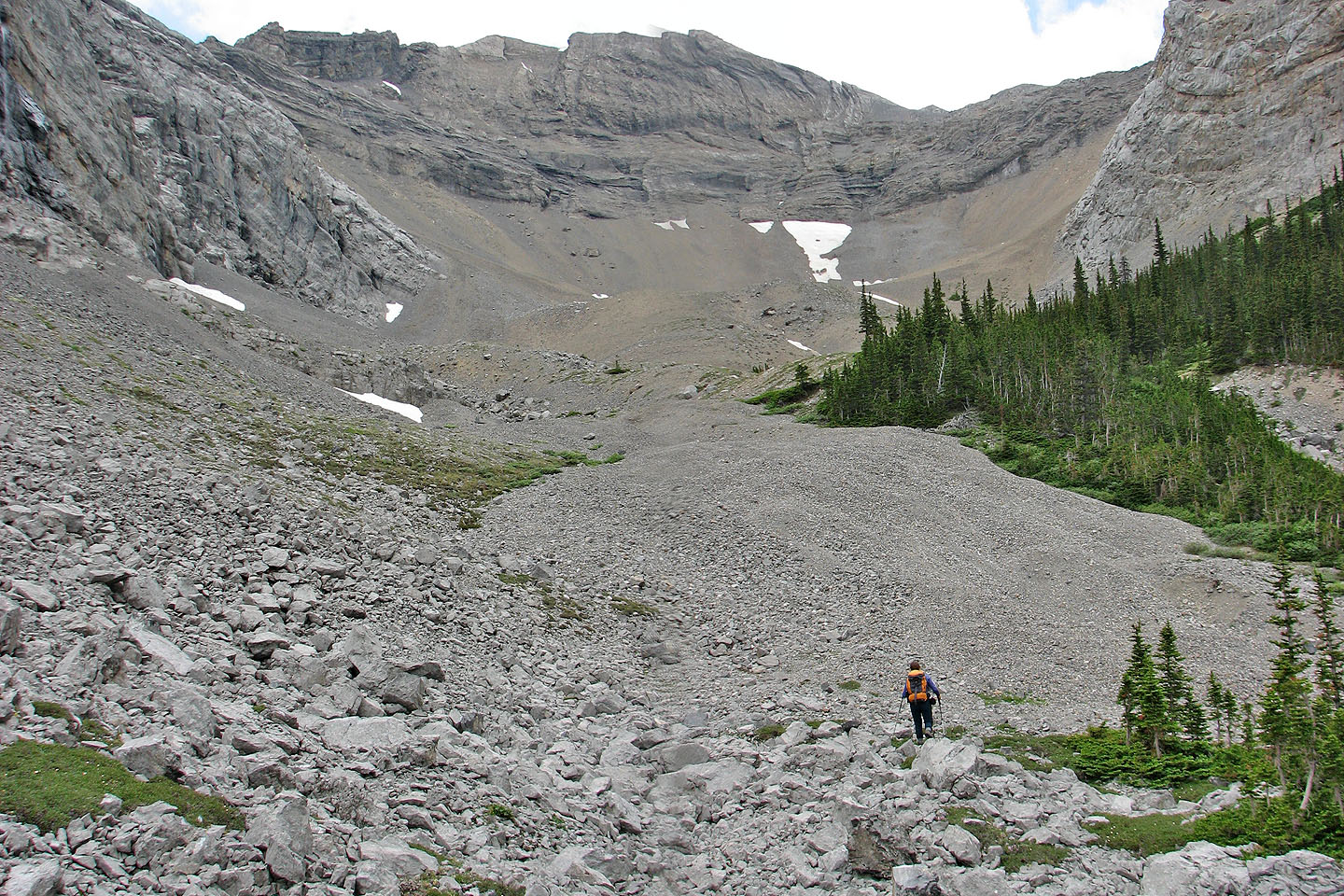
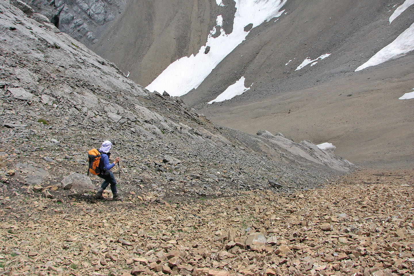
We headed to the scree in cirque below the rock buttress on the right
Heading up to the cirque
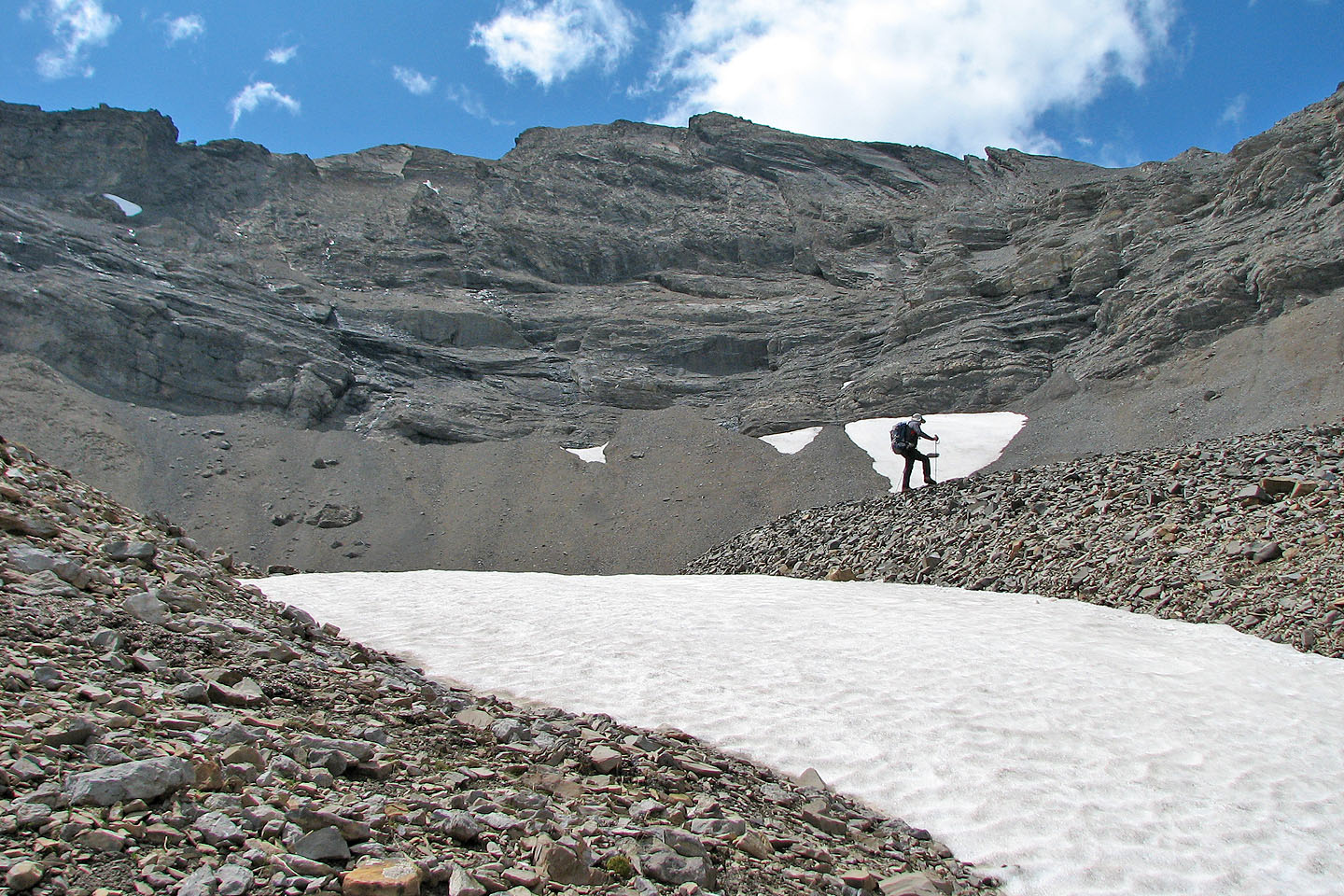
The cirque
Looking back, the view was neatly framed!
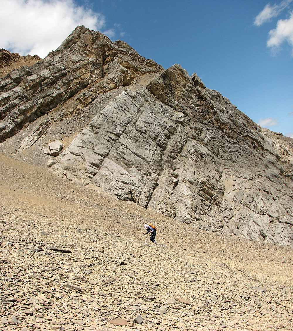
We needed to pass by this rock buttress to determine the best way to ascend from the cirque
To assess our options, we stayed close to the middle of the cirque before deciding to try the gully on the far
right
The gully on the right turned out to be a good choice
As we started up the gully, Mount Fable (left) came into view (mouse over for a close-up)
Part way up the gully, the foreshortened view makes it look shorter than it is.
We came out of the gully onto a small saddle. Mount Fable behind.
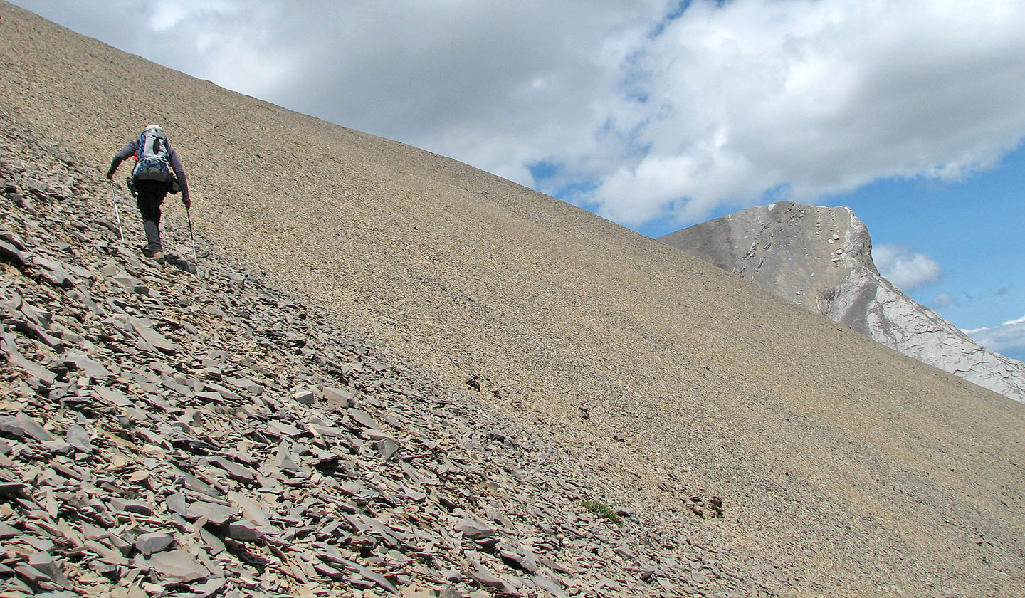
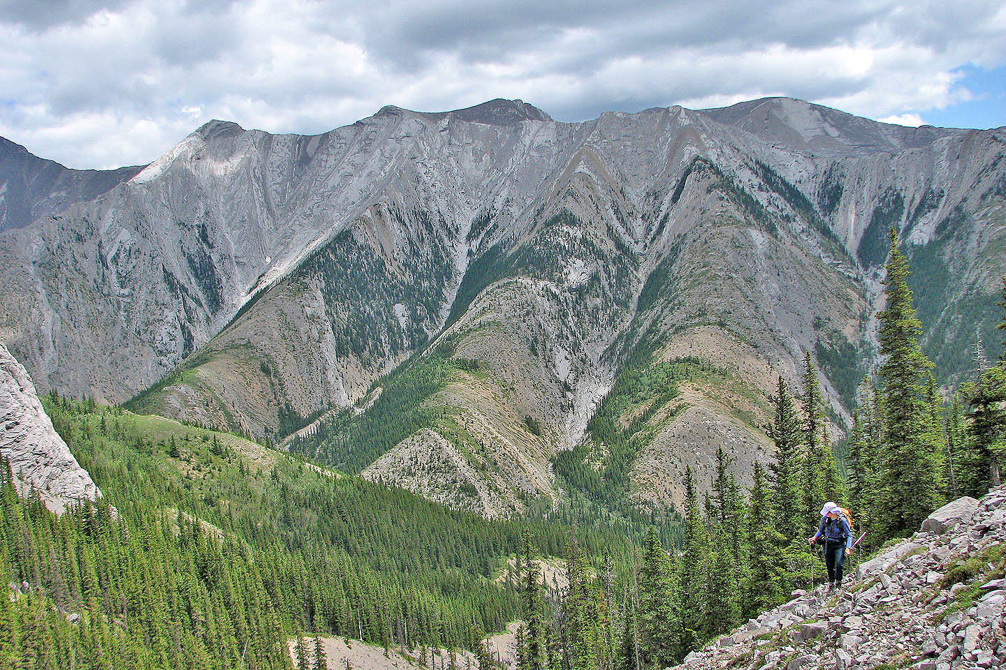
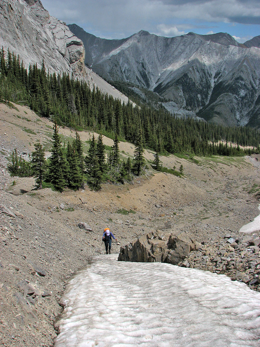
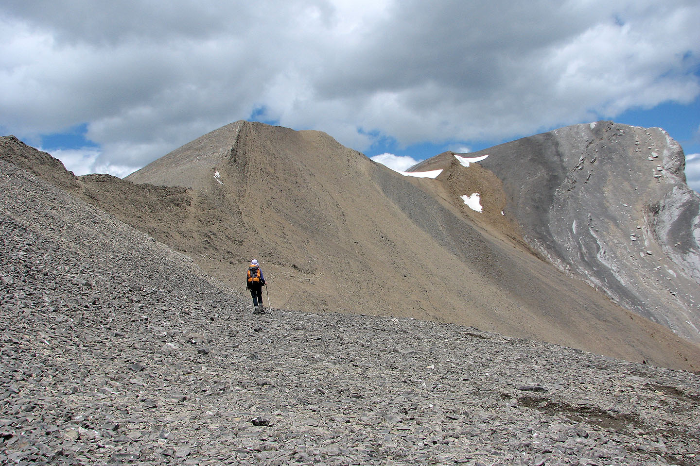
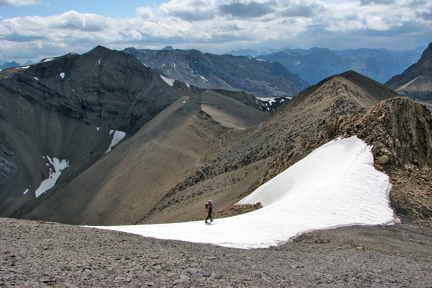
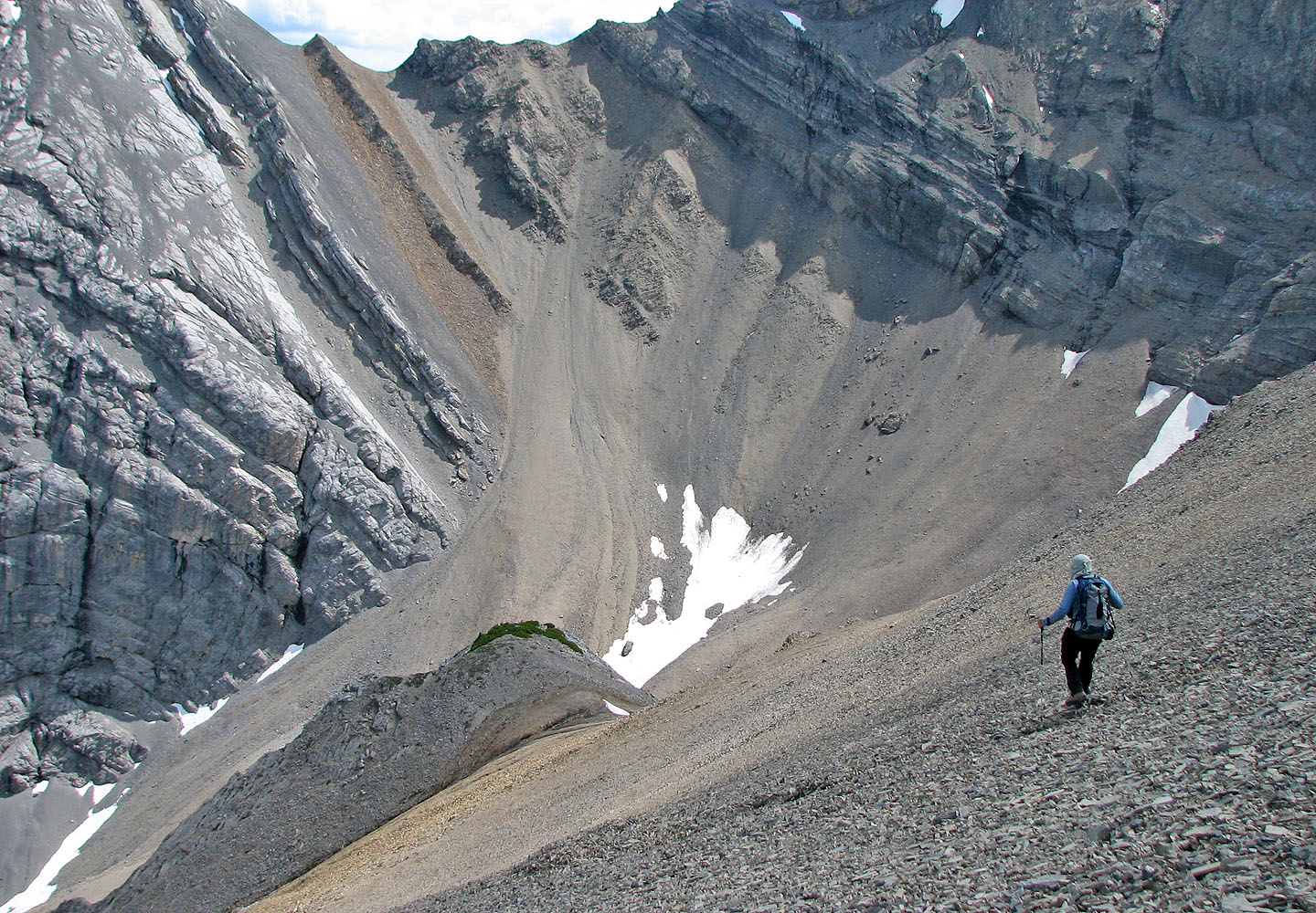
We had to cover a lot of scree before we reached the ridge. Little Mythic appears in the distance.
Below is the ascent drainage
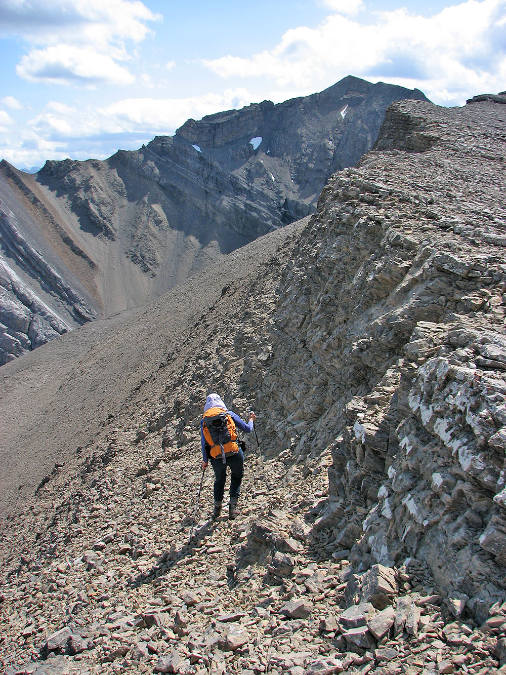
A break in the cliff on our left provided a way to reach the ridge
Finally on the ridge
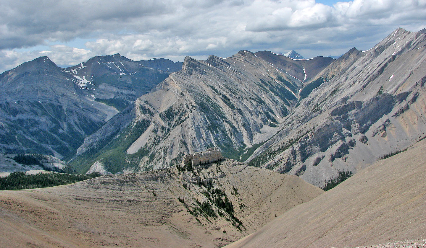
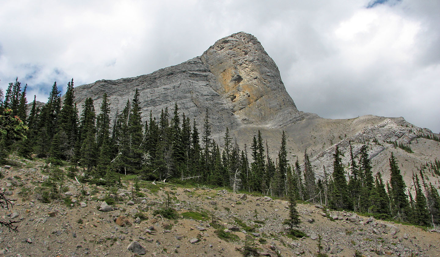
Looking northwest to the forks of Cougar Creek, a huge rock block (mouse over) stands out
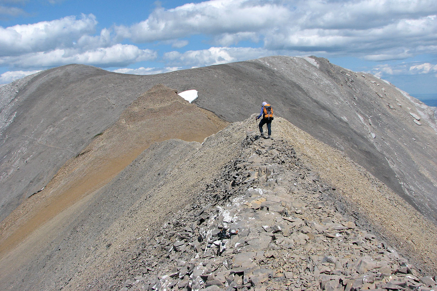
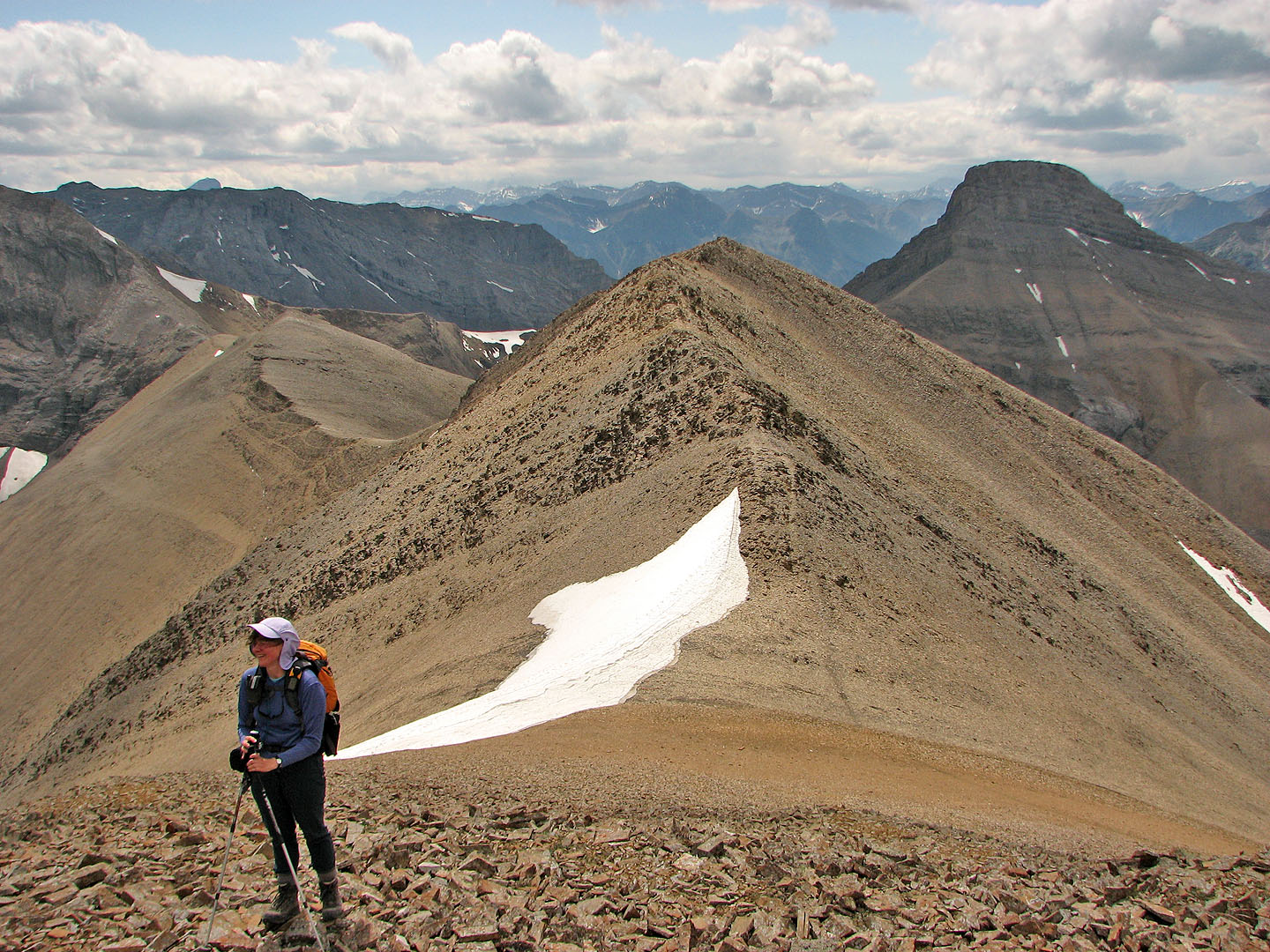
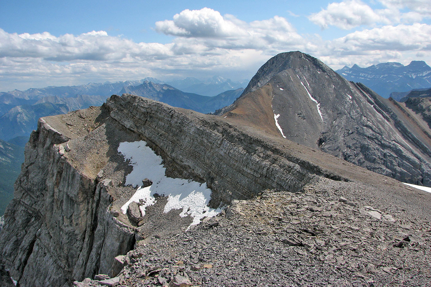
The highest point is on the left but only by a couple of metres
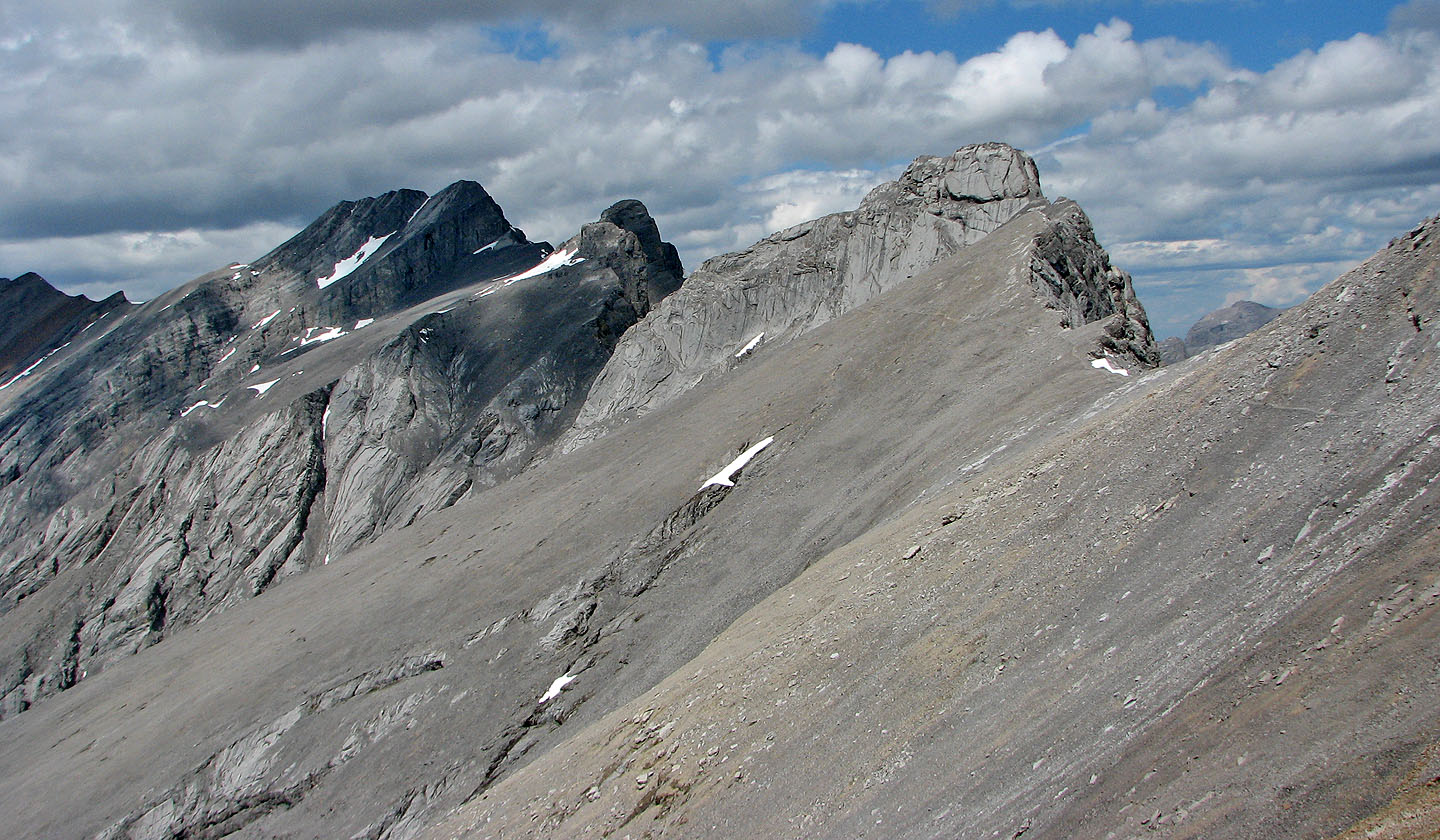
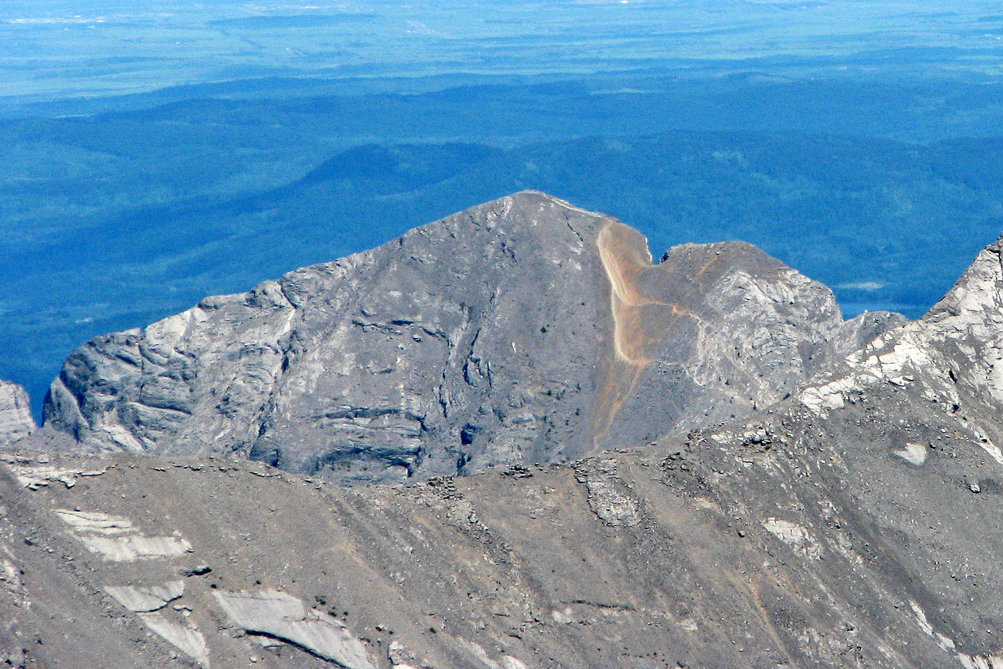
Mount Townsend and the Mythic Towers (mouse over for a close-up of the Mythic Tower)
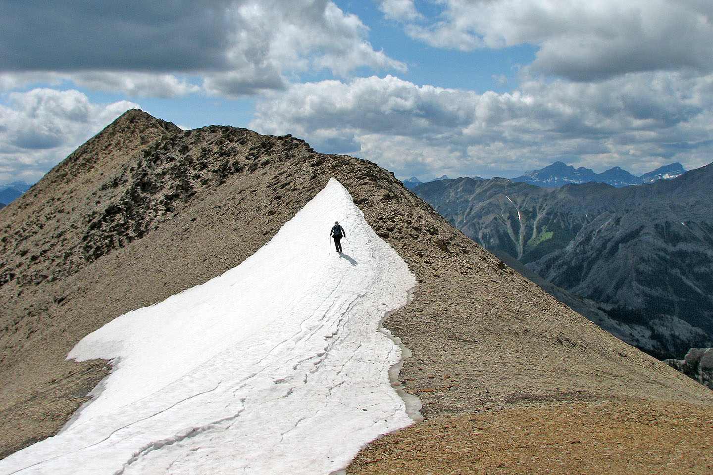
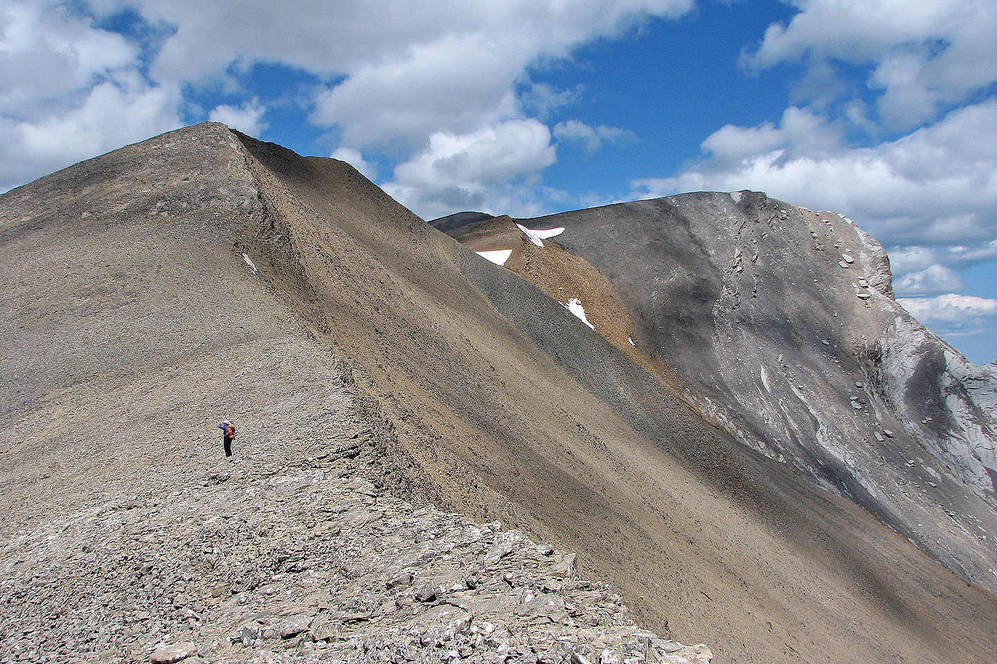
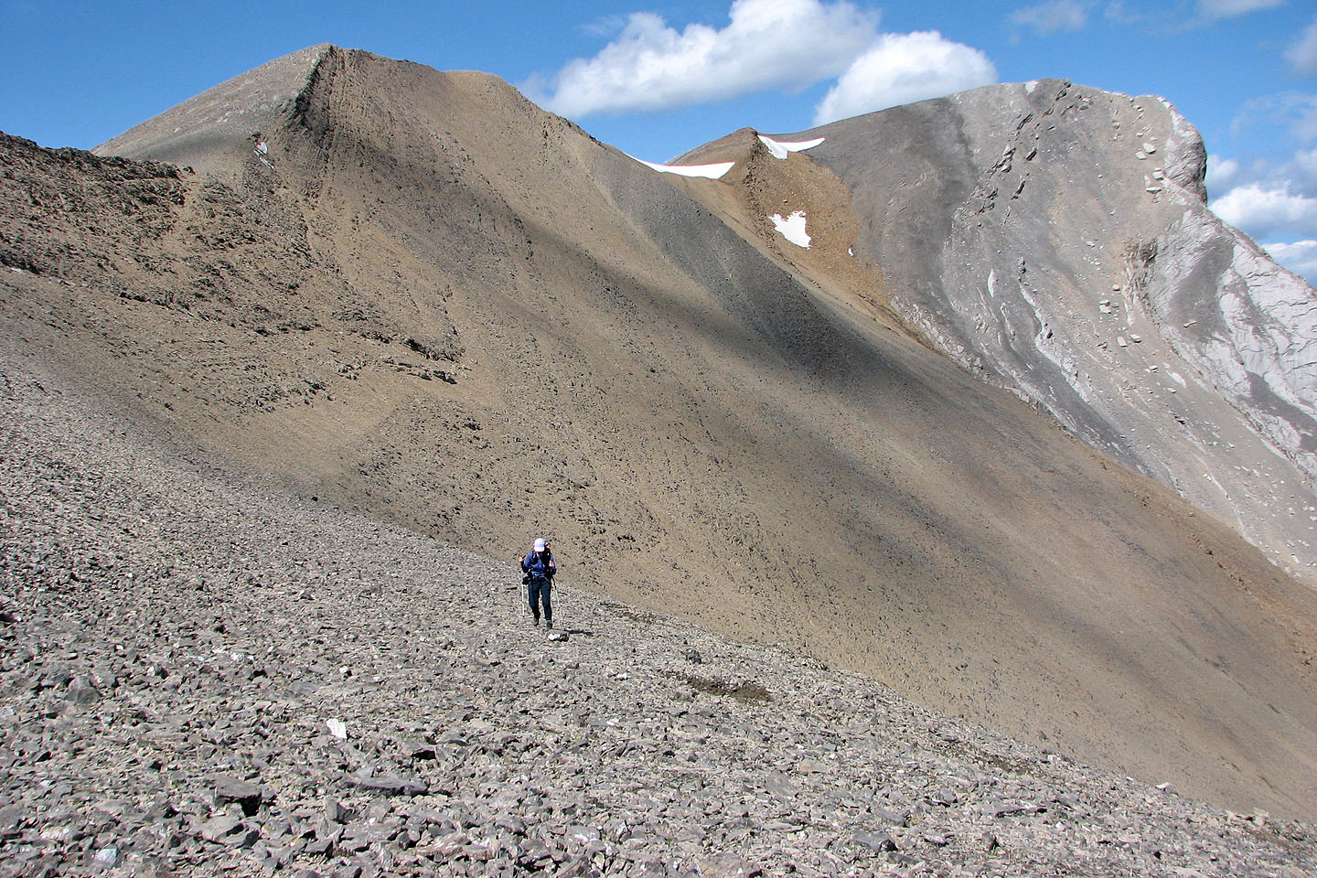
Minor ups and downs along the way
Looking back along the ridge we came up
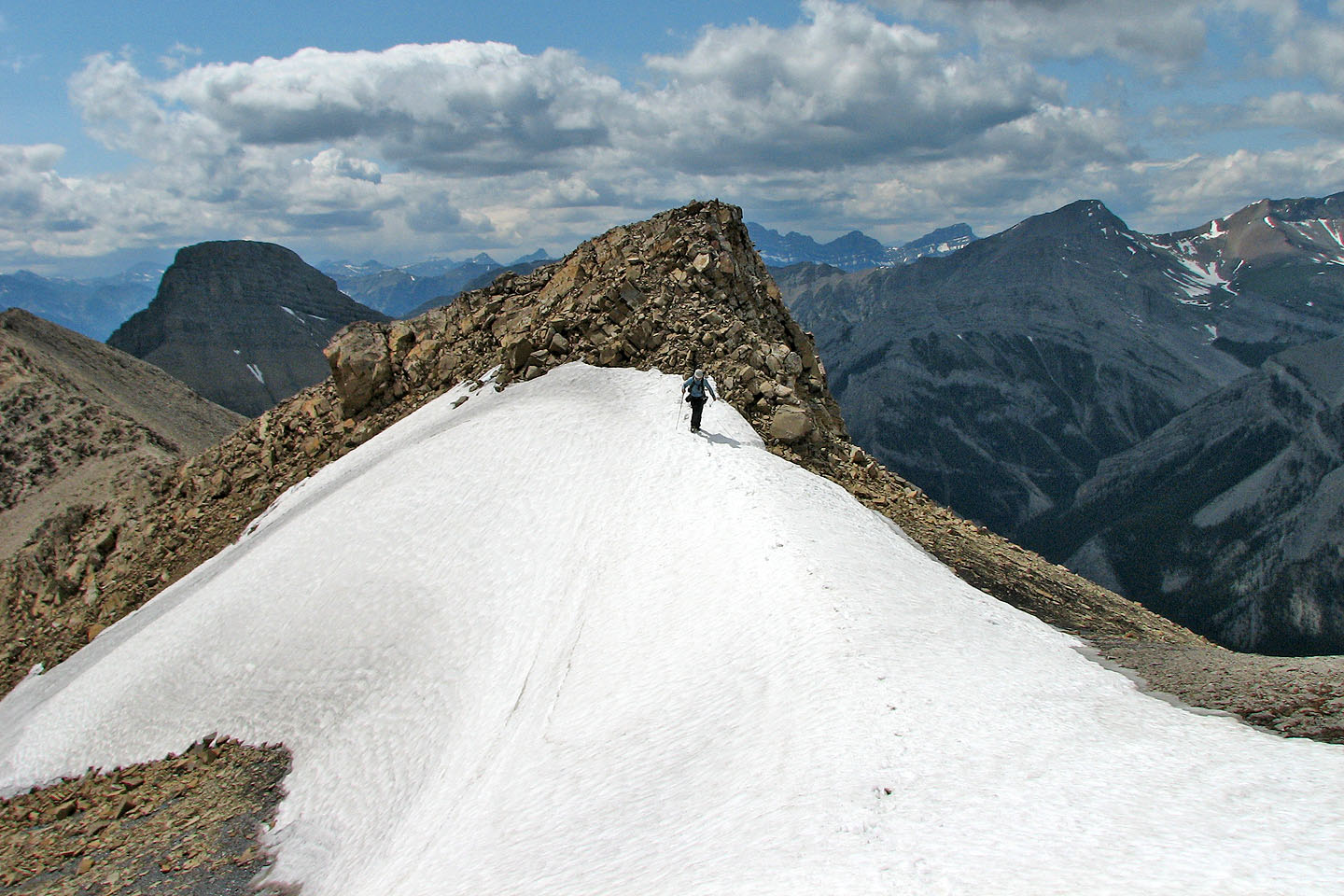
Throughout our trip, we were never sure if we would be stopped around the next corner. Five minutes from the
summit we knew we had the peak.
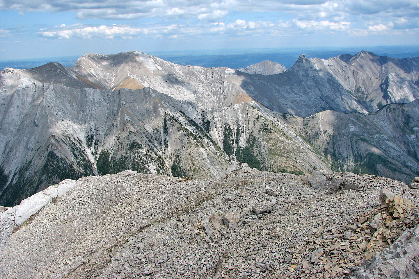
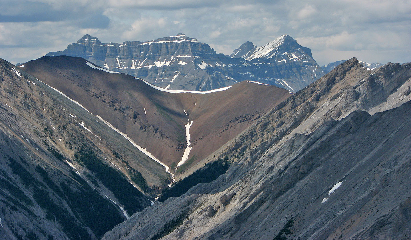
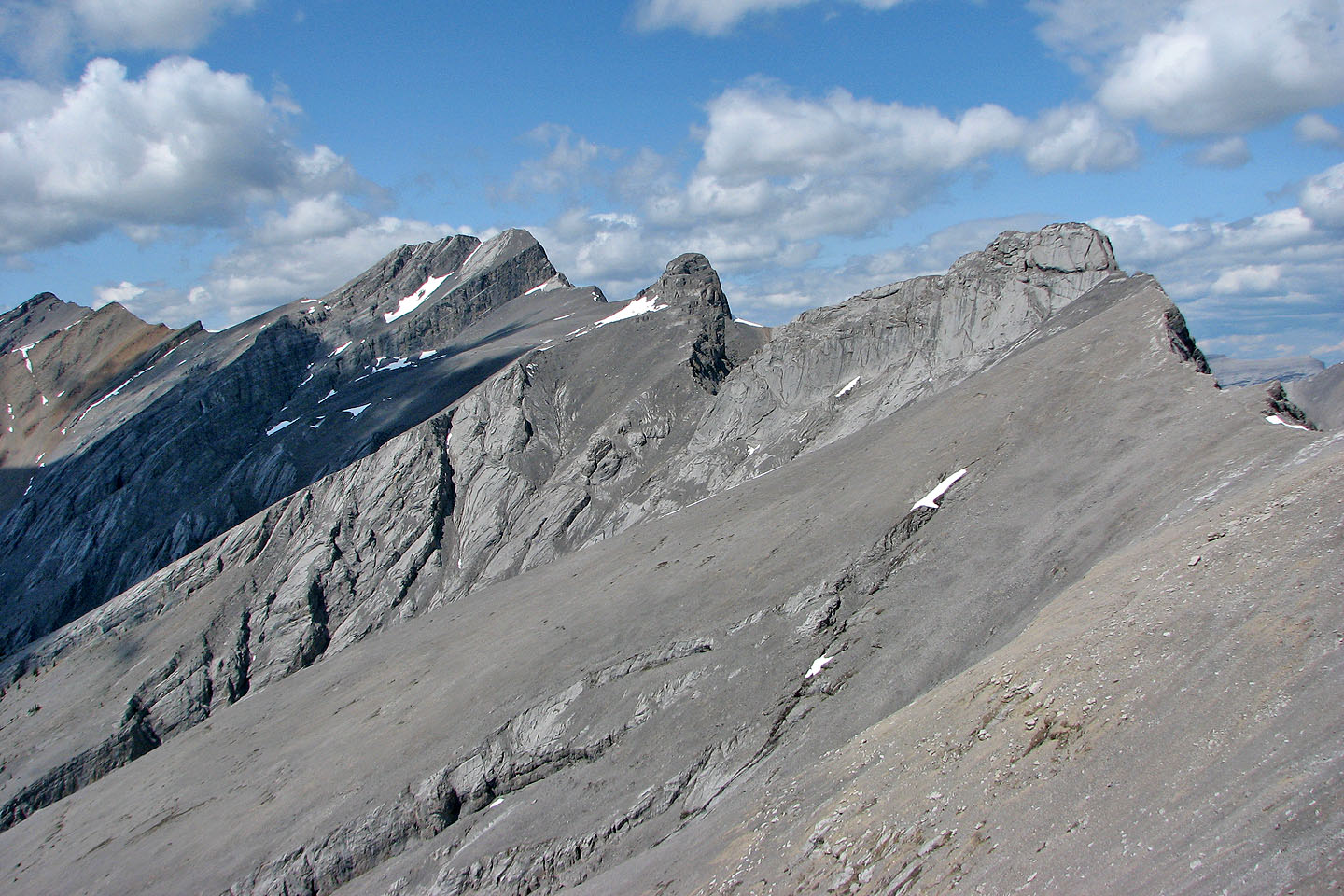
From front to back: Exshaw Ridge,
Morrowmount and Hassel Castle,
Mount Yamnuska
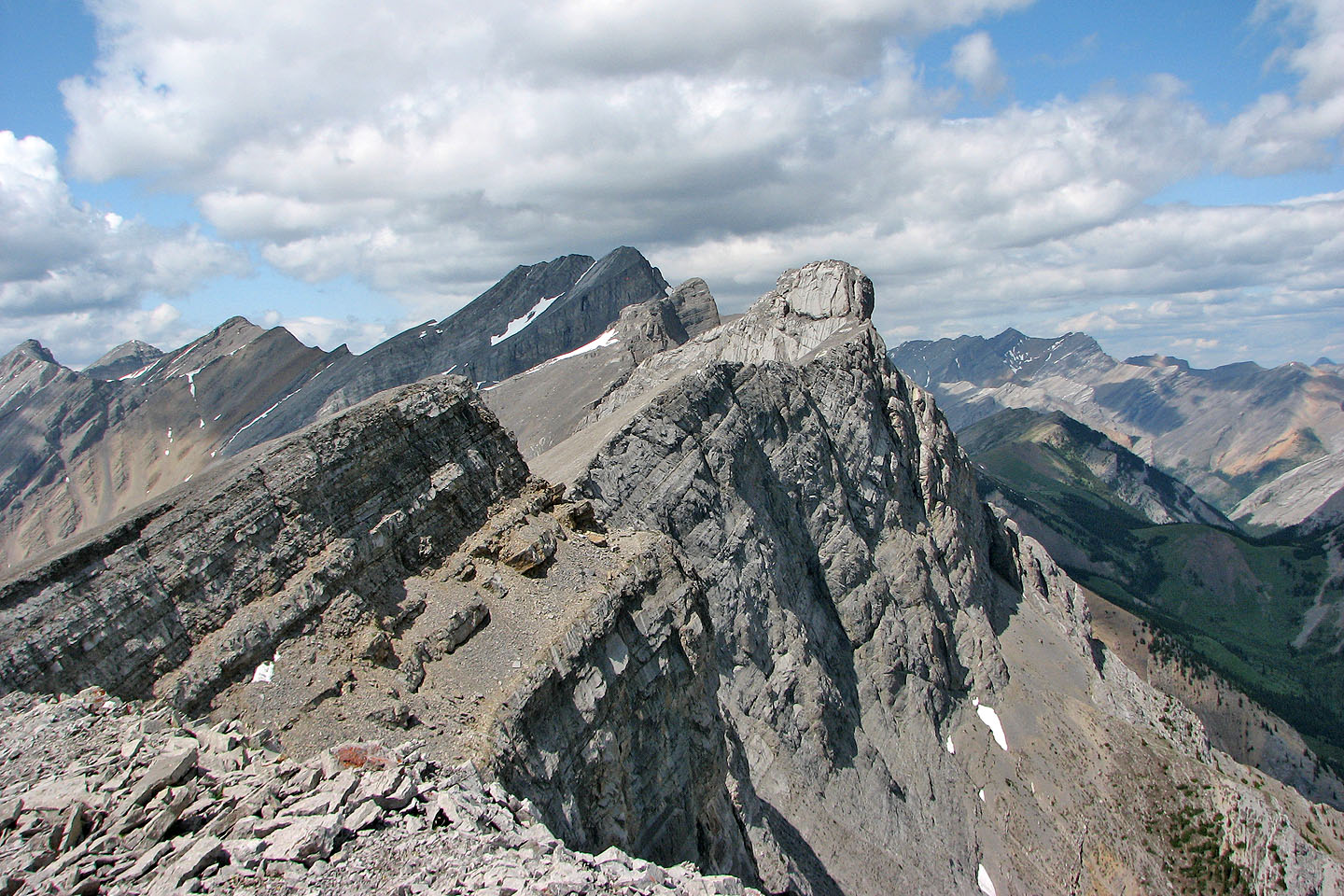
Another look at Mount Townsend and the Mythic Towers (mouse over for a close-up)
Peechee, Inglismaldie and Girouard (thanks to Grant Myers for identifying them)
Mount Fable appears to be connected to the ridge ahead but it isn't, of course
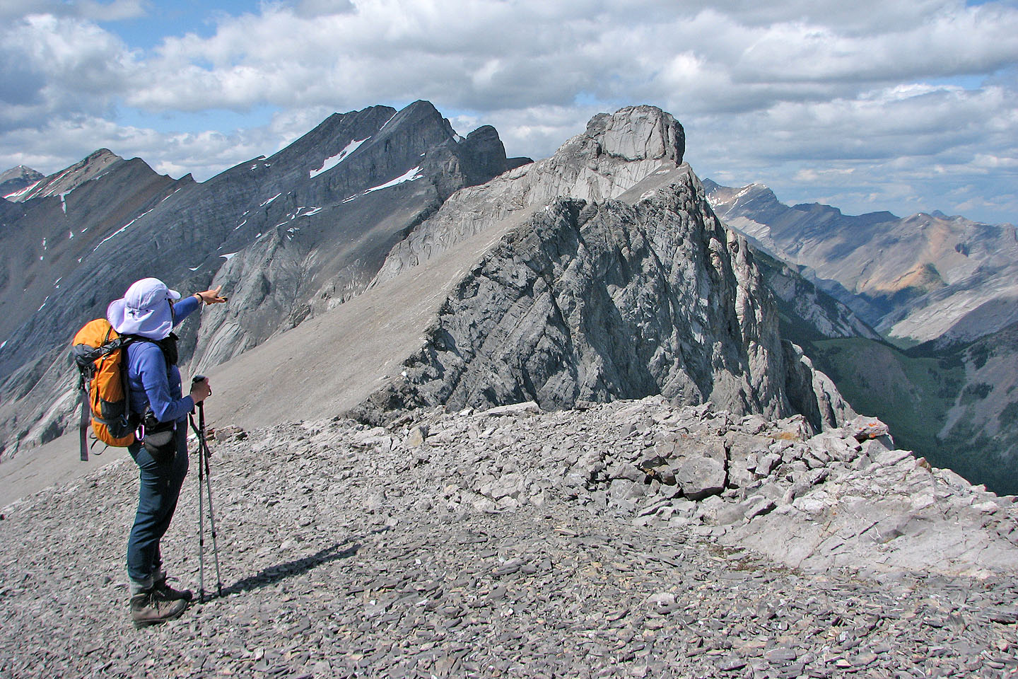
On the summit, Dinah points at the Mythic Tower (mouse over)
Heading back
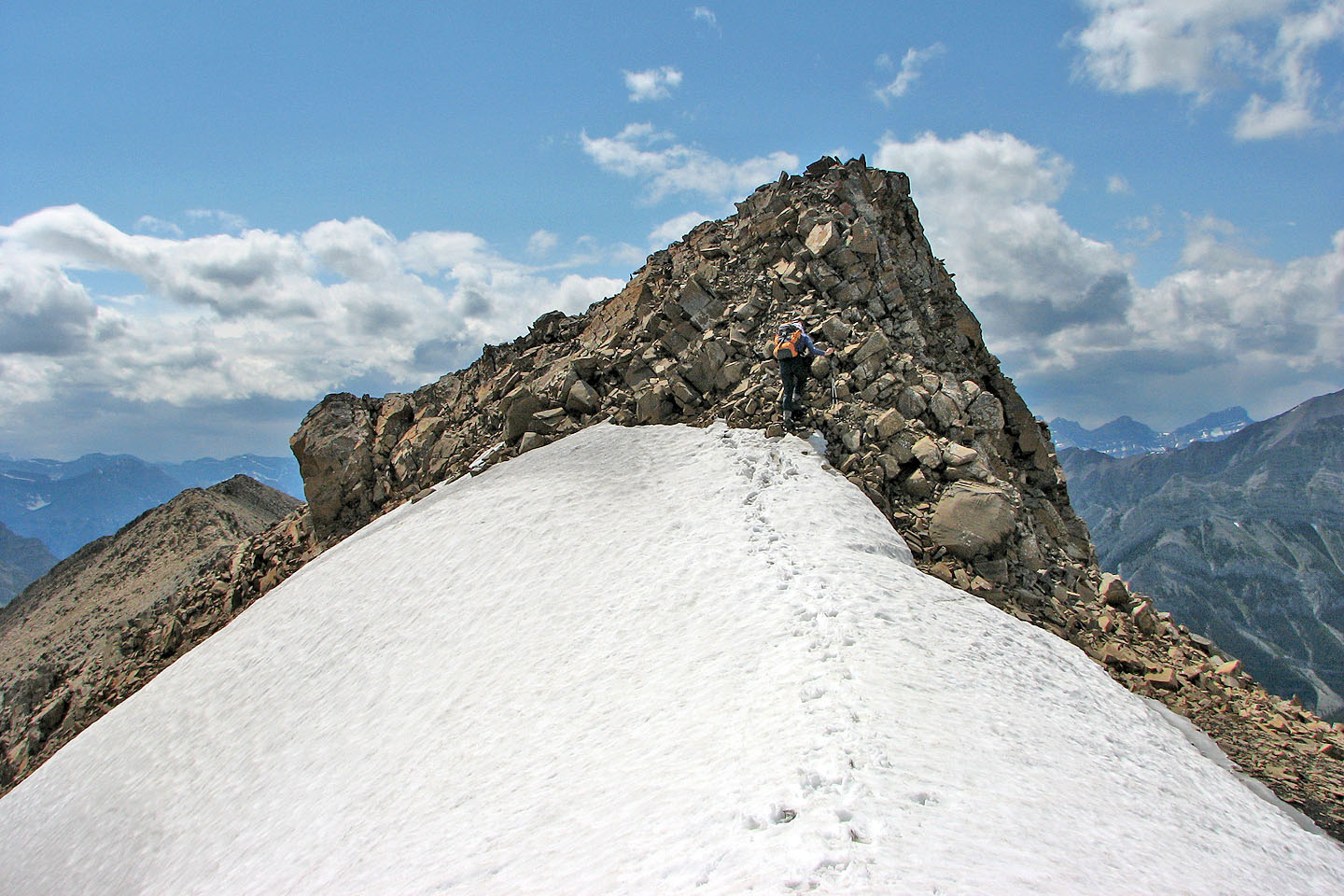
This part, just before the summit, was the only scrambling we did on this trip
Another look at Mount Townsend and the Mythic Towers (mouse over for a close-up of Townsend and Epic)
Mount Yamnuska was visible
Leaving the ridge at a break
We made our way back to the saddle
Last look at the south face of Little Mythic
Back down to the cirque
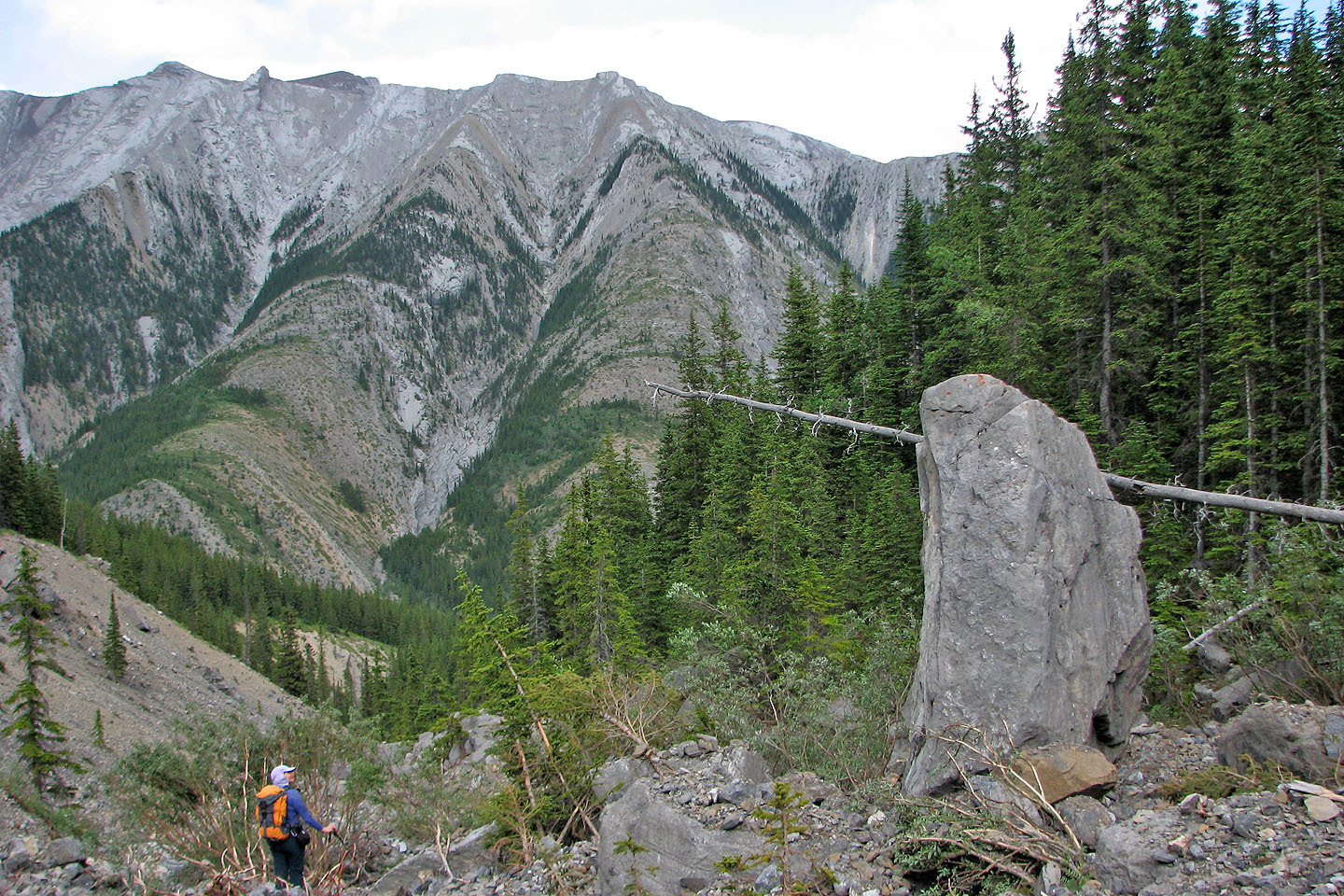
In the drainage, we passed by a boulder strangely standing on end
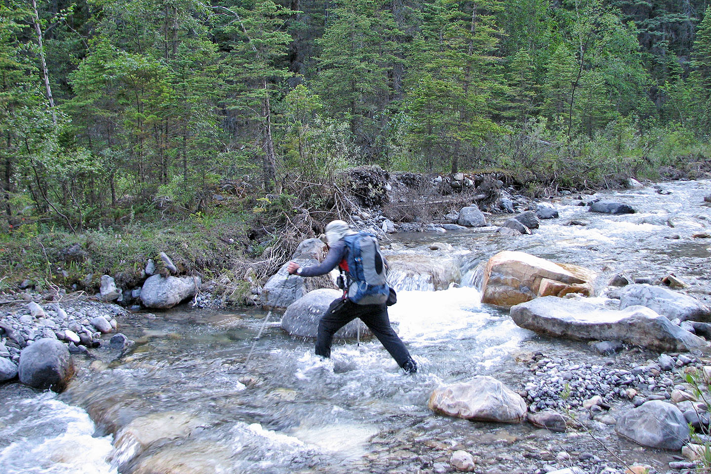
On the way back we didn't worry about getting our feet wet!
82 O/3 Canmore