bobspirko.ca | Home | Canada Trips | US Trips | Hiking | Snowshoeing | MAP | About
Crowfoot Mountain
July 27, 2022
Icefields Parkway, Banff National Park, Alberta
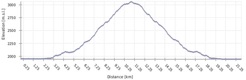
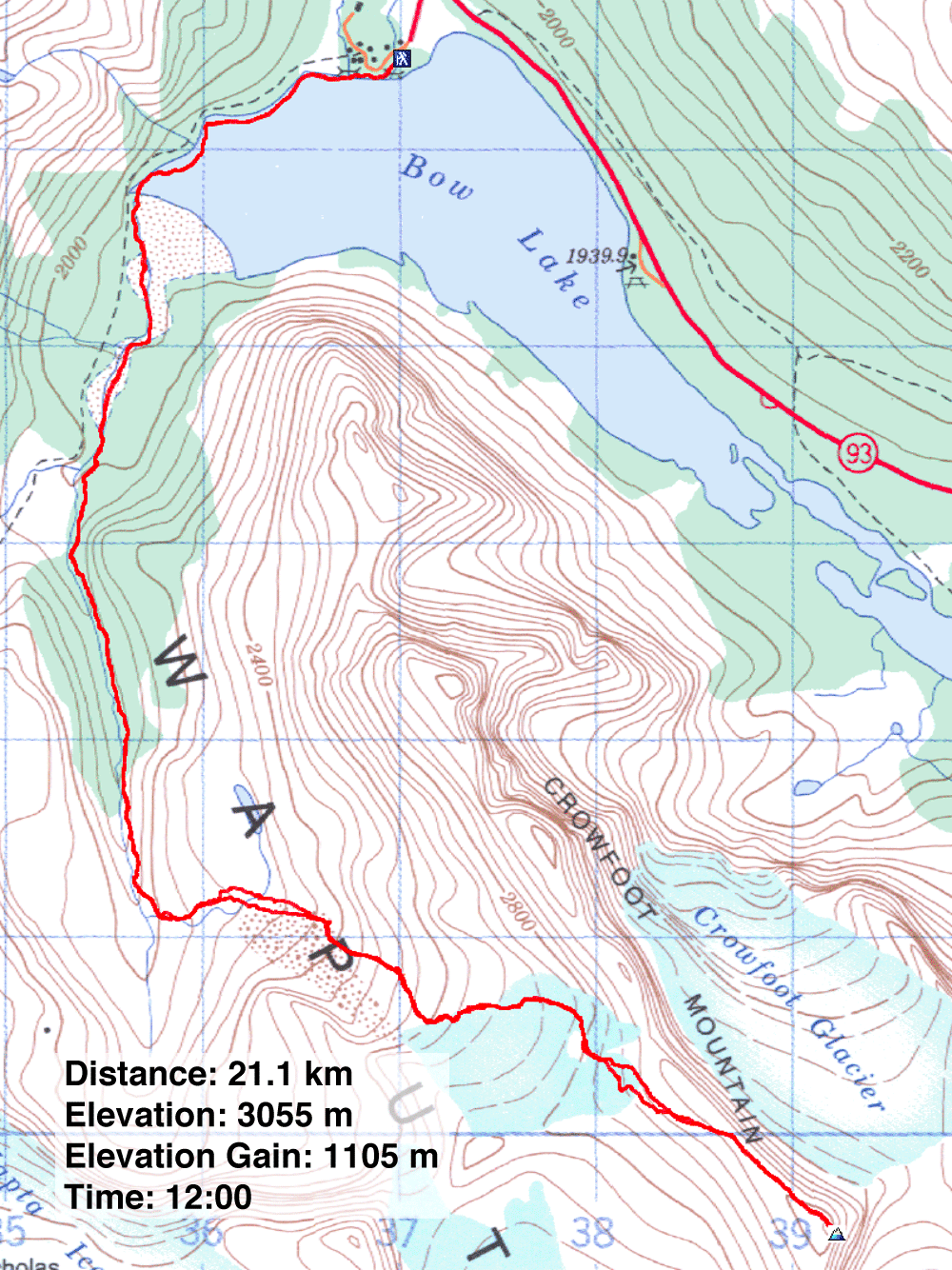
Distance: 21.1 km (13.1 mi)
Cumulative Elevation Gain: 1138 m (3734 ft)
The stunning alpine scenery seen from the top of tall peaks along the Icefields Parkway is usually hard-fought, and Crowfoot Mountain is no exception. We delighted in seeing vast glaciers, snow-covered peaks and turquoise tarns but found the long approach and rubbly slopes taxing. Then again, we're not spring chickens.
We almost didn't get out of the starting gate. Christine forgot her trekking poles, and Zora twisted her ankle when she stepped off the boardwalk at the trailhead. For Christine, we found branches that served as makeshift poles; despite falling short of real poles, they served her well, although I largely credit her perseverance. Likewise, Zora was determined to push on despite a painful ankle. Or maybe the two couldn't bear the thought of waiting in the parking lot for 12 hours while Dinah and I bagged a peak.
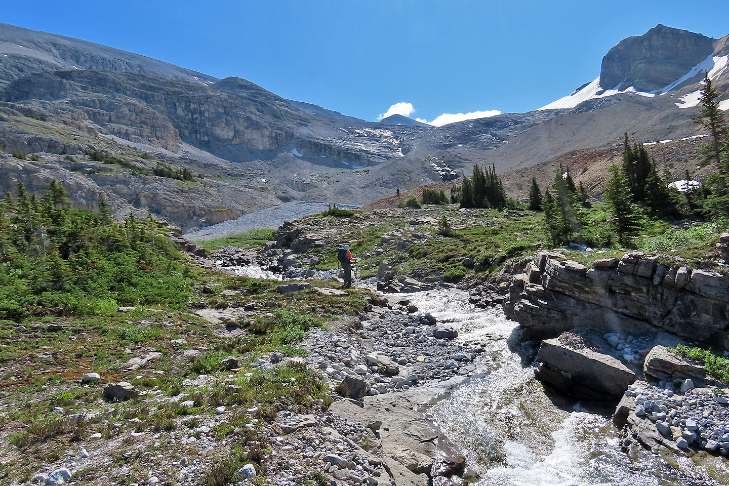
We mostly followed Matt Hobb's route. From Num-Ti-Jah Lodge, we followed the trail to Bow Hut and left it before it crossed a creek. In the trees, we found a narrow path heading to Crowfoot Mountain. When the path ended on a low ridge, we made our way through trees and meadows to the creek. After crossing the rushing creek, nothing but rocks, snow and ice lay ahead.
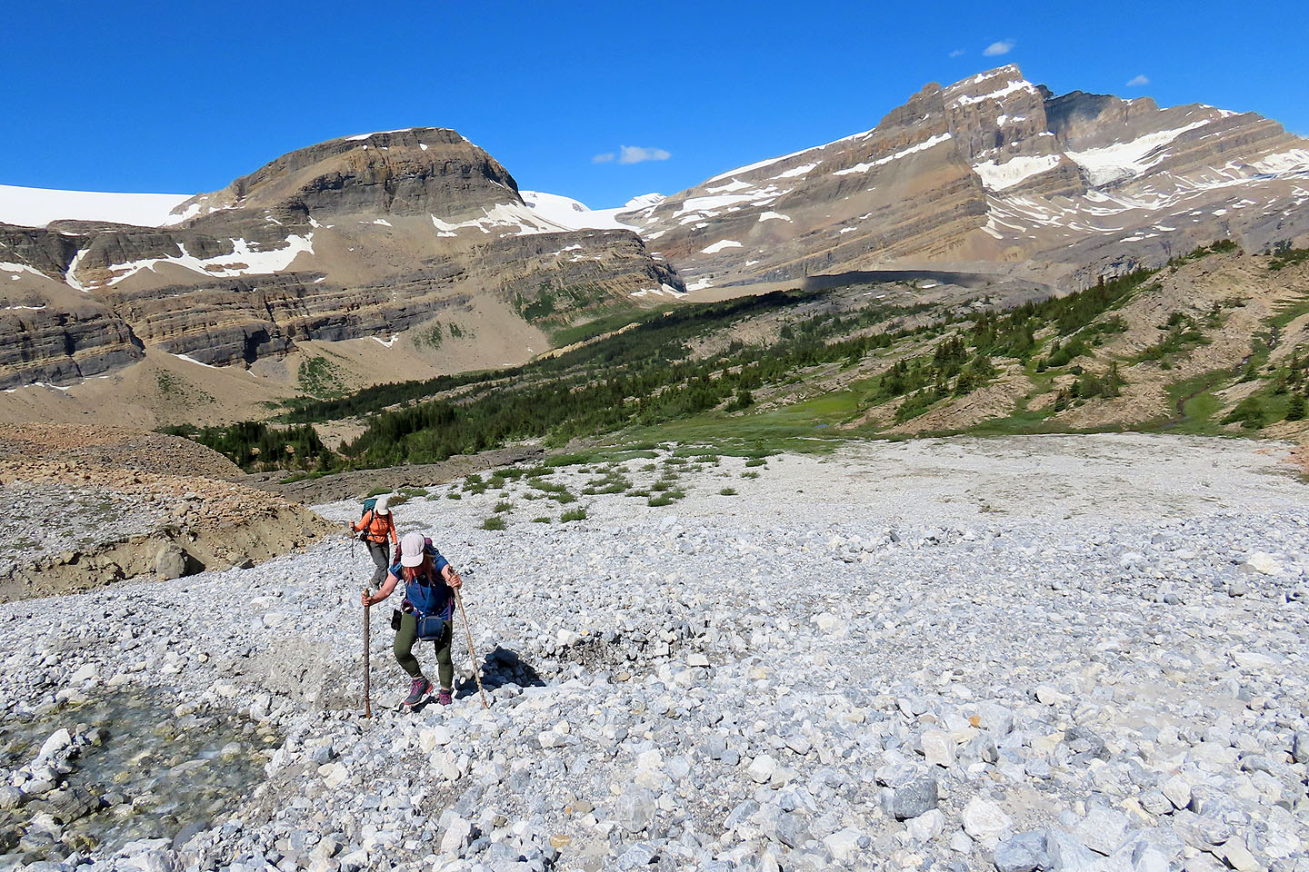
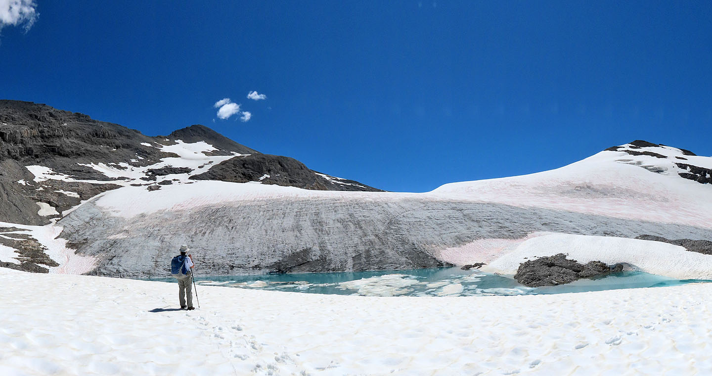
We crossed a gravel bed to reach the end of a low, gray ridge. The ridge parallels a gully full of snow. After climbing a short distance, we easily crossed the gully. After crossing two more snow gullies, we came to a tarn. We stood transfixed by its azure waters before continuing to a glacier we had to skirt. We kick-stepped up a strip of snow edging the glacier to reach a snow-covered hump.
We ignored the false summit on our left and focused on the slope between the false summit and the unseen summit. The nearby slabs looked like a good place to quickly gain elevation before angling to the ridge. What we couldn't see was the crappy, unstable rock beyond the slabs. It was among the worst any of us had experienced. With loose rocks spinning underfoot, we laboured up the slope to the crest. There, we breathed a sigh of relief knowing it was a relatively short walk to the summit.
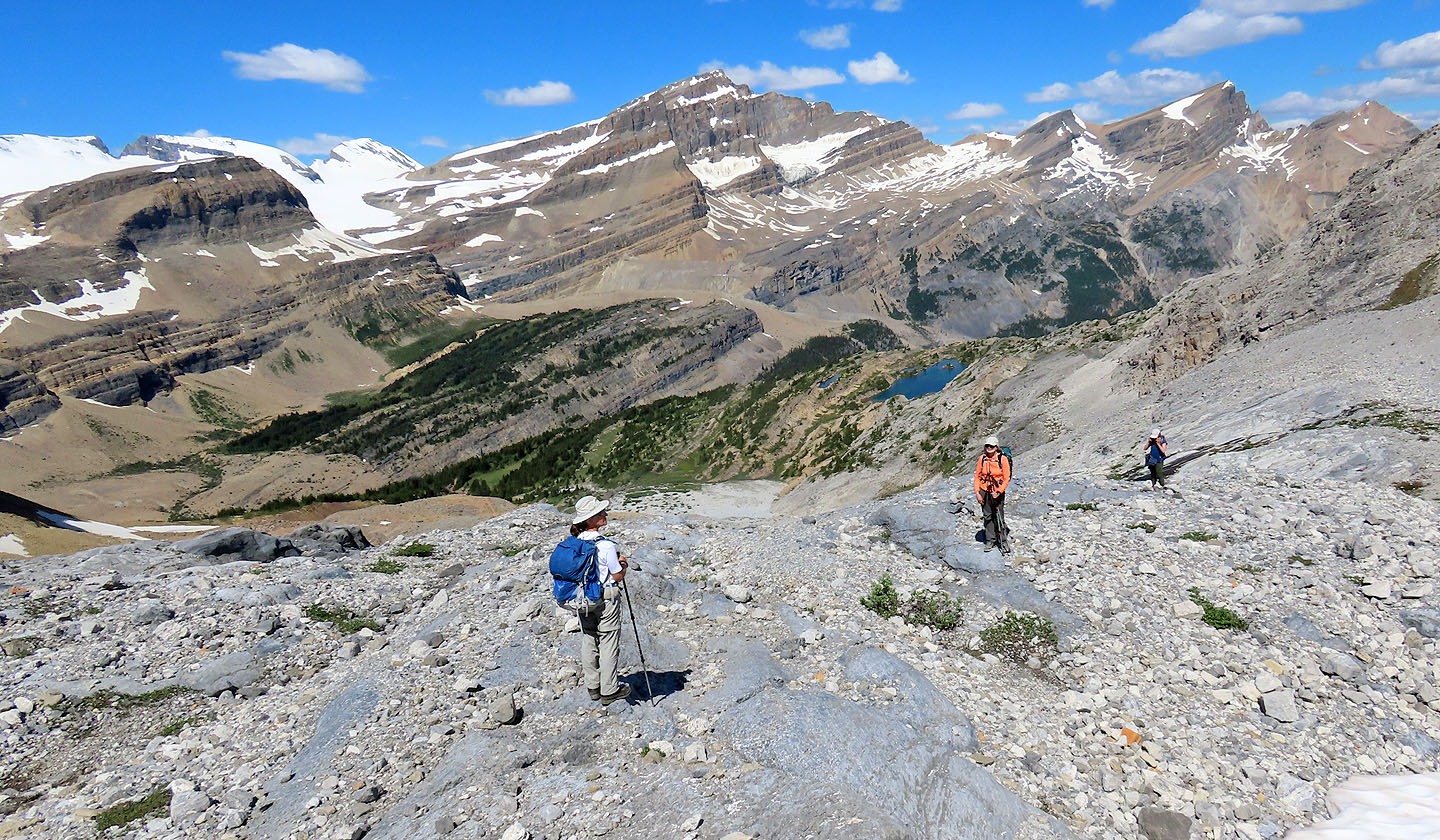
On our ascent, the alpine scenery had slowly emerged but now it exploded. Below Mount Balfour, for instance, we gazed down at nine beautiful tarns. After an extended stay on top, we headed back down. Having learned a hard lesson going up the rocky slope, we cast a critical eye at the way down. We took advantage of the snow patches that dotted the mountainside and stayed off the wretched rocks as much as possible.
Once off the tedious rocks, our progress quickened, but the descent was still miserable. The temperature rose throughout our hike, and after a reprieve on the relatively cool summit, we again sweltered in the heat. Most of us ran low on water and rationed what little remained. And in the trees, mosquitos descended upon us (Christine and Dinah each had over 50 bites). Hot, thirsty and spent, we plodded back to the parking lot. "I'm on autopilot,” someone remarked. But we successfully climbed Crowfoot Mountain, and that, I think, is something to crow about.
Crowfoot Mountain from the highway viewpoint. Summit is in the centre.
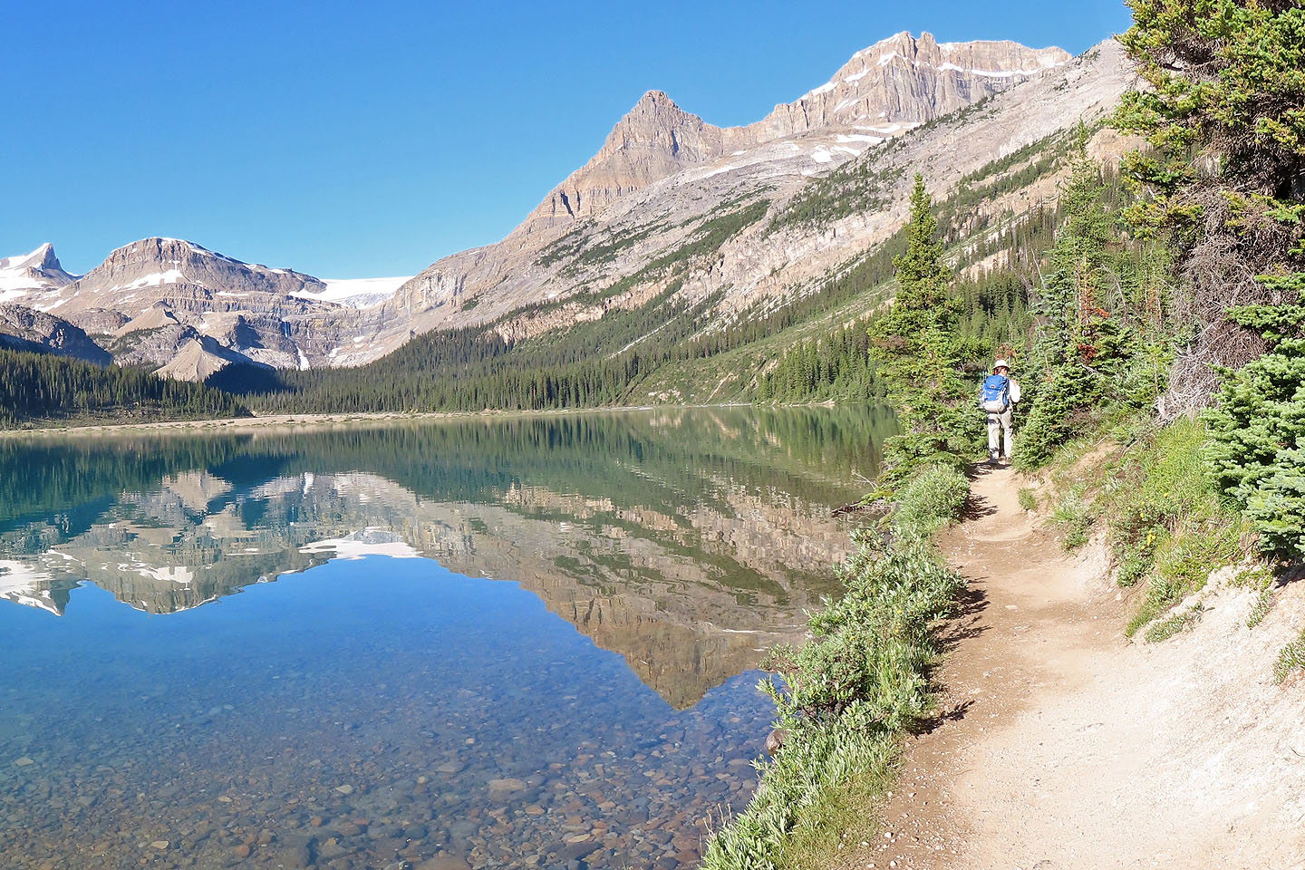 Following the trail around Bow Lake
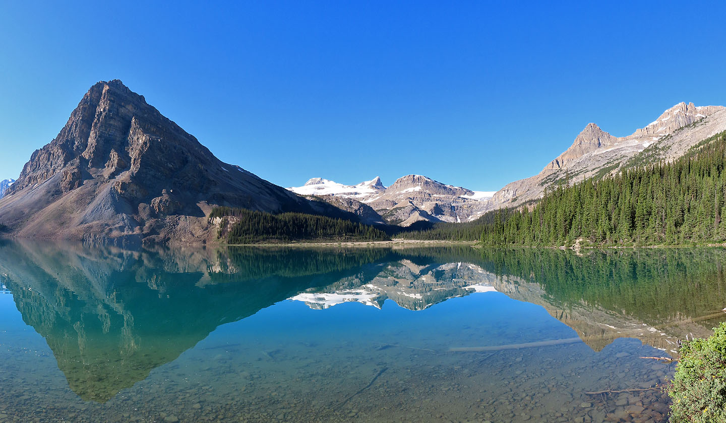
The calm day casts a perfect lake reflection. Crowfoot North on the left.
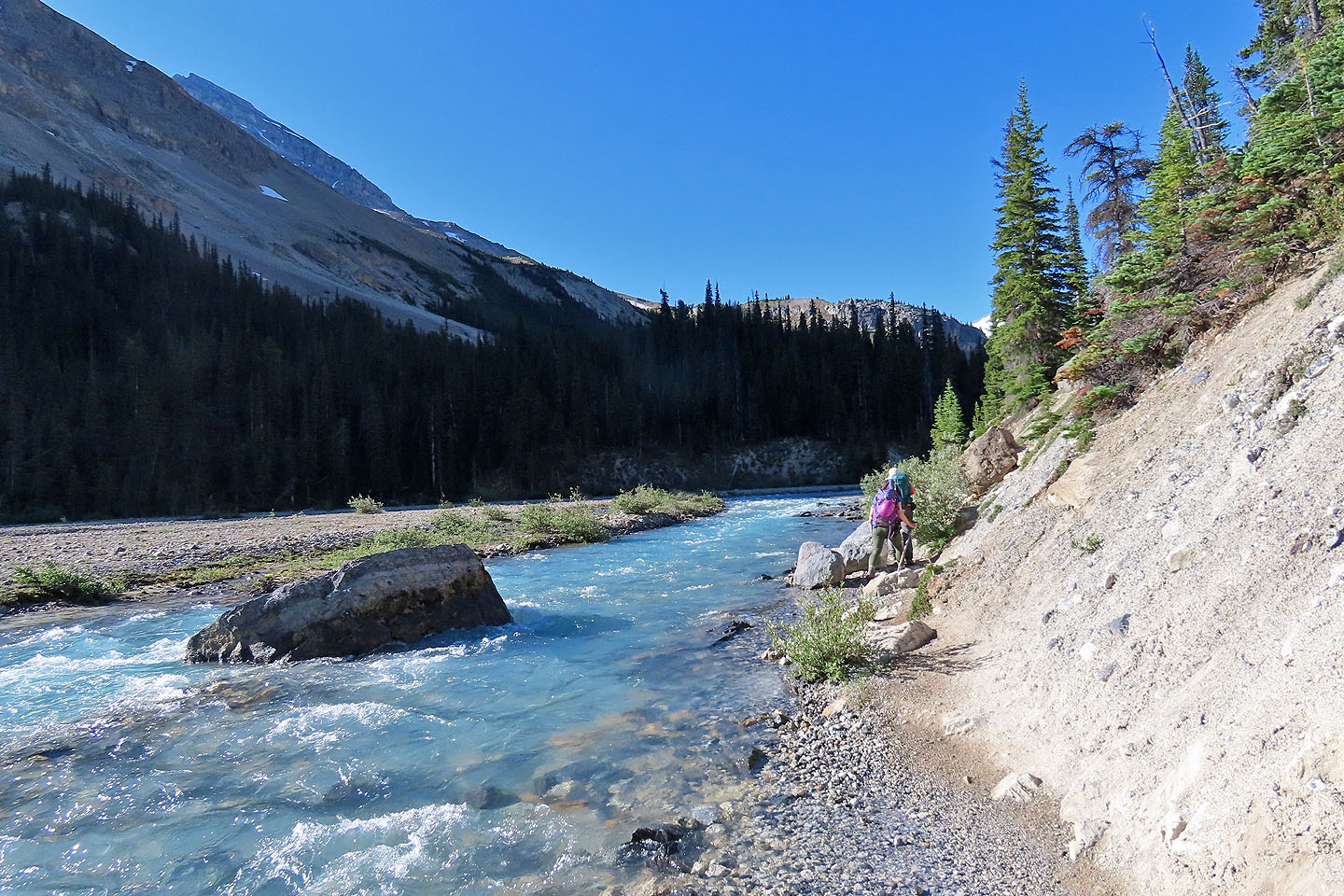
Following the trail alongside Bow River
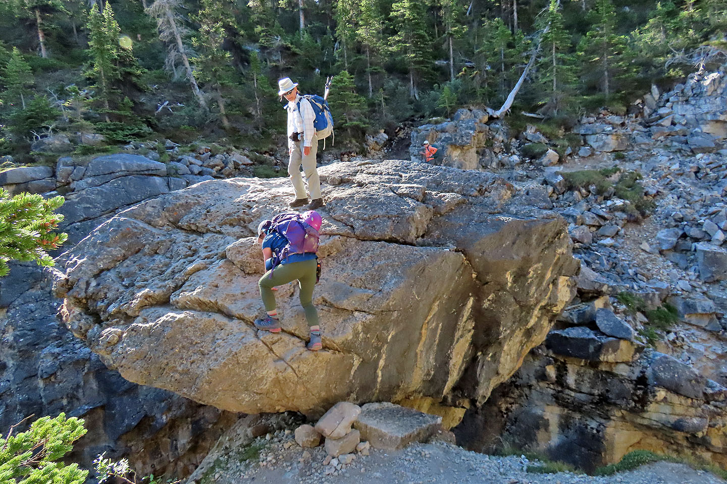
Christine scrambles up the chockstone
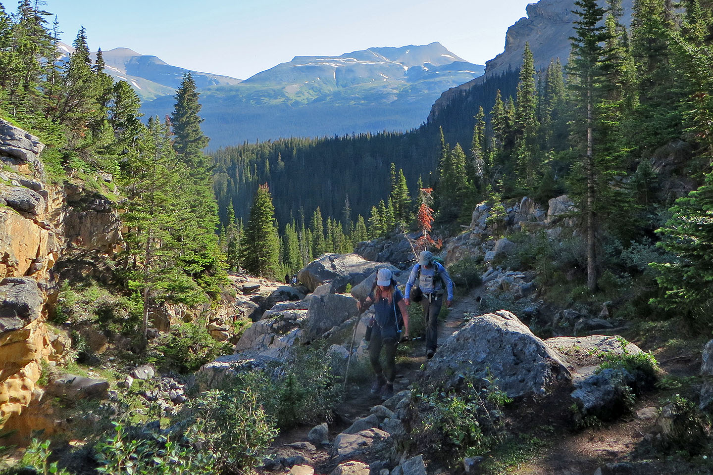
Continuing up the trail after the chockstone (centre)
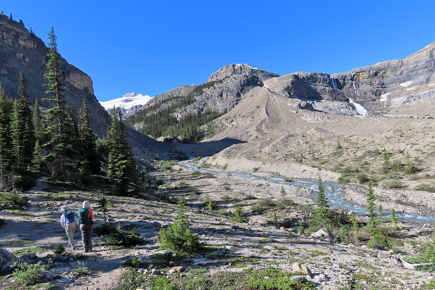
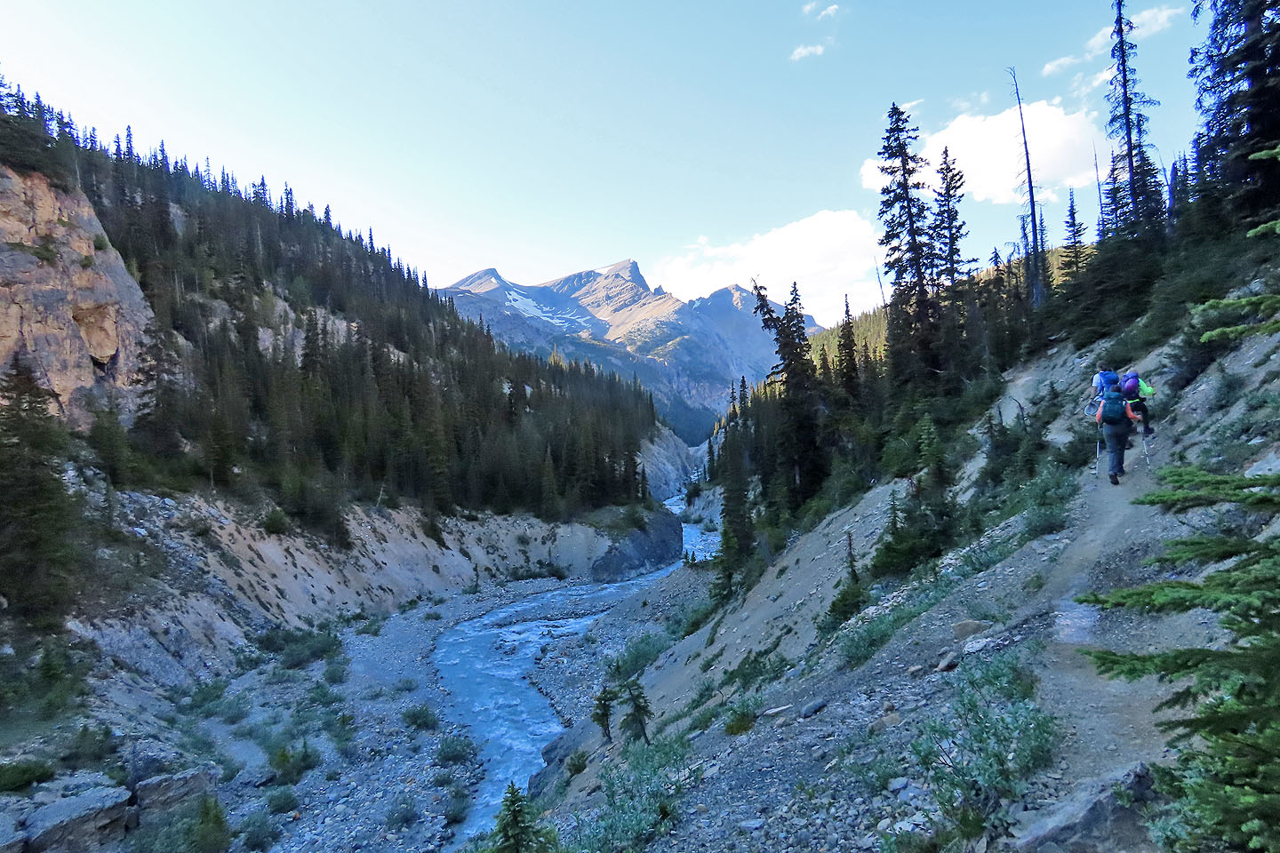
The trail runs alongside a creek for a few kilometres
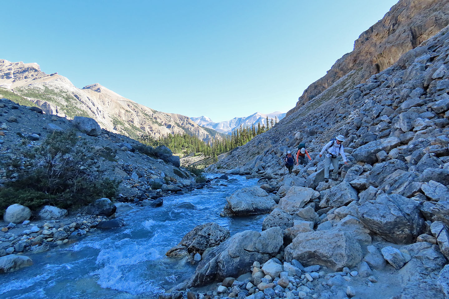
Crossing boulders along the creek
Coming to a boulder field
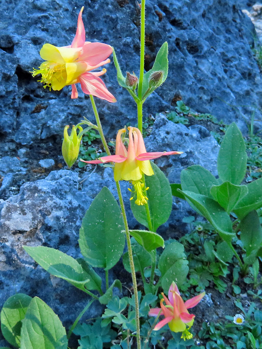
Colourful columbine
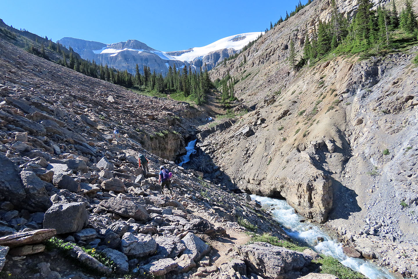
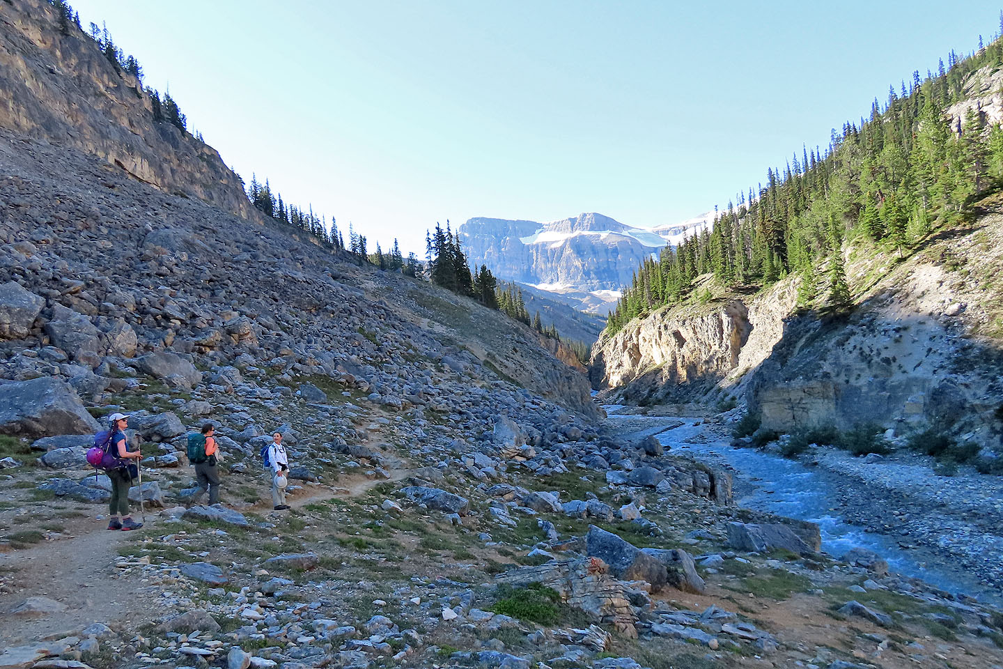
Coming to another boulder field
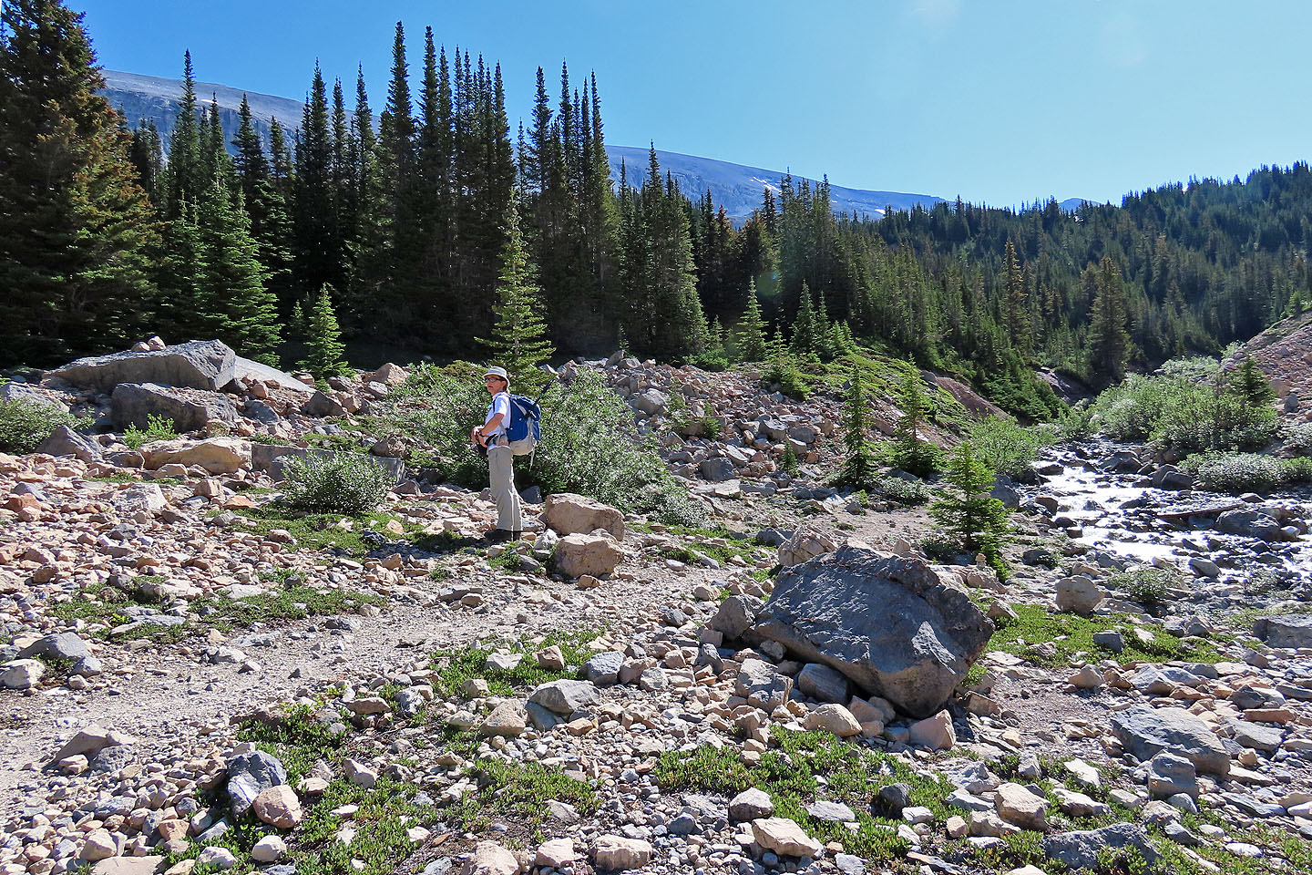
The trail to Bow Hut turns right and crosses the creek, but we entered the trees left and found a path
Hiking up the path
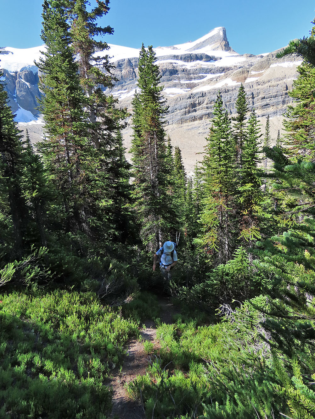
The trail disappears on the top of a low ridge
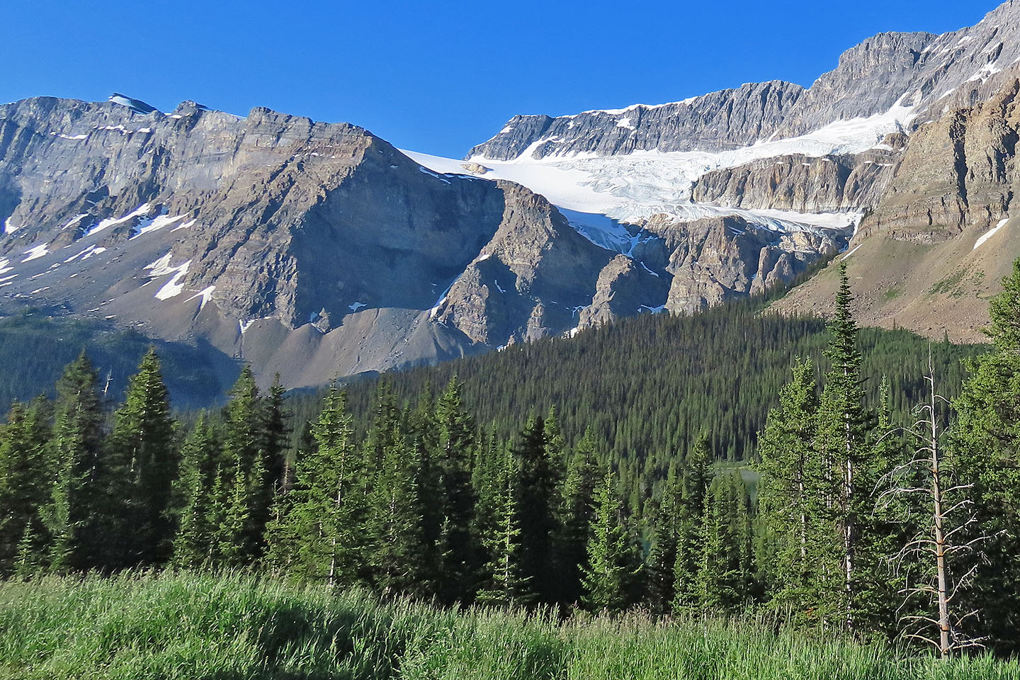
Behind us, St. Nicholas Peak rises above Bow Hut in the centre
After passing through trees and meadows we reached the creek. Ahead is the ridge we climbed (mouse over for our route).
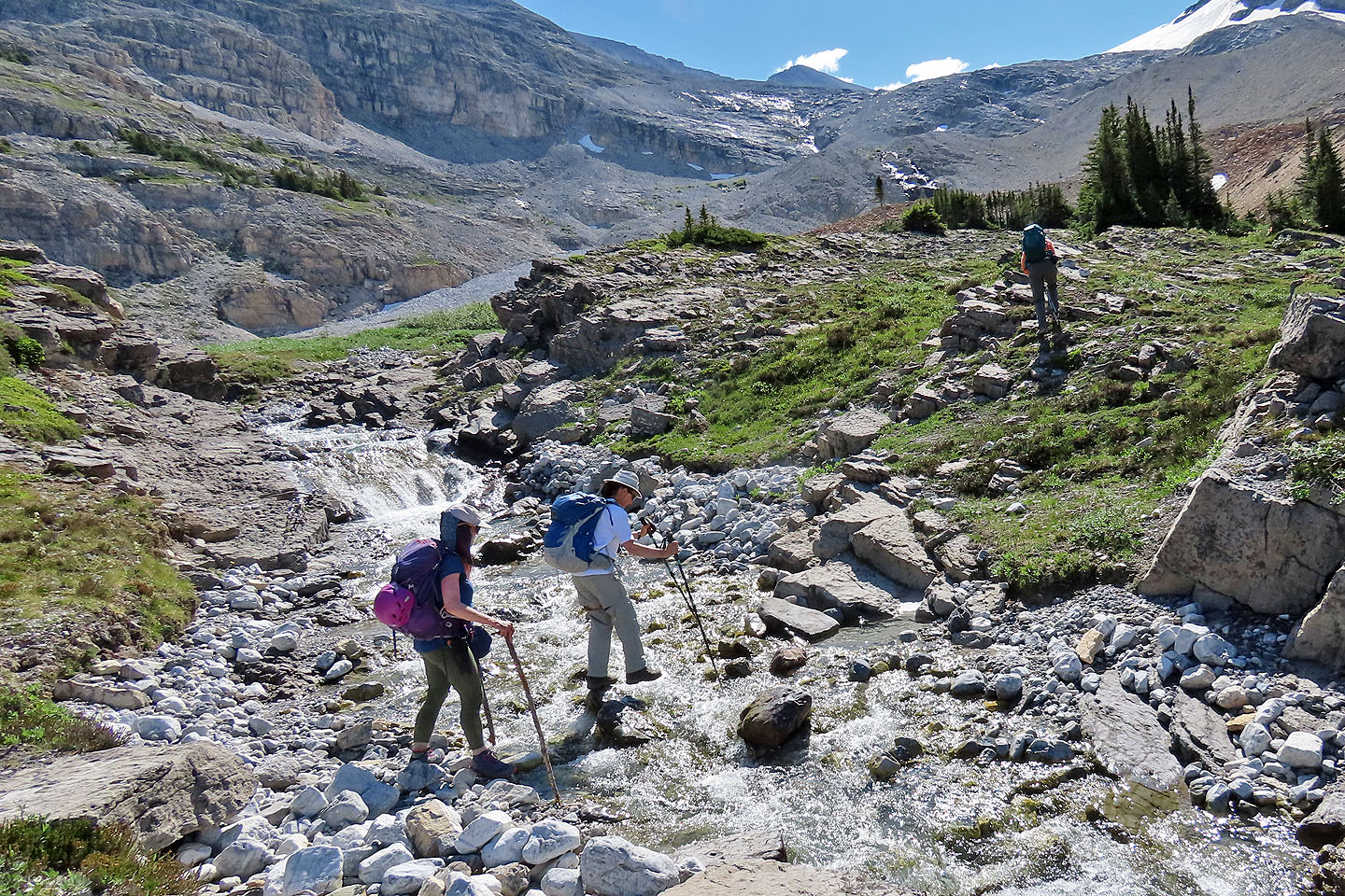
Zora steps across the creek. Christine follows using her makeshift wood poles.
Looking back. In the centre
is the meadow and forest we came from.
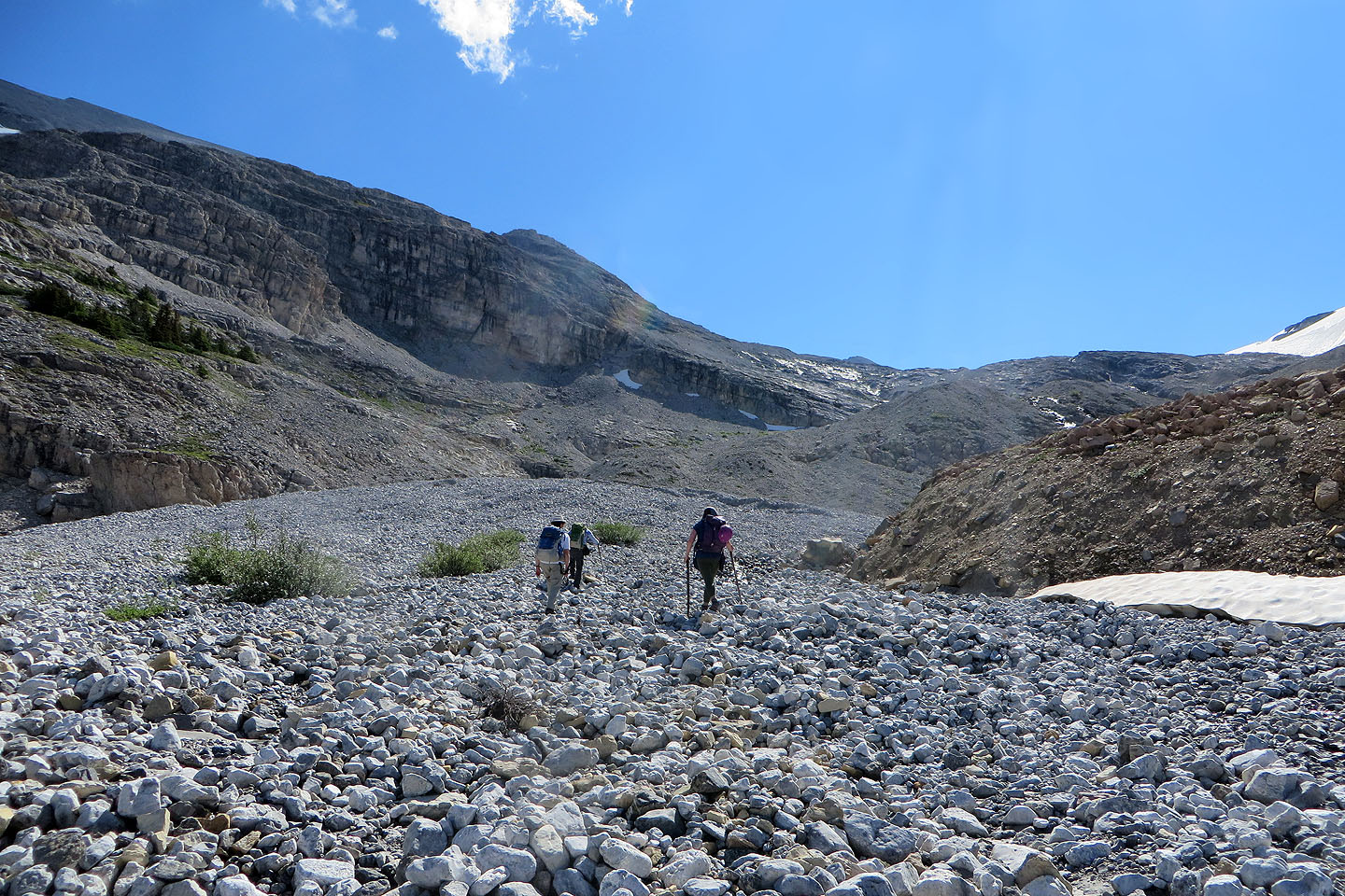
We made our way to the end of the ridge ahead
We reached the ridge by hiking up a moraine. The false summit of Crowfoot is left.
Glaciers left rocks smooth and polished
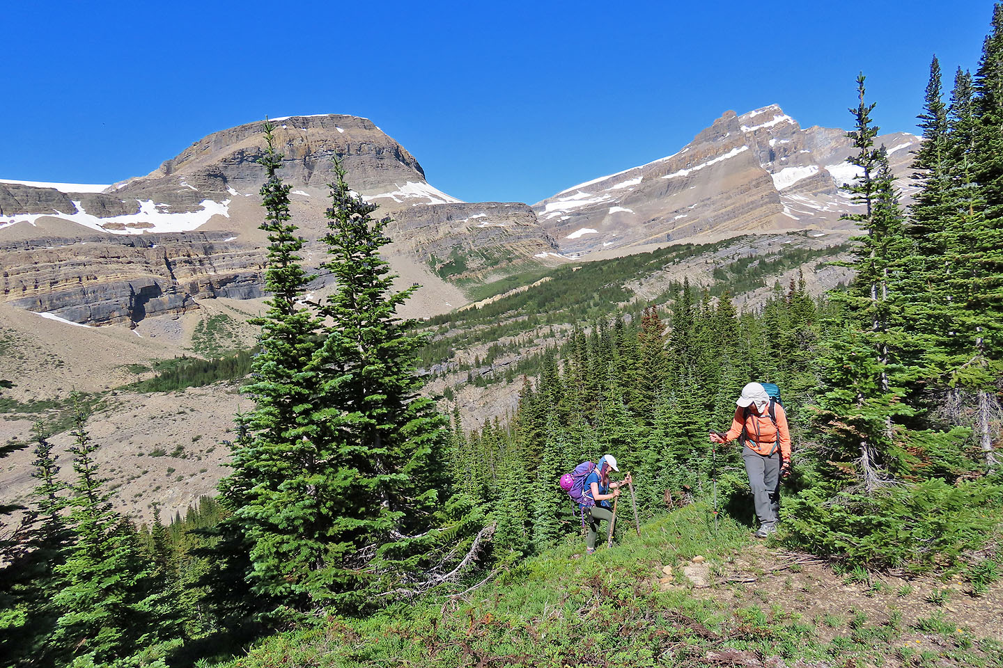
Looking back from the ridge. The second peak from the right is Mount Jimmy Simpson.
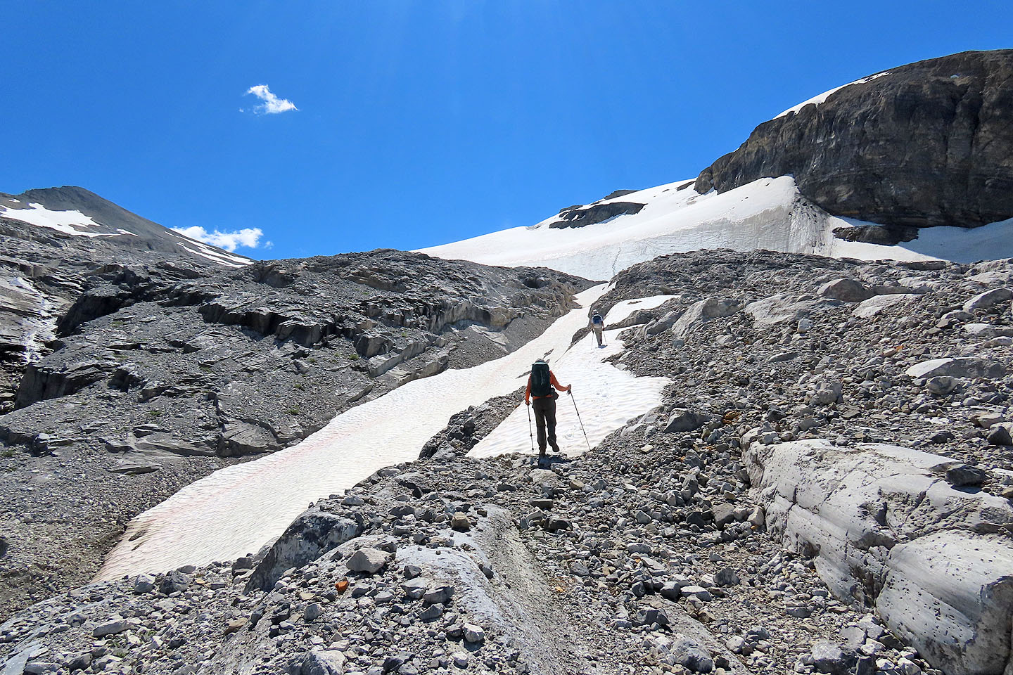
We continued along the ridge, looking for a place to cross the first snow gully
Crossing the gully
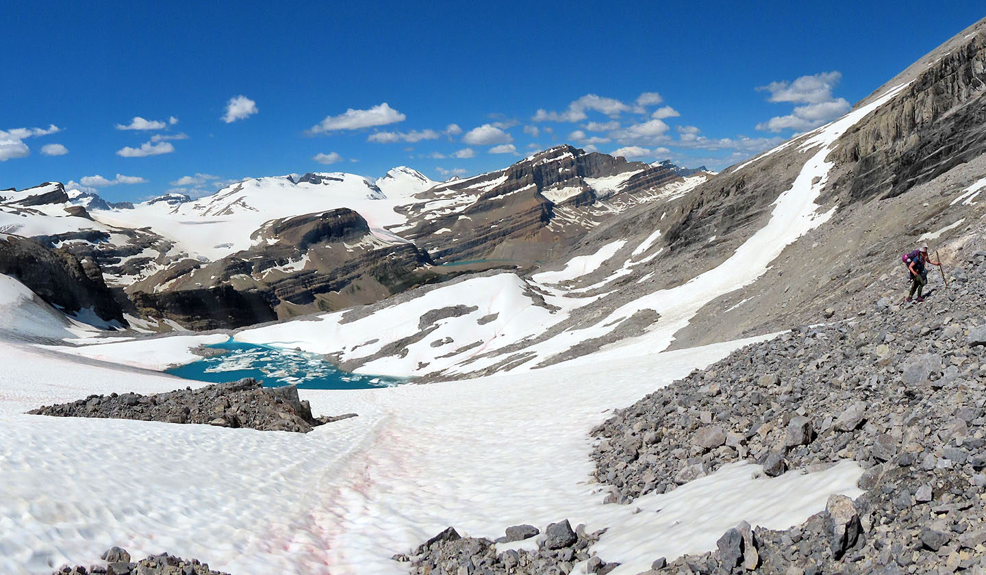
After crossing two more snow gullies, we arrived at the tarn below the false summit
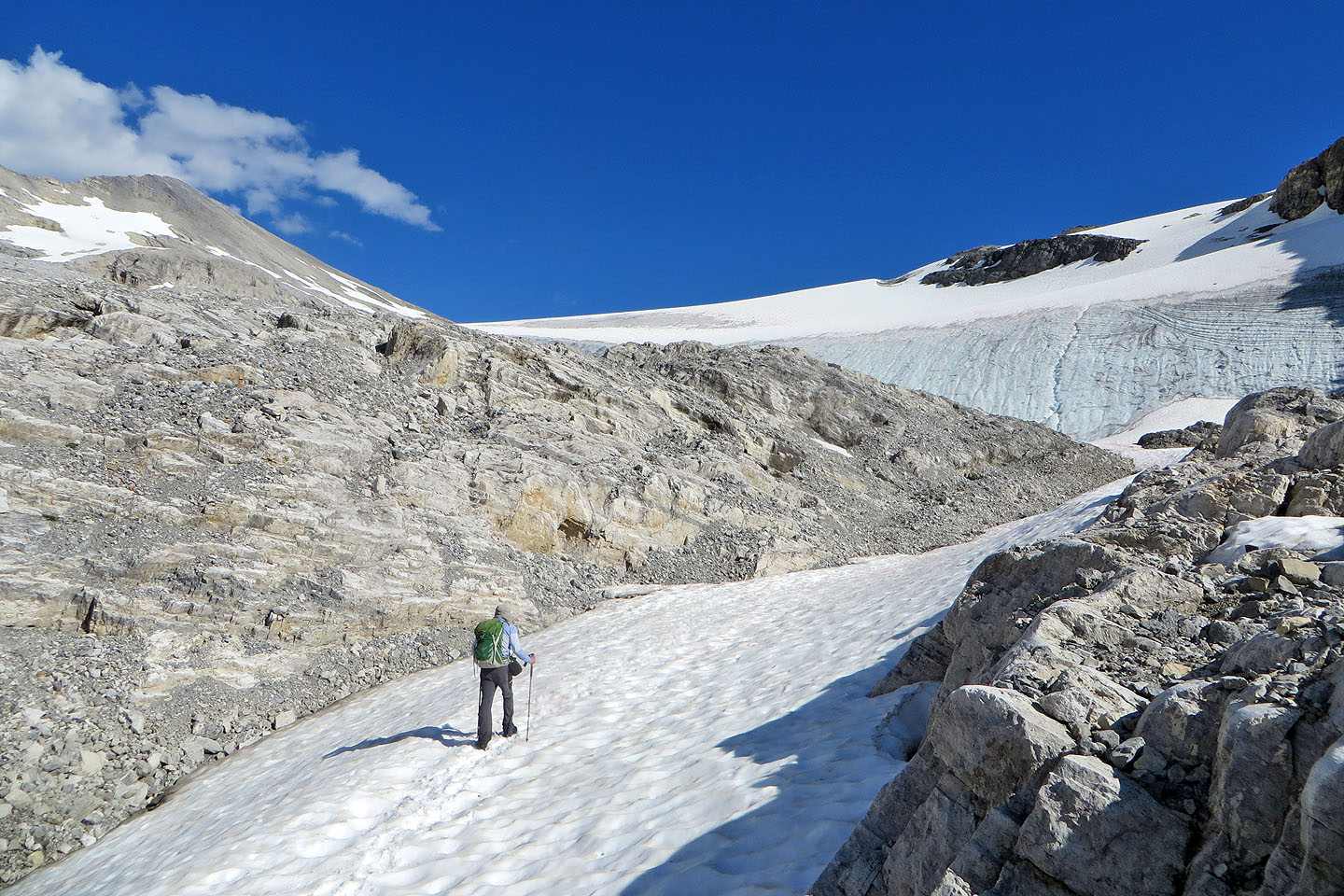
We continued past the tarn
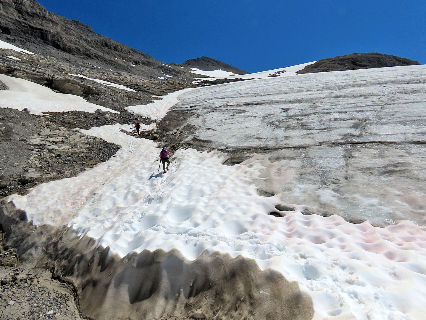
We climbed along the edge of the glacier
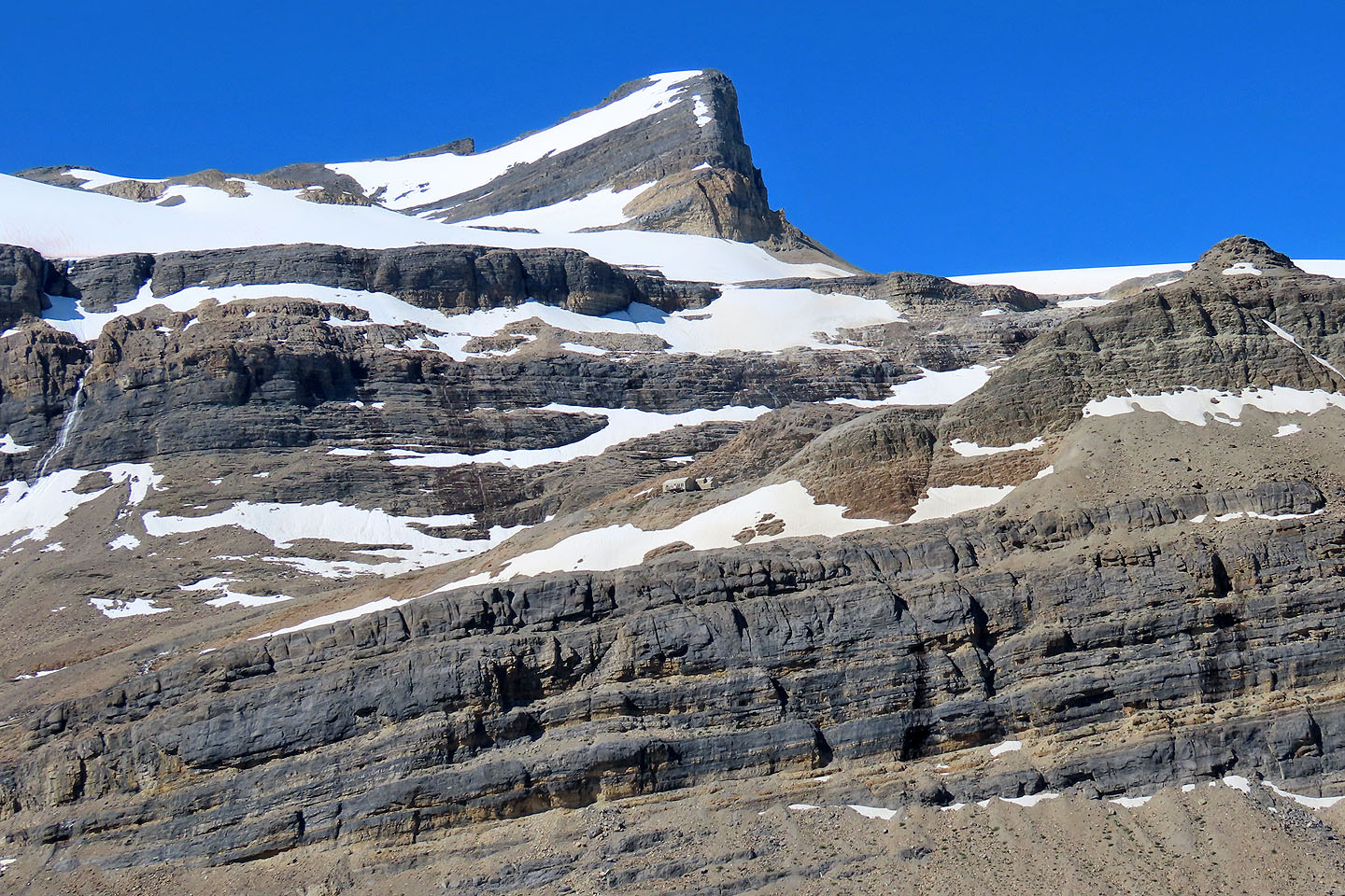
Above the tarn is The Onion. Iceberg Lake is in the centre.
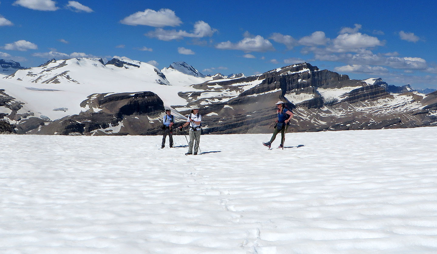
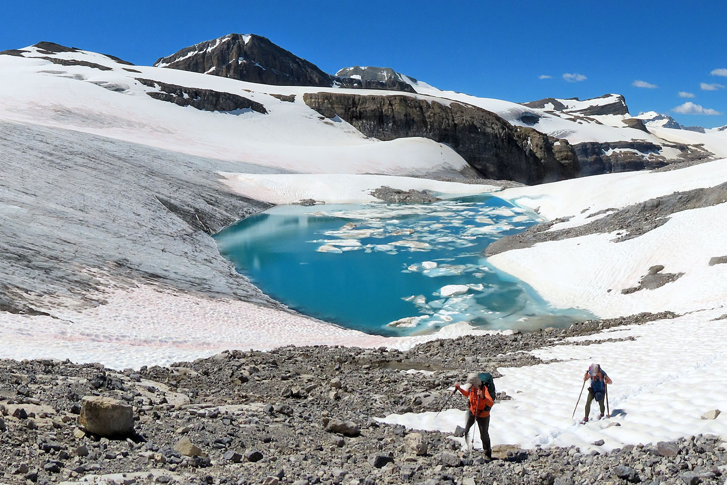
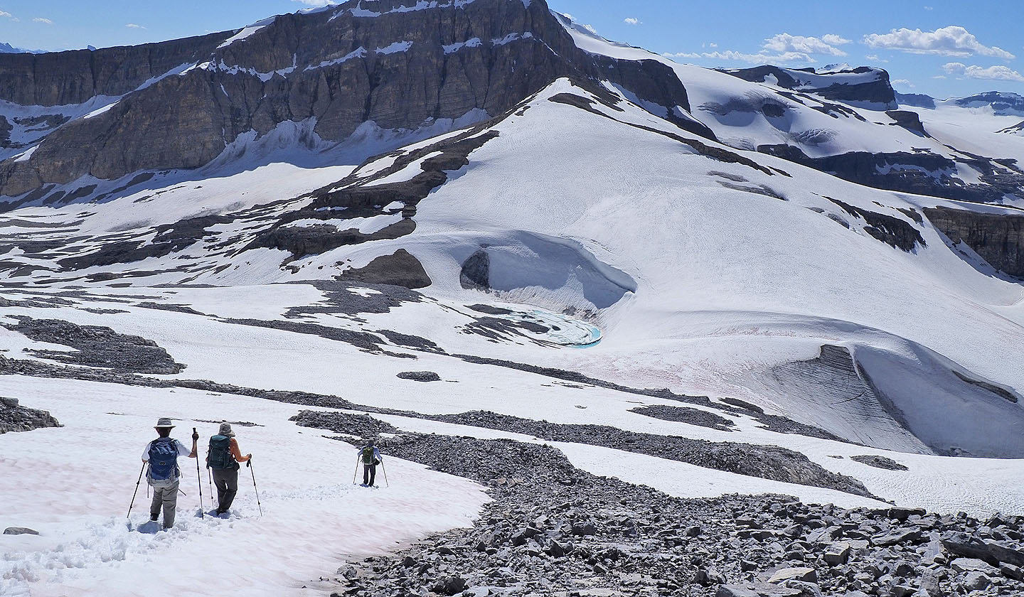
We reached a snow-covered bump
To quickly gain elevation, we ascended the slabs above us before angling towards the ridgetop. But the rocks were crappy, so on the descent, we took a different angle to take advantage of the snow patches.
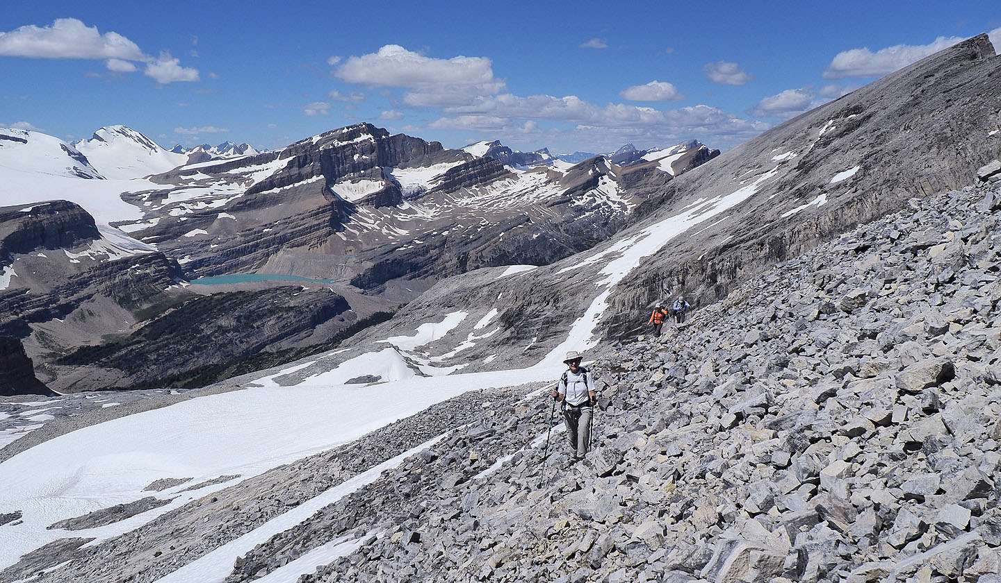
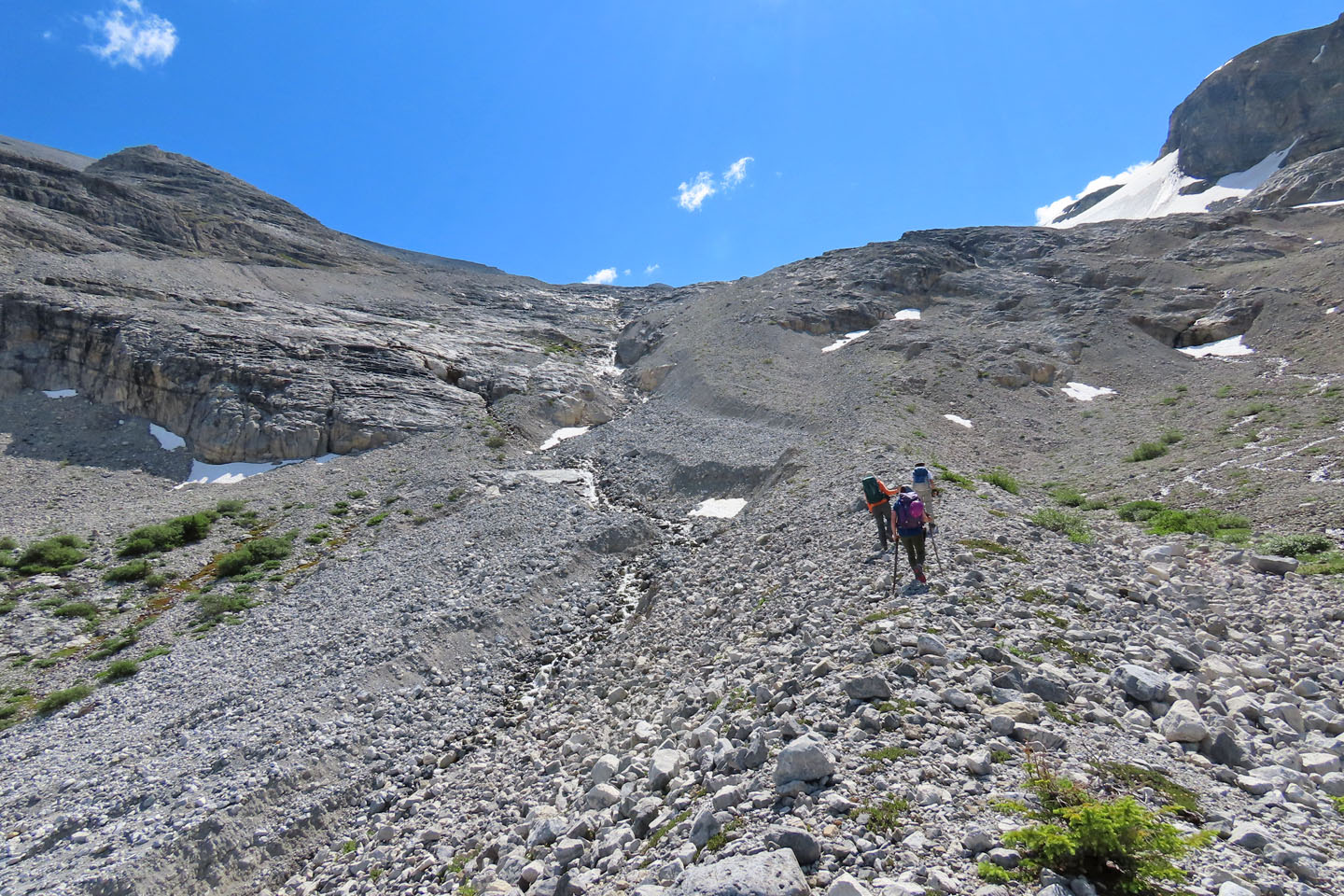
Hiking up the rocky mountainside
The ridge crest is deceptively far away
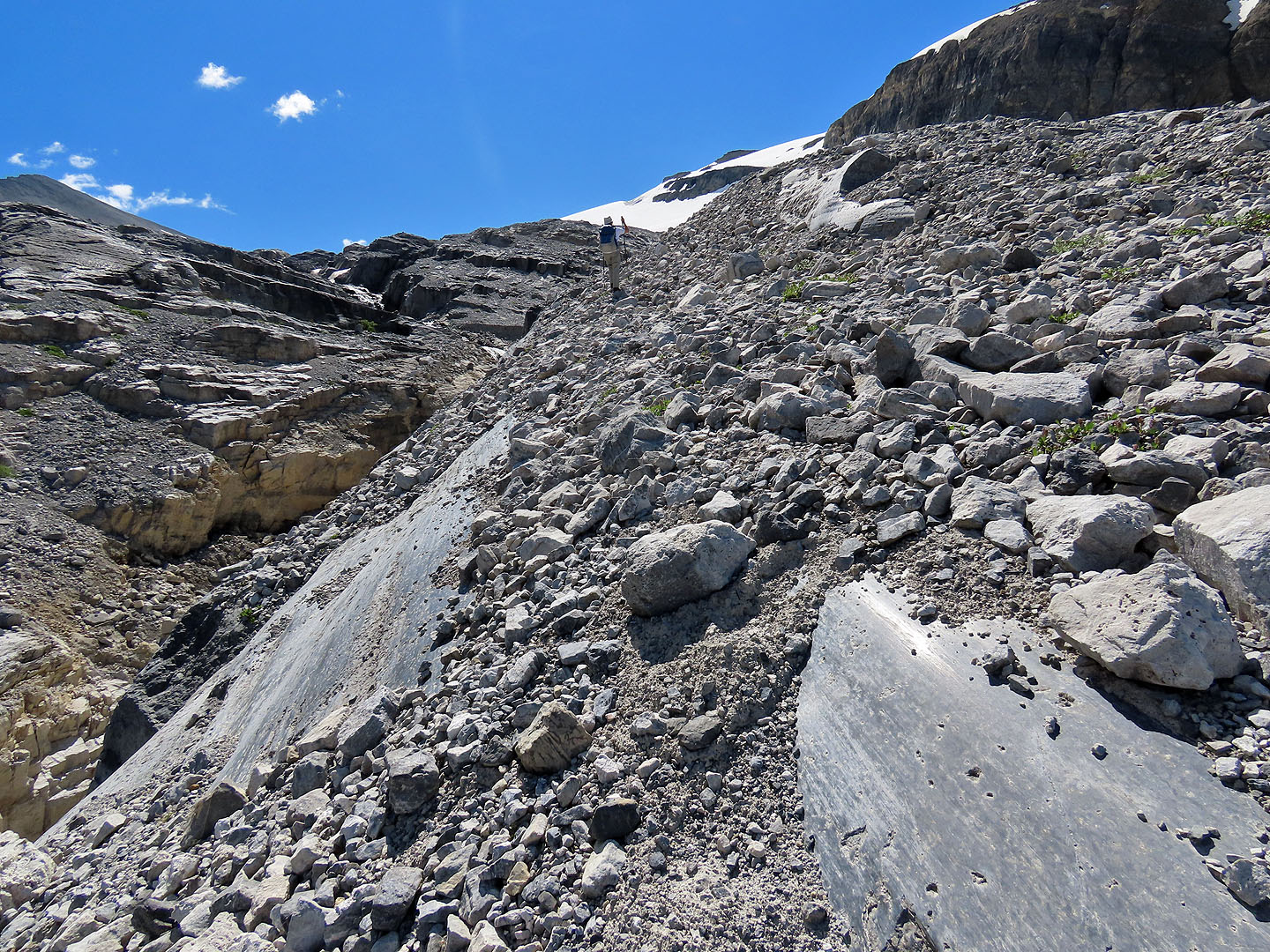
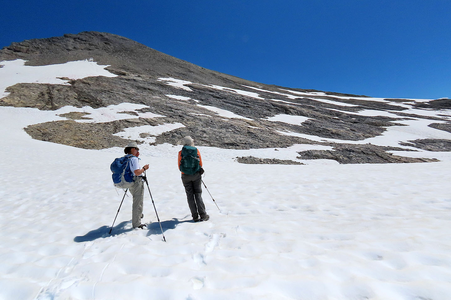
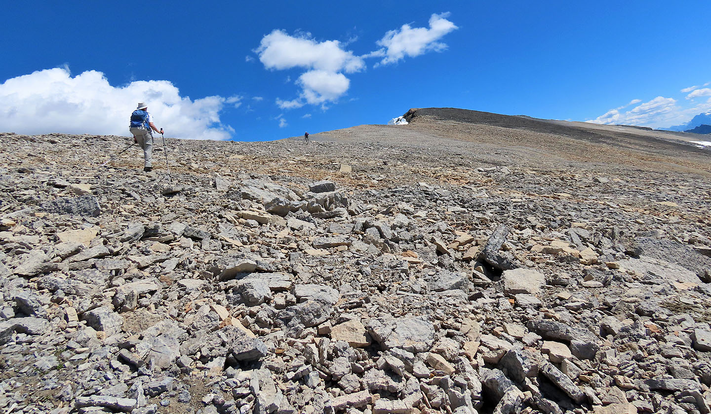
We finally reached the top of the ridge 700 m from the summit
The long walk to the top
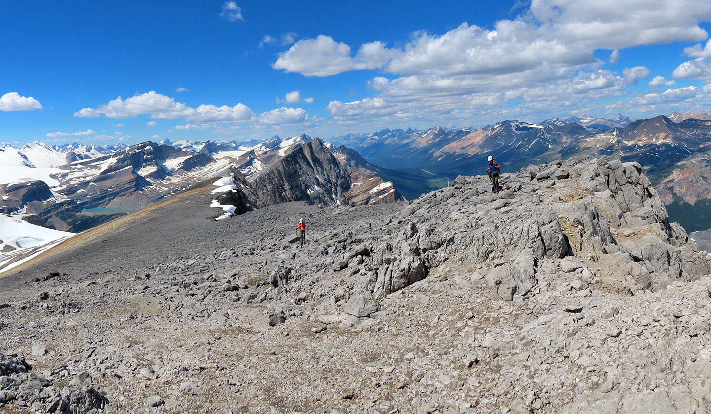
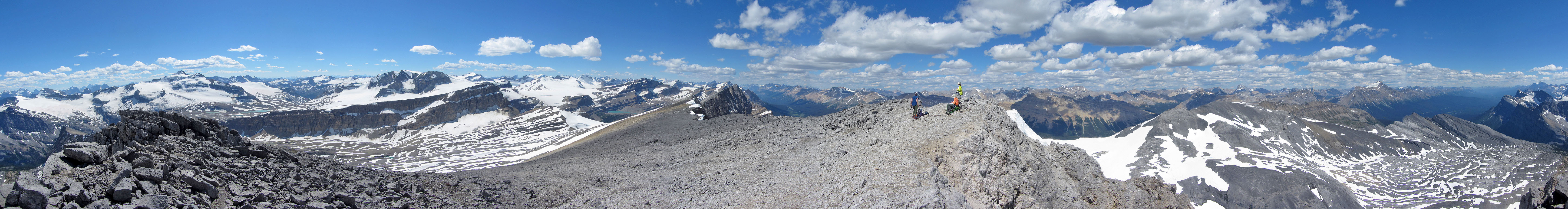
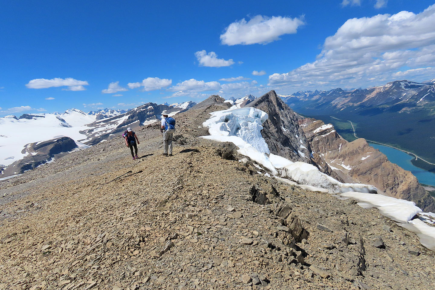
Looking back along the ridge from the summit
Vulture Peak lies nearby to the west
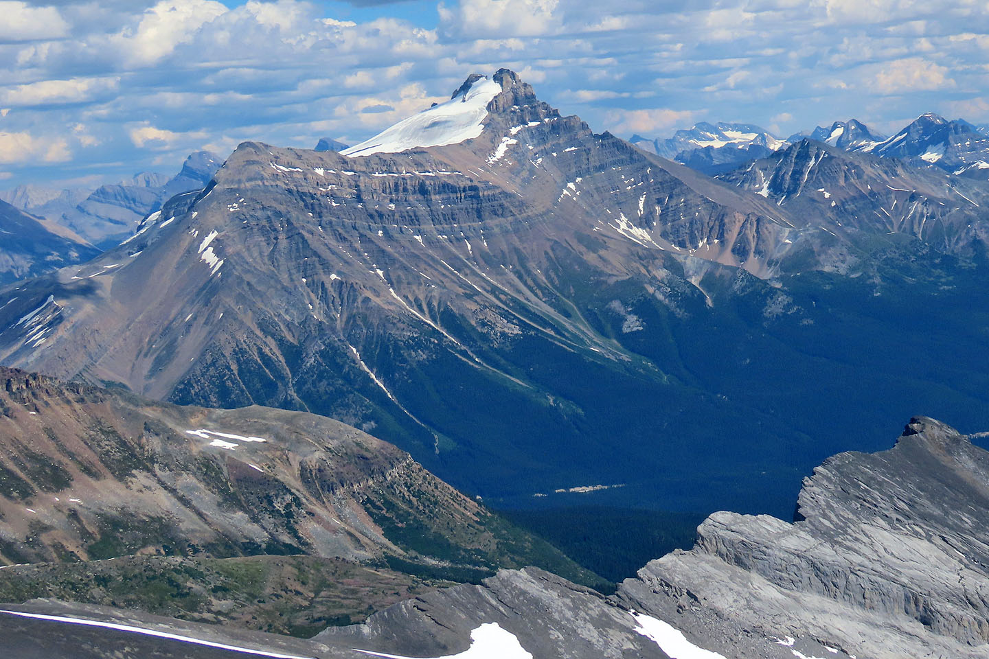
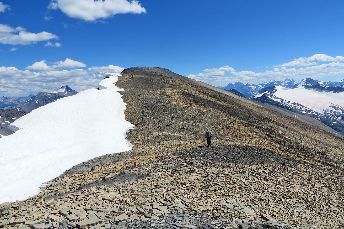
Little Hector is an extension of Mount Hector
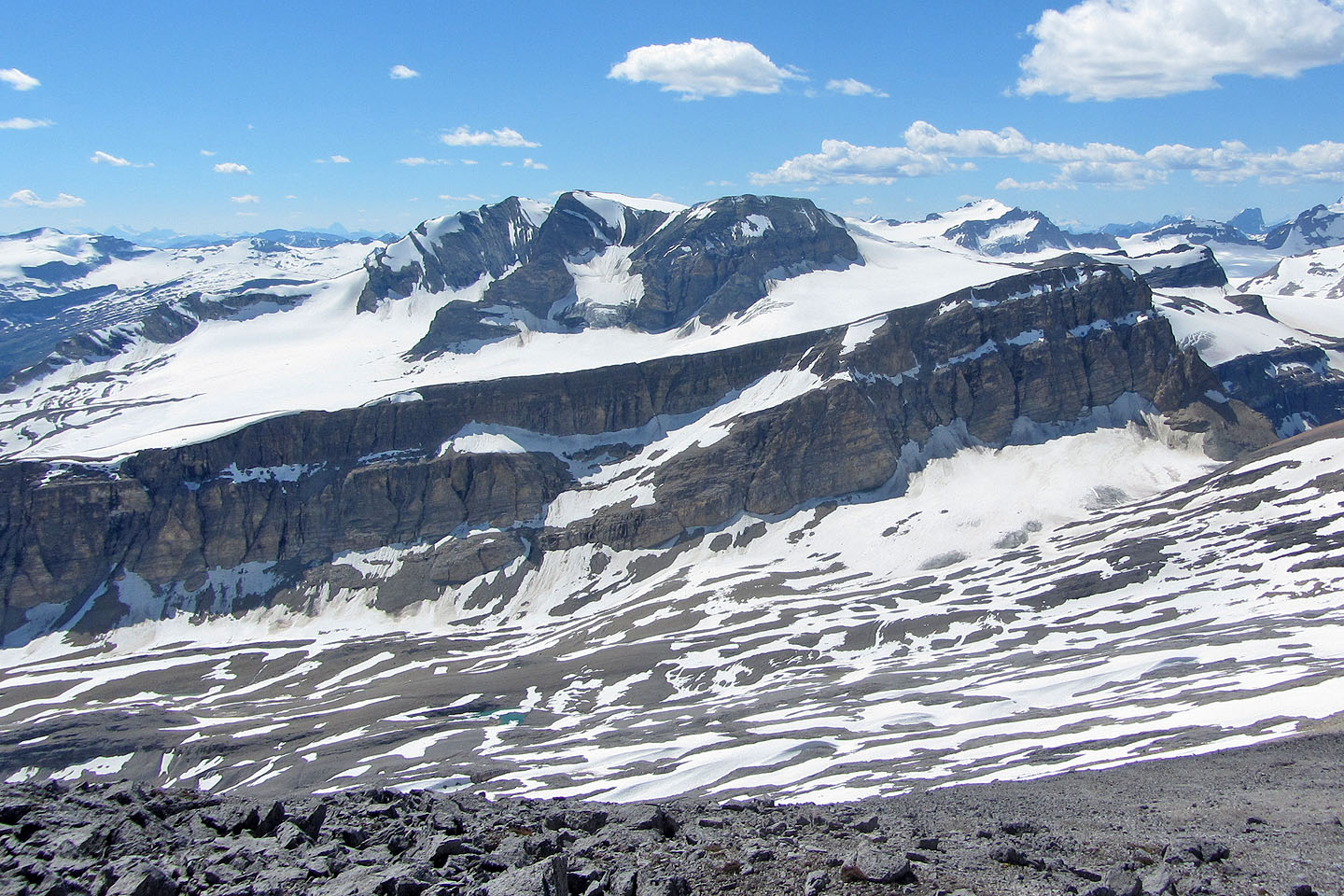
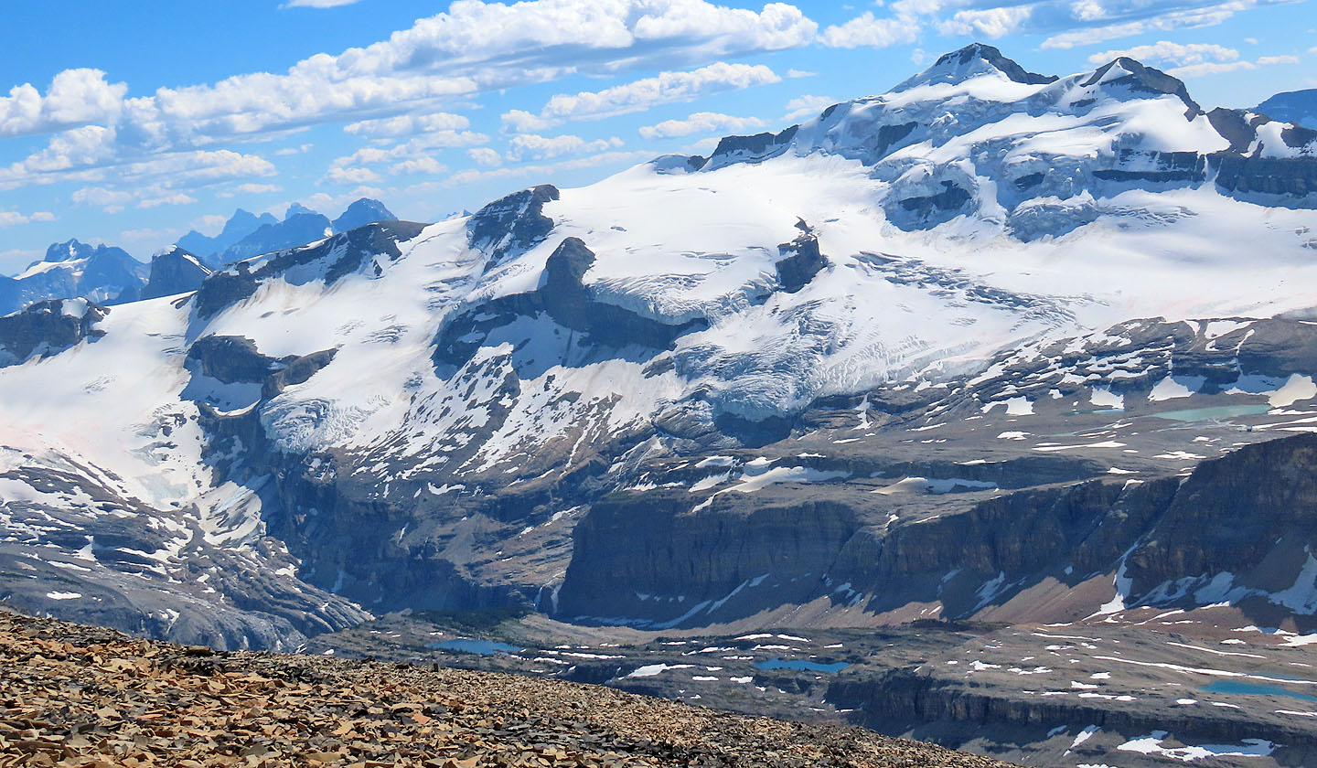 Mount Balfour towers over colourful tarns (mouse over)
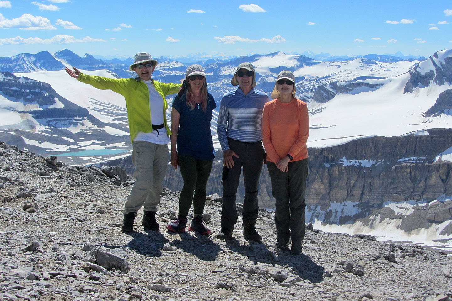
Zora, Christine, me and Dinah on the summit
On the descent, we took advantage of the snow to avoid the horrible loose rock
Back on the main trail as it follows the creek
82 N/9 Hector Lake