bobspirko.ca | Home | Canada Trips | US Trips | Hiking | Snowshoeing | MAP | About
Mount Rowe
Waterton Lakes National Park, Alberta
July 11, 2009
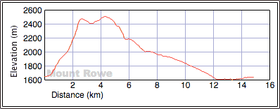
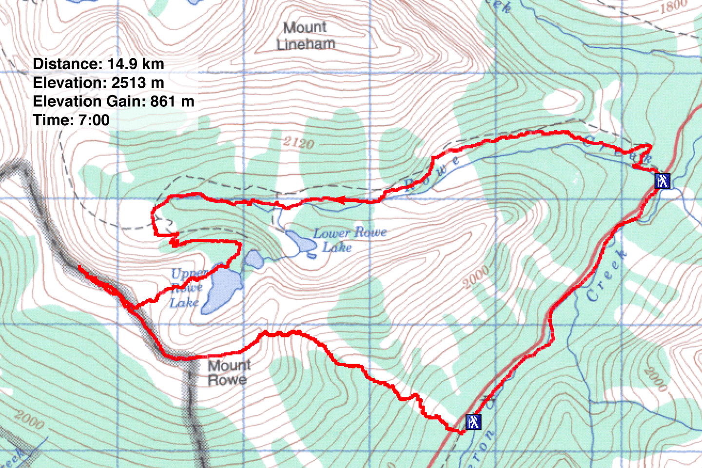
Distance: 14.9 km (9.3 mi)
Cumulative Elevation Gain: 963 m
(3159 ft)
Mount Rowe doesn't have the nicest approach, being bushy in some places and steep in others, but once we got above the treeline, the colourful views were a reward for our efforts. The rest of our loop trip along the ridge and down to the Rowe Lakes trail was more than satisfying.
Dinah and I used Nugara's route up the southeast slope. There was a “No Parking” sign at the pull-out, so we parked across the road at the day-use area.
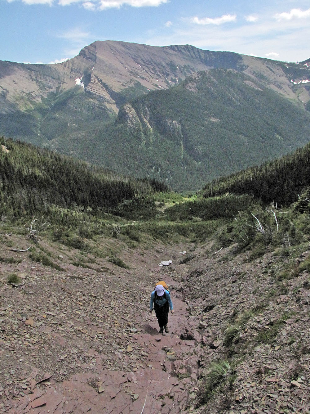
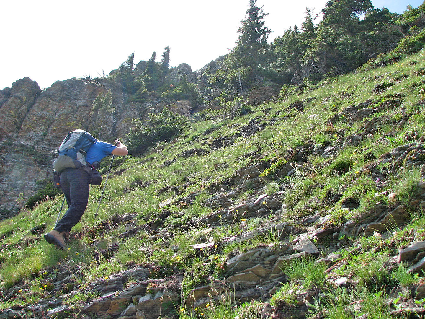
After walking up the road to a culvert, we headed into the bushes. Staying near the drainage wasn't easy because of the dense trees and bushes, and we wandered off-course a bit. Because of the steep slopes on our left, we were committed to ascending until we could bushwhack back to the drainage.
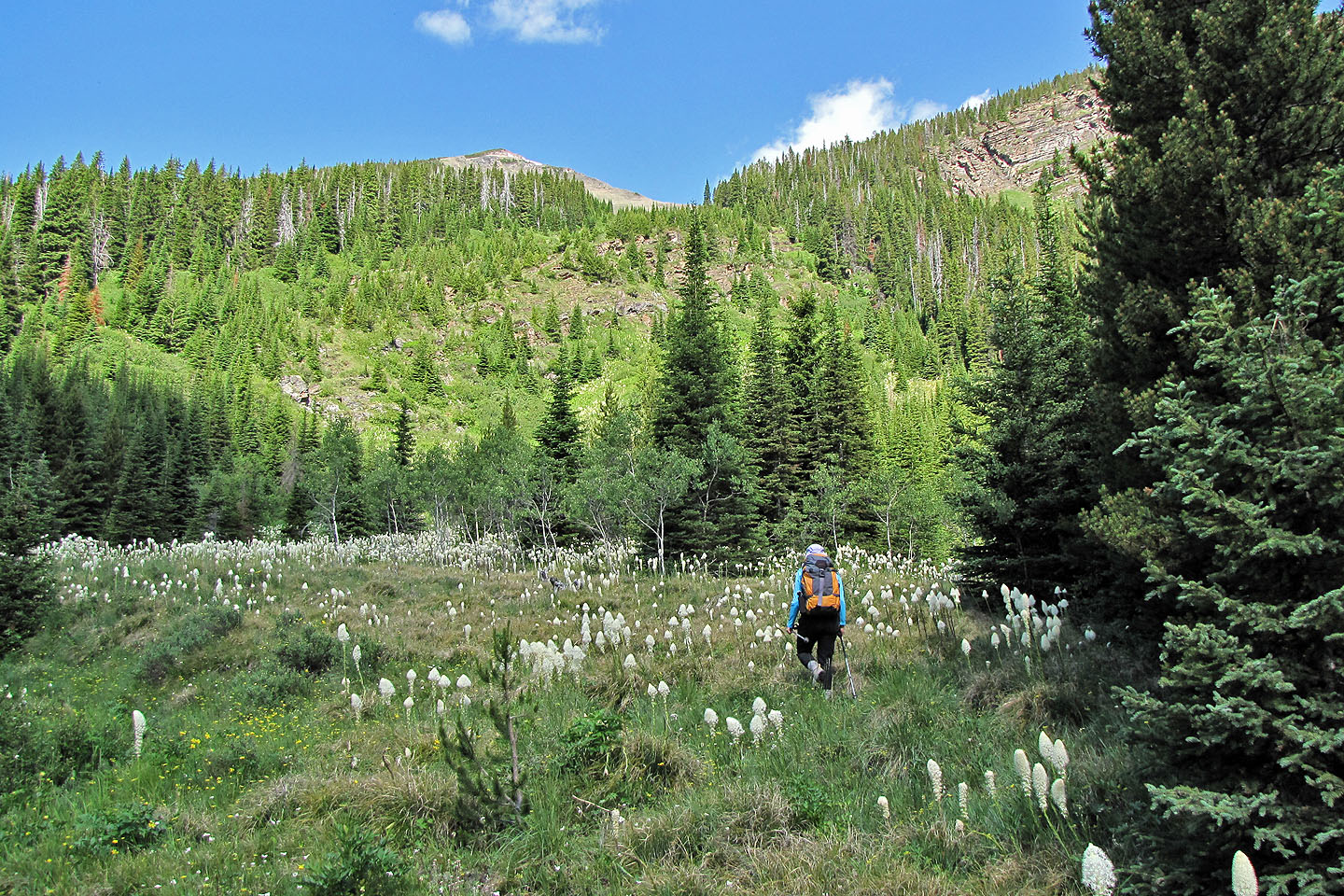
The drainage was a mix of bush and deep grass on open slopes. Here we had to push through bear grass, so much of it that we became covered in yellow pollen. Eventually, vegetation receded from the drainage, and we hiked easily alongside it.
The route calls for scrambling up a gully, but the gully, with its steep sides and loose shale floor, held little appeal for us. We hiked up the adjacent steep, grassy slope. In a short time, we reached the false summit and walked the short ridge crest to the top.
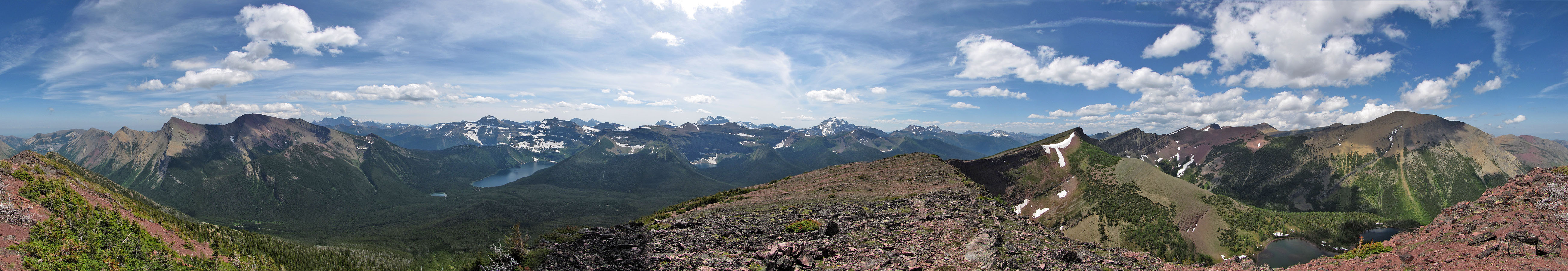
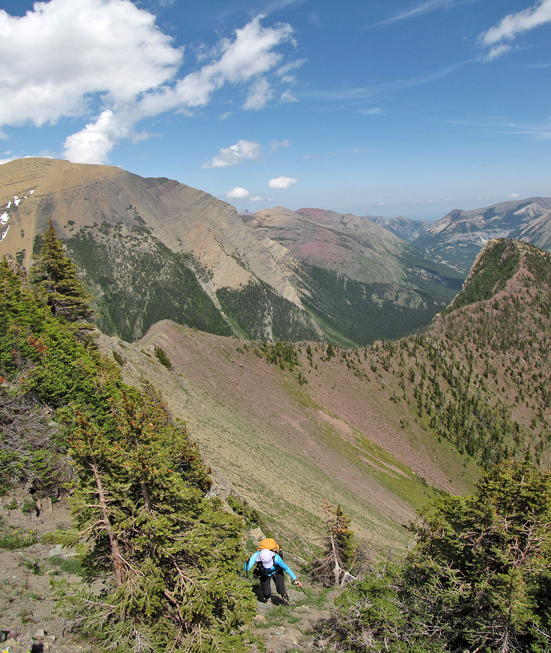
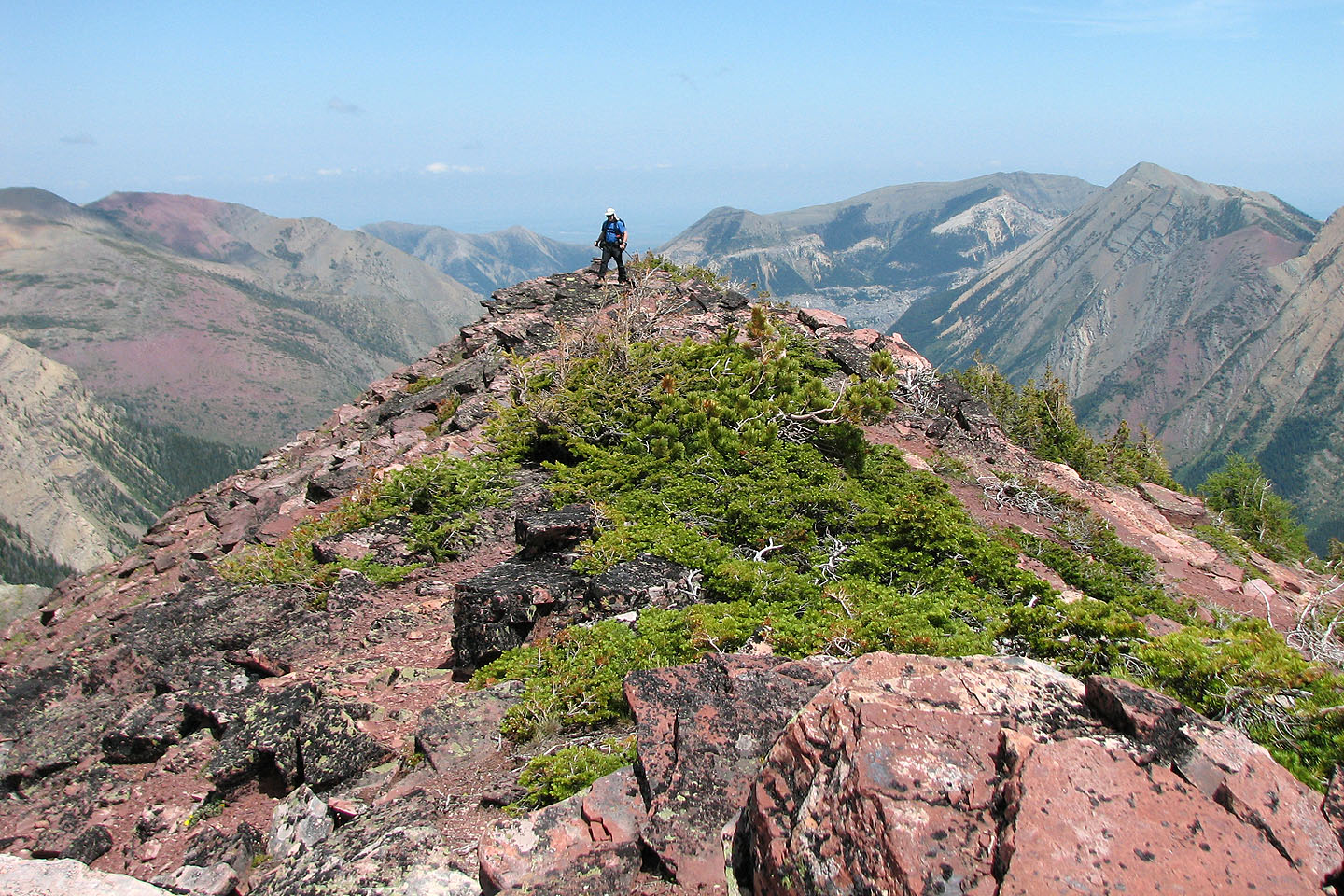
We didn't enjoy the ascent route and had no interest in retracing our steps, so we decided to take the Rowe Lakes trail back to the road. First, we walked along the northwest ridge to the high point at 136374. The pleasant walk afforded us great views in all directions. We soon reached the high point, a couple of dozen metres higher than Mount Rowe.
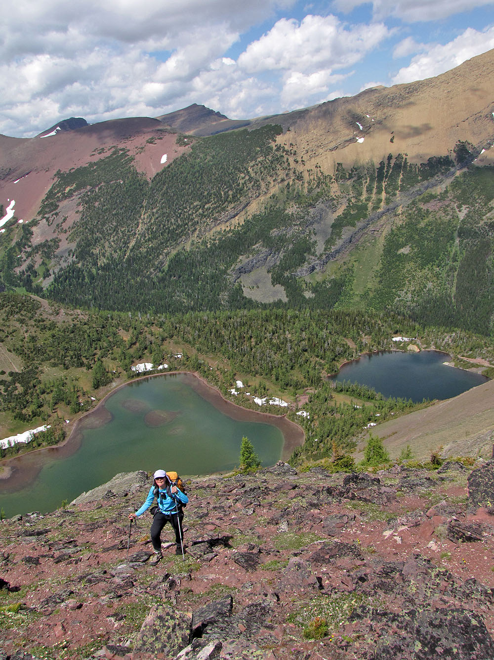
Afterwards, we backed down the ridge partway before descending to a shoulder that dropped down to the Upper Rowe Lakes. The 6 km trail back to the road was more scenic than we expected. At the Rowe Lakes trailhead, I left my pack with Dinah and hoofed it 2.6 km back along the road to my car.
A clearing shows the way up
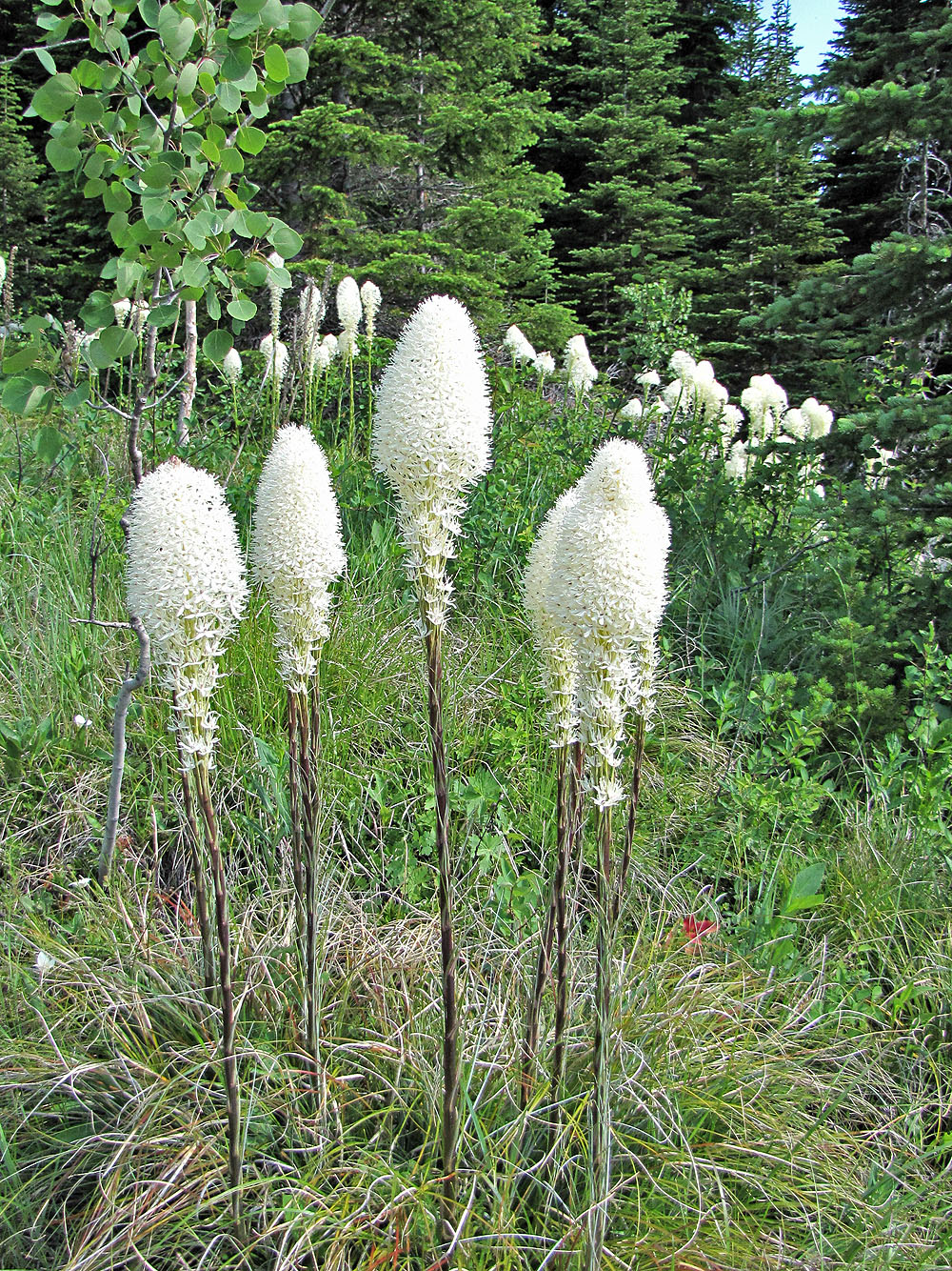
Bear grass
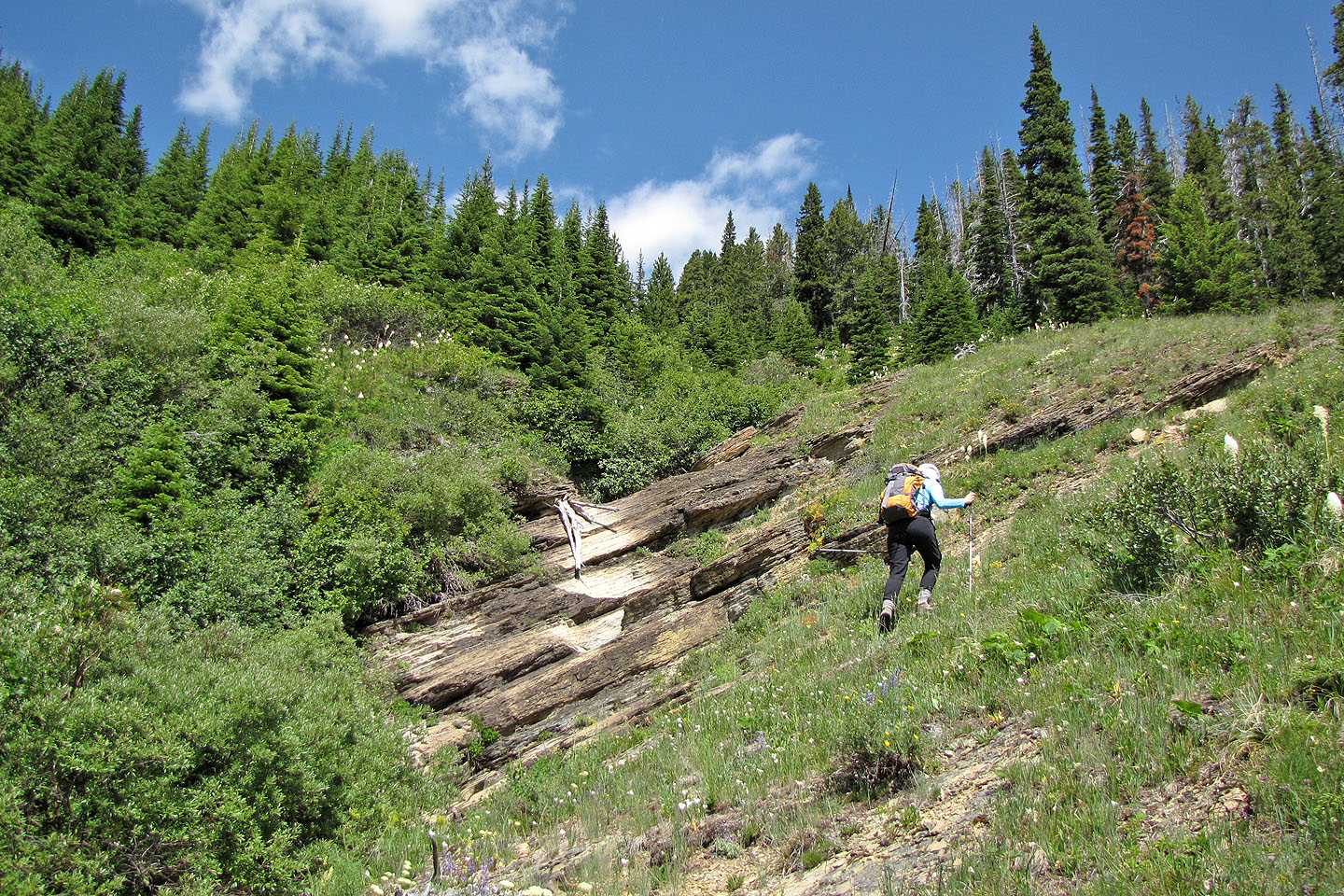
As much as vegetation allowed, we kept close to the drainage
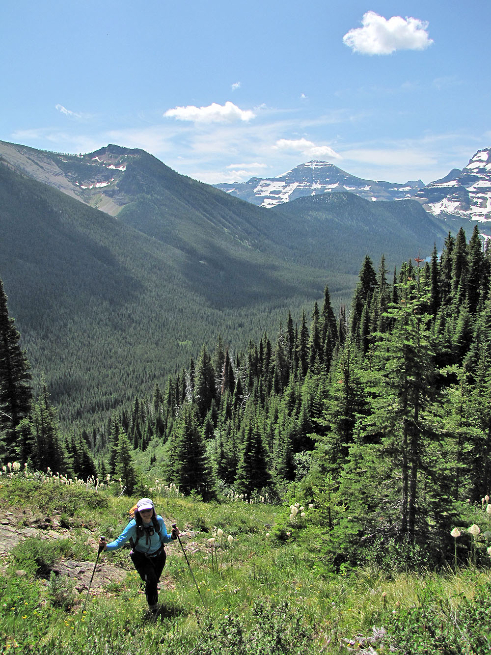
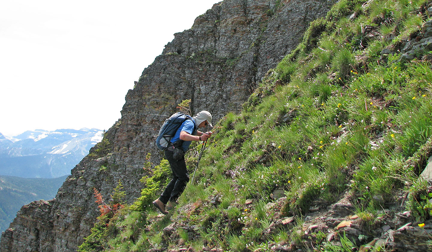
The views began to open up behind us
Mount Carthew behind
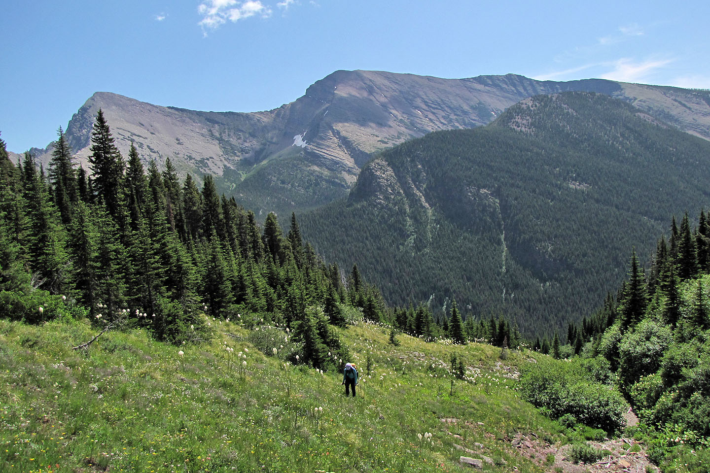
We finally got a clear view of Mount Rowe
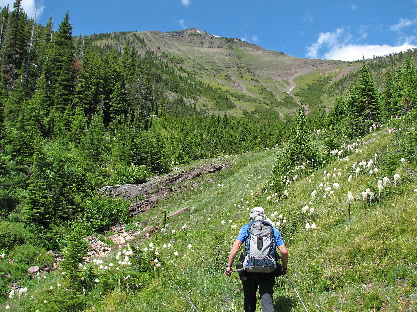
Travel became easier here
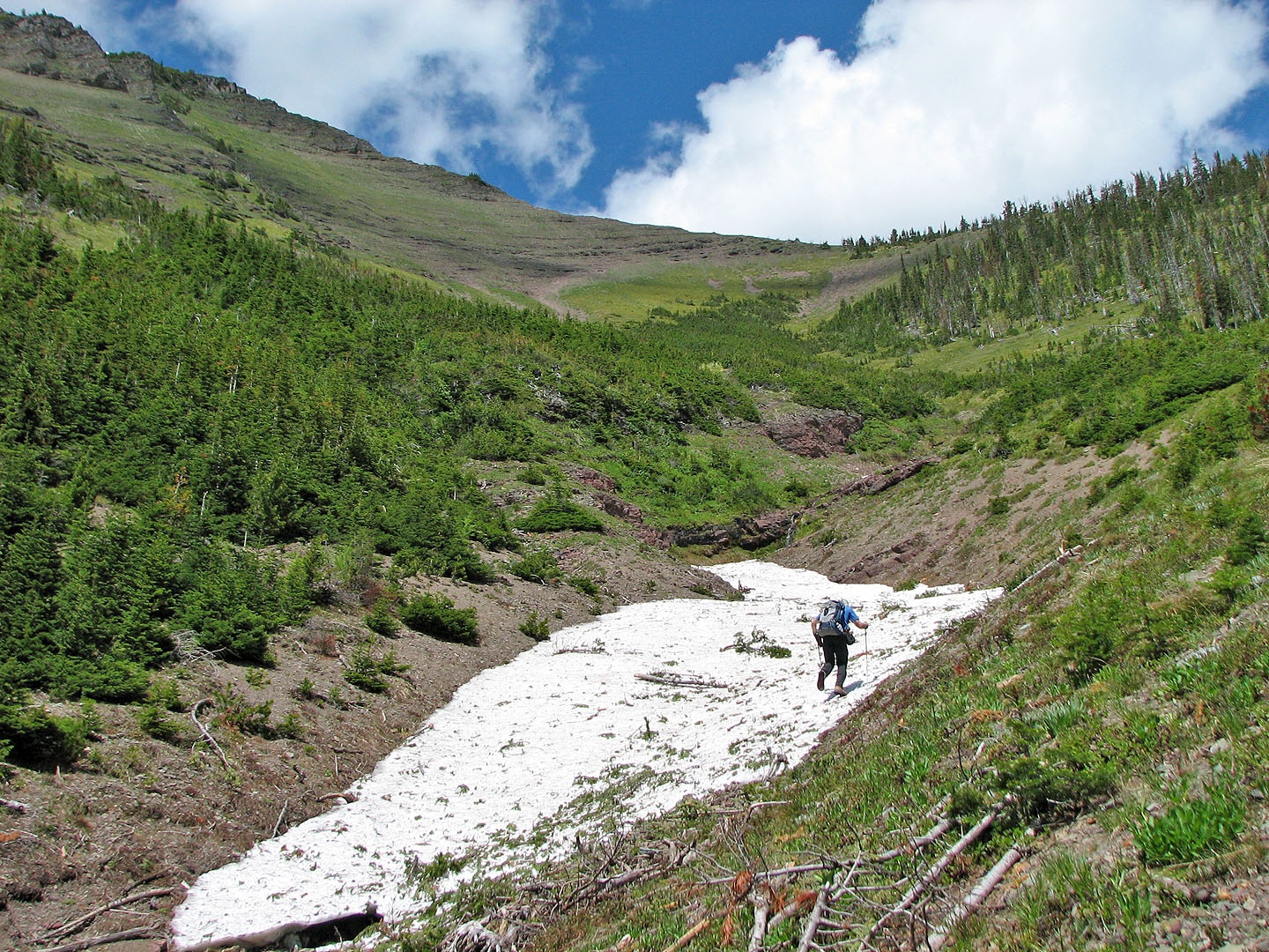
Snow lingers in the gully
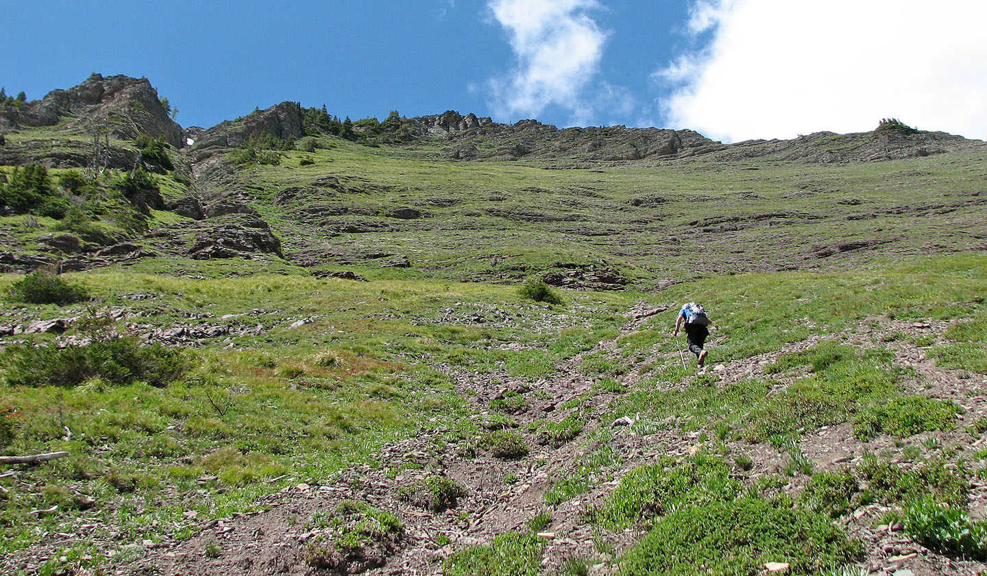
The gully route is on the left, but we hiked up the grass slope (mouse over to look back)
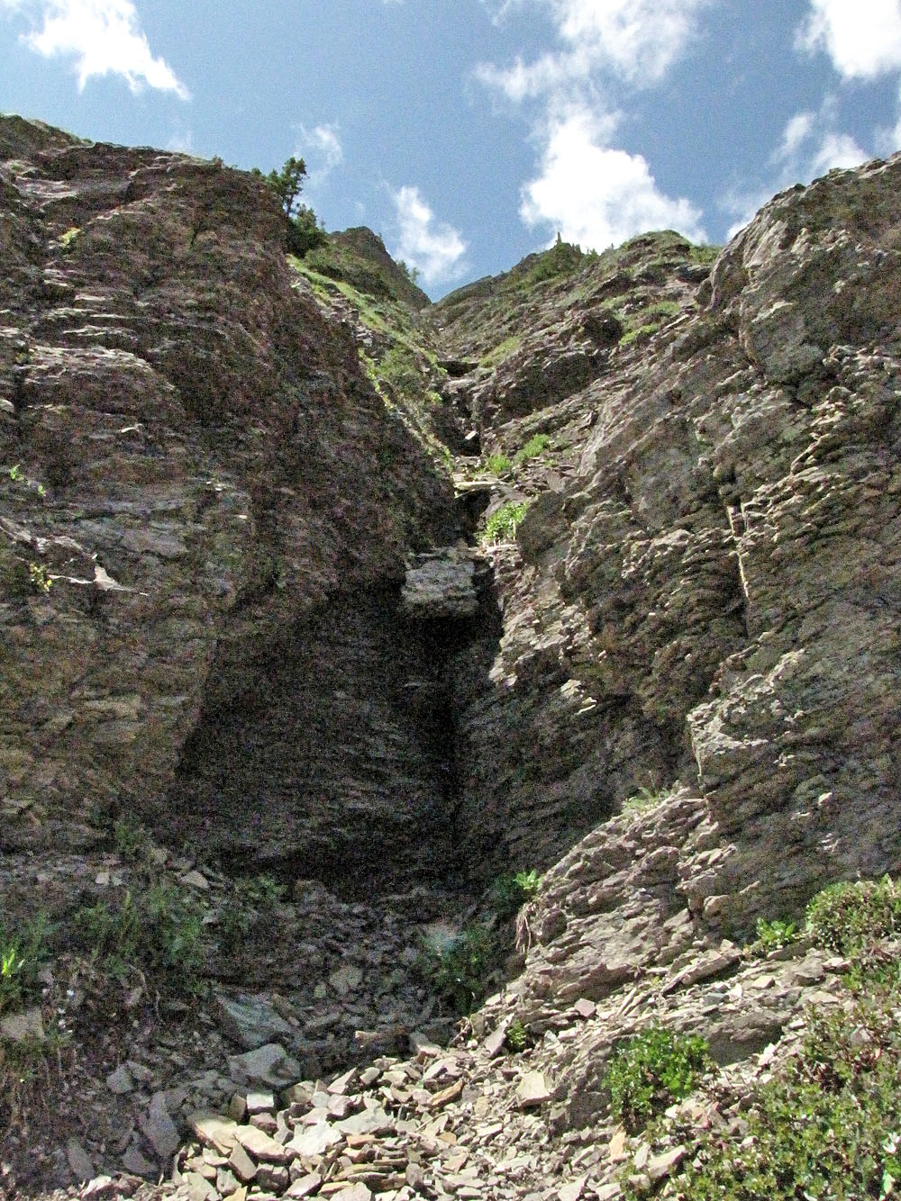
Looking up the nasty-looking gully
Ascending the grassy slope
It's surprisingly steep
Looking back
Heading to the false summit. Upper Rowe Lakes below.
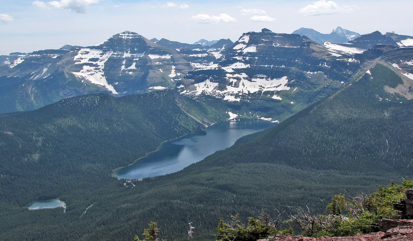
Akamina and Cameron Lakes
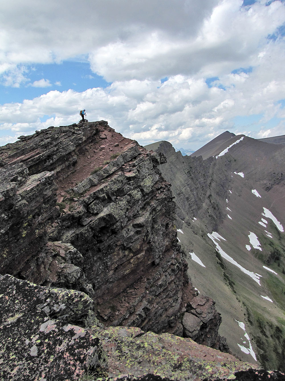
 Climbing to the false summit
Looking back at the false summit while heading to the summit
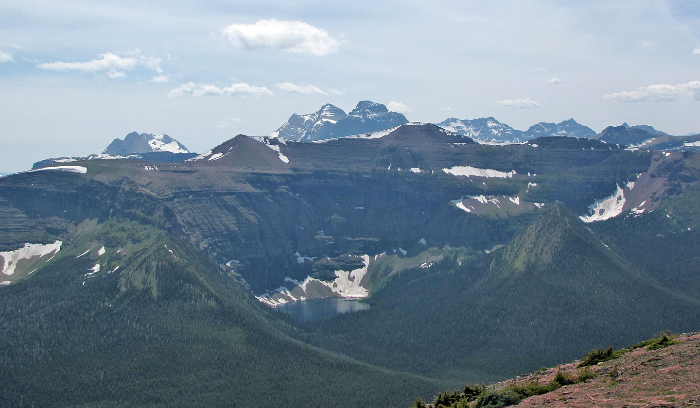
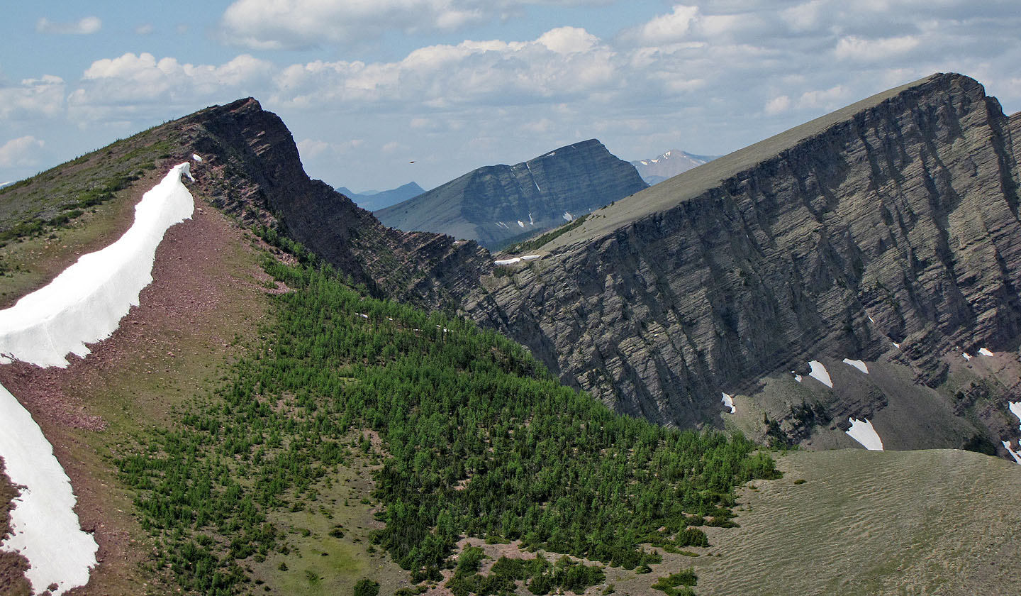
Forum Peak and Akamina Ridge appear above Wall
Lake
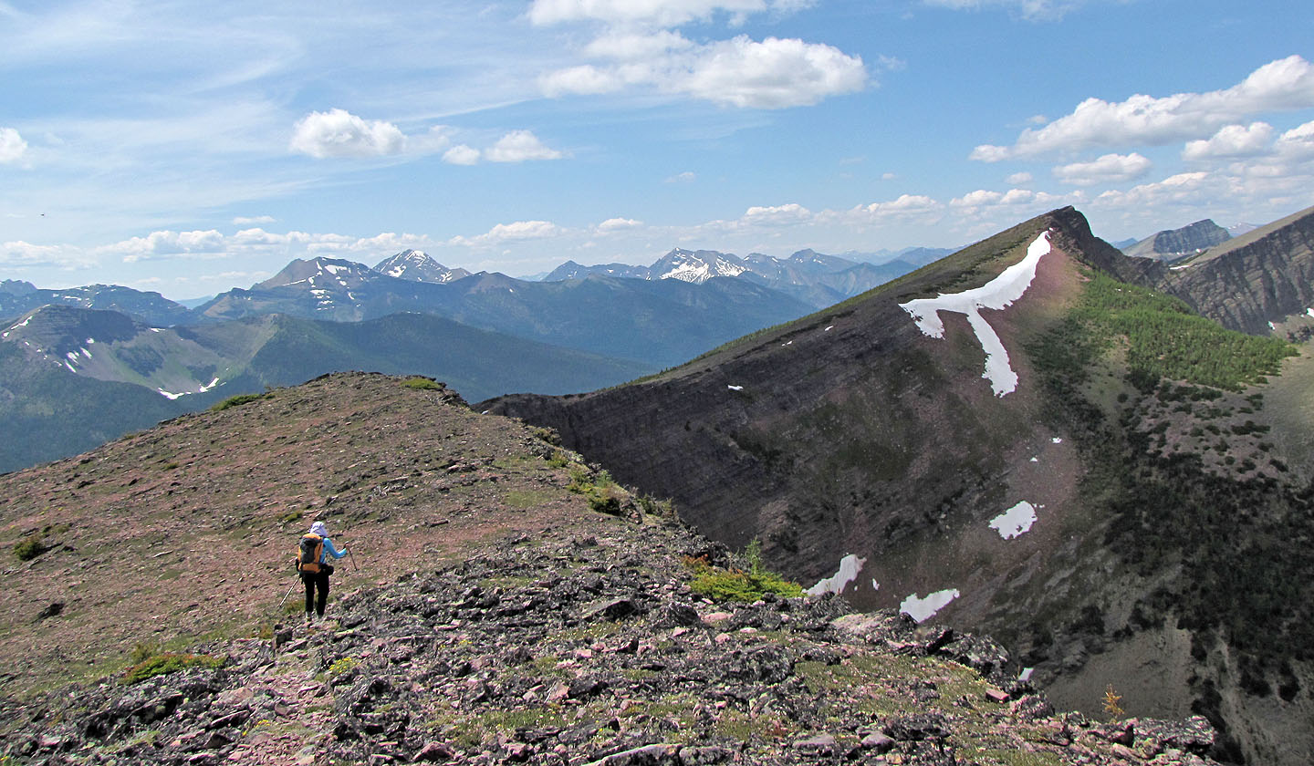
From the summit we headed for the high point
From the high point, we descended the shoulder in the foreground to the Upper Rowe Lakes
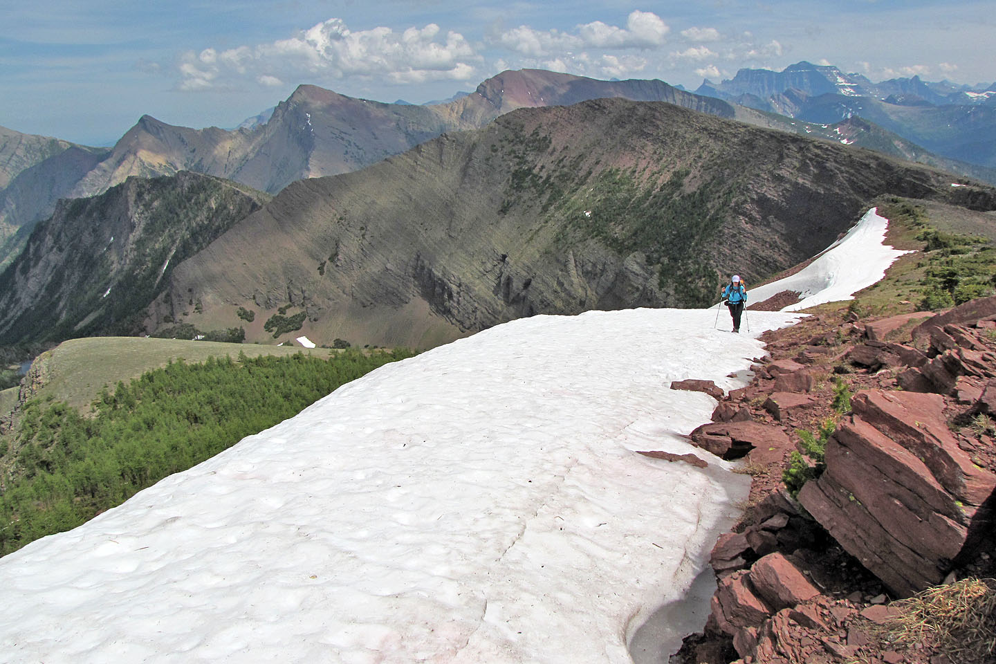
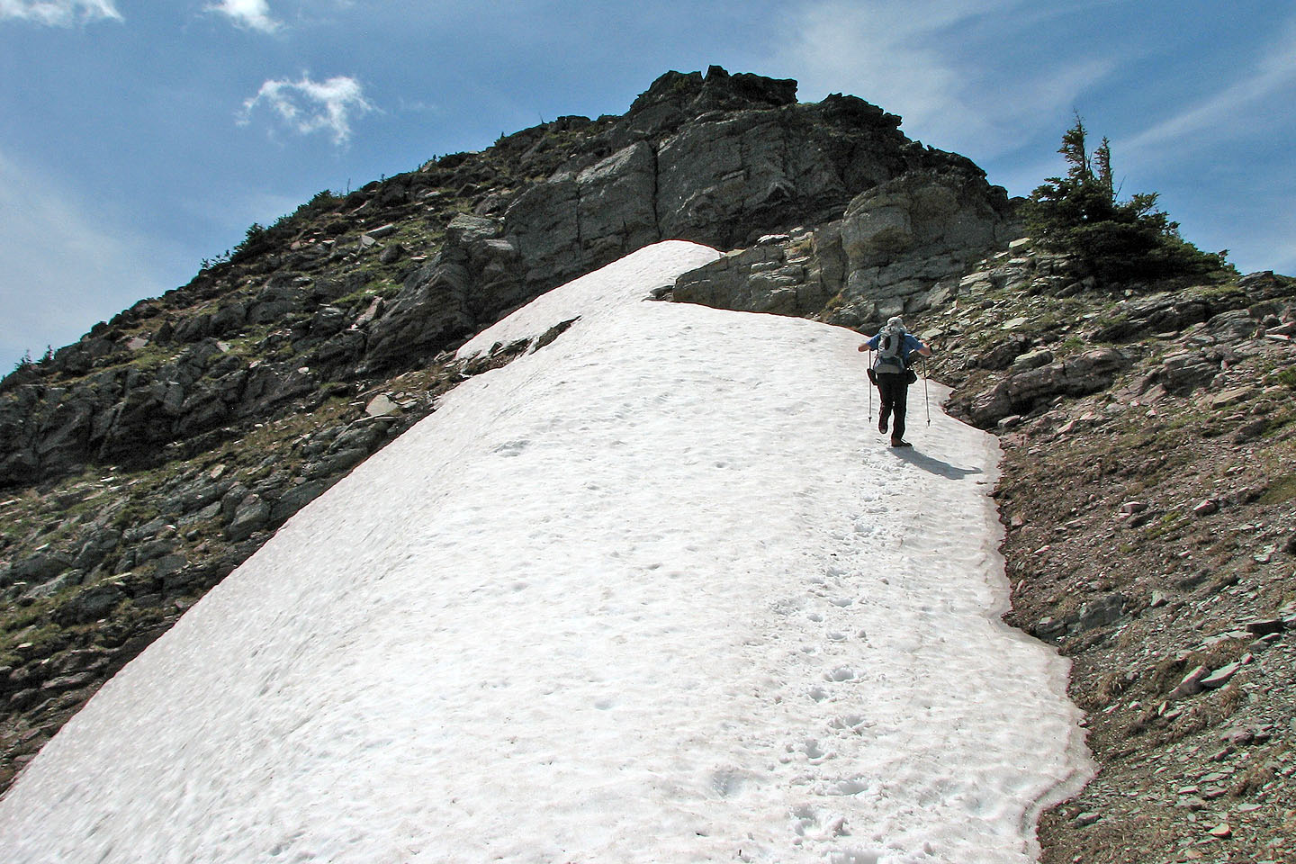
Cruising on firm snow
Dinah on the high point. Mount Festubert on the right.
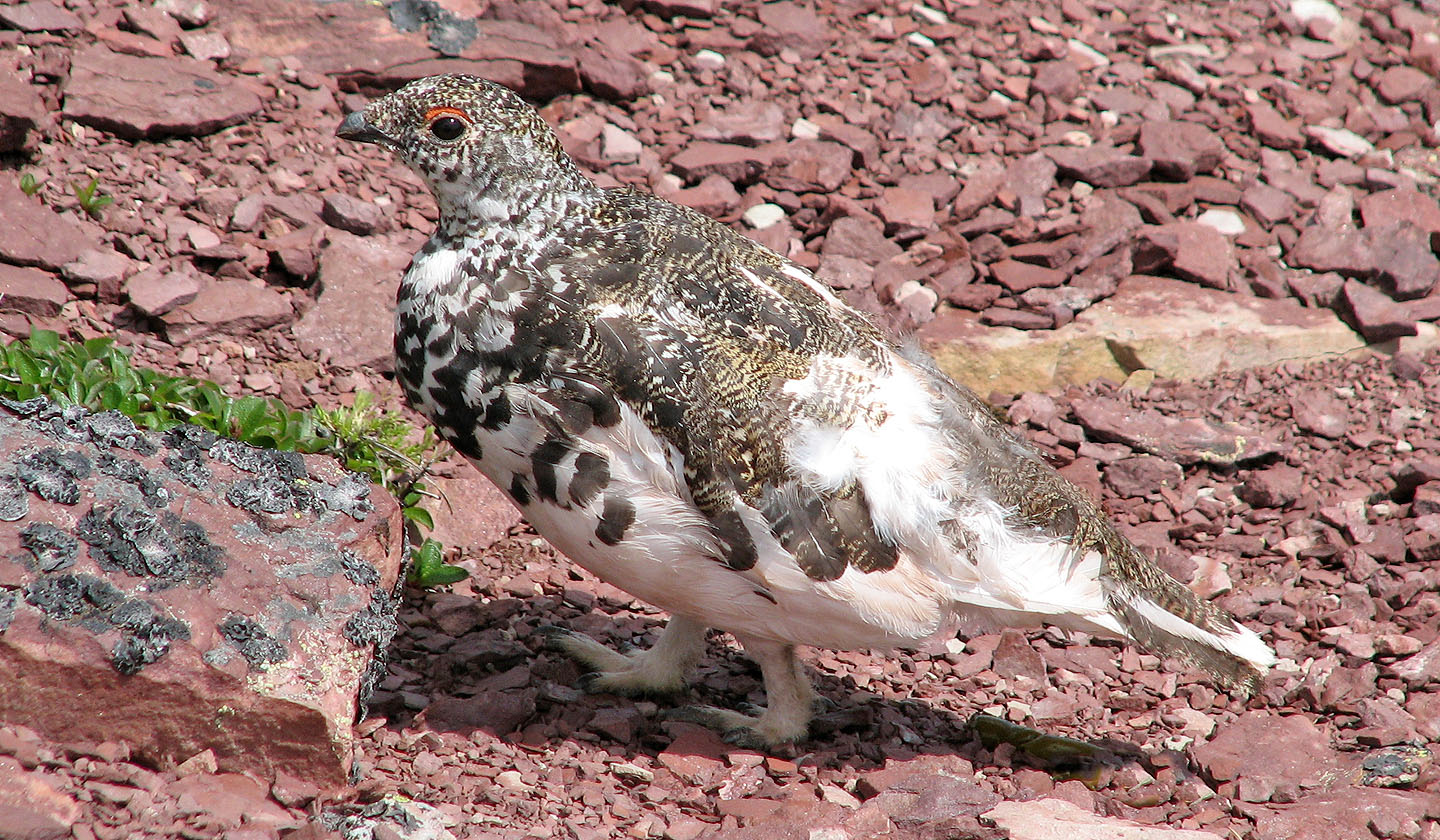
Ptarmigan
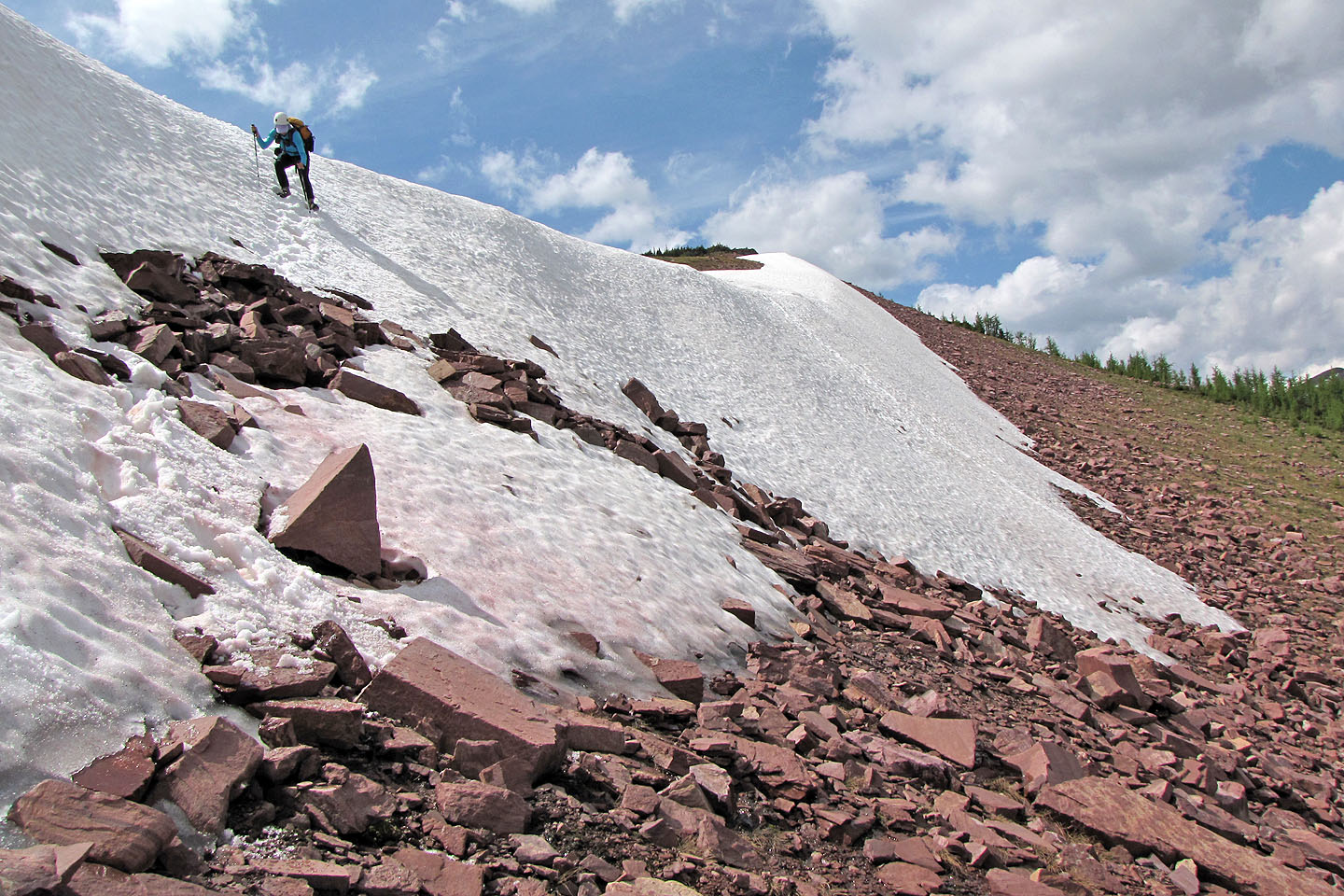
We descended on snow as we headed to the lakes
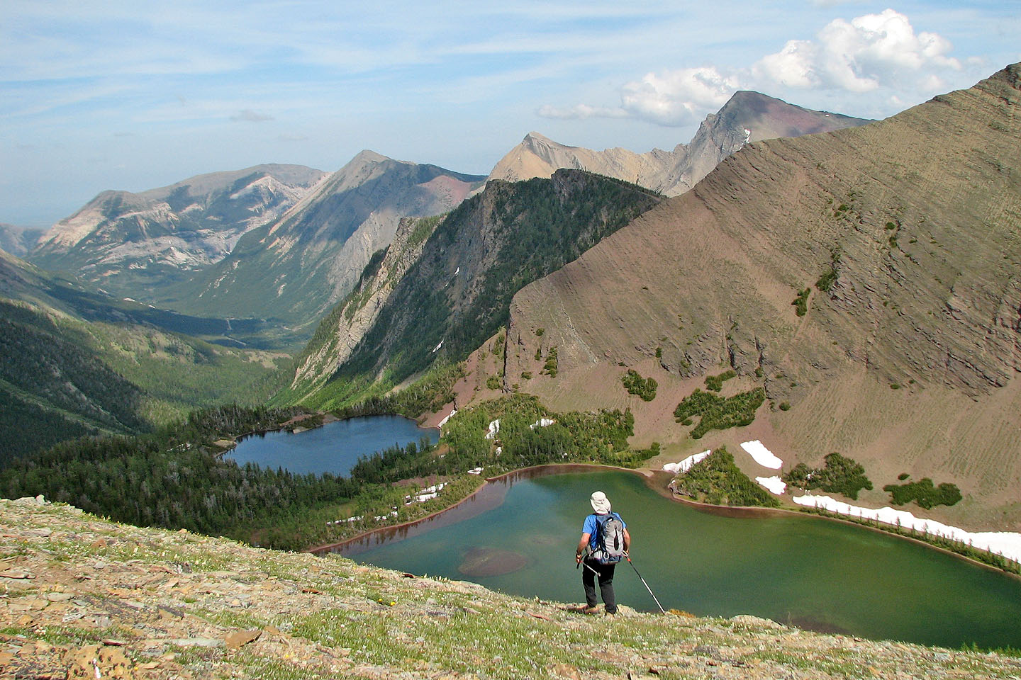
Upper Rowe Lakes: the trail is at the far end of the lake below us
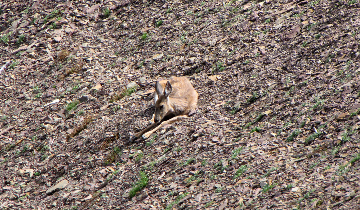
A deer reposes on the trail but soon gets up (mouse over)
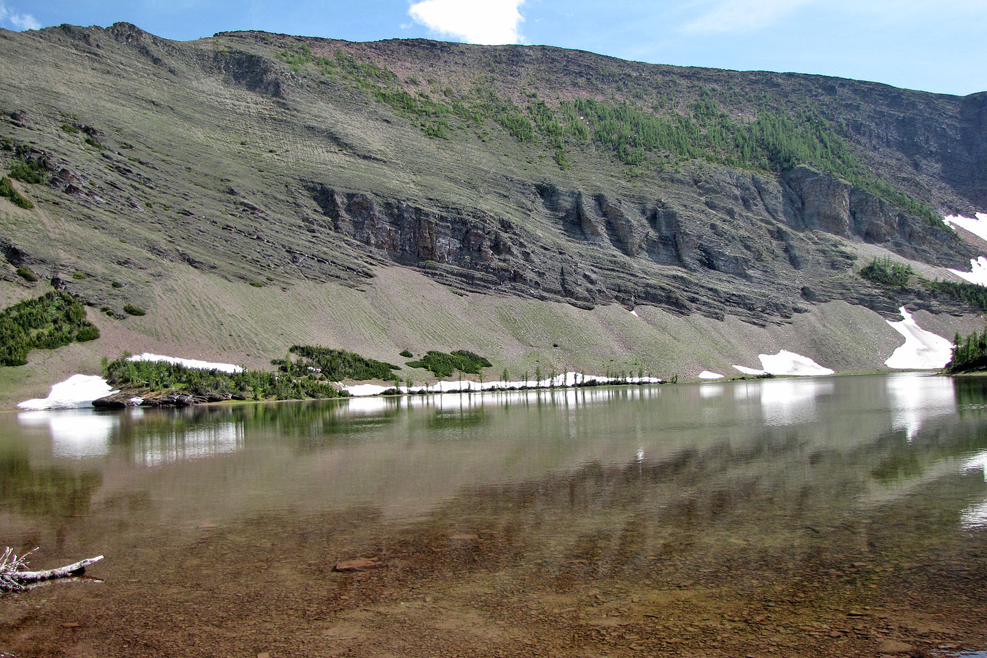
Upper Rowe Lake
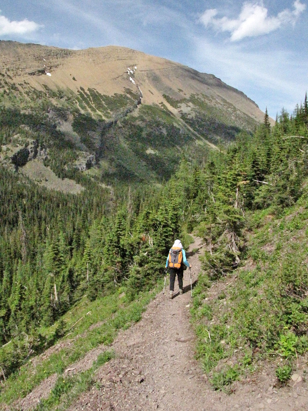
Heading down the trail,
Mount Lineham fills the view
82 G/1 Sage Creek