bobspirko.ca | Home | Canada Trips | US Trips | Hiking | Snowshoeing | MAP | About
Mist Ridge
Kananaskis, Alberta
August 25, 2012
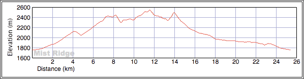
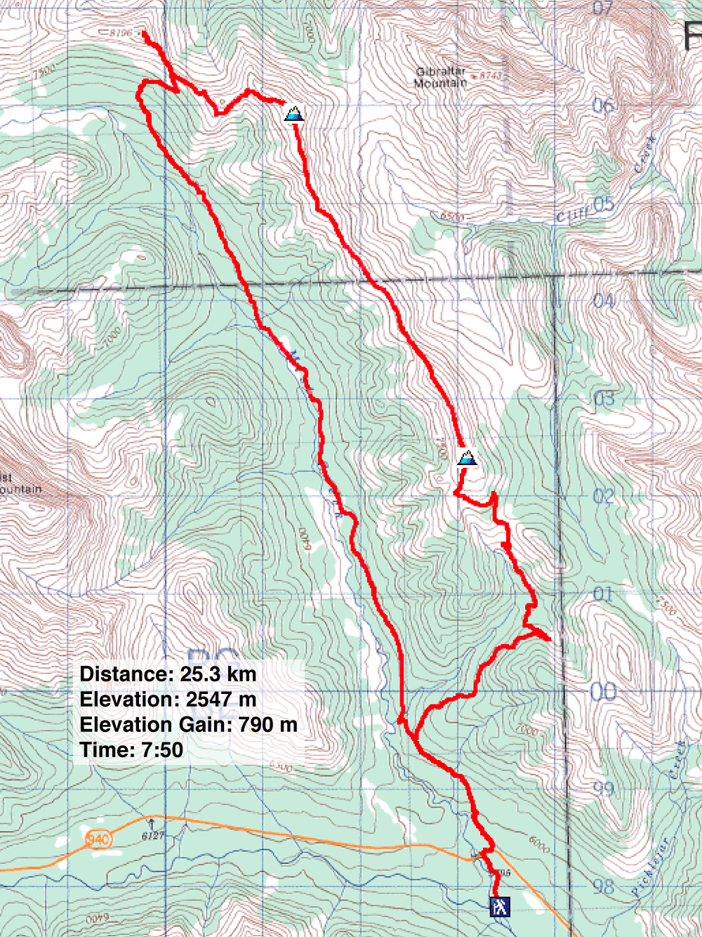
Distance: 25.3 km (15.7 mi)
Cumulative Elevation Gain: 1211 m (3973 ft)
Mist Ridge had been on my bucket list ever since I caught sight of it from the top of Mist Mountain several years ago. The route is simple. Nearly all of it is on a trail, and it can be done as a loop: traverse the ridge north to Rickert's Pass and then return via Mist Creek Trail.
From the trailhead, it took Dinah and me half an hour to reach the fork: left for Mist Creek Trail, right for the south summit of Mist Ridge. The right fork was choked with bushes. It looked like a single track, but further along the bushes receded to expose a road, a road that twists you around, takes you up and down, and does everything but turn you inside out, so when it finally delivers you to its end, you may feel disoriented. But a short hike up the grassy slope on your right puts the north summit dead in your sights and the south summit under your feet. Here Dinah and I met eight members of CORA (Calgary Outdoor Recreation Association) who were also traversing Mist Ridge. After introductions and a short conversation, Dinah and I pushed on to the north summit.
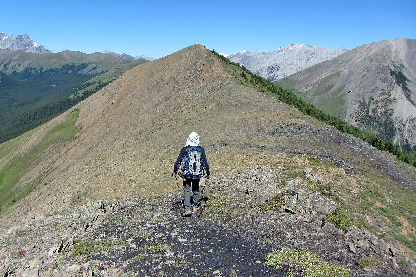
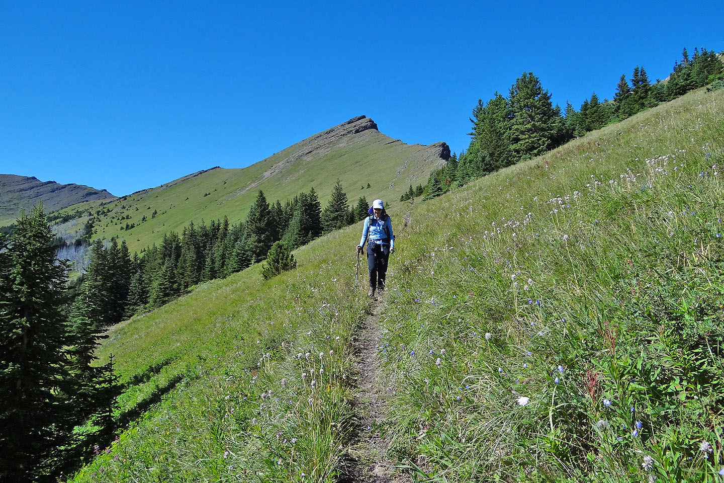
The next four kilometres would satisfy anyone's idea of an enjoyable ridgewalk, except perhaps a hardcore scrambler: there is no scrambling. You're taken up and down a gently undulating ridge while peaks on either side roll by. At first we were lulled into staying on the trail beaten into the left slope, but when we spotted bighorn sheep above us, we headed to the crest. After snapping photos of the sheep, we continued to the north summit. After summiting, we dropped down to a sheep track and followed it to Rickert's Pass.
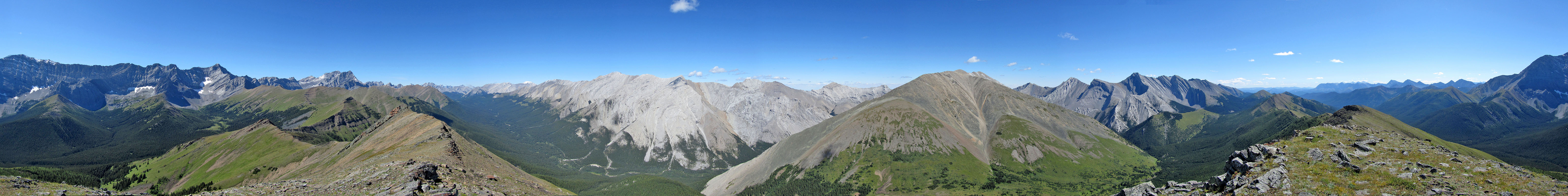
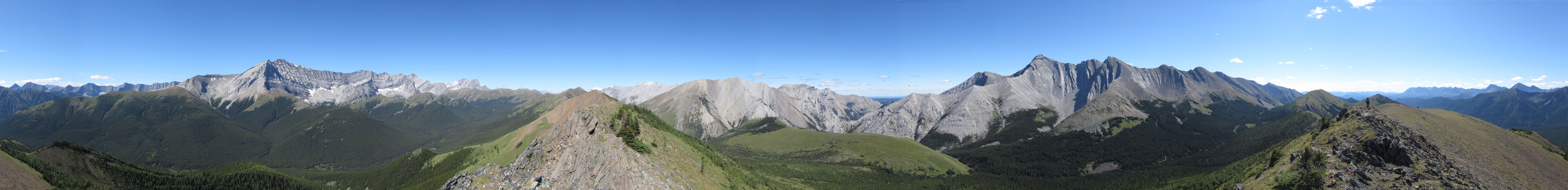
With the sun blazing down from blue skies, it seemed a shame just yet to drop down into the gloom of the forest and follow Mist Creek trail back. Instead, we turned to a small peak (497067) west of the pass; it was the east end of Storm Ridge which extends from Storm Mountain. We hiked up, scrambled easily over rock ledges, and reached the summit. At 2498 m, only 50 m lower than Mist Ridge, we could not only take in Mist Ridge but a large section of Sheep River Valley as well.
Then we faced the ordeal we dreaded: the 10 km hike down Mist Creek Trail. We tried to make a quick time of it, but after finding bear scat bright red with berries, and so fresh it was still glistening wet, we were forced to be circumspect. We hollered as we went but never did catch sight of the animal.
After the trip, I was surprised to see the height gain was only 790 m, a figure in keeping with the map contours but much less than the guidebook's 1020 m. But I can throw in another number, 1330 m, the total elevation gain displayed on my GPS, but that included the little peak we climbed. But the numbers matter little. What's important is that we enjoyed our walk along Mist Ridge.
The road to the south summit leads to the switchbacks on the open slope, but not before losing
80 m of
elevation
South Mist Hills in the background
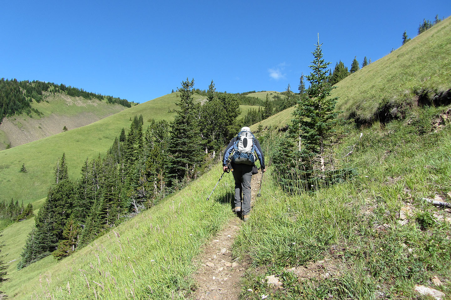
On the switchbacks
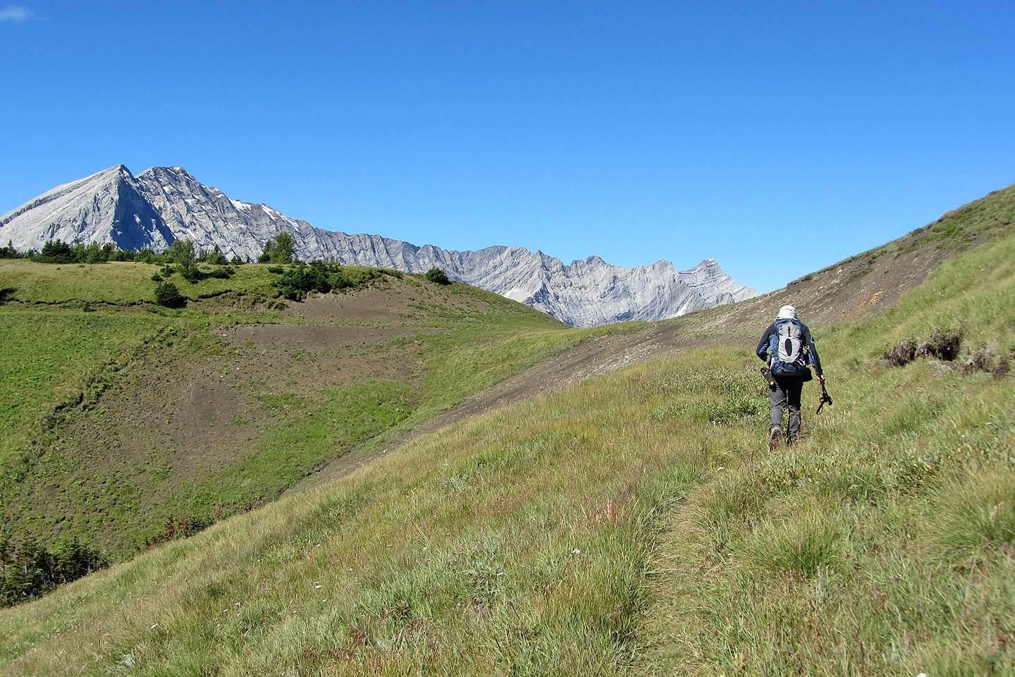
The road ends here, and we walked up the slope on our right to the south summit
View from the south summit
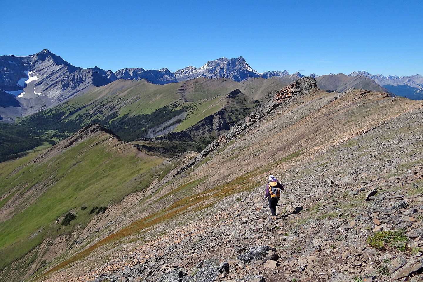
Heading to the next bump on the ridge
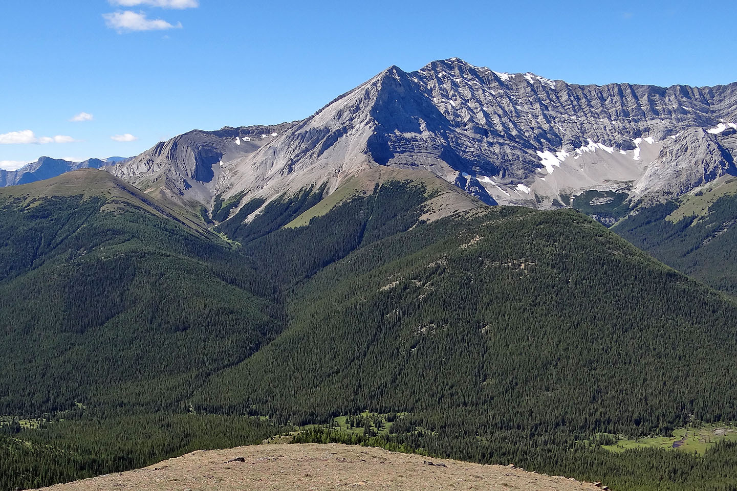
Mist Mountain fills the centre. Nameless Ridge is the green bump on the left.
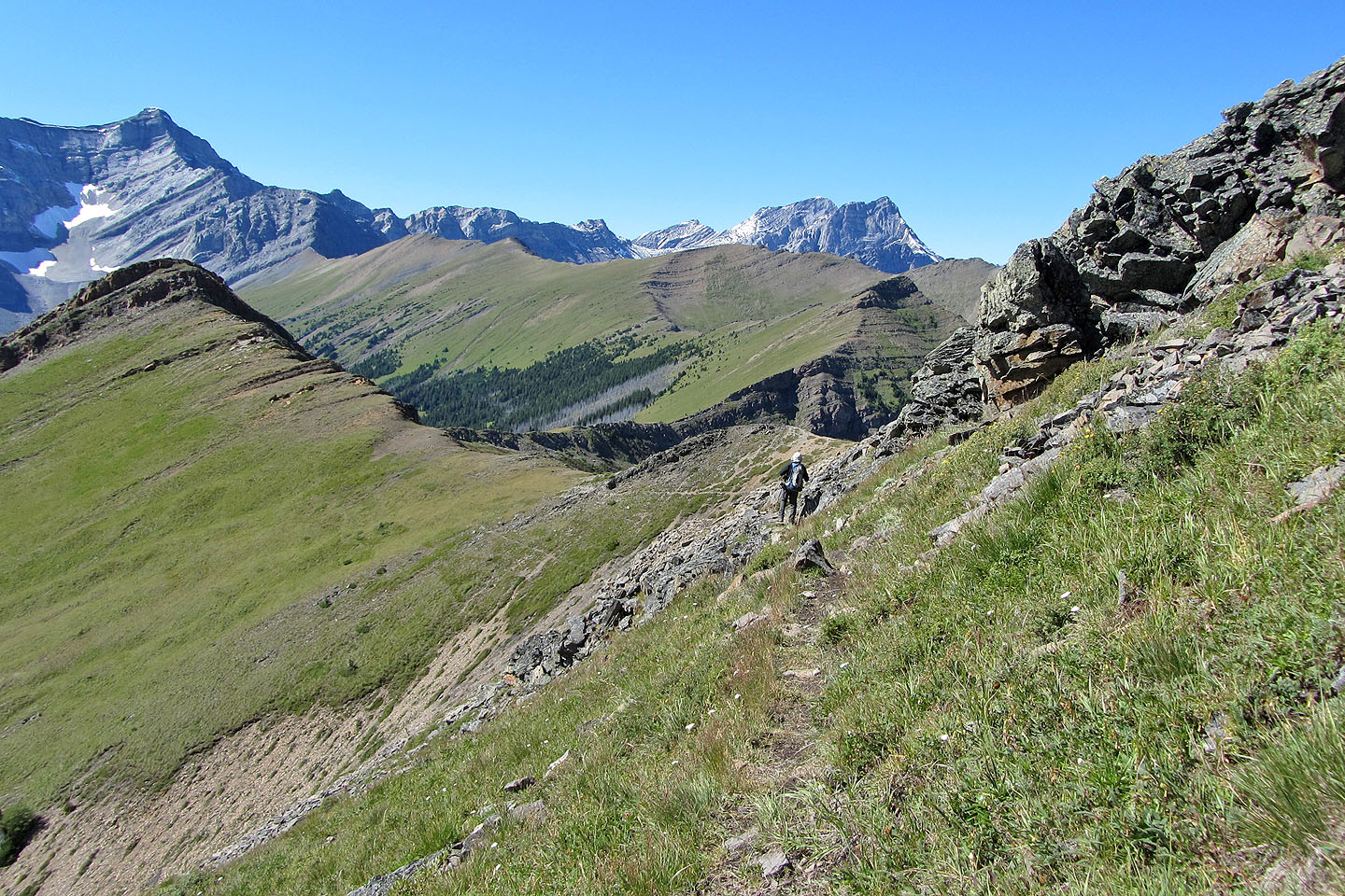
Those looking for more exercise will appreciate the 100 m drop here
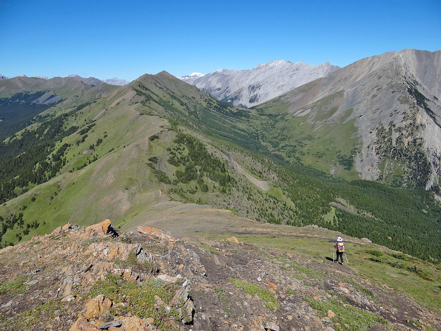
We reached the bottom just as the CORA group tagged the high point behind us (mouse over)
Looking back along the ridge. Below us are a couple of wary bighorn sheep (mouse over)
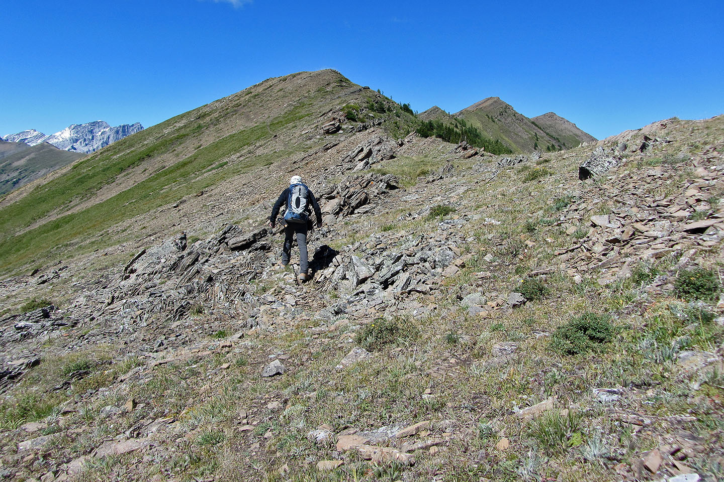
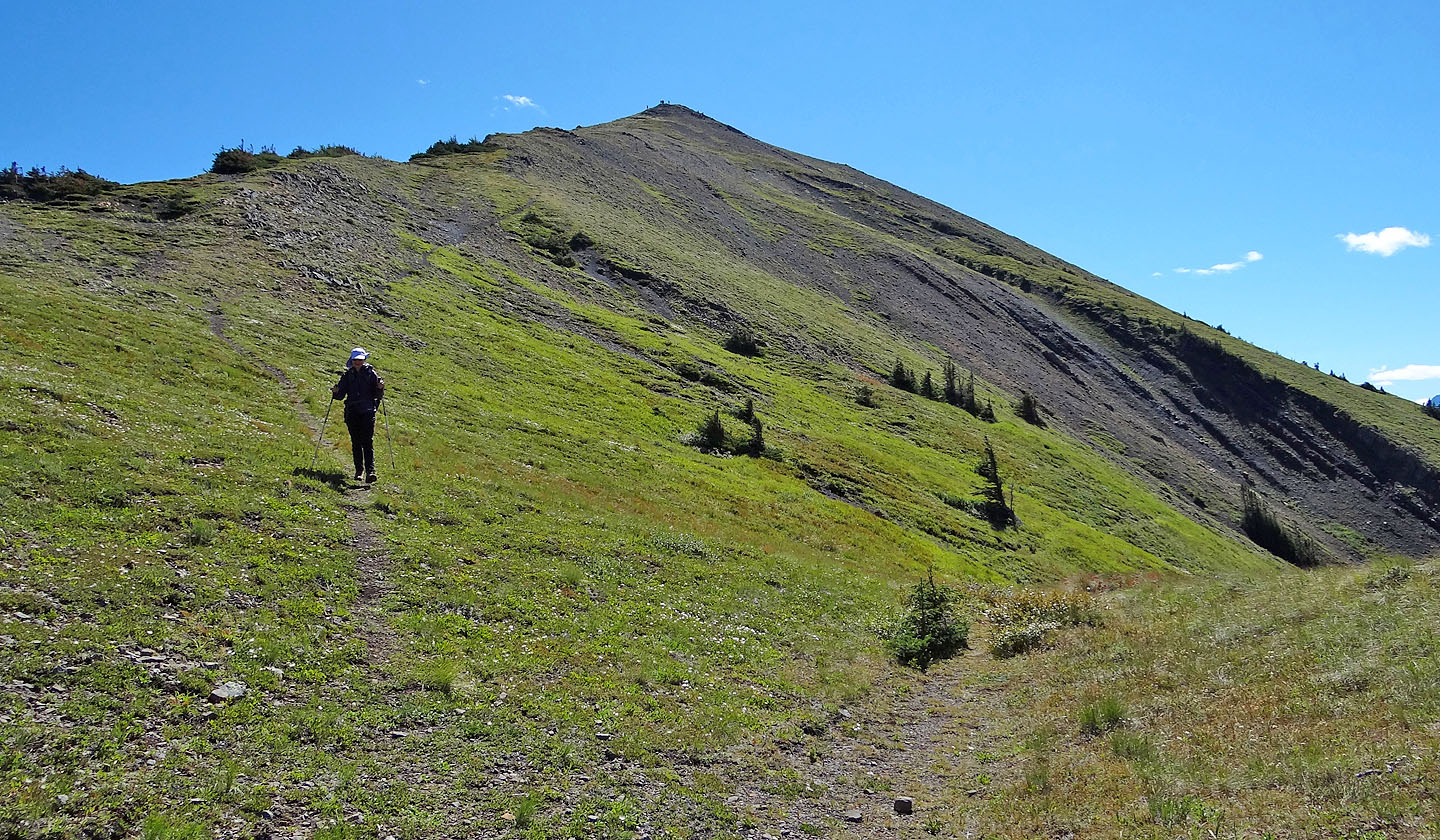
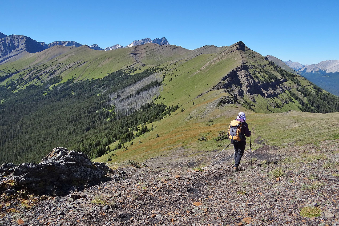
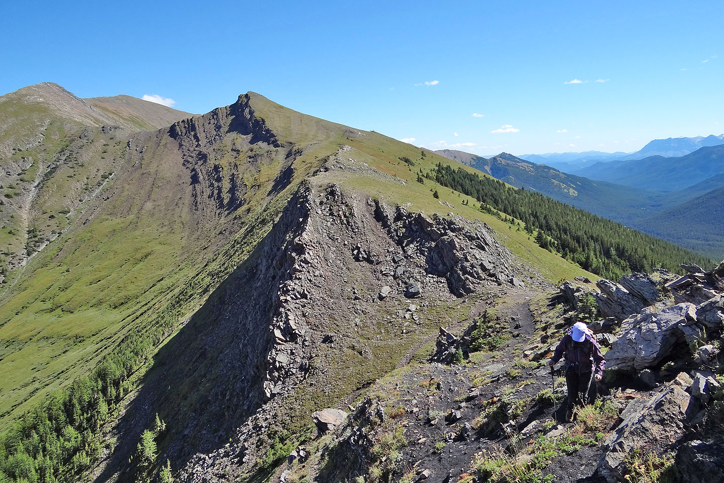
A few more false summits remain
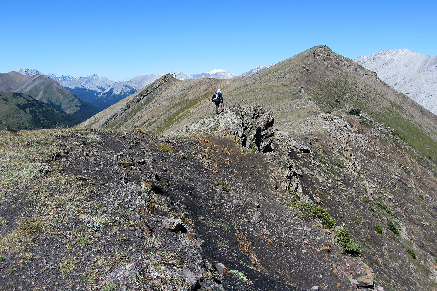
On the last false summit, the true summit lies ahead (mouse over to look back)
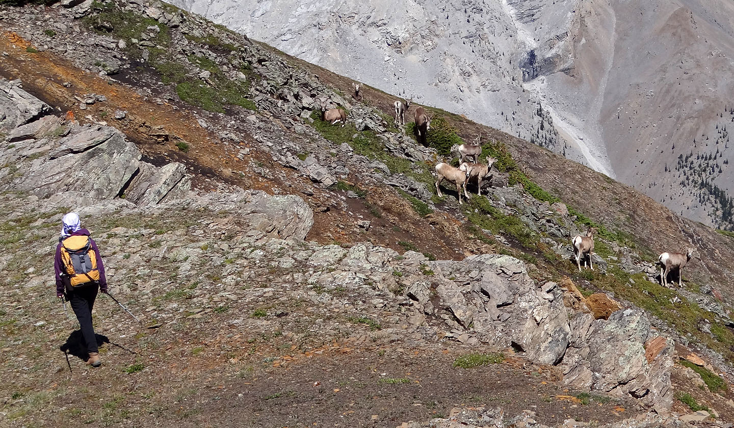
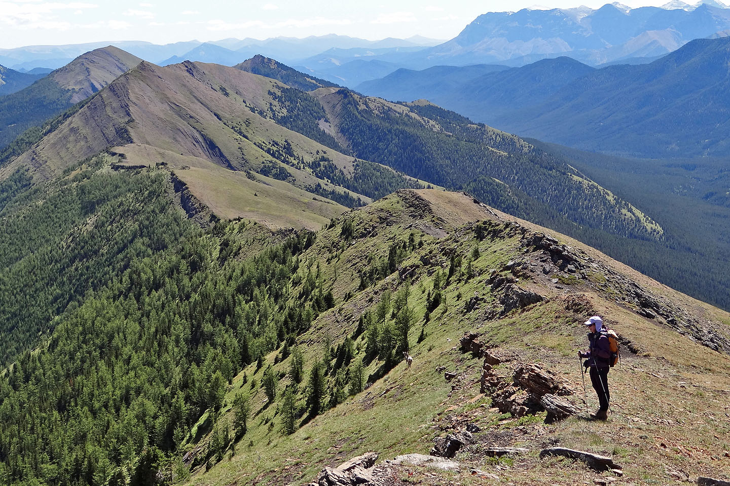
Dinah passes a herd of bighorn
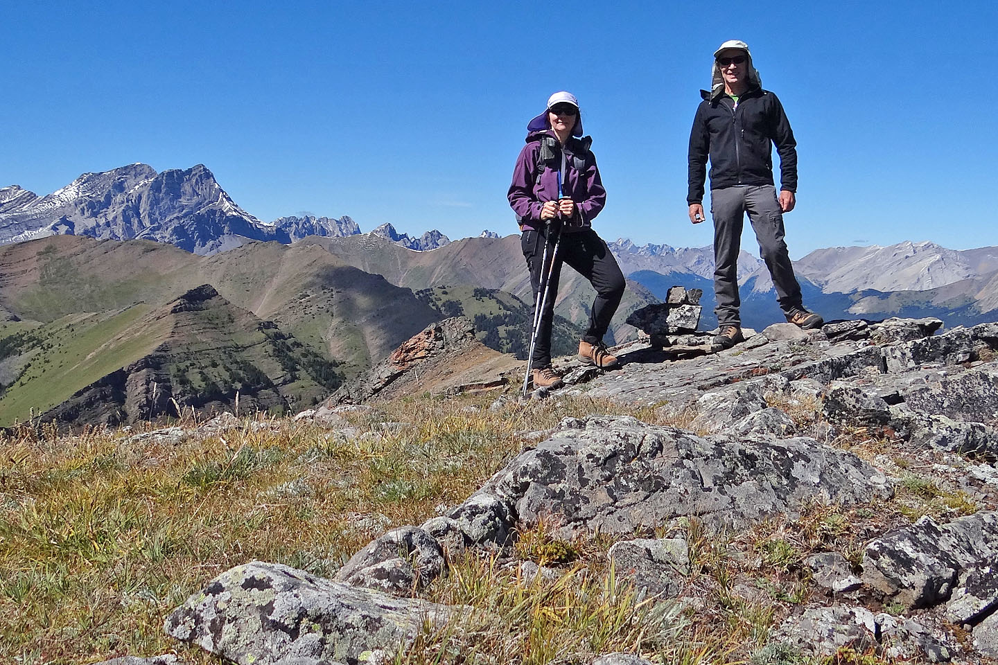
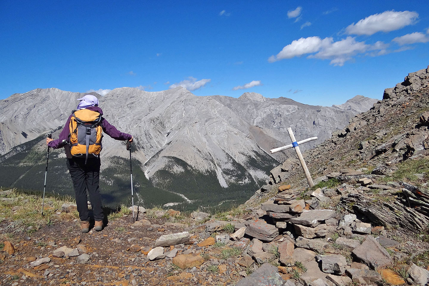
On the north summit
From the summit, we dropped down to a sheep track that cuts below the rock band ahead
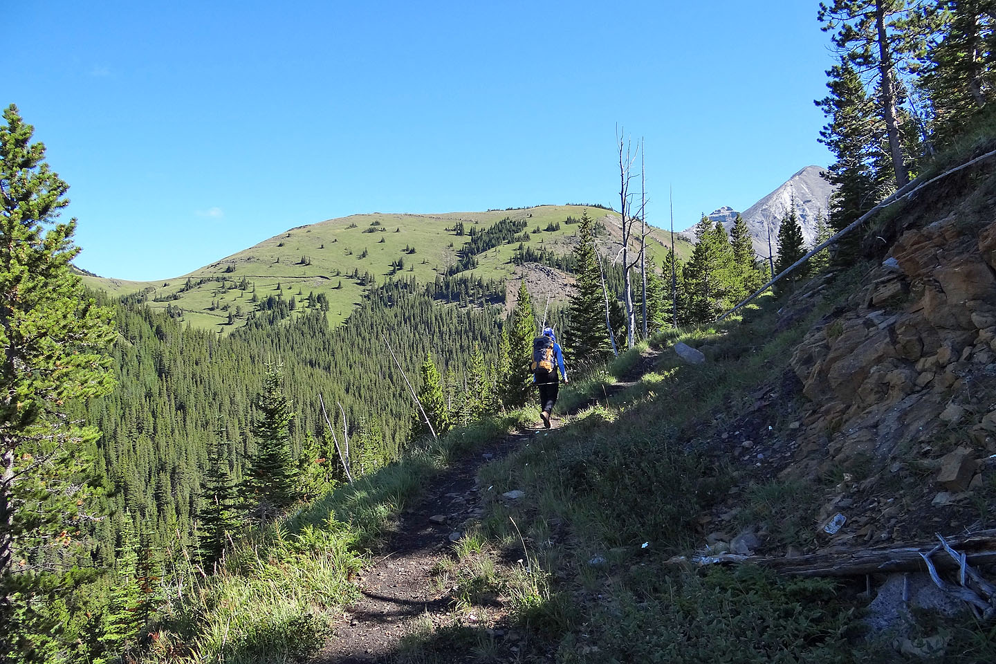
The trail leads to the track cutting across the green slope on the left
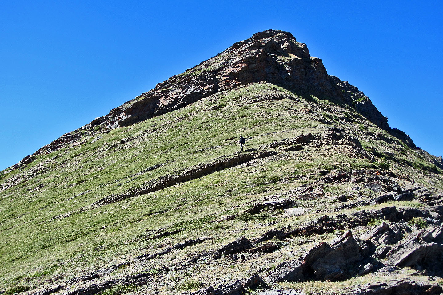
The small peak we ascended, 497067, lies ahead and rises 160 m above Rickert's Pass
Rickert's Pass
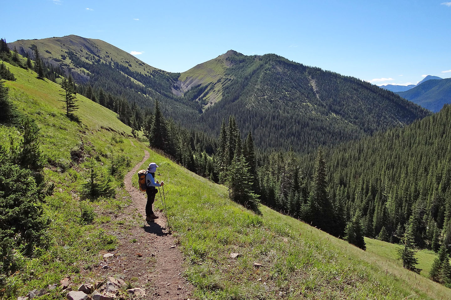
As we started up from the pass, the scenery behind us unfolded
The rock bands are easily climbed by skirting left
Looking down at the pass
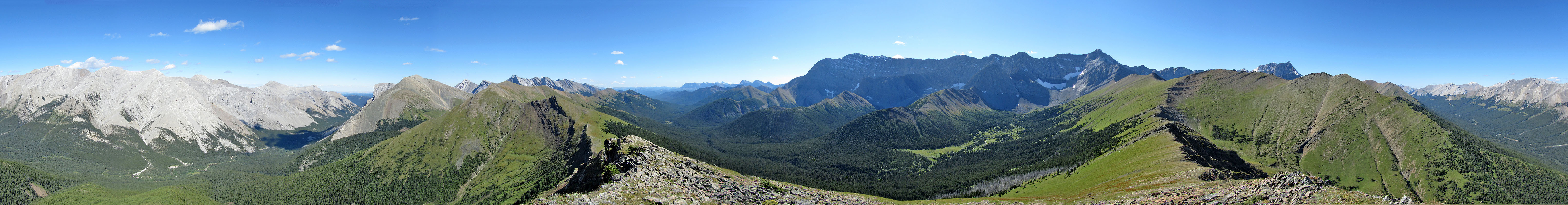
Panorama from the east end of Storm Ridge
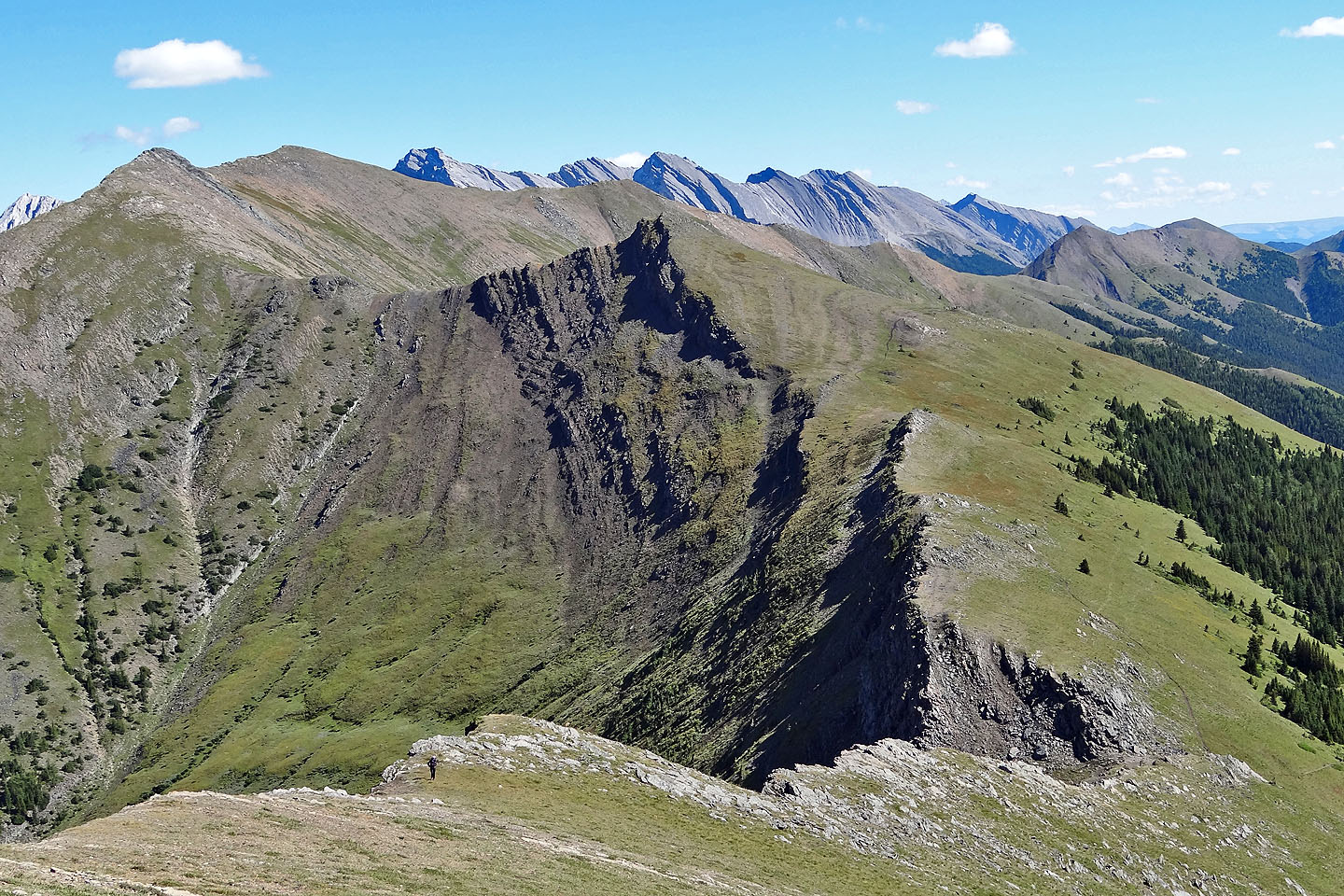
Looking back at the little peak we climbed
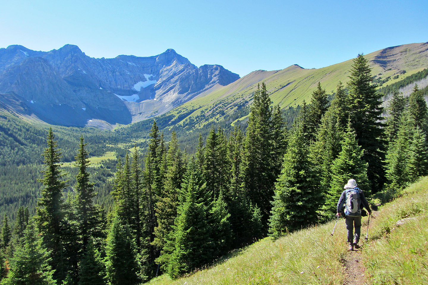
Starting down Mist Creek trail from the pass. Storm Mountain (centre) rises above Misty Basin.
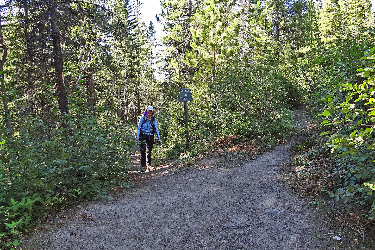
Back at the junction
82 J/10 Mount Rae