bobspirko.ca | Home | Canada Trips | US Trips | Hiking | Snowshoeing | MAP | About
Mount Brett
Banff National Park, Alberta
August 3, 2005
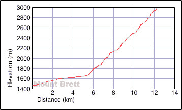
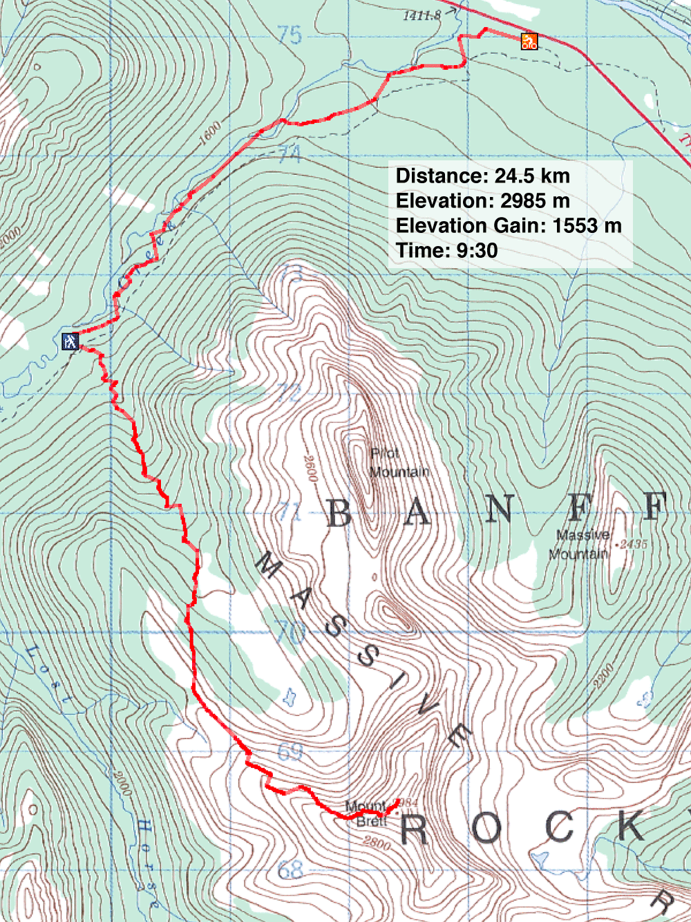
Distance: 24.5 km (15.2 mi)
Cumulative Elevation Gain: 1600 m (5249 ft)
Mount Brett wasn't just another "difficult" Kane scramble, but rather the most difficult of the 19 difficult scrambles I've done so far. Saying the ridge crest has "sections of interesting scrambling" is an understatement. For Andrew Nugara who suggested we climb Brett, it was his second most difficult, after Mount Smuts.
I wasn't mentally physically or mentally prepared for what lay ahead. I hadn't yet recovered from my last two lengthy trips, and my intensive peak bagging in the last three and a half weeks had left me eight pounds lighter. But the draw to do another peak in superb weather got the better of me.
Andrew and I cycled 11.2 km up Redearth fire road to the drainage system we needed to ascend. Actually we cycled slightly past it, so we decided to angle towards the drainage. Finding the drainage was more difficult than we anticipated, and we ended up bushwhacking longer than was necessary.
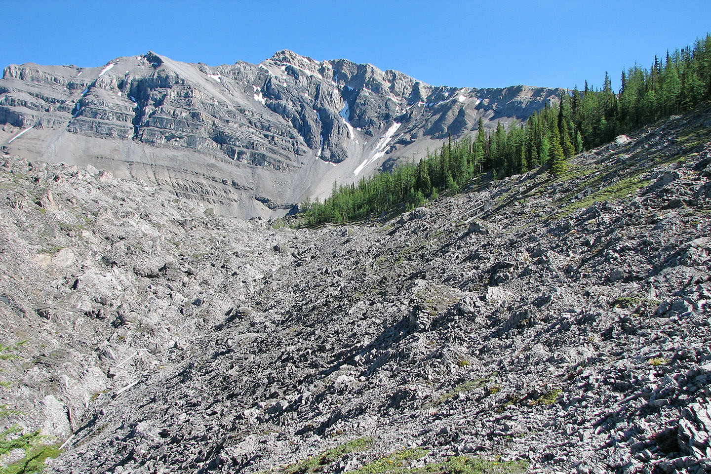
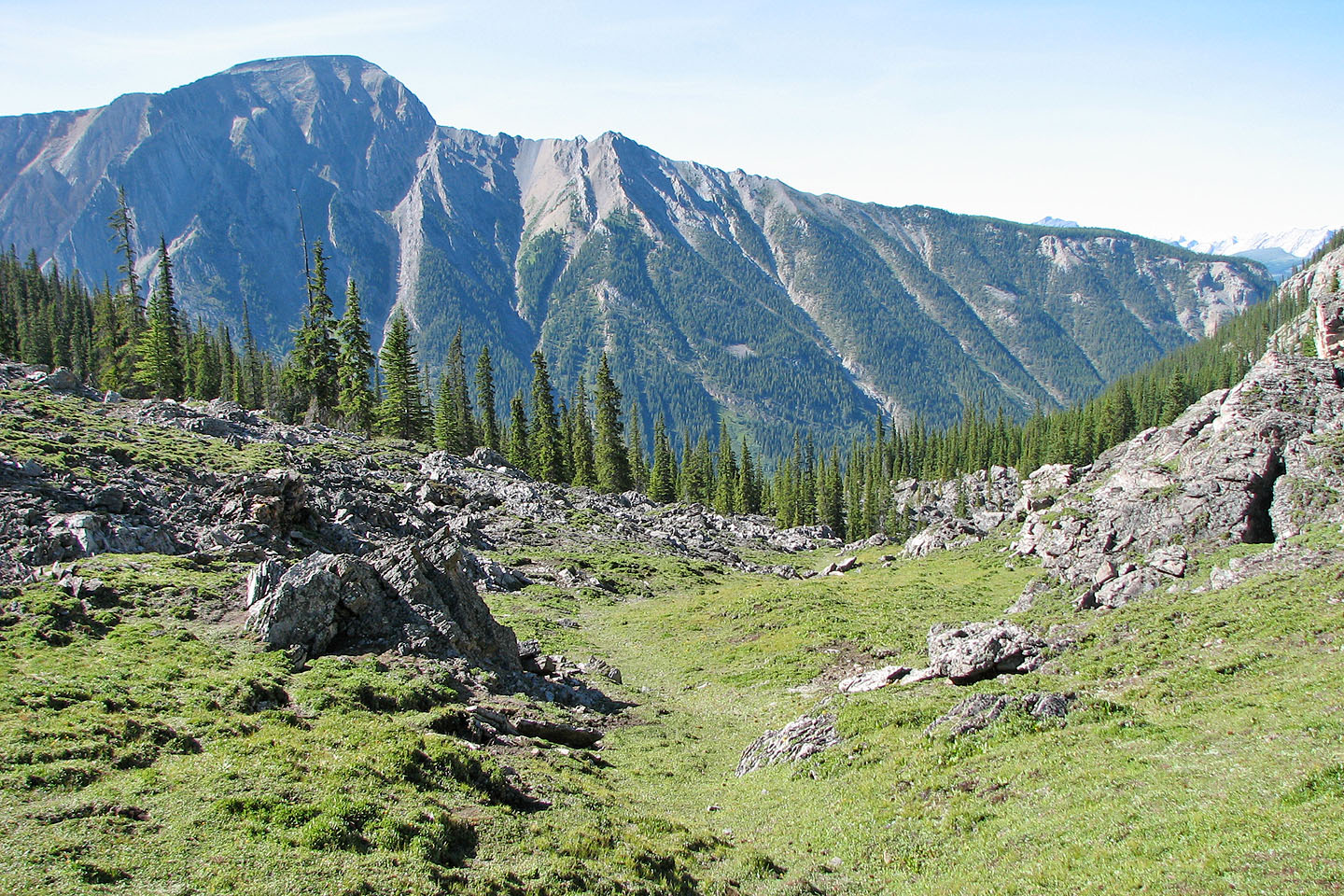
Eventually we reached the hanging valley with its mixed bag of chunky rocks and thin vegetation. We travelled well up the valley before leaving it to ascend the larch-covered slopes on our right. This put us on the long, curving, treeless ridge that runs to the summit.
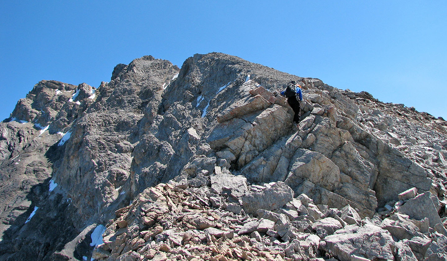
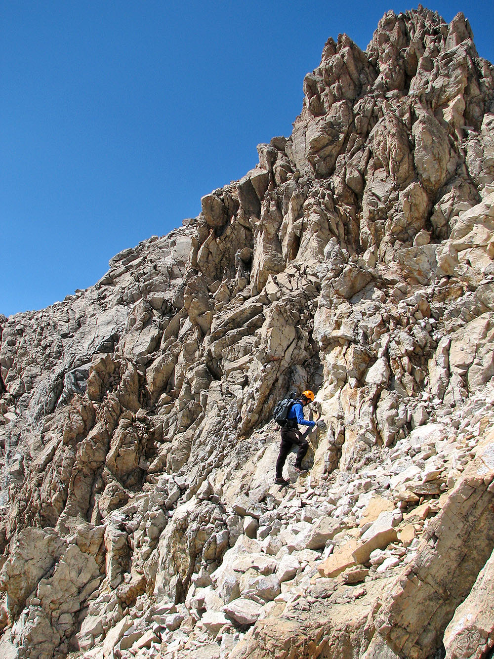
The higher we climbed up the ridge, the more craggy it became. We put away our poles and started grabbing handholds. The rest of the ascent would be mostly hands-on climbing. None of the ridge scared me off, but the sustained scrambling effort took me by surprise. We had to continually route-find and scramble along its length. There were a few sections where the ridge wasn't demanding or exposed. The steep sides of the ridge restricted us to scramble along the crest.
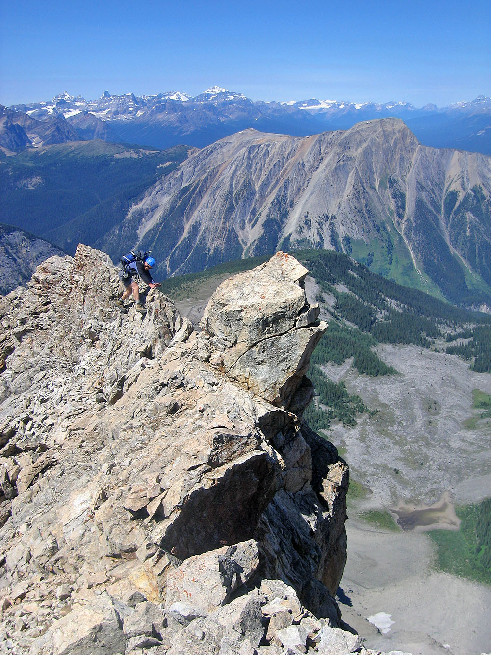
We took the difficulties in stride until we came to the second crux, a downclimb with a considerable drop. I went over the top while Andrew searched for a way on the side. I climbed down a short way, but there seemed no easy way to reach the bottom. I climbed back up to see if Andrew fared better with a side descent.
At this point we changed places. Andrew decided to go over the top while I tried the side descent. The side descent was less exposed and easier, although it still required care. In a short time, I reached the bottom and waited while Andrew descended the over-the-top route.
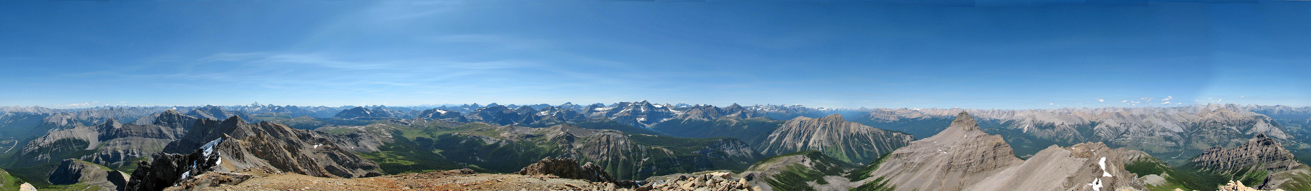
With the second crux behind us, it was only about a 5-10 minute hike to the summit. It was a beautiful day, so we enjoyed spending half an hour on top. Visibility was excellent. We could see Mount Chephren 98 km to the north as well as Mount Joffrey 83 km to the southeast.
While ascending the ridge, I had noted the descent route on the rubbly, undulating west slopes below us. The route didn't appear inviting or direct, so Andrew and I returned the same way on the ridge crest. Now that I knew what to expect, I didn't mind scrambling back down. In retrospect, there is some thrilling scrambling on this ridge!
The rest of the trip was uneventful. We saved time by following an animal trail that angled down towards the valley bottom. Unlike our ascent, we closely followed the drainage system to a point where it petered out above the fire road. Andrew used his GPS to guide us back to our bikes. From there, it was a blast riding down the trail!
Pilot Mountain and Mount Brett from Copper Mountain
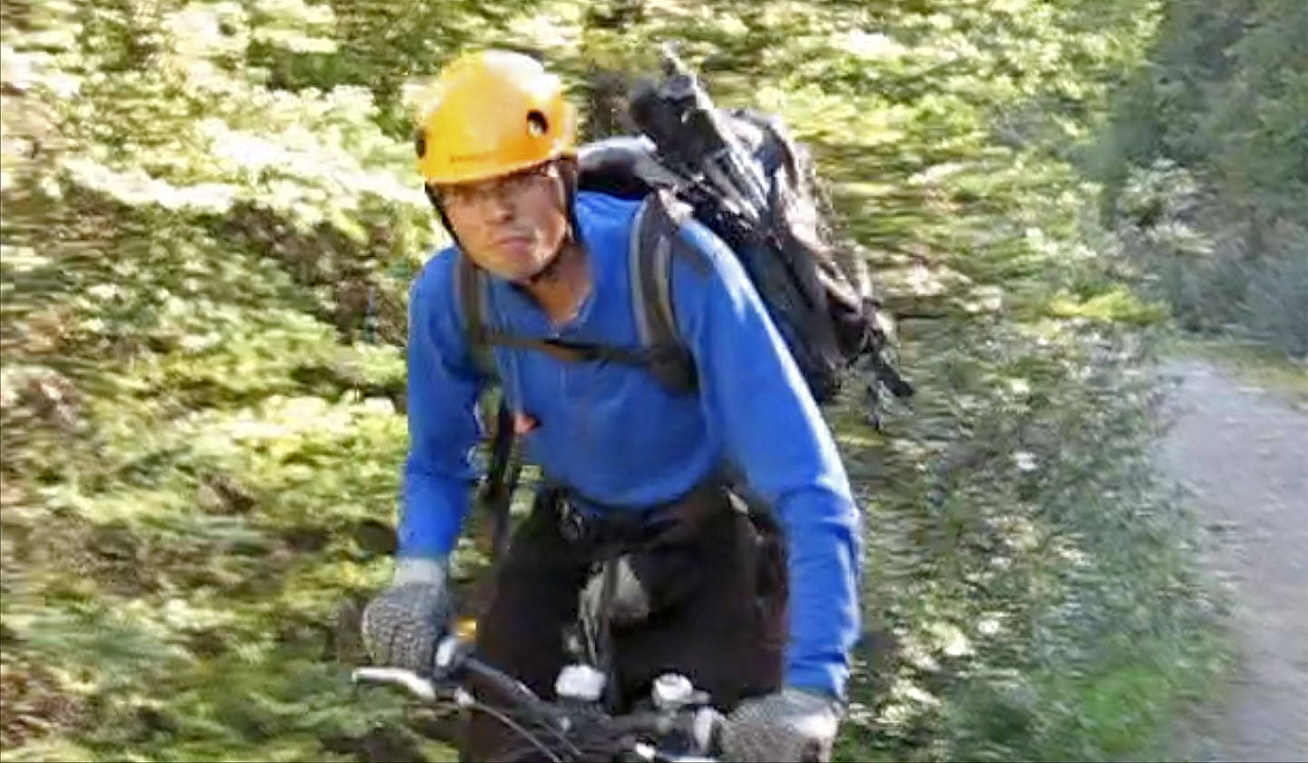
Andrew on his bike
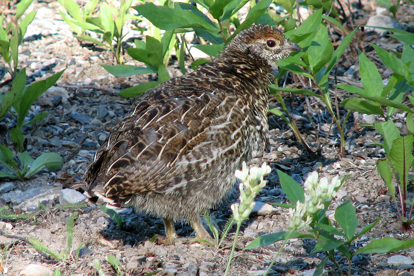
While biking up the Red Earth Creek trail we came across a grouse family including this chick
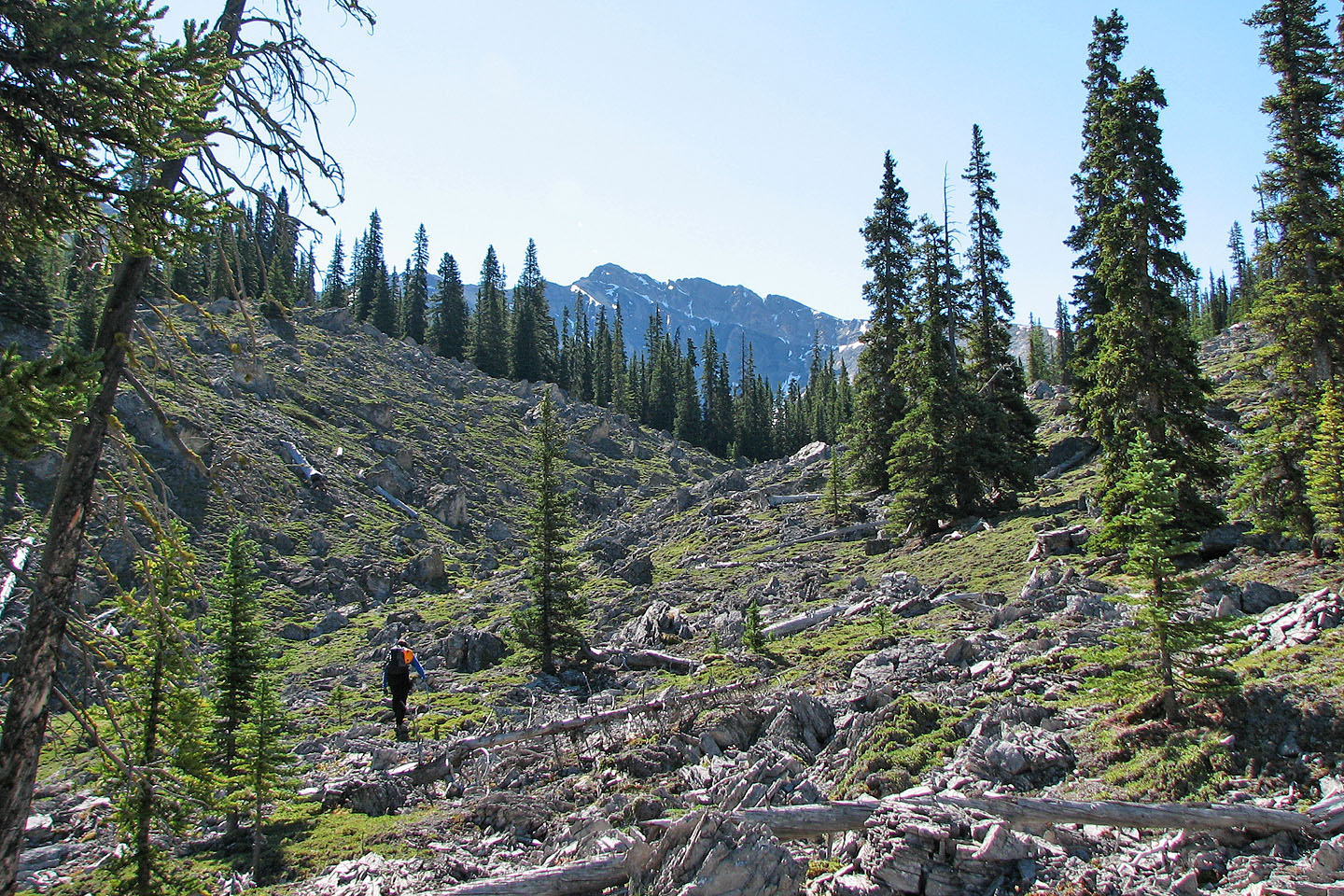
Mount Brett appears far from the rocky drainage
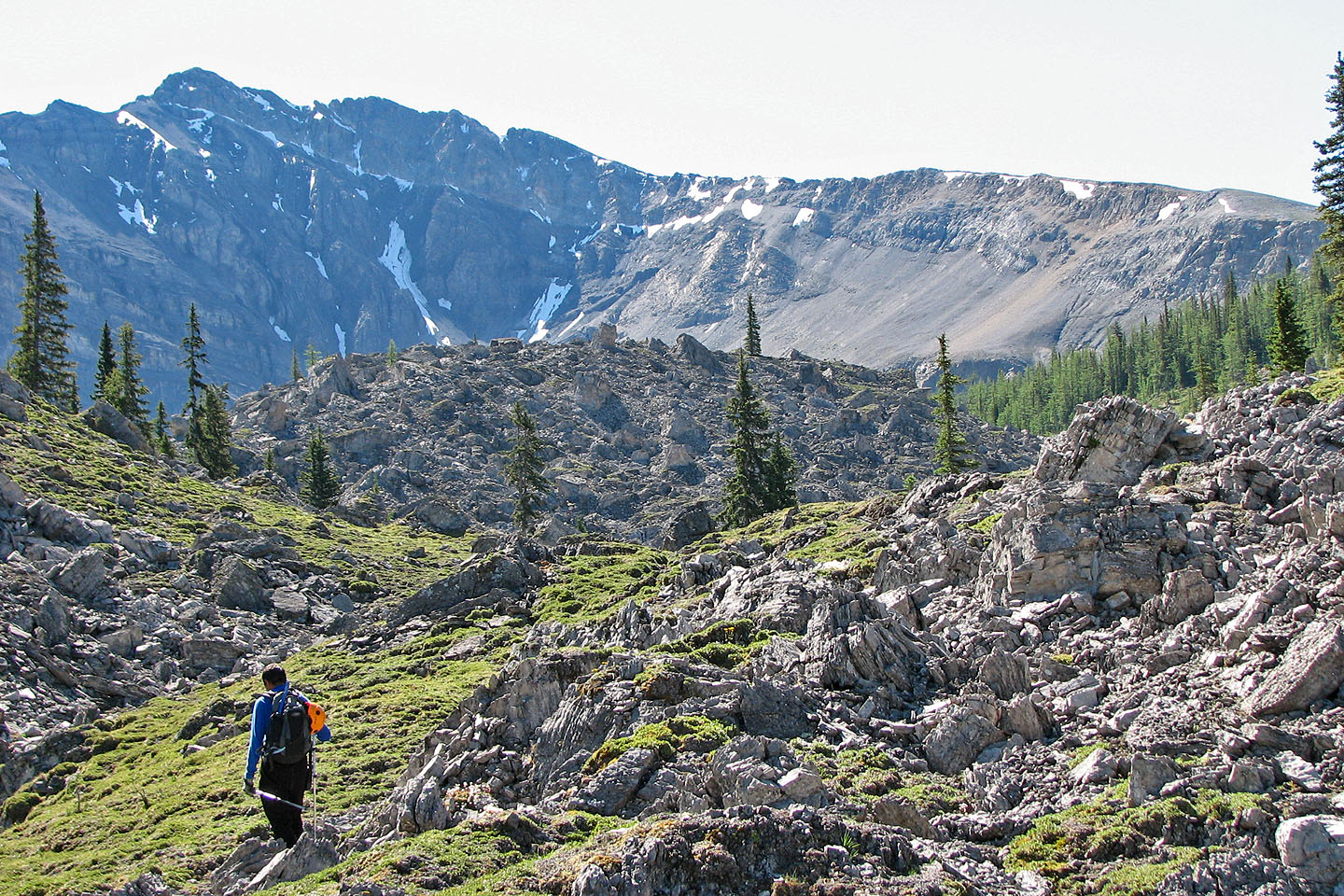
Brett looks much closer now
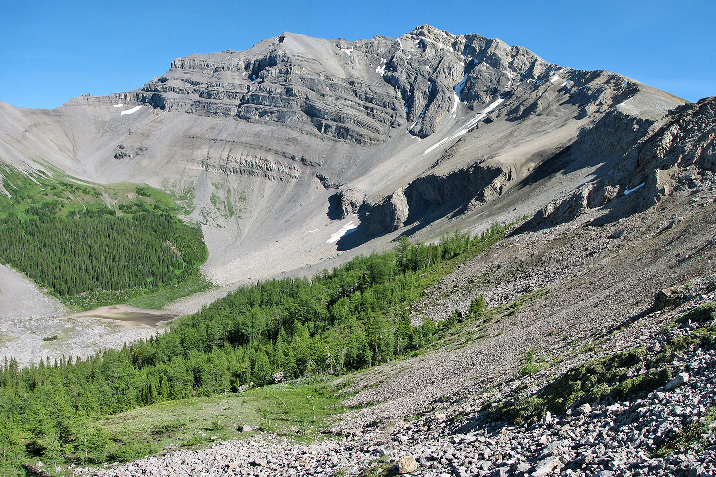
Pilot Mountain rises above a basin. Note the dry pond on the
lower left.
We made our way to the trees
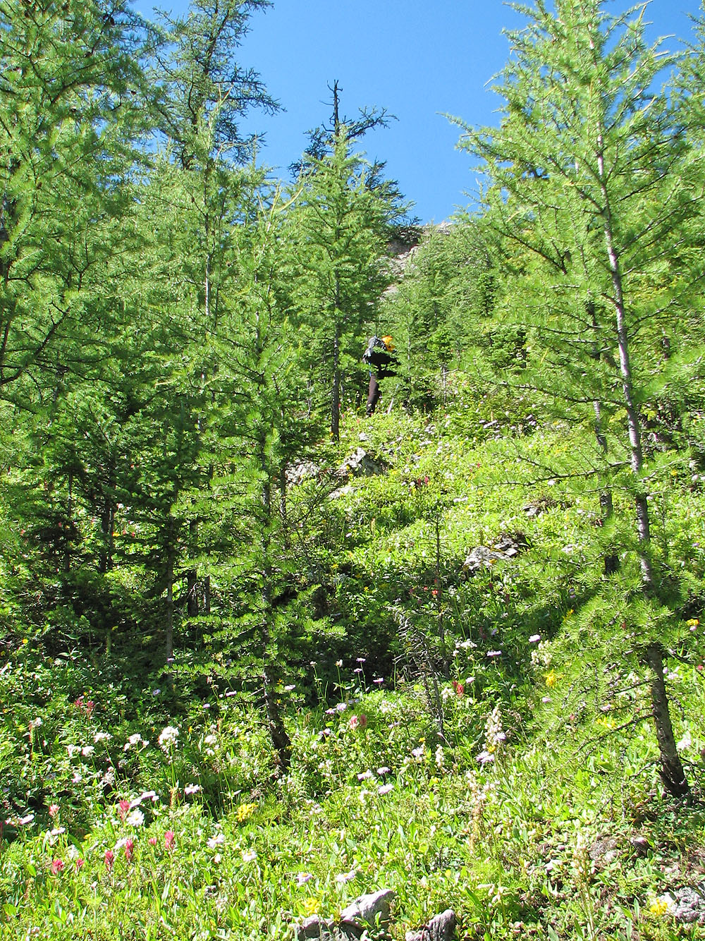
Hiking through larches to gain the ridge above us
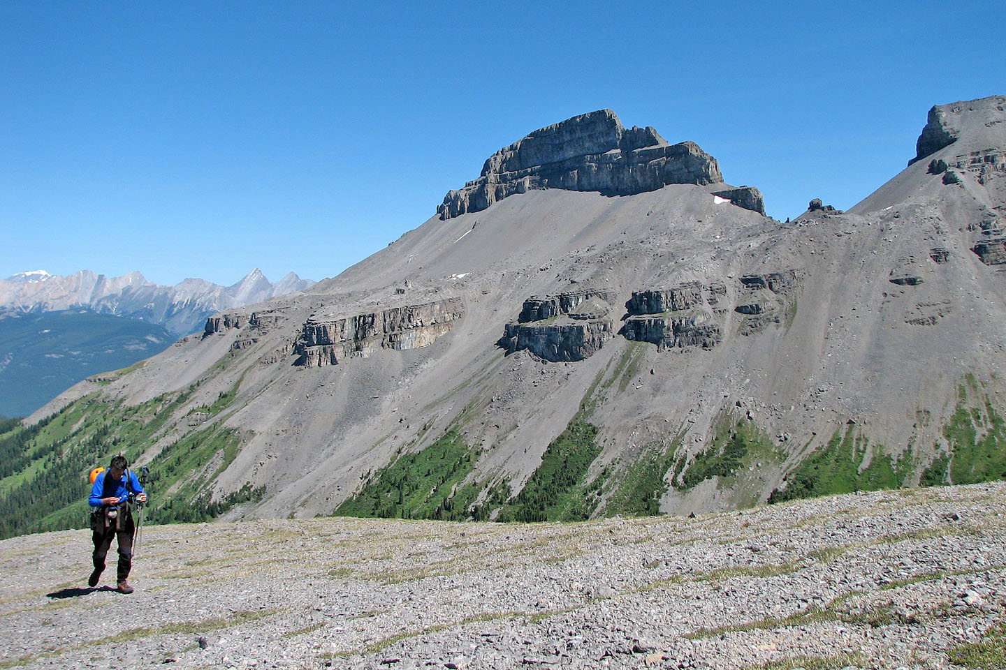
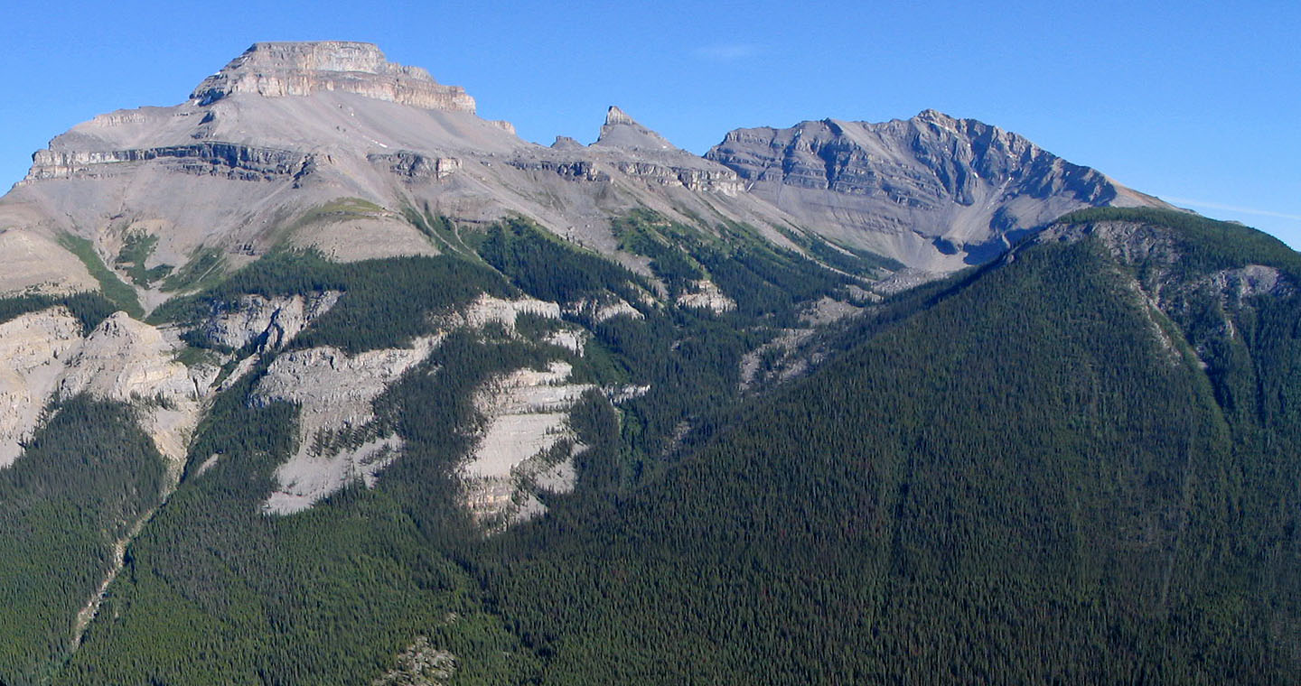
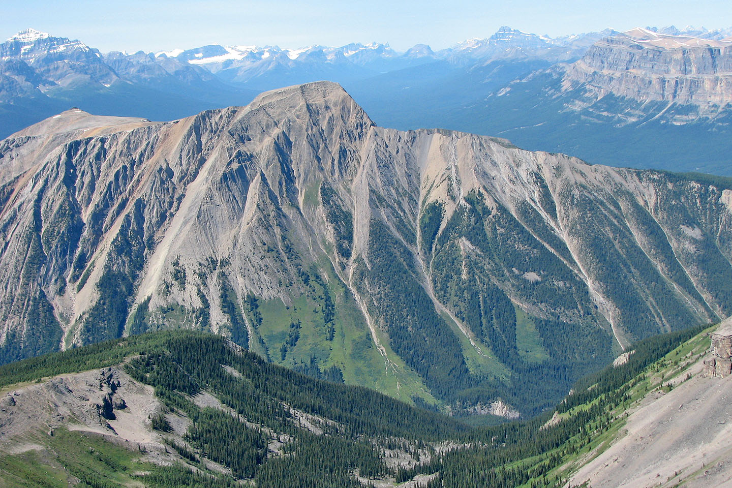
From the ridge, Pilot Mountain shows its stately west face
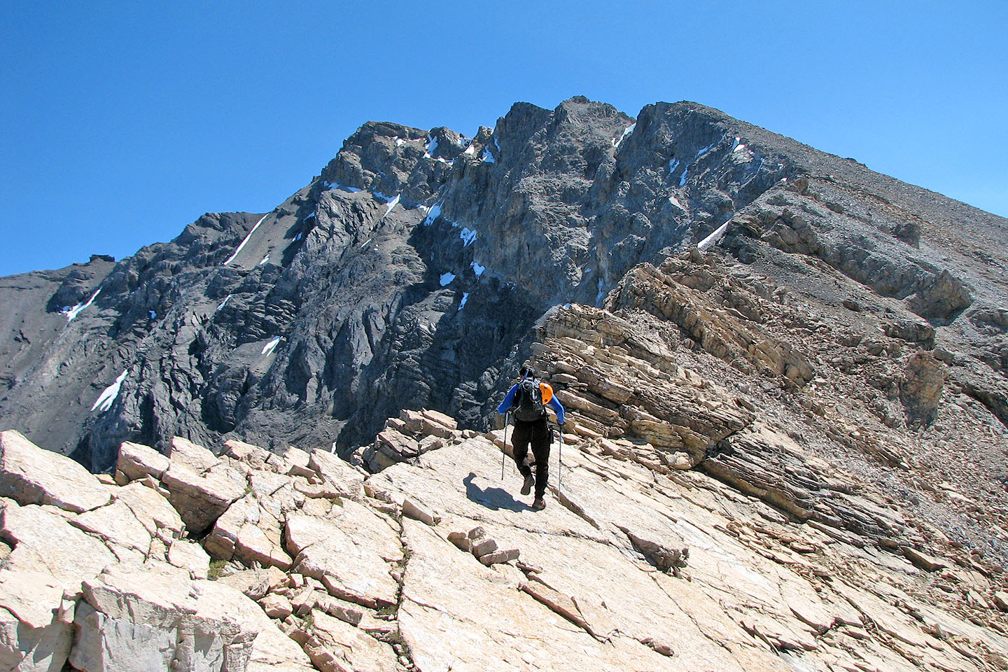
We are still a few hundred metres below the summit
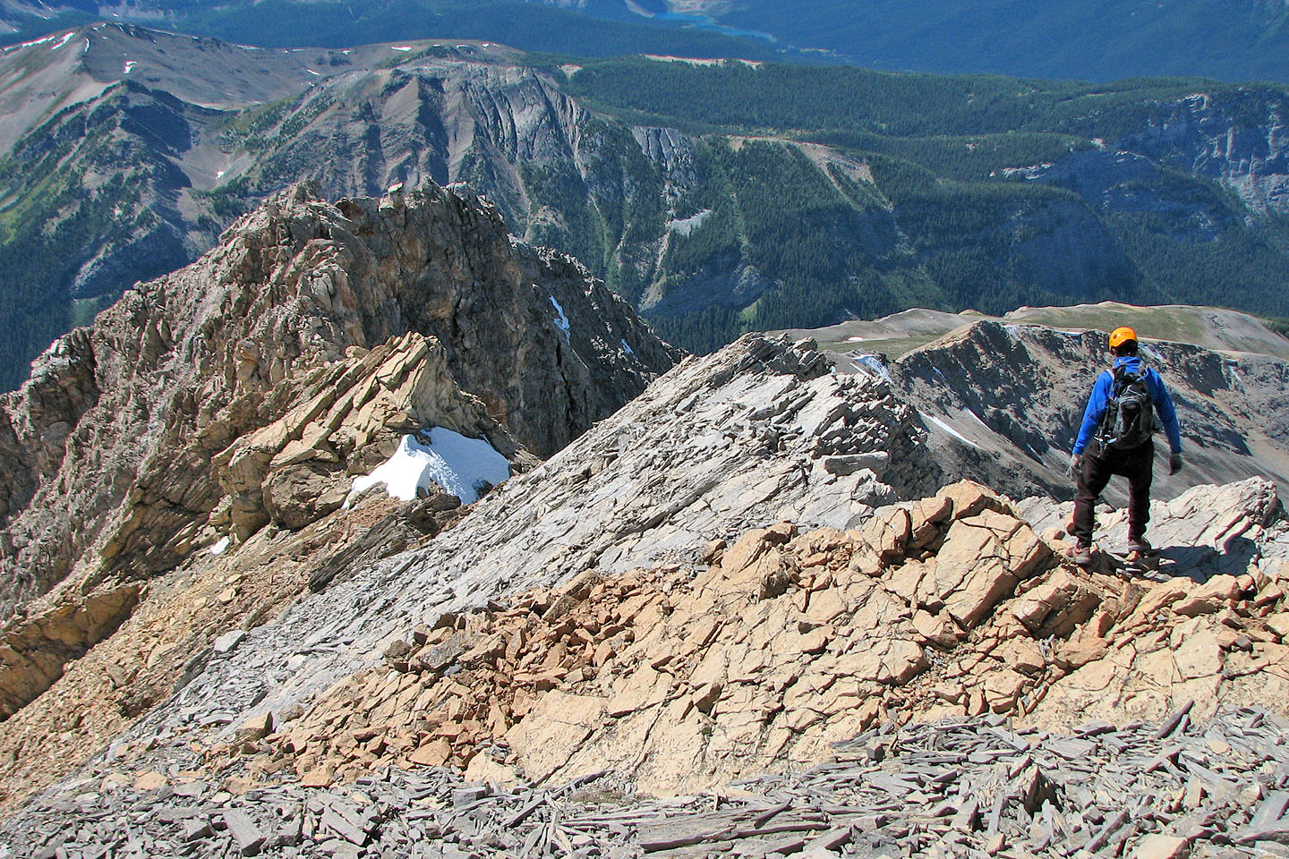
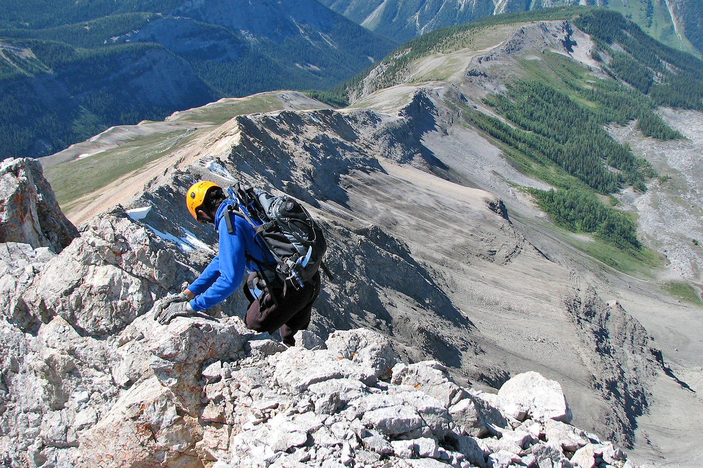
Making our way along the crest
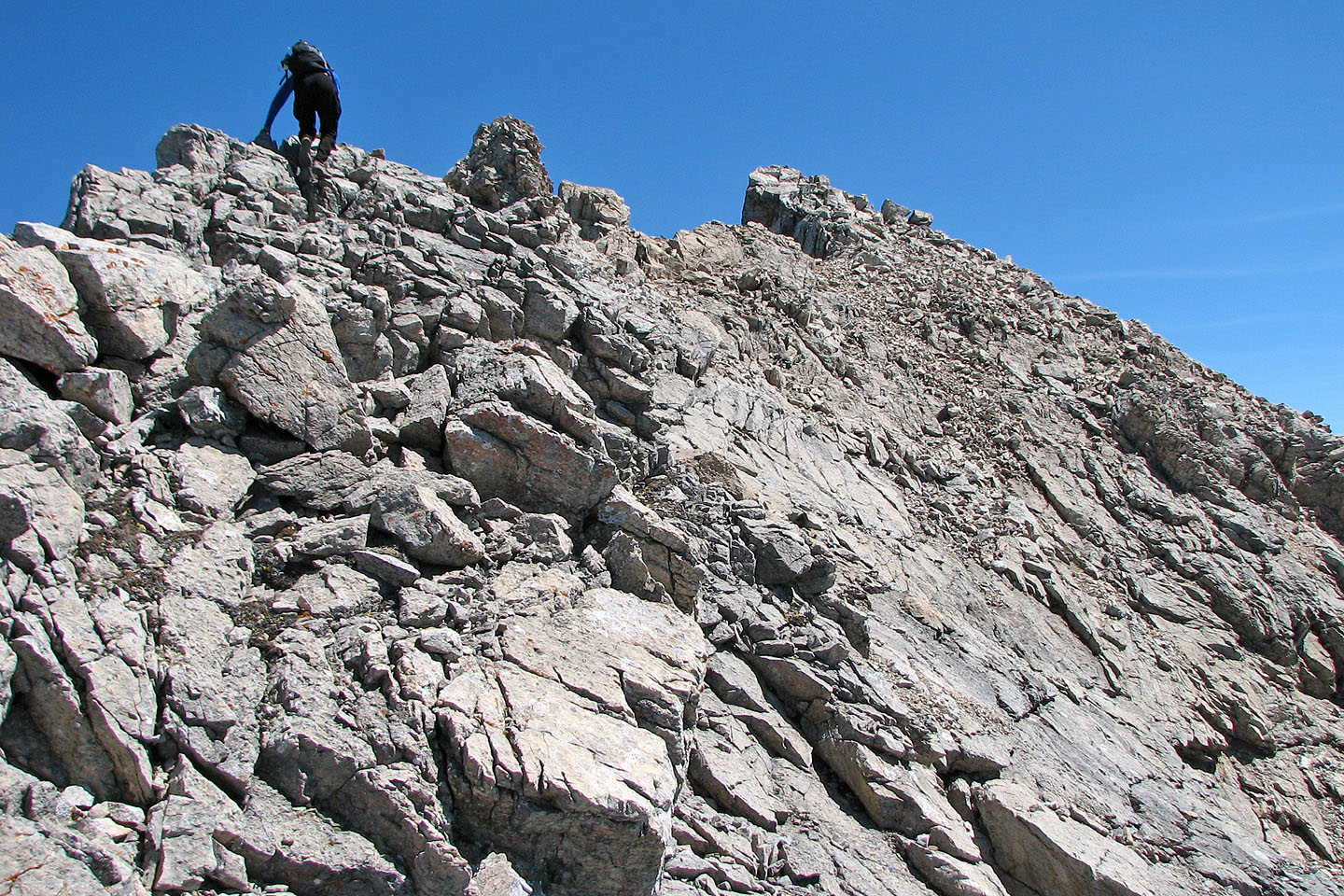
Much of the ridge is narrow forcing us to follow the crest
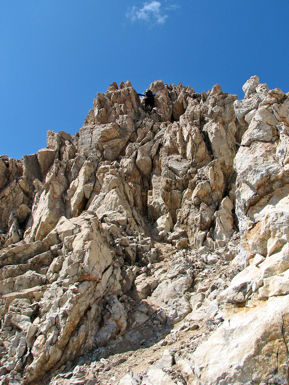
Lots of hands-on climbing along the ridge
Scrambling along a knife-edge
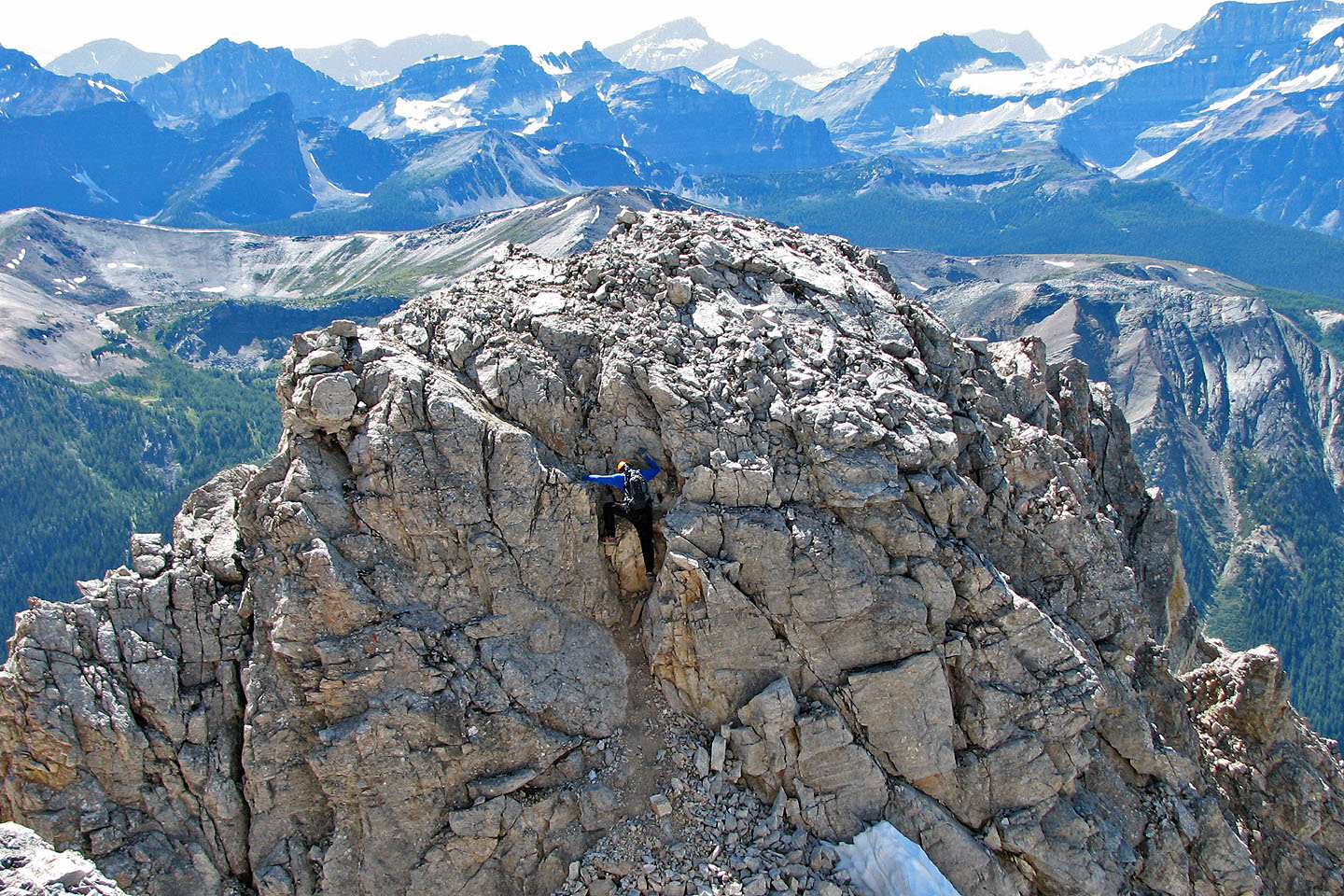
The second crux: Andrew came over the top where the "V" is. I
dropped over the west side to the weakness directly left of Andrew.
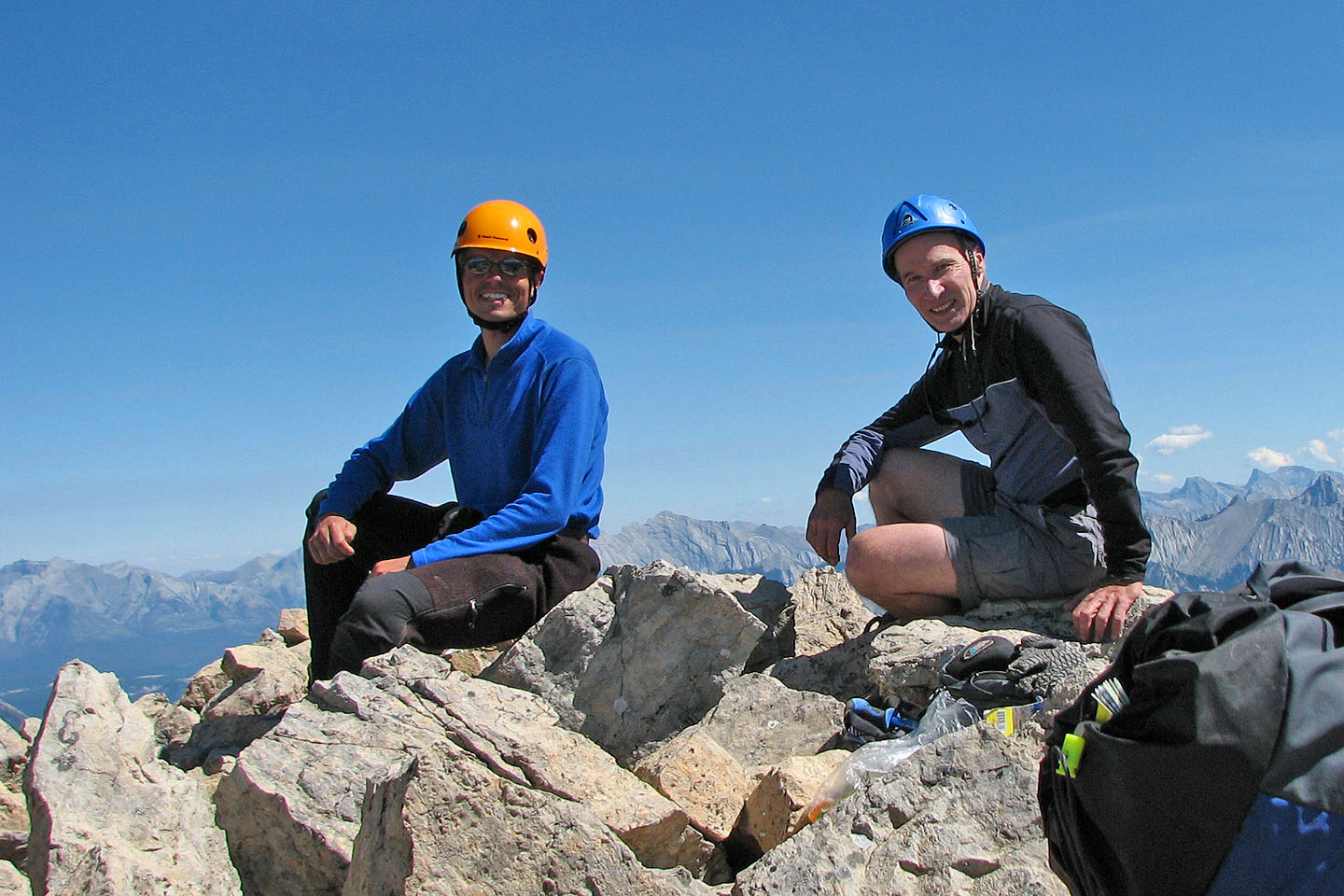
There was no summit cairn, only a summit register
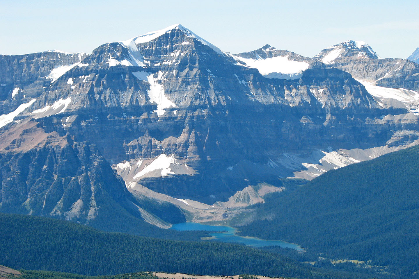
Mount Ball rises above Shadow Lake
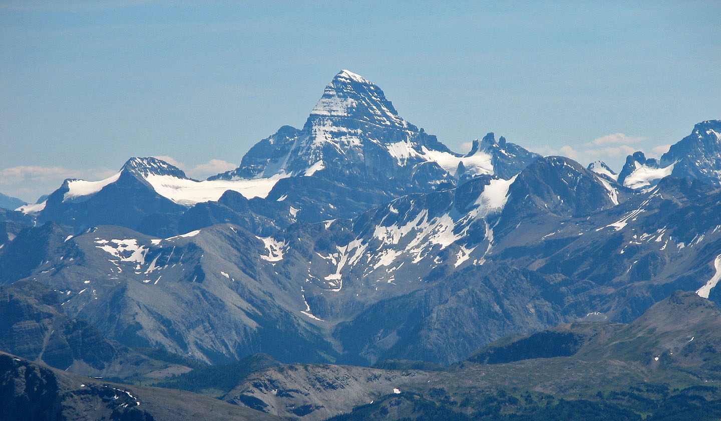
Mount Assiniboine
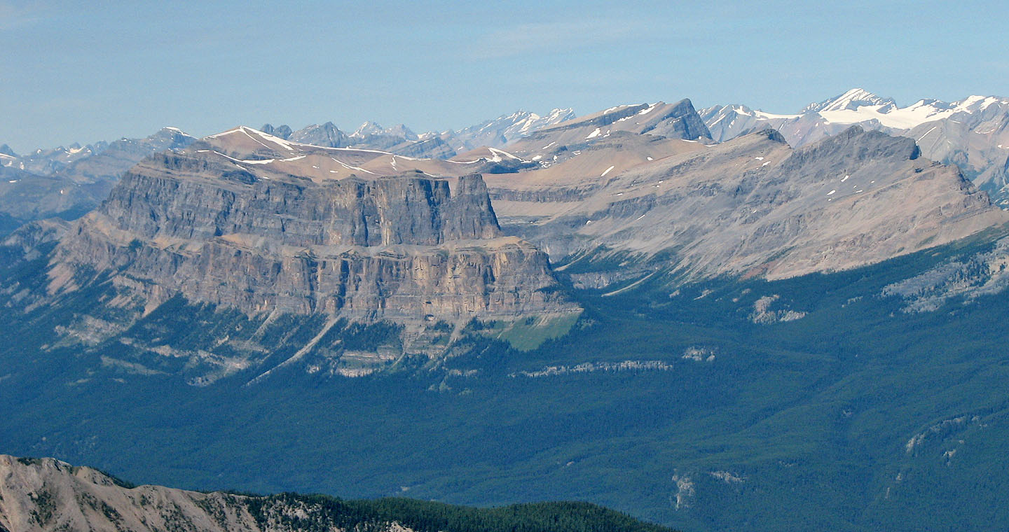
Castle Mountain, Stuart Knob and Helena Ridge
Copper Mountain
This shot taken soon after leaving the summit, the second crux is ahead
No room for error
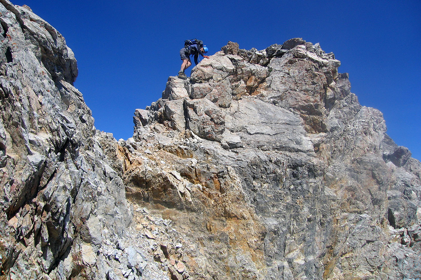
Andrew scrambles up the second crux
Andrew nears the top of the second crux
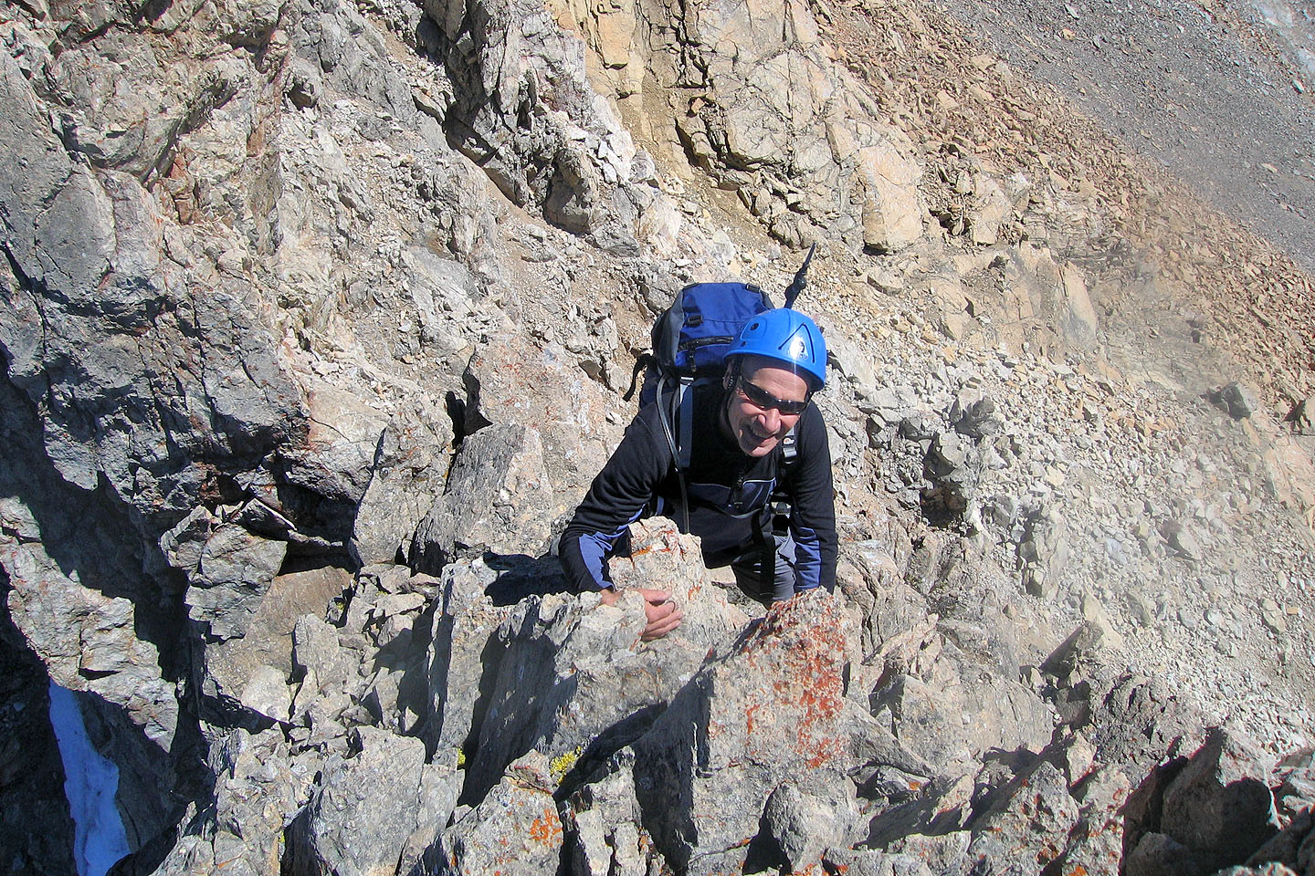
Climbing up the first crux
The difficulties continue after the cruxes
Looking back after reaching the basin
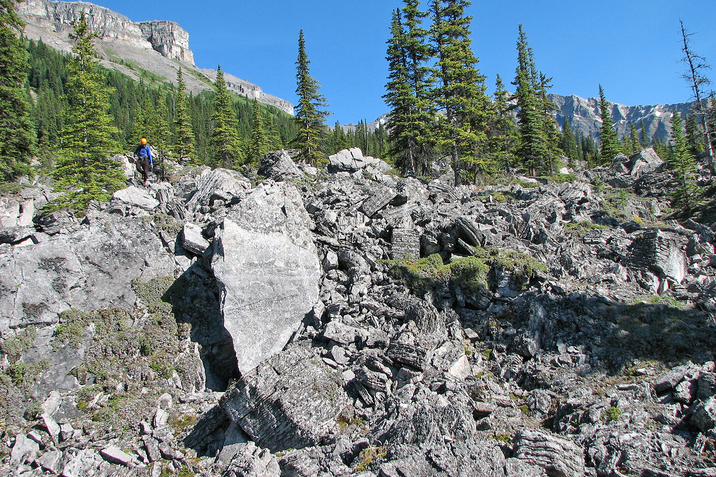
Working through the tedious rubble below the basin
82 O/4 Banff