bobspirko.ca | Home | Canada Trips | US Trips | Hiking | Snowshoeing | MAP | About
St. Eloi Mountain
Castle Provincial Park, Alberta
June 30, 2007
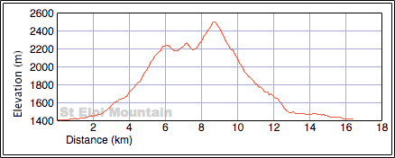
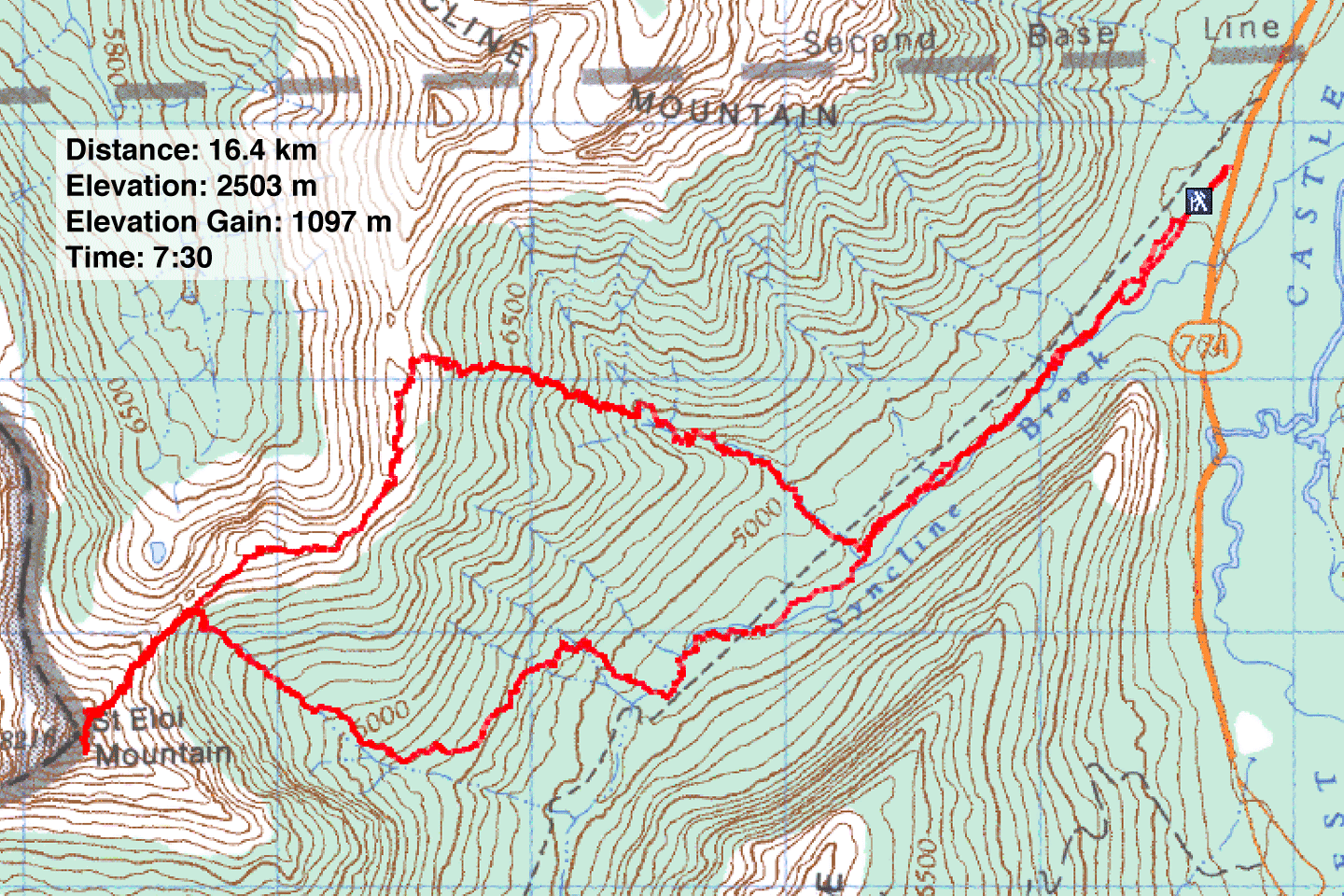
Distance: 15.7 km (9.8 mi)
Cumulative Elevation Gain: 1249 m (4098 ft)
Thumbing through my fresh copy of More Scrambles book, Dinah and I chose to climb St. Eloi Mountain first. We parked at a bare spot on the roadside and found Syncline Brook trail hidden behind a berm.
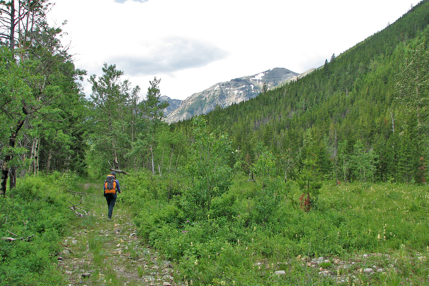
We hiked up the trail 2.3 km through a verdant forest before reaching the drainage. We saw no flagging, but there was no mistaking the drainage as it dropped a couple of metres below the trail. The drainage was an unpleasant affair. In its confines we could see little, and the rocks, willows, and running water conspired to slow our pace.
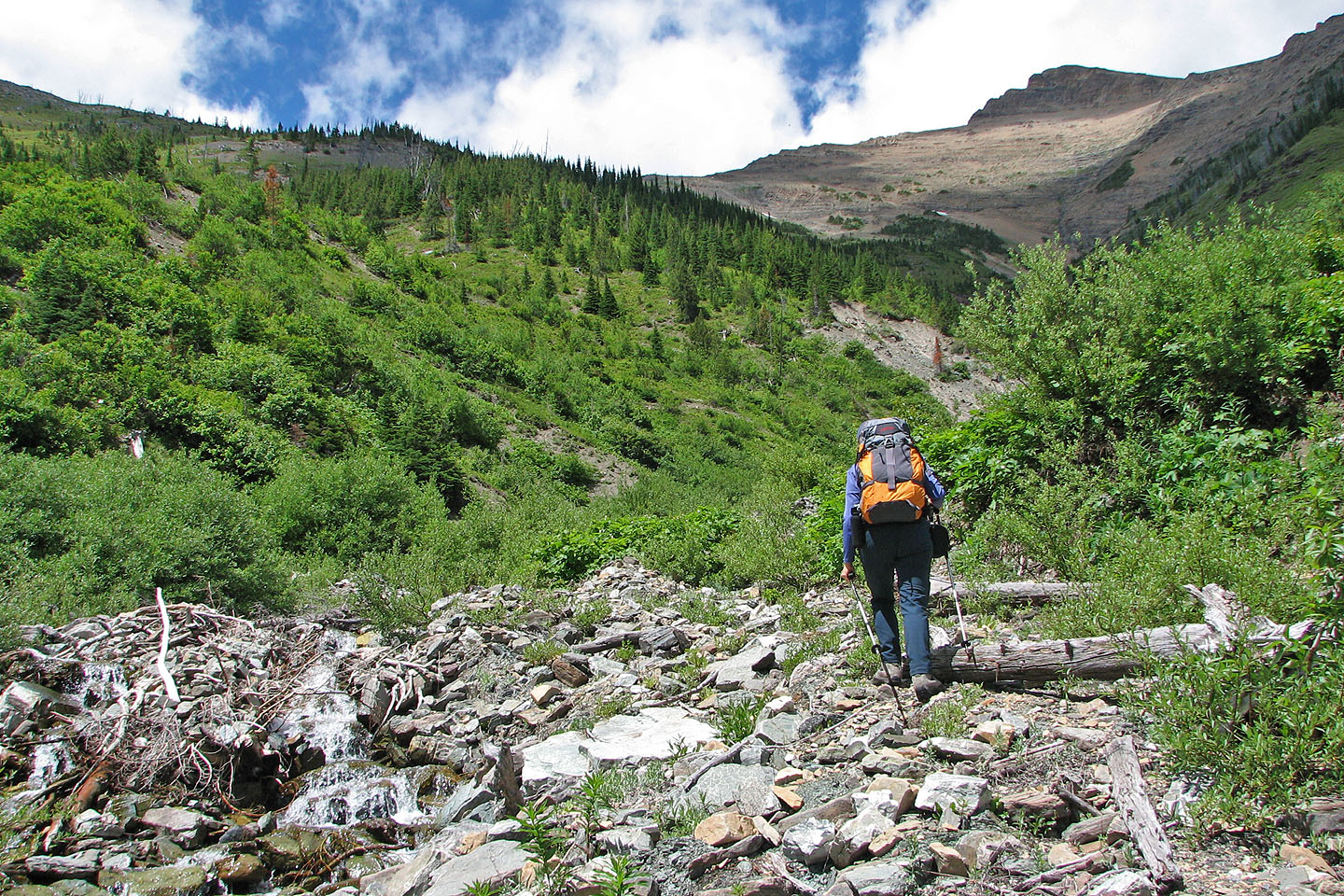
When the trees on the left bank gave way to a steep, scrubby slope, we left the drainage. The vegetation thinned as we climbed, and we found ourselves in a basin. We couldn't see the ridge, so we headed to the steep slope on our right. We would end up farther back along the ridge from the mountain, but I was hoping to catch sight of the ridge to get oriented. Even so, we ascended a fair distance before the ridge came into view.
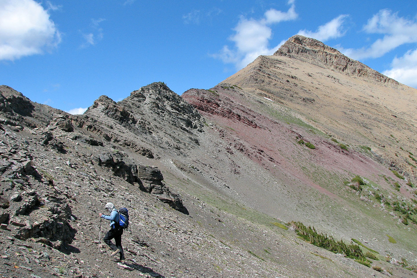
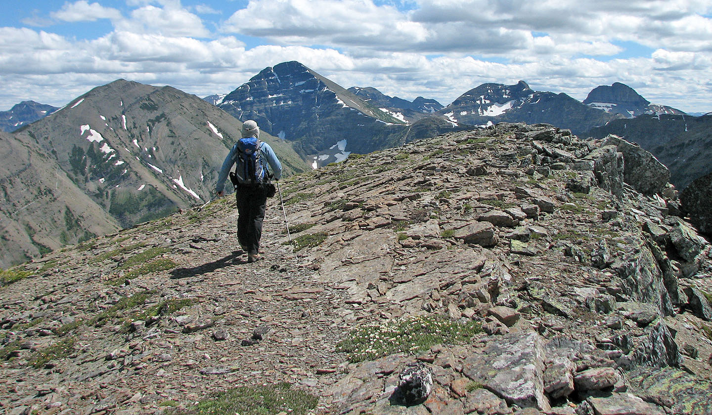
We reached the ridge just before a high point. Beyond that was another high point that Andrew recommends ascending for the views. We did, and it was indeed worth the effort. We dropped down the other side to the col and headed to the summit.
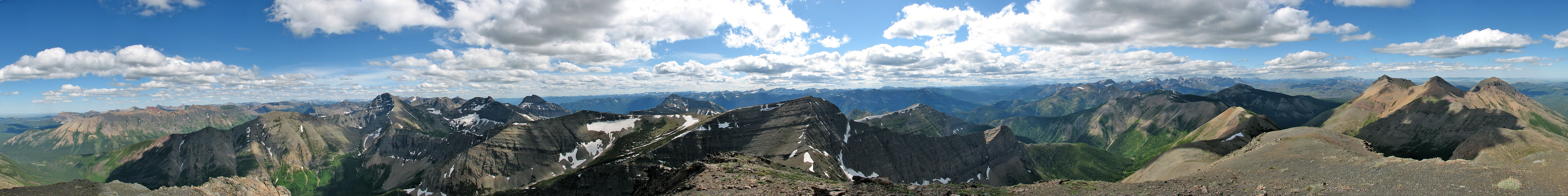
It was a steep ascent, but an intermittent trail assisted us up. On the summit we were met with high winds, a small cairn, and a new summit register. We spent half an hour on top taking photos and studying surrounding peaks before returning to the col where we considered our options.
We could retrace our steps back to the trail which meant following the undulating ridge and descending the ascent drainage, or we could drop down to the drainage below us and find our way back to Syncline Brook trail. We were up for an adventure so we chose the latter.
We stayed with the drainage until it became too rugged and then headed left to an opening in the trees. More than an opening, it was a long, winding break. We followed this until we hit upon an animal trail. Following this trail – probably a series of trails – was an adventure in itself. It was well-trodden but nearly invisible in waist-deep bushes. But it was fast, fun and headed in the right direction.
When we were about a hundred metres above Syncline Brook Valley, and the way down appeared mostly clear, we left the trail and started down. In retrospect, we should have stayed high up the slope on the animal trail. Frustratingly, at this point Syncline Brook trail wasn't much of a trail. We ended up doing some awful bushwhacking along the left bank of the creek until we reached the hiking trail.
The scramble up St. Eloi was a worthwhile effort given it's a novel area that probably sees few ascents. Not surprisingly, we saw no one else on the mountain. The Castle West area, however, was rife with outdoor enthusiasts on quads and dirt bikes, transportation I'll eschew while I have two good legs!
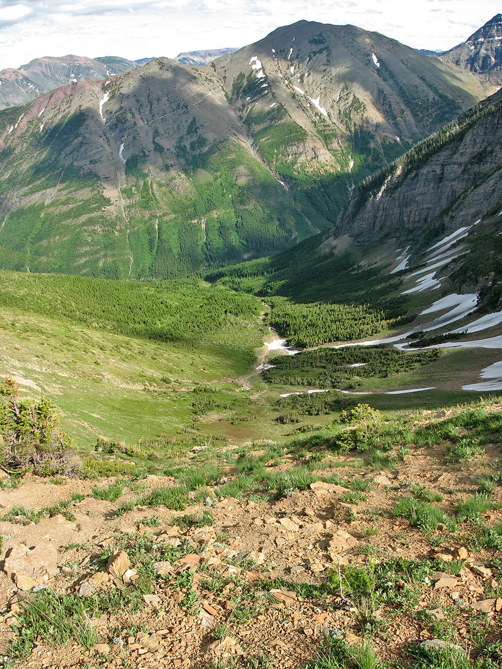
St. Eloi seen from the trail
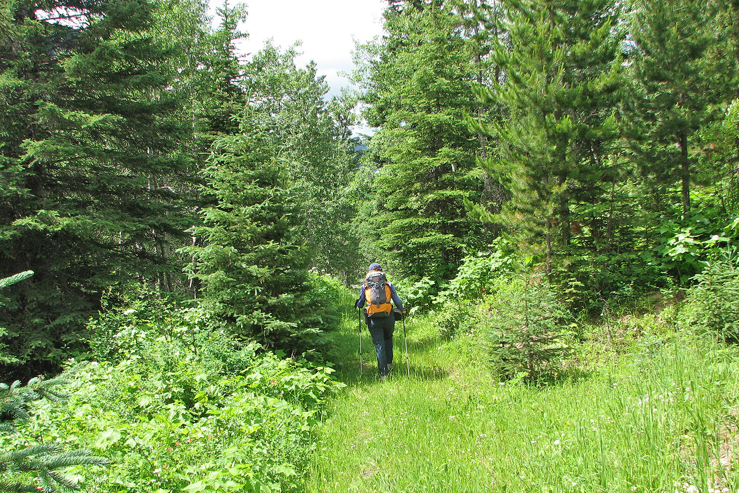
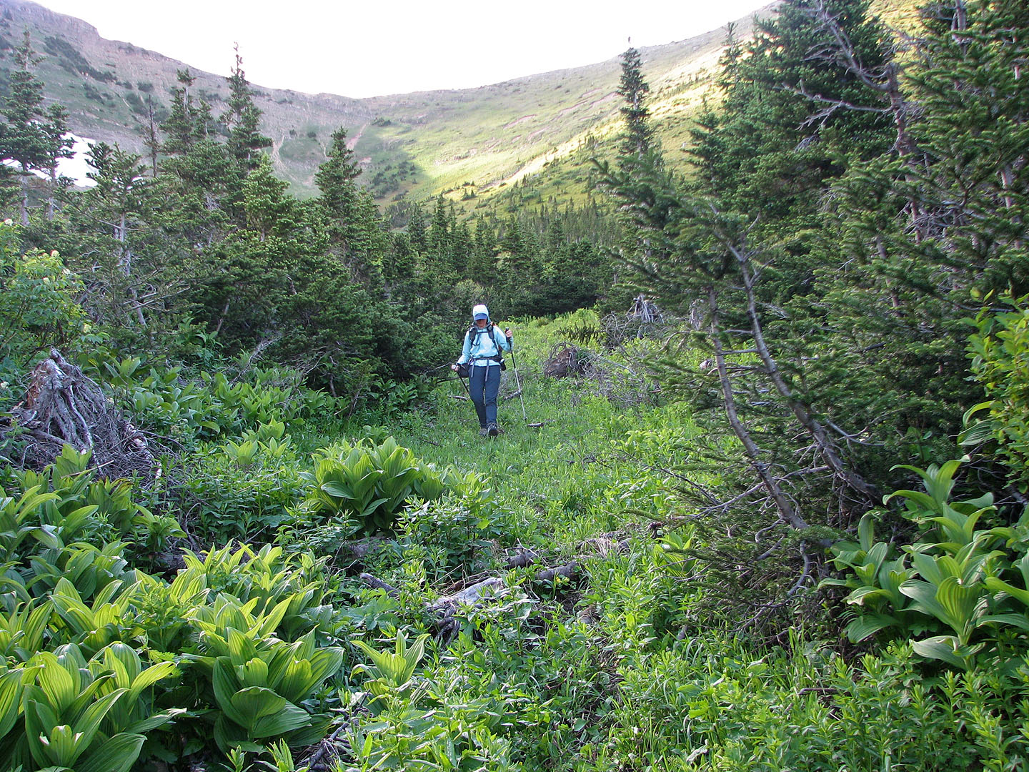
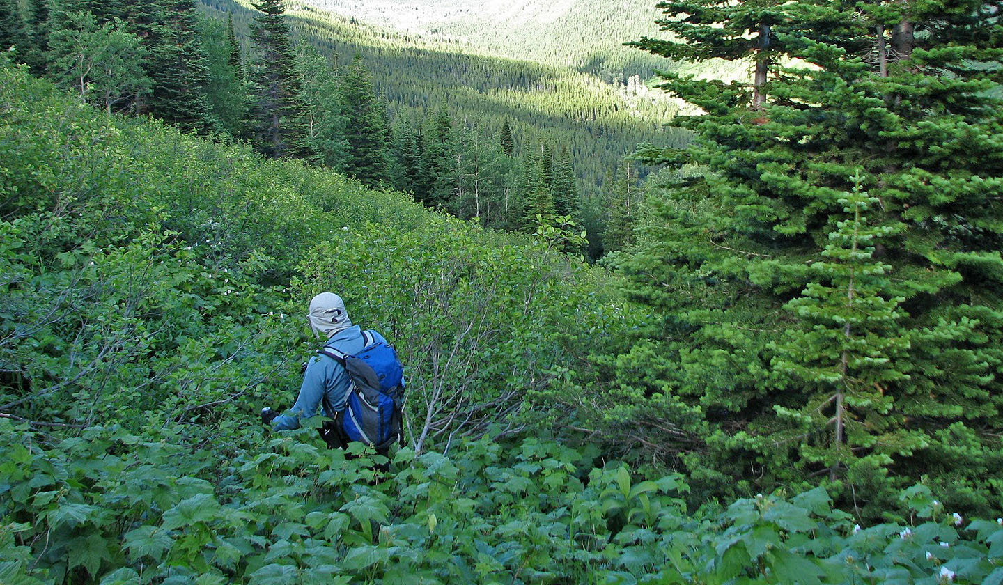
Pleasant hiking on Syncline Brook Trail
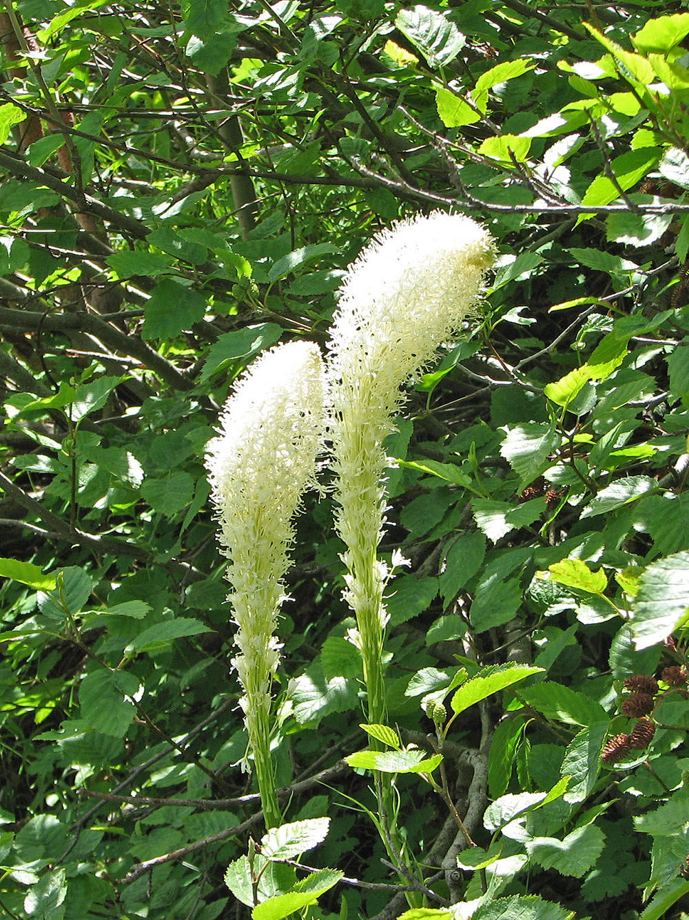
Bear grass
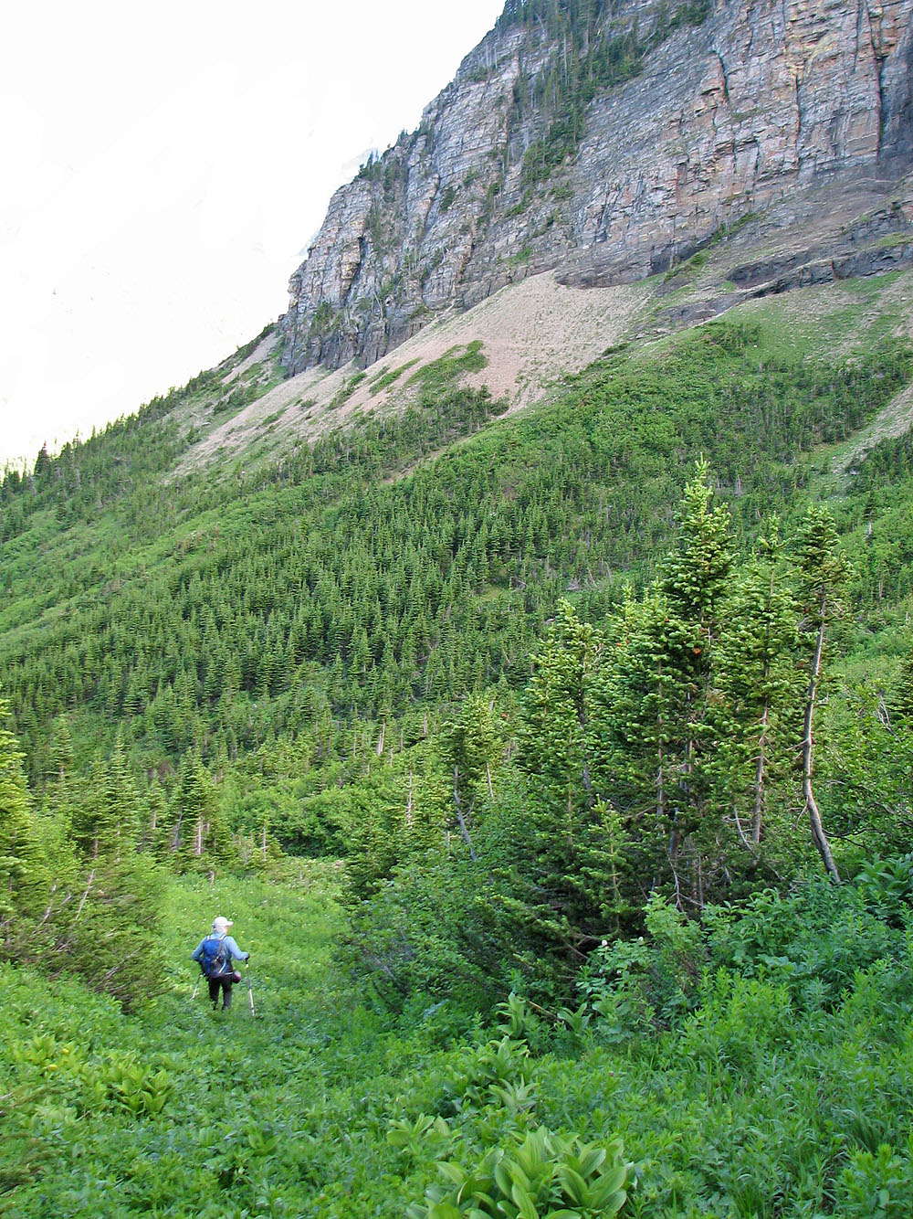
After hiking up the drainage, we headed for the slope on our left
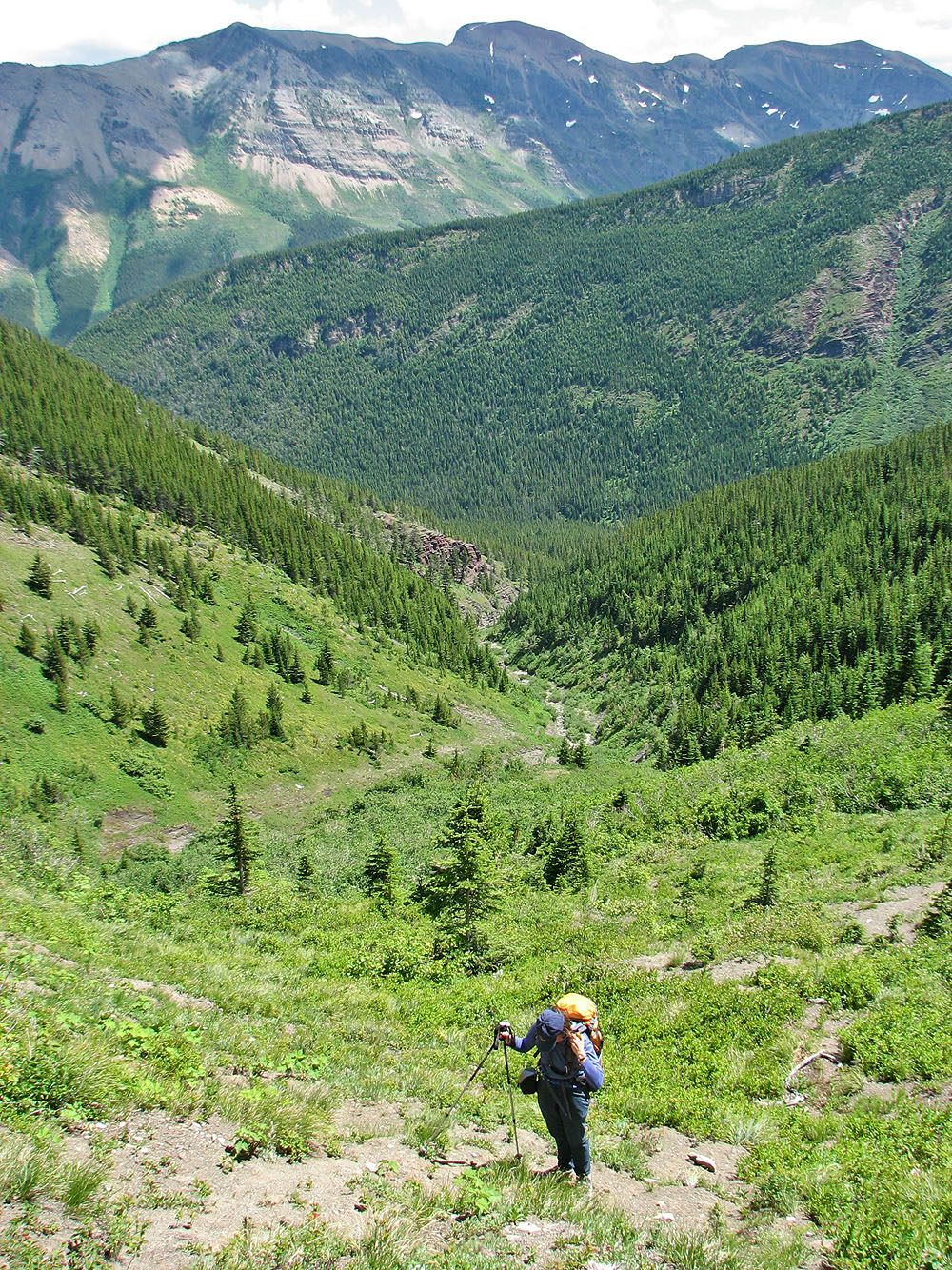
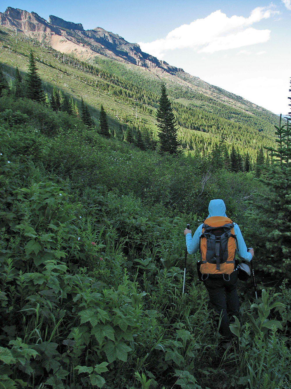
We left the drainage far below
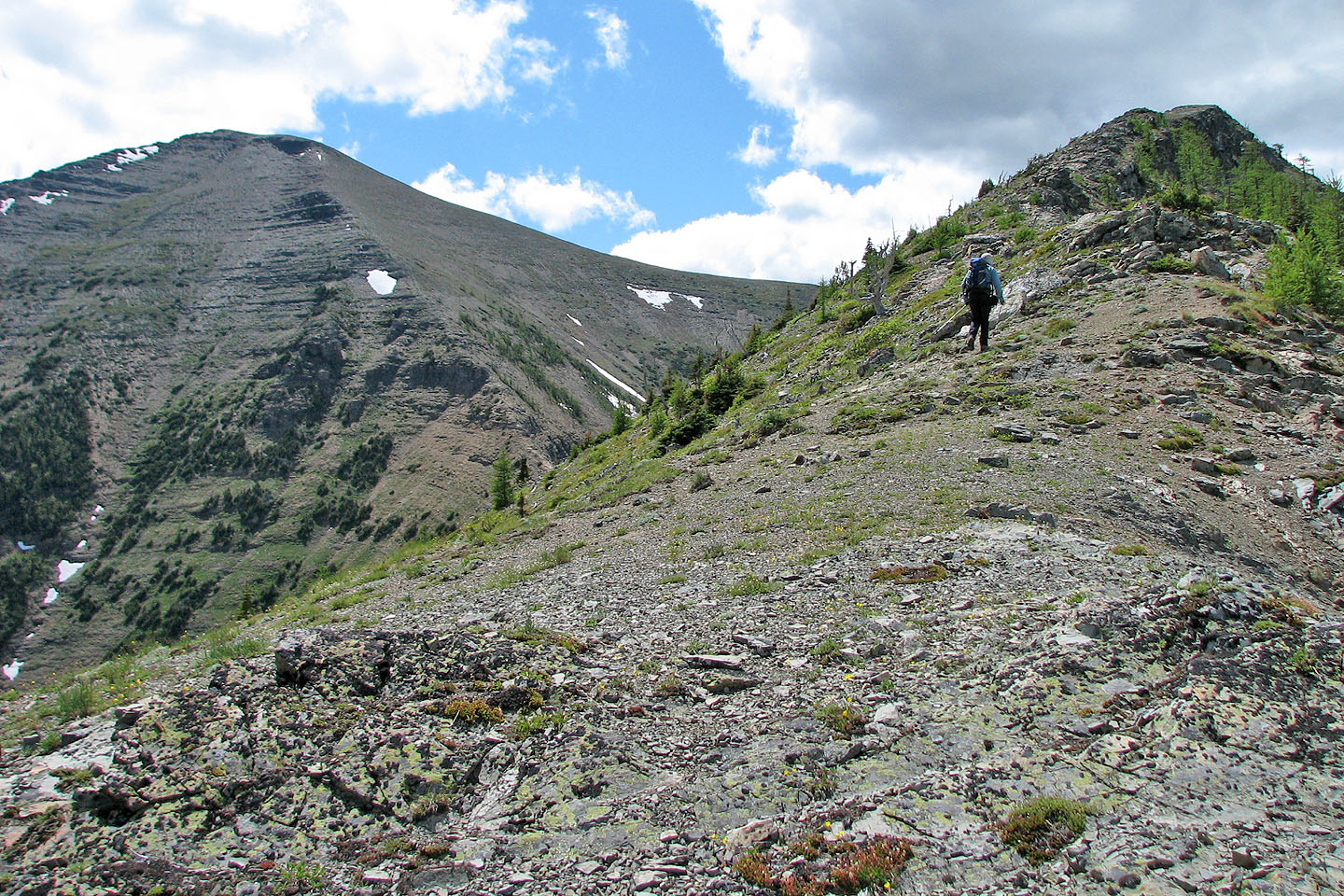
After nearing the ridge, the second summit of Syncline Mountain appeared on our right
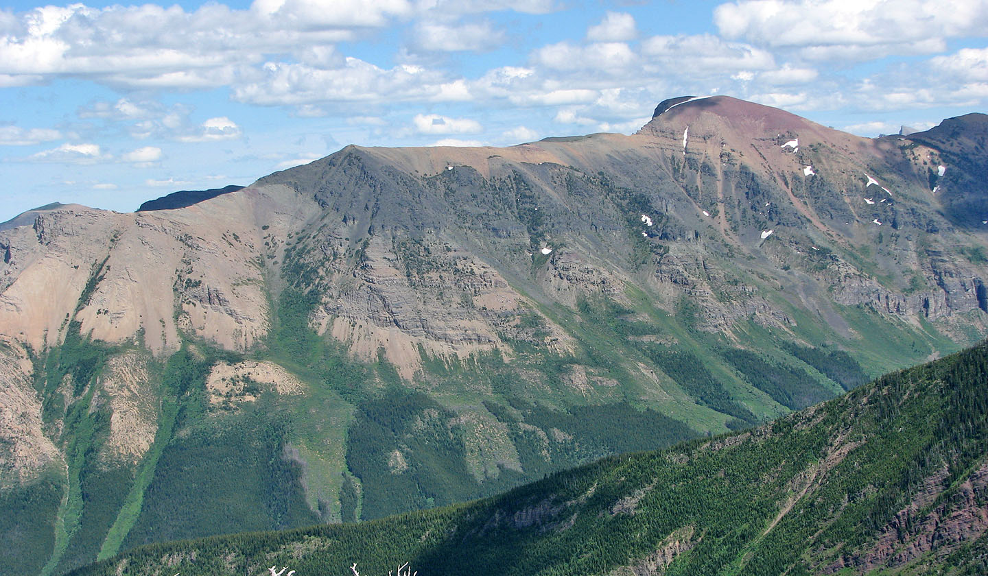
Southfork Mountain on the left
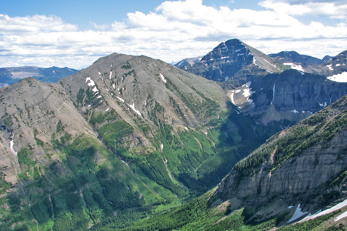
Gravenstafel Ridge and Mount Haig
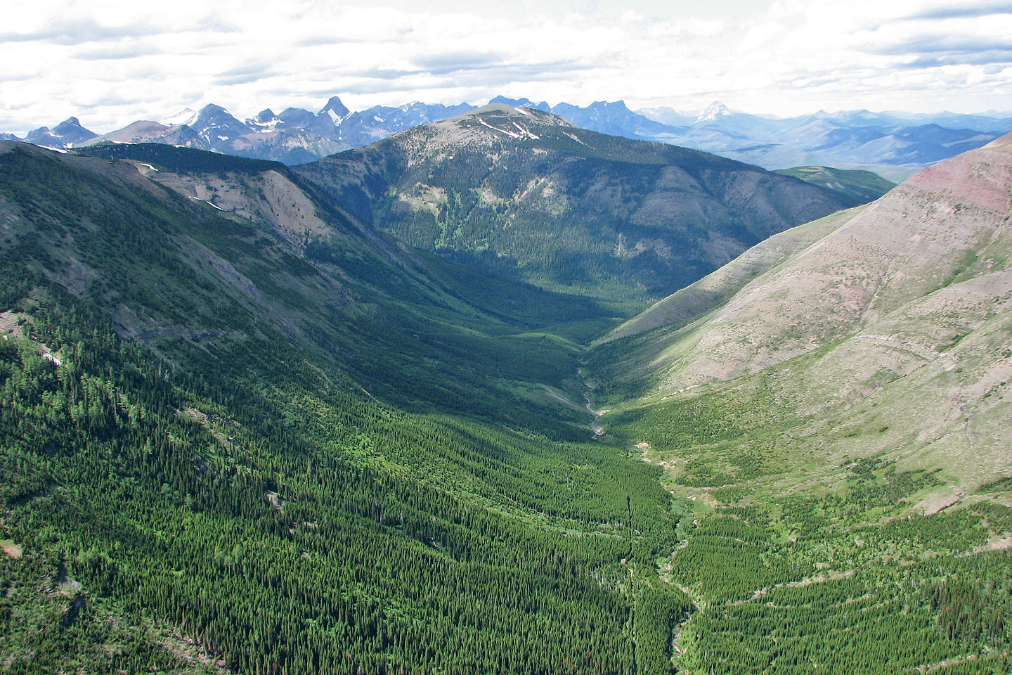
Looking north at Mount McCarty
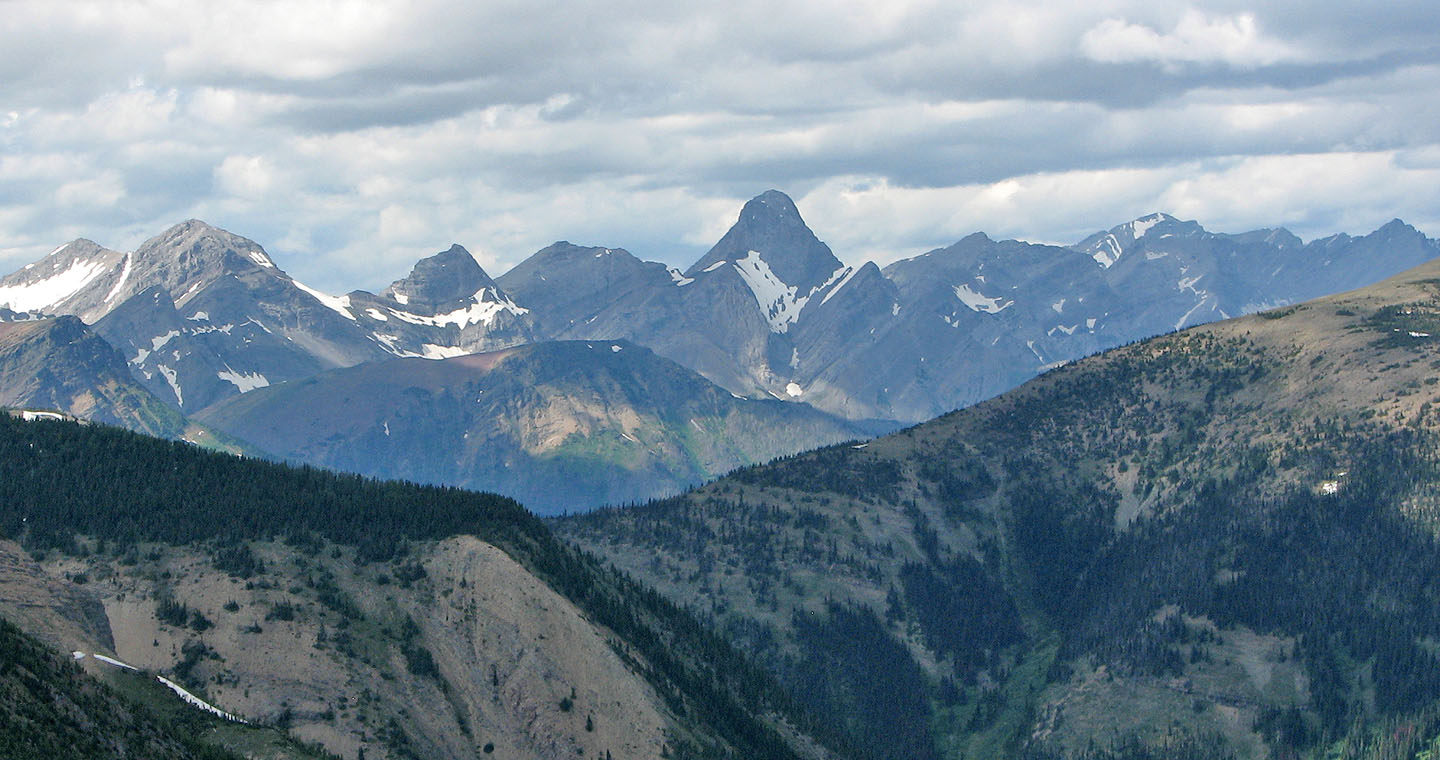
Mount Darrah stands out on the north skyline (mouse over for a close-up)
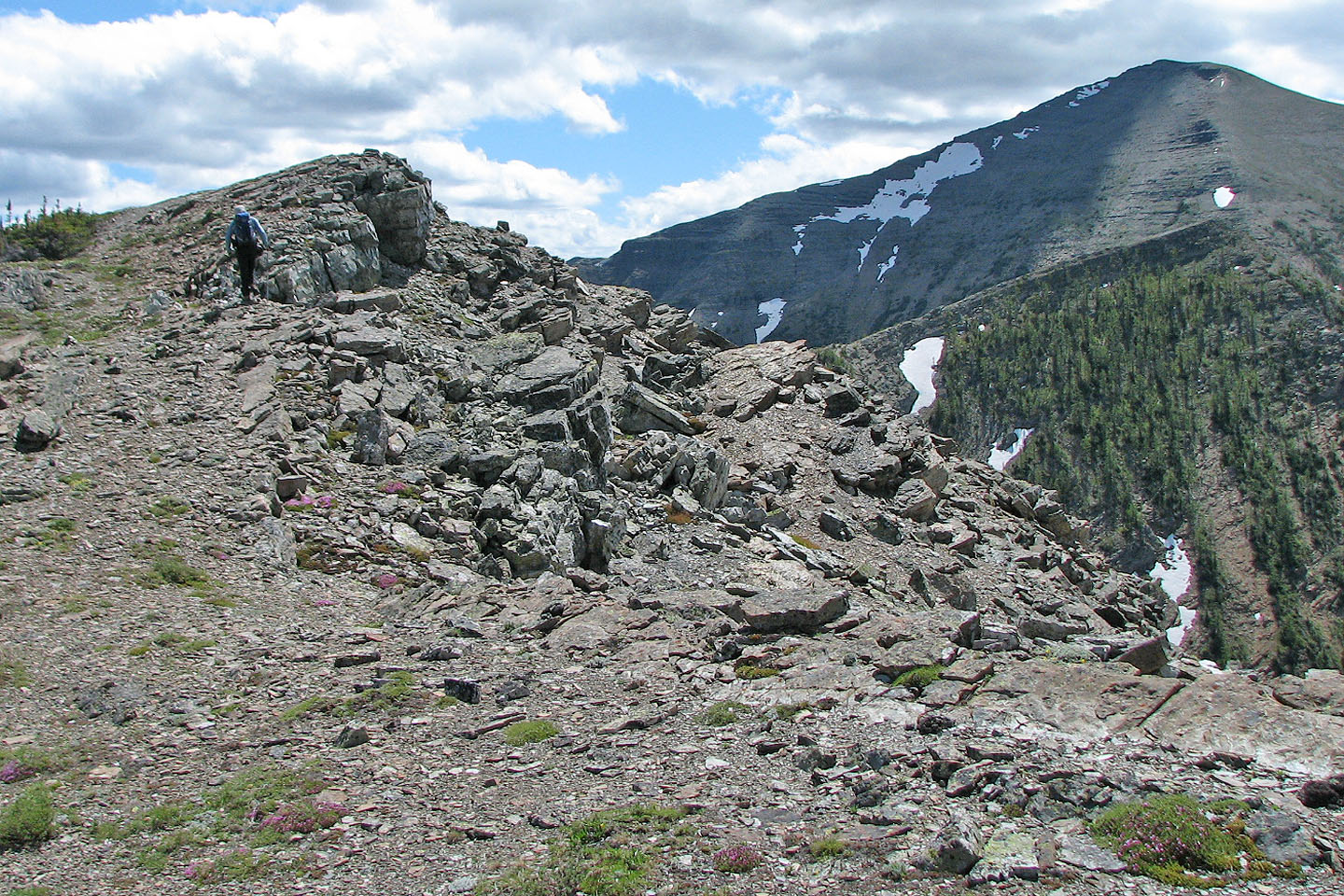
Reaching a high point with another high point and St. Eloi ahead
On the first high point
Descending the first high point
Ascending the second high point
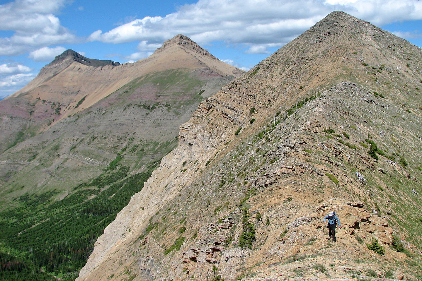
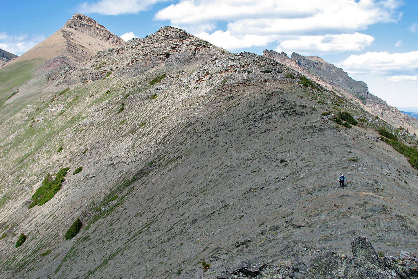
It was an 80 m drop from the second high point to the col
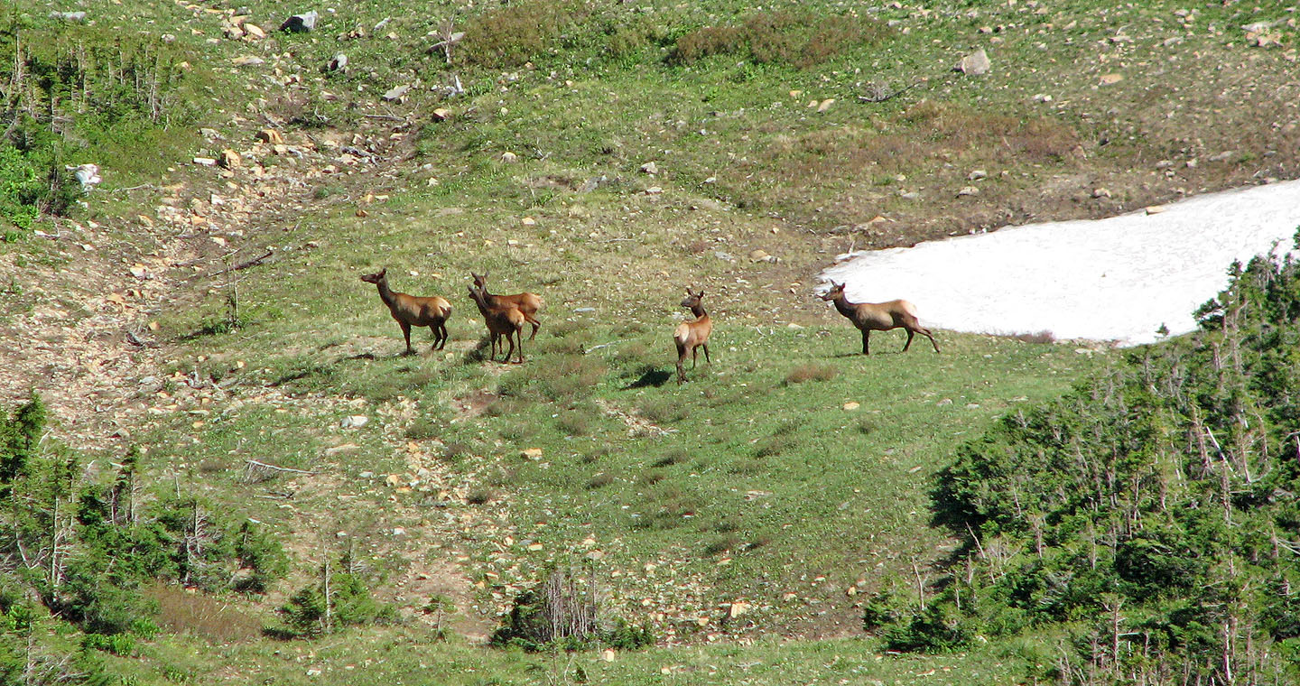
We spotted elk below the col. Later, when we descended from the col, we passed through this area but didn't
see any elk although the air was thick with their scent.
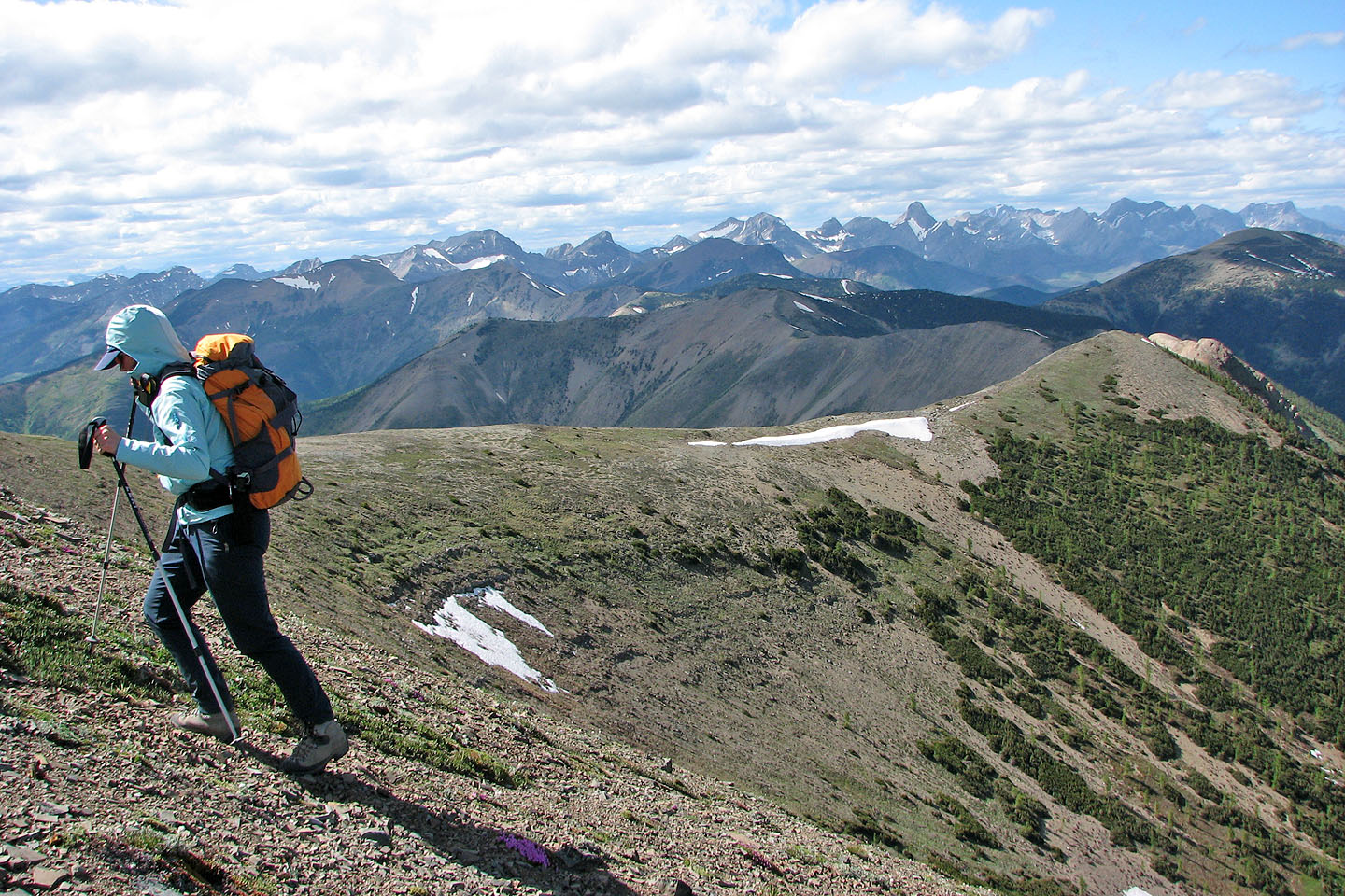
Final push to the summit. Flat Head Range in the background.
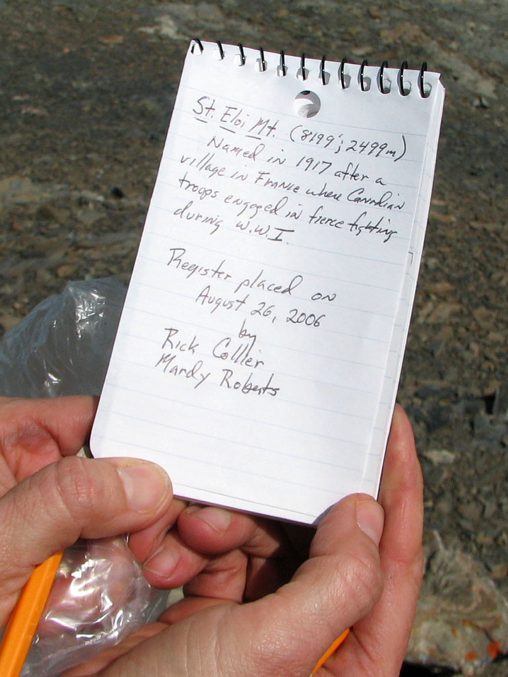
A single entry appeared in the summit register
We couldn't resist descending to this drainage (steeper than it looks).
 Looking back at the col
Following a break in the trees
The break extends a long way
Typical travel on an animal trail
I wished we had stayed on the animal trail, but we dropped down to Syncline Brook where we expected to find
the hiking trail
82 G/8 Beaver Mines