bobspirko.ca | Home | Canada Trips | US Trips | Hiking | Snowshoeing | MAP | About
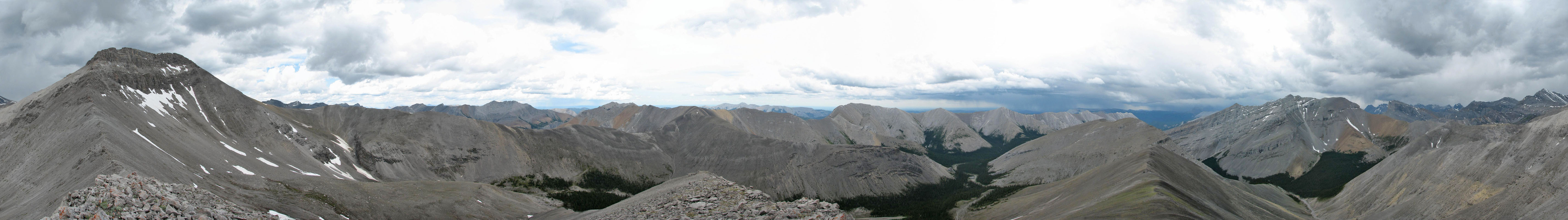
View from the high point where I turned around. The storm, centre right and behind Nihahi Ridge, looks far, but it would
reach me in 30 minutes.
Mount Howard (attempt)
Kananaskis, Alberta
June 12, 2006
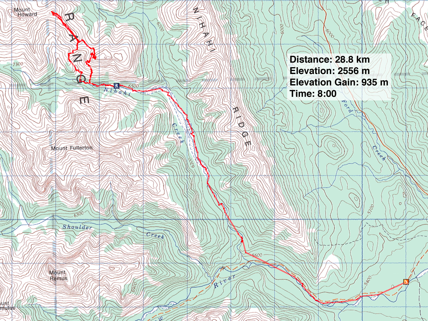
Mount Howard is cruelly placed far from any road. The south route shares the same long approach with Mount Fullerton, but is even longer. However, after reading Dave Macdonald's Mount Fullerton attempt where he used his bike for the approach, I realized cycling would save time.
I rode up little Elbow trail and turned onto the Nihahi Creek trail. I stayed on the trail – when I could find it. When the trail disappeared, I continued riding up the creekbed, negotiating rocks, logs and small trees. At times I was forced to push my bike. I made good time, although I didn't enjoy it. Where hiking up Nihahi Creek is hell, riding is hell on wheels!
Past the ascent route for Mount Fullerton, the creek narrows and becomes impossible to cycle. I left my bike after riding 10.25 km; the last 2 km were offtrail. The ride took an hour and 45 minutes.
From where I left my bike, it was only a kilometre to the base of Mount Howard. Trusting my GPS receiver and impatient to starting climbing, I left the creek prematurely. I didn't realize my error until I had ascended a hundred metres. Although I had set my waypoint correctly, an inaccurate reading from the creekbed indicated the wrong spot to ascend. Had I taken the time to check my map, I would have seen that I had to pass a major gully before ascending.
Now aware of my error, I made for the col between the unnamed peak (442337) I was on and Mount Howard. It would put me on track for ascending Mount Howard. But the steep terrain rife with cliff bands forced me higher. Eventually I reached an insurmountable long cliff band. I hiked along the cliff base towards the col. I was well above the col but couldn't reach it by traversing or descending. The landscape forced me to climb higher. Since the col appeared unreachable I decided to try summiting the unnamed peak.
Above me the scree slope was steep, so I angled right where the grade was easier and led to solid rock. I soon reached impossible cliffs. Rebuffed, I started back down.
As I made my way down, I figured I might as well try for the col since I was high above it. Sure enough, around the bend an open scree slope led to the col. I reinstated my bid for Mount Howard.
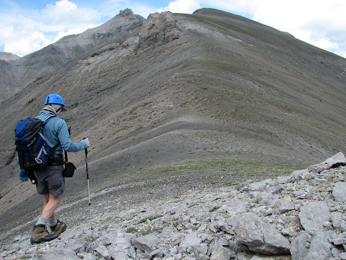
I started up a gentle ridge that would take me to a high point (428348) east of the summit. It was a pleasant hike all the way. Looking back, I realized I from here I could have reached the unnamed peak easily.
As I walked up the ridge, I became concerned about the weather. The forecast called for a risk of a thunderstorm late in the day, but the weather wasn't going to wait that long. When I reached the high point at 1:00 p.m., I noticed a storm southeast of me. It was several kilometres away on the other side of Nihahi Ridge. Unfortunately, the wind was coming from the SE and would soon deliver the storm to Mount Howard.
I was 260 vertical metres short of the summit when I turned back. As I came down the ridge. the wind picked up, and it started raining lightly. Thunder and lightning soon descended on me. The storm came in much faster than I expected.
Since the descent ridge ended in trees, I broke left to a gully that led back to the creekbed. By the time I reached the creekbed, it was pouring rain and thundering fiercely. Occasionally a flash of lightning would light up the sky. Hailstones added to the foray.
By the time I reached my bike, I was soaked and chilled. But the storm was passing, and it soon stopped raining. As I rode back, the downhill grade helped slightly, but now everything was wet and slippery. When I reached my car I was covered in mud.
Now that I have the logistics sorted out I should make easy work of summiting Mount Howard when I returned, but in 2008, I took the hiking approach up Canyon Creek.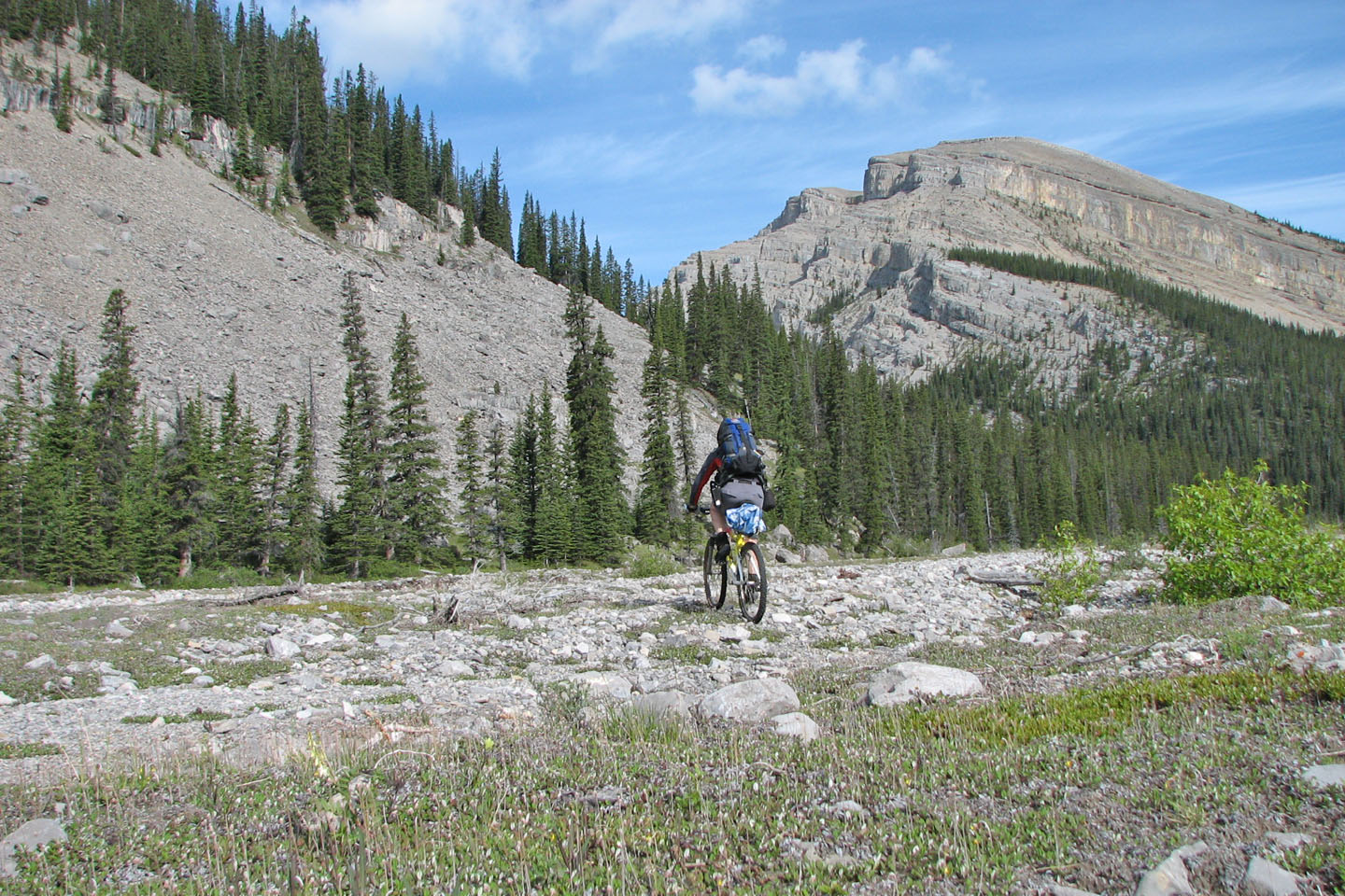
Near the north end of Mount Fullerton, I made my own trail
Looking back after parking my bike (lower left)
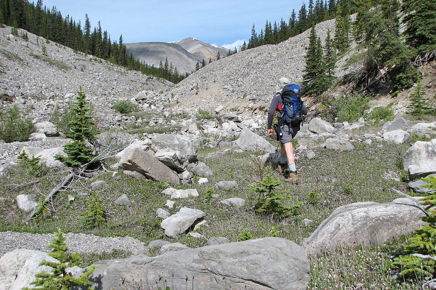
Setting off on foot. Mount Howard is to the right but out of sight.
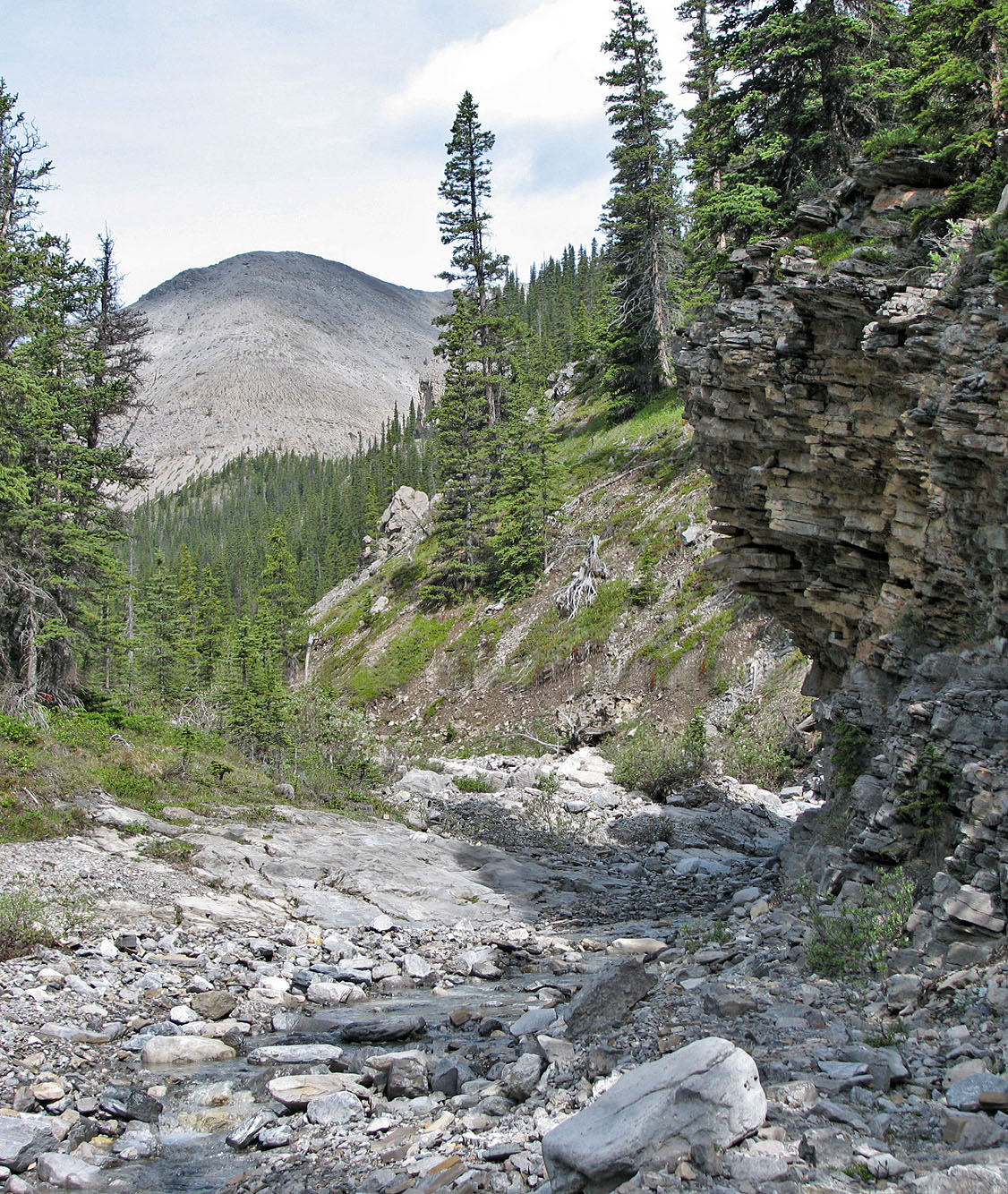
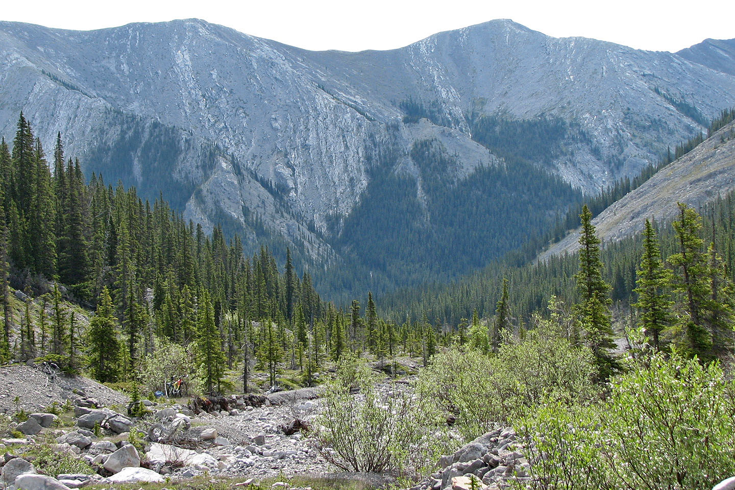
The creek becomes more confined
I should have continued past these orange cliffs, but instead I started my ascent
before them.
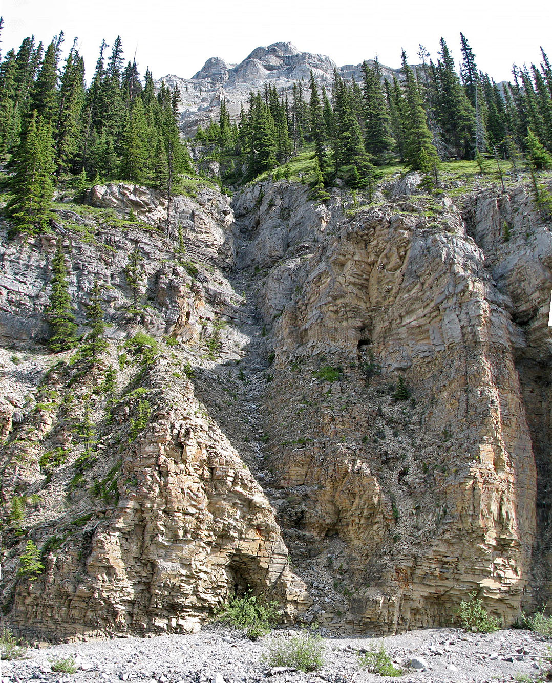
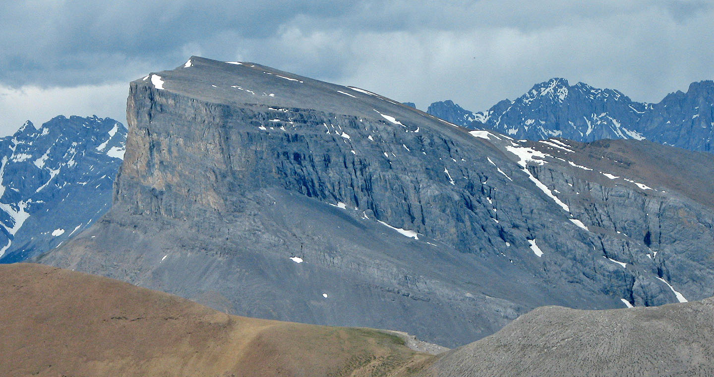
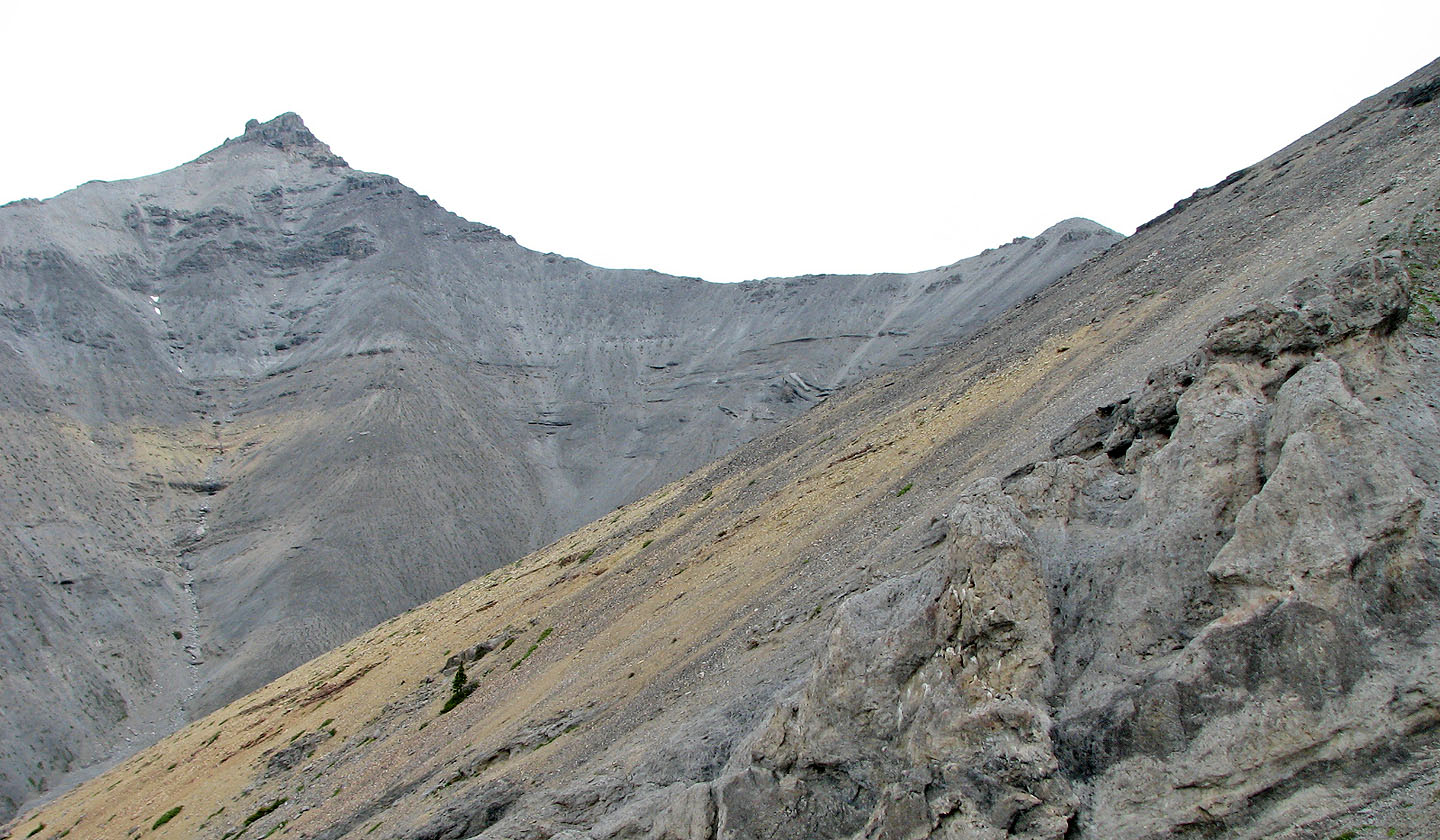
The slope steepens on the left, so I was forced to go up through the cliffs
above me. Mount Howard is on the left.
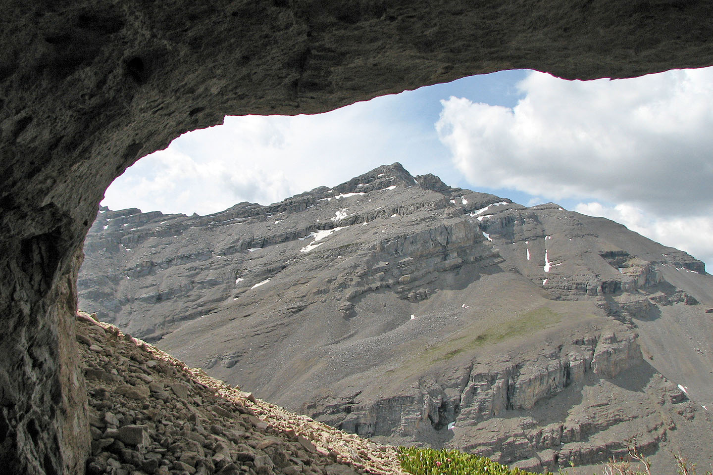
The unnamed peak has several shallow caves like this one facing Mount Fullerton
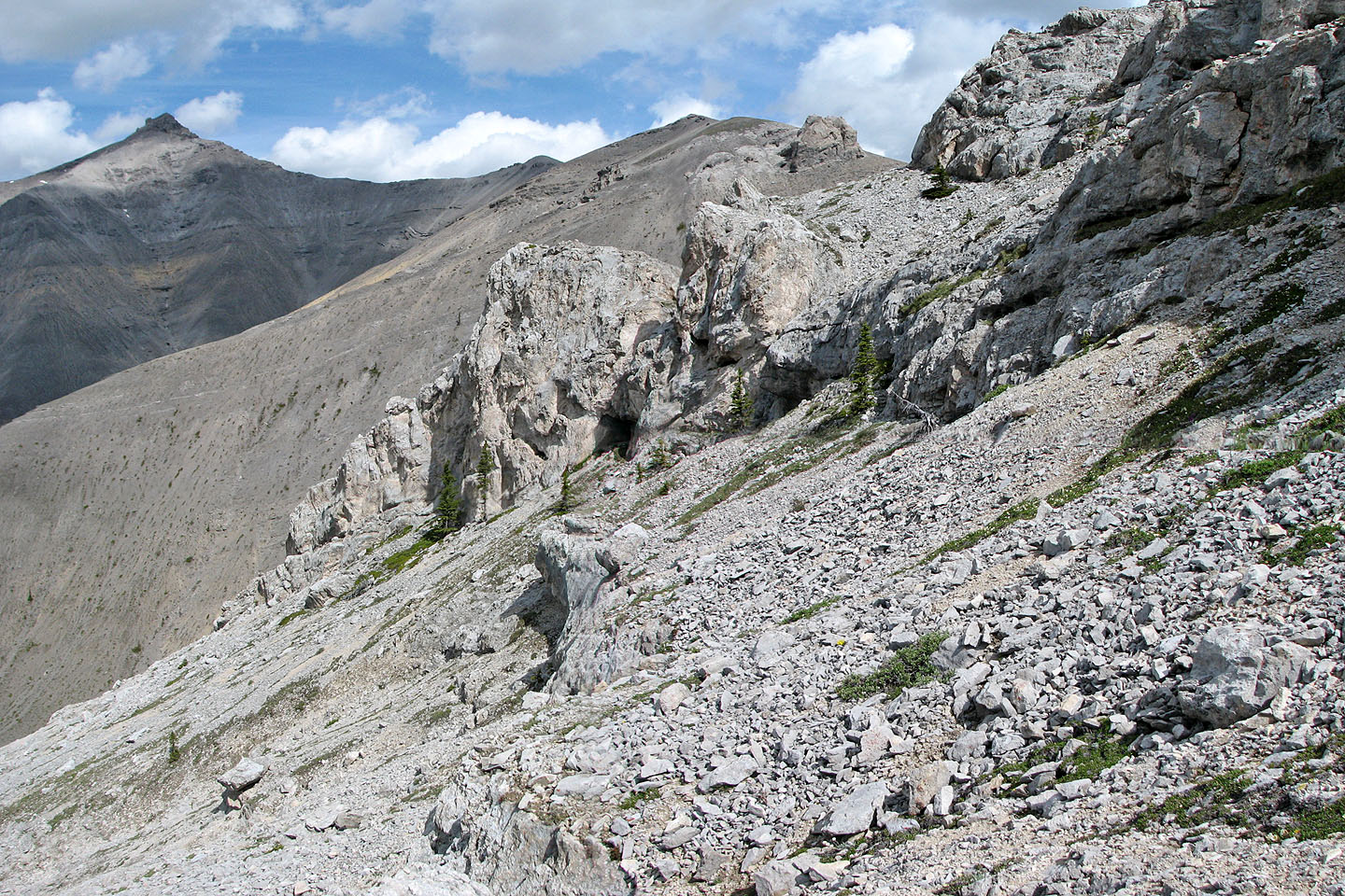
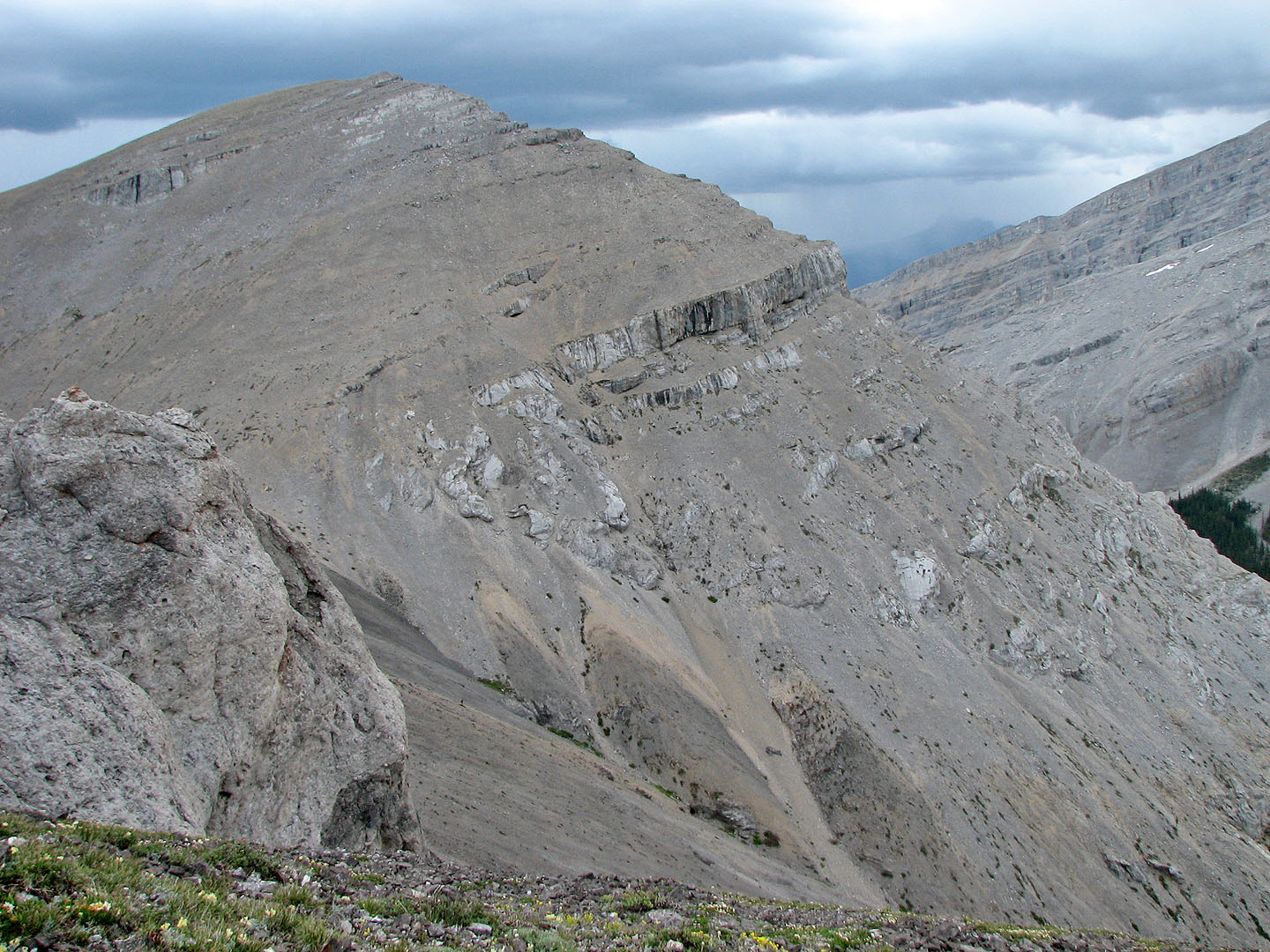
Complex terrain ahead. On the left is Mount Howard. Note the gentle ridge on the left that I would
later descend.
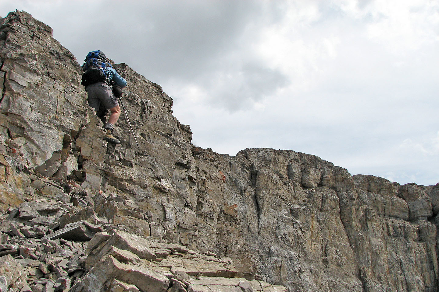
I was soon stopped by the cliffs above me while attempting to ascend the unnamed peak
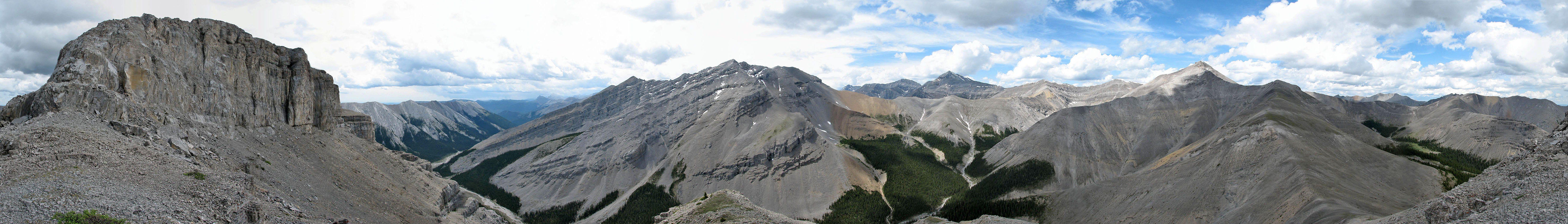
View from the unnamed peak, l to r: unnamed peak, Mounts
Fullerton and Howard
At the col between Mount Howard and the unnamed peak
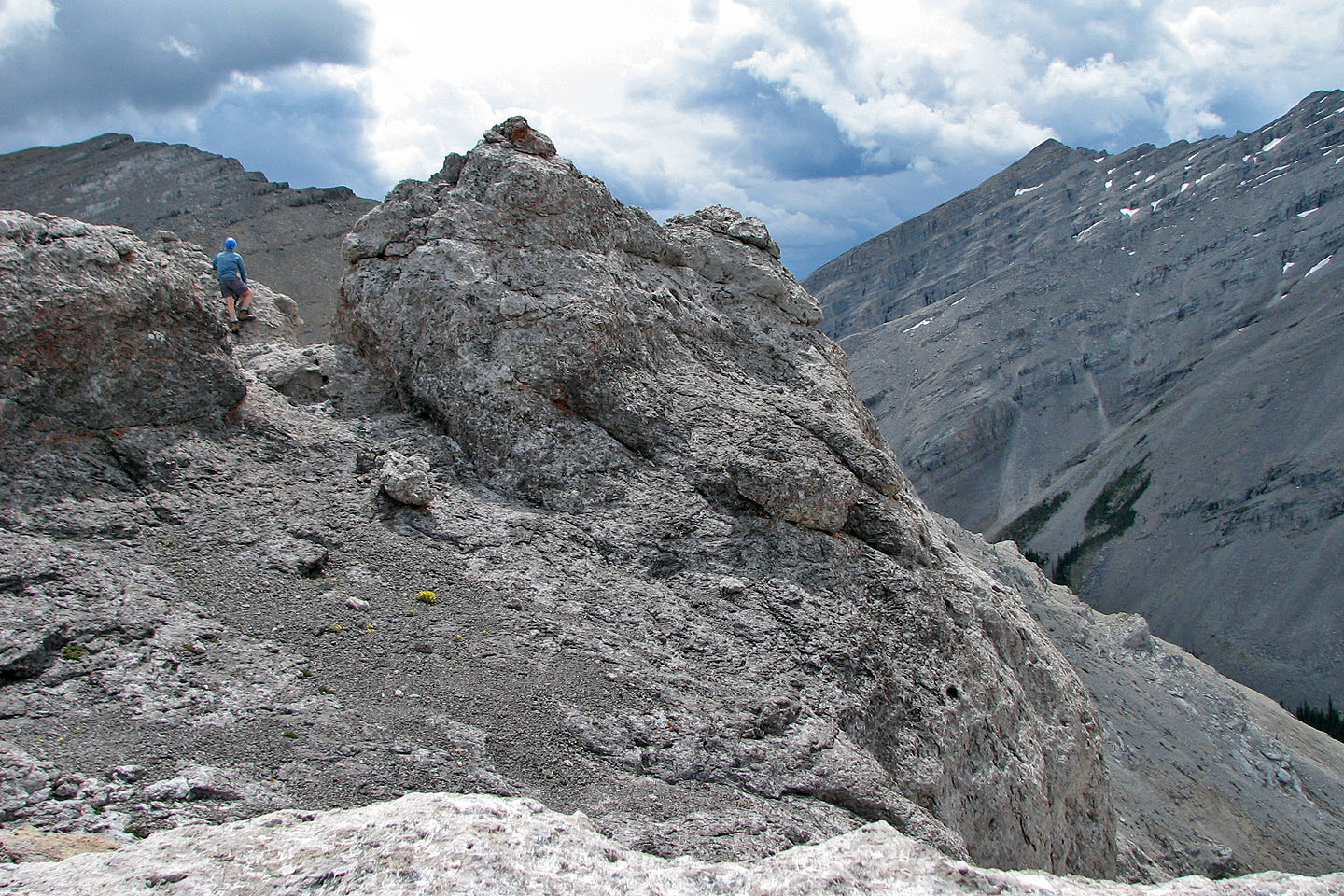
I climbed some rocks to look back at the unnamed peak
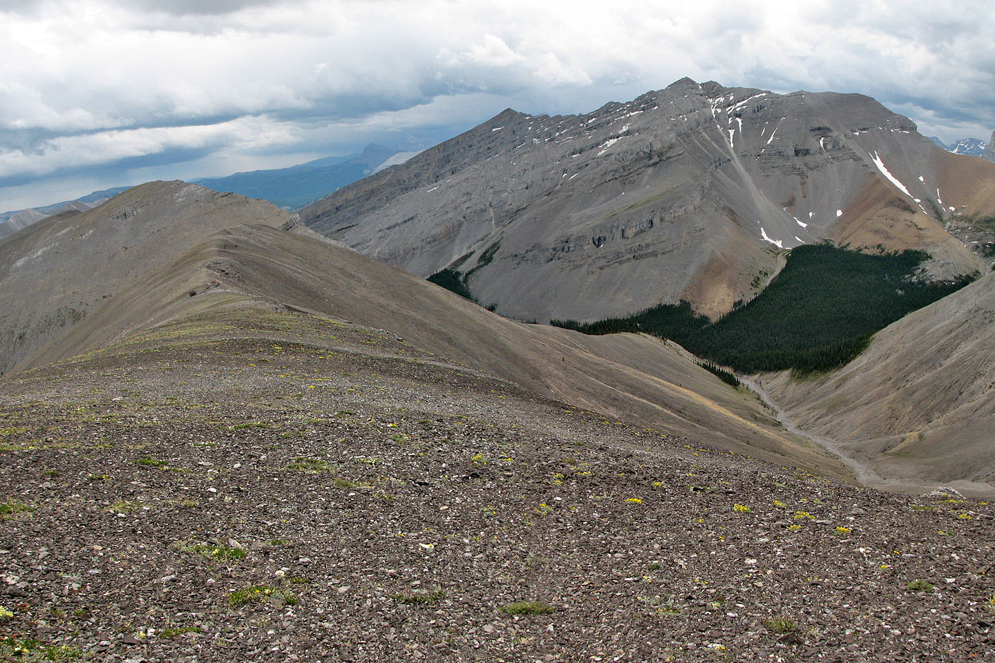
On the ridge with Mount Fullerton behind
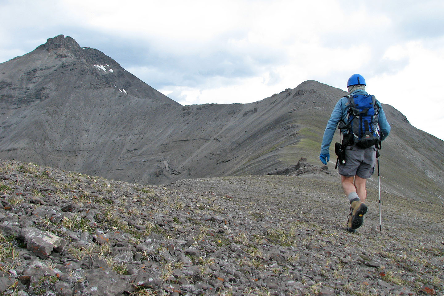
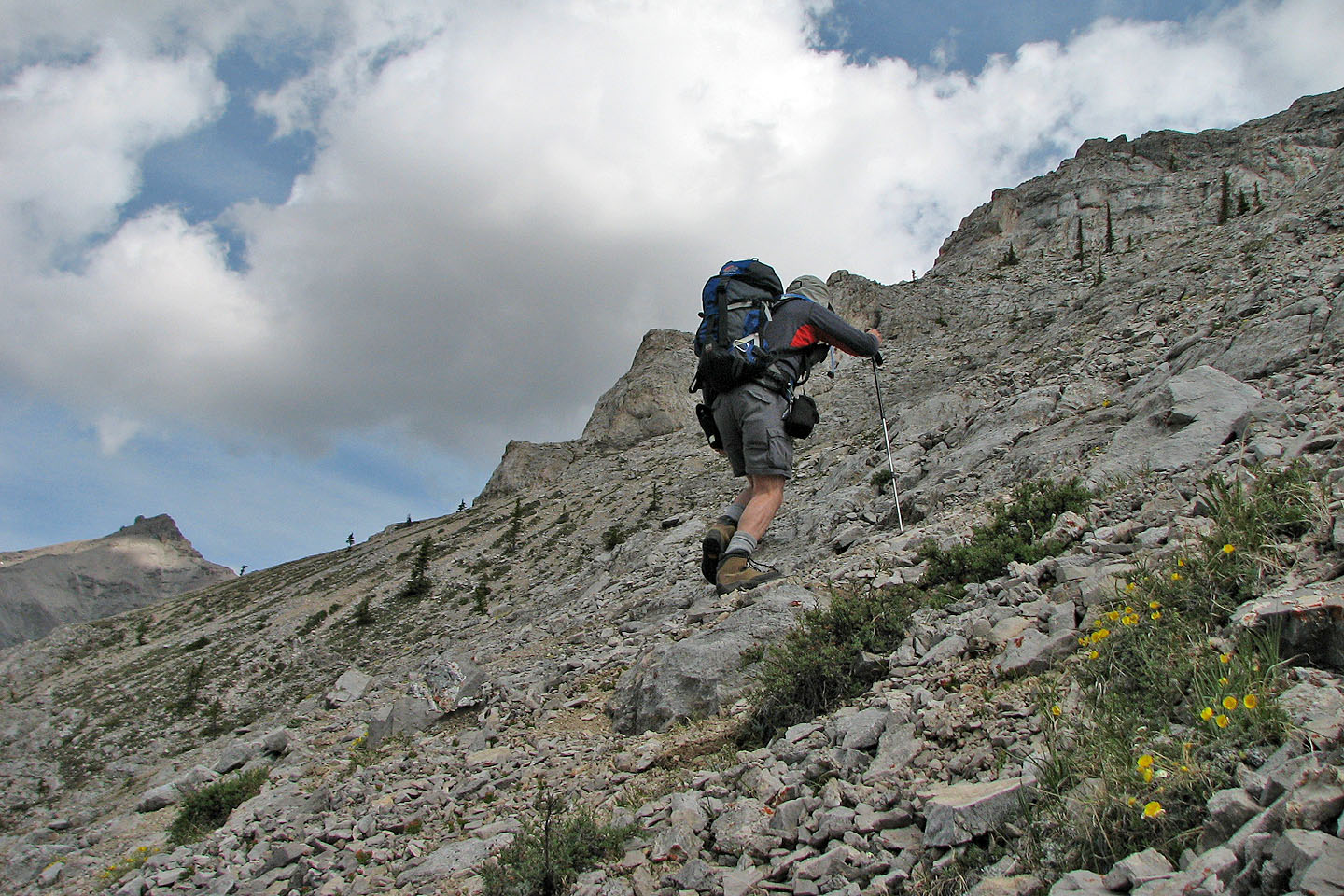
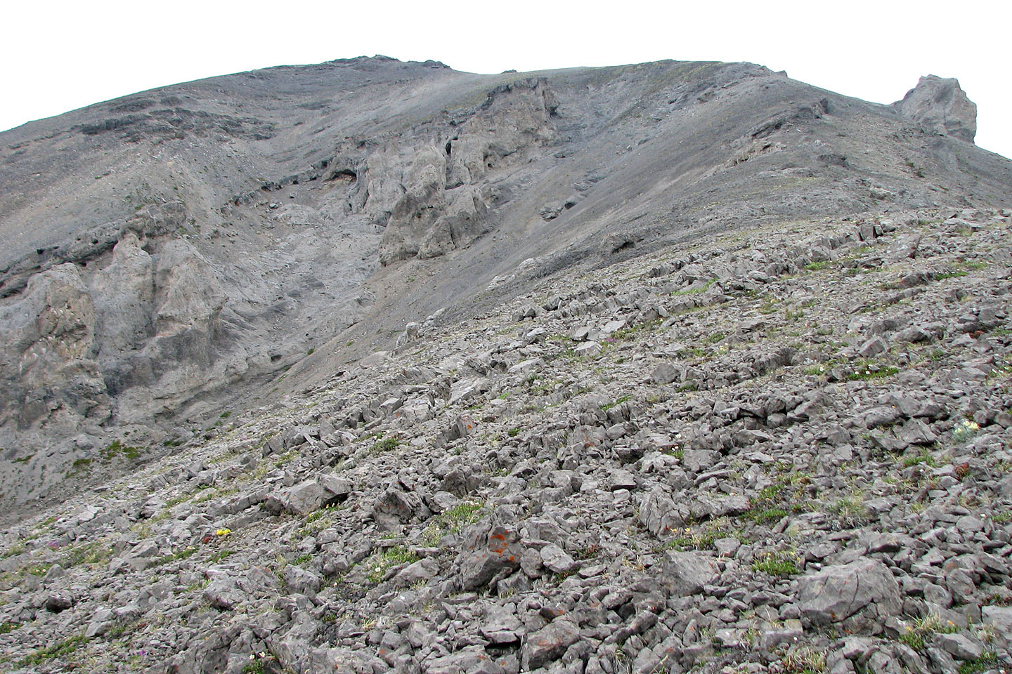
Walking to the high point ahead
Coming up to the high point, the summit fills the view to my left. I turned around soon after this photo.
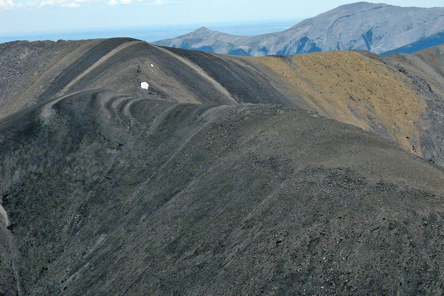
Interesting patterns on Compression Ridge
The unnamed peak: I ascended the right side until I reached the long cliff band. I followed the cliff band
until I could get above it. I could have gone left for an easy ascent to the top of the unnamed peak.
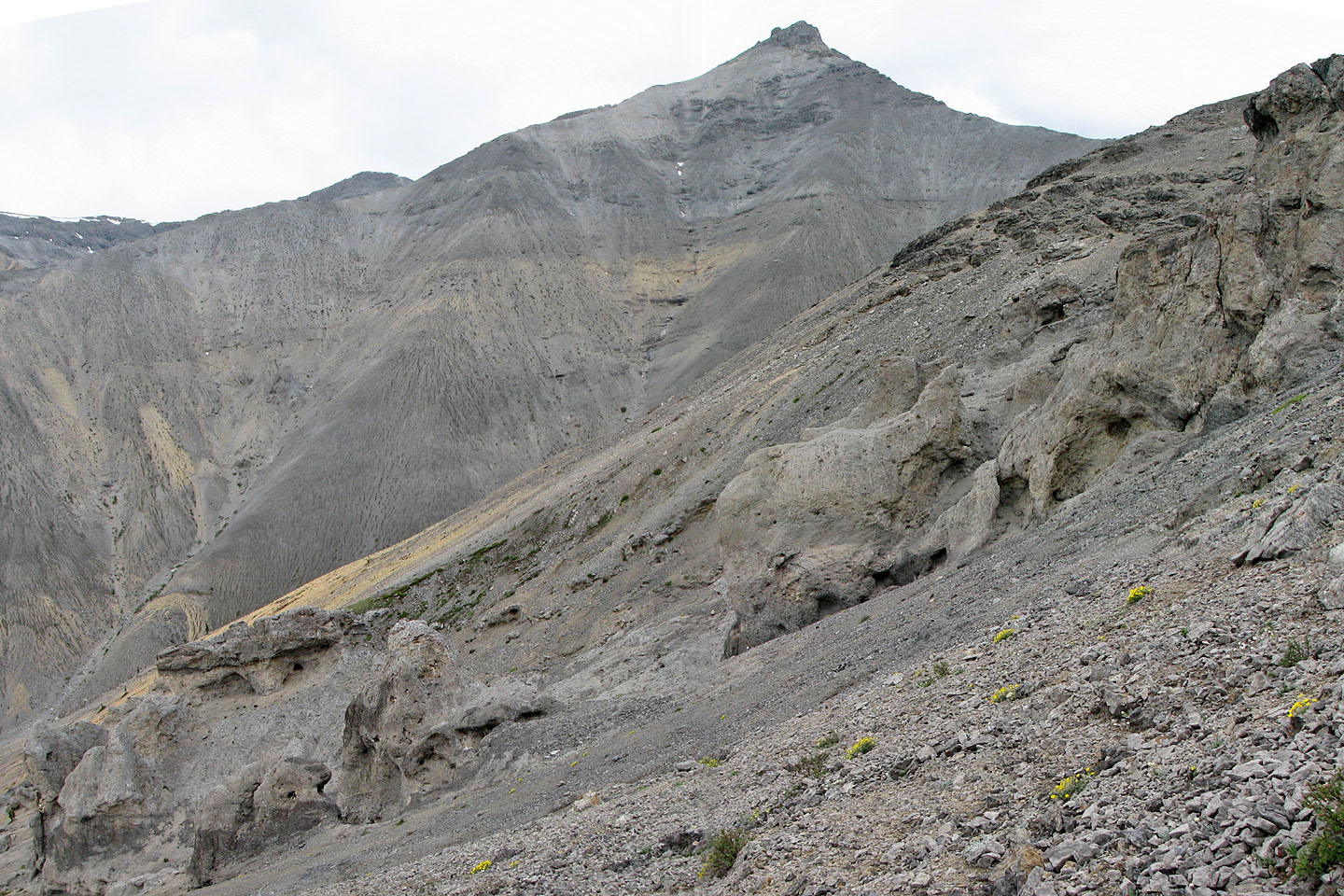
Weird rock formations below Mount Howard
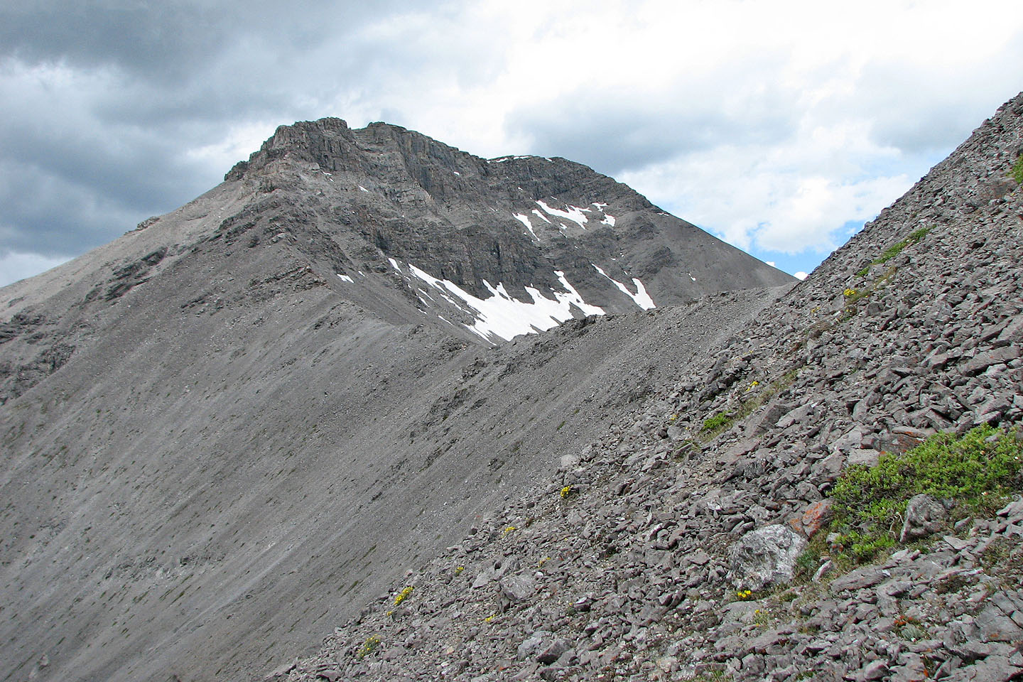
Mount Howard and the high point where I turned around
Looking back at ridge I descended
82 J/15 Bragg Creek