bobspirko.ca | Home | Canada Trips | US Trips | Hiking | Snowshoeing | MAP | About
View from Lost Mountain
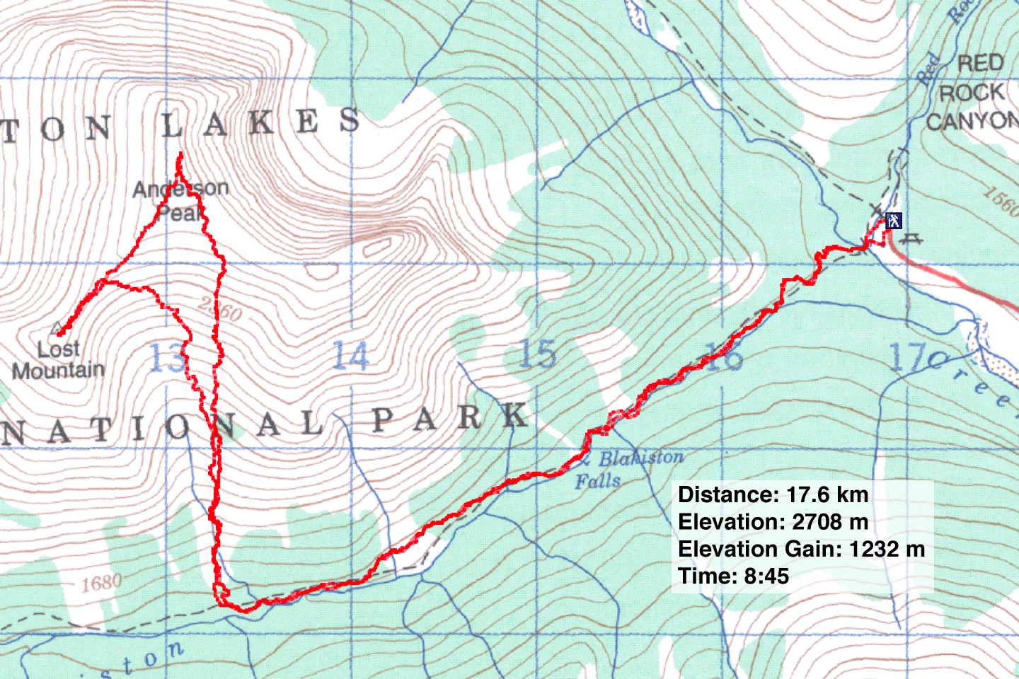
Anderson Peak and Lost Mountain
Waterton Lakes National Park, Alberta
August 11, 2007
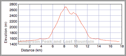
Distance: 17.6 km (10.9 mi)
Cumulative Elevation Gain: 1313 m (4308 ft)
Given the cool, wet weather in the Rockies west of Calgary, Dinah and I headed south to warmer climes to bag Anderson Peak. Following Andrew's description, we hiked the Blakiston Creek Trail. We reached the drainage below the Lost-Anderson col in an hour.
Taking the left side of the drainage would require battling bushes, but the right side was largely free of bushes so we headed up it. This turned out to be a fairly direct route to the summit.
After following the drainage, we came to a small side drainage and hiked up it. We soon left this drainage and struggled through dense bush for a short way before reaching open slopes. We continued toward the summit, although now it was blocked from our view.
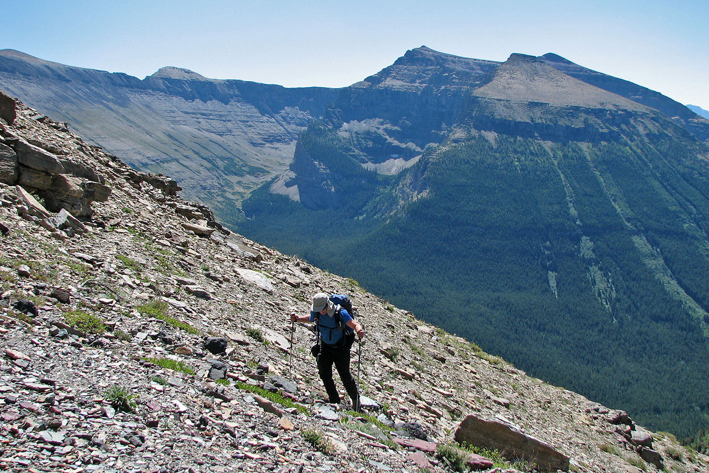
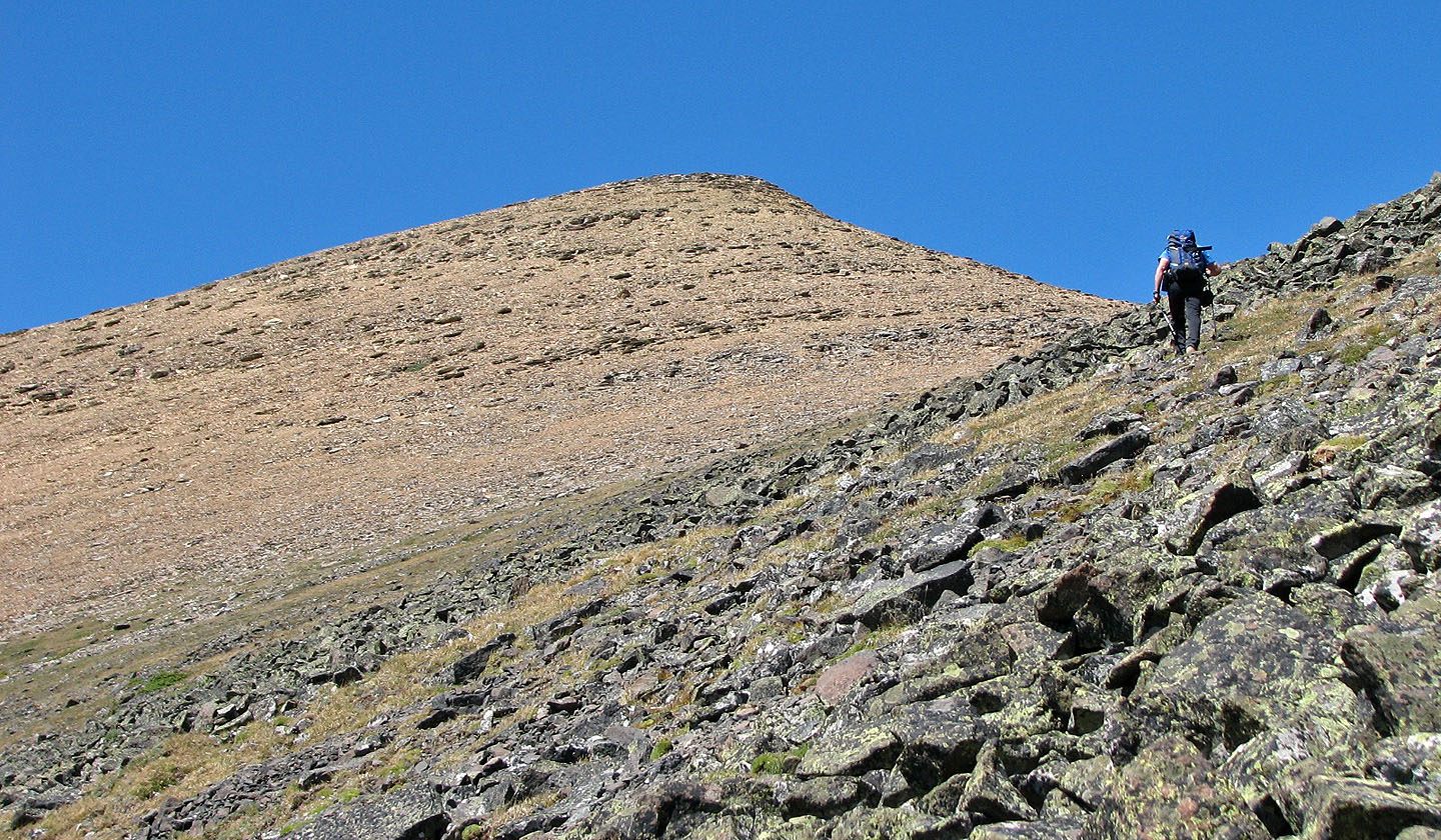
We plodded up scree until we reached the black rocks on our left. The rocks were stable and a welcome relief from the scree. We quickly reached the orange scree below the summit and trudged to the top. As always, the colours of Waterton enthralled us. After a half-hour stay on the summit, we descended to the Lost-Anderson col.
From the col, the ascent of Lost Mountain was quick (only 60 m of elevation gain!). Sitting nearly 500 m below Anderson, it's a wonder that this tiny point was given a name. A buttress of red rock prevents a direct ascent up the ridge, but after looking around, we found that the left side offered the simplest route: we walked along a ledge until we found a spot where we could regain the ridge with a moderate step.
After a 15-minute stay on the summit, we returned to the col and retraced our steps down the drainage.
We enjoyed the trip although in retrospect, after checking the Lost Mountain route and seeing how close it was, I wish we had descended the south slopes of Lost Mountain for the different scenery.
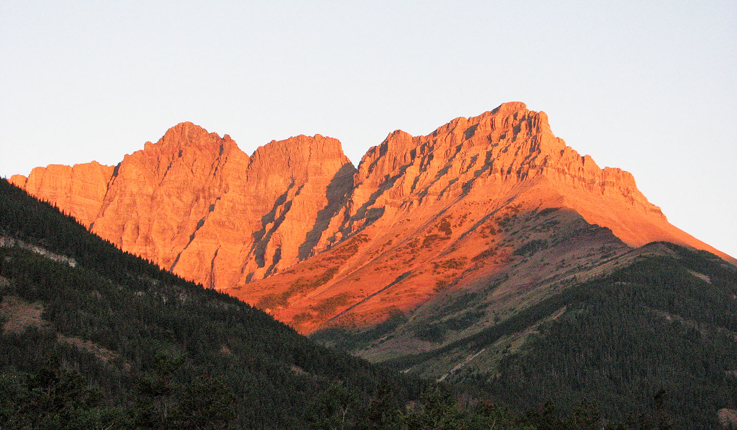 Sunrise lights up peaks by our campsite
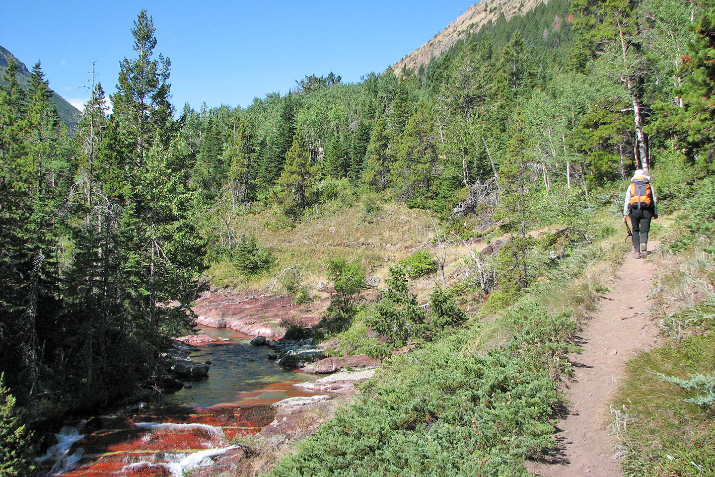
Following the trail alongside Blakiston Creek
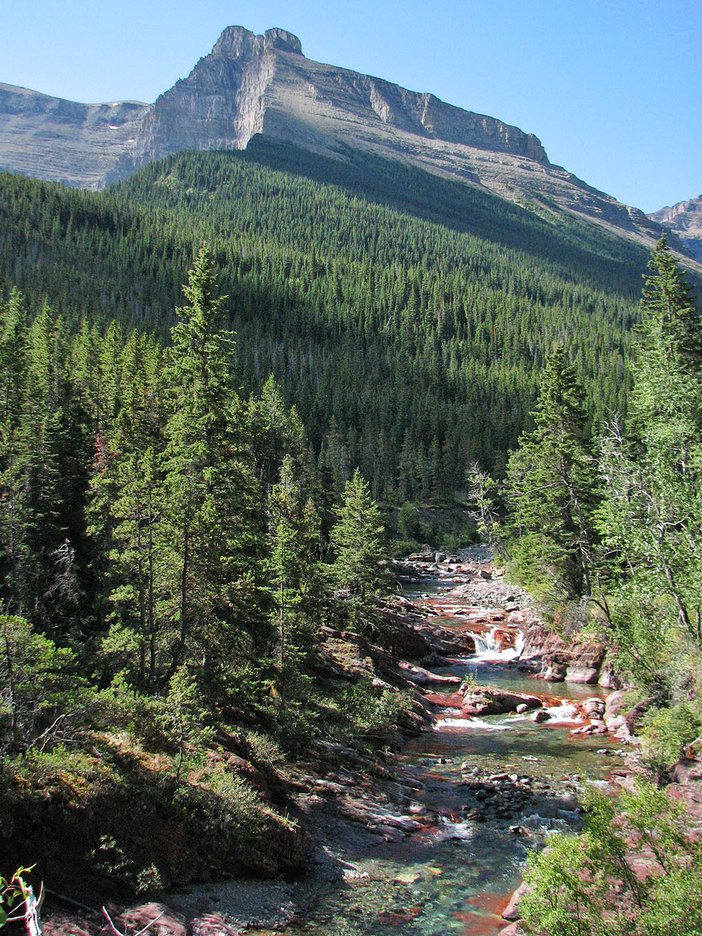
Another view of the creek
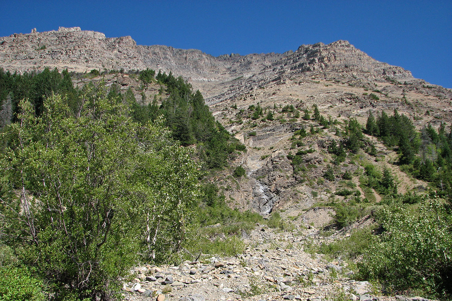
Looking up the second drainage, the moderate scrambling route to Anderson Peak
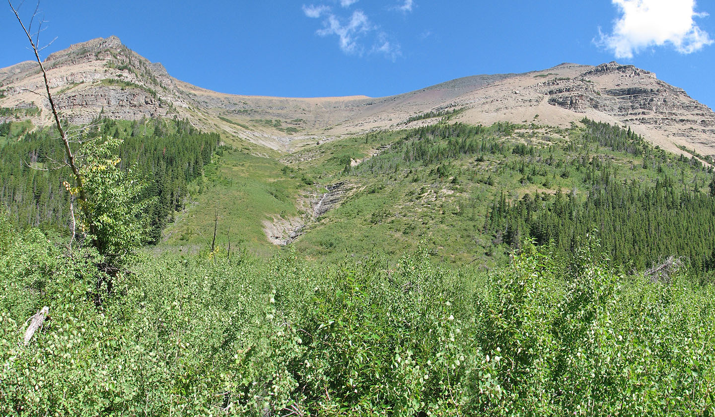
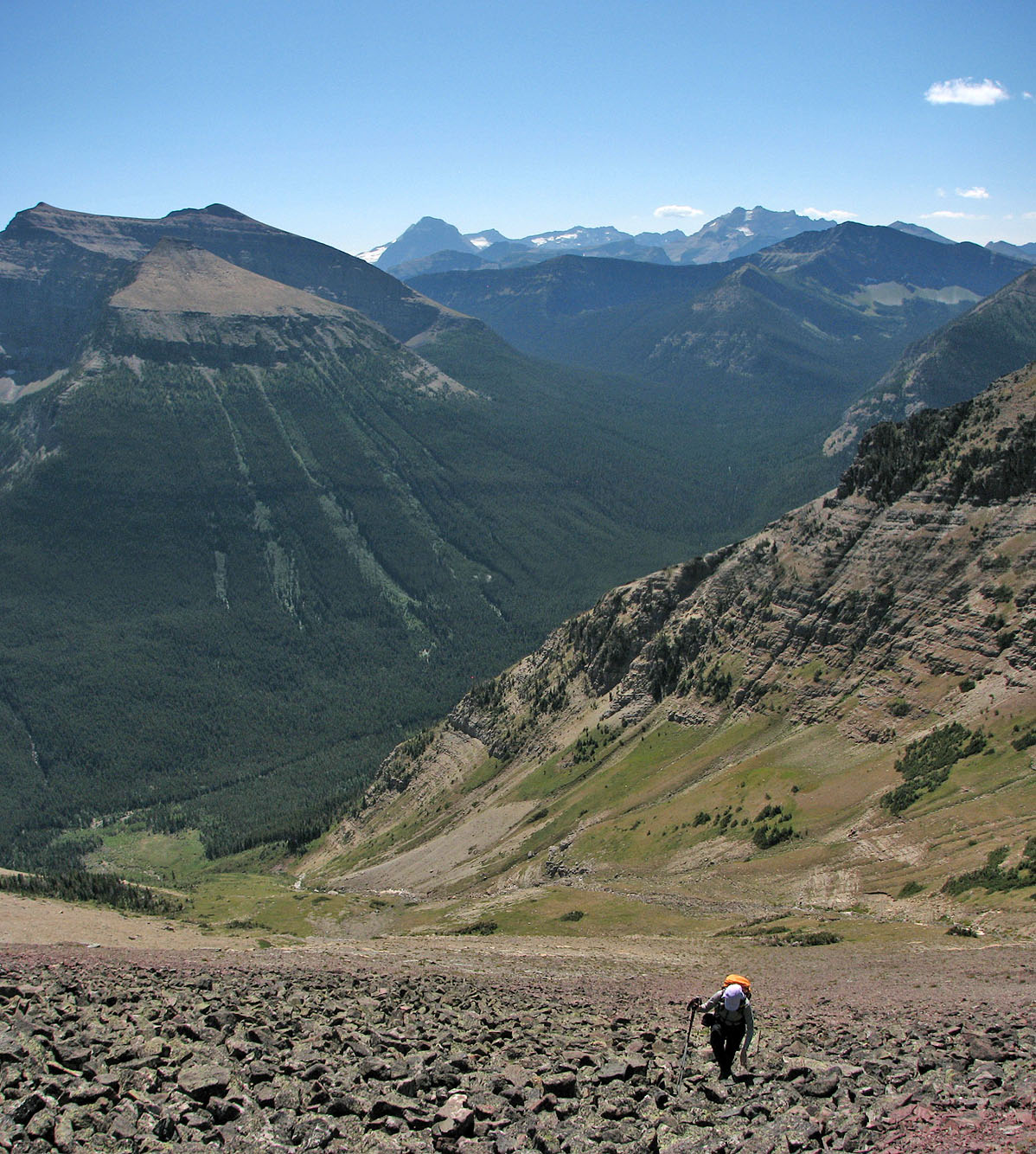
Lost Mountain (left) and Anderson Peak (centre) from the trail (mouse over for our route)
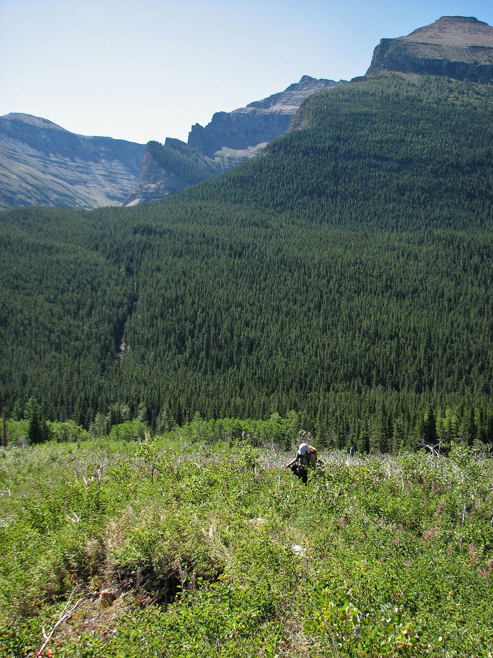
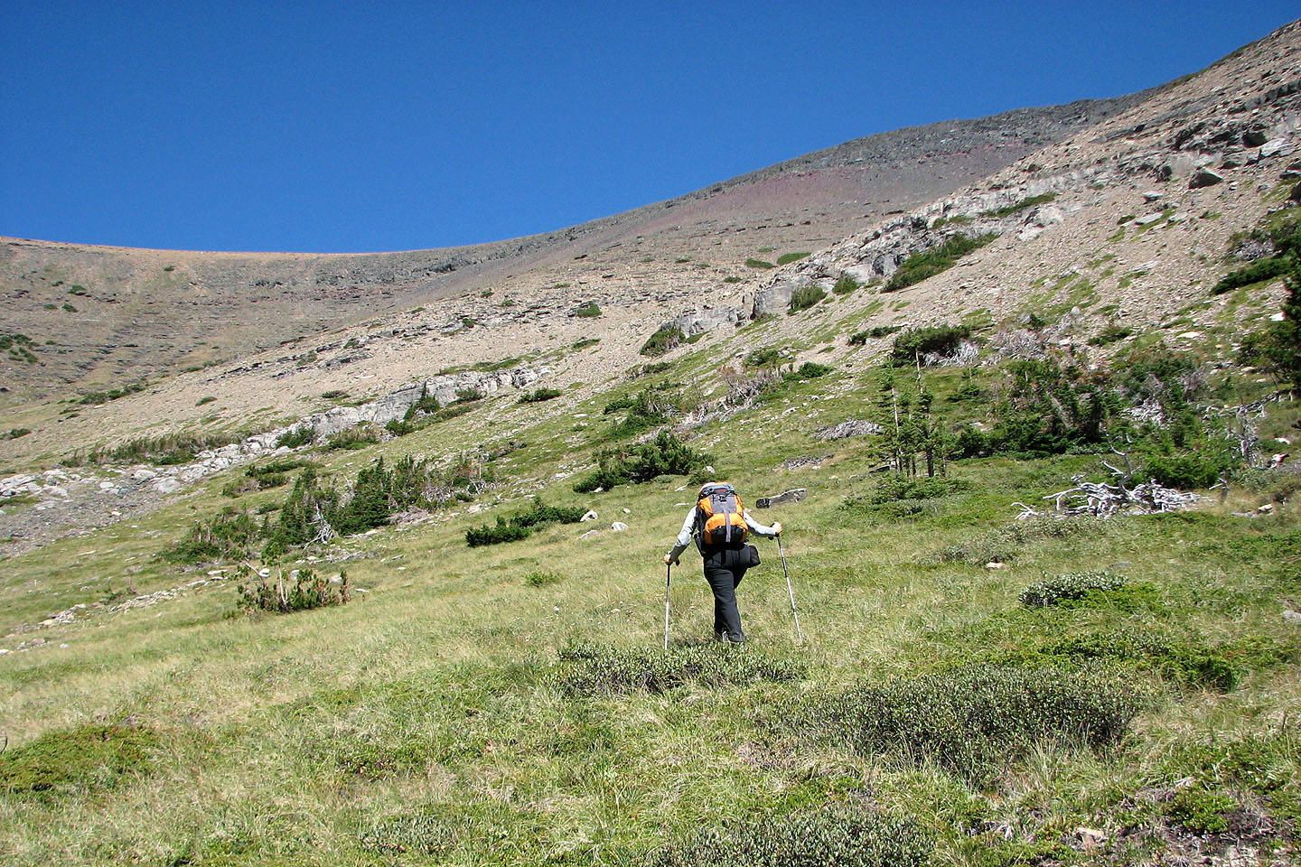
After leaving the trail, we bushwhacked to the drainage
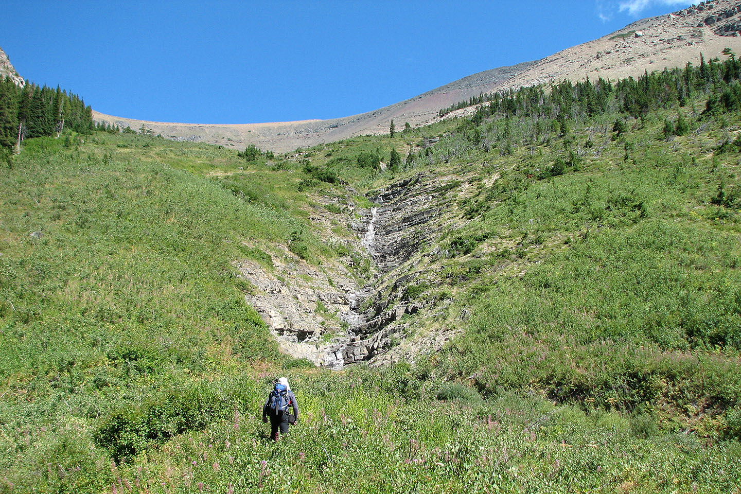
We climbed up the right side of the drainage which was semi open
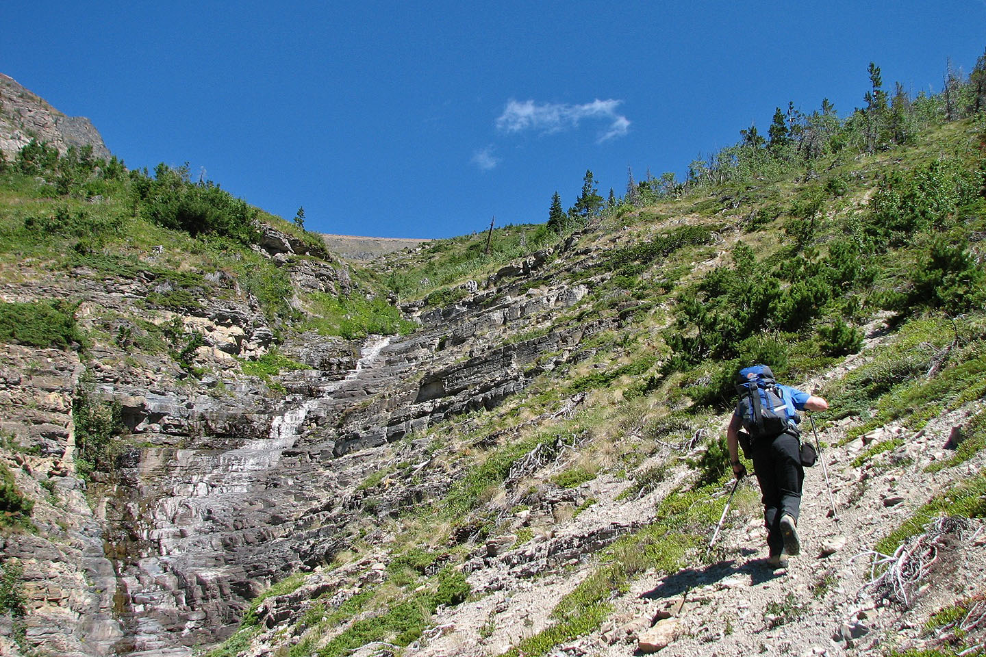
Fairly easy travel here. Animal trails eased the way.
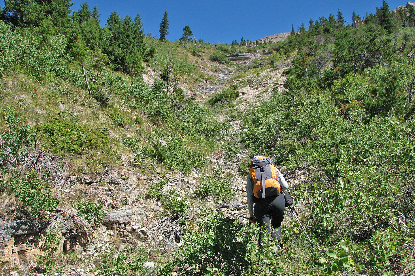
Going up the side drainage: we exited on the left and headed towards the tall
spruce on the skyline. This lone tree guided us back to the drainage on our return.
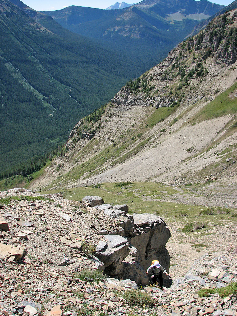
After bushwhacking, we reached an open scree slope. Mount Hawkins behind us.
We welcomed a reprieve from the scree and traveled on grass before hitting more
scree. The summit is above Dinah but hidden from view.
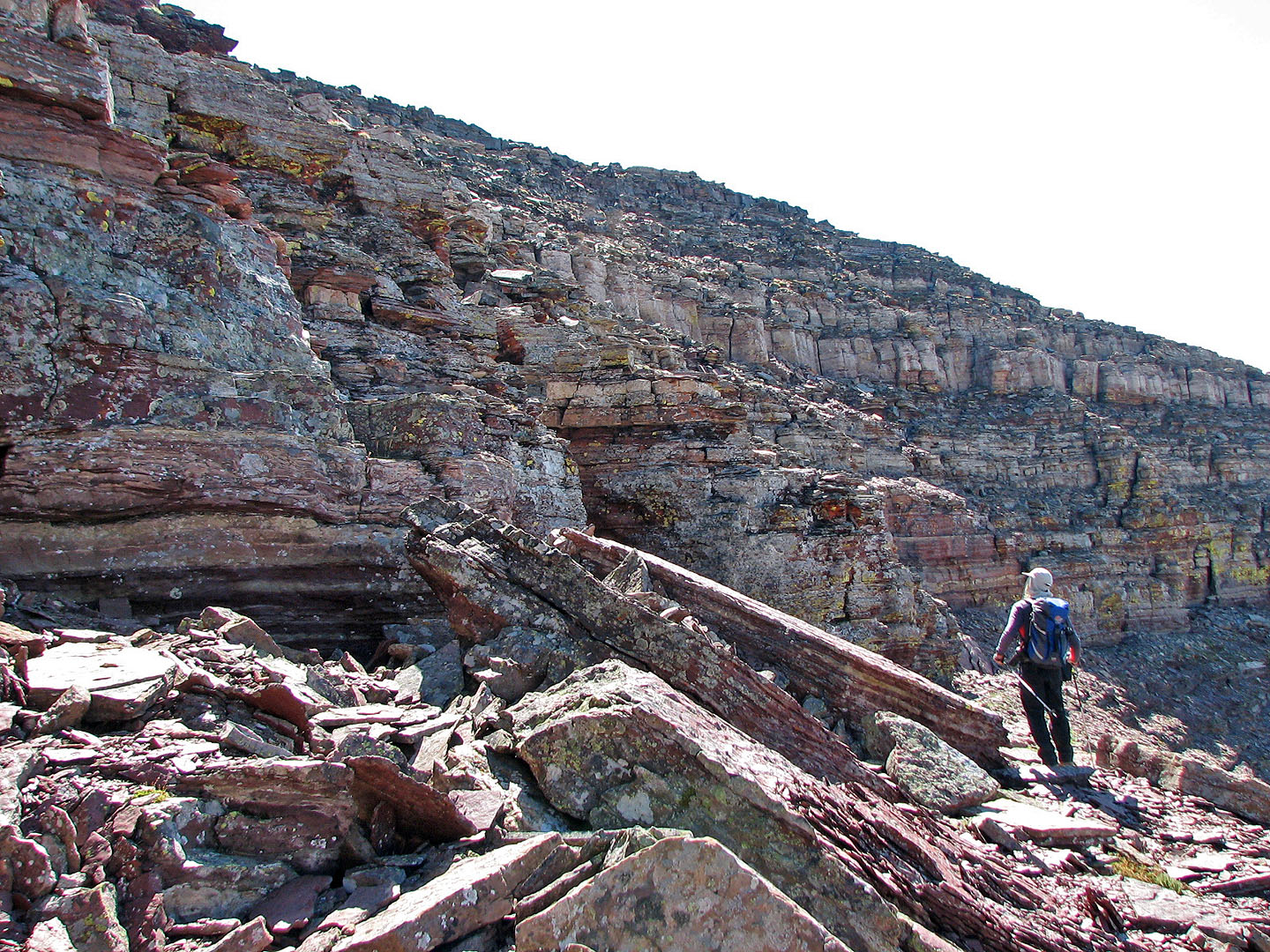
We bypassed cliffs

The slope is interrupted by a short cliff band
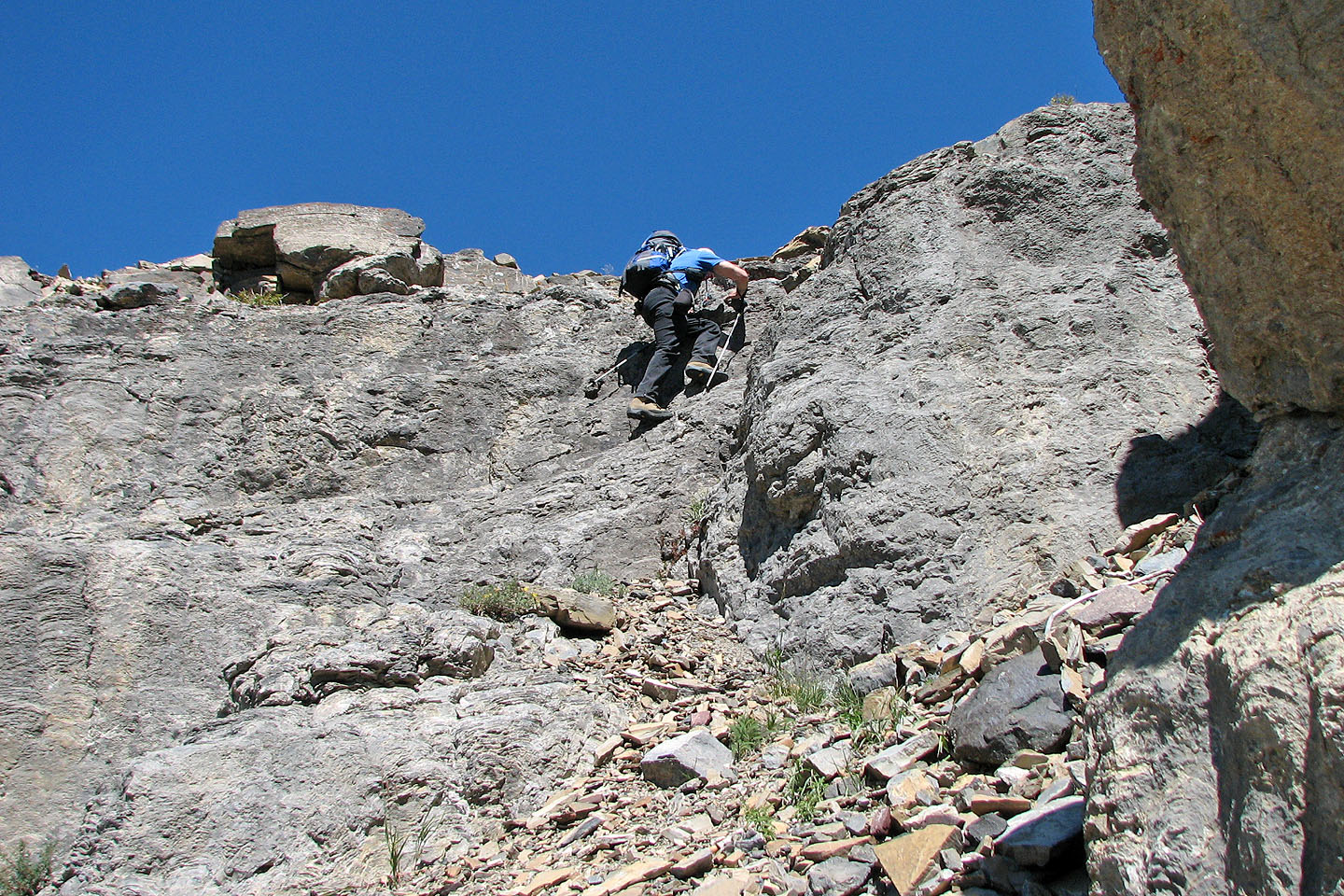
Scrambling up a short rock band
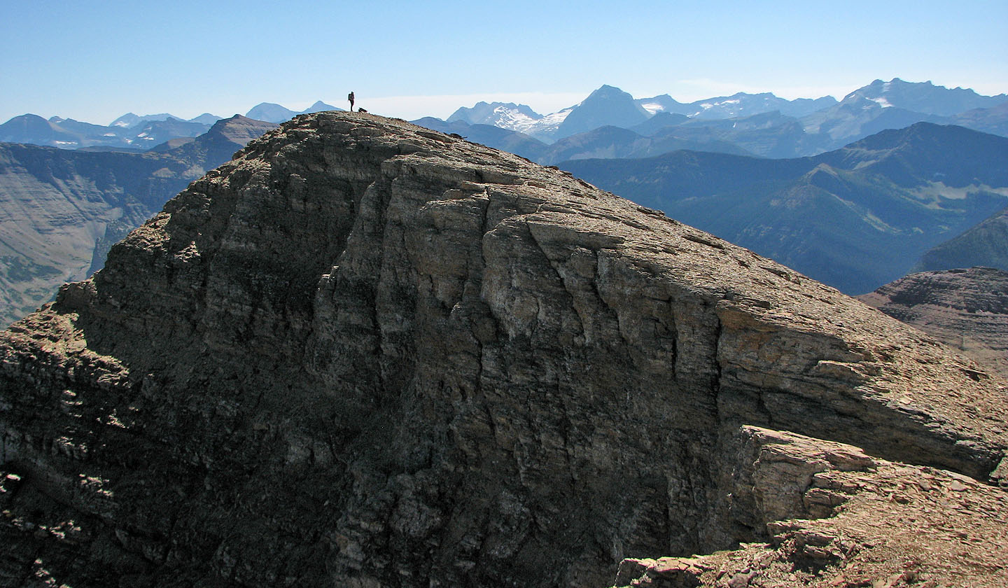
Lost Mountain
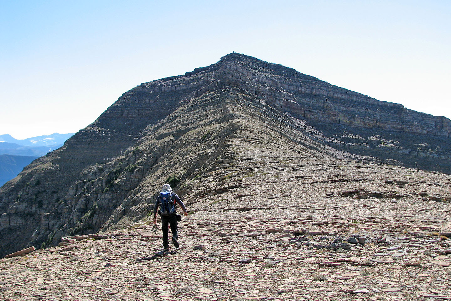
We made good time ascending the black talus slope
Anderson Peak summit ahead
Mount Blakiston fills the background
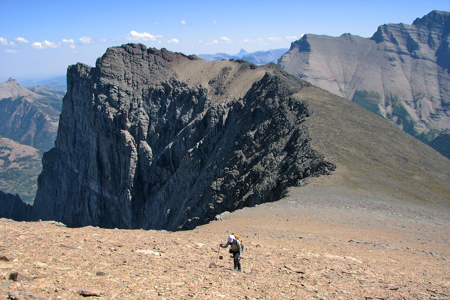
The east end of Anderson behind us
Dinah on the summit (mouse over to look back)
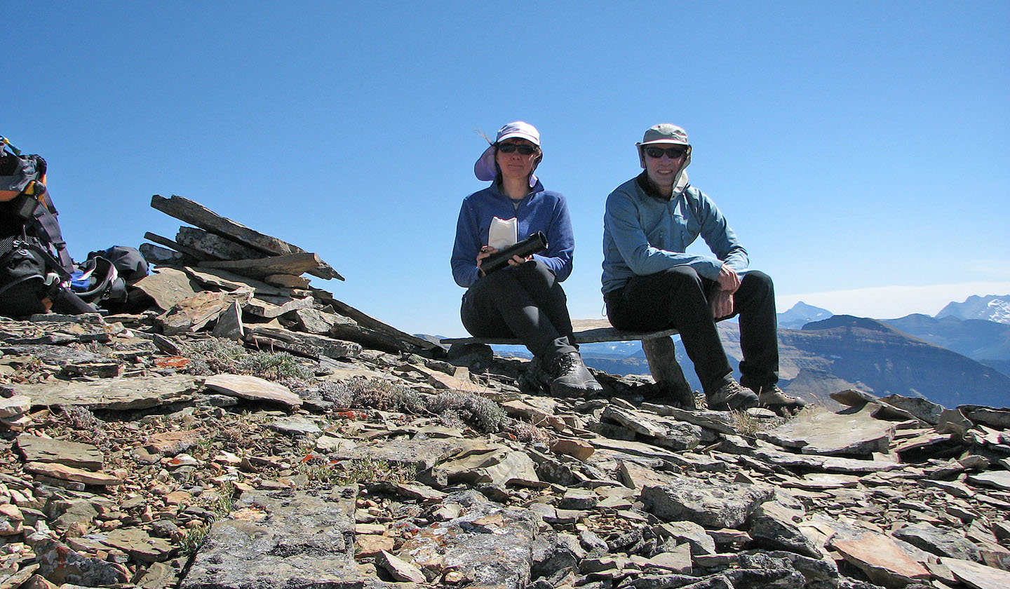
I built a chair next to the summit using a couple of rock slabs. Dinah checks out the summit register.
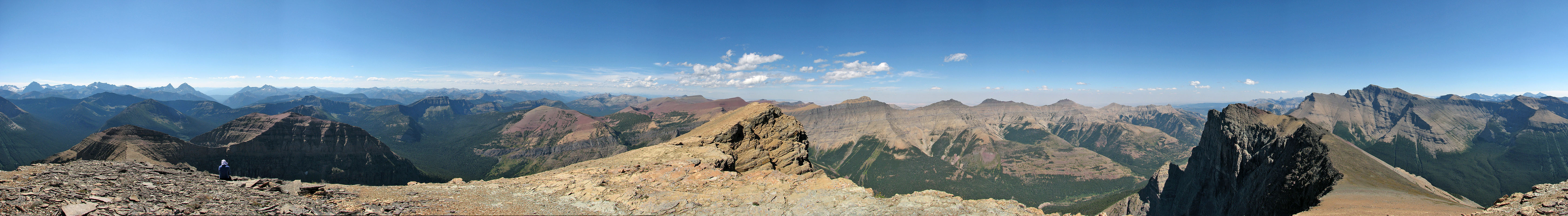
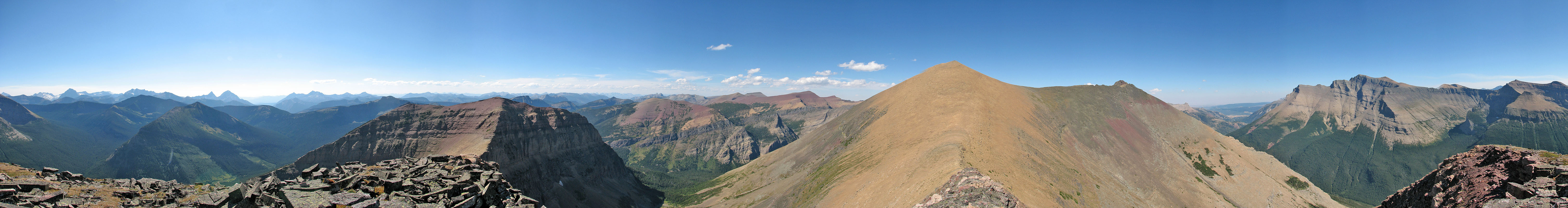
View from Anderson Peak
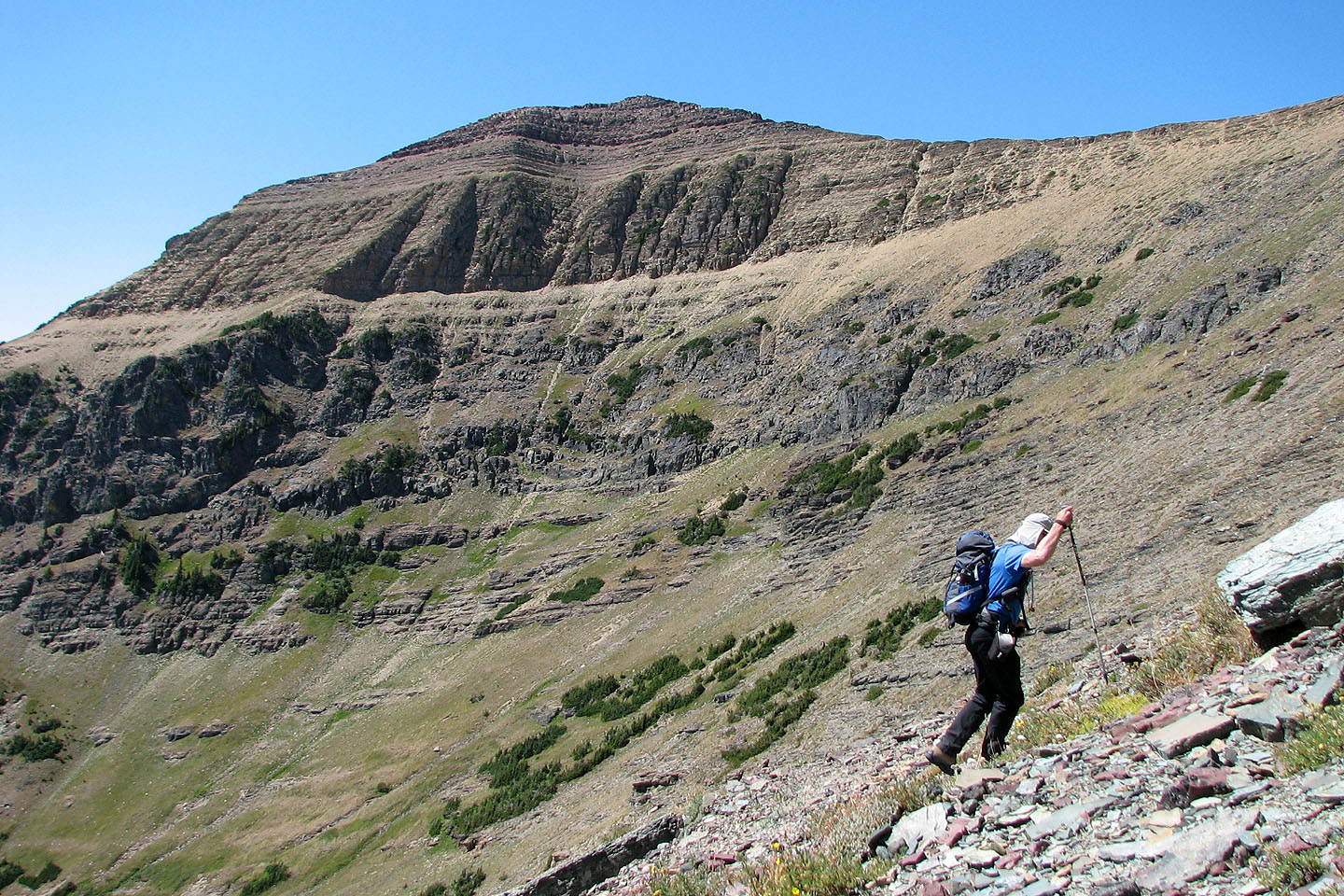
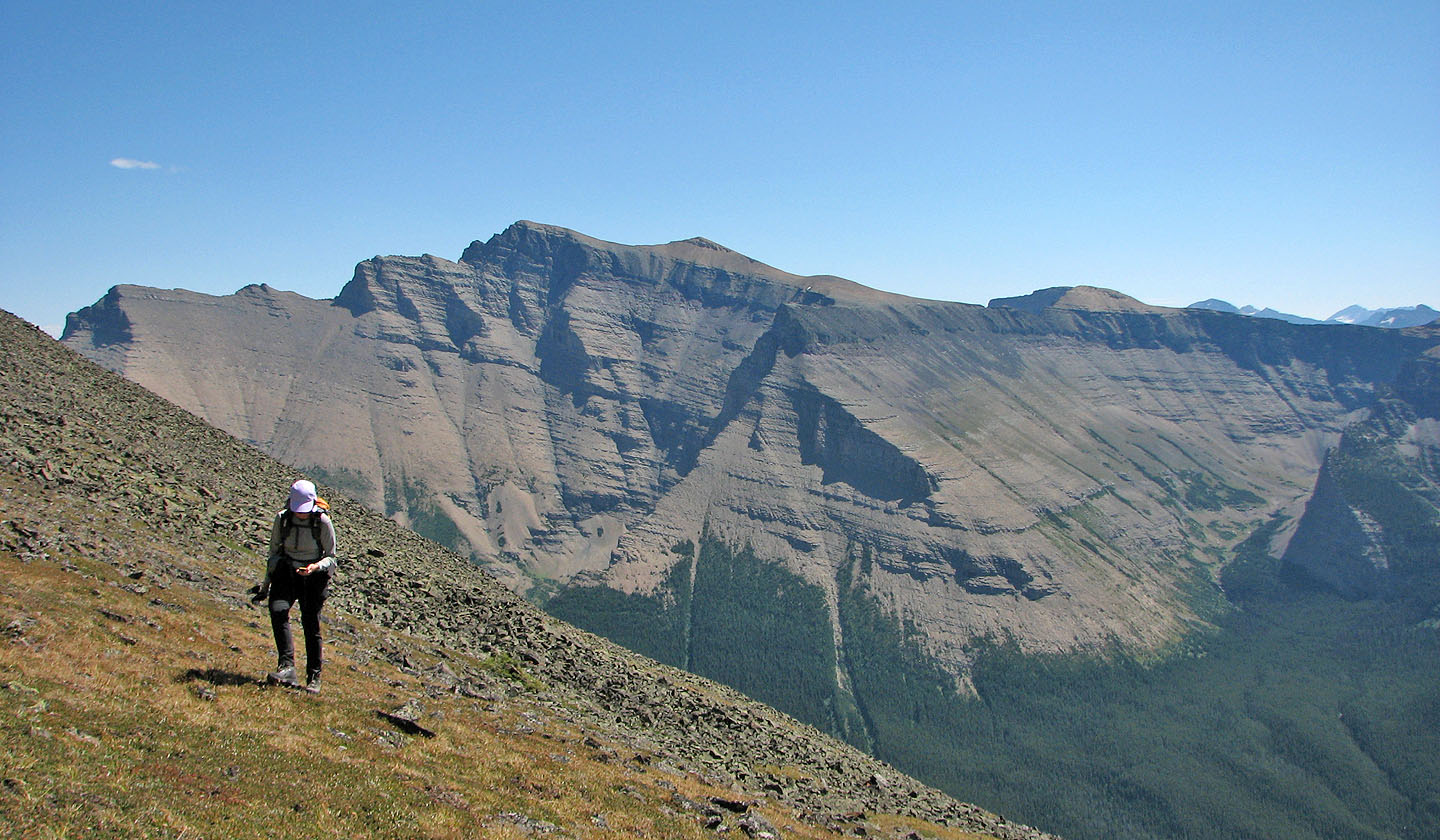
Lost Mountain from the col
The right side of the buttress is rather complex so we went
around the left side where routefinding was simpler
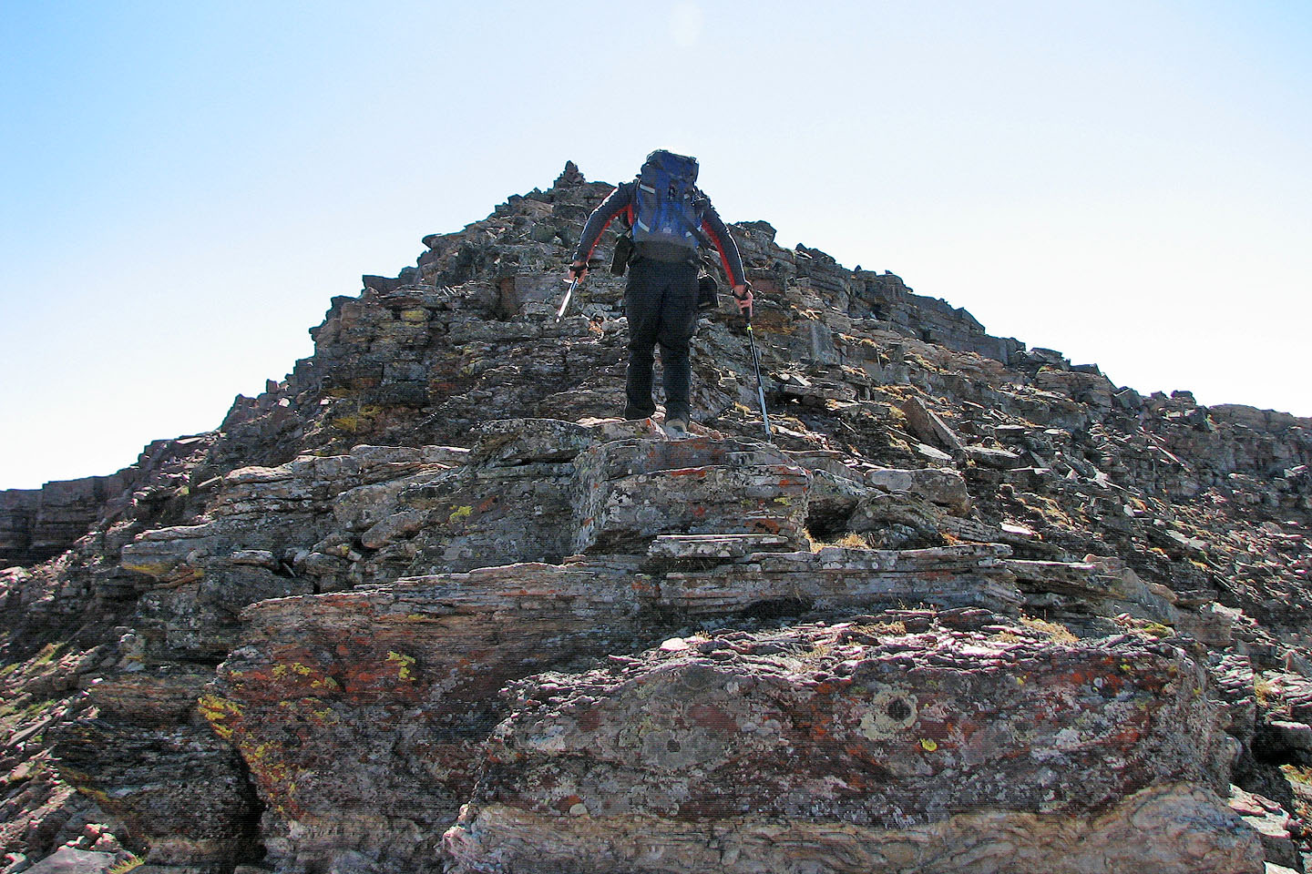
Almost at the summit
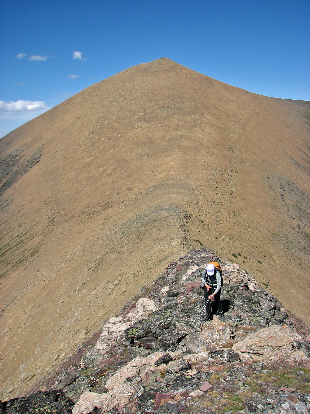
Looking back at Anderson Peak as Dinah ascends Lost
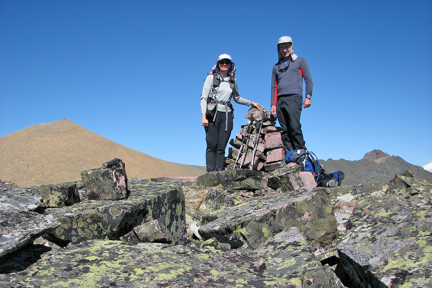
On the summit of Lost Mountain

Heading back down the drainage
82 G/1 Sage Creek