bobspirko.ca | Home | Canada Trips | US Trips | Hiking | Snowshoeing | MAP | About
View from Banded Peak
Banded and Outlaw Peaks
Kananaskis, Alberta
May 28, 2005
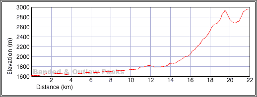
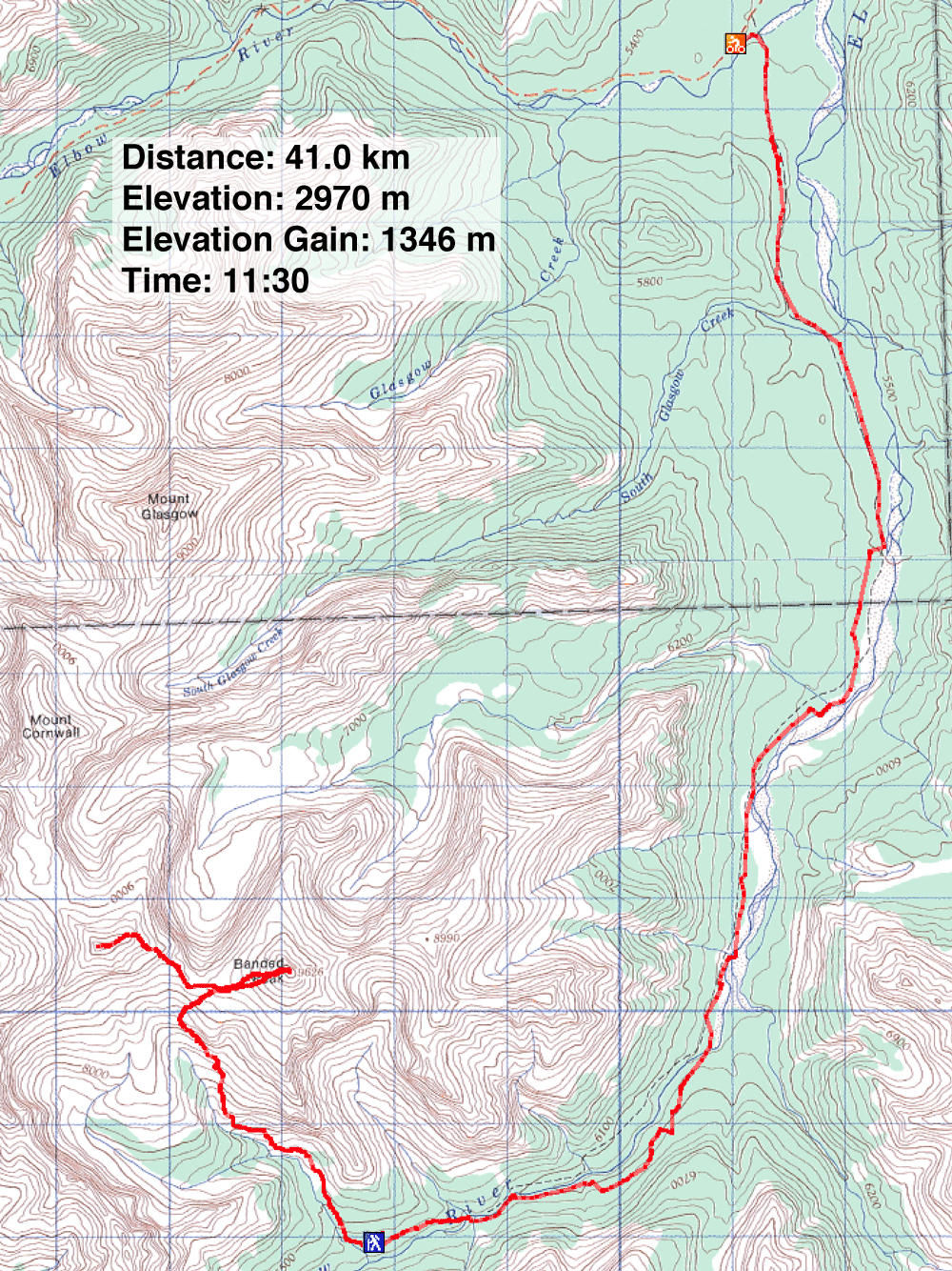
Distance: 41.0 km (25.5 mi)
Cumulative Elevation Gain: 1664 m (5459 ft)
Taking advantage of the fine weather, Dinah and I decided to bag two peaks. We did so even though Dinah wasn't
feeling well; unknowingly she had become dehydrated when we climbed Mount Lady Macdonald the day before. We
realized this while biking to the trailhead to Banded Peak when she suffered from fatigue, headache and sore
muscles. We stopped frequently, so she could rest and drink water. Two hours after starting out, she felt a bit
better, and we traded our cycling shoes for hiking boots. We slowly headed up the trail.
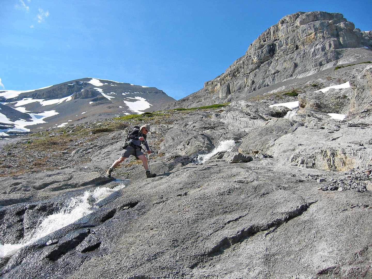
We had no trouble following the trail to the basin until it disappeared into solid rock. We climbed the east
slope expecting to spot the trail from above but no such luck. Most of the valley was under snow, so we
traversed a talus slope and then, after squeezing between slabs below and cliff bands above, we reached the
Banded-Outlaw col.
Although Outlaw Peak filled our view while going up the basin, it wasn’t until we arrived on the col that
we finally saw our first objective, Banded Peak.
Dinah still hadn’t fully recovered, and as we crunched up the loose shale, it was touch and go if she
would make the summit. Eventually though, we found ourselves standing next to Banded's summit cairn looking at
the bewildering contents of the register canister: toy cars, music CDs, a key chain, a slide rule and other
sundry. A card read: “Congratulations! You have found Banded Peak Cache.”
The register held a September entry congratulating the first adventurers to arrive on the peak since the
placement of the cache. However, we weren't the first to summit Bandit that year; another party beat us by five
days.
Summiting Banded Peak infused Dinah with new energy, and now she wanted to bag Outlaw Peak. We dropped 265 m
down to the col and headed up Outlaw. Like Banded, it too was little more than a pile of scree.
The loose rock here was worse than that on Banded Peak. It seemed to go on forever, but quicker than we
expected, we were on the summit of Outlaw. At 2970 m, it was slightly than Banded's 2943 m top. After skimming
the summit register and taking photos, we made our way down. We had no trouble finding scree runs for a fast
descent to the col.
Soon we were navigating through the basin. Under the blazing sun, water from melting snow trickled, flowed, and
roared. The sound of running water was all around us. The din gradually diminished as we hiked down the trail to
retrieve our bikes.
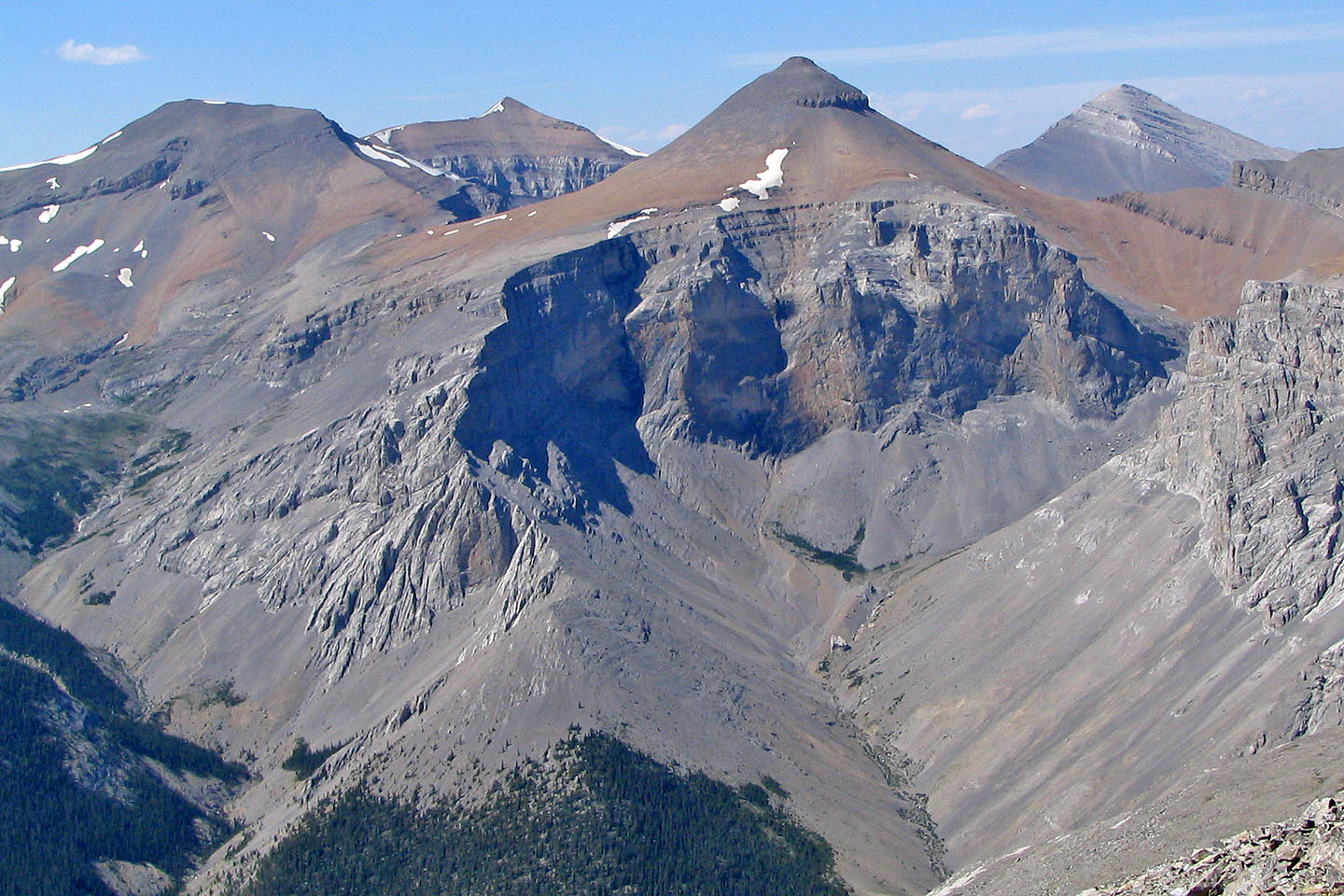 Outlaw Peak, Mount Cornwall, Banded Peak and Mount Glasgow. Our ascent trail appears in the valley on the
left.
Outlaw Peak, Mount Cornwall, Banded Peak and Mount Glasgow. Our ascent trail appears in the valley on the
left.
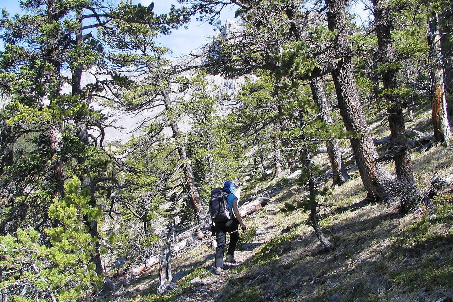
Hiking up the trail through the trees
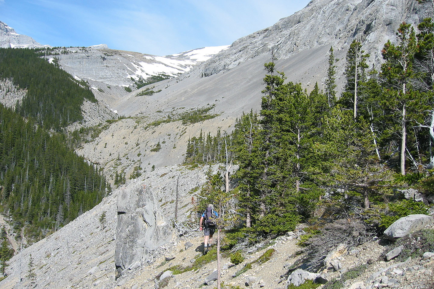
On the trail to Banded and Outlaw Peaks
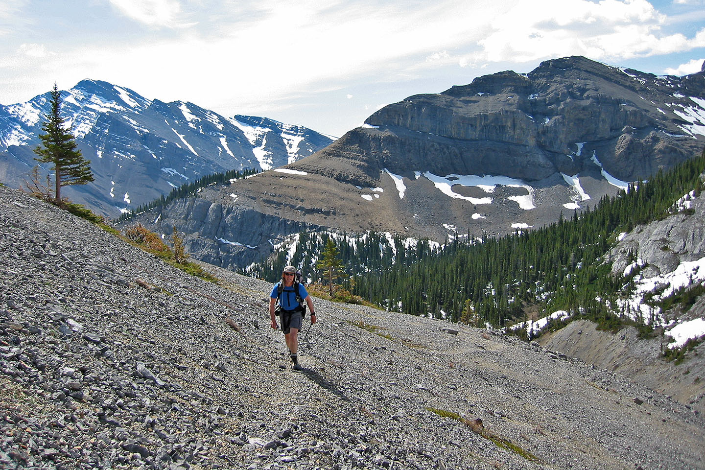
Trail cuts into a scree slope for a long way
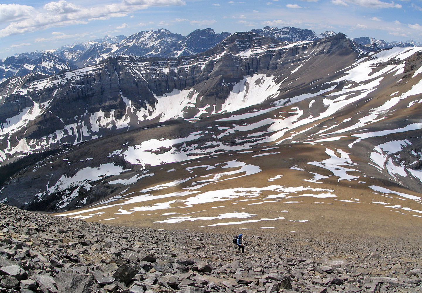
Soon after this we lost the trail. Outlaw Peak is on the left.
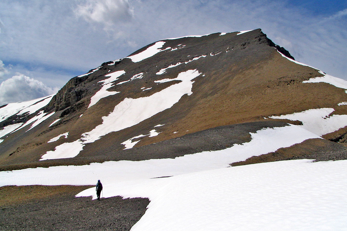
From the Outlaw-Banded col we head up Banded Peak.
Cougar Mountain is on the left.
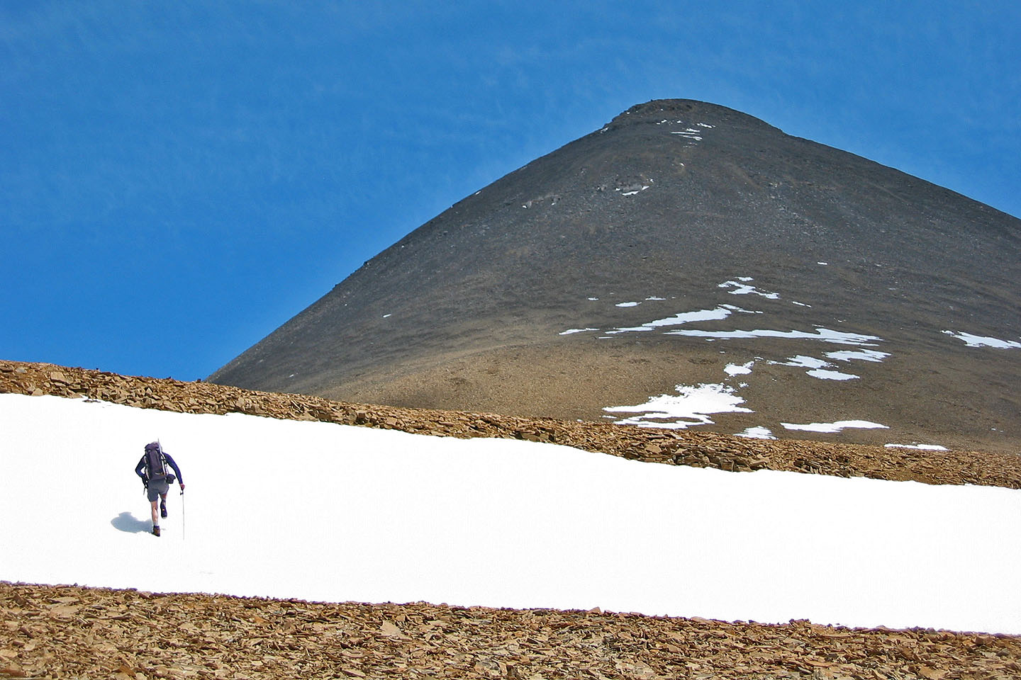
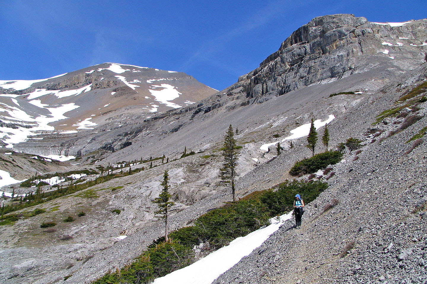
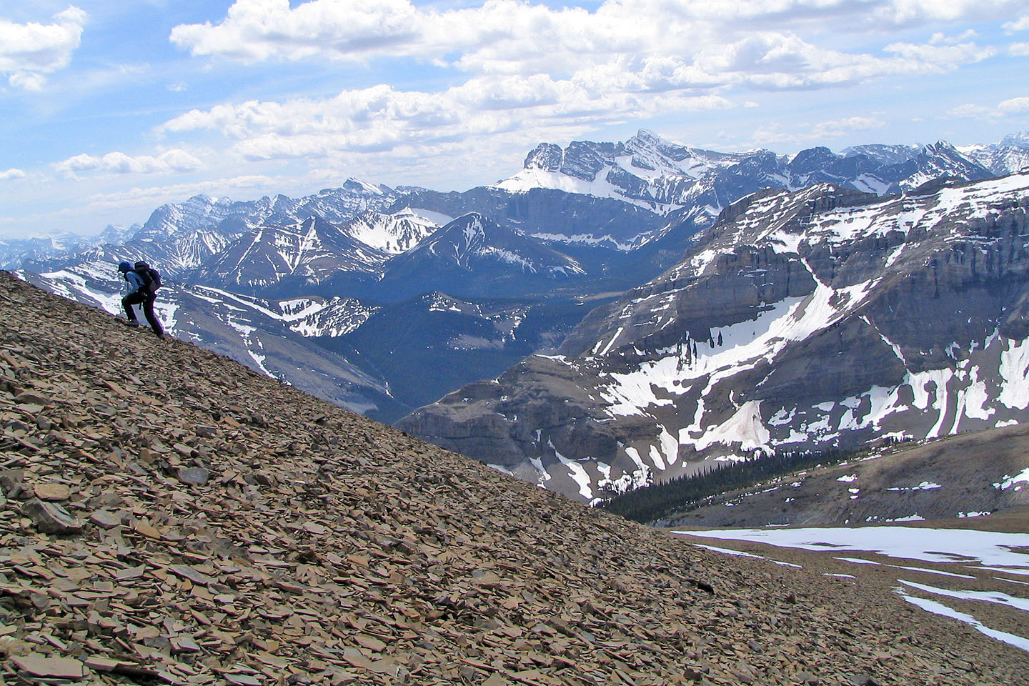
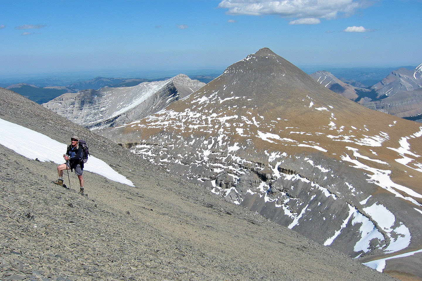
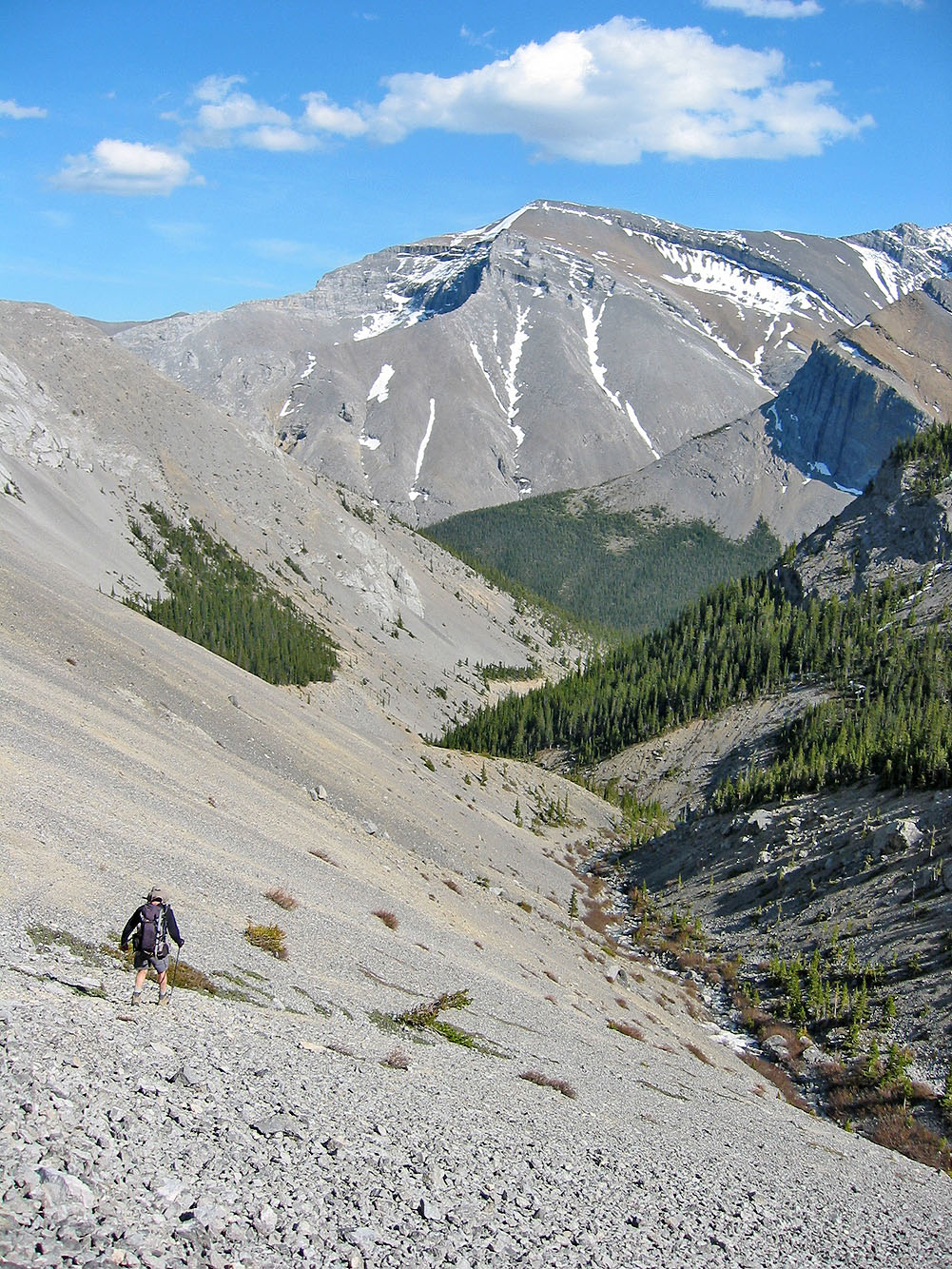
Nearing the base of Banded Peak
There was no trail going up Banded Peak
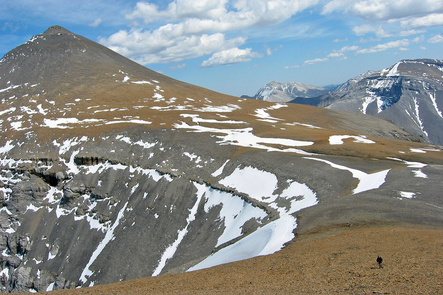
Outlaw Peak appears close by
Mount Cornwall and
Mount Glasgow are a bit farther
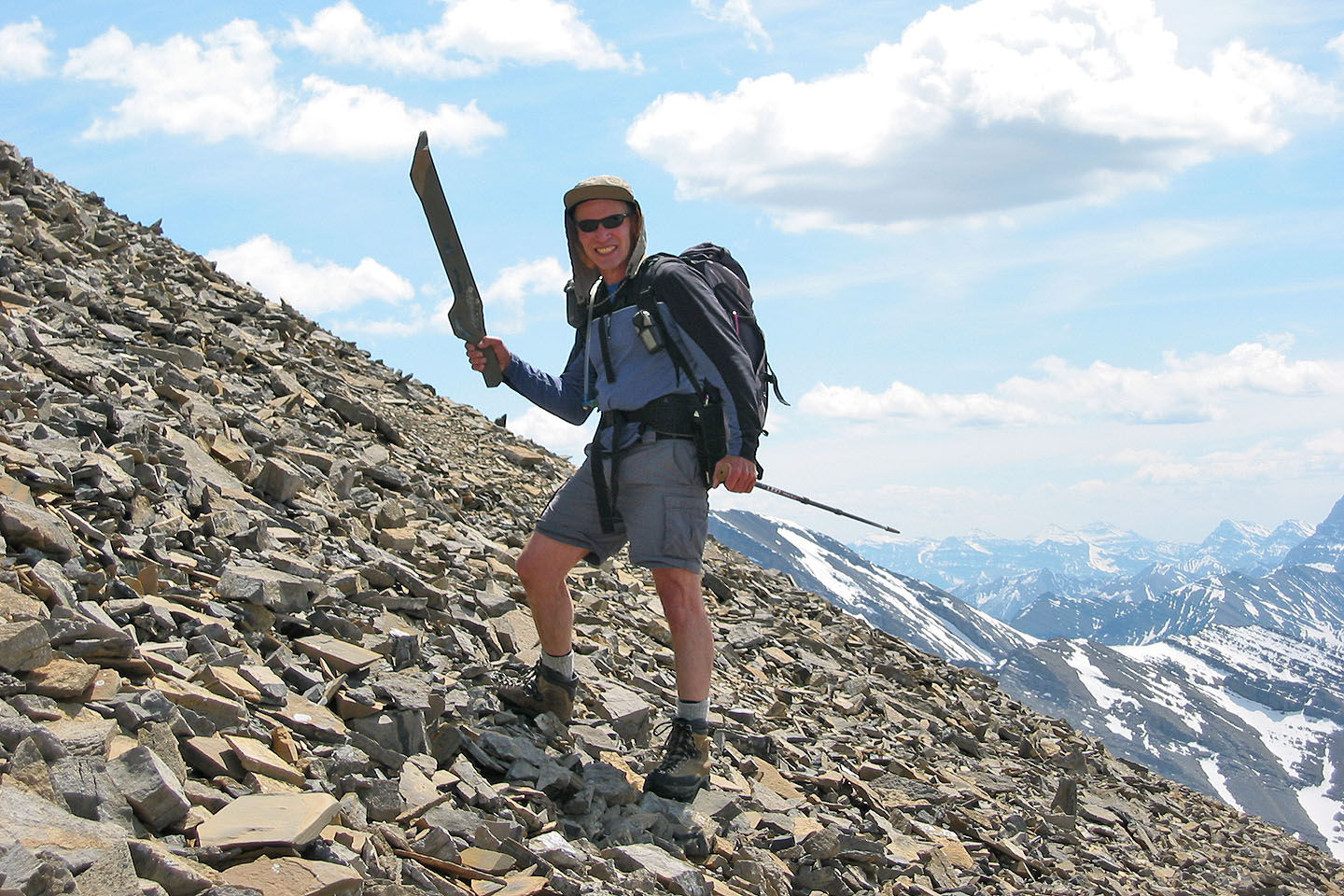
I made a remarkable find: a stone cutlass!
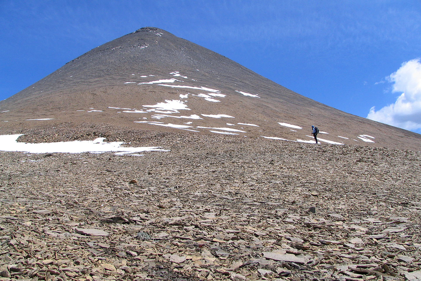
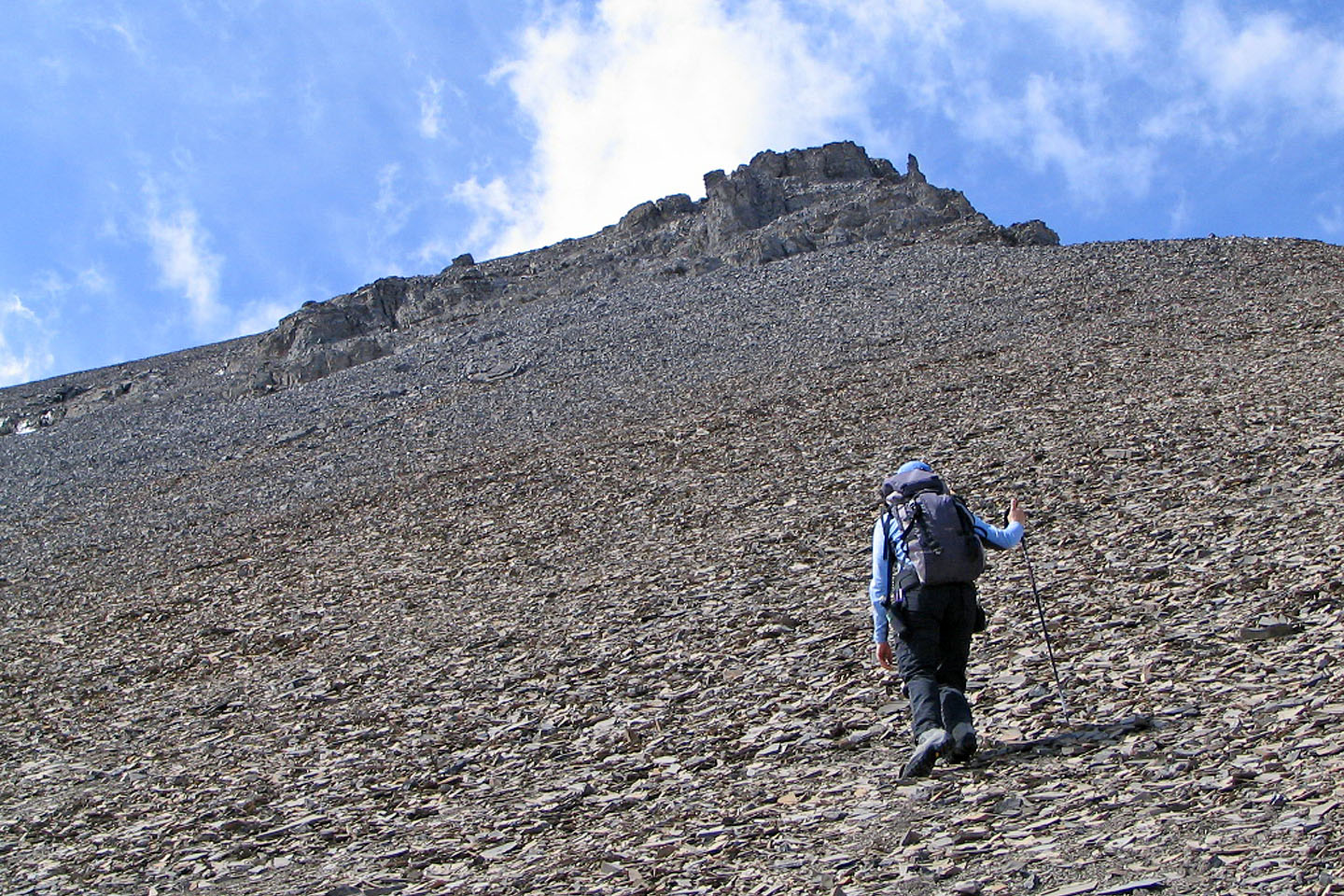
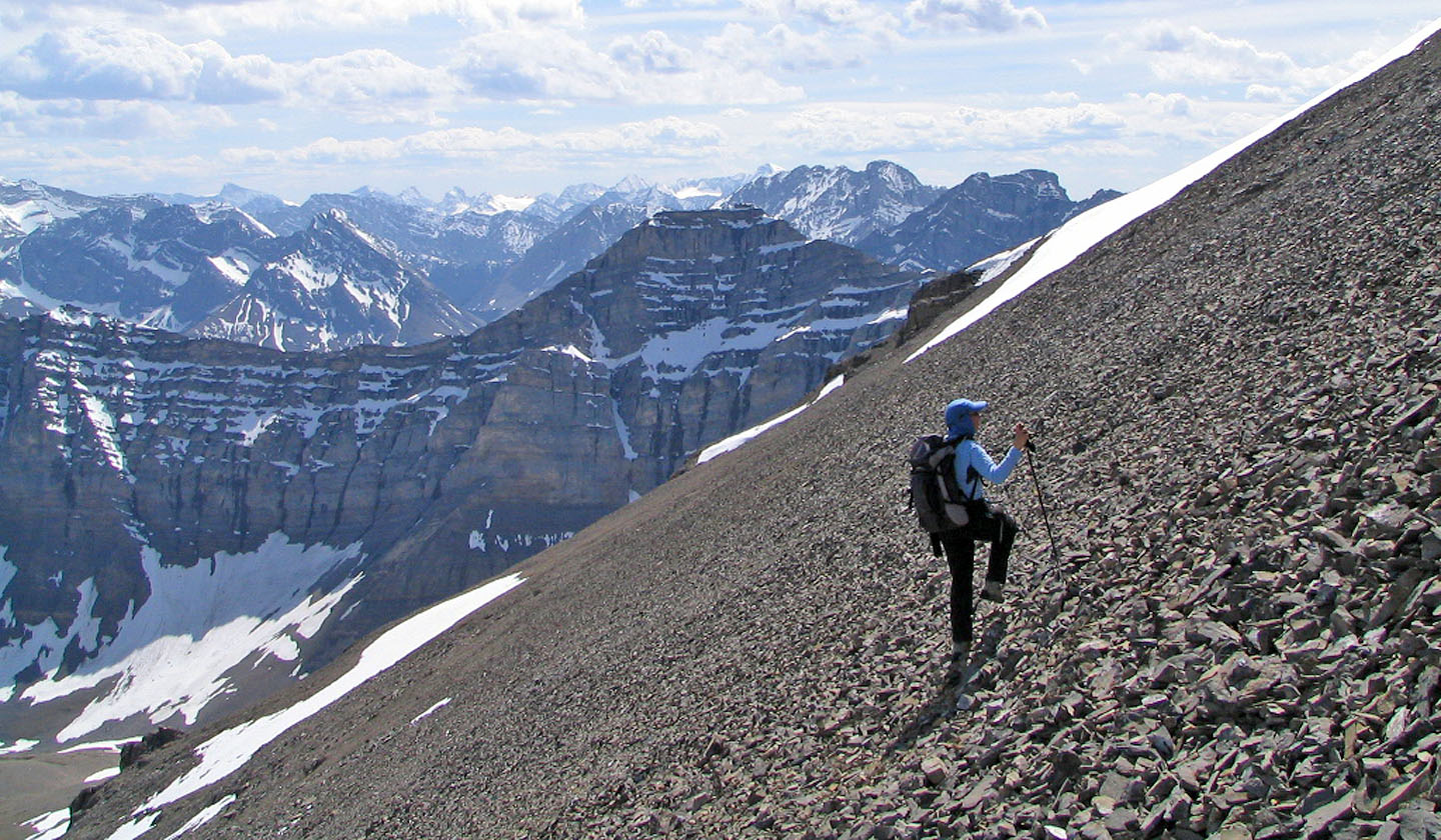
Endless scree up Banded Peak
Grinding up the scree slope
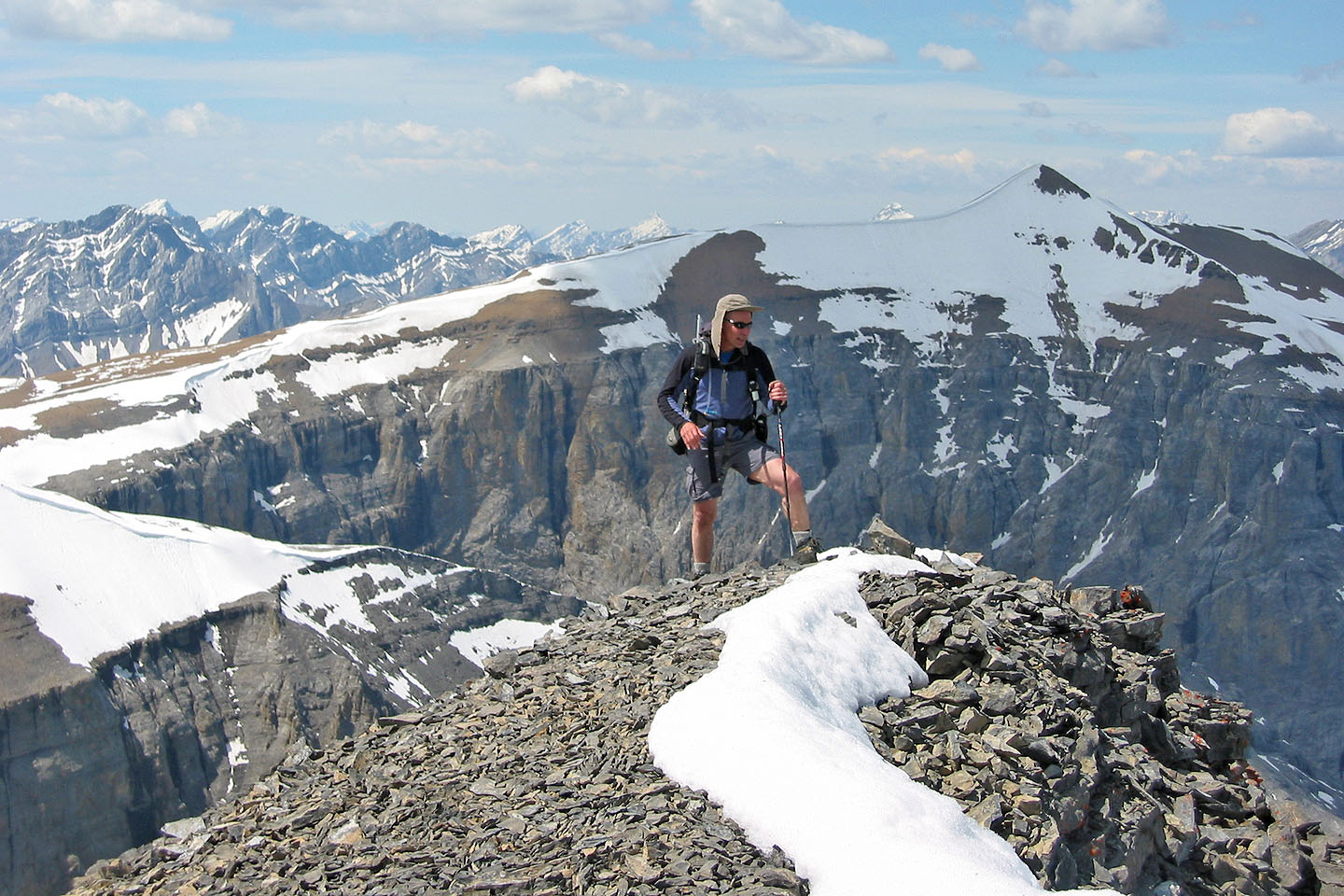
On the summit of Banded Peak
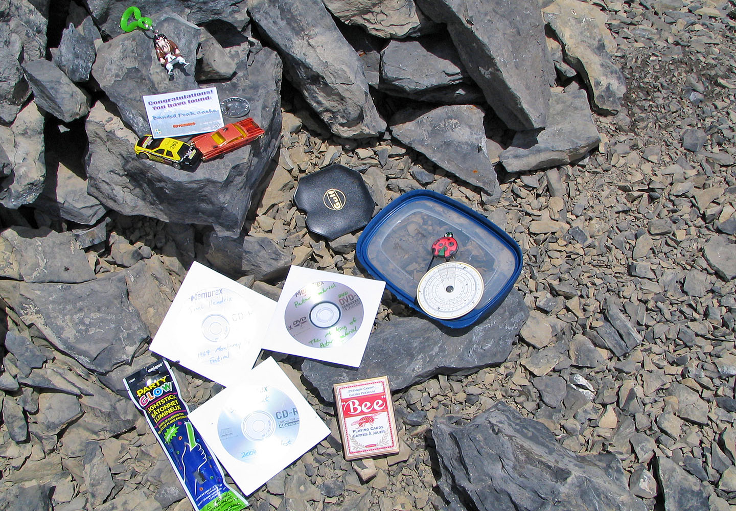
Someone set up a geocache on the top of Banded Peak. Jimi Hendrix CD anyone?
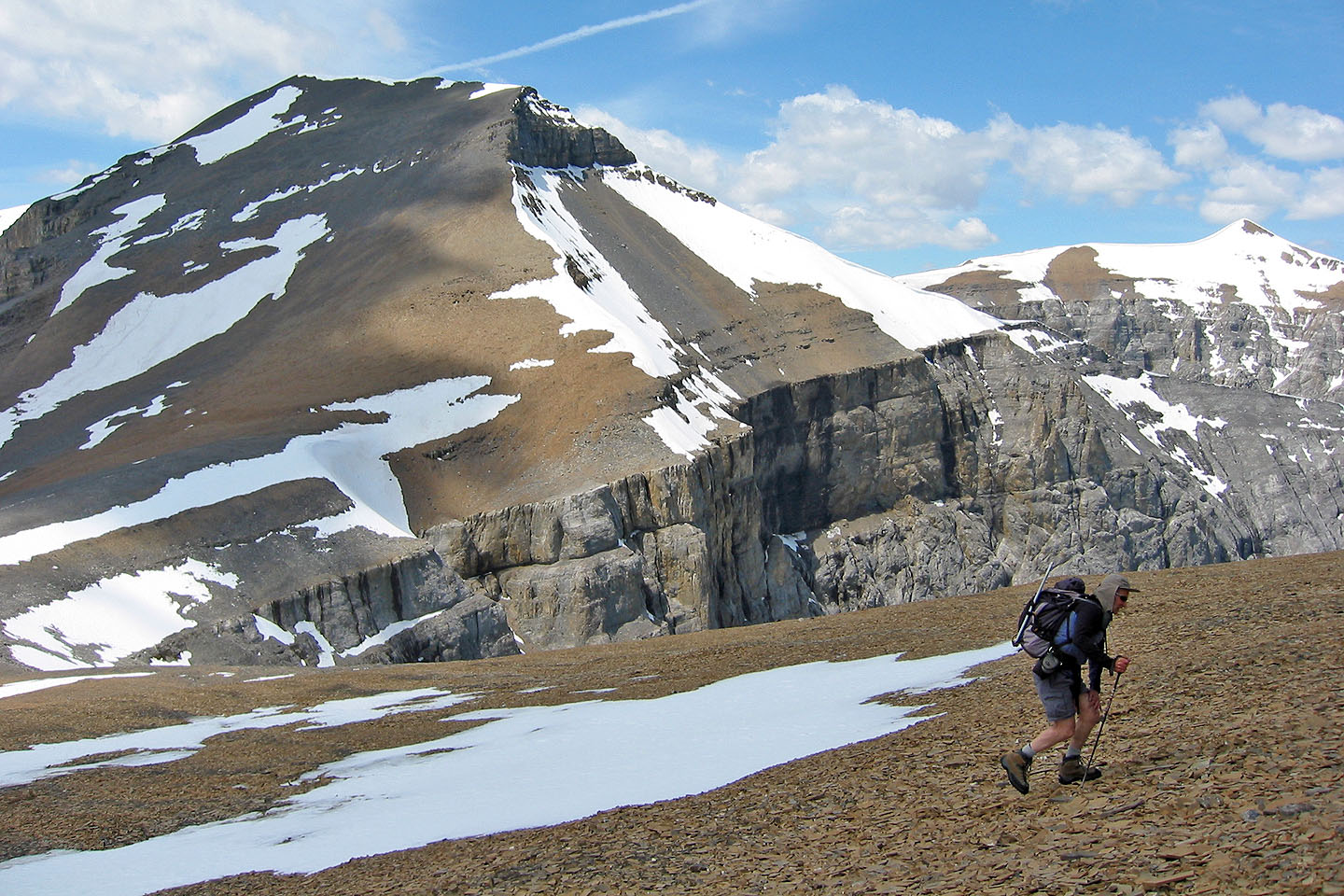
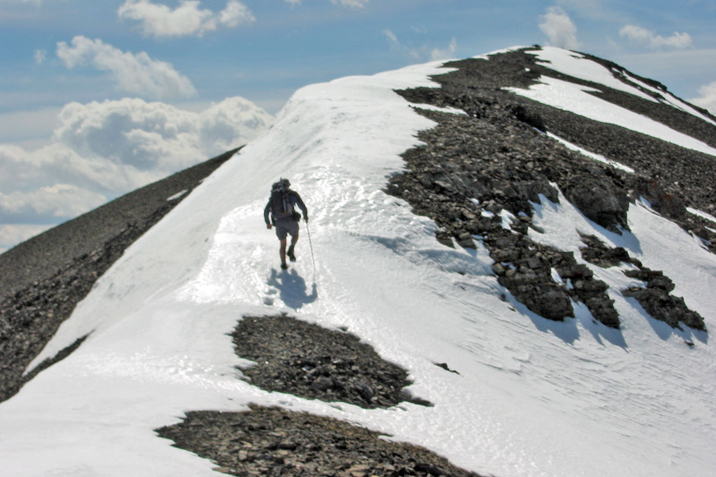
After returning to the col, we headed for Outlaw Peak
Looking back at Banded Peak from the col
Rock band above was easy to get through
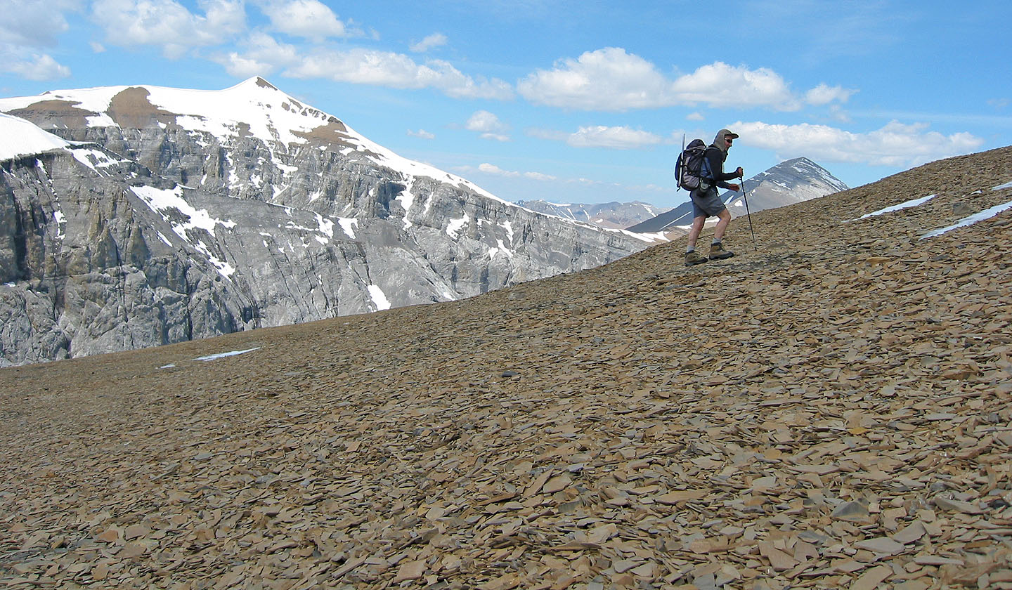
The scree on Outlaw Peak seemed softer than the scree on Banded Peak!
Plodding up the scree slope
Taking the last steps to bag Outlaw Peak
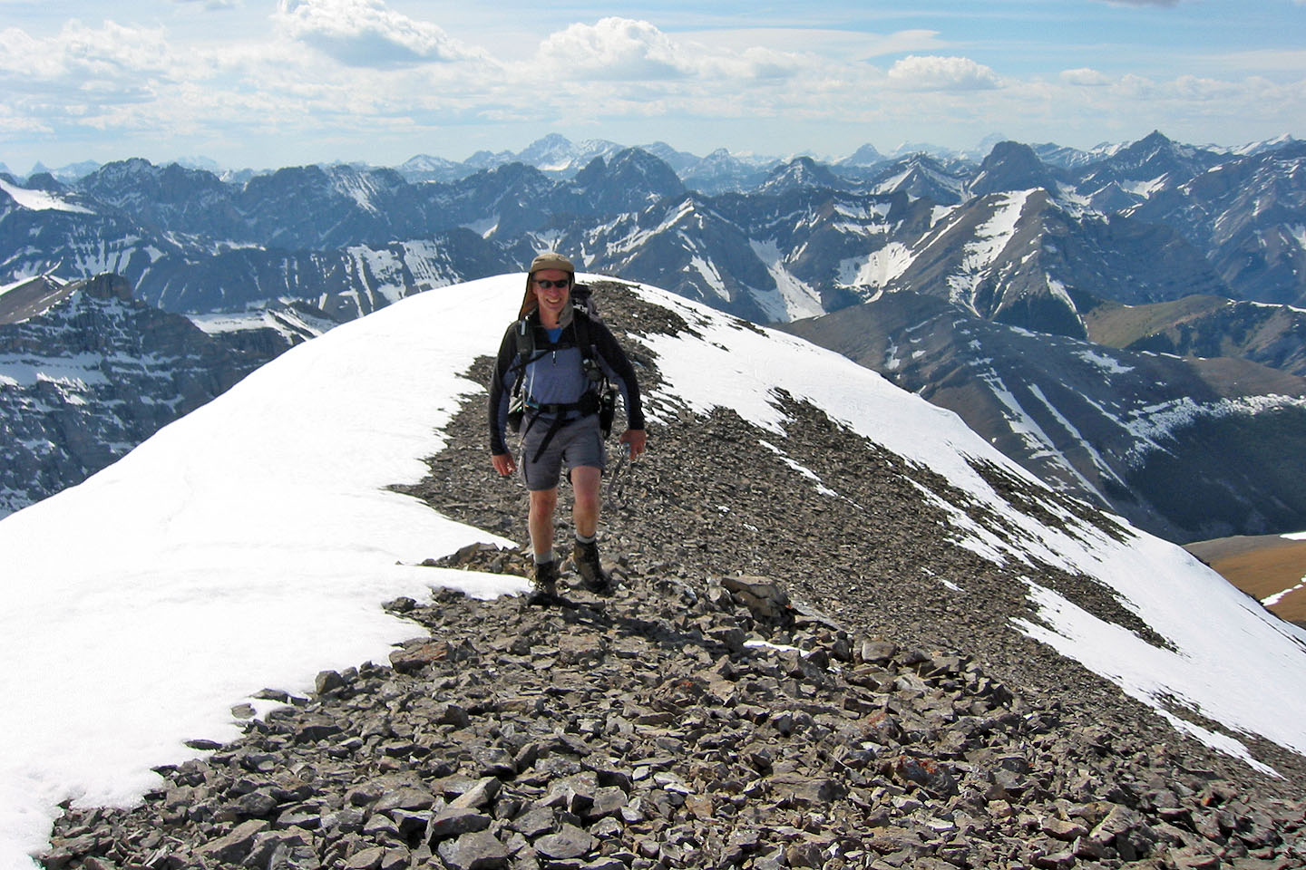
On the summit of Outlaw
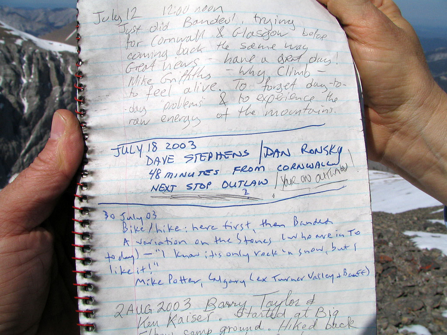
A page from the summit register
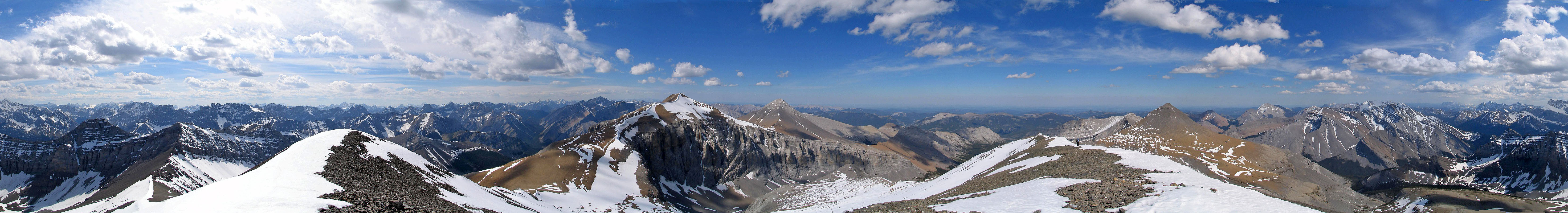
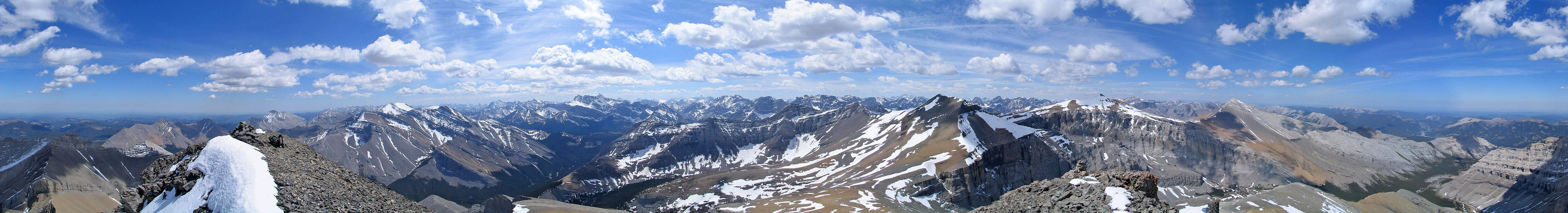
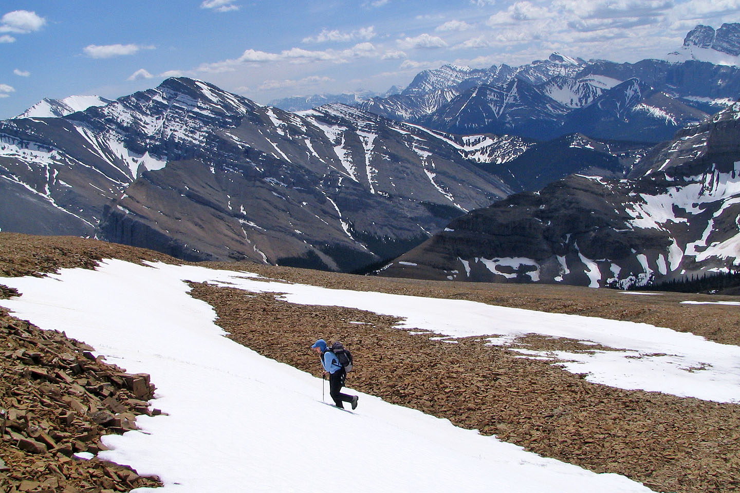
Summit panorama from Outlaw Peak
What was a trickle in the morning was now a torrent as we exited the basin
Heading down to the valley
82 J/10 Mount Rae