bobspirko.ca | Home | Canada Trips | US Trips | Hiking | Snowshoeing | MAP | About
Hector South Peak (Attempt)
Banff National Park, Alberta
February 26, 2005
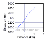
Distance: 8.1 km (5.0 mi)
Cumulative Elevation Gain: 980 m (3215 ft)
Judging by the widely spaced contour lines on the map, I thought this peak might be possible to ascend on snowshoes, but without a vantage point to observe it, we didn't know what to expect. This unnamed peak is only two kilometres south of Mount Hector. It's probably overlooked since it cannot be seen easily from the highway and since Mount Hector overshadows all else in the area, but the South Peak is nearly 3000 m high!
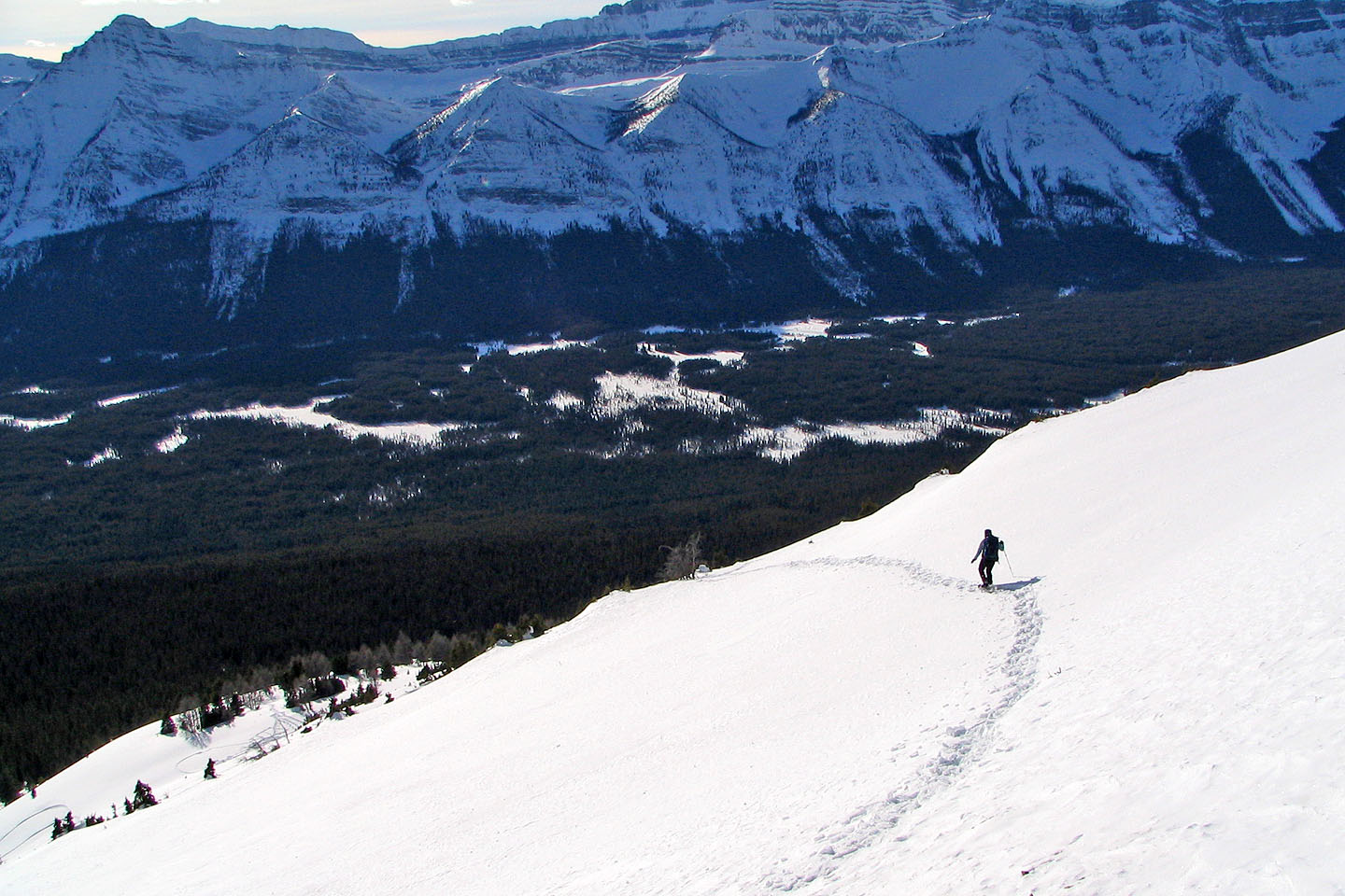
I selected a likely place to start and set a waypoint where we would park. We were fortunate to find a plowed pull-out. We set off up a wooded slope. The grade was gentler than I expected. The terrain varied so it wasn't a mindless slog, and the trees weren't so thick we had to fight our way up. After about an hour and 15 minutes, the trees thinned and we could take in the views.
At this point, we heard voices behind us. We were baffled. We were in a remote area far from any trail, and we couldn't understand why anyone would follow someone's snowshoe tracks without knowing where they were going. Eventually, five people came into view far below us. They were carrying snowboards! We never ran into them, however. After snowshoeing about 300 m in our tracks they rode down the gully and climbed up the other side where they did some more boarding.
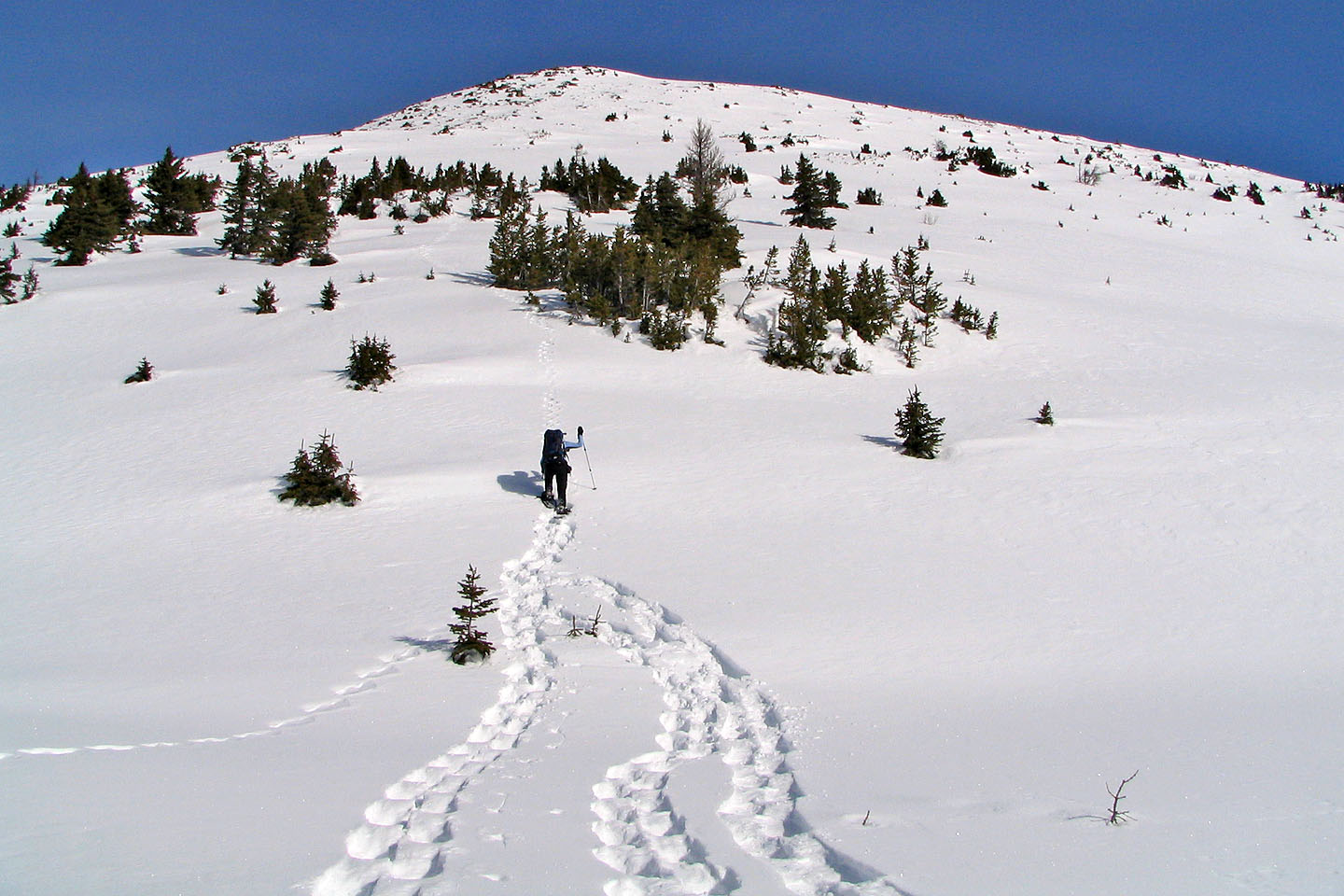
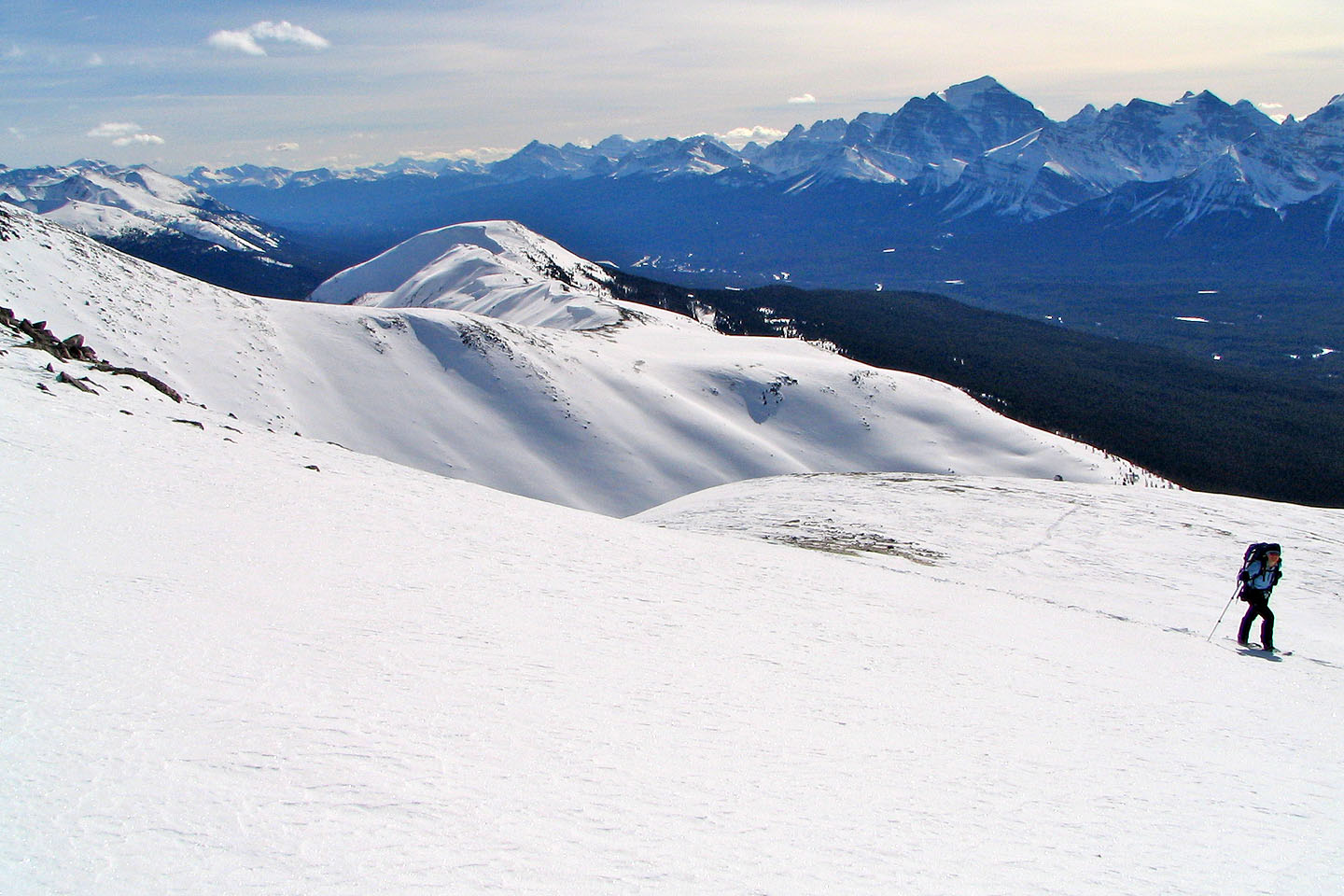
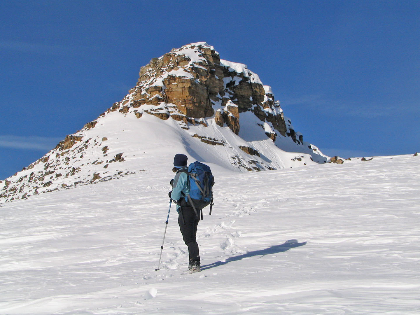
We continued and ascended above the treeline. Here it became too steep to snowshoe straight up, so we angled right. The grade eventually eased and the slopes became rolling hills. Our destination became obvious: a rocky prominence thrusting straight up from the slope.
The rock was steep and snow-covered, but we managed to scramble up a short way before turning back, about 175 vertical metres short of the summit. Without helmets, ice axes and crampons it was imprudent to go continue.
Postscript: Three years later, Andrew Nugara ascended Hector South (as he calls it) via the west ridge.
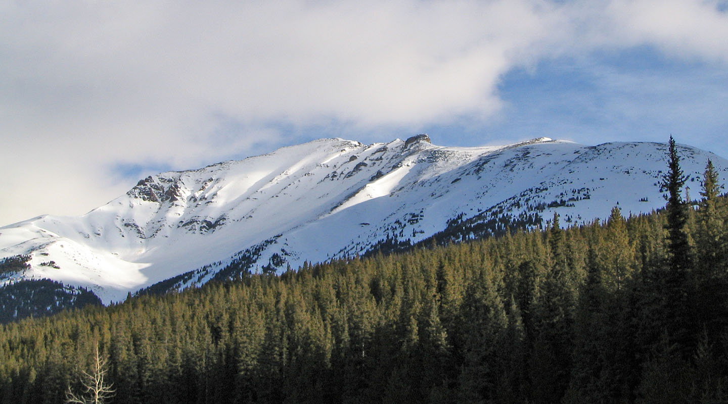
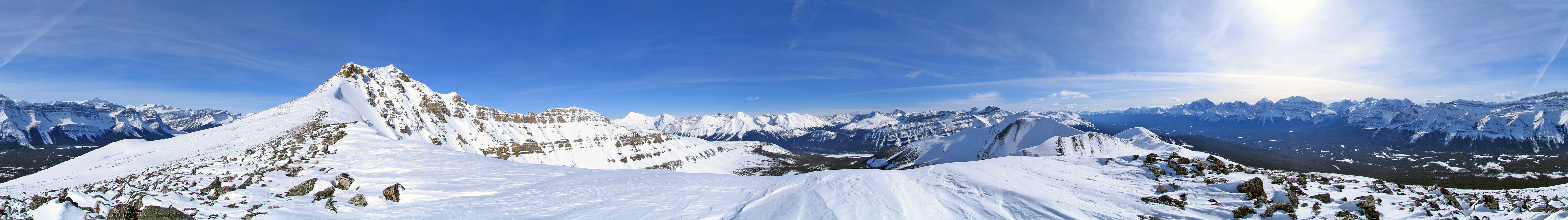
The South Peak seen from the highway. We turned back on the rock outcrop in the centre.
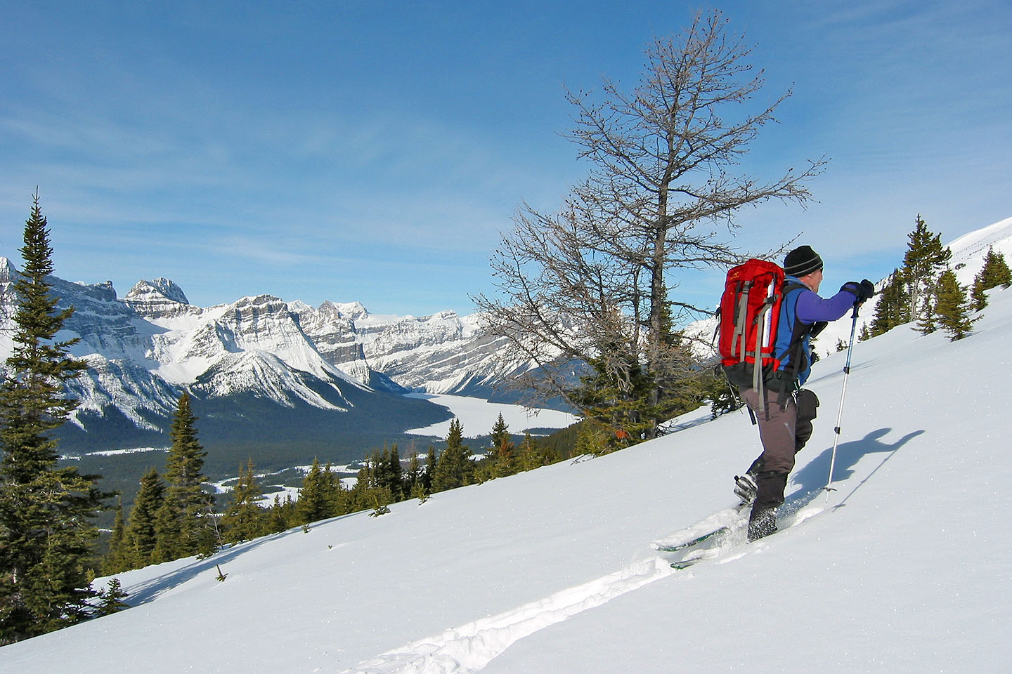
As the trees thinned we took in the views
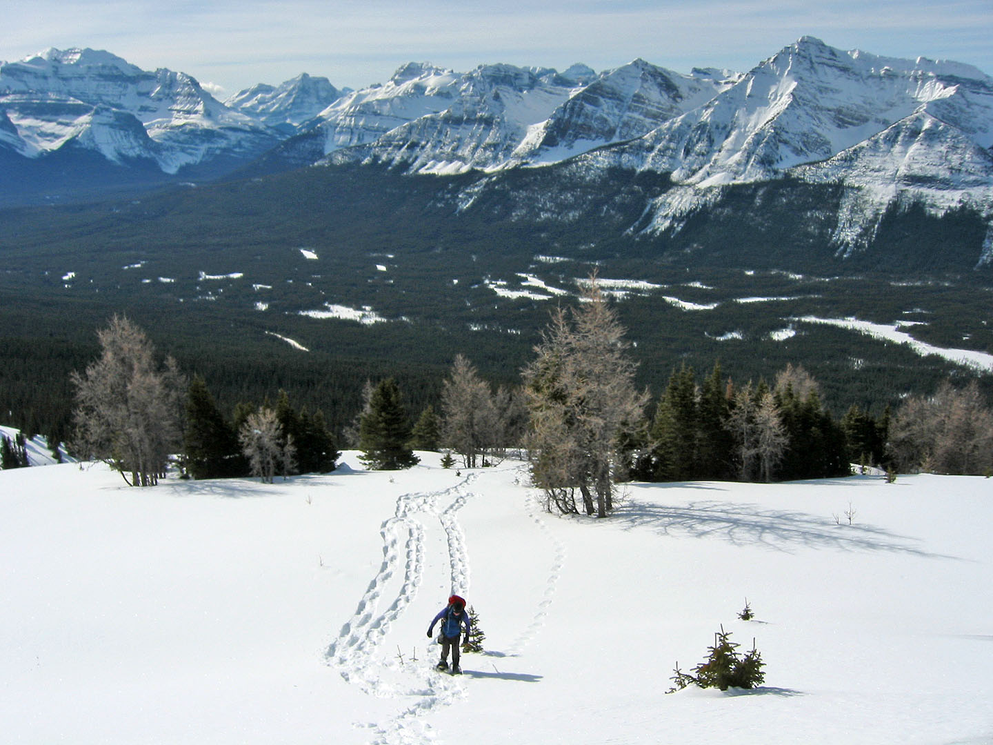
We left the forest behind
Behind Dinah is the slope that the snowboarders would later climb up and ride down
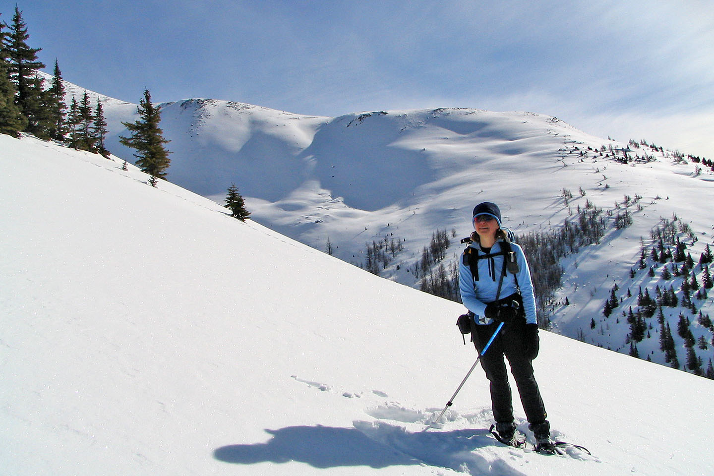
We'll soon be above the treeline
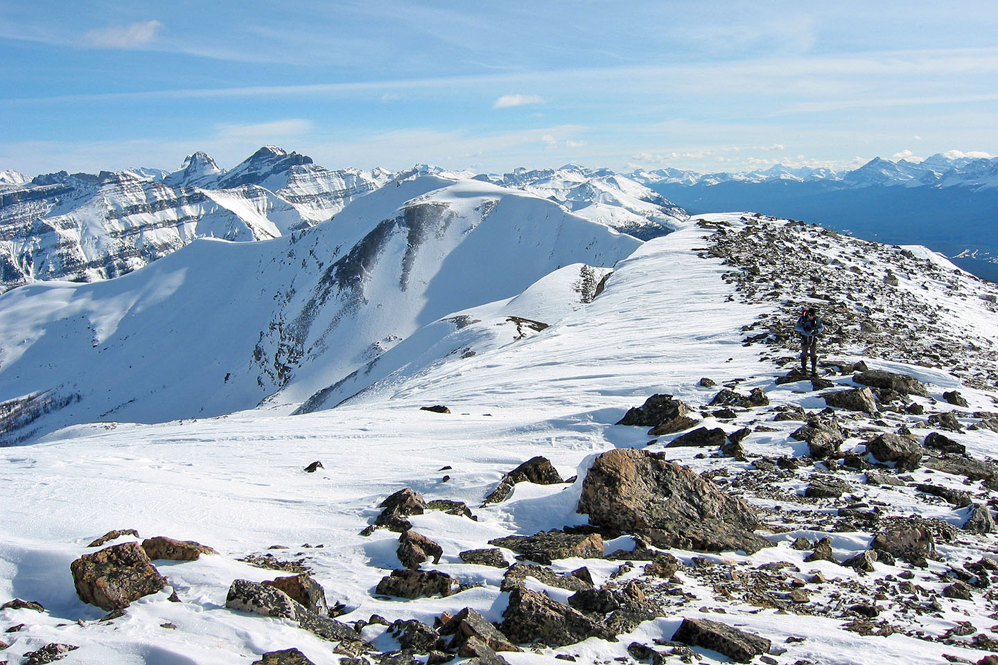
On the skyline, left to right, are Waputik Peak, Mount Bosworth and Mount Daly
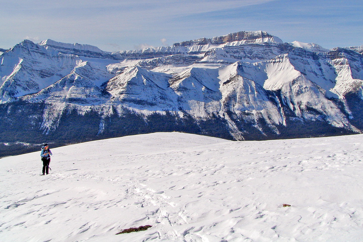
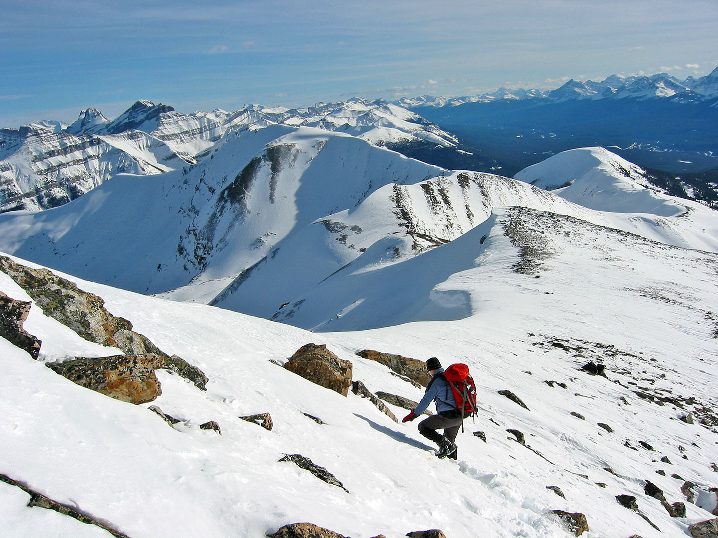
Looking south at the Lower South Ridge
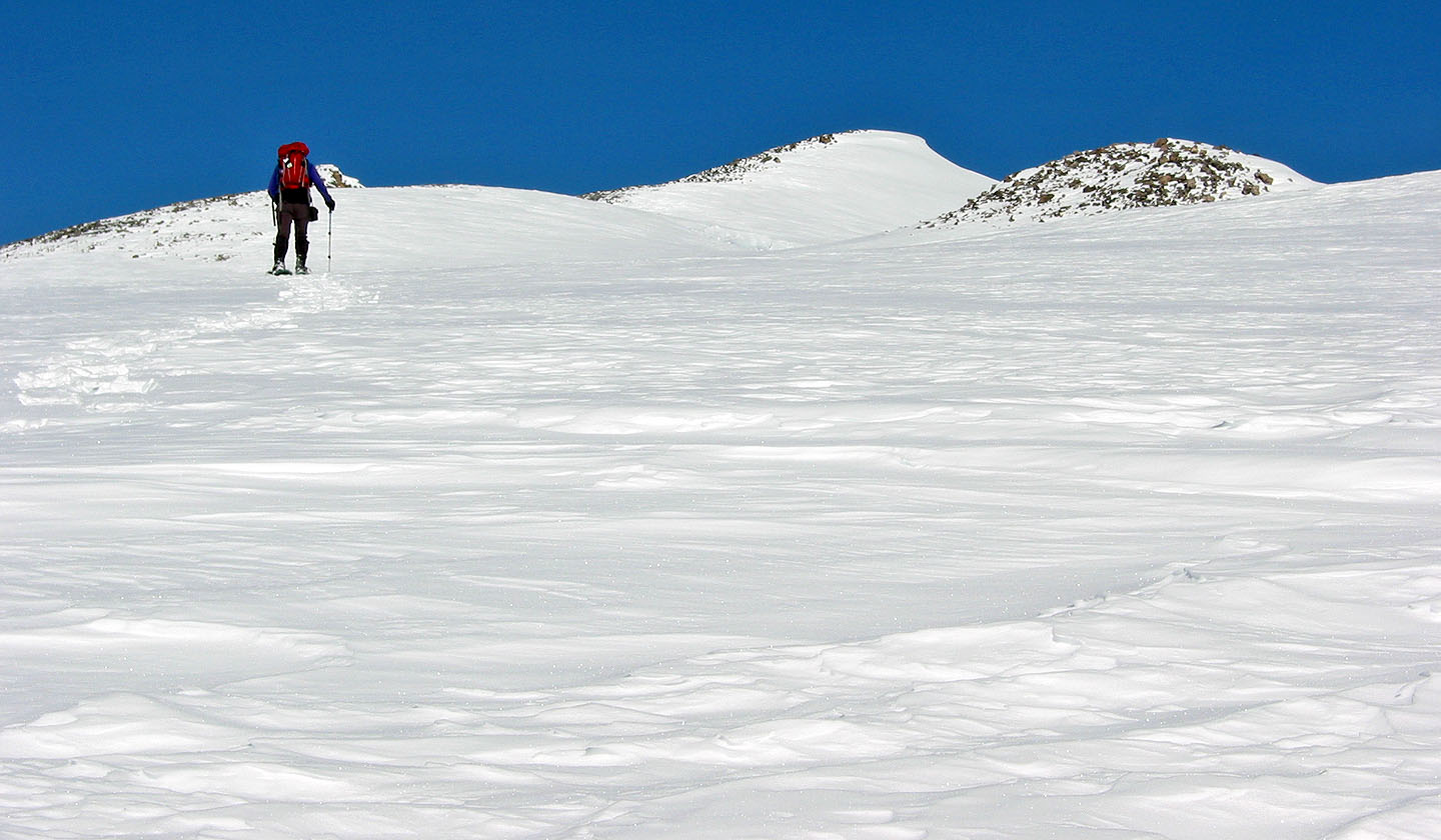
Much of the ridge here is broad
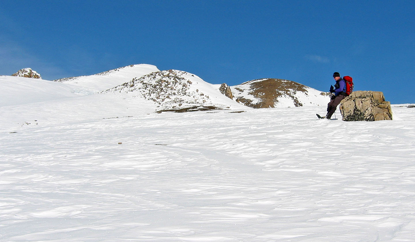
A solitary boulder provides a rest spot
Continuing along the spacious ridge
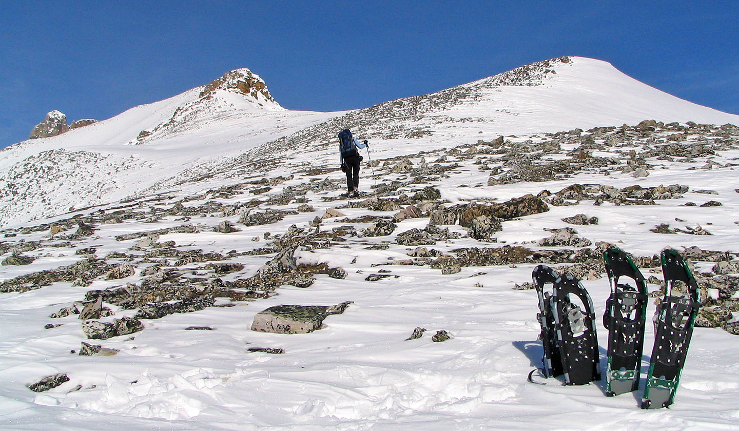
After ascending 800 m we removed our snowshoes and climbed another 200 m on foot. We headed to the point on
the right to take a panorama before climbing the rock in the middle. Mount Hector is far left
Here the ridge narrows
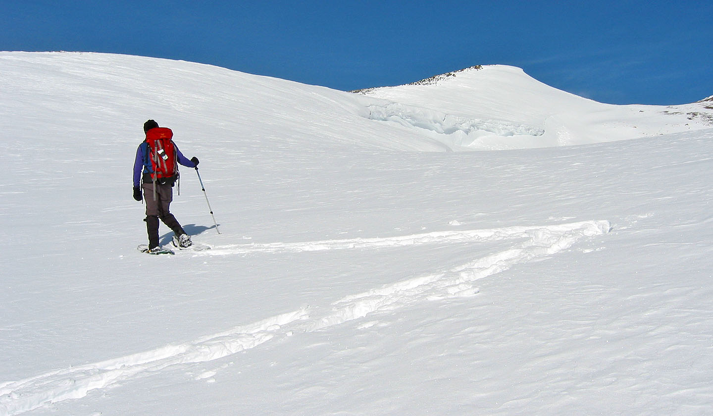
We headed for the rocky ridge
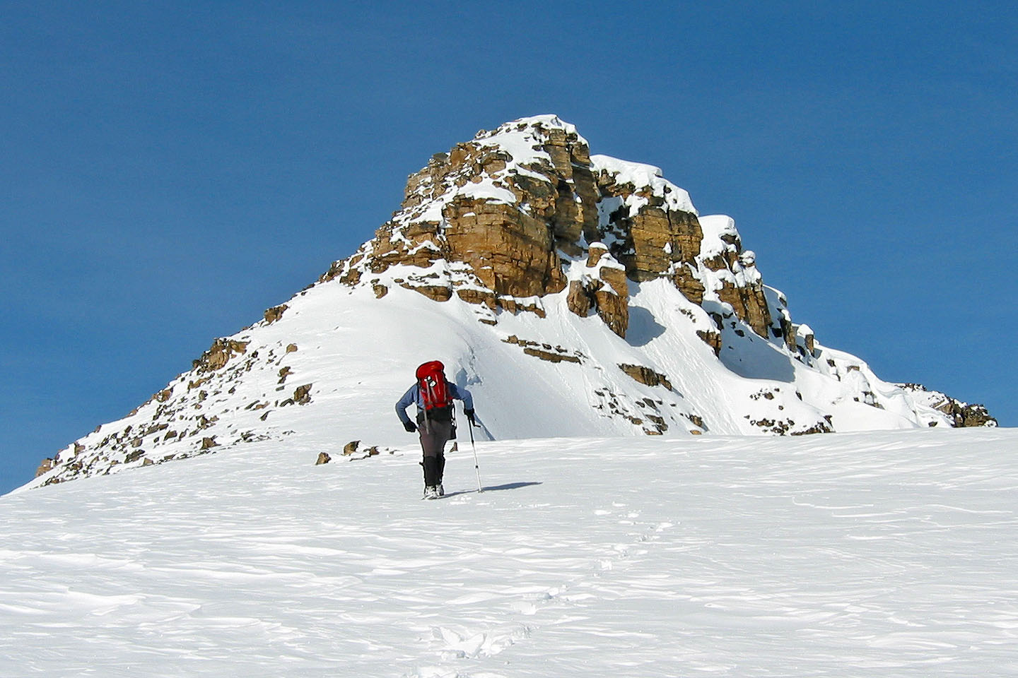
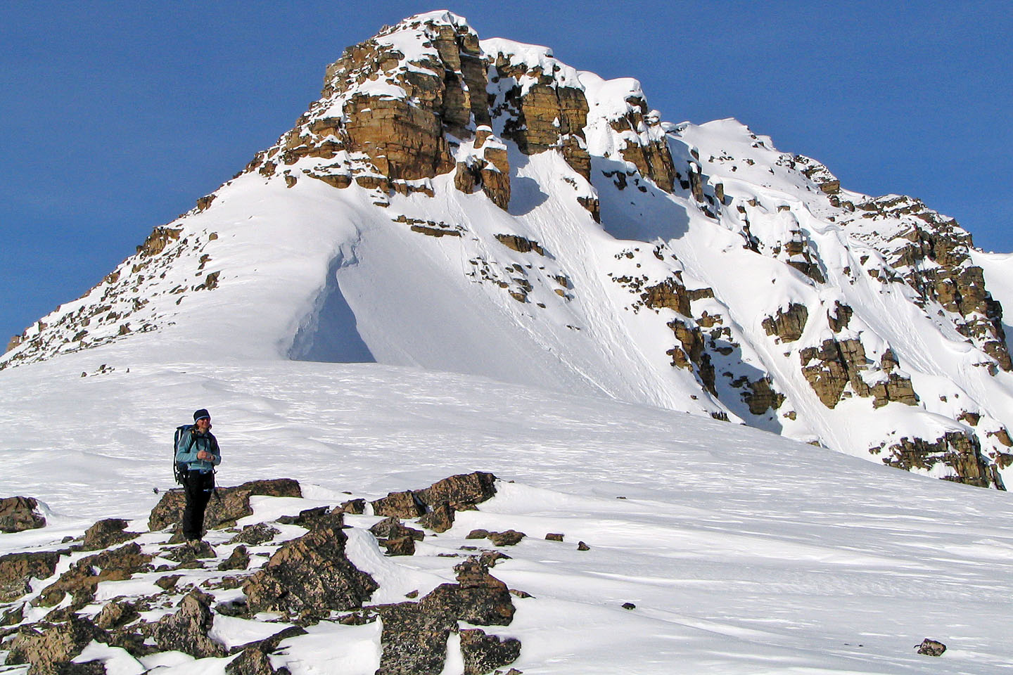
False summit of the South Peak
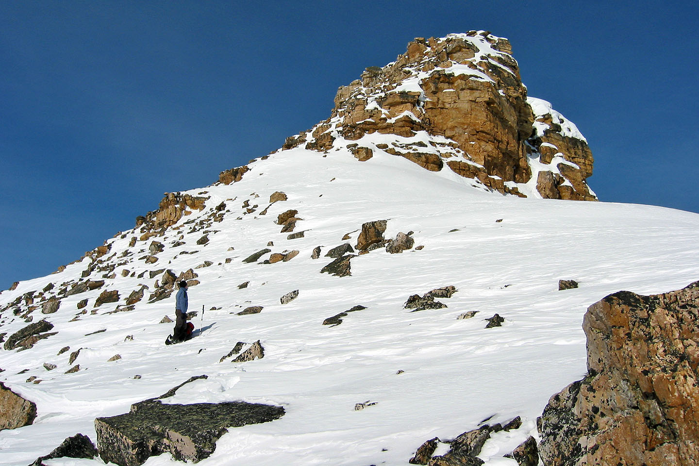
The left side looked plausible to climb
After postholing in the snow on the lower slopes, we're among the rocks.
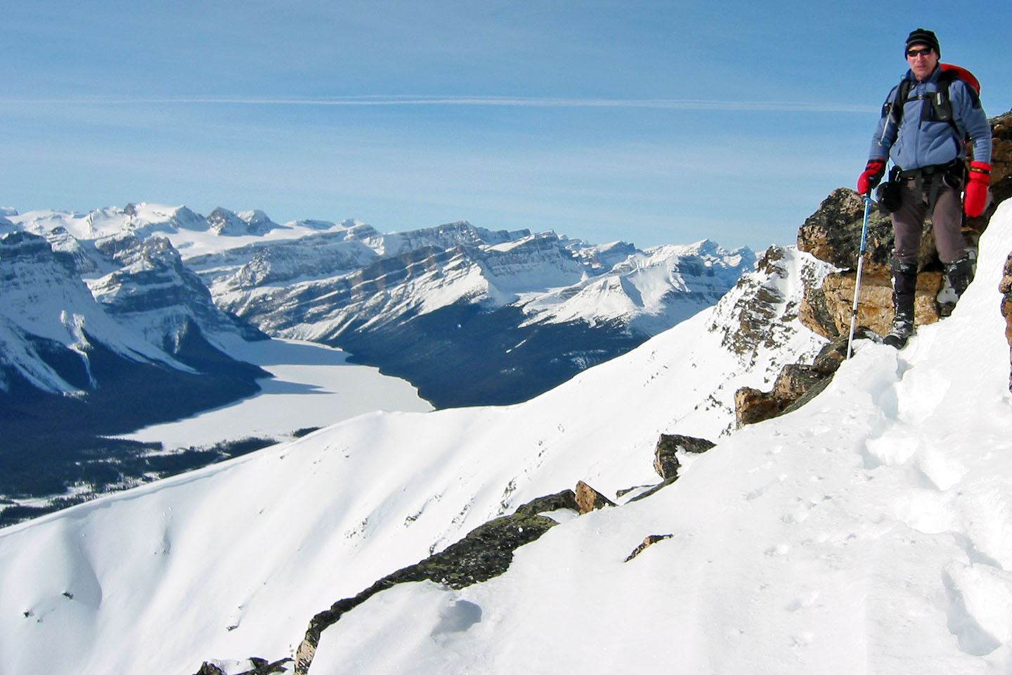
Hector Lake came into view
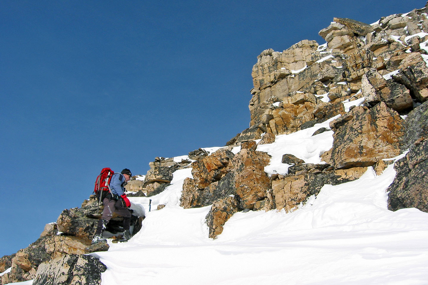
The rock became steeper as we climbed
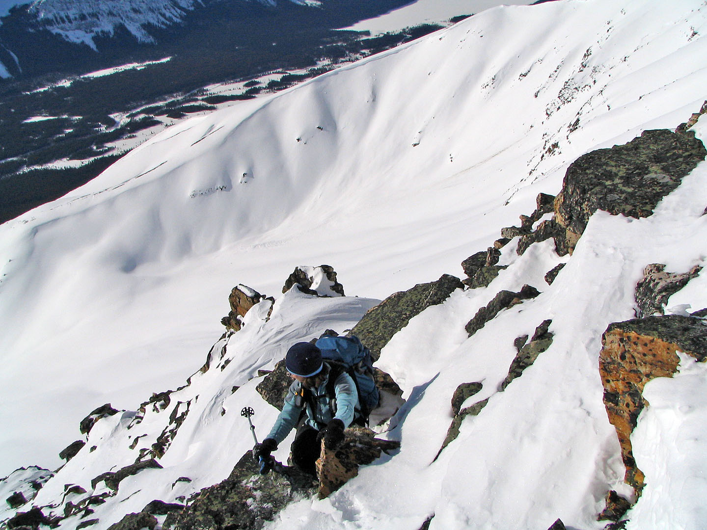
It wasn't safe to continue without helmets and crampons so we turned back
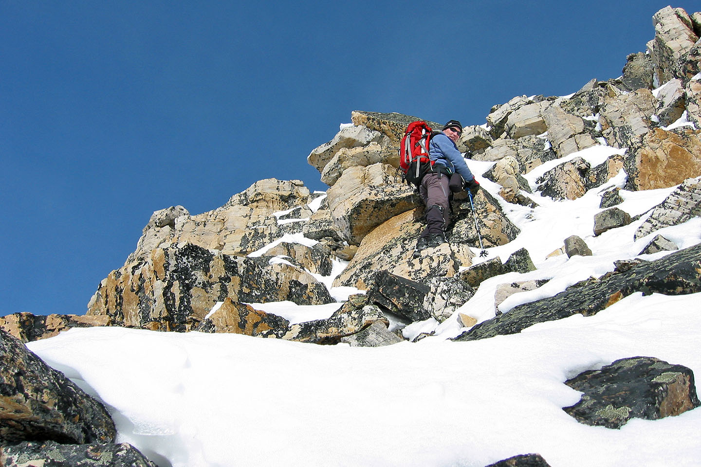
On the lower slopes of the false summit after turning around
Looking back: we got about a third of the way up the rock. In dry conditions, this would probably be a fun
scramble (mouse over for a closer look)
Heading back down
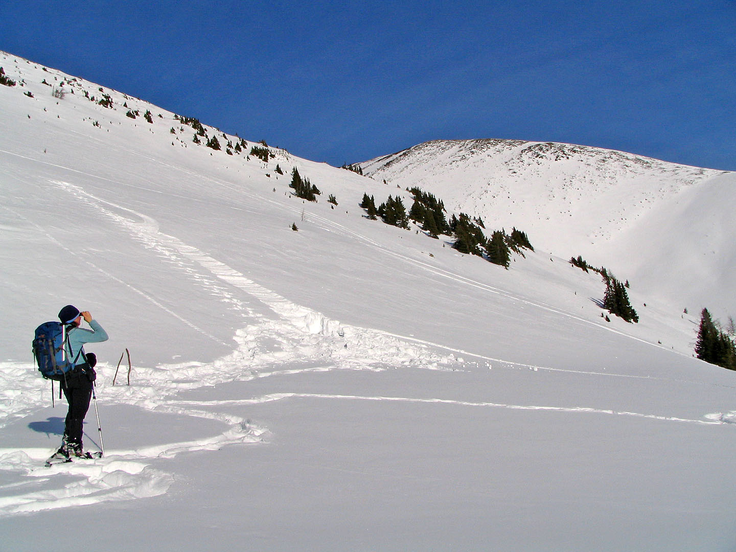
Dinah uses binoculars to look at the snowboarders (mouse over to see them). We returned the following week
and used their ascent tracks to start us up the South Ridge.
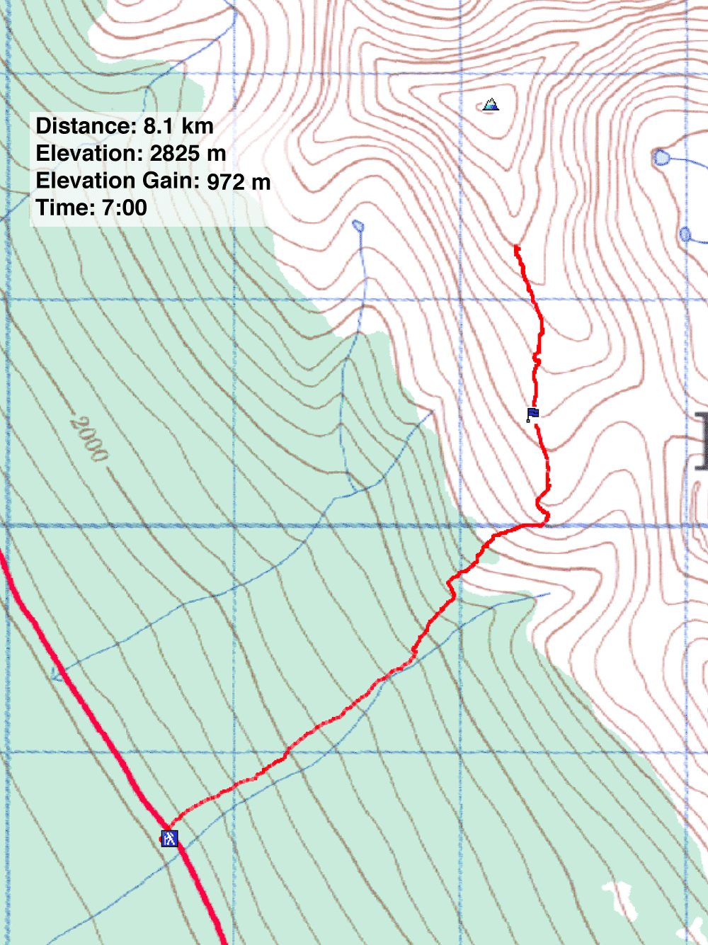
82 N/9 Hector Lake