bobspirko.ca | Home | Canada Trips | US Trips | Hiking | Snowshoeing | MAP | About
Mount Haffner
Kootenay National Park, B.C.
March 22, 2008
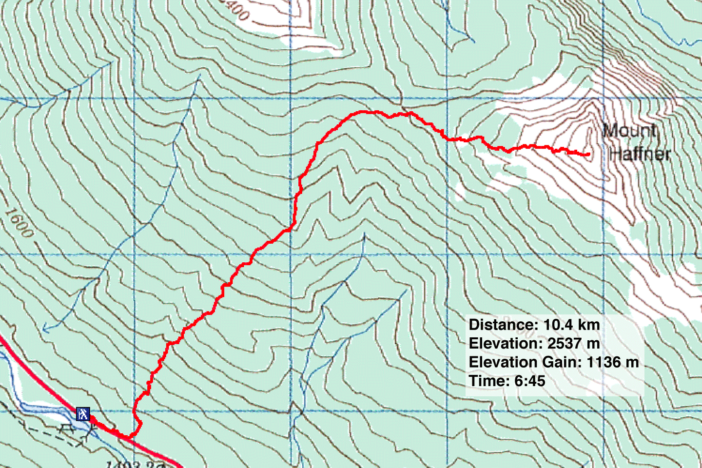
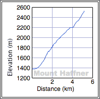
Distance: 10.4 km (6.5 mi)
Cumulative Elevation Gain: 1158 m (3799 ft)
After an enjoyable if unsuccessful ascent of the North Ridge of Storm Mountain two weeks ago, I wanted to return to the Kootenays to try another summit, Mount Haffner. The map contours looked promising and like Storm Mountain, the slopes should be easy to navigate because a forest fire had left the trees bare, easier to see our way through them. Sonny Bou agreed to join Dinah Kruze and me.
The best course appeared to be to park at Numa Falls trailhead on Highway 93 and head for the Vermillion-Haffner col. We would, though, have to detour left of the drainage that extends below the col. From the col, we could trace the ridge to the summit.
After parking our car, however, no approach presented itself. Being at the bottom of a steep valley we could see nothing of the slopes above us. We walked up the highway for about 300 m before putting on our snowshoes and setting off into the trees.
Five minutes later we were surprised to find a road running parallel to the highway. Perhaps a portion of the old Highway 93? We snowshoed up it a short way before leaving it.
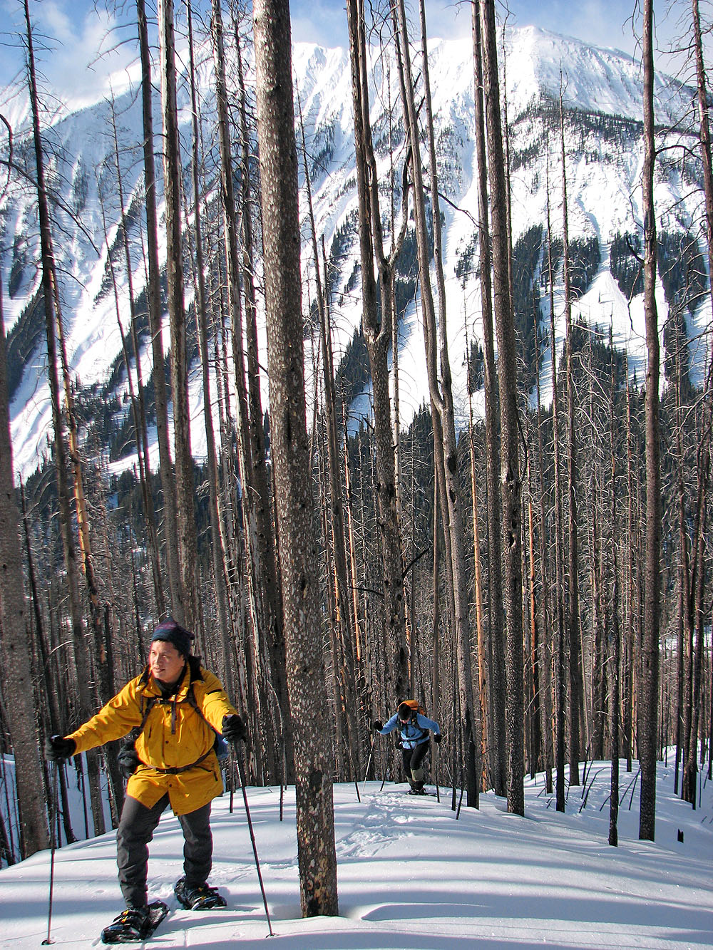
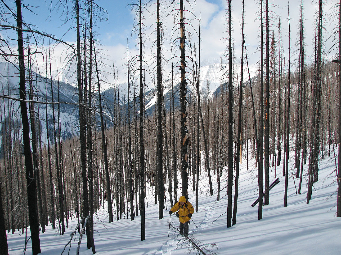
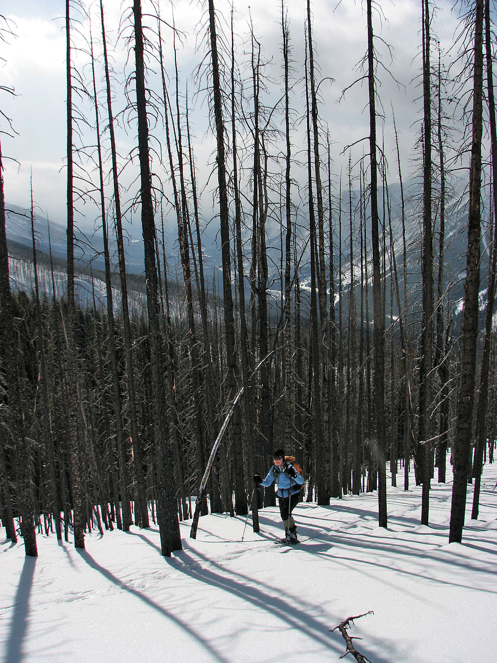
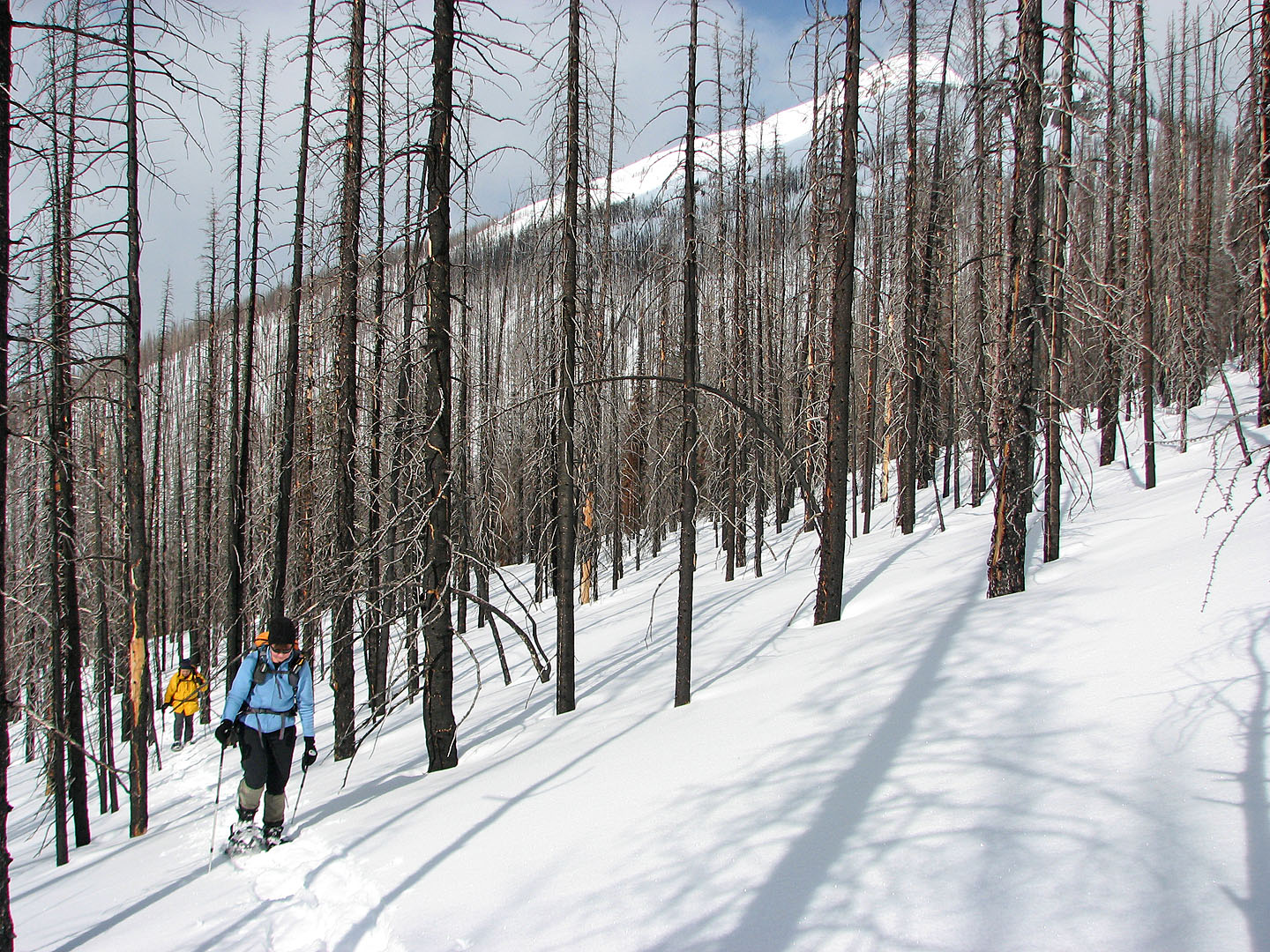
Immediately it appeared we would have no problems, for a while at least. The snow was excellent and we found ourselves easily ascending one of the ribs running down the lower slopes of Mount Haffner. The snow covered the deadfall and underbrush so there was no bushwhacking.
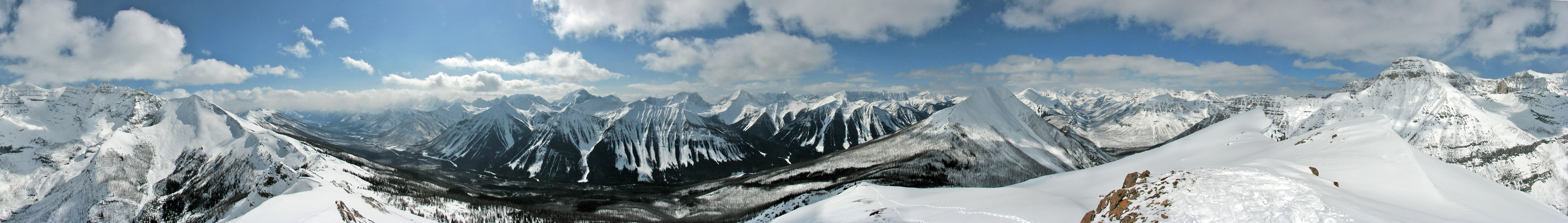
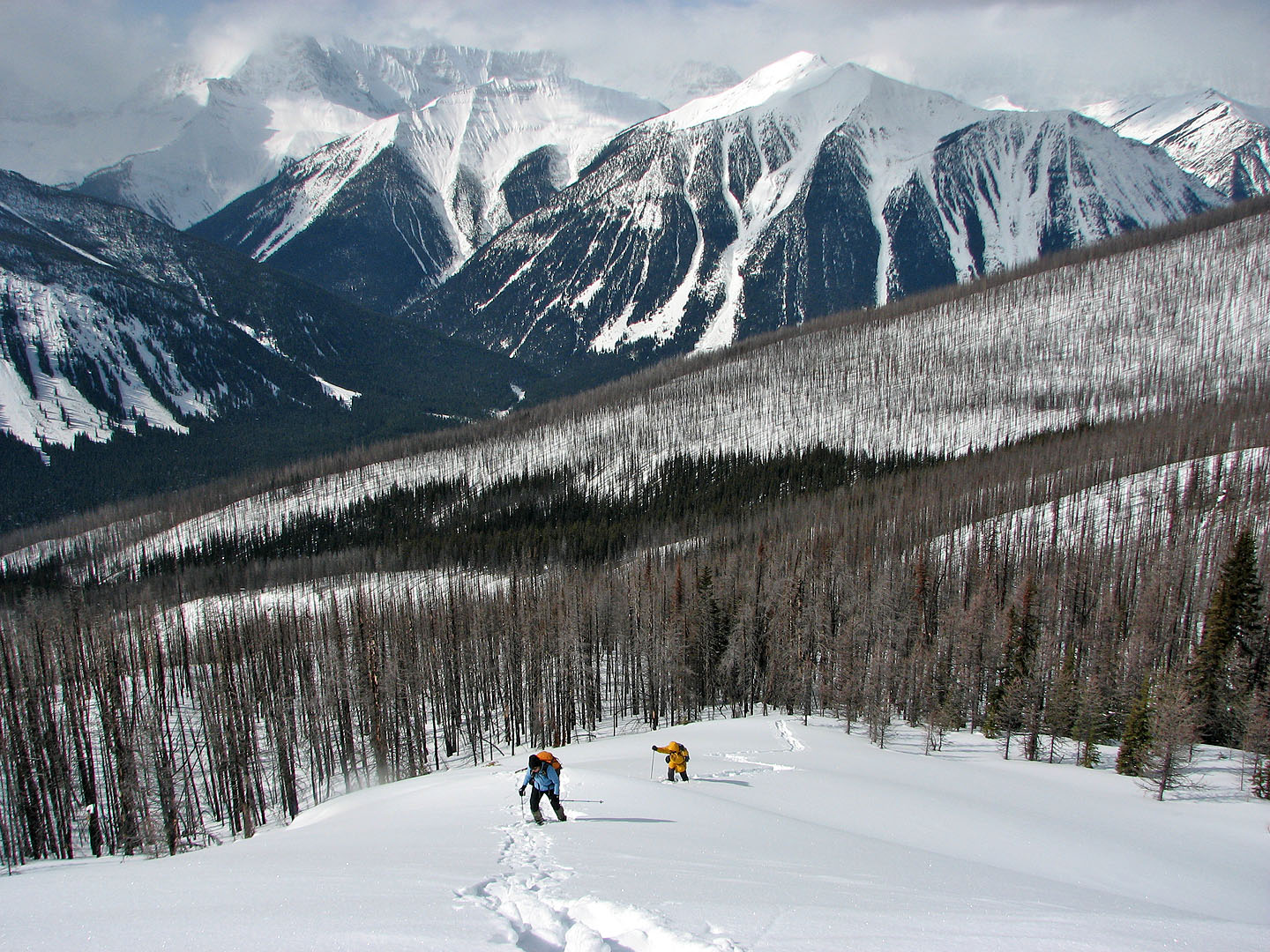
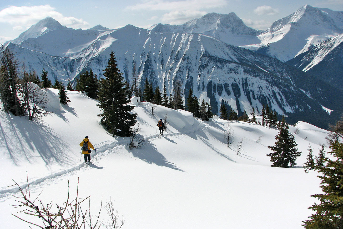
In time we found ourselves plodding alongside the drainage on our right. When we reached the col, however, we could see little of the summit because of trees. We snowshoed up the ridge and reached a bare section of ridge where the snow lay soft and deep. We had good views, but trees still hid the top of Haffner. After breaking through the trees, we finally had a clear view of the false summit. Around us, the snow-covered peaks captivated our attention.
Four and a half hours after starting, the three of us were standing on the summit. We spent more than half an hour, snapping photos in all directions, before starting back down. Retracing our steps, we were back at the car in short order.
For a snowshoe trip based largely on guesswork, it unfolded remarkably well. We encountered no cliff bands nor any detours, and clear skies gave us fine views of the area. (I wished all our trips went this well!)
The mountain was named after Lieutenant H. J. Haffner who made the first survey for the Banff-Windermere Highway. He was killed in World War I.
KML and GPX Tracks
Sonny's Trip Report
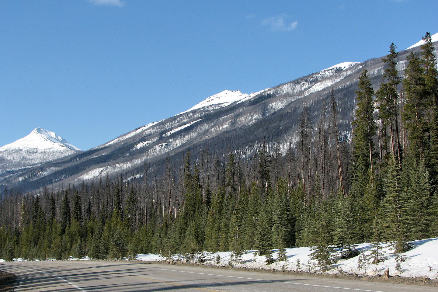
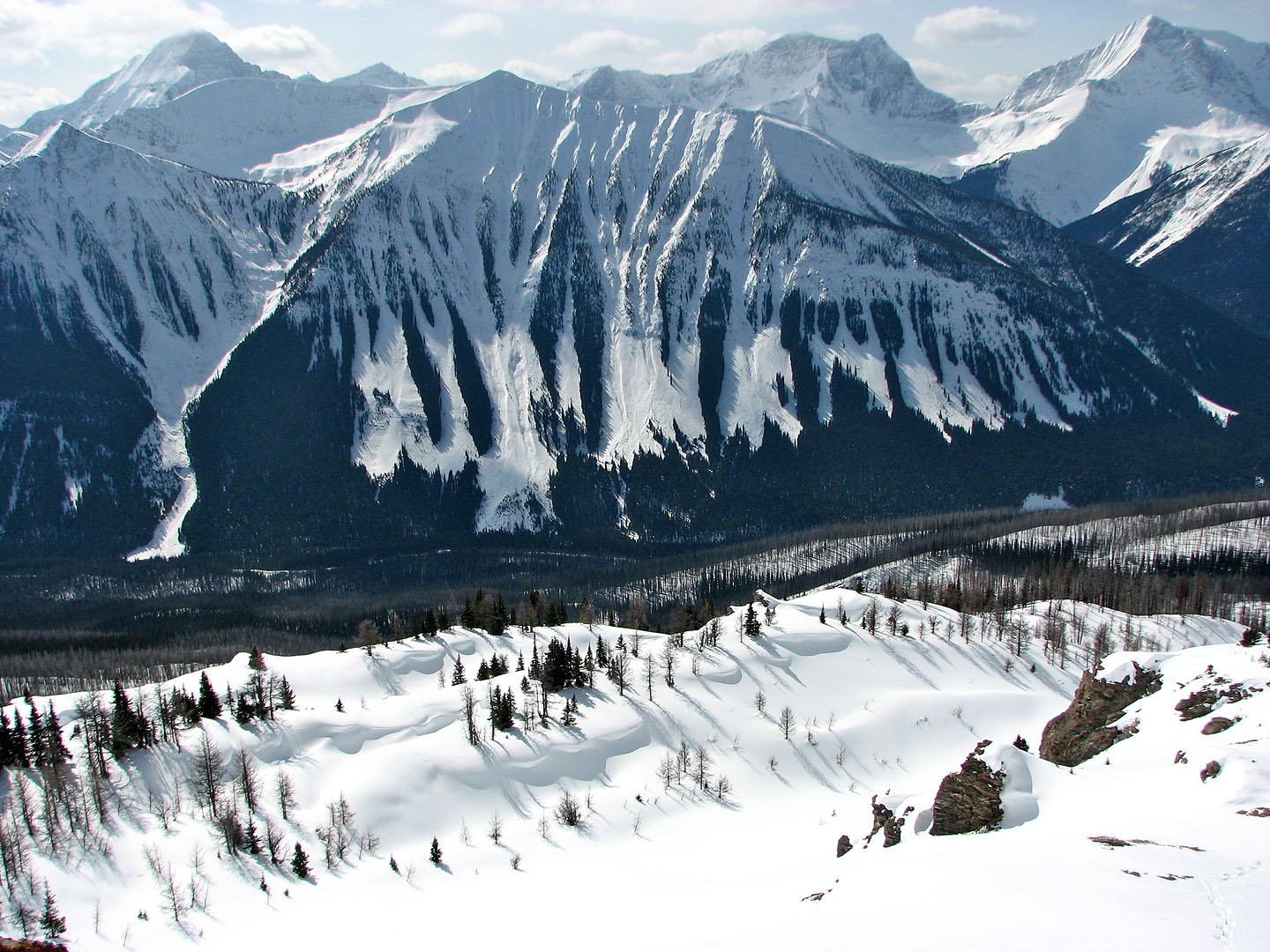
Vermillion Peak and Mount Haffner seen from the highway. Mouse over to see the col from
Vermillion Peak before a forest fire killed the
trees.
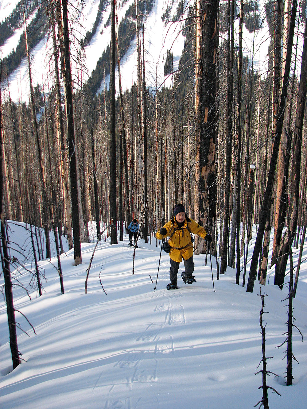
At the start our snowshoes hardly left an impression in the snow
We ascended one of the narrow ribs on the slope
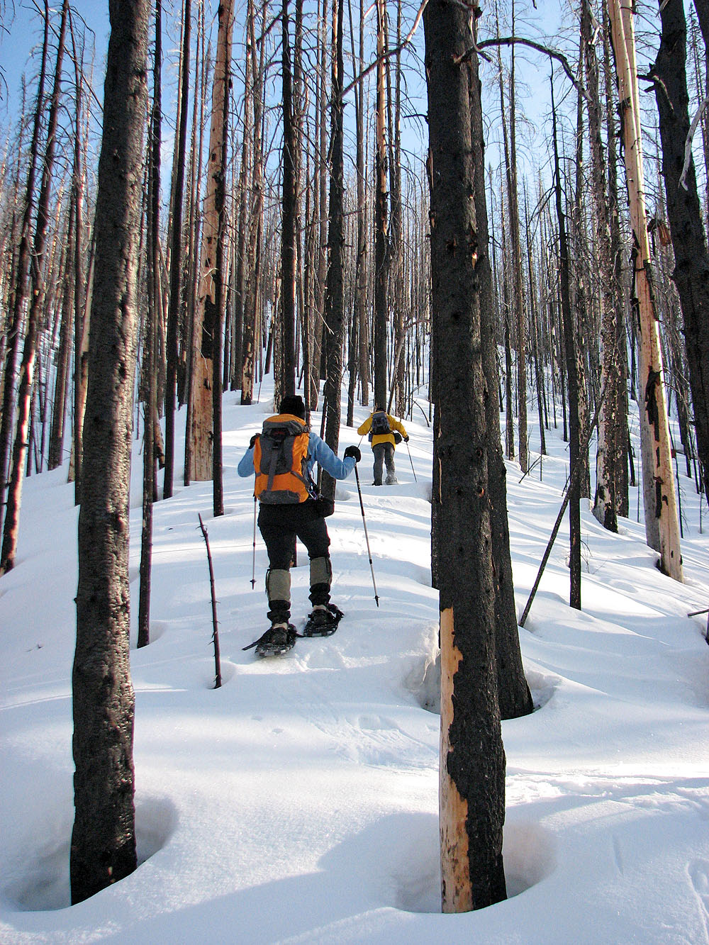
This is Sonny's first time on snowshoes
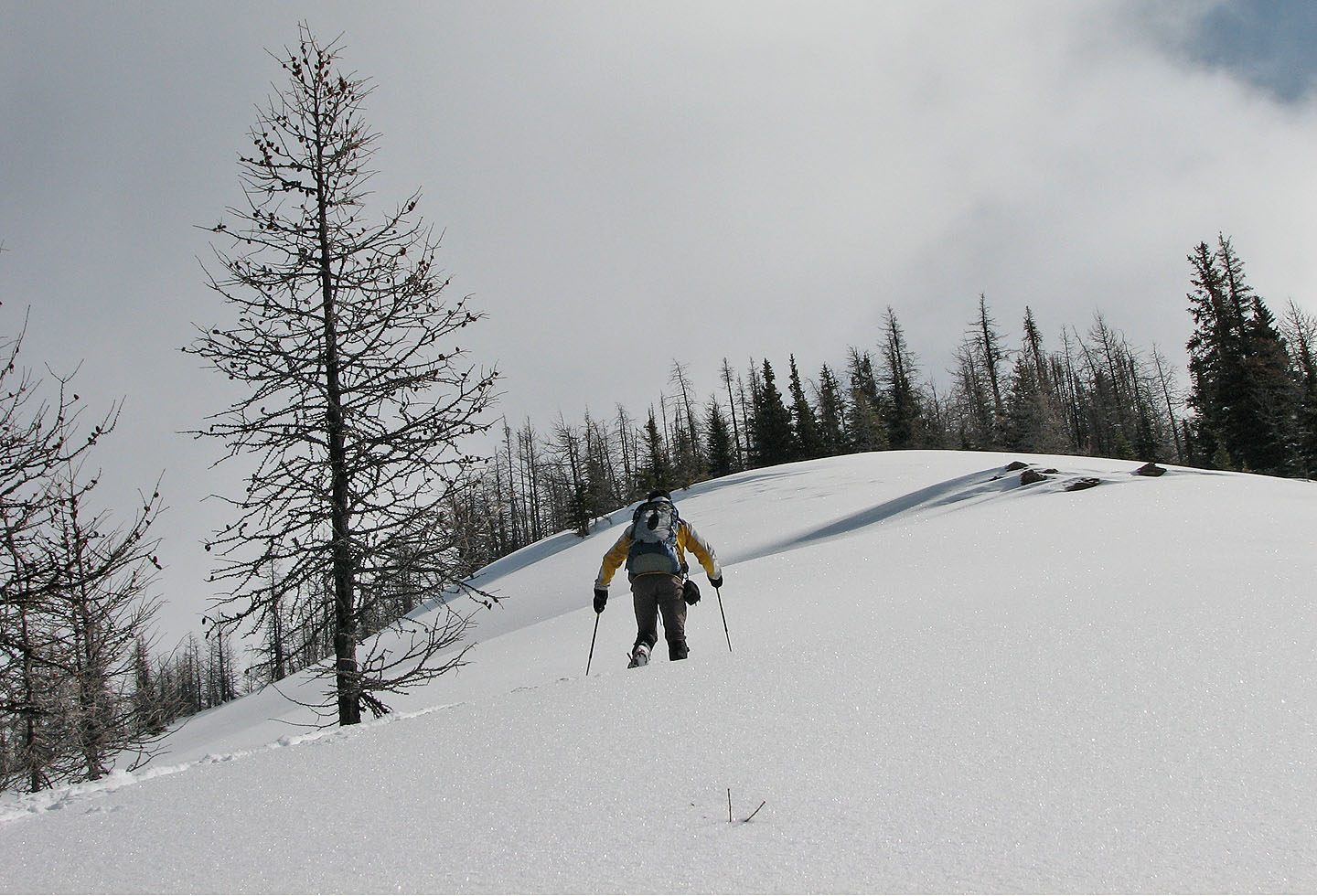
Higher up, the trees are smaller and begin to thin
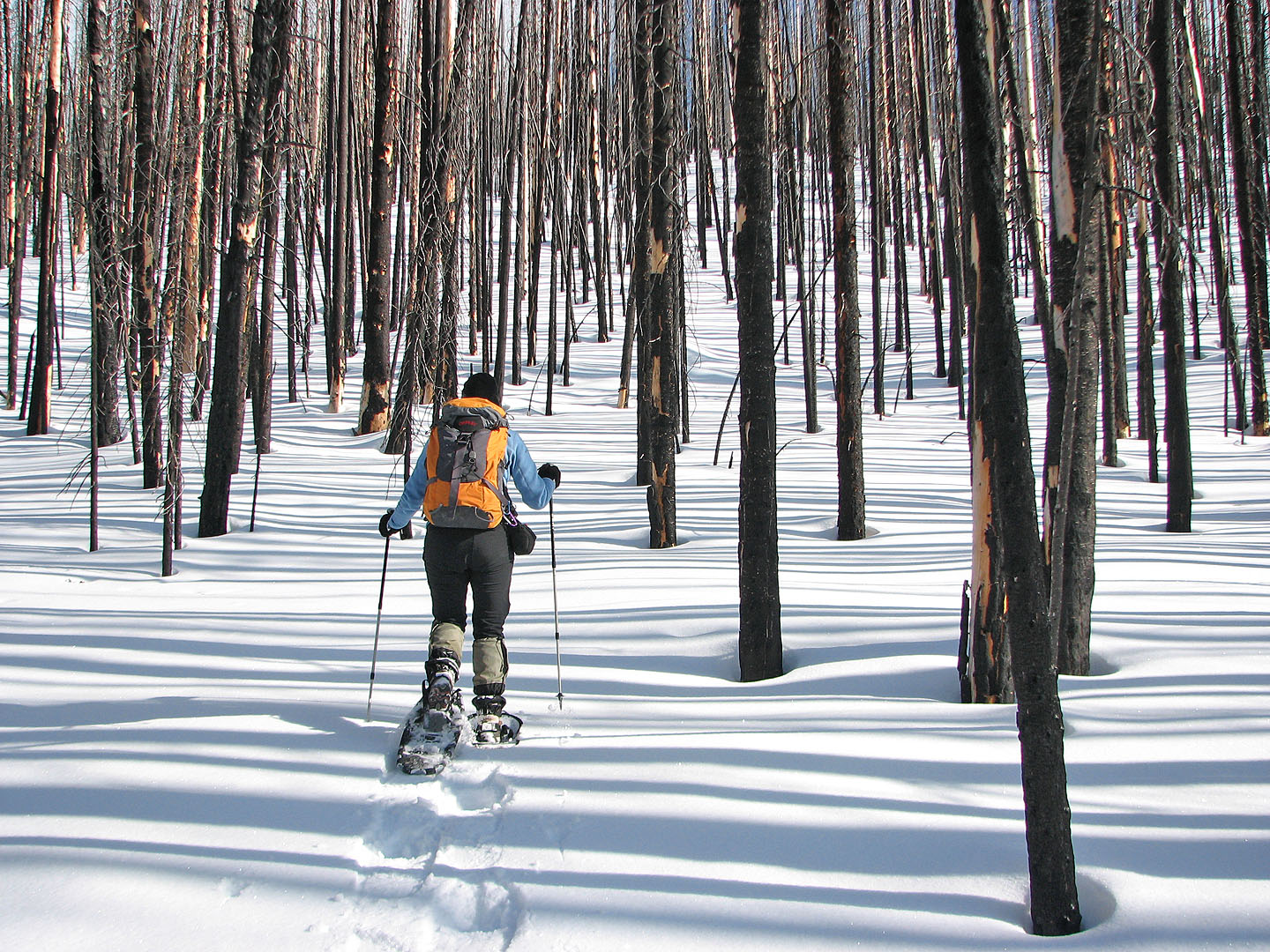
The trees cast striking shadows on the snow
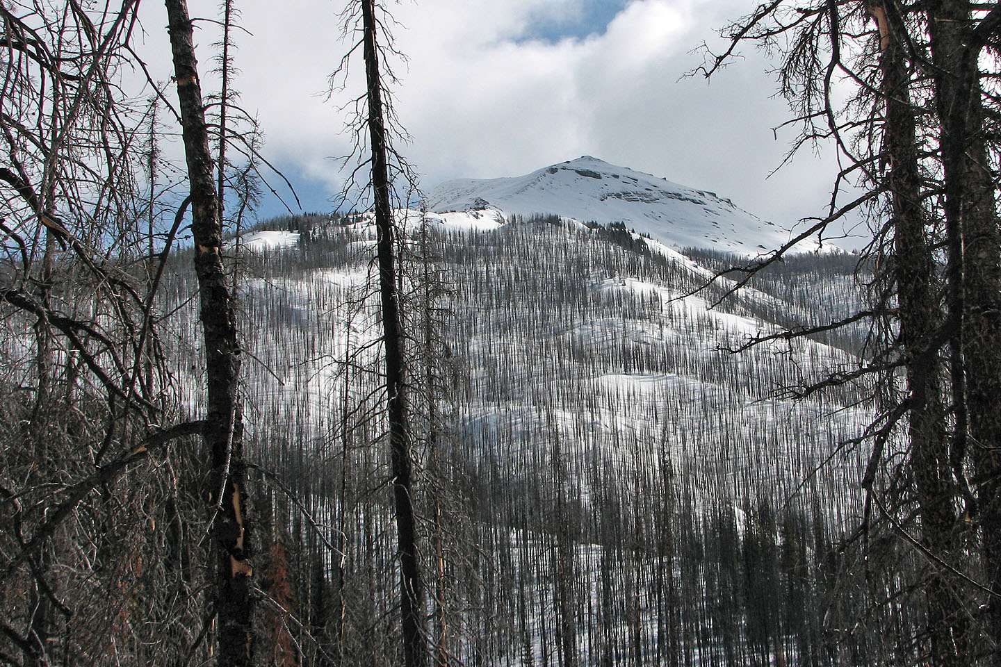
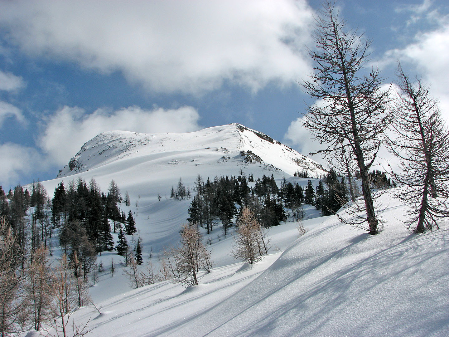
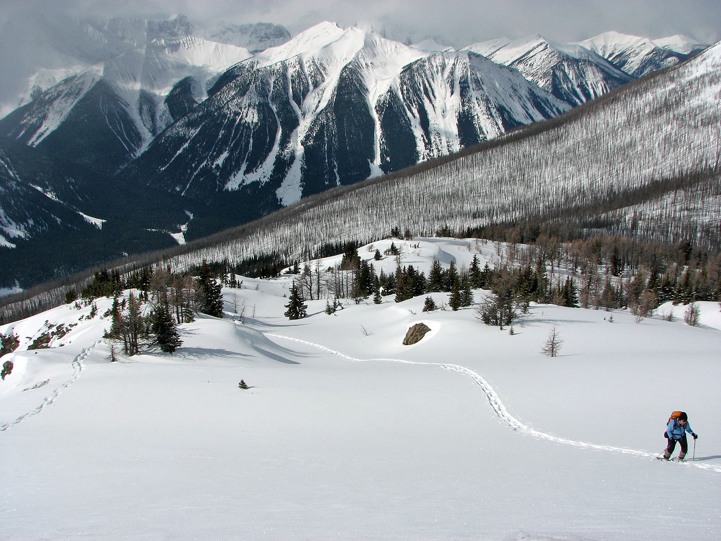
First view of the summit
We can make out the valley below
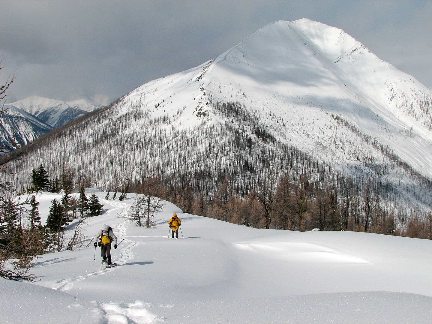
As we neared the col, Vermillion Peak appeared behind us
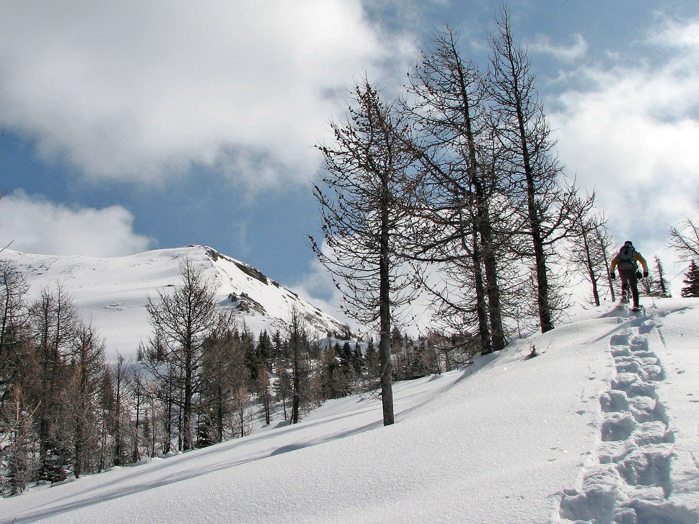
Our first break in the trees
Looking down the clearing
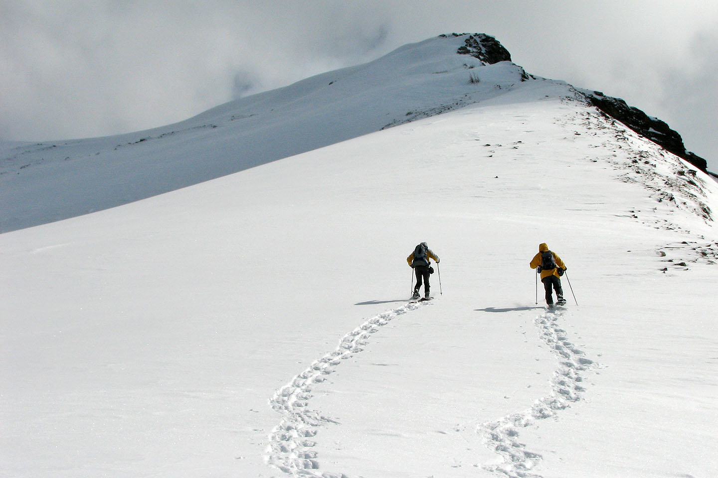
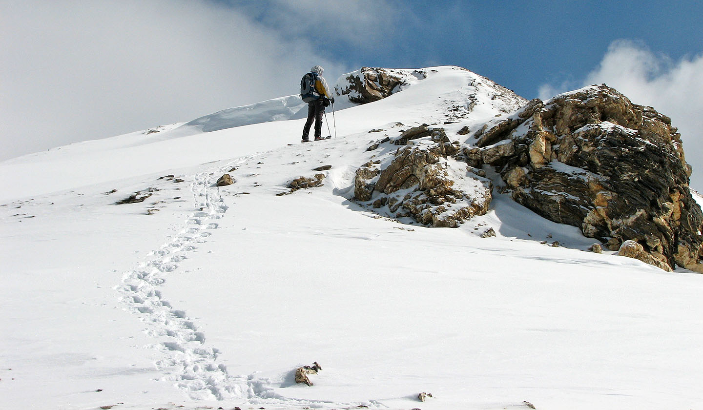
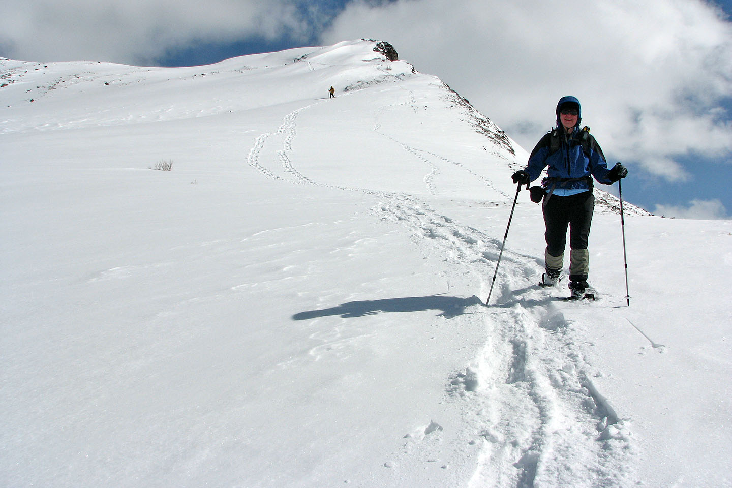
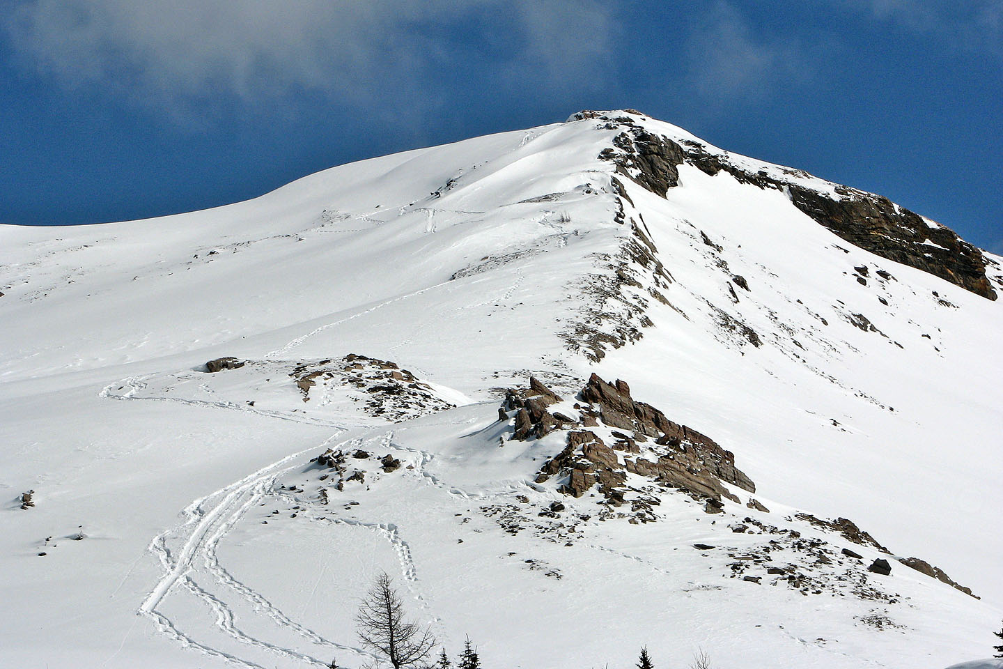
After passing through more trees, the false summit appeared
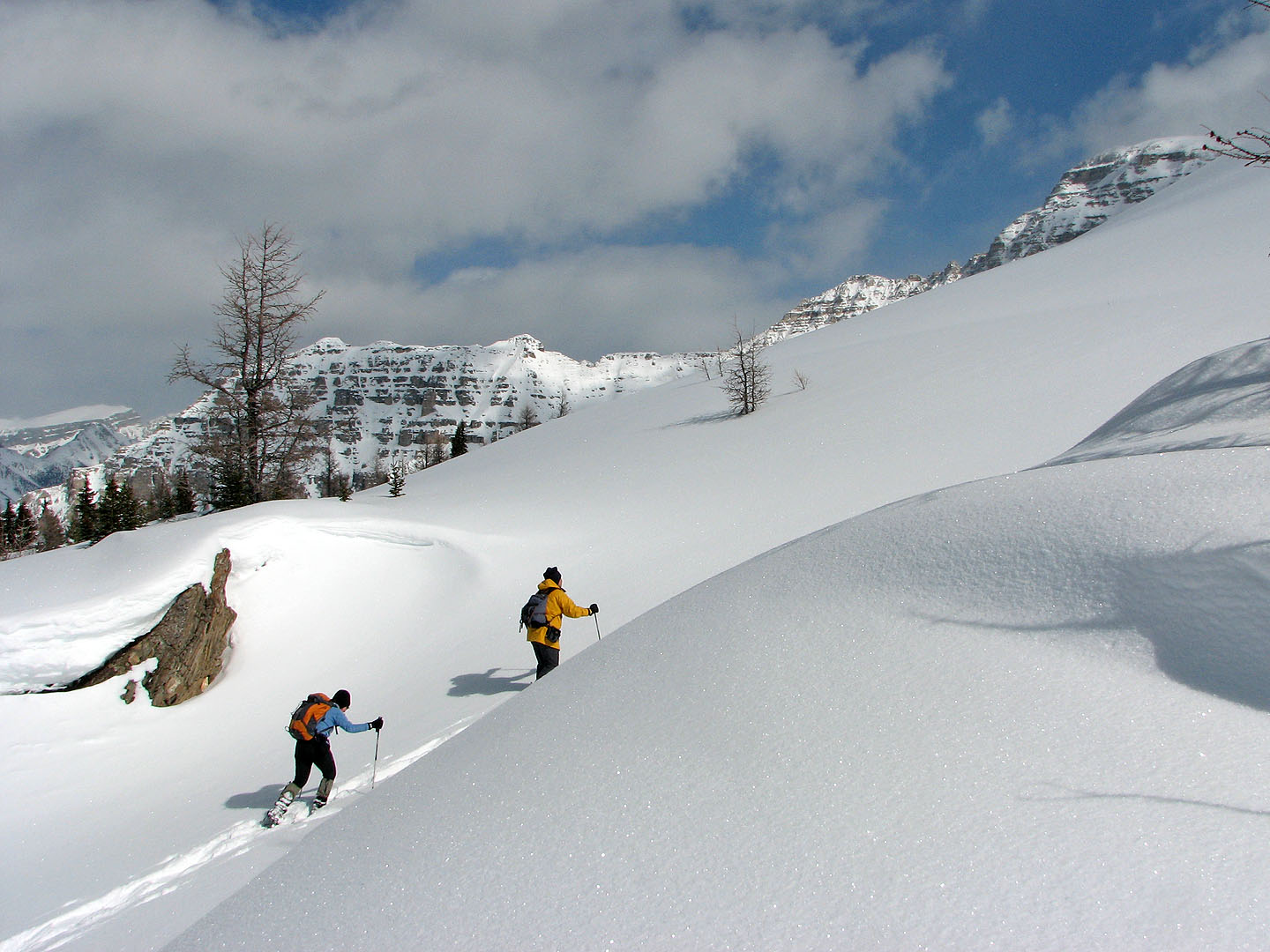
To reach the false summit we crossed this beautiful plateau
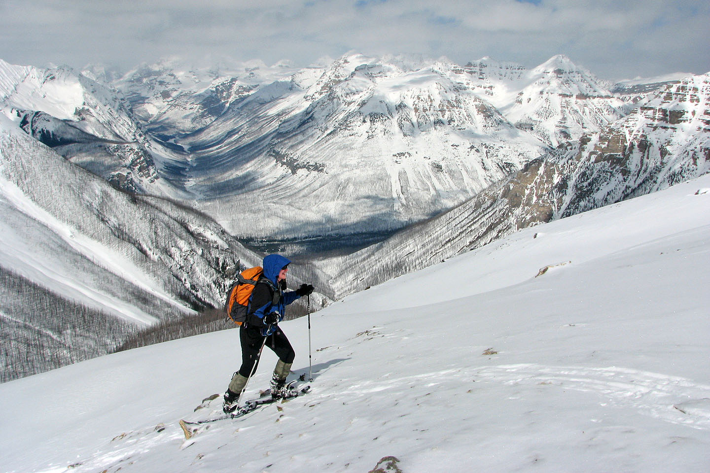
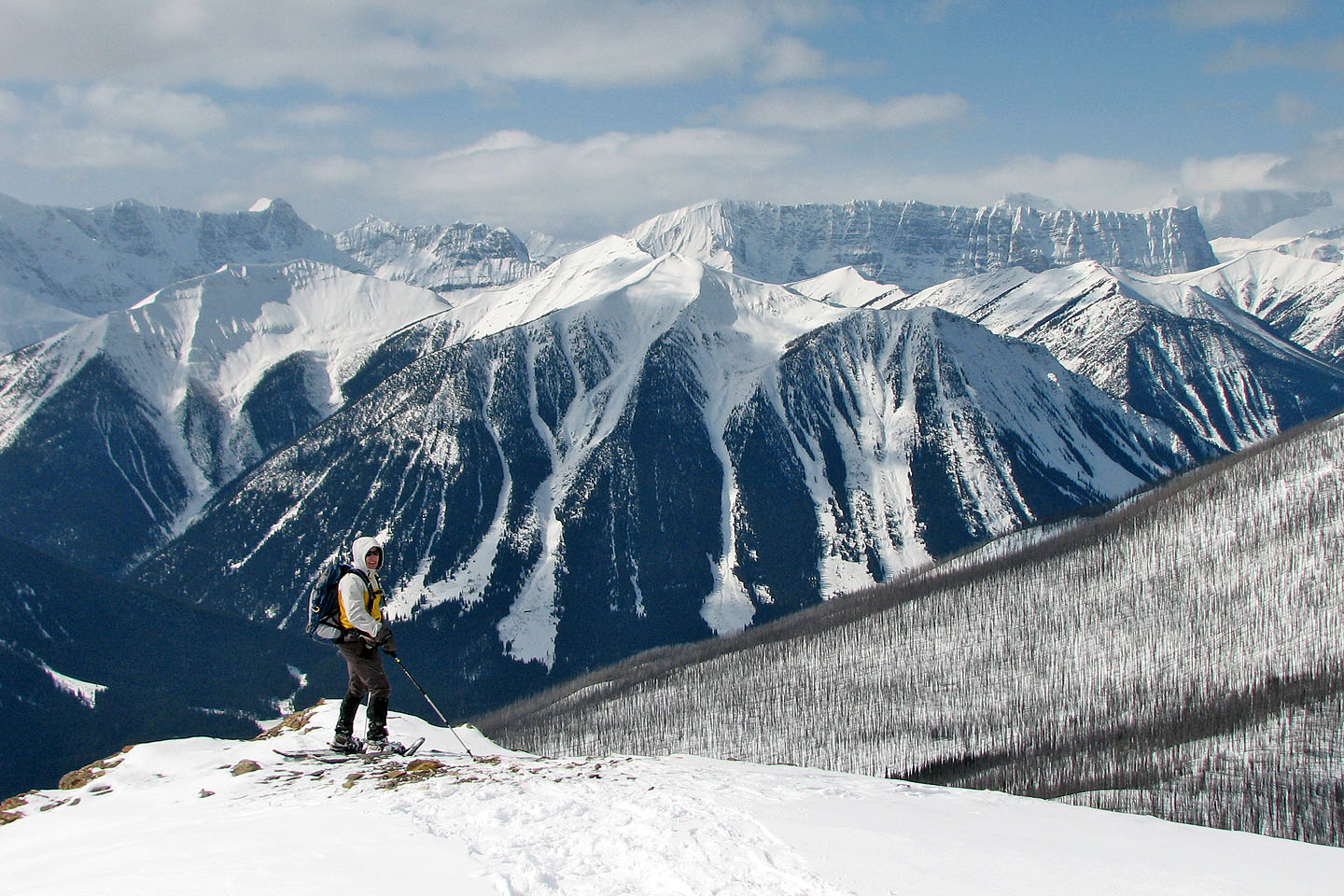
Vermillion Peak filled the view northwest
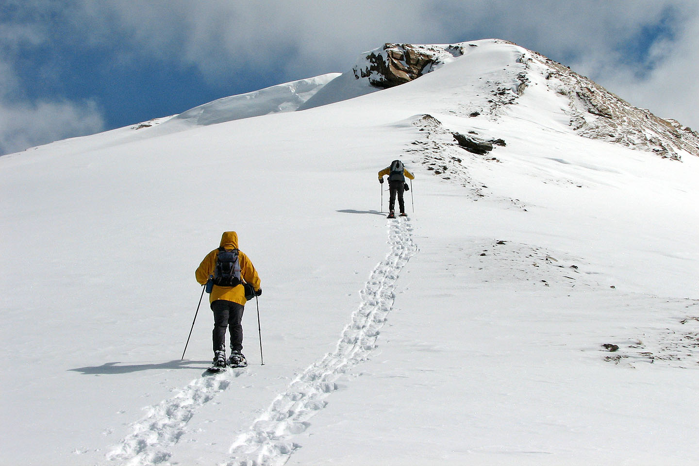
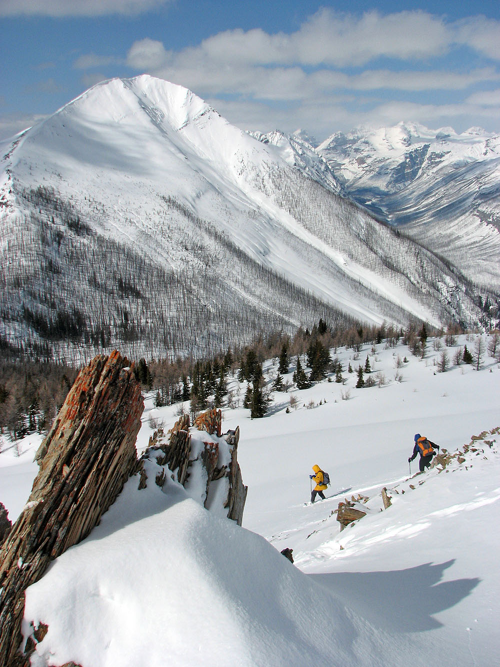
Dinah and Sonny ascended a gully while I stuck to the ridge (mouse over)
Looking back at the plateau
Sonny and I headed to the false summit. Near the top we skirted left because of steep snowdrifts.
View to the north: The pointed peak on the right is
Mount Whymper (mouse over for a close-up)
Looking back from the false summit
Looking at the true summit from the false summit
The Rockwall on the right (mouse over for a close-up)
We set off for the summit
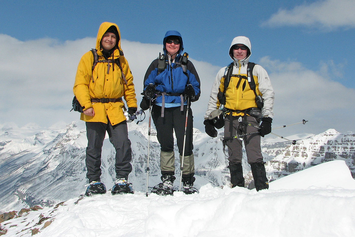
Sonny, Dinah and I on the summit
Unnamed peak to the west
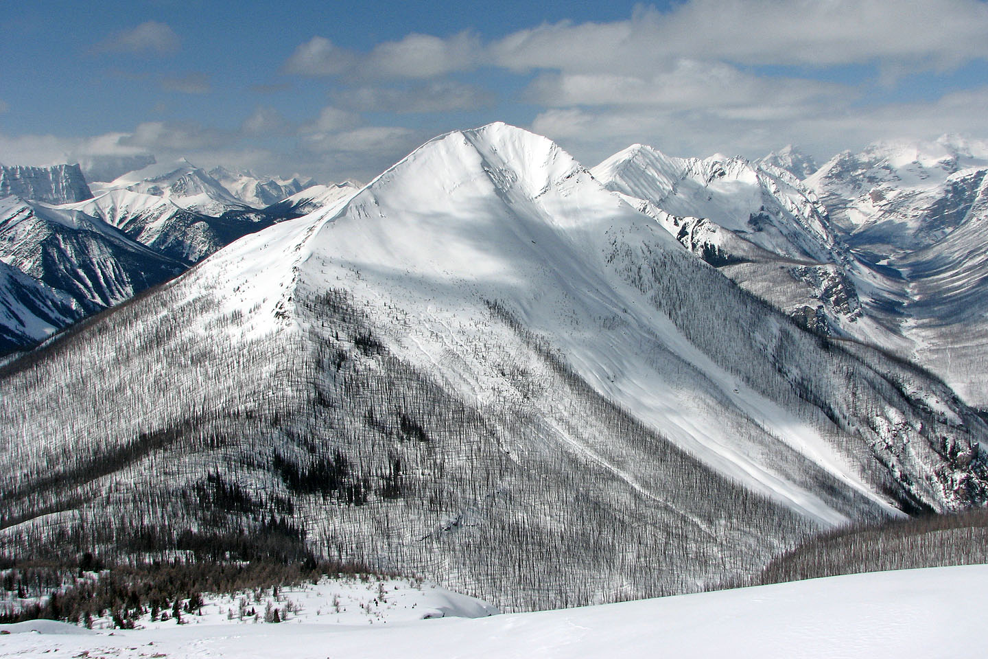
Vermillion Peak
Coming down from the false summit
Making our way through the rocks
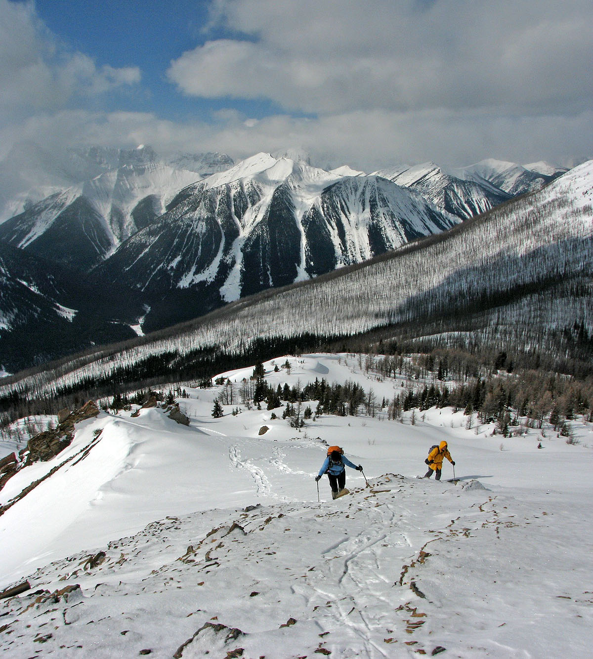
Retracing our steps back along the plateau
Looking back at our tracks
82 N/1 Mount Goodsir
Snowshoeing | Canada | Home