bobspirko.ca | Home | Canada Trips | US Trips | Hiking | Snowshoeing | MAP | About

Vermilion Peak
Kootenay National Park, Alberta
July 14, 2003
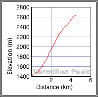
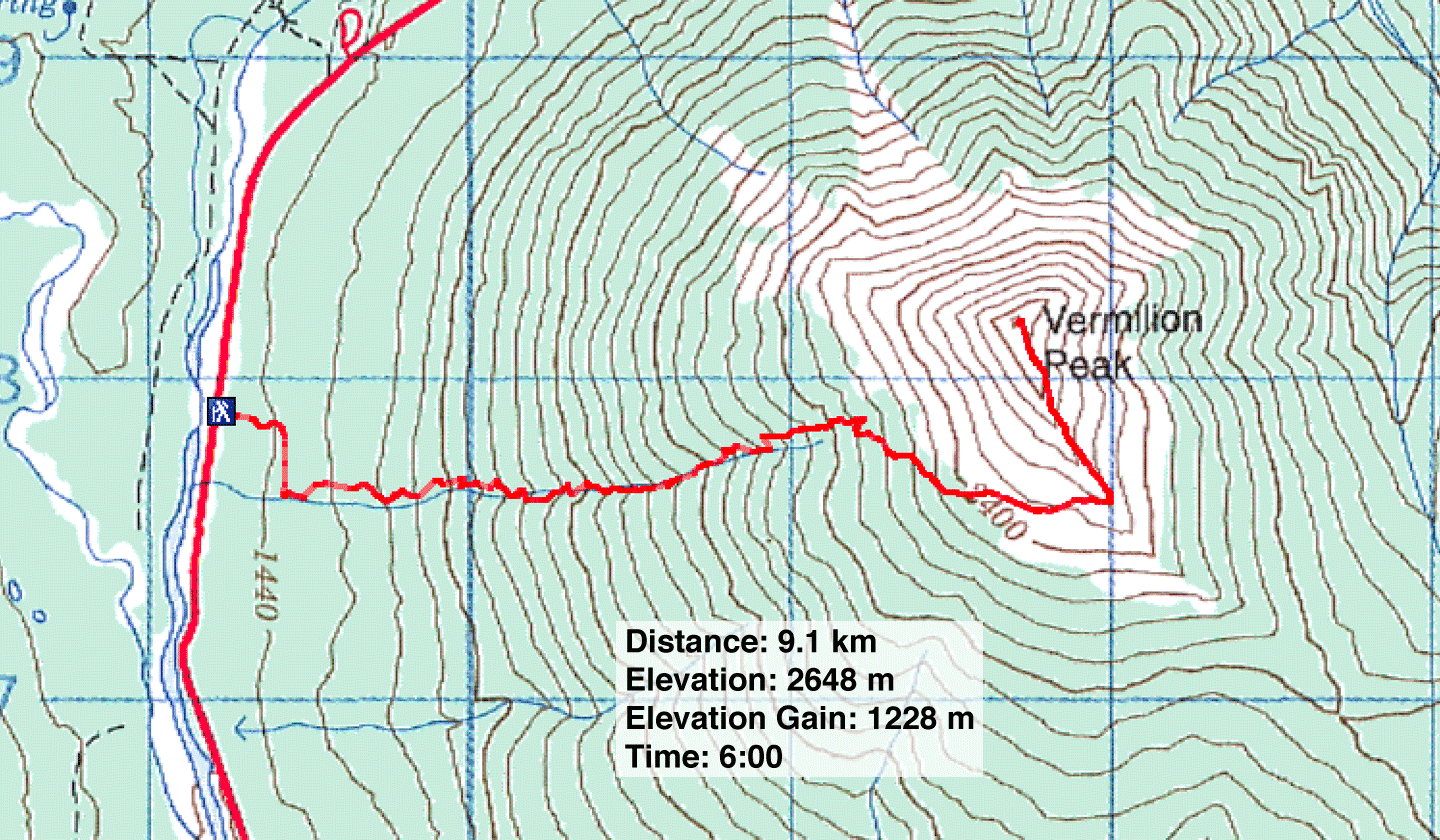
Distance: 9.1 km (5.7 mi)
Cumulative Elevation Gain: 1250 m (4101 ft)
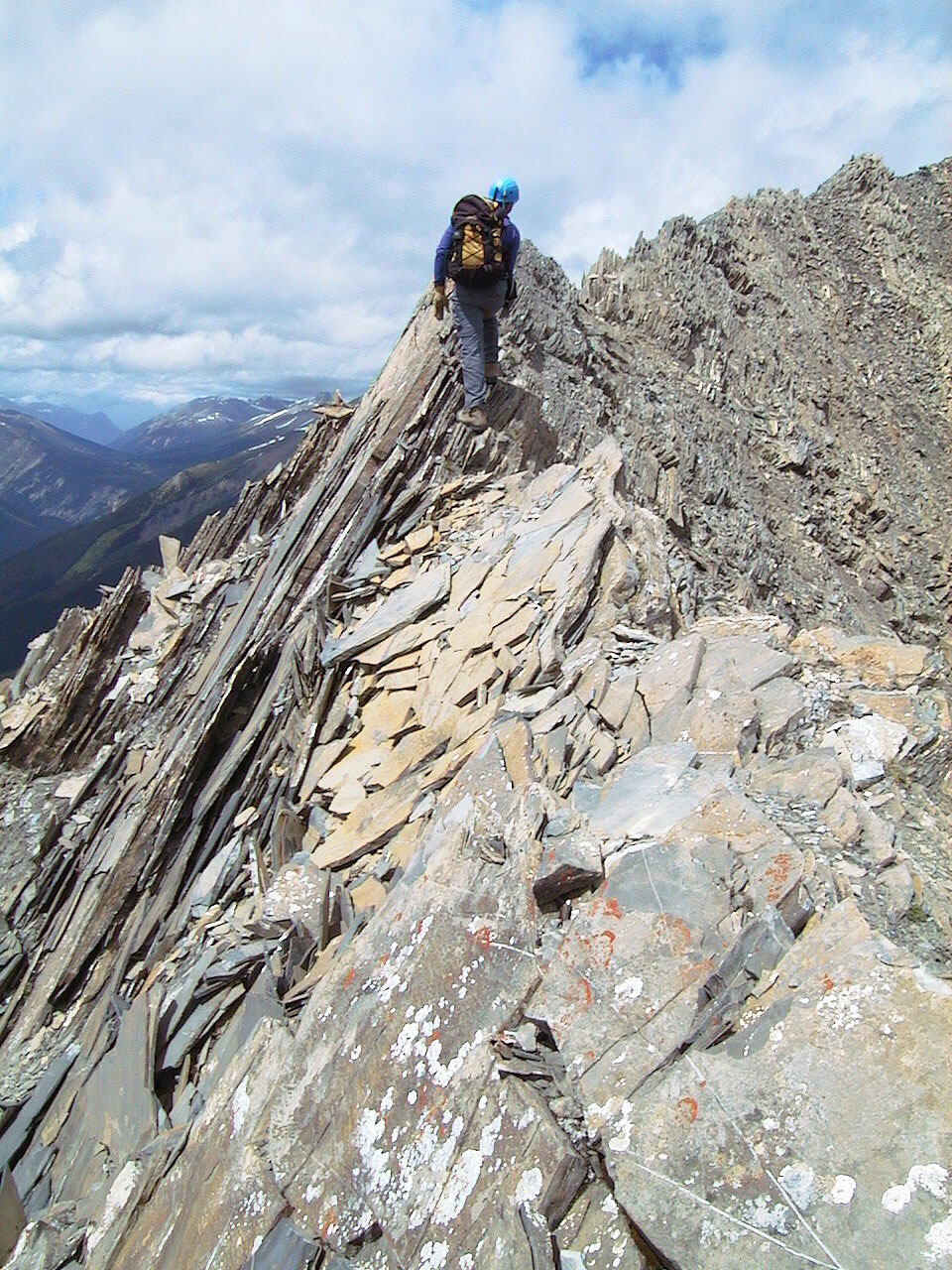
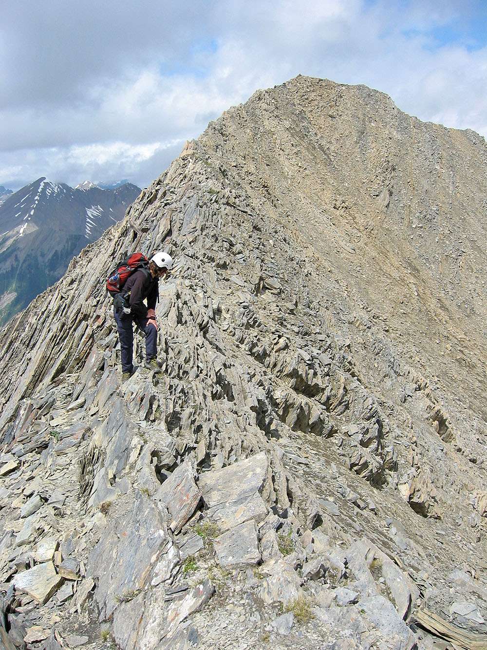
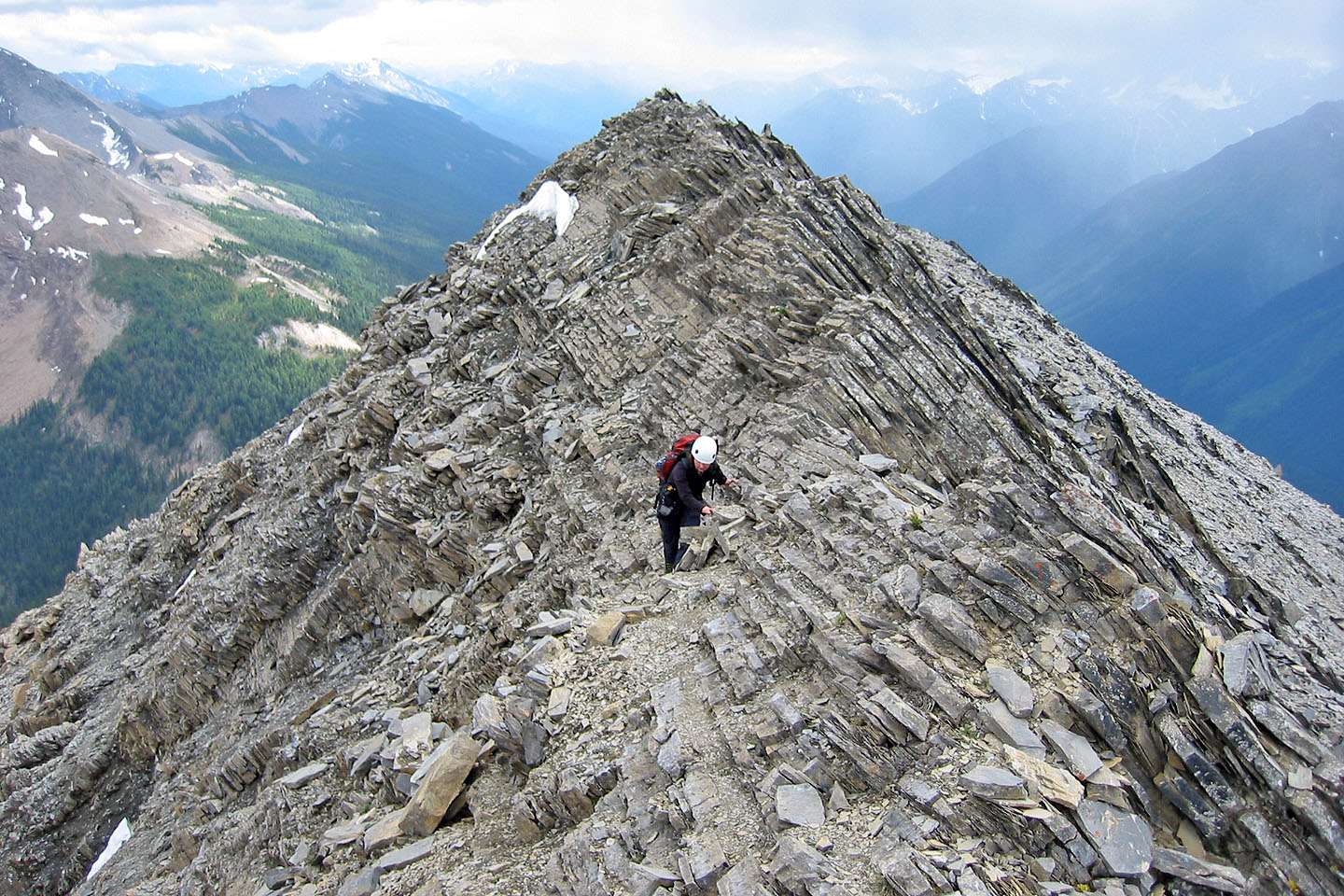
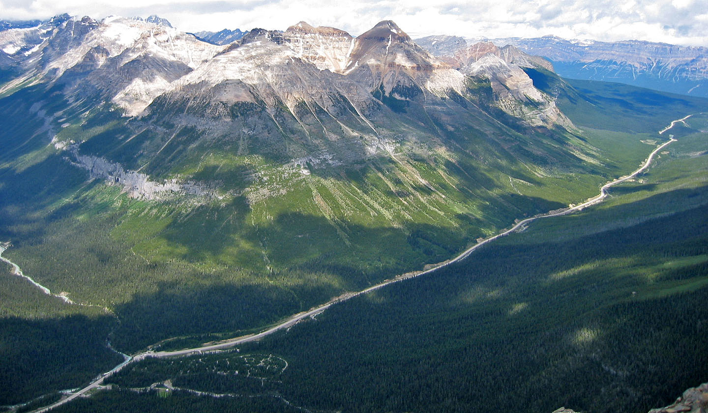
Despite the long haul up a gully, Vermillion Peak is an enjoyable scramble and impossible to get lost. Dinah and I hiked up the gully and turned right when we reached the base of the shale slope. We followed the base until we found a break and easily scrambled to the crest. The ridge appeared well-trodden, and we found it was usually best to stay on top of the ridge instead of traveling below the crest. I was fascinated by the immense flat shale flakes on the ridge. Unfortunately clouds and haze prevented a clear view of the surroundings peaks.
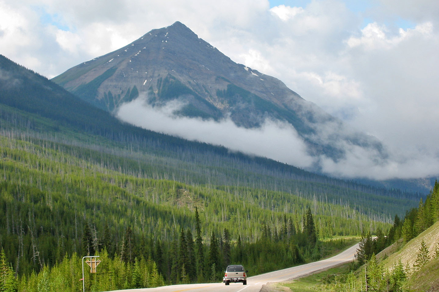
Vermillion Peak from the highway
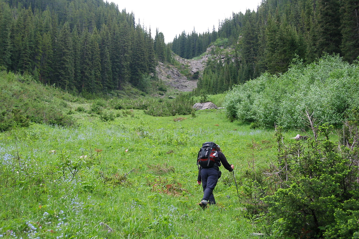
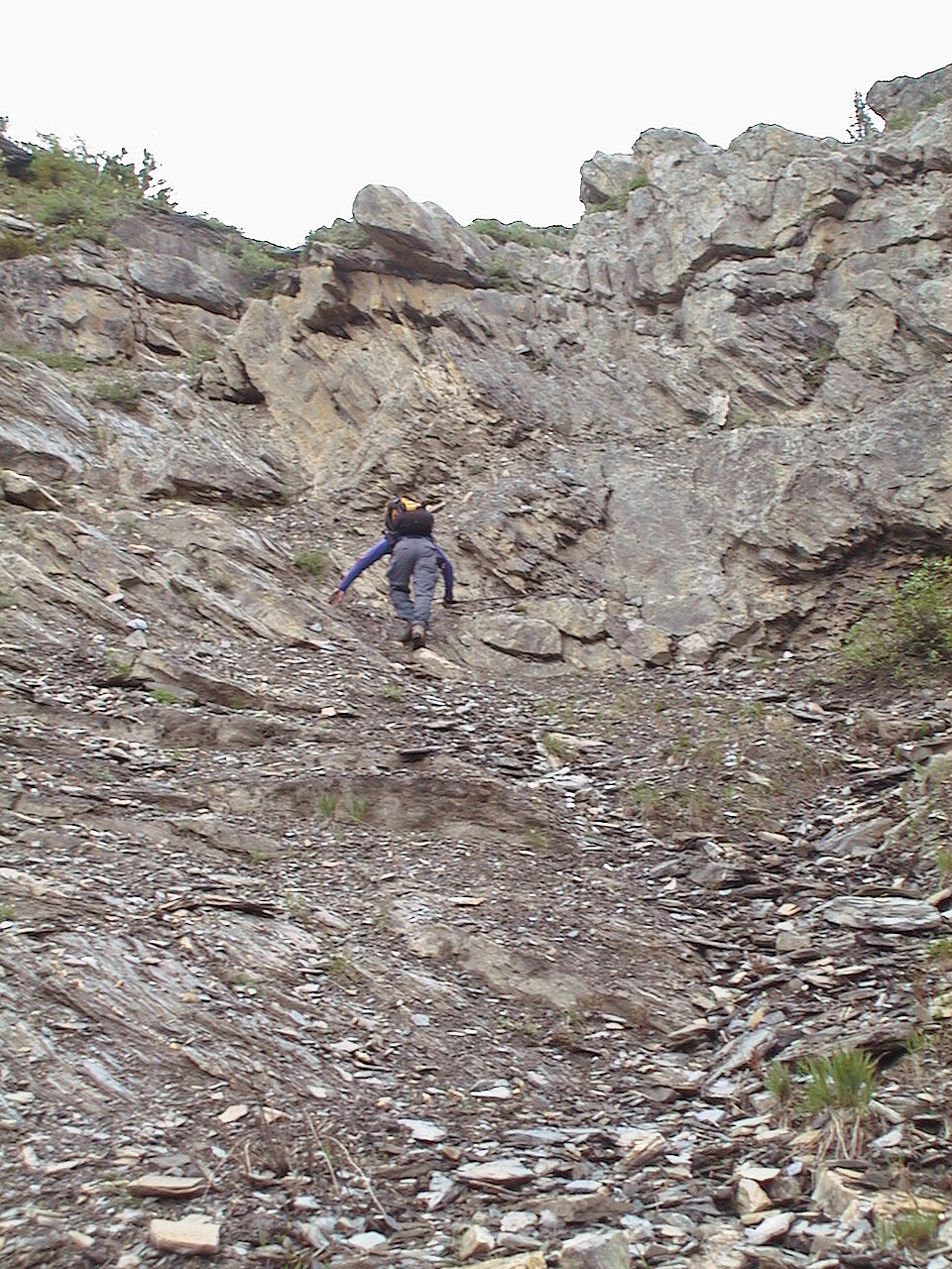
Starting up the gully
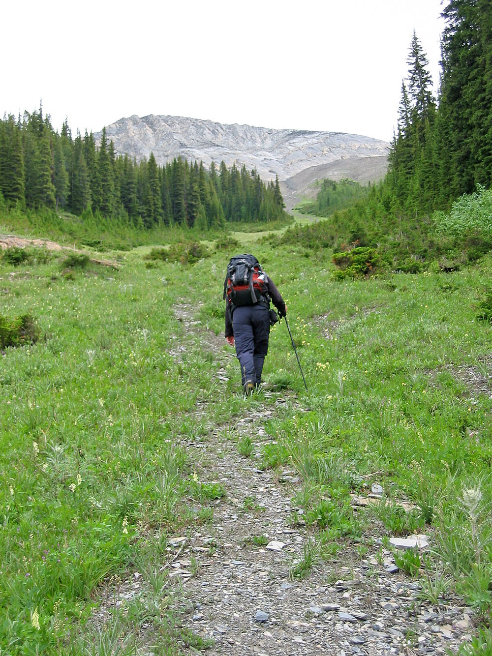
Partway up, the mountain appears
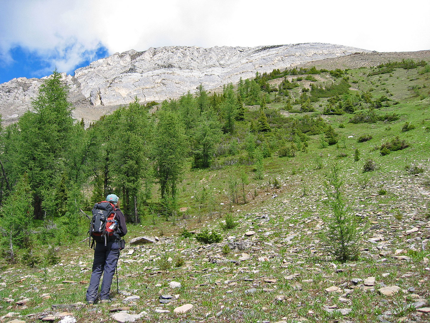
Vermilion Peak seen from the top of
the gully. We headed to the far right of the ridge.
We skirted the base of the ridge looking for a suitable spot to ascend
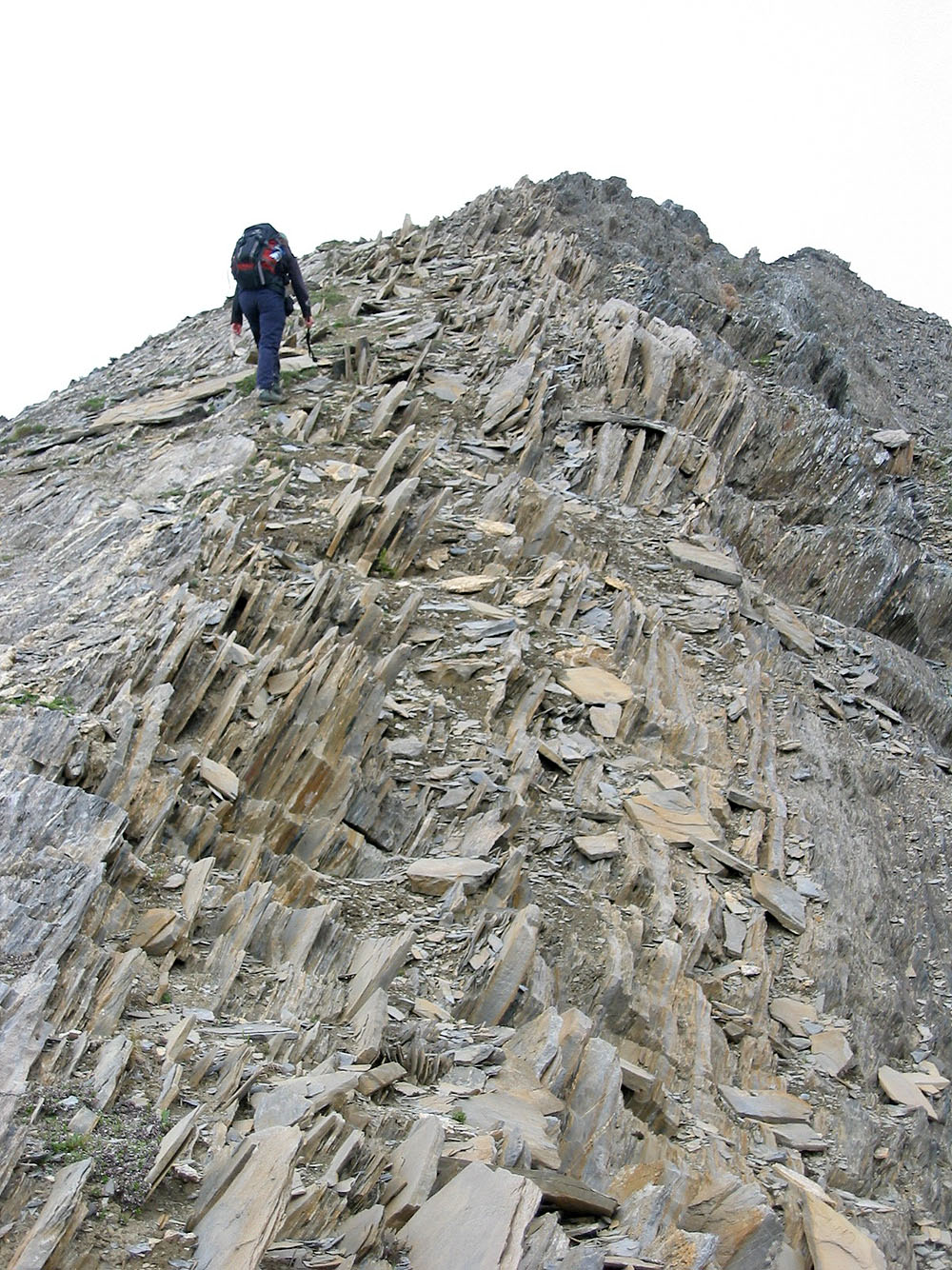
Scrambling up a weakness to the ridge crest
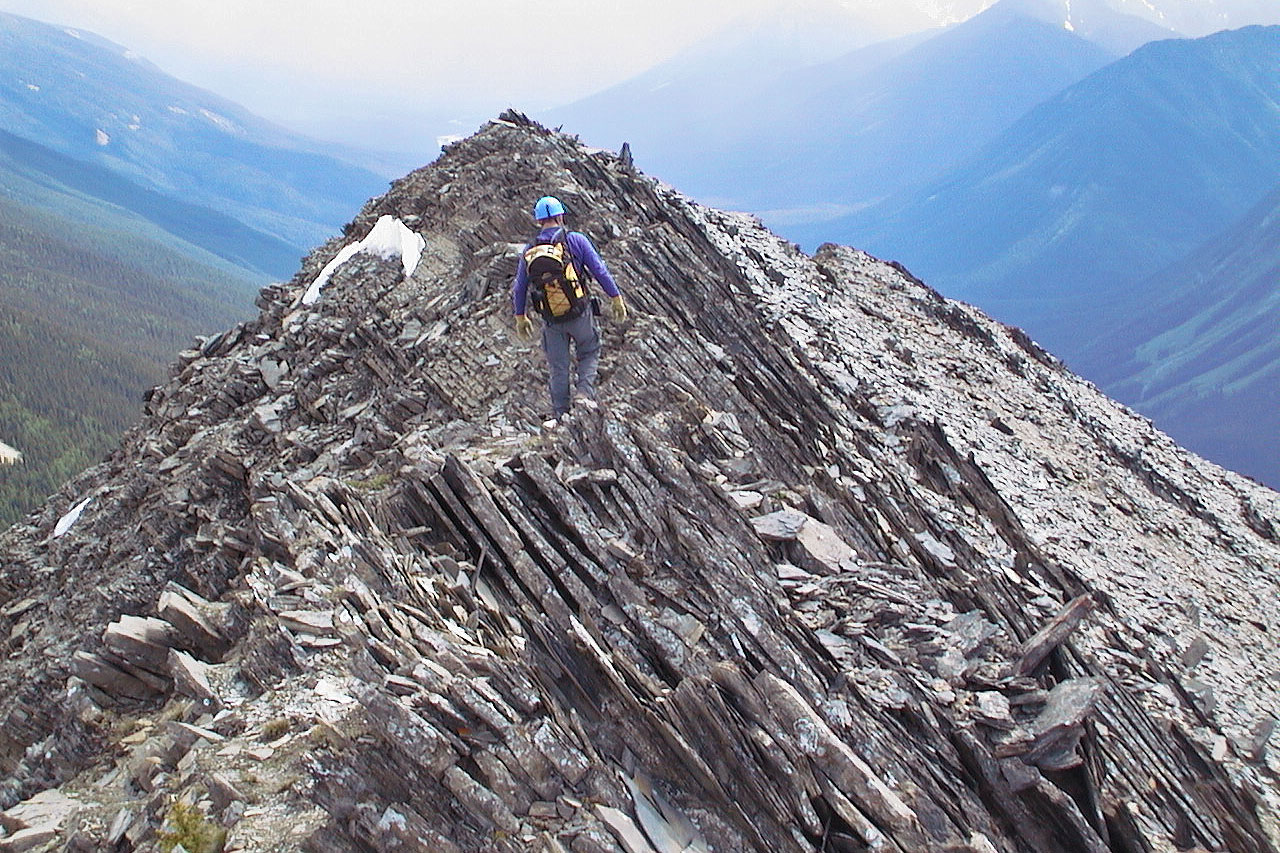
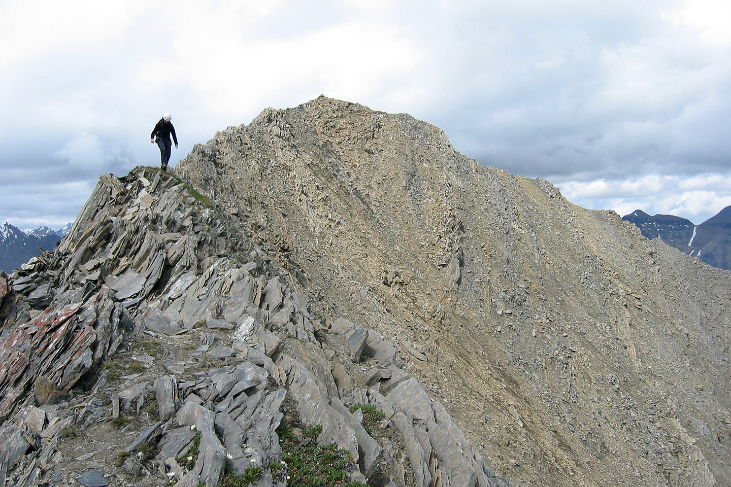
Once on the ridge we followed it to the summit
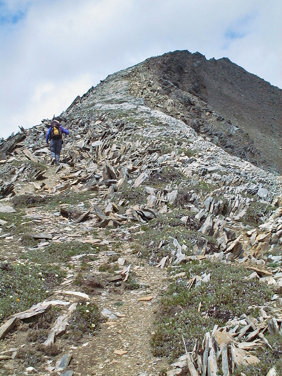
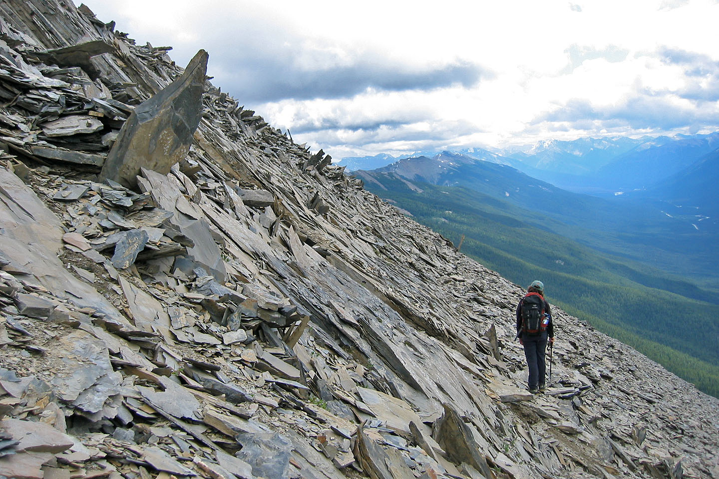
The ridge transitions to rocks
The ridge starts smooth before deteriorating into a jagged edge
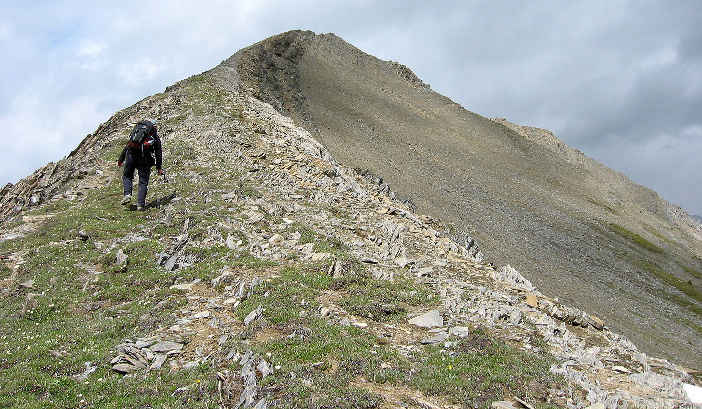
We'll soon be scrambling
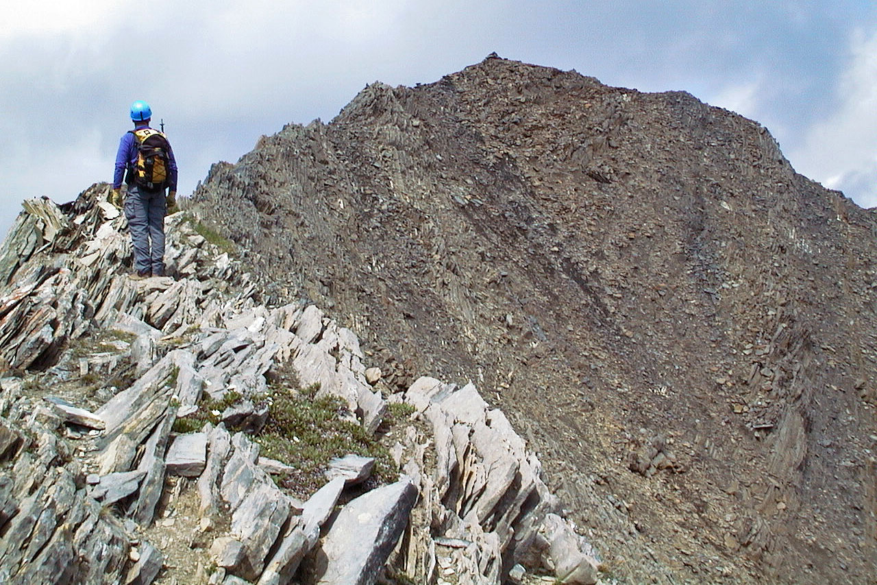
The summit lies ahead
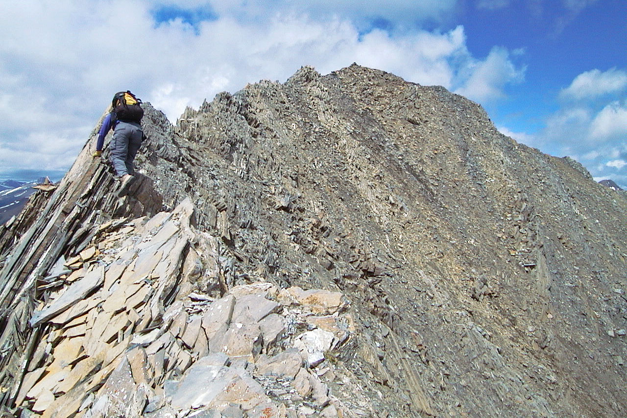
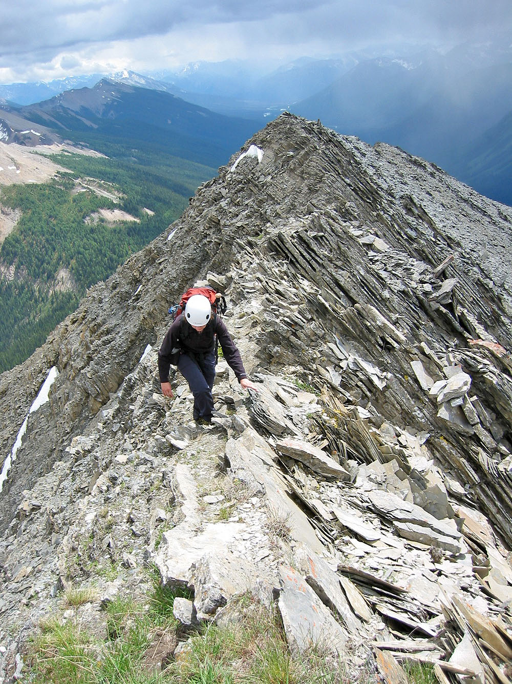
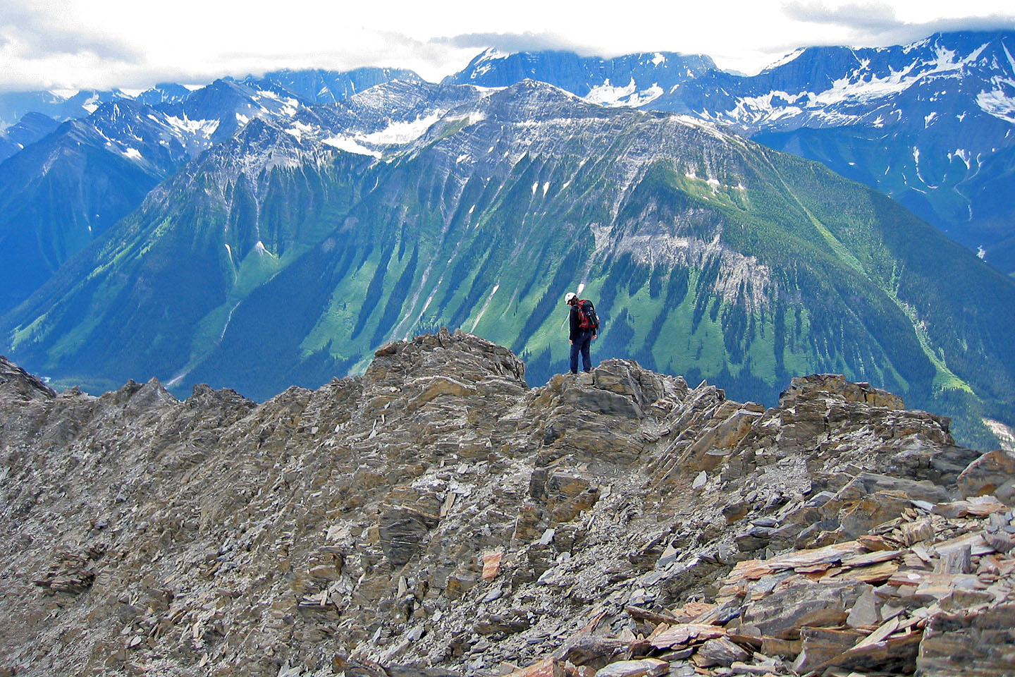
The ridge becomes narrow forcing us to scramble
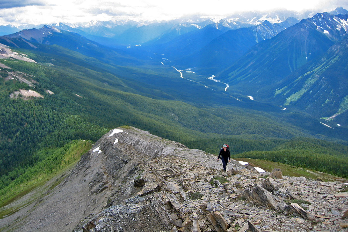
There's a precipitous drop on the left side
Dinah looks for a spot to drop down on the right side
We skirted below the crest here
We regained the ridge before reaching the summit
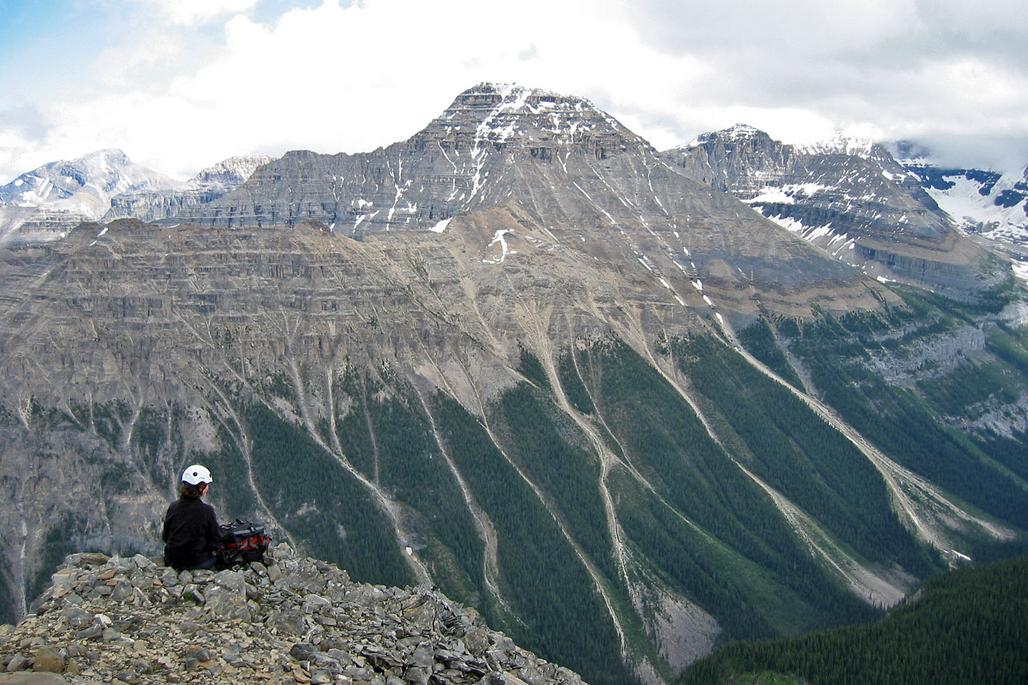
Dinah relaxes on the summit. Beatrice Peak and Mount Ball appear close by.
Rising to a blunt point across the valley is Mount Whymper
Starting back from the summit
We made our way slowly back along the ridge
We'll soon be off the rocks
82 N/1 Mount Goodsir