bobspirko.ca | Home | Canada Trips | US Trips | Hiking | Snowshoeing | MAP | About
View from Brachiopod Mountain
Anthozoan and Brachiopod Mountains
Skoki, Banff National Park, Alberta
July 29, 2005
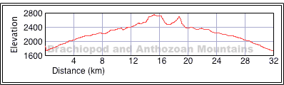
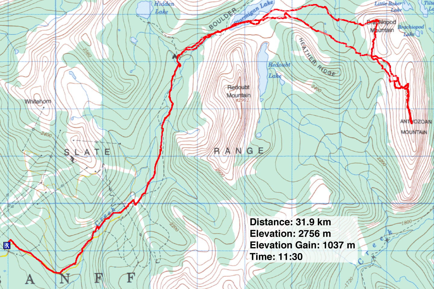
Distance: 31.6 km (19.6 mi)
Cumulative Elevation Gain: 1396 m (4580 ft)
Anthozoan and Brachiopod Mountains appear to be hasty additions to the scrambling book. Unlike other route descriptions, only two paragraphs were allotted for these peaks. Despite the "easy-moderate" rating, we found both required route-finding and moderate scrambling.
Perhaps though, I would be less critical if we had tackled these from nearby Baker Lake instead of Fish Creek parking lot. Unlike our previous excursions into Skoki Valley, we didn't catch a ride up Temple Road. After trudging up the road, Dinah and I followed the trail to Boulder Pass which overlooks Ptarmigan Lake. The view here never ceases to amaze me. The lake sits in the valley surrounded by mountains. We left the main trail here and followed the south shore of the lake. We soon came to Heather Ridge, a long ridge similar to Brachiopod Mountain. We tried to cut across the lower slopes of Heather Ridge only to find we had to backtrack and drop down because of steep snow on the north slope.
The spectacularly long ridge comprising Anthozoan and Brachiopod Mountains was now in front of us. But we first had to cross some undulating terrain. We decided to bag Anthozoan first, so we headed to the Brachiopod-Anthozoan col. From the col, we could begin our ascent. The summit appeared so far away I wondered if it was in another time zone.
Talk about a long approach! Four hours and 13.5 km after starting, we reached the B-A col. Ahead of us, the lower slopes of Anthozoan comprised of ankle-breaking rubble. There was no Kane effect here, no evidence of a trail. As we climbed, the terrain improved, and we gained the ridge with a sigh of relief.
We enjoyed the ridgewalk until we came to an unexpected crux: we had to cross a steep rock slab that dropped down dozens of metres. A slip here could be deadly. We found it too steep to simply walk across and down, and too smooth for a handhold. We carefully crossed it. I wouldn't want to attempt it in wet conditions let alone when it's under snow or ice.
After the crux, we continued our walk to the summit, arriving there an hour and 15 minutes after leaving the col. We took in views of Quadra, Temple, Protection to the south. To the east, we could see clear to Television Peak which in two days, we would be standing on.
After spending about 20 minutes on top, we started back down the ridge. The crux was easier on the return because it required angling up instead of down. We continued along the ridge, passing the point where we topped out on our ascent. We were tempted to ascend the north peak of Anthozoan which was marked with a huge cairn as we were only a few dozen metres below it. But it would offer no new views, and the day was long enough. In retrospect, it may be better to climb up and over the north peak. It would involve a scree descent and avoid the crappy loose rock that we endured on the lower slopes.
Instead, we found an orange scree run to descend. When that scree line gave out, we traversed until we found a black run of scree. Eventually we ran out of scree and were back on that wretched loose rock. We lost our patience here and headed for the valley floor, willing to forfeit elevation to save stumbling along the rocky slope. After climbing back up the B-A col, we faced our ascent of Brachiopod Mountain.
Like Anthozoan, Brachiopod's summit is perched at the end of a ridge. It made little sense to drop down below summit and climb up as the guidebook indicates: from the B-A col we were only 150 m below Brachiopod's summit.
We headed up the slope at a shallow angle. The side-sloping was unpleasant, and I wondered if it would have been better to ascend the south end and hike up the ridge even if it did incur an elevation loss. We aimed for a point above the scree and below the solid rock. There seemed to be no easy way to scramble directly to the summit, so we continued angling until we neared the north face of the mountain. Here, a series of ledges appear below the mountaintop. It was a matter of walking along each ledge to a weakness where we could gain the next ledge above. This was a moderate scramble, but the rock was excellent. Two hours after leaving Anthozoan Mountain we reached the summit of Brachiopod. After spending some time on top, we headed back to our car, a journey that would take us over three hours.
Postscript: Martin Siddler emailed me with the following suggestion: "We did Brachiopod several days prior but went up the big crack to the right of your ascent route as shown on the upper mountain. A very enjoyable bit of hands on scrambling with one short steep bit just below the summit. A descent is available to the north from the B-A Col, which we used to get back to our Baker Lake camp."
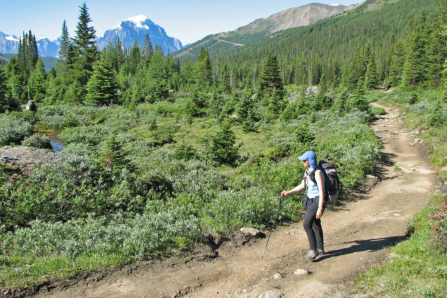
Hiking up the trail to Boulder Pass. Mount Temple in the background.
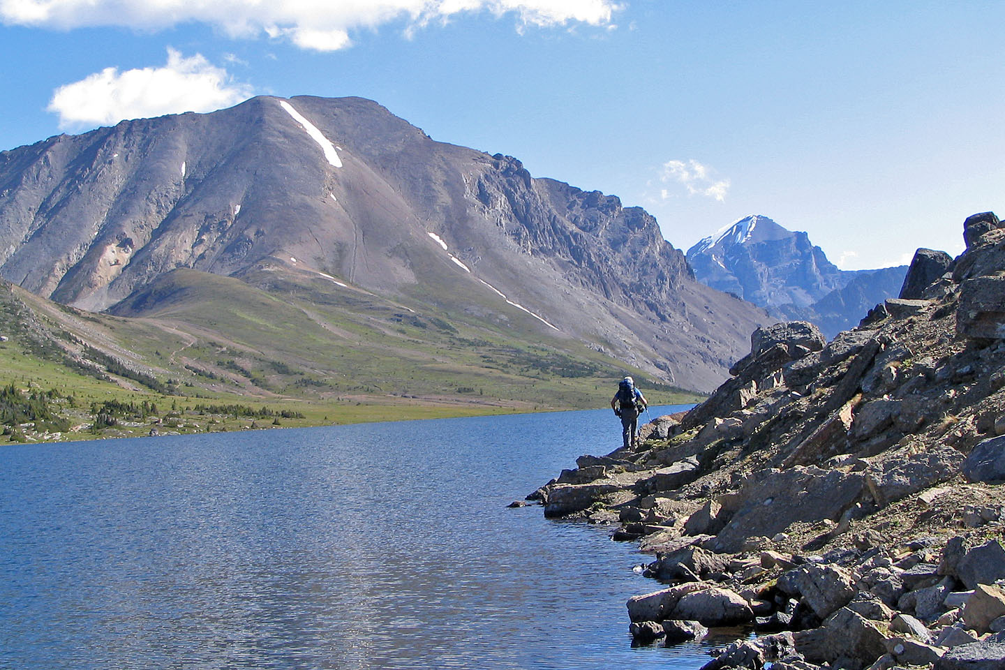 Fossil Mountain sets the background as we skirted the Ptarmigan Lake
shore
Fossil Mountain sets the background as we skirted the Ptarmigan Lake
shore
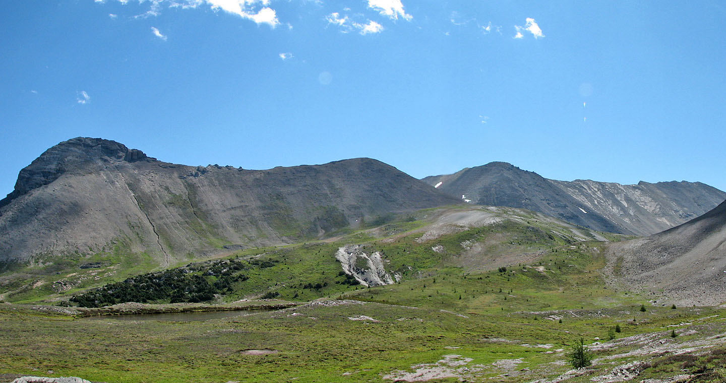
The summits of Brachiopod and Anthozoan Mountains lie at the extreme ends in this photo
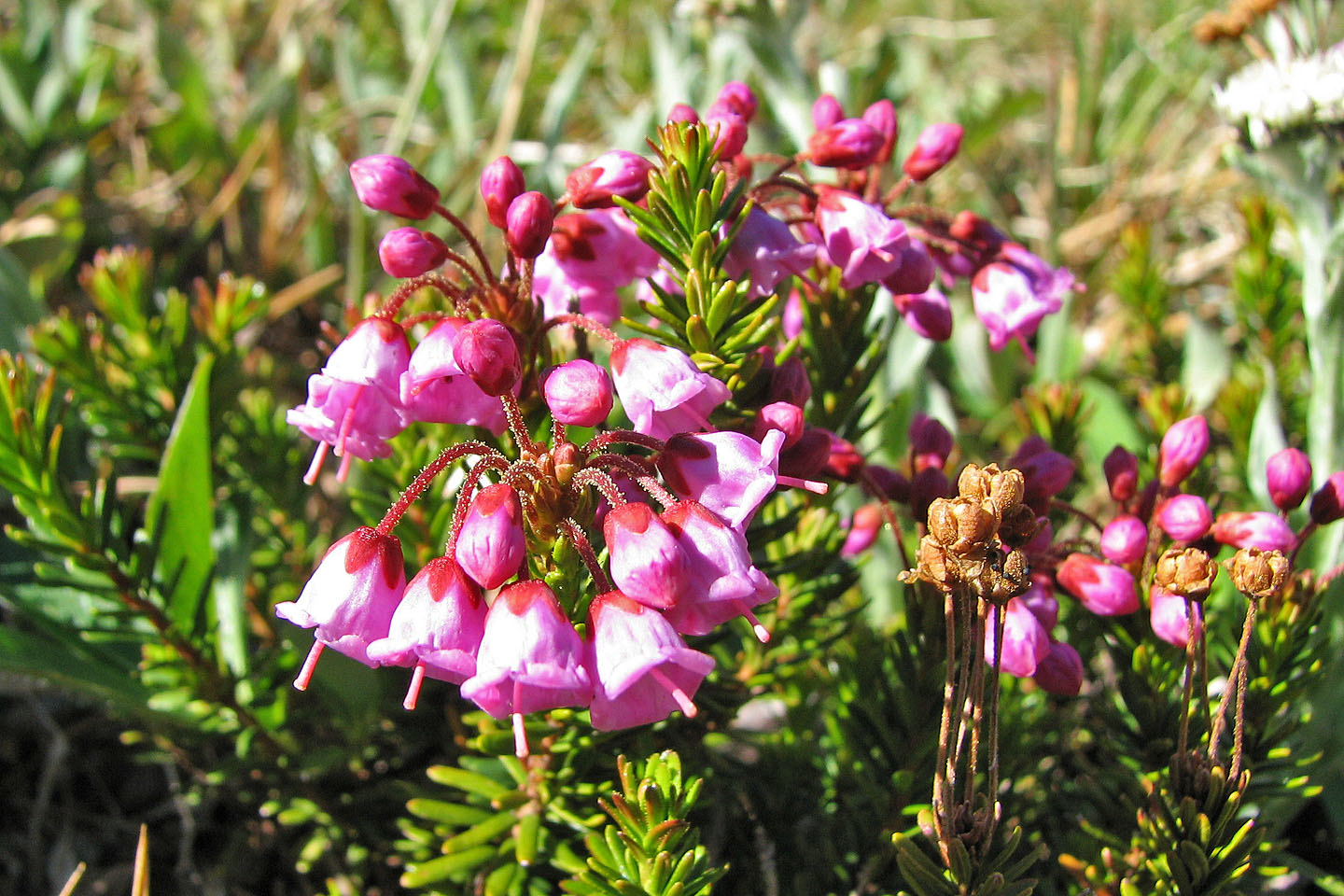
Red heather
Crossing the meadows below Brachiopod
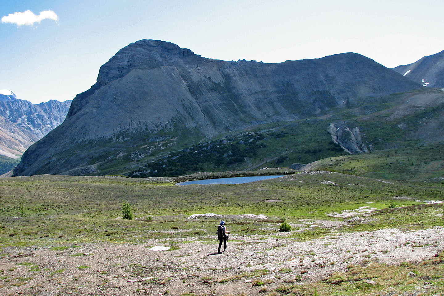
Heather Ridge on the left, Ptarmigan Peak on the right
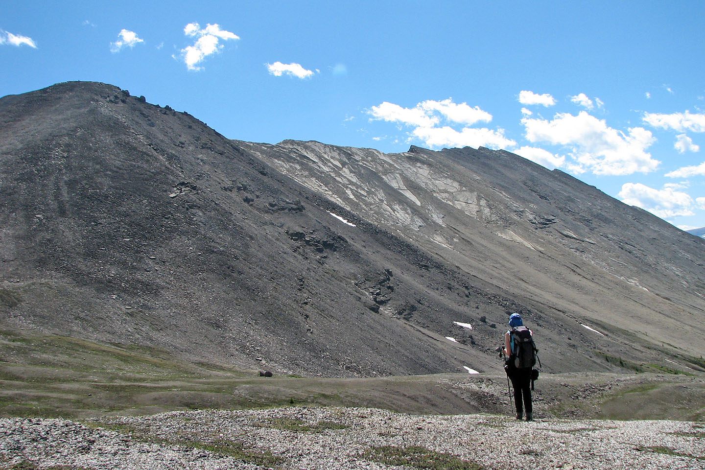
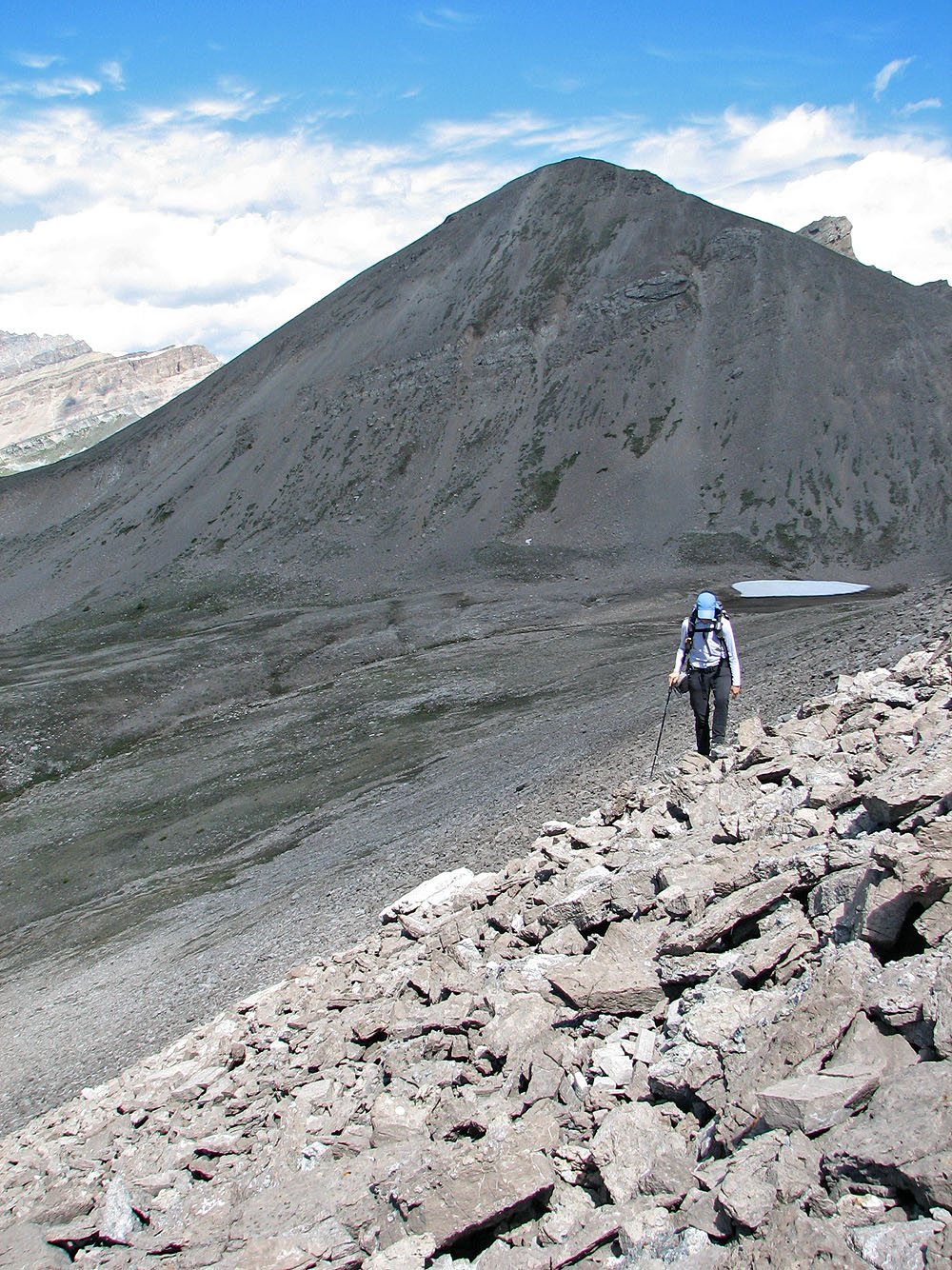
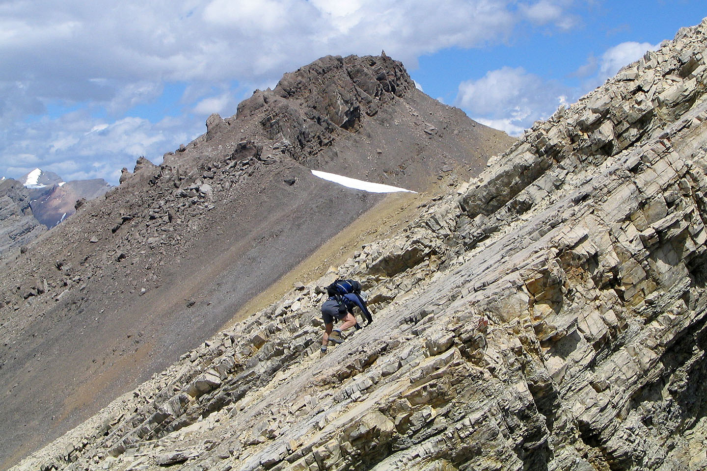
Coming up the lower slopes of Anthozoan
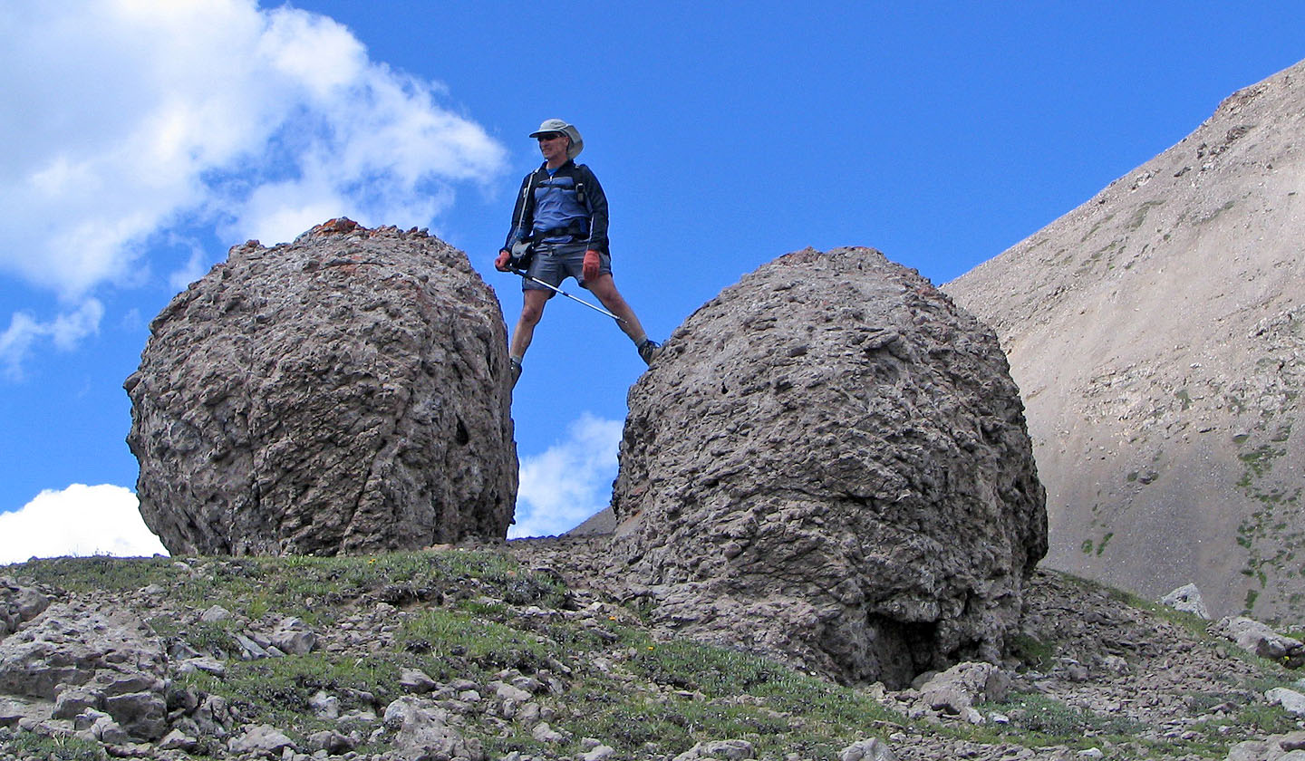 Checking out two massive balls of rock
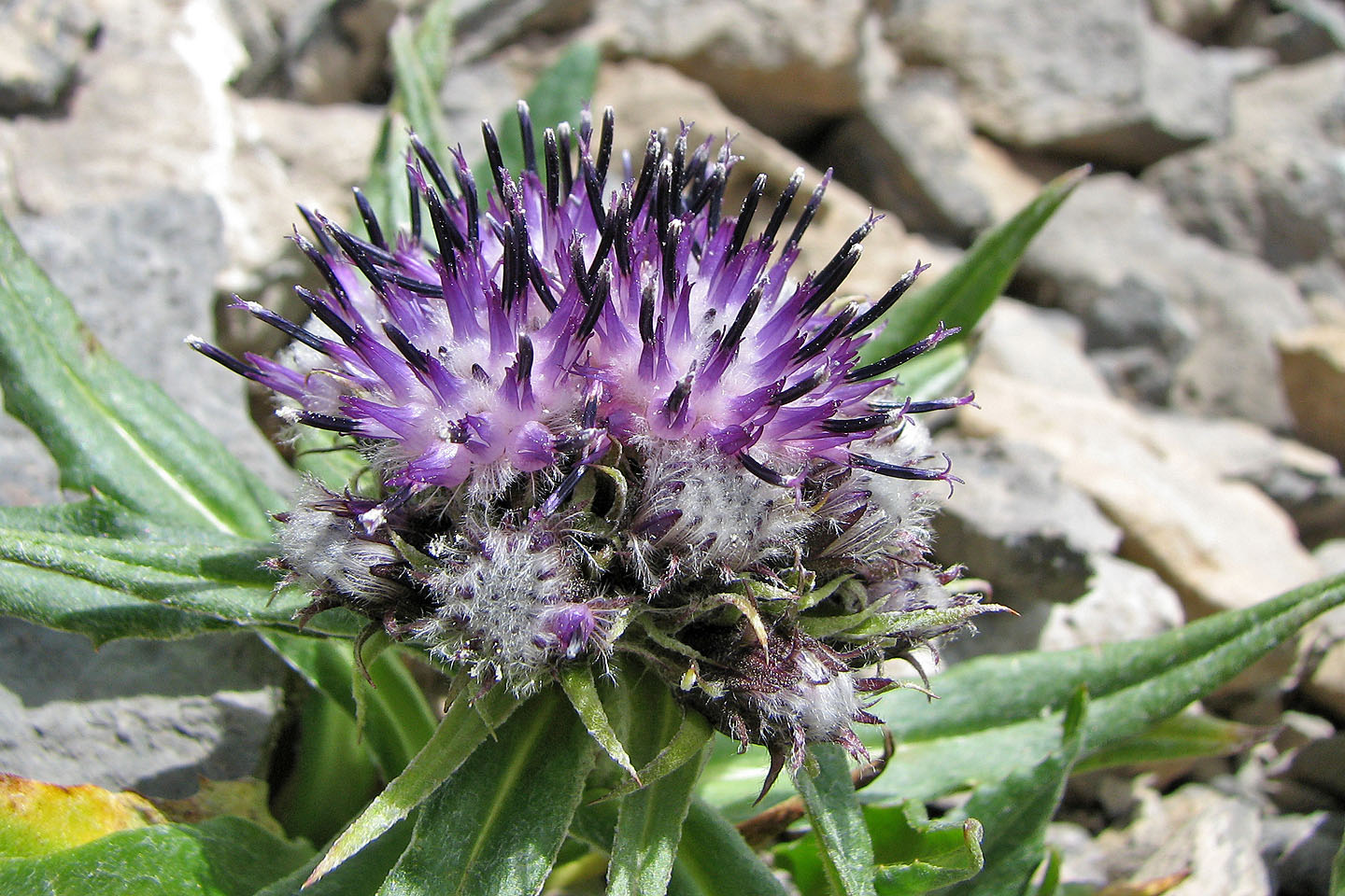
Sawwort aka purple hawkweed
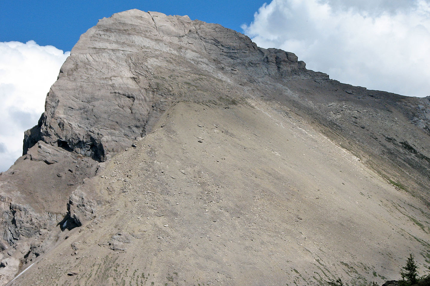
After working along the lower rubbly slopes, a mosaic of slabs appear
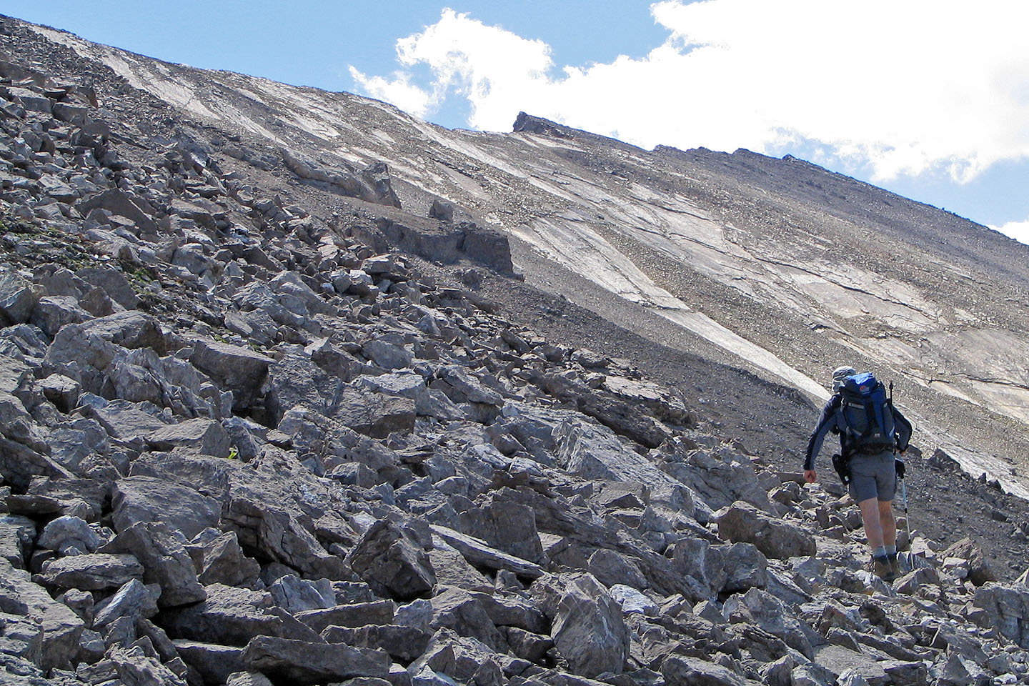
Starting our ascent
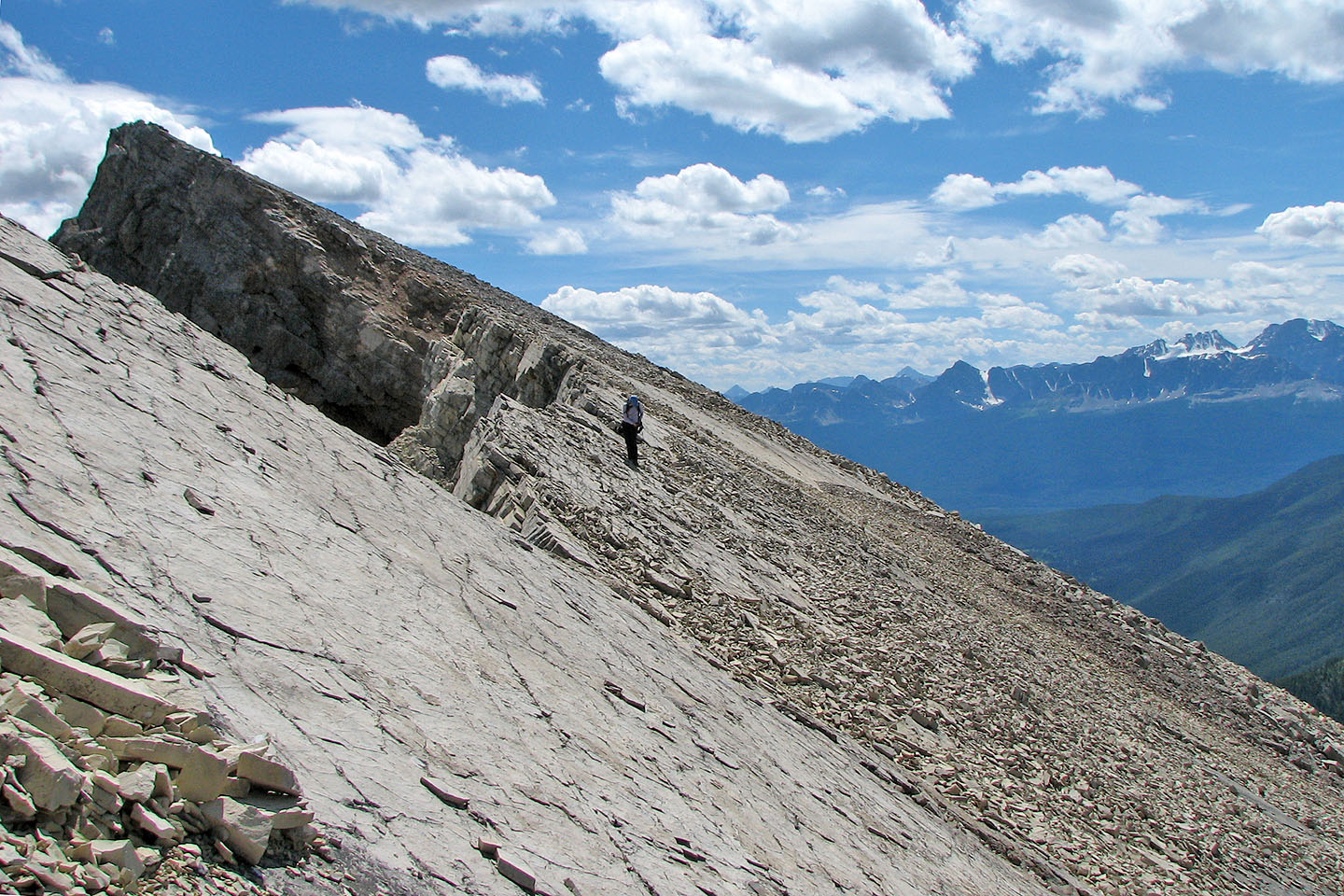
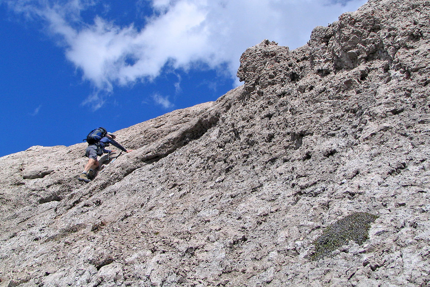
Making our way up to the ridge
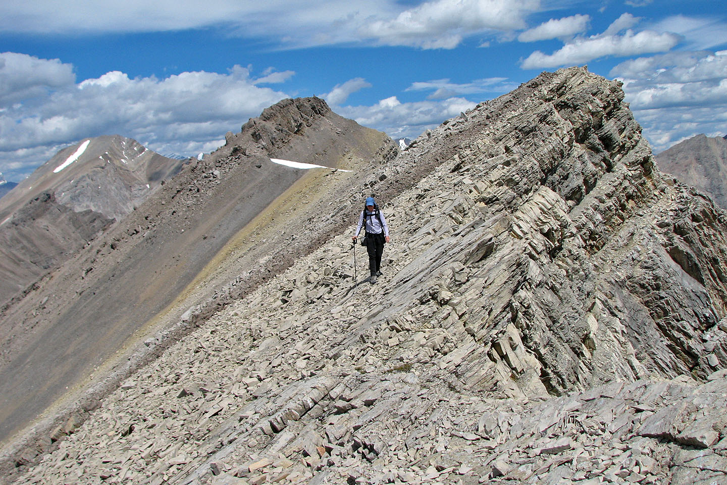
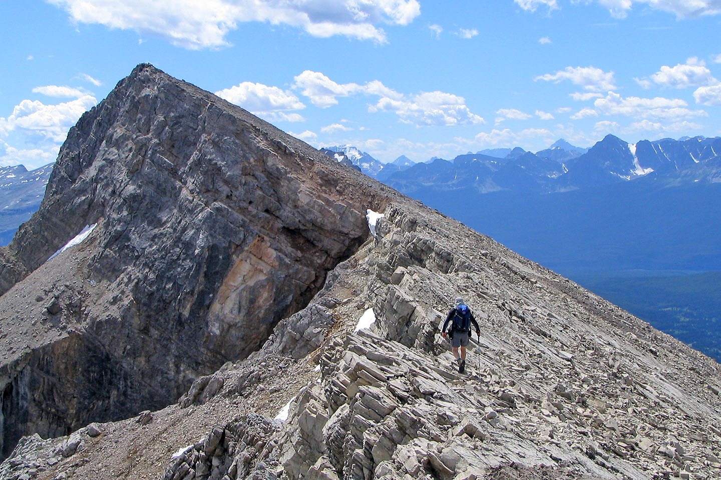
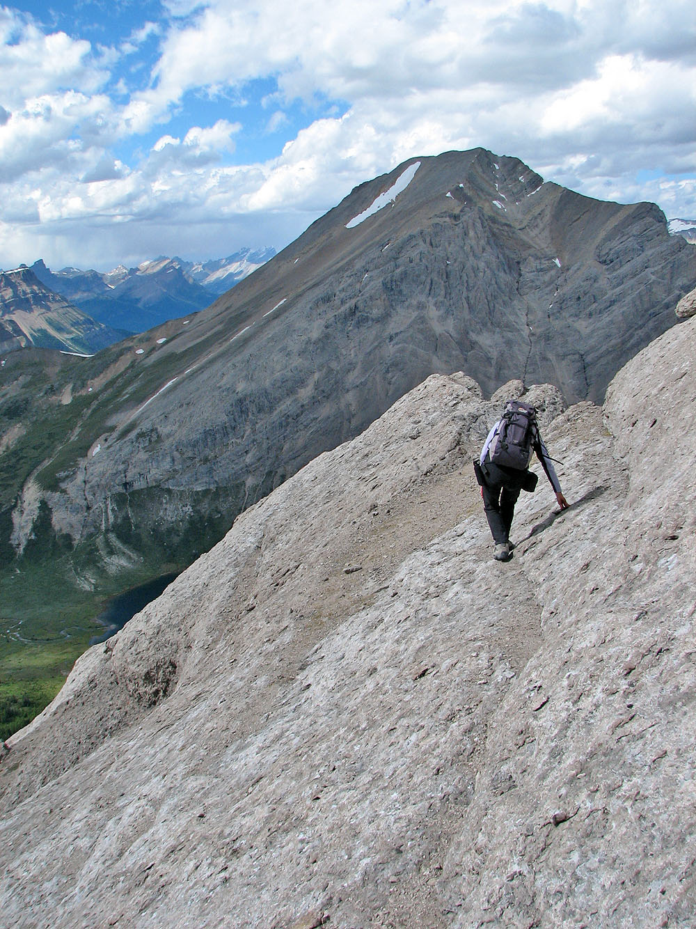
Typical travel along Anthozoan's ridge
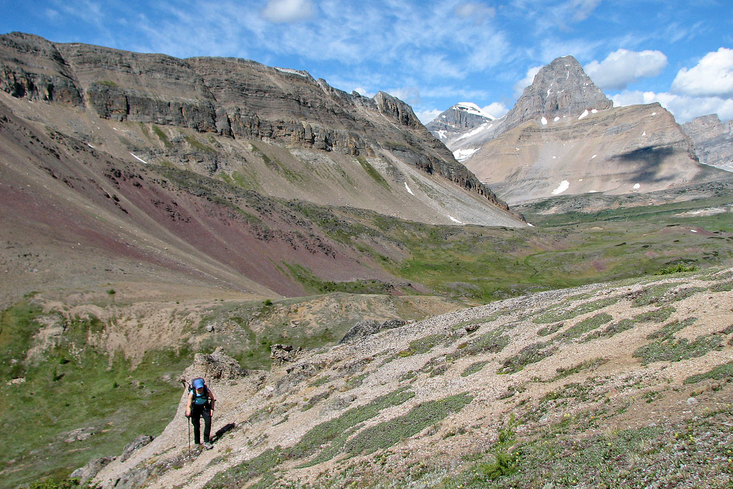
Pulsatilla Pass lies southeast
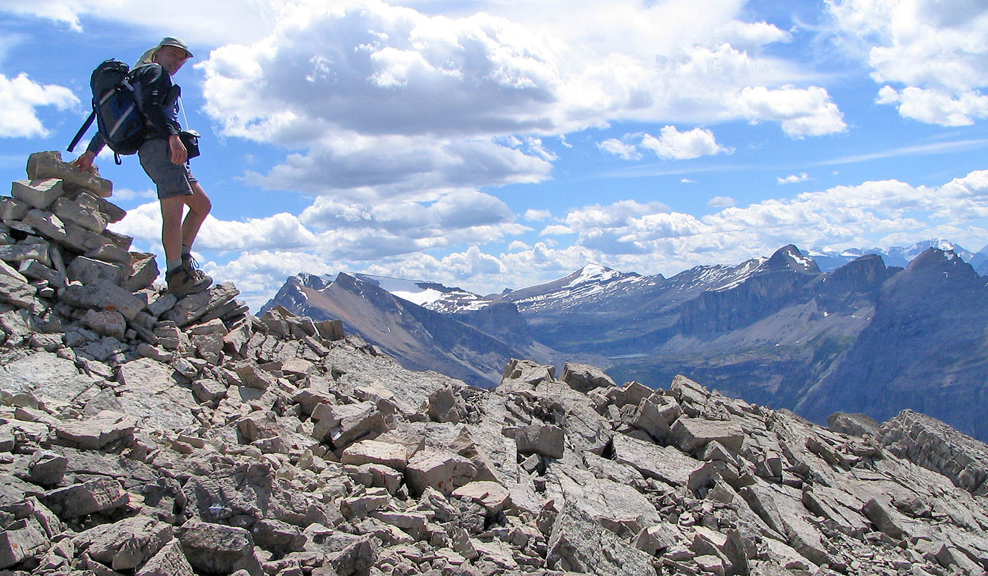
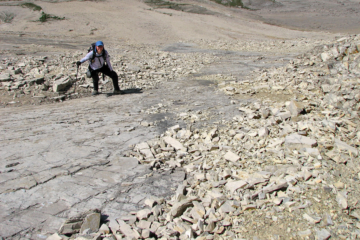
Finally the summit is in easy reach
On the summit. The snow-covered peak in the centre is Television Peak
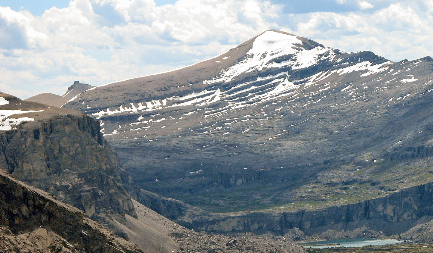
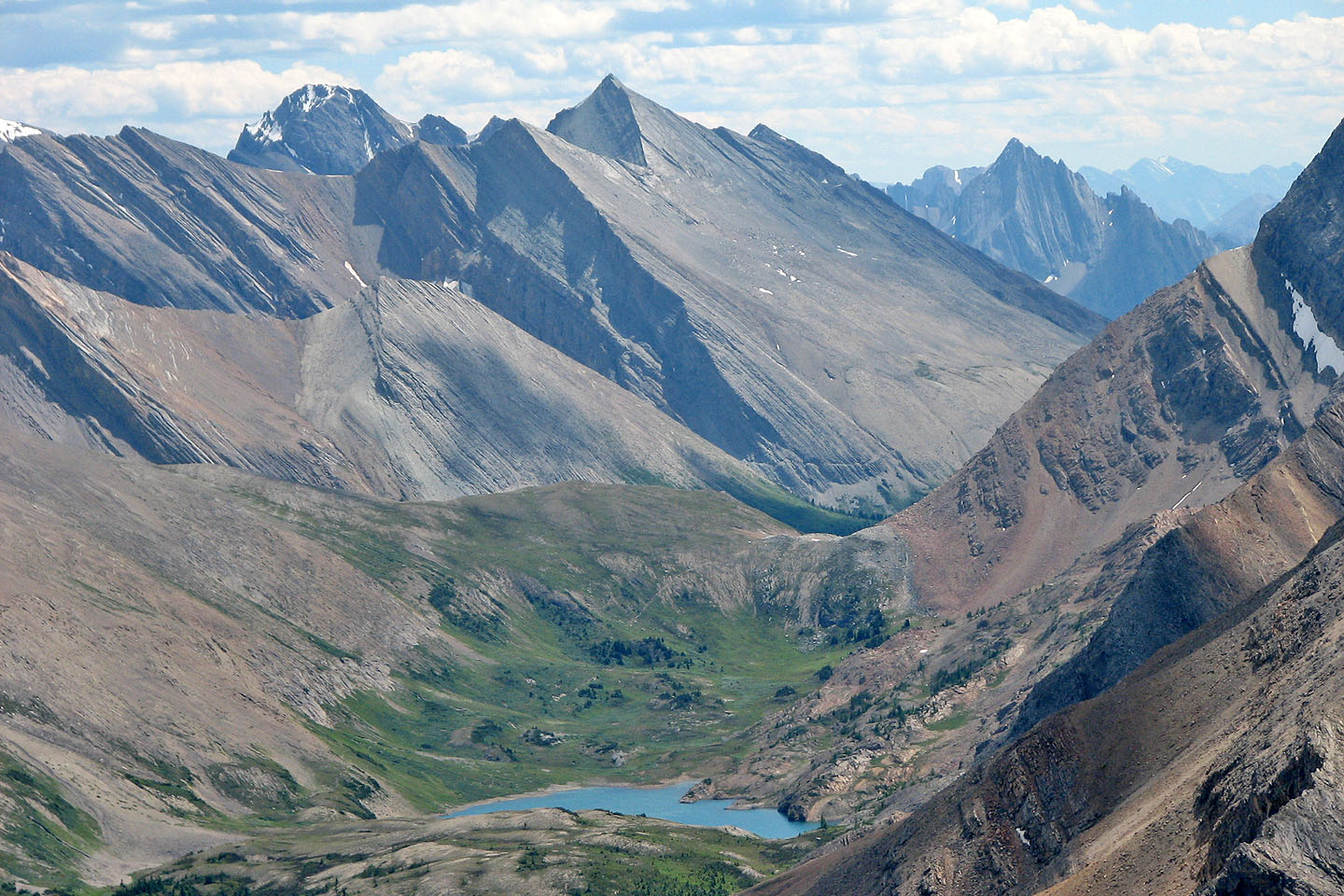
A close look at Stuart Knob and Television Peak. Mitella Lake
below.
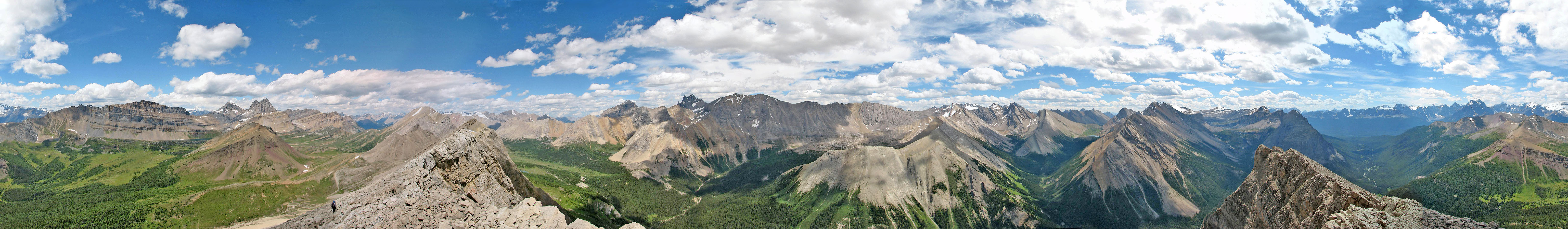
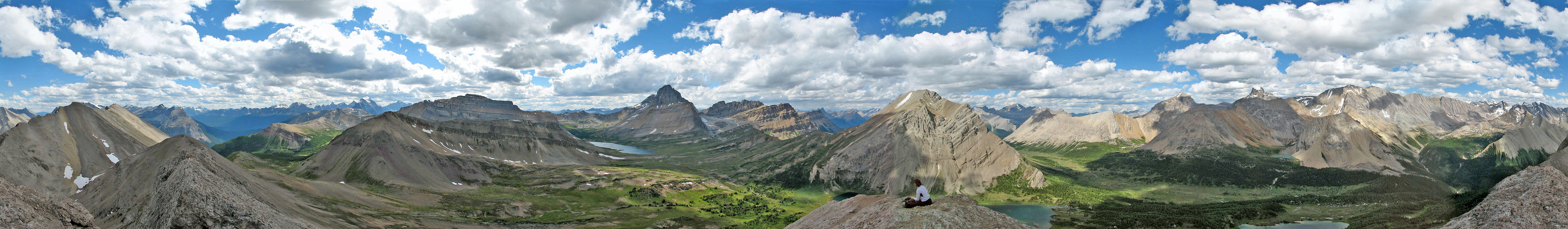
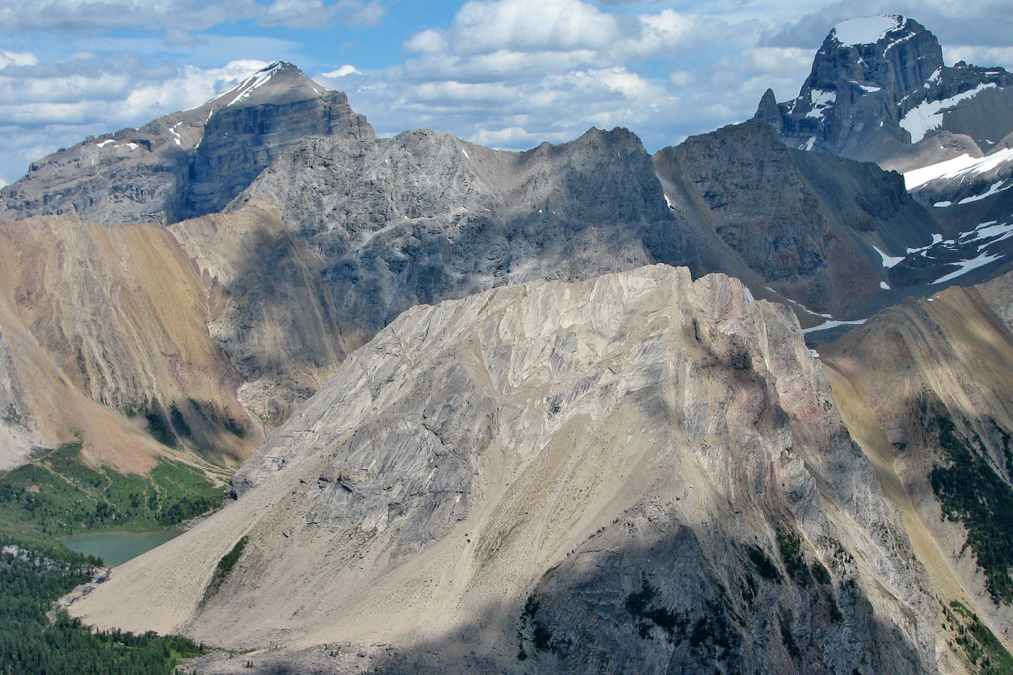
View from Anthozoan Mountain. Bunched together on the far left are Mounts Redoubt and Richardson, Pika and
Ptarmigan Peaks, Heather Ridge in the foreground.
Crossing the crux. Note the cairn on Anthozoan's north peak. We descended on the orange scree.
Looking back after crossing the slabs
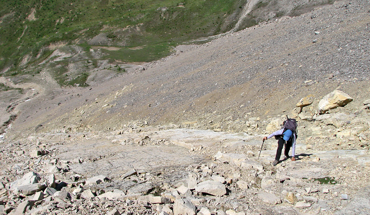
 Looking down at the crux, there was little to
stop us if we started sliding
Looking down at the crux, there was little to
stop us if we started sliding
Foreground: Heart Lake and Tilted Mountain. Upper right: Mount St. Bride.
The summit of Brachiopod (mouse over to see our route)
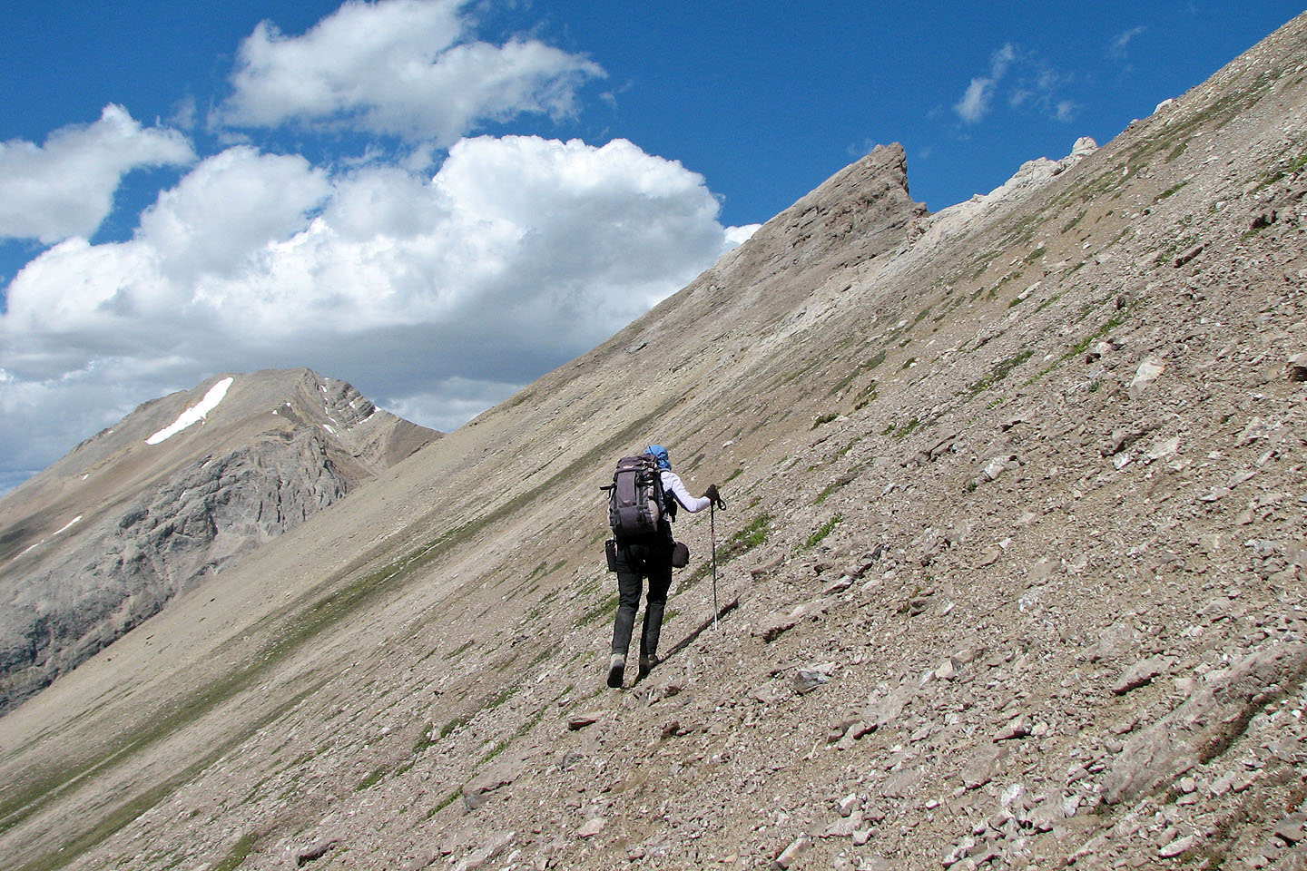
Traversing the scree slope to Brachiopod Mountain. Fossil Mountain on
the left.
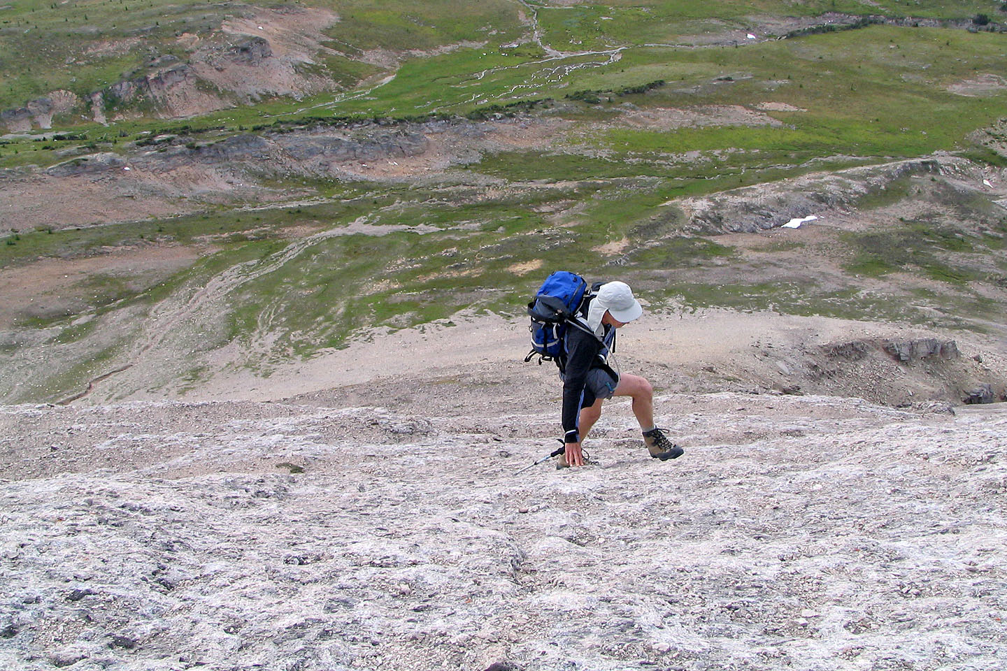
 Nice grippy rock on Brachiopod
Looking down
Walking along one of the ledges near the top
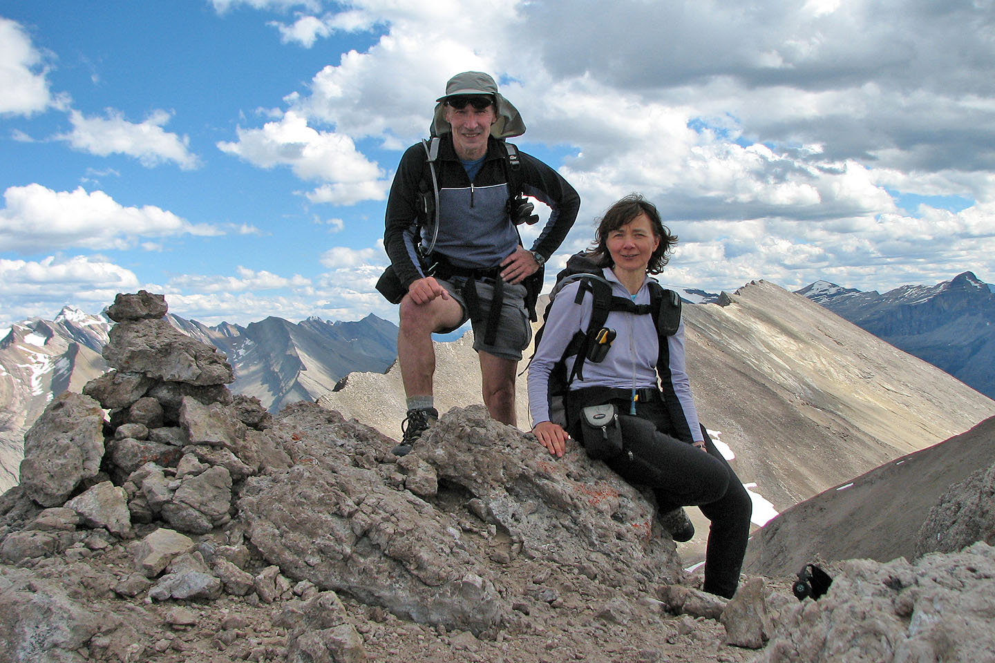
On the summit of Brachiopod Mountain. Anthozoan Mountain behind us.
82 N/8 Lake Louise