bobspirko.ca | Home | Canada Trips | US Trips | Hiking | Snowshoeing | MAP | About
Association Peak
Kananaskis, Alberta
July 14, 2007
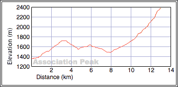
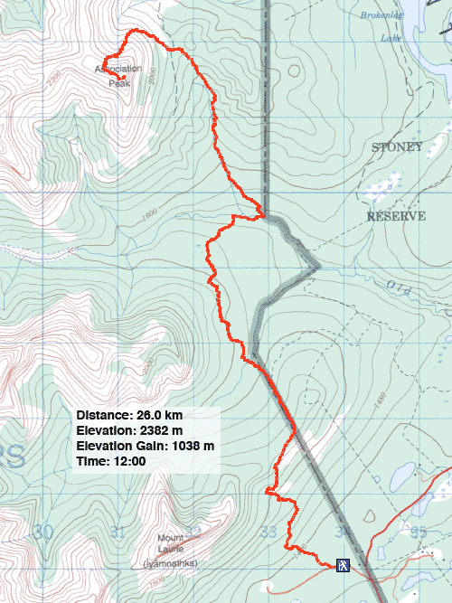
Distance: 26.0 km (16.2 mi)
Cumulative Elevation Gain: 1645 m (5397 ft)
I got the idea of a north ascent of Association Peak when we did Association Hill last fall. From the Hill, we couldn't see the north slope of Association Peak – we didn't know if cliff bands barred the way – but I was gambling that the north slope would be like the south basin – a rubbly slope with broken cliff bands – which we had observed when we made it to the south canyon last winter.
What made this route attractive was the likelihood of using trails. Taking the east approach trail for the East End of Wendell, we could reach Old Fort Creek. From there I hoped to follow a trail to the col between Association Peak and Association Hill. (On the Association Hill trip I had spotted a trail on the col but didn't know where it led.) From the col we would work our way around to the north slope and hopefully make our ascent.
We picked a sunny but hot day. Normally I abhor a long approach in trees, but on this trip, a tree canopy provided relief from the sun. The heat was just one of the problems that concerned us. Soon after starting, we found that the boundary cutline was under several inches of water, and we were forced to give the area a wide berth. By the time we reached the top of the east end of Yamnuska, our circuitous, bushwhacking route took 30 minutes longer than if we had hiked up the cutline when it was dry. Nor did it help that we battled hordes of mosquitoes.
Hot, tired, and mosquito-bitten, I wondered if we should contemplate a less ambitious trip. But we found cooler air as we descended the other side of Yamnuska's east end, and our quick descent kept the mosquitoes at bay. After gaining and losing elevation going over the east ends of Wendell and Yamnuska, we reached Old Fort Creek.
After crossing the creek, we spent several minutes looking for a trail near the drainage running down from the col. We had no luck and rather than waste more time searching, we went up the slope left of the drainage. It was pleasant at first, a grassy slope with spaced trees. Higher up, though, we encountered dense vegetation and were forced to cross the drainage. That's when we found the trail! It was a horse trail, but quite good. We followed the trail to the col.
When the trees thinned along the trail, we again became concerned about the heat. It was 30° in the shade and insufferable in the sun. Our pace slowed, and whenever we came to a lone tree by the trail we rested briefly in its shade. It didn't seem likely we could get far in this heat, but I was determined to see the backside of the mountain before turning around.
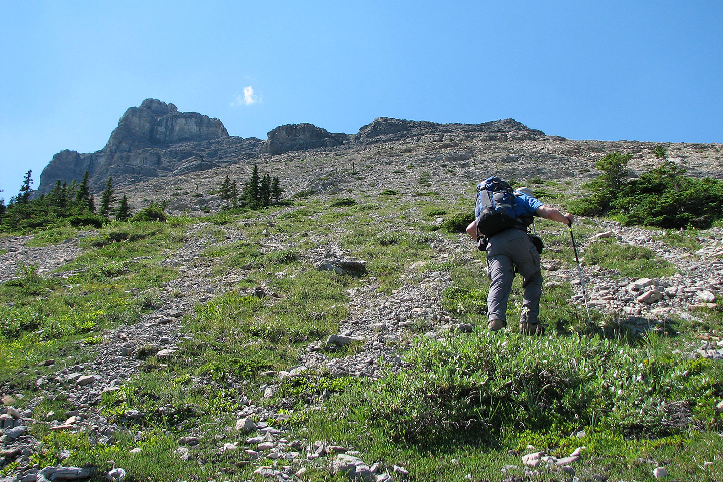
From the col, we started up Association Peak. After ascending straight up to avoid the trees on our right, we started traversing to the backside of the mountain. Because of the curvature of the slope, our view was limited. We didn't know that we could've scrambled up the broken cliff band above us, but without knowing what lay ahead, it seemed prudent to keep low rather than risk getting turned back because of unseen cliffs. We went around the corner first to check the north slope to see if and how we could ascend.
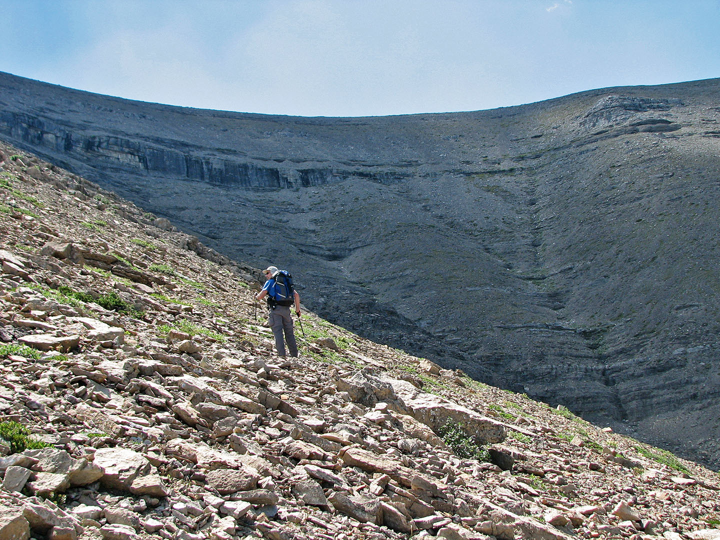
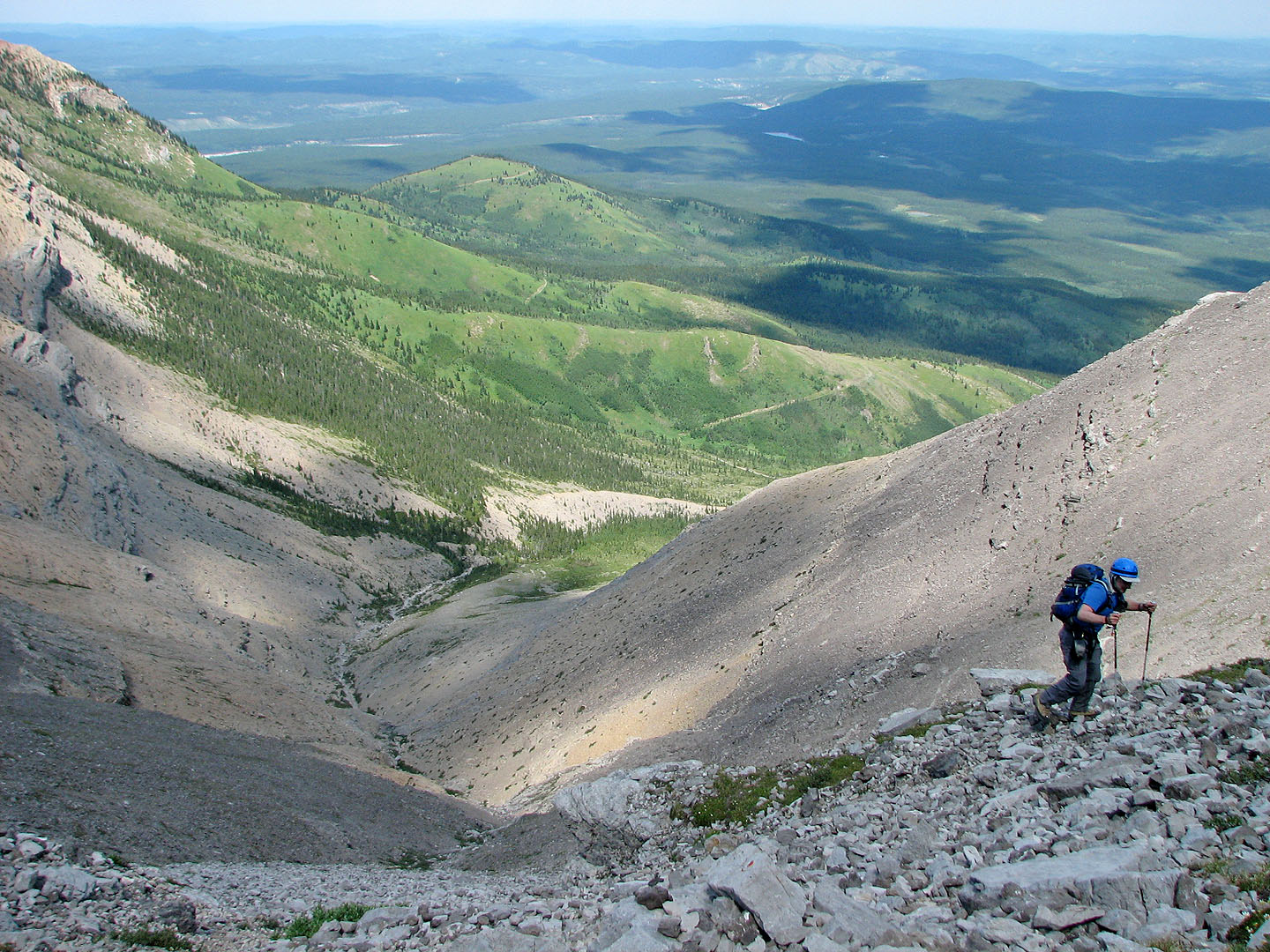
We found an impressive sight: a rubbly slope bisected by a long cliff band. But above it, a gentle ridge led to the summit. More importantly, we could gain that ridge using a break in the cliff band. But to reach it, we had to traverse ankle-breaking talus.
It was cooler on the backside of the mountain, so heat exhaustion was no longer a concern. But now Dinah began to have trouble with her left foot, her Achilles tendon. It had bothered her when we did Victoria Ridge two weeks ago, and now 200 m below the summit of Association, it was bothering her again. Walking wasn't a problem, but scrambling up – pushing off with her foot – was painful.
We decided to pull the plug on bagging the peak. Dinah stopped, so I said I would look for a line to reach the break in the cliff band and come back. After I started, Dinah pondered our dilemma. She realized we had worked hard to get this far, and it would be a bummer to quit when we were so close. Suddenly she became determined and followed after me. The aspect of reaching Association Peak spurred her on, and adrenaline dampened the pain in her foot.
We had almost reached the cliff band when for the fourth time we considered turning back: my left thigh developed a cramp. I suspected it was caused by dehydration; I had run out of water. Dinah had a half litre of water left, so I took a swig and ate a nectarine from my pack. We decided to reach the base of the cliff band and assess our situation. Slowly and painfully I made my way there.
Fortuitously, the rock here was a weeping wall, and I was able to suck water from a puddle. I also set a bottle against the wall. Surprisingly it only took a few minutes to fill. My cramp disappeared.
Now we were both ready and anxious to summit. We went through the break in the cliff band and slogged up to the ridge. Once on the ridge, Dinah couldn't stop smiling. The clear sky allowed us to take in the peaks around us, and the summit lay a short walk away. The highest point was on the edge of a precipitous drop. A cairn stood a few metres away. The summit register was a glass jar with a rusted lid. There were three entries for 2006 and a few for 2000. Nothing else.
We took photos and looked around. I would have liked to explore the west ridge, but it was hot and we weren't full of energy. We headed back to the break in the cliff band and retraced our steps to the col.
We followed the horse trail to Old Fort Creek. The trail ends 250 m downstream from the drainage and 400 m from the trail going over the east end of Wendell. We drank from the creek and filled our water bladders before continuing.
It was hot and humid on the trail, and we slowed to a crawl. We still had 320 m of elevation to climb, and we were sweating buckets. My shirt and pants became soaked in sweat, and Dinah began to feel ill from the effects of the heat. A welcoming committee of mosquitoes descended on us as we headed up the east end of Yamnuska and stayed with us down the Yamnuska Trail to the parking lot.
I don't recommend doing this trip on a hot day! On a mild day, sticking to trails from cutline to the col, I think it would take 9-10 hours. It's not a trifling trip because of the massive elevation gain, but the views are worth it!
Postscript 1
Gerry Richardson of the Calgary Outdoor Club emailed me to say
his group knocked 8 km off my route by starting at the Stoney Reserve. They applied for and received a permit
to cross Indian land. See
COC's trip.
Postscript 2
Some groups have used my route for a descent route only to miss the trail at the col between Association Hill
and Association Peak and mistakenly take the road. This road (marked on the NTS map) runs 90° to the trail
and reaches a dead end and leaves parties bushwhacking down to Old Fort Creek.
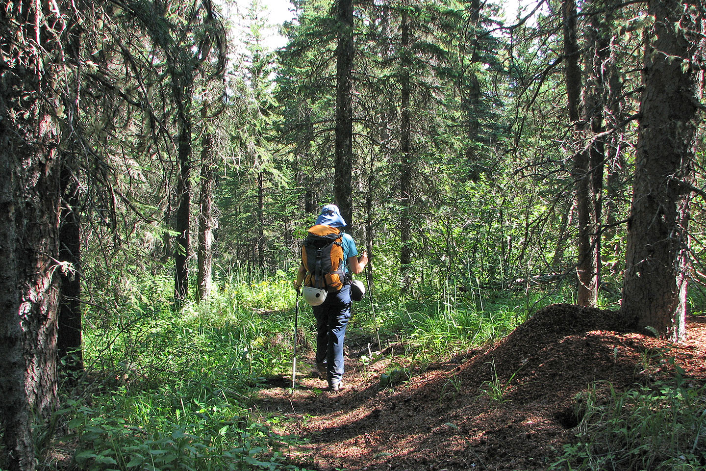
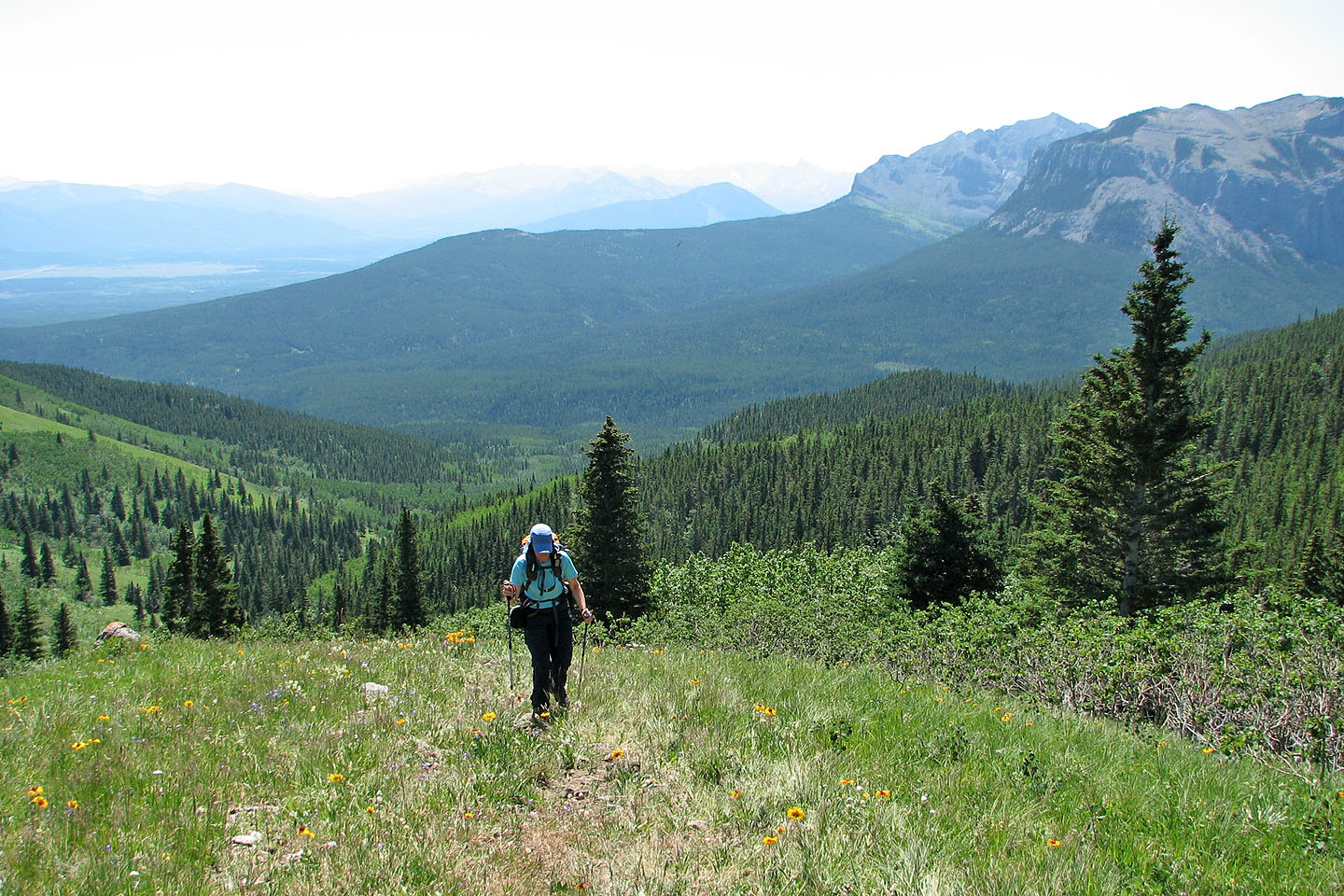
Hiking the trail east of Wendell Mountain
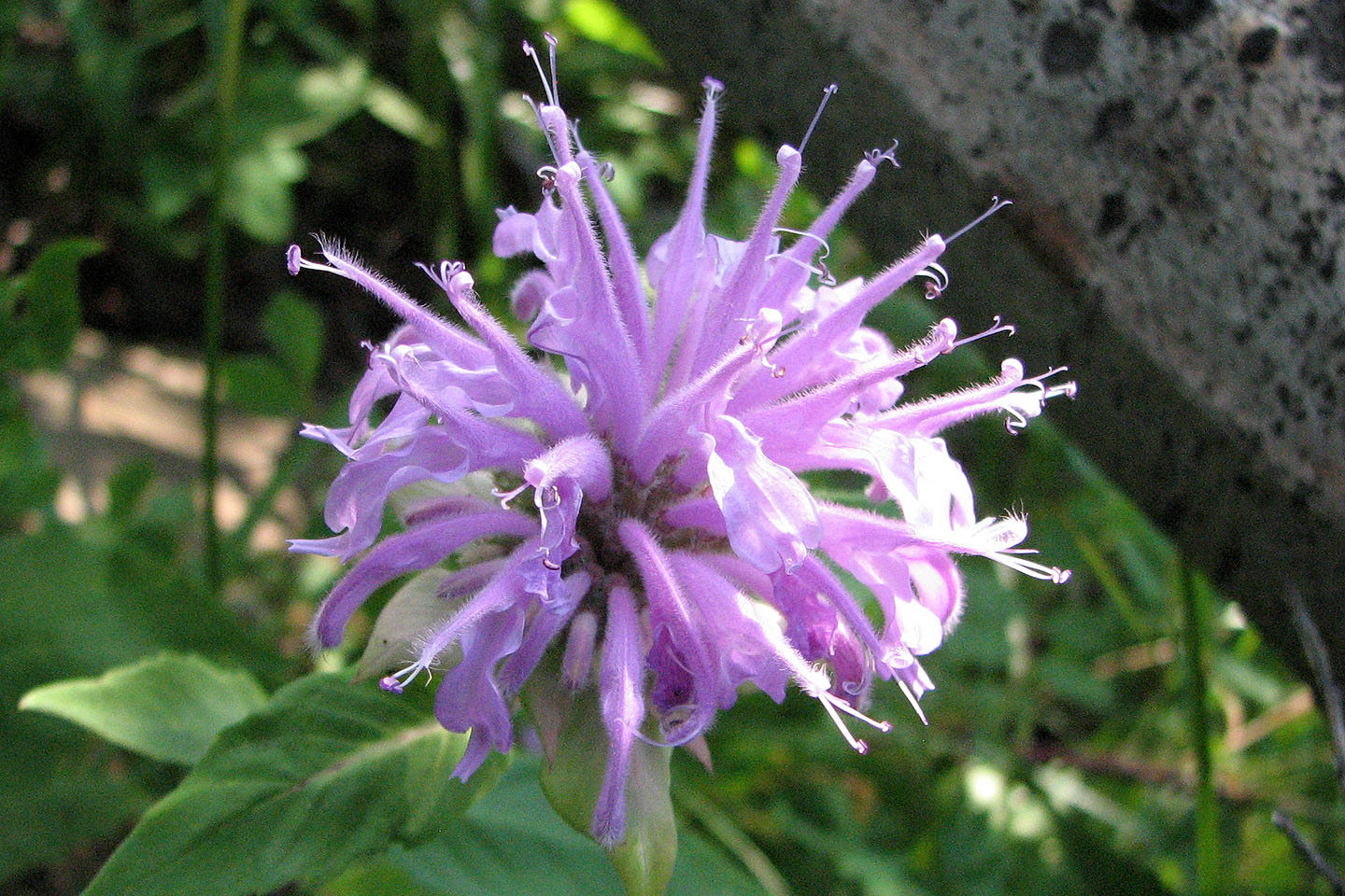
Wild Bergamont
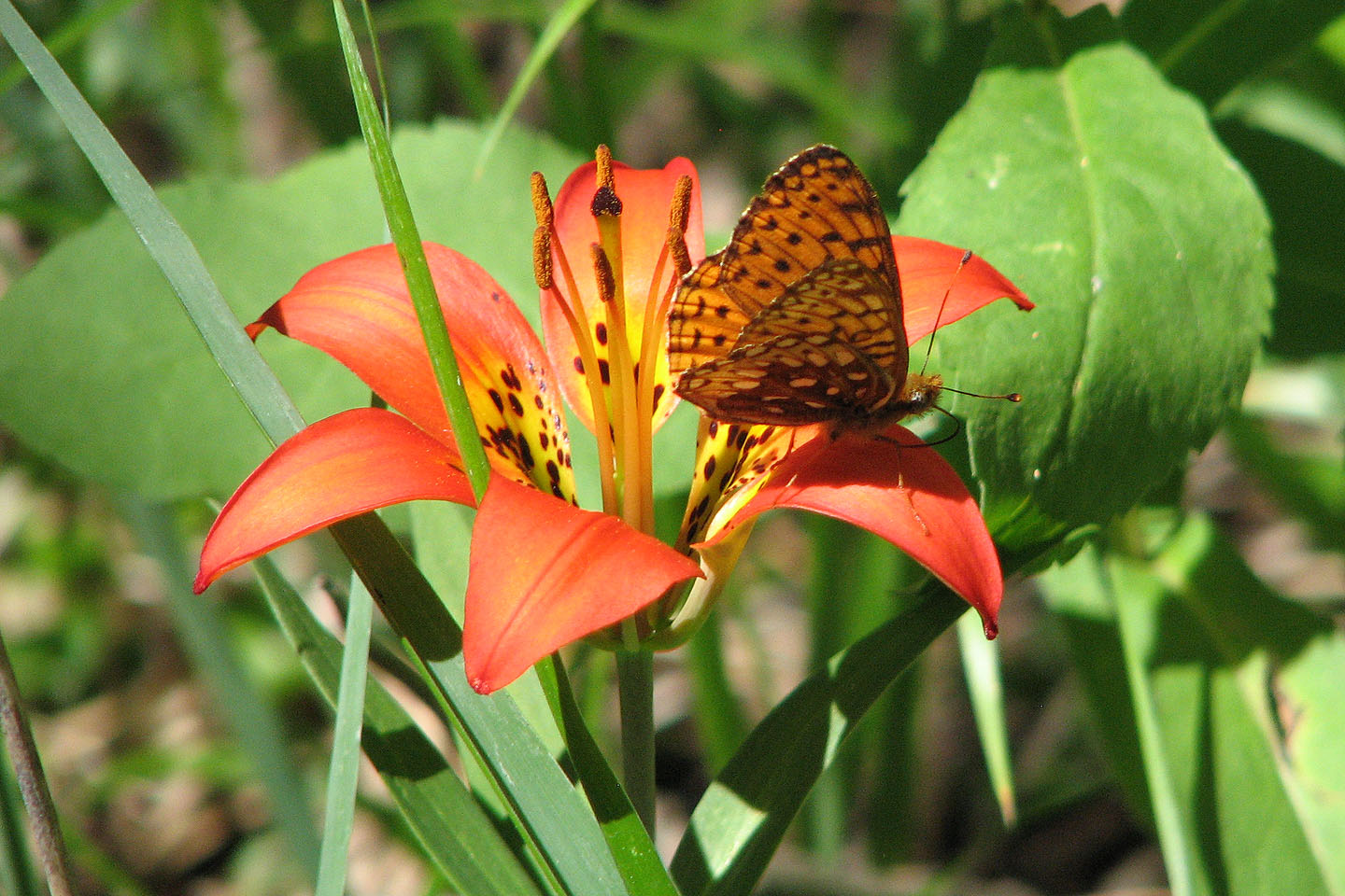
A butterfly visits a Western Wood Lily
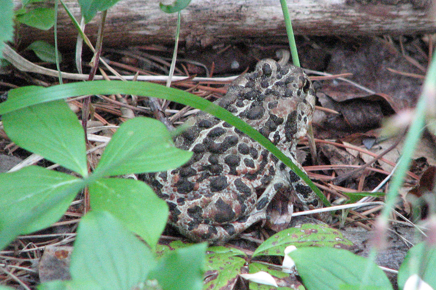
On the trail, we saw two toads and a frog (mouse over)
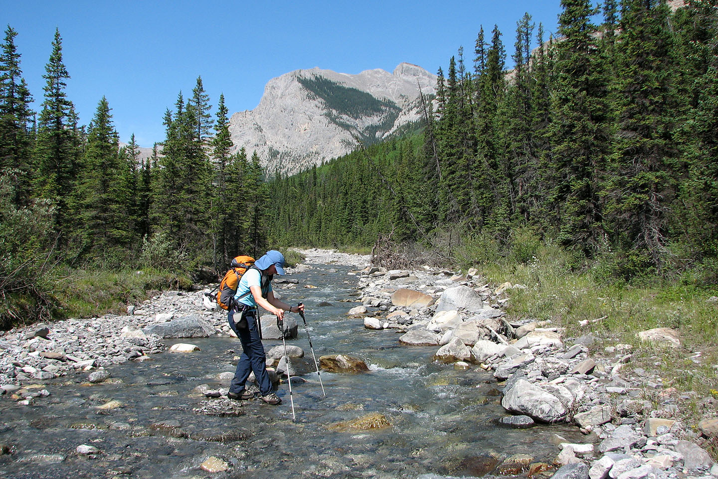
Crossing Old Fort Creek. Unnamed peak in the background.
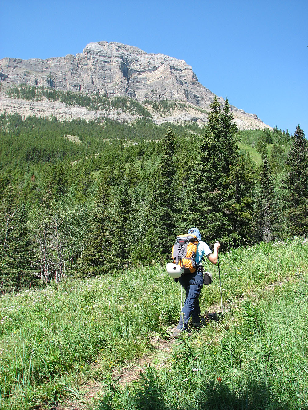
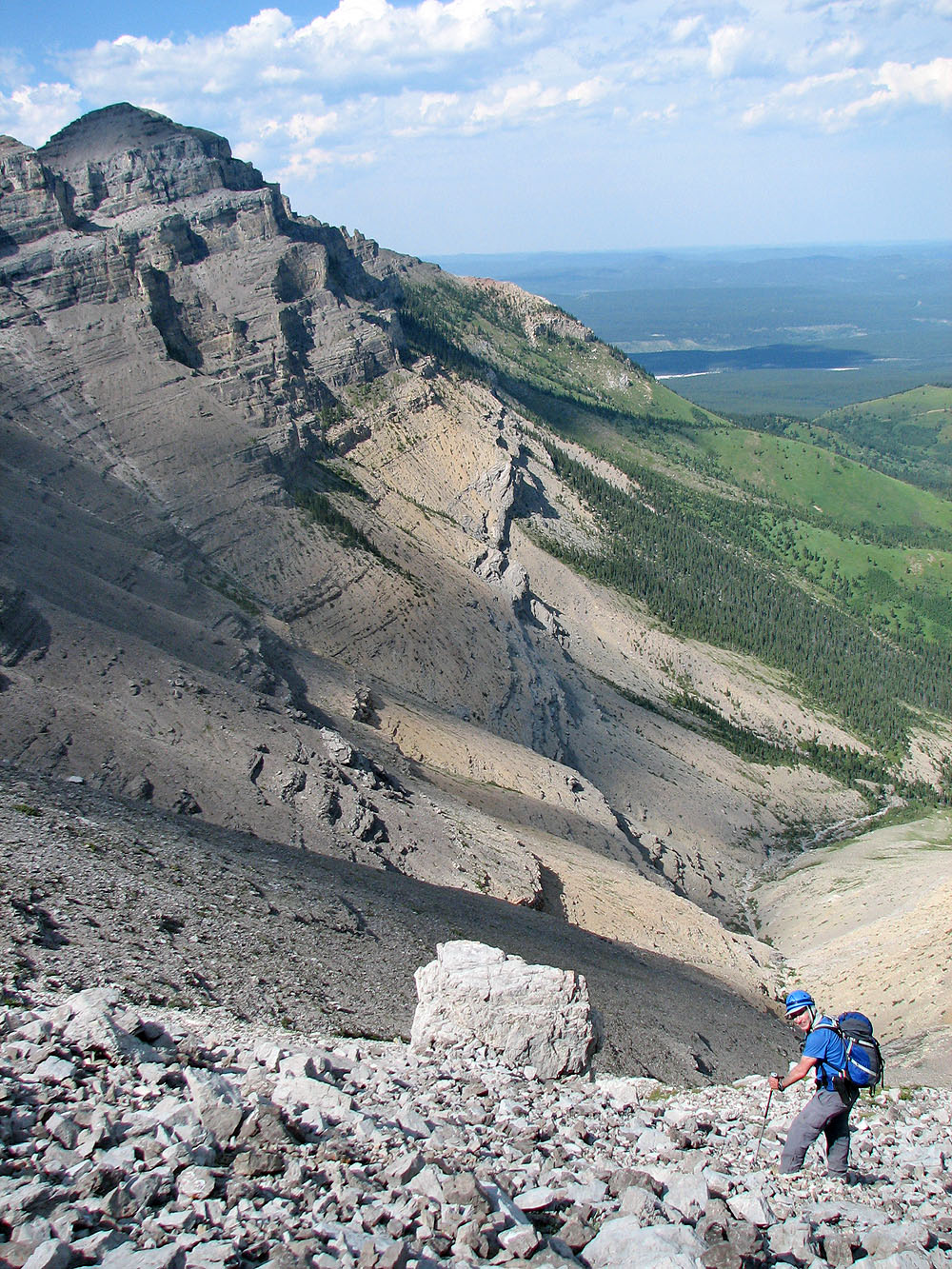
On the horse trail, our objective in sight
On the right, Mount Yamnuska and
Wendell East Peak appear far away
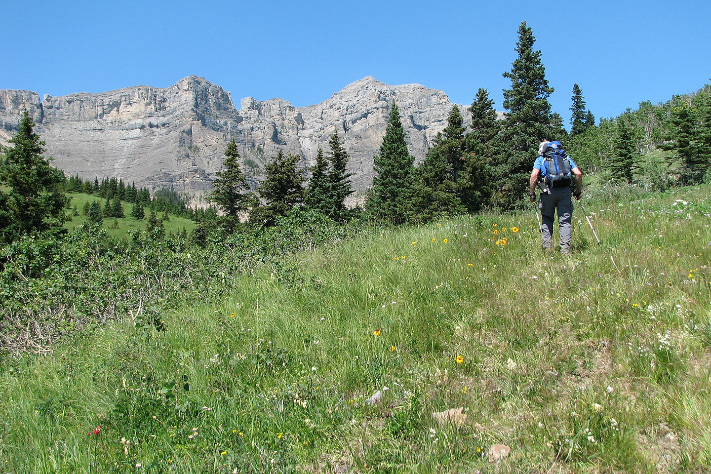
Making our way to the col, End Mountain appears ahead
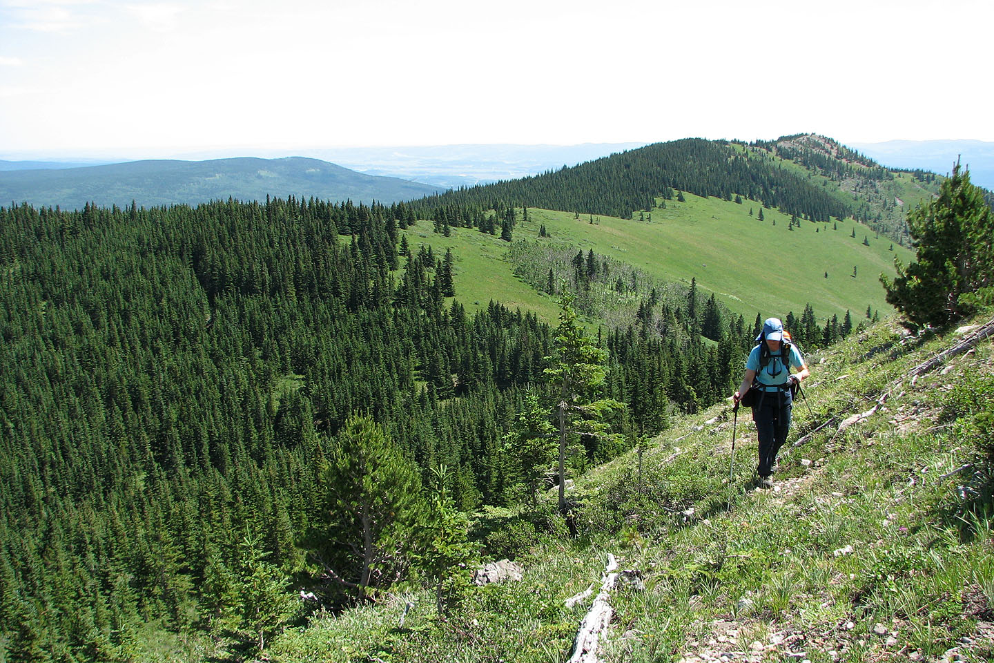
Ascending above the col, Association Hill in the background
Heading to the backside of Association Peak, End Mountain on the right
On the left is the summit
Another view of the summit
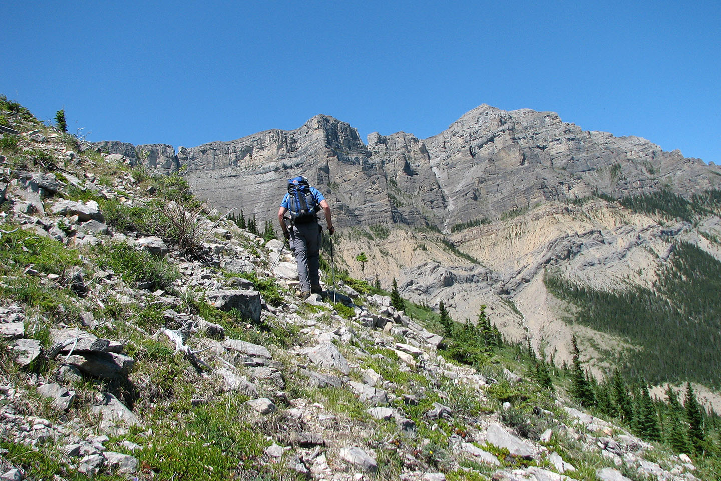
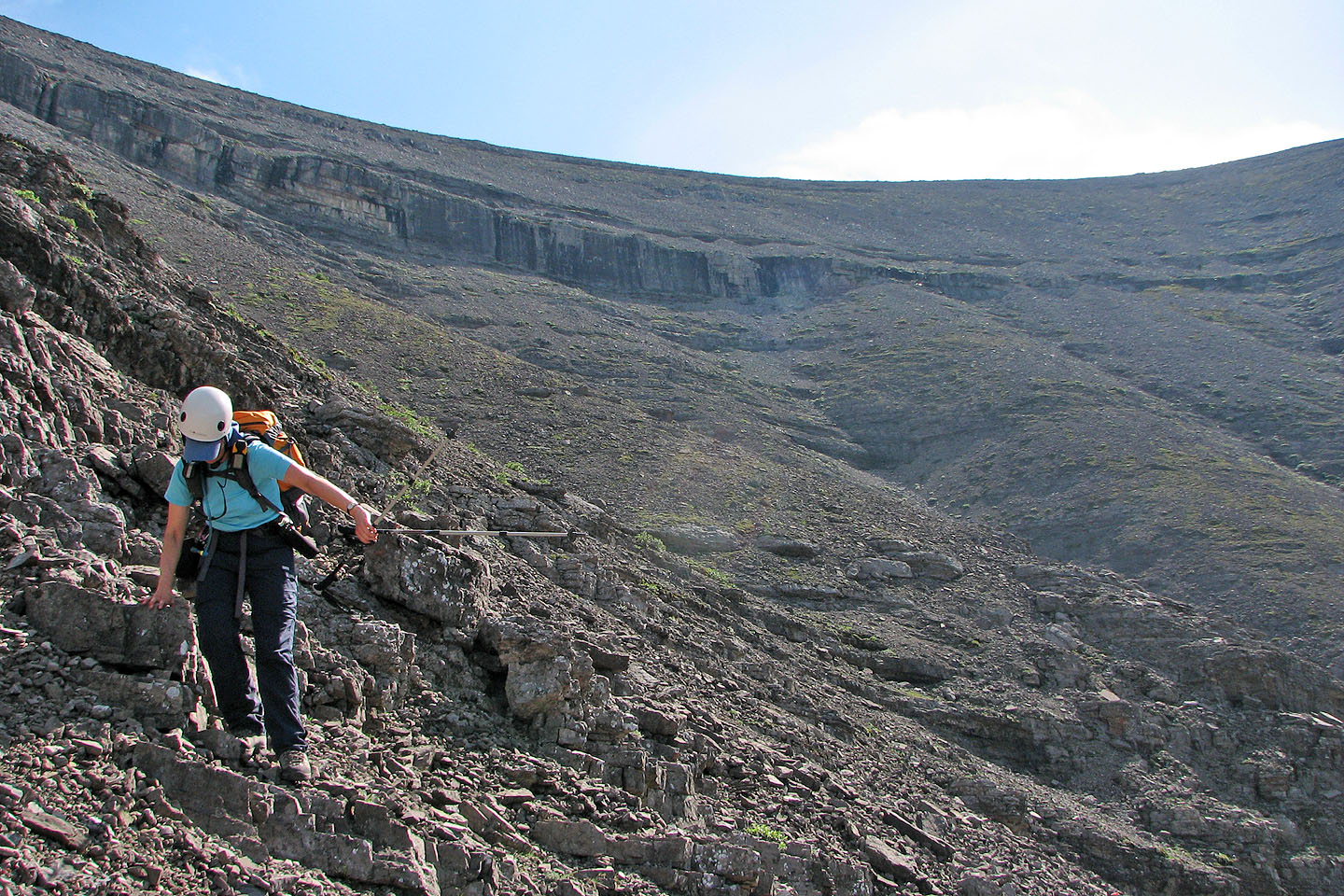
Much of the way is a rubbly slope. Not knowing what what lay ahead, we kept low.
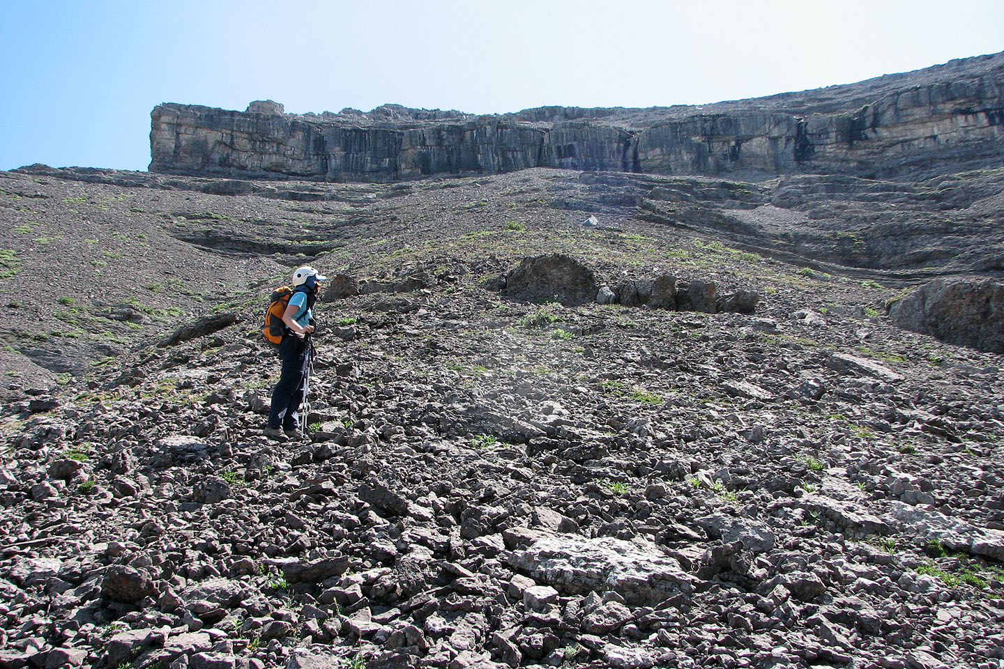
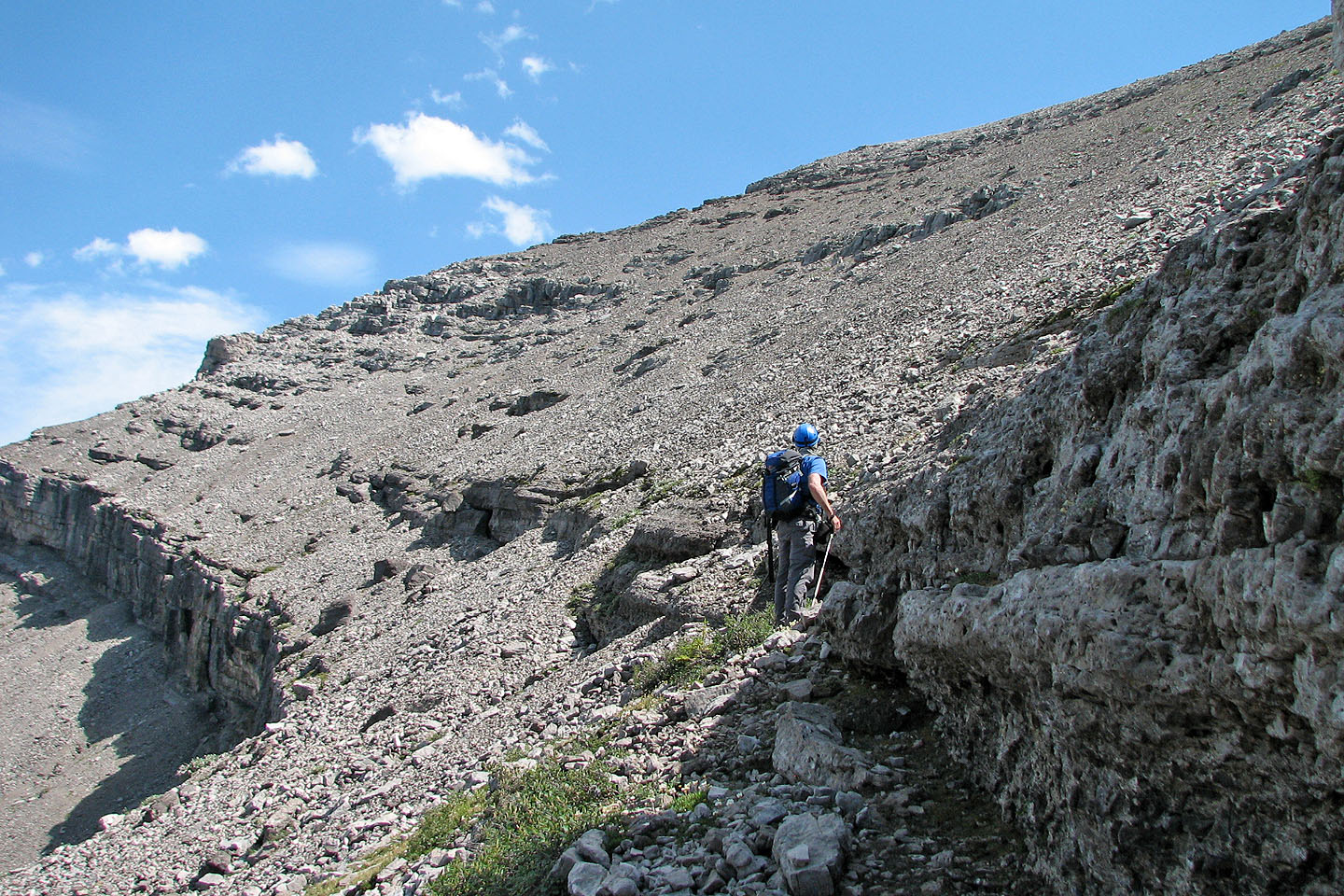
A cliff band prevents a direct route to the summit
We headed for the nearest break in the cliff band
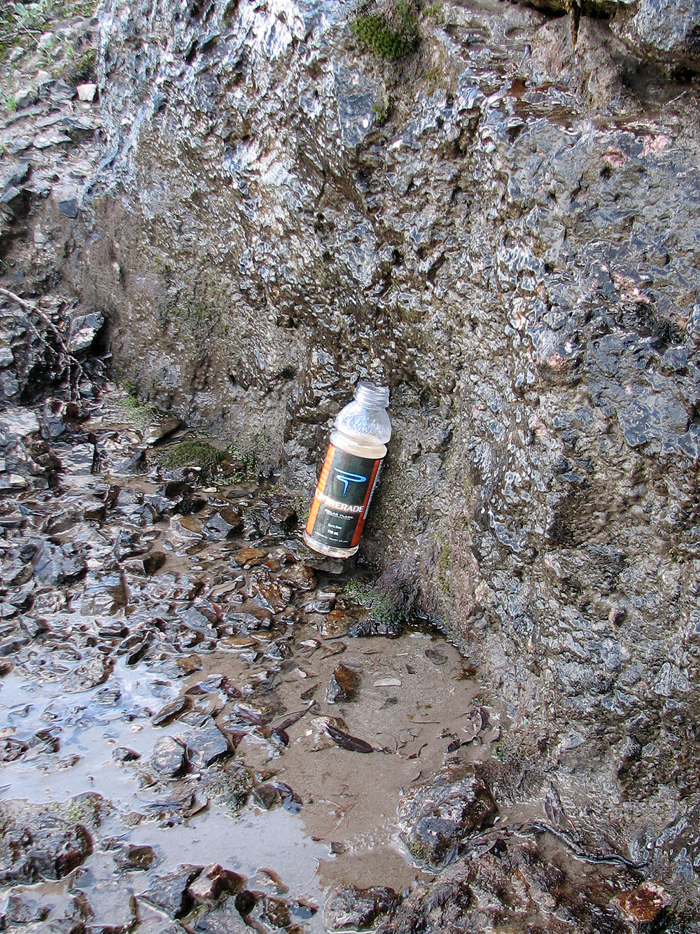
I drank from this puddle and filled my bottle with water dripping from the rock
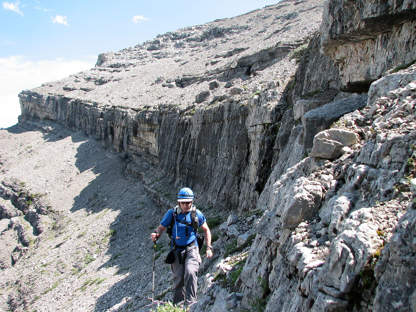
Traversing the base of the cliff band to the break
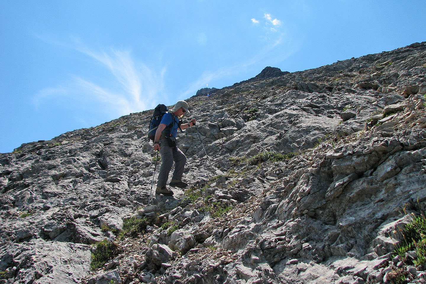
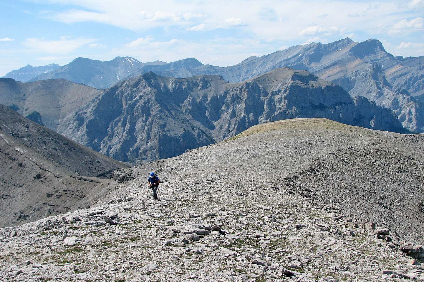
Hiking
above the cliff band
Same as above but looking towards the plains
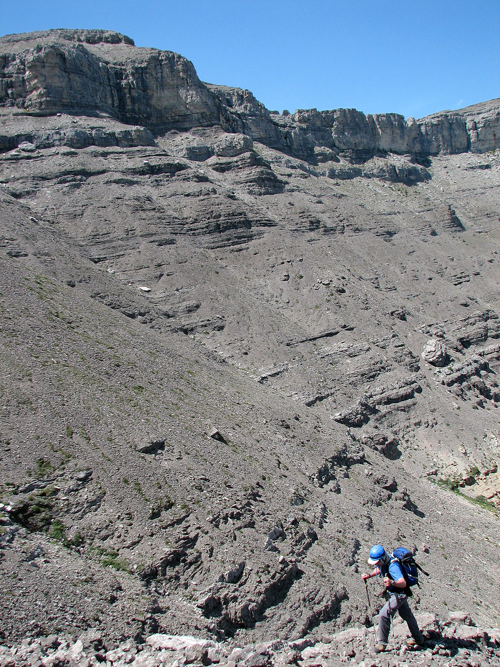
I looked for a good line to the ridge but there wasn't one, all rubble
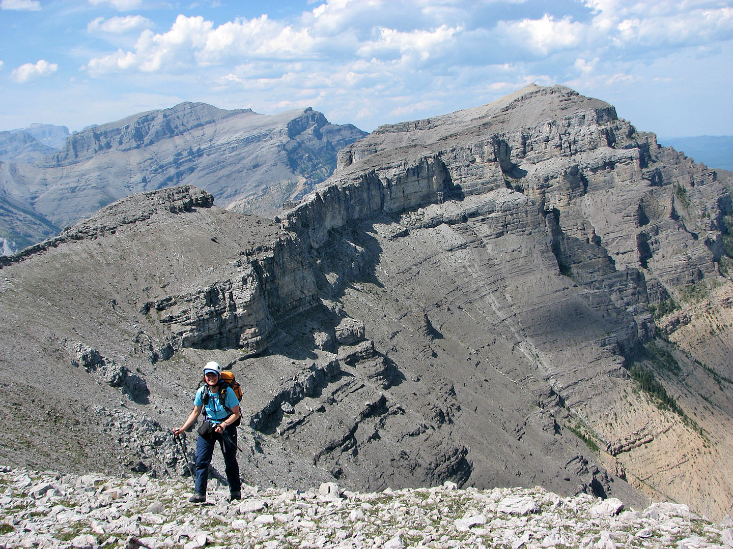
Dinah smiles as she reaches the summit ridge
Looking back at the ridge leading to the summit
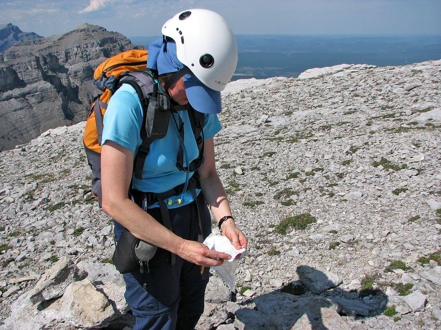
Dinah reads the register (mouse over)
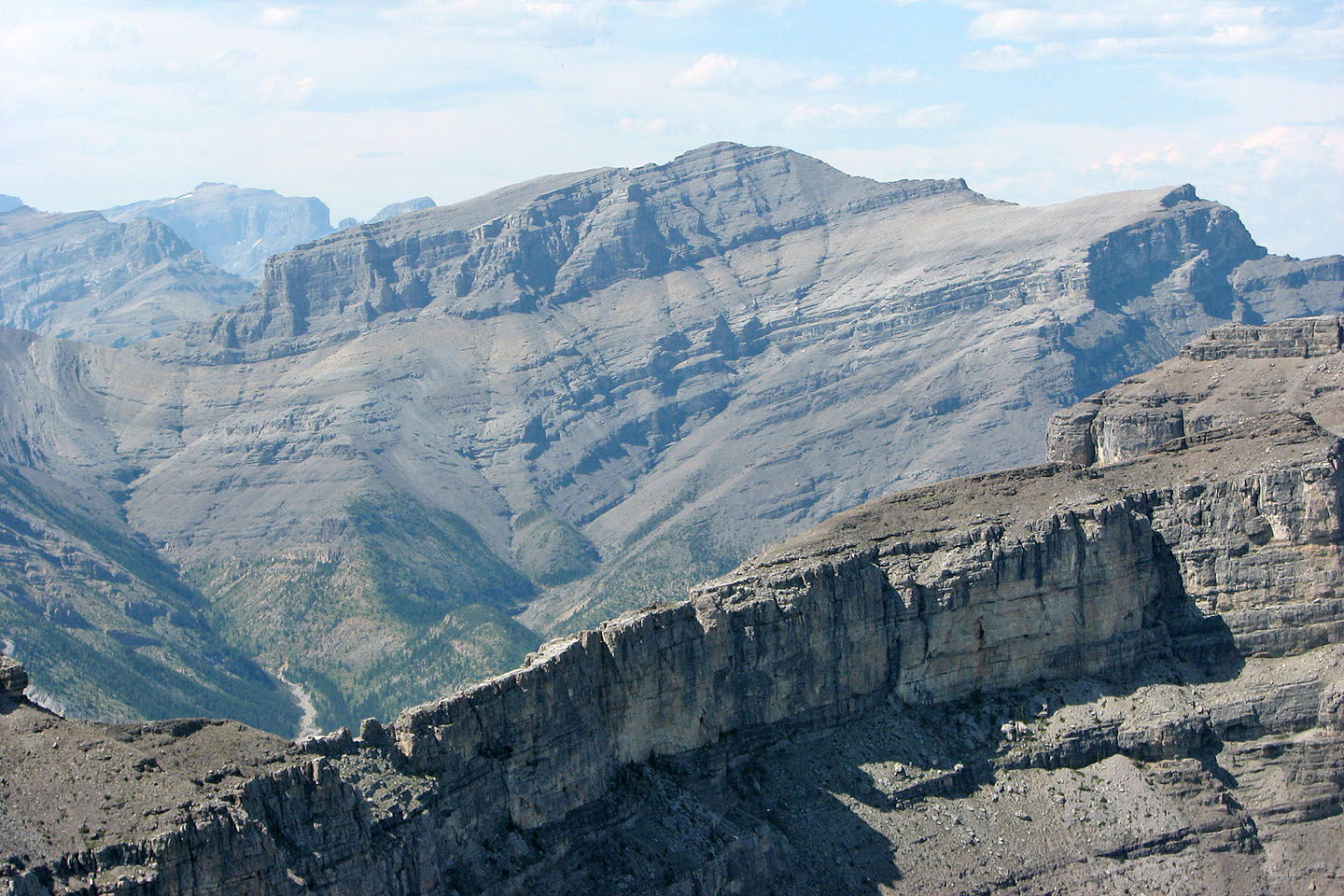
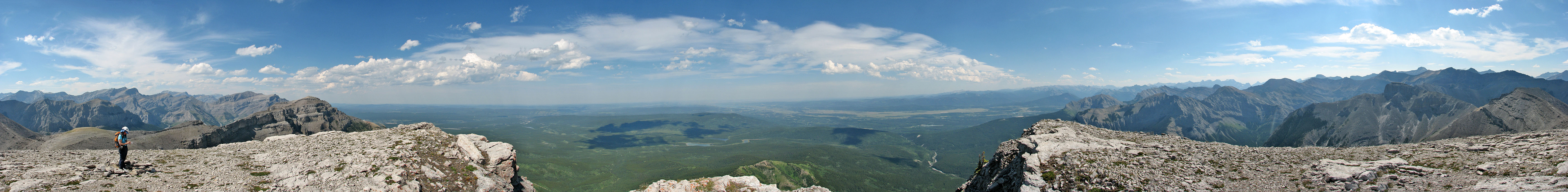
Orient Peak
This boulder sits above the break in the cliff band, so we used it to guide us back
down the otherwise featureless slope
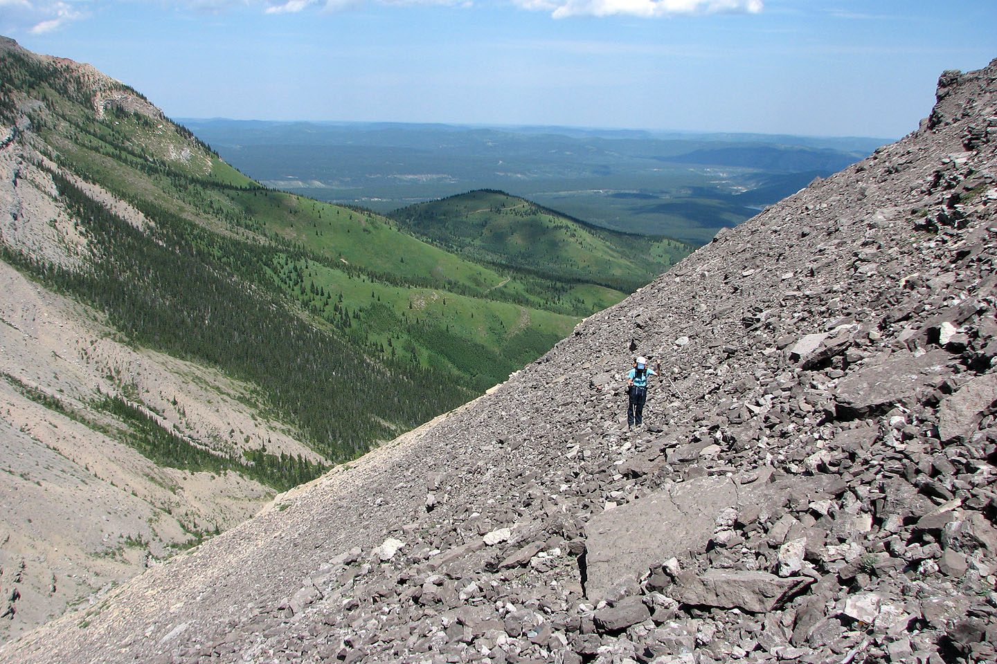
 Descending the north slope below the cliff
band
Descending the north slope below the cliff
band
82 O/3 Canmore (showing our descent route)