bobspirko.ca | Home | Canada Trips | US Trips | Hiking | Snowshoeing | MAP | About
Victoria Peak (Scramble Route)
Castle Provincial Park, Alberta
June 16, 2006
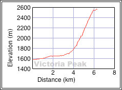
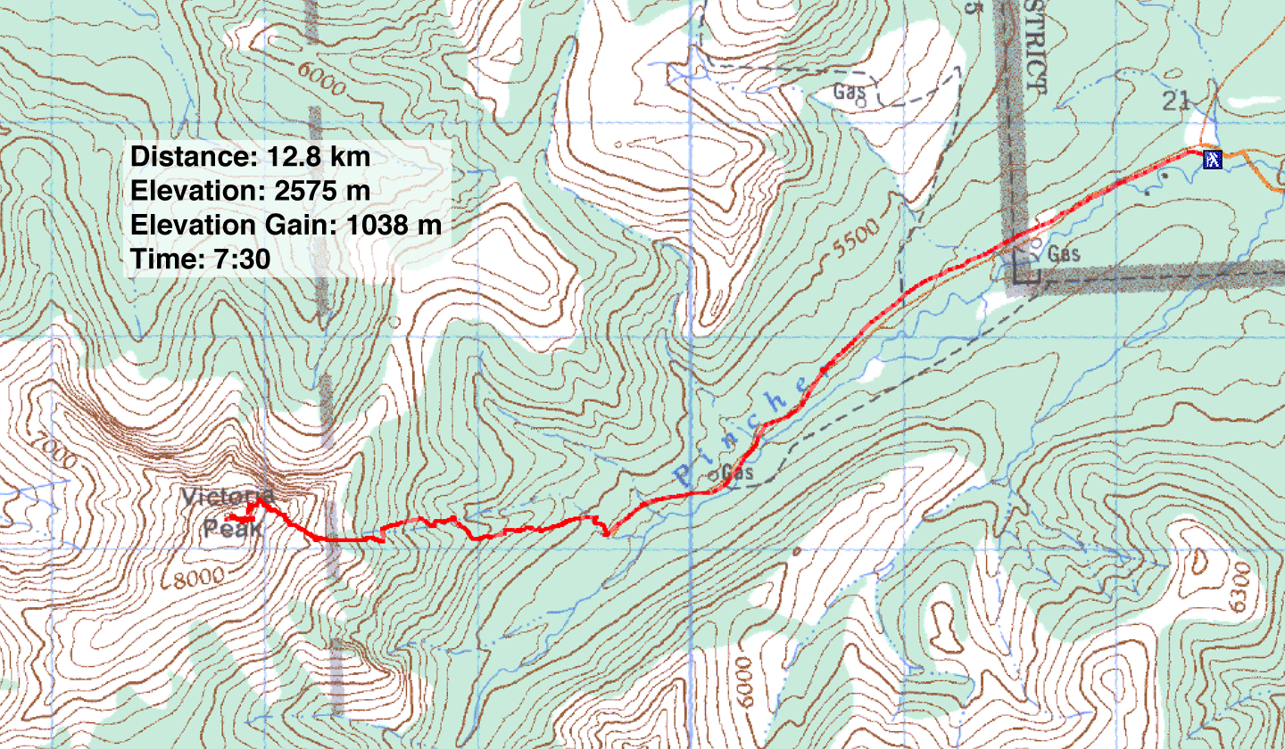
Distance: 12.8 km (8.0 mi)
Cumulative Elevation Gain: 1100 m (3609 ft)
After ascending a few peaks in Castle Wilderness, it was only a matter of time before Dinah and I got around to Victoria Peak. We planned the usual route: hike up the road and ascend near a gully.
But a couple of things changed my mind about this route. First, it was blustery, not a good day for attempting exposed scrambling. Second, Dinah was feeling under par for the course. Eyeing the peak as we walked up the road, I thought we should try for an open slope far below the summit. If we could reach that slope, we could walk to the summit. Barring any surprises, it looked feasible. Unfortunately we were surprised.
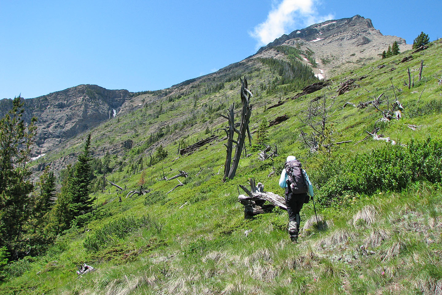
After leaving the road, we kept low and angled towards that spot. From our roadside vantage point, we couldn't see the three hidden drainages. We easily crossed the two first but the third one appeared impossible, especially because of the water torrent coursing down it. So we changed our focus to something closer.
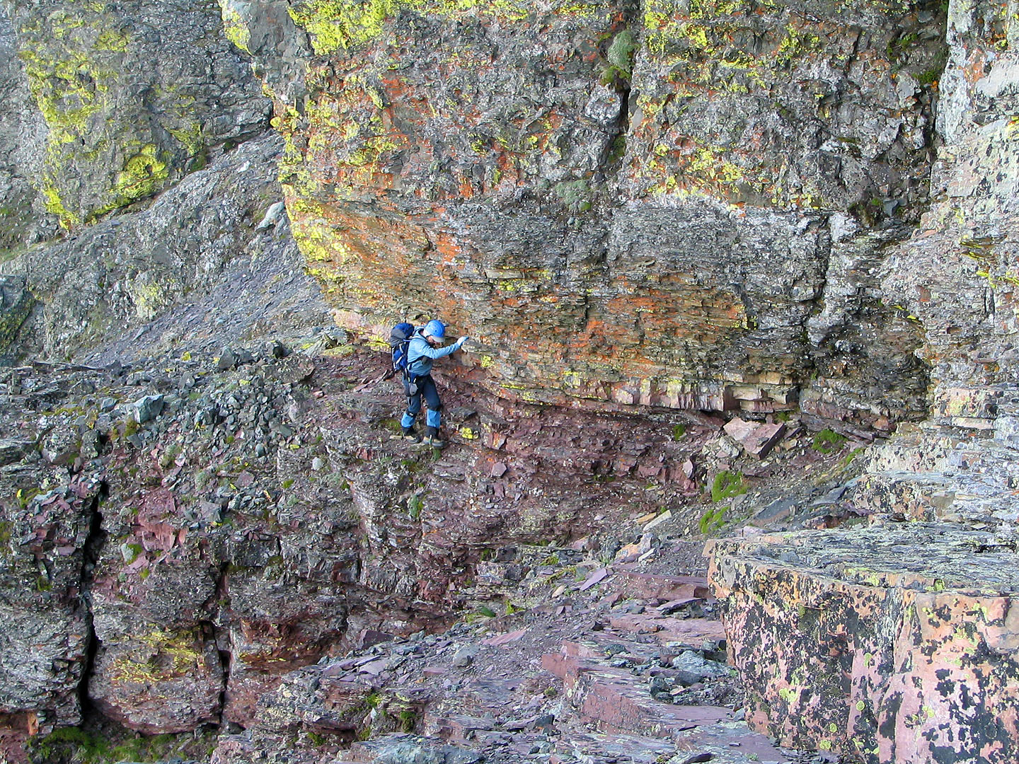
We were still angling along the slope when I glimpsed a high gully before the third drainage. It looked possible to ascend, although a rock band hid much of it. We'd have to get over the rock band, but I noticed a gap and hoped it would provide a way. We made our way to the gap.
After getting through the gap the views were intriguing. Ahead a waterfall flowed down cliffs. To my right the view was blocked. I couldn't see left around the corner, but it appeared to be exposed. At my feet was a steep downclimb. I started down, but when the rocks starting slipping under my feet, I climbed back up.
We left the gap and headed back, but angled up. This soon brought us to the ridge on the left side of the ascent gully. We would do the conventional route.
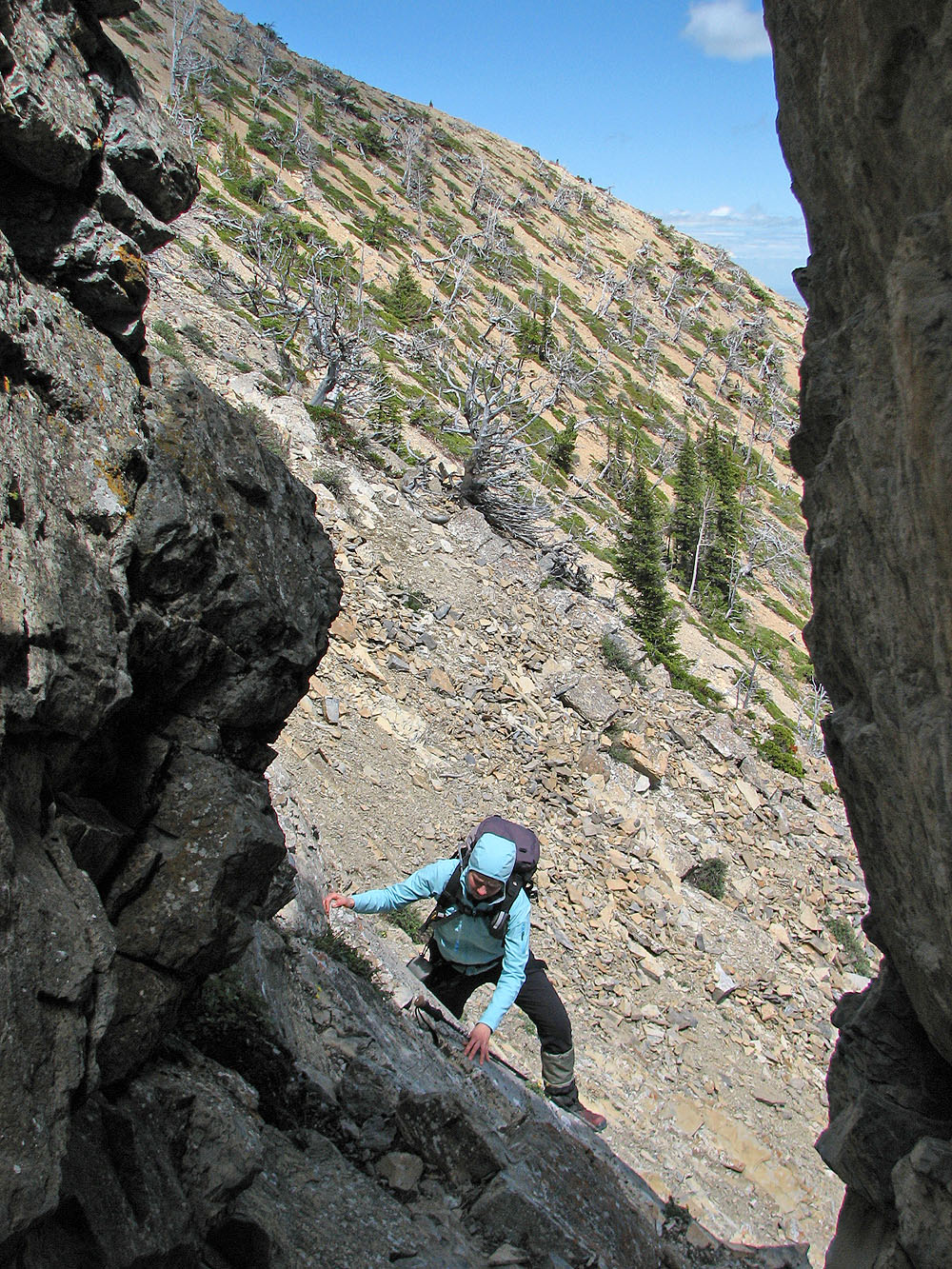
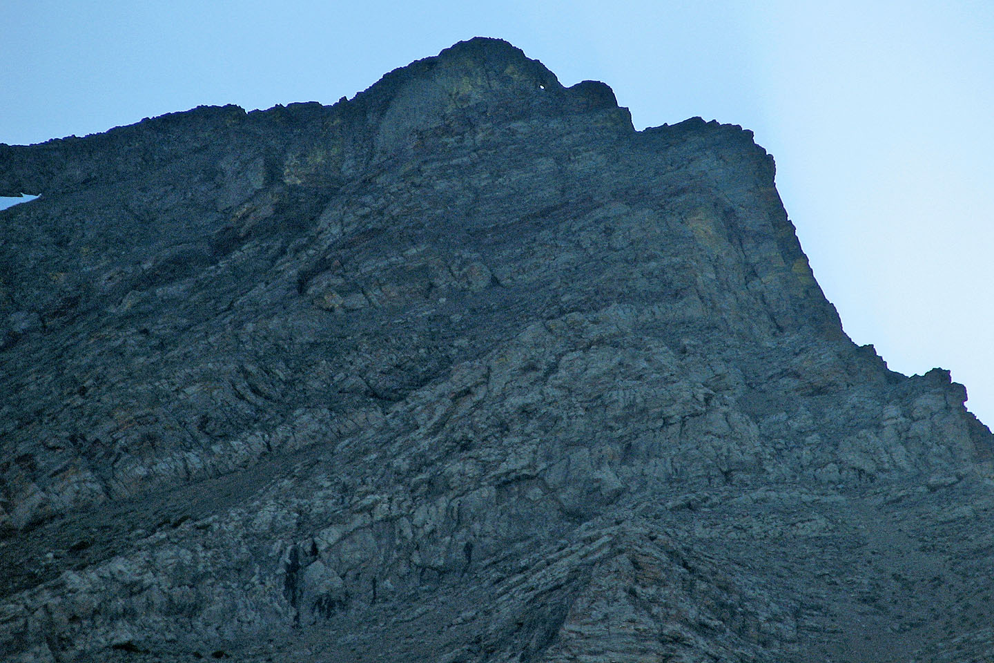
After reaching the top of the gully, we took the easiest terrain. We headed right along the base of a cliff band before scrambling over it. After that it was mostly a scree crunch to the base of the cliffs where we found a wall of rock with a window. We were 40 m below the summit.
Here, still not feeling well enough to attempt any exposed scrambling, Dinah decided to stop. I could see some exposed, difficult scrambling routes, but nothing I wanted to downclimb on my return! From the window I ventured left around a corner and came to steep, rubbly terrain. Although some difficult scrambling lay ahead, the exposure was mild and nothing so tricky that I couldn't downclimb with relative ease. I reached the summit in a few minutes.
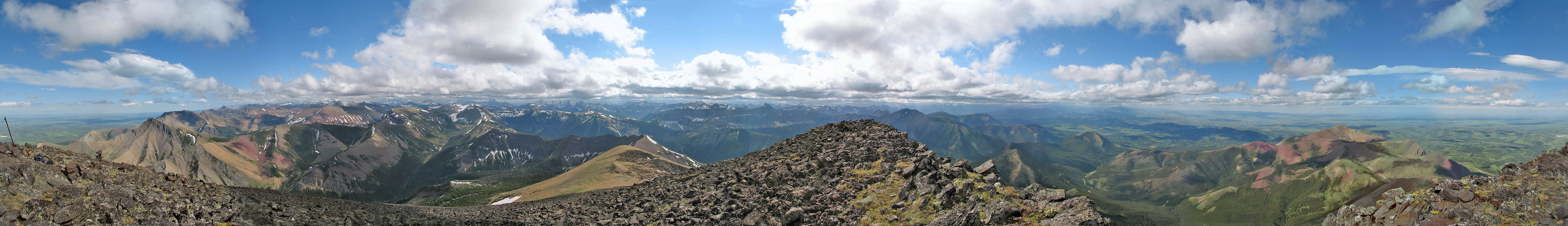
We had been climbing mostly in the lee of the wind, but now I was hit by strong gusts on the summit. I took a panorama and quickly retreated. I joined Dinah at the window and we started down.
When we reached the main gully, we headed left, running down the scree until we reached vegetation. After traversing the gully and bushwhacking through trees we were back on the open lower slopes. As we neared the road, I looked back and was surprised to see the window. The window wasn't noticeable on our ascent, but now with the sun behind the mountain, we could clearly see it. Indeed, we were well down the road before it disappeared.
Even though our side route didn't pan out, I still wondered about the gully on the other side of the gap. I guess it will be Victoria's secret!
Postscript: The usual start is now closed to the public, and a No Trespassing sign is posted. For the new access, see our hiking route for Victoria Peak.
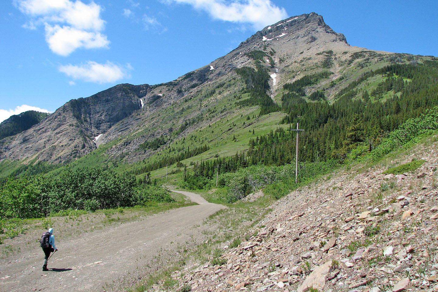
The walk to Victoria Peak (mouse over to see our ascent route)
We headed for the bare slope to the right of the black cliffs on the left
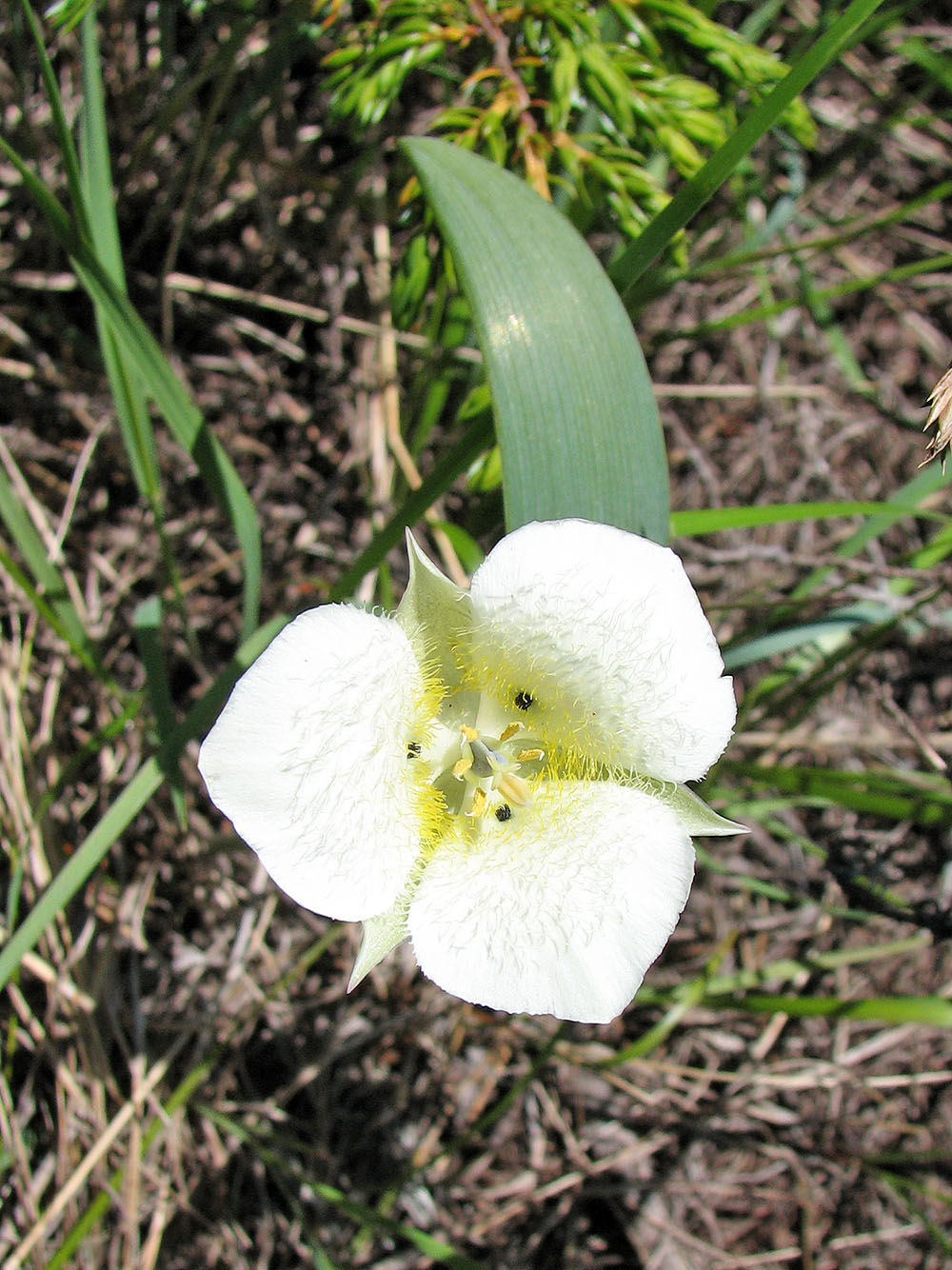
Mariposa tulips dotted the hillside
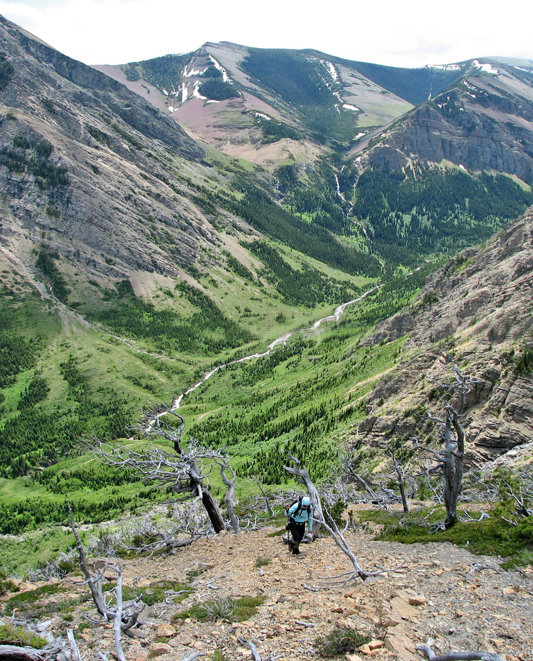
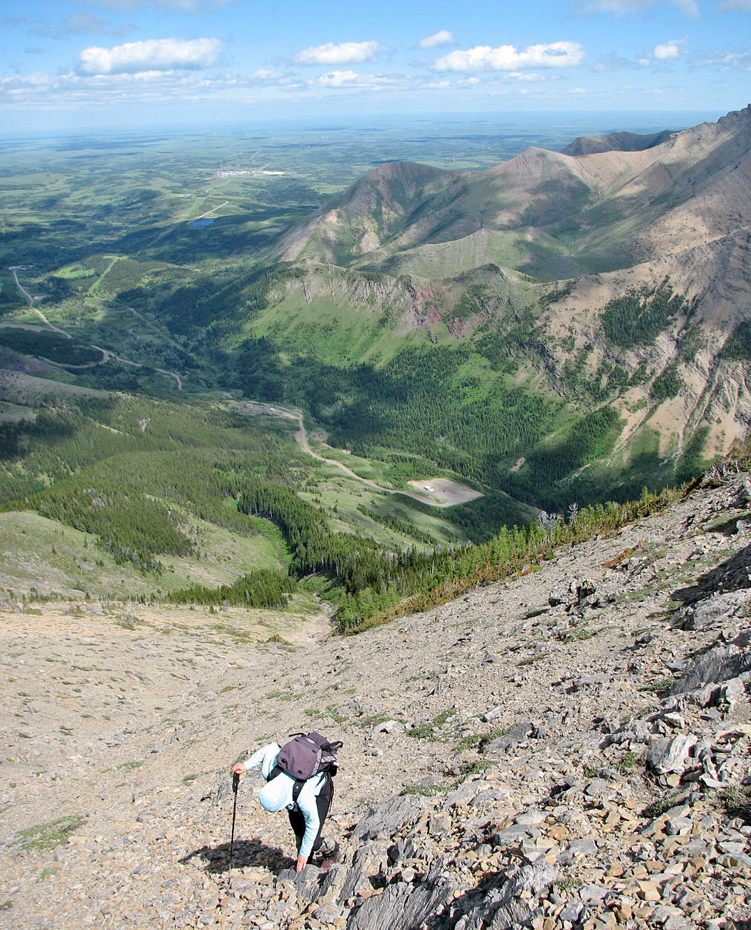
Below is the Pincher Creek valley
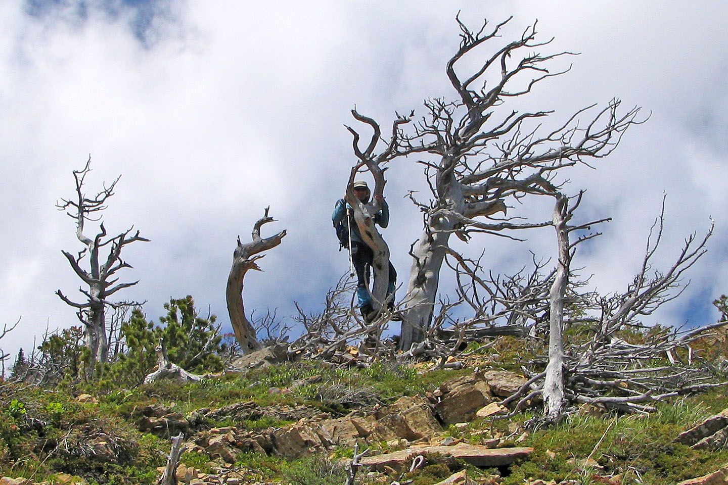
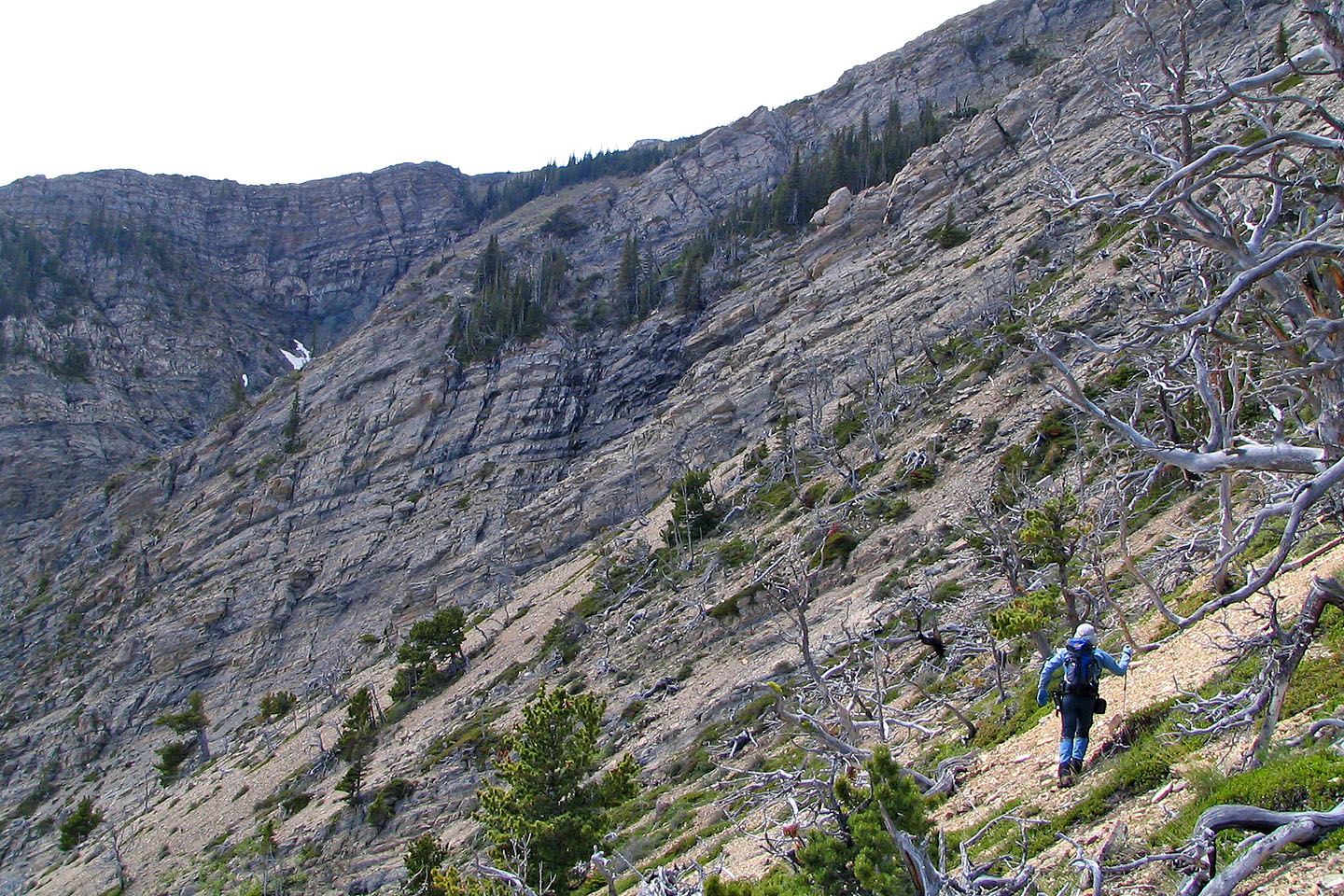
No lack of firewood here!
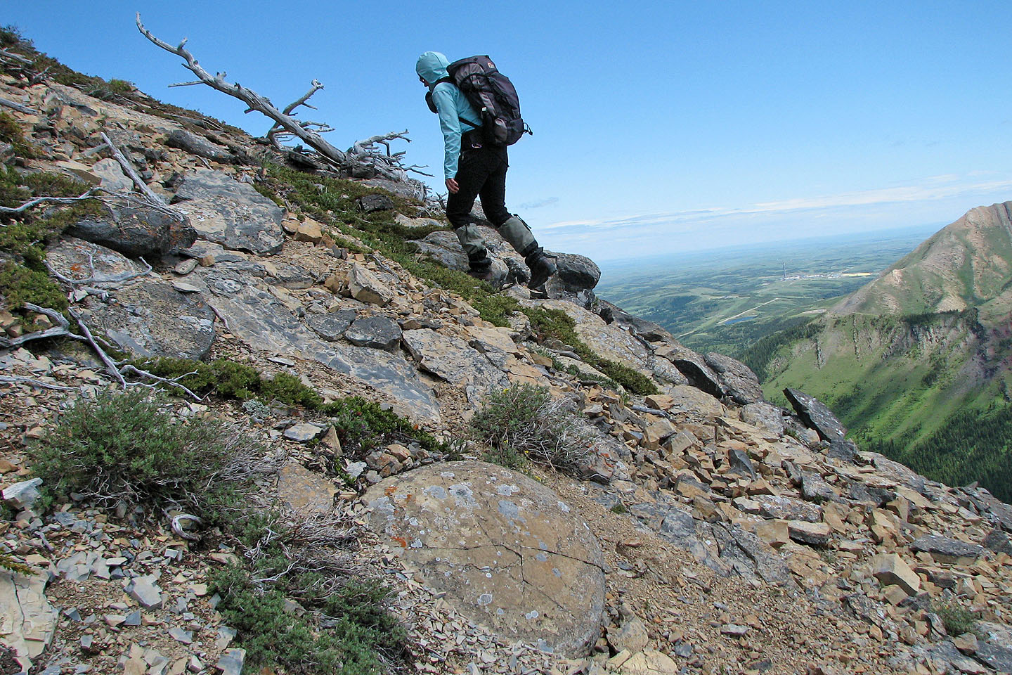
We saw some unusual round rocks like the one in the foreground
Heading to the gap
Reaching the gap
Dinah follows
Downclimb attempt on the other side of the gap (mouse over for the reverse
view)
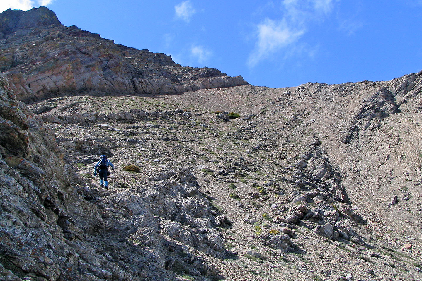
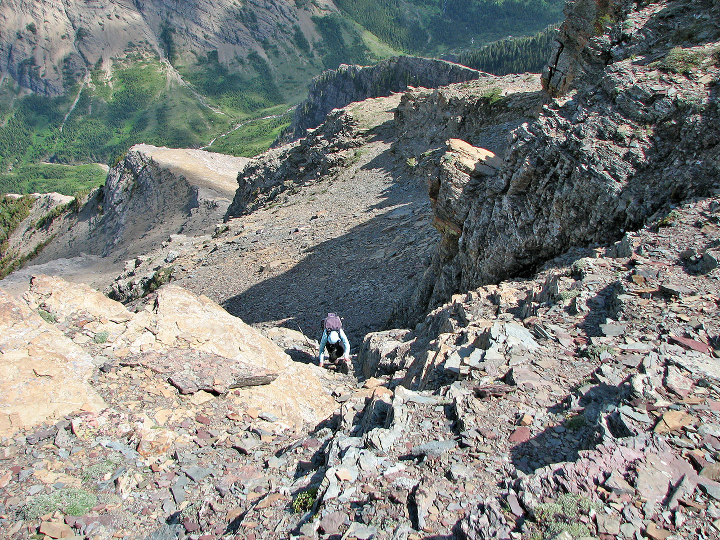
In the gully and on track for the usual ascent route
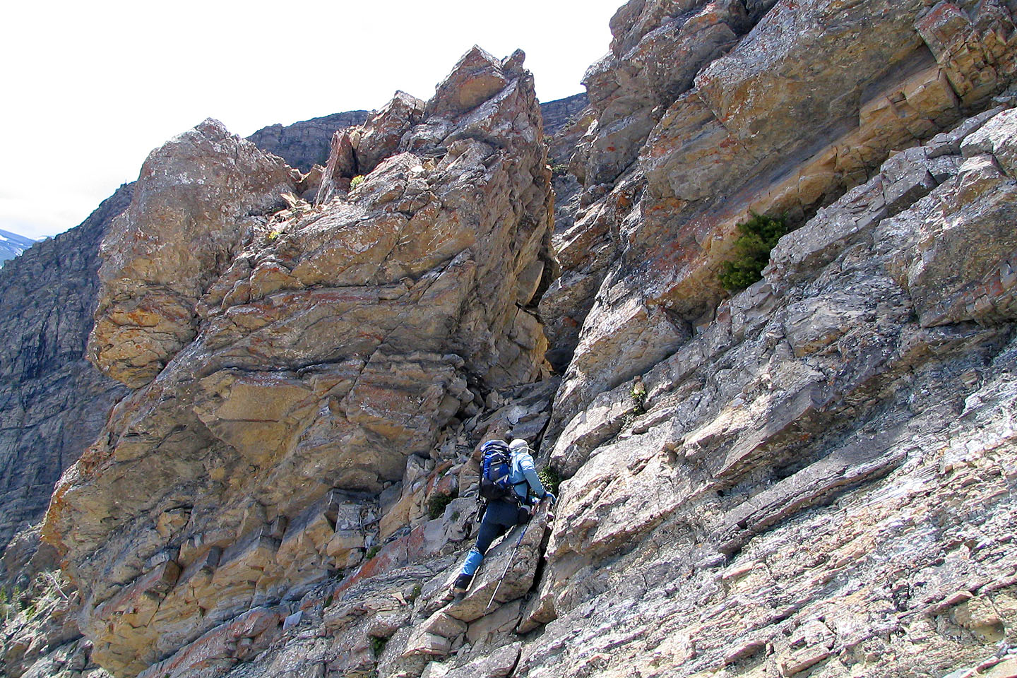
After topping out of the gully, we followed the base of the first cliff band
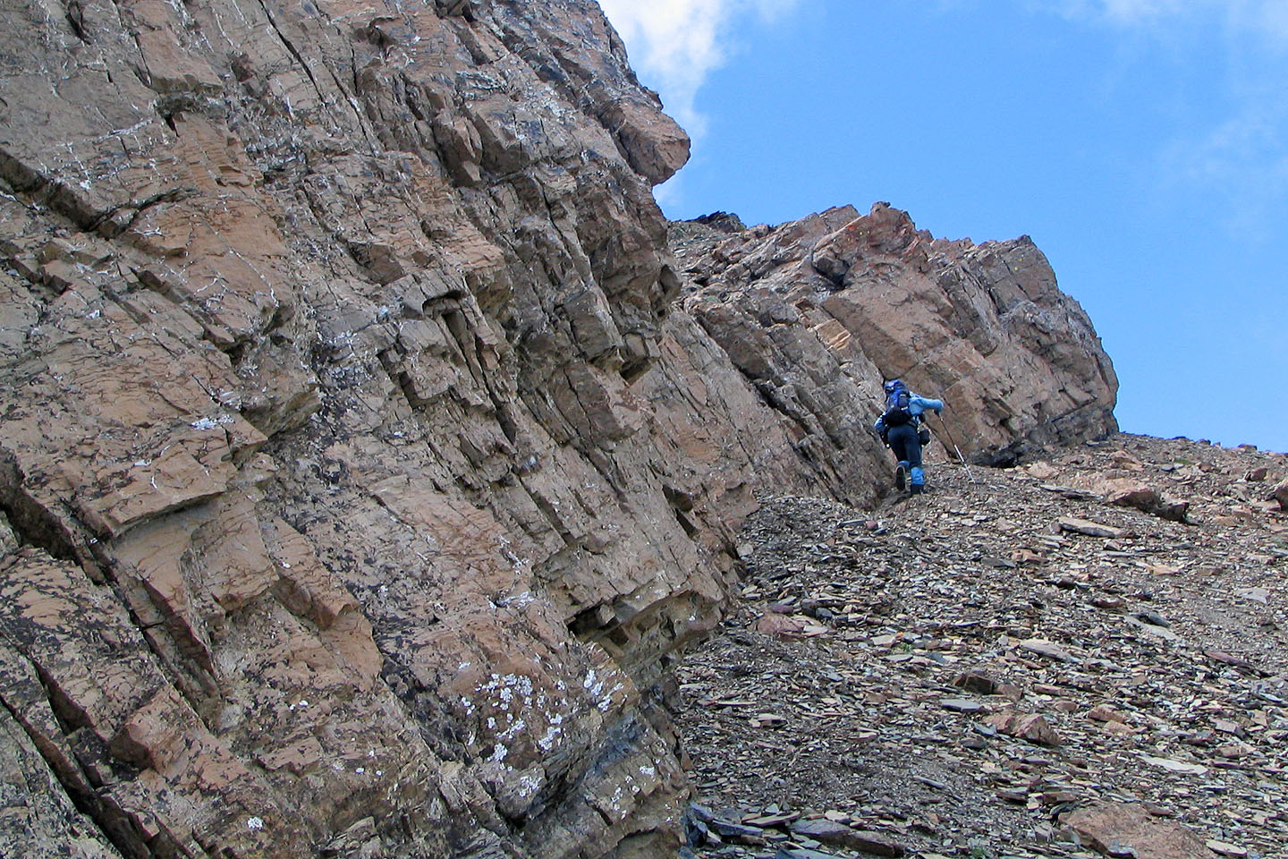
We looked for a place to scramble up the cliff band
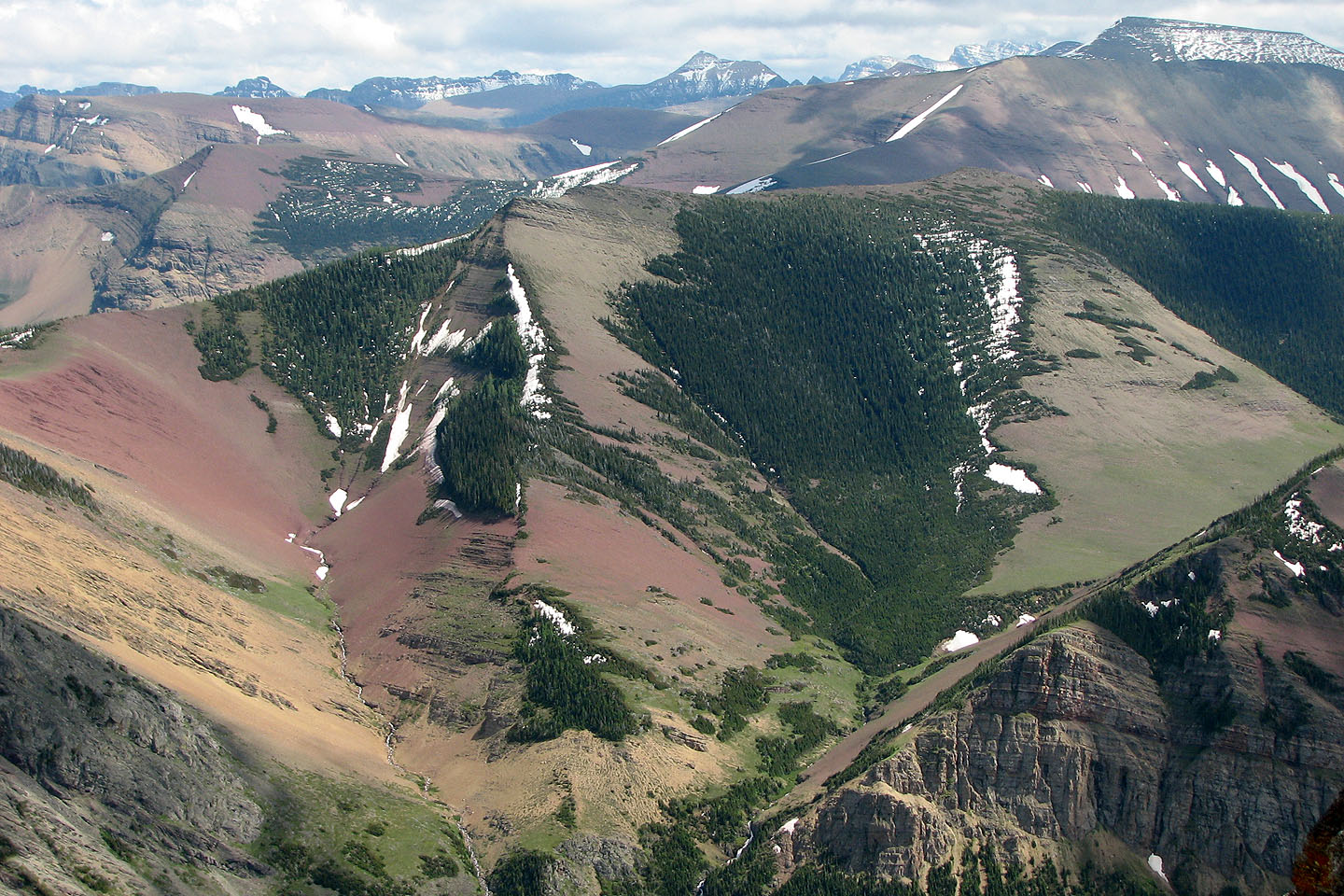
The colorful centre peak of Pincher Ridge (mouse over for a close-up)
Looking down from near the window, the ascent gully is on the left
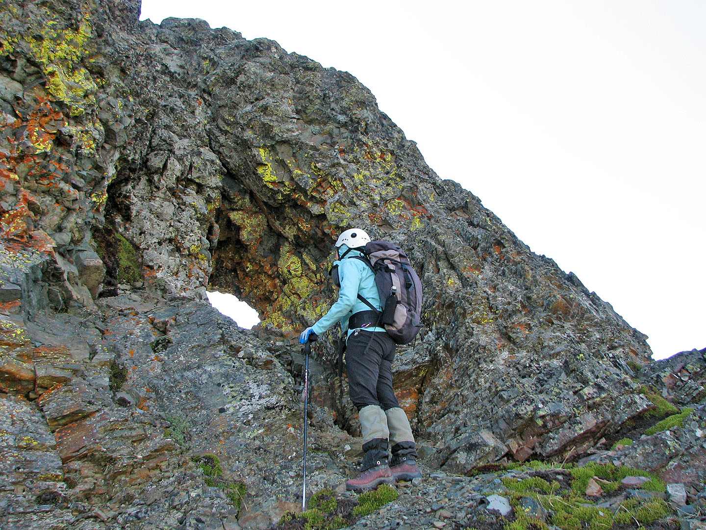
Dinah inspects the window
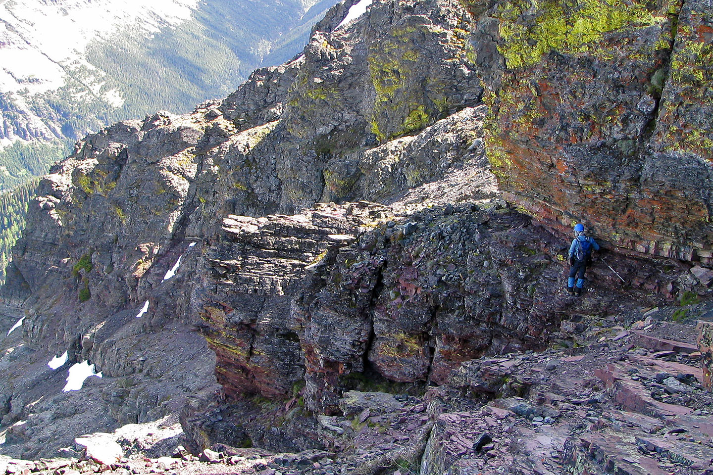
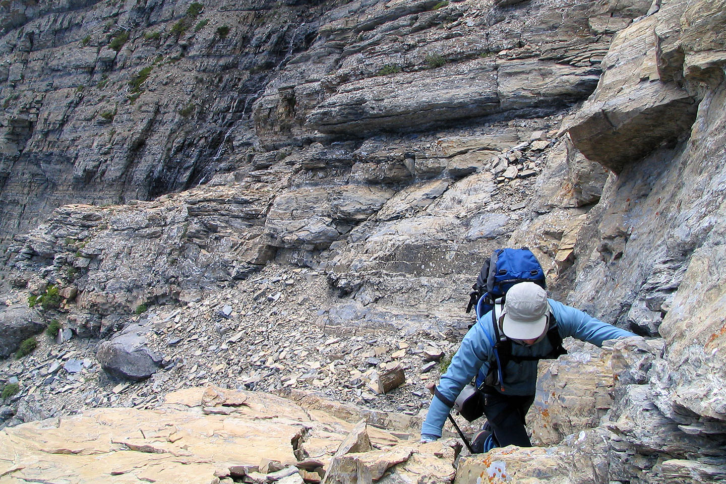
From the window, I headed left around the cliffs
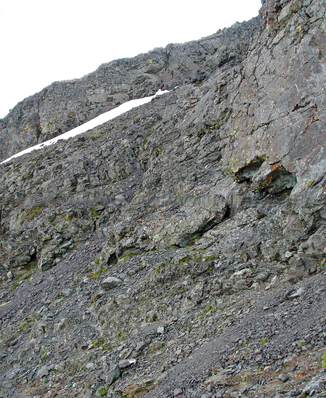
After scrambling up to the skyline,
it was a minute's walk to the summit
Coming back
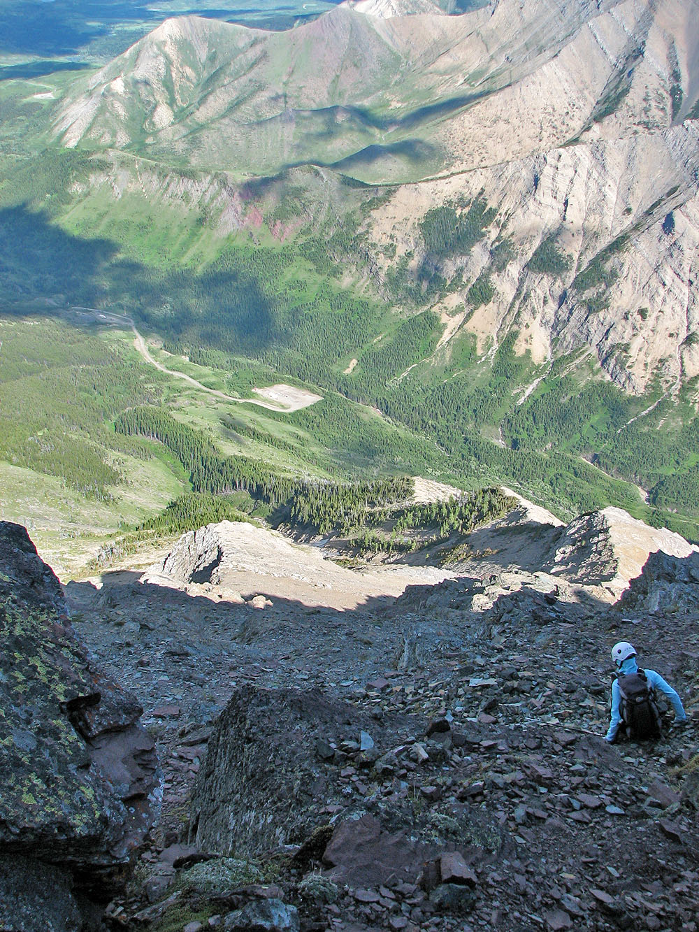
We started back down
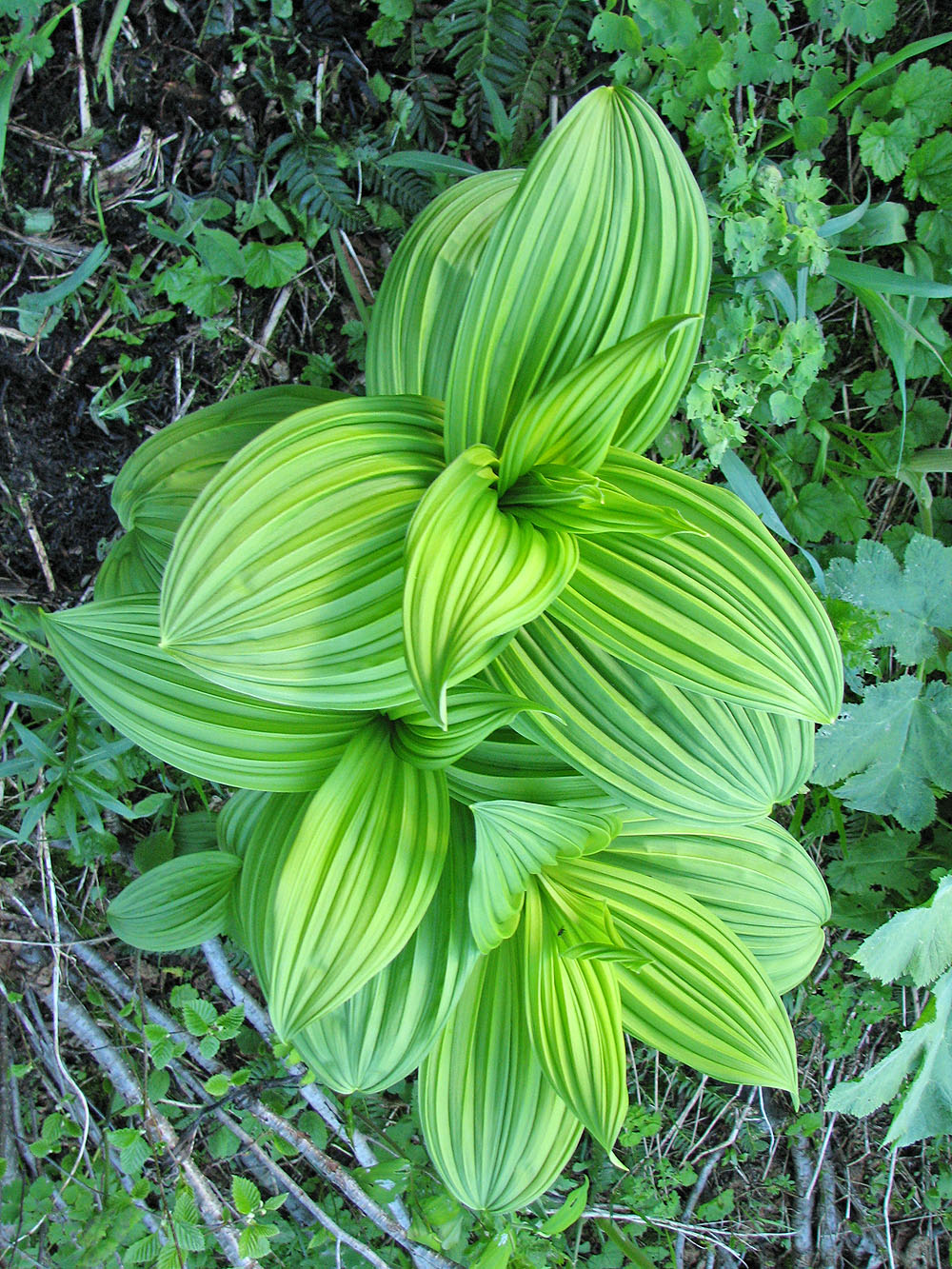
Striking leaf pattern
The window can be seen from the lower slopes
82 G/8 Beaver Mines (descent route)