bobspirko.ca | Home | Canada Trips | US Trips | Hiking | Snowshoeing | MAP | About
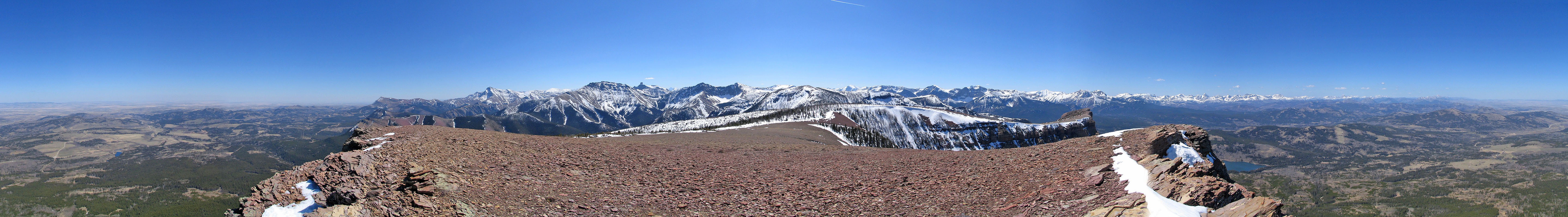
Table Mountain
Castle Provincial Park, Alberta
April 25, 2005
The peaks of Castle Wilderness take on colourful hues and Table Mountain is no exception. To reach the trailhead, drive west on HWY 774 from Pincher Creek to Beaver Mines Campground. The map at the trailhead and a good trail starts you up Table Mountain, but once you leave the trail you're on your own. Trails abound but not all may take you where you wish to go. Often they begin or end abruptly.
We hiked up a good trail through thick aspen. At the first drainage, we took a left turn at the first fork which brought us out onto a semi-open plateau. We went straight up, but found on the return it would have been easier to head to the left side of the gully where there is a trail.
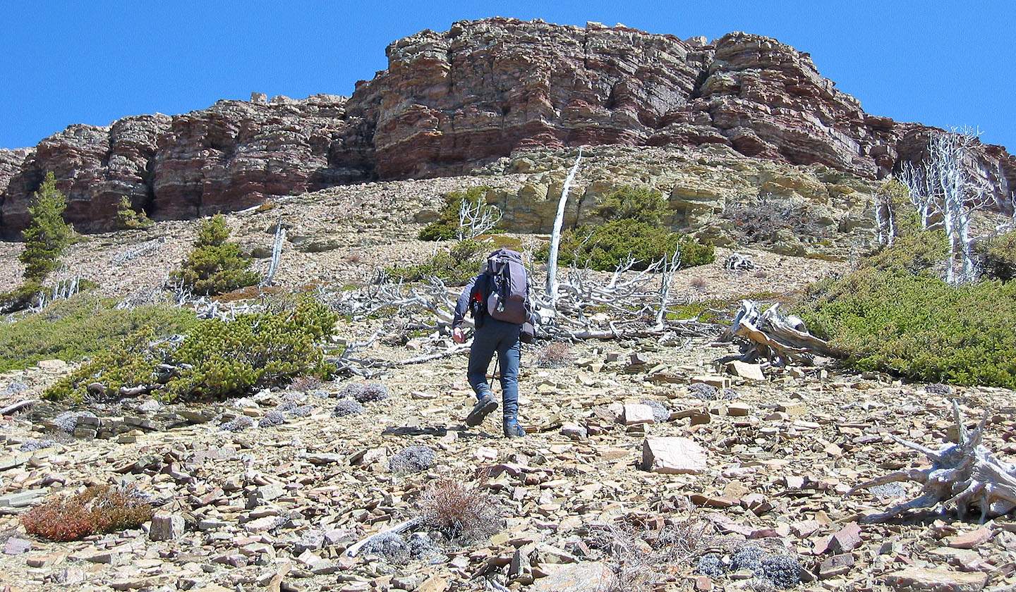
At the base of the mountain, water flowed in the gully, but higher up it disappeared underground, allowing us to easily climb up the gully. There were intermittent trails on either side, but the creek bed offered solid footing. Eventually we left the gully and ascended the ridge on the right. Above us, a red cliff band filled our view so we headed for it.
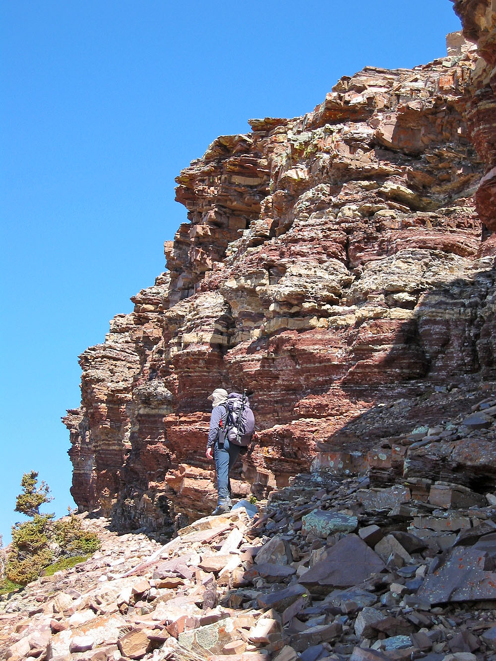
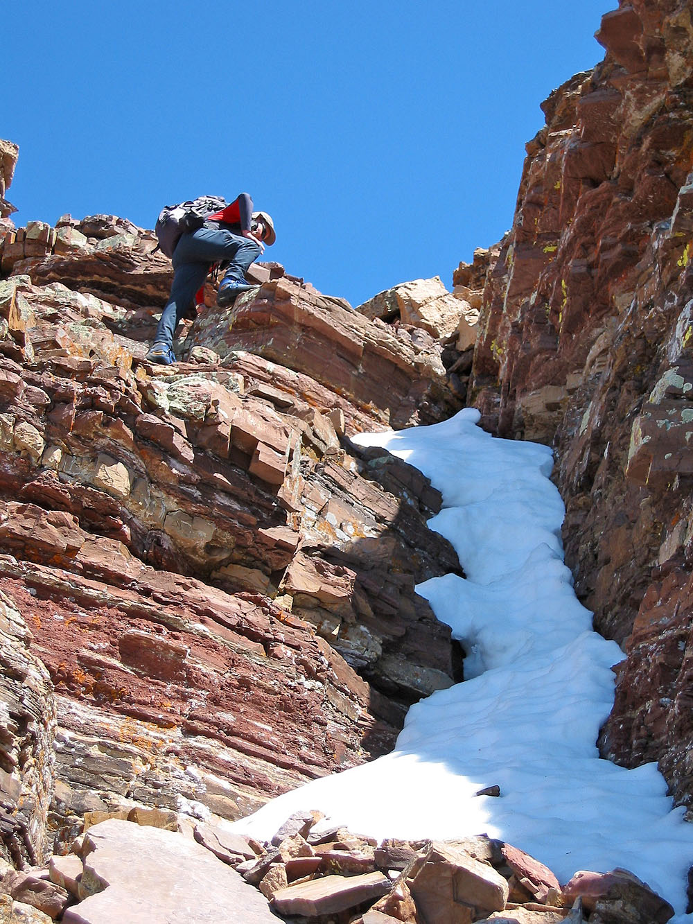
We continued until we reached the base of the cliff band. We ambled along the left side of the cliff base. Near the end of the cliff, we found a breach that we could scramble up onto the west end of the mountain. Later we realized we could have saved time by circumventing the cliffs on the right, but by reaching the west end we bypassed extensive scree and took in some extra scenery. From the west end, it was a pleasant stroll to the summit except for an unavoidable copse that sheltered a few feet of snow. Fortunately, the snow was consolidated and we didn't sink much.
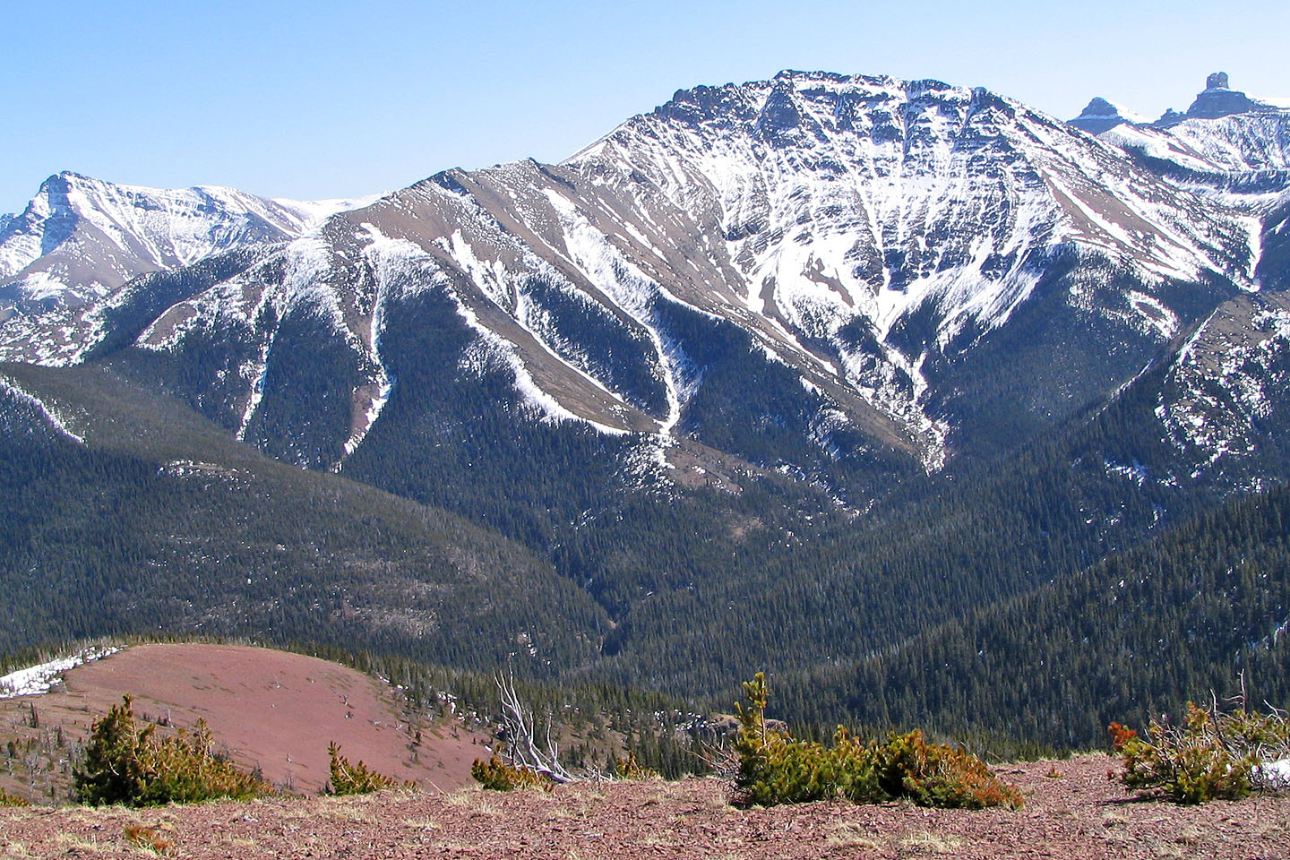
From the summit we took in views of Victoria Peak, Mount Gladstone, and the expanse of prairie to the east. Castle North was especially striking, rising like a tower.
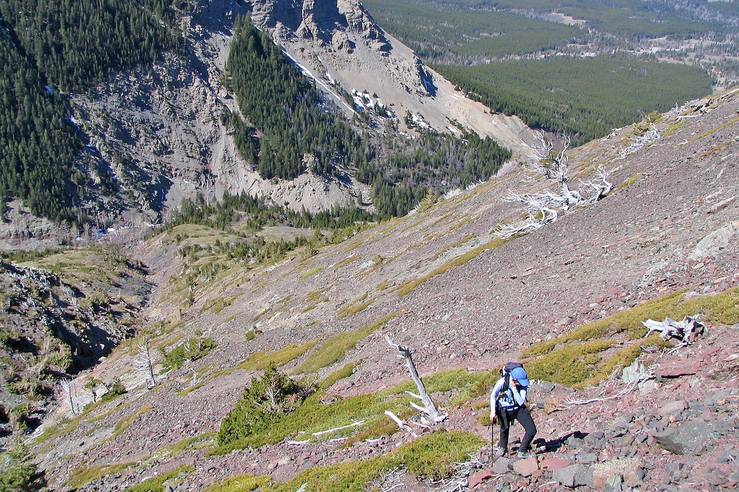
From the summit, we returned to the low point in the middle section of the mountain. We angled down the scree for quite a way before stumbling on a good trail with pink flagging; perhaps this trail is the best way to reach the middle section. We followed it down until we emerged on a ridge top where the trail disappeared. From there, we had to traverse rugged slopes to get back to the first drainage.
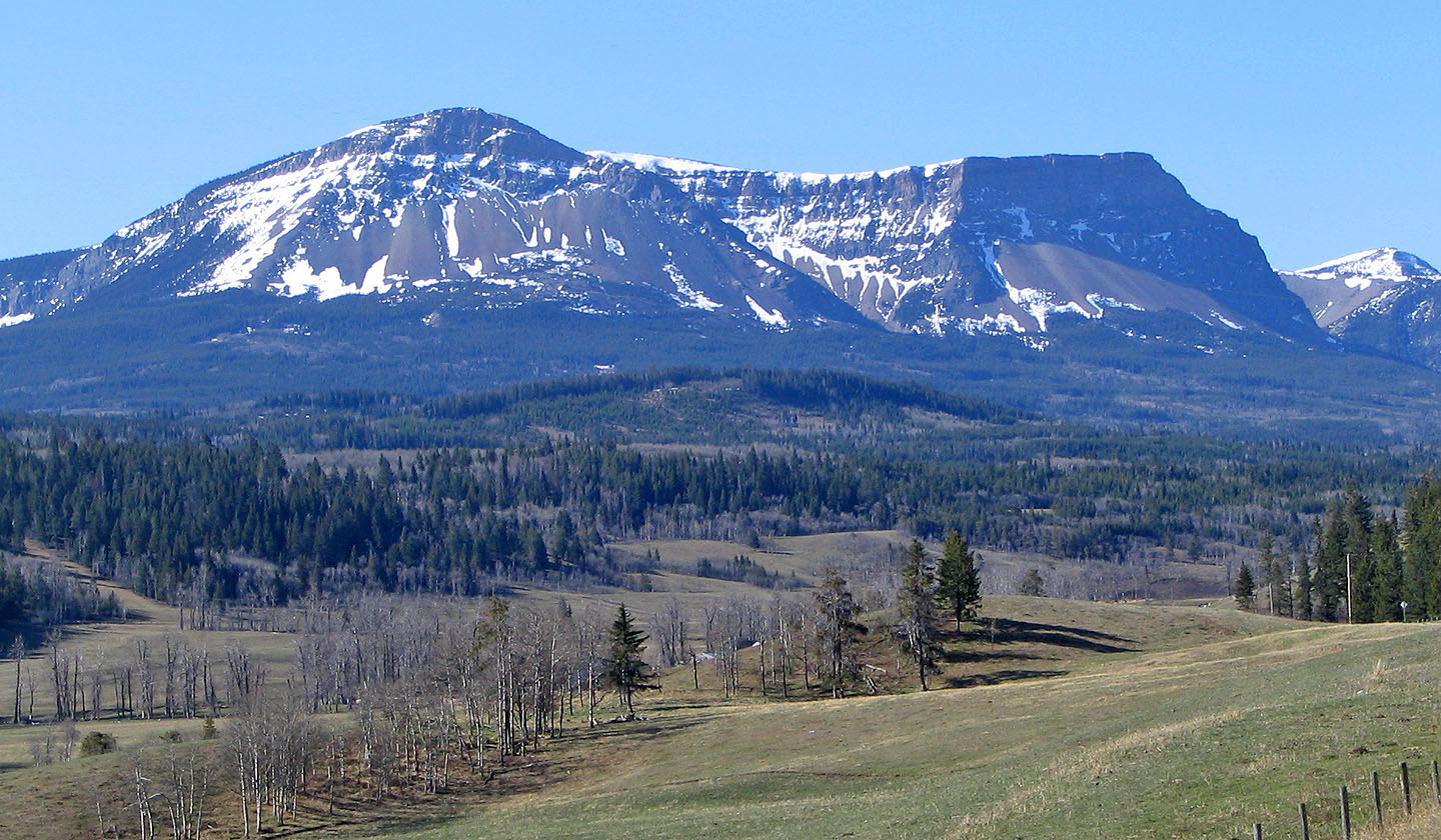
Table Mountain seen from the highway. Summit is left.
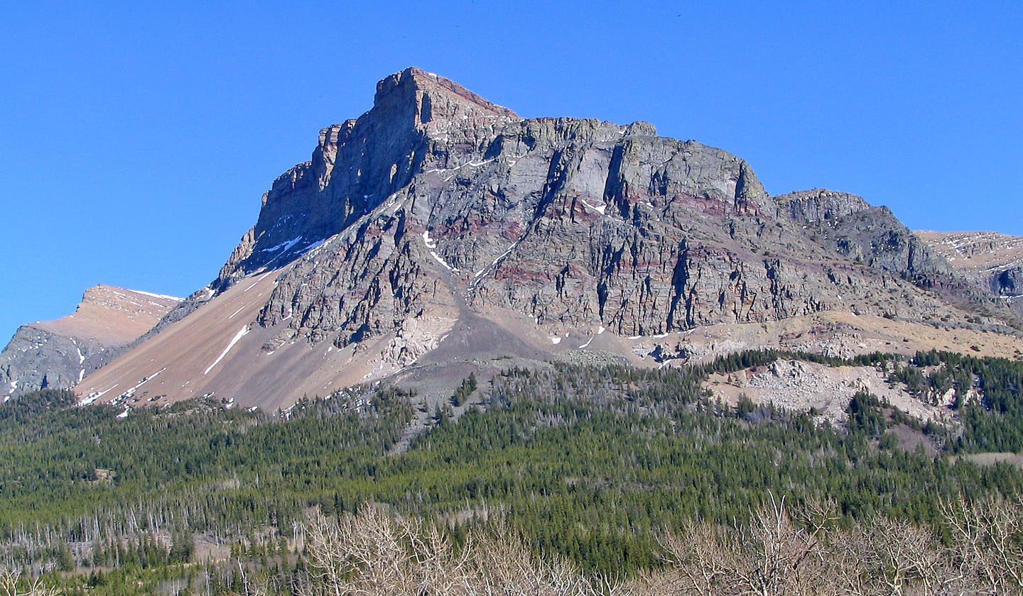
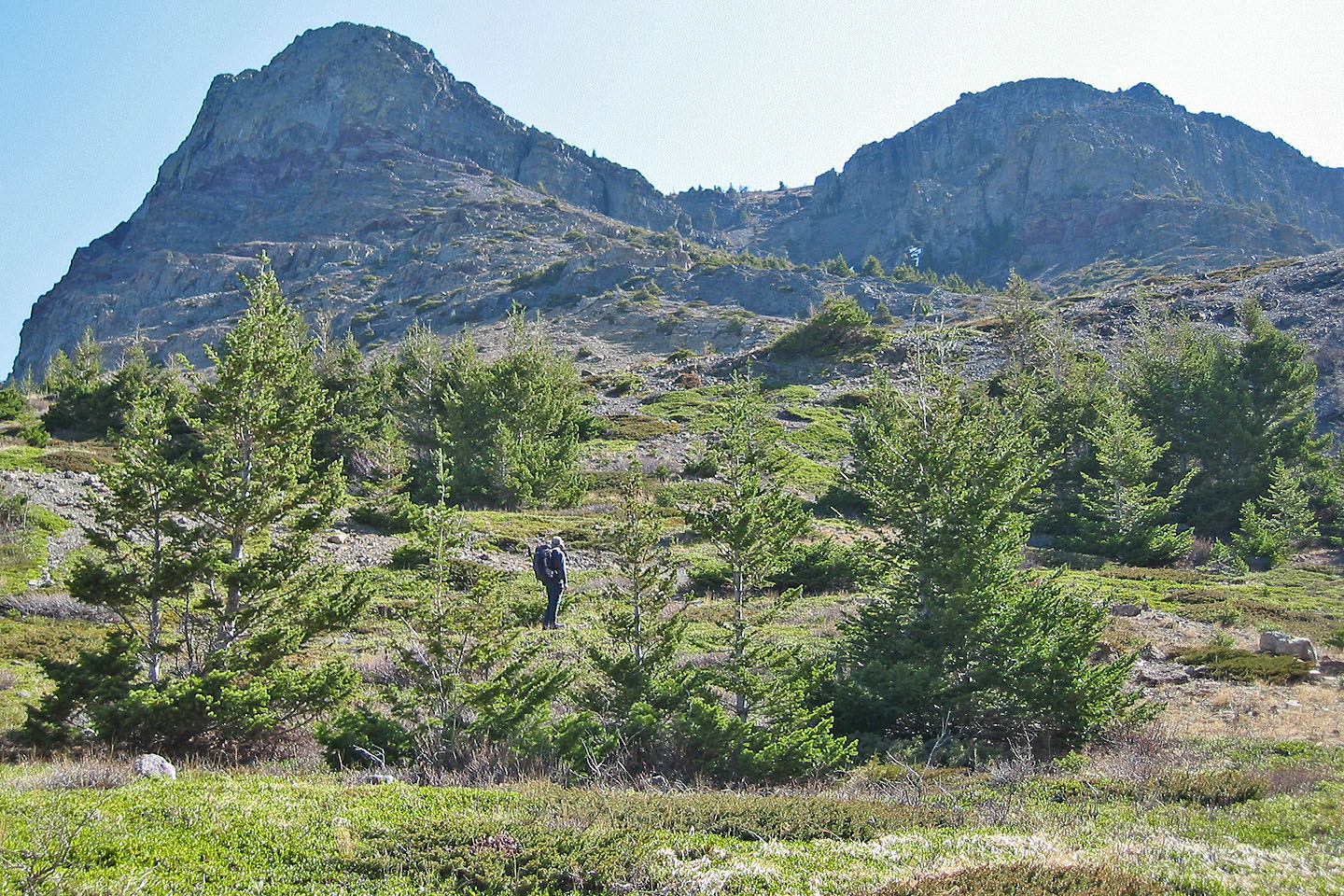
Table Mountain from near the approach. The trail heads right and then up a gully between two buttresses. The
summit is far left. The lower west end fills the foreground. The bit of snow you see near the top of the west
end is where we scrambled up.
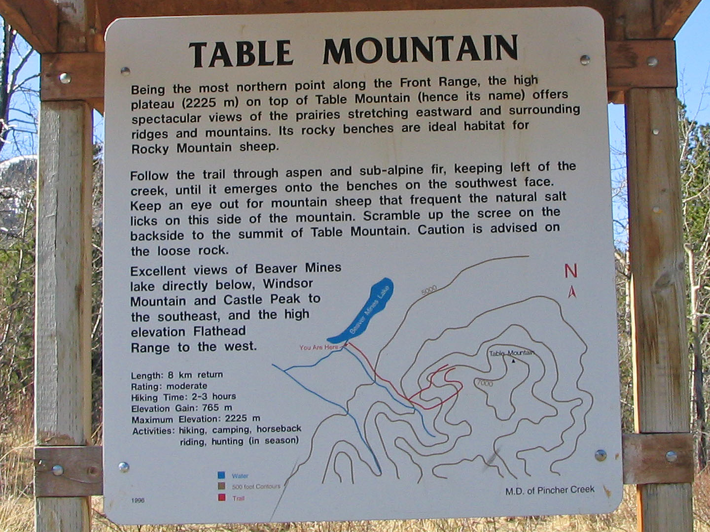
Trailhead sign
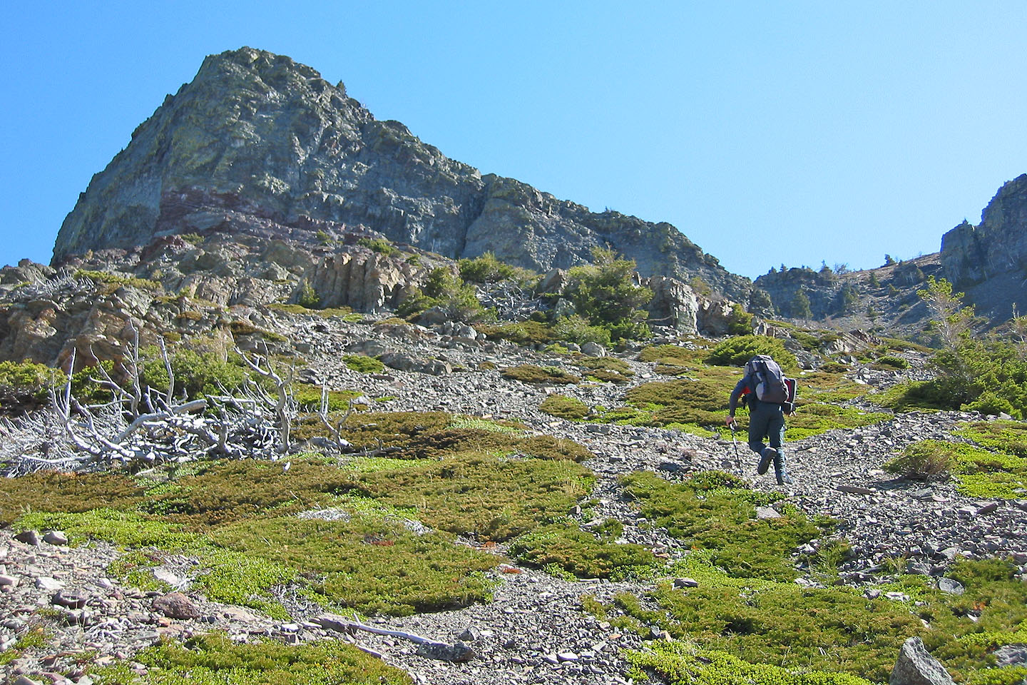
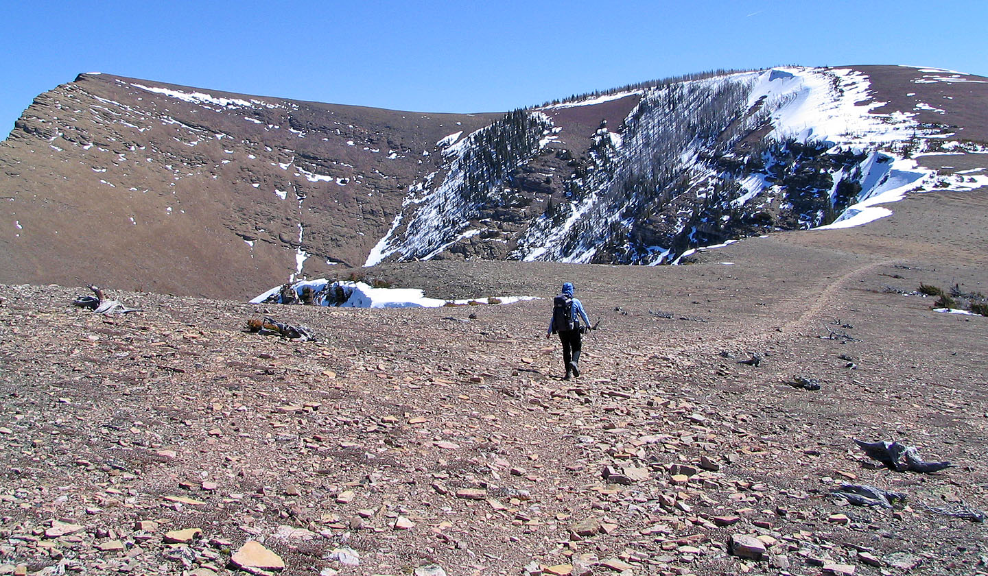
After leaving the trail, we set off across a gentle slope
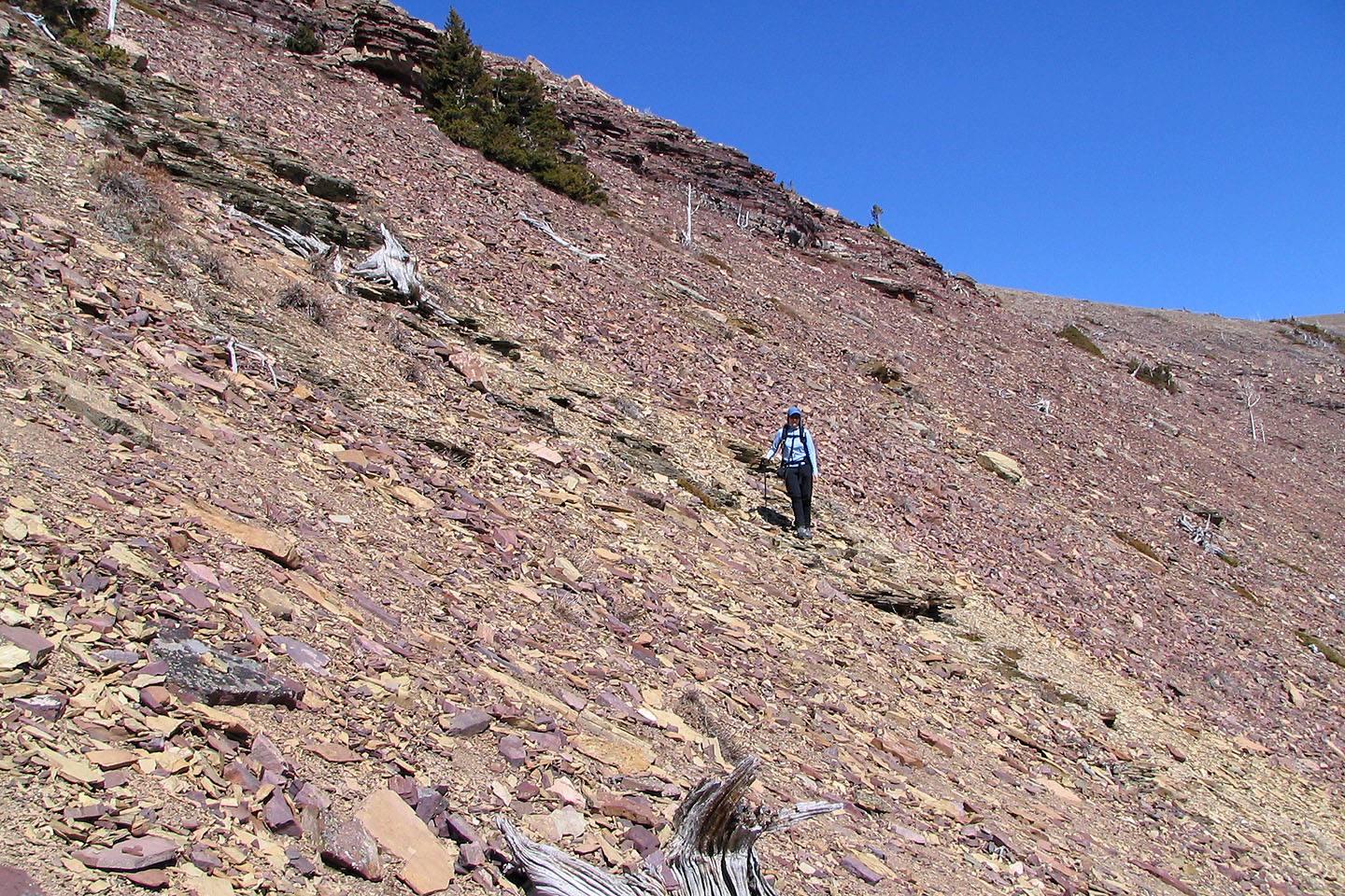
The first drainage: on our ascent, we ended up on the orange scree and gray rock on the left, but it would
have been easier to hike closer to the gully. The red cliff band in the background between the two buttresses
marks the west end.
There's plenty of scree as we ascend. On the return we found a trail closer to the gully that ends on the rib
to the right of the gully.
We made our way to the gully between the buttresses
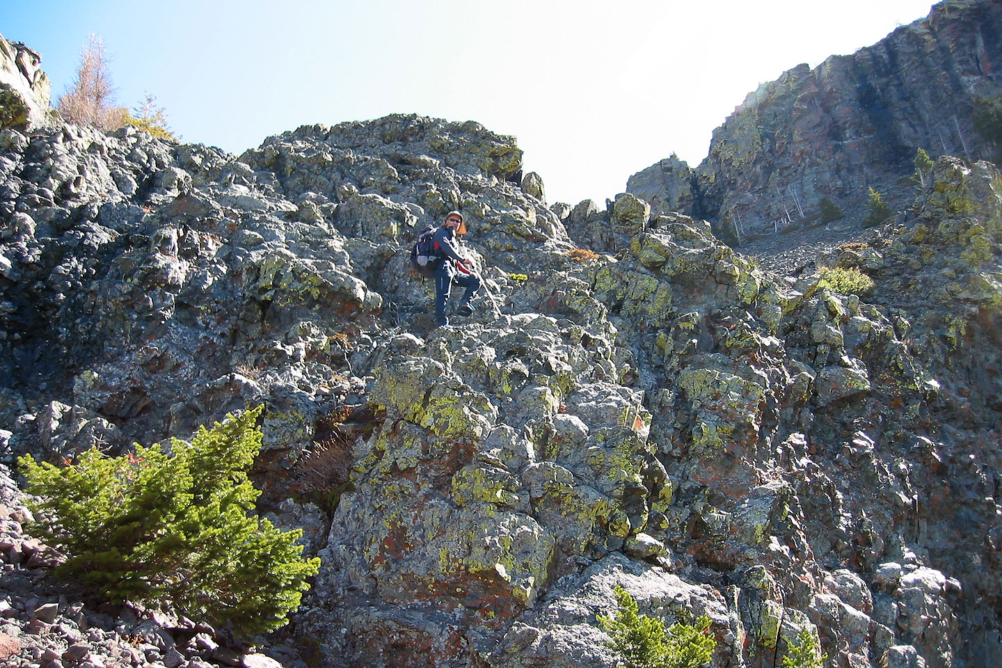
Some scrambling here
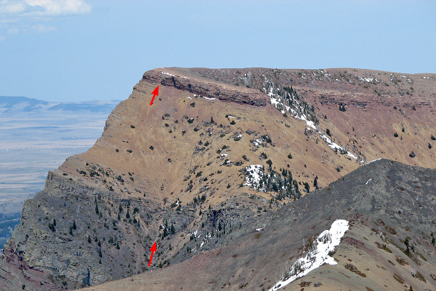
Arrows indicate the gully and the weakness in the cliff band we took, but note the trail in the orange scree
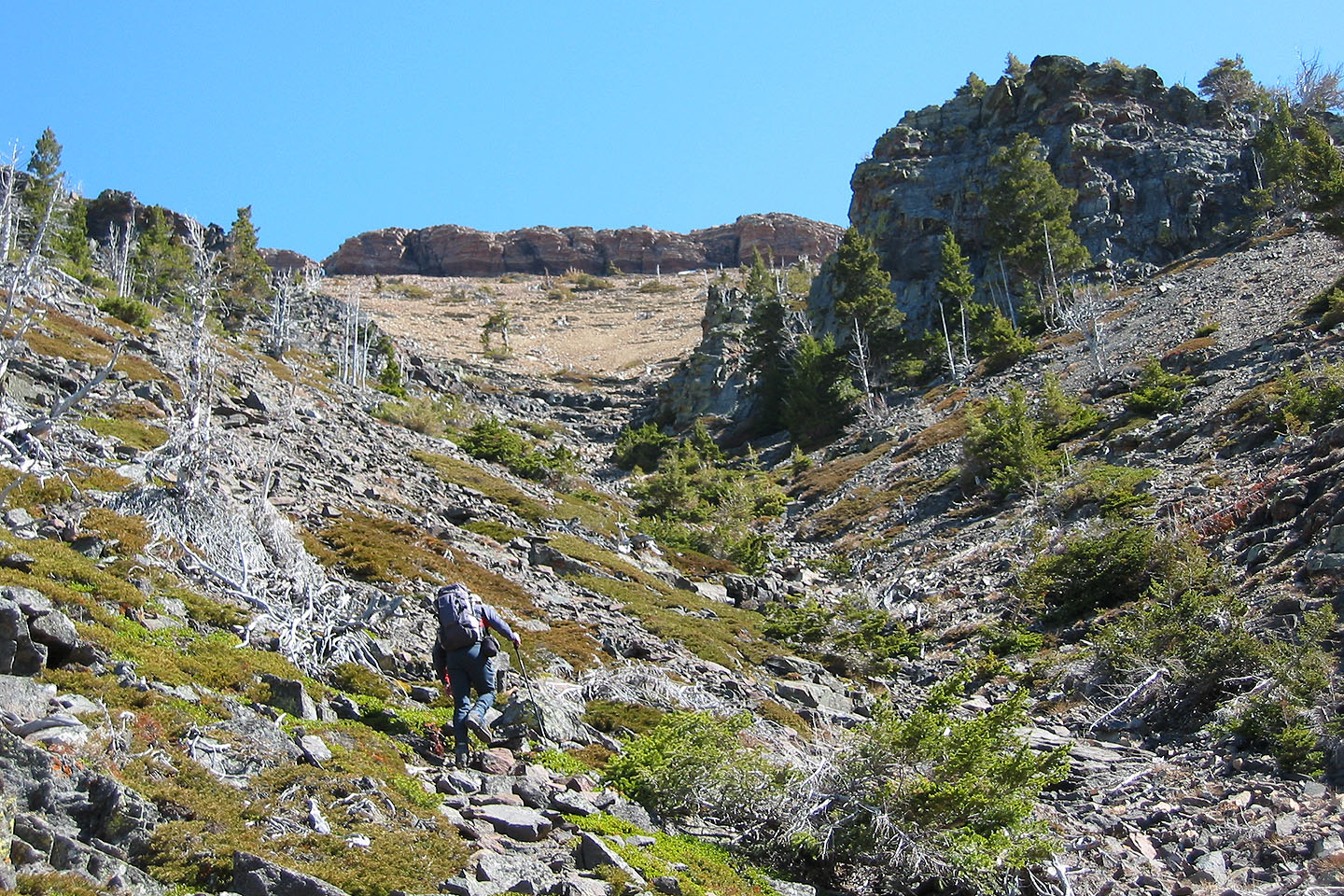
The gully leads to a cliff band
Below the cliff band: I ascended the chimney on the right which wasn't to Dinah's liking, so instead we hiked
left along the base of the cliff band until we came to a break
Looking for an easier way up
We skirted the cliff band until we found an easier spot to ascend
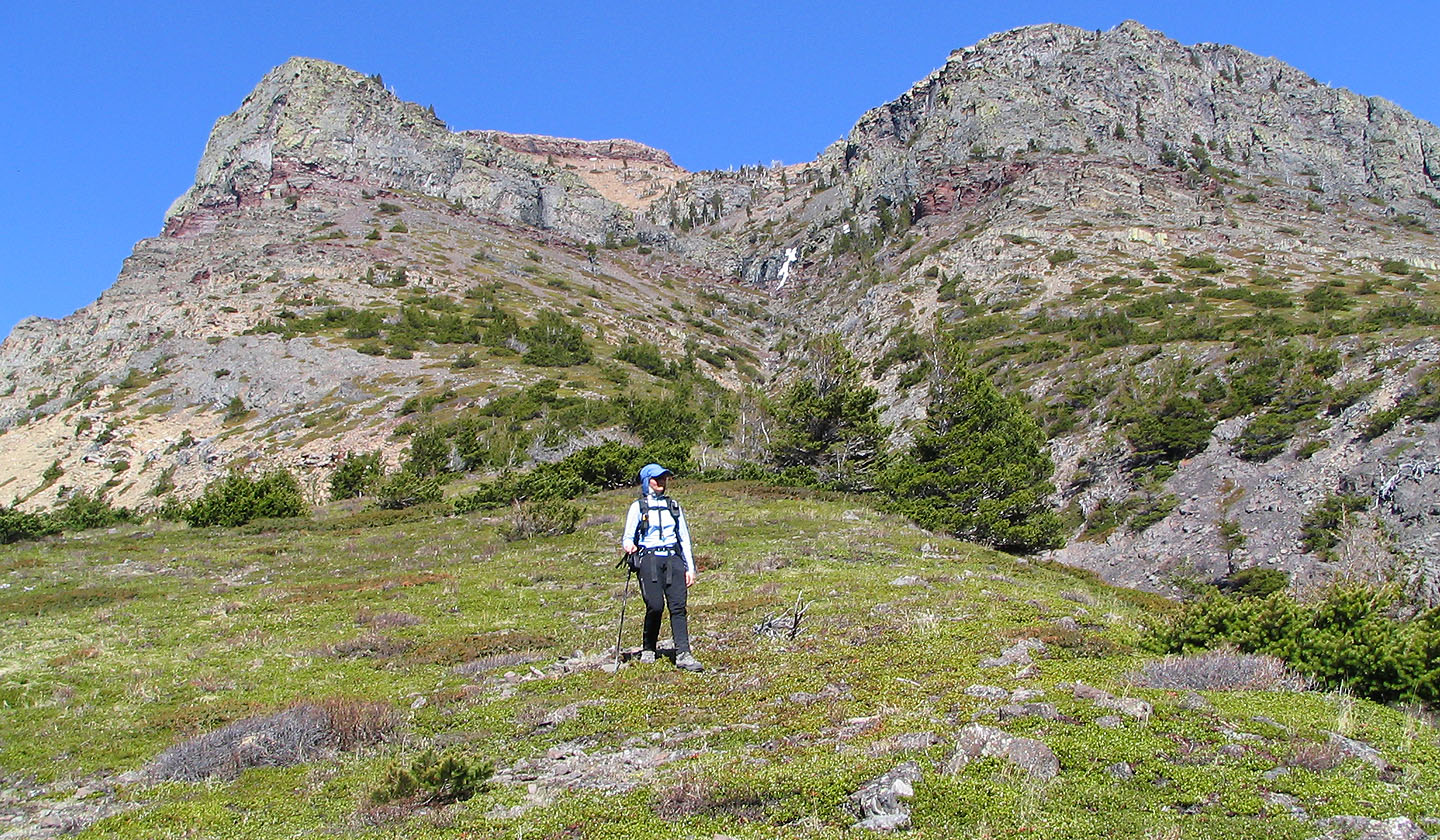
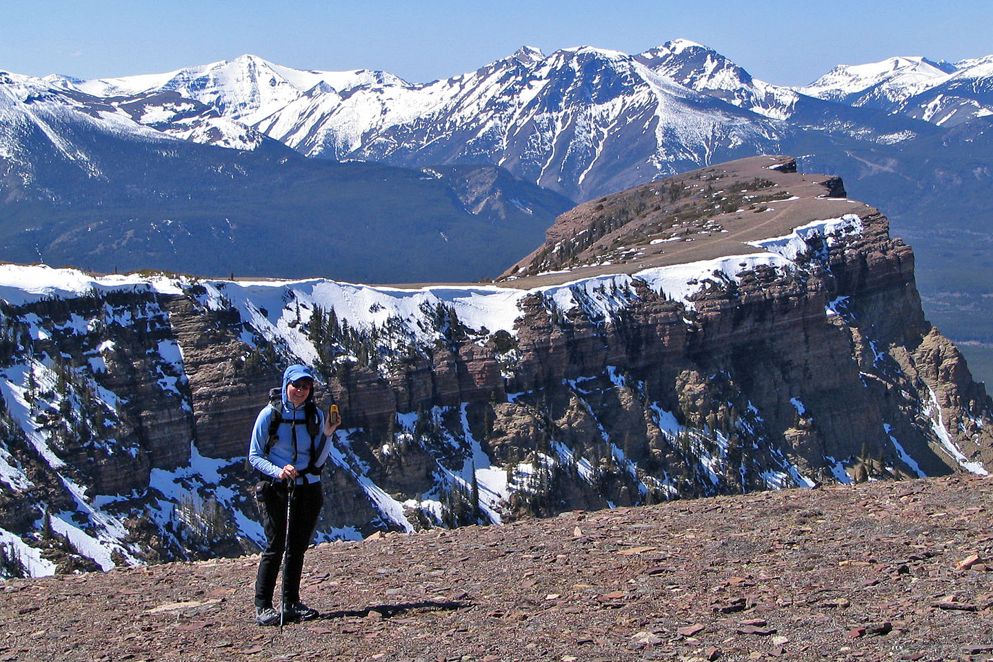
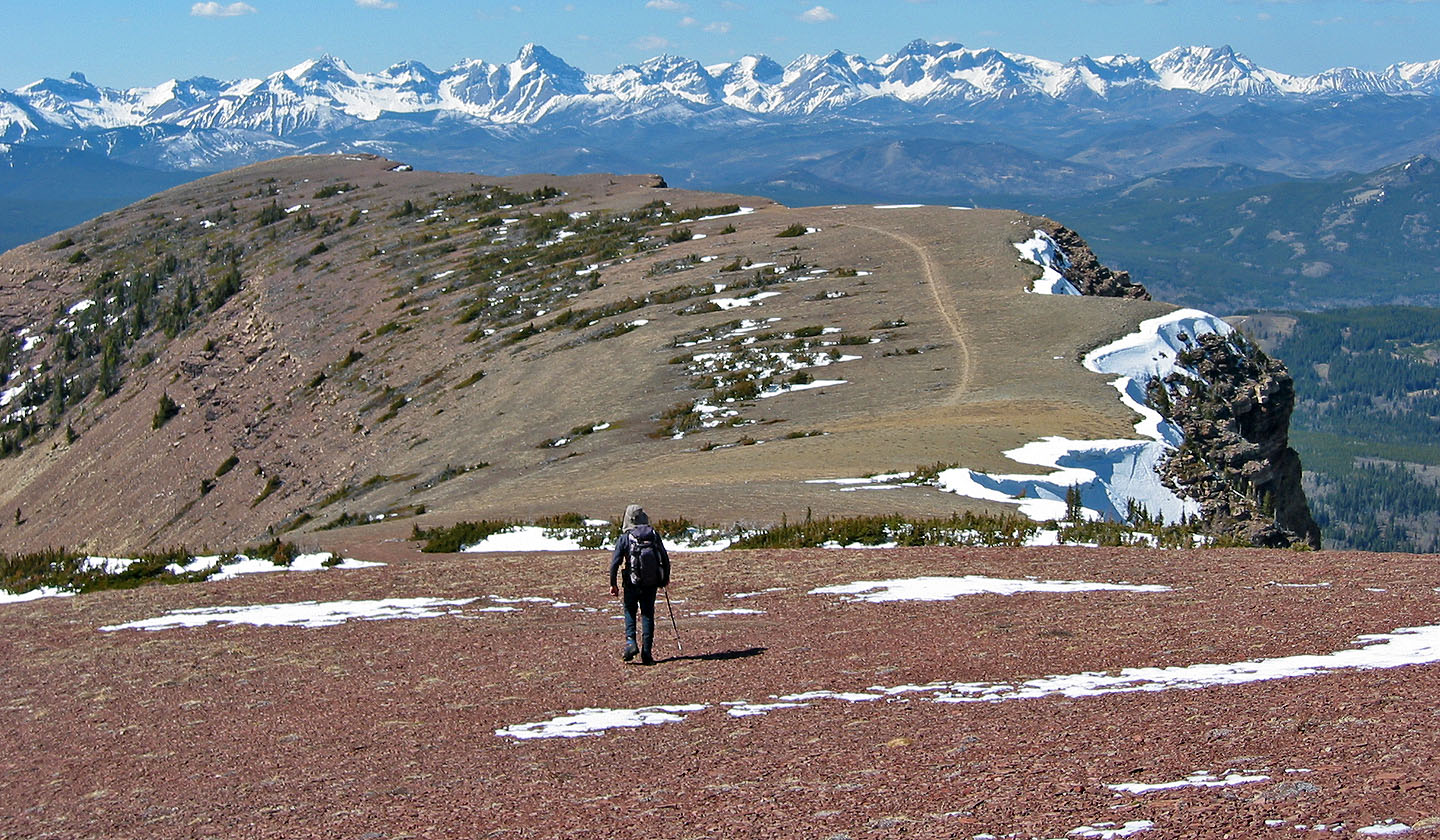
On the west end of the mountain looking towards the summit
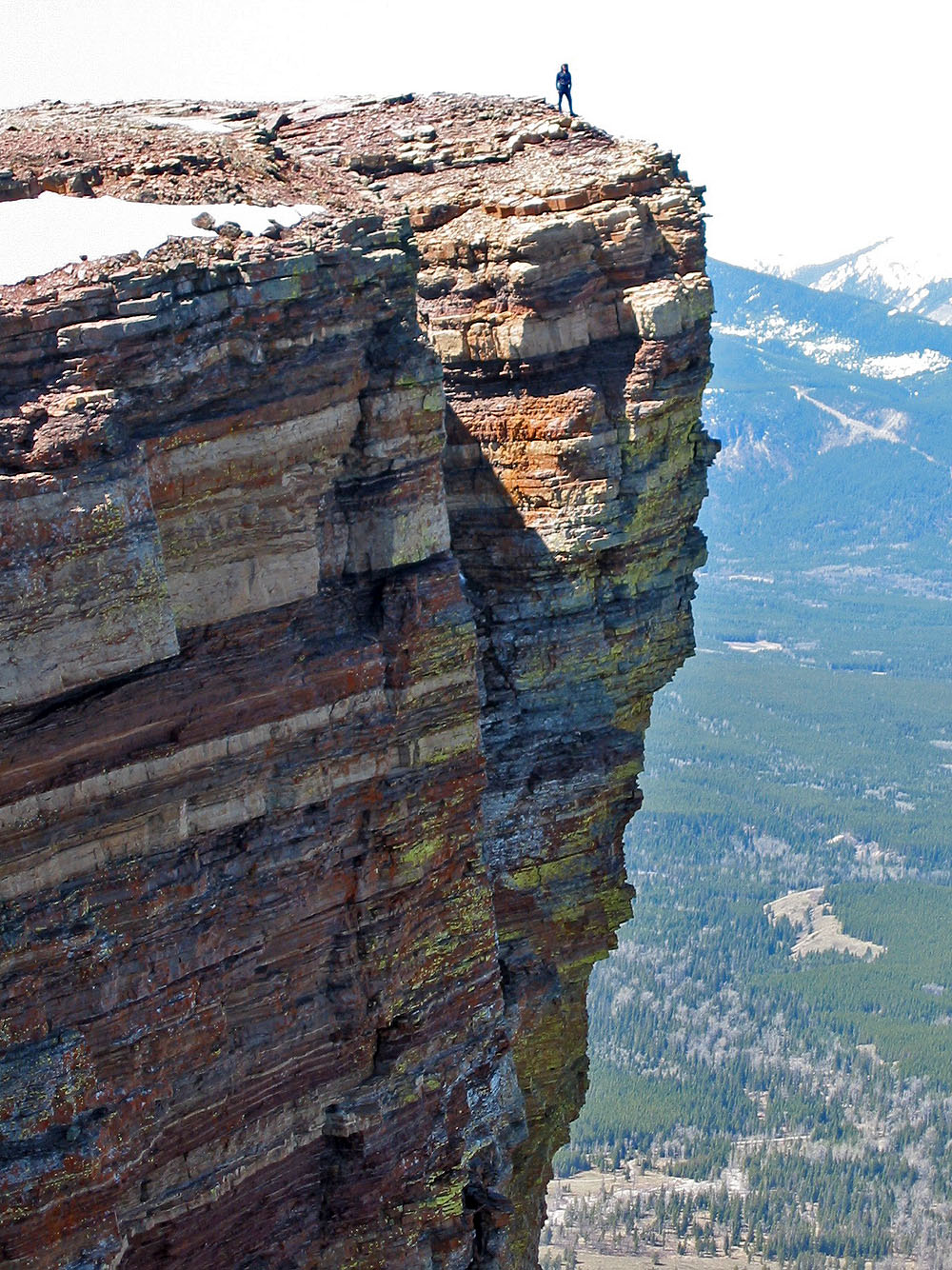
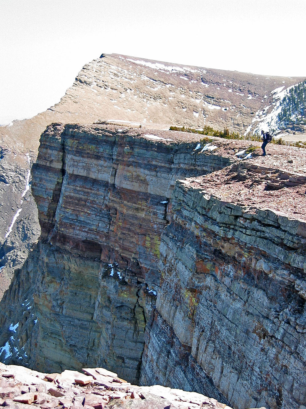
Impressive drop!
Heading to the summit
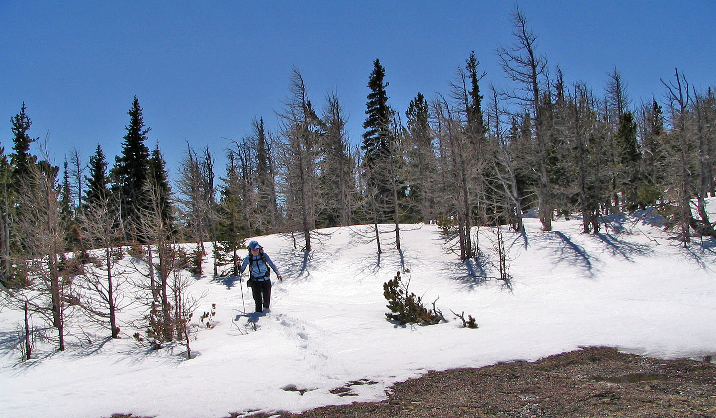
Coming out of the snow
Almost at the summit, looking back at the ridge we traversed
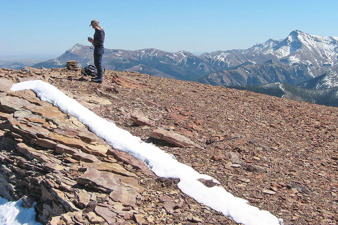
The summit
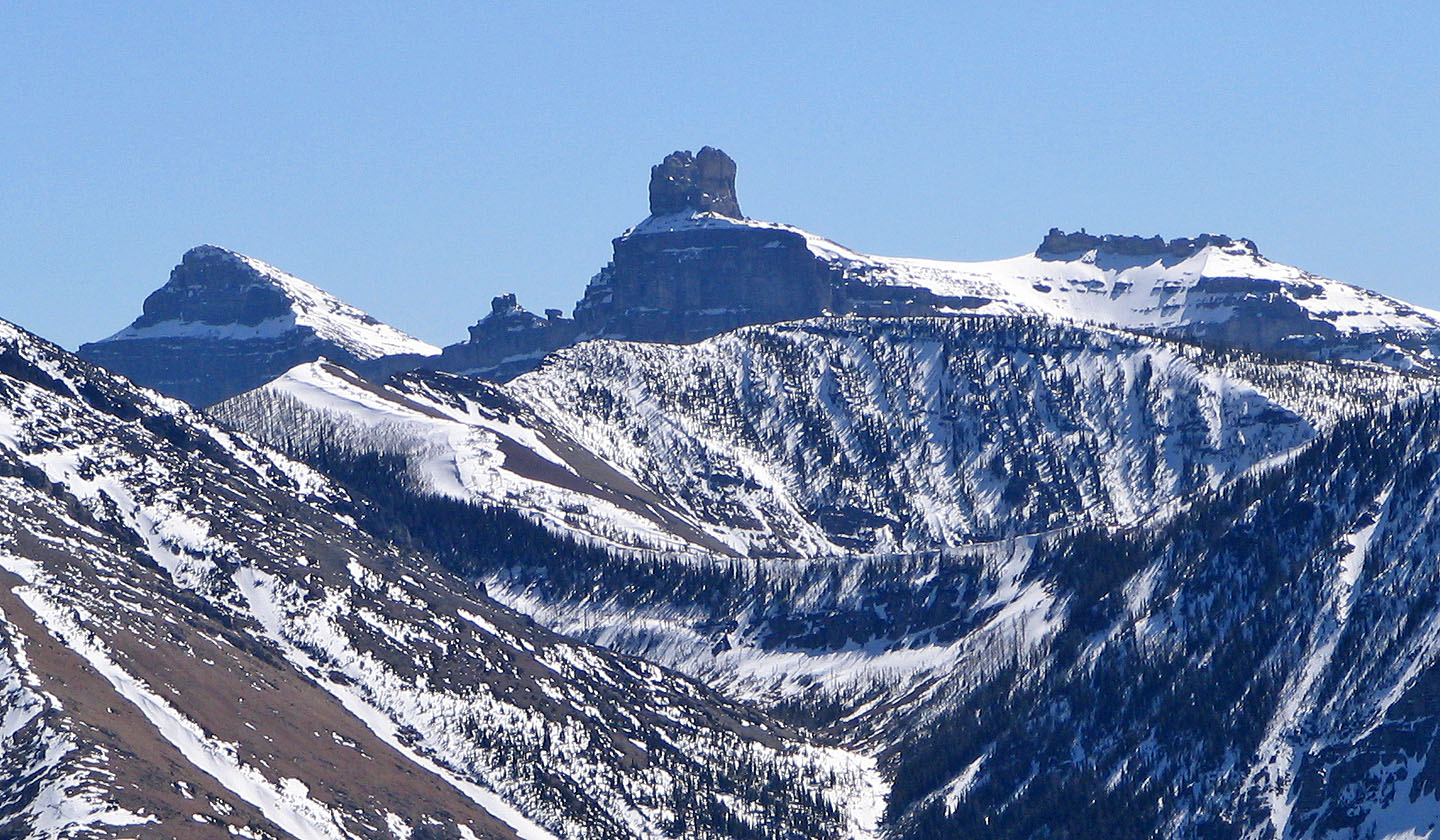
Castle Peak
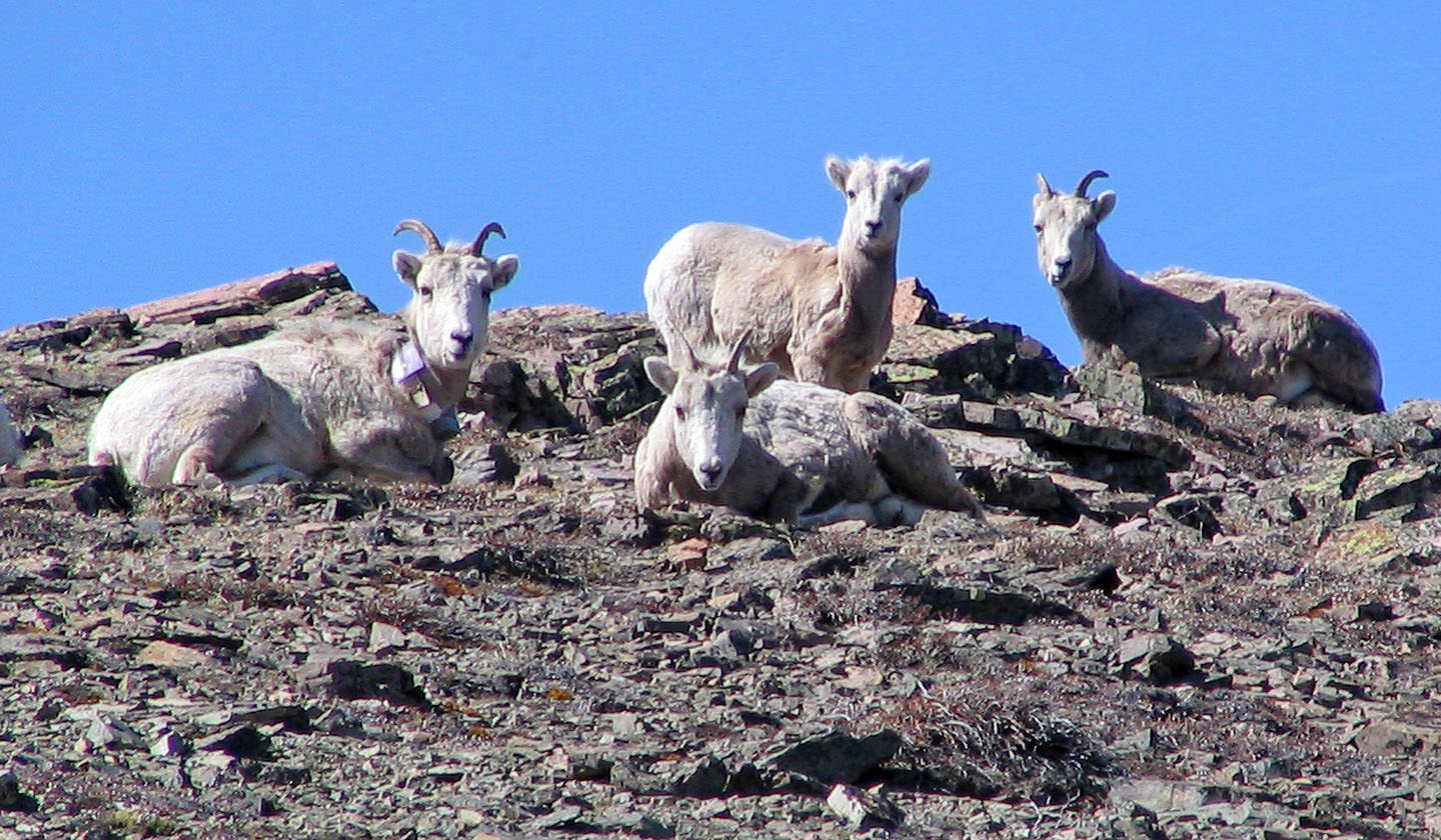
Mountain sheep relaxing on Table Mountain
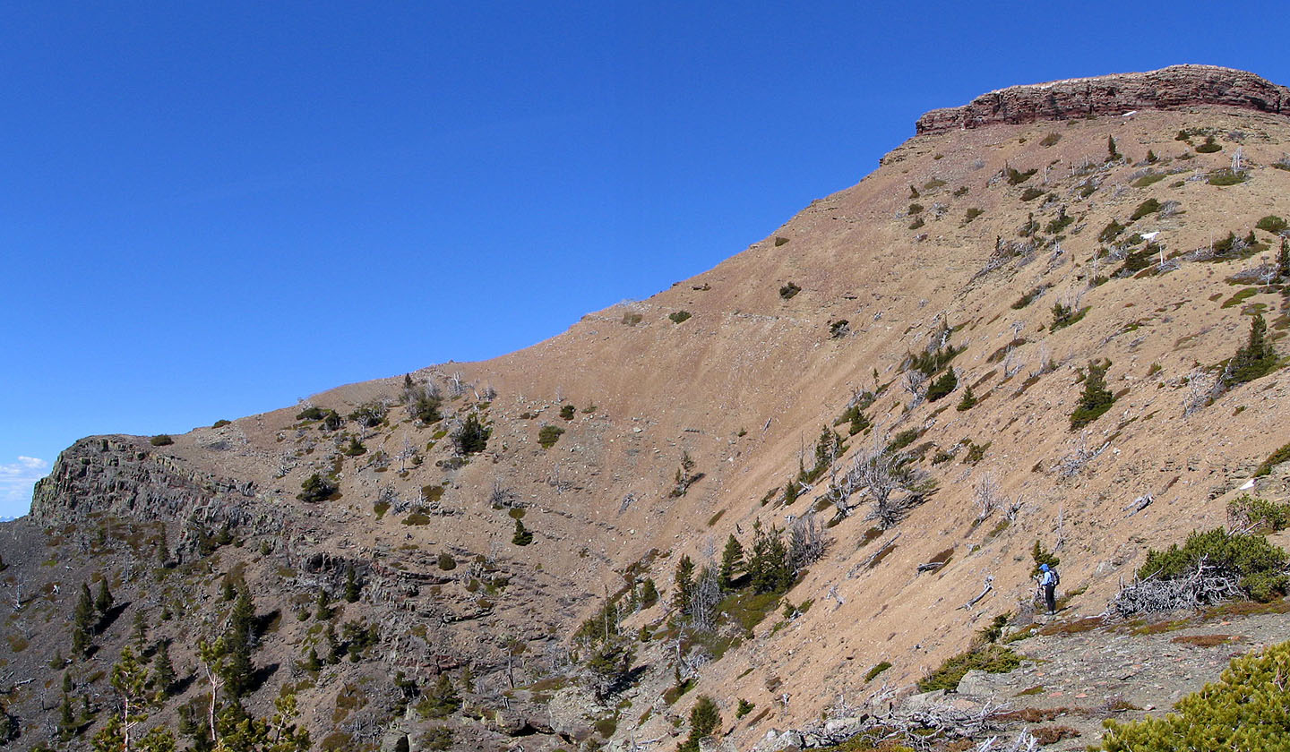
Heading back to the west summit
Instead of returning via the cliff band, we came down a scree slope east of the cliff band
 We made our way back to the ascent gully
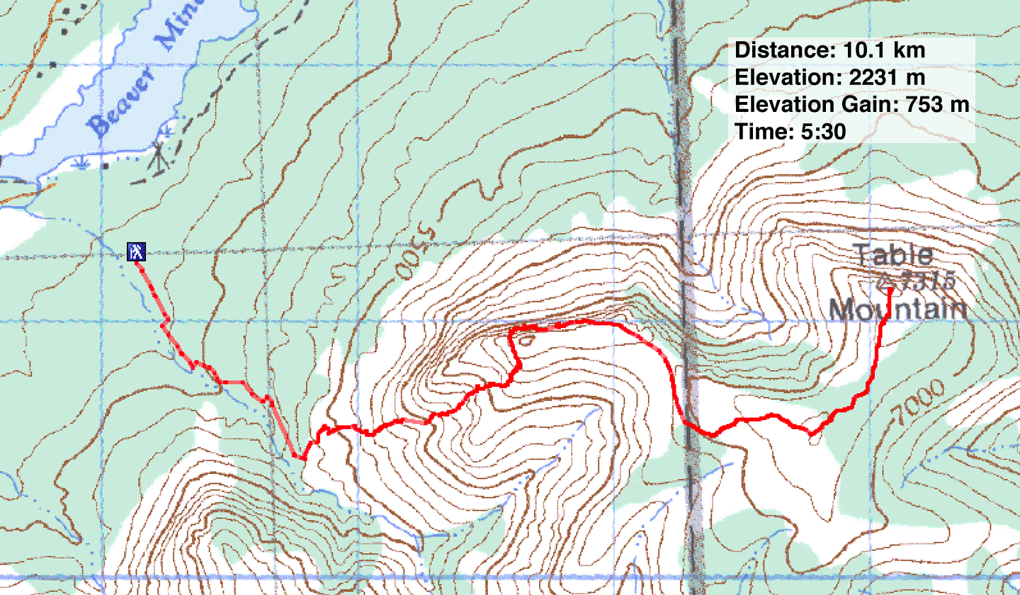
82 G/8 Beaver Mines (ascent route)