bobspirko.ca | Home | Canada Trips | US Trips | Hiking | Snowshoeing | MAP | About
Tent Mountain (North Approach)
Crowsnest Pass, Alberta
November 5, 2016
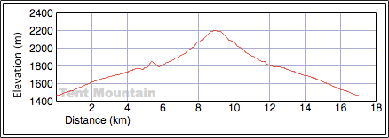
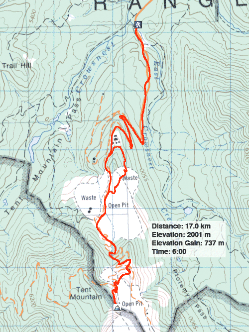
Distance: 17.0 km (10.6 mi)
Cumulative Elevation Gain: 782 m (2566 ft)
Tent Mountain is unlike any other mountain I've climbed. Thirty years of pit mining has carved up the slopes leaving a misshapen mass that no longer bears the profile of a tent for which it is named. Even after coal mining operations ceased in 1983, there still remain vast treeless tracts. On the upside, mining roads run almost to the summit, although not as straight as one would like. Tedious switchbacks demand patience from hikers.
This is my second time up the mountain. The north approach is the usual route, but in 2014, when faced with a road closure, Sonny and I reached the summit using an old mining road winding up the west slope, a route that worked surprisingly well given winter conditions. But for Dinah and I, Chinook Coal Road was open, so we drove 4 km to the trailhead to an old gate. A faded sign reads “No Trespassing,” but I learned from Dave McMurray that the sign ceased being valid after the mine closed.
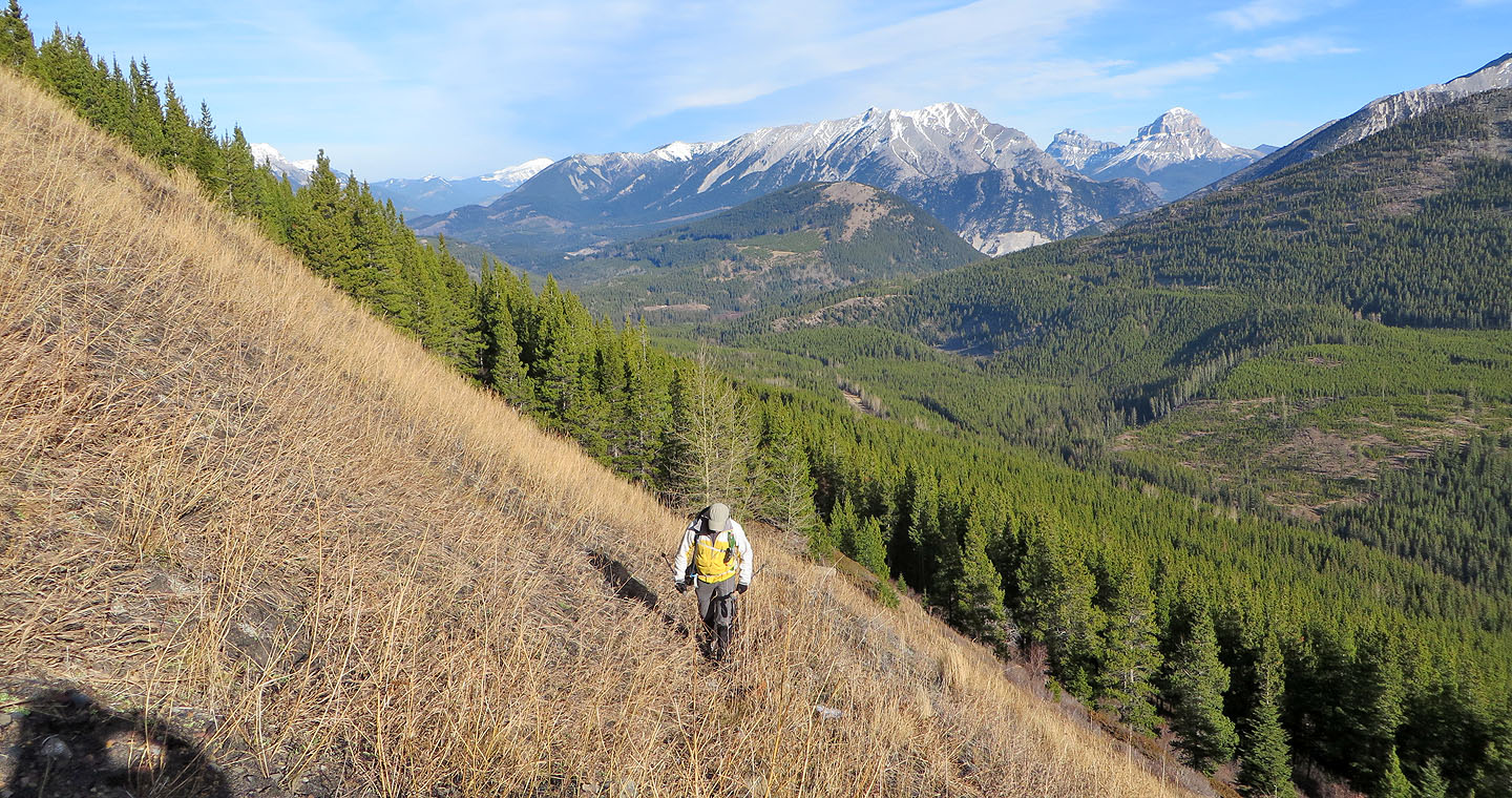
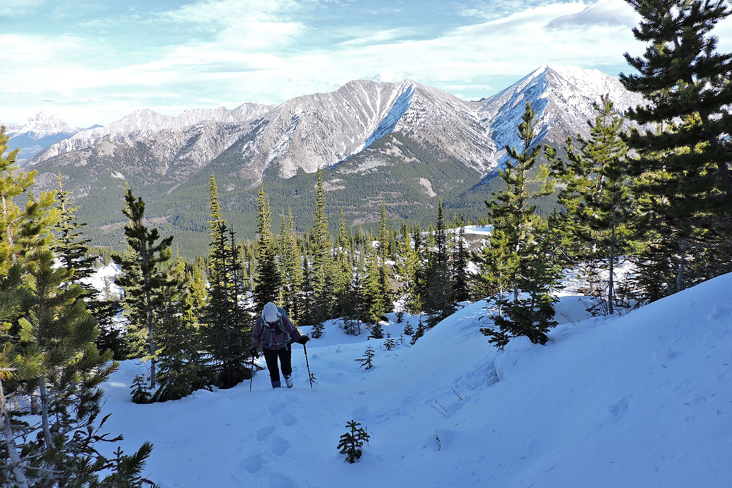
Dinah and I set off up the old mining road. After the first two klicks, we faced three long switchbacks. I was hoping to find a shortcut or two, but the cutlines shown on Google Earth turned out to be choked with vegetation. So on we trudged. After the last switchback, we left the main road, turning onto a short-lived side road that passes a large meadow where buildings once stood. At the end of the road, we followed a trail in a cutline, but after becoming snarled in thick bushes, we climbed a bit up the ridge to an old road.
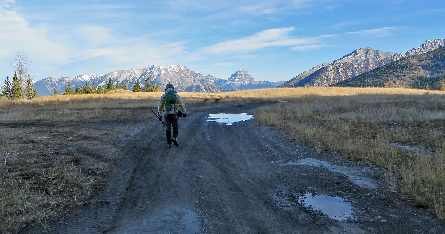
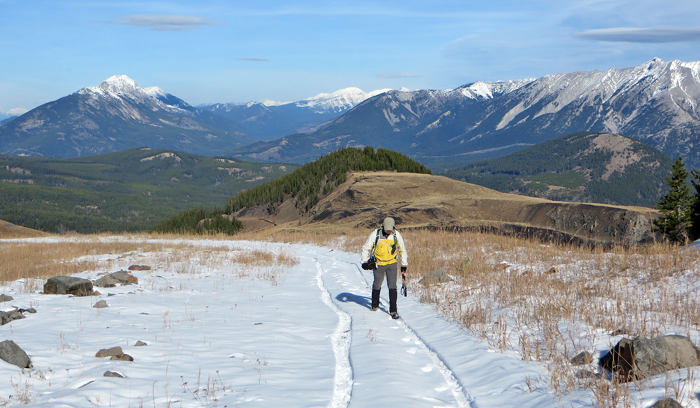
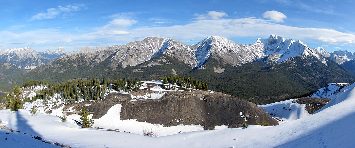
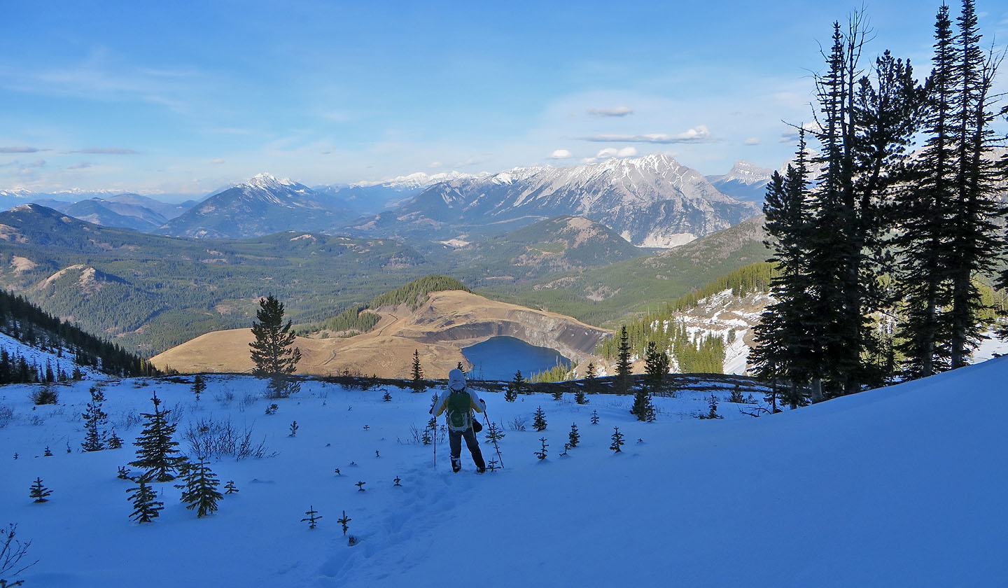
The road breaks out onto grassy slopes where we had the best sight of Tent Mountain, an iconic view unavailable had we stayed on the main road. From our vantage point high on a meadow, we had a sweeping view of Tent Mountain that included the striking terraced slope and the huge mining pit, now an artificial lake. The sheer scale of the old mining operation took our breath away. After taking in an eyeful, we dropped down the open slope, back to the main road.
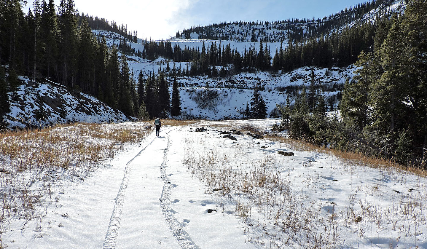
Up until the lake, we had been hiking in dry conditions, but when the road climbed above the lake we trod in a few inches of snow. And we faced more switchbacks. Where it appeared feasible, we took shortcuts. Eventually we ran out of road and were on the summit ridge, topping out just 300 m shy of the summit. We passed an outcropping and made our way through thin trees to the top of Tent.
After a short stay, we followed our footsteps in the snow back down the main road. After passing the side road we used for the detour on our ascent, a Jeep passed us, crawling up the road. I heard that it is possible to drive up the road, but where they access it is a mystery to me. We plodded down the unforgiving long switchbacks to our car.
I came away from Tent Mountain with mixed feelings. I was awed by the power it must have taken to reshape the mountain, but I was also appalled by the scar that mining left. Whether the transformation is viewed as a striking sight or an abominable blight, it’s bound to leave an impression.
Postscript: Mining operations have resumed on Tent Mountain and is no longer accessible to hikers.
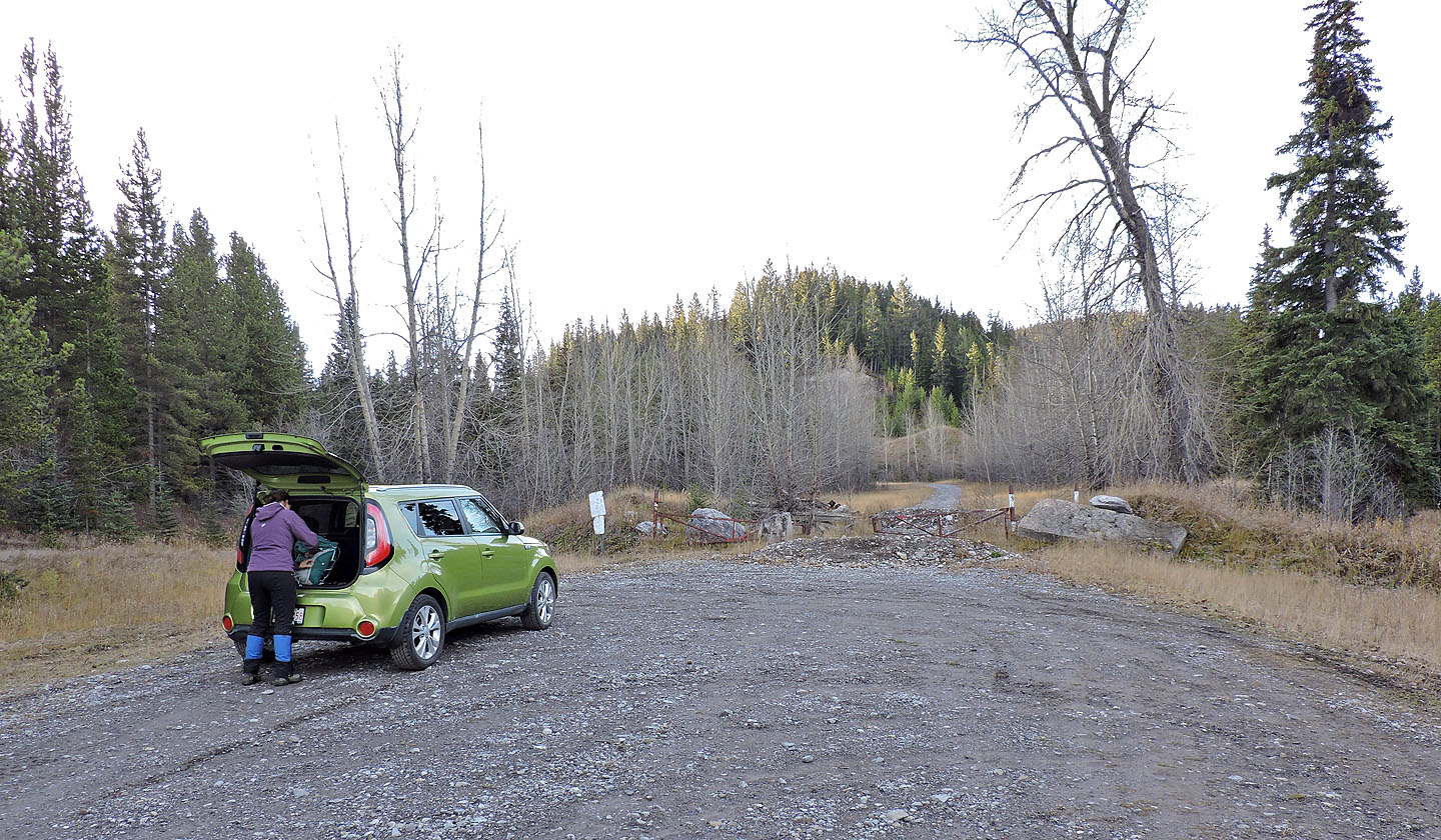
Trailhead
After walking for a few minutes we could see the excavated slope
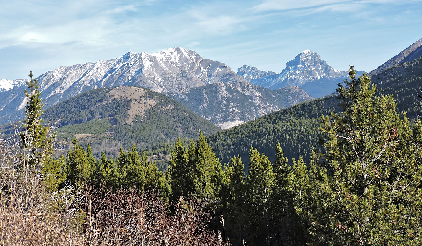
To the north on the skyline are Mount Tecumseh, Seven Sisters Mountain and Crowsnest Mountain.
Closer in are Island Ridge and Crowsnest Ridge.
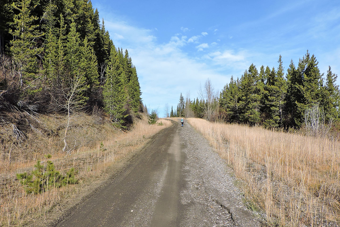
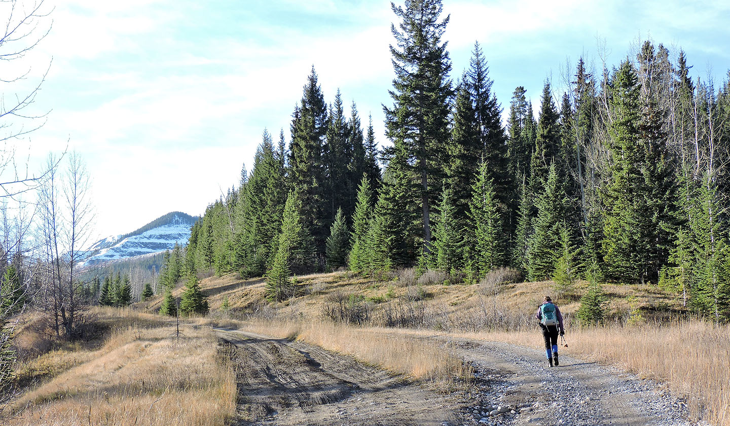
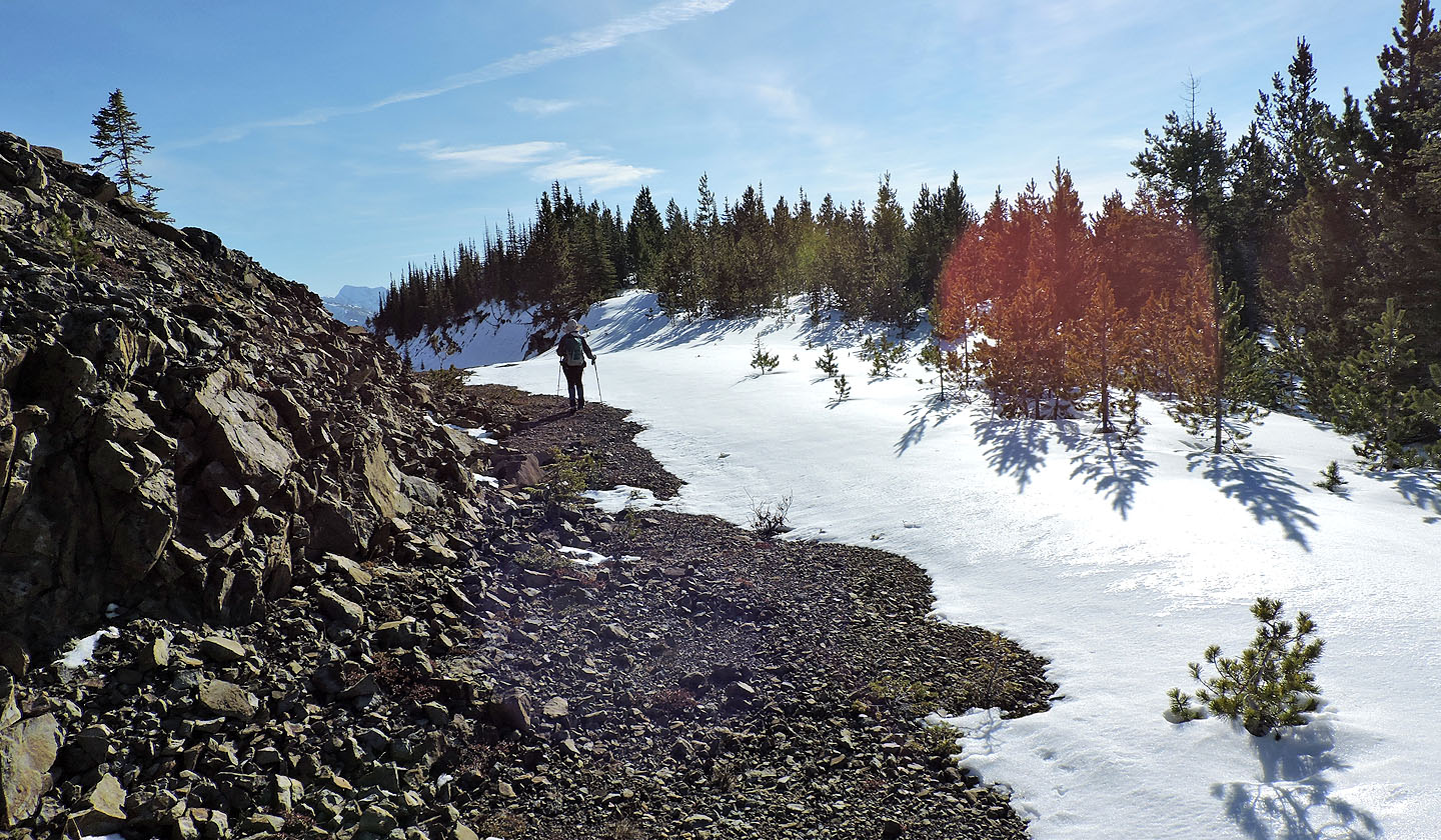
Mostly there are few views along the road
A side road leads to a flat section where buildings once stood
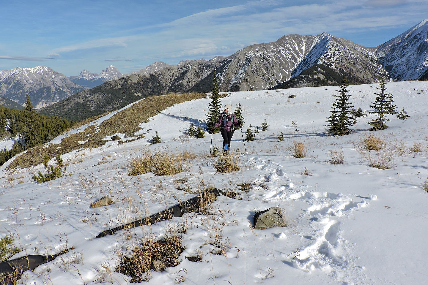
When the road ended we made our way to the grassy slopes
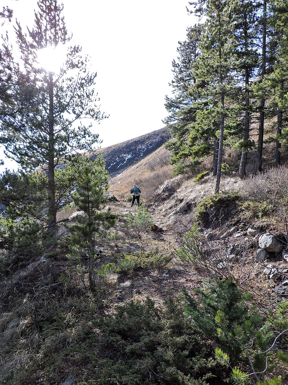
We followed an animal trail up the slope
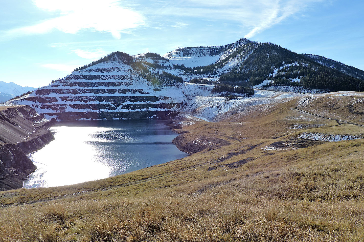
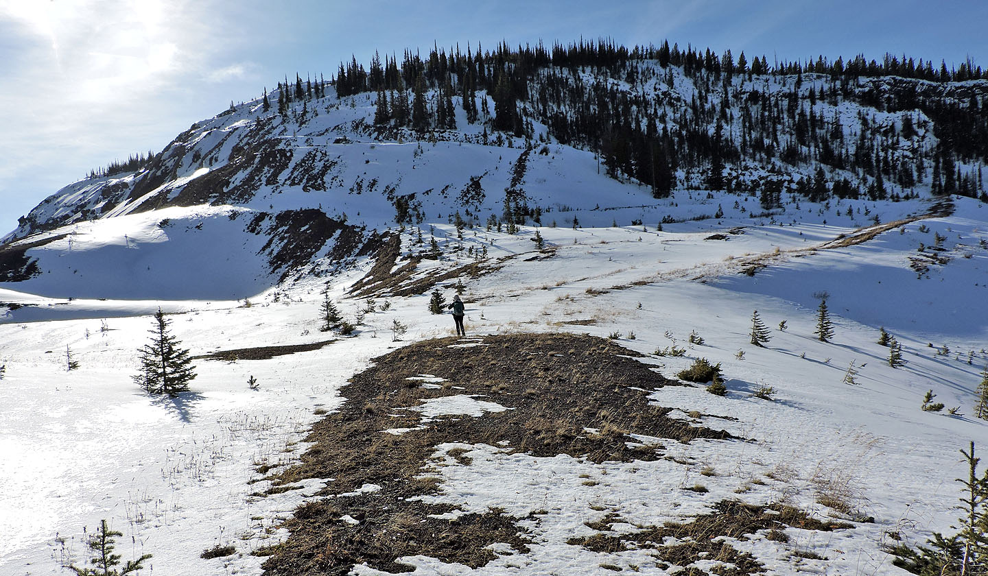
The detour from the main road made it worthwhile to take in this scene.
The summit is in the centre.
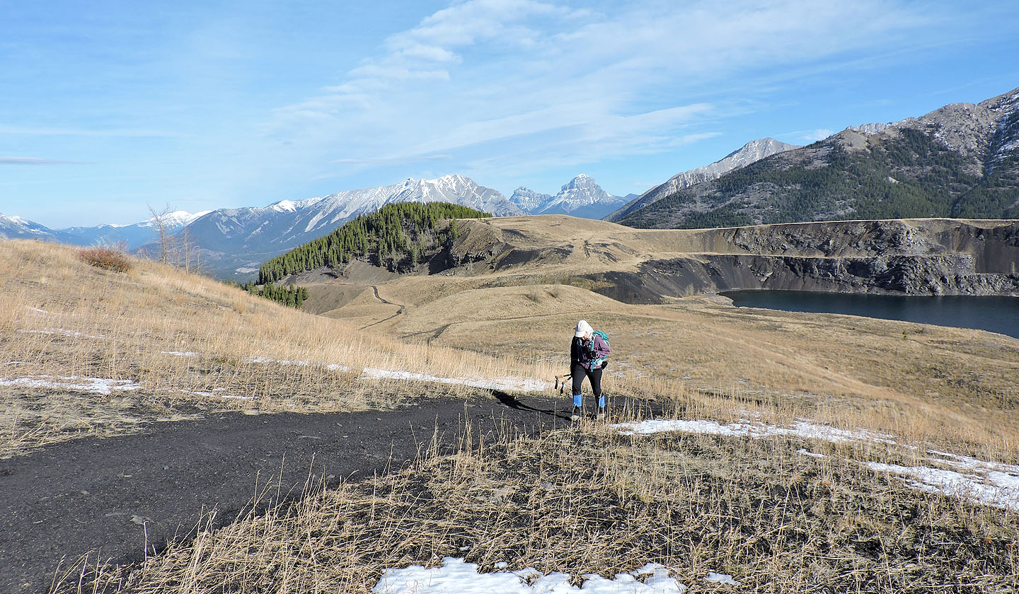
Back on the road. Behind is the high meadow that we crossed. The main road winds to the left of it.
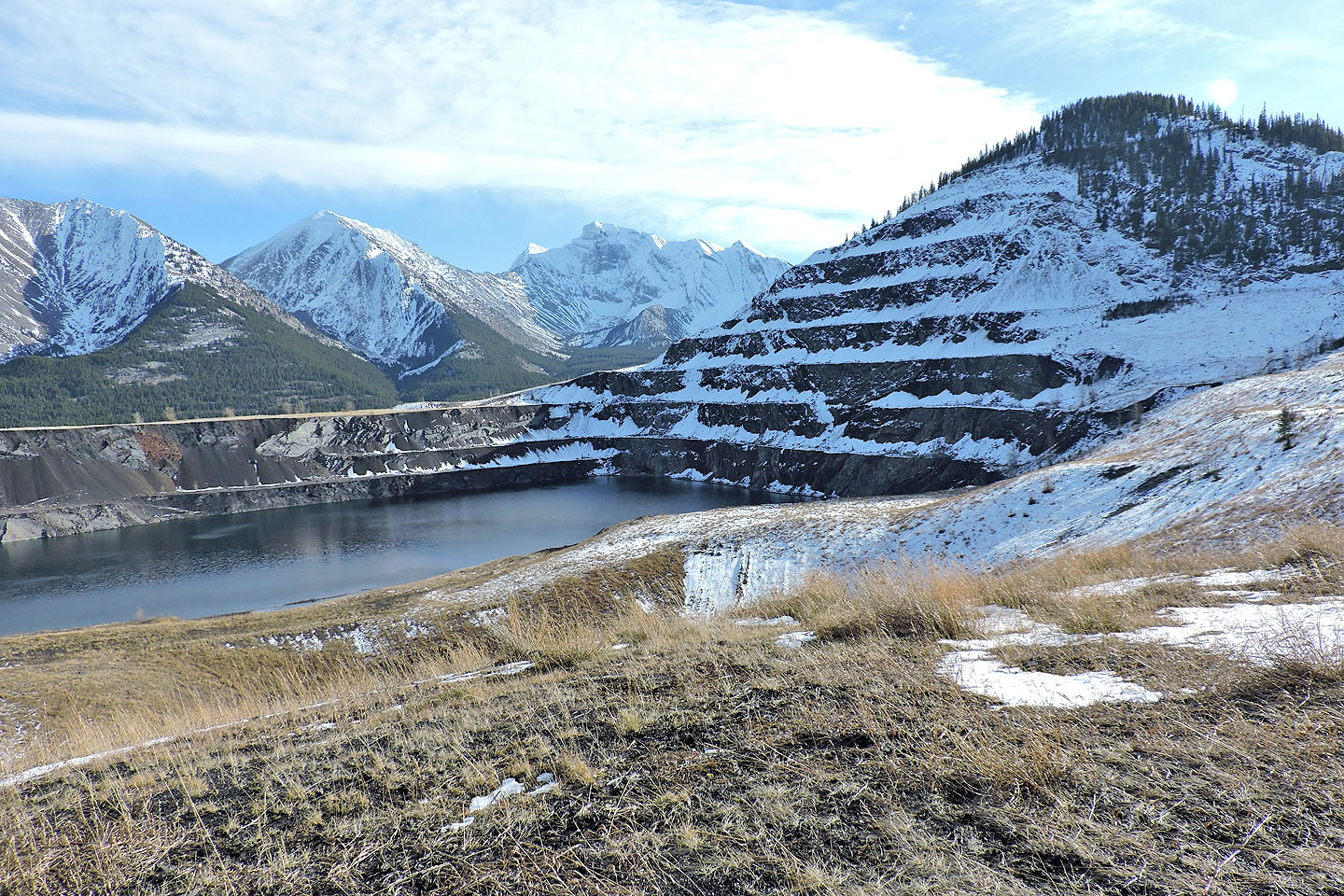
The road climbs above the lake
We hiked in snow for the rest of the ascent
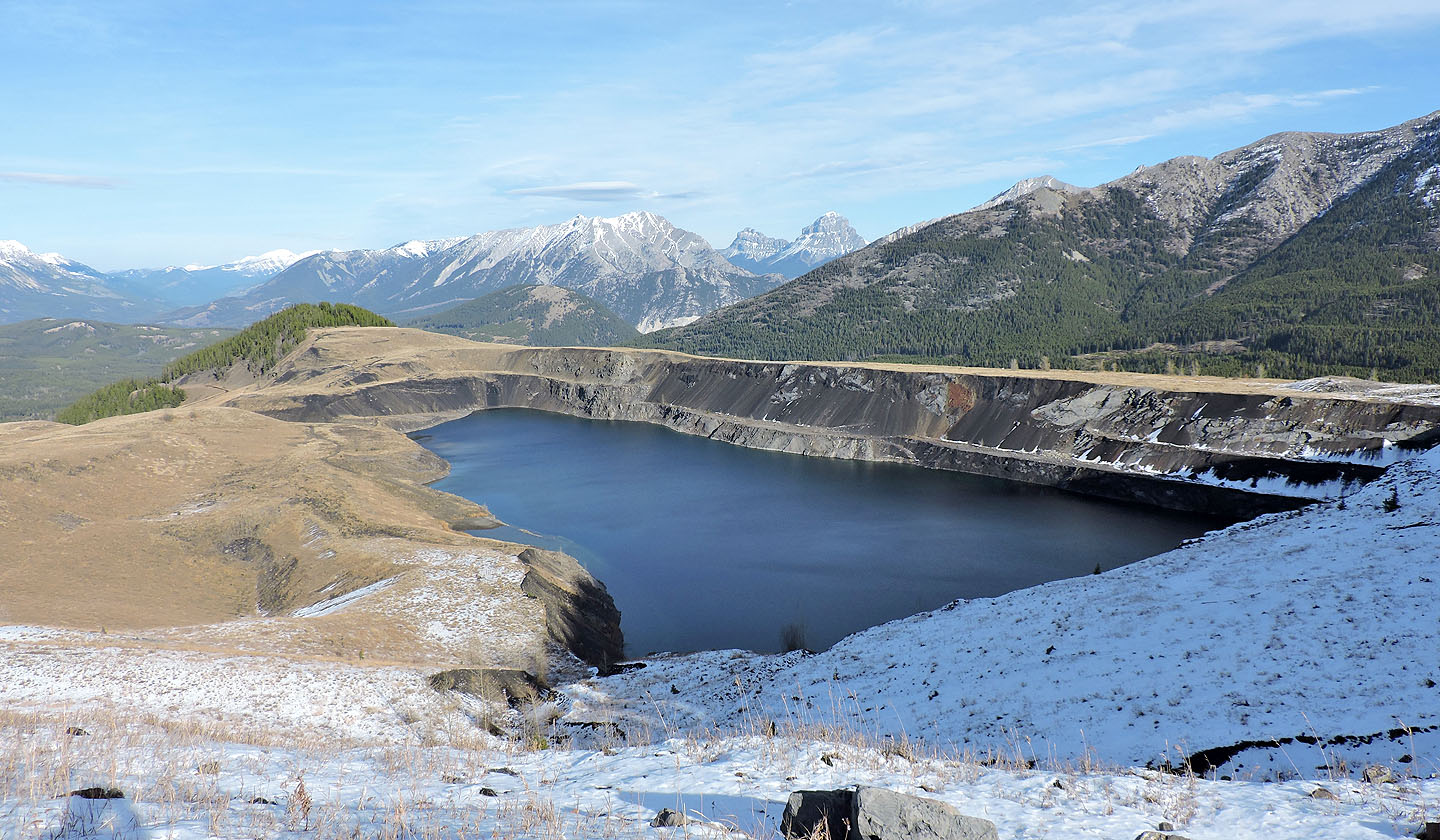
Looking back at the lake
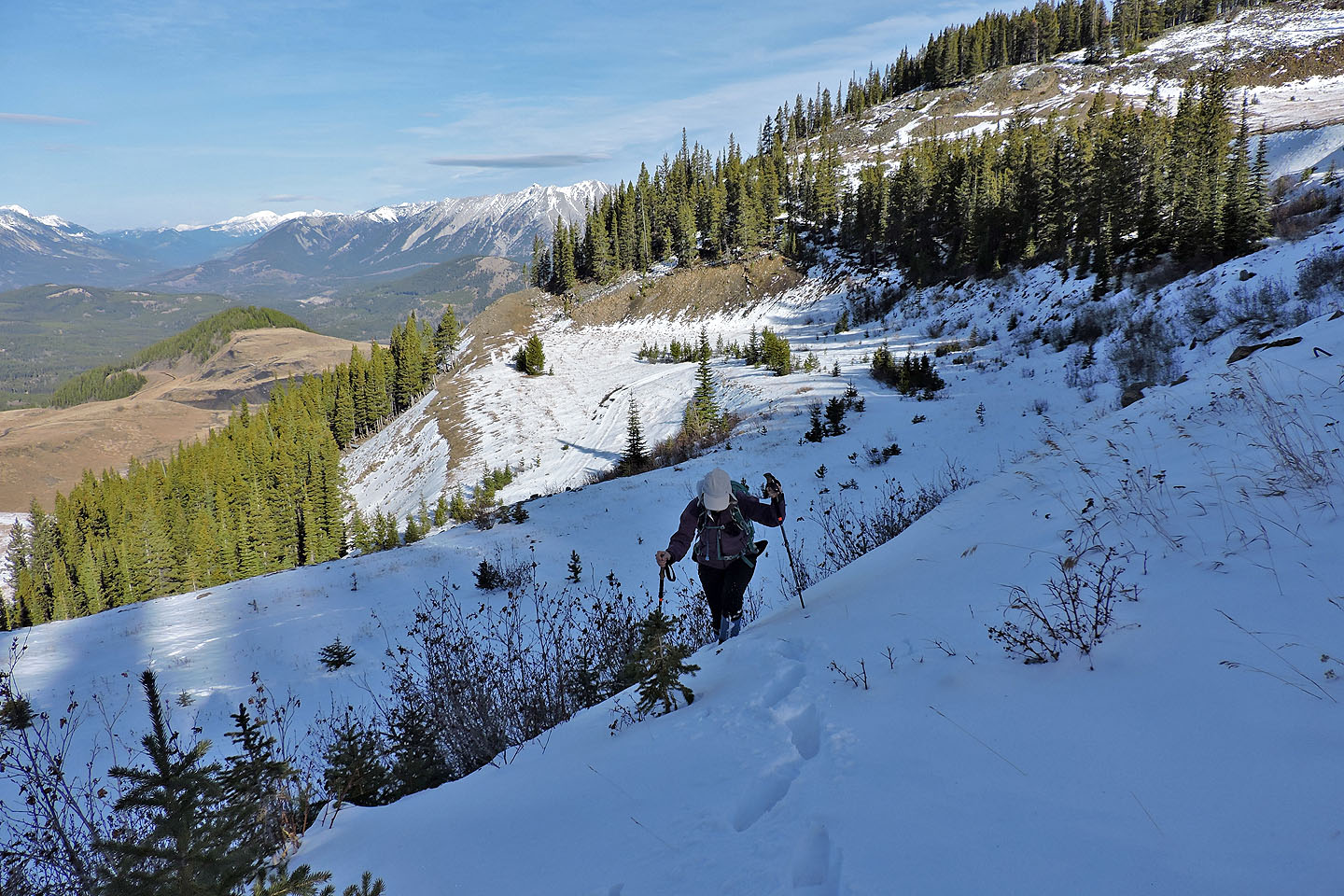
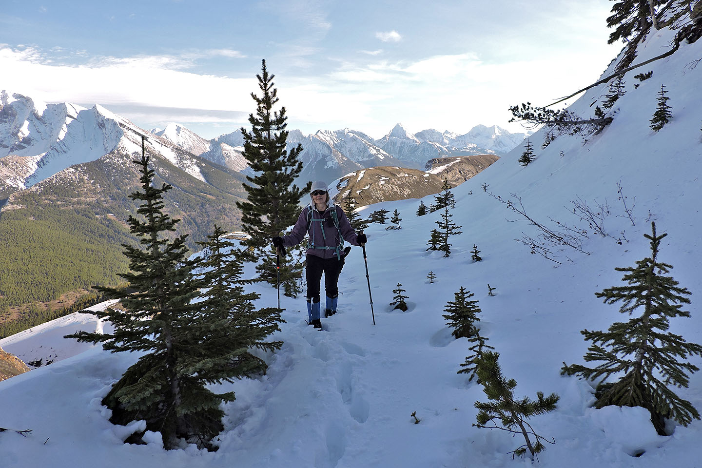
Below the summit are a series of switchbacks
Cutting through one of the switchbacks
On one of the turns we came across a steel pipe
Just below the summit the switchbacks became much shorter
Behind is the barren south end of Tent Mountain
Mount Ptolemy on the right
Coming up to the summit ridge
On the ridge, heading to the summit
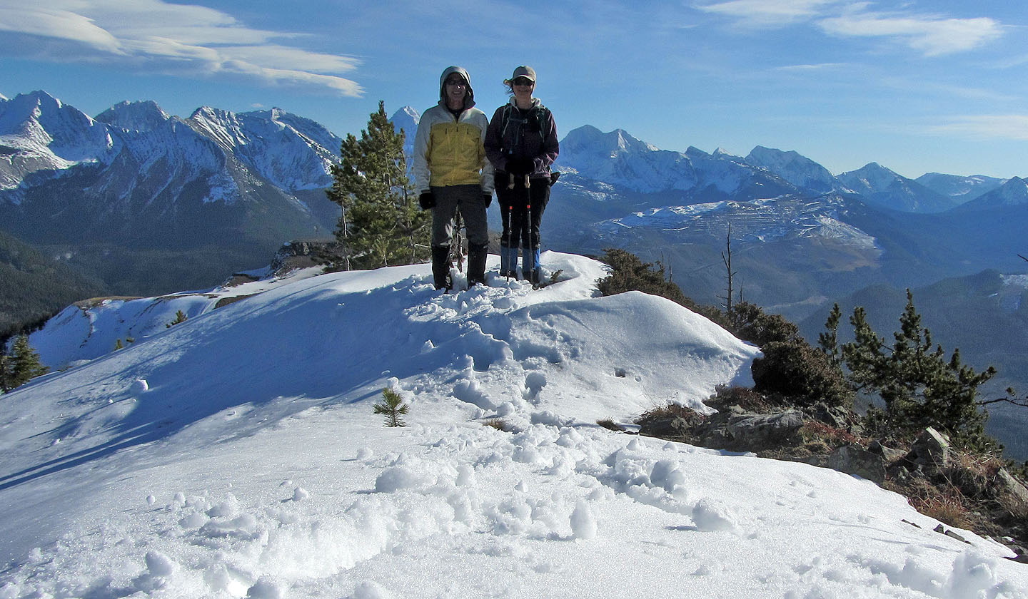
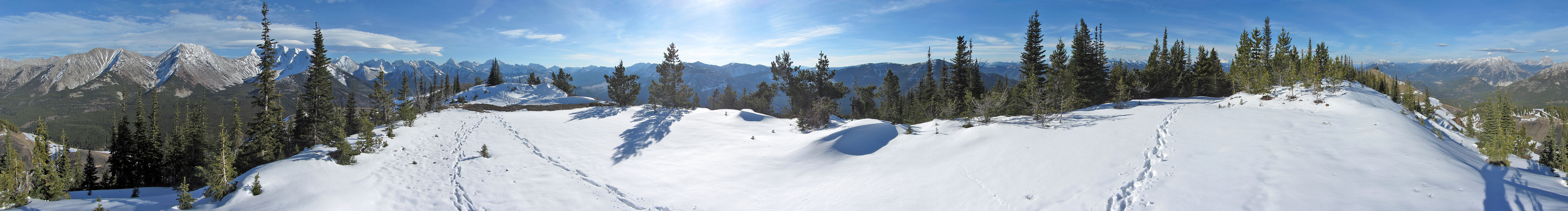
Standing on top of Tent Mountain
Heading back was a study in contrasts: shadow and light, snowy and dry terrain
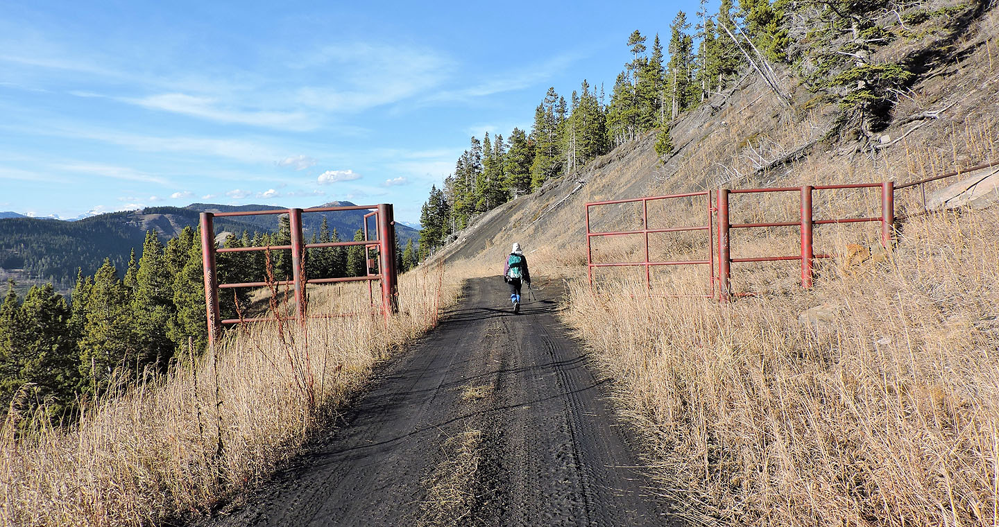
We followed the road back, passing through gates we missed when we detoured across the meadow
82 G/10 Crowsnest