bobspirko.ca | Home | Canada Trips | US Trips | Hiking | Snowshoeing | MAP | About
Ironstone Lookout / Willoughby Ridge
Crowsnest Pass, Alberta
June 6, 2015
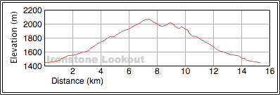
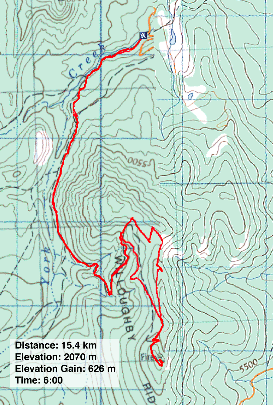
Distance: 15.4 km (9.6 mi)
Cumulative Elevation Gain: 675 m (2215 ft)
Ironstone Lookout sits on top of Willoughby Ridge, so if you achieve one objective you achieve the other. All it takes is hiking up a road and taking all the correct turns.
Following the driving directions in Hiking the Historic Crowsnest Pass, we followed York Creek Road and turned onto a side road just before the single-lane bridge. A short way in, we found a parking spot. Unlike the book's start, there was no bushwhacking and the log bridge has been replaced by a wood and metal footbridge. After crossing the bridge, Sonny, Dinah and I turned right and followed the road as it winds alongside York Creek. At the first fork, we kept left and climbed the road until it intersected the main road. We turned right and then went left at the next two forks. The last fork brought us to a gate.
After the gate, on the long stretch to a switchback, a mountain biker came from behind and flew past us, undaunted by the steep, rough road. We plodded on.
When we reached the switchback, we immediately gravitated to a bench there, not because we wanted to rest, but because it was such a queer sight on a mountainside. Painted white with pink hearts was bad enough, but the love essay was a bit much. However, the bench was a welcomed distraction from the monotonous tree-lined road. As we pondered how we were going to take photos of each other seated on the pretty plank, an ATV roared down the road and skidded to a stop next to us. The driver got off and approached us.
His name was Fred, and he just came from servicing the repeaters on Willoughby Ridge. Affable and a ready talker, he quickly filled us in. The bench is called Sarah's Bench, after past lookout observer Sarah Thompson. And the guy on the mountain bike, that was Troy. He was riding a loop. (A loop? That piqued our interest.) Before leaving, he snapped photos of us on Sarah's Bench with our cameras. Then he jumped on his quad and disappeared down the road. We continued trudging up.
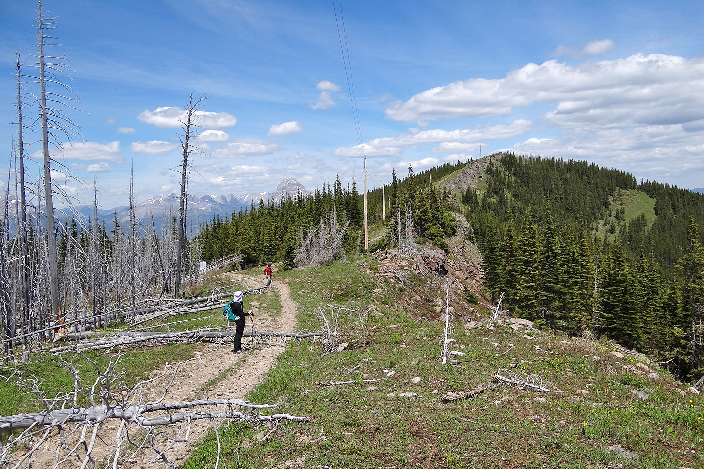
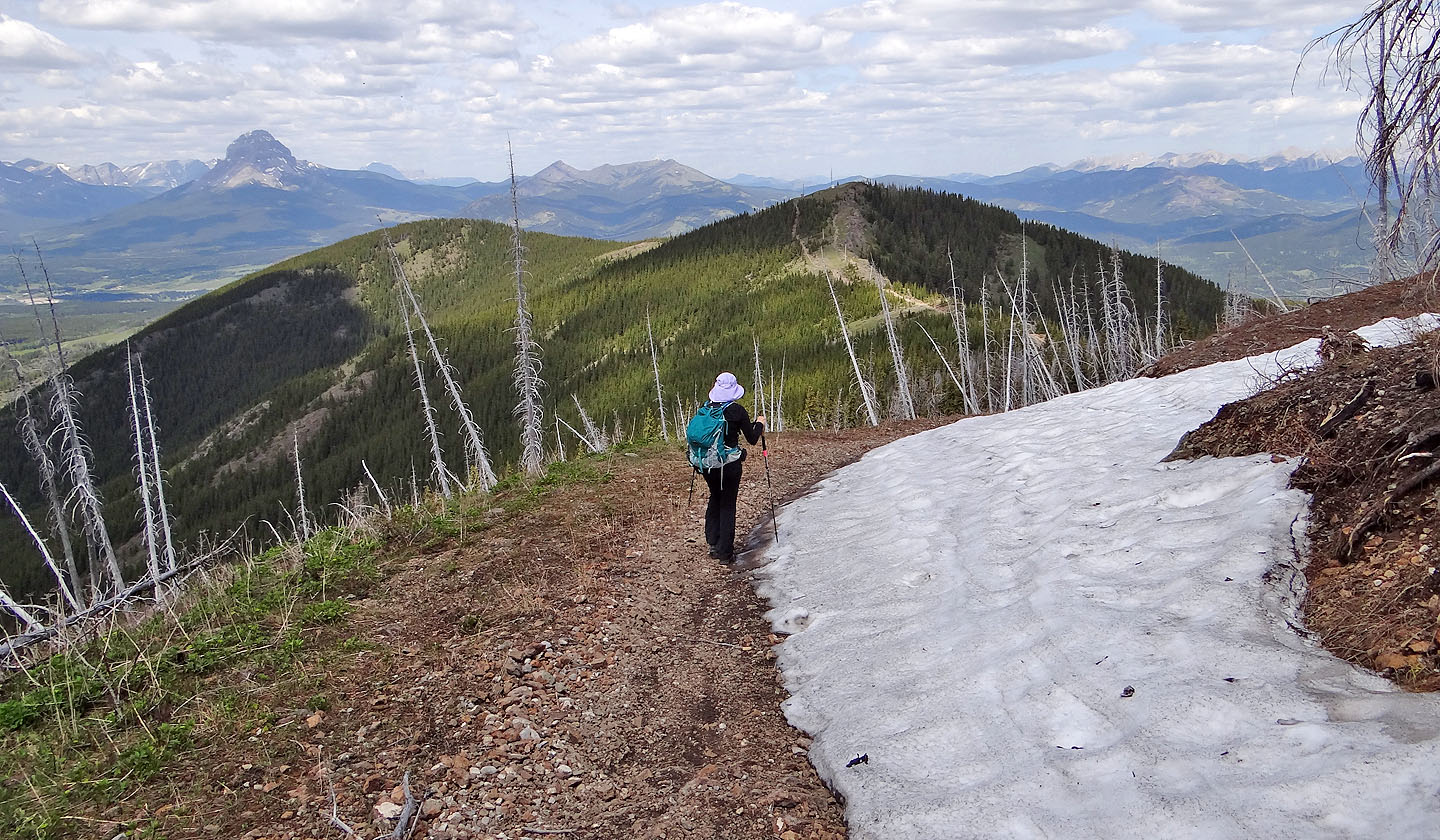
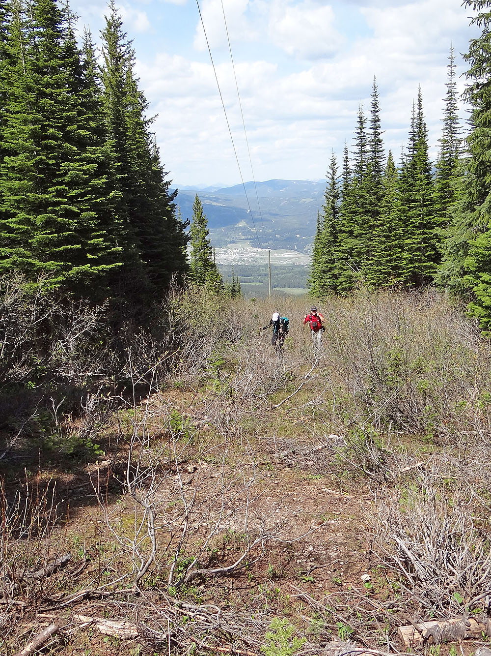
Until now, trees withheld expansive views, but after Sarah's Bench, the mountainside opened up, and we had a stunning look at the Flathead Range. A short time later, we reached the col that connects the north and south summits of Willoughby Ridge. Ironstone Lookout is on the higher south summit, and that's where we went.
When we got there, the lookout observer, Steve, along with his companion Linda, wasted no time in greeting us. Like Fred, Steve was cheerful and chatty. Clearly he loved his mountaintop job and enjoyed talking about it. This was his fifth season. Afterwards, Sonny, Dinah and I departed and dropped down below the lookout to have lunch while taking in the snow-covered peaks around us.
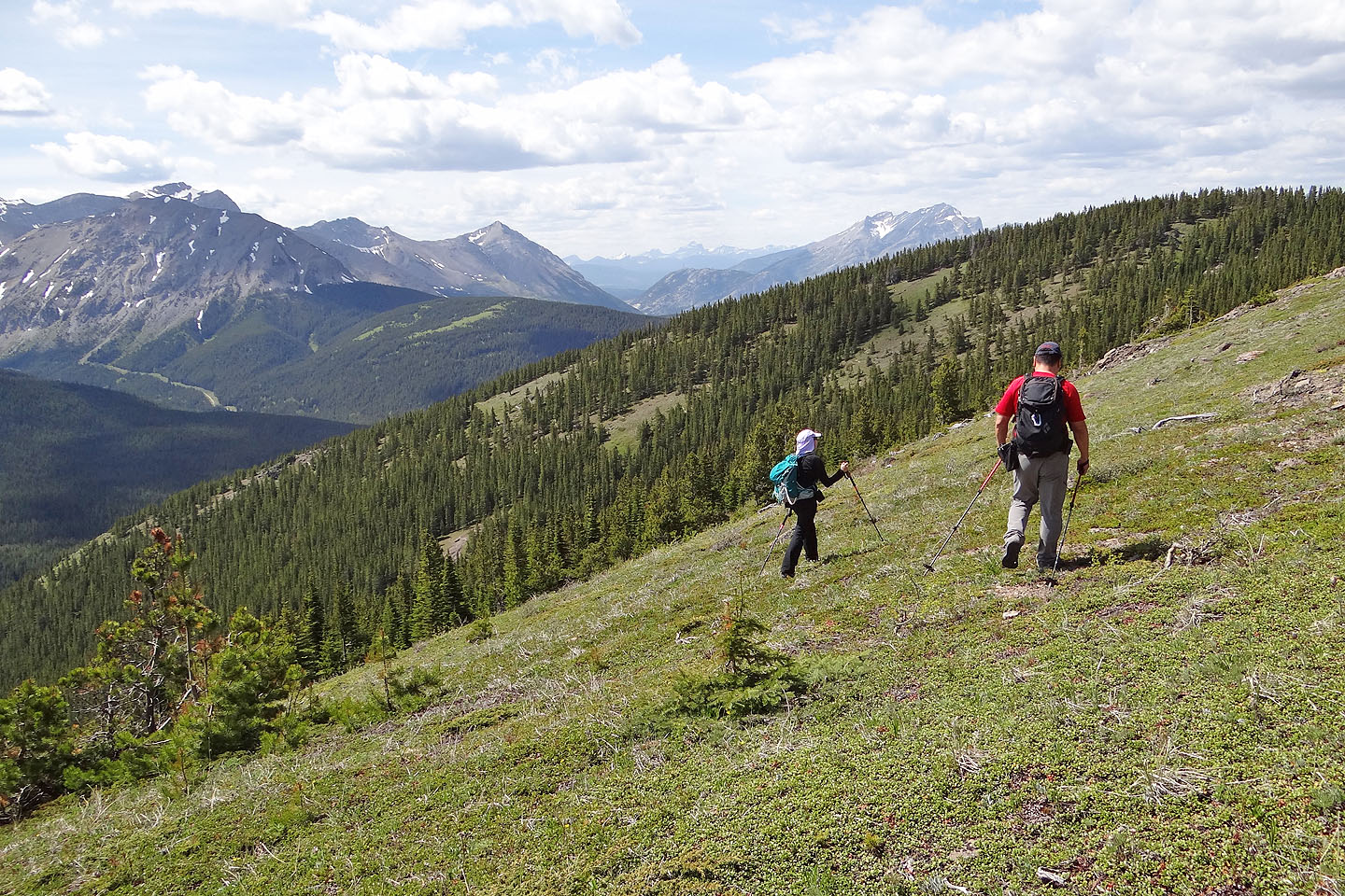
When it was time to head back, Sonny suggested we hike up the north summit, easily accessed by a road. We hadn't seen Troy, the mountain biker, so we assumed the loop he was doing must have included this road. There seemed nowhere else to go, and we were curious where he went. We followed the road over the north summit, but strangely it ended abruptly at a cutline choked in bushes. There was no trail. Troy didn't come here. We had passed an obscure side trail well back, but it dropped off on the other side of the ridge.
Rather than retrace our steps back to the col, we thrashed up the bushy cutline to a clearing. We started heading to Willoughby's northwest ridge but soon changed our course to Sarah's Bench as it was only 200 m away. After some easy bushwhacking, we were back at the garish seat. As we hiked back down the road to our car, occasionally stepping aside to allow quads and dirt bikes to pass, we were left with a burning question: where did Troy go?
Postscript: Nine months after posting my trip report, I heard from Troy:
Hi Bob,
Great to read your trip reports and see you out on the trails. I like to mountain bike, hike and backcountry ski. A friend sent me the link to your Ironstone Lookout trip. I am the mountain biker who passed you on your hike. You were on my route when you followed the old road which heads north over the middle summit. Before this road turns left (west) and becomes choked with smaller trees, you turn right onto a small established singletrack trail. This trail will bring you down the north side of the Willoughby Ridge and out into some newer cut blocks just above the quarries up York Creek road. It can make for a nice loop instead of an out and back. It is a 20km loop from the start of York Creek Road. Hopefully this answers your burning question!
Happiest Trails,
Troy
Sonny's Trip Report
KML and GPX Tracks
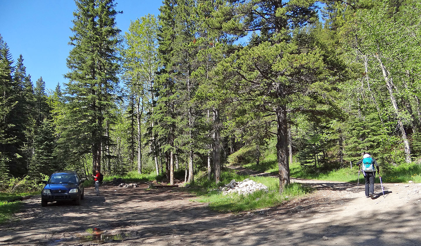
The footbridge is a stone's-throw from the parking lot
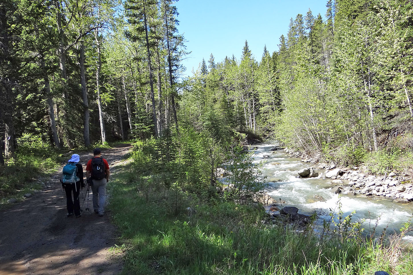
The route follows York Creek for 800 m before turning left
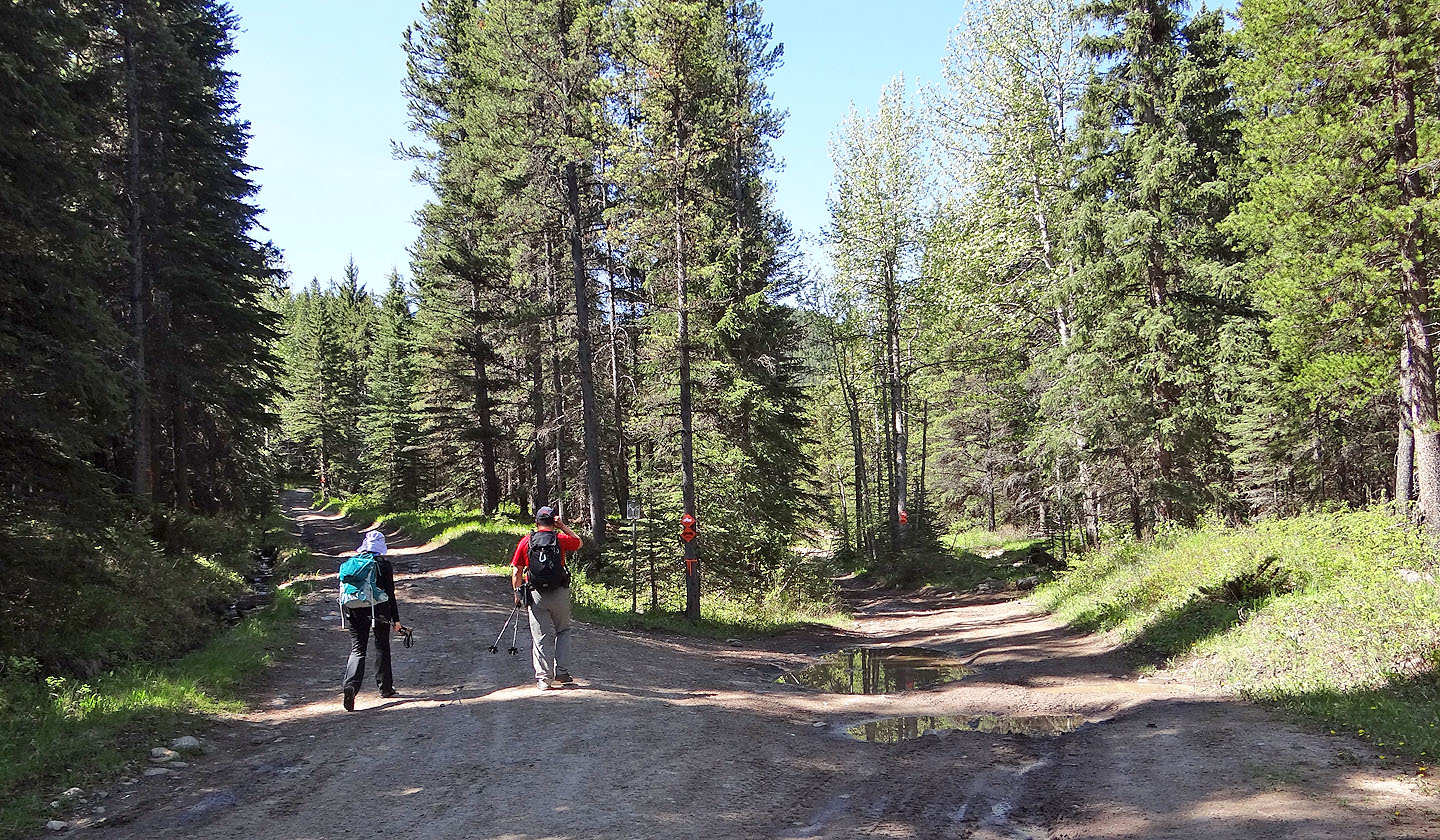
Starting up the first fork. It soon runs into the second fork, the main road, where you turn right.
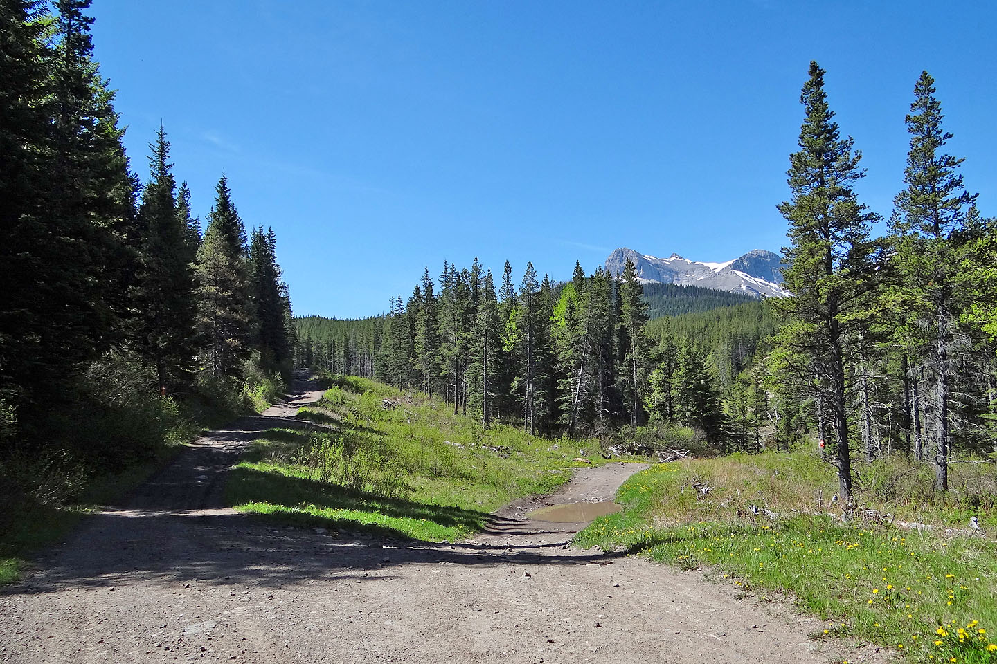
Keep left at the third fork. The right fork leads to Mount Coulthard seen in the distance.
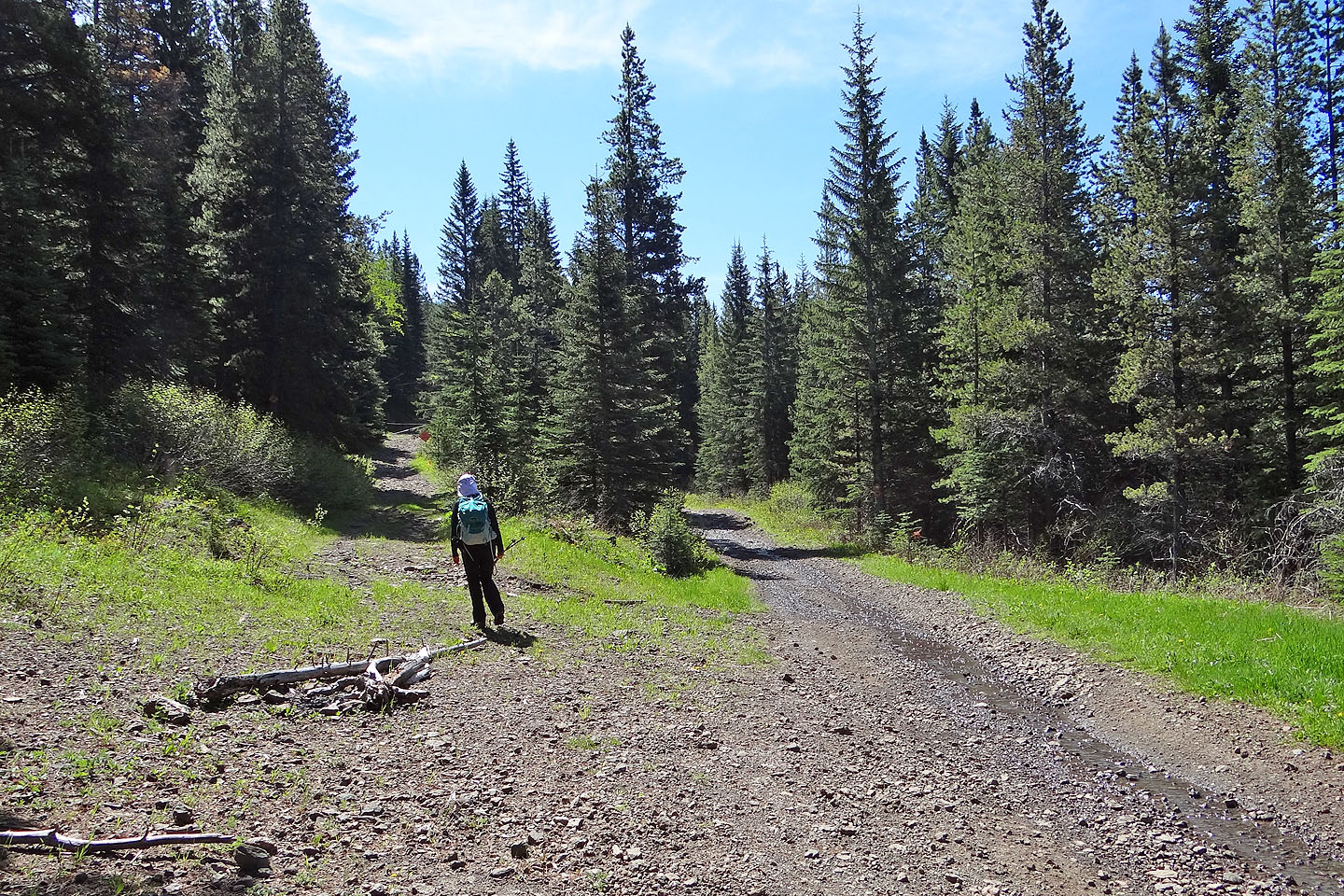
Keep left at the fourth fork. A gate bars ATVers, although they've found a way to get around it.
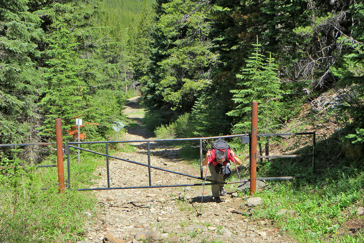
Sonny crouches to get through the gate
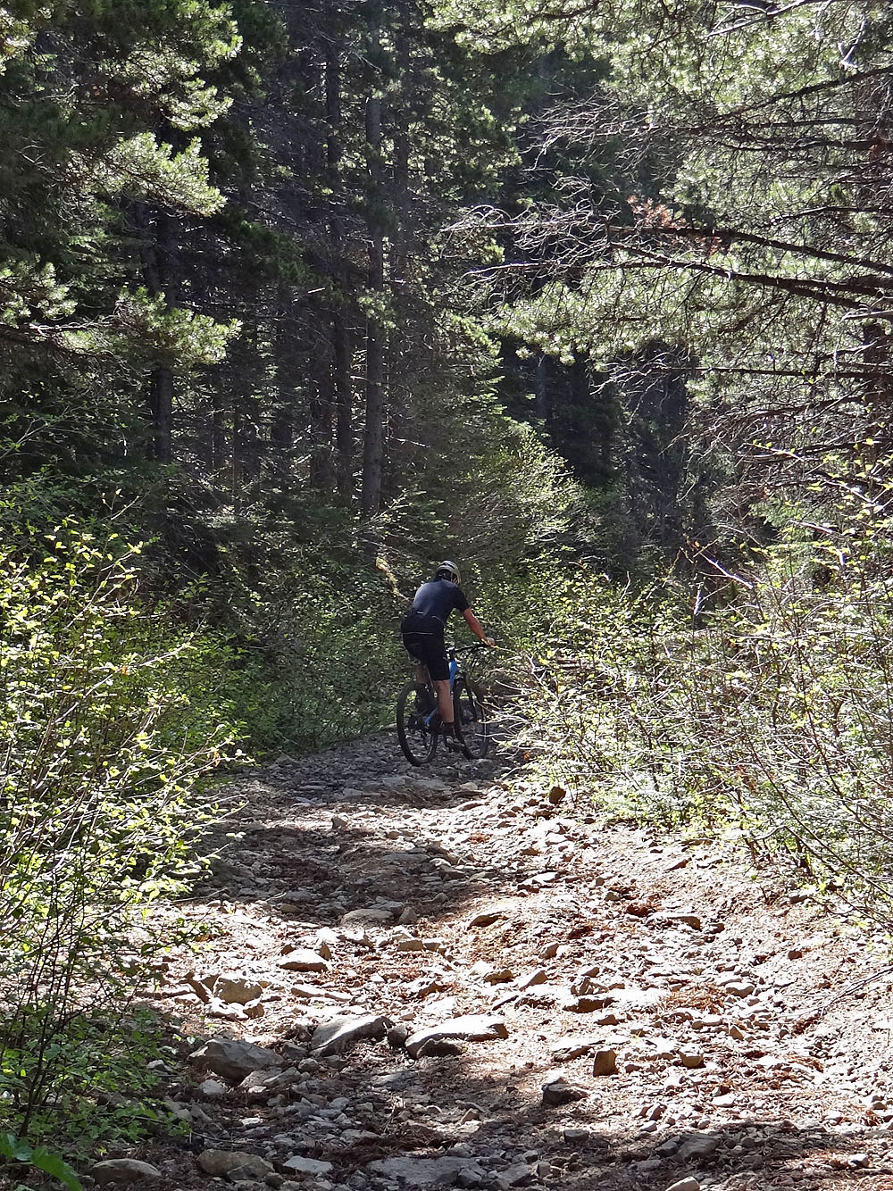
Troy zipped past us on his mountain bike
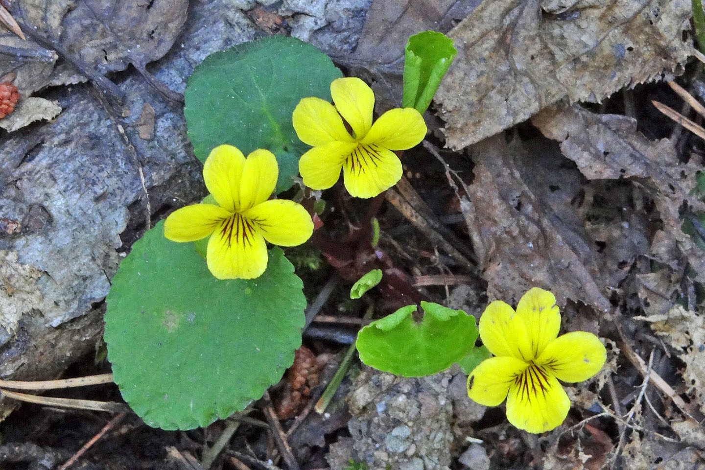
Evergreen violets lined the road
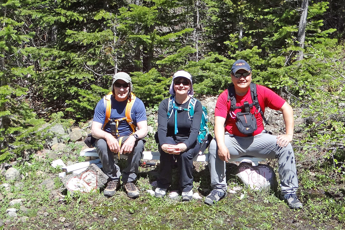
Seating on Sarah's Bench (the support rocks say "ME" and "YOU")
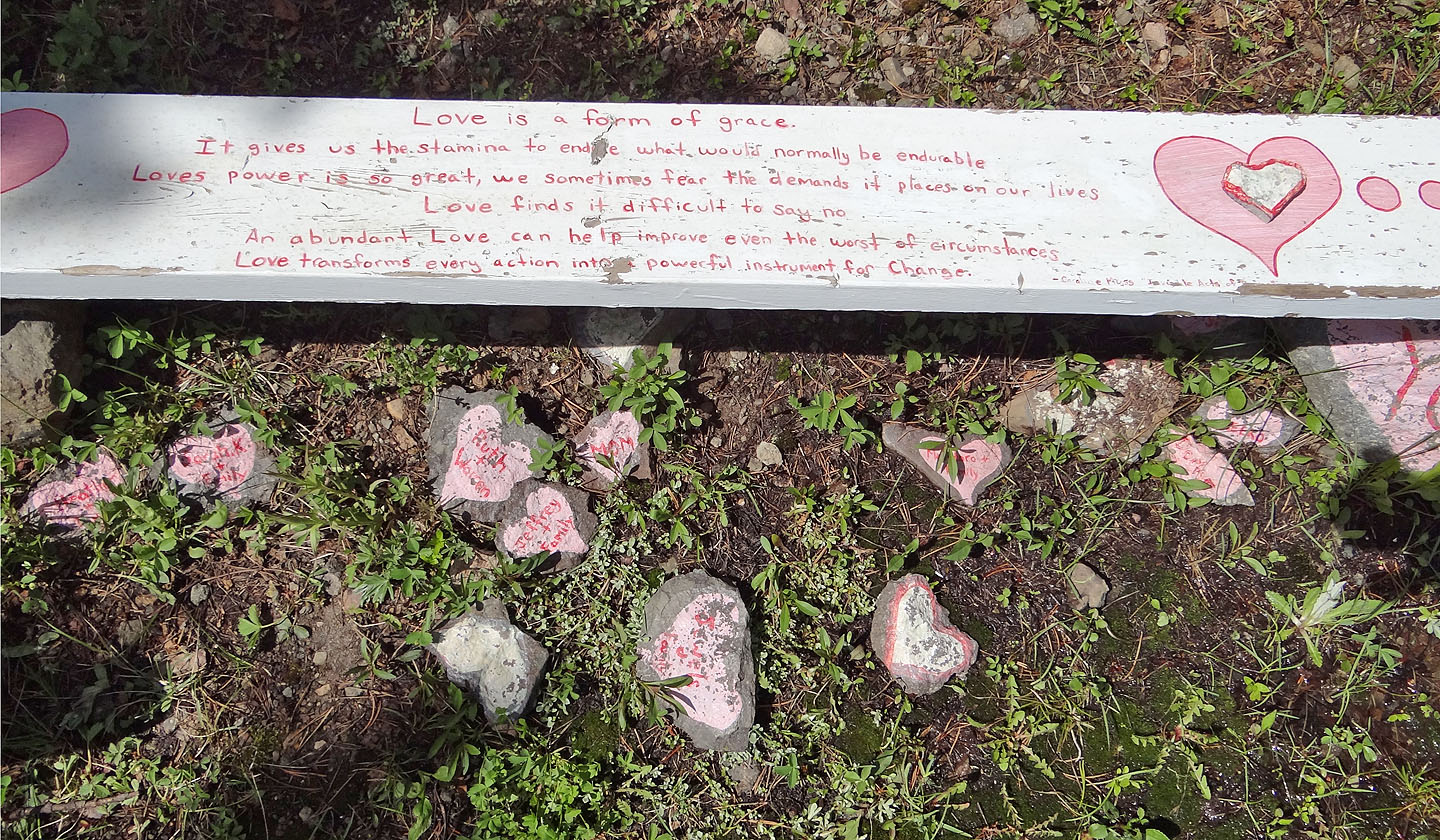
Under the bench, rocks displayed names (mouse over)
After turning a corner we saw the ridge
The second bench was destroyed by ATVers
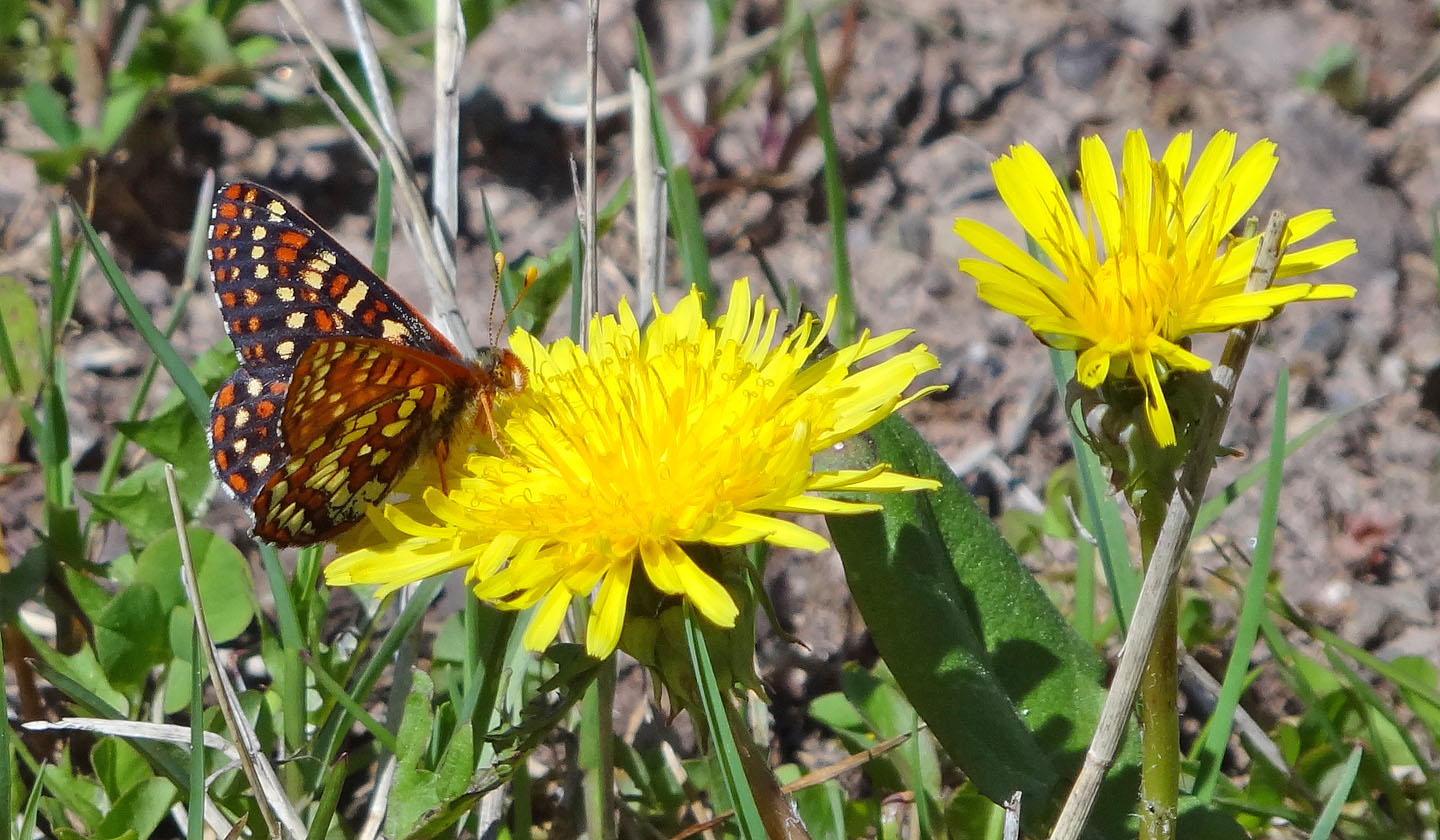
Anicia checkerspot on a false dandelion
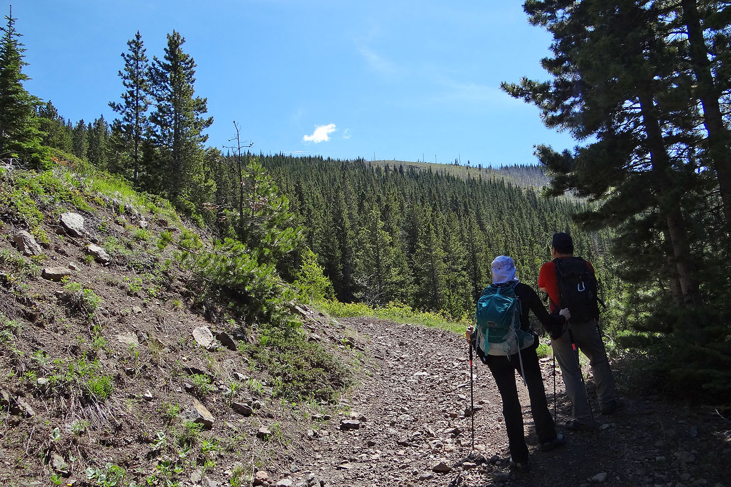
Sonny pauses to take a photo
After reaching the ridge, Sonny and Dinah stopped to eye the lower north summit
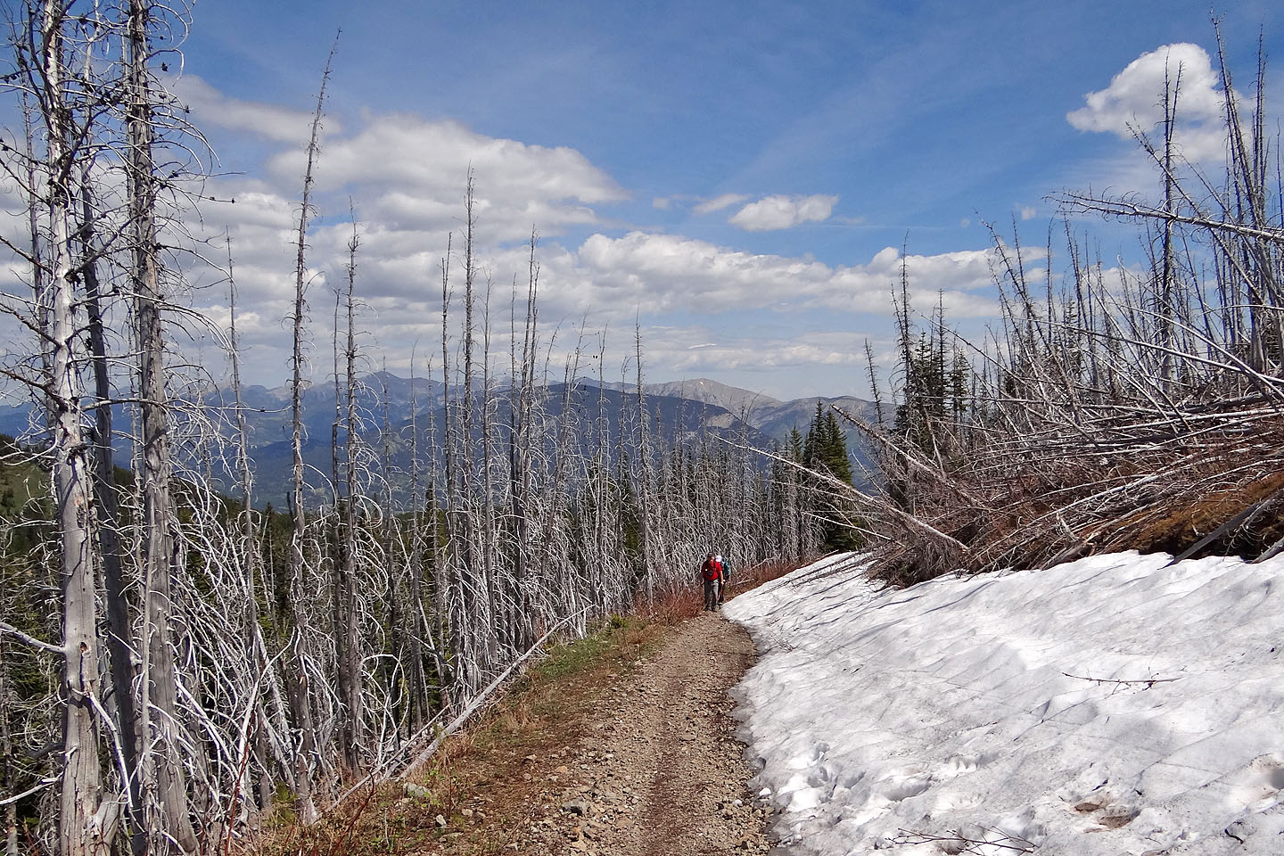
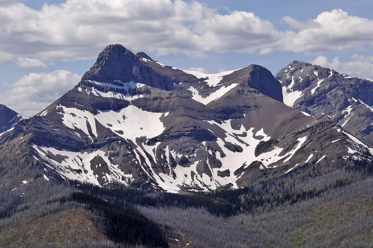
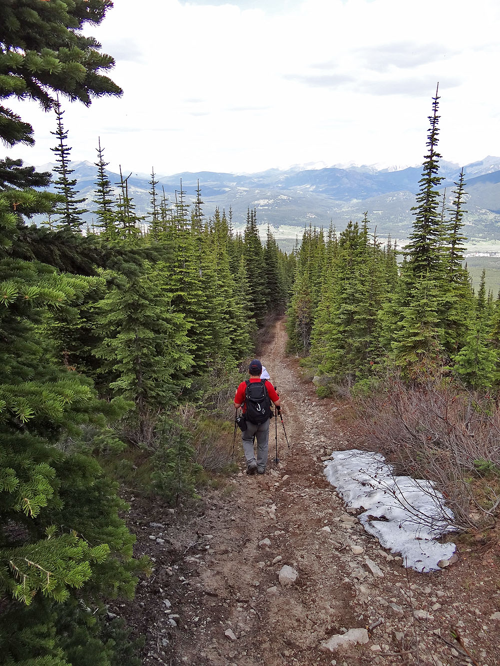
Dead trees and persistent snow lined the road below the lookout
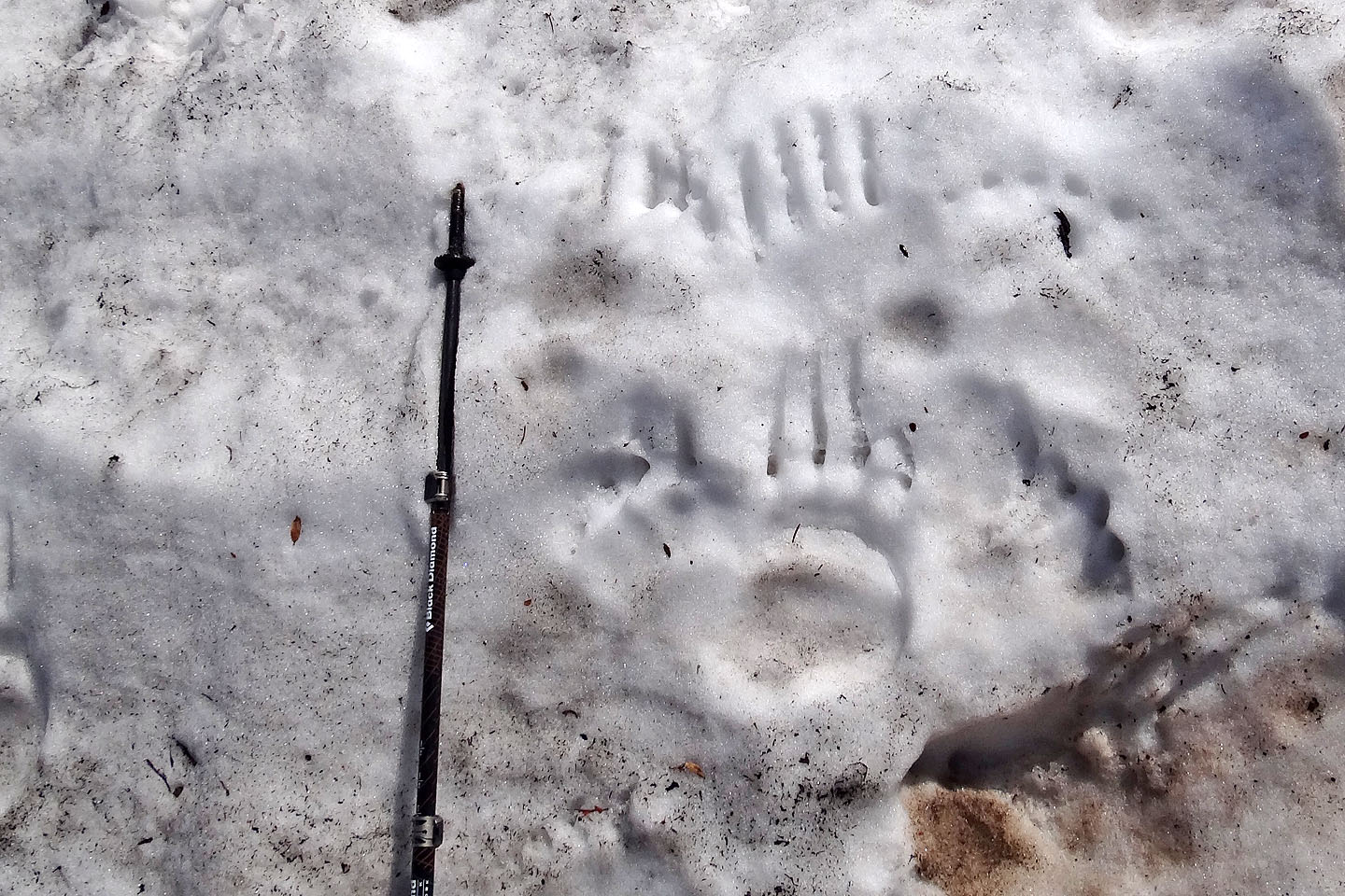
Despite ATV activity, there are bears here
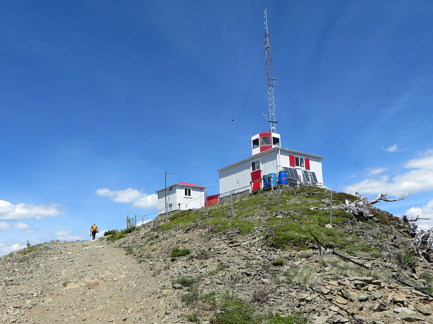
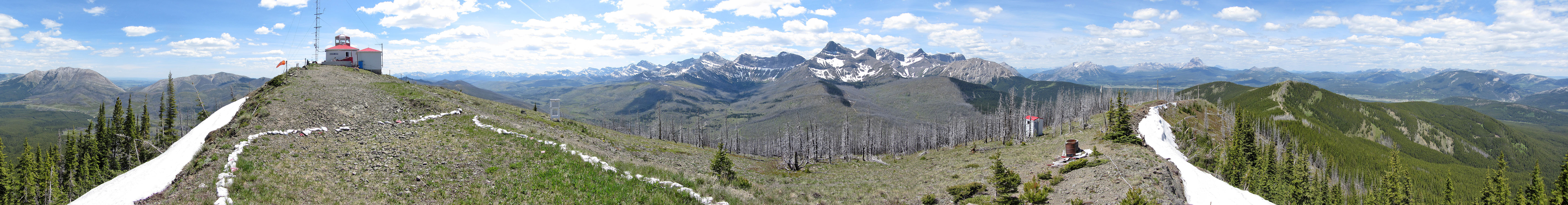
Ironstone Lookout
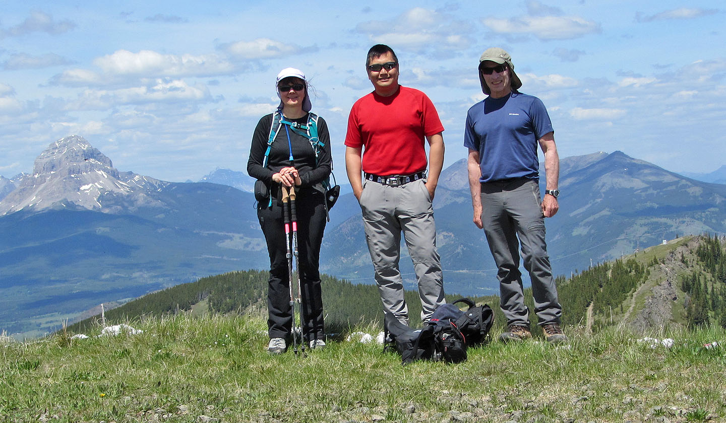
Posing on the helipad
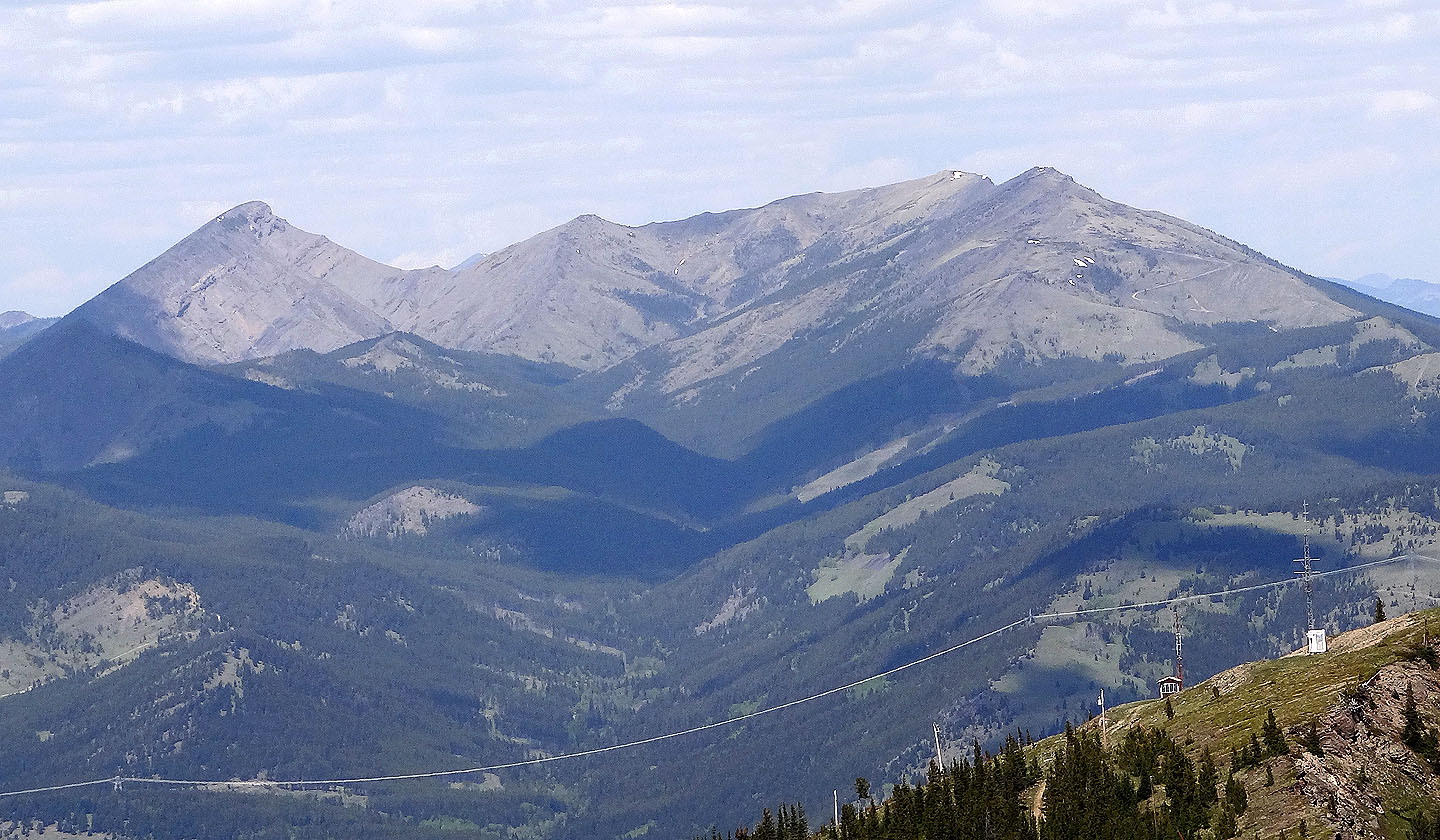
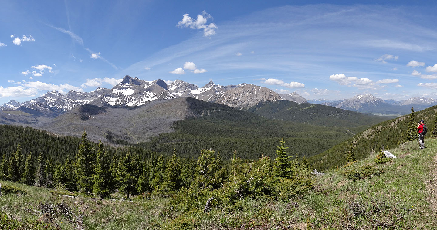
Ma Butte and Machiavellian Ridge
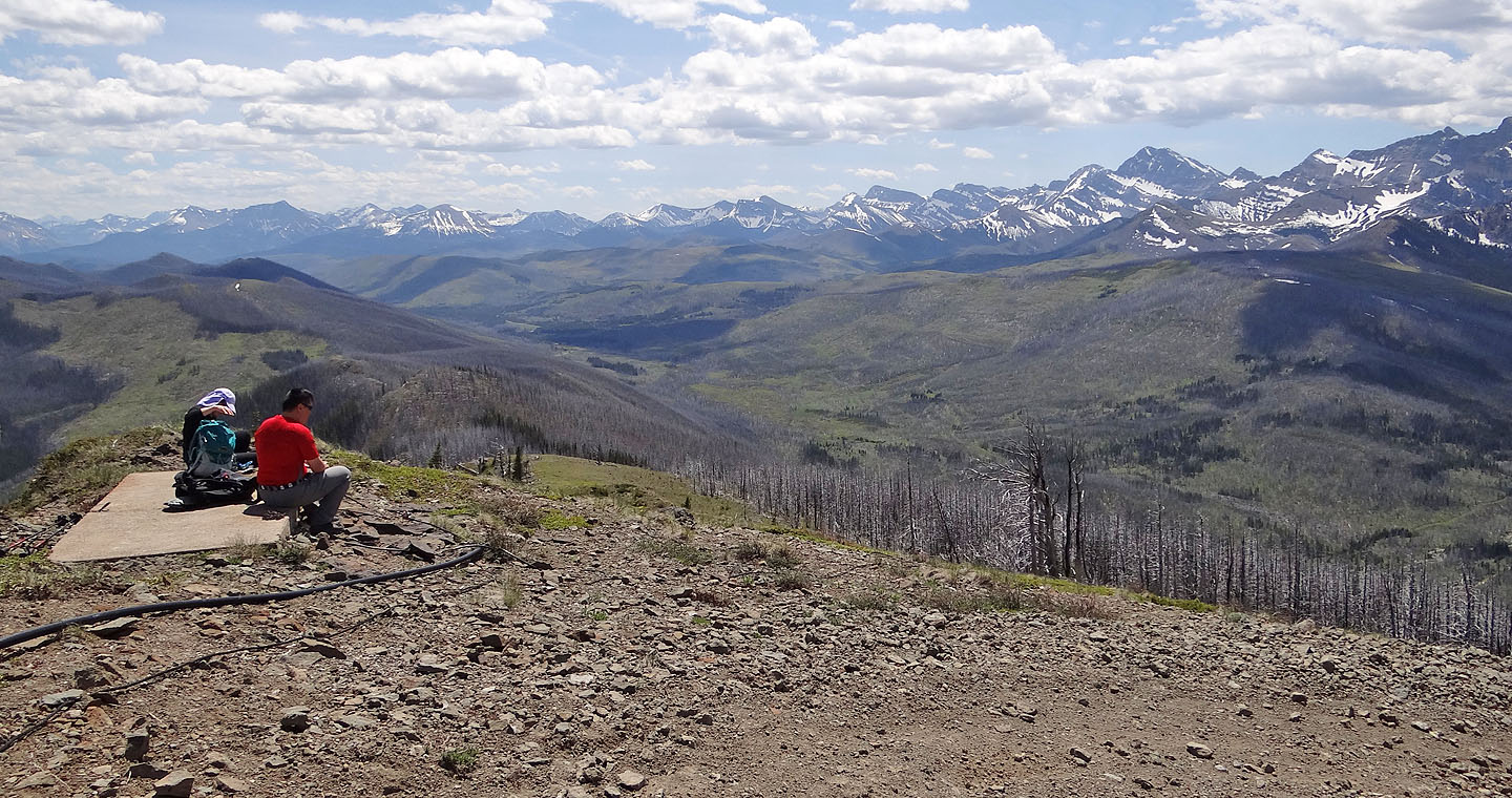
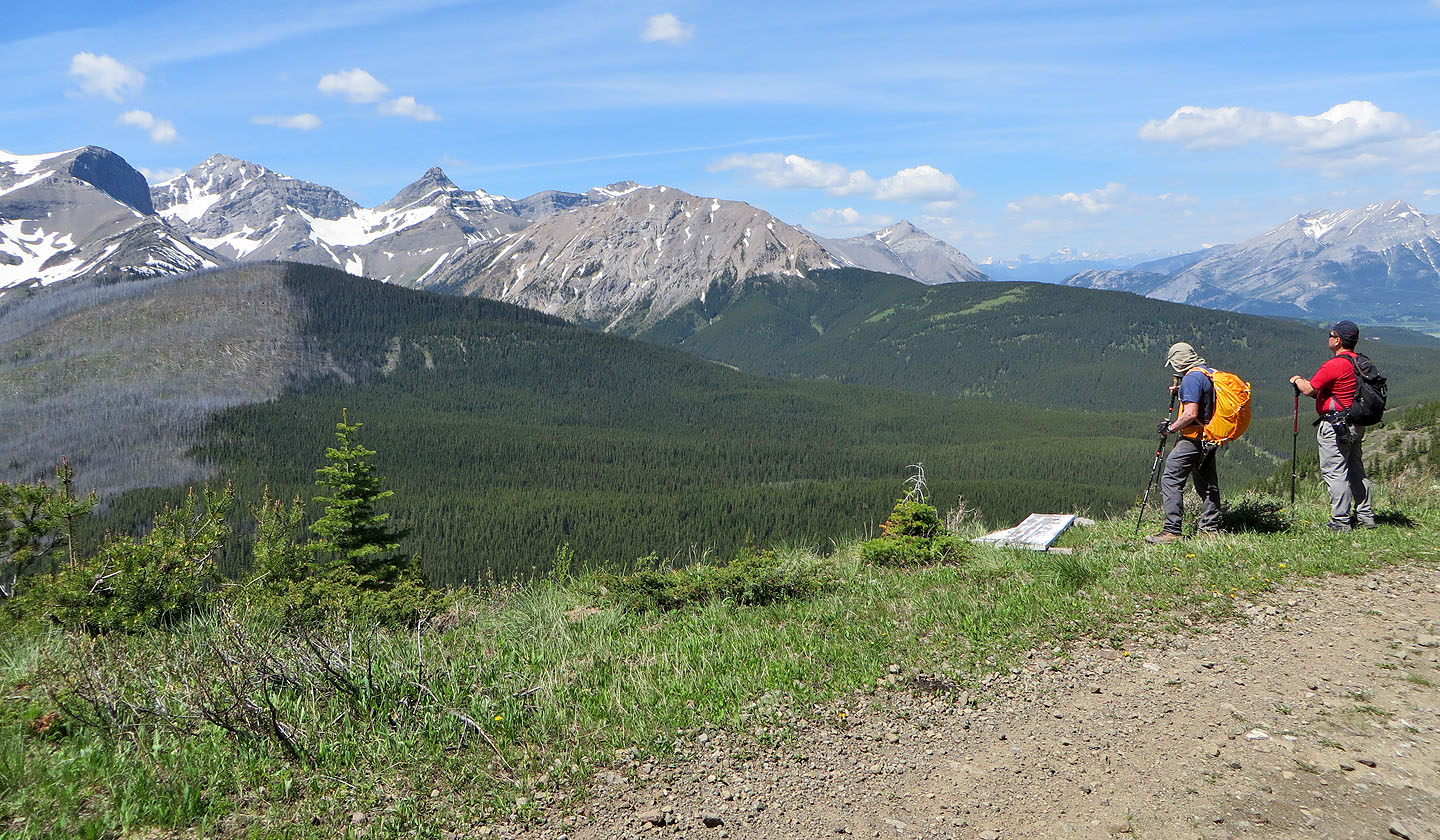
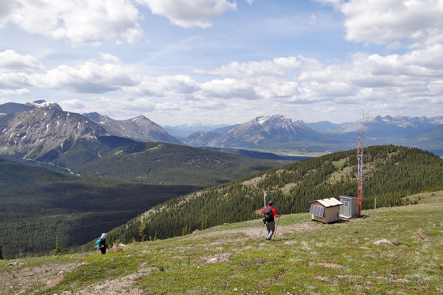
We lunched on a cement pad with a view of distant peaks south
After lunch we headed to the north summit
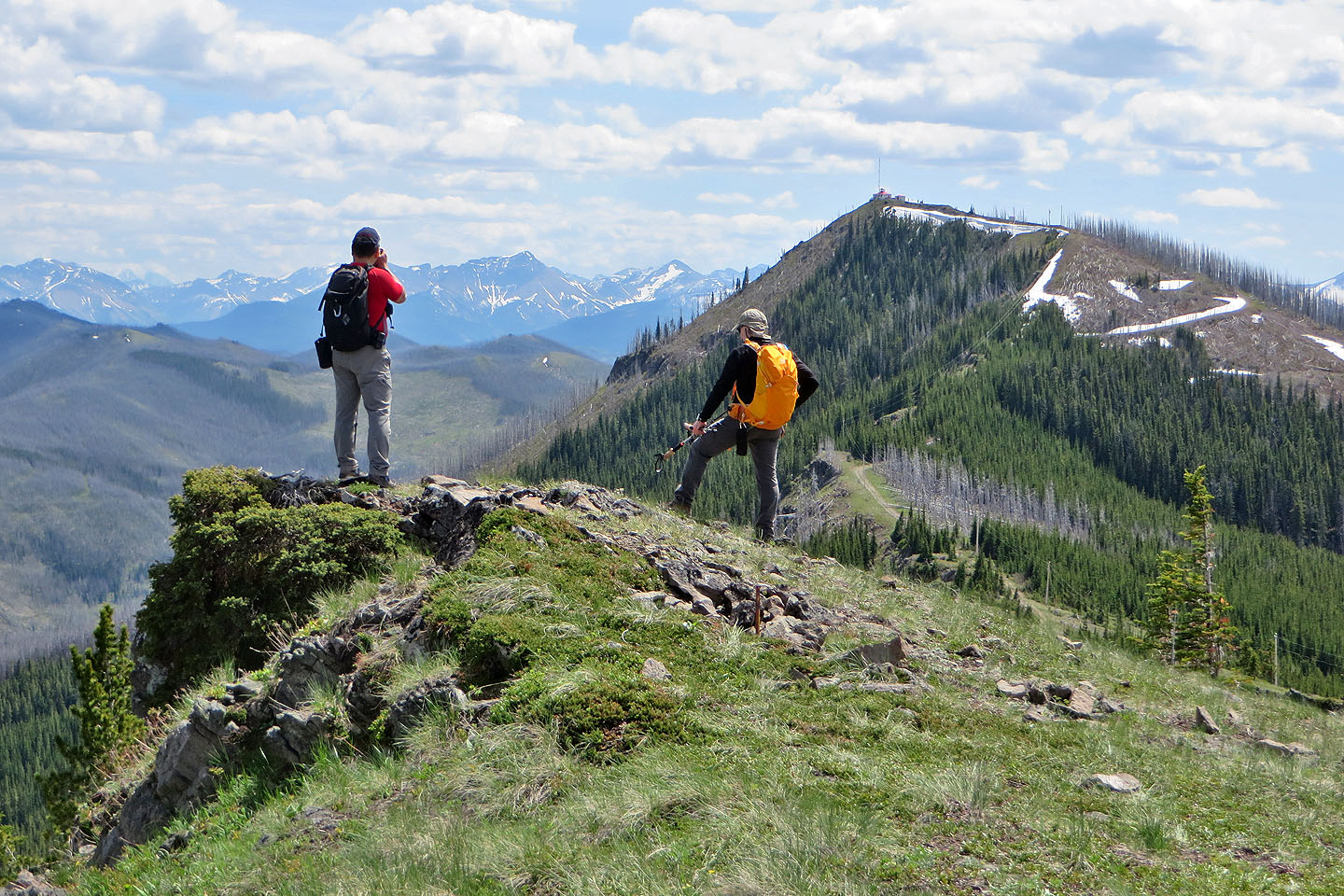
Looking back at the lookout from the north summit
We continued north along the ridge
The road from the north summit looked promising...
...but ended abruptly at a cutline choked with bushes
We headed for the northwest ridge ahead but soon switched to Sarah's Bench only 200 m away
82 G/10 Crowsnest, 82 G/9 Blairmore