bobspirko.ca | Home | Canada Trips | US Trips | Hiking | Snowshoeing | MAP | About
View from Ma Butte
McGillivray Ridge and Ma Butte
Crowsnest Pass, Alberta
June 26, 2010
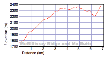
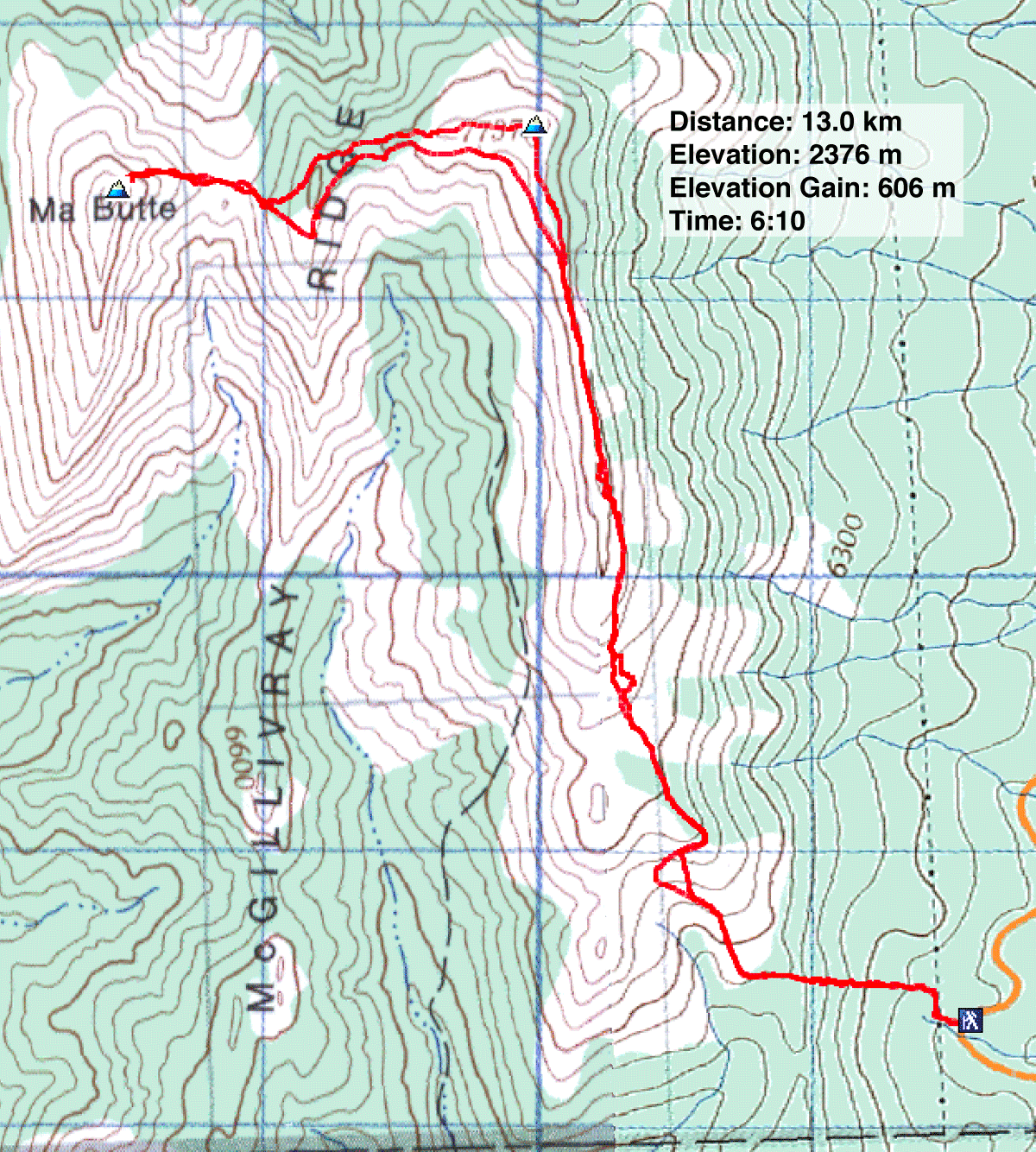
Distance: 13.0 km (8.1 mi)
Cumulative Elevation Gain: 962 m (3156 ft)
The same weekend that saw the G20 and G8 Summits at Toronto and Huntsville respectively, also saw Dinah and me on two summits in Crowsnest Pass. Unlike the international government summits, however, our summits were serene. More than just bagging two peaks, ascending McGillivray Ridge and Ma Butte was an enjoyable ridgewalk with far-ranging views.
The route for McGillivray is described in Hiking in the Historic Crowsnest Pass, but we extended the trip to include the slightly higher Ma Butte. Our only difficulty was finding the trailhead: it fell short of the book's driving distance on Hwy. 40 and didn't stand out along the forested roadside.
But from the trailhead, the route played out as described. We dragged ourselves up the steep powerline to a road and followed the road to where it folds back to a repeater station. We plodded up McGillivray Ridge only to encounter another, more primitive road etched into the slope. We took it until it faded into the hillside, forcing us to clamber to the ridge crest.
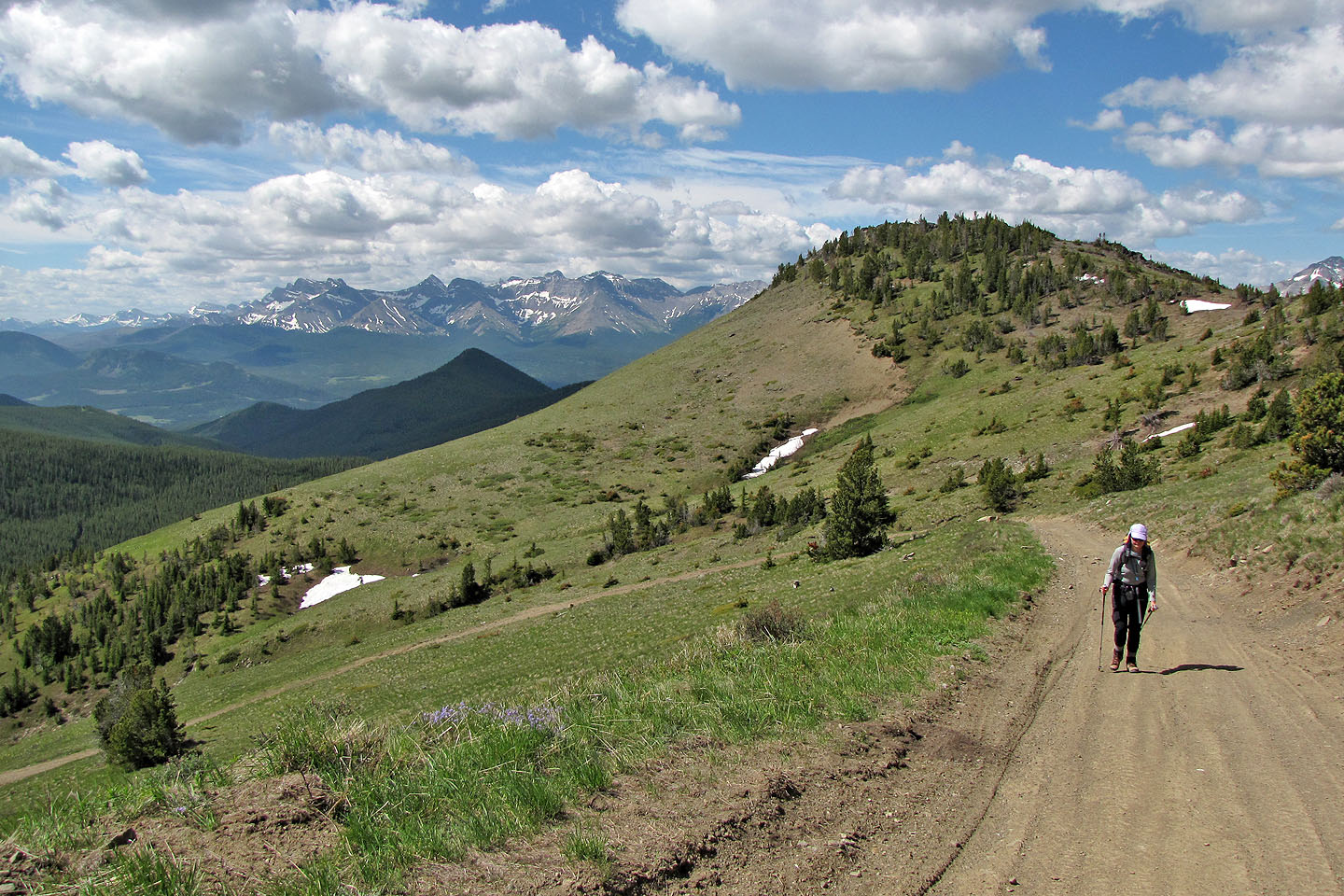
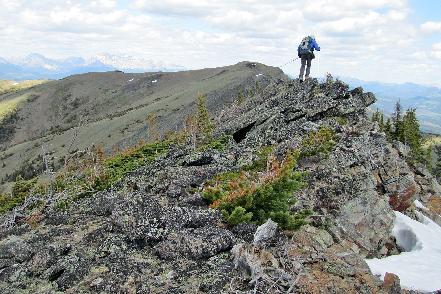
On the ridge crest, we discovered a large cairn where we had an unobstructed view of our objectives. We followed the ridge, first rocky and then becoming grassy, until we reached our first summit. The book says McGillivray's highest point is a 3.2 km hike but we reached it only after hiking 4.9 km.
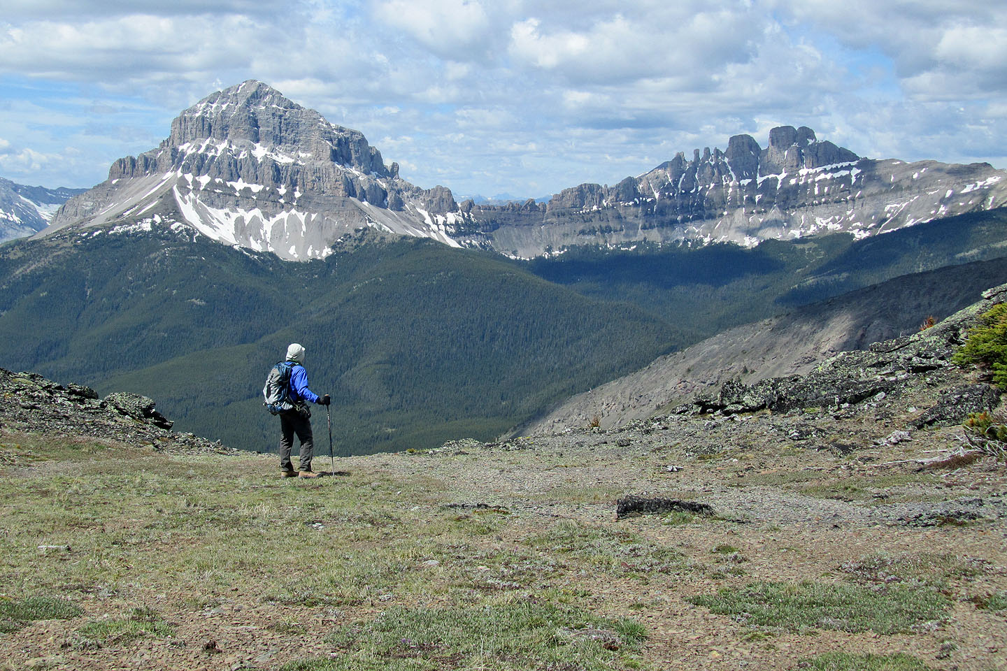
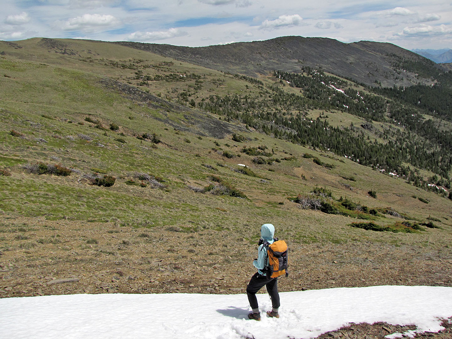
From the top, we could see familiar peaks all around us, but we turned our attention west towards an unfamiliar one: Ma Butte. Only a gentle, rolling ridge separated us. That and a 160 m elevation loss to the col.
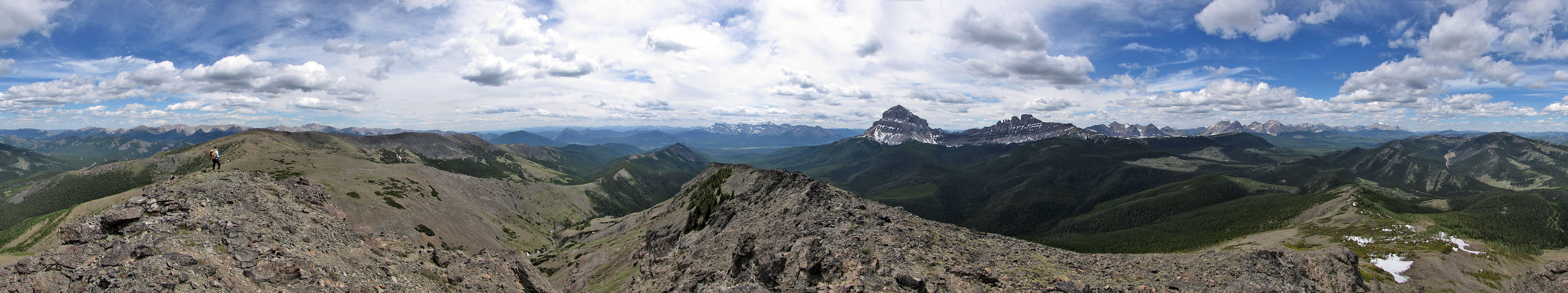
Ma Butte presents a vertical rock face to the east, but when we hiked around to the right side, we found an easy scramble to the summit. We stood 9 m above McGillivray Ridge, but we had front-row seats to Crowsnest Mountain and the Seven Sisters.
After leaving Ma Butte, we returned the same way except we skirted well below McGillivray's summit: no need for a second visit. As we hiked back, Dinah wondered why we hadn't encountered other hikers. I waved a hand at Turtle Mountain; that's where I would expect to see them, but I was glad to have found solitude on McGillivray Ridge.
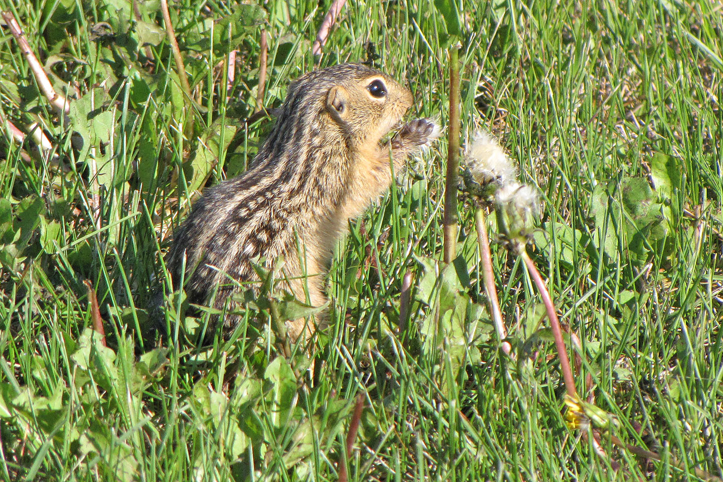
When we made a pit stop at Chain Lakes, I spotted this thirteen-lined
ground squirrel feeding on dandelion seeds
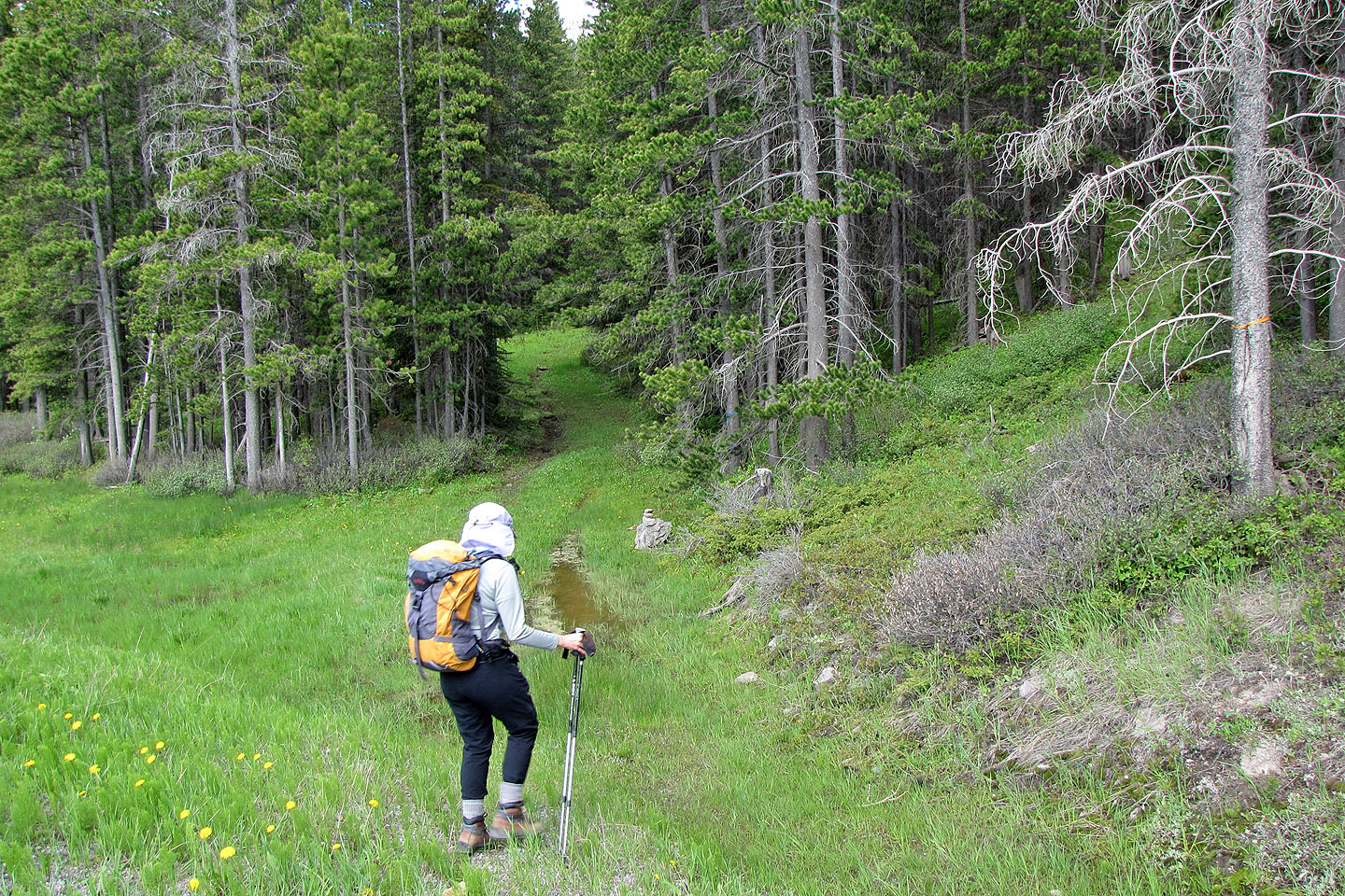
The trailhead seen from the road
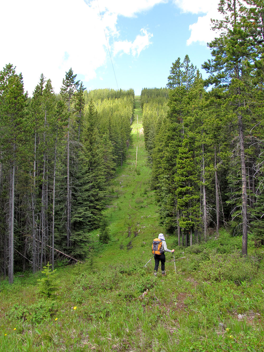
Starting up the powerline
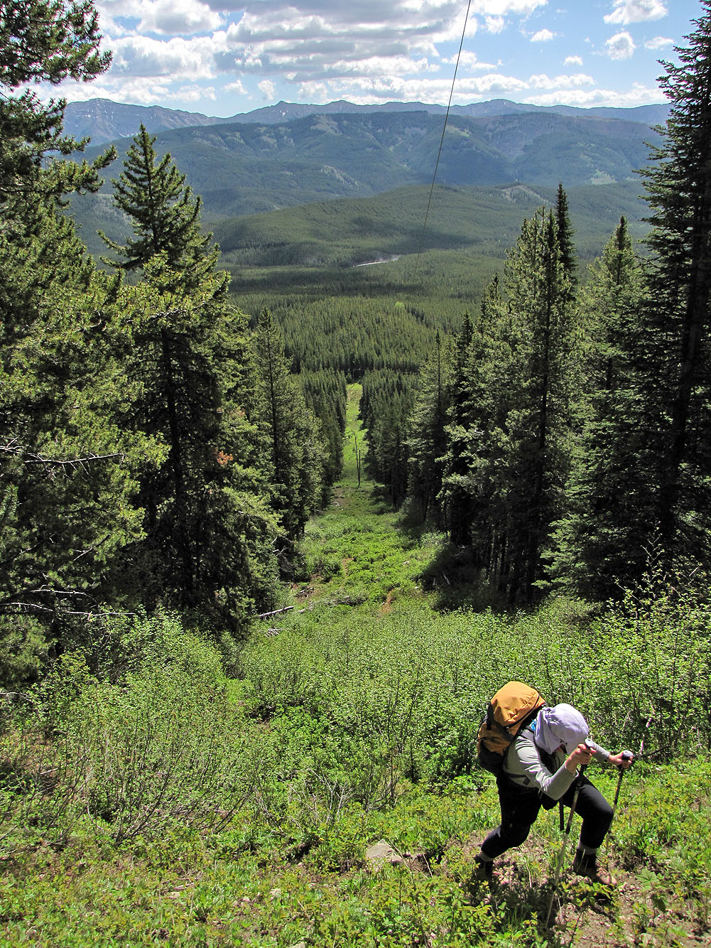
Looking back
On the road. Not seen is a drainage left of me that we used it as a shortcut on the way back, saving
us from hiking this bend in the road
The road winds left to the repeater station but we pushed on to the slope ahead
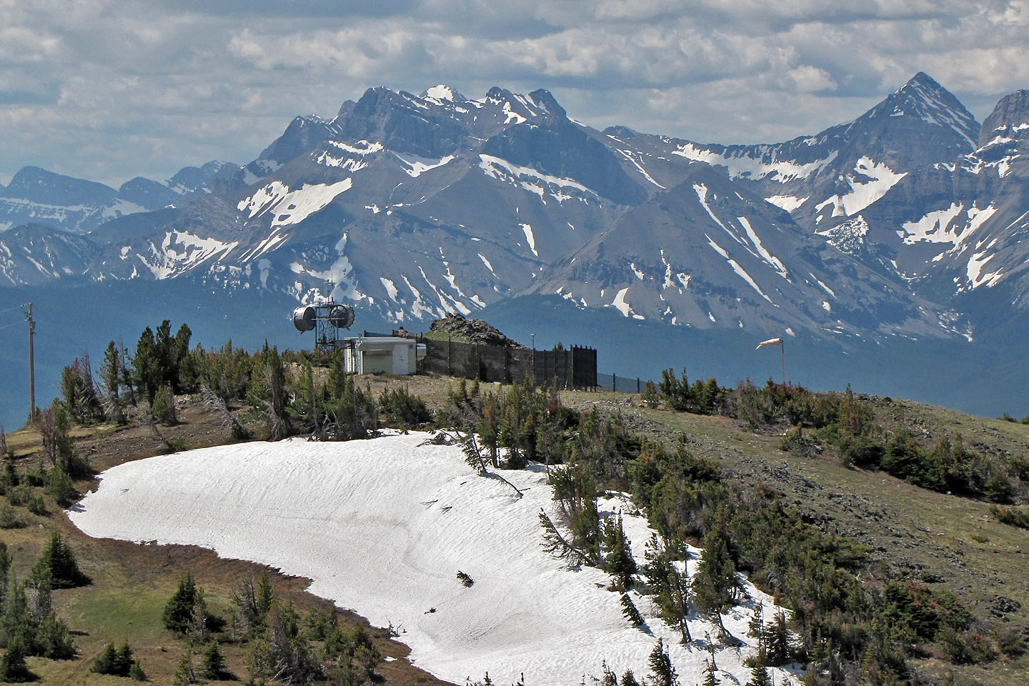
Behind us: Mount Coulthard, Andy Good Peak and the repeater

On the primitive road (mouse over to look back)
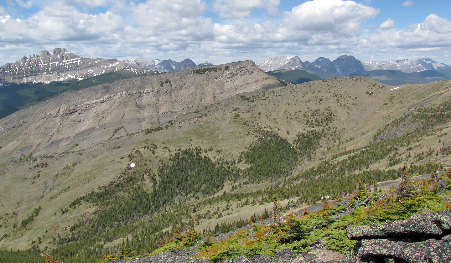
Crowsnest Mountain and Seven Sisters
We head to McGillivray summit (just left of me)
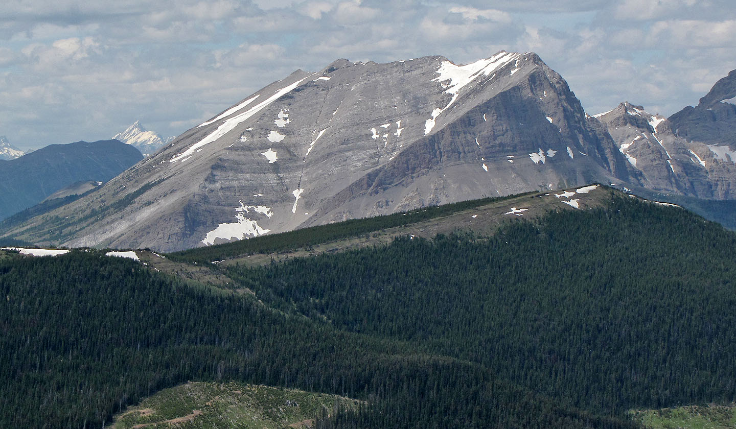
Ma Butte appears as a long, gray ridge
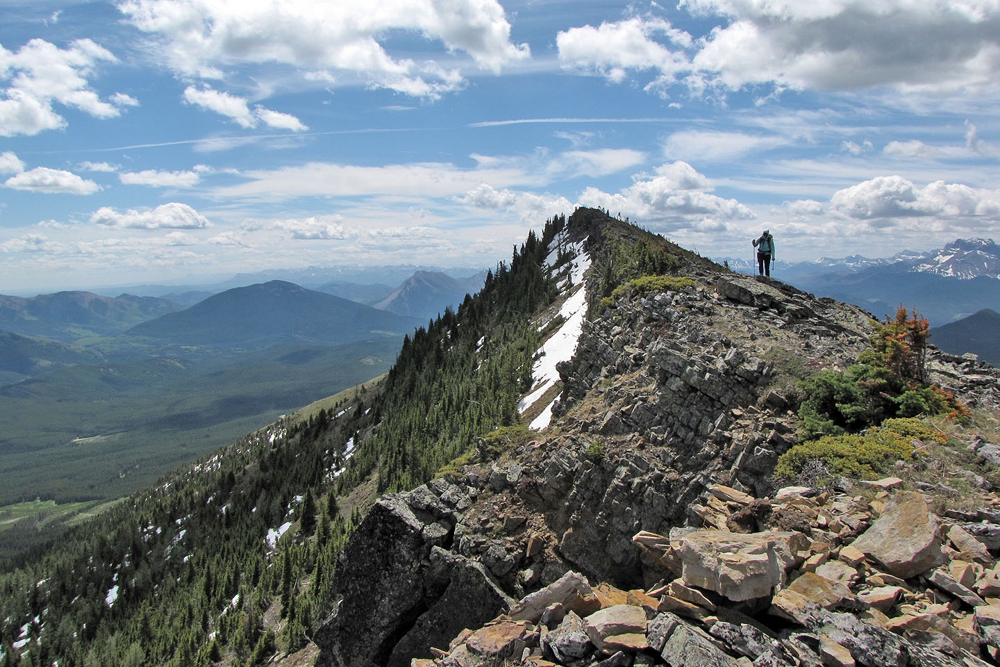
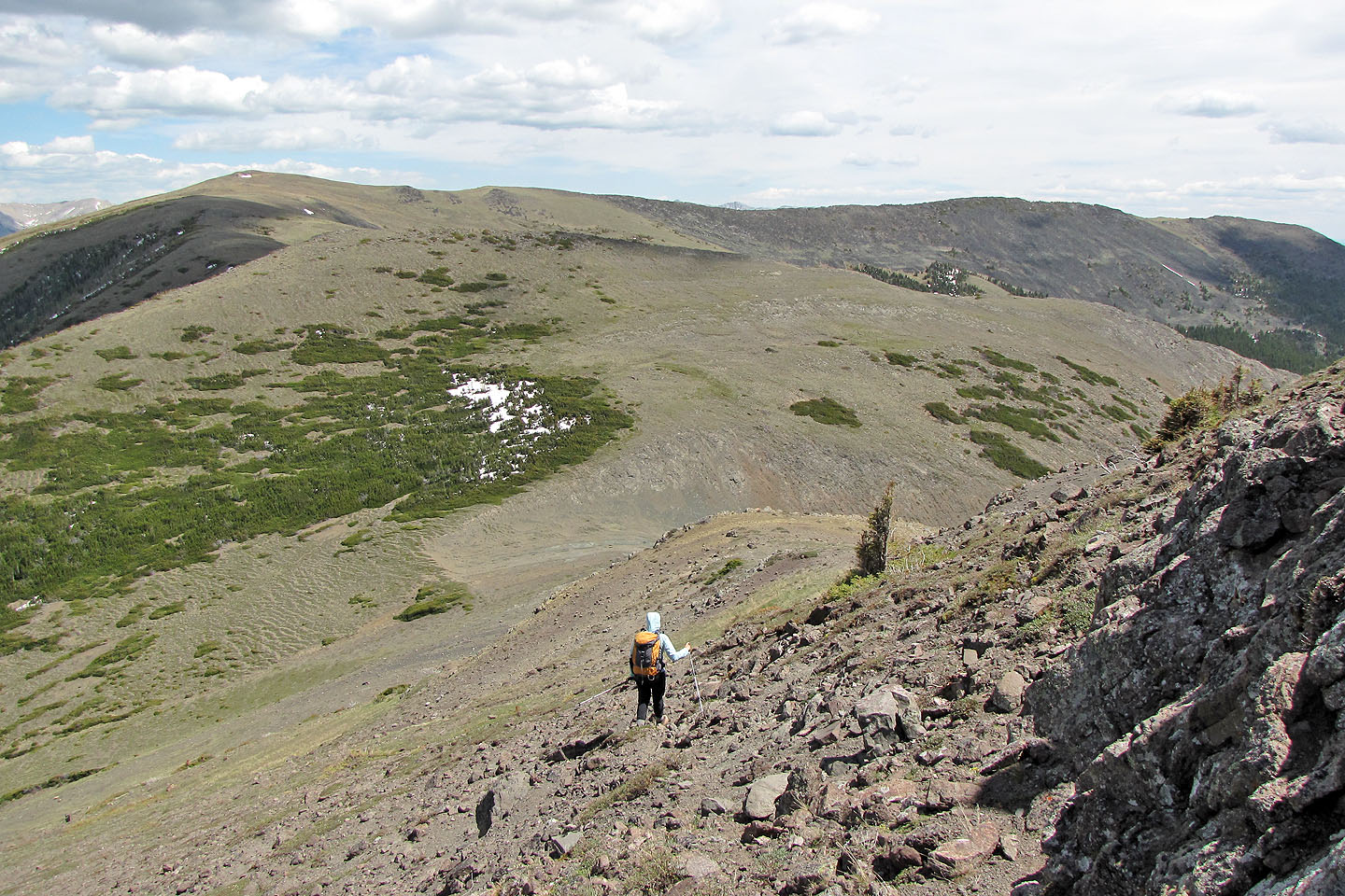
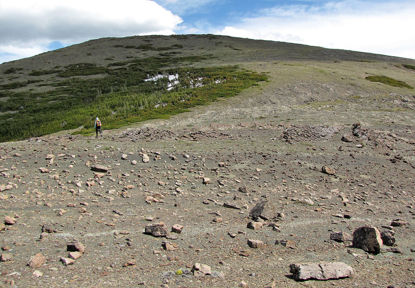
Hiking along McGillivray Ridge
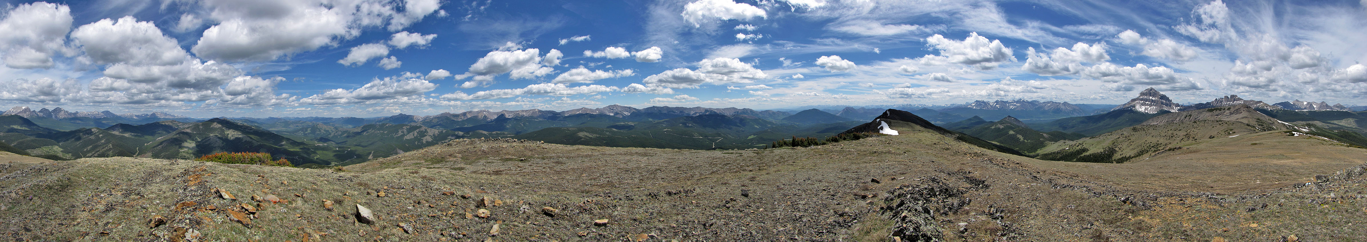
Panorama from the summit of McGillivray Ridge
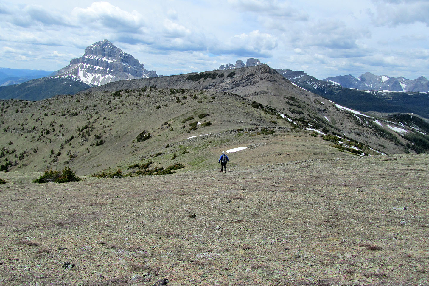
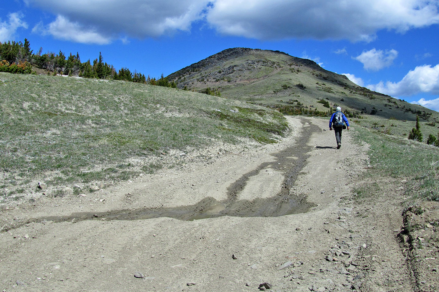
Next stop: Ma Butte
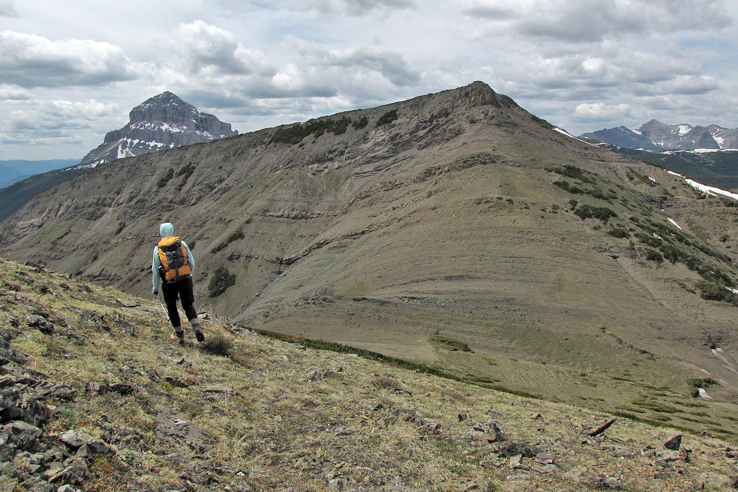
Ma Butte ahead
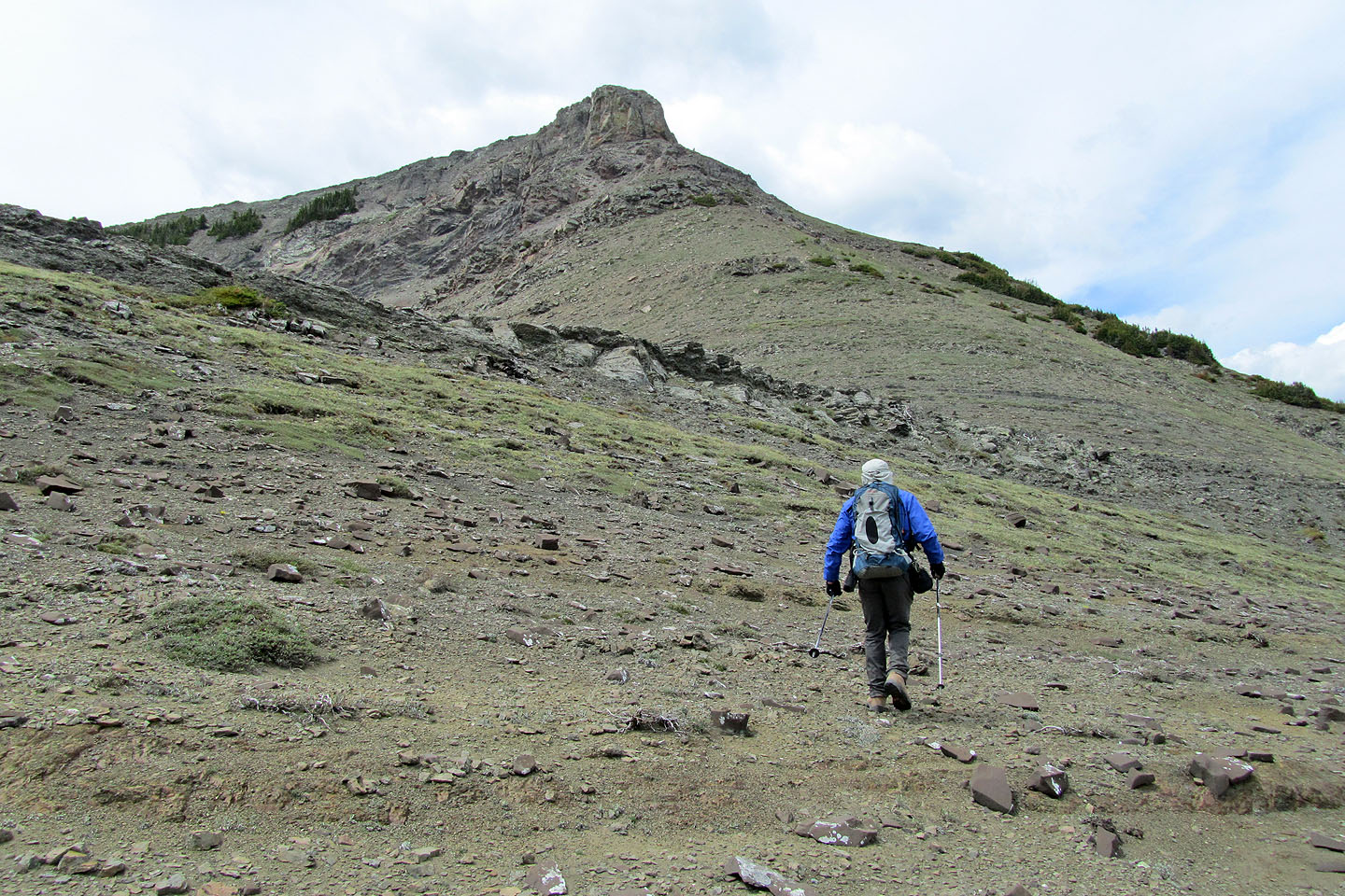
A summit block tops the mountain
Partway up Ma Butte. McGillivray summit left.
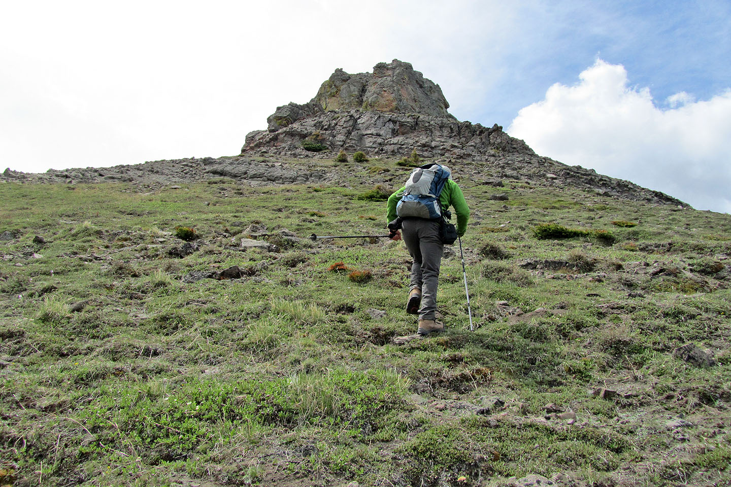
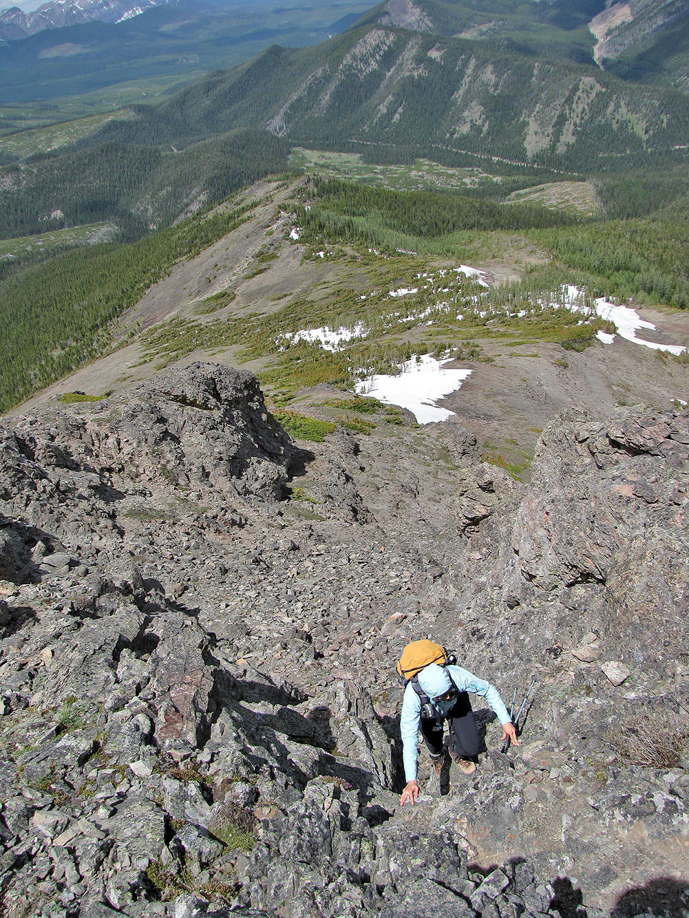
Heading to the summit
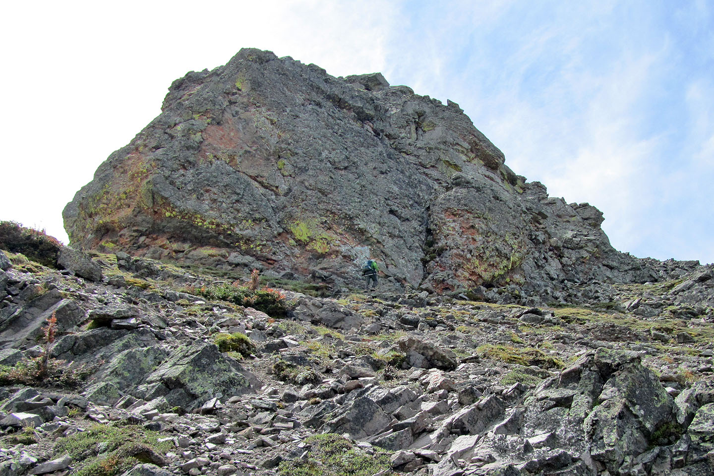
I'm dwarfed by the immense rock face
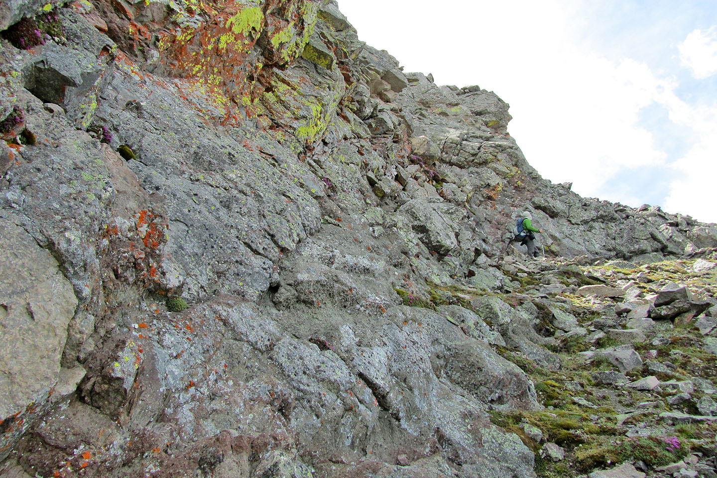
We searched for a way up
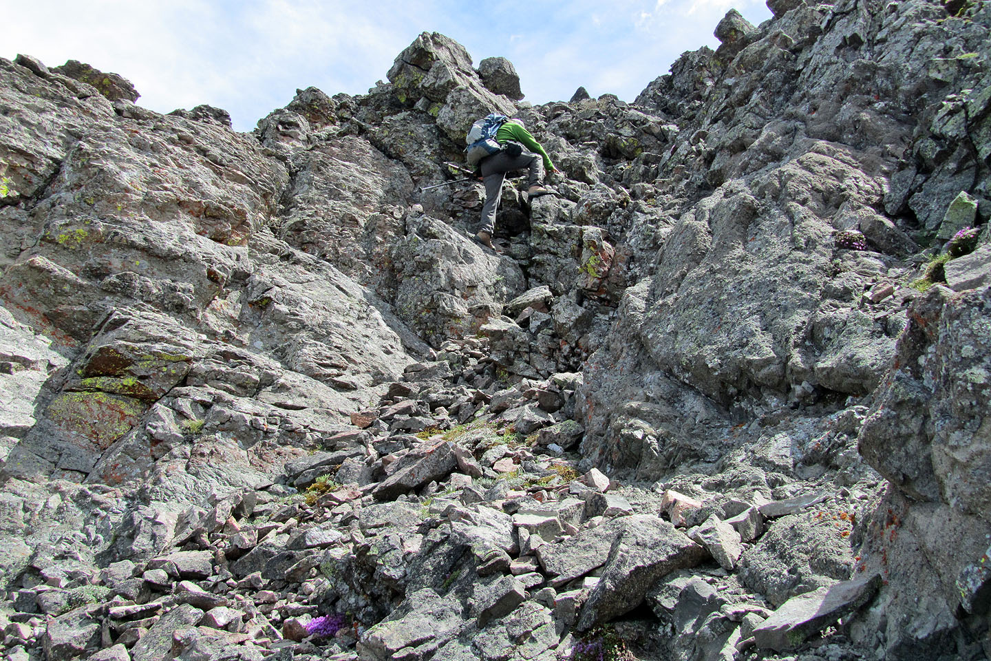
Scrambling up a gully
Dinah follows
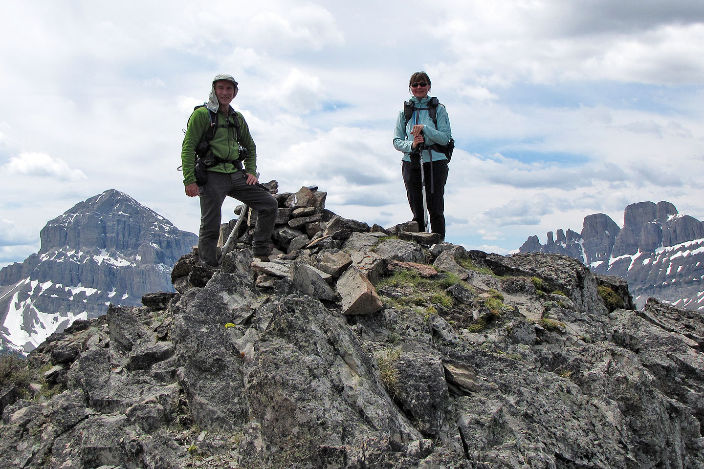
On the summit of Ma Butte
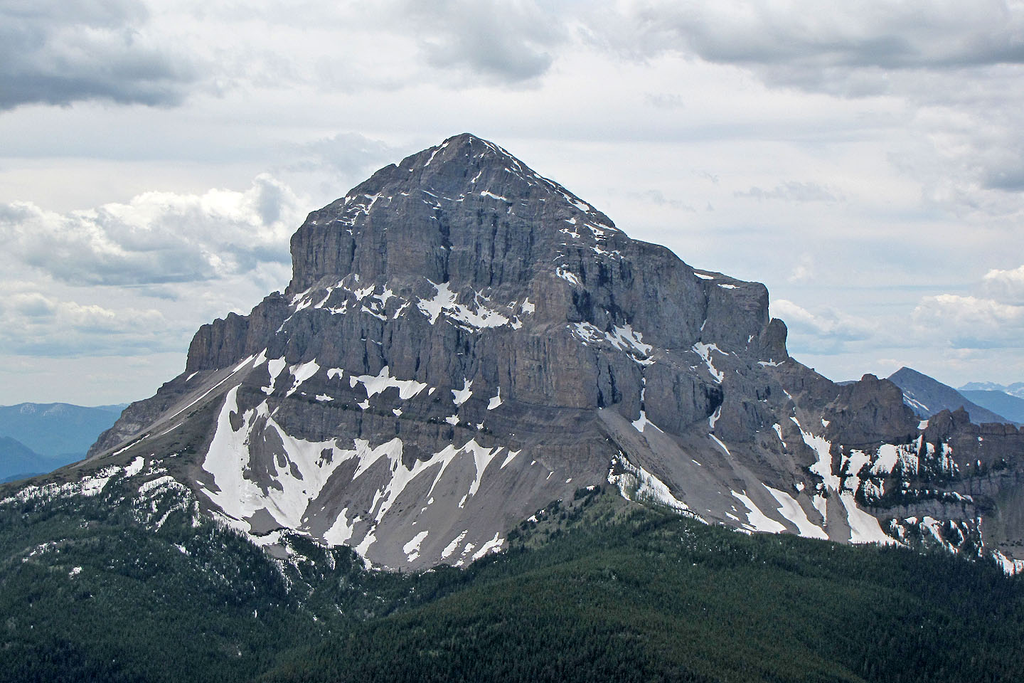
Crowsnest Mountain
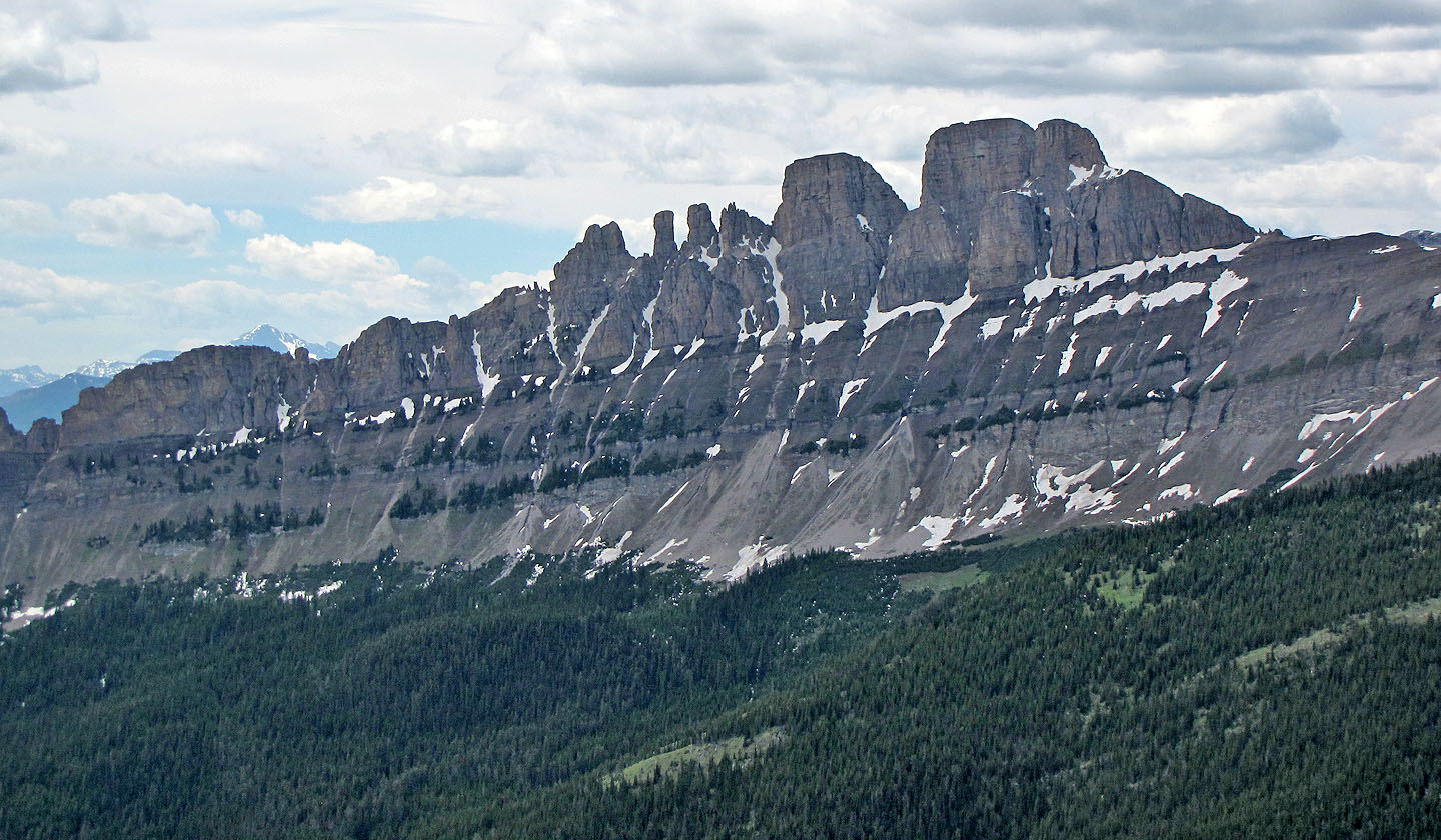
Seven Sisters
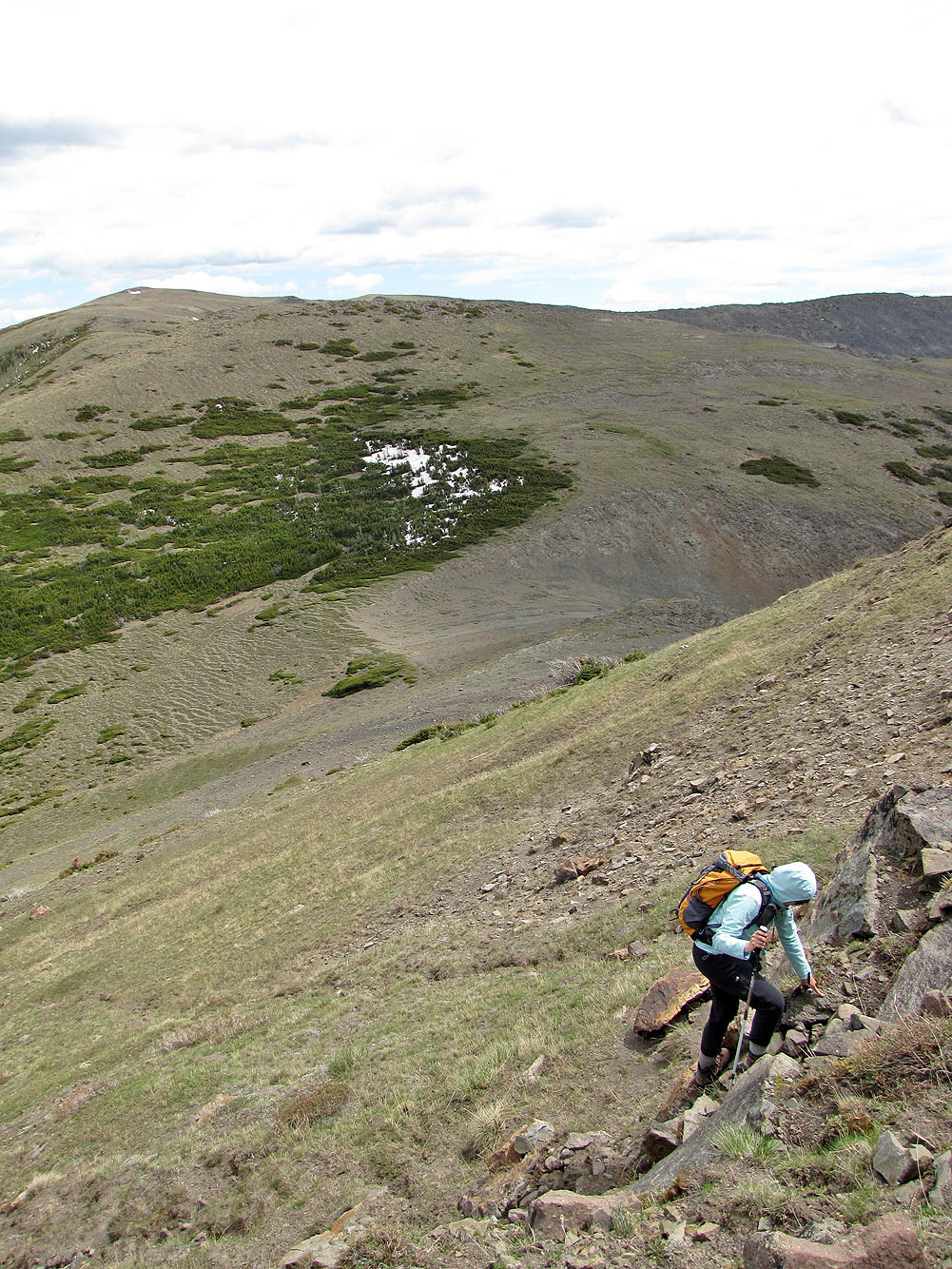
Heading back
Striking landscape
Making our way back to McGillivray Ridge in the distance
82 G/10 Crowsnest, 82 G/9 Blairmore