bobspirko.ca | Home | Canada Trips | US Trips | Hiking | Snowshoeing | MAP | About
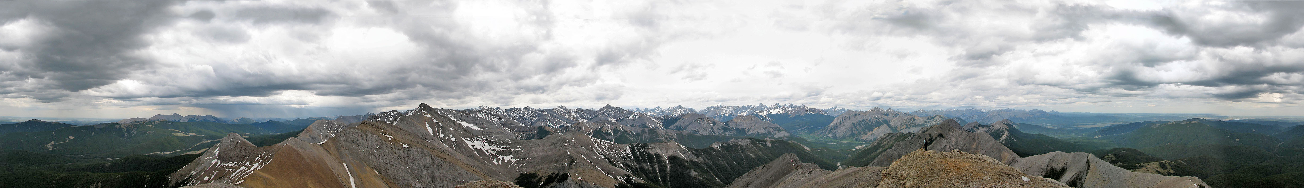
View from Boundary Peak
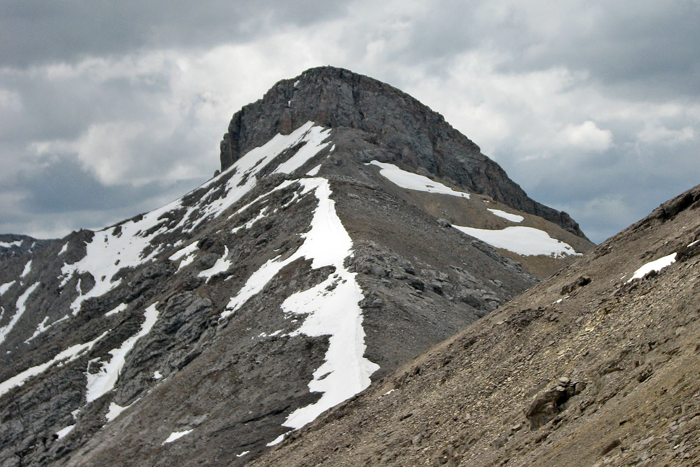
Belmore Browne Peak and Boundary Peak
Kananaskis, Alberta
May 20, 2006
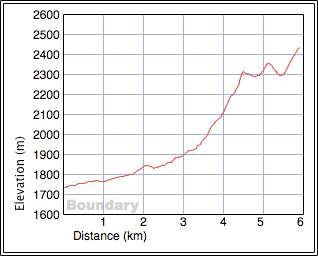
With work ruining our plans for a more ambitious trip or trips for the long weekend, we settled on a minor peak in the front range. We had no trouble following the guidebook's instructions except for finding the cutline. The cutline wasn't noticeable from the logging road, but we found a faint trail that led to it. In about two hours, we arrived on the summit of Belmore Browne Peak (2317 m).
On the top, we met a couple relaxing. The Bickersons, who were retired, had recently moved from Kimberley B.C. Of interest to me was their reaction to the scrambles that they did there, following Scrambles in Southwest B.C. Guide, B.C.'s counterpart to Alberta's Scrambles in the Canadian Rockies. They were disappointed in the B.C. peaks. Getting to a trailhead often involved a long, complicated drive on logging roads. A 4x4 vehicle is a must, they told me. On one occasion they spent the entire day trying without success to find the trailhead! Originally from Alberta, they returned to live in High River. They far prefer the mountains here than those in B.C.'s Southwest.
After chatting with the Bickersons we left Belmore Browne and followed the ridge east to a second point, more of a bump really, then northeast to a high point on Boundary Peak. The weather wasn't great but at least it didn't start to rain until we turned back. Even then it rained little, but other areas around us were hit by rain and thunderstorms.
Years ago I did several trips in this area including Belmore Browne and the different forks of Upper Canyon Creek. I've forgotten how pleasant this area is. Certainly it's worth exploring given its long season and proximity to Calgary.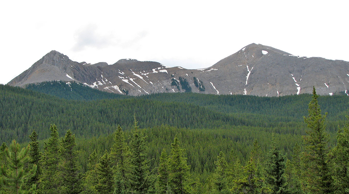
From Powderface Trail: Belmore Browne (left) and Boundary Peak (right)
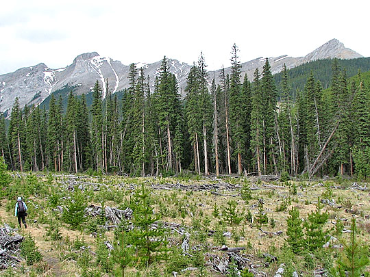
Hiking through the first cut block: Tiara Peak on the left, Belmore Browne right
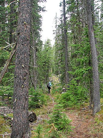
Following the cutline
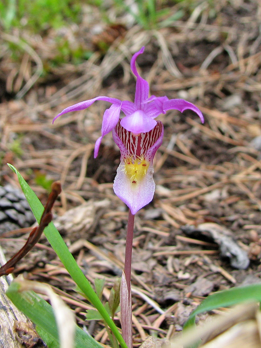
Calypso orchid on the cutline
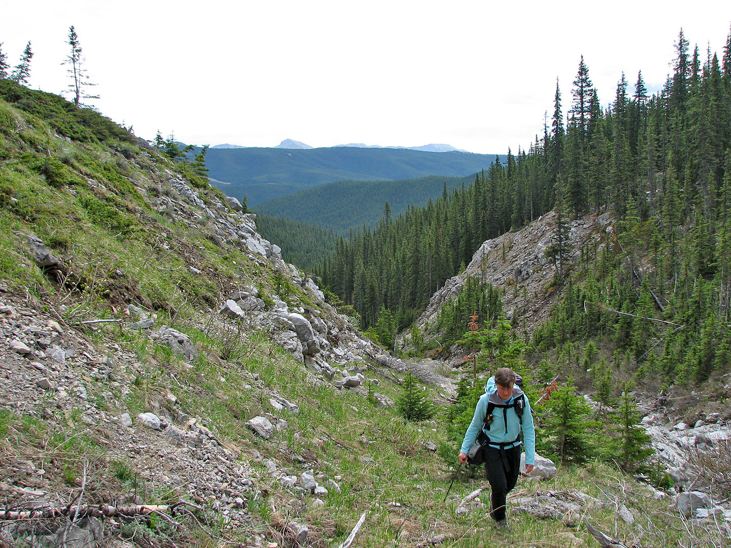
Coming to the end of the drainage, Moose Mountain on the left in the background
On the ridge near the summit of Belmore Browne
Tiara Peak lies south
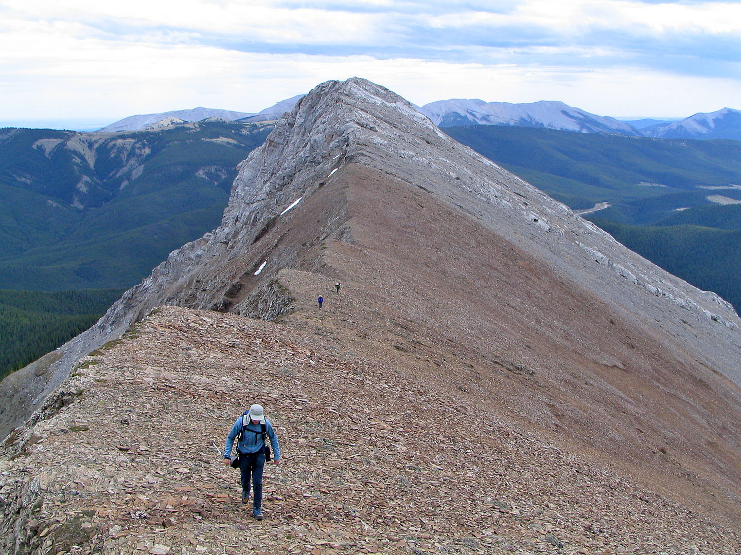
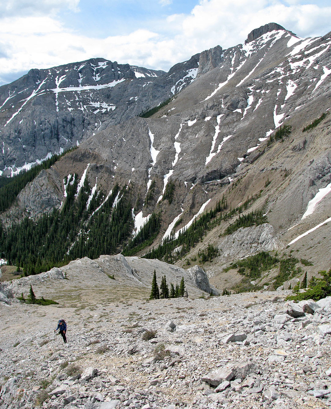
Making our way along the ridge
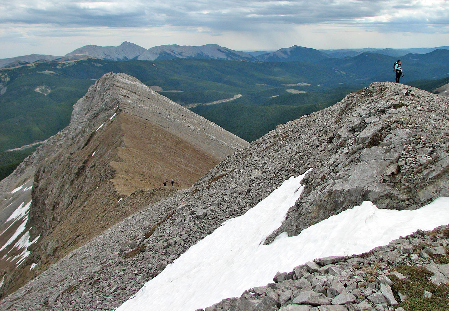
On the second point, looking back at Belmore Browne
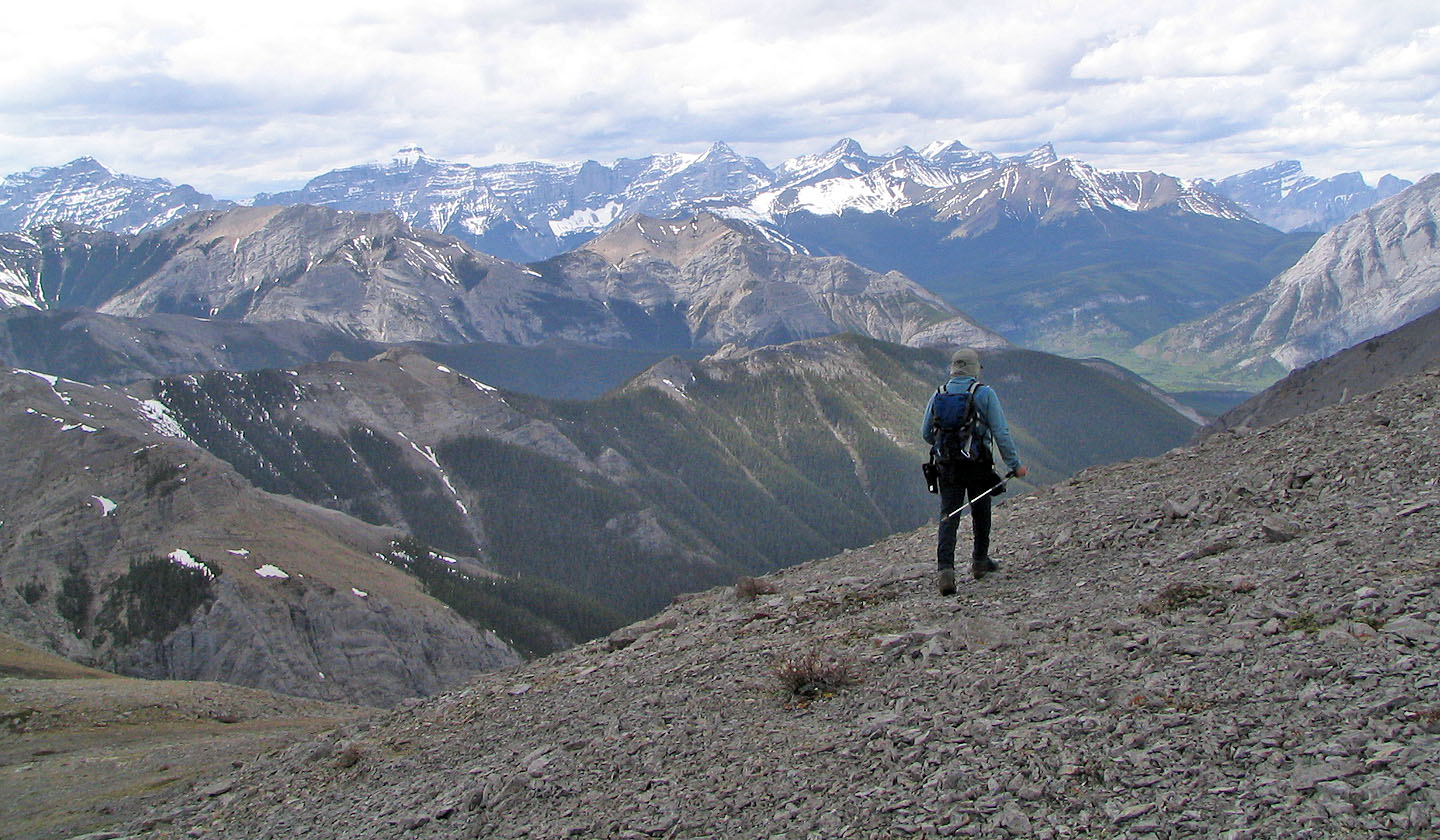
Well-known peaks to the west including Mount Bogart on the far left
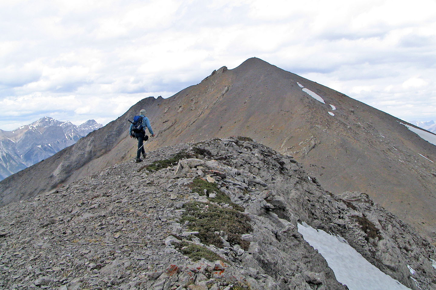
From the second point, we set off for Boundary Peak
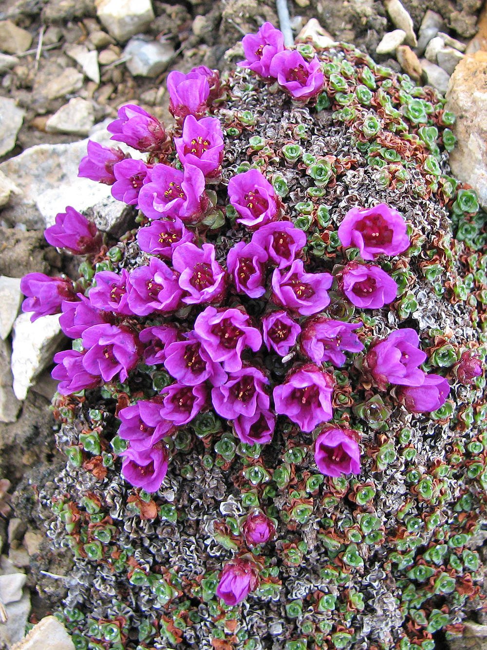
Purple saxifrage
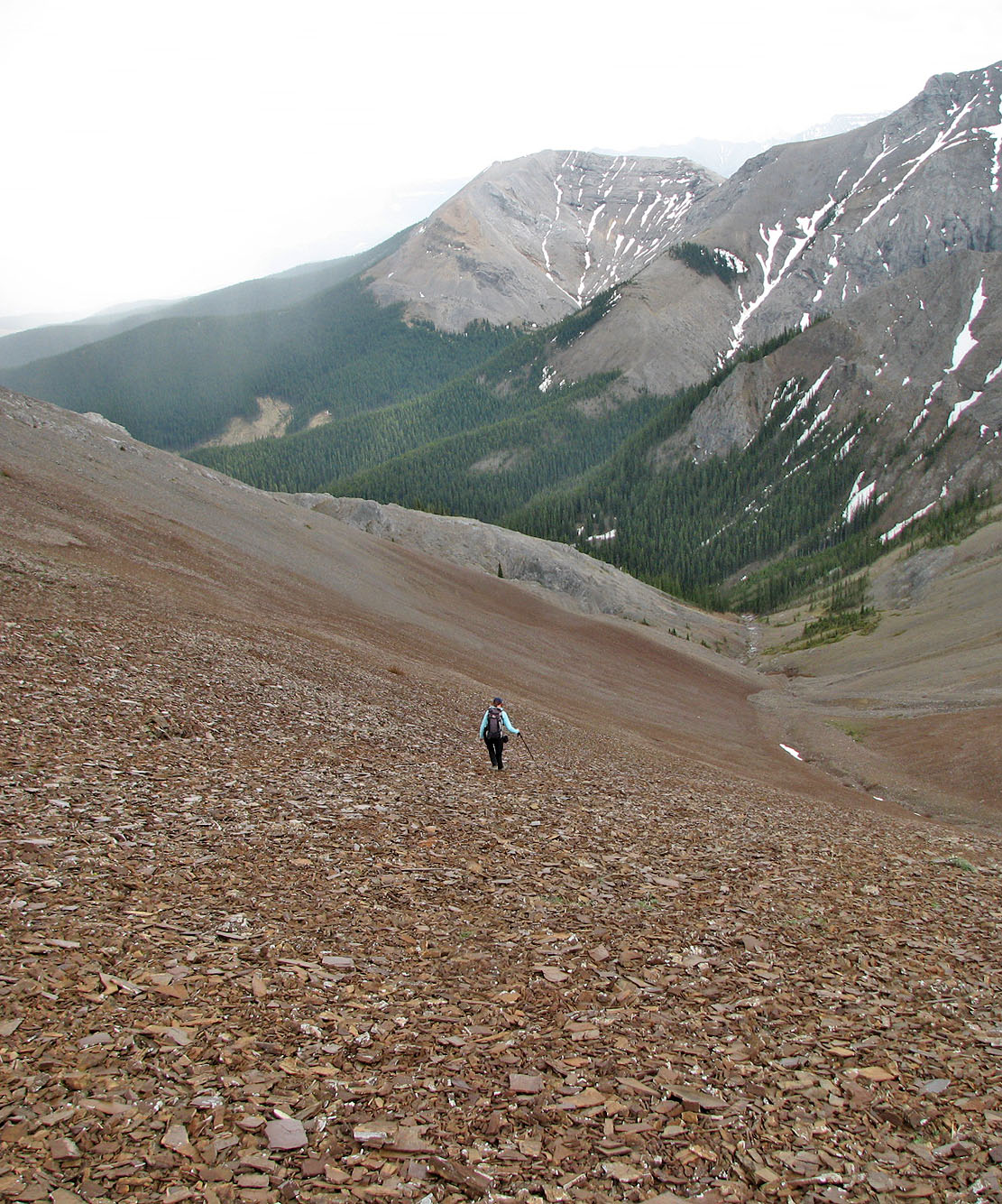
On the return we bypassed Belmore Browne and took the shortcut from the col
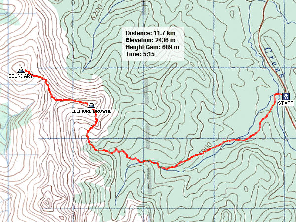
82 J/14 Spray Lakes Reservoir, 82 J/15 Bragg Creek