bobspirko.ca | Home | Canada Trips | US Trips | Hiking | Snowshoeing | MAP | About

Devil Peak
Jean, Nevada
April 14, 2013
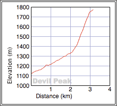
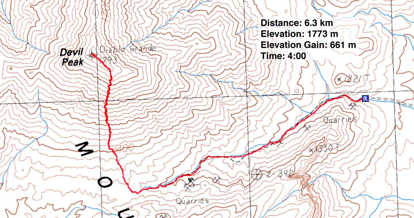
Distance: 6.3 km (3.9 mi)
Cumulative Elevation Gain: 665 m (2182 ft)
Despite its ominous name, there's nothing devilish about Devil Peak. It's just a small, obscure peak lying at the southern end of the Spring Mountains. But as we discovered, it's a hike worth doing. The route follows an old mining road to a saddle before ascending a steep scree slope. It finishes off with a short ridge traverse to the summit. Summitpost provides route details. According to Zdon's Desert Peaks, the mountain is of volcanic origin: a rhyolite plug.
Dinah and I, along with Shin, drove to Jean and then motored up a dirt road to the base of the mountain. The road wasn't bad; we drove all the way to the base of the mountain in our rented Toyota 4Runner without having to drop it into 4WD.
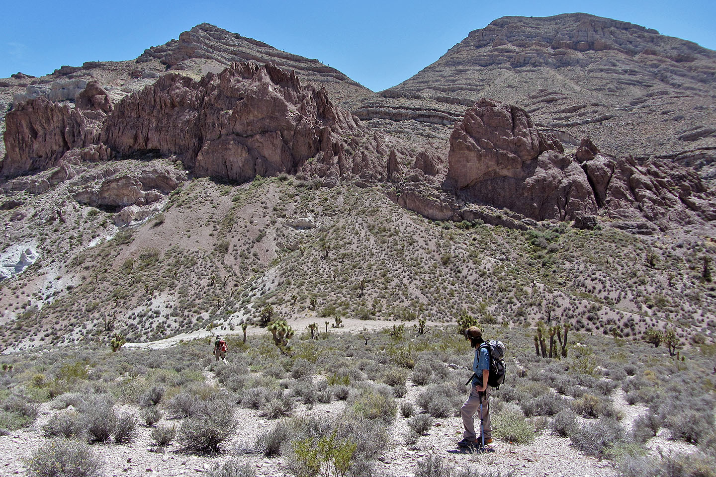
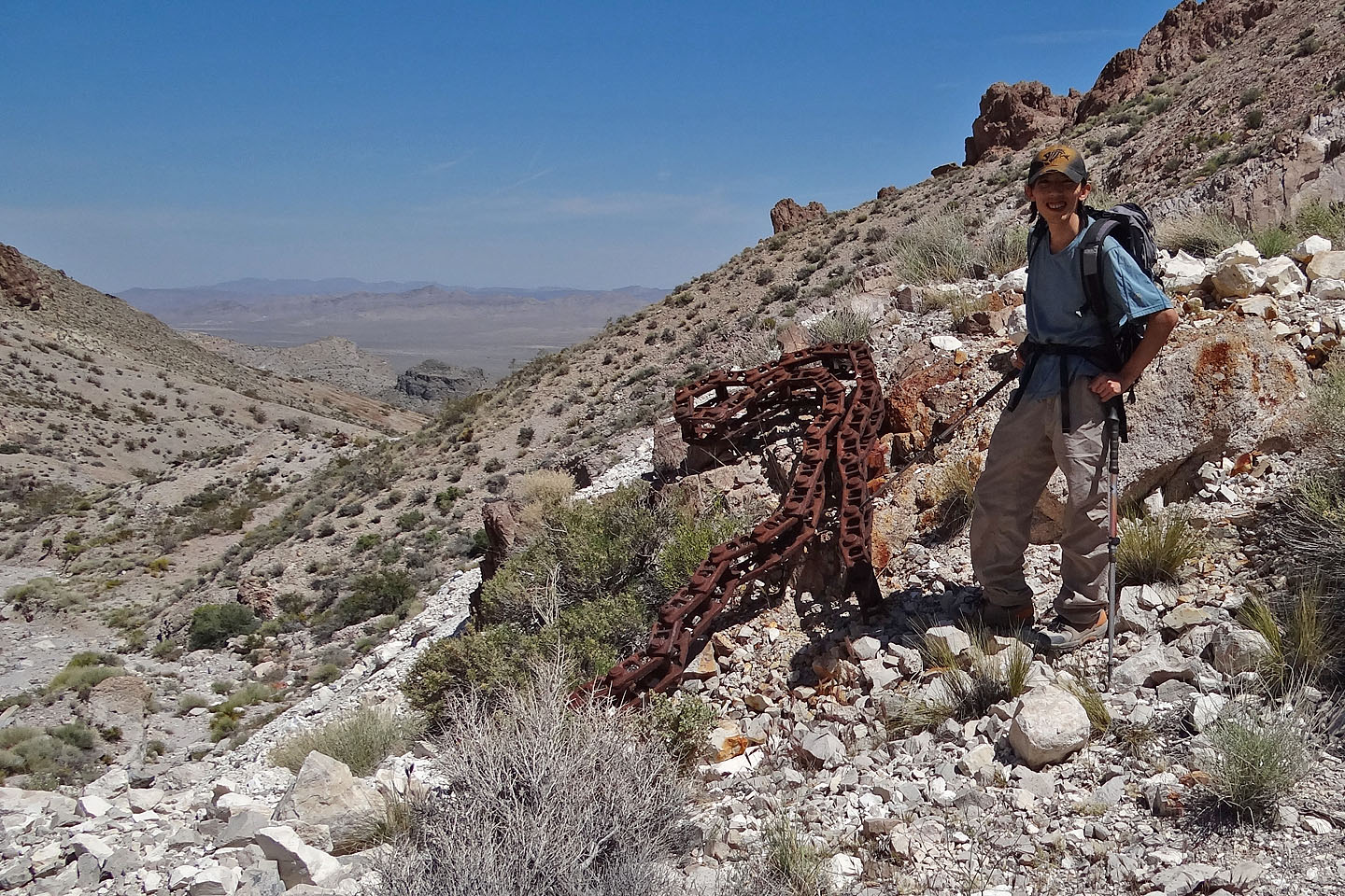
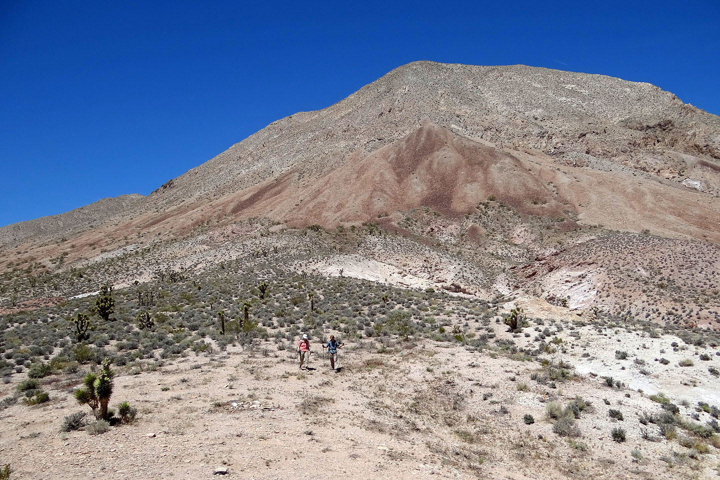
As I anticipated, the hike up the road to the saddle was easy, although more interesting and picturesque than I expected. We noted a few mines along the way, but we were focused on reaching the summit first. (On the way back, we explored a couple of mines that appeared safe.)
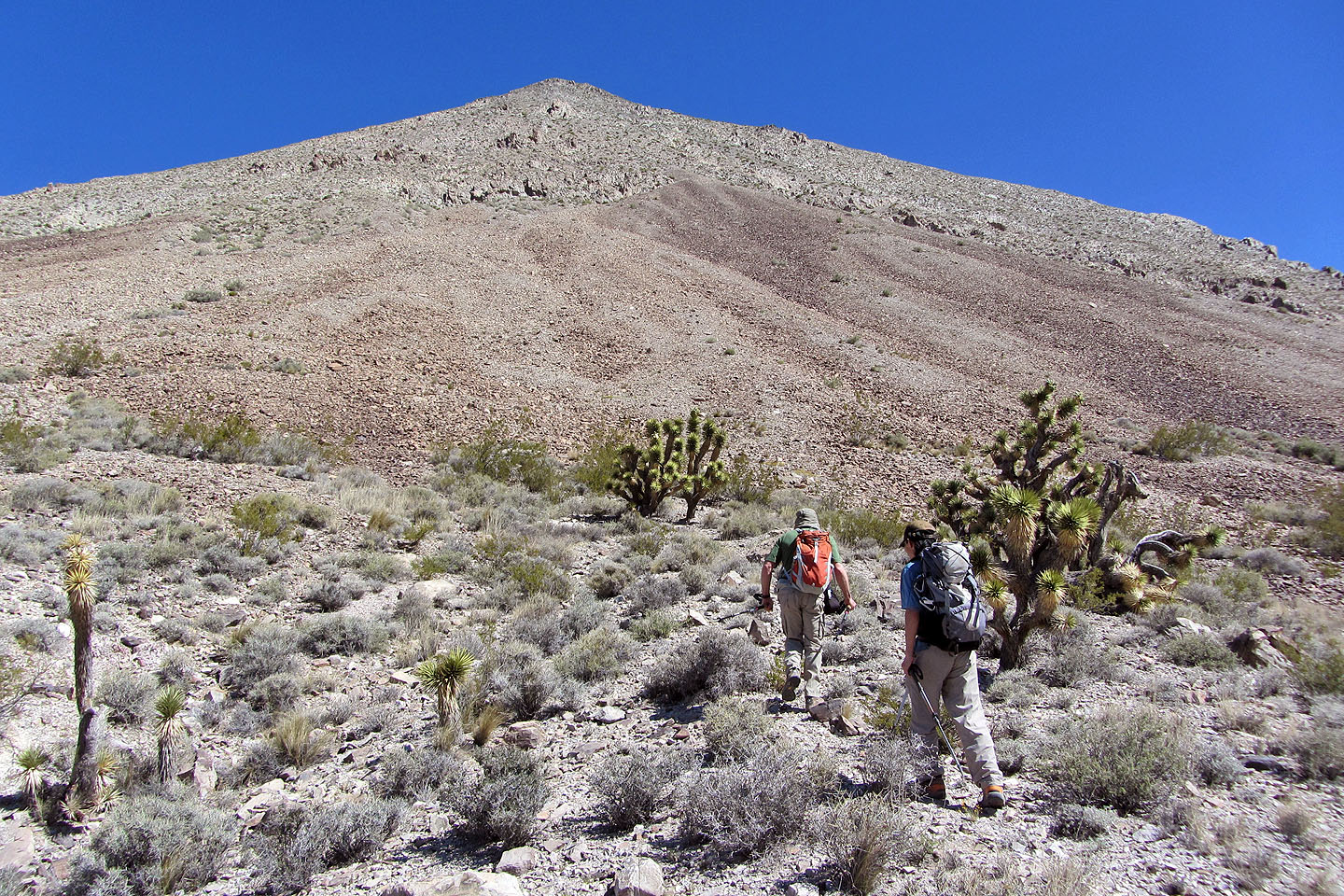
After the saddle, the route became much more demanding. Our boots found poor purchase in the hellish scree on the slope leading to a false summit. As we slogged upward, the views improved of course, but overall we experienced more perspiration than inspiration. Eventually we reached the top of Devil Peak. Not mindful of its namesake, a dozen butterflies flitted about a cairn. A summit register indicated few ascents since 2011. We lingered for over half an hour before heading back.
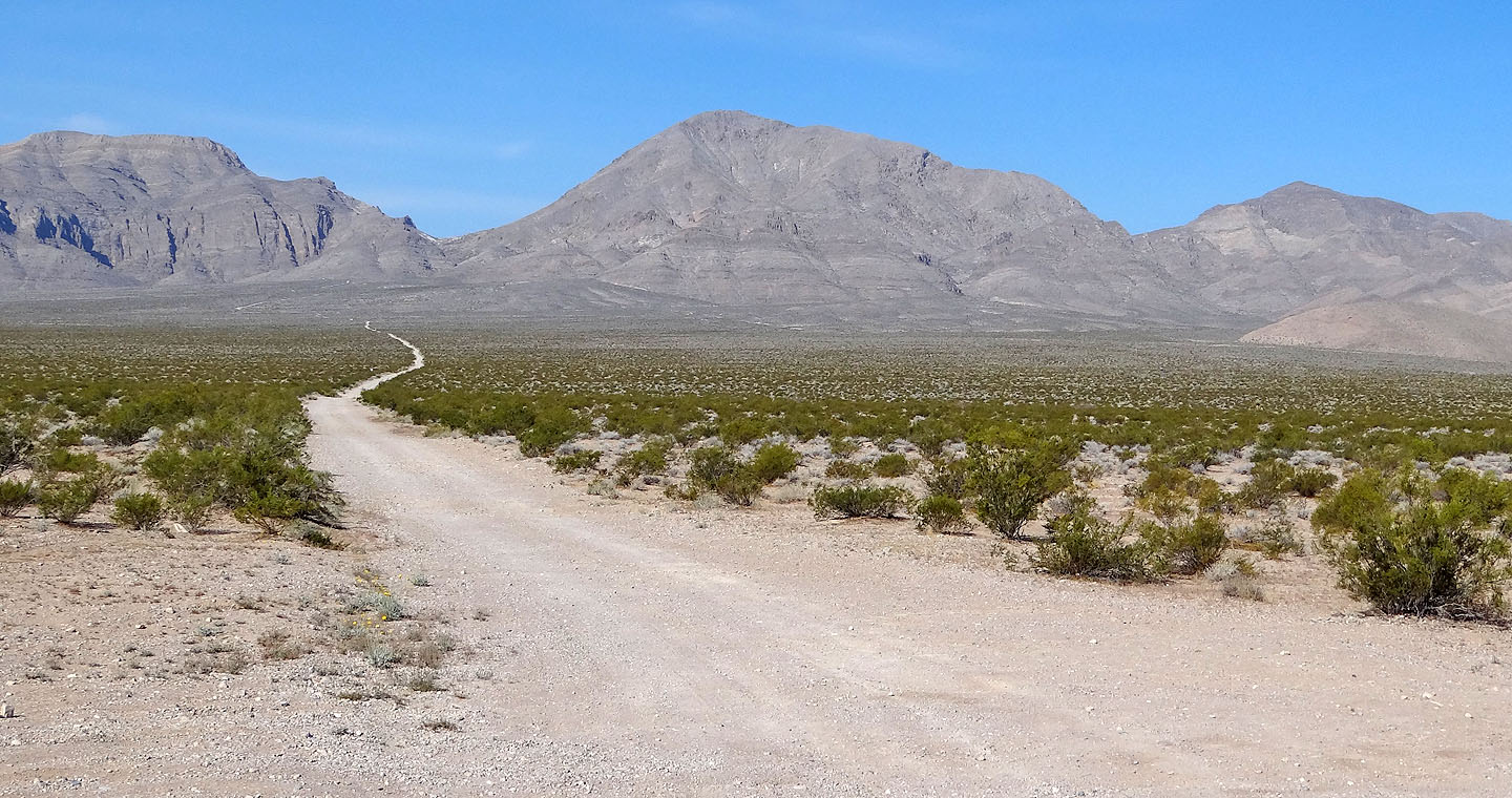
The dirt road leading to Devil Peak (centre)
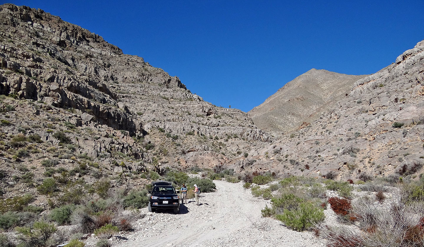
We parked at the mouth of the canyon
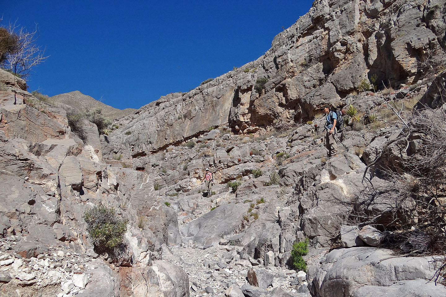
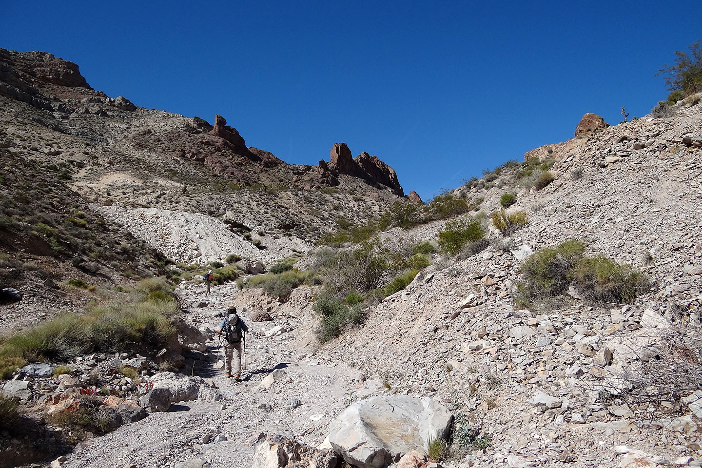
The canyon
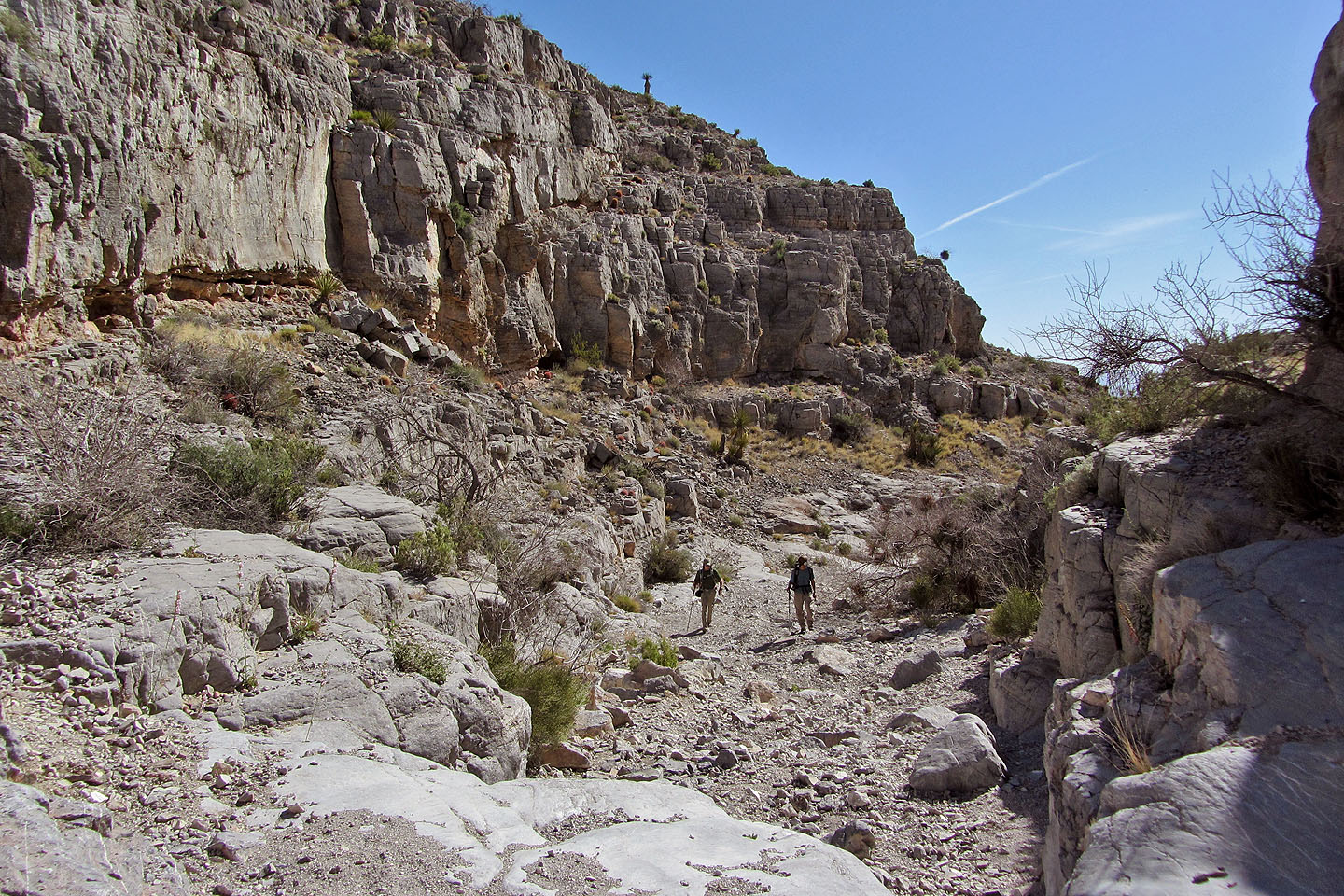
Looking back
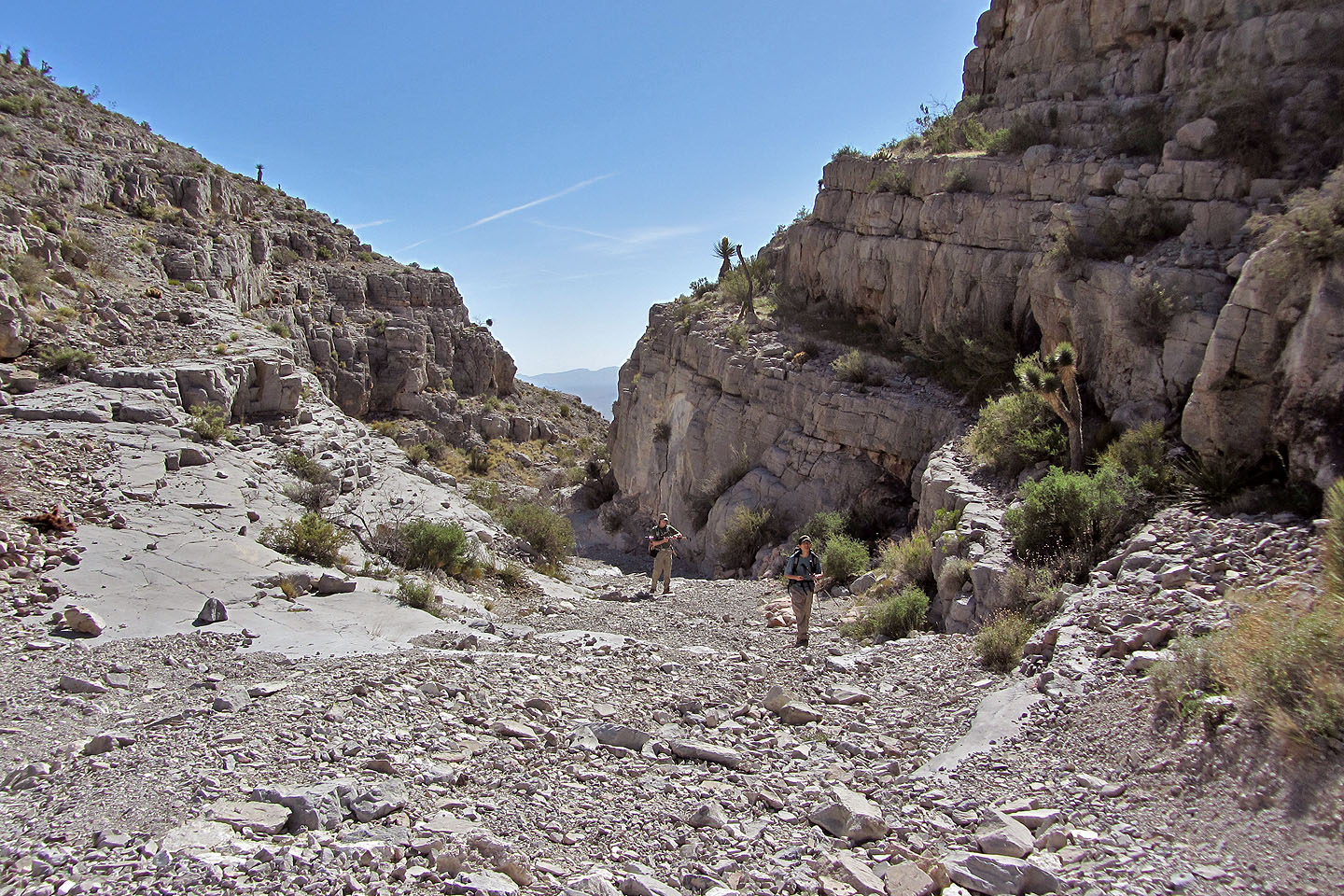
Continuing up the canyon
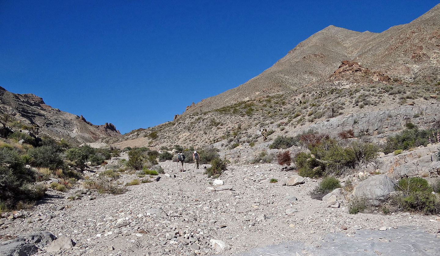
Heading to the saddle. Devil Peak's false summit is on the right.
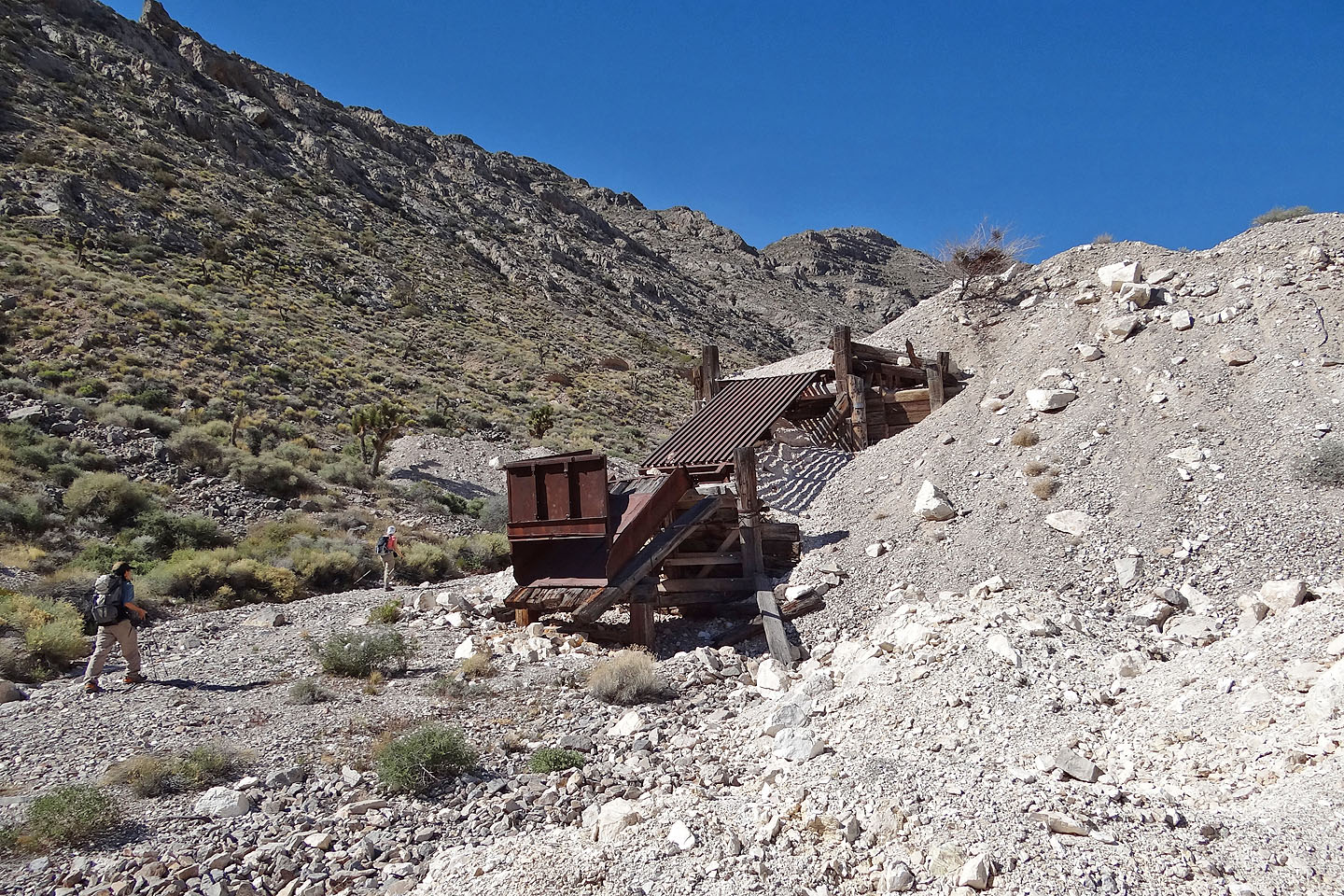
Mining equipment (mouse over for a close-up)
The outcrop above Shin looks like a reposing cat (mouse over for a close-up)
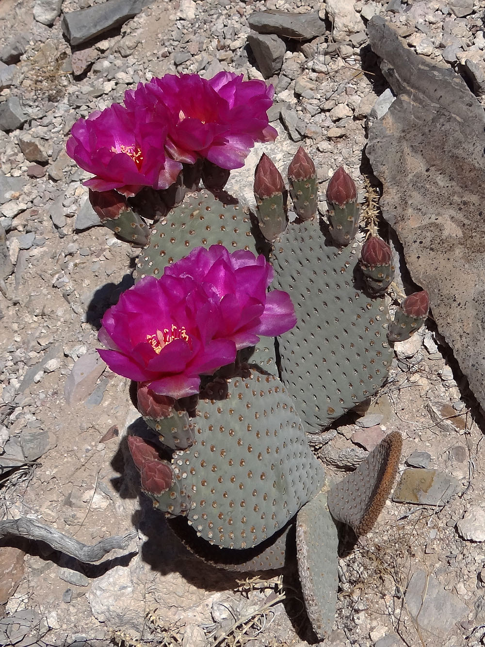
Flowering beavertail cactus
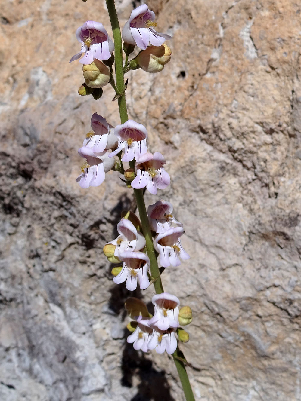
Palmer's penstemon
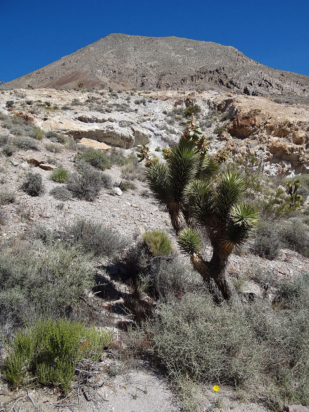
The ascent slope from the saddle. Joshua tree in the foreground bears
huge seed pods (mouse over for a close-up)
Starting up the slope

Unavoidable scree
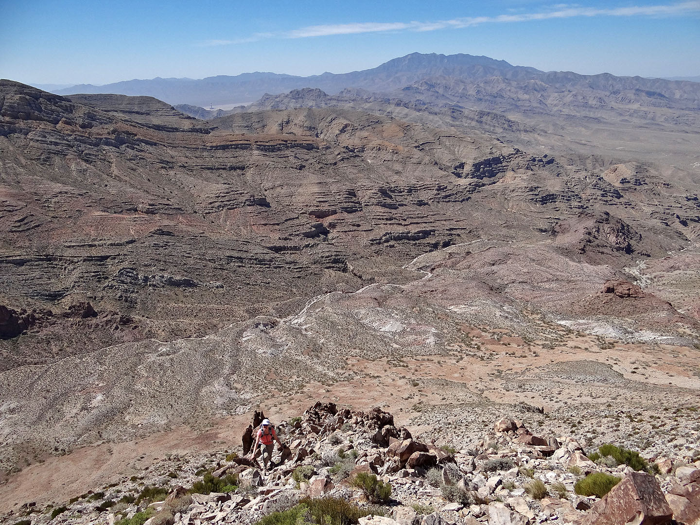
Looking down at the pass. Clark Mountain on the skyline.
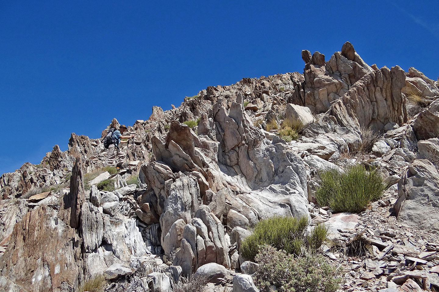
Unusual rock formations below the false summit
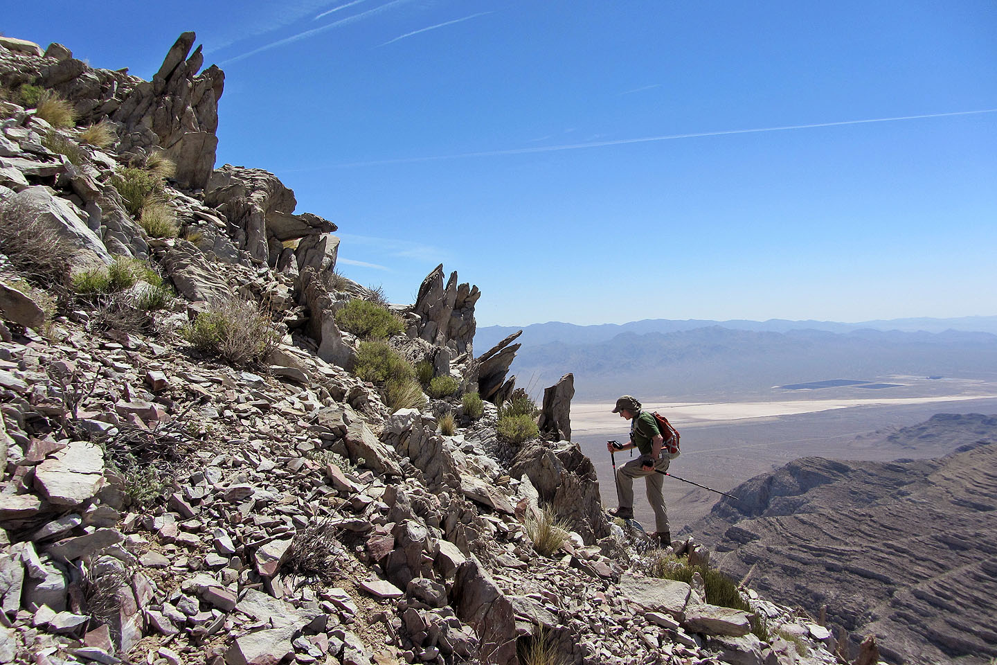
View east
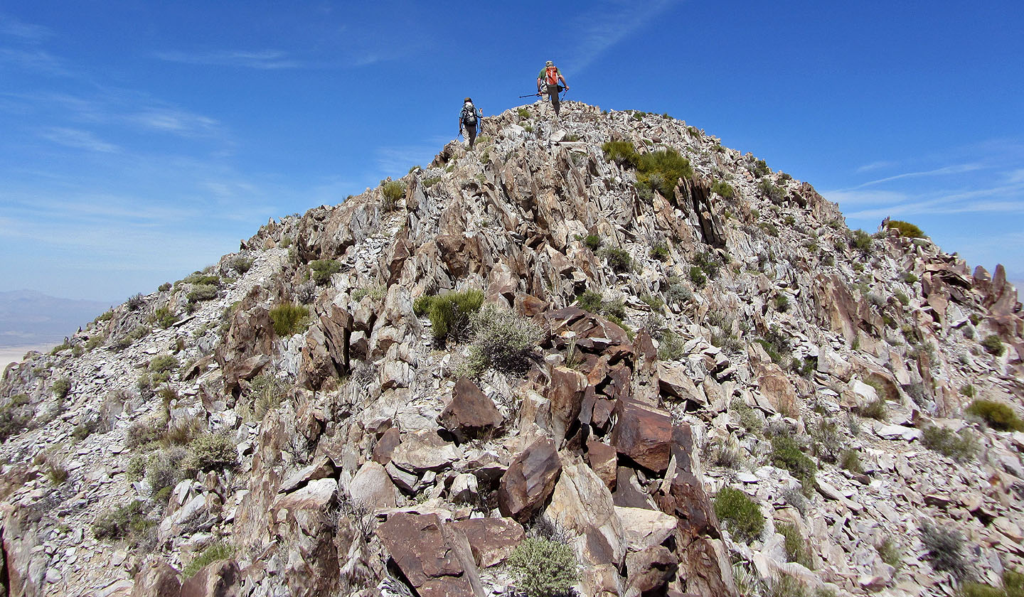
Ridgewalk to the summit
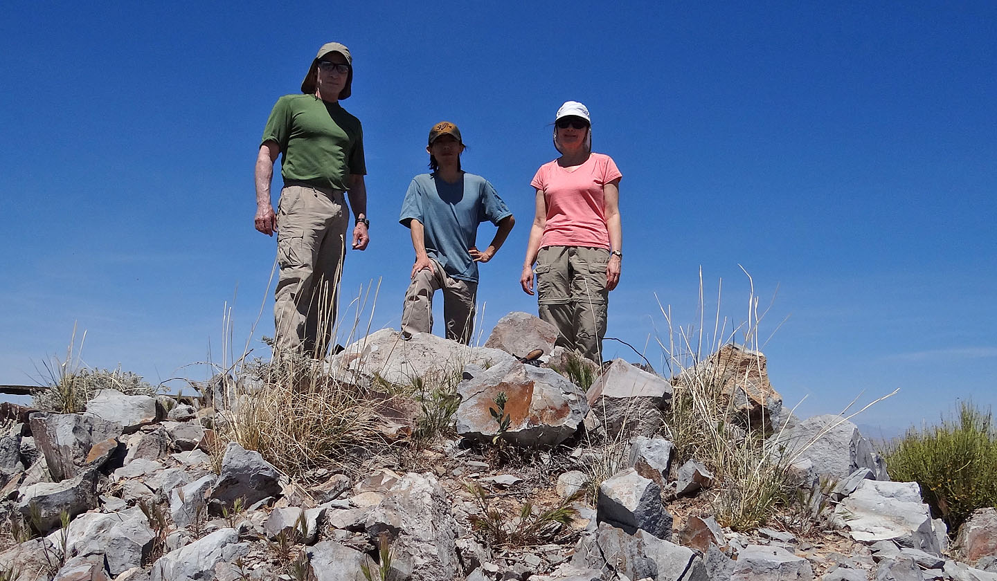
On the summit
Heading back to the pass
A rusted chain near a mine
Looking back at Devil Peak from the saddle
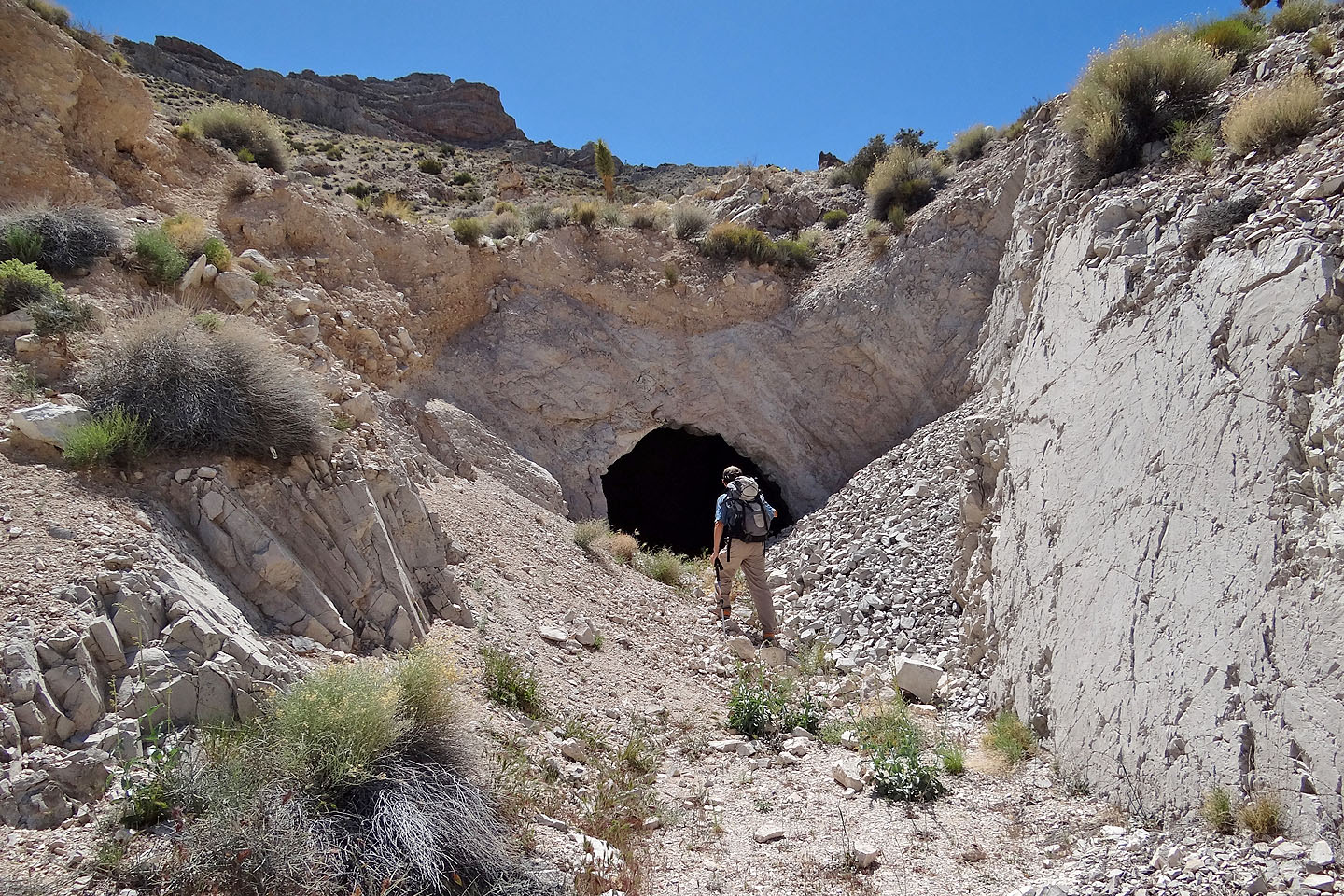
The small mine entrance leads to a cavernous interior (mouse over). Temperatures were
pushing 30C, but it must have been 5 degrees cooler in the mine.
Stateline Pass (3.9 mi, 5817 ft, 2169 ft)