bobspirko.ca | Home | Canada Trips | US Trips | Hiking | Snowshoeing | MAP | About
View from Mount Henkel
Mount Henkel and Crowfeet Mountain
Glacier National Park, Montana
July 26, 2014
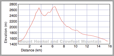
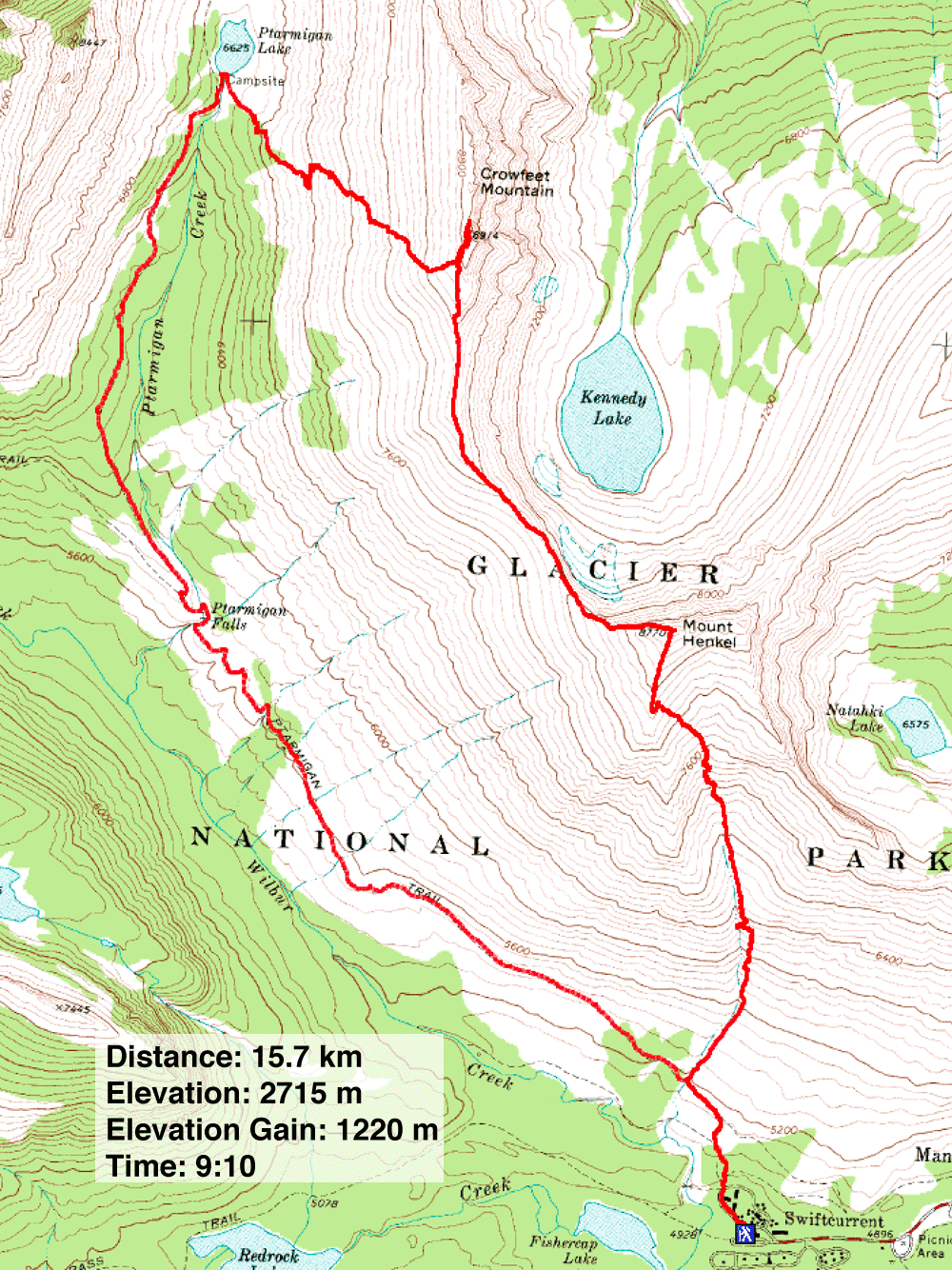
Distance: 15.7 km (9.8 mi)
Cumulative Elevation Gain: 1579 m (5180 ft)
When Sonny Bou invited me to climb Mount Henkel and Crowfeet Mountain, I knew little more than that they were south of the border. So I referred to my copy of A Climber's Guide to Glacier National Park. The route for Henkel starts on Iceberg-Ptarmigan Trail but soon leaves it for a brief side trail that heads to Henkel's south couloir. After climbing two sets of easy cliff bands, the route turns left to gain the ridge leading to the summit.
In his book, Gordon Edwards says little about Crowfeet Mountain other than it's a long traverse from Mount Henkel. From Crowfeet, instead of returning the same way, Sonny wanted to drop down the west slopes and head to Ptarmigan Lake. We could then follow Ptarmigan Trail back.
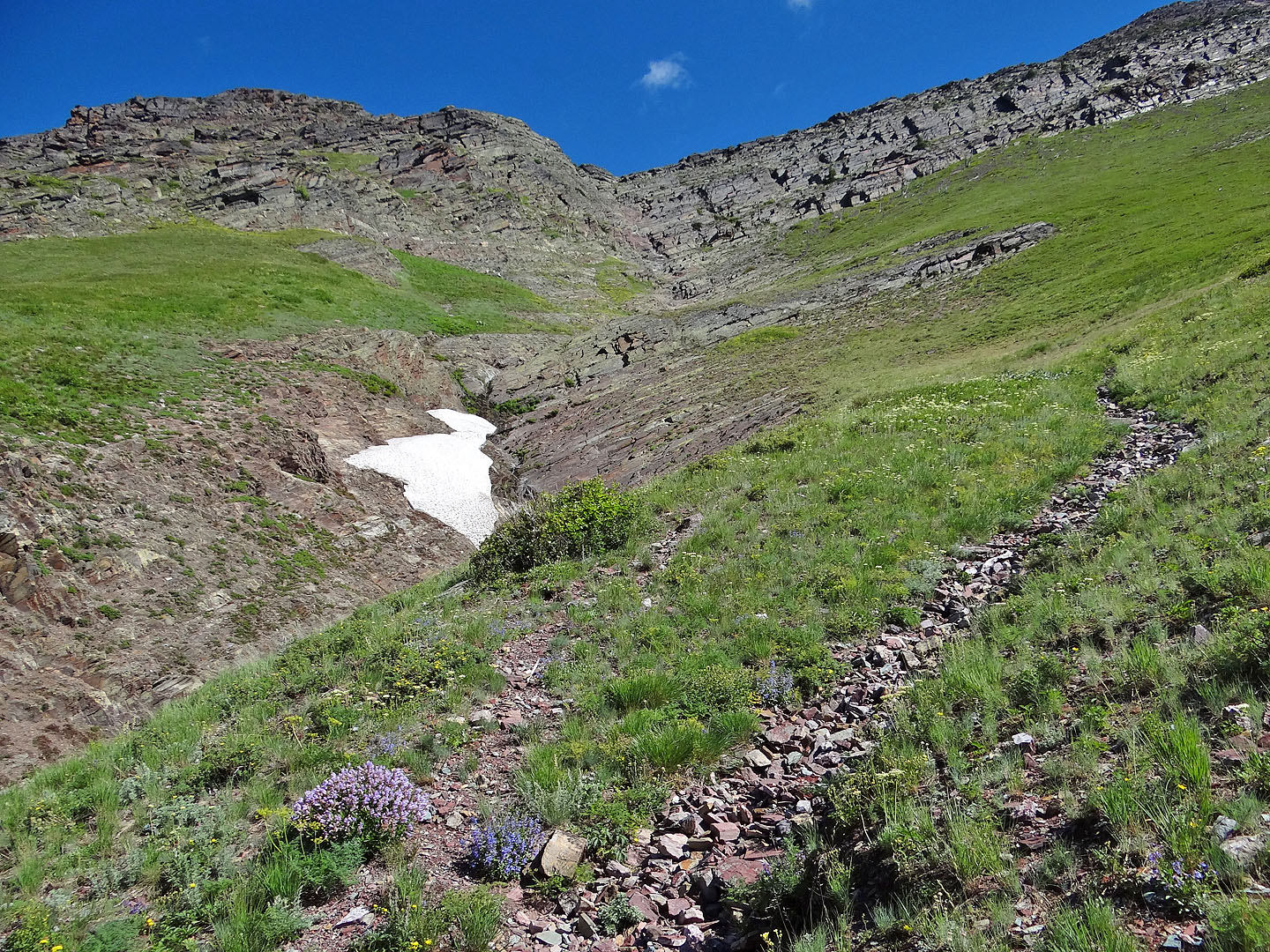
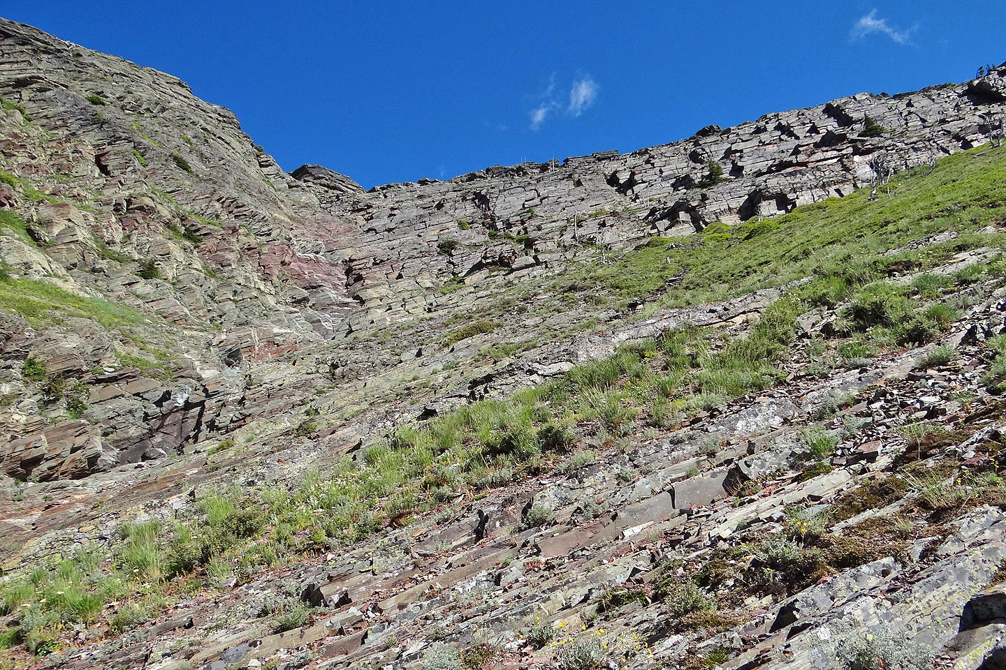
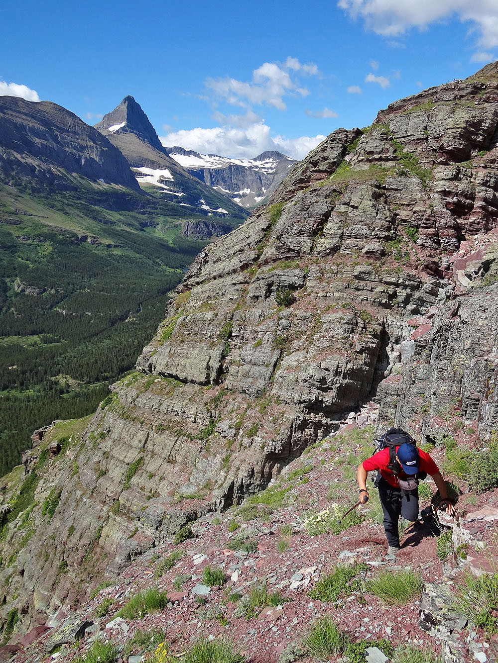
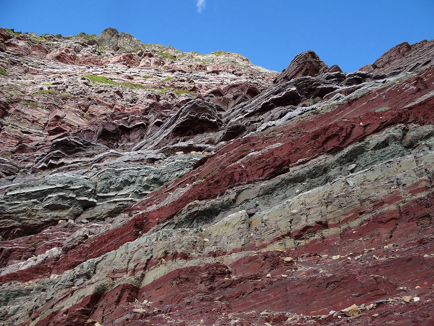
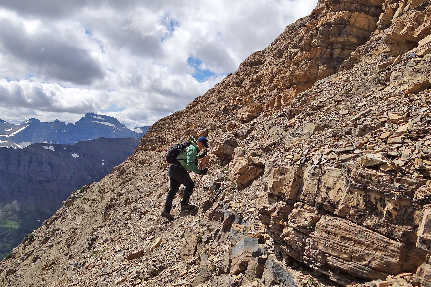
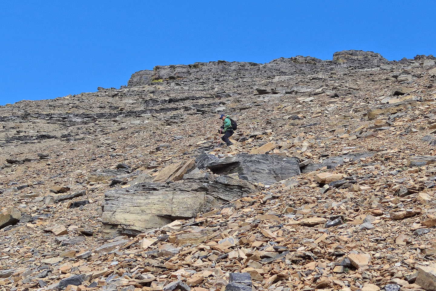
From the parking lot, it took us 15 minutes to reach the side trail that stops short of the first cliffs below Henkel. The book suggests going up the short, gray cliffs, but since they were covered in loose stones, they weren't as easy as they looked. However, the dry gully on the left worked well for us. After scrambling up partway, we caught a ledge on our right and reached the top of the cliffs. Ahead, a red basin stretched to another set of short cliffs.
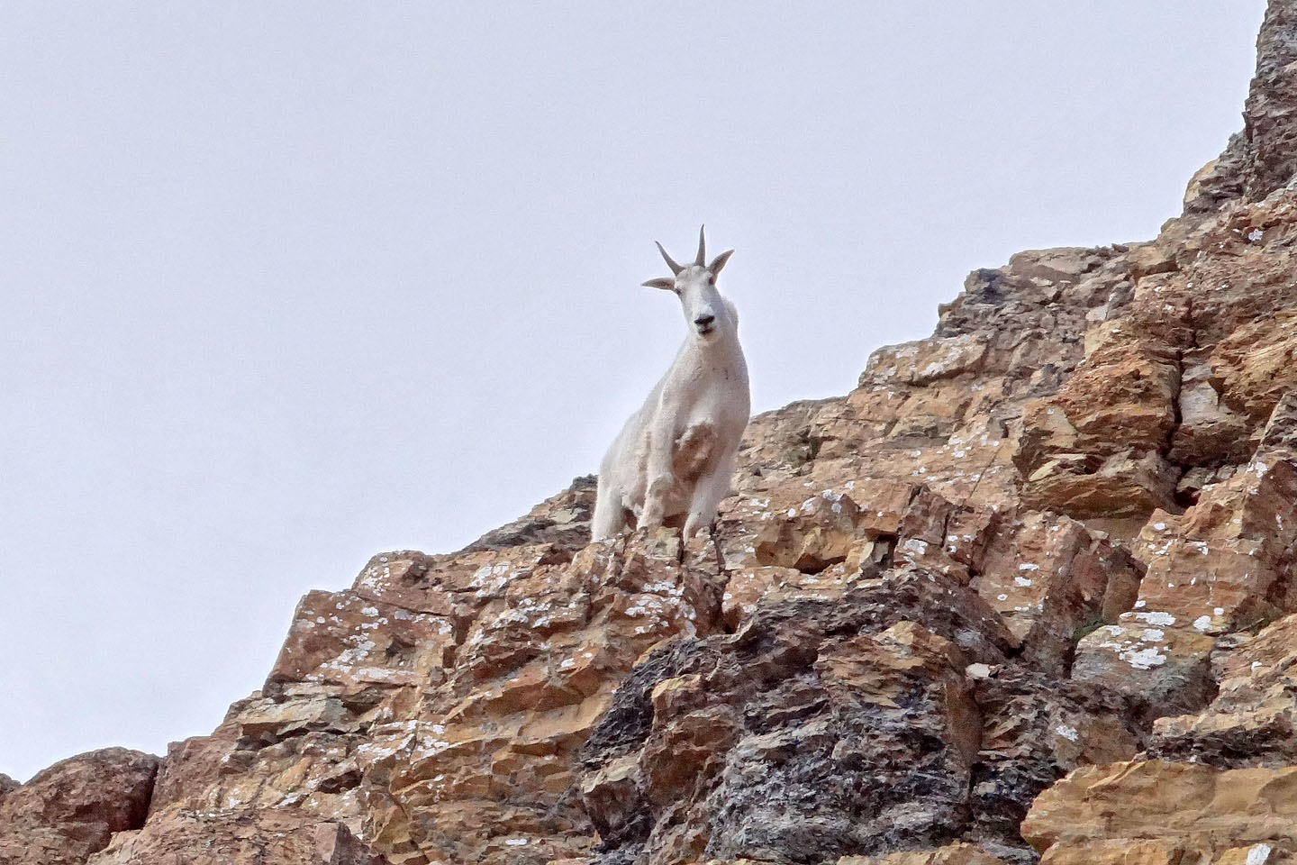
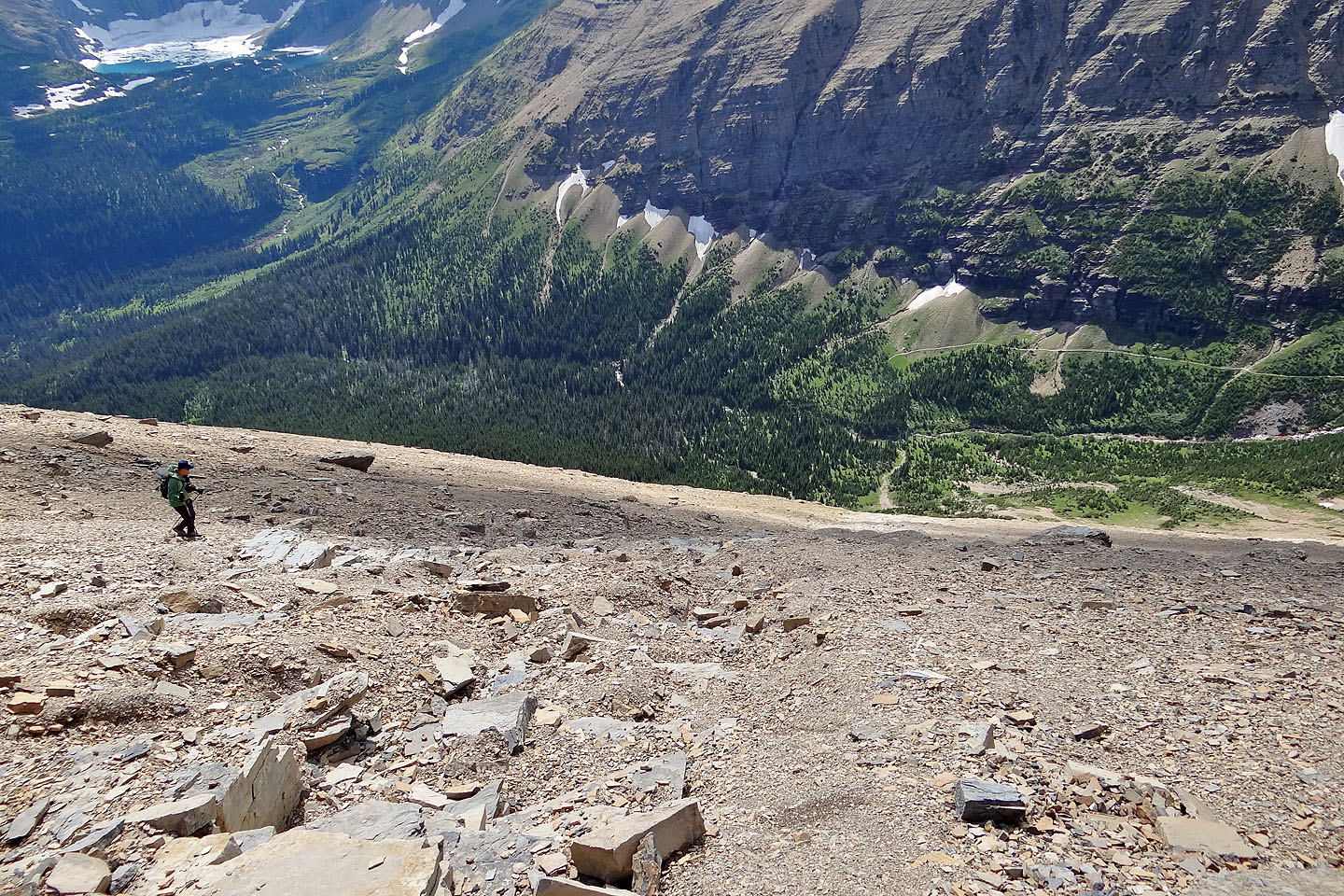
On our way up, routefinding was never demanding so we had plenty of time to observe the abundant wildlife. And there was no lack of it. While ascending the red cliffs above the basin, we passed two mountain sheep grazing. Then when we reached the top of the cliffs, we spotted a mountain goat high up the rubbly slope we had to ascend. Before reaching the ridge we would see two more goats as well as three marmots.
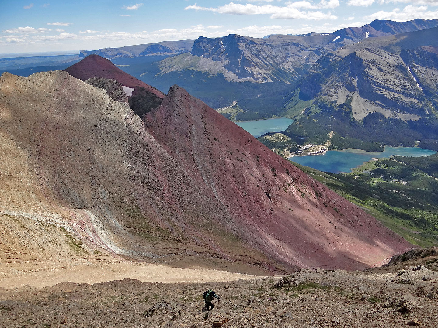
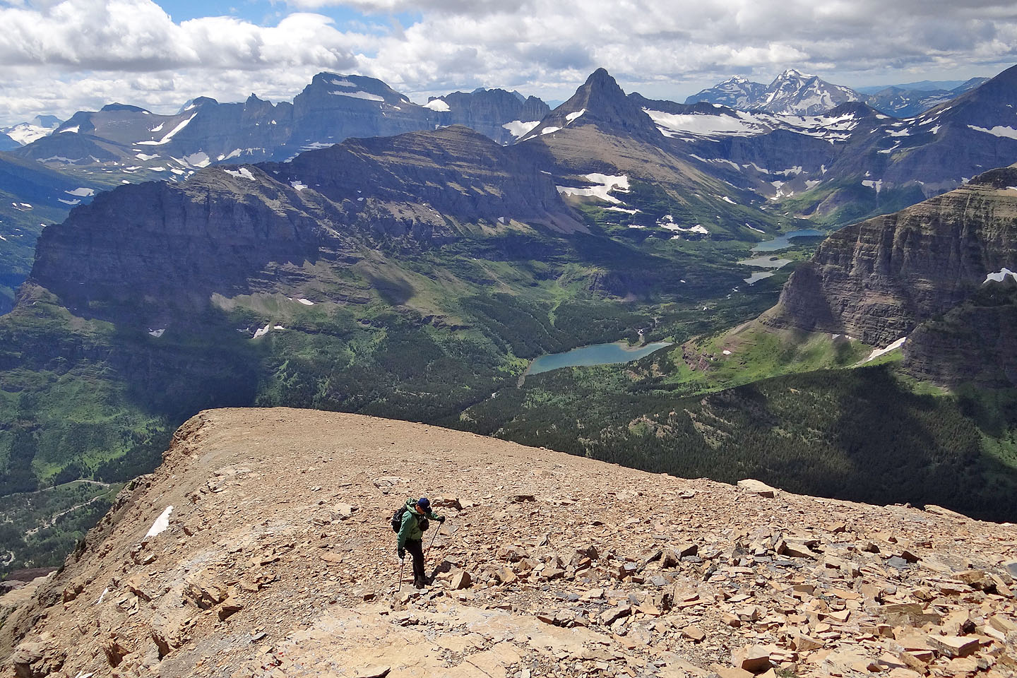
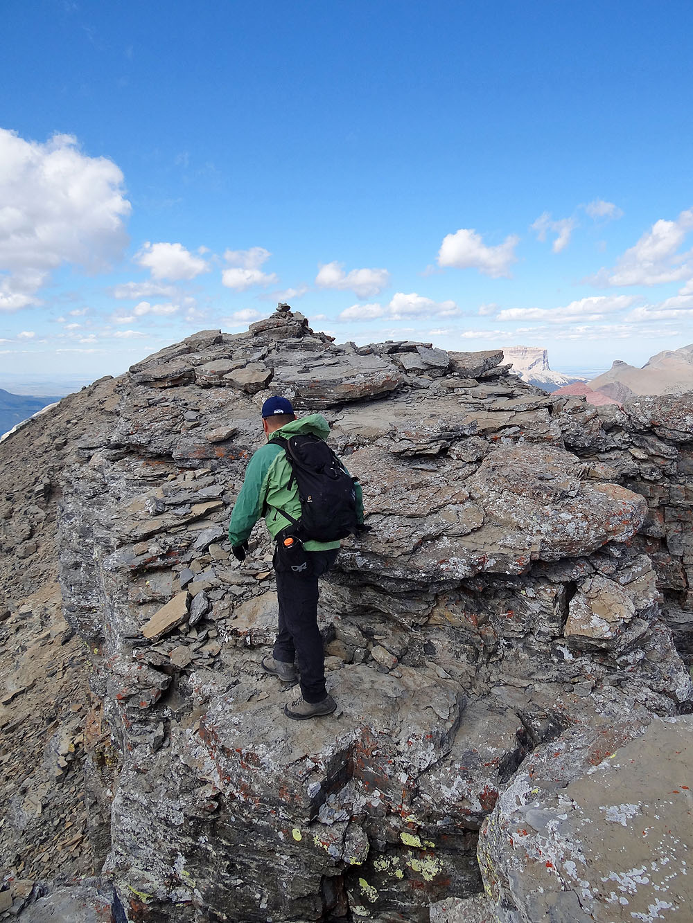
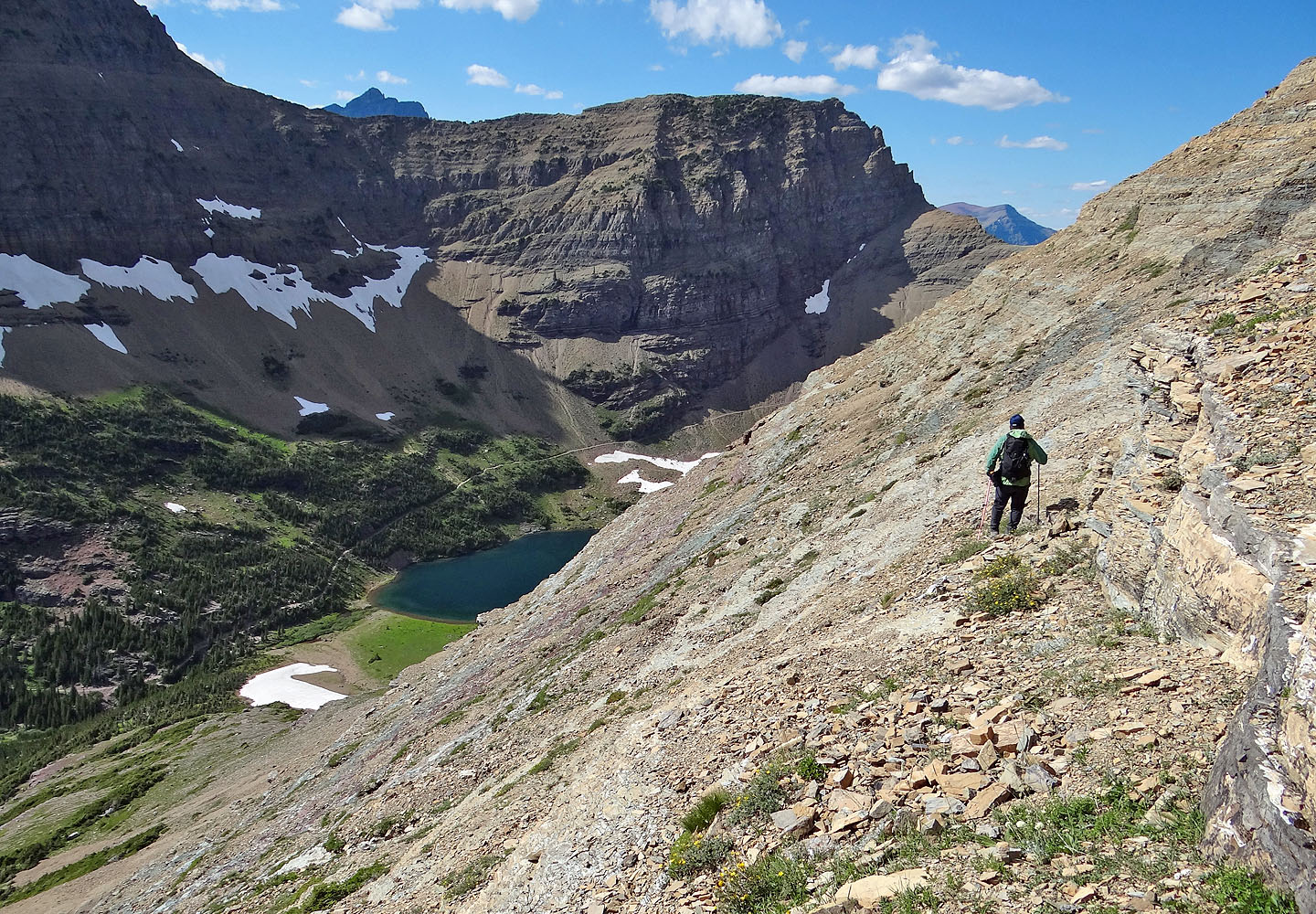
After a short hike along the ridge, Sonny and I arrived at the top of Mount Henkel. After our summit stay, we followed the trail that links Crowfeet to Henkel We relished the expansive scenery along the high traverse, although at the expense of losing nearly 300 m of elevation. A long summit block caps Crowfeet Mountain, and we spent several minutes searching for the best way up before finding it next to a lichen-covered rock pillar near the south end. After a brief scramble, we hiked to the north end.
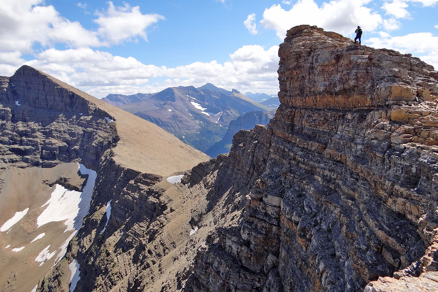
Sonny easily crossed an exposed section of ridge and tagged the summit cairn. But I wasn't comfortable with the vertical drop and stopped about 30 lateral feet short of the top. I went back along the summit block to take a panorama.
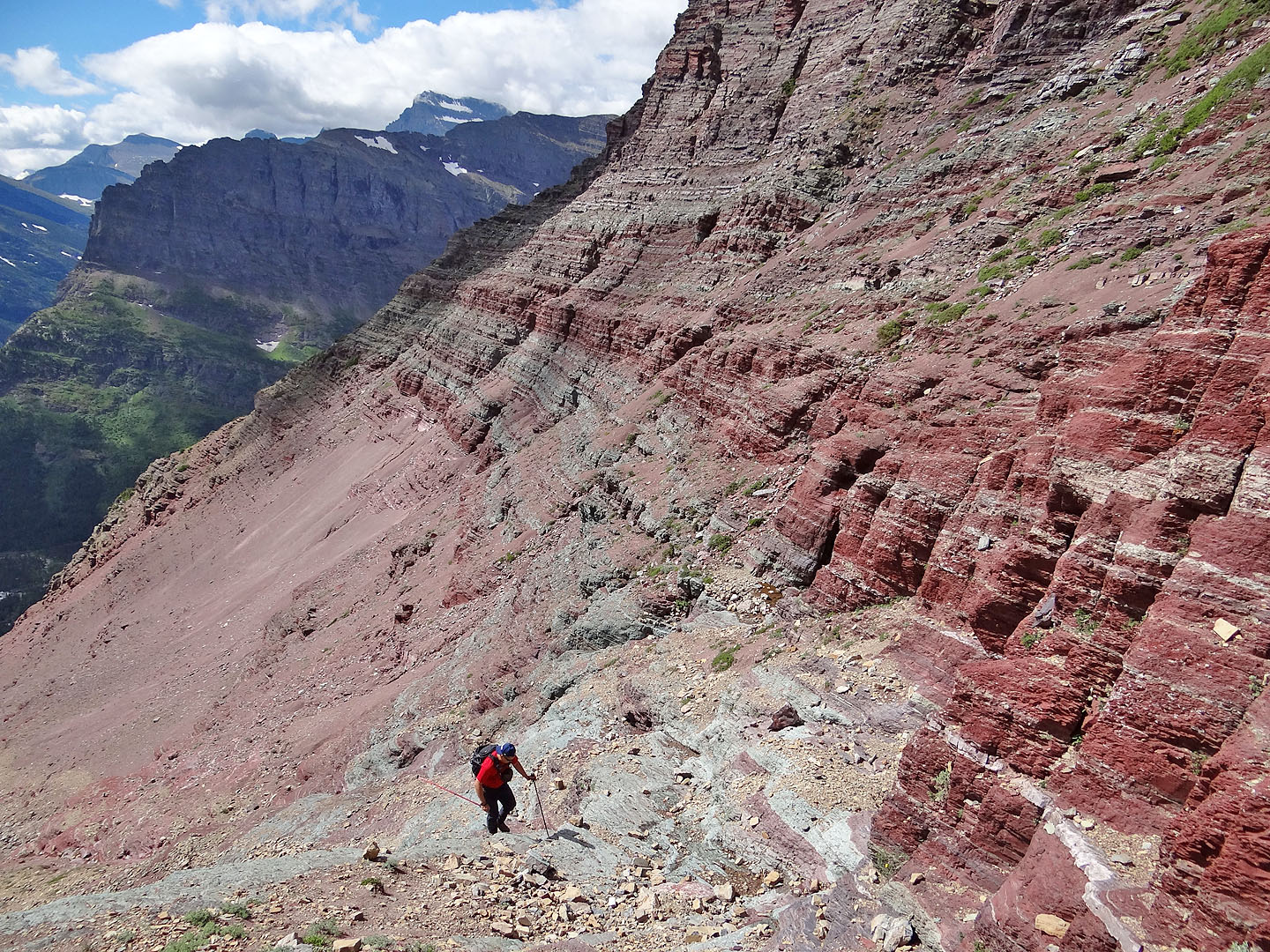
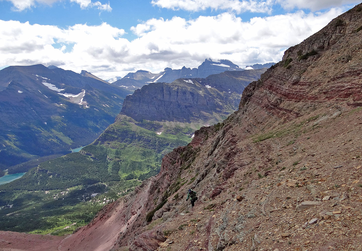
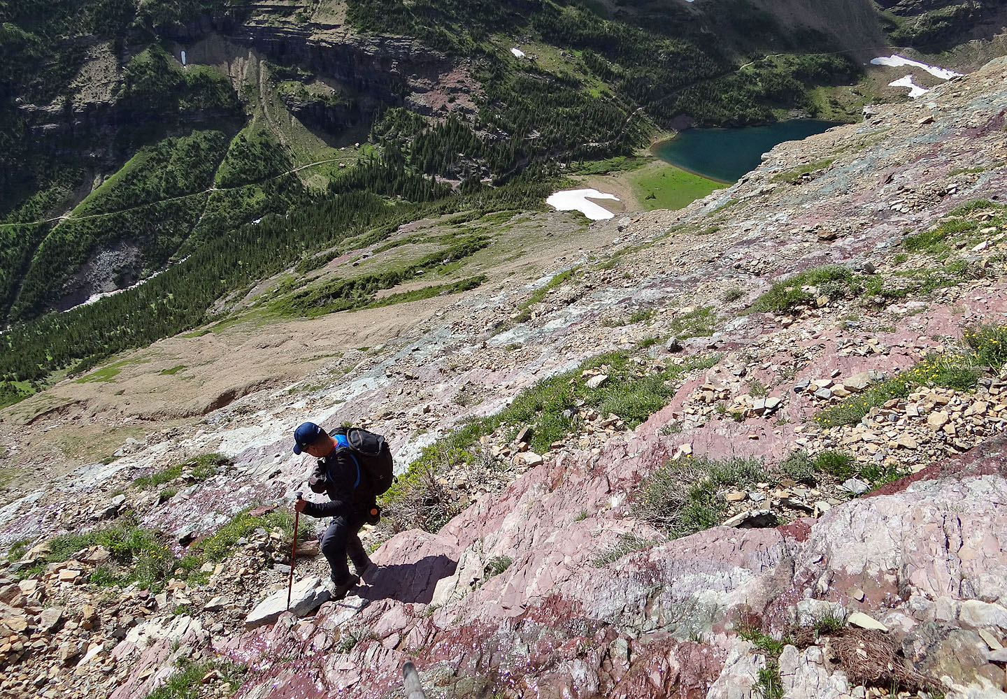
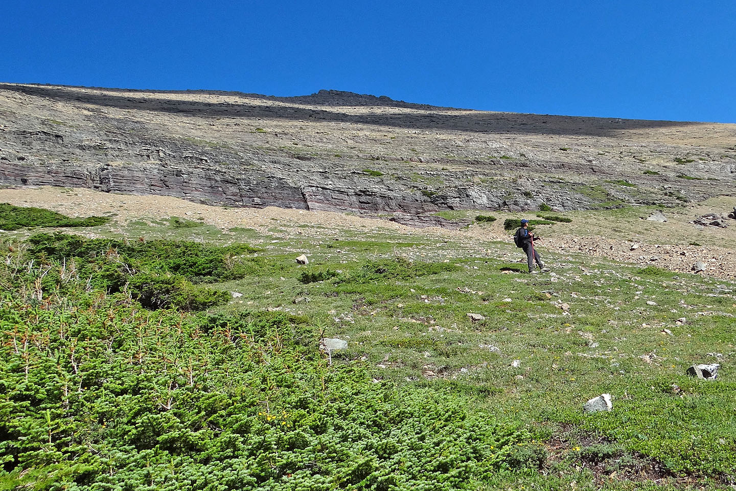
Then we started down the west slopes to Ptarmigan Lake. Taking advantage of the good scree in places, we descended quickly at first. But as we neared the base of the mountain, our pace slowed. Not only did we have trouble discerning the cliff bands below us, but we had to navigate down through steep slabs. Little wonder that a well-used trail runs between Henkel and Crowfeet, yet none goes down to Ptarmigan Lake.
Somehow we managed to thread through the slabs and cliffs, and gratefully reached the lake. Near the end of our 7 km hike back along Ptarmigan Trail, we passed two bears close by, foraging in dense bushes. The wildlife sightings put a nice finish to our trip.
Sonny's Trip Report
KML and GPX Tracks
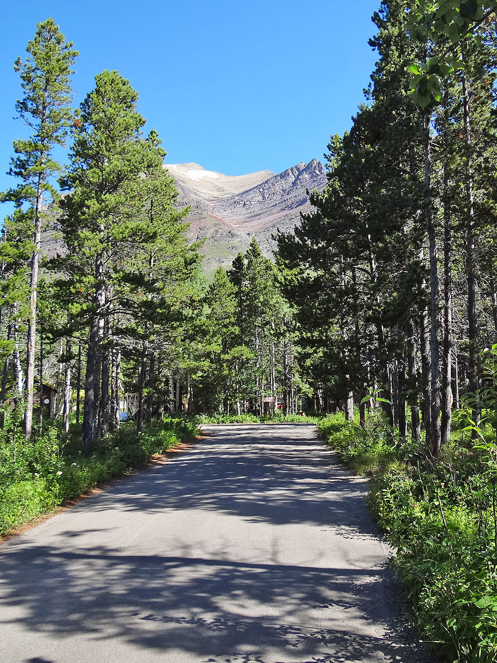
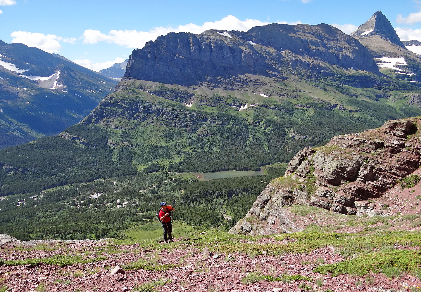
Henkel's upper route can be see from near the parking lot
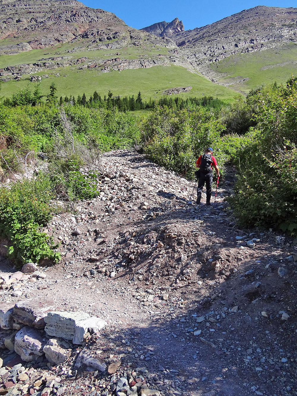
From Iceberg-Ptarmigan Trail, we took the side trail leading to the first cliffs
When the trail ended, we made our way to the cliffs
We started up a gully left of the cliffs
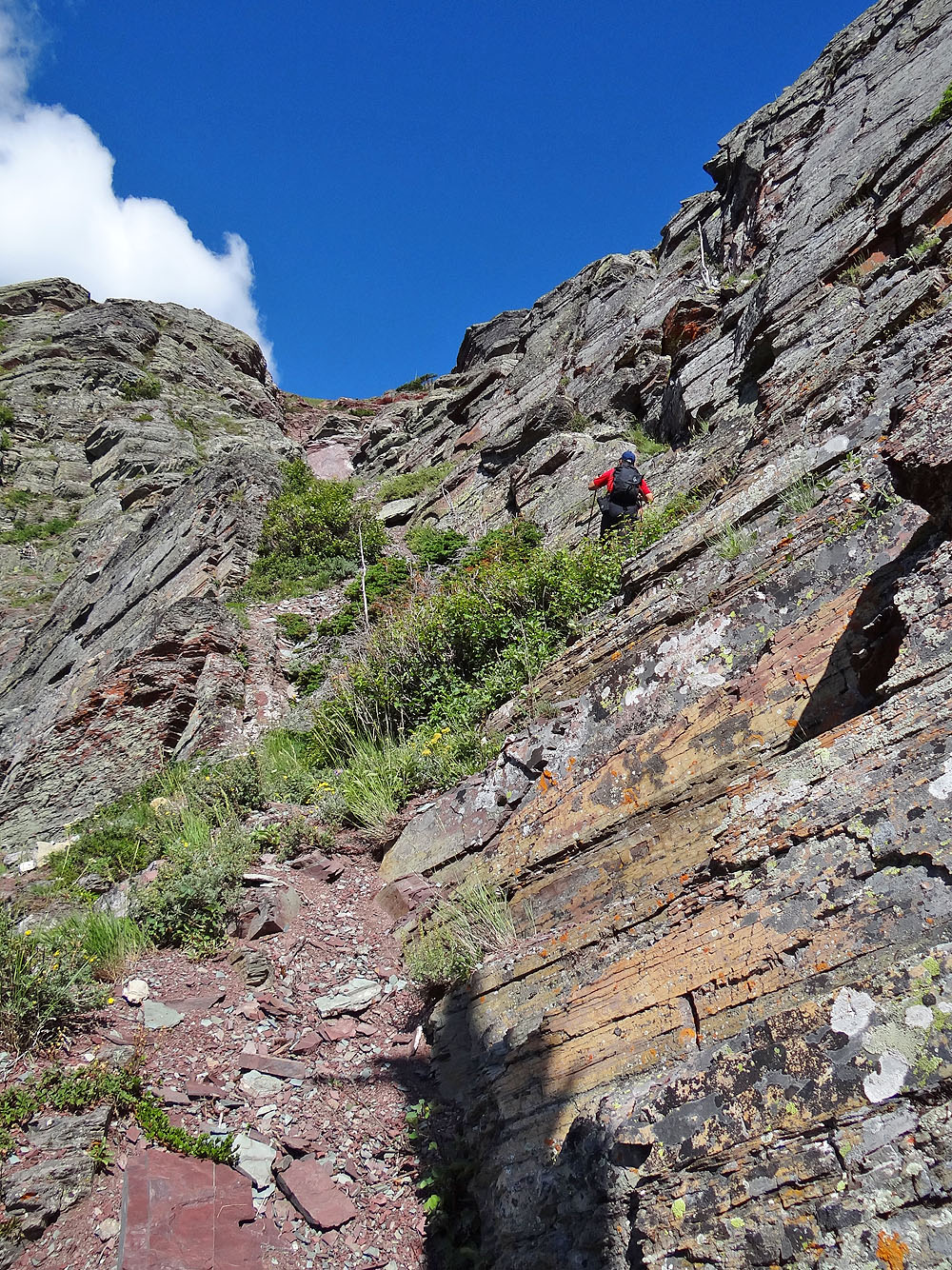
We headed to the gully
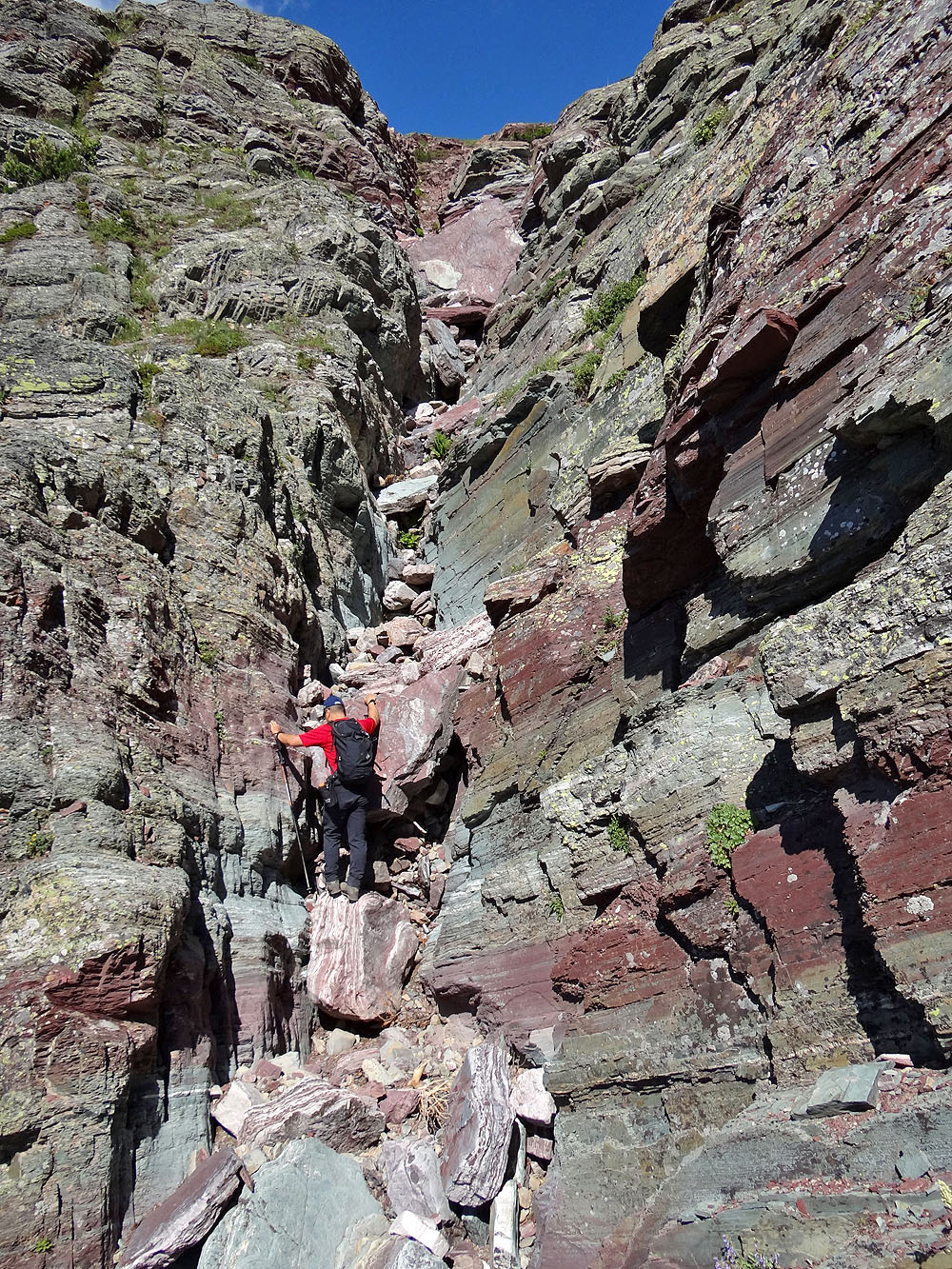
Fun scrambling up the gully. Before reaching the large red boulder
we turned right and traversed a ledge.
On the ledge
We topped out above the cliffs with Grinnel Point (above Sonny) and Mount Grinnel behind us
After crossing the red basin we approached the cliffs at the end
We zigzagged up easy ledges
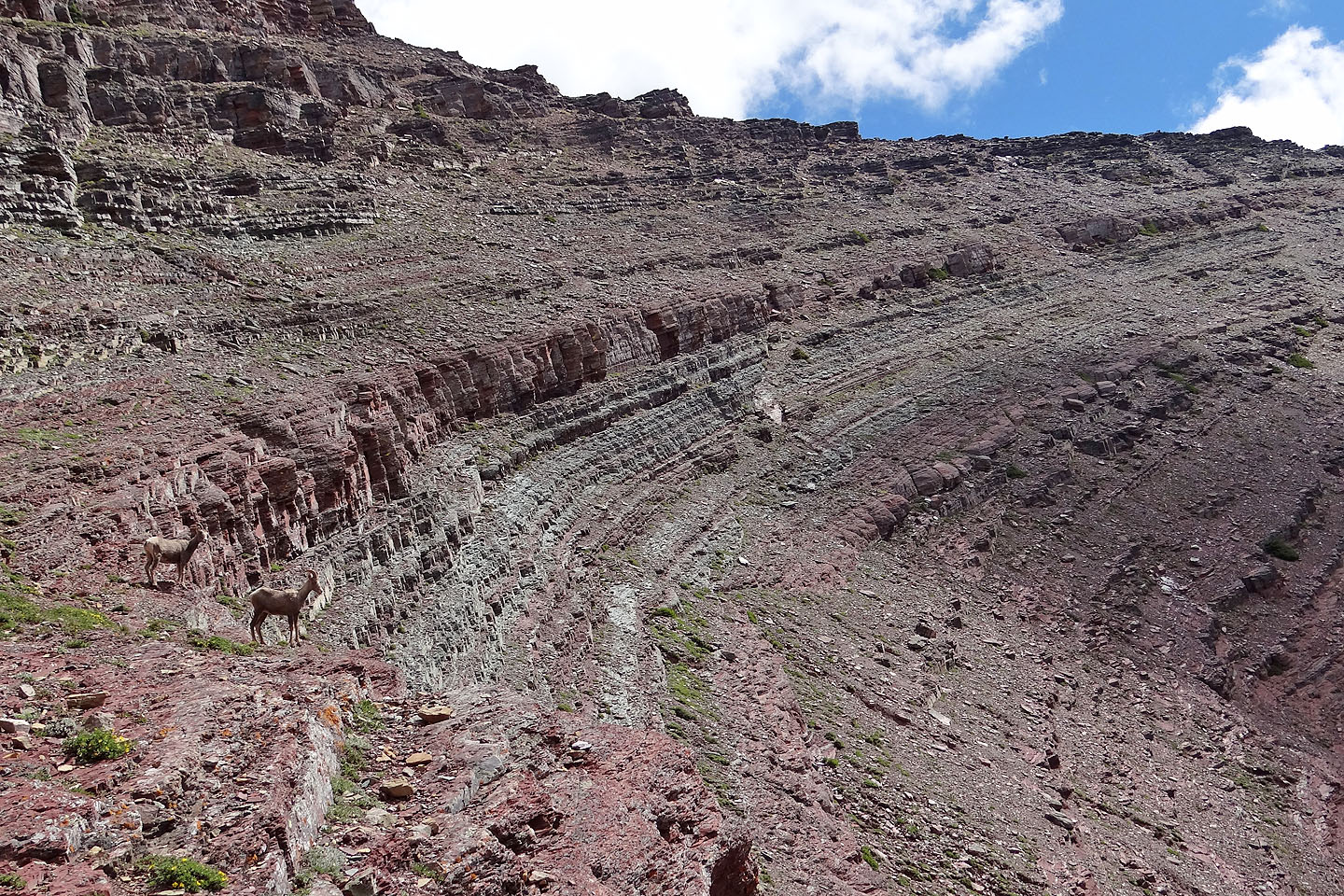
A couple mountain sheep posed for us (mouse over for a close-up)
More ledges above us
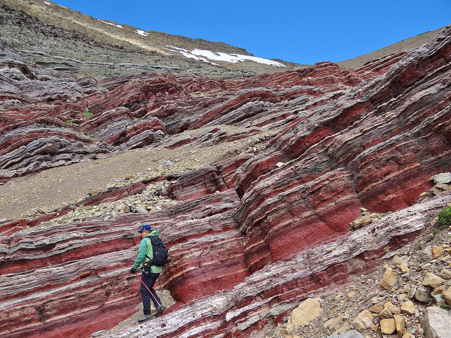
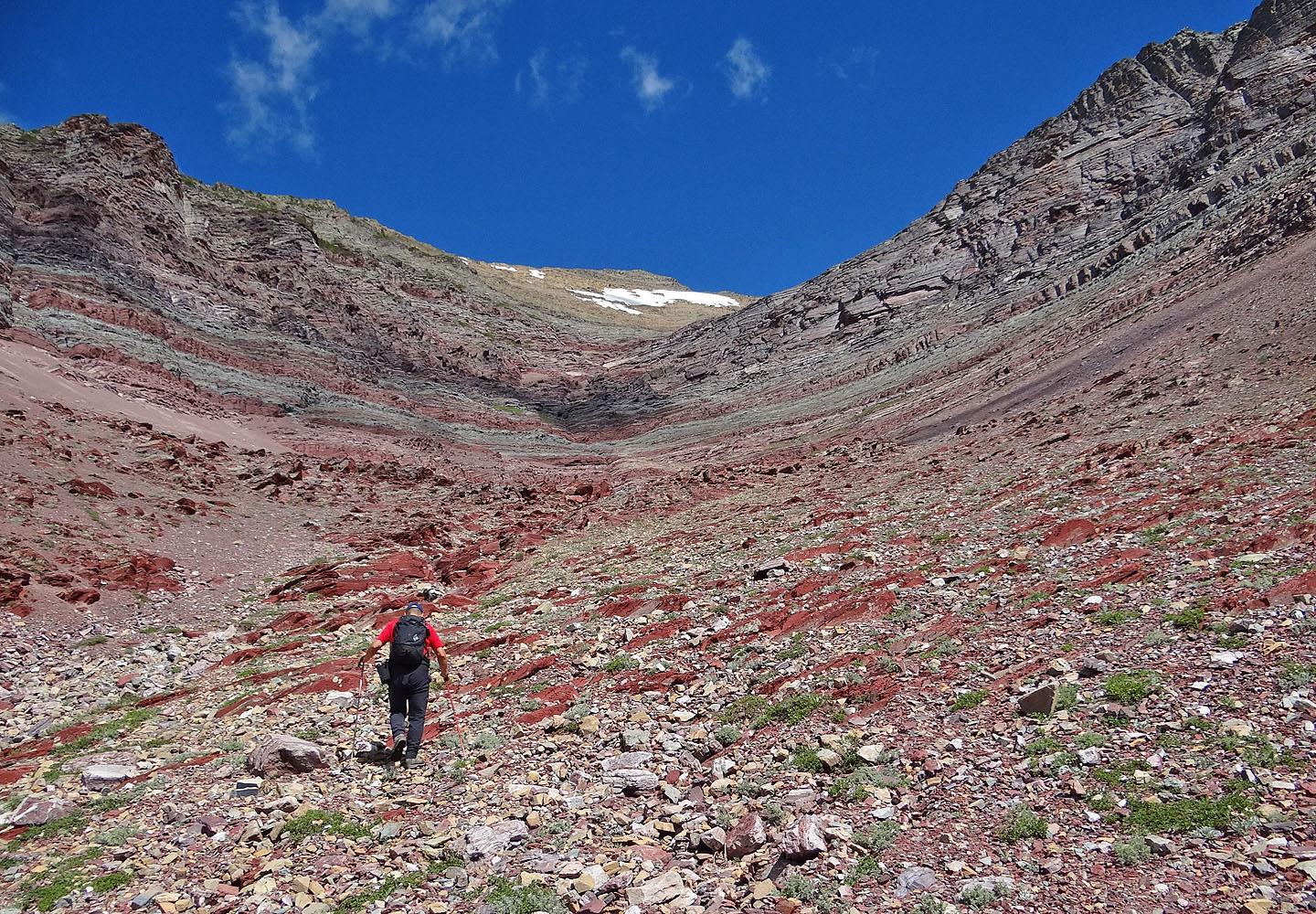
After ascending the last of the red cliffs, we headed up the slope on the left
High above the red basin
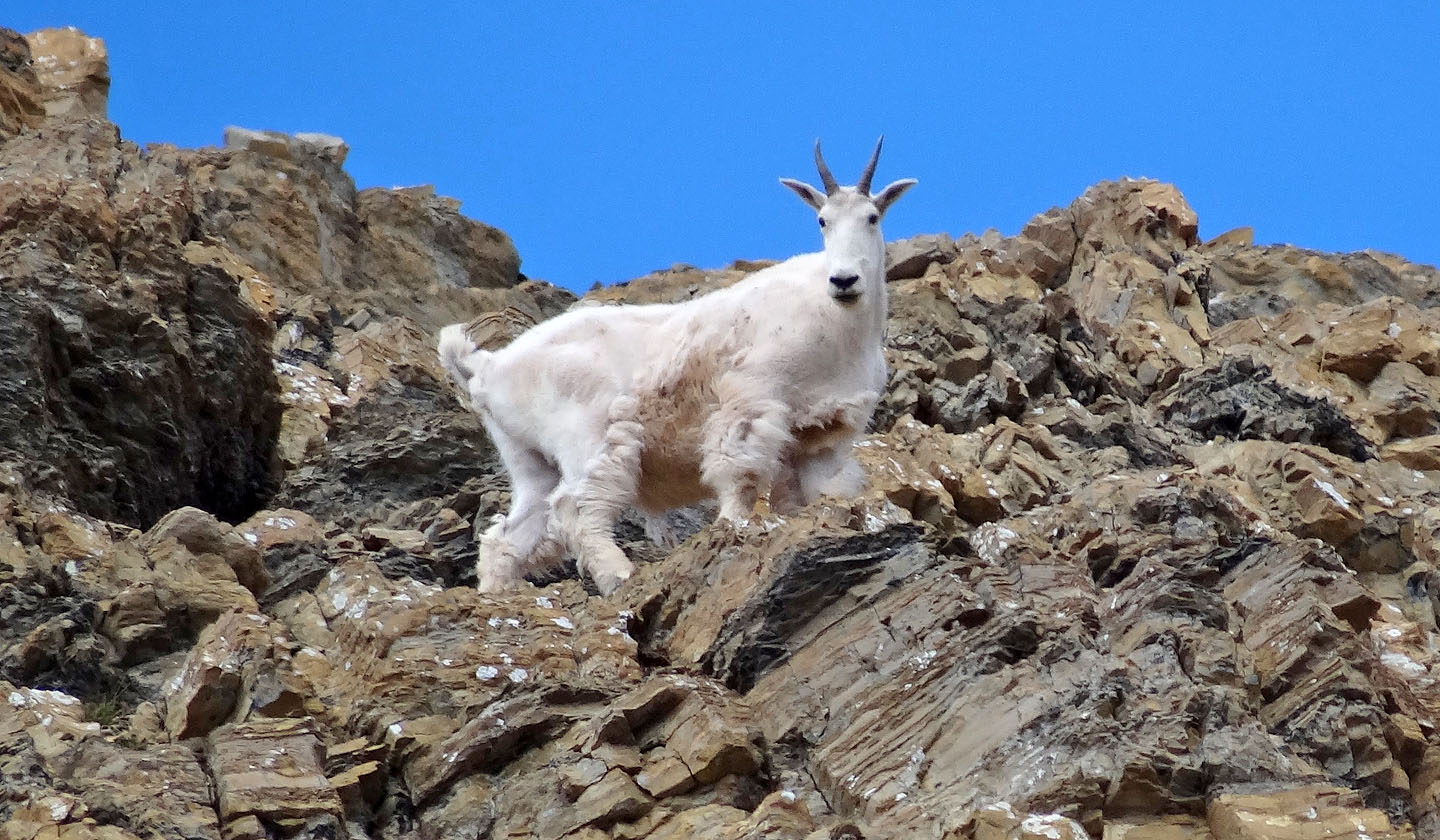
One of three mountain goats that climbed above us
Another goat along with a hoary marmot (left on the skyline)
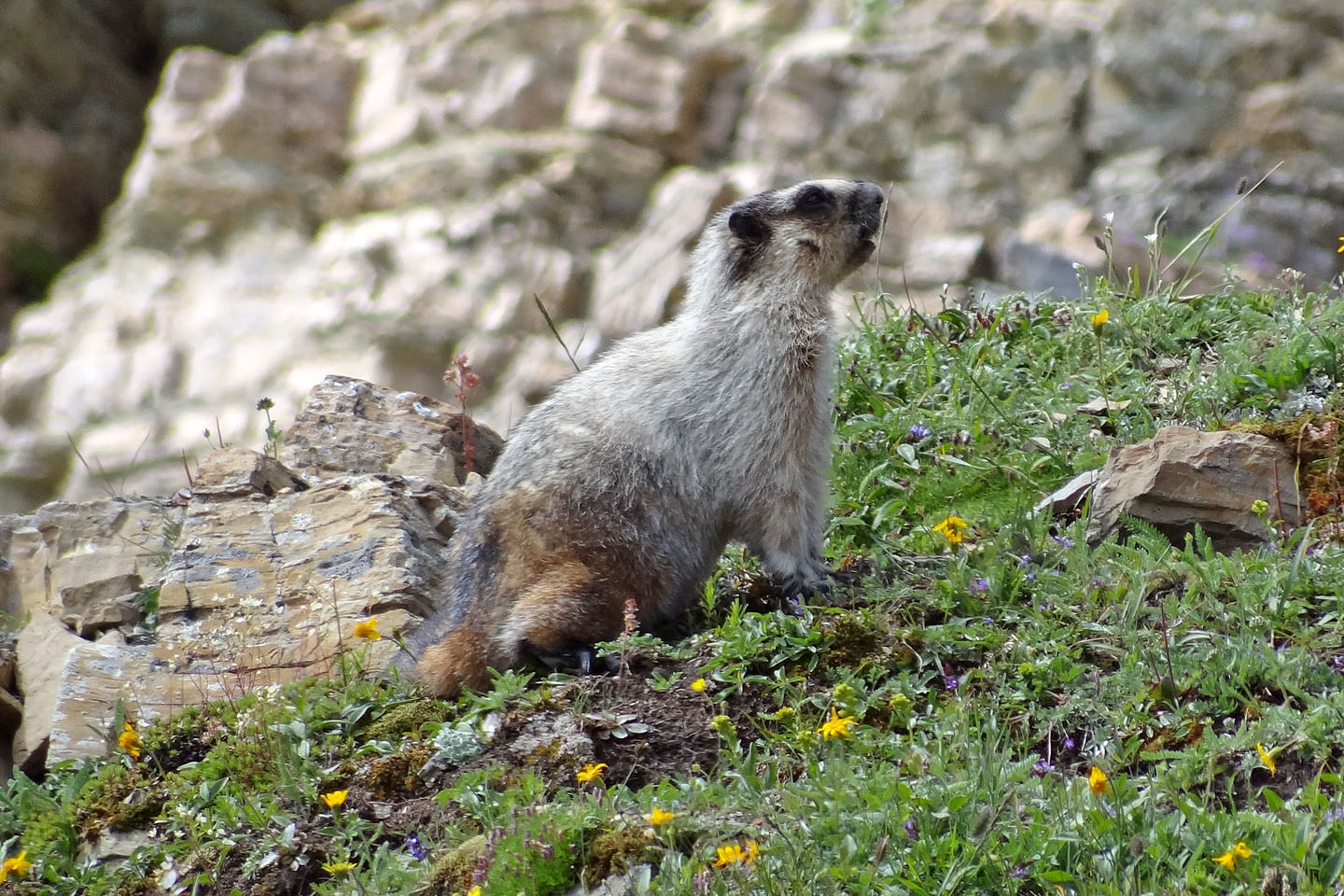
Juvenile marmot
Looking down at the basin
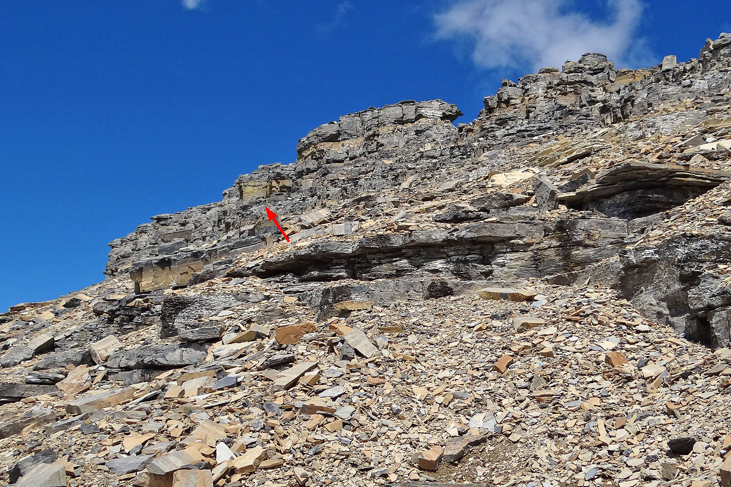
Minor cliff bands on the way to the ridge
After a steep climb we found a gentler grade on the ridge
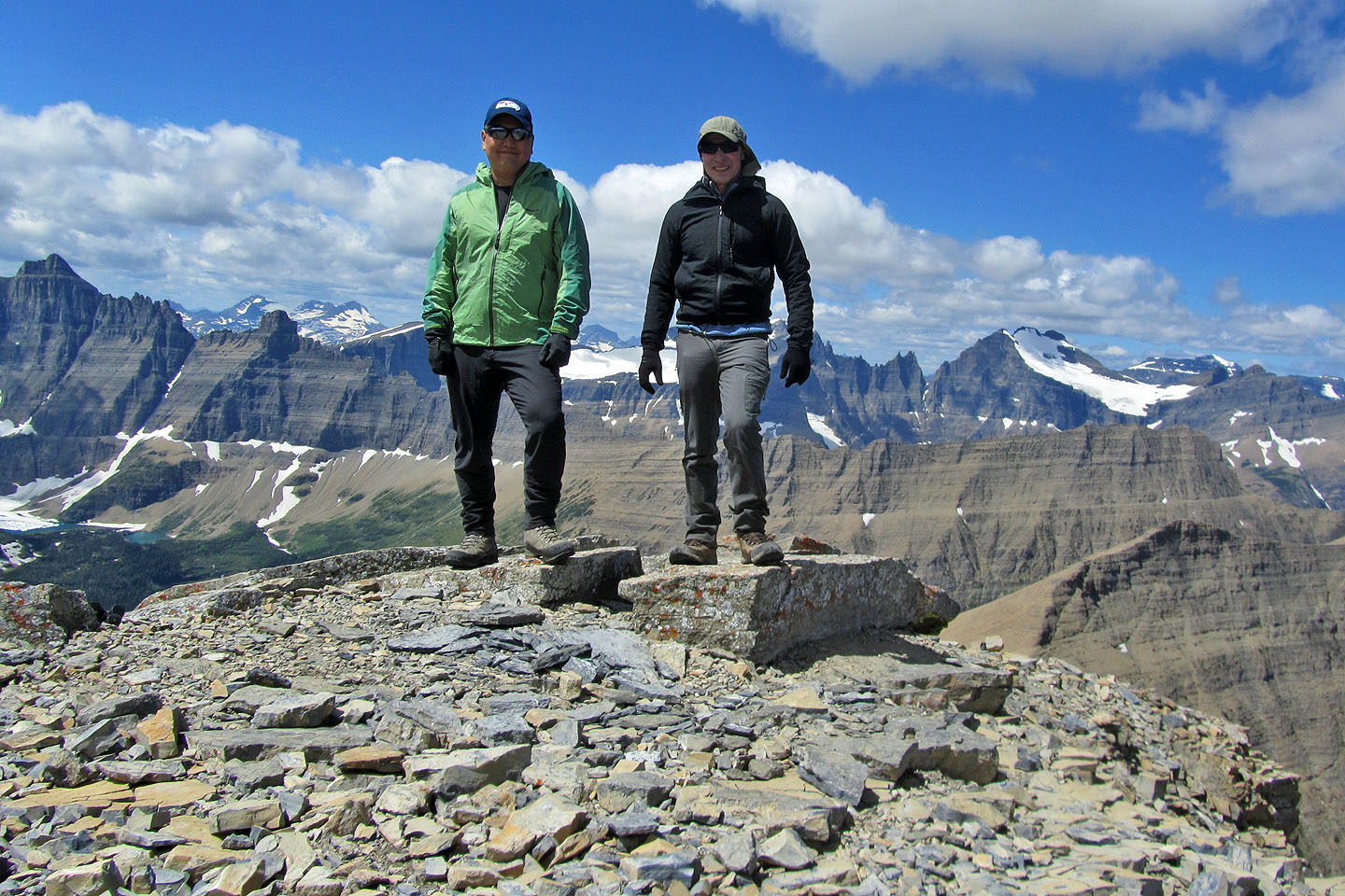
On the summit of Mount Henkel
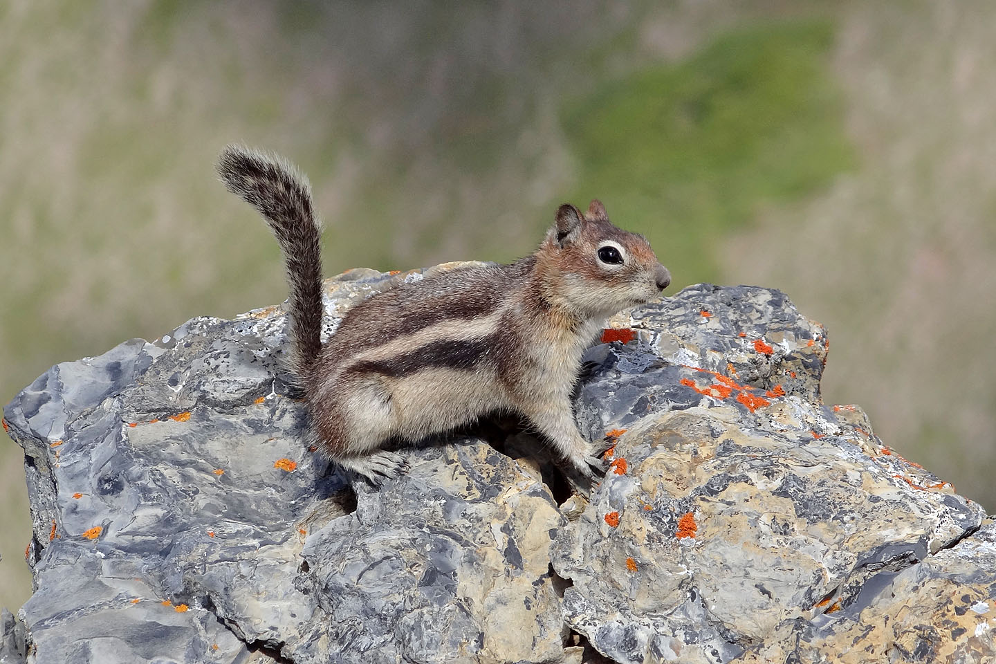
Golden mantle ground squirrel on the summit
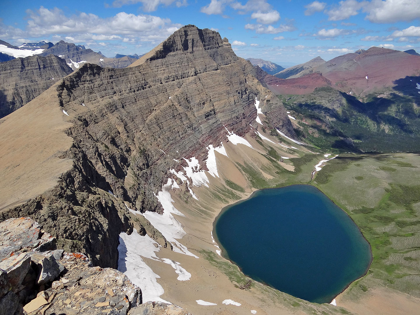
Crowfeet Mountain rises above Kennedy Lake
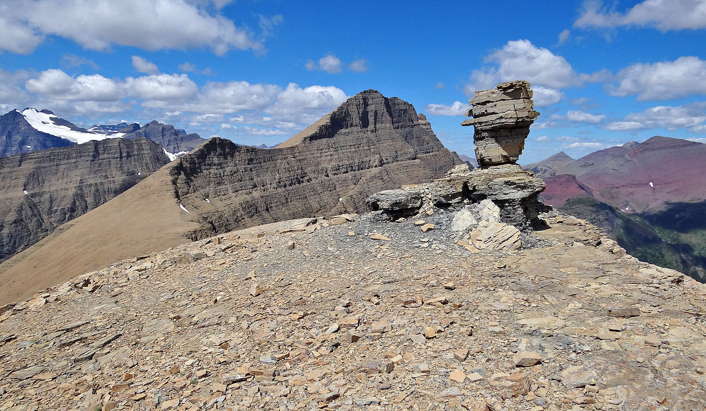
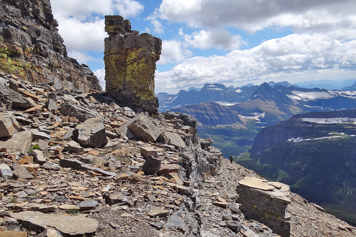
On our way down to the Henkel-Crowfeet col, we passed this rock pillar
Looking back at Henkel from the other side of the pillar. Sonny is barely visible on the skyline, right.
Apikuni Mountain and Kennedy Lake
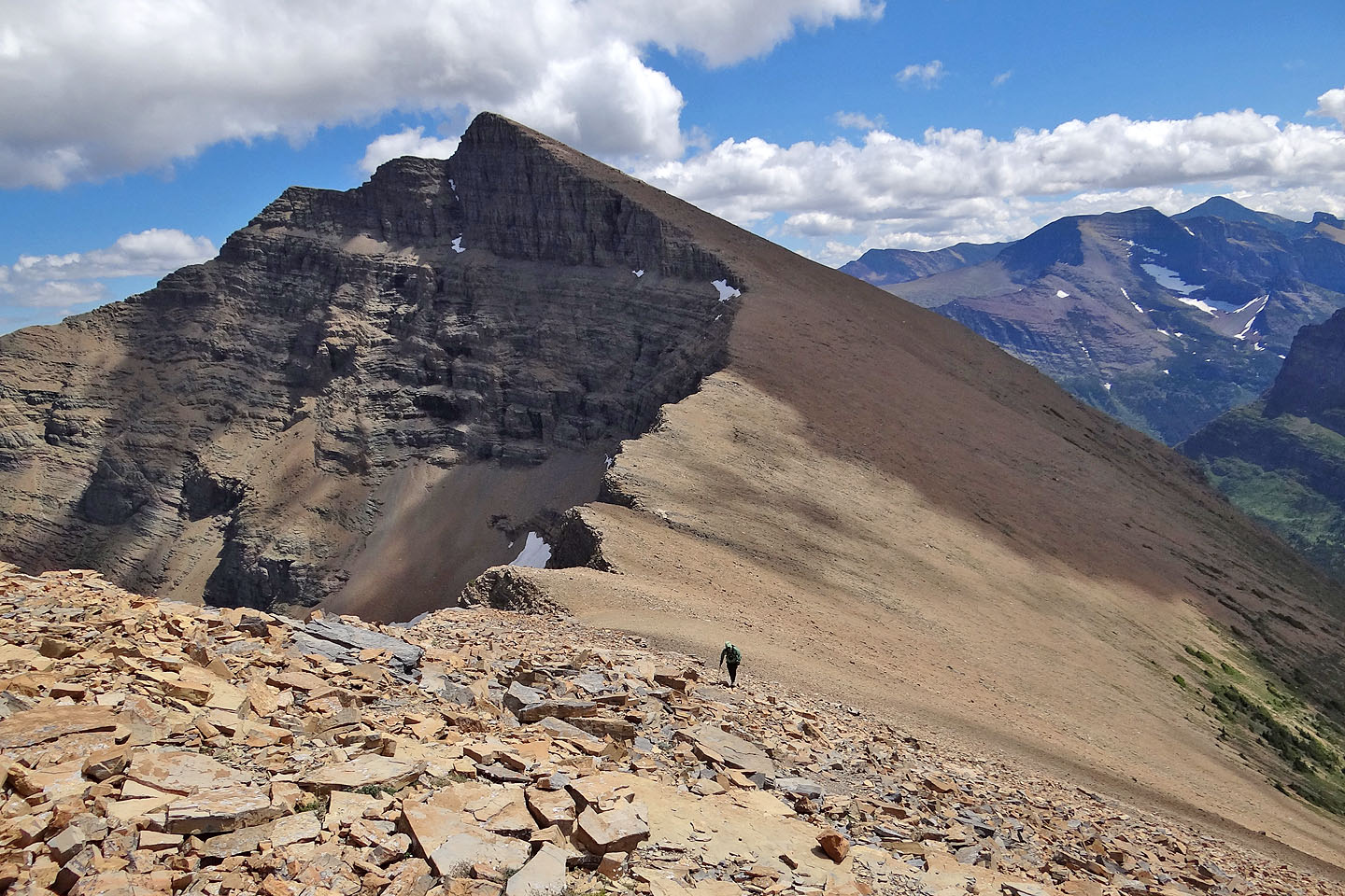
Ascending the rubbly ridge of Crowfeet
The trail runs over a rise before the summit
Mount Wilbur and Iceberg Peak appear to embrace Iceberg Lake (mouse over)
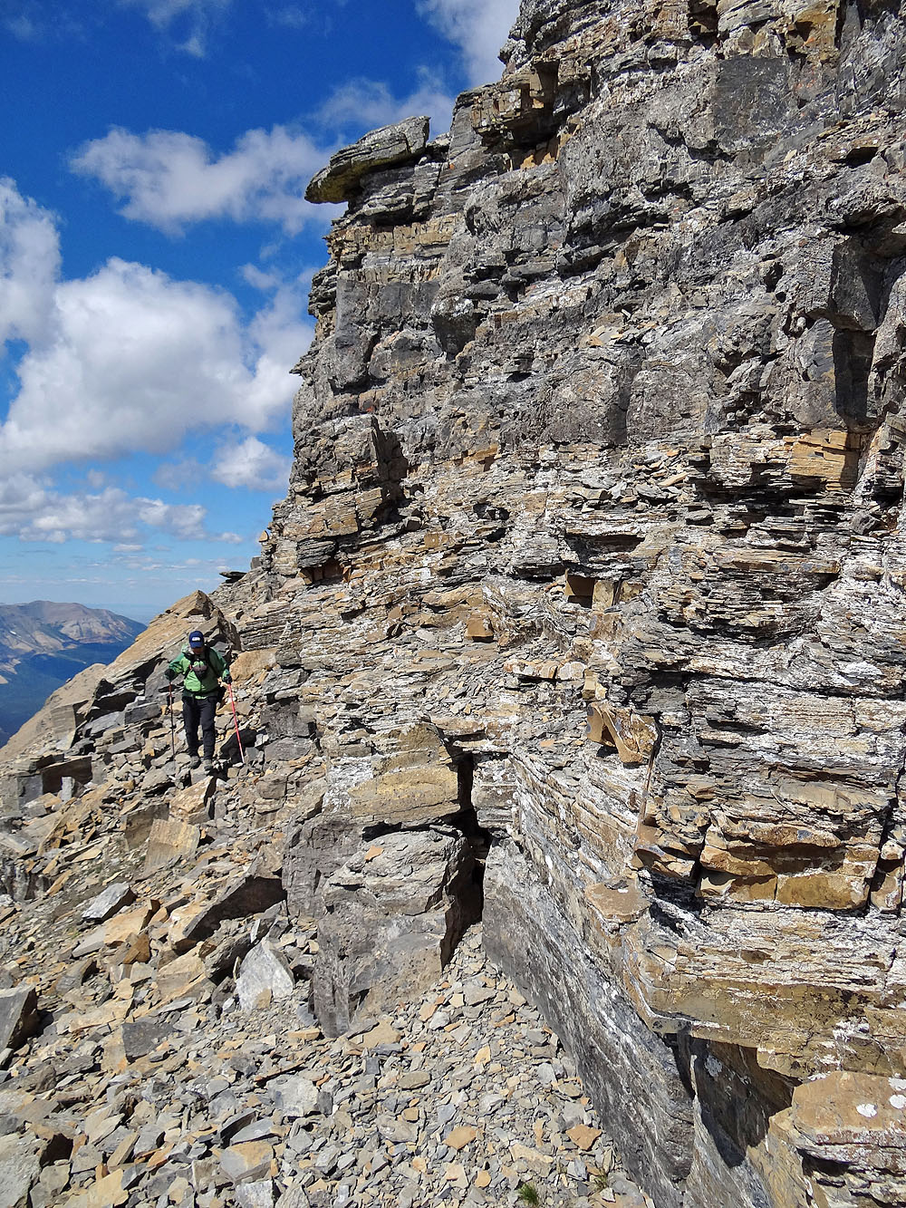
Looking back along the ridge
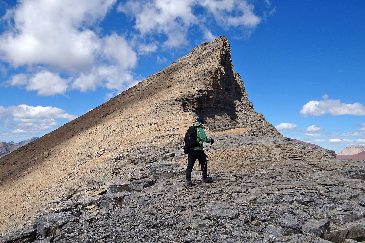
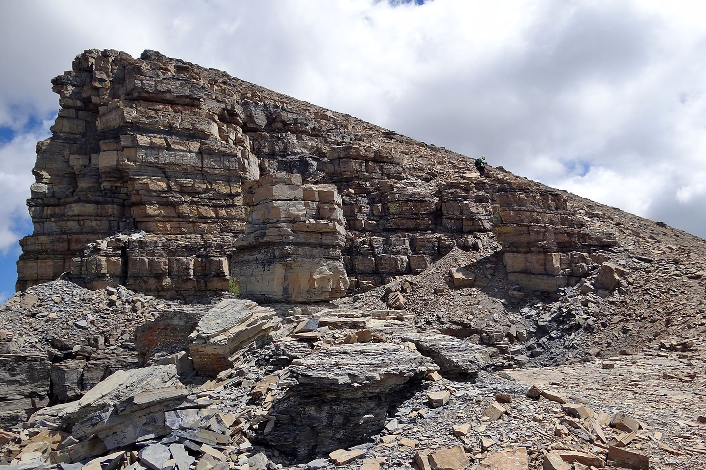
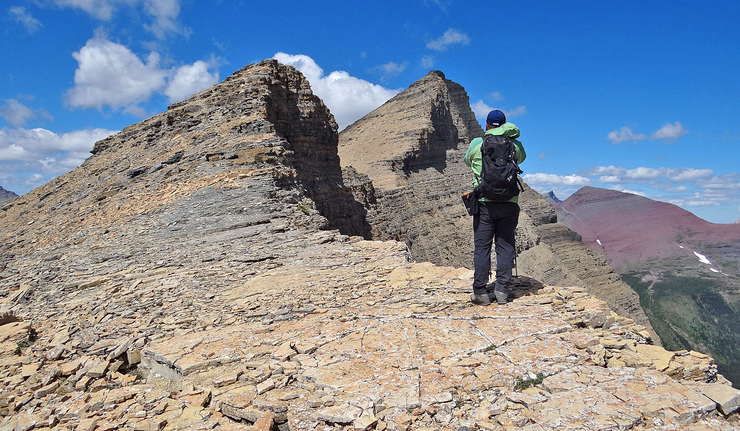
The long, steep section to the summit of Crowfeet
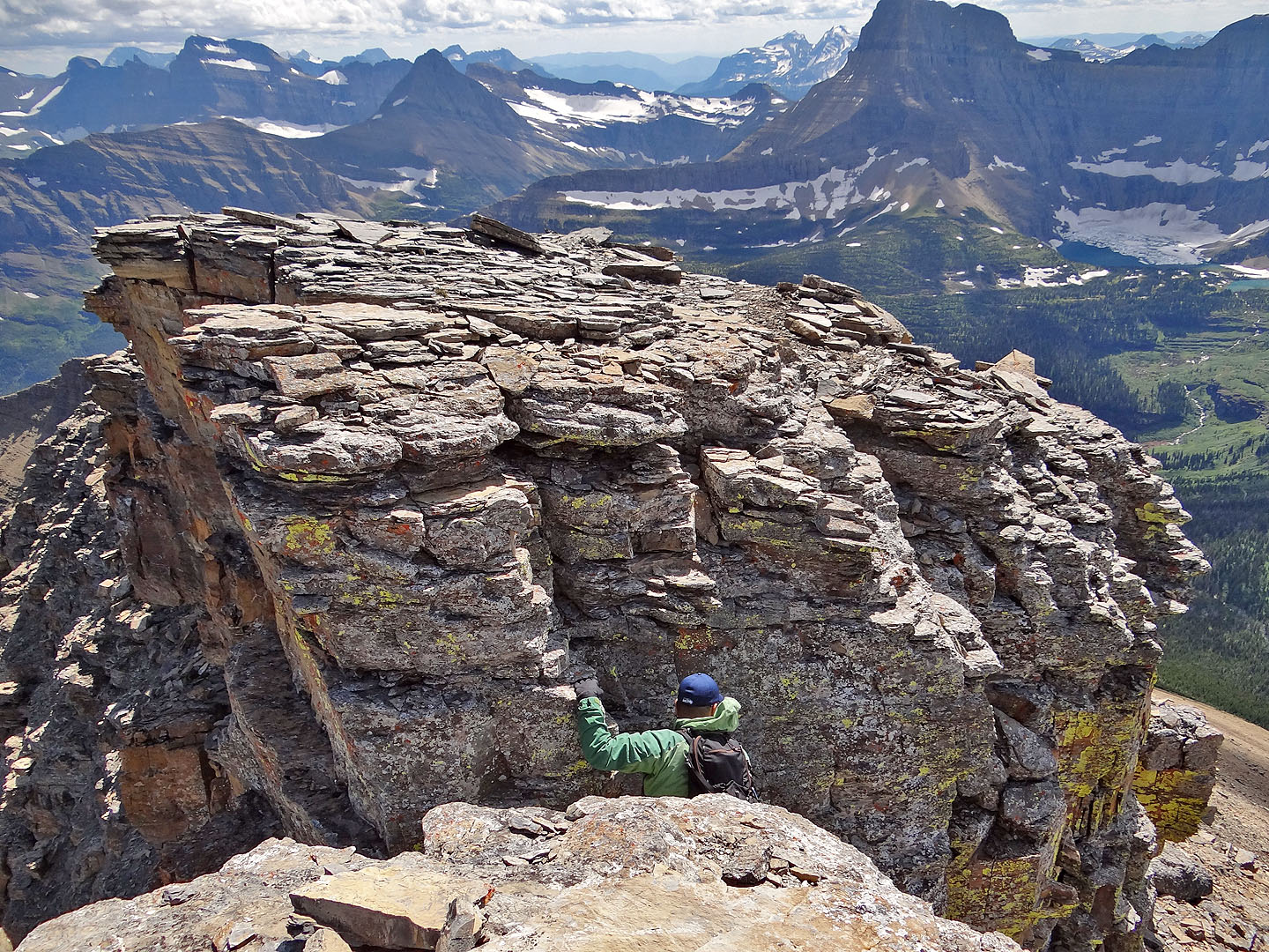
The summit is at the left end of the summit block. We found a weakness next to a rock pillar with yellow lichen.
The chimney we used is left of the pillar. Sonny is in the distance on the right.
After exploring the base of the summit block we opted to ascend by the pillar
Sonny at the top of the chimney
Uncomfortable with the exposure, I stopped just short of the summit
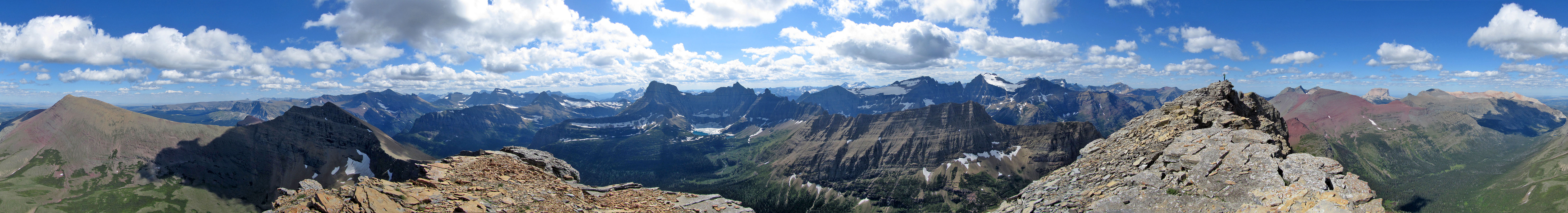
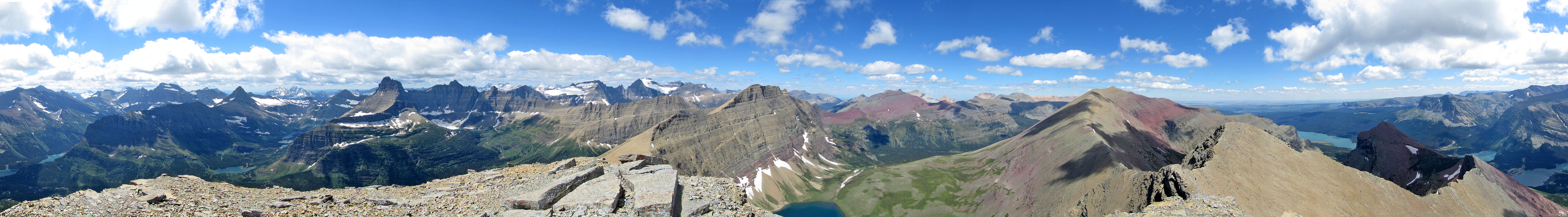
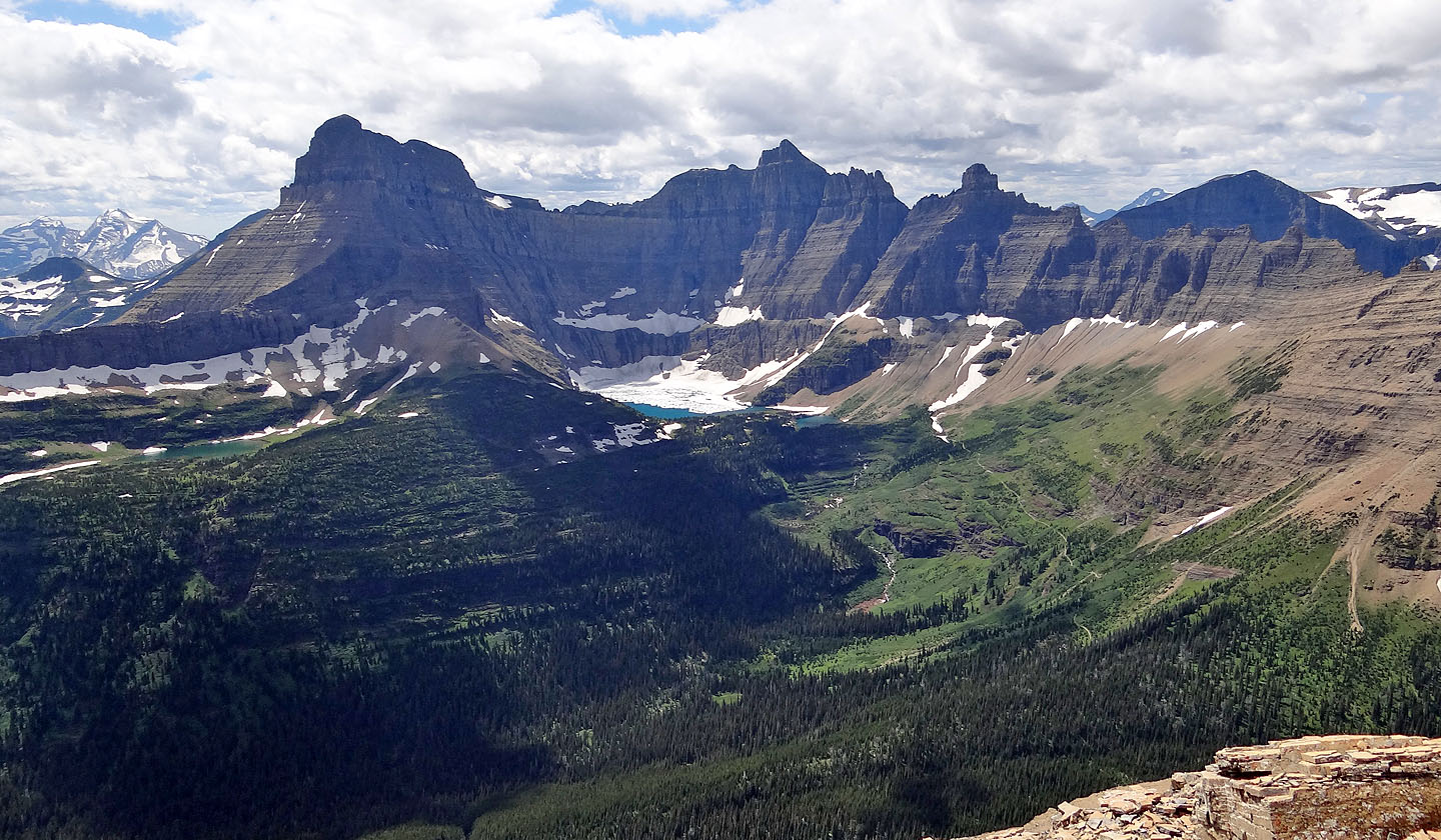
Panorama from the summit block of Crowfeet Mountain
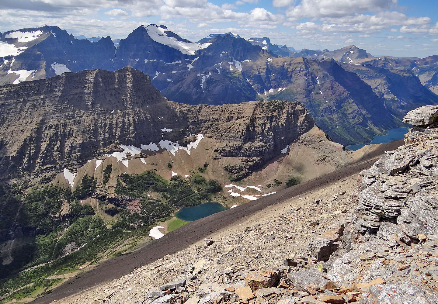
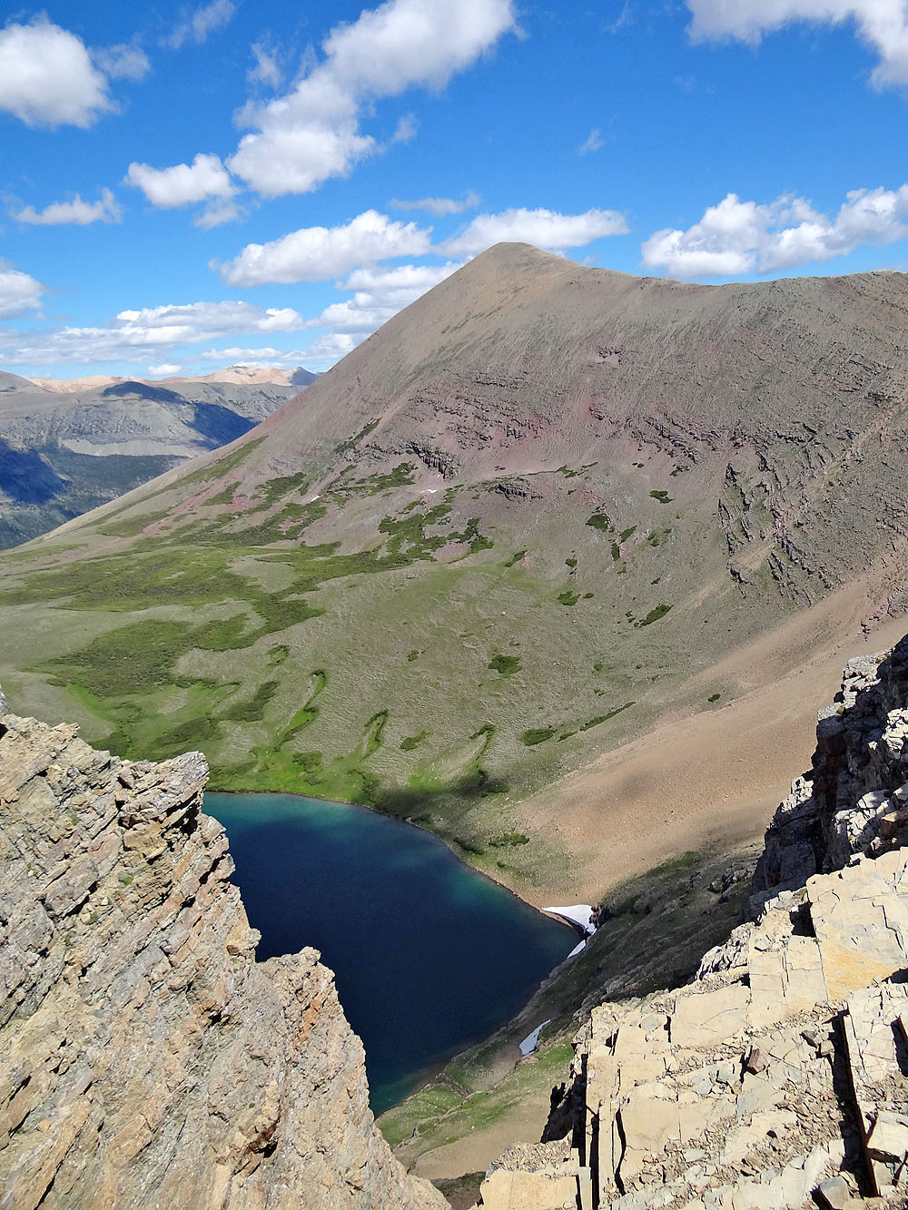
Ptarmigan Lake appears far below
Coming down the west slopes below the summit
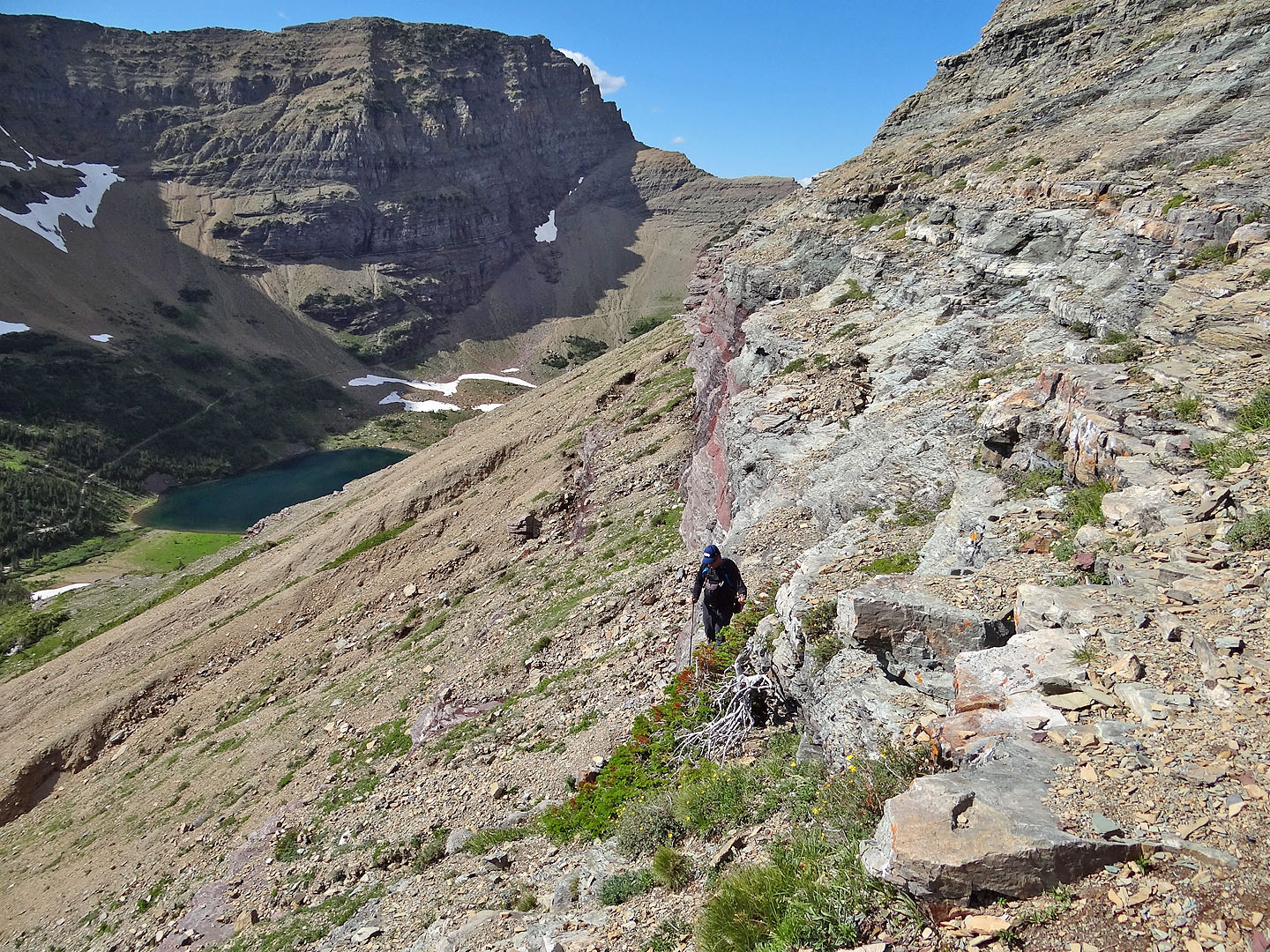
Far below are hidden cliff bands
As we made our way to Ptarmigan Lake, seen below, we had to negotiate cliffs and slabs
The closer we got to the bottom, the more difficult it became
Sonny downclimbed this cliff band but I came down grassy ledges behind me
Looking back at the cliff band Sonny came down and the grassy ledges (right) I used
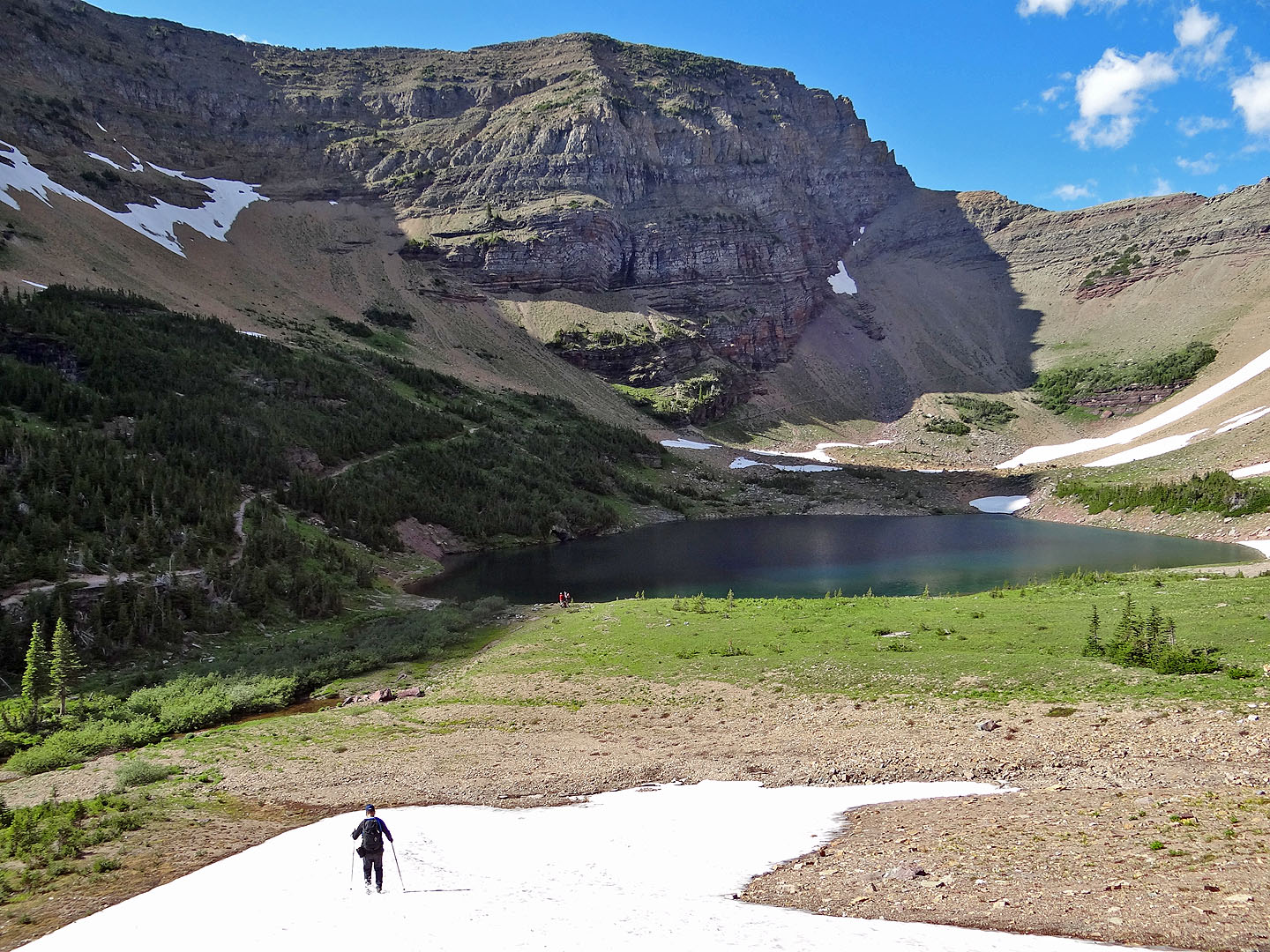
We made our way to the lake and then to Ptarmigan Trail
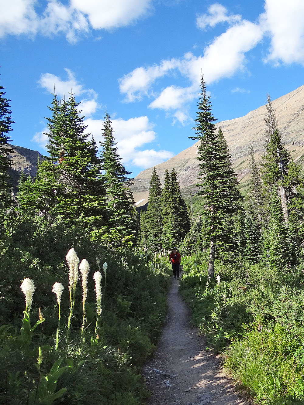
Glad to be back on a trail!
Many Glaciers (9.8 mi, 8907 ft, 4003 ft)