bobspirko.ca | Home | Canada Trips | US Trips | Hiking | Snowshoeing | MAP | About

Mount San Jacinto (aka San Jacinto Peak)
Palm Springs, California
April 24, 2022
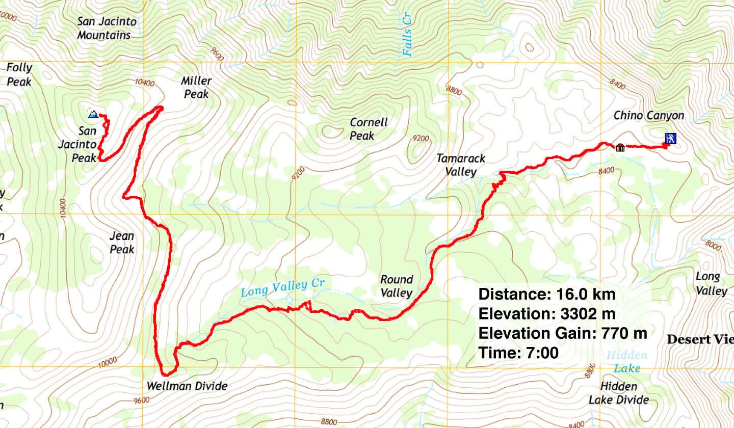
Distance: 16.0 km (9.9 mi)
Cumulative Elevation Gain: 788 m (2585 ft)
Dinah had a tall order: climb a desert peak in Death Valley and a couple of days later, ascend Mount San Jacinto (3300 m). Too late in the spring for the former, and we could suffer from dreadful heat; too early for the latter, and we could be wallowing in deep snow. So we settled on what hopefully would be a comfortable compromise: mid-April.
Fortunately both climbs worked out well. We ascended Ubehebe Peak in Death Valley when the temperature was below normal, around room temperature, and ascended San Jacinto when the trail was in good condition, just missing a snowstorm two days earlier. By the time we arrived, hikers had pounded down the snow on the trail.
While hardy hikers can ascend San Jacinto starting from Palm Springs – a daunting trip called Cactus to Clouds that involves an elevation gain of 3100 m – less ambitious travellers like ourselves can knock off over 2,000 m by taking the Palm Springs Aerial Tramway. No ordinary tram, it's the largest rotating tramcar in the world. It can carry 80 people, but Covid-19 restrictions limited capacity to 50.
We arrived at the tramway valley station at 7:15 am, well ahead of our 8:00 ticket. We snagged the closest spot in Parking Lot A, just steps from the stairs to the station entrance. (A shuttle runs from the other parking lots, all the way from Lot J.)
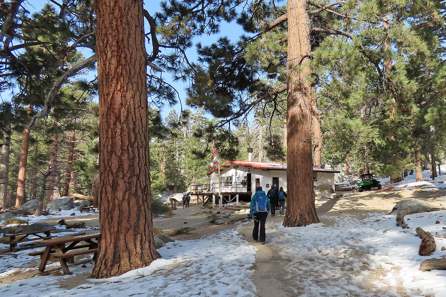
When we stepped off the tram at 2600 m, we hoped we were prepared for what lay ahead: cold weather, a snowy or icy trail and thin air. From the tramway mountain station, we walked 70 m down to the ranger station where we signed a permit, a requirement for any hiker continuing up the trail.
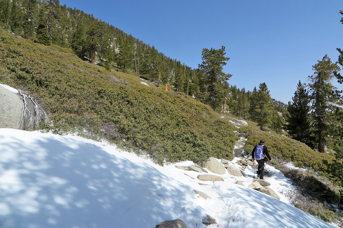
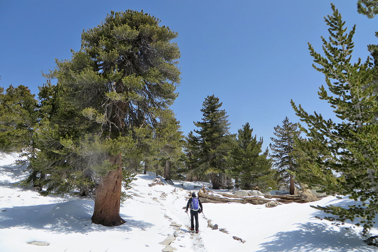
There were a few snow patches on the ground, but after we crossed a stream and the trail began to climb, the snow covering was mostly uninterrupted. We donned Microspikes and continued up the path.
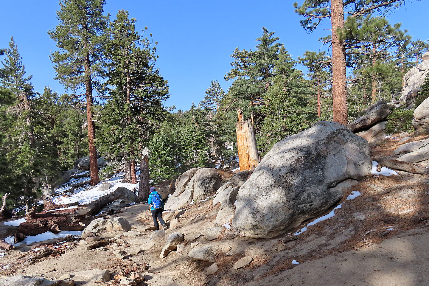
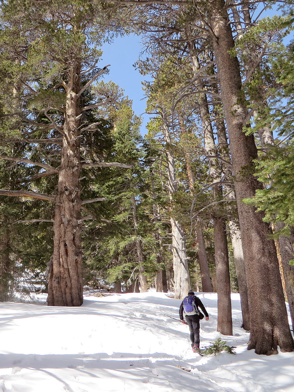
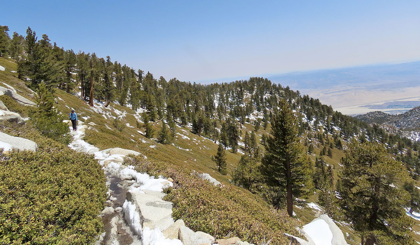
Being in trees, there are no views for a time, although huge boulders are an interesting diversion. We passed several hikers coming down, having spent the night at Round Valley Campground. At the first clearing, Wellman Divide (2950 m), we took a break while gazing at the hazy mountains south. From there, the trail turns north and soon reaches a semi-open slope. The views improved with every step.
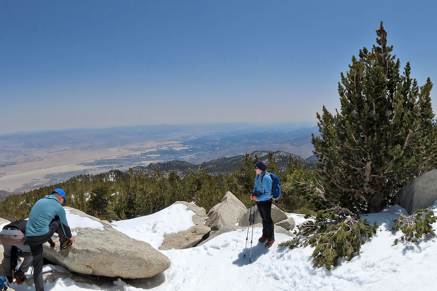
After a long, straight stretch along the slope, the trail turns sharply left. A couple of more turns, and we reached a summit topped with jagged boulders. Rocks and trees prevented a 360° panorama, but we still had far-ranging views.
The forecast had called for freezing temperatures on the mountaintop, and we were prepared. Yet it was so mild we removed our jackets. Our packs held layers that were left untouched for the entire trip.
We spent 45 minutes on top, having lunch, taking photos and talking to a few hikers lingering on the summit. None had come up the same way we did.
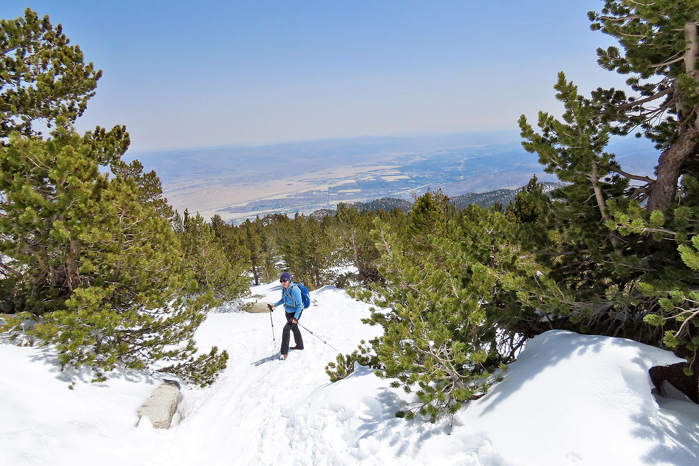
The return trip down the trail was uneventful, except the snow was melting fast, leaving much of the trail wet and slushy. Still wearing Microspikes, we had no difficulties, although we ran into hikers who wished they had them.
We reached the tramway mountain station to find throngs of tourists milling about. Some purchased photos that tramway operators take when you step off the ascent tram. I had to chuckle, for those pictures are no match for the ones we took on top of Mount San Jacinto.
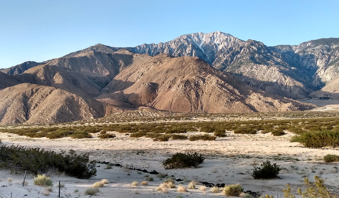
Mount San Jacinto seen on our way to the tramway station
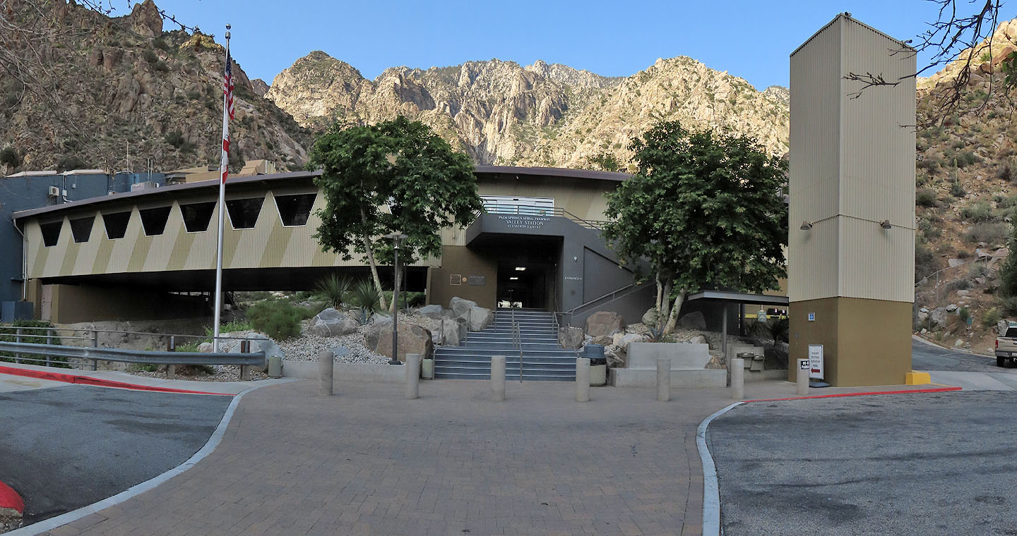
The entrance sign reads: Palm Springs Aerial Tramway Valley Station, Elevation 2643 ft (806 m)
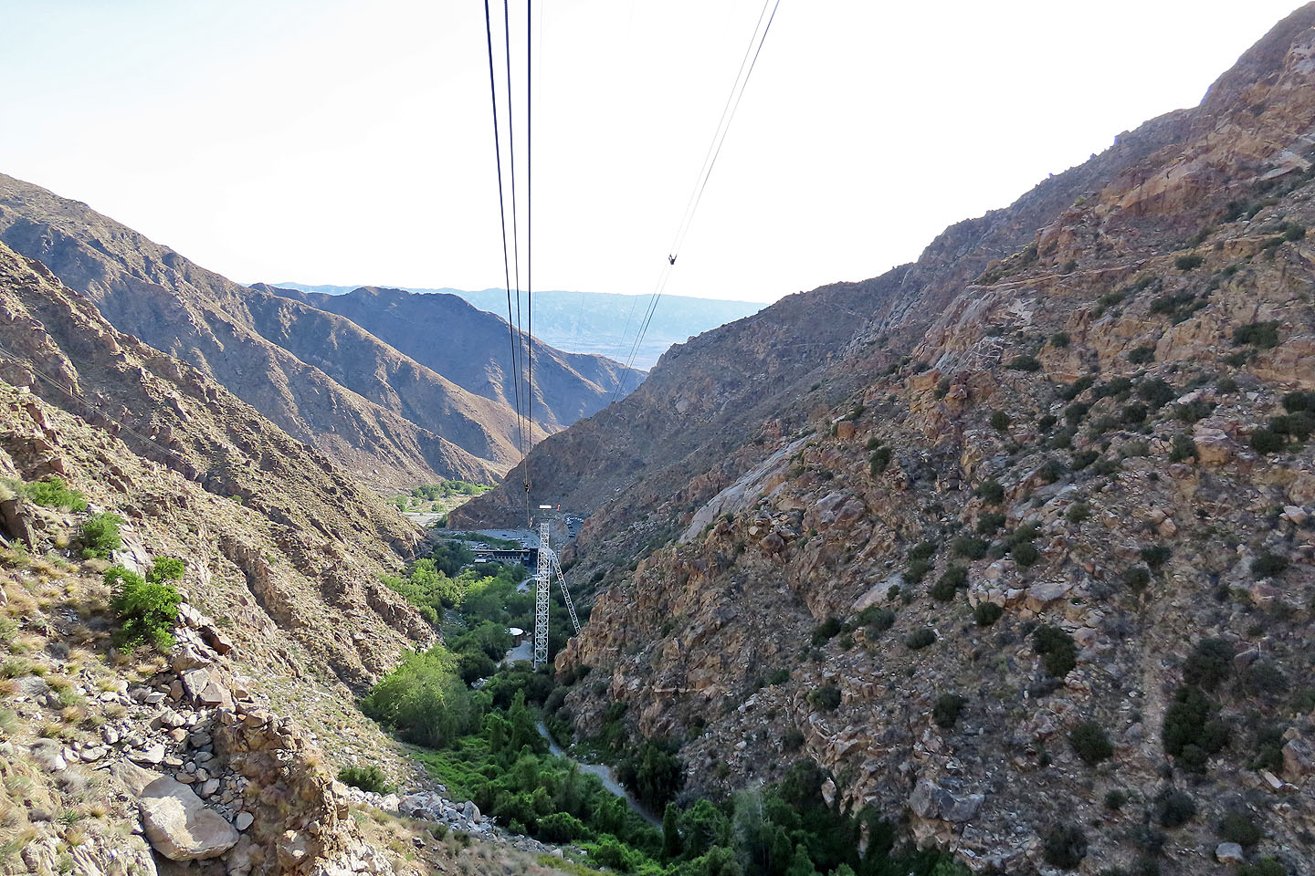
Looking back as the tram ascends
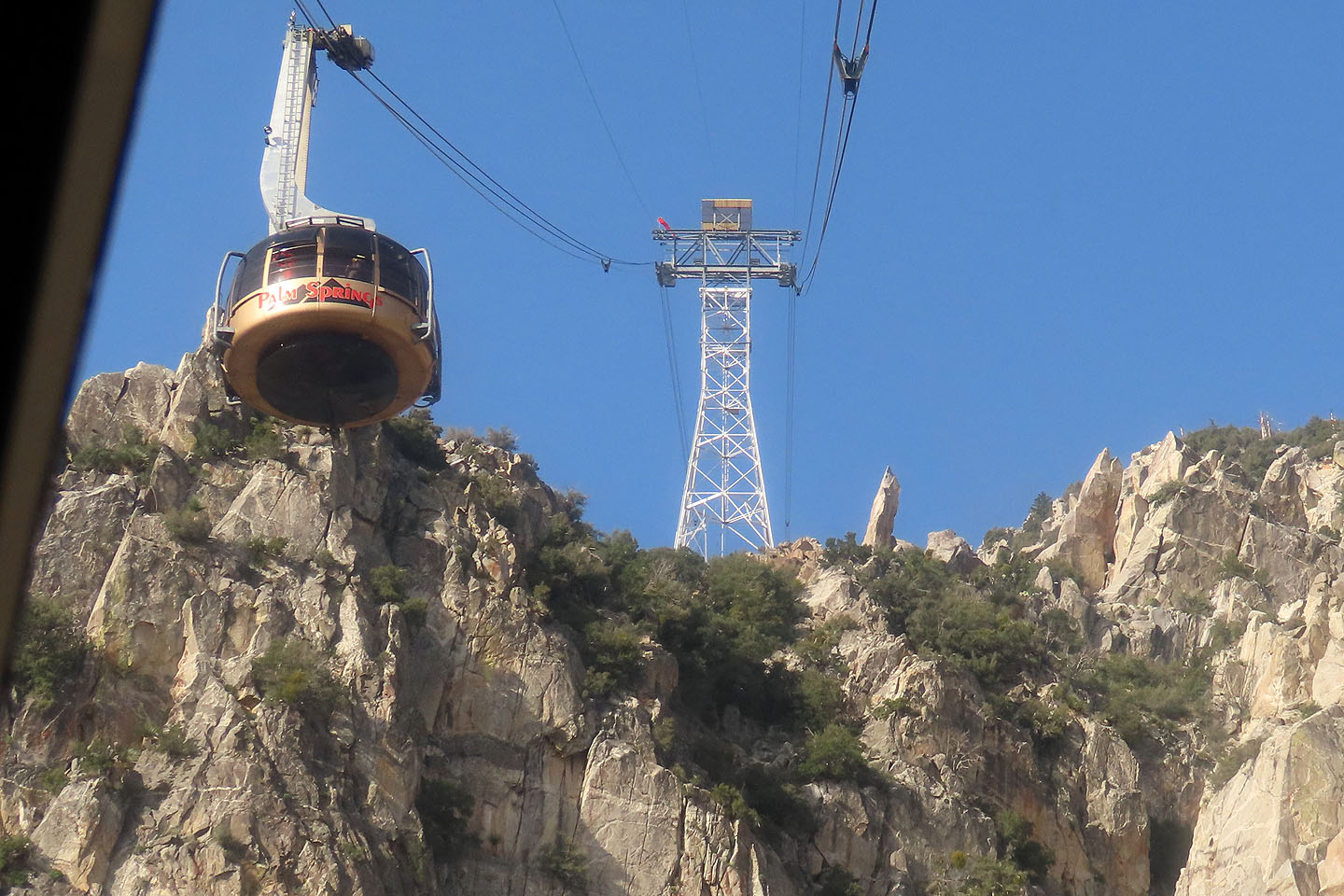
Passing the tram coming down
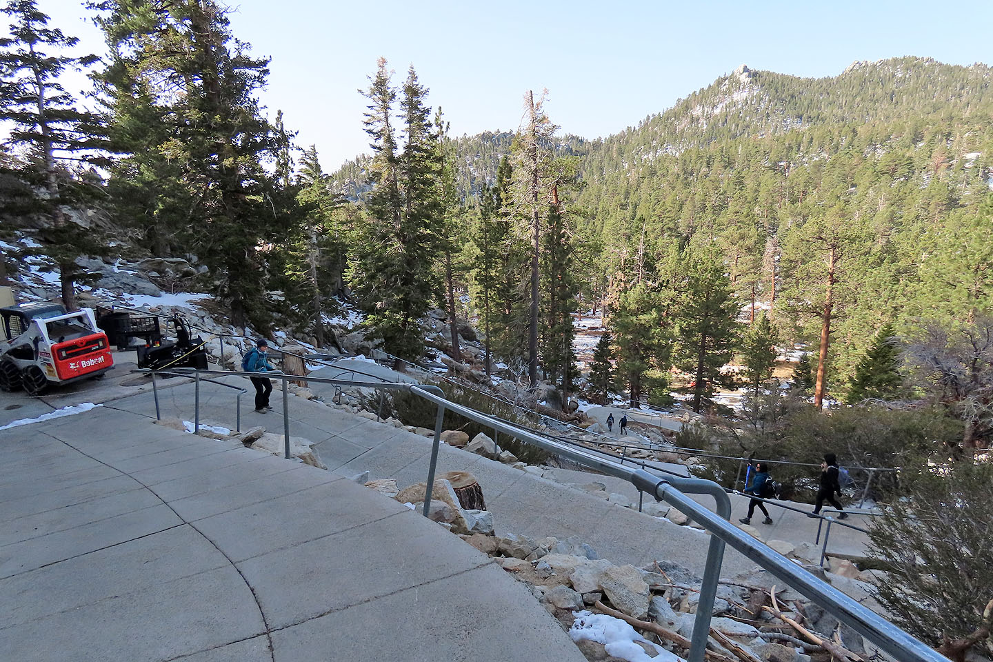
From the tramway mountain station, we walked down a sidewalk
To continue up the trail, hikers must sign a permit
The trail was dry at first, but that didn't last long
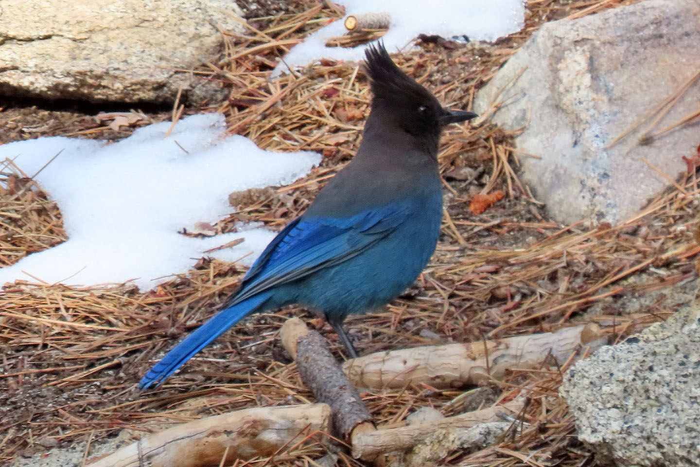 Stellar's jay
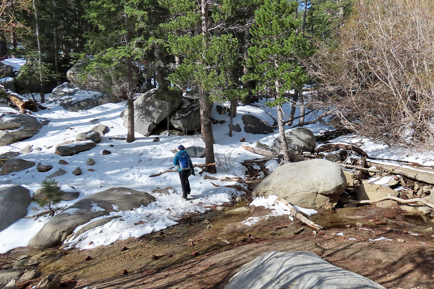
After crossing a creek, all was snow-covered
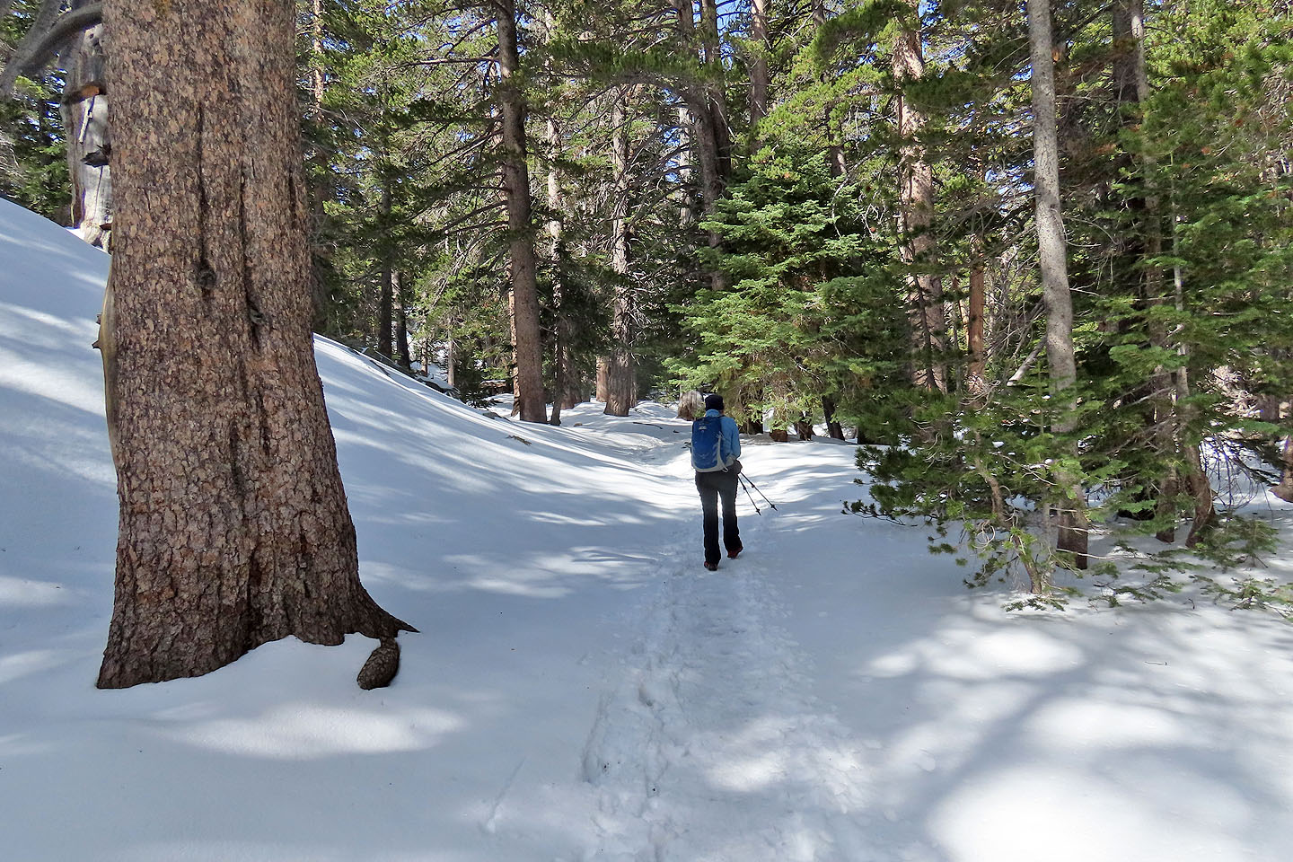
Continuing up the trail
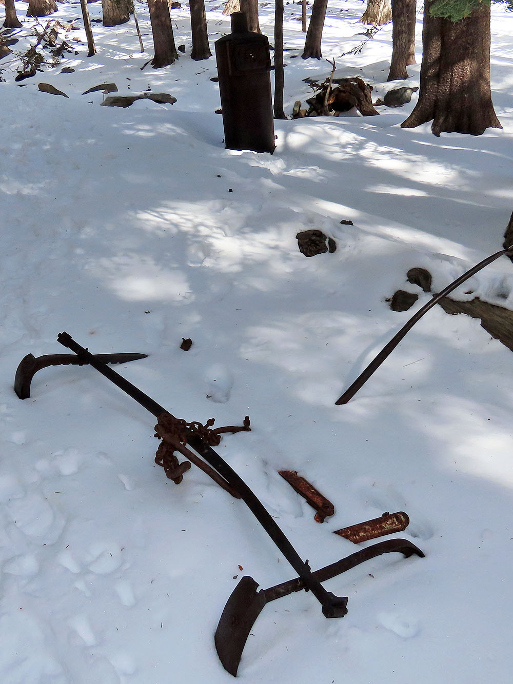
We saw some artifacts at the campground. The top one is an old stove.
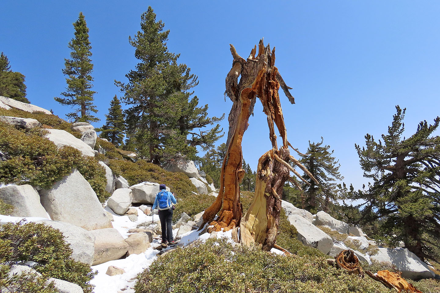
We passed a twisted dead tree (mouse over for a closer look)
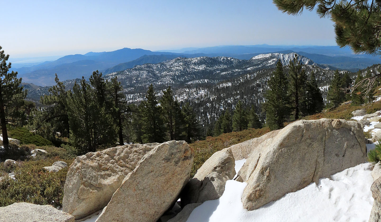
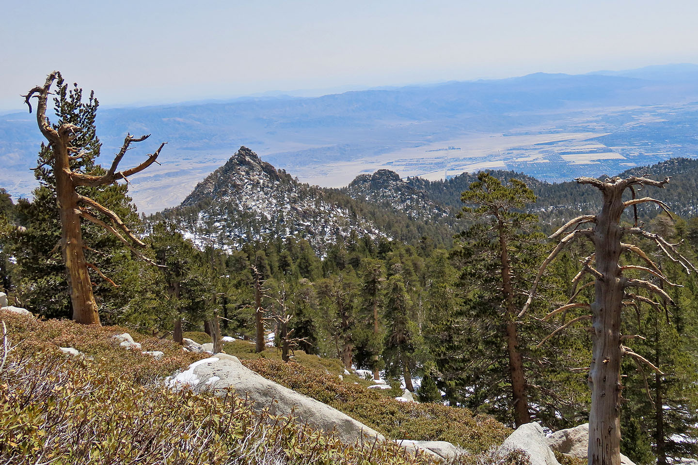
View from Wellman's Divide (2950 m). Far left in the distance are Salton Sea and Asbestos Mountain (mouse over for a close-up).
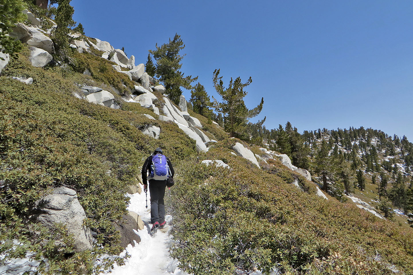
After Wellman Divide, we reached open slopes
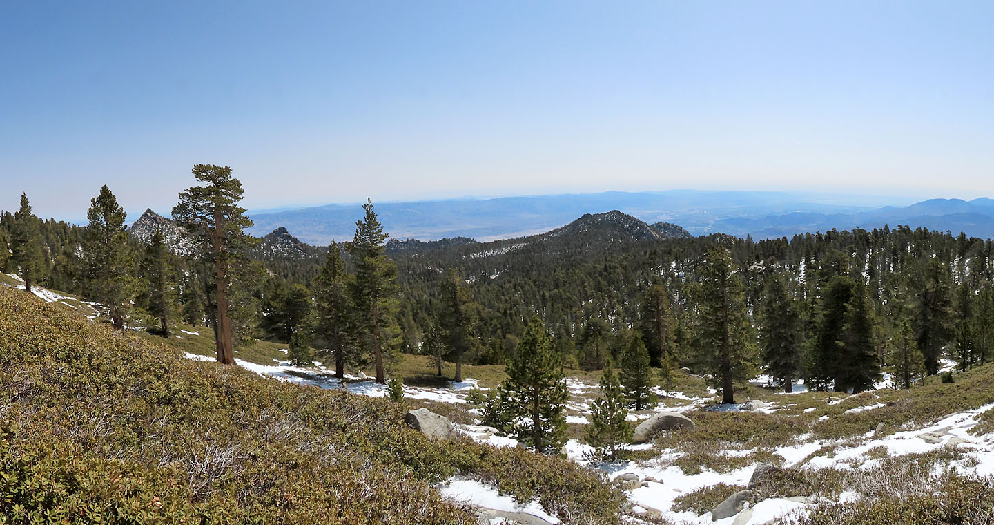
The view east
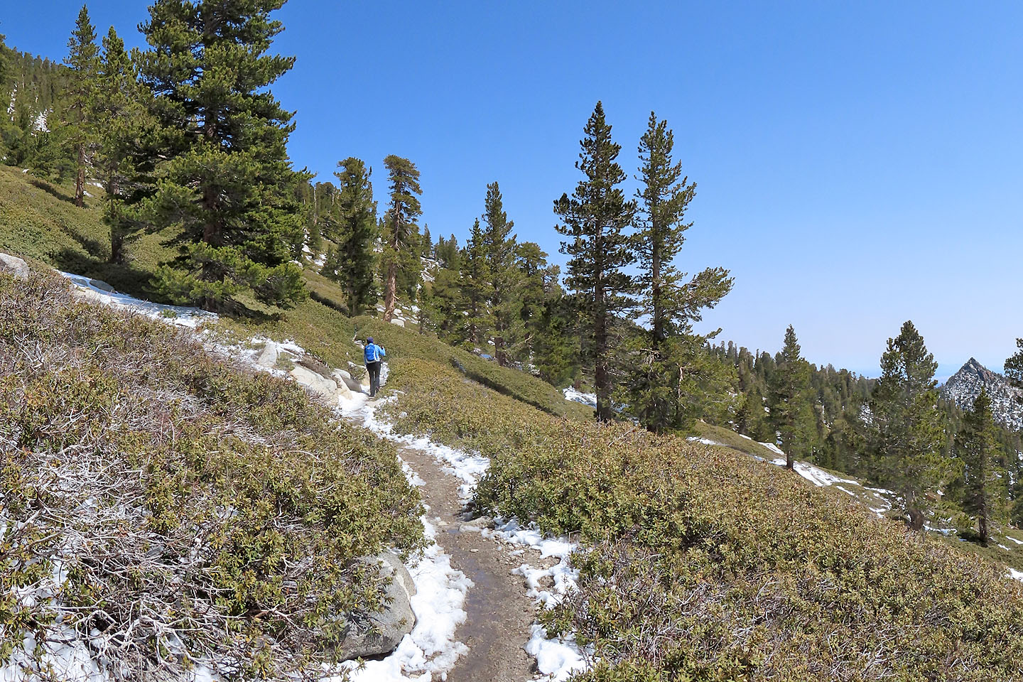
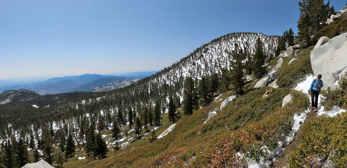
The hike along the slope was long but enjoyable
A dead tree looks ready to collapse
Miller Peak is close by but Palm Springs lies far below
At the ridge ahead, the trail makes a sharp left turn
Looking back toward Wellman Divide
Looking back after we turned the corner
After another turn the unseen summit is ahead
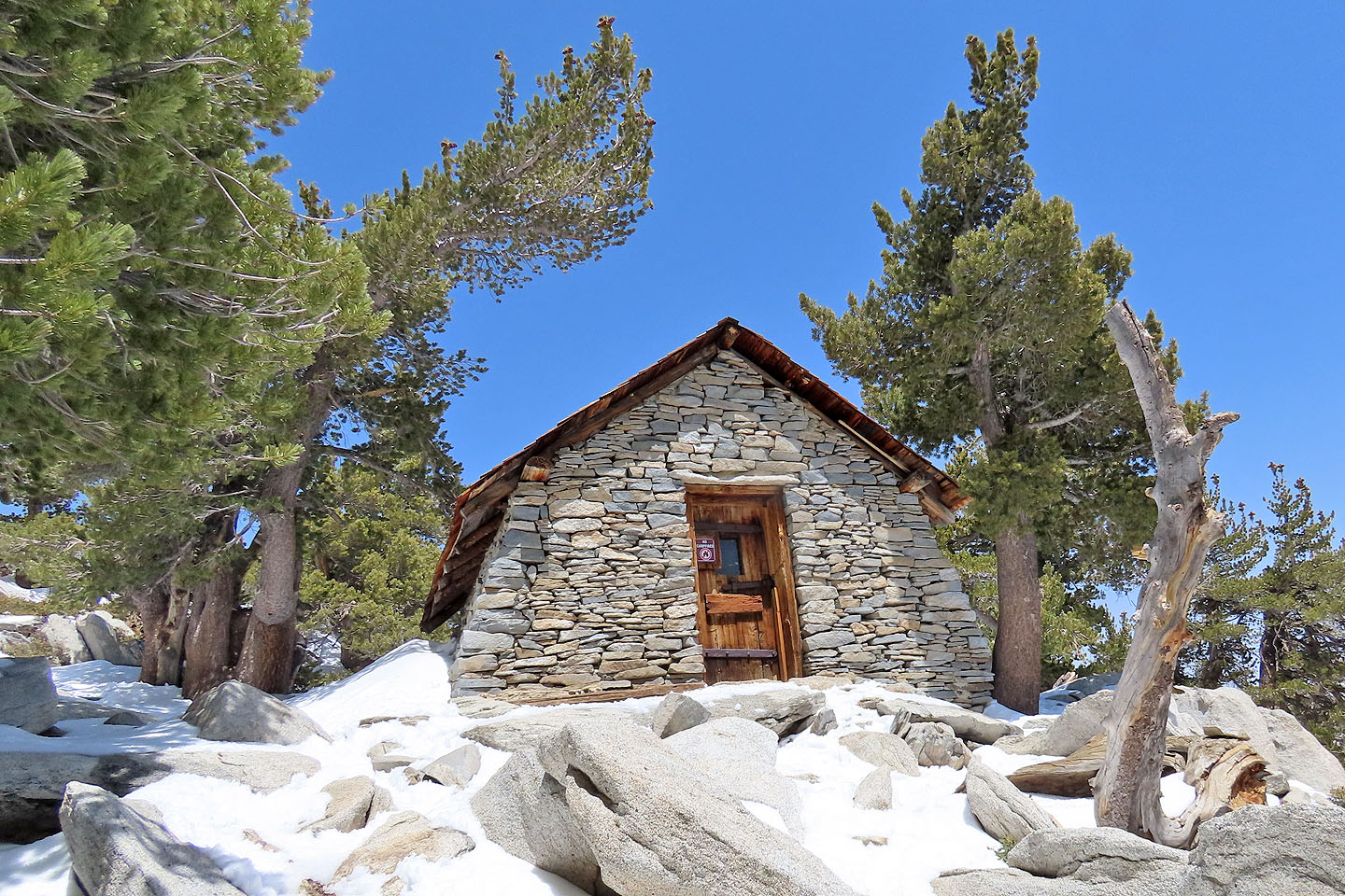
There's a shelter just below the summit. Mouse over to see inside.
The snow appeared deep on the mountaintop
Dinah reaches the top
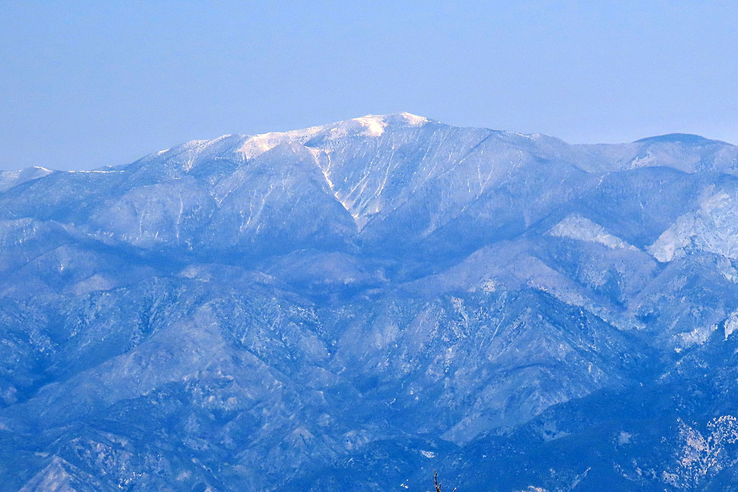
San Gorgonio lies north and is 200 m higher
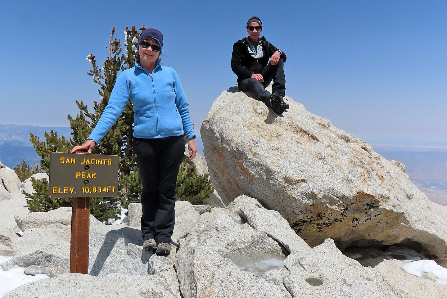
On the summit
San Jacinto Peak (9.9 mi, 10833 ft, 2428 ft)