bobspirko.ca | Home | Canada Trips | US Trips | Hiking | Snowshoeing | MAP | About
Badwater Basin
Death Valley, California
April 1, 2012
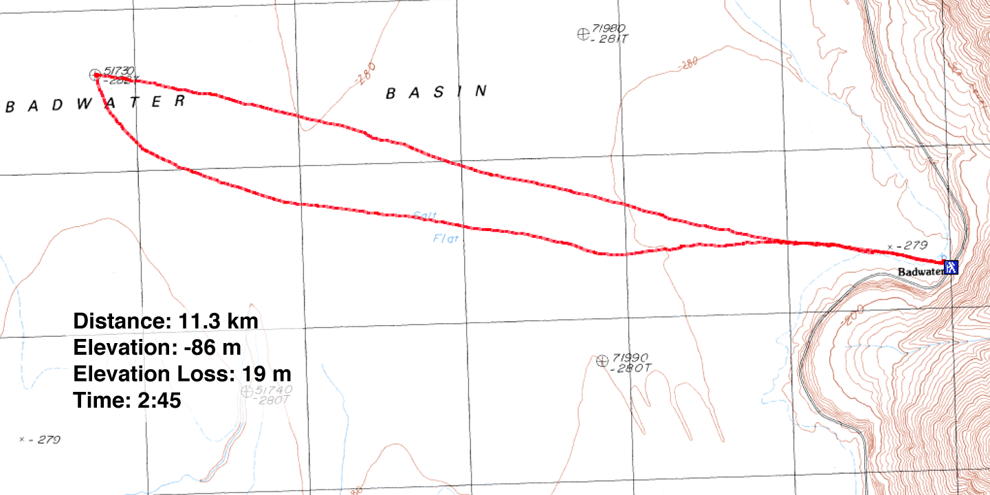
Distance: 11.3 km (7.0 mi)
Cumulative Elevation Gain: 19 m (62 ft)
A trip to the lowest point in Death Valley was high on Dinah's list, but low on mine. For me, hiking downhill to reach an objective held little appeal, but since Dinah found herself sick with a cold after we landed in Las Vegas, I could think of no hike that used so little energy. Losing only a couple of metres over 5 km, this is undoubtedly the flattest hike we'll ever do.
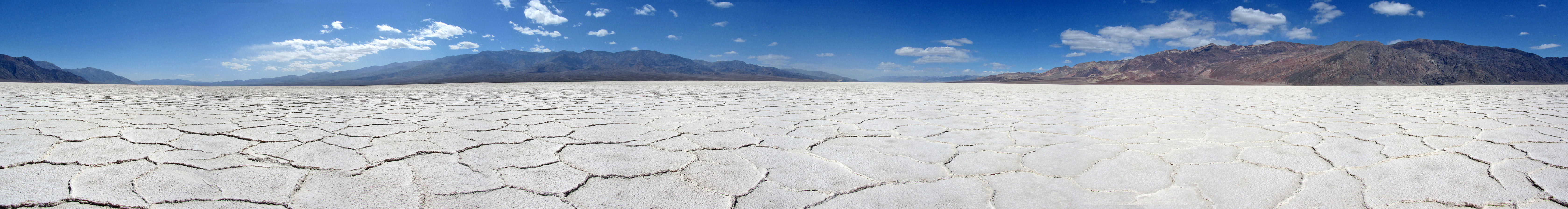
Badwater Basin is not just the lowest point in Death Valley, but at 86 m below sea level, it's the lowest point of land in North America. (At -105 m, Laguna de Carbón is the lowest point in the Western Hemisphere.) And instead of hiking on limestone, granite, dirt or sand, we would tread on an entirely different substance: salt.
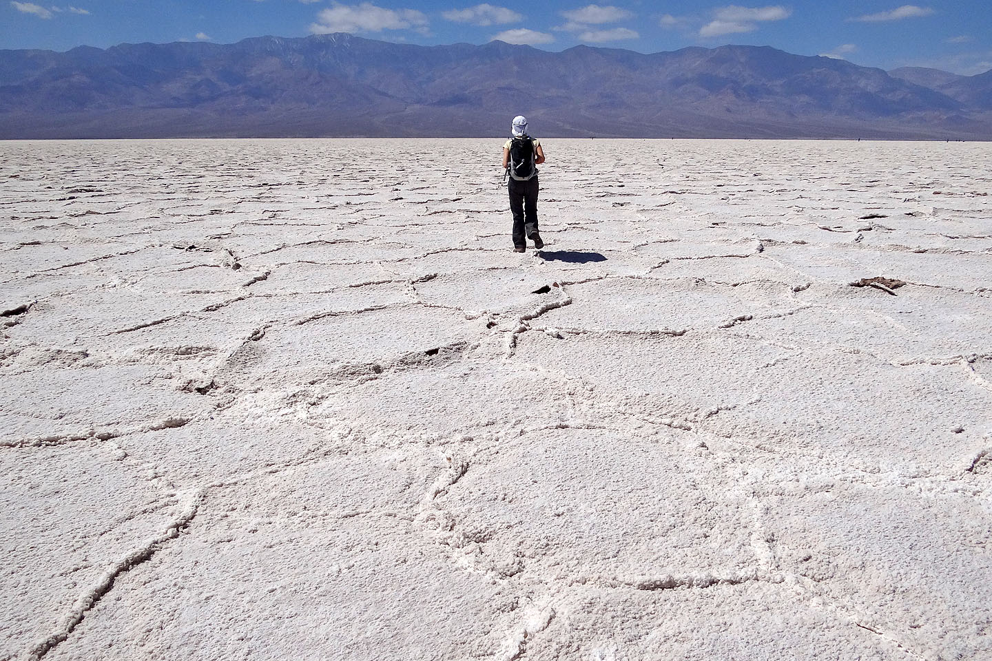
Our walk began at a tourist stop on the eastern edge of Badwater Basin. Although it was teeming with tourists, we soon left them in the salt dust as we crunched across the white expanse of the basin. Still, the flats ahead weren't free of people. Nearly a kilometre from the trailhead, we encountered dozens of students strung out across the basin. They were conducting wind and temperature studies using instruments set on tripods. They said they were from the University of Vienna, Austria and their accents left no doubt. When I asked a student what the temperature was, he peered at his device and told me it was 25°C.
Dinah and I didn't want to interfere with their work, so instead of going through them, we walked around them, which took us off course a bit. Then using GPS, we zeroed in on the lowest point. We looked for a marker and after searching around, we found a small stone, unnoticeable until we were nearly on top of it (36°14.519', -116°49.533'). This was 11 m (36 ft) off from the coordinates I had found on the Internet.
Strangely, we were ecstatic about finding this little rock, as if we had summited a major peak! The stone had sunk into the salt, making it hard to spot. So I lifted it out, filled the depression with a handful of salt and replaced it.
After taking the panorama (above), we set off for the parking lot. We could see it clearly from the low point, even though it was over 5 kilometres away. Unlike the little stone marker, we had no trouble finding our car.
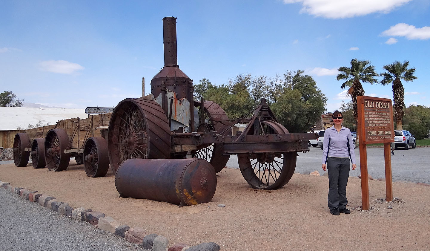
Dinah stands beside Old Dinah at Furnace Creek

Badwater Basin trailhead
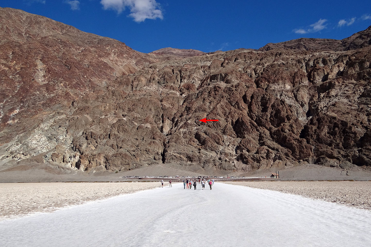
Looking back at the trailhead. The red arrow marks sea level (mouse over).
Following the tourist path
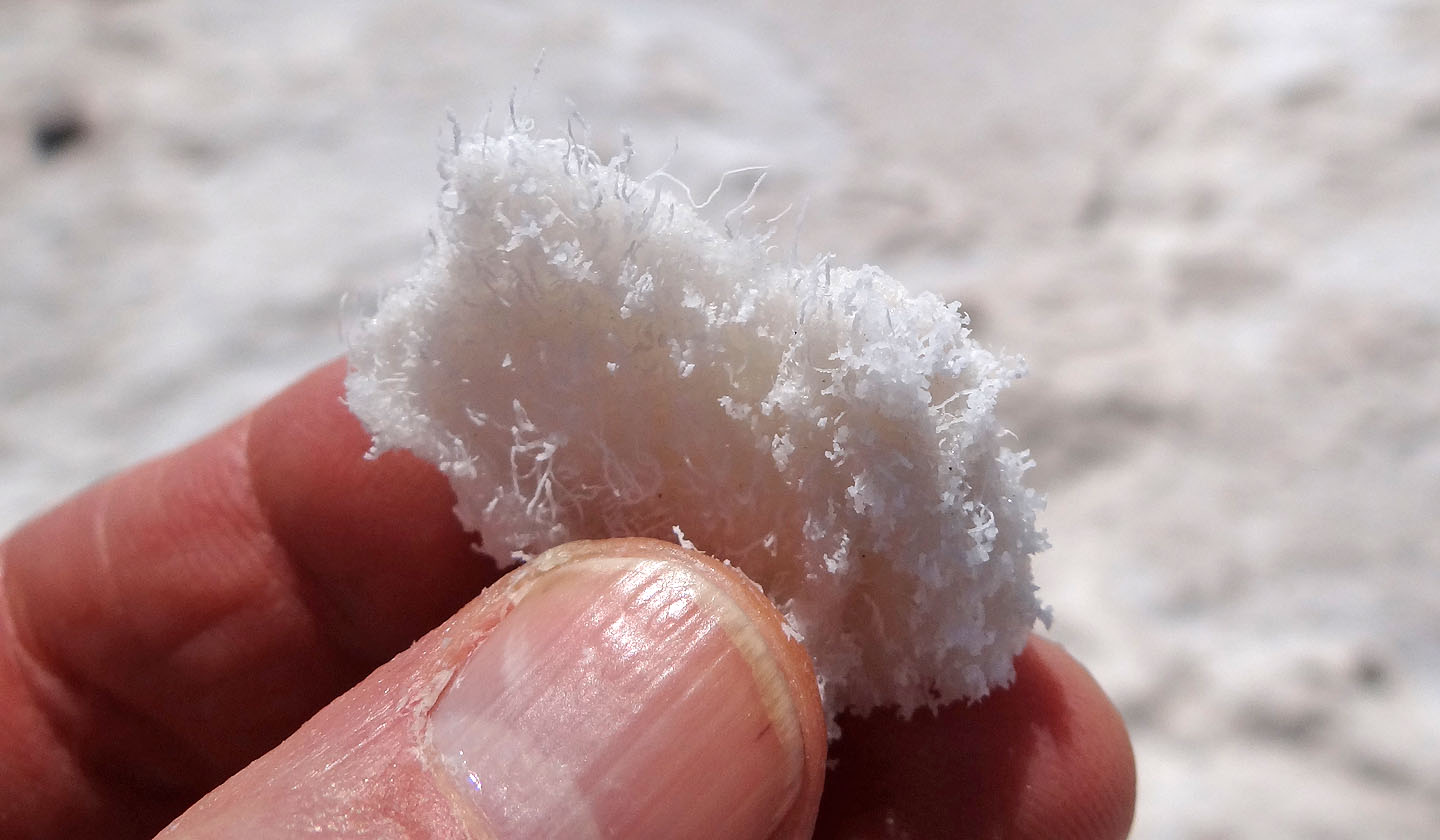
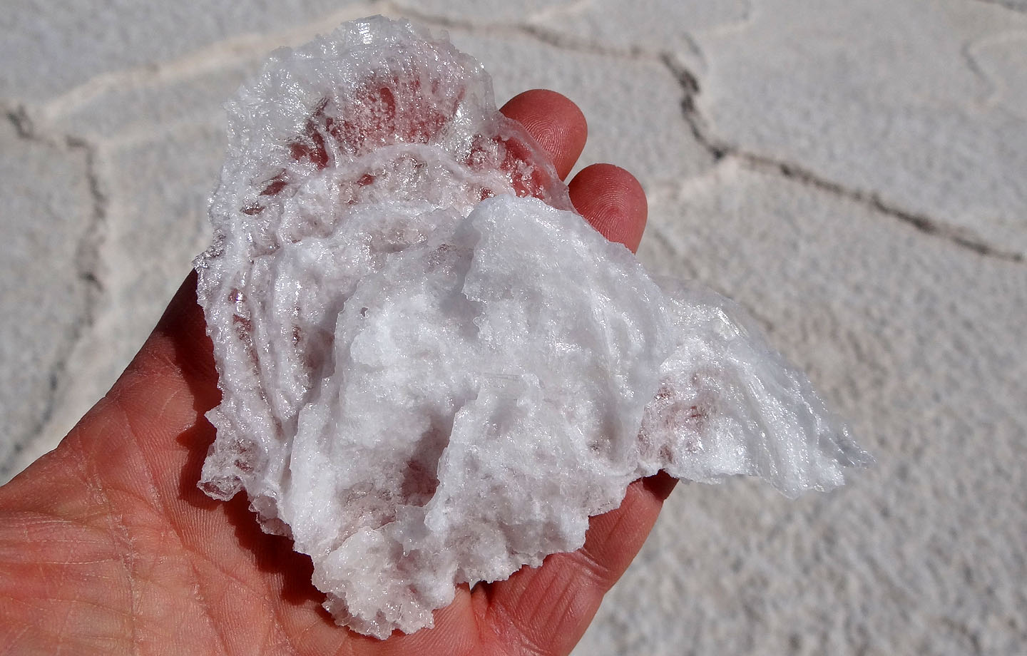
Chunk of salt
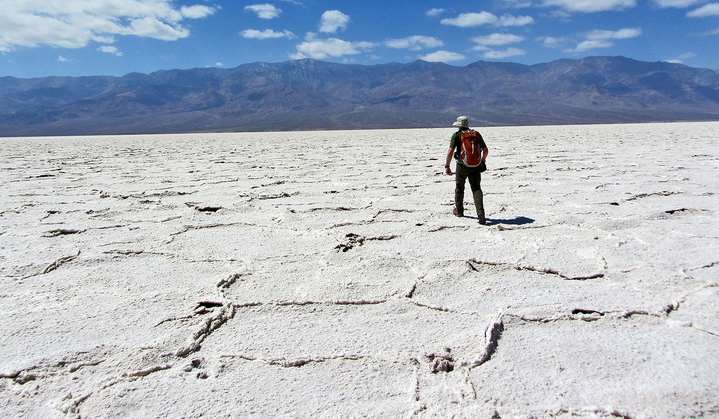
After leaving the path we found cracks and pressure ridges
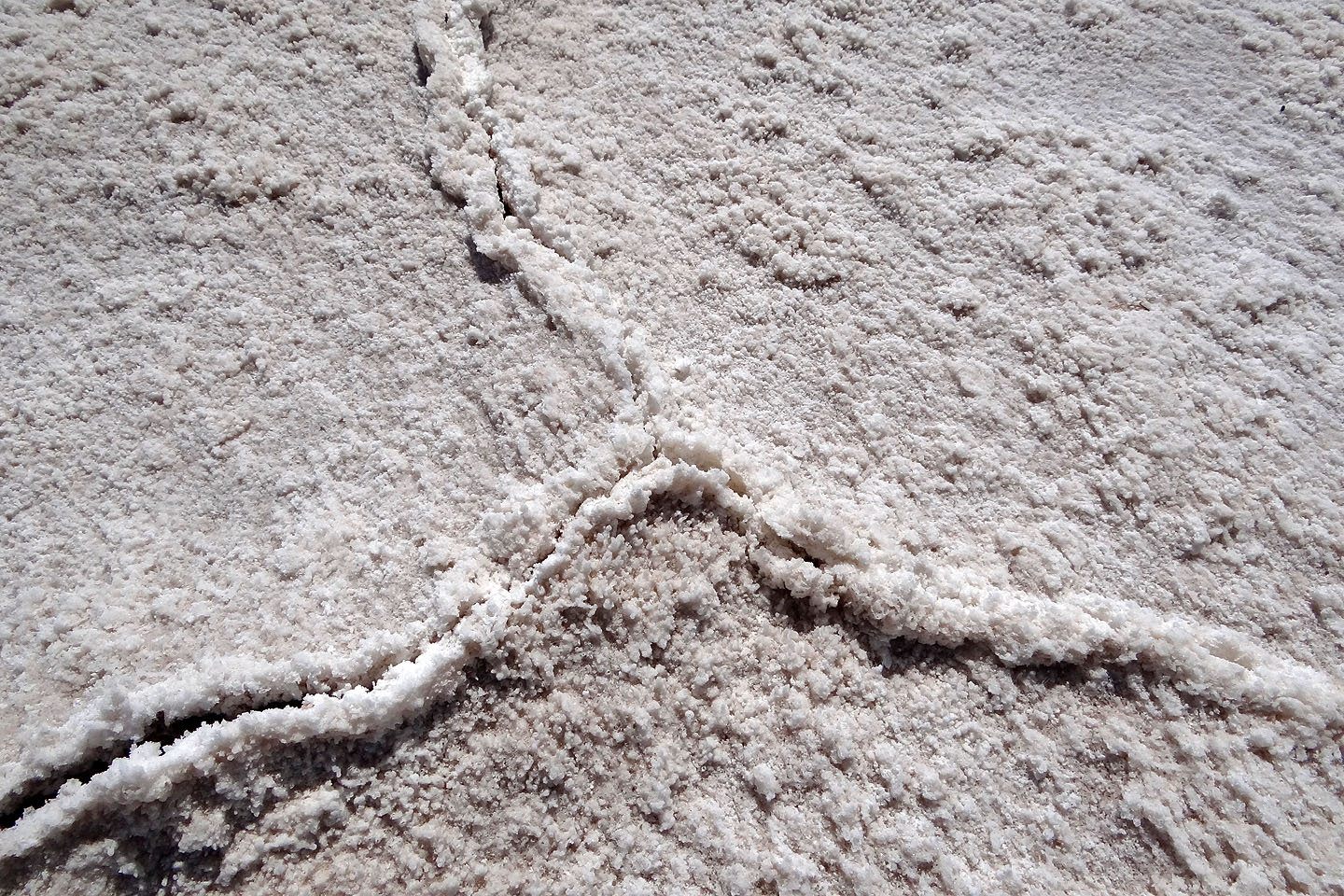
Close look at the cracks
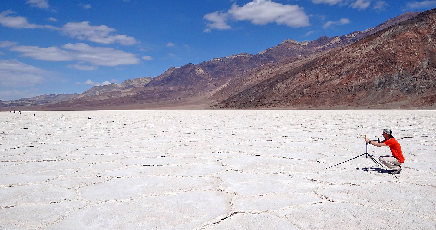
Students conducted wind and temperature studies
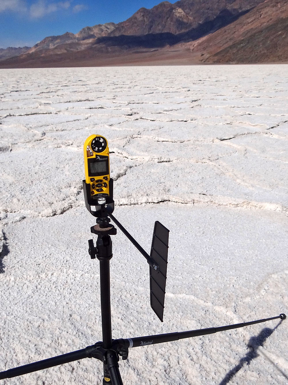
A close look at the meteorologic instrument (gadget freaks can mouse over for a closer look)
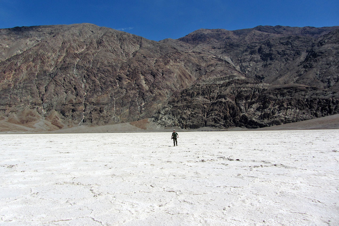
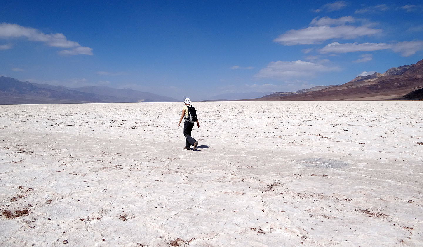
Looking back you can just make out the parking lot to the right on me
Because of strong winds kicking up dust, views to the west were hazy
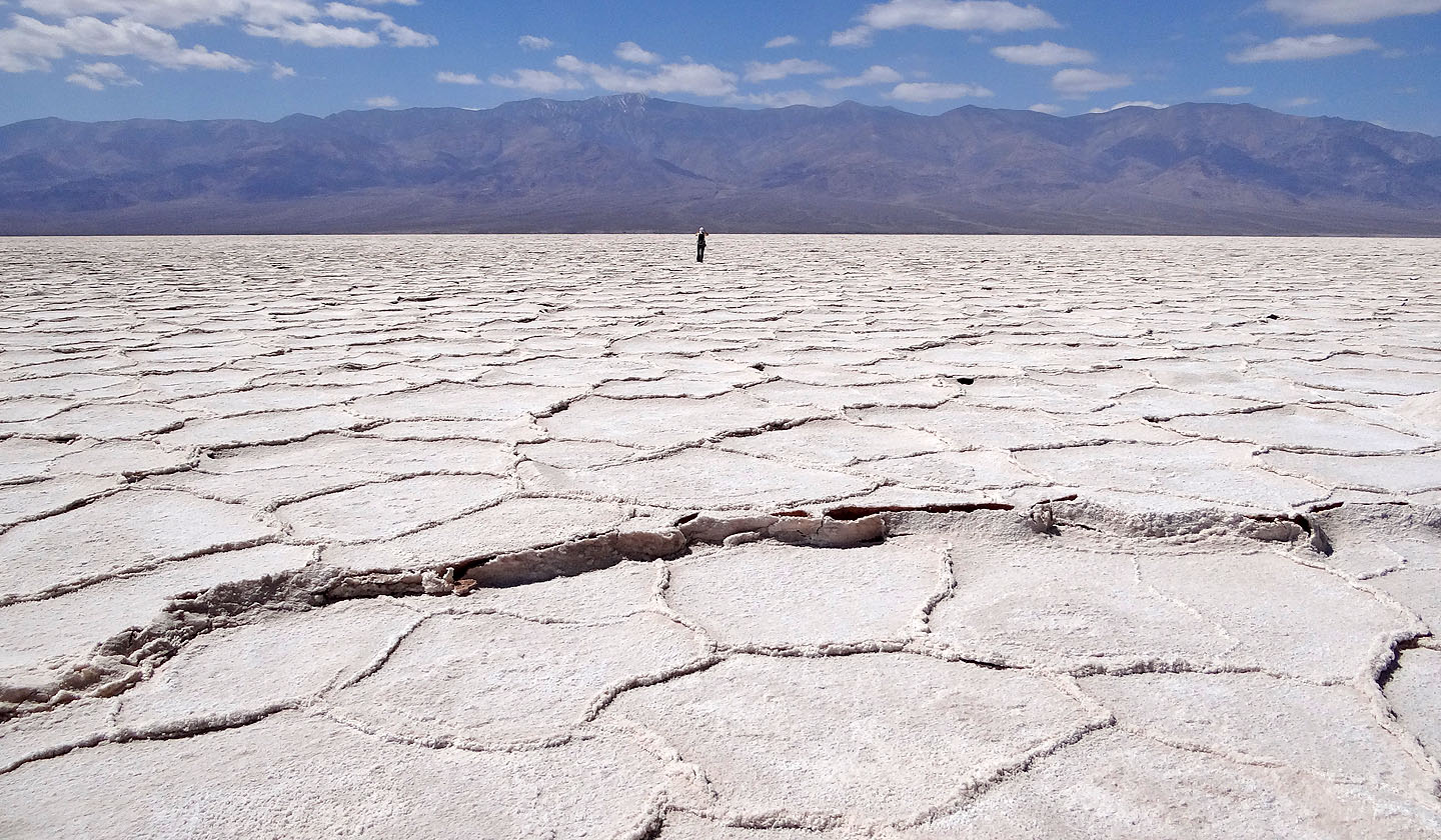
As we ventured deeper, cracks and pressure ridges became more pronounced
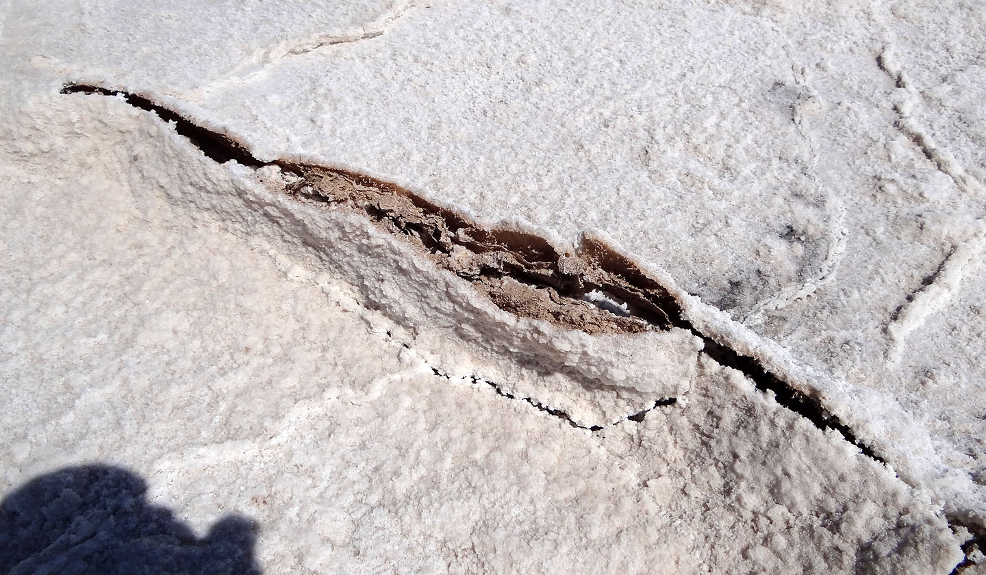
A close look at a pressure ridge reveals dirt under the salt layer
After kicking open a pressure ridge I found a large salt flake underneath that had apparently "grown" horizontally (mouse over). Unlike the dirty surface salt, it appeared pristine.
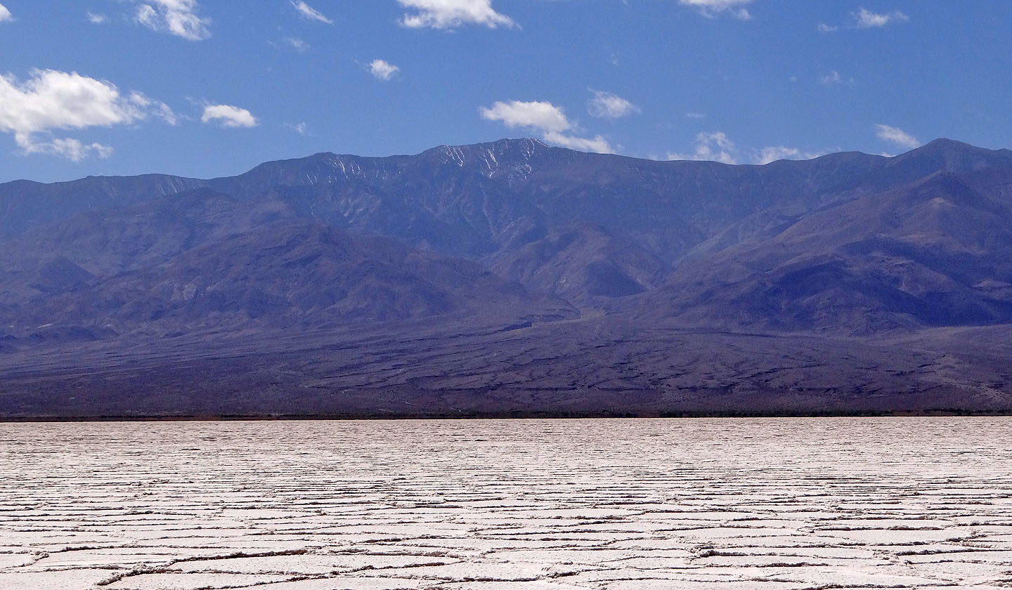
Telescope Peak towers 3400 m (11,000 ft) above the basin (mouse over for a close-up of the summit)
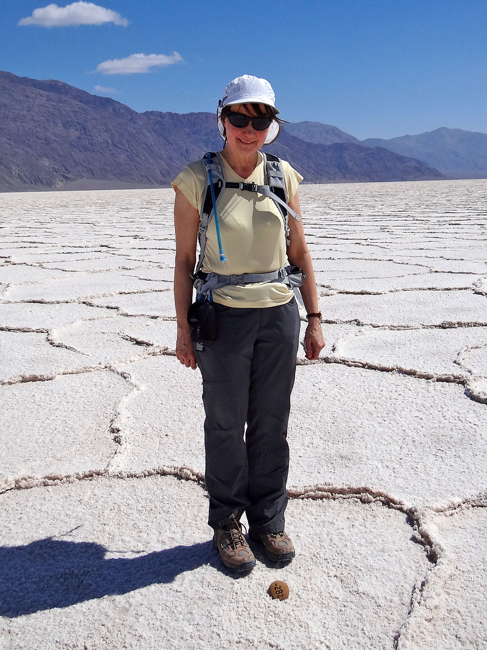
A small stone marks the lowest point in the Western Hemisphere
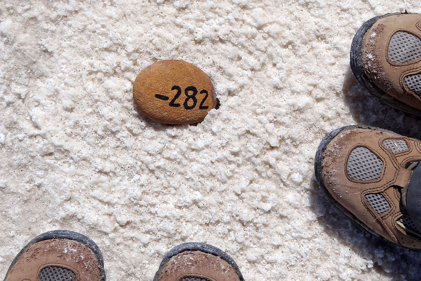
Our objective, this little stone: -282 (ft)
Badwater Basin (7 mi, -282 ft, -62 ft)