bobspirko.ca | Home | Canada Trips | US Trips | Hiking | Snowshoeing | MAP | About
Lightning Peak
Livingstone Range, Alberta
July 25, 2015
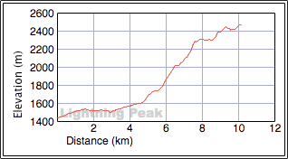
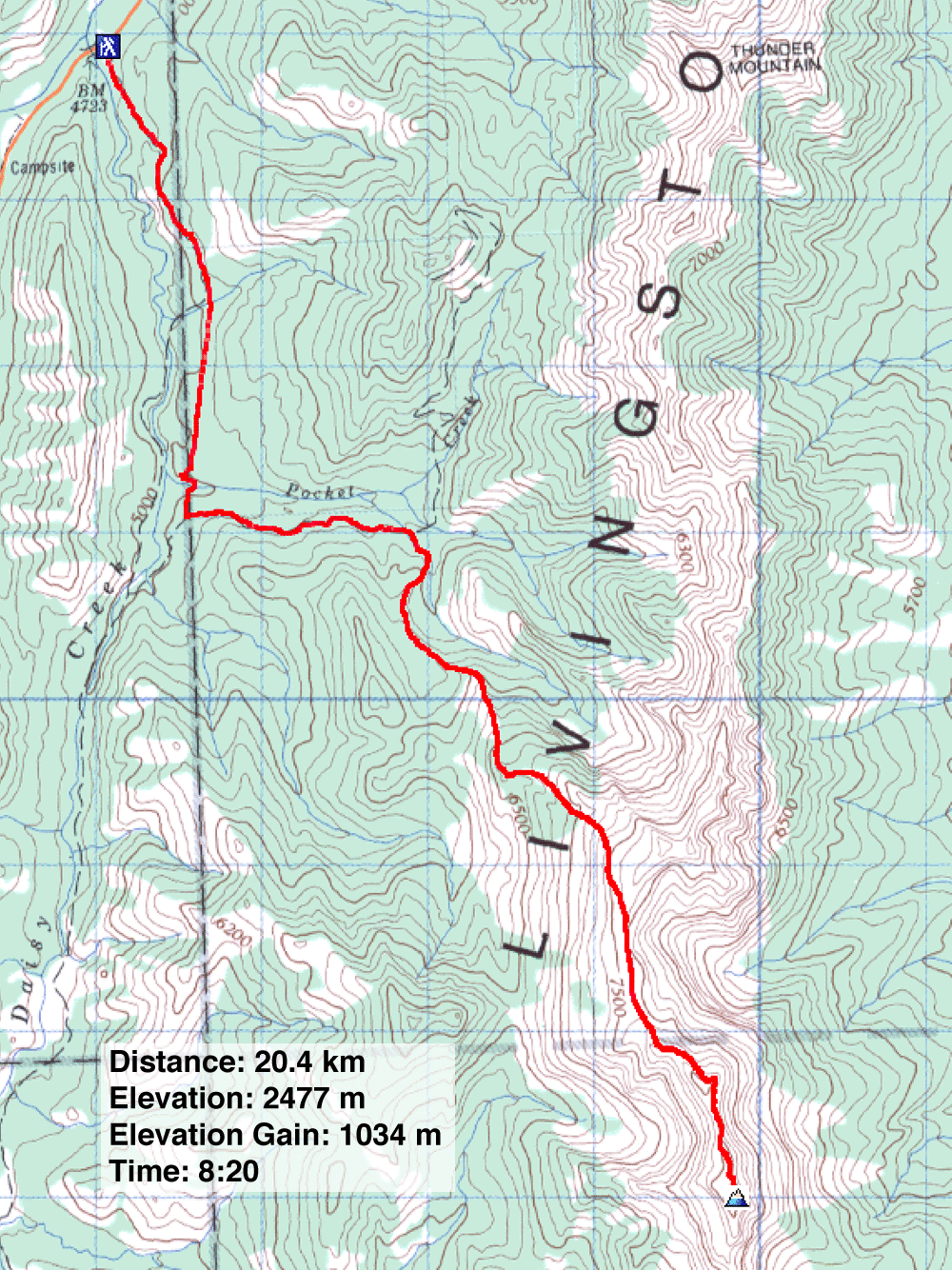
Distance: 20.4 km (12.7 mi)
Cumulative Elevation Gain: 1384 m (4541 ft)
Livingstone Range boasts several peaks well-known to hikers and scramblers, yet the second highest goes unnoticed and unnamed. I came across it by accident, after studying a route to gain the ridge south of Thunder Mountain. I realized it appeared possible to reach a high point surpassed only by Centre Peak in the Livingstone Range. Taking a cue from nearby Thunder Mountain, I called it, "Lightning Peak."
Lightning Peak has all the trappings of a terrific trip: an approach up a 4WD road, a no-nonsense route, and a 2 km ridgewalk. Those who love bushwhacking or scree-bashing will be disappointed. Hardcore climbers will also be disappointed. There is little scrambling and all of it easy. But everyone will appreciate the large arch that graces the slope beneath the summit.
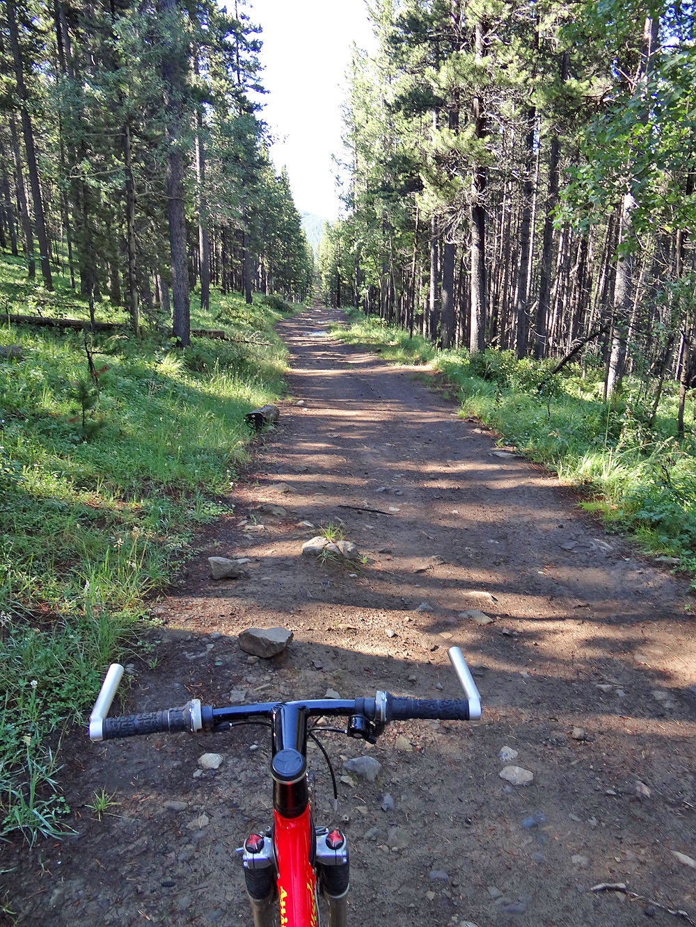
Four months earlier, I hiked up an unnamed ridge (later to be called Zebra Ridge) to study a route to the top of Lightning Peak. Then on July 18, I attempted Lightning. I parked at an unofficial campground before a bridge, 3 km south of the junction of Forestry Trunk Road and Maycroft Road. I opted to bike up the 4.6 km road. Near the start, I walked some of the steep sections, but a kilometre in, after passing a viewpoint, the road levels off and crosses Pocket Creek. 200 m after Pocket Creek, I turned left onto a side road (I added flagging). A few minutes later, I came to the drainage where I would start hiking.
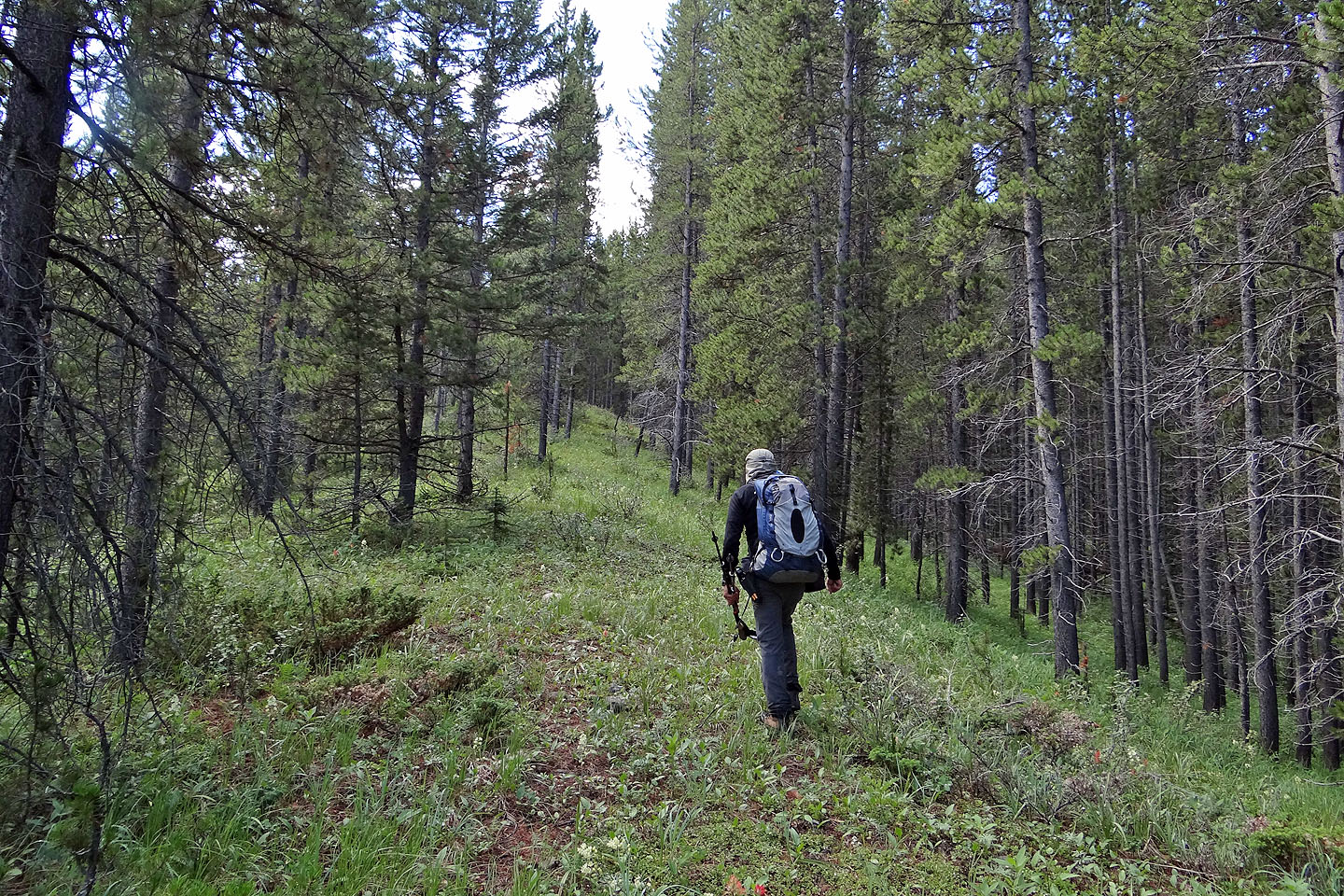
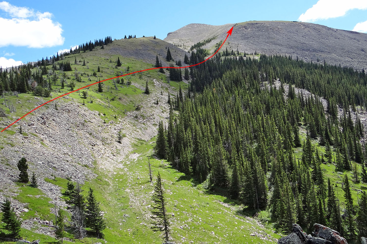
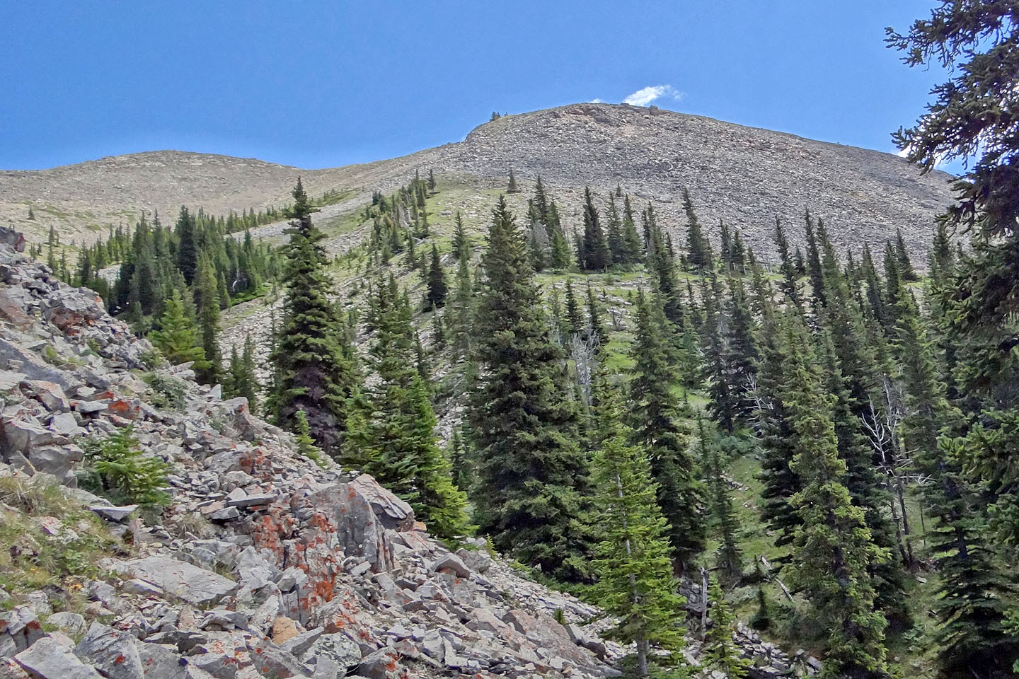
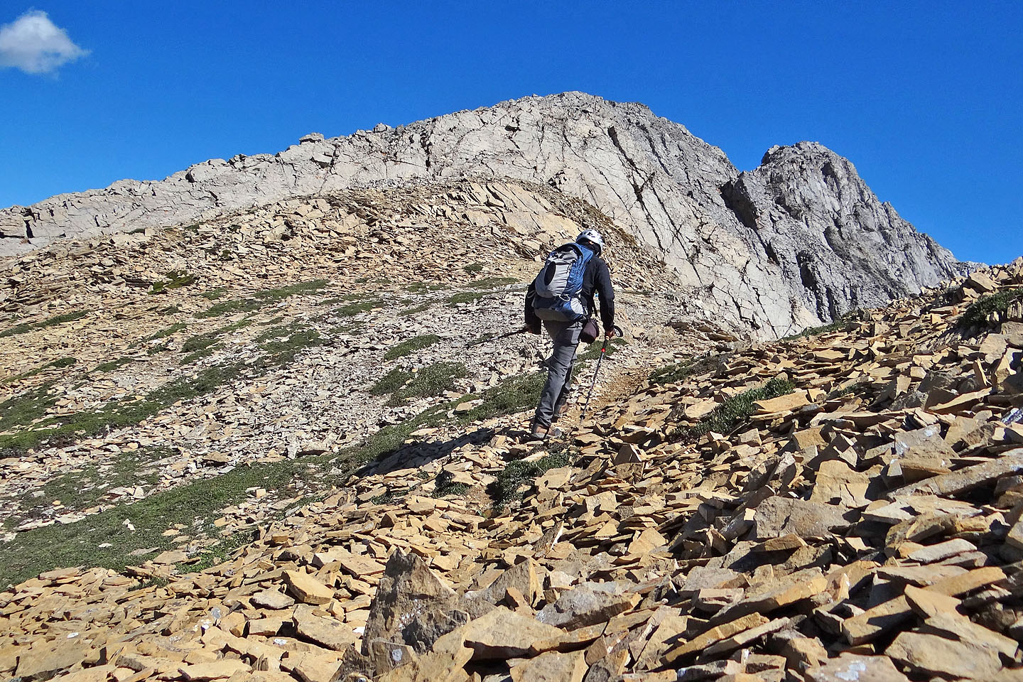
After putting away my bike and flagging the drainage, I set off up a dry creek bed. I missed the exit on the ascent but figured it out on the descent: from the road, start on the left side of the drainage where travel is easiest, and after 150 m, look for flagging that I left on the right side. That's where an animal trail hidden in trees begins. It's the start of the northwest spur. Once on the spur, there is little chance of straying off-route. The spur is well-defined, lightly wooded, and leads to the top of some unusual bluffs.
From the bluffs, I followed a grassy strip to a small ridge on my left. Partway up the ridge, I angled right to cross a gully. This put me below the corner of a massive talus slope topped by a grassy saddle. I hiked to the edge of the talus. I thought I could get to the saddle quicker if I angled right. This was a blunder for the rock is steep and unstable. I should have continued straight up.
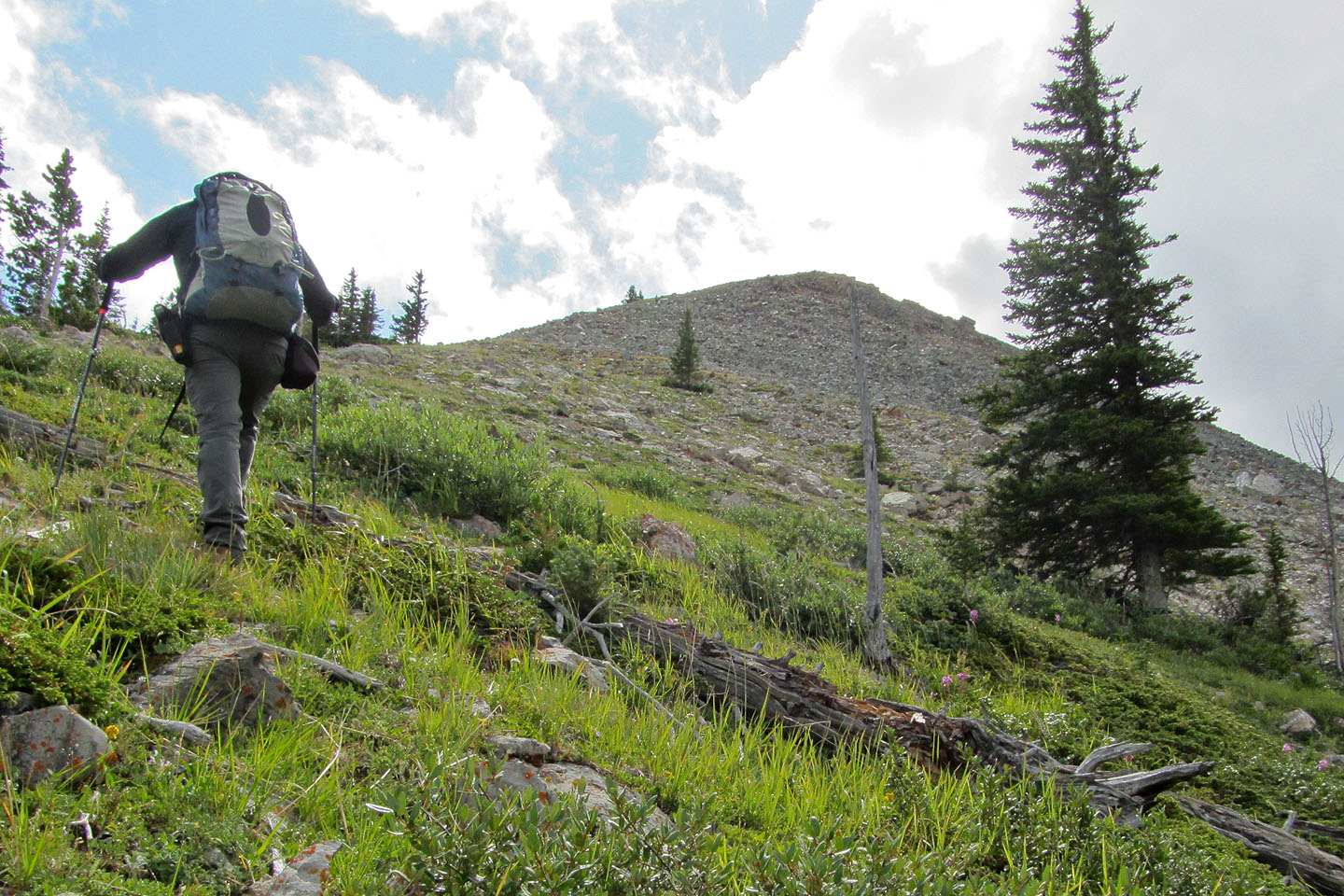
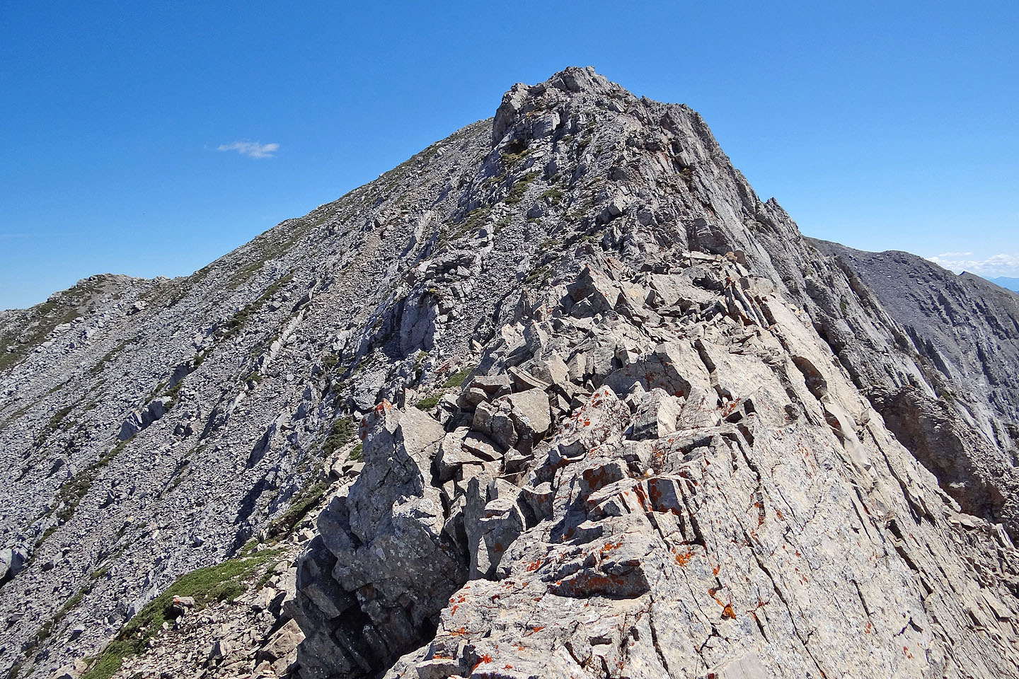
I was glad when I stepped off the crappy rock onto the grass of the broad saddle. Ahead of me, two rocky points rose up, hiding the summit. I hiked to the first point and caught a sheep trail (easy scrambling) that disappeared before I reached the top of the second. From there, the summit is less than a kilometre away, although there is a drop before it. But I stopped there.
For some reason, I was feeling out of sorts. I tired easily, and after the bluffs, I developed recurring leg cramps that were causing me grief. I never had persistent cramps before. I was concerned since I was far from the trailhead and didn't know if the cramps could get worse. So I turned around and went back along the ridge to the lowest point in the saddle. I crossed the talus slope at a low angle where the rock was more stable. It wasn't optimum, being rather long and tedious, but it's good to keep in mind. There are few places on the ridge to escape a thunderstorm.
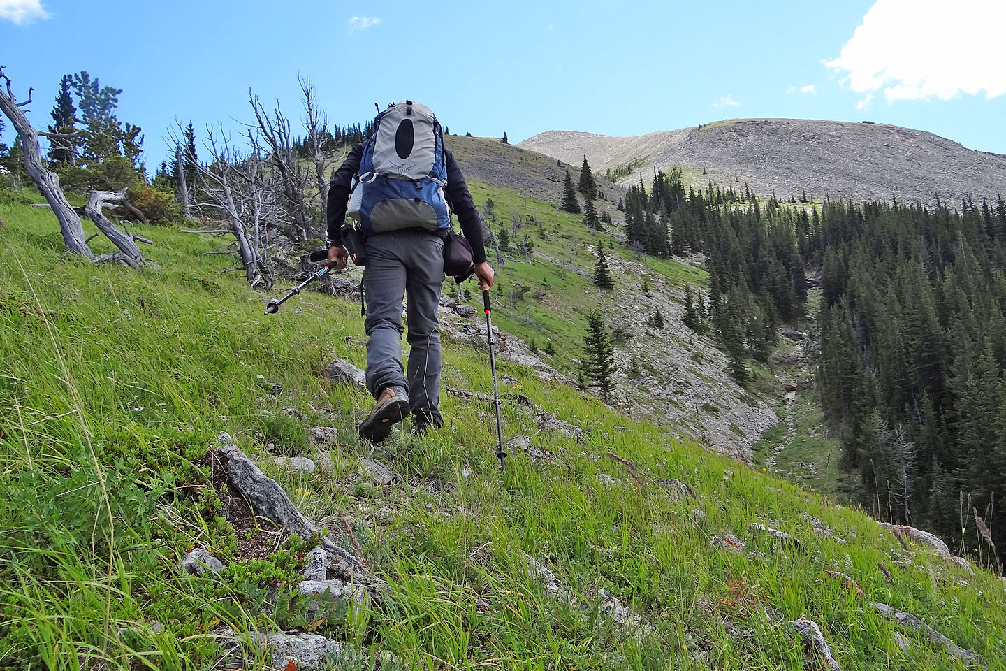
I returned the following weekend (photos are from both trips). I was glad to redo the trip, not only to summit but to correct my mistake on the talus slope and get the route right. I retraced my steps to the edge of the talus, but this time I charged straight up. The rocks are stable here and after ascending a short distance, the grade eased. I angled toward the saddle, hiking on grass patches or easy-angled rocks. After reaching the crest, I continued along the ridge and made my way to the second high point.
Unlike the previous week, I was fresh and eager to push on – no leg cramps this time. After hiking down the east side of the high point, I saw the way was clear to the summit. I worked my way across a rubbly slope and reached a sheep track. It runs almost to the summit.
Whereas my attempt was under blue skies, this day was fraught with fickle weather. Changing every few minutes, I never knew what to expect next: clouds, sunshine, rain, calm winds or strong winds. I had experienced it all a few times by the time I reached the summit. There were a couple of rocks piled on the top, perhaps left by Rick Collier when he traversed Livingstone Range from Old Man River to Crowsnest Highway in 2006.
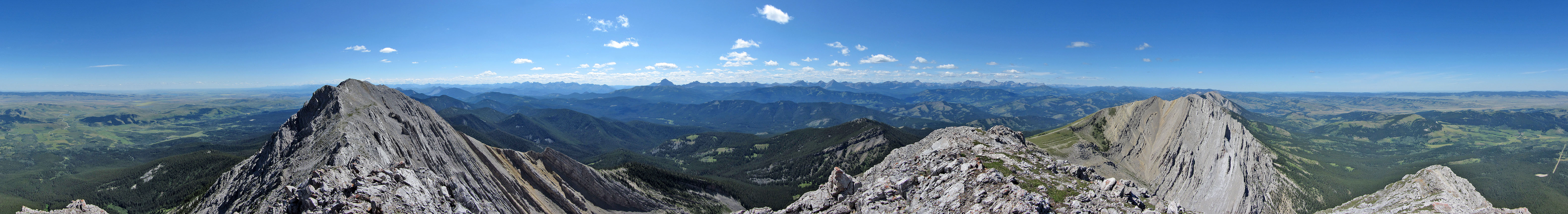
Under scuttling clouds, I took three panoramas hoping one would turn out. Twenty minutes after summiting, I headed back. Now hit by rain and a cold, strong wind, I wanted to get off the mountain quickly. However, I took a few minutes to visit the arch. It's close to the trail but requires going down a steep slope of loose rock. Afterward, I retraced my steps to the east side of the high point where I was glad to get out of the wind. Enduring successive cycles of rain, wind and sun, I made my way back to my car.
Who would have thought that the second-highest peak in the Livingstone Range is mostly a hike and a memorable one? Unknowingly, I have driven past it dozens of times.
Postscript: On June 10, 2020, an email from Peter (no last name given) indicates logging has ruined the approach:
"With the whole approach as you described it now totally destroyed by logging, I walked the 5km clear-cut road to try to make sense of the re-arranged topography. I MIGHT have come to the dry drainage but there was no flagging or cairn. The ONLY place in your description that is still intact is the VIEWPOINT a few minutes after starting up the 'temporary' highway (as the government sign proclaims)."
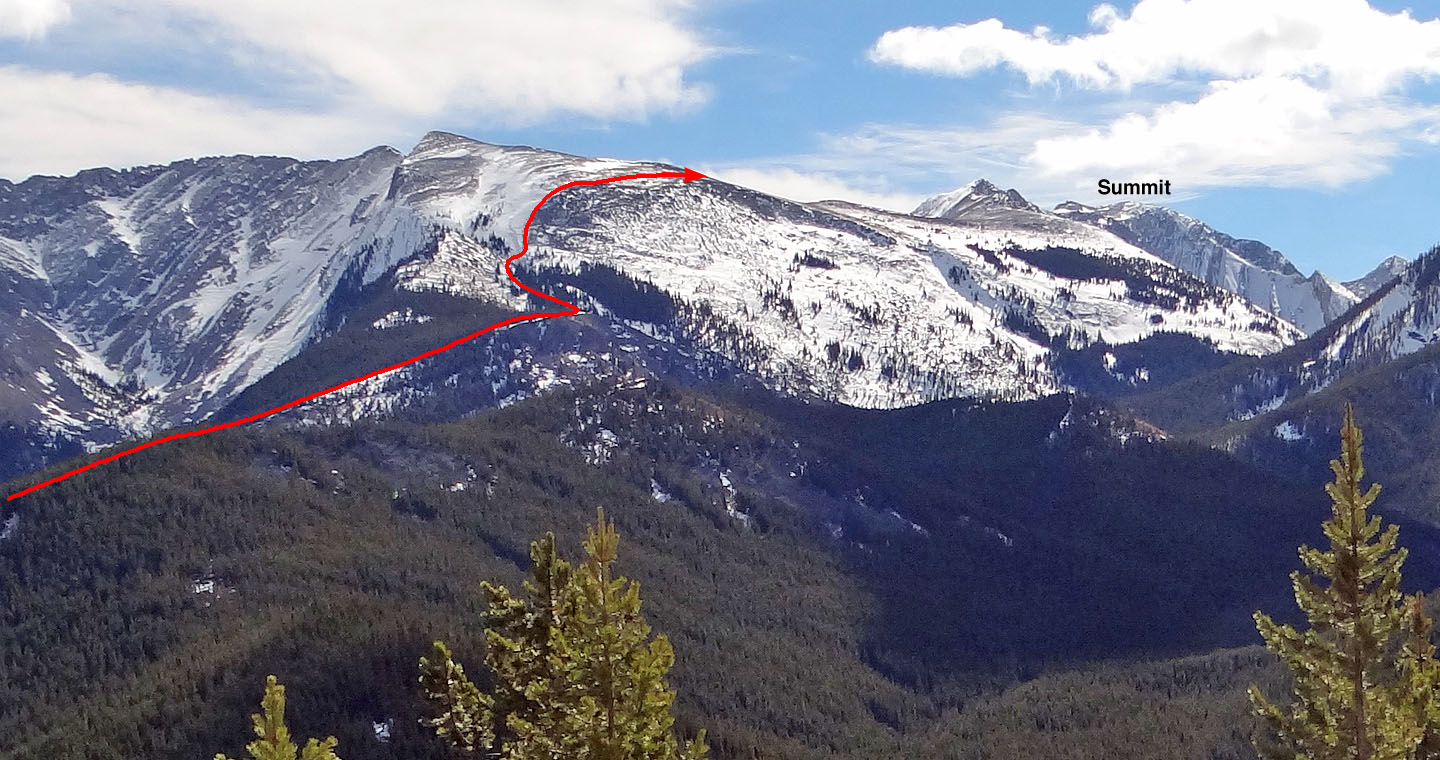
The ascent seen from a west outlier on a recon late March
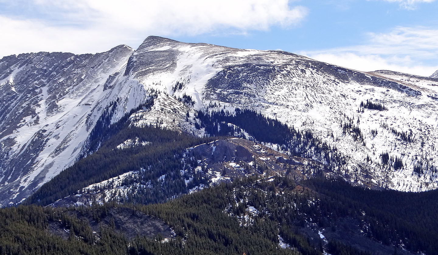
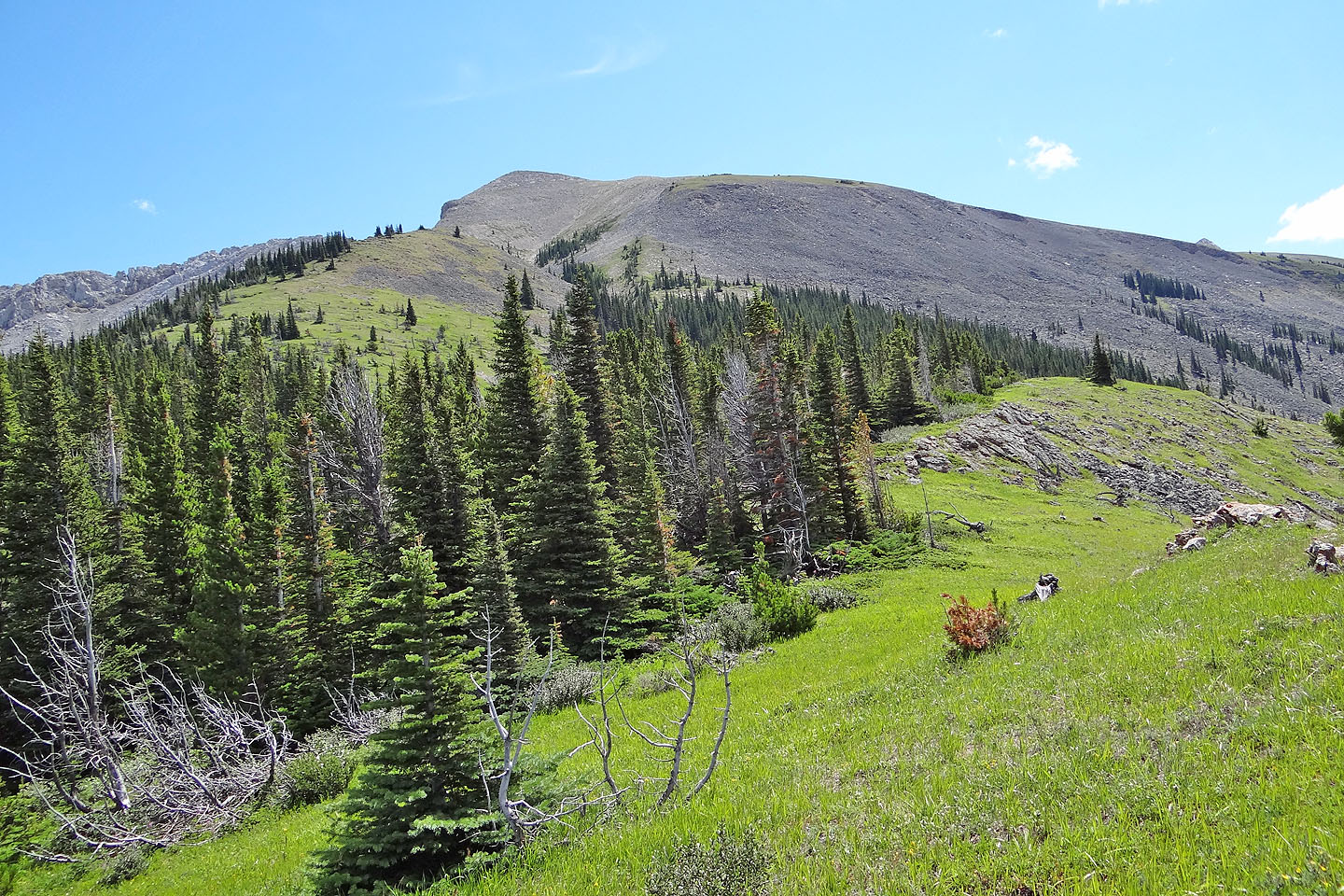
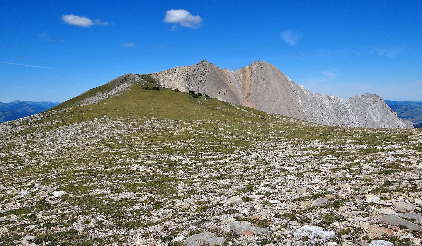
The ascent slope. The bluffs are near the centre.
The summit is on the right

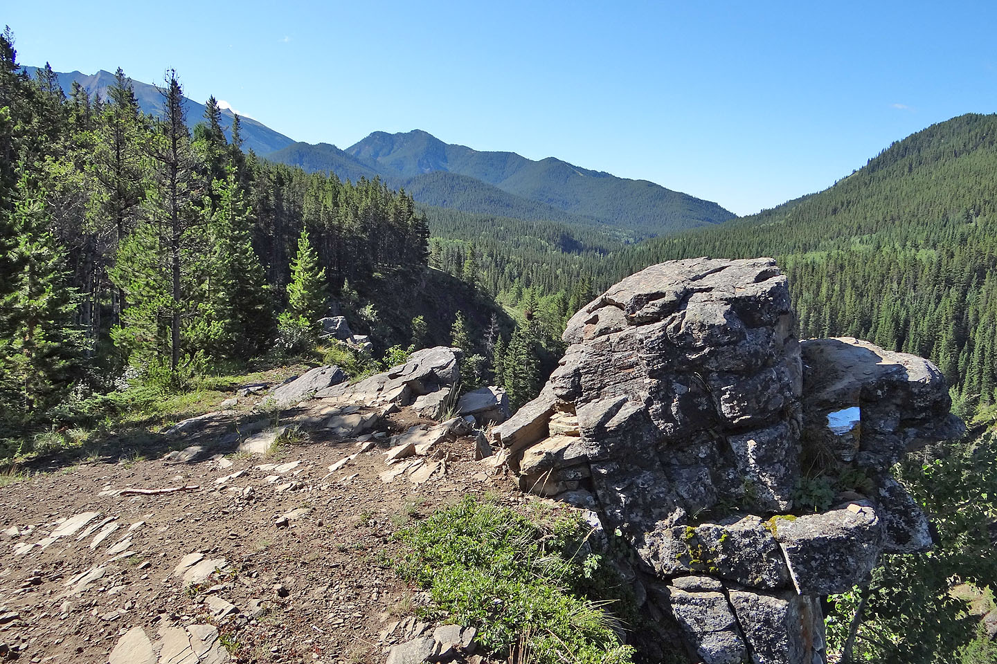
The trailhead
A kilometre up the road, a viewpoint shows Daisy Creek Valley but little else
After the first kilometre the road levels off
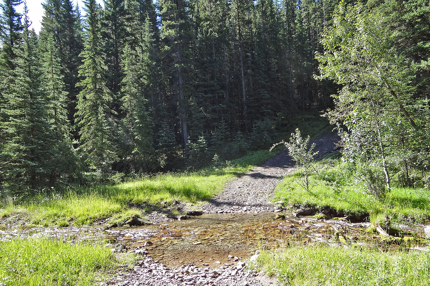
Pocket Creek
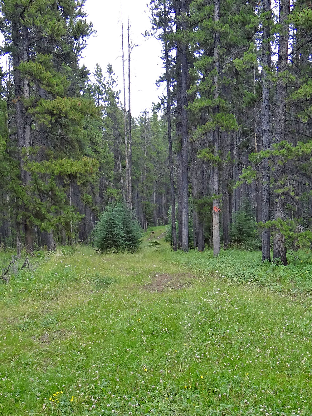
The side road

The side road had a gentle grade
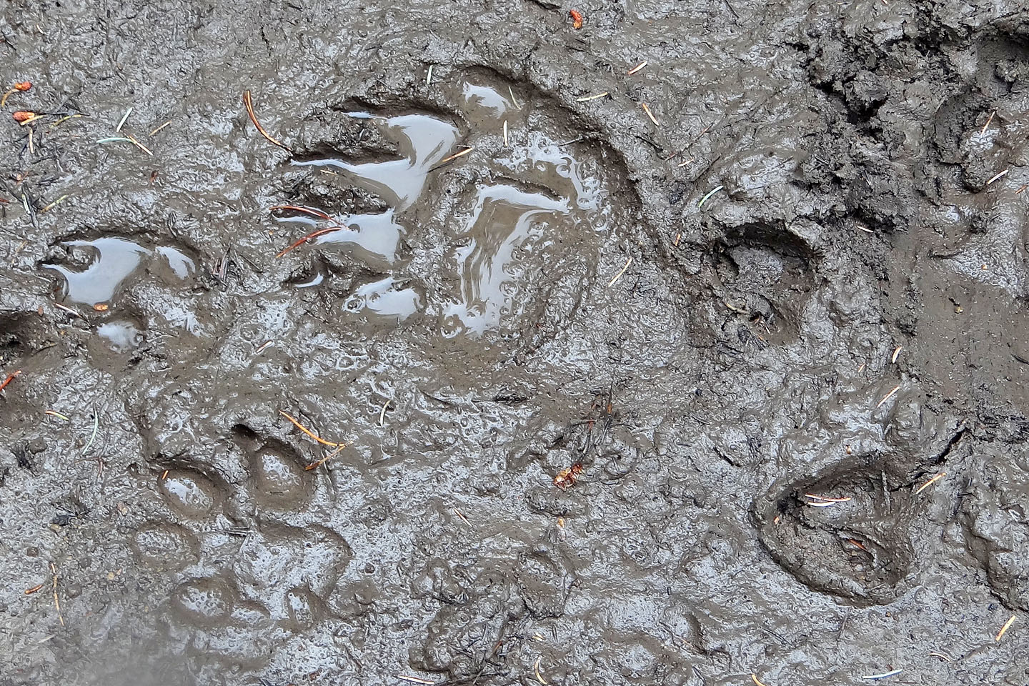
Cougar, bear and deer share the road

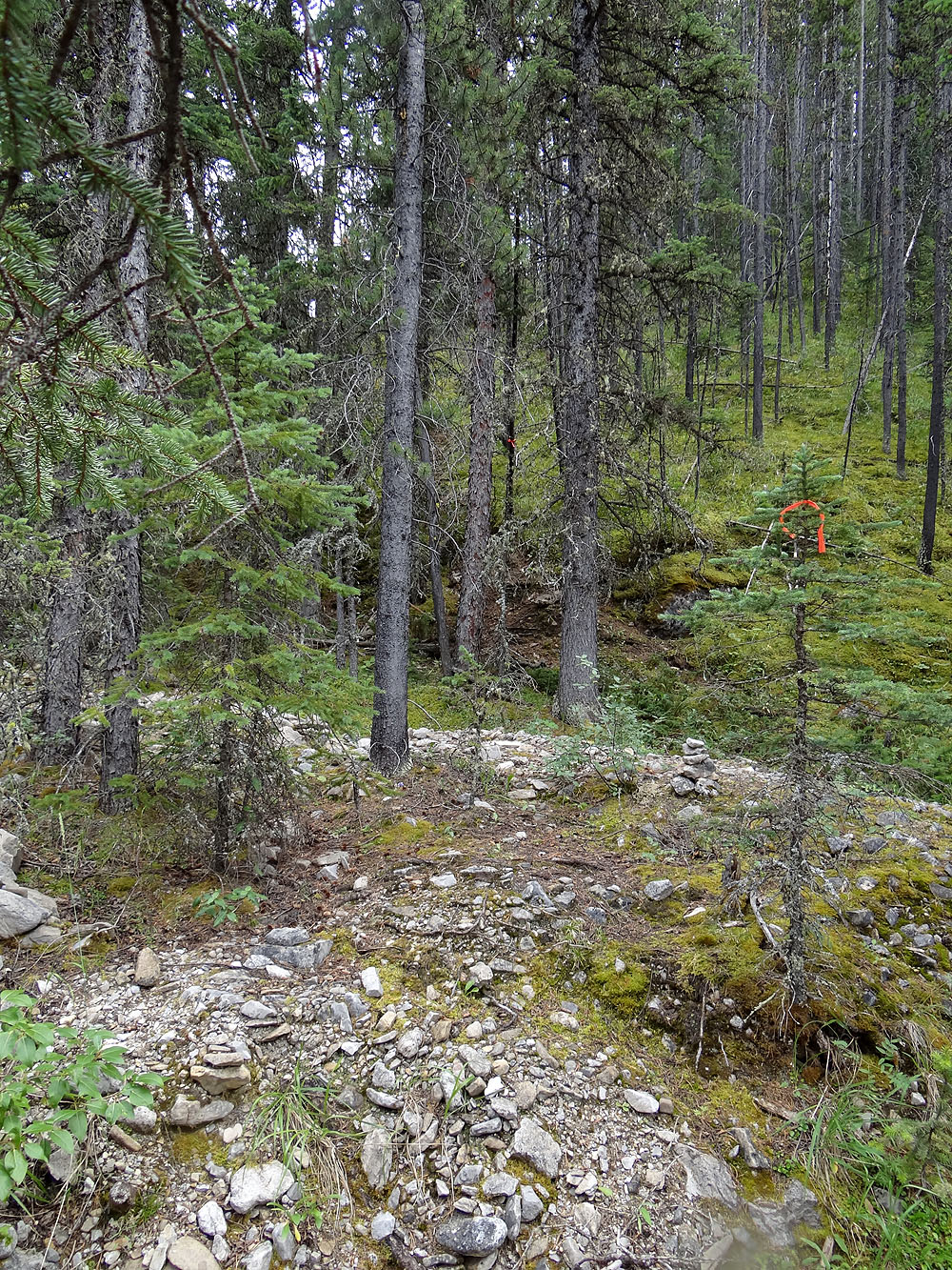
The drainage: start up the left side and look for flagging on the right side after 150 m
The start of the spur
Pleasant hiking up the lower spur
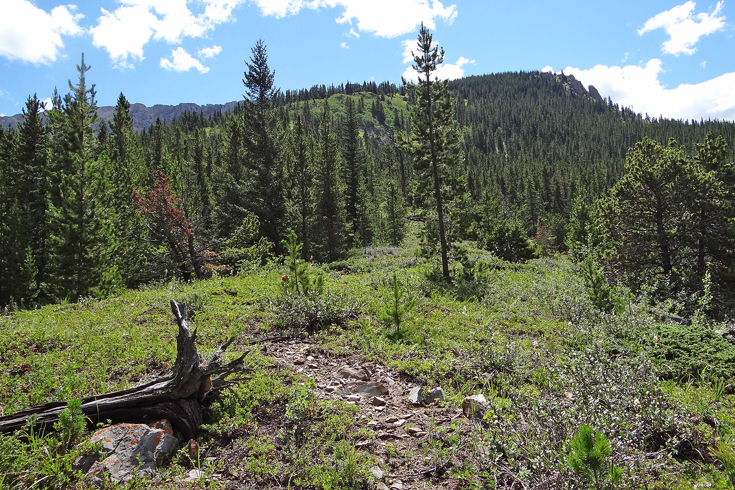
Follow the spur to the bluffs on the right
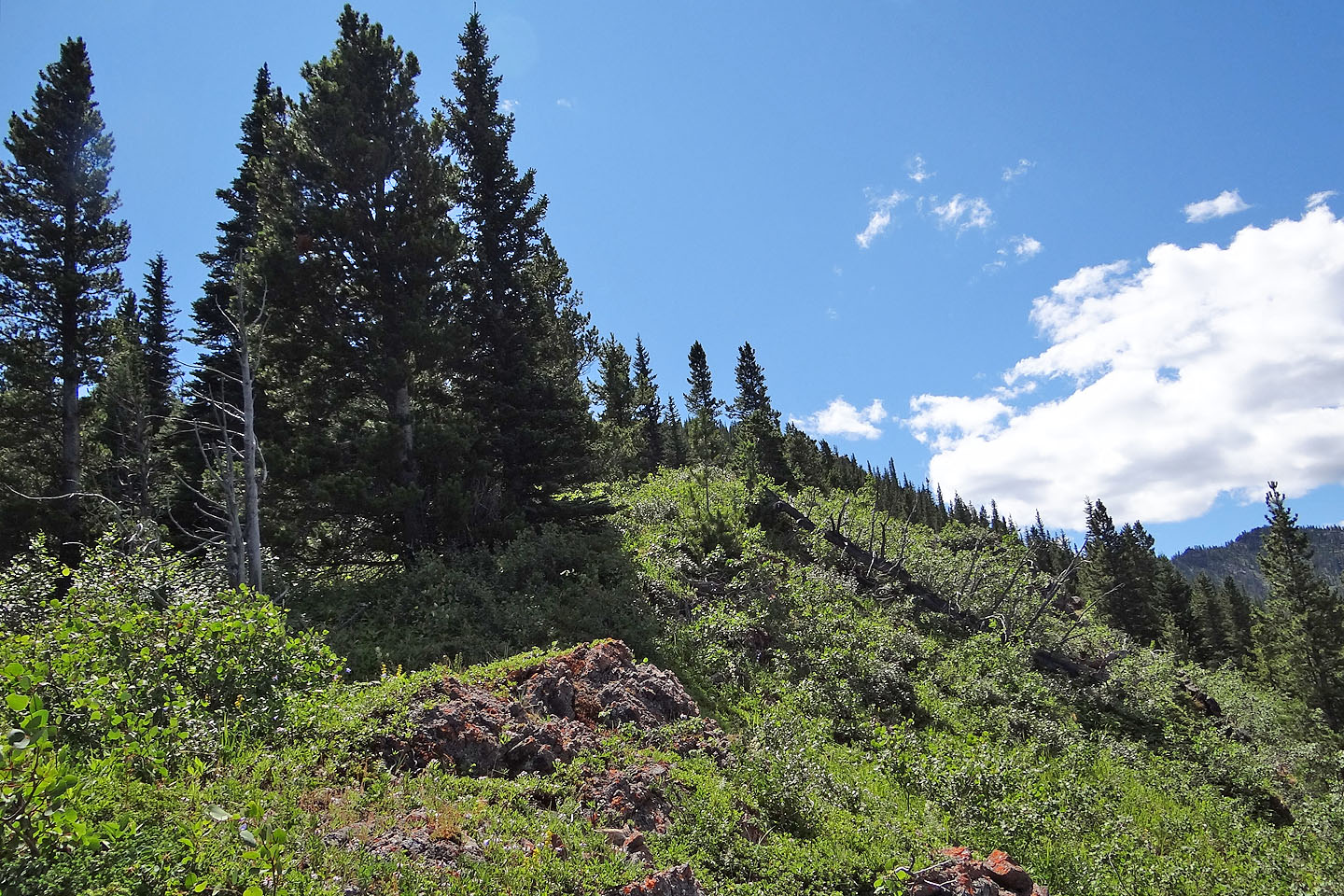
The upper spur is mostly free of trees and bushes, although the last 100 m before the bluffs is in trees

On top of the bluffs
Looking back
After the bluffs, the ridge fills the view ahead
Follow a small ridge partway before crossing a gully
Somewhere, I'll cross the gully on my right
Looking back
Approaching the gully
After crossing the gully I headed straight up the slope
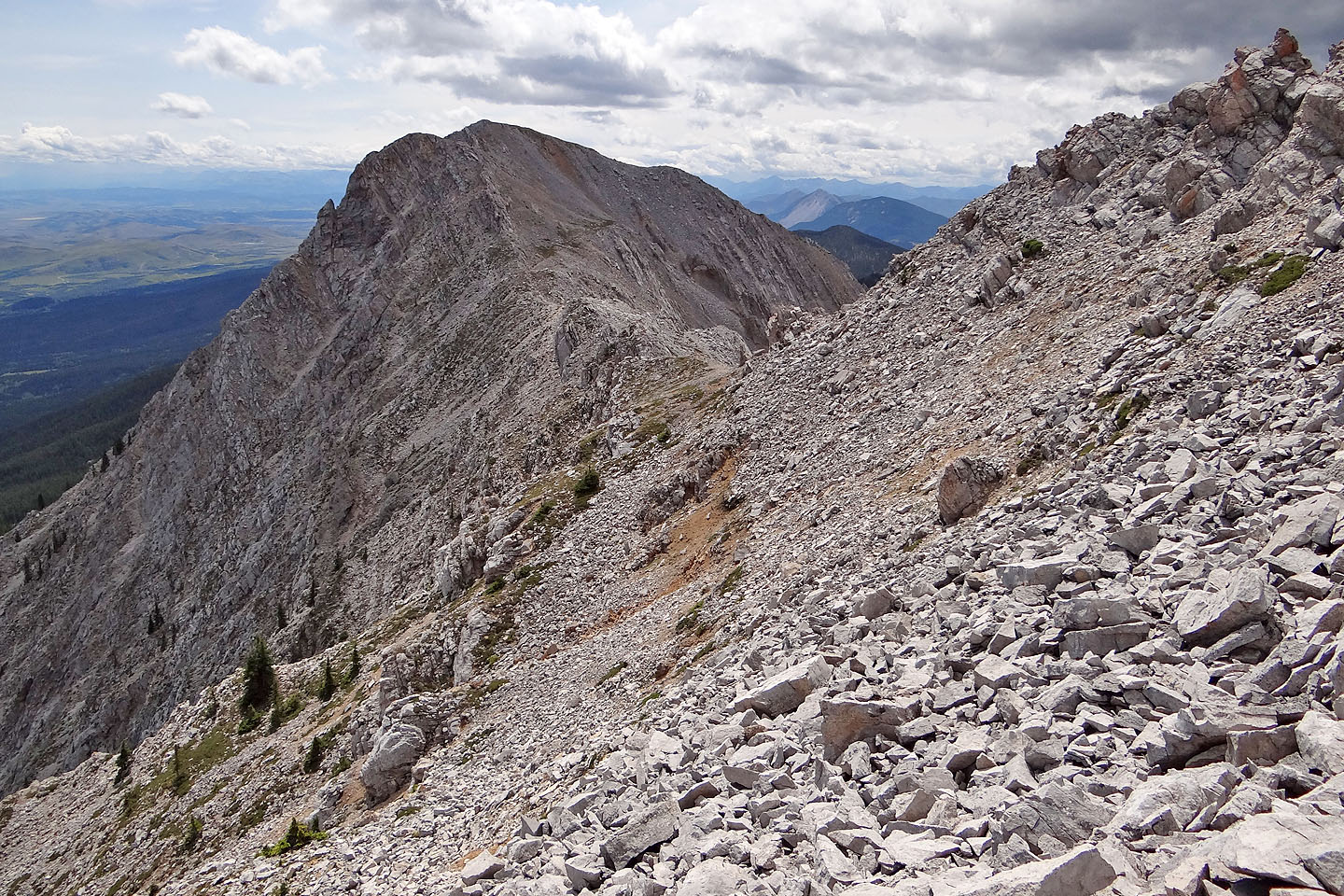
Looking back from the top of the talus slope
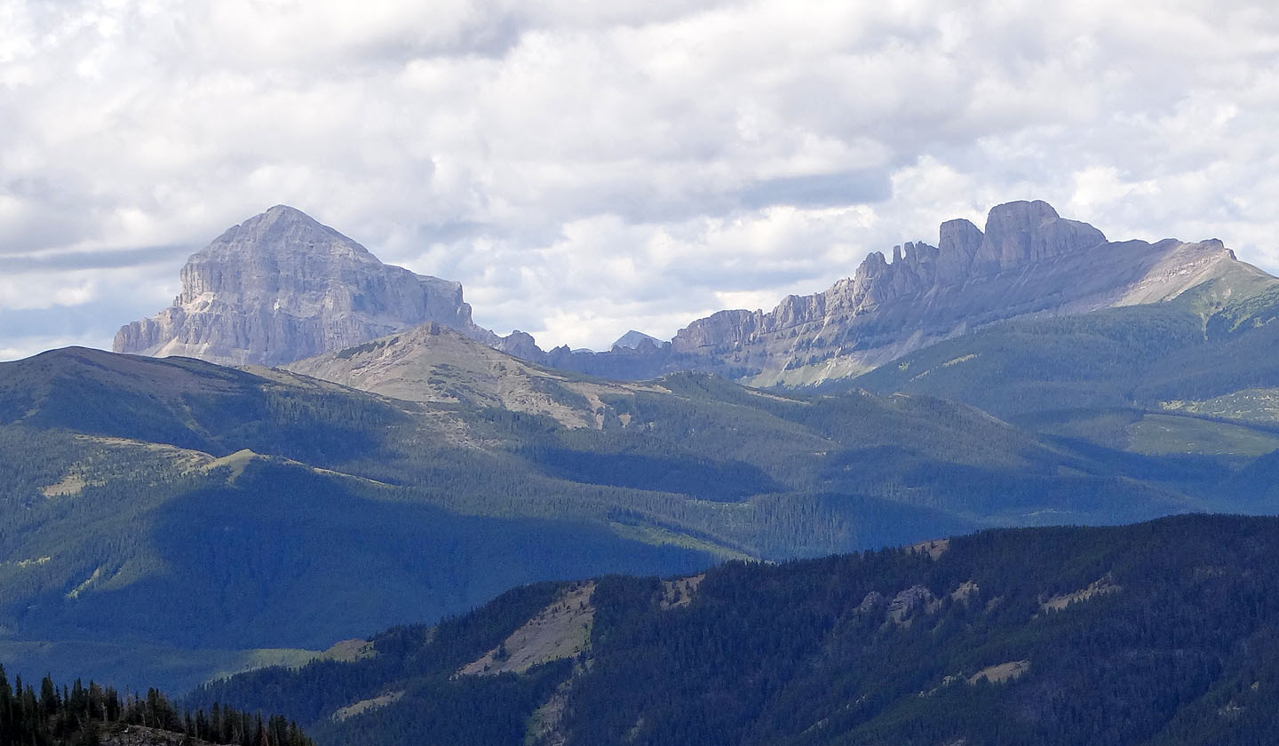
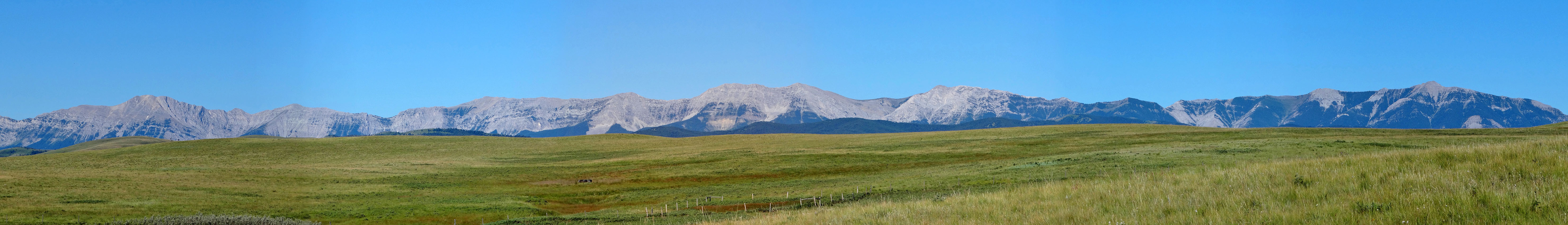
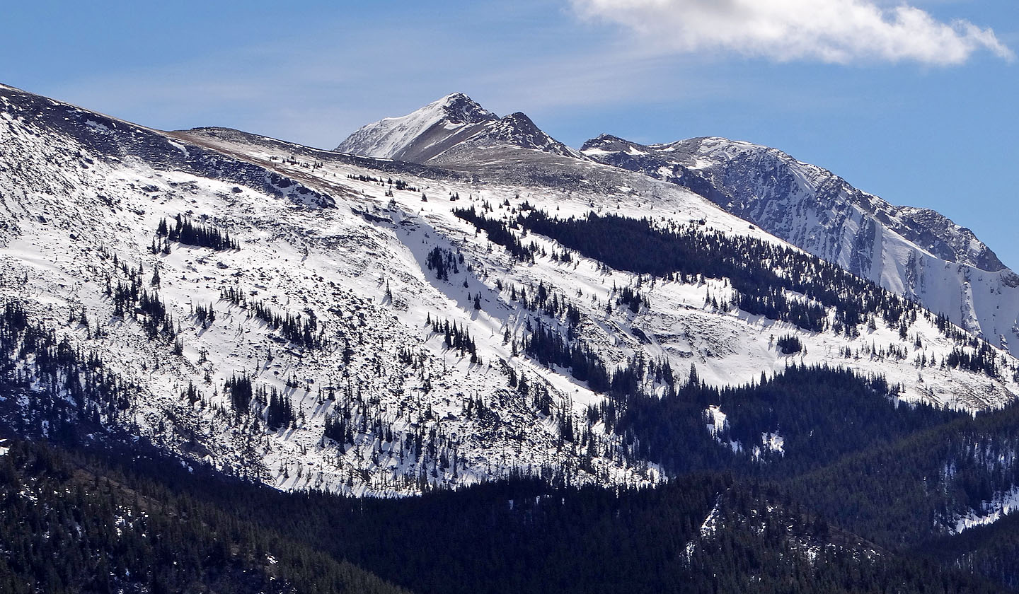
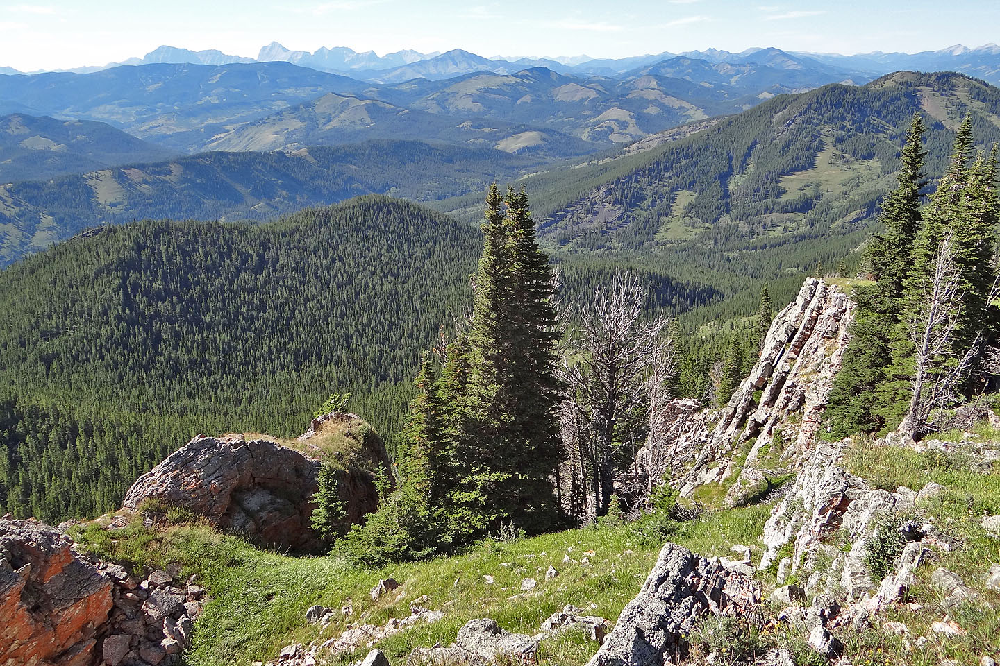
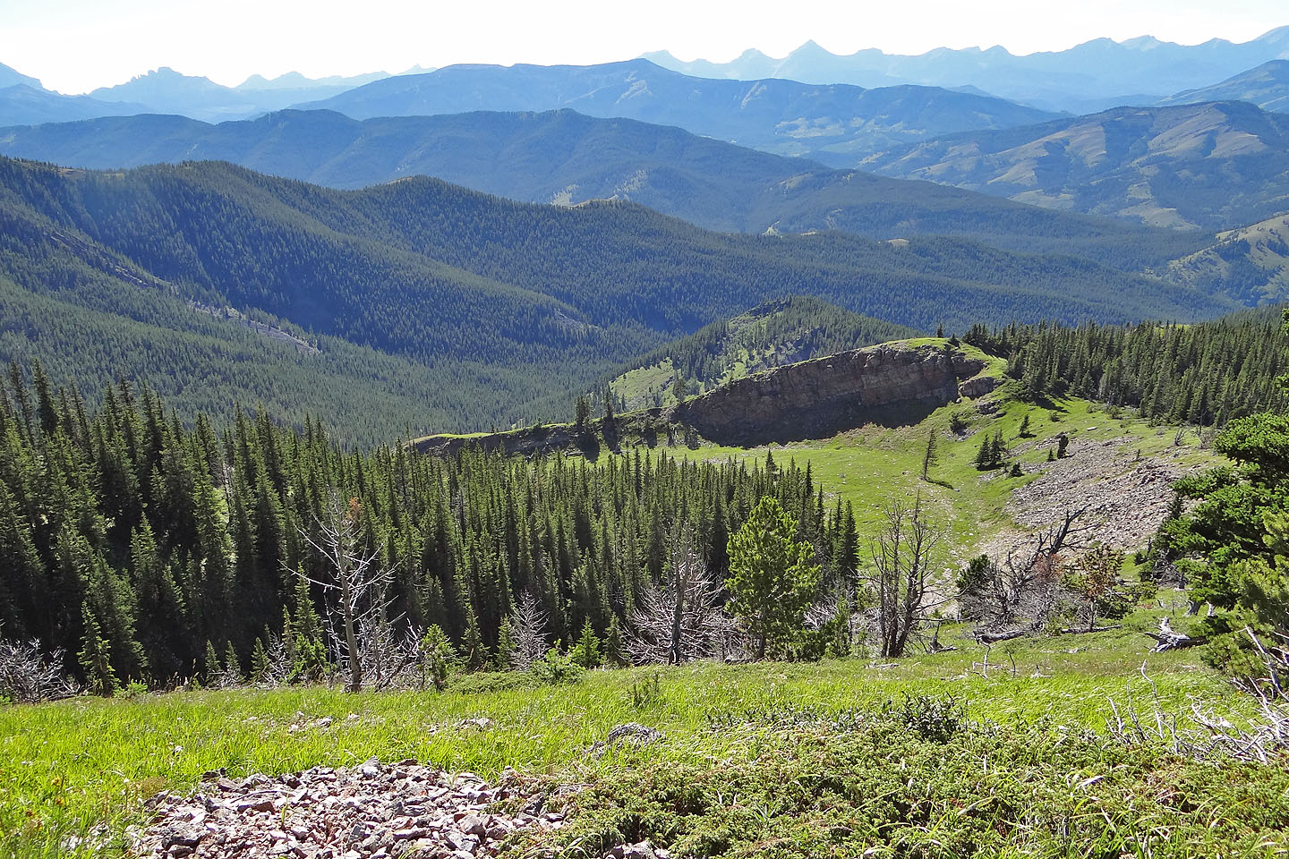
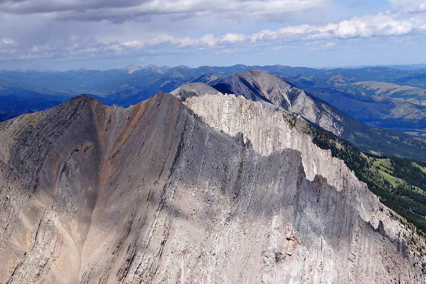
Crowsnest Mountain and the Seven Sisters

On the ridge crest
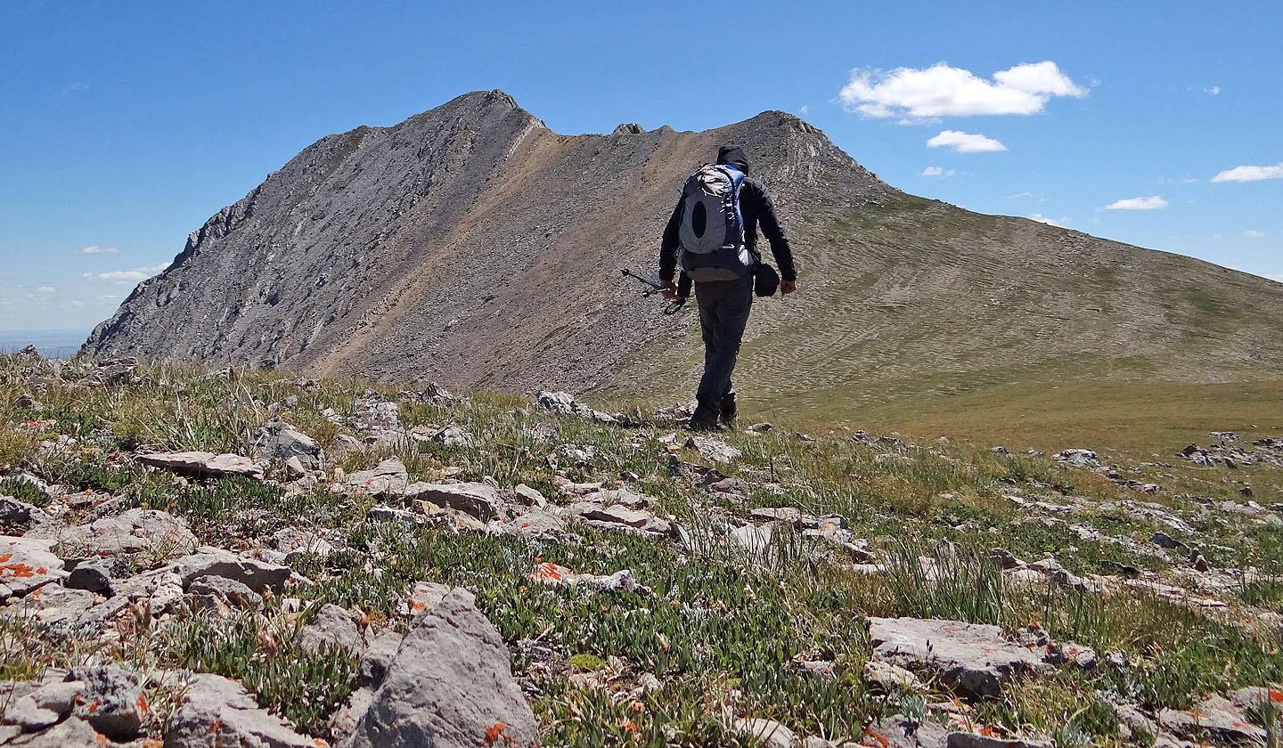
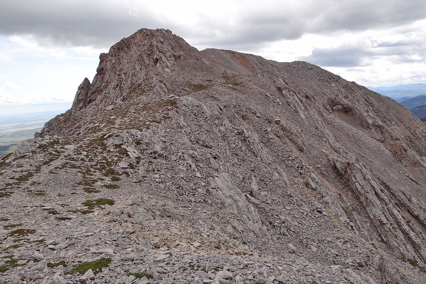
Heading to the two high points before the summit
Looking back across the saddle at what I think of as the north summit of Lightning (mouse over for a closer look)
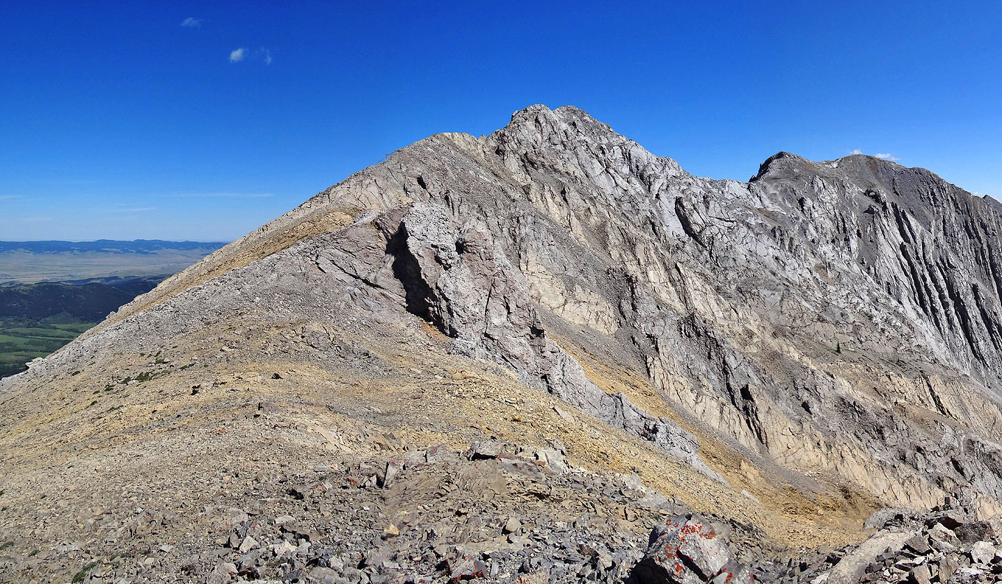
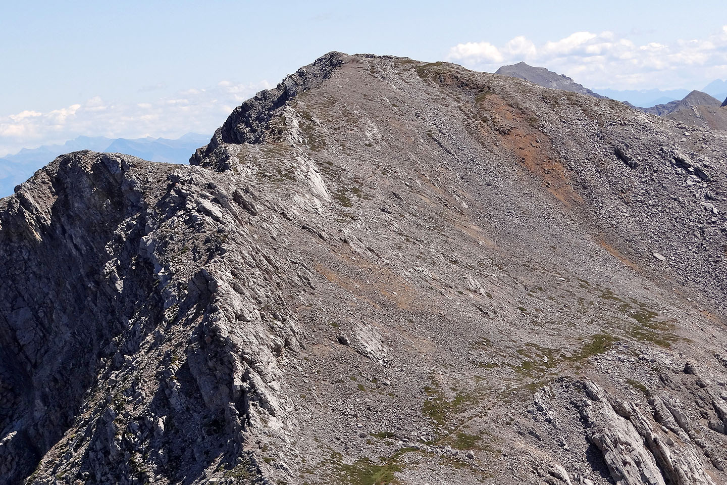
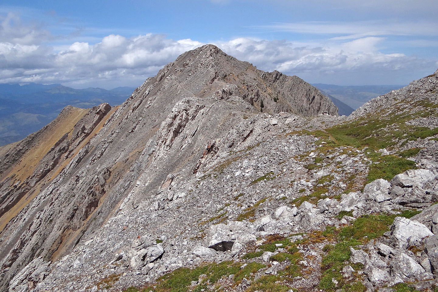
The view ahead from the first high point. The summit and arch are right.
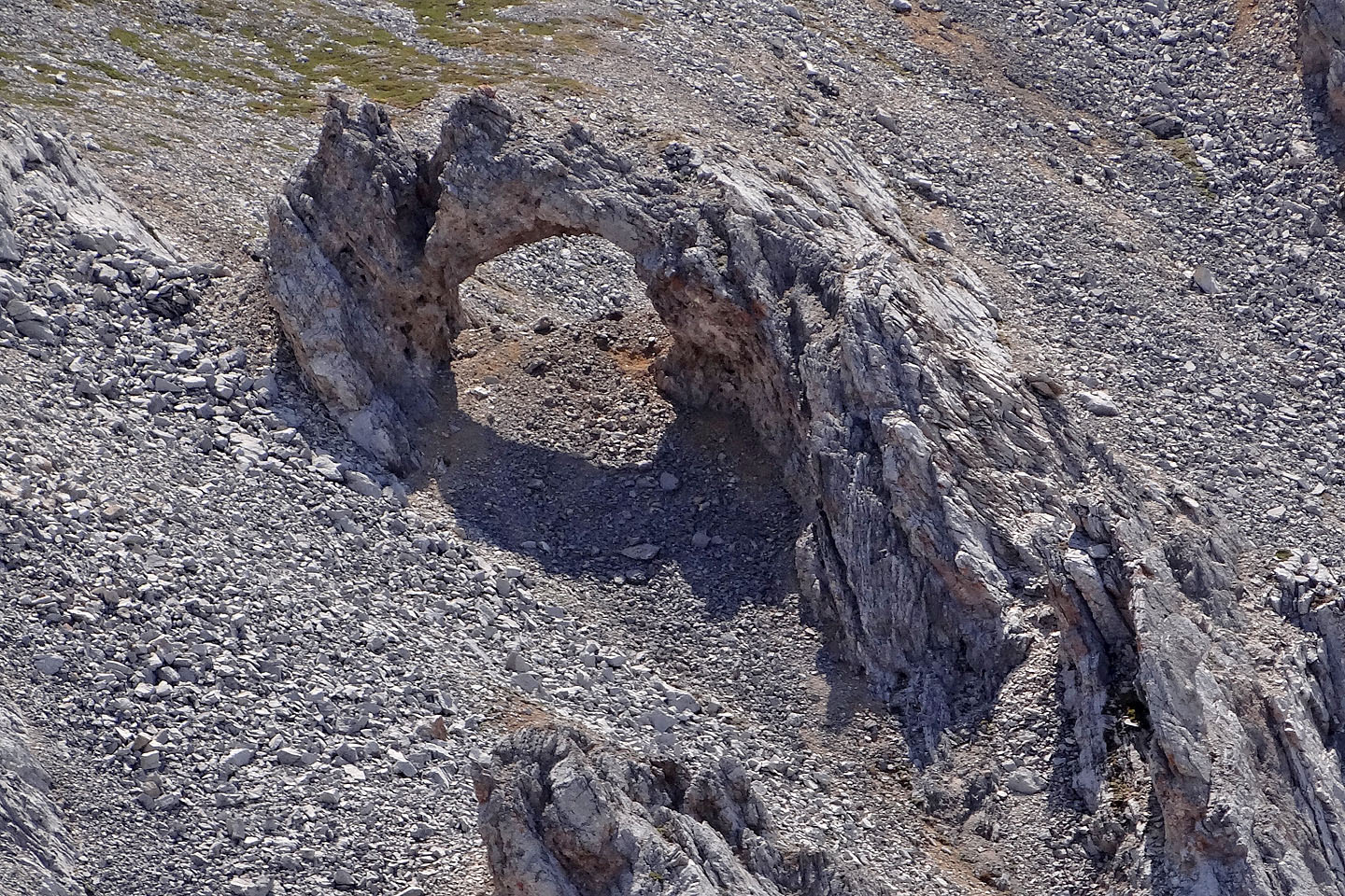
A close look at the arch
A sheep trail leads to a weakness in a two-metre-high cliff band
After scrambling up, I angled left, and followed a faint track in spots
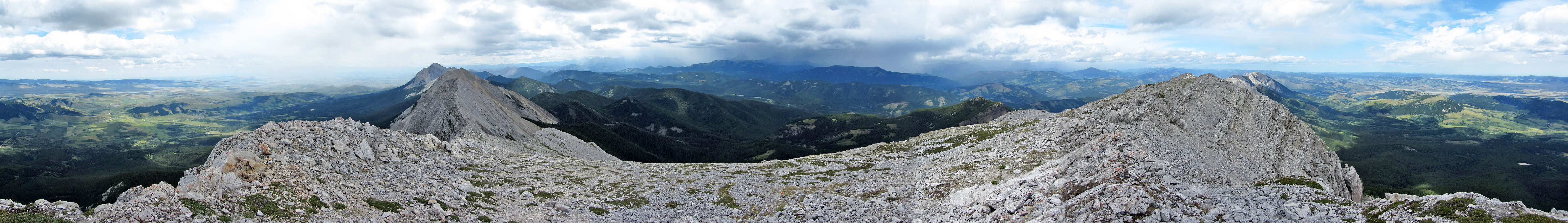
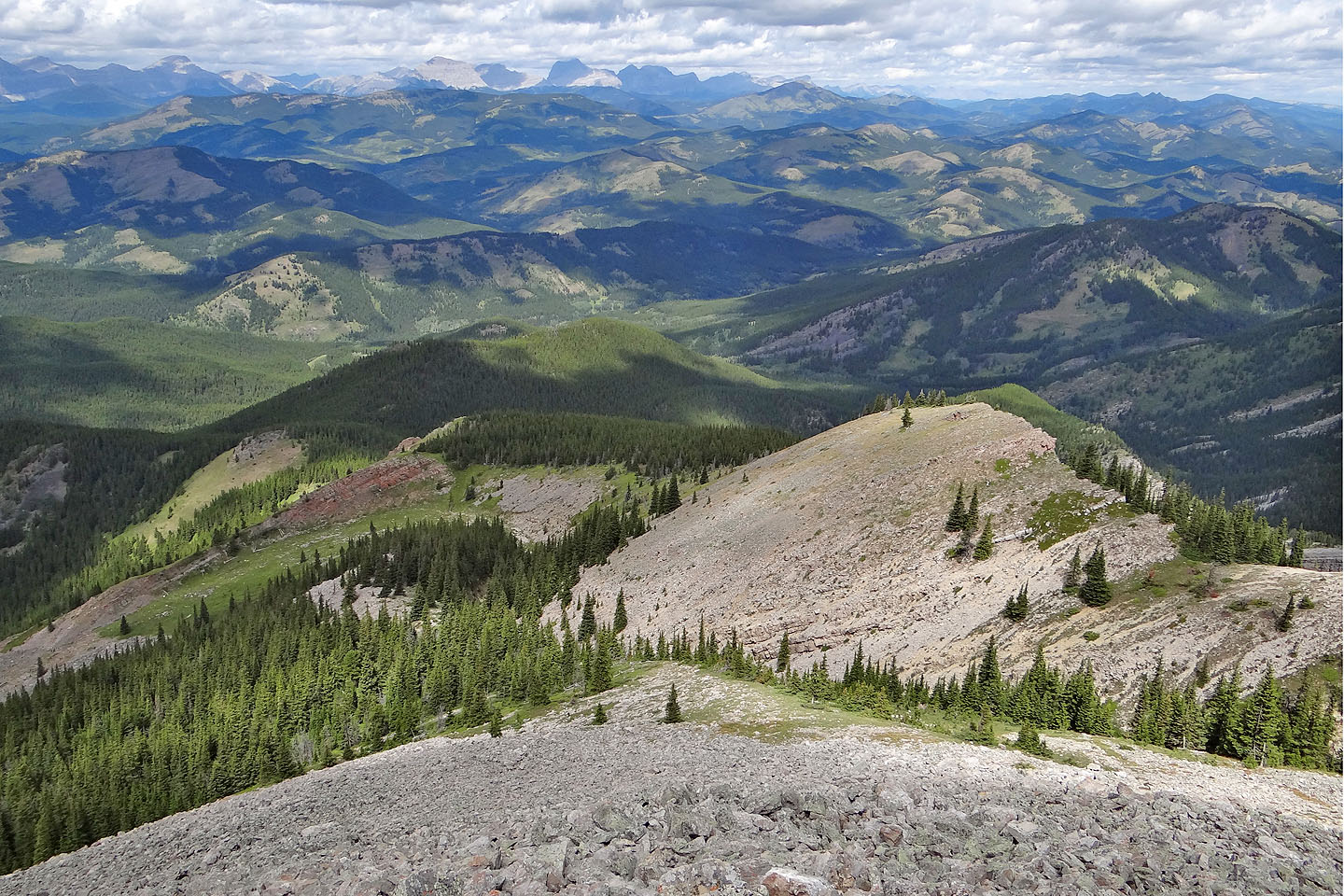
View from the second high point
After the second high point, a trail runs almost to the summit
In the centre is Thunder Mountain, 6.2 km north
After dropping down a bit, I headed to the summit
After crossing the rubbly slope, I followed the sheep track almost to the summit in the background
Looking back: I was tempted to the the sheep trail on the west side of the second high point
on the descent, but I wanted to get out of the wind (mouse over for a closer look)
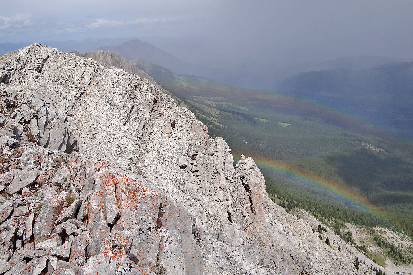
A double rainbow appeared just when I reached the summit
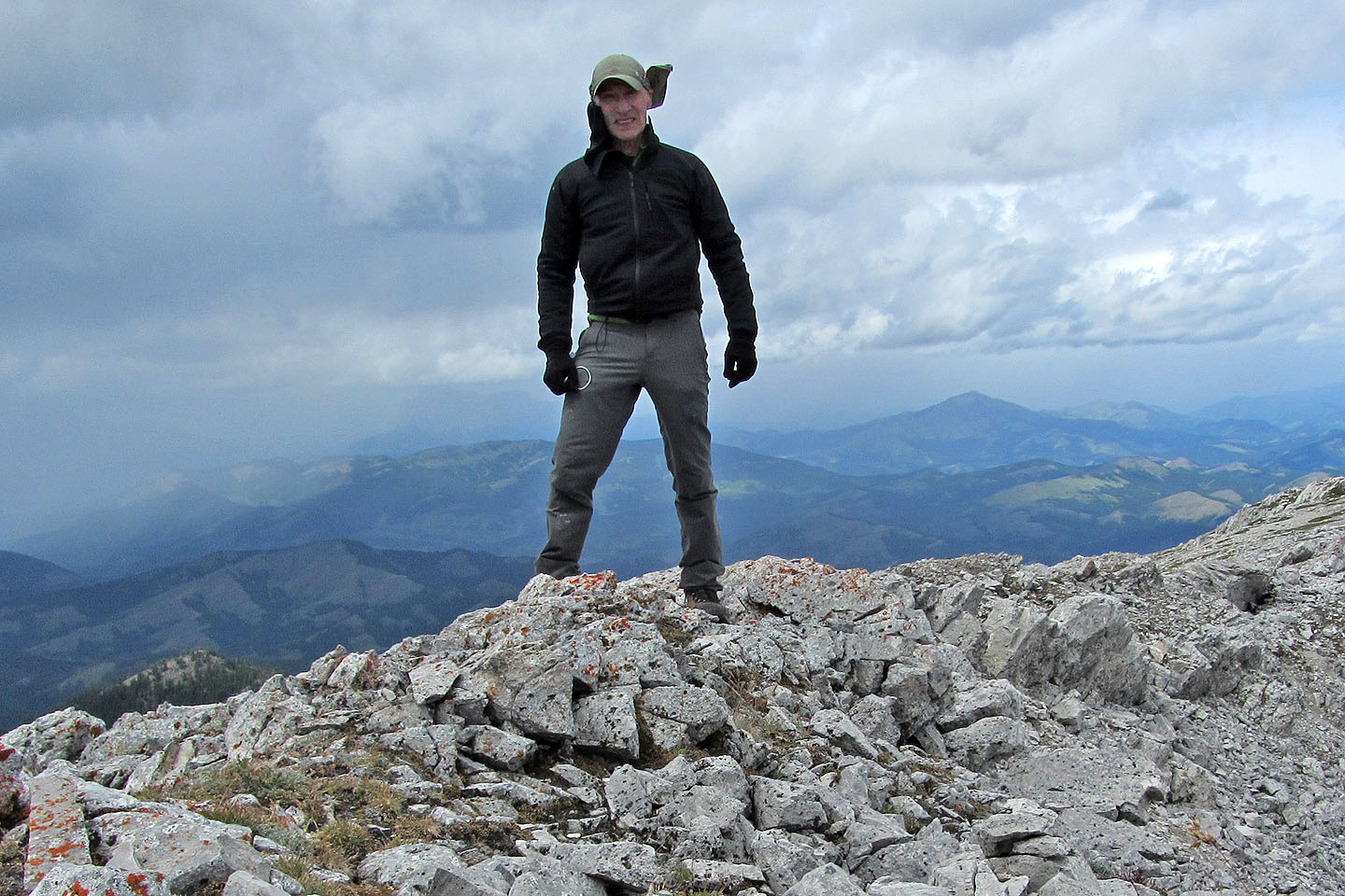
On the summit
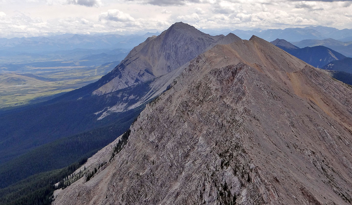
Looking south at Centre Peak 6.6 km away

Standing under the arch
82 G/16 Maycroft