bobspirko.ca | Home | Canada Trips | US Trips | Hiking | Snowshoeing | MAP | About
Hunchback Hills 4 and 5
aka Lusk Ridge East
Kananaskis, Alberta
October 29, 2022
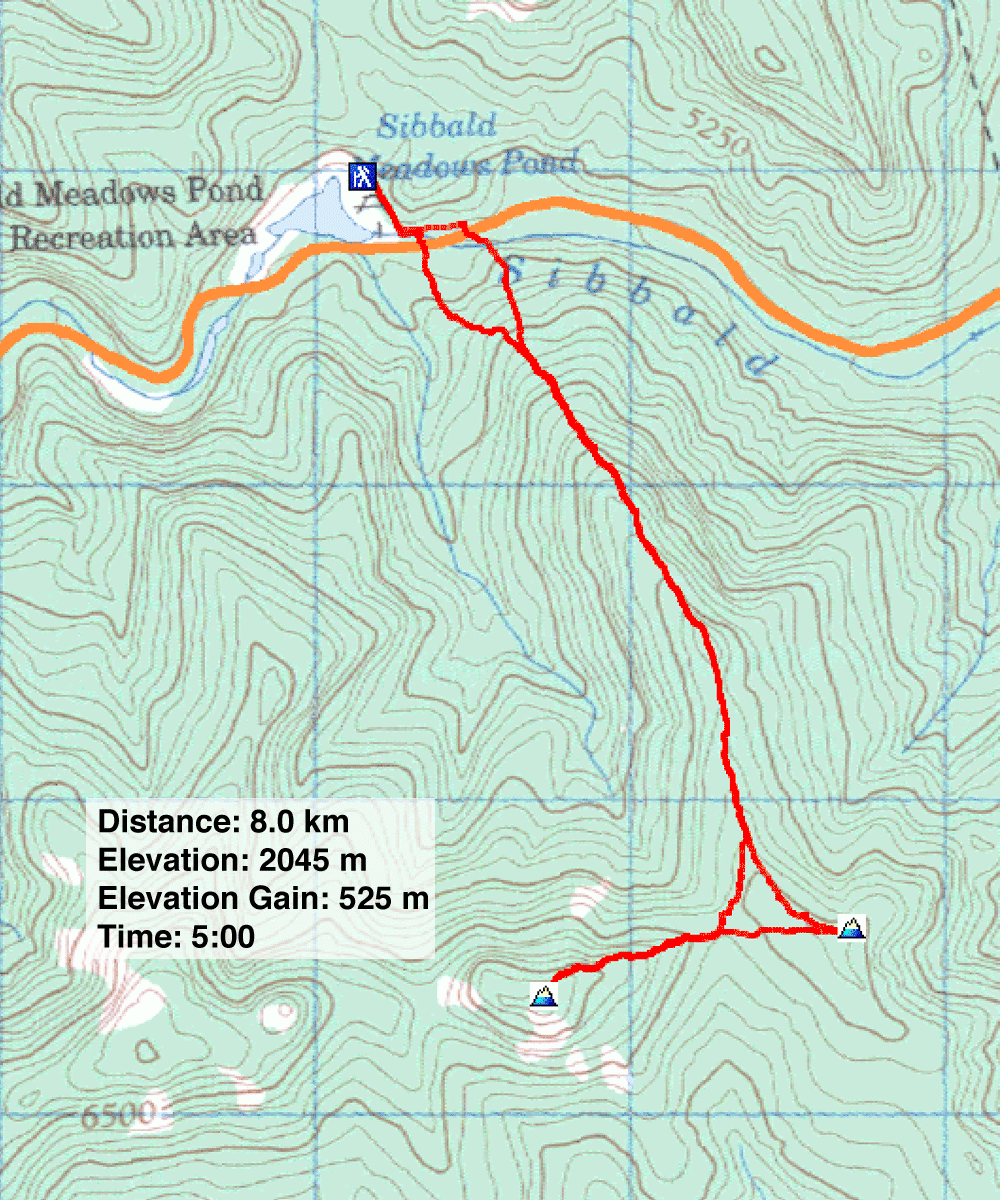
Distance: 8.0 km (5.0 mi)
Cumulative Elevation Gain: 578 m (1896 ft)
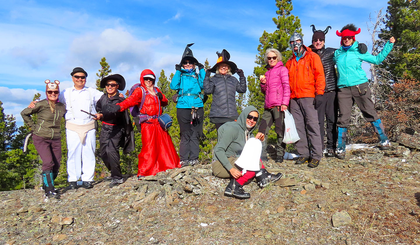
Setting a Halloween theme, Zosia invited several hikers to don costumes and ascend Hunchback Hills 4 and 5. Dinah and I joined her and nine others on this hike.
The north ridge looked like a good way to reach the the two hills, and hiking apps showed a track going up it. But being skeptical of unknown tracks, we assumed we would have to bushwhack up the ridge. However, it turns out there is a trail although the trailhead isn’t apparent from the road.
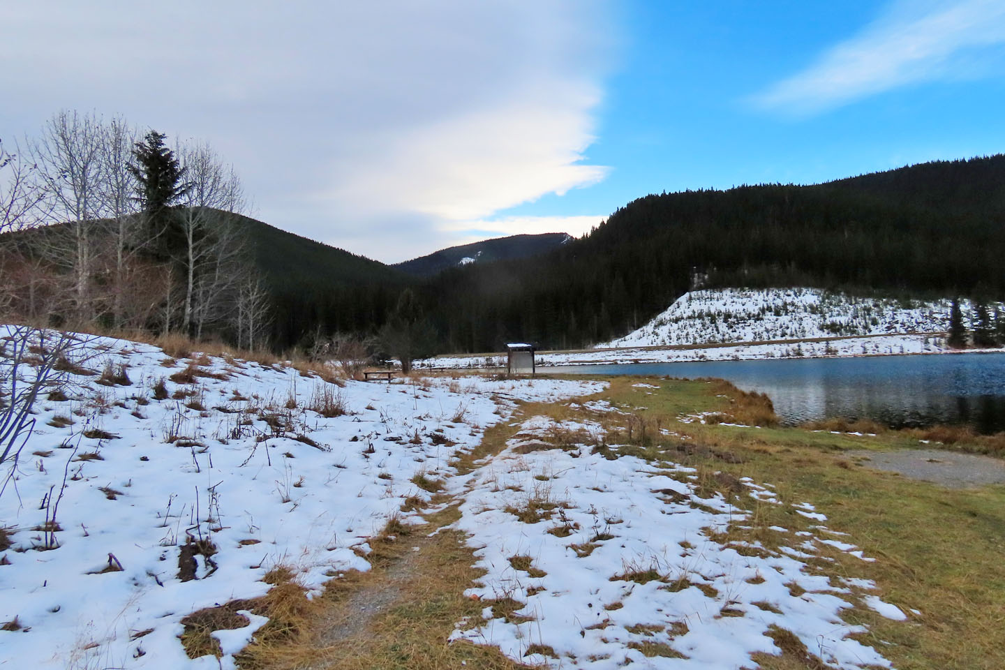
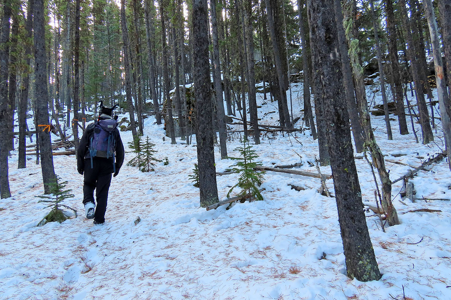
After meeting at Sibbald Meadow Pond Provincial Recreation Area, we walked down the road and selected an arbitrary point to begin our ascent up the ridge. After bushwhacking a few hundred metres, we were surprised to find a flagged trail. We followed the trail, falling into conversation as we climbed, to the edge of a cutblock.
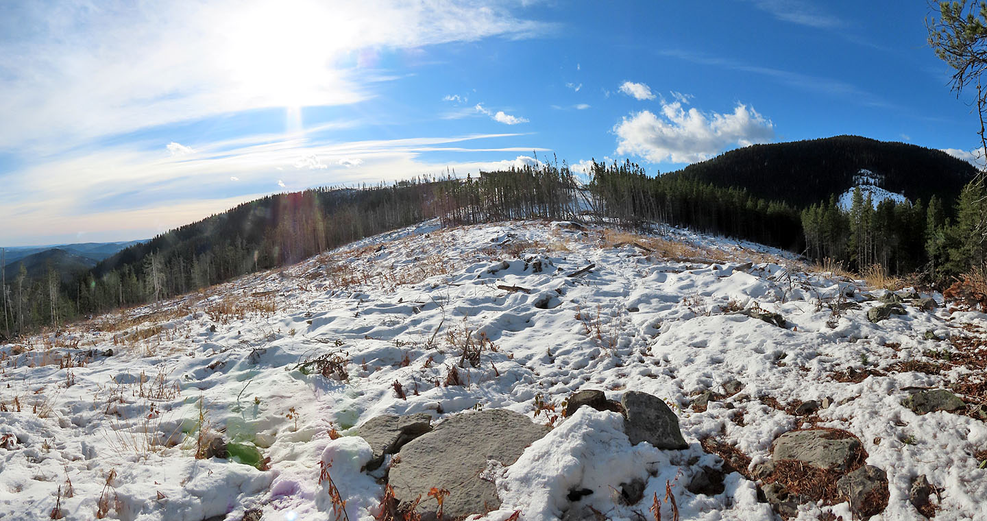
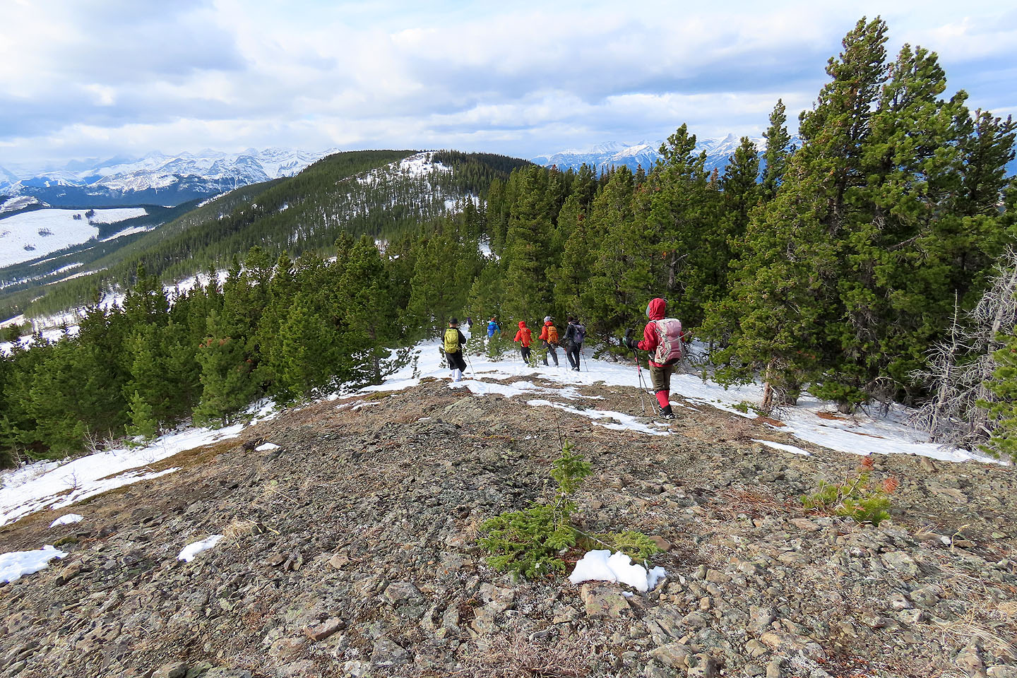
We continued up the open ridge, keeping left to climb Hill 5. But rather than a nicely rounded bump, we encountered an ugly plateau strewn with logging debris, a hill notable only for a small cairn with a geocache. After a summit photo, we turned to Hill 4. We dropped to the col separating the two hills and followed flagging in the forest to the half-bare summit. If there was a trail, it was hidden under several inches of snow.
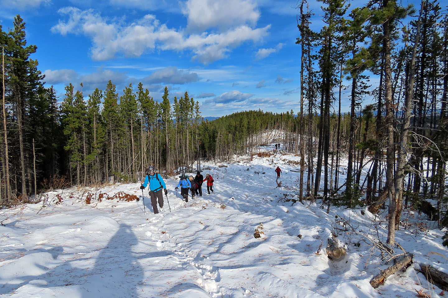
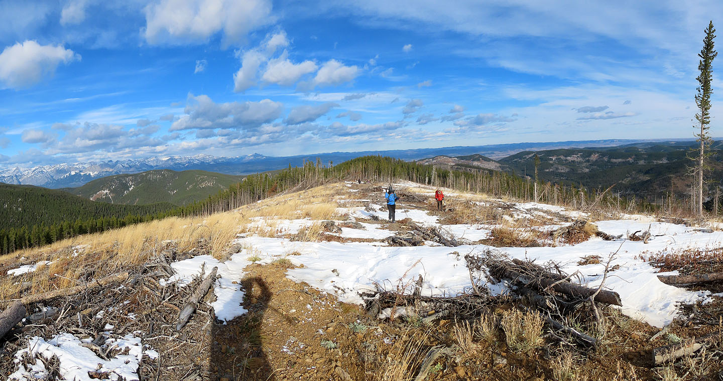
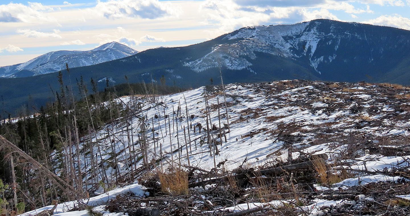
From the summit, the other Hunchback Hills spread out before us while snow-covered peaks set a nice backdrop. We settled down for lunch which we chased down with Halloween treats. Afterwards, we split up. Four turned around while eight pushed on to the next hill west and fortuitously descended a new trail.
While the others continued on, Christine, Glenda, Dinah and I followed our tracks back to the col. From there we took a shortcut to the north ridge trail. We followed it down to the road. Strangely, the lower trail section lacked flagging, and the trailhead had no marking at all. The trail, however, begins across the road from the blue sign for Sibbald Meadows Pond, 200 m east of the access road to the parking lot. The sound trail makes the Hunchback Hills an attractive off-season objective, even if you don't hike it on Halloween.
KML and GPX Tracks
Sonny'sTrip Report
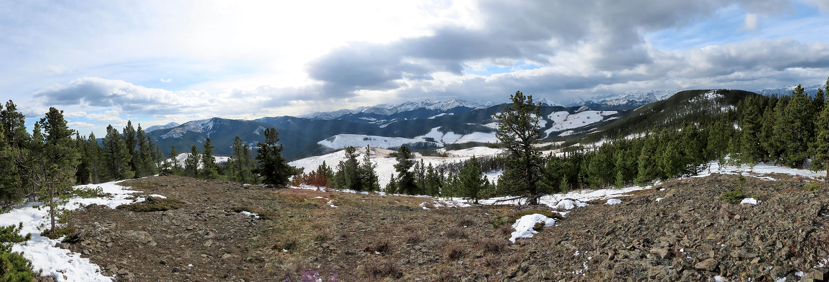
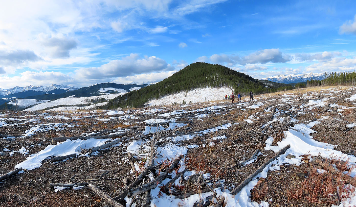
From Sibbald Meadows Pond, we ascended the ridge on the left and reached the hill in the centre
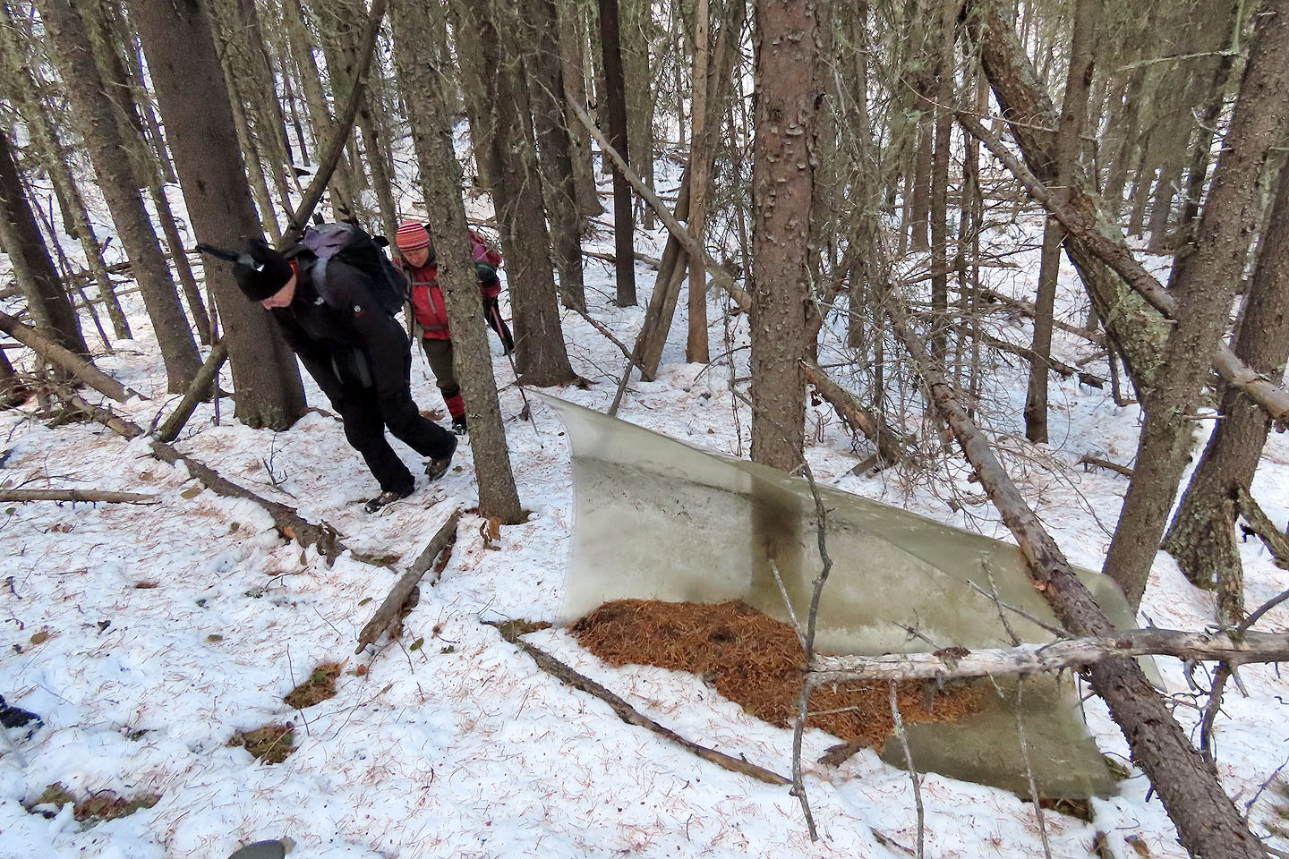
Before reaching the trail, we passed a heavy plastic sheet. Where it came from and how it ended up here is a mystery.
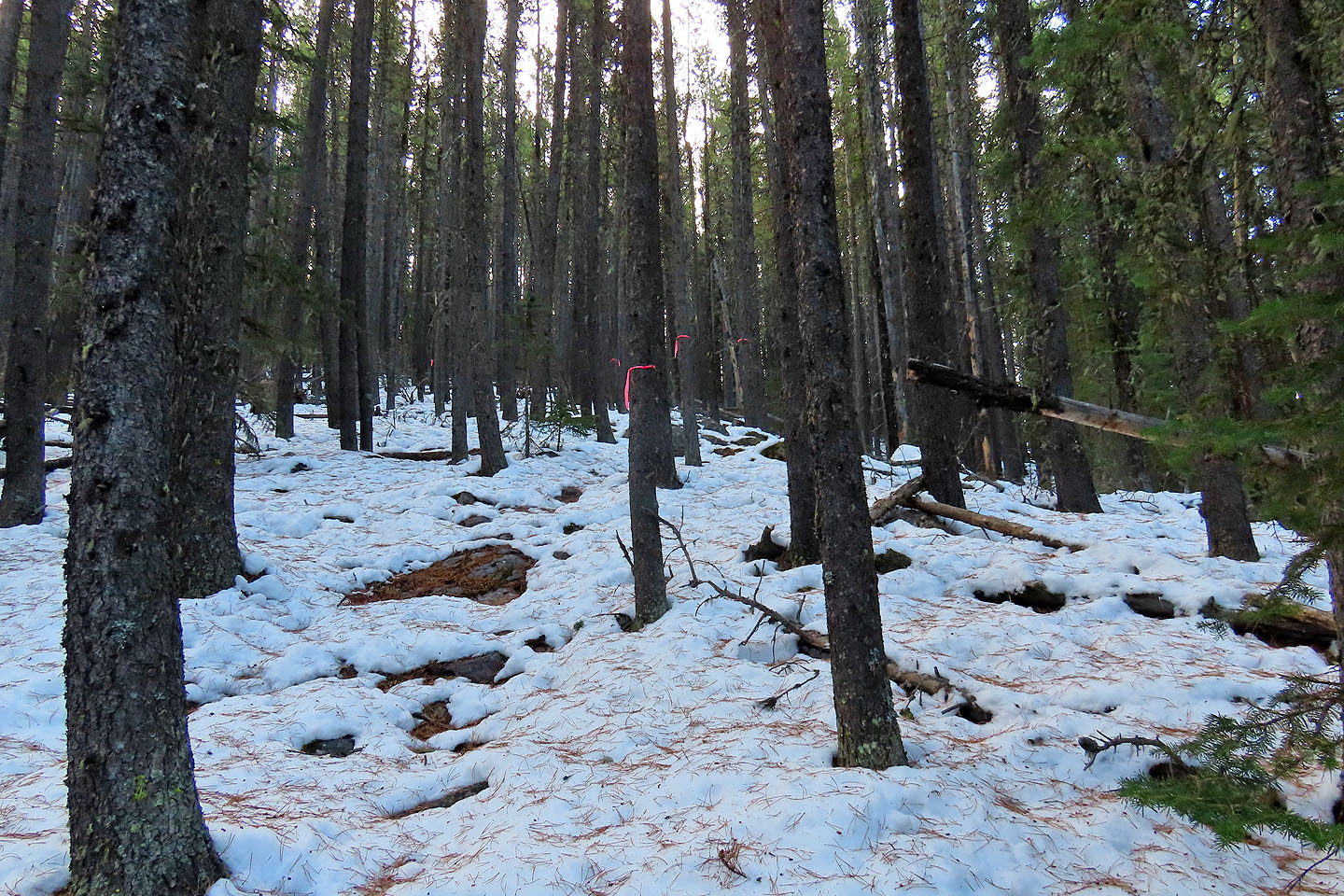
Beginning partway up the ridge, the trail has lots of flagging
We passed boulders on the way up
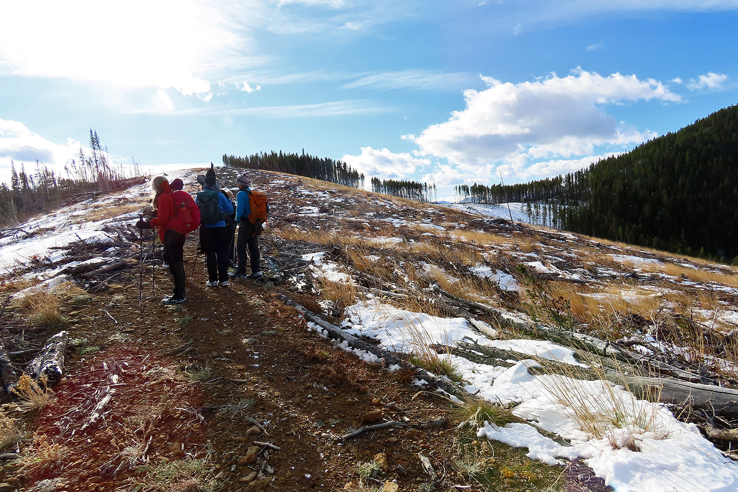
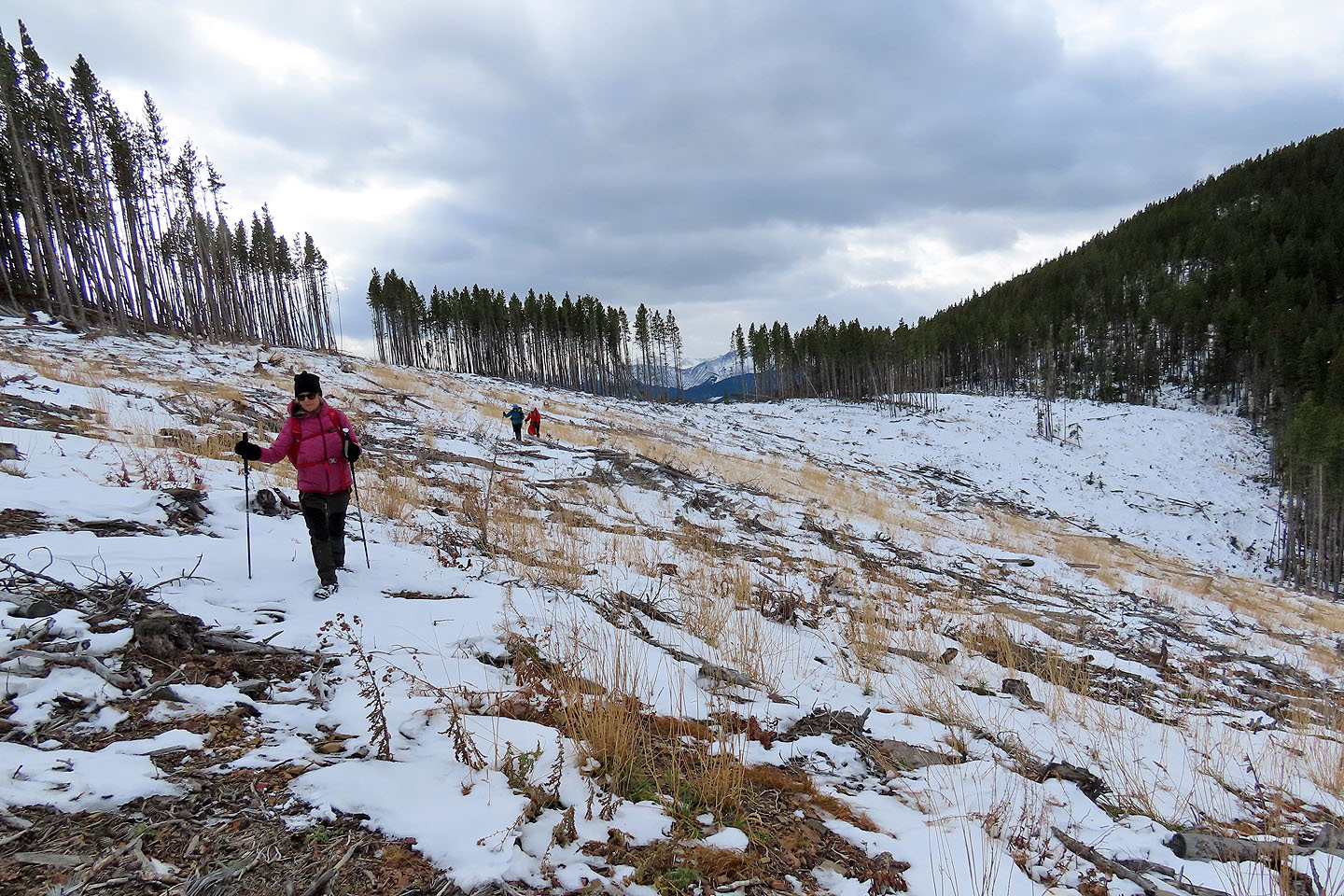
From the edge of the cutblock, the two hills we climbed appear ahead
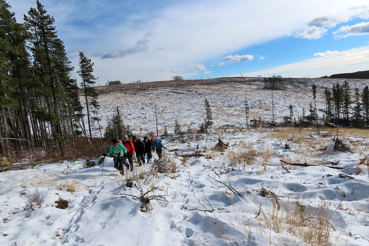
Looking back as we hiked up the cutblock
We continued up the ridge
On the right is the col connecting the two hills
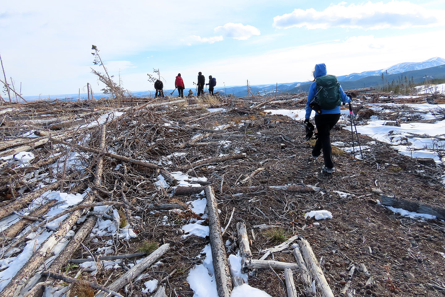
After stumbling across a cutblock, we reached Hill 5
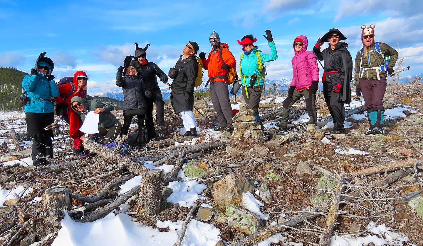
Gathered by the summit/geocache cairn are Dinah, Christine, Zosia, Shelly, Bob Parr, Sonny, Raff, Marta, Glenda, Shaun and Aga
In the background are Moose Mountain and Cox Hill. Closer in on the left is the top of Shell Hill.
We headed to the next hill
Looking back at the first hill
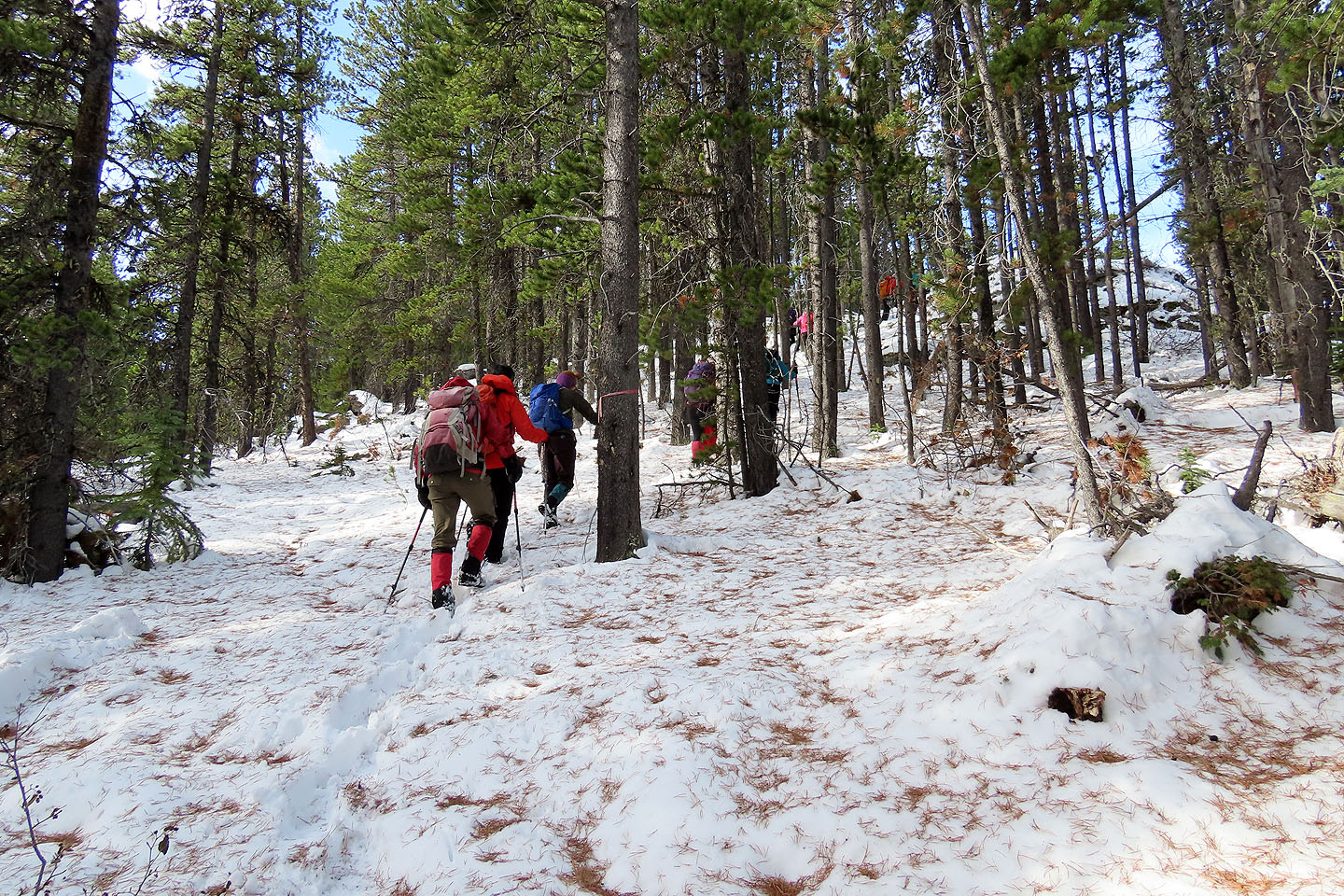
Hiking through the trees to the second hill
Posing on Hill 4
Sonny, Marta, Aga, Raff, Shelly, Bob, Shaun and Zosia head to the next hill
On our descent, Glenda, Dinah, Christine and I took a shortcut from the col
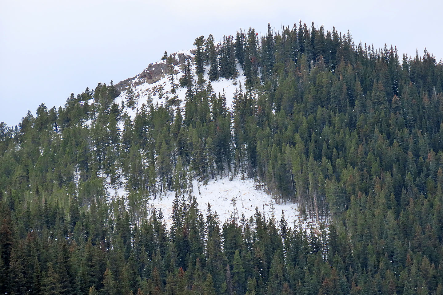
Looking back, the others appear on the next hill (mouse over for a close-up)
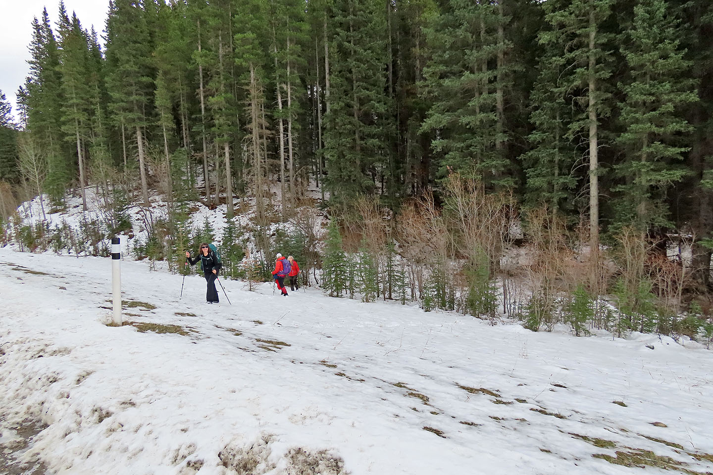
We reached the start of the trail to find it unmarked, but it is opposite the blue sign for Sibbald Meadows Pond
82 O/2 Jumpingpound Creek