bobspirko.ca | Home | Canada Trips | US Trips | Hiking | Snowshoeing | MAP | About
Buchanan Ridge
Waterton Lakes National Park, Alberta
September 4, 2005
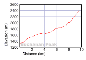
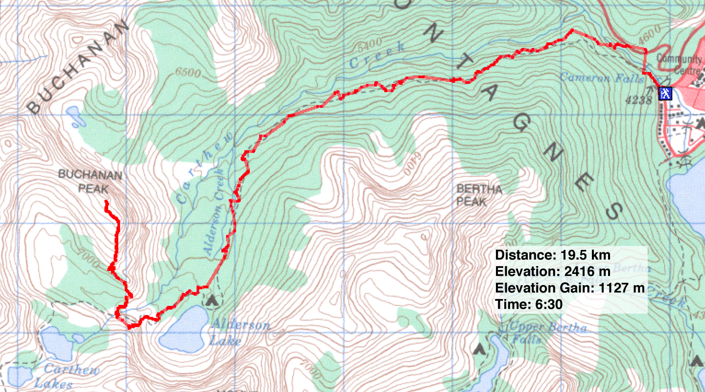
Distance: 19.5 km (12.1 mi)
Cumulative Elevation Gain: 1266 m (4154 ft)
Starting from the townsite, Dinah and I ascended the southeast ridge of Buchanan Peak. We thought we were climbing Buchanan Peak, but the topo map we used (see the map below) was wrong. We only reached the southeast ridge, and what we thought was an unnamed peak was actually Buchanan Peak. Despite being a minor summit, our trip held some fascinating scrambling but nothing more than moderate.
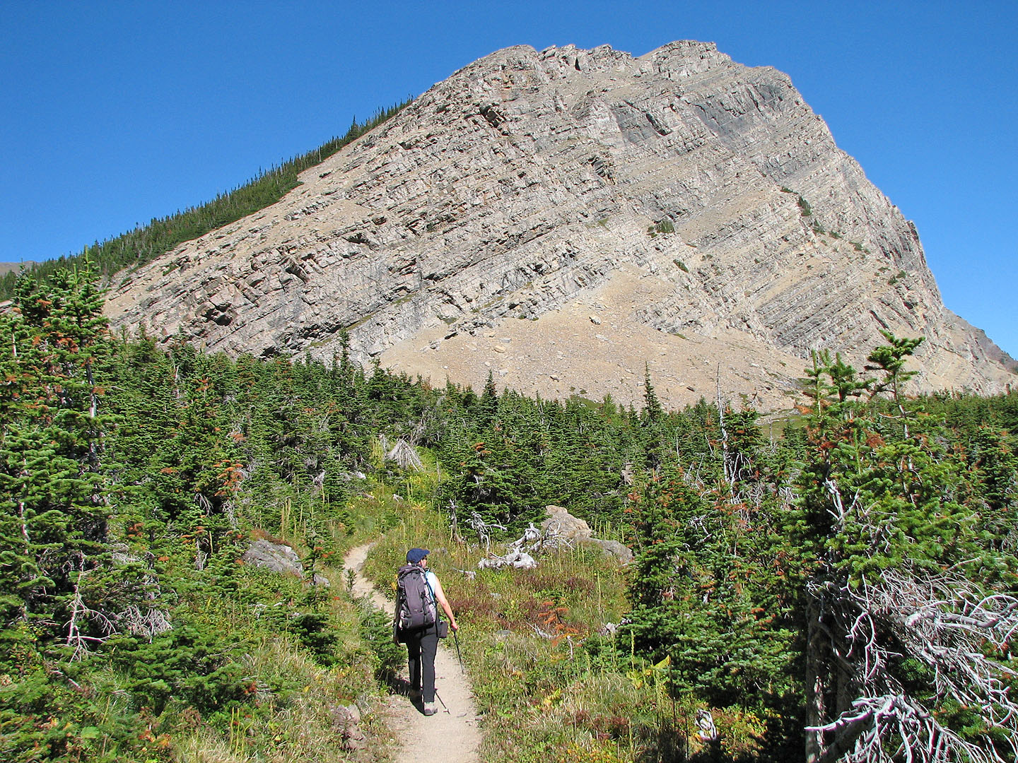
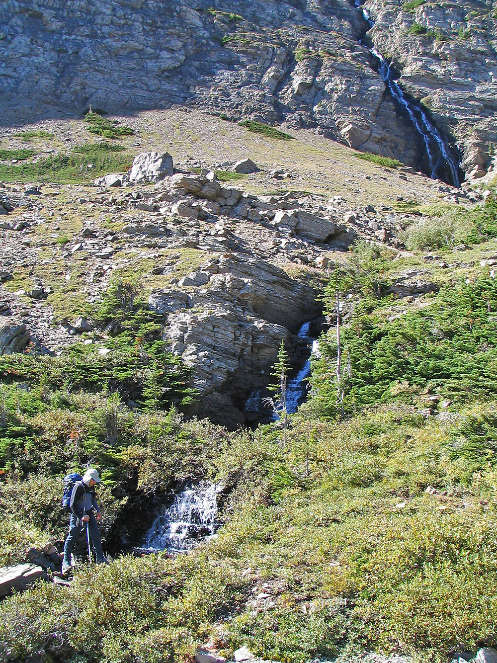
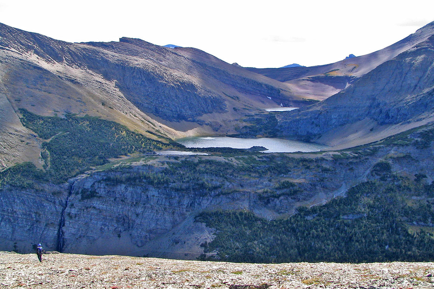
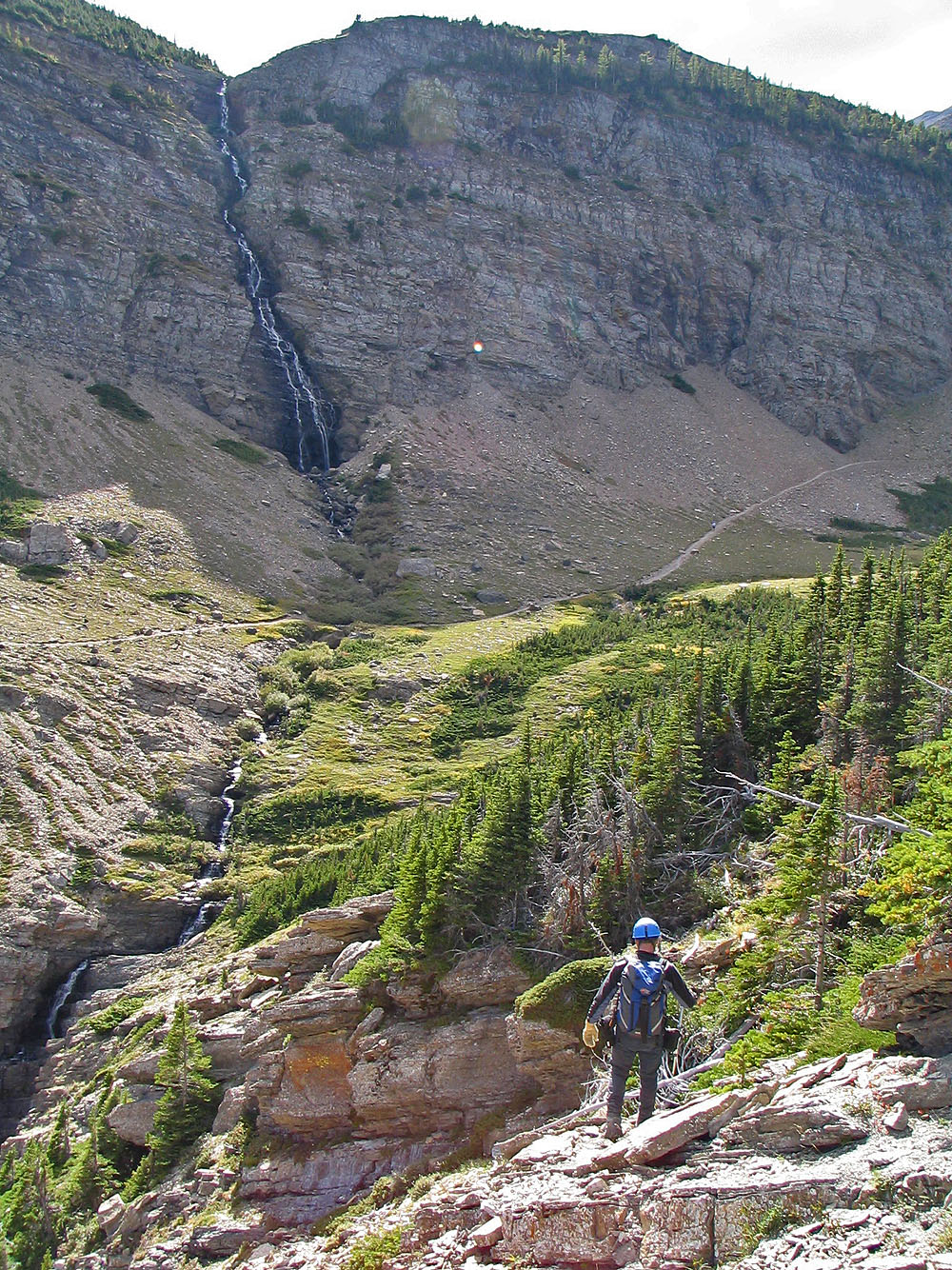
From Waterton townsite, we hiked up Carthew-Alderson trail and reached Alderson Lake in about two hours. A few minutes later, the trees thinned so we could look for an ascent route up the southeast ridge. We stayed on the trail until just before a waterfall. We left the trail, dropped down, and stepped across the stream which flows below the falls. We hiked up the other side of the drainage but soon encountered dense forest. After a short but brutal bushwhack, we appeared on a scree slope that led to a shoulder on the ridge. Here, the delightful scenery kicked in. We had striking views of Alderson Lake and later Carthew Lakes.
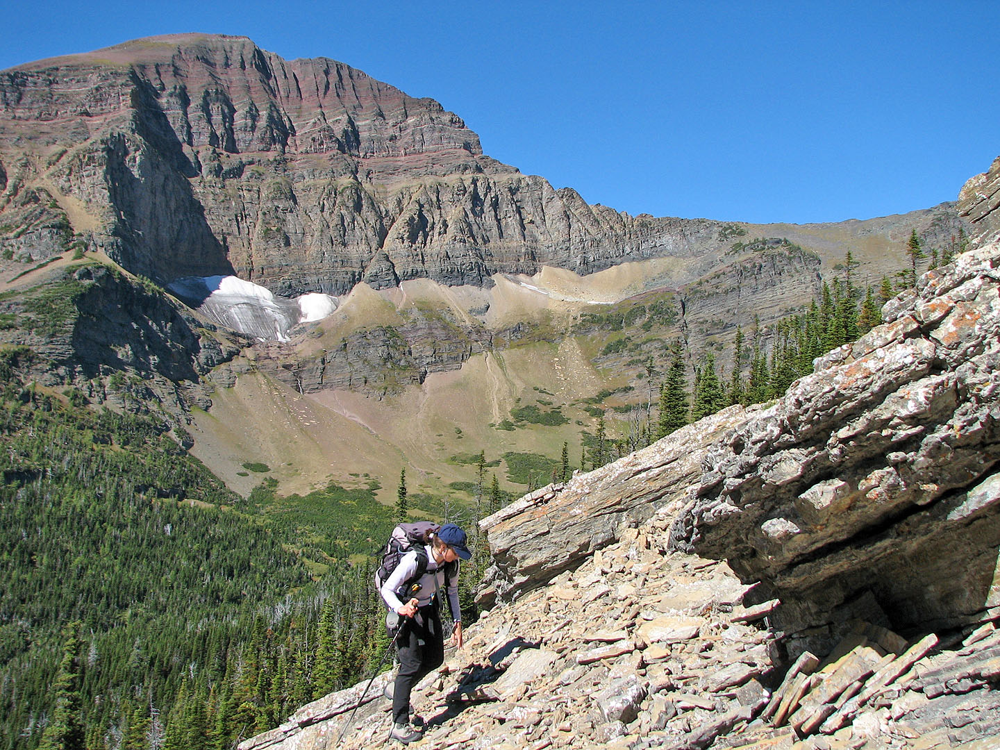
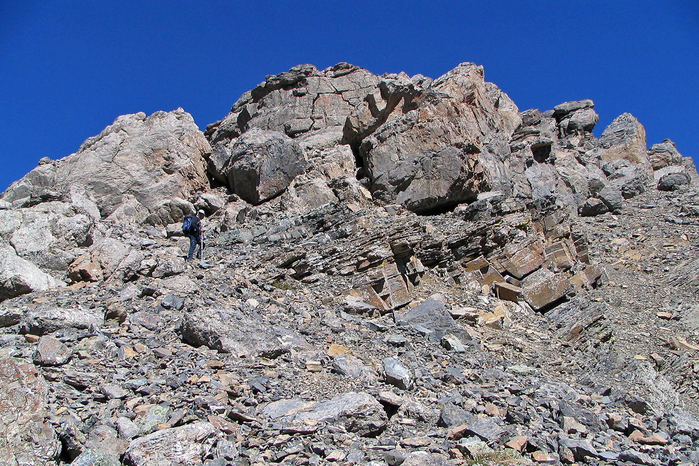
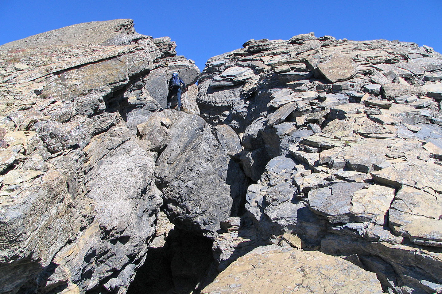
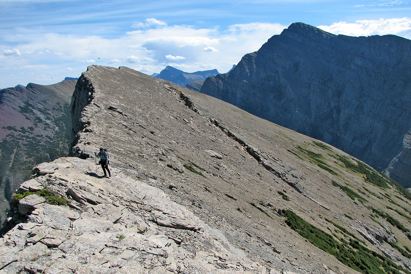
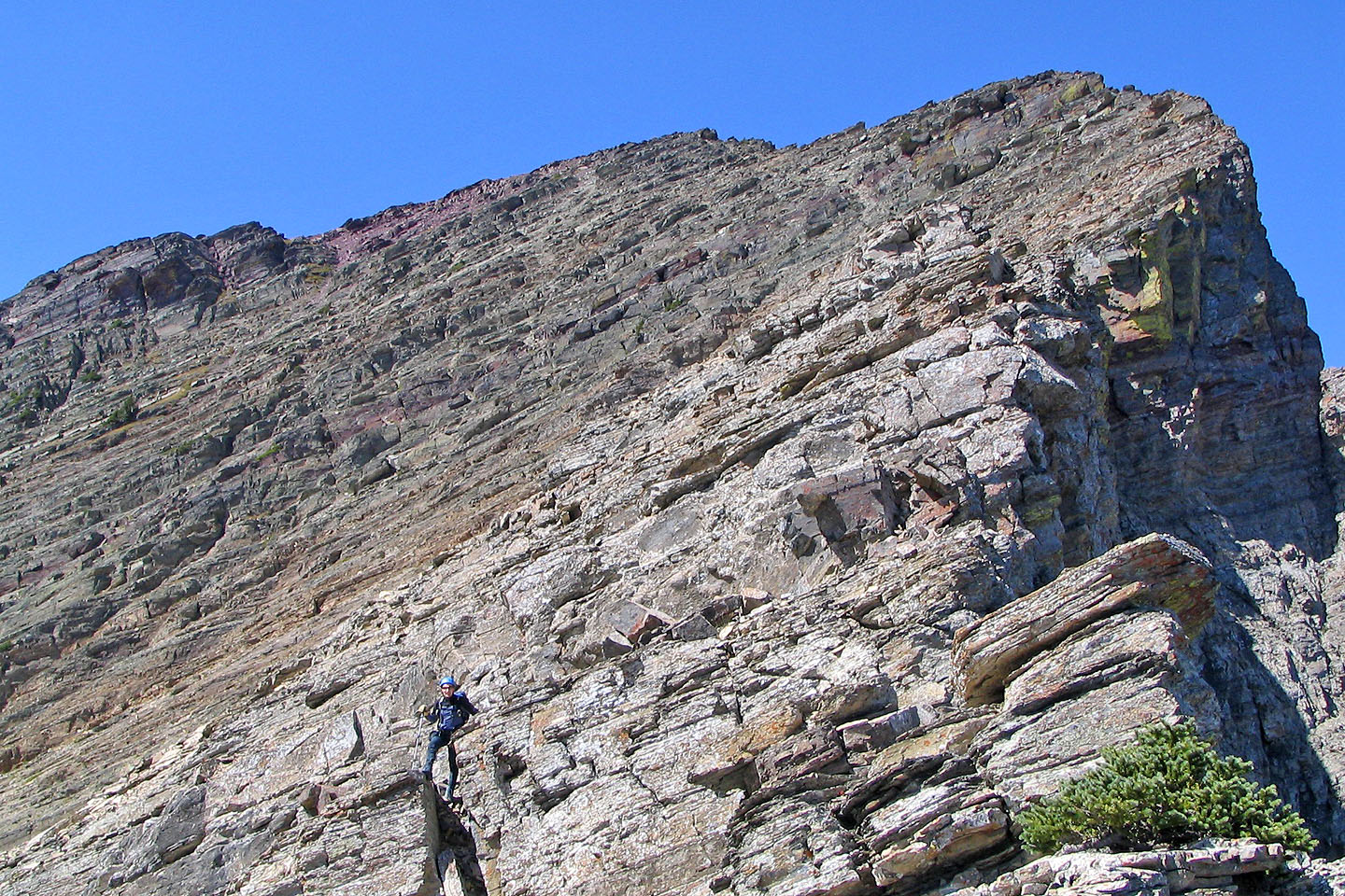
The shoulder ends in a crumbling cliff band comprising huge boulders. On close inspection, we realized the boulders presented no problem. Indeed, we could pretty well scramble up wherever we wished. Enthralled with the boulders, we sought out an interesting route through them. Afterwards, we emerged on a broad scree slope, featureless except for a few fissures. From there it was a plod to a high point on the ridge.
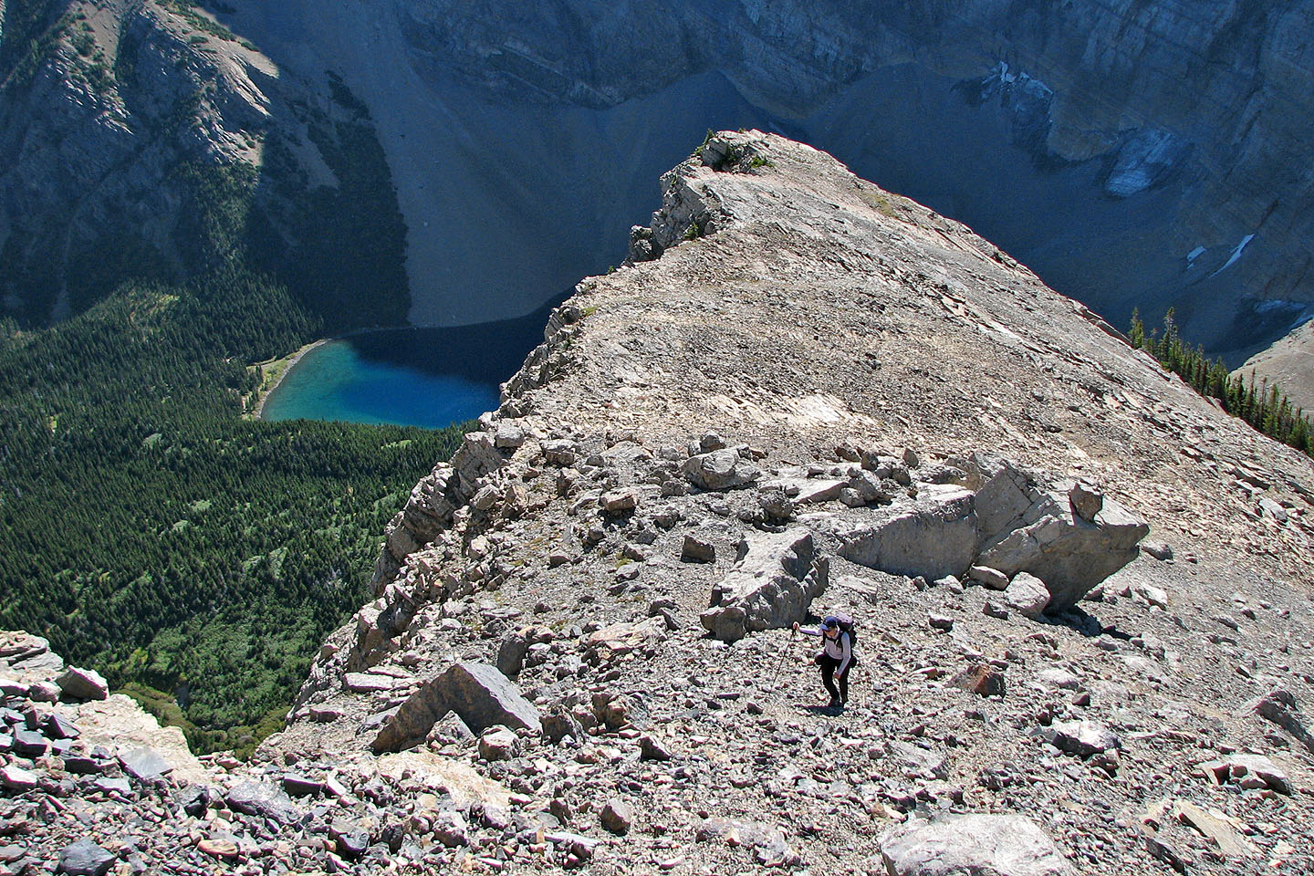
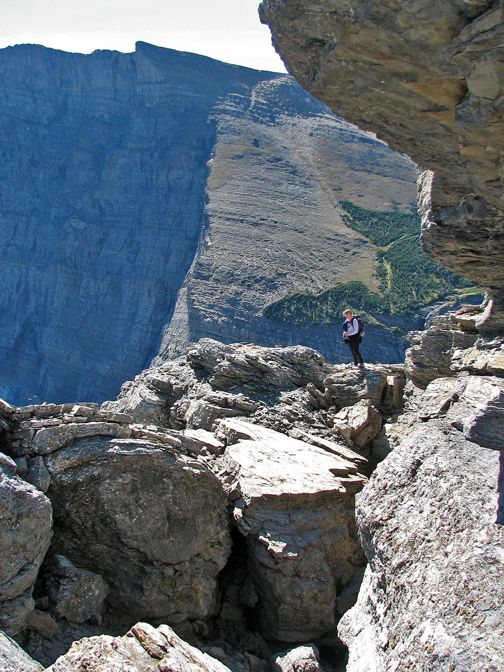
From the high point, we followed the ridge towards a peak I later learned was Buchanan Peak. We soon ran into exposed, down-sloping rock, so we retreated to the high point. Belatedly, we realized we should have dropped below the ridge. We considered going back and trying it, but we were both tired of the Waterton wind that day. When we descended, we took a slightly different route down the boulders; we even went through a short tunnel.
It took us 3:50 to ascend and 2:40 to descend. Not included on the map is the hour we spent on our attempt up the unnamed peak, actually Buchanan Peak. I didn't realize the map was wrong until years later.
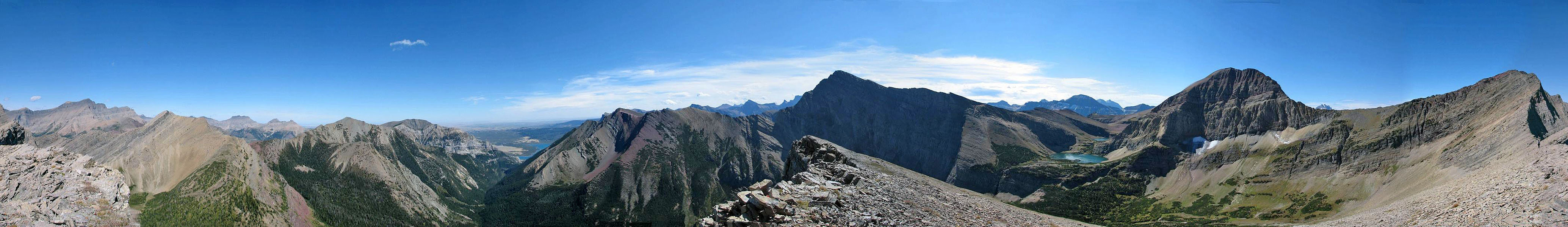
View from the trail showing the southeast ridge in the centre and Buchanan Peak right
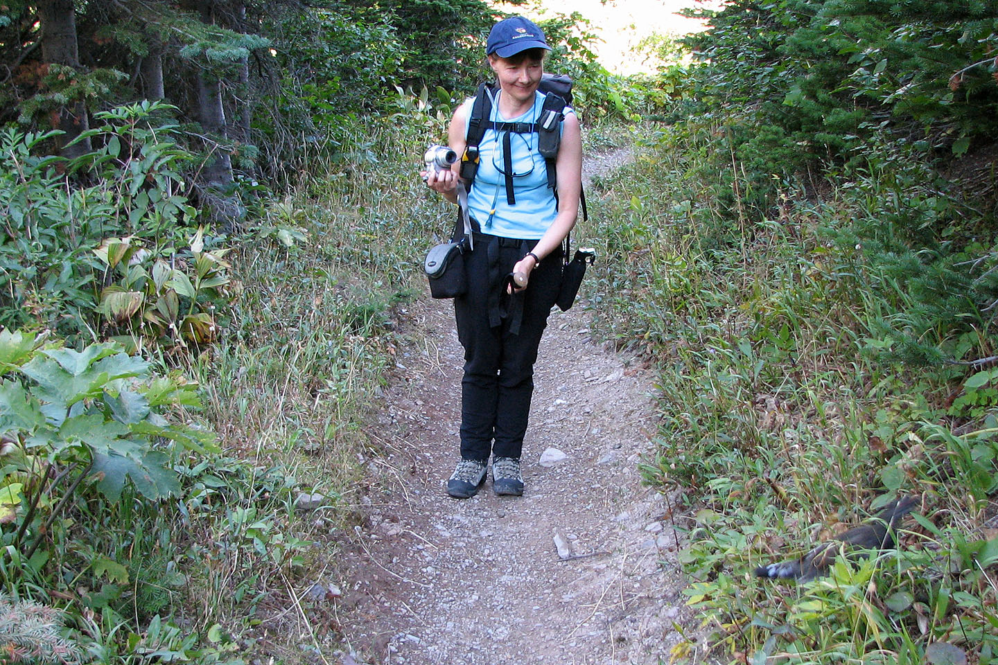
Dinah watches a grouse zip by her on the trail
We headed to the end of the ridge
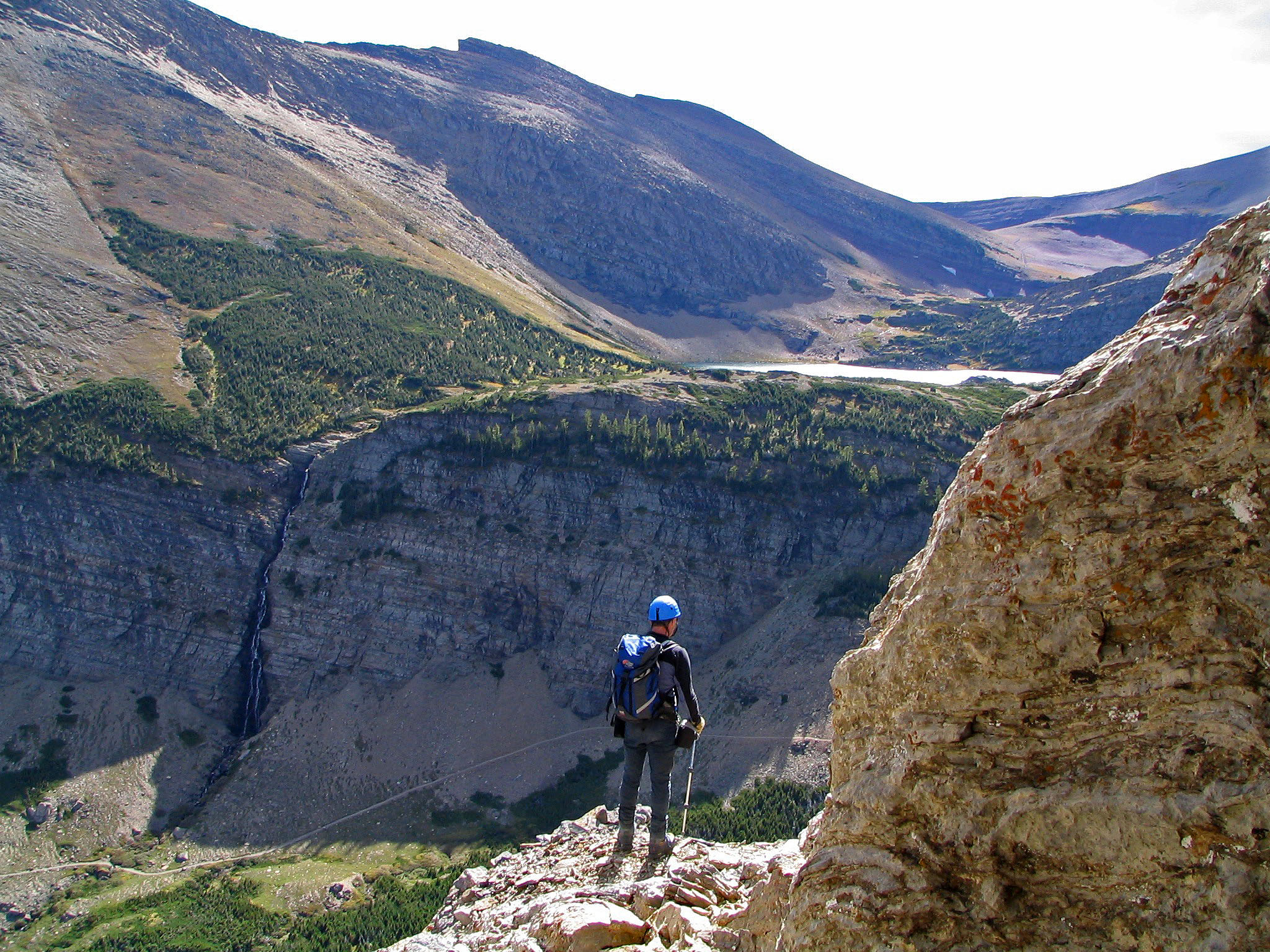
Crossing below the waterfall
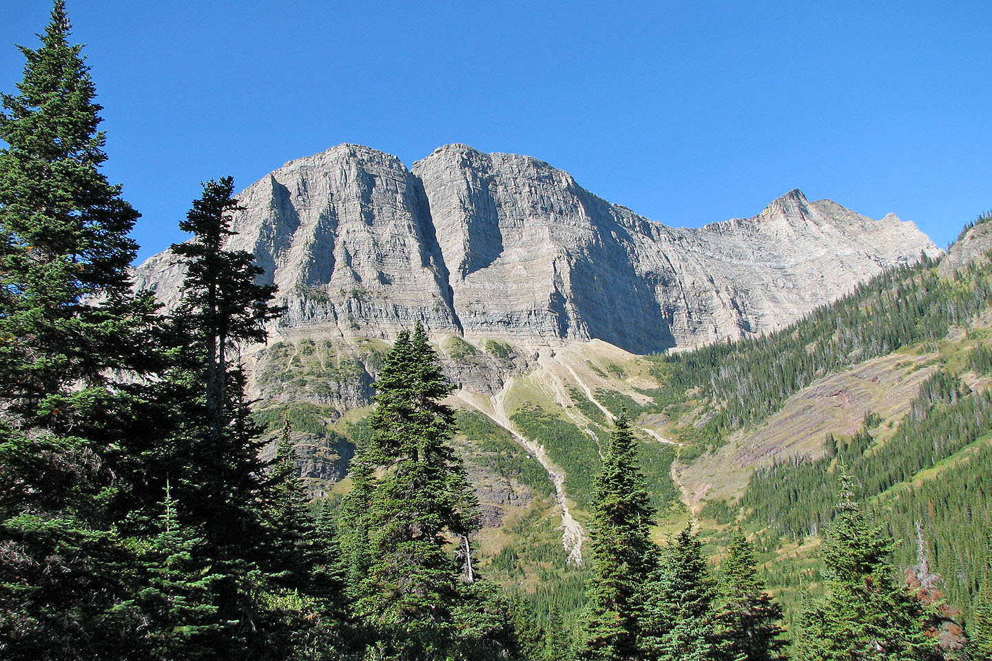
Hiking up the lower slopes with Mount Carthew in the background
 The shoulder partly hides Alderson Lake
 View of the ridge from the shoulder
Working our way up through the boulders
Looking back
 Lots of places to scramble up
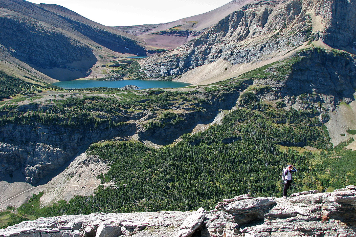
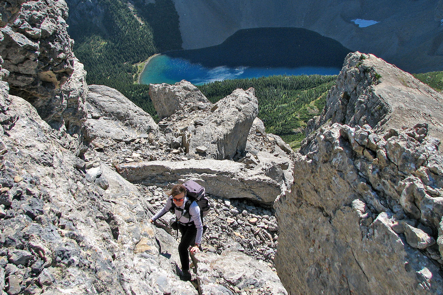
Carthew Lakes in the background
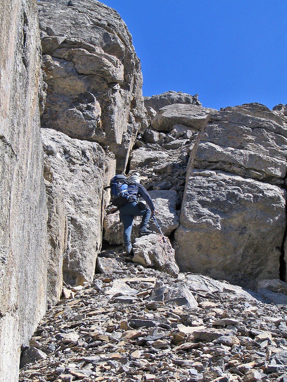
 Standing on a chockstone in a large fissure
Looking back from the chockstone
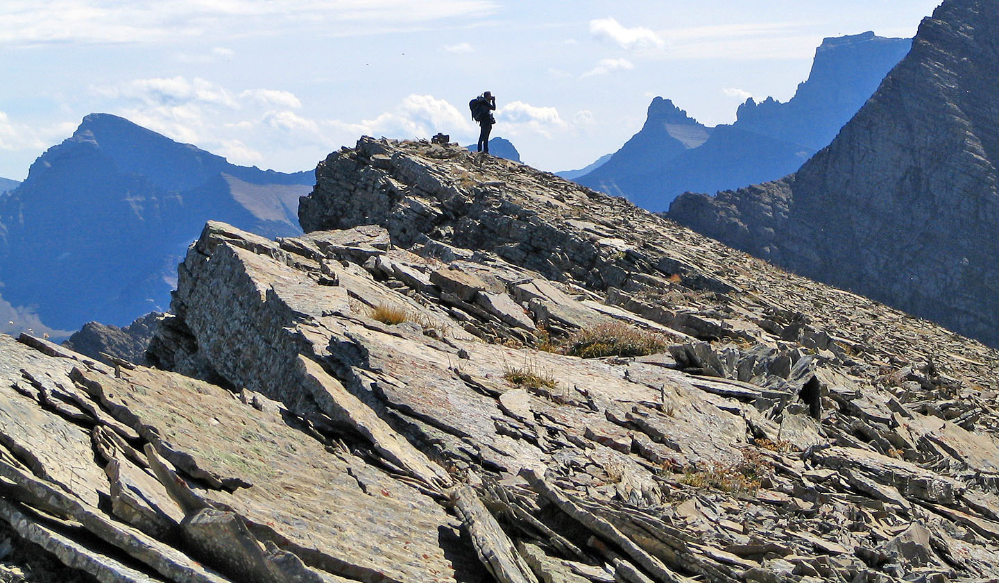 On the high point
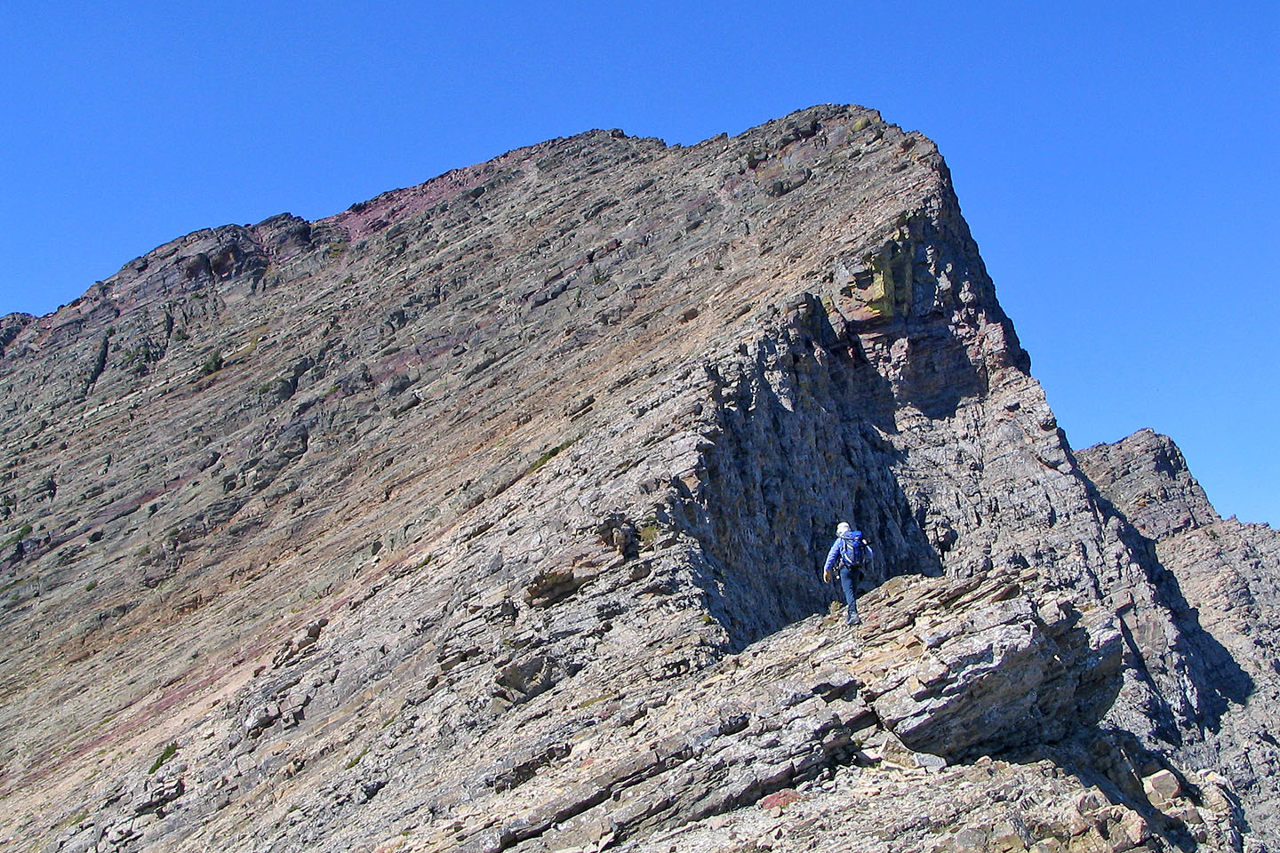
Starting for Buchanan Peak
Looking back at the high point
As far as I got before I turned around
Heading back down the scree
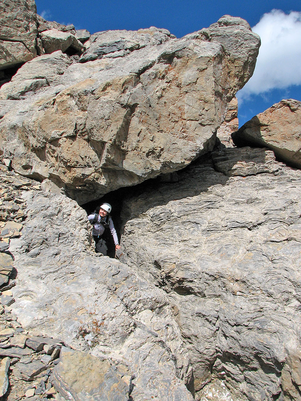
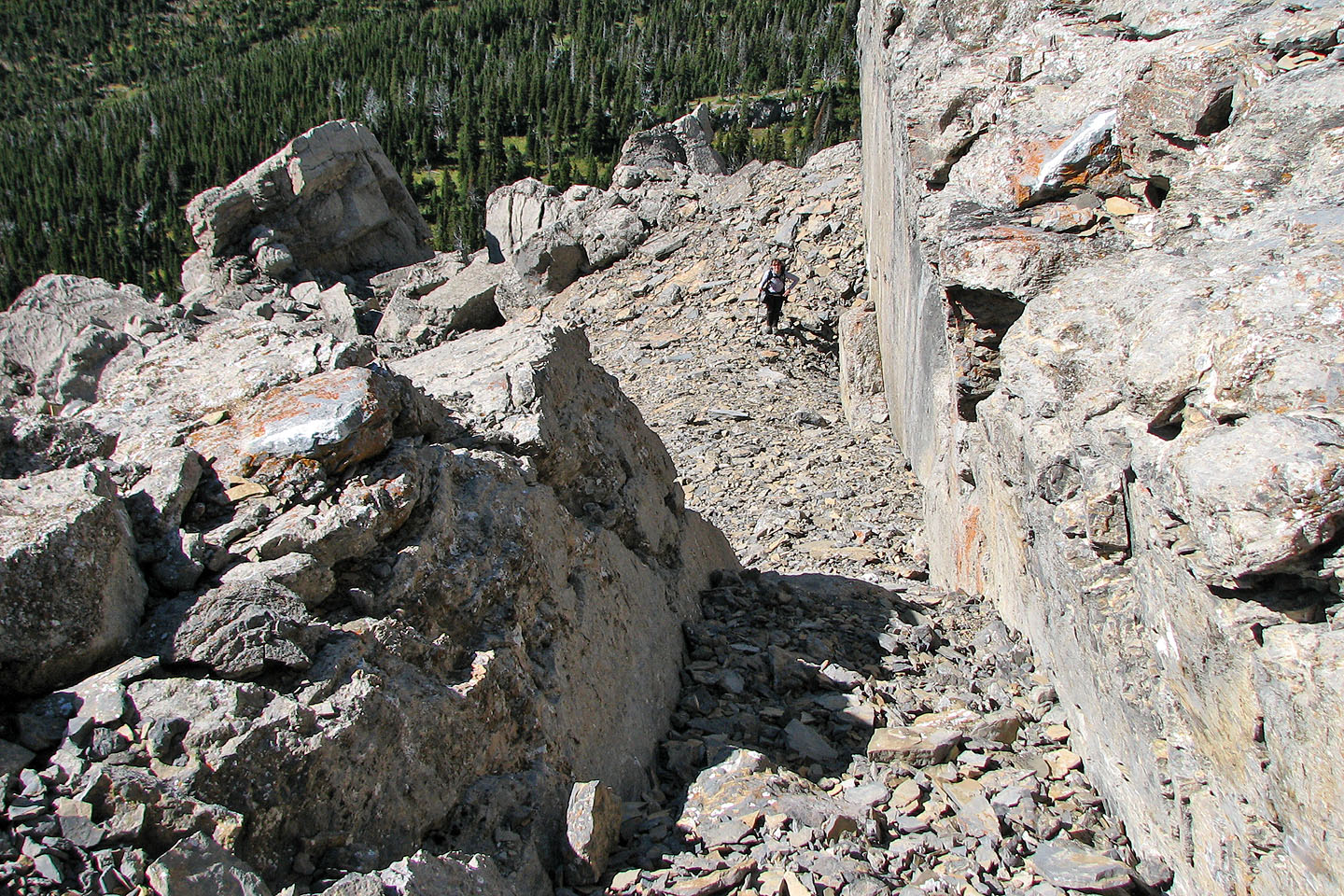
Dinah emerges from a short tunnel through the boulders
 Carthew-Alderson trail appears below
Heading back to the trail
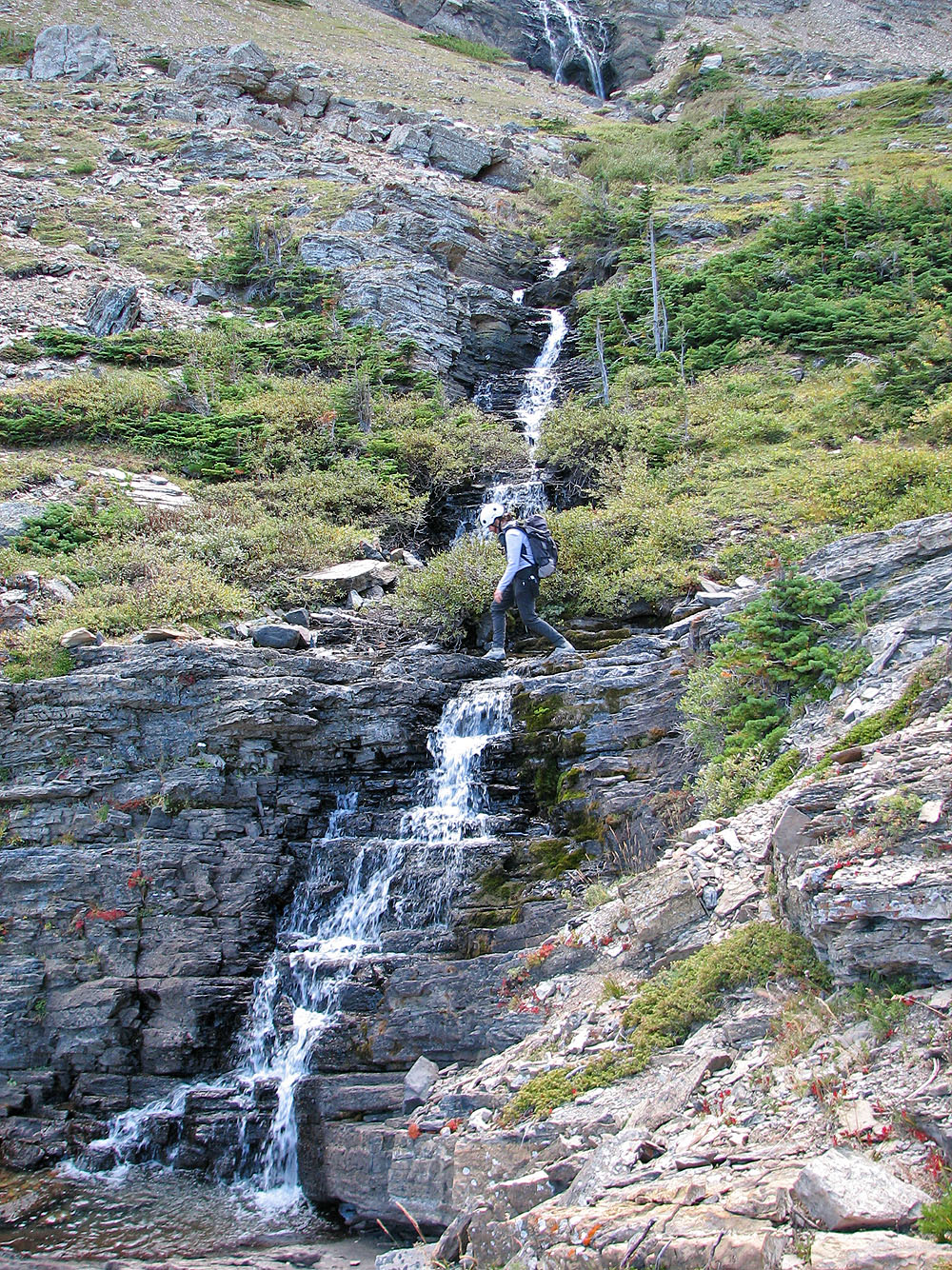
Dinah crosses above the waterfalls
82 H/4 Waterton Lakes