bobspirko.ca | Home | Canada Trips | US Trips | Hiking | Snowshoeing | MAP | About

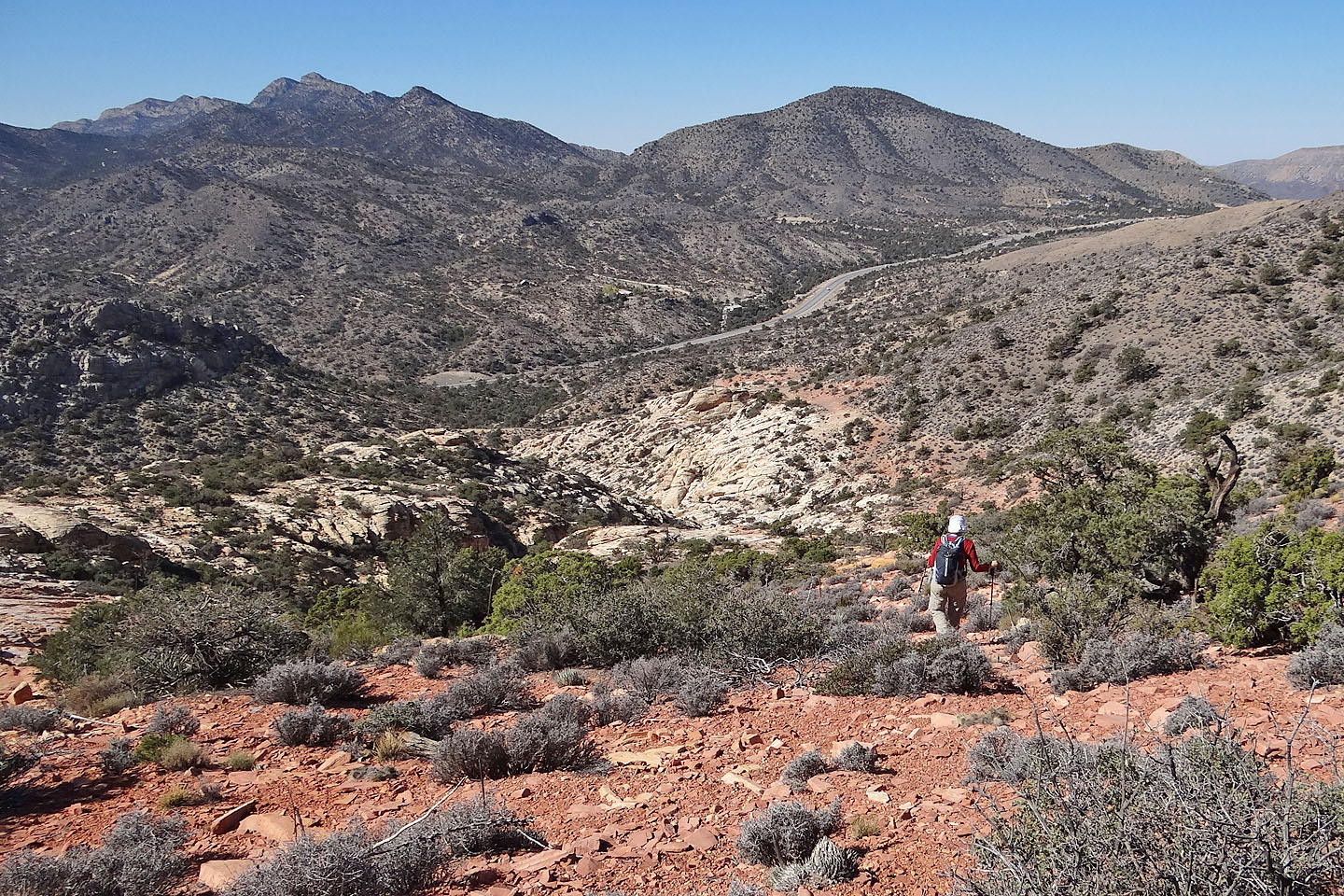
View from a high point near the summit block
Hollow Rock Peak
Red Rock Canyon NCA, Nevada
October 14, 2013
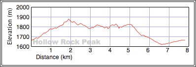
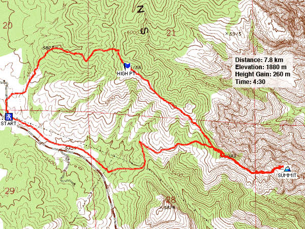
Distance: 7.8 km (4.8 mi)
Cumulative Elevation Gain: 388m (1273 ft)
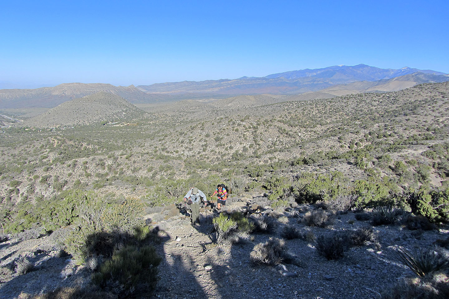
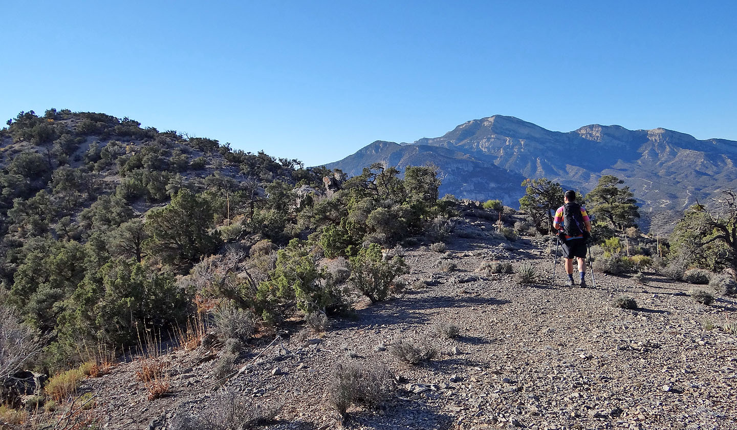
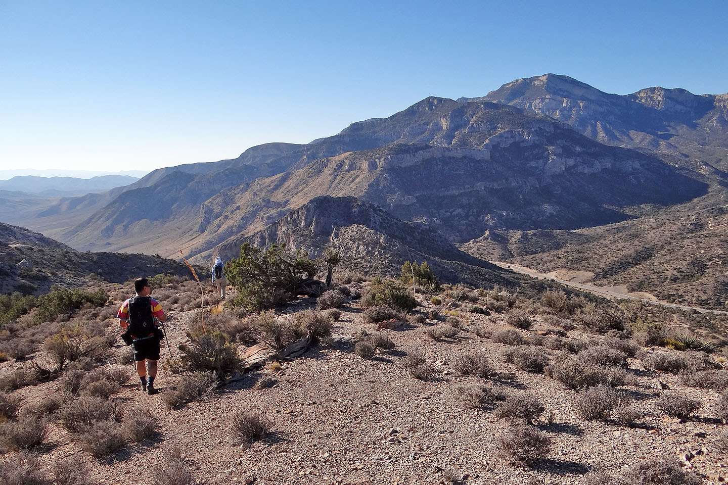
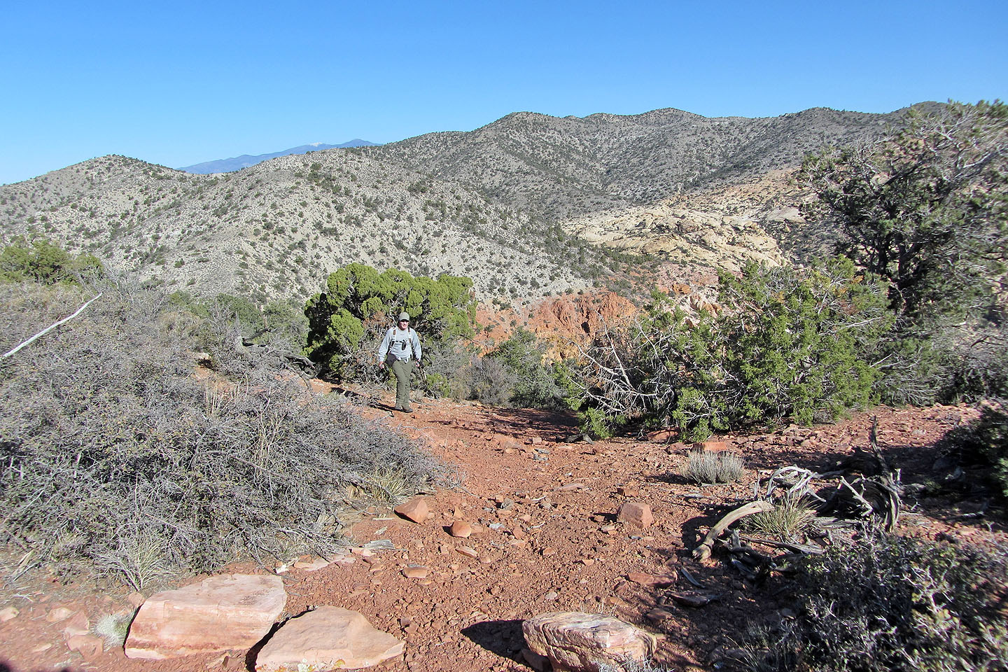
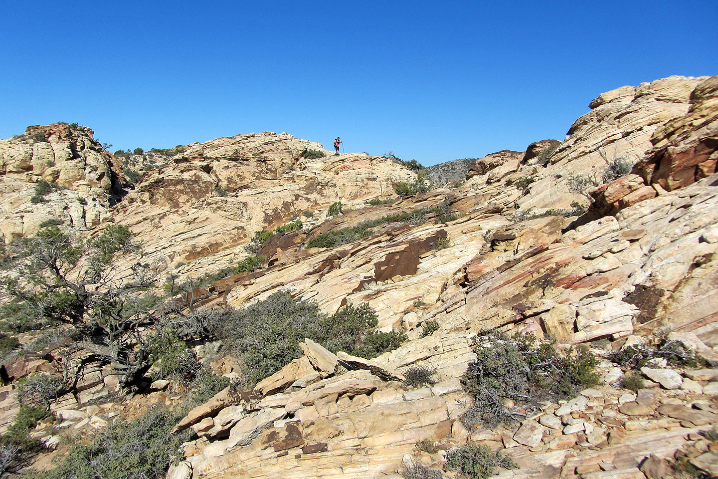
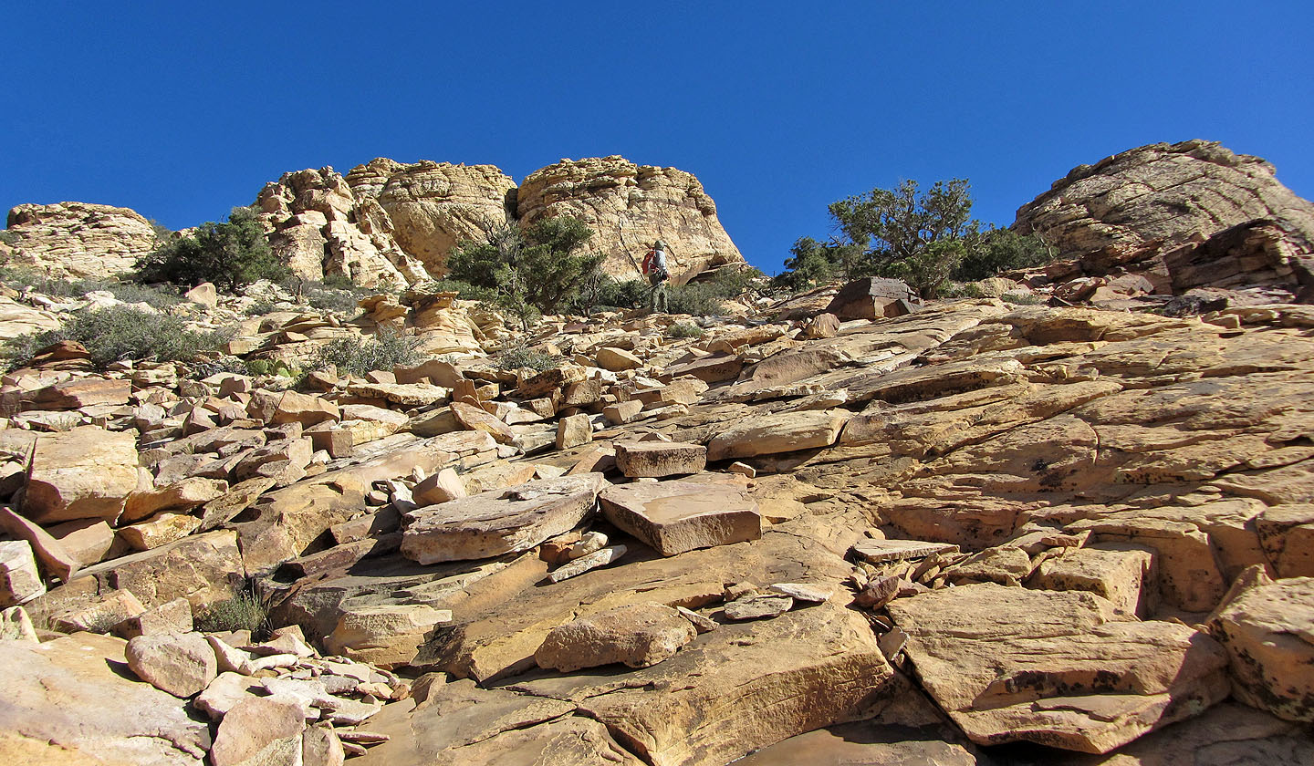
Looking for a half-day trip coupled with a short drive, Sonny, Dinah and I found it in Hollow Rock Peak. We had no trouble following Jim Boone's route description. From the trailhead near a small town west of Las Vegas, we followed a trail up a bushy, treed slope before gaining the ridge. Continuing east along the ridgeline, we soon arrived at a high point, higher in fact than Hollow Rock Peak which lies further along the ridge. Continuing on, the trail undulates through scattered pinyon and juniper trees with plenty of opportunities to view the dark and brooding slopes of Potosi Mountain on the right juxtaposed with the pale rocks of Windy Peak on the left.
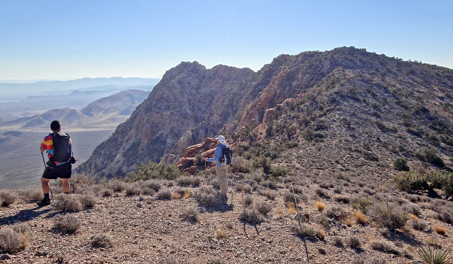
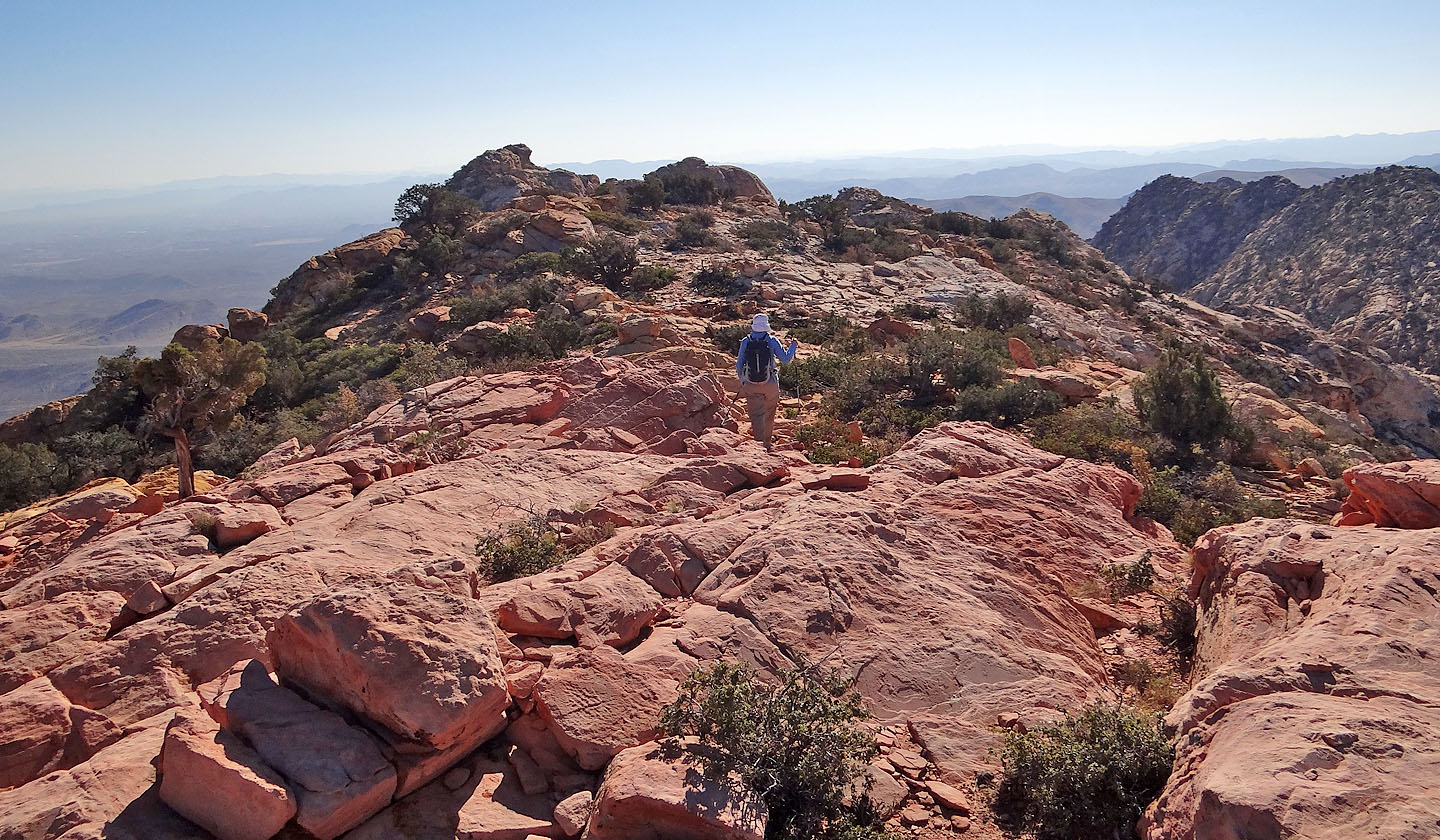
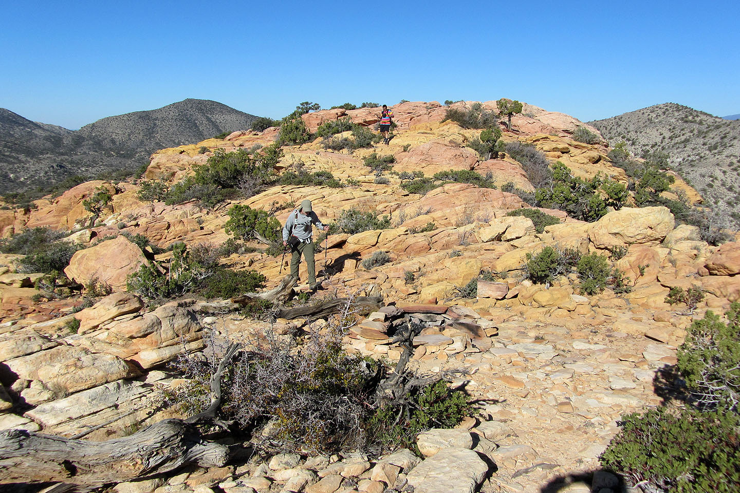
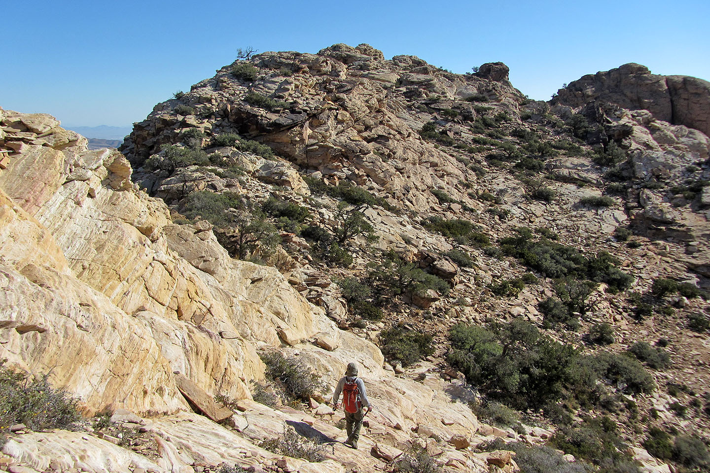
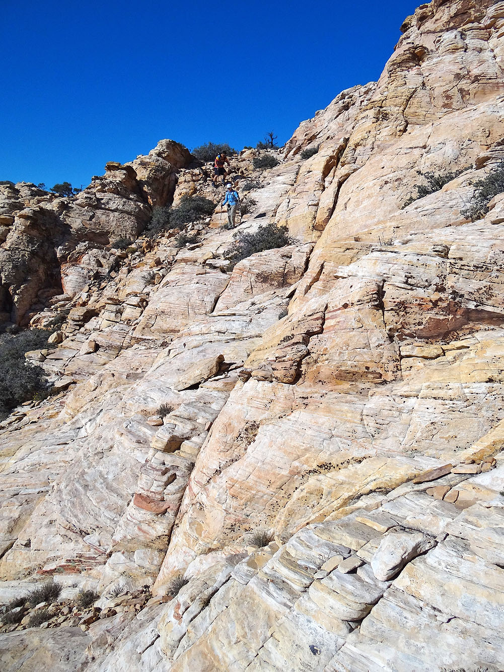
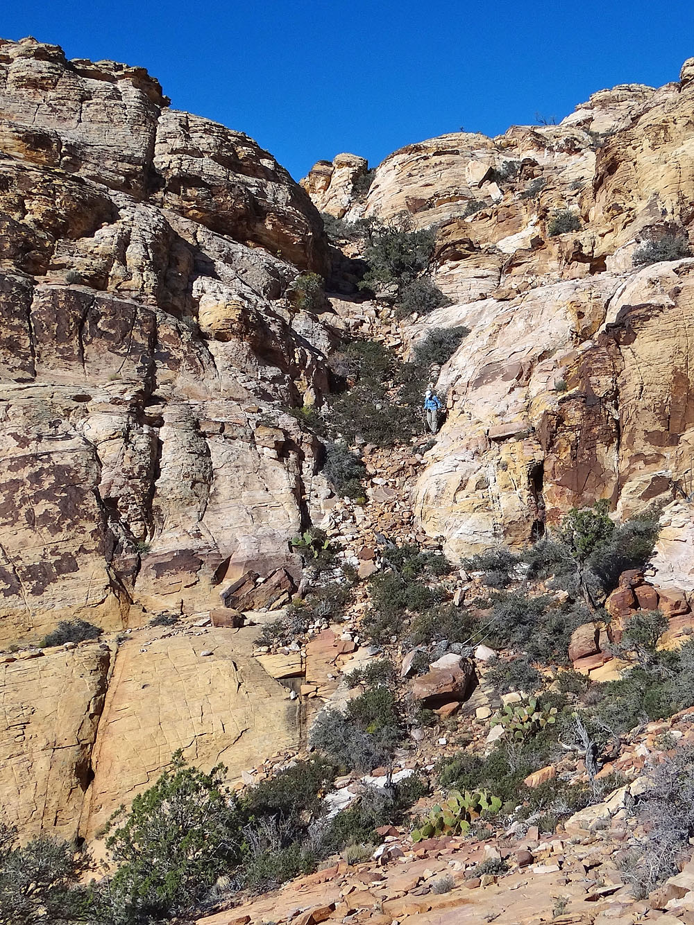
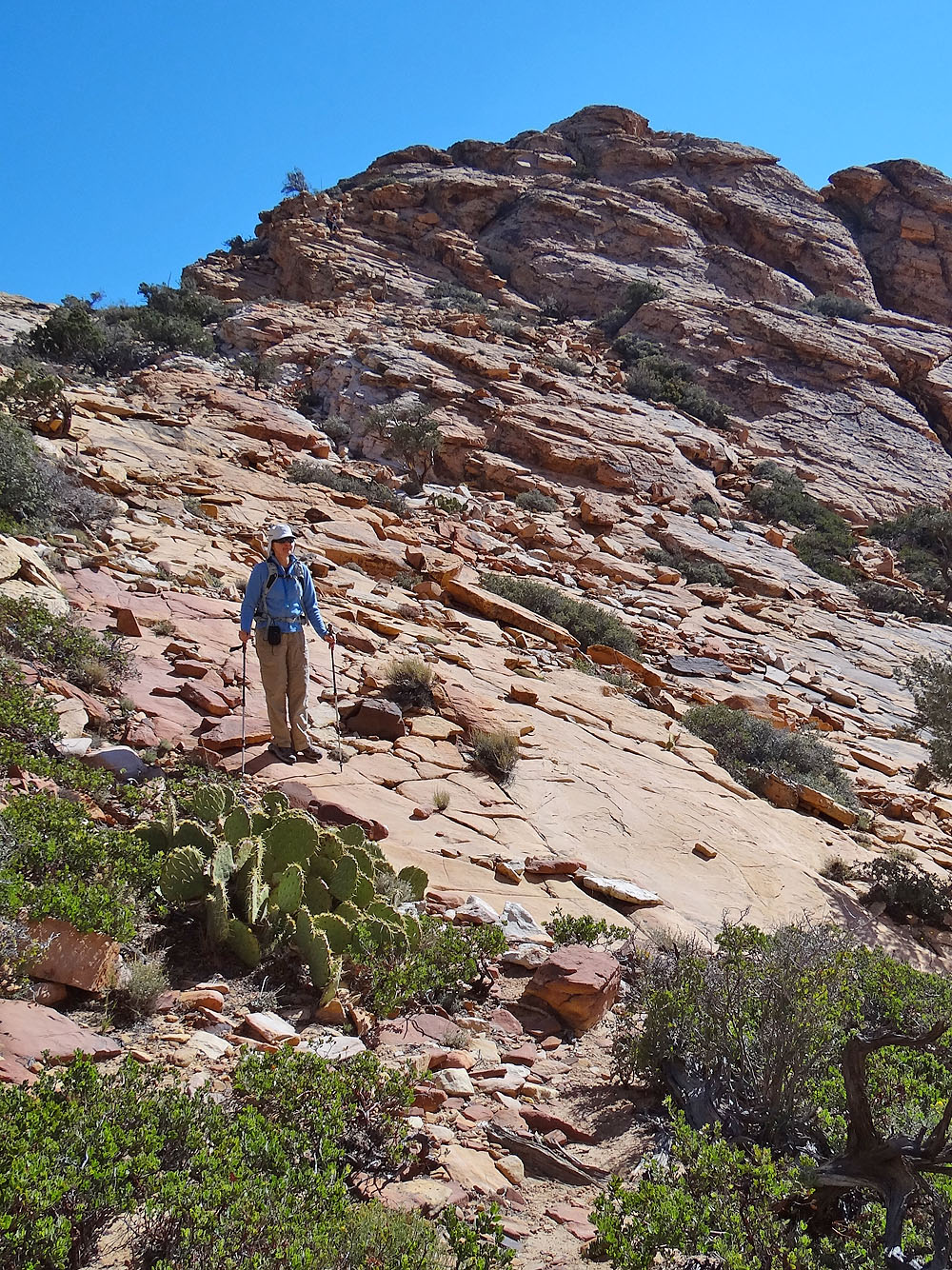
720 m before reaching the summit, the landscape changes dramatically. Grey limestone gives way to white, yellow and red sandstone while pinyons and sagebrush become scarcer. The ridge drops down and then rises to hit the summit of Hollow Rock Peak. It tops out at a boulder the size of a house.
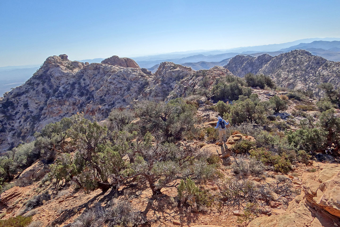
Dinah and I declined to try the exposed, class 4 climb to the summit, but Sonny scrambled up. Meanwhile, Dinah and I made our way to an adjacent point nearly as high as the summit. Sonny joined us later, and we sat down for lunch under an azure sky.
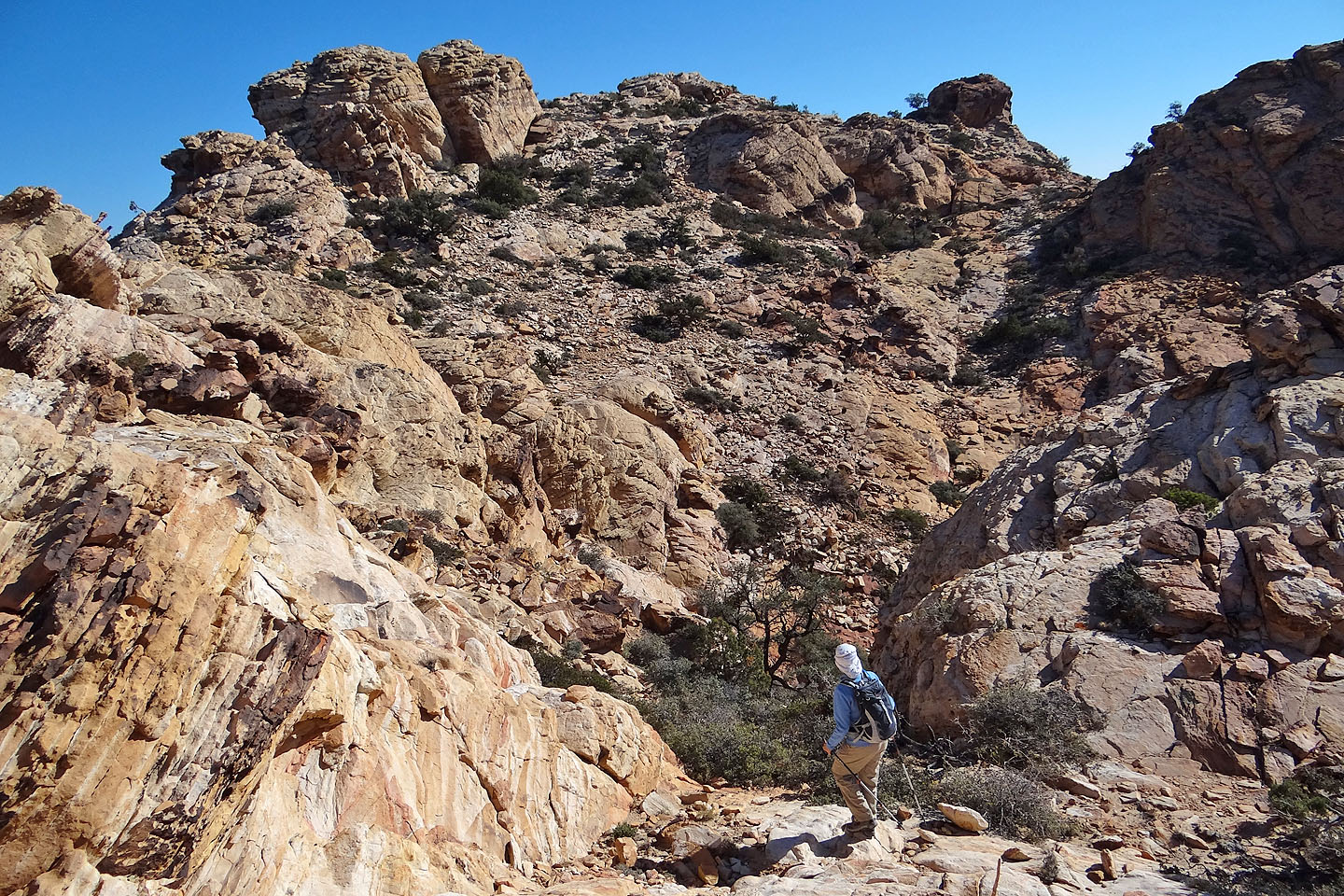
When it was time to go, we followed the ridge back to a low point and eyeballed the slope on our left. Far below we could see a dirt road. Although much of the terrain was hidden from our view, it appeared feasible to reach the road. Nor were we the first to use this descent route for soon after starting down, we encountered a good trail. It dropped down before climbing to a shoulder on the right side of a white sandstone canyon. At the top of the shoulder, we hit a red sandstone road and followed it down to where it intersected with the dirt road. The dirt road, annoying with its many ups and downs, paralleled the highway and led back to our car.
After an enjoyable hike to Hollow Rock Peak, we returned to Las Vegas with plenty of time to do other activities. For Dinah and Sonny that meant winning money at the casinos. At least that was their plan, but it didn't exactly turn out that way. As for me, I sat down to plan a trip up another desert peak.
KML and GPX Tracks
Sonny's Trip Report
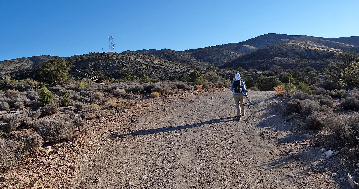
Starting up the road. After the tower the road becomes a path.
The view west
Hiking along the ridge
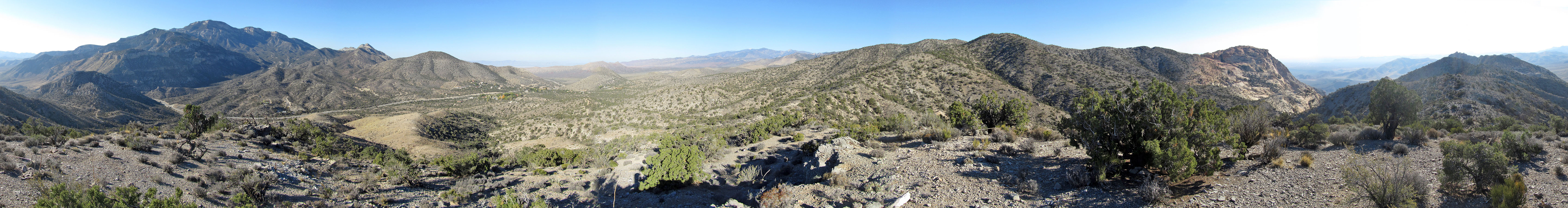
Panorama from the highest point on the route
Mount Potosi lies south
Stopping at the lowest point along the ridge
From here to the summit we'll be hiking on sandstone
We have a colourful hike ahead of us
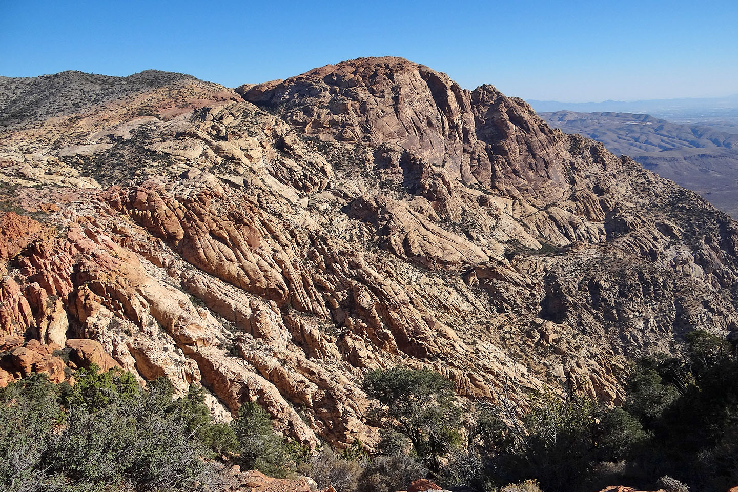
Looking back at the colourful sandstone
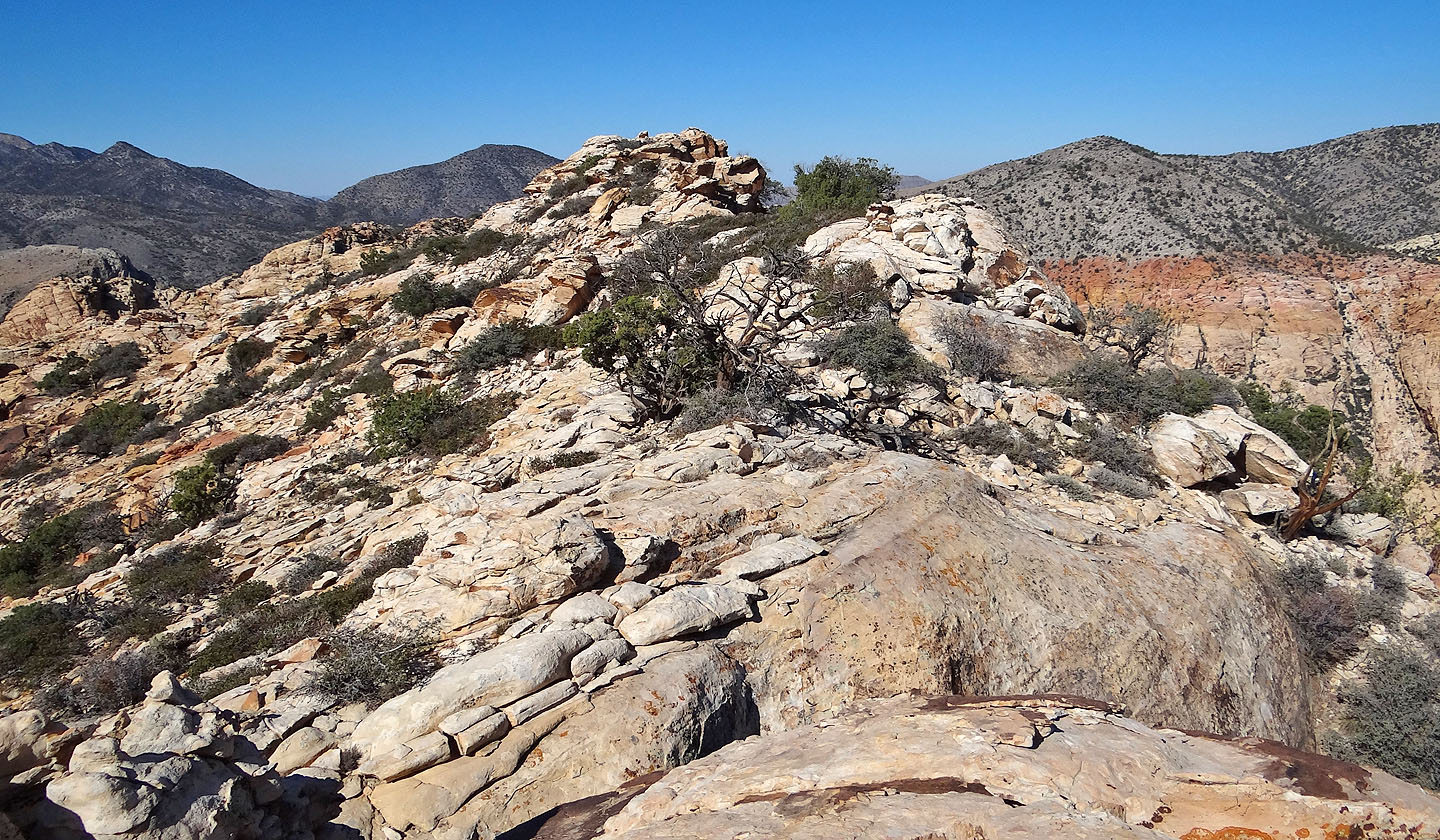
The summit block is the second point from the left
Looking back as Sonny navigates the sandstone
The first of two drops before the summit
Looking back at the first drop
The second drop. The summit block appears above Dinah.
Looking back at the second drop
Hiking up the other side
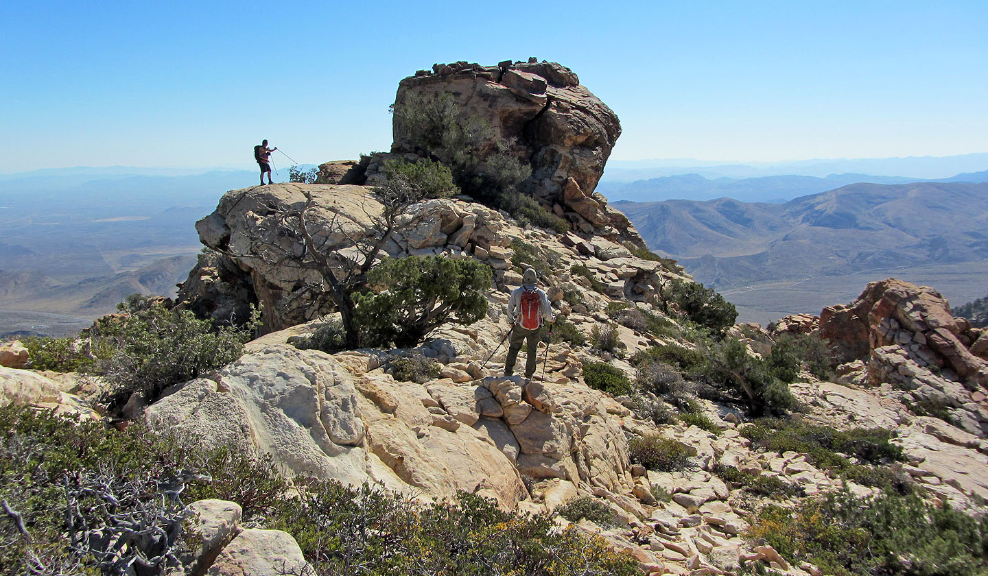
The summit block
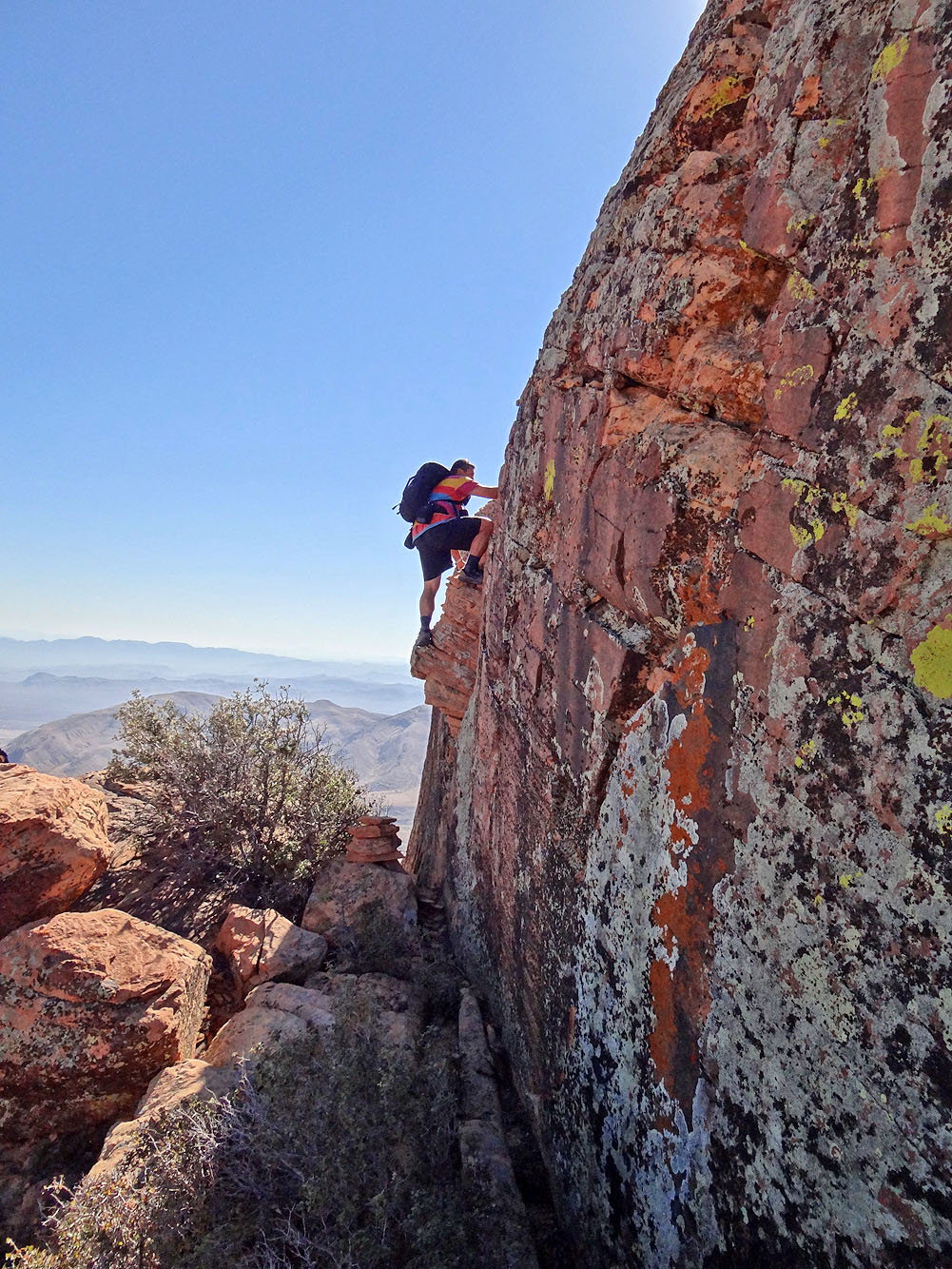
Sonny scrambles up
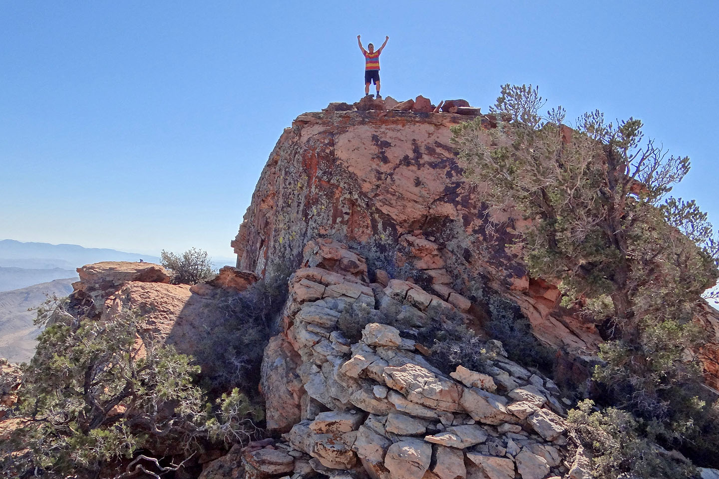
Sonny on the summit of Hollow Rock Peak
Dinah and I climbed to this high point next to the summit
Heading back
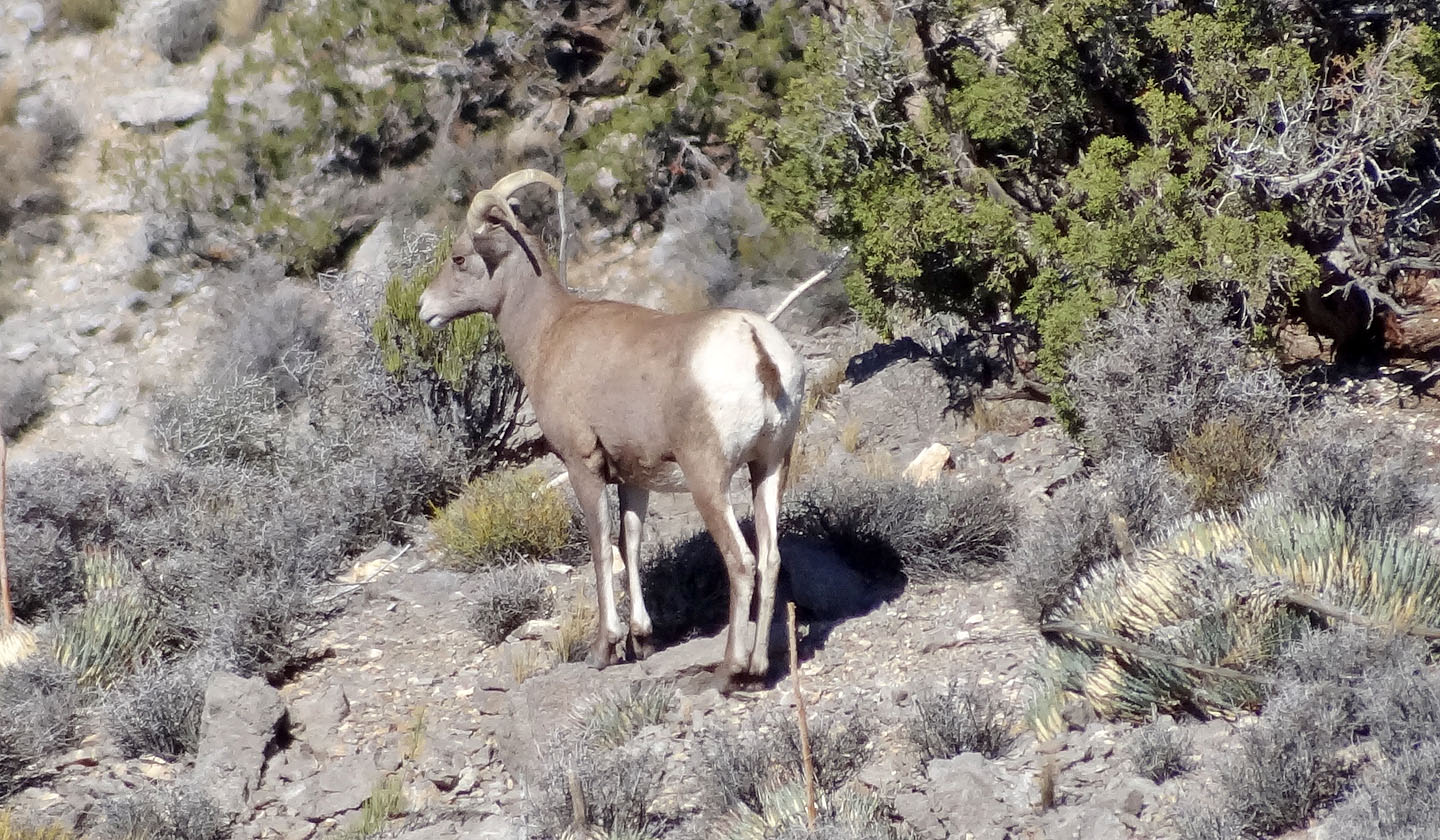
Bighorn sheep
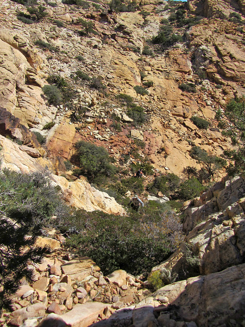
We had to endure the two drops
From the low point on the ridge, we dropped down to a trail that led to a red dirt road
above the
white sandstone
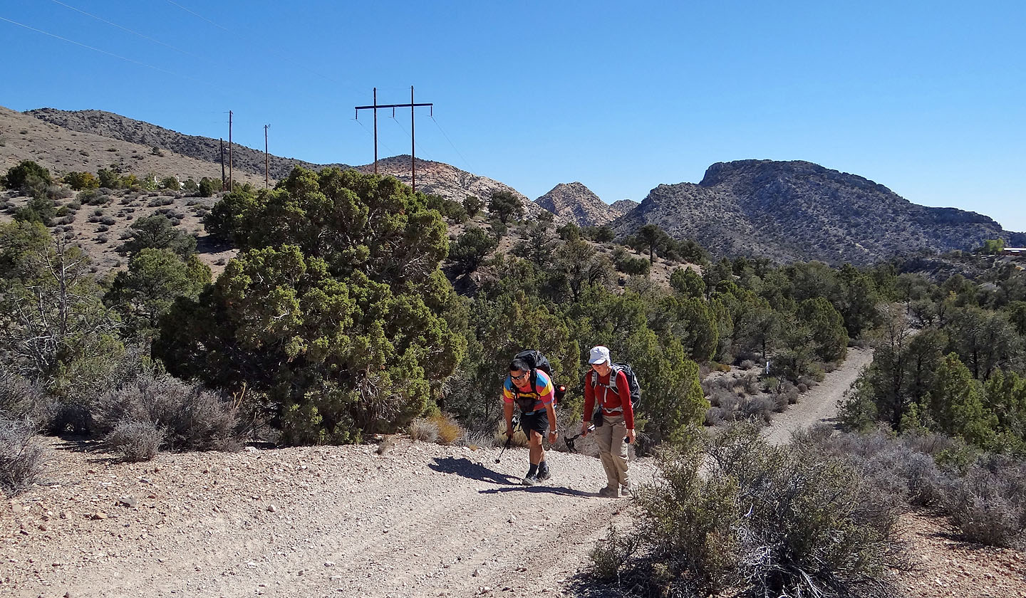
Sonny feigns weariness as we walk back along the undulating dirt road
Blue Diamond Topo (4.8 mi, 6168 ft, 853 ft)