bobspirko.ca | Home | Canada Trips | US Trips | Hiking | Snowshoeing | MAP | About
Spreading Ridge
Banff National Park, Alberta
July 9, 2021
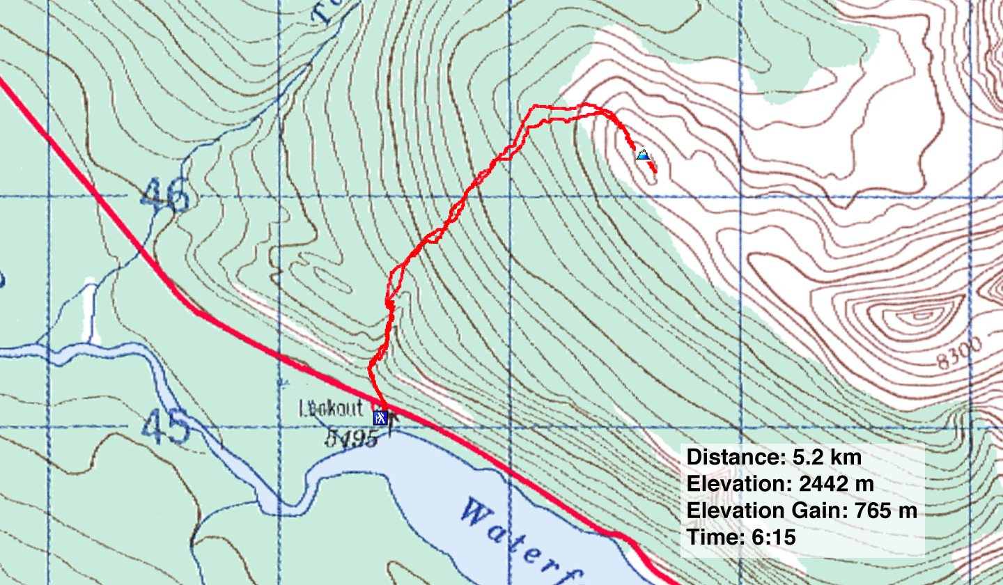
Distance: 5.2 km (3.2 mi)
Cumulative Elevation Gain: 775 m (2543 ft)
For a short climb, short for anything on the Icefields Parkway, Spreading Ridge grants amazing scenery. A nod to Matt Hobbs, who climbed it with Matt Clay, for coming up with both trip and name.
Matt described a sluggish snowshoe ascent that culminated in spectacular alpine views, but those views would be quicker to attain in the summer. Moreover, we weren't confined to a snowshoe route. Instead of ascending the gentle northwest ridge, we favoured a steeper, more direct route that would knock off nearly a kilometre of bushwhacking. We would park farther south, at the north end of Waterfowl Lakes, and start up a broad gully.
At least it looked good in theory. There was no way to tell from Matt's photos if there was impenetrable underbrush under their snowshoes or if cliff bands lined the gully. But the starting point was convenient: a paved lookout that grants tourists a view of Waterfowl Lakes. Zora, Christine, Jonathan and I crossed the road and hiked 200 m to the edge of the gully.
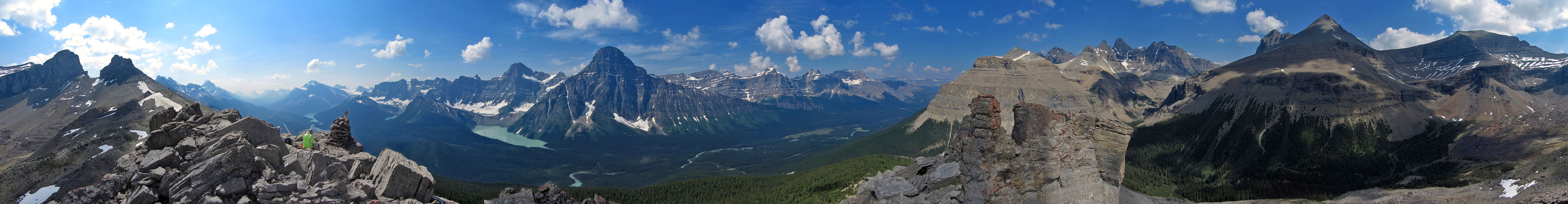
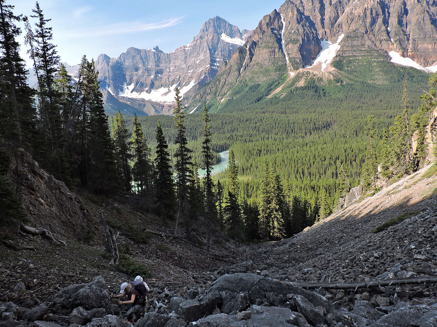
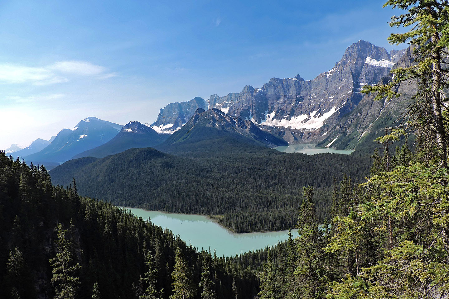
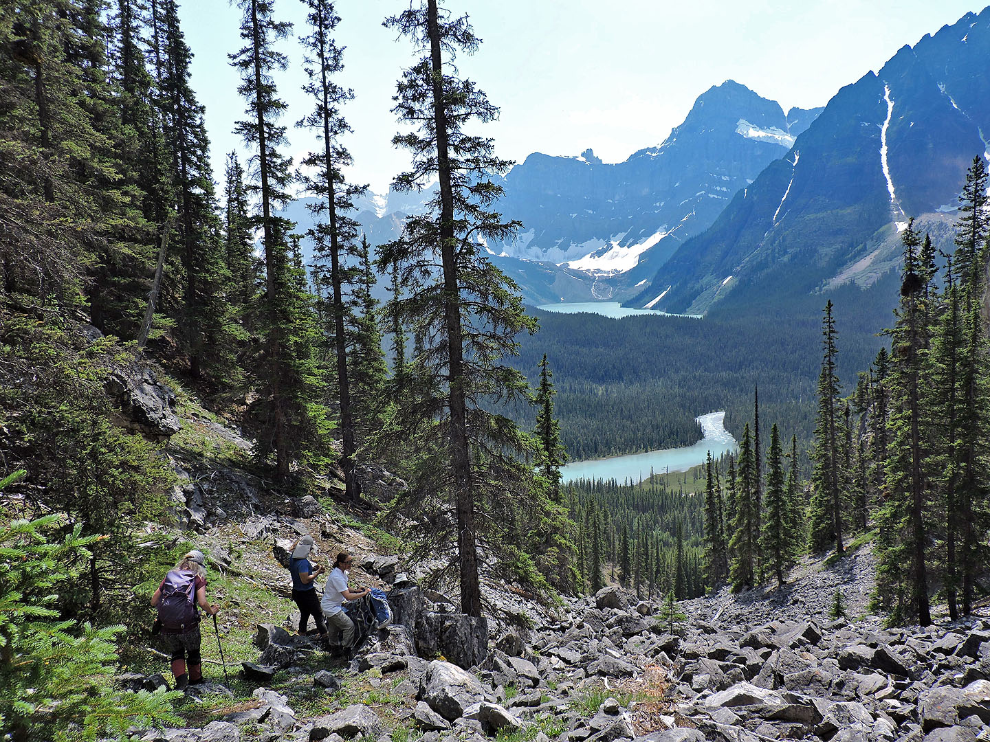
There were no cliff bands. Instead, talus filled the canyon-like gully from one steep side to the other. Climbing the rocks was awkward, but I preferred it to bushwhacking, especially since we were treated to splendid views of Waterfowl Lakes and Chephren Lake, as well as Howse Peak where three world-class alpinists perished in 2019.
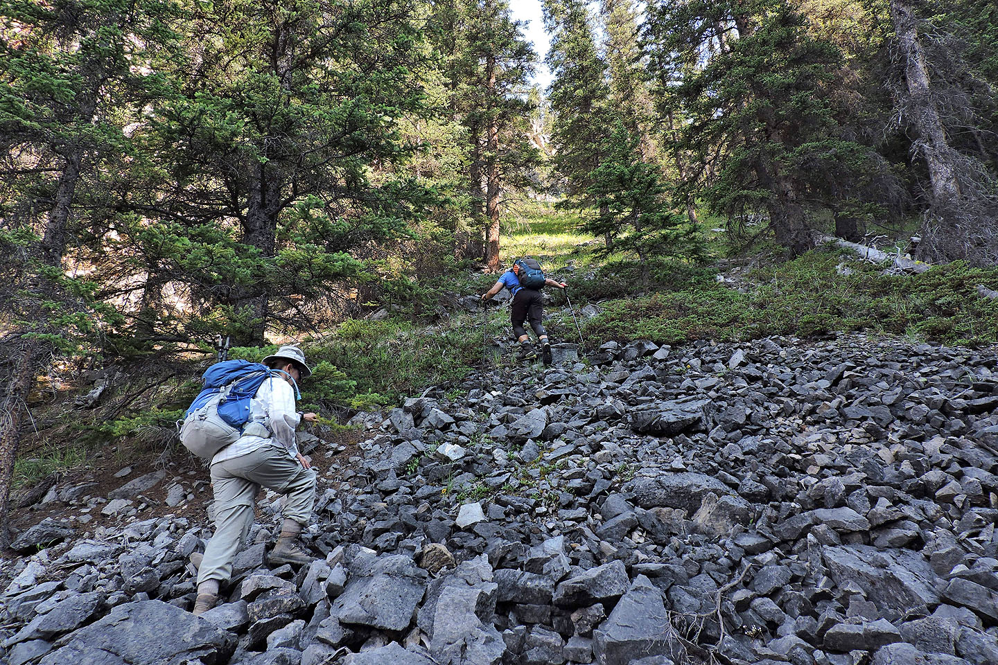
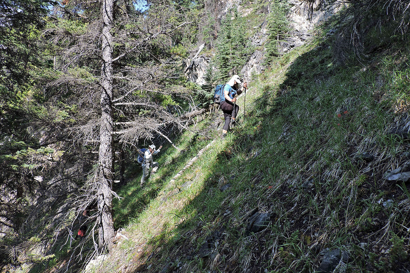
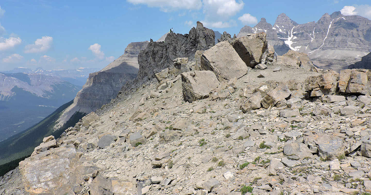
A broken cliff band tops the gully, and we found a weakness that we easily climbed. Then we headed to the north end of the ridge a kilometre away, a route that avoids cliff bands (we purposely veered off to climb a cliff on the ascent where I expected views, but there were none). Bushwhacking was generally easy, aside from a swath of bushes after the gully and dense forest below the ridgetop. When we broke out onto a flowery meadow, we stared at the rocky, spiky summit ridge. We easily negotiated the boulders to reach an impressive summit cairn.
We stayed nearly two hours on top, had lunch, relaxed and took copious photos. I meandered down the east end to view the summit ridge from the other side. Soon after I returned to the summit, we headed back the same way. Descending the rocky gully was irksome, but again we were treated to views of the aquamarine lakes, putting a fine finish on our trip just minutes from our car.
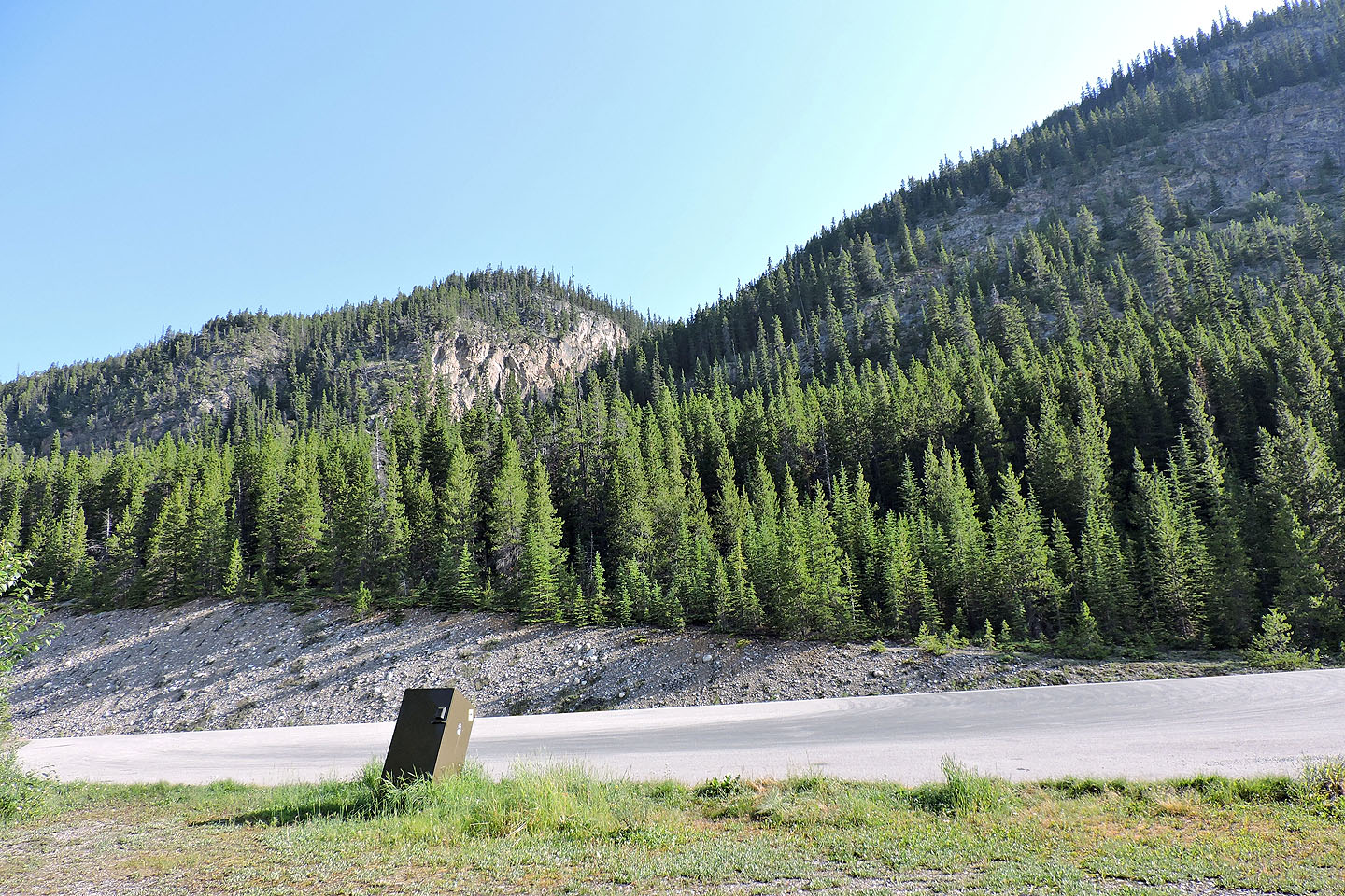
View of the gully from the pullout. We crossed the road and started up the drainage.
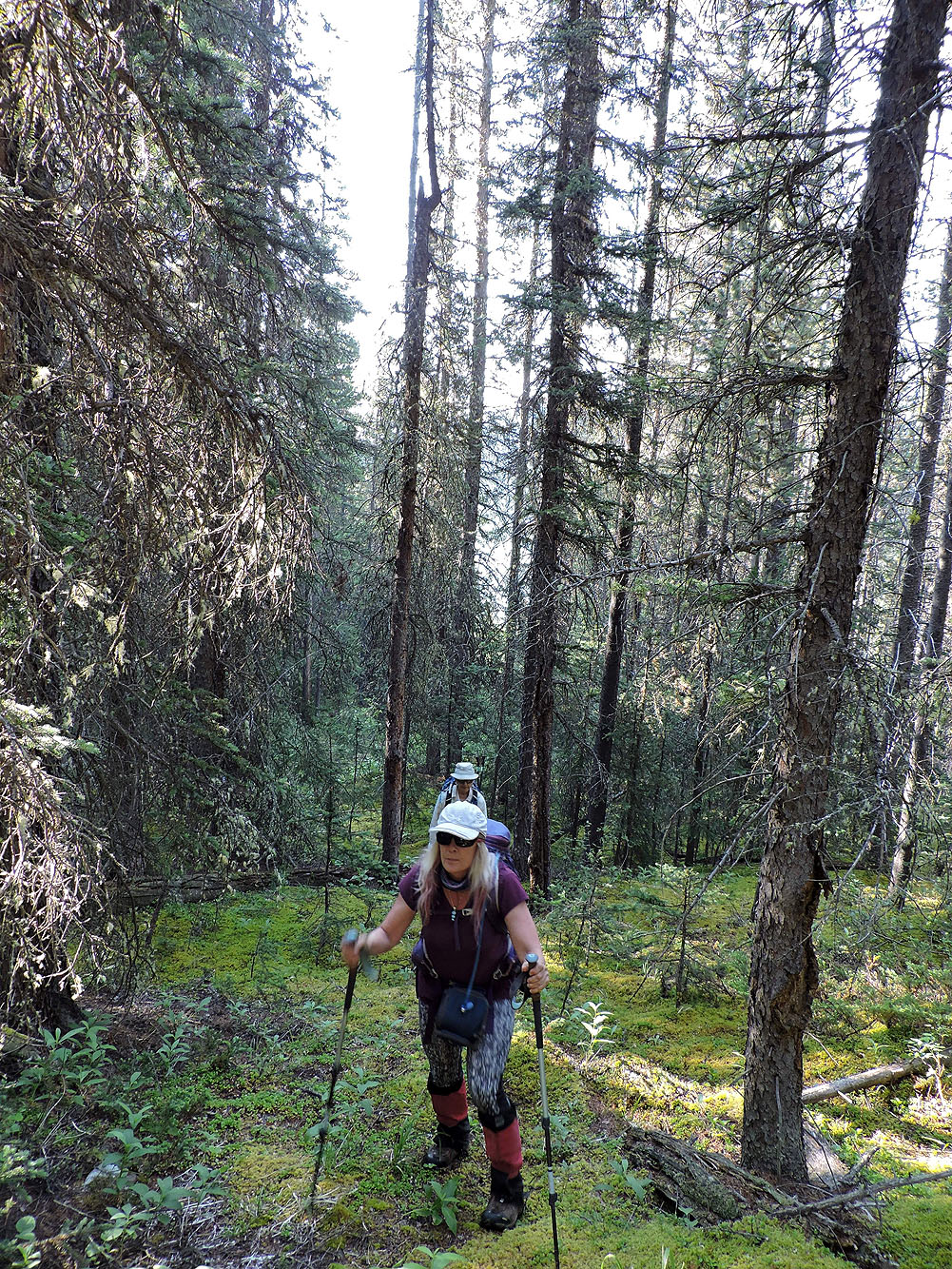
We hiked up spongy moss to the foot of the gully
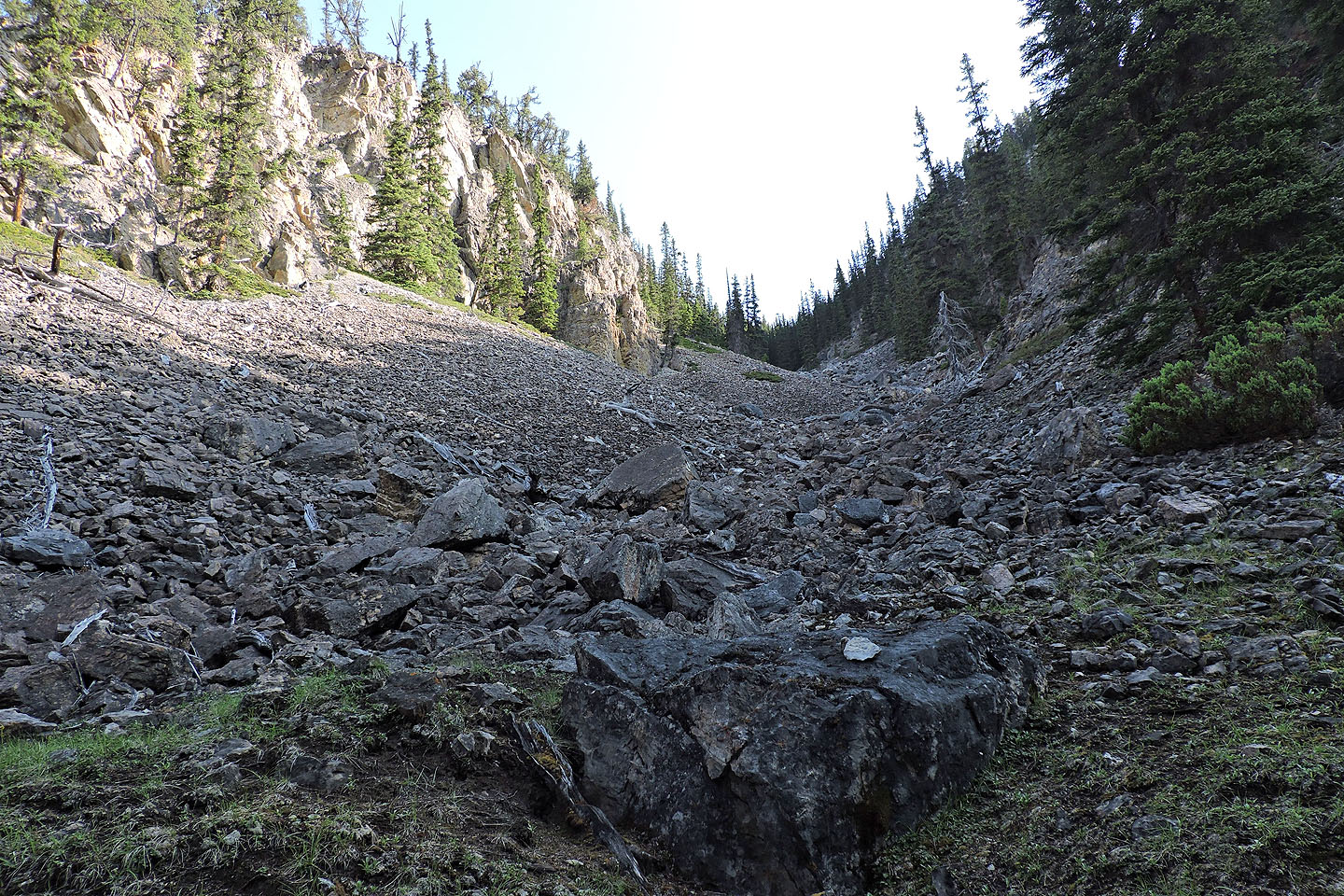
Looking up the gully. The rocks were fairly stable but not easy to come down on.
Looking back from partway up the gully. Howse Peak in the centre.
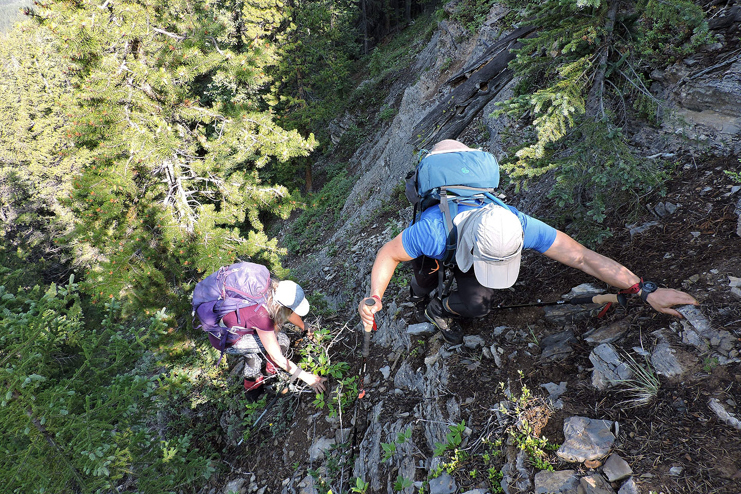
Climbing out of the gully
It's a steep slope and there would be others
From the top of the gully, we saw Chephren Lake and a canoeist on Waterfowl Lakes (mouse over)
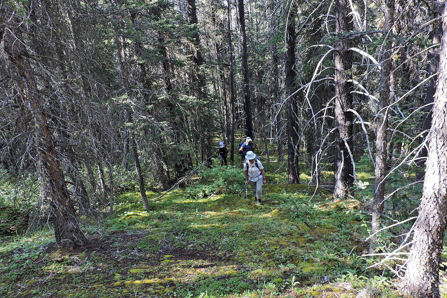
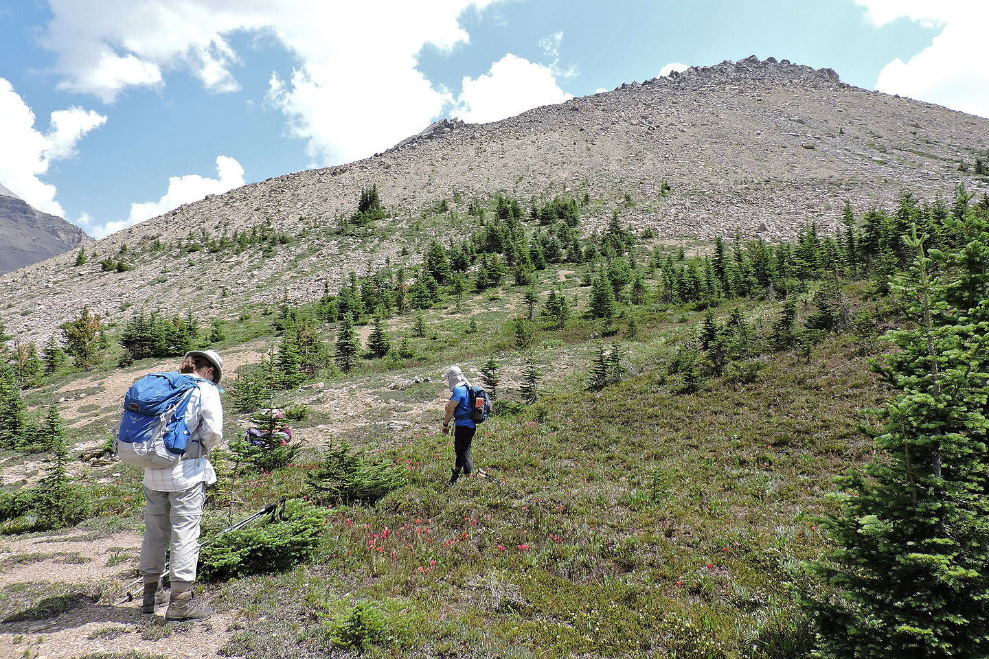
Except for a few pockets of brush, there was little bushwhacking
I led us up a short cliff band where I hoped to have a view. Not so.
We
avoided the cliff on the descent by skirting the end of the cliff band 40 m west.
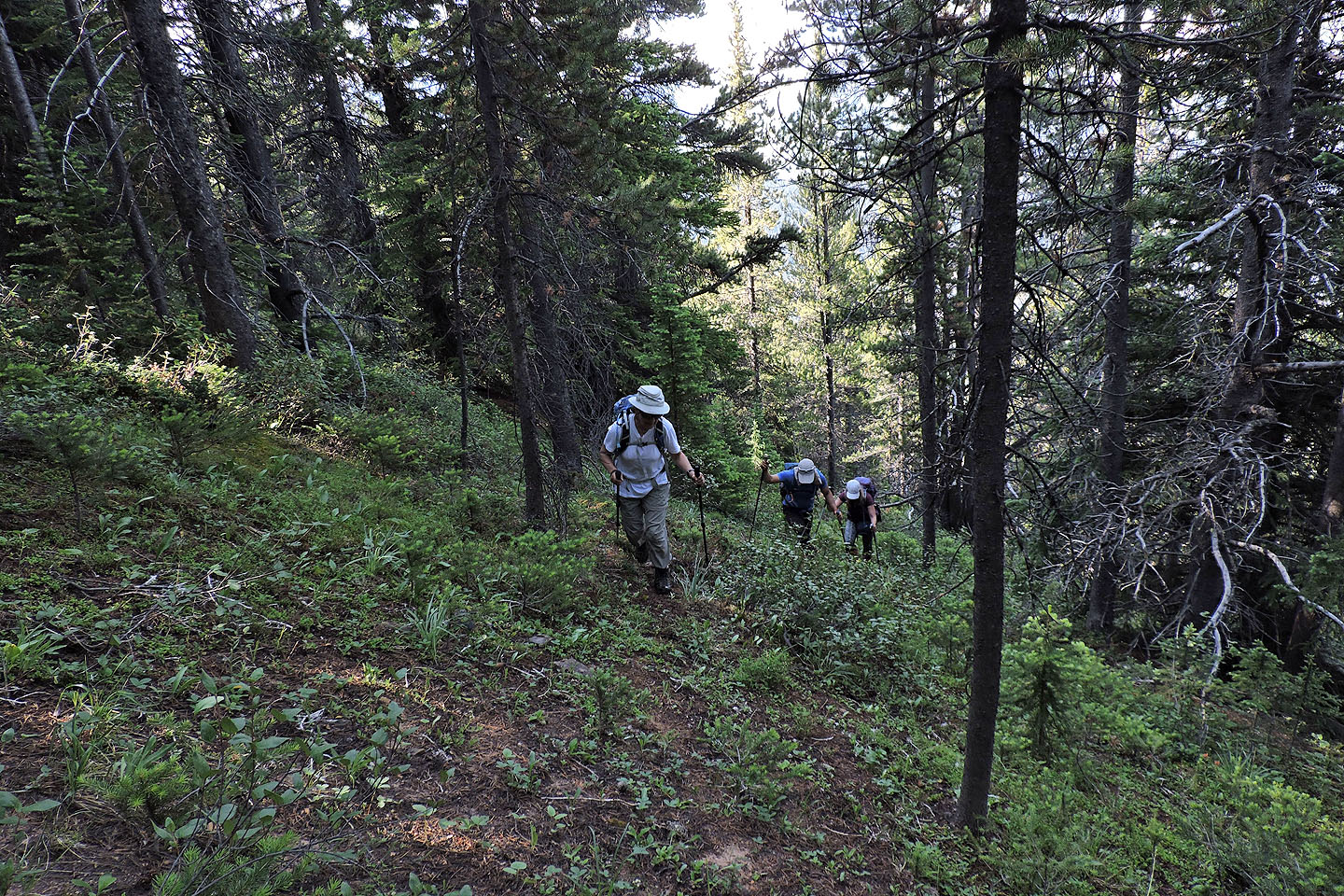
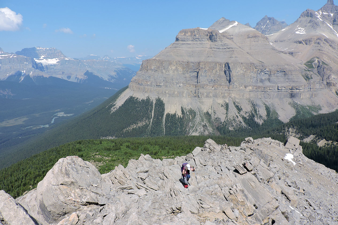
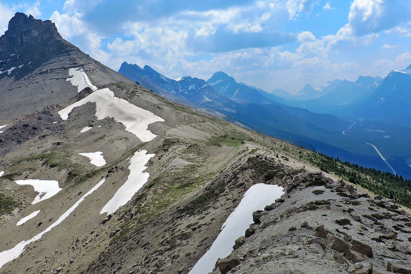
We continued up the ridge
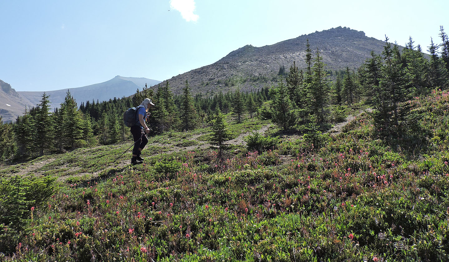
When we broke out of the trees, the summit came into view
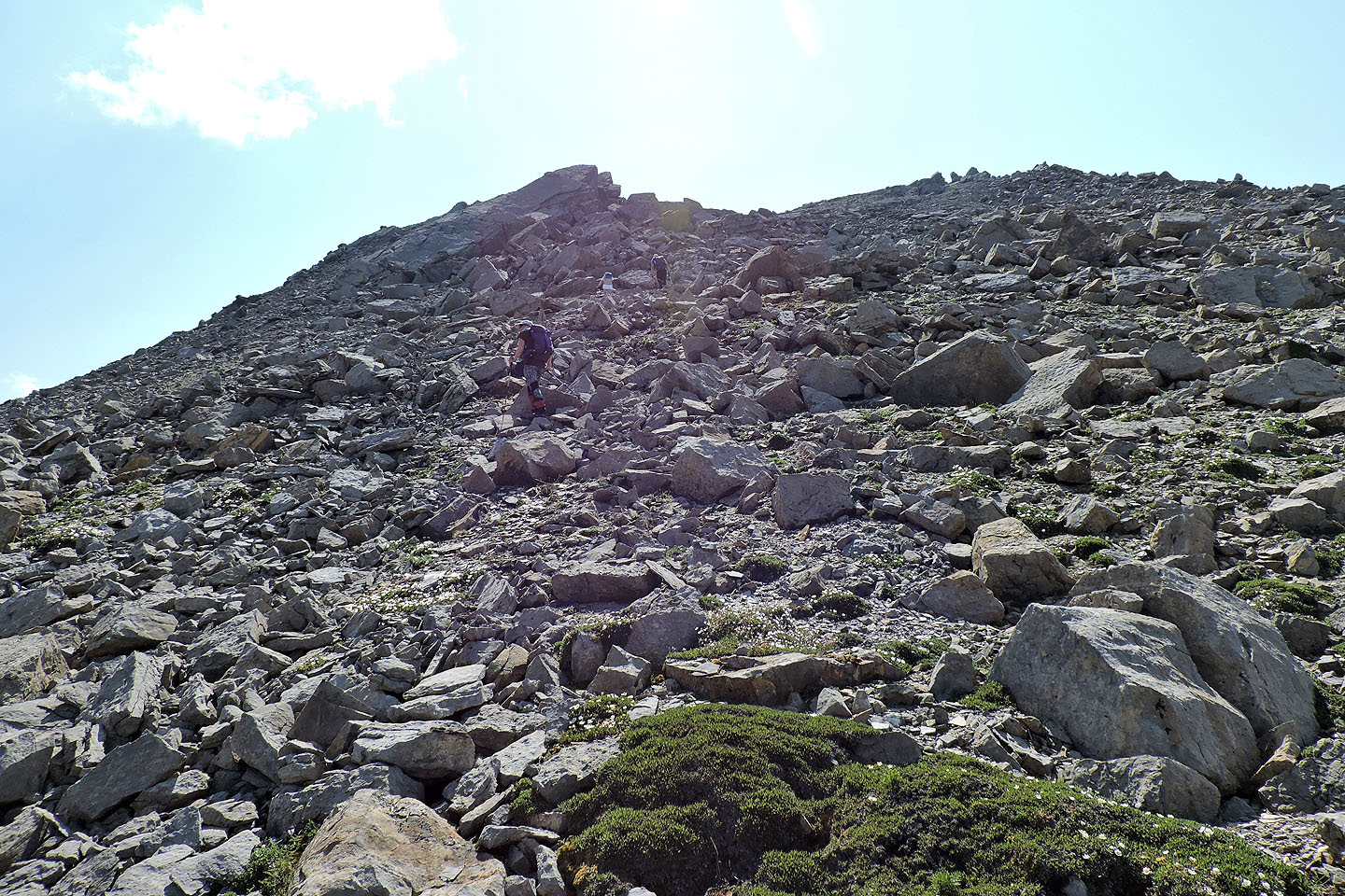
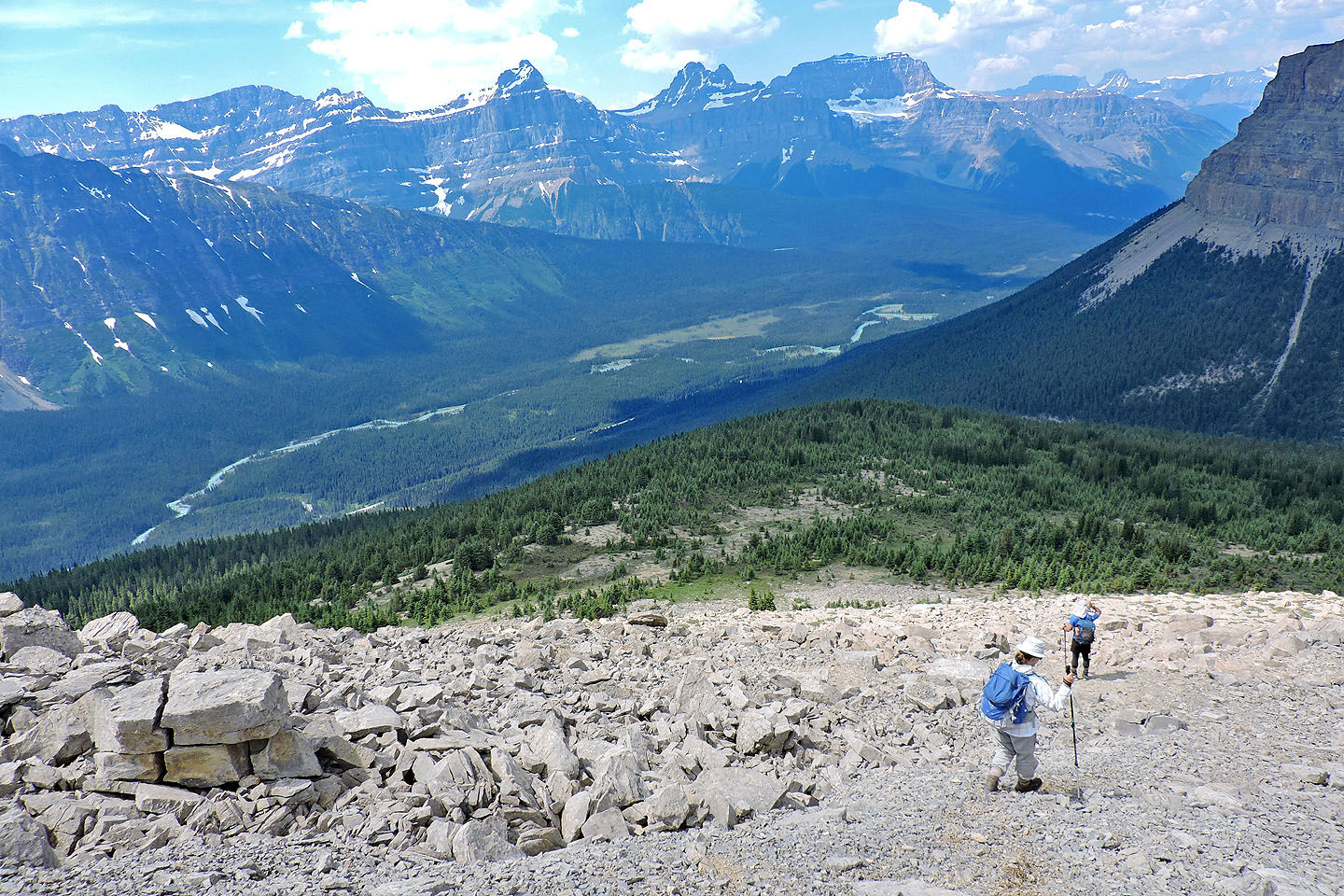
Hiking up the rubbly slope
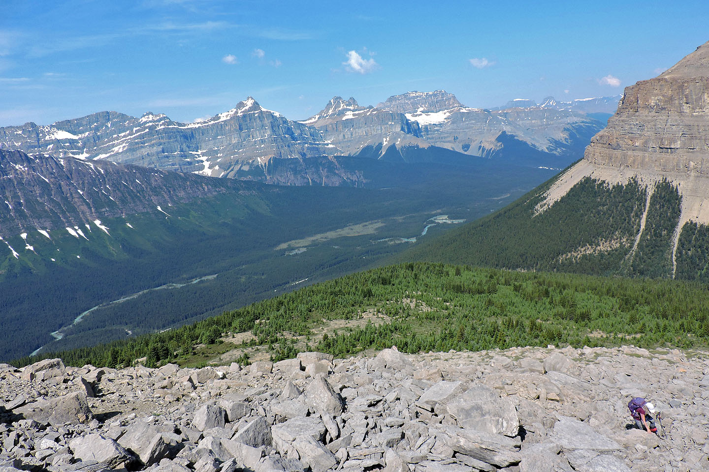
Looking back
Bison Peak in the background
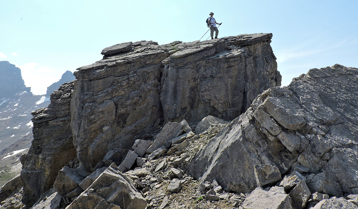
Zora climbed this rock, but it wasn't the highest point
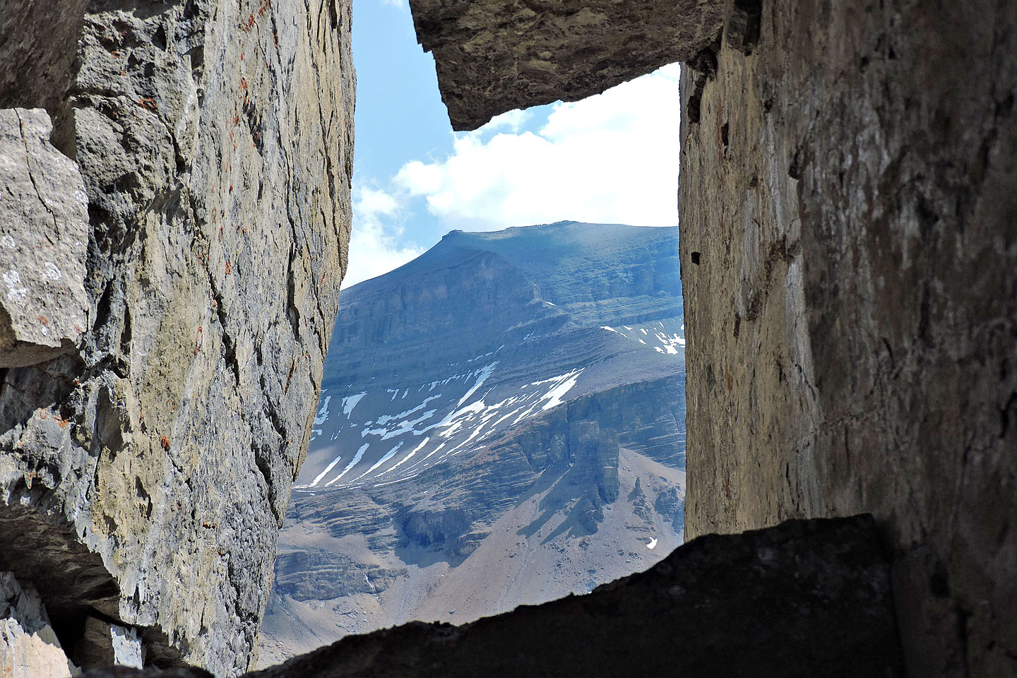
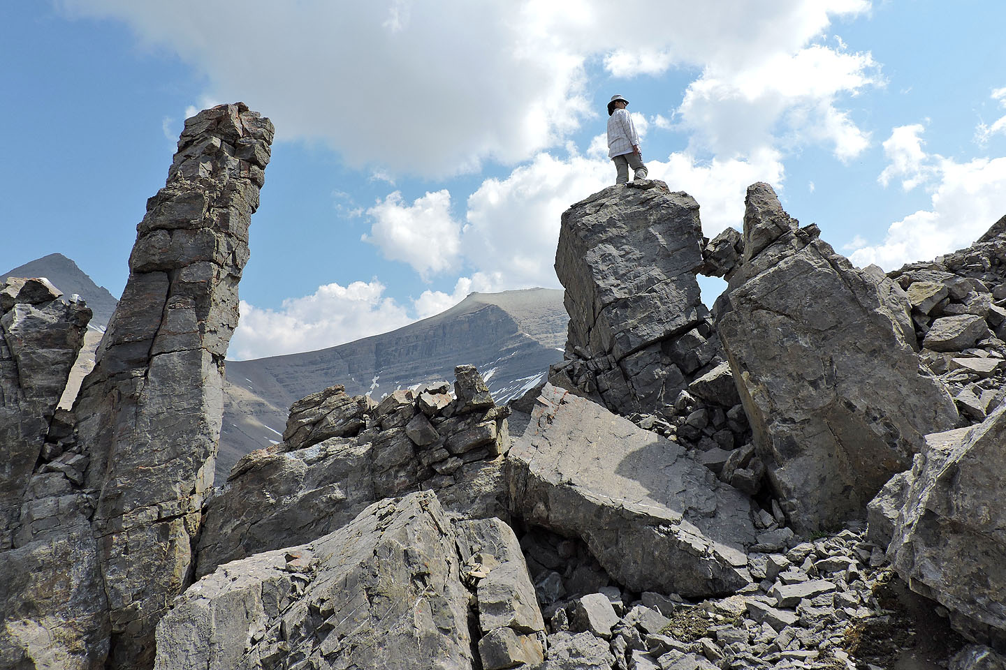
Spreading Peak seen through a window
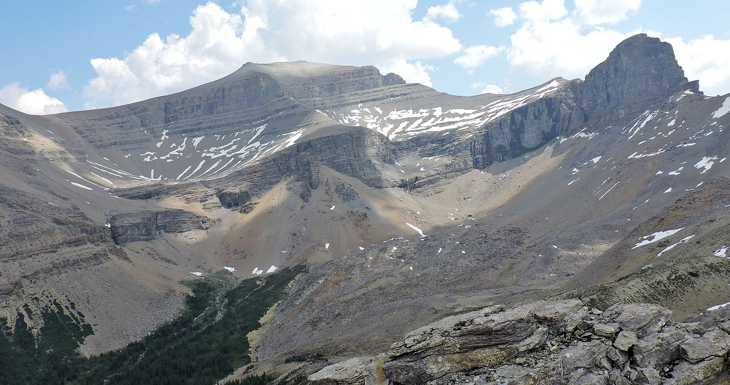
Full view of Spreading Peak
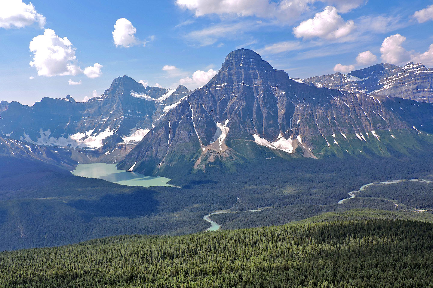
Mount Chephren
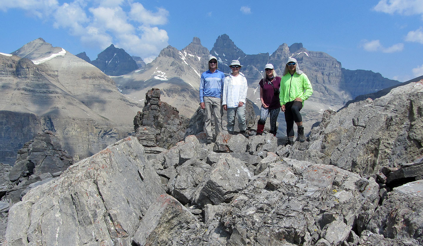
Posing on the summit
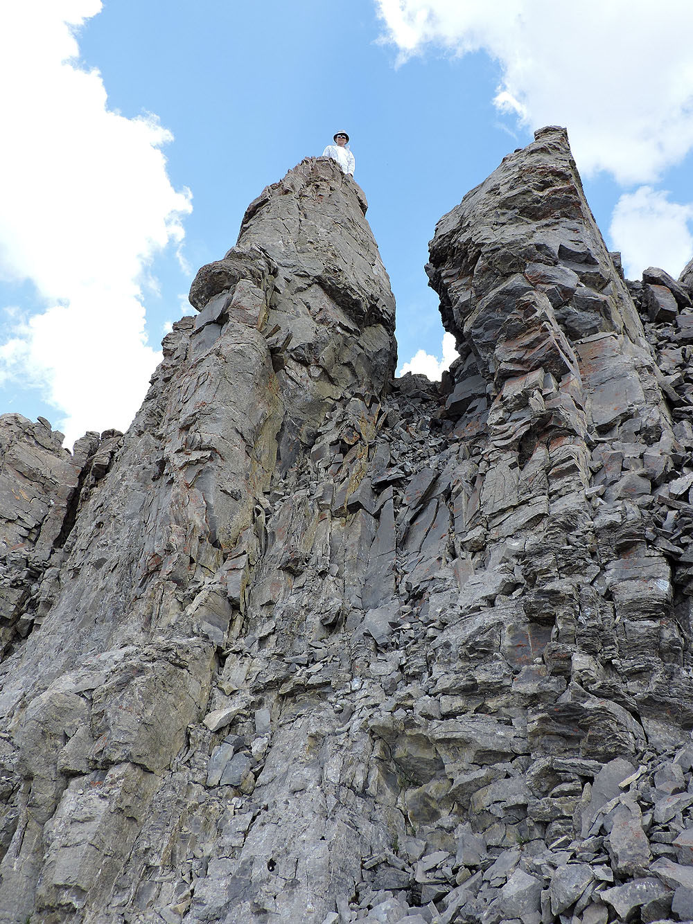
None of us dared climb the highest point, the skinny pillar left.
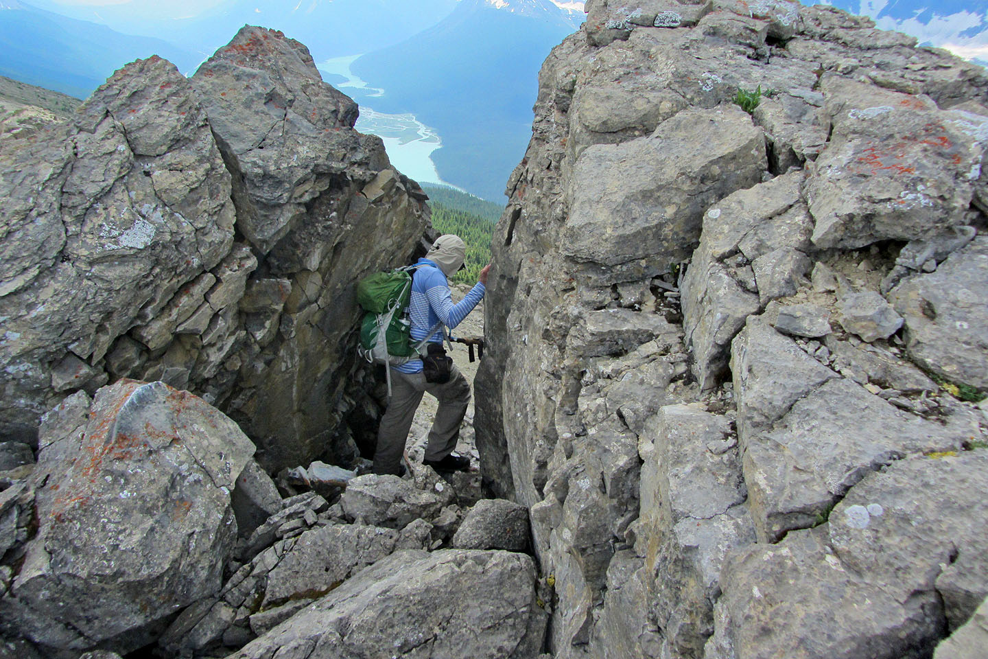
To reach the east end of the summit ridge, I climbed down a chute between pinnacles.
Looking back at the chute
I soon turned around after this point (mouse over for a close-up)
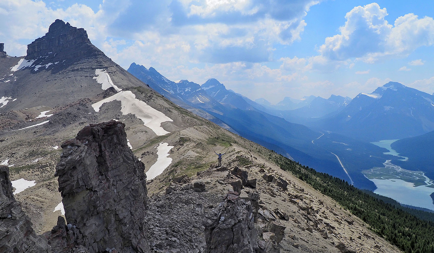
Looking along the ridge, Mount Weed in the centre
Looking back at the girls on the summit ridge (mouse over)
Heading back down
We stopped to take pictures of wildflowers
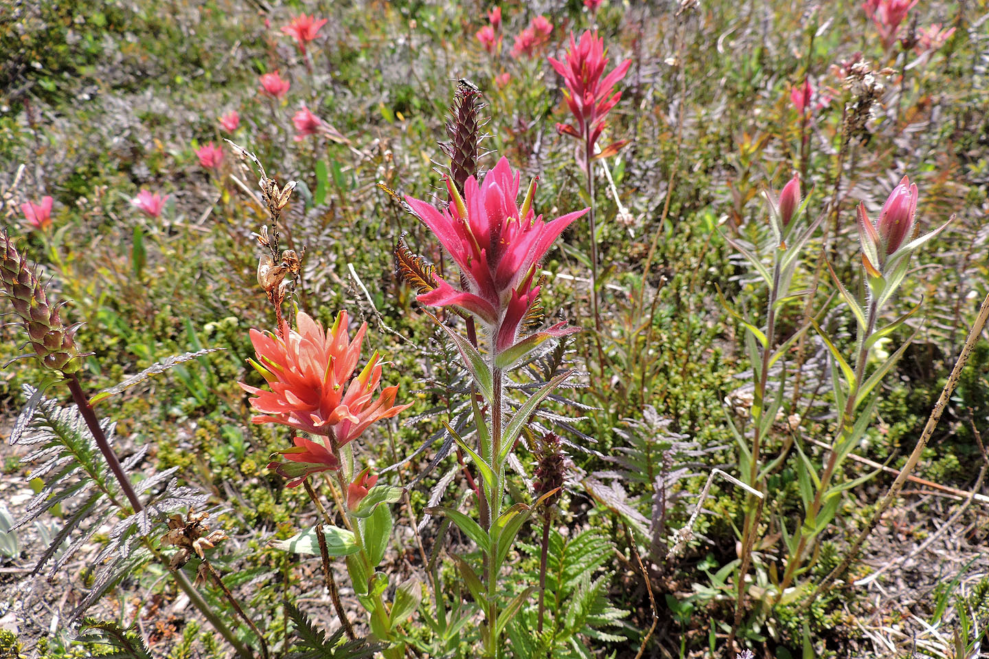
Paintbrushes grew profusely in the meadows
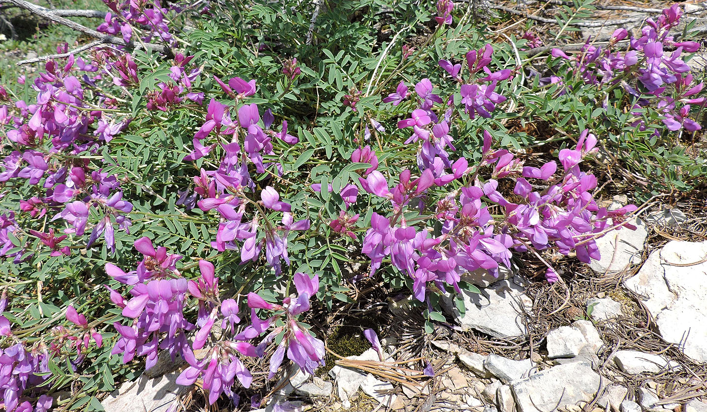
Northern sweetvetch
Back at the gully, we took a break at the top
 82 N/15 Mistaya Lake