bobspirko.ca | Home | Canada Trips | US Trips | Hiking | Snowshoeing | MAP | About
Coral Ridge
David Thompson Highway, Alberta
July 20, 2008
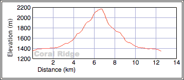
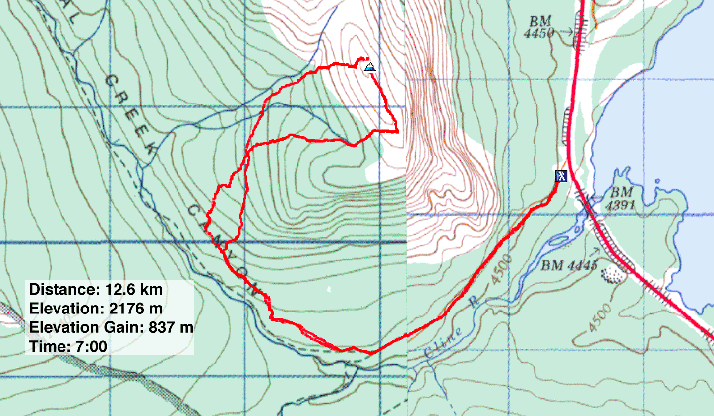
Distance: 12.6 km (7.8 mi)
Cumulative Elevation Gain: 840 m (2756 ft)
I find it hard to say anything good about Coral Ridge, but partly to blame is the poor route description in the David Thompson Highway: A Hiking Guide. We had no trouble following the horse trail, but after leaving it to ascend the ledges, the instructions made no sense. The book suggests repeatedly to “drift left.” Such instructions are useless when you are bushwhacking for the better part of an hour. Instead, a compass bearing or a waypoint would have been useful.
Somehow drifting left didn't feel correct so we went right. As it turns out, my instincts were correct. When we climbed high enough above the trees to view the ridge, we saw a scree slope topped by steep slabs. We had to work our way right to avoid the slabs to gain the ridge. (Later I realized the simple map in the book does show the route going right.) Also, the wrong elevation and elevation gain were given – off by 200 m – which can be determined by looking at the NTS map. The summit GR should have been added since this ridge is not named on any map I found.
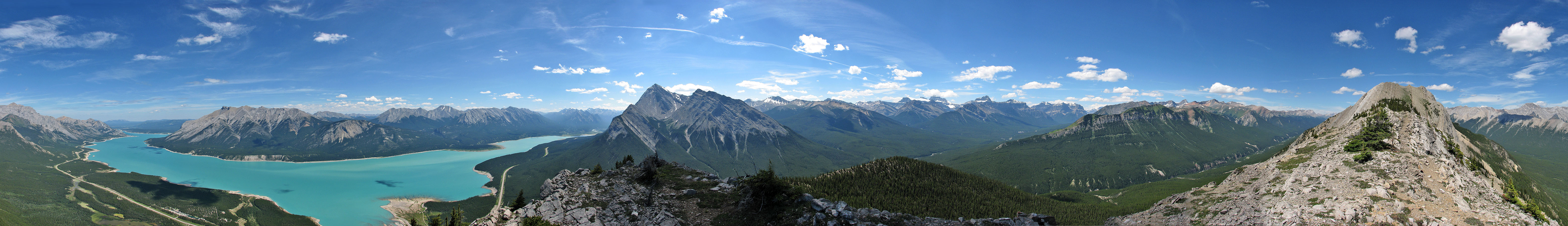
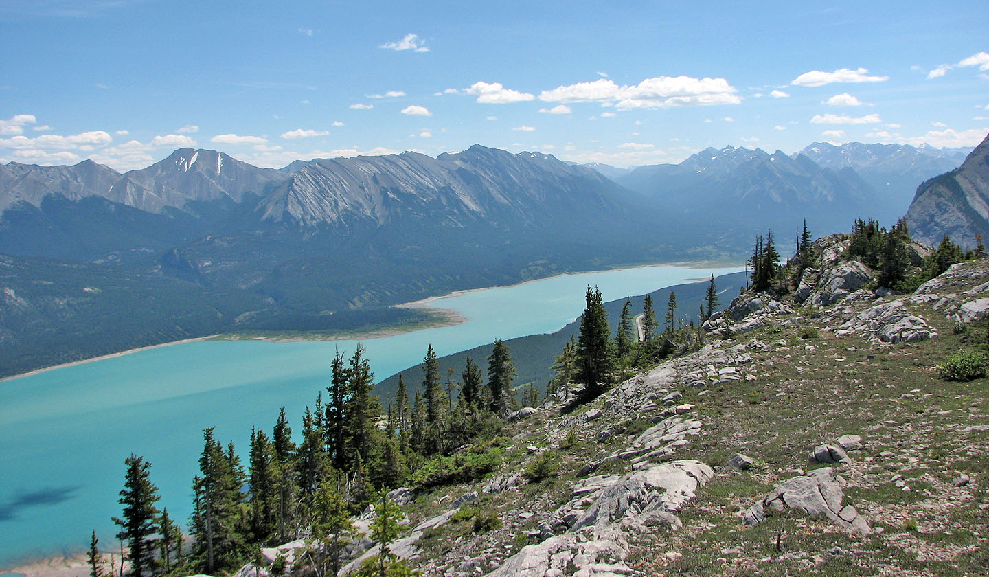
When the trees didn't obscure the view, Abraham Lake from the ridge was impressive. We spent an hour and a half on the summit ridge before heading down. Instead of retracing our steps, we descended a steep slab and scree slope below the summit. Possibly this is the "avalanche slope" that the authors refer to by drifting left, although that would be contrary to the route on their map. But it would take luck to reach it by bushwhacking.
As good as the views were on Coral Ridge, it may be better to gain the ridge at the east end and follow it as curves west. This would give you the best scenery.
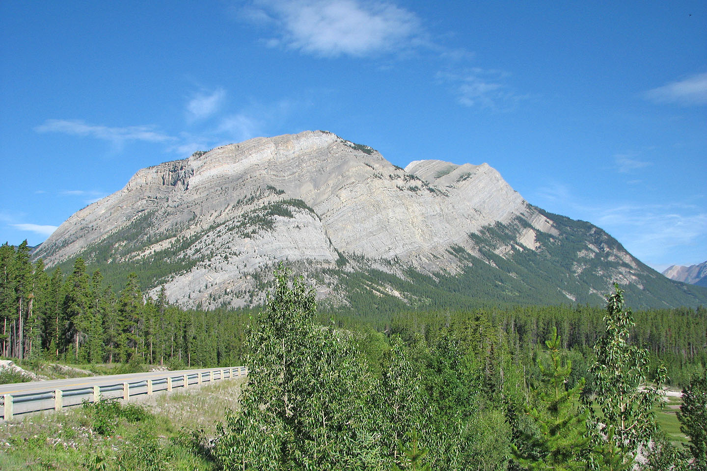
Coral Ridge from the highway
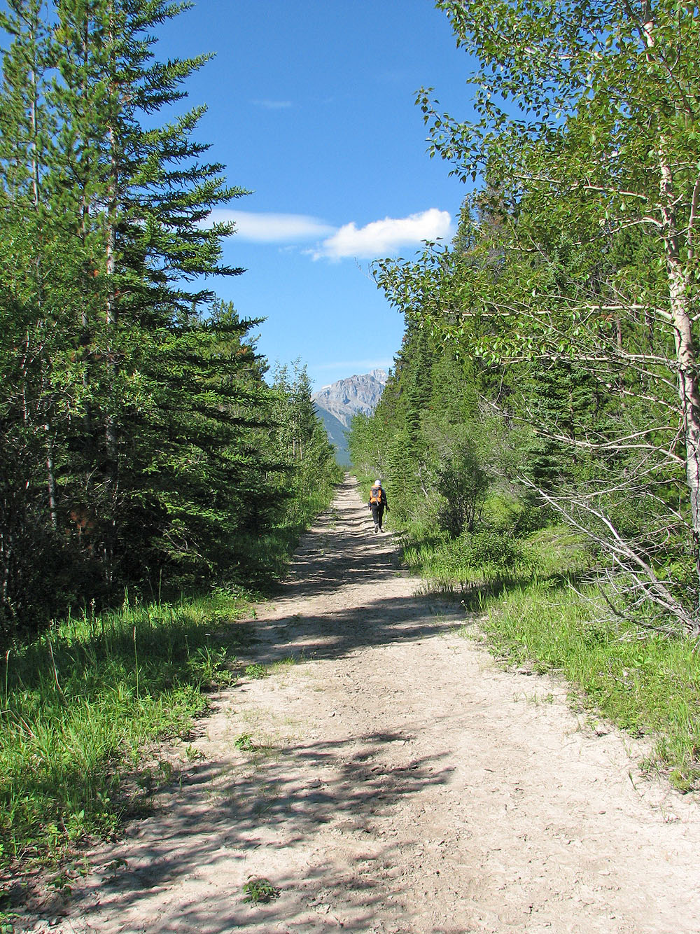
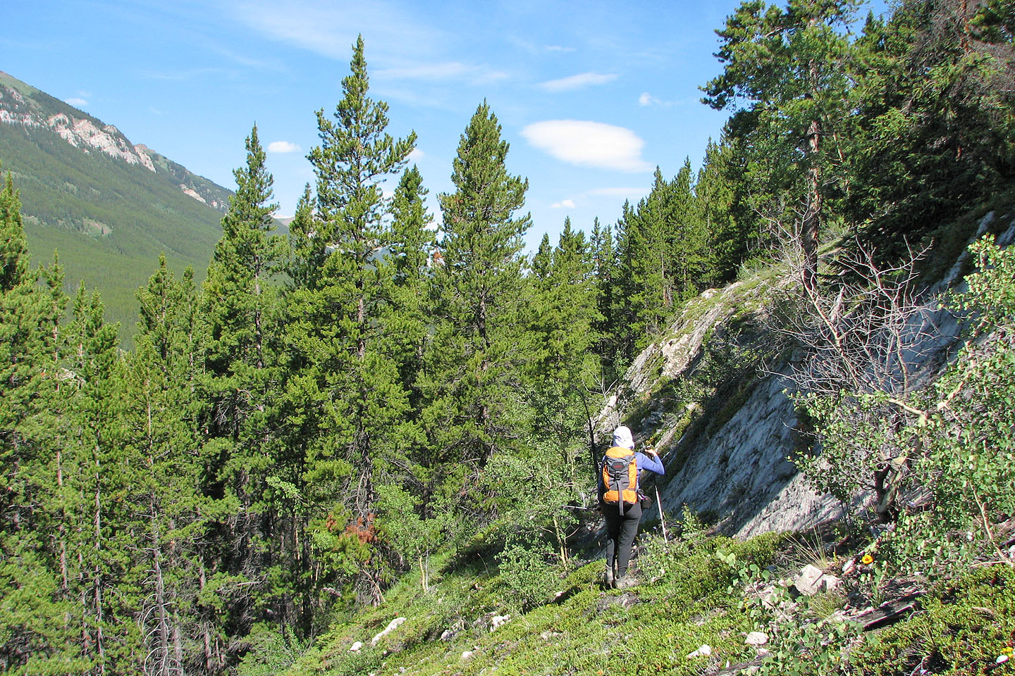
Hiking up the trail
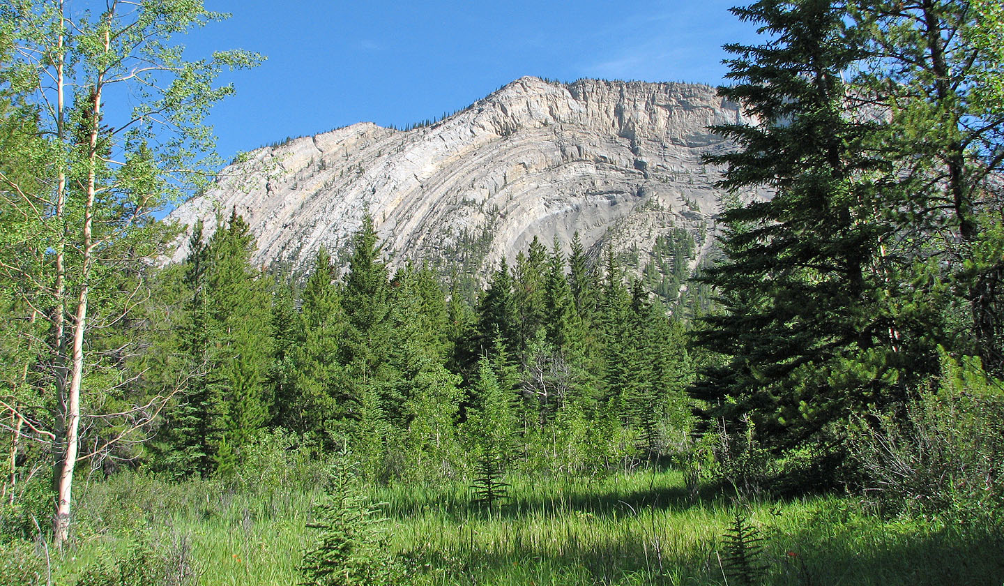
Southeast face of Coral Ridge seen from the trail
The trail follows Coral Creek gorge for a short way
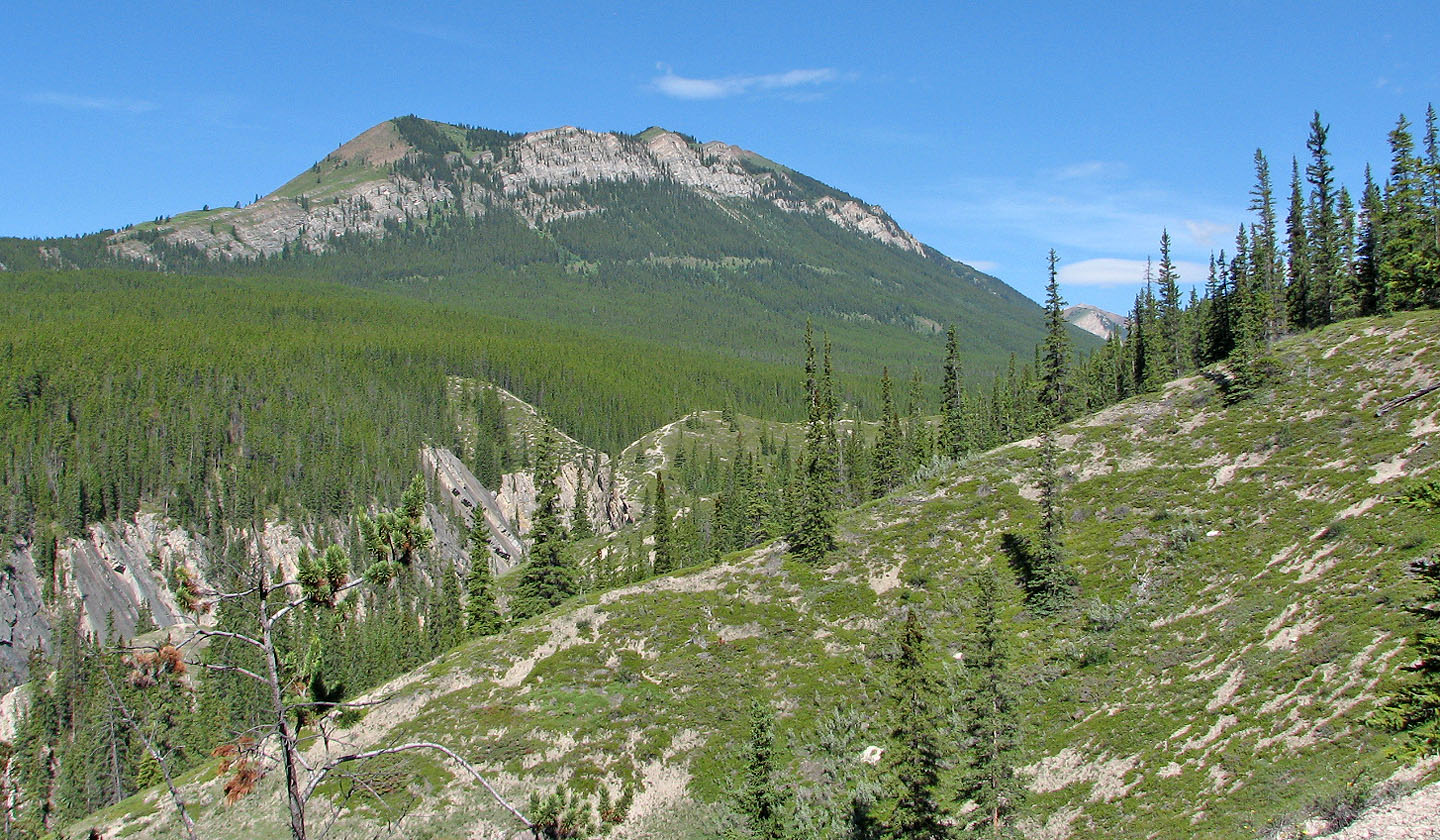
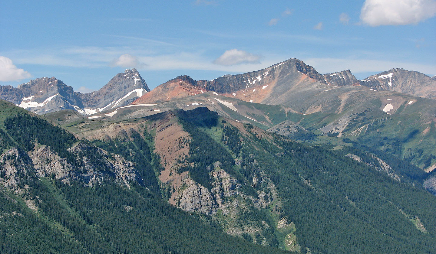
Unnamed mountain to the west
This was the first ledge we encountered after leaving the trail
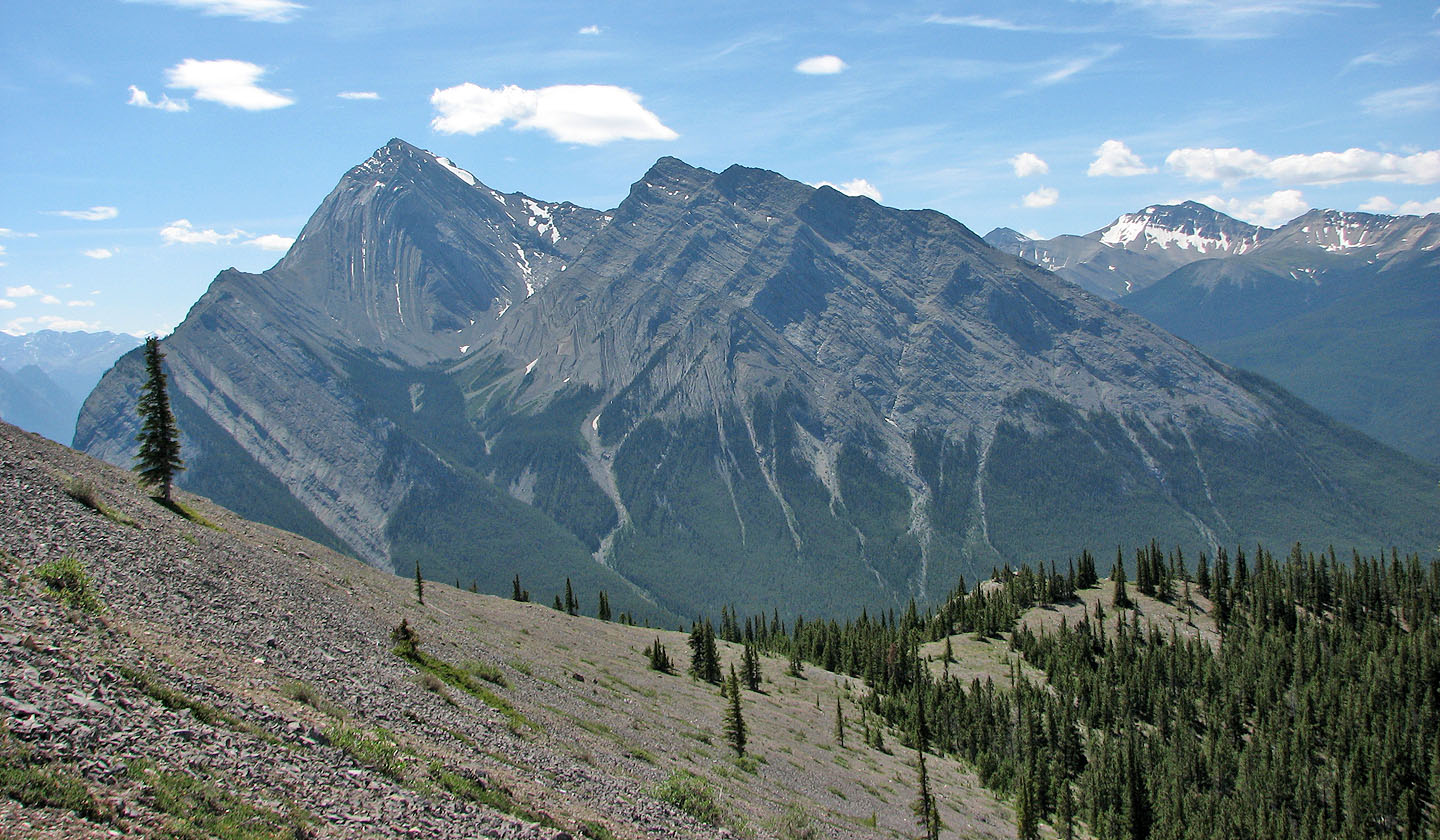
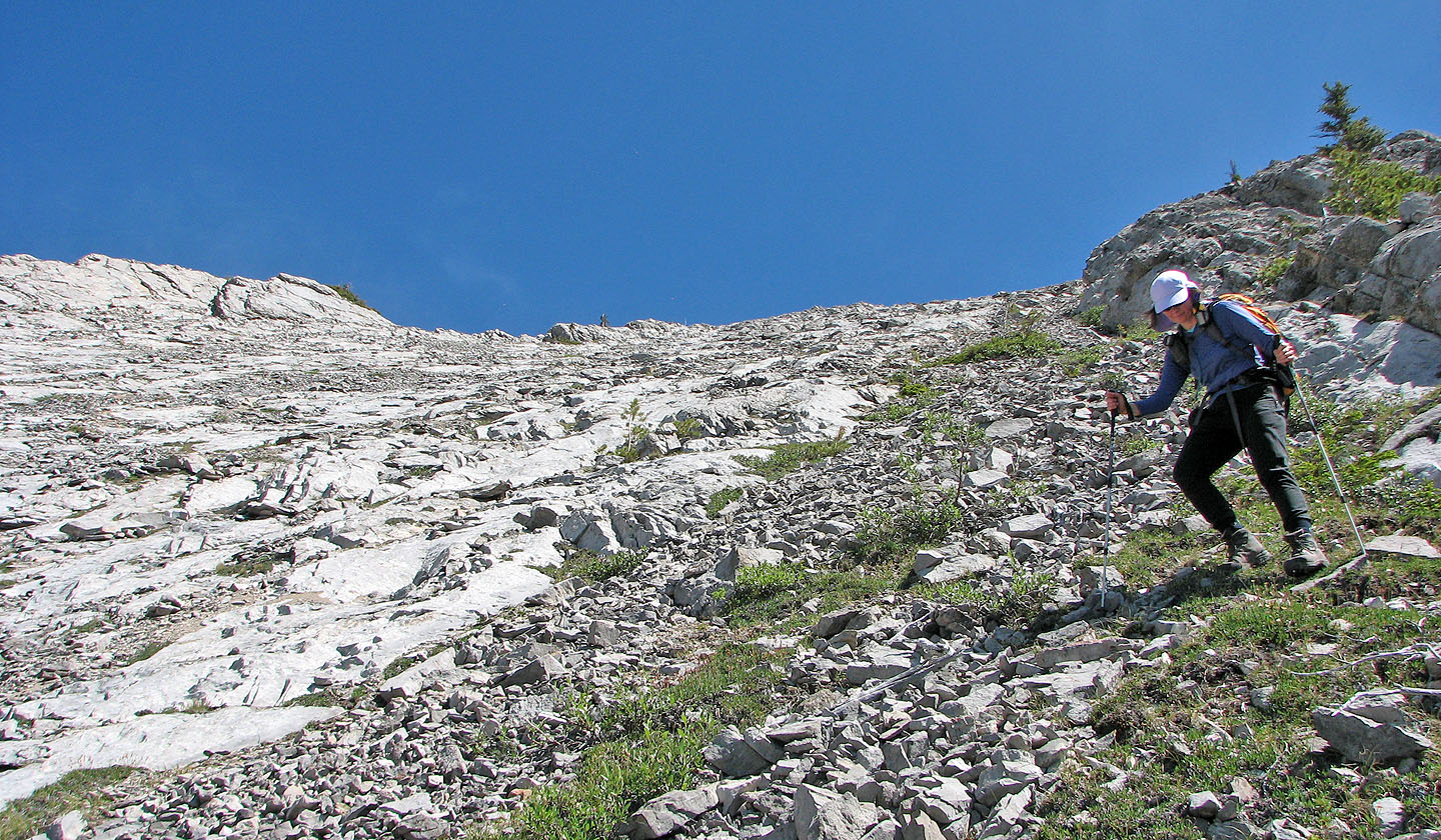
Ascending the scree slope to the ridge. Elliot Peak and Sentinel Mountain in the background.
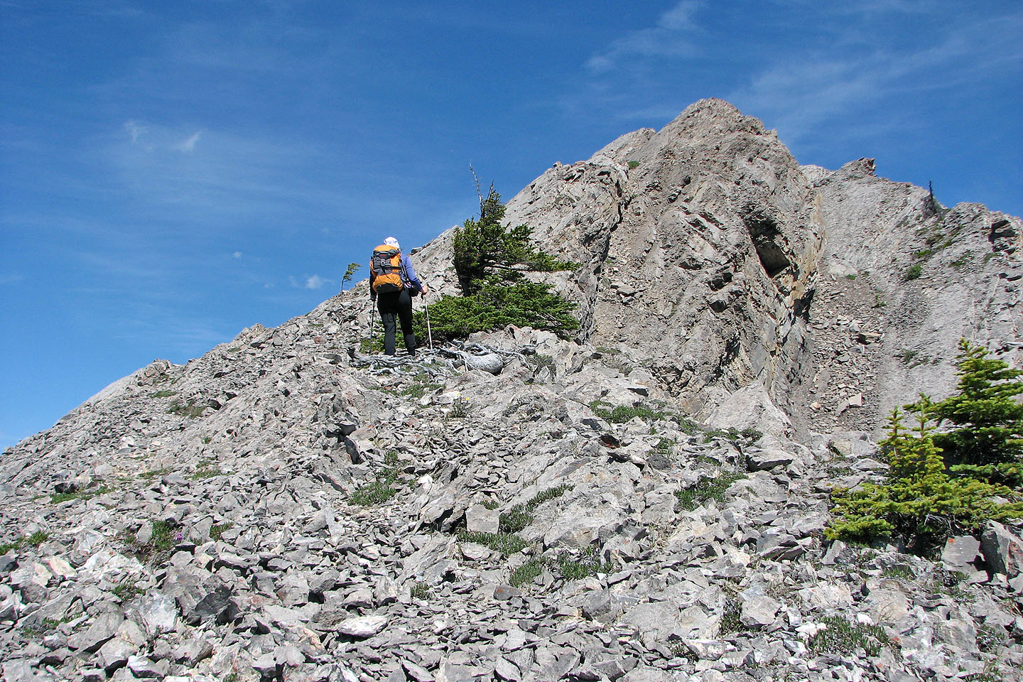
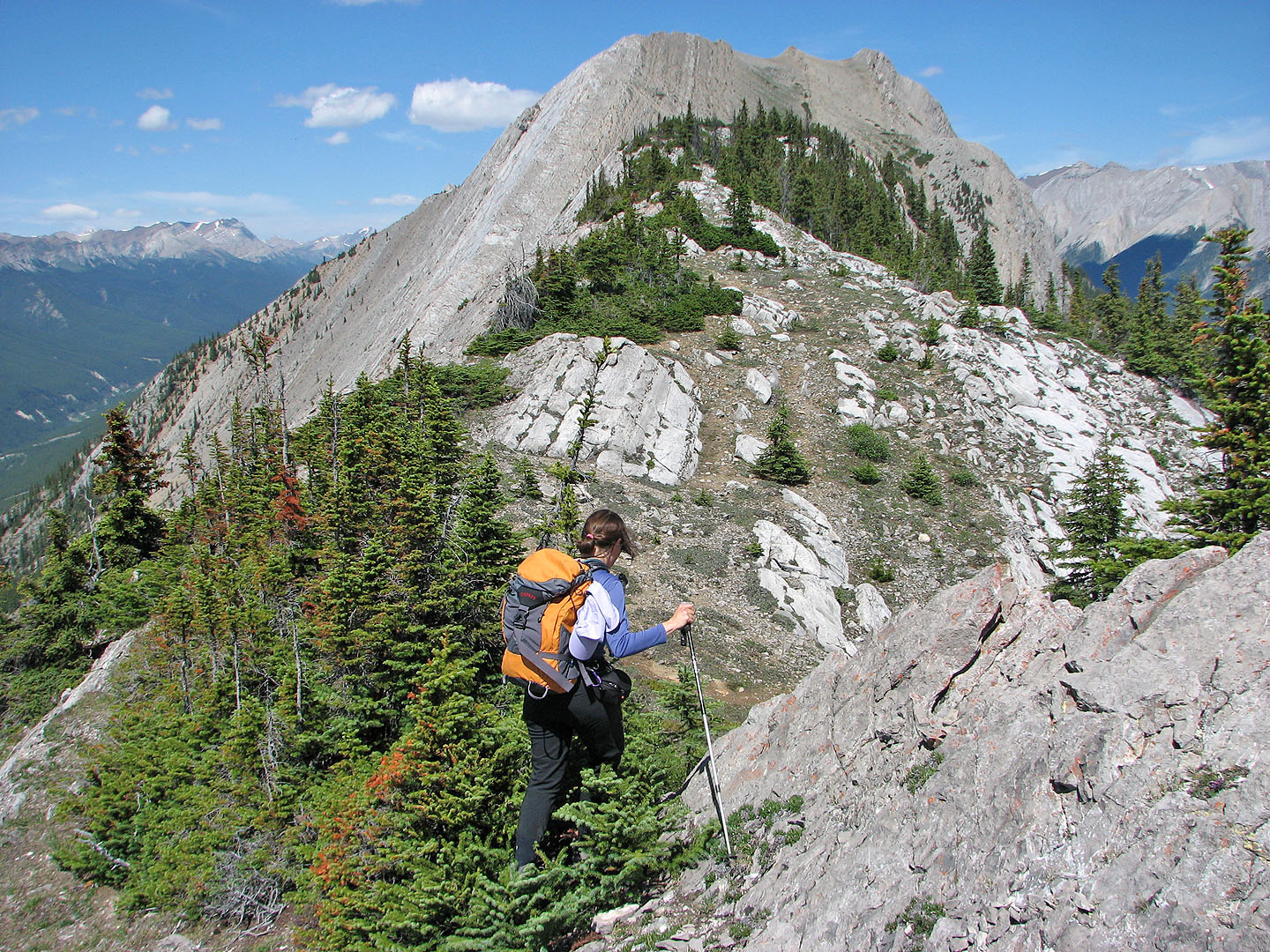
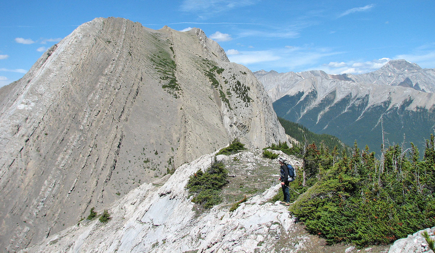
Ascending the ridge
Looking southeast from the south end of the ridge
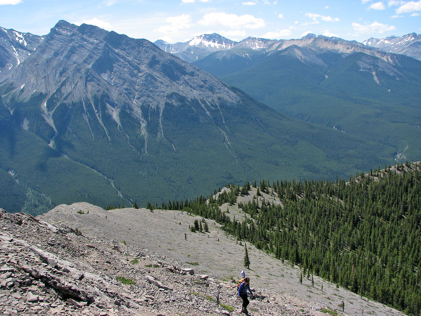
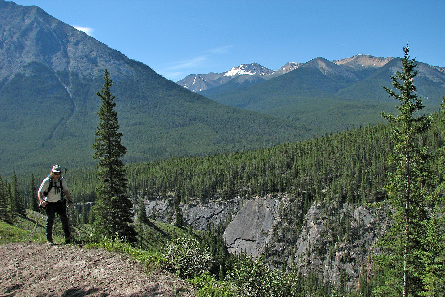
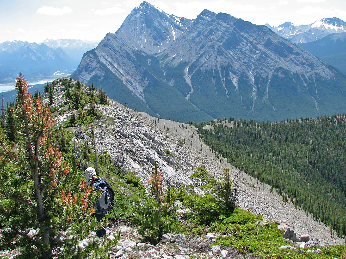
The ridge behind us might offer a better ascent/descent route
View to the northwest
Heading to the summit
Looking back along the ridge
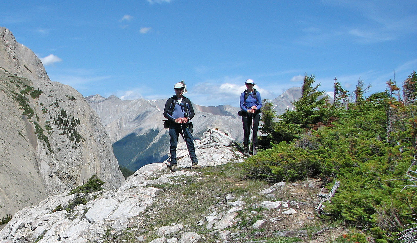
On the summit
South end of Stelfox fills the view north. Vision Quest on the right.
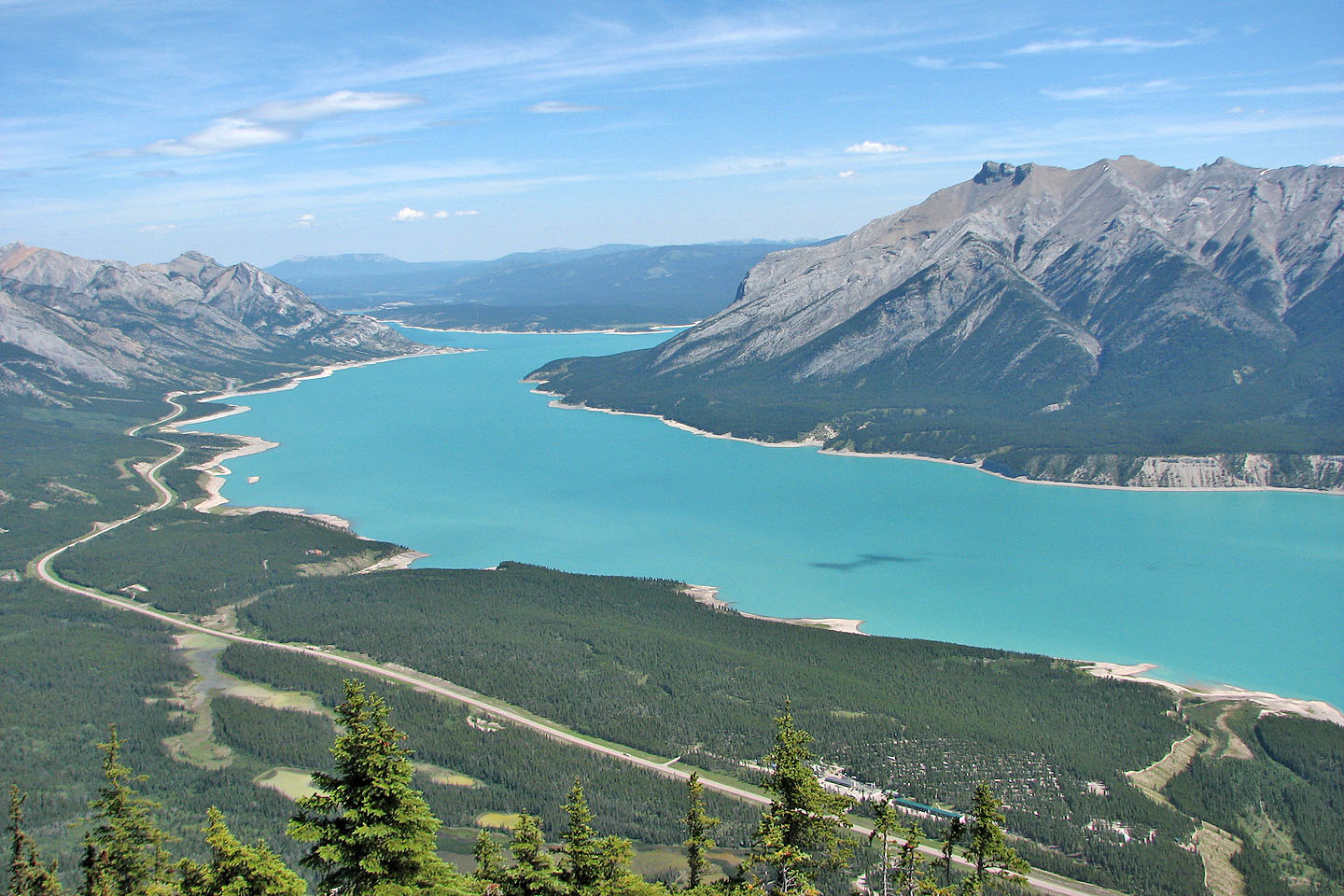
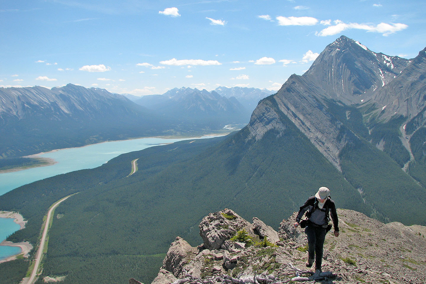
Looking across Abraham Lake at Mount Michener
Looking southeast at Mount William Booth
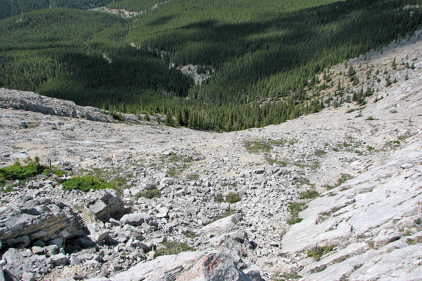
Looking down our descent slope
Heading down
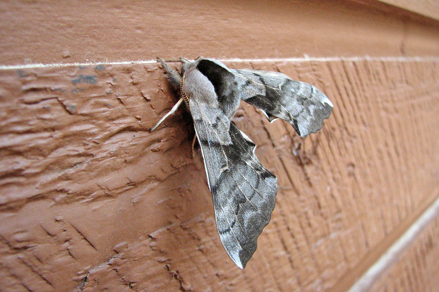
Hanging onto the wall outside our motel room we discovered this strange moth, Cerisy's Sphinx,
nearly three inches across
83 C/2 Cline River, 83 C/1 White Rabbit