bobspirko.ca | Home | Canada Trips | US Trips | Hiking | Snowshoeing | MAP | About
Yarrow Ridge
Castle Provincial Park, Alberta
October 16, 2010
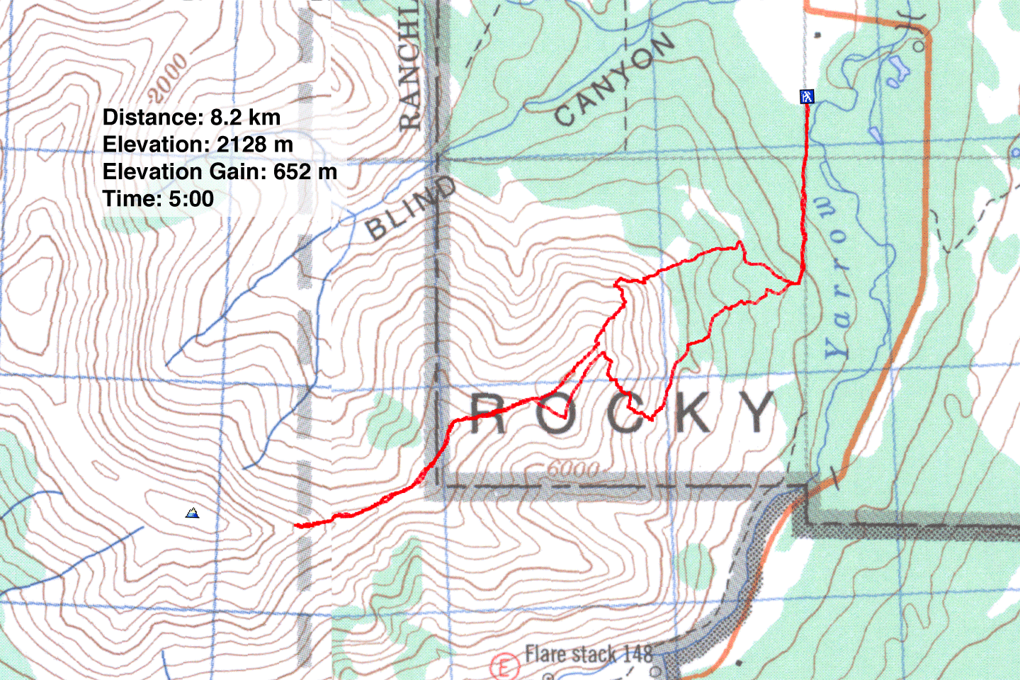
Distance: 8.2 km (5.1 mi)
Cumulative Elevation Gain: 720 m (2632 ft)
We set out to climb Mount Yarrow but when our plans went awry, we resigned ourselves to doing its east ridge, what I call “Yarrow Ridge.” We expected this ridge to be uninspiring, but we were met with a few pleasant surprises.
We considered Yarrow Ridge only after we realized we couldn't reach the southwest slopes of Mount Yarrow. First, a gate on the access road stopped us from driving to the start point. We had anticipated this and were prepared to walk up the road to the trailhead. But we couldn't do that because of a “No Trespassing” sign. So we changed our objective to Yarrow Ridge.
We parked at the end of a gravel road, as close to Mount Yarrow as we could. From there we could hike down a cutline before leaving it to ascend the northeast slopes of the ridge.
We hadn't gone far along the cutline when we noticed a cougar only 50 m away, crossing in front of us. It pattered by so fluidly it seemed to glide. The big cat glanced at us and disappeared into the bushes before I could reach for my camera. After getting over our excitement – this was our first time seeing a cougar on foot – we moved on.
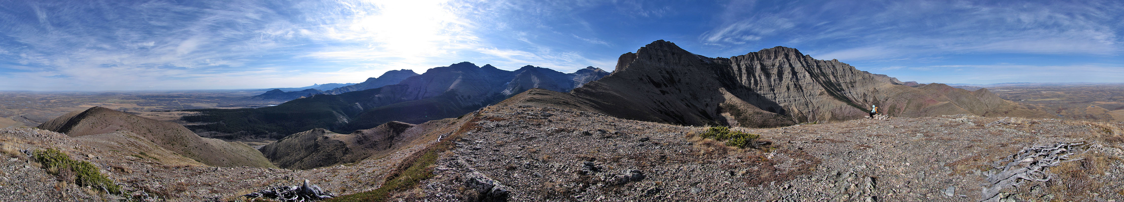
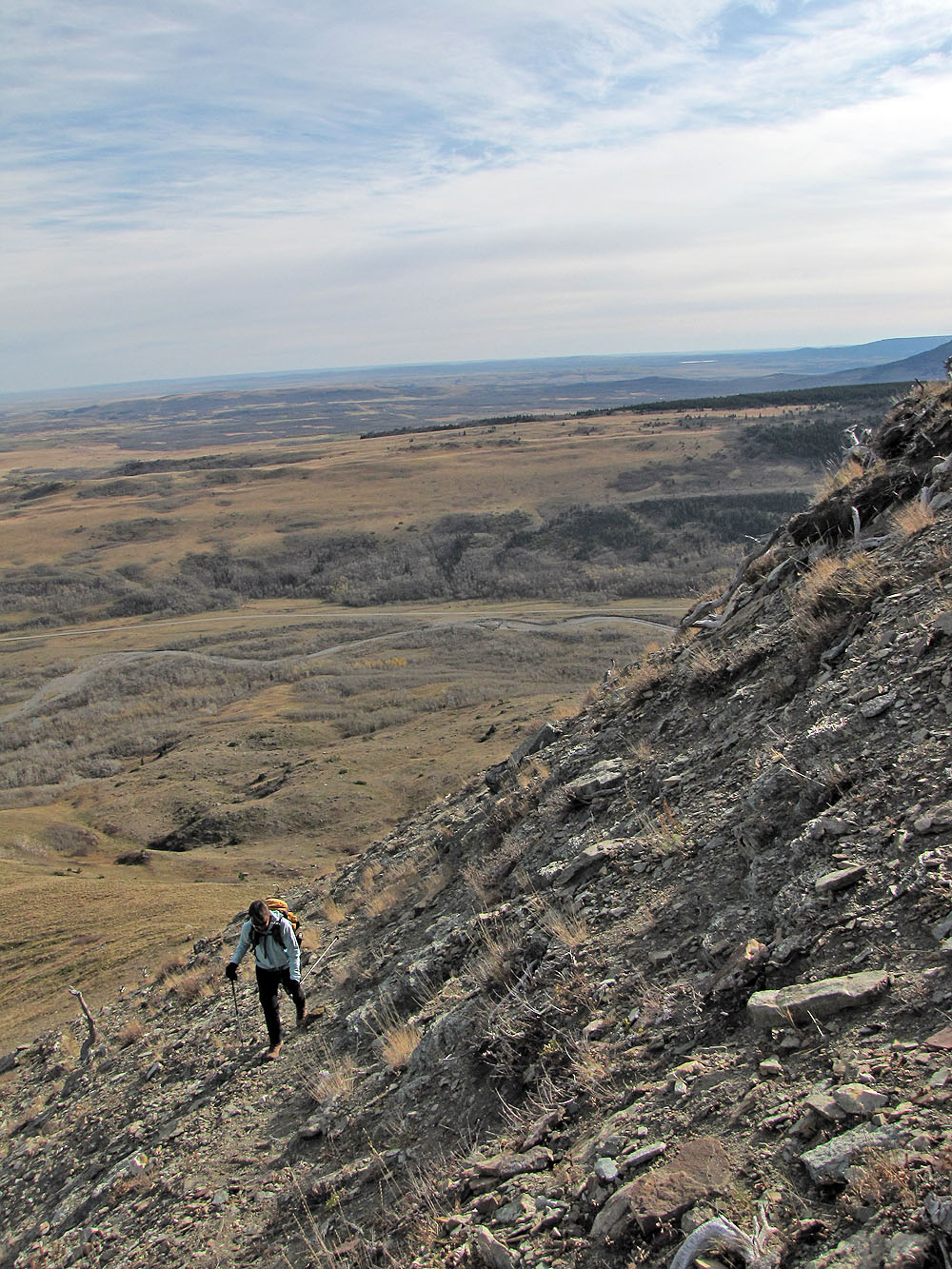
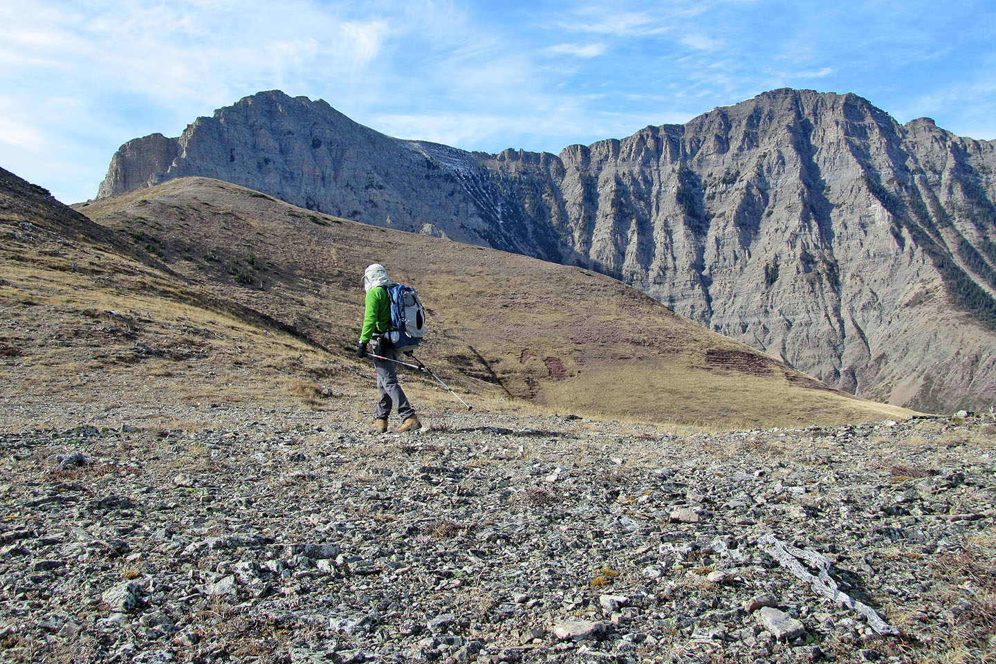
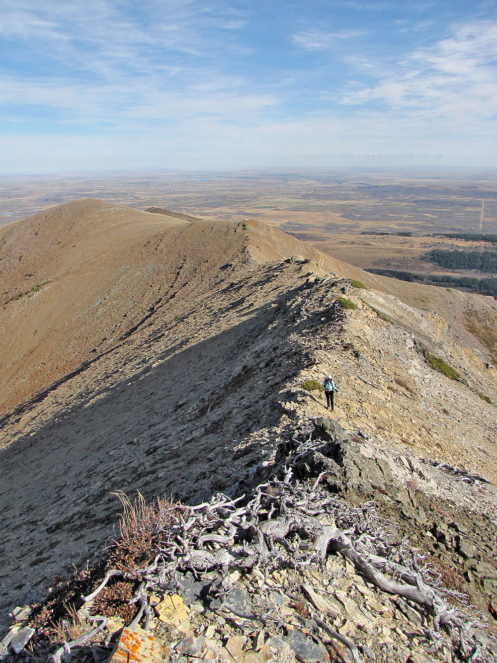
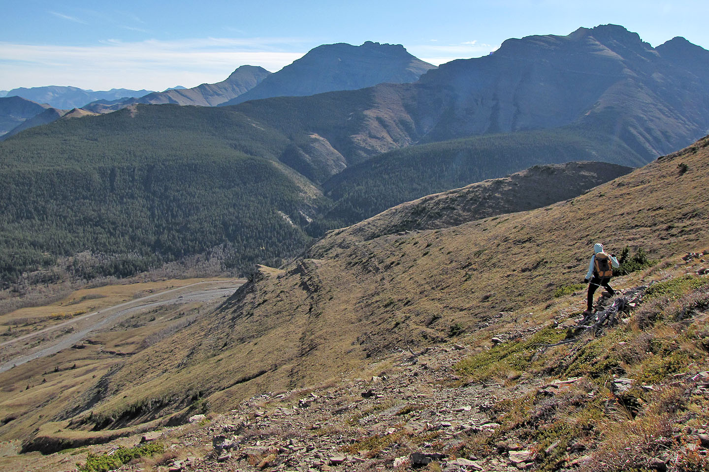
We continued up the cutline until we found a break in the trees on our right. A meadow led to the base of the ridge. As we drew near, the ridge appeared more interesting and challenging than I expected. The grade steepened, forcing us right where we found kinder slopes. Then we reached the ridge crest.
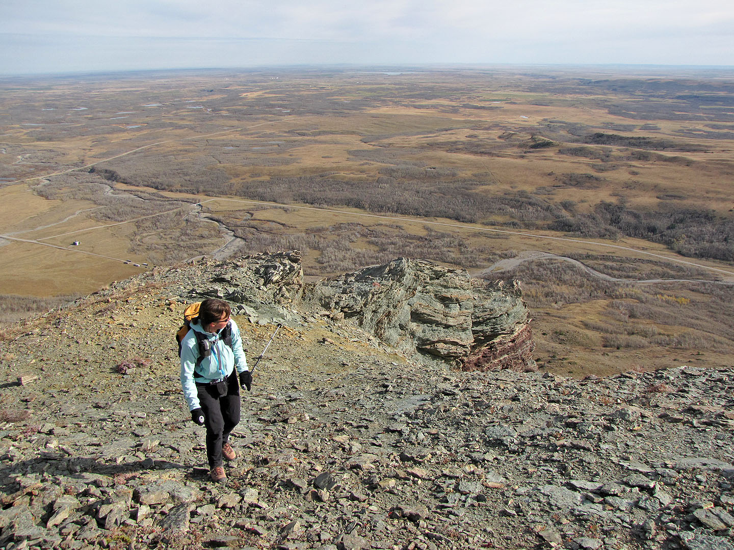
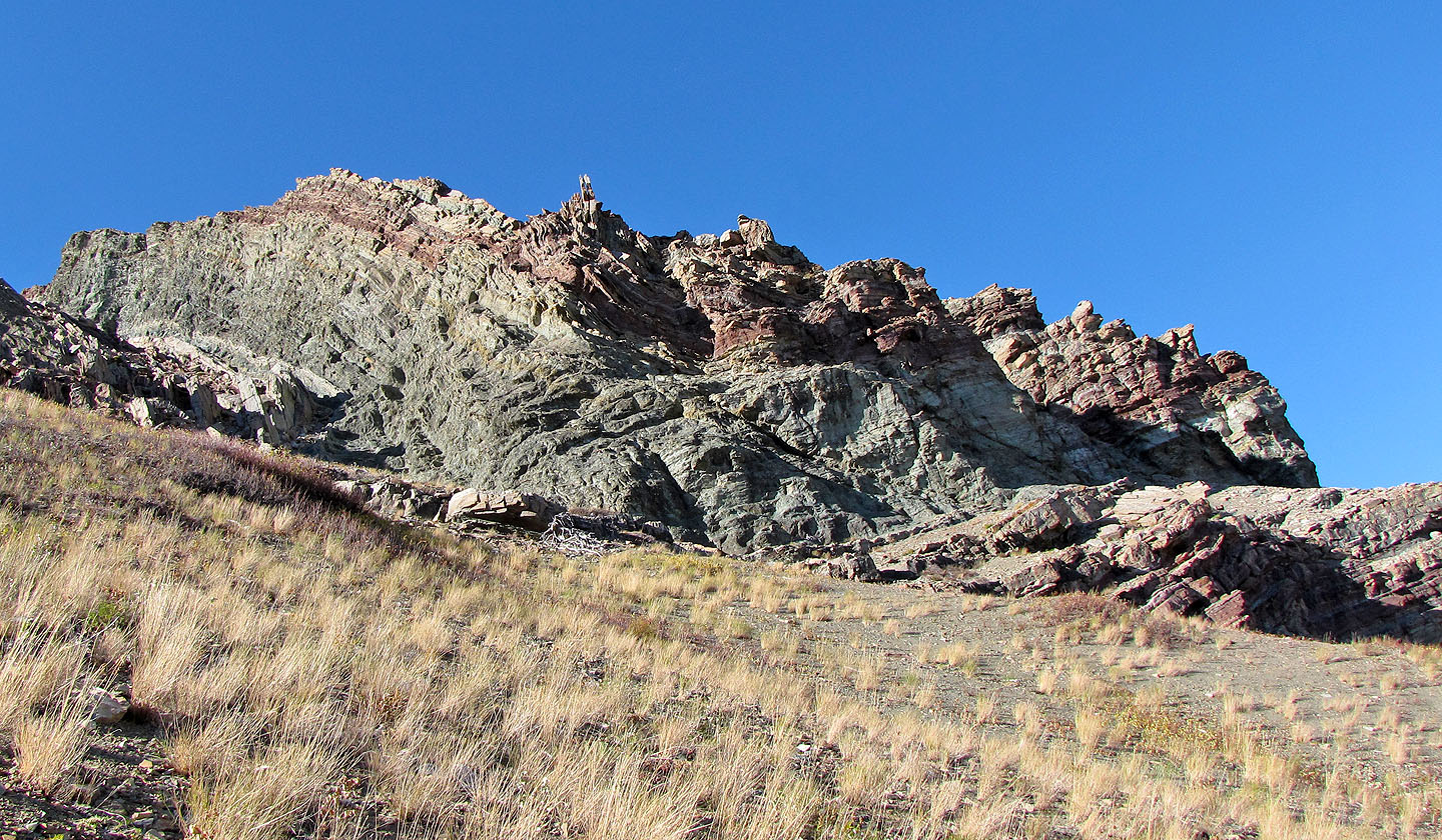
Now following the edge of a cliff, we saw spectacular rock in various textures and colours. We were dazzled all the way to the false summit. After that, the ridge comprised of hills. Watching us from the first hill was a buck with an impressive rack. We saw two more deer when we reached the highest point along the grassy portion of the ridge. Perhaps the deer hoped to find sanctuary on the ridge, for from the valley below, we could hear the gunshots of hunters.
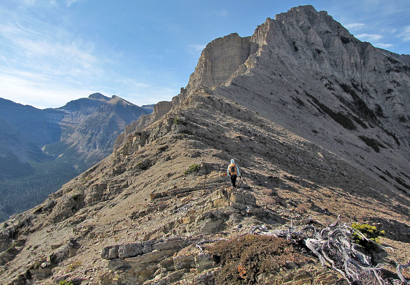
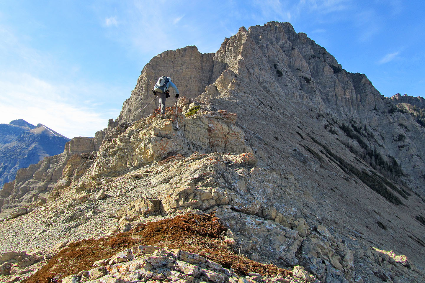
It took us less than two hours to reach the high point. It was too early to turn back, so we continued along the ridge, although cliffs below Yarrow prevented us from getting far.
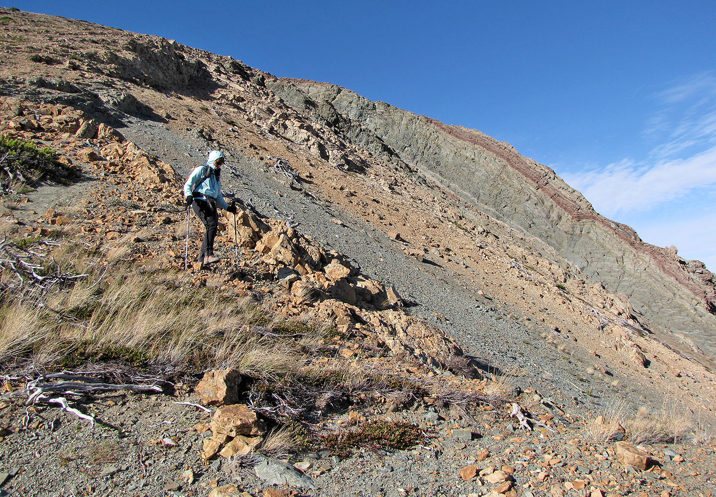
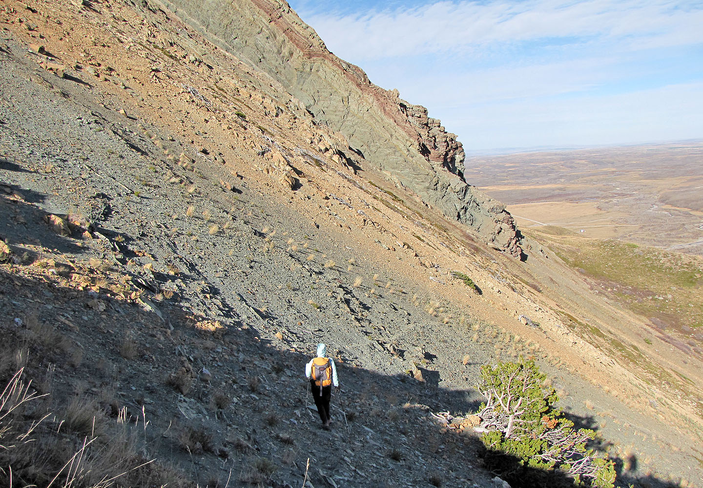
We turned around and followed the ridge back for a way. We had come up the north side but decided to descend the south side to view more spectacular rock. As we followed the ridge back, we searched for a feasible descent. Eventually we found a slope to go down, and we passed under fascinating geological folds before returning to the cutline.
When we got back to our car, a hunter came up to us. Despite our reservations about hunting, we quickly warmed to him. He was unaffected and amiable; he even offered us a beer. He and his friends had been hunting in the valley without success, a fact that didn't disturbed him. He was happy to just get some exercise. He said he was surprised to see two people high on the ridgeline below Mount Yarrow. Those two people, of course, were us.
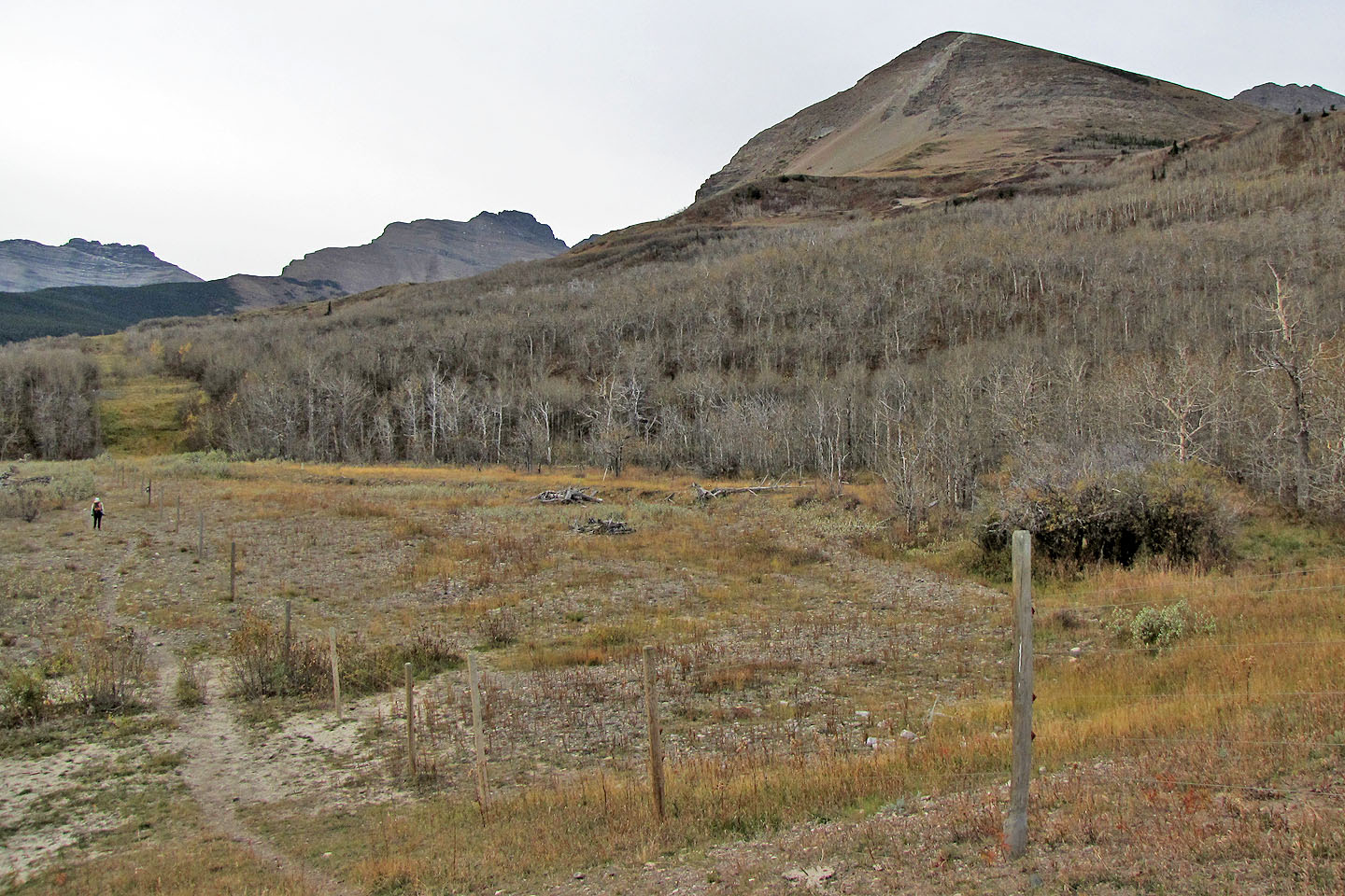
View of the ridge from our starting point
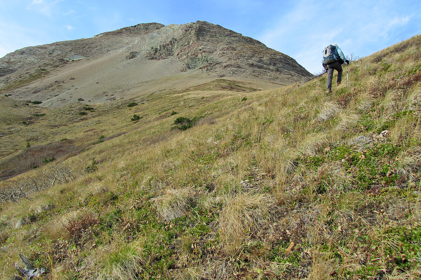
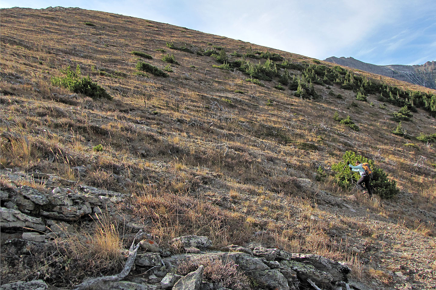
Ascending the grassy slopes
An easy grade until we hit the rocks (mouse over to look back)
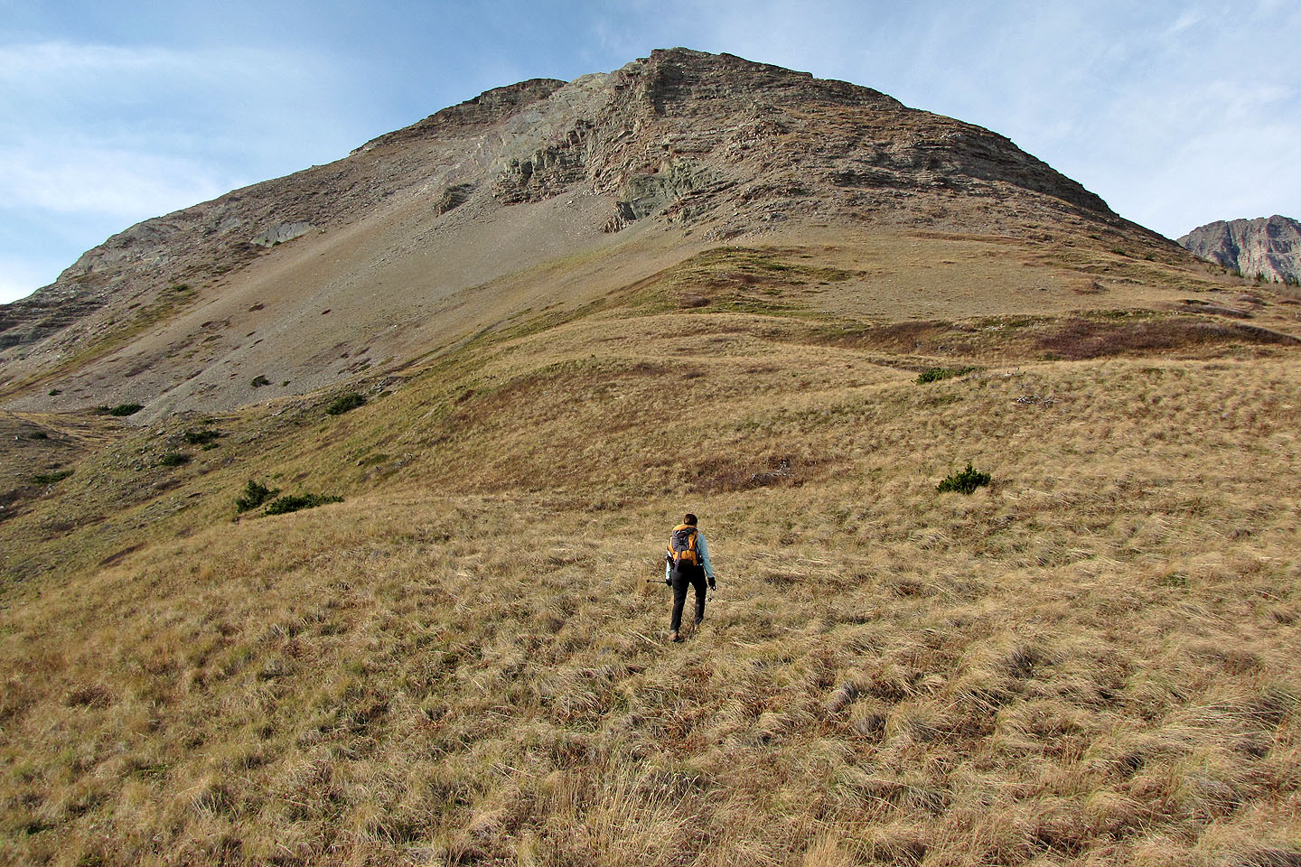
Following an animal track up the slope
Gentle slopes on the north side
On the ridge
From here to the false summit we saw lots of colourful rock
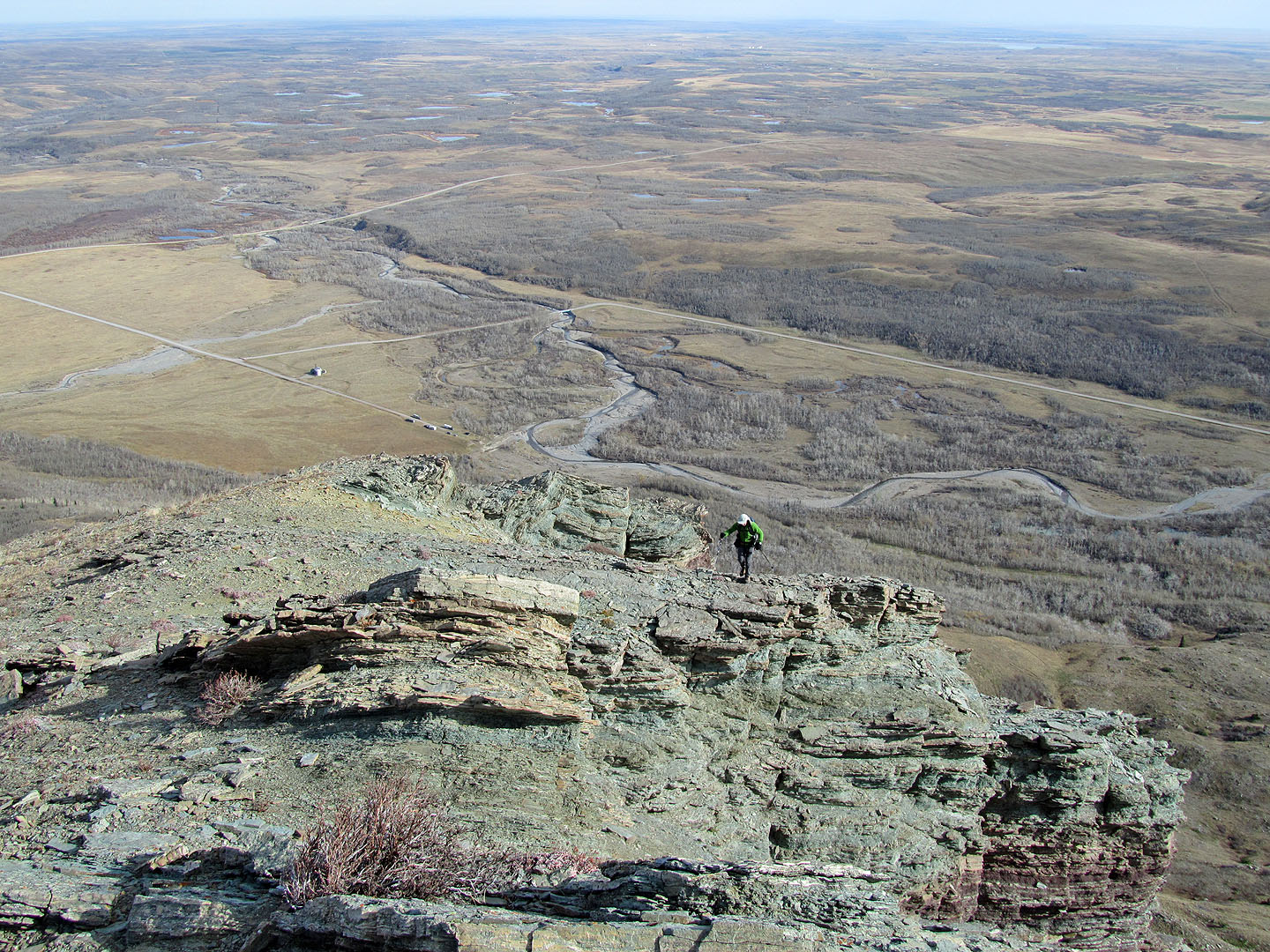
Far-ranging views to the east
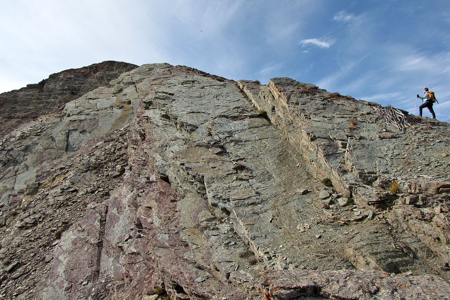
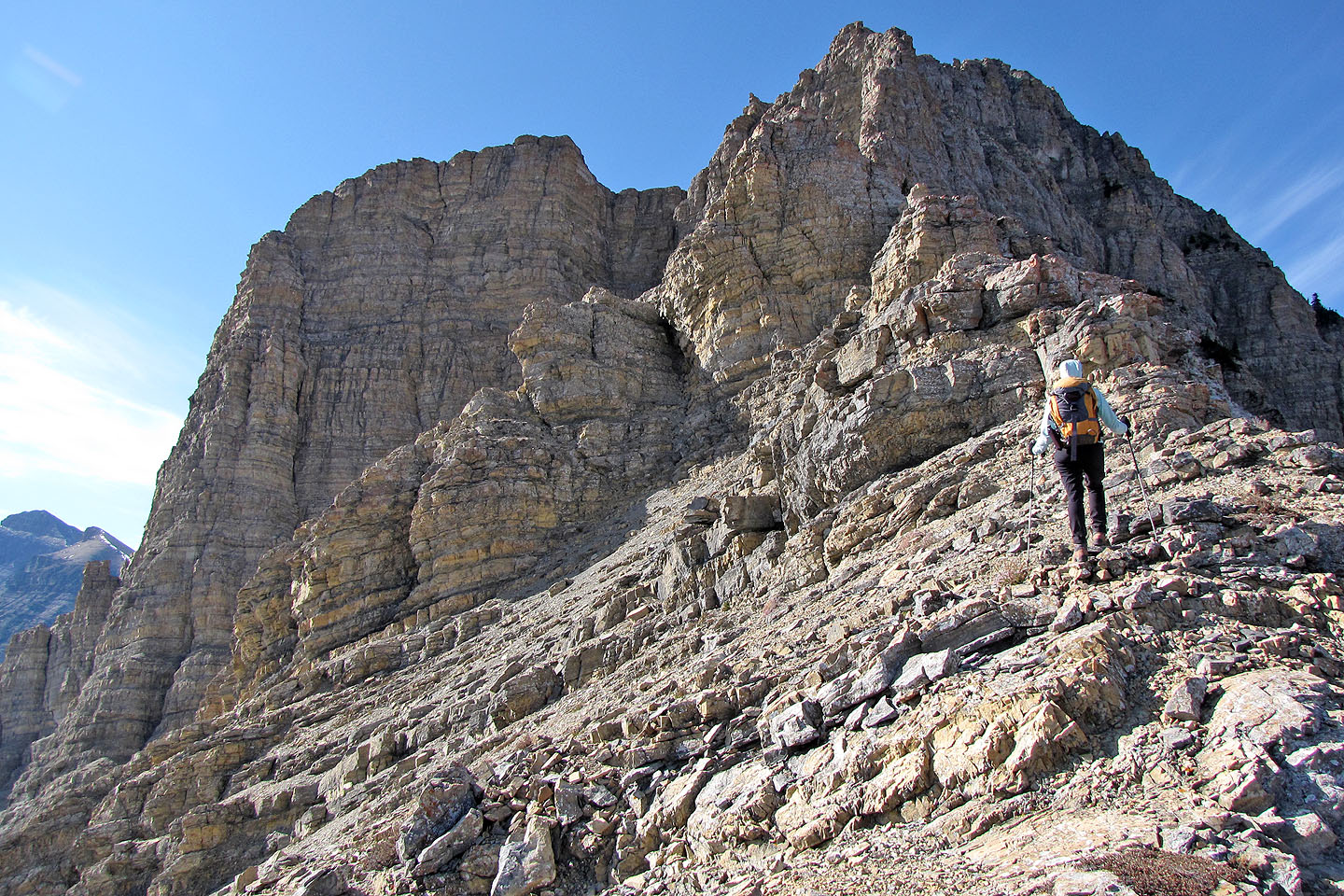
Impressive rock face
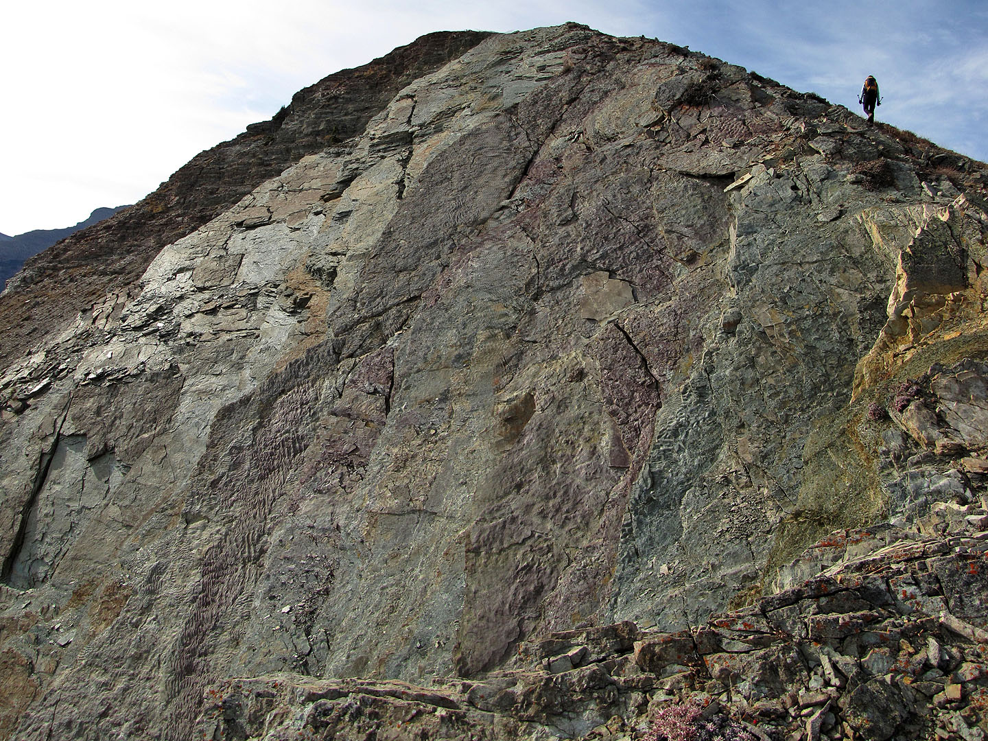
Another impressive face
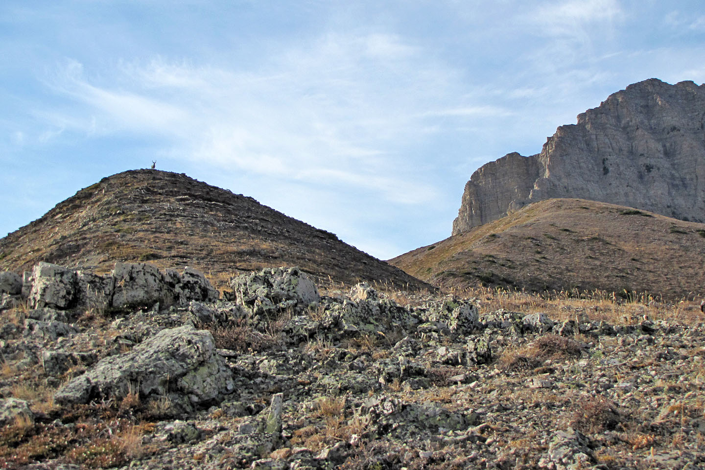
Under the gaze of a buck (mouse over) we headed to the grassy high point on the right
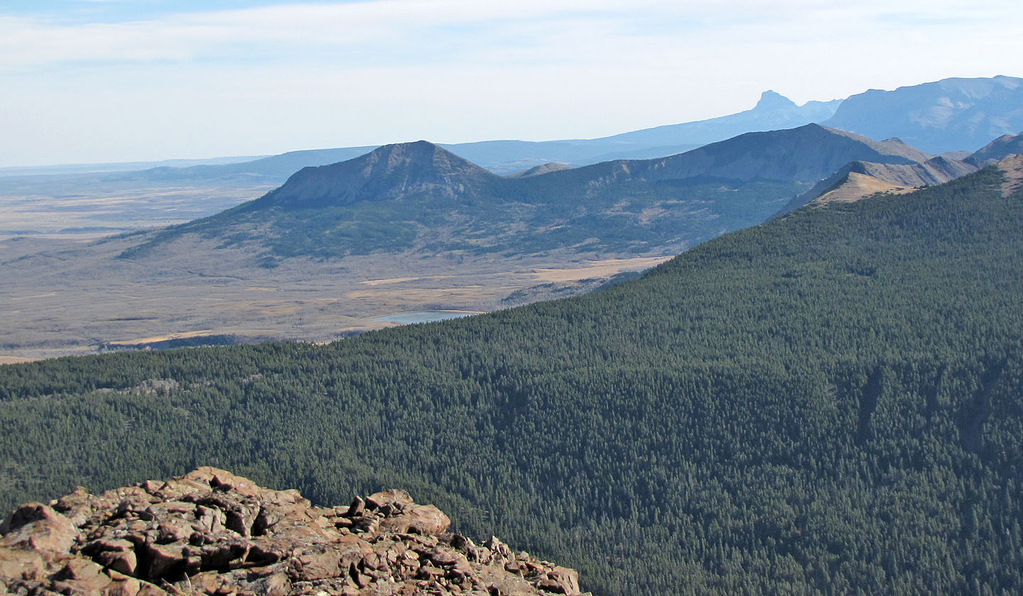
Mount Yarrow and Spread Eagle Mountain
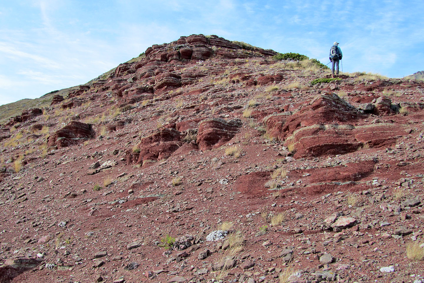
More colourful rock
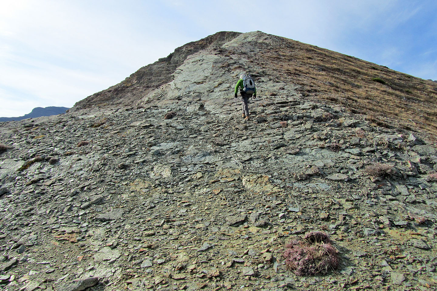
We continued along the ridge
Continuing up the ridge
Looking back
We'll soon turn back
We turned back here
Dropping down the south slopes
Looking back
We followed a path a scree slope
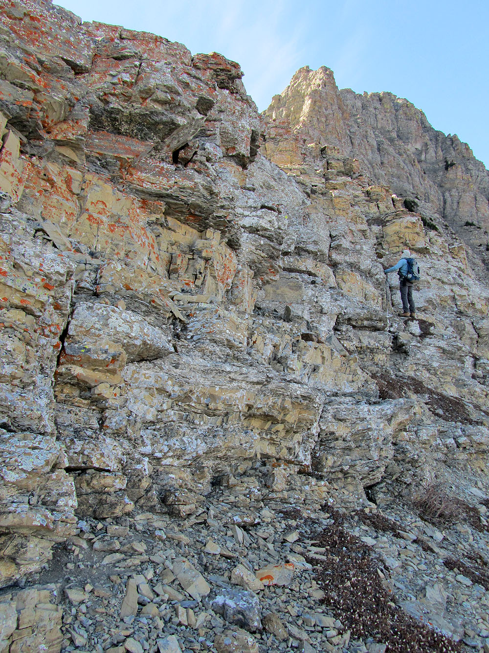
Looking up at the jagged cliffs we hiked under
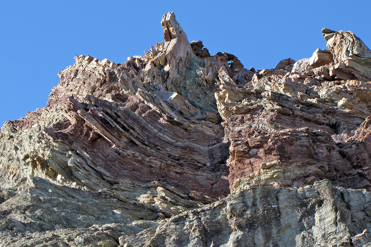
Gnarly rock above us (mouse over to zoom back)
82 G/1 Sage Creek, 82 H/4 Waterton Lakes