bobspirko.ca | Home | Canada Trips | US Trips | Hiking | Snowshoeing | MAP | About
Mount McCarty
Castle Provincial Park, Alberta
July 19, 2014
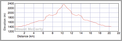
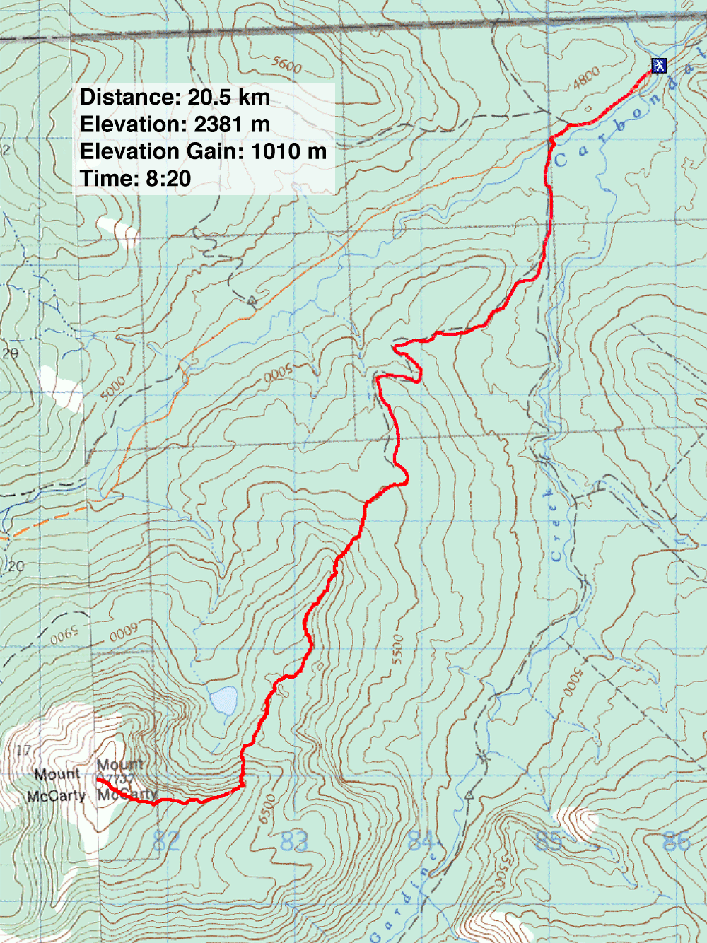
Distance: 20.5 km (12.7 mi)
Cumulative Elevation Gain: 1222 m (4009 ft)
Until we were stopped by a closed bridge several kilometres from the trailhead, Mount McCarty looked like a promising destination. I had eyed the peak from Castle Wilderness a few times, so when Dave McMurray invited me to climb it with him and his nephew Jeff Lang, I accepted. Like me, Dave has a penchant for obscure peaks on no one's bucket list.
We had planned to drive up Carbondale River Road to a side road north of McCarty. Then after walking to the end of the side road, we would make our way through forest to the unnamed lake east of the peak. From the lake, we needed only to head south to gain the east ridge that curls north to meet the summit.
But the flood in 2013 swept away the foundations of a bridge on Carbondale River Road along with any hope of driving to our trailhead. The upper structure of the bridge appeared intact, but a barrier prevented anyone from driving across.
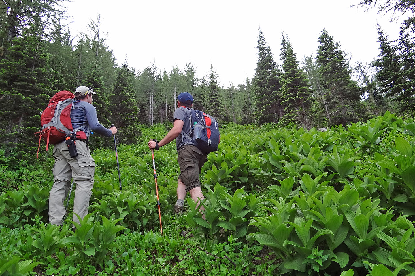
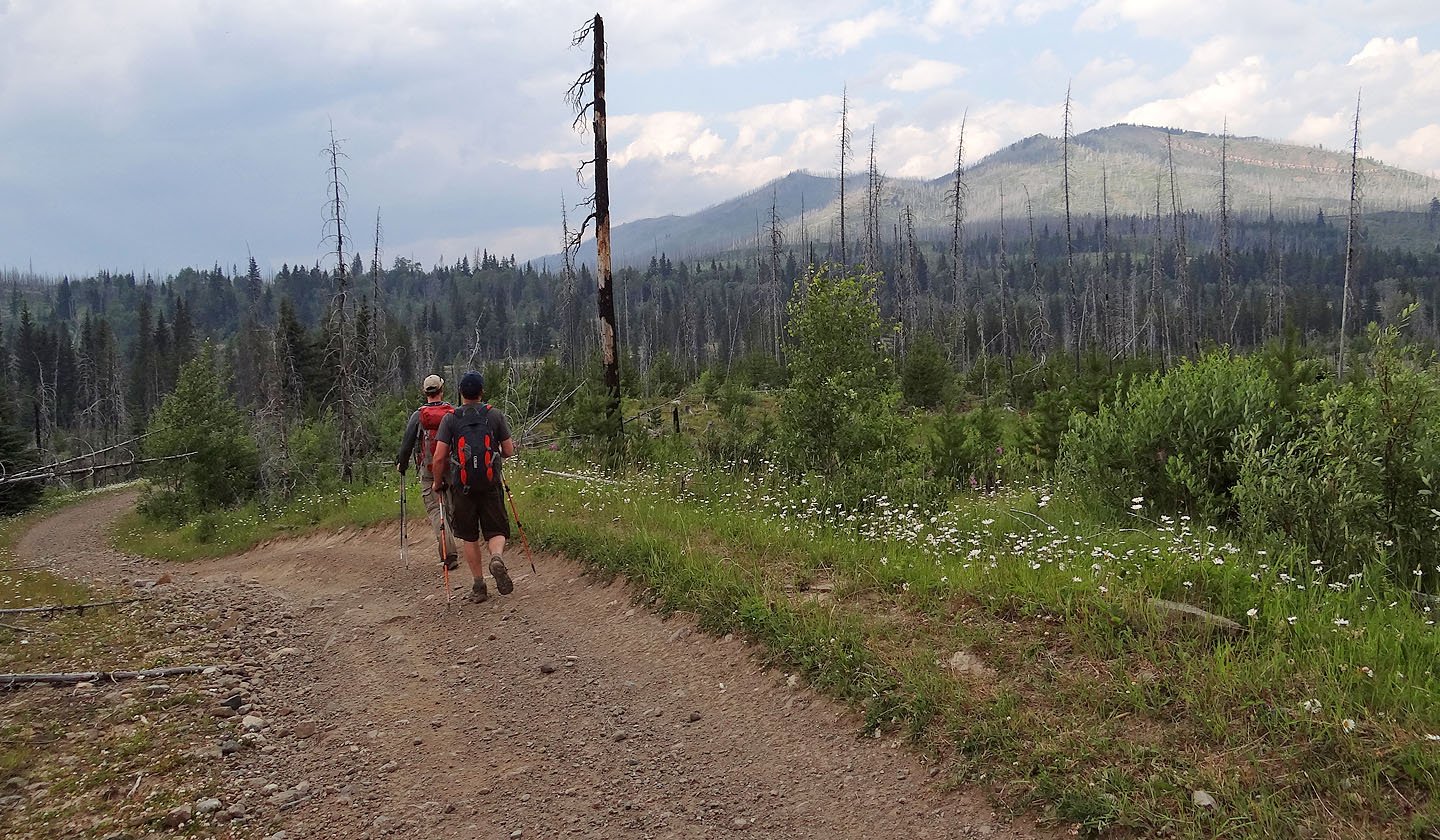
But we had a fallback for McCarty. We parked by the bridge and continued on foot a kilometre up Carbondale River Road to a side road. After hiking a kilometre up this road we kept right at a fork. This road put us squarely on the end of the east ridge, the same ridge we had intended to reach from the lake, albeit much closer to the summit. The road was especially enjoyable. Profuse daisy fleabane later gave way to lush towering plants that arched over the tracks.
The road ended in a small glade (828740). In the far corner, we picked up a good trail, but it stopped suddenly after only 300 m. Then hiking, as we knew it, was over. For the next couple of klicks, we mostly bushwhacked through dense bushes and trees, some of it gnarly. We had a reprieve when we climbed to an alpine meadow on a high point with a striking view of McCarty, but we made the mistake of continuing along the ridge. (As we learned on our descent, we should have descended the left slope where, after brief bushwhacking, we would have found a nice strip of meadow.)
After dropping down from the high point and fighting through trees and bushes to reach a clearing below the ridge (828740), we stopped for lunch. Afterwards, the pleasantries ended. We reclaimed the ridge only to encounter the worst bushwhacking of our trip. That was followed by a steep stretch, mercifully, up a glade.
The steep climb ended on a sparsely treed ridge arcing to the top of McCarty. We wended easily through the trees and made our way to the bald, expansive summit. Here we were slammed by strong west winds. I hadn't expected that or the enormous summit cairn. The cairn served as a windbreak, and we spent much of our summit time huddled behind it. There was no summit register, at least not on paper. Curiously, we found a rock with etched-in names and dates going back at least five decades. Jeff, however, brought Mount McCarty out of the stone age: he had packed paper and a PVC pipe container. We signed the new register and placed it in the cairn.
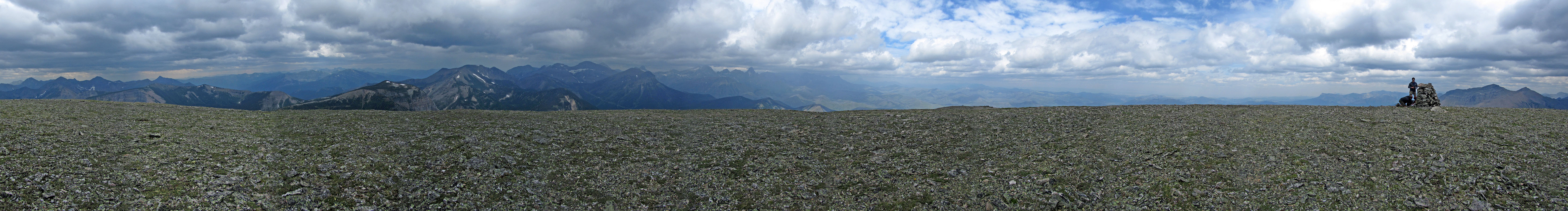
Summit views were disappointing. Smoke from B.C. wildfires made it difficult to see nearby peaks let alone distant mountains. It was just as well as it was too windy to stick around. We made our way down McCarty, grateful to get out of the wind.
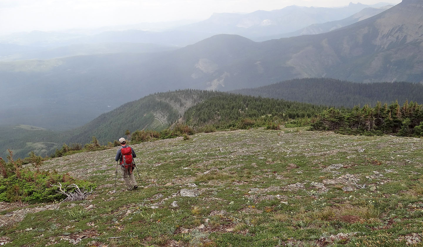
We retraced our steps back except to take advantage of the meadow below the high point. Soon after reaching the road, a side-by-side ATV came up behind us. The driver appeared worried about us as if he thought we were in danger. He even asked to see our bear spray. (Perhaps he couldn't fathom being in the middle of nowhere without the security of a vehicle.) He offered us a lift, but we declined. He was probably shaking his head as he drove away. But we were only an hour from our car, and we enjoyed the solitude, the scenery and the camaraderie that comes from having a good time on a tough mountain.
Postscript: The bridge reopened in the fall, so it's now possible to follow our original and shorter plan of driving up the road and climbing McCarty via the lake.
KML and GPX Tracks
Dave's Trip Report
At the closed bridge, Dave assessed the creek crossing but decided not to risk his SUV
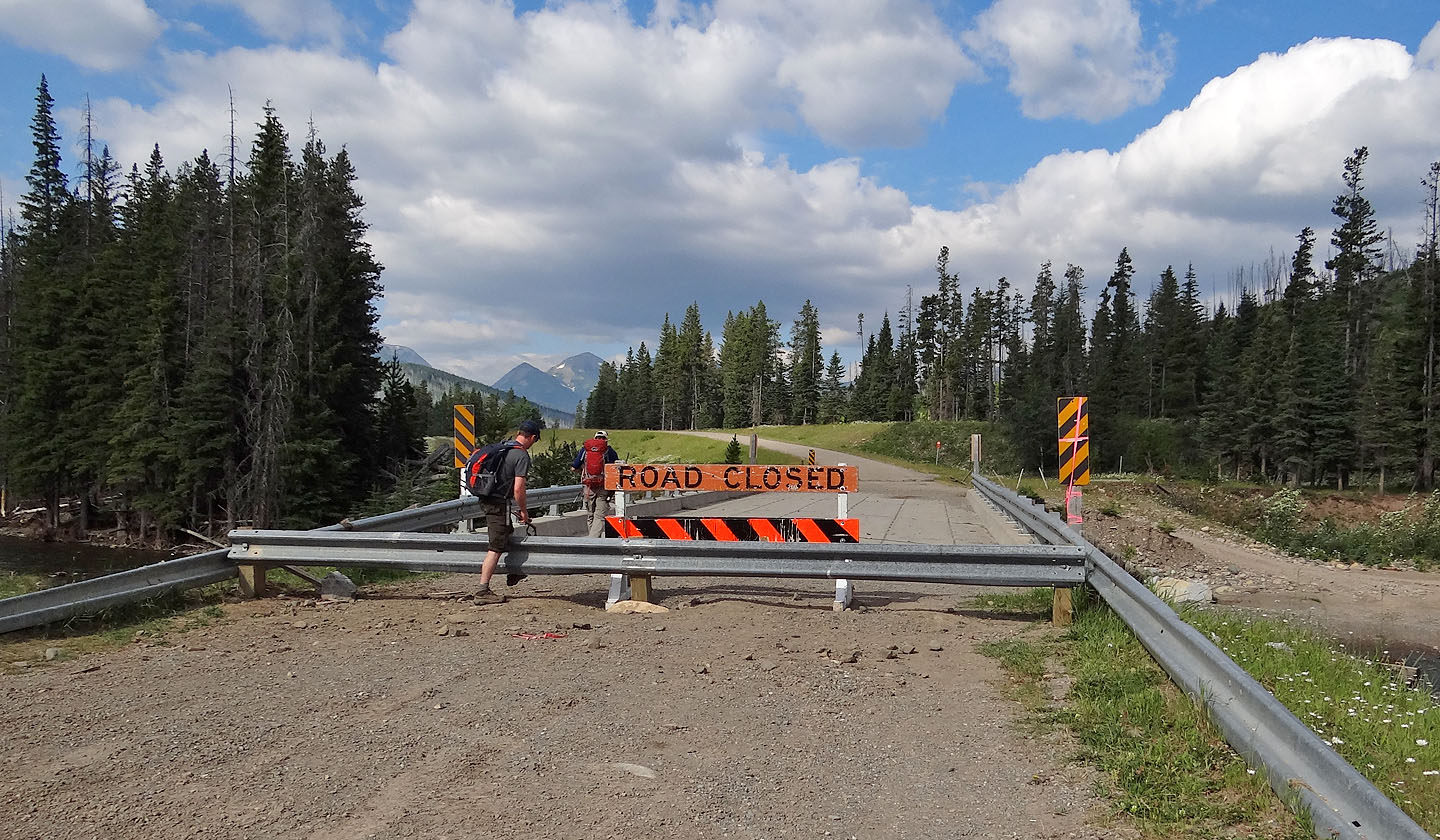
We crossed the bridge on foot
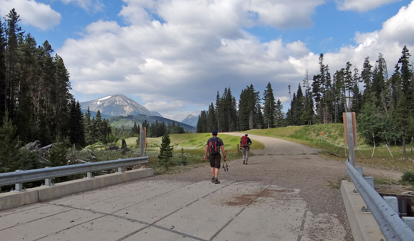
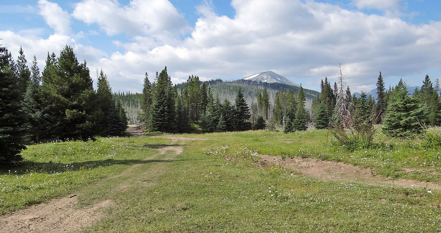
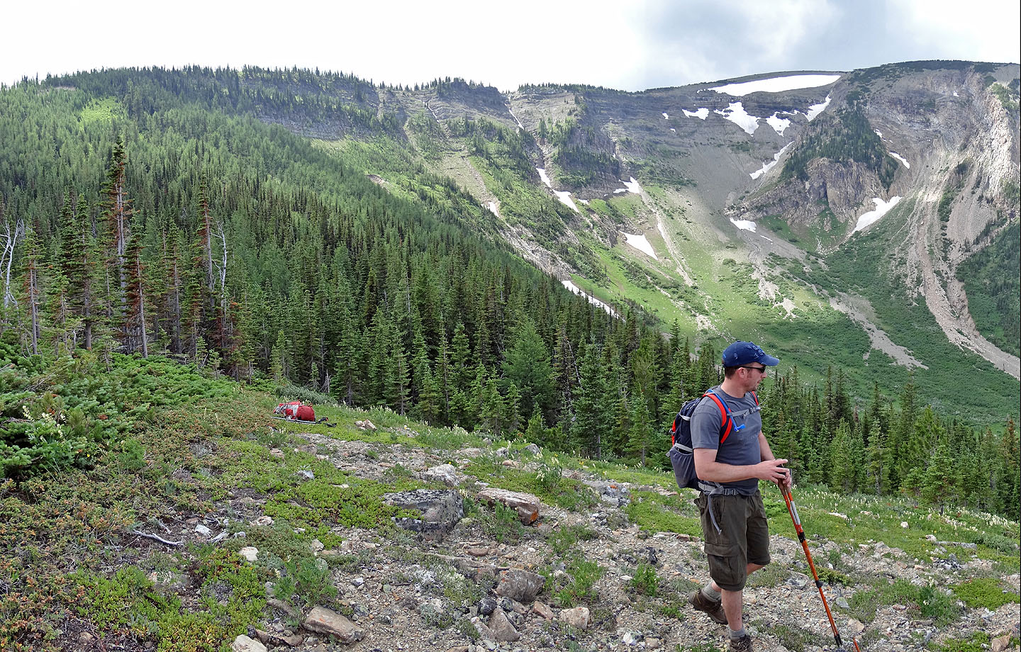
At the other end, Mount McCarty came into view
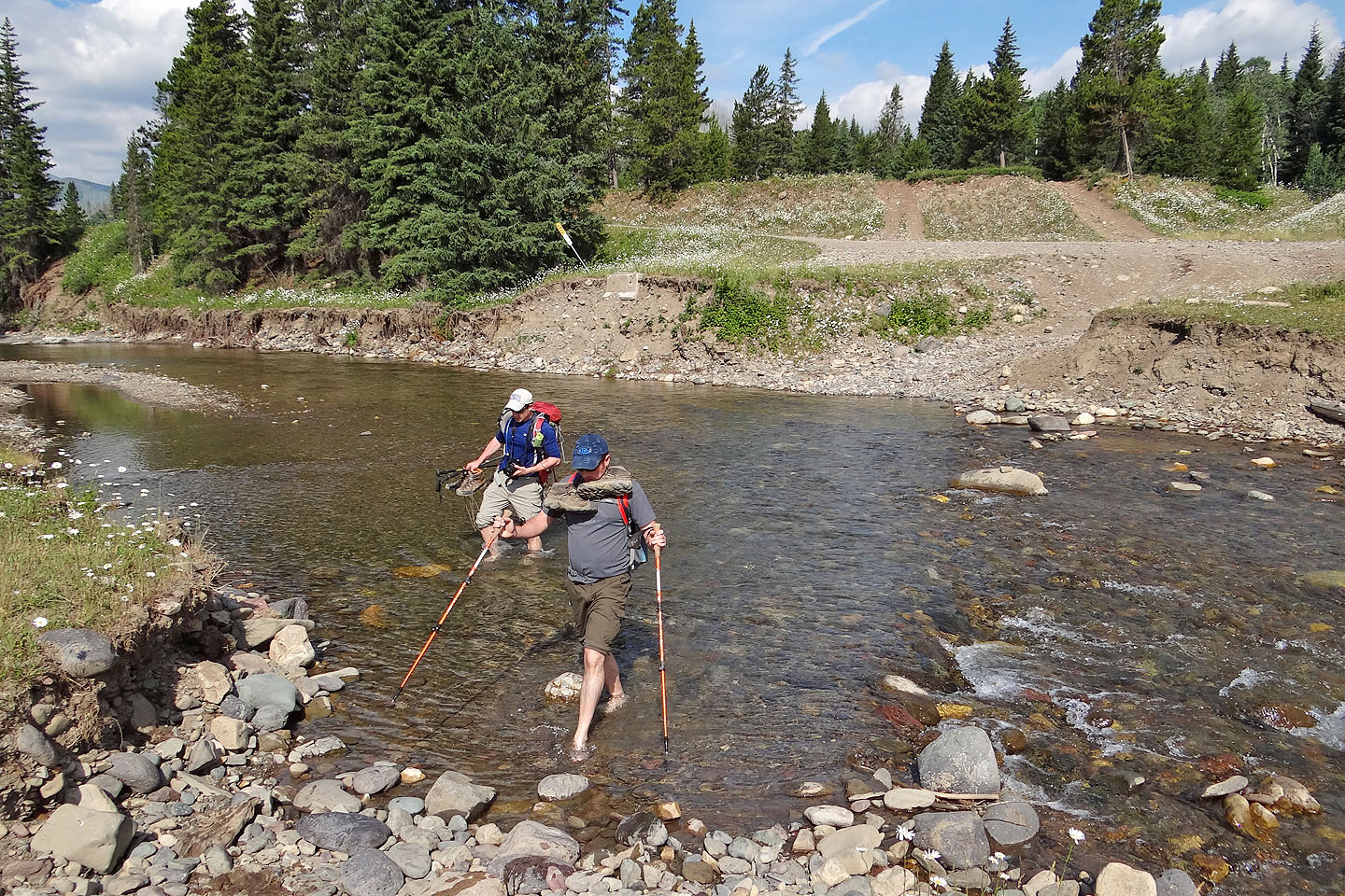
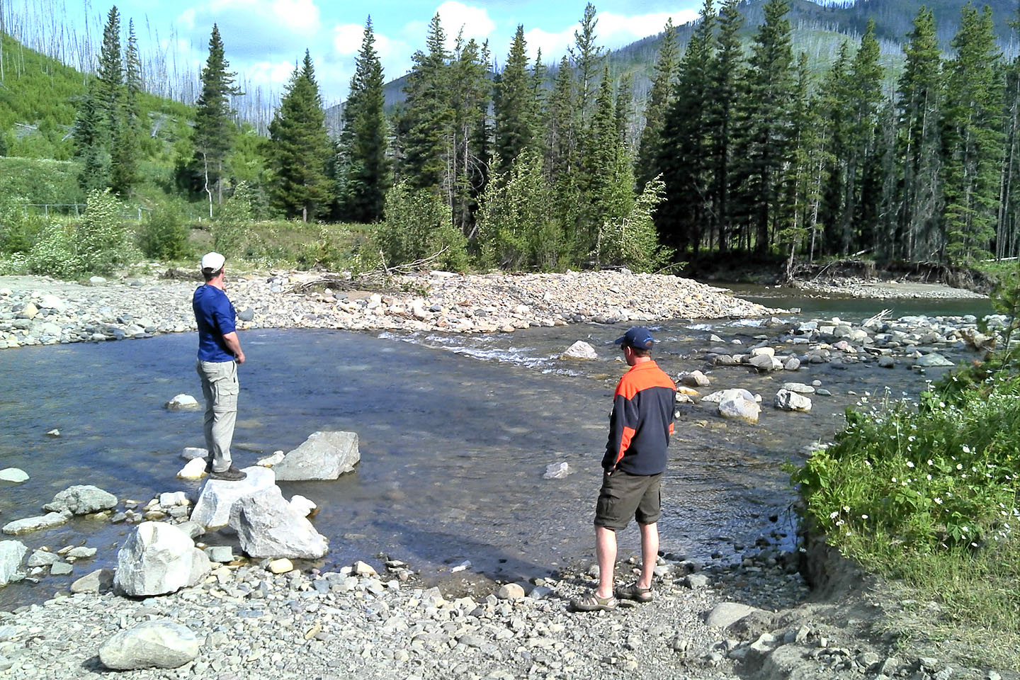
After leaving Carbondale River Road we had to cross the river to get to the side road
We hiked up the side road for a kilometre before taking a right fork to get on the ridge
leading to McCarty
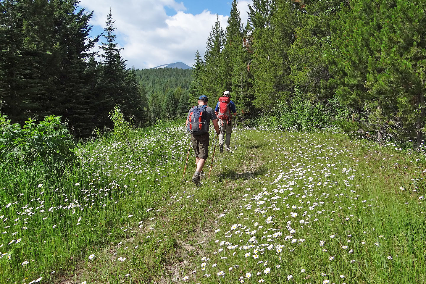
Daisy fleabane lined the road
At one point, the road turned down and right, but we stayed on the ridge, picking up a hidden
road going to a clearing
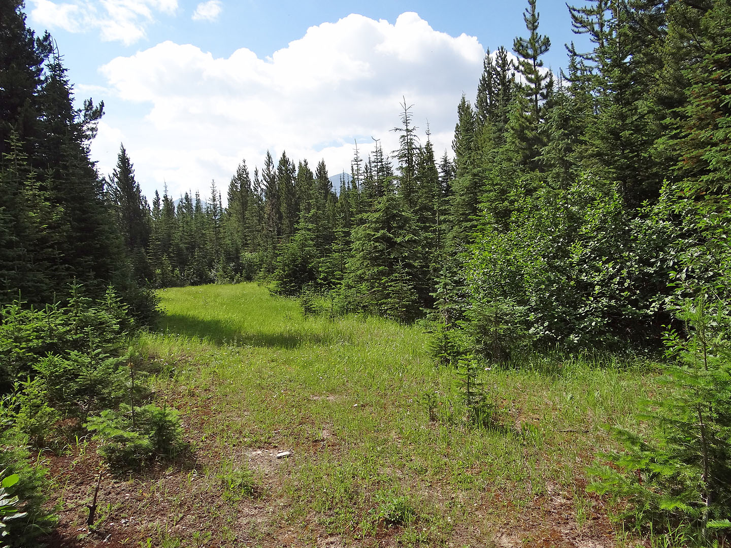
The road ended here and we found a trail at the end of the clearing
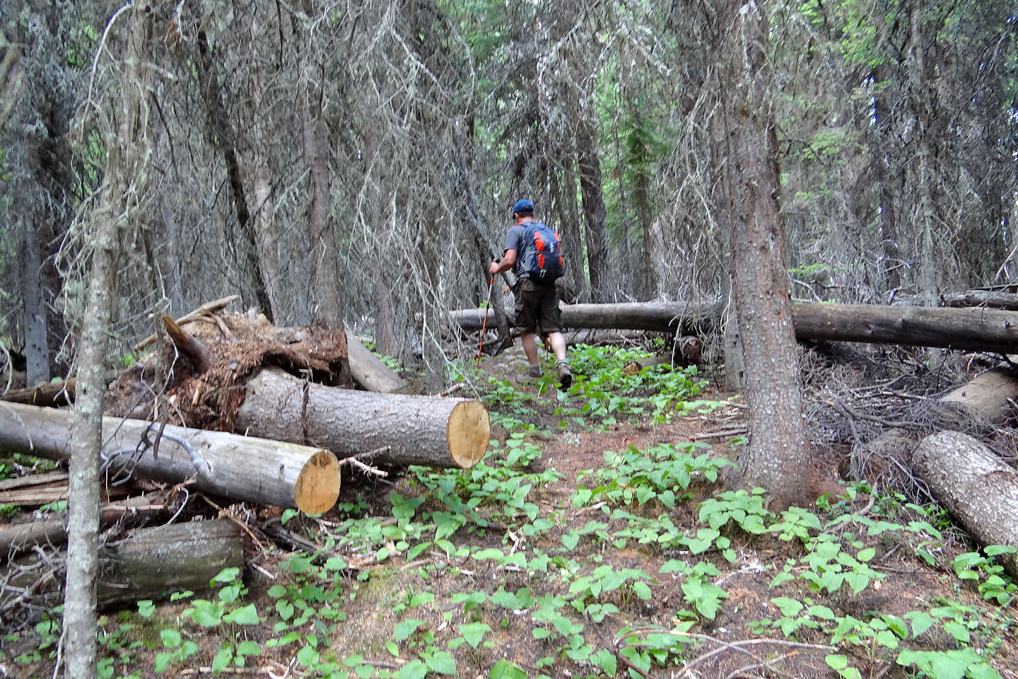
Despite signs of both old and recent maintenance, the trail stopped 300 m from the clearing
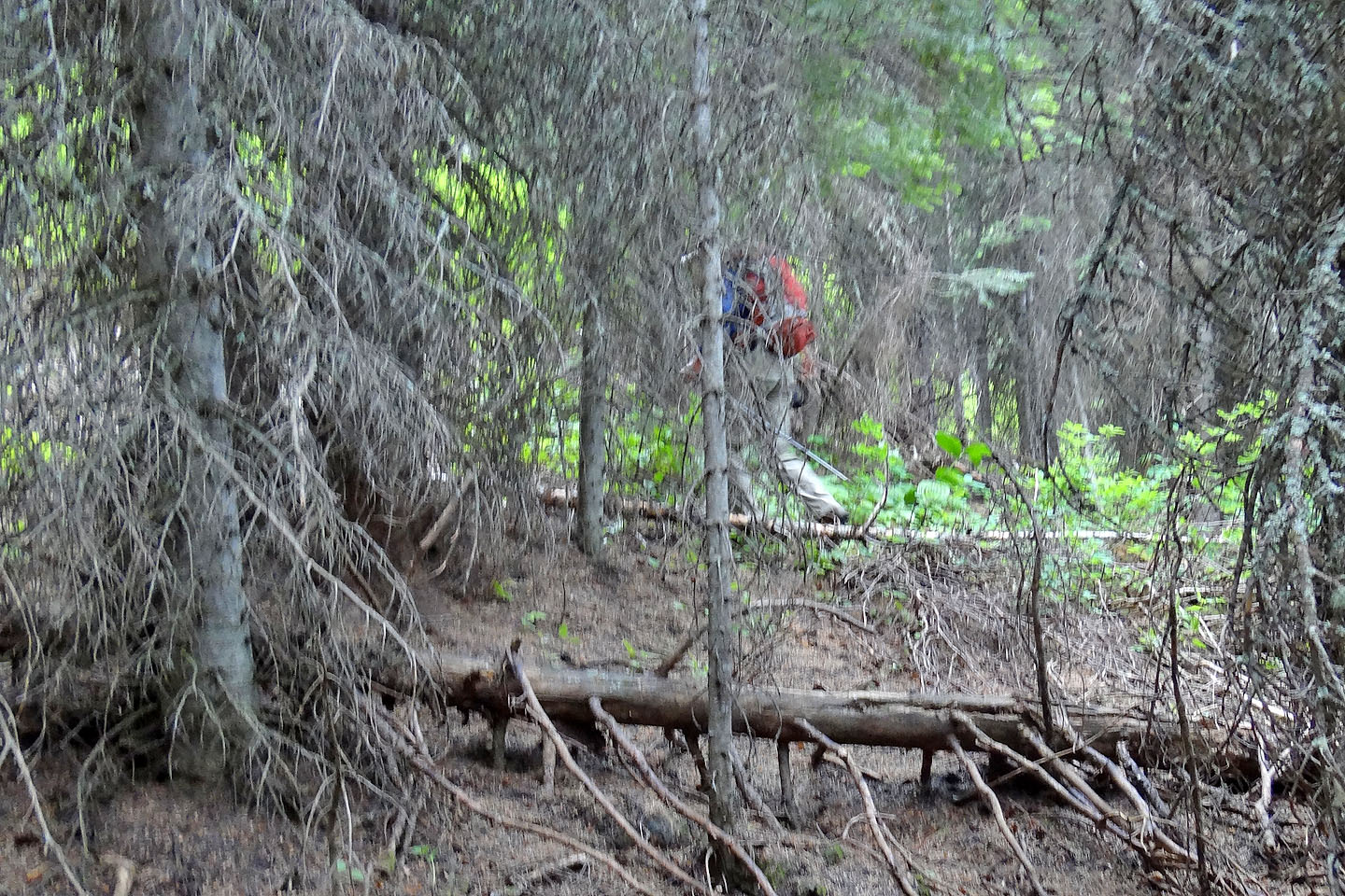
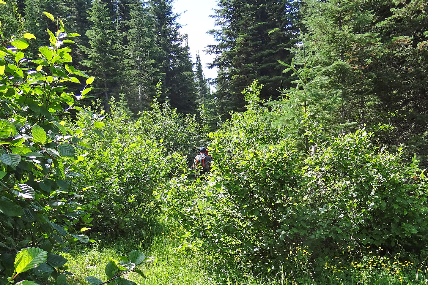
After the trail ended the bushwhacking began
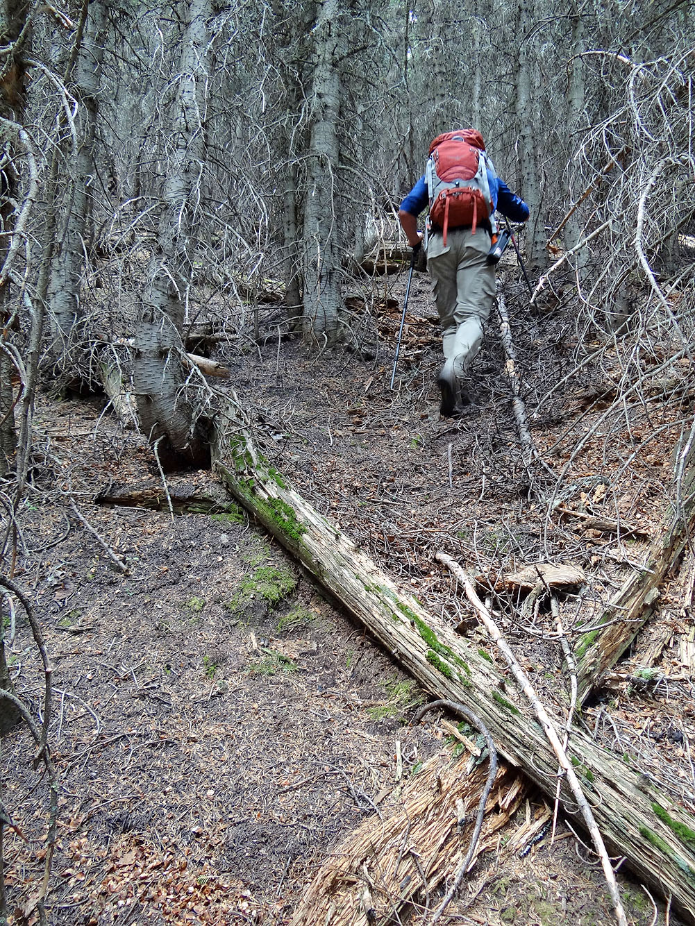
Some of the easier bushwhacking we did
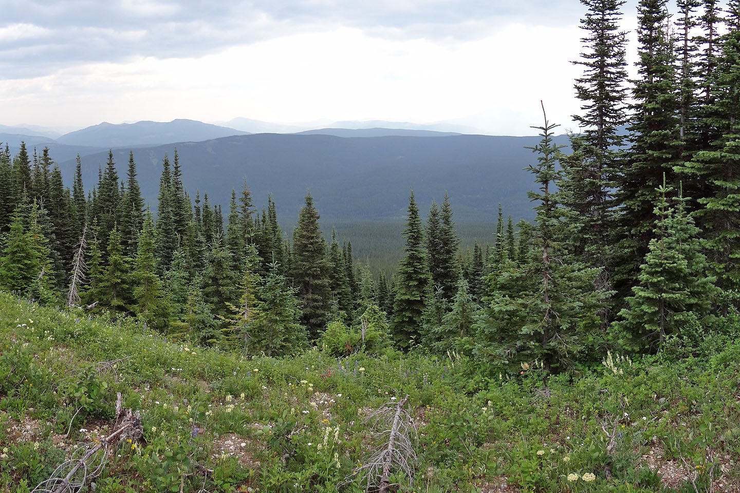
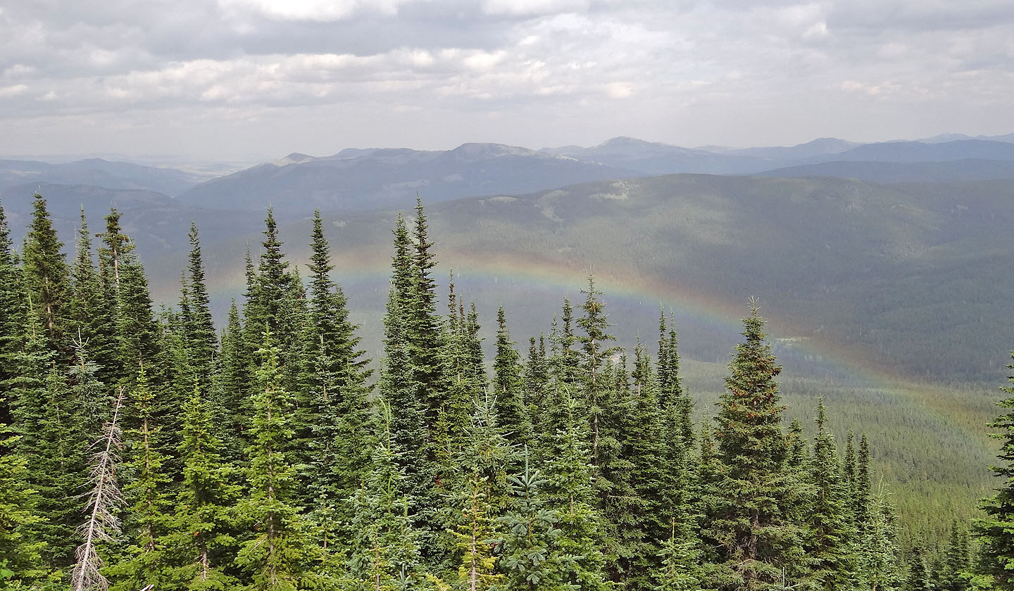
When we reached a clearing we could see little because of the haze
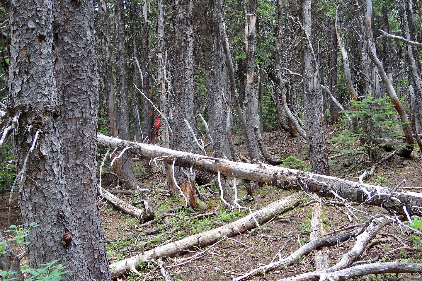
We often lost sight of each other because of dense trees
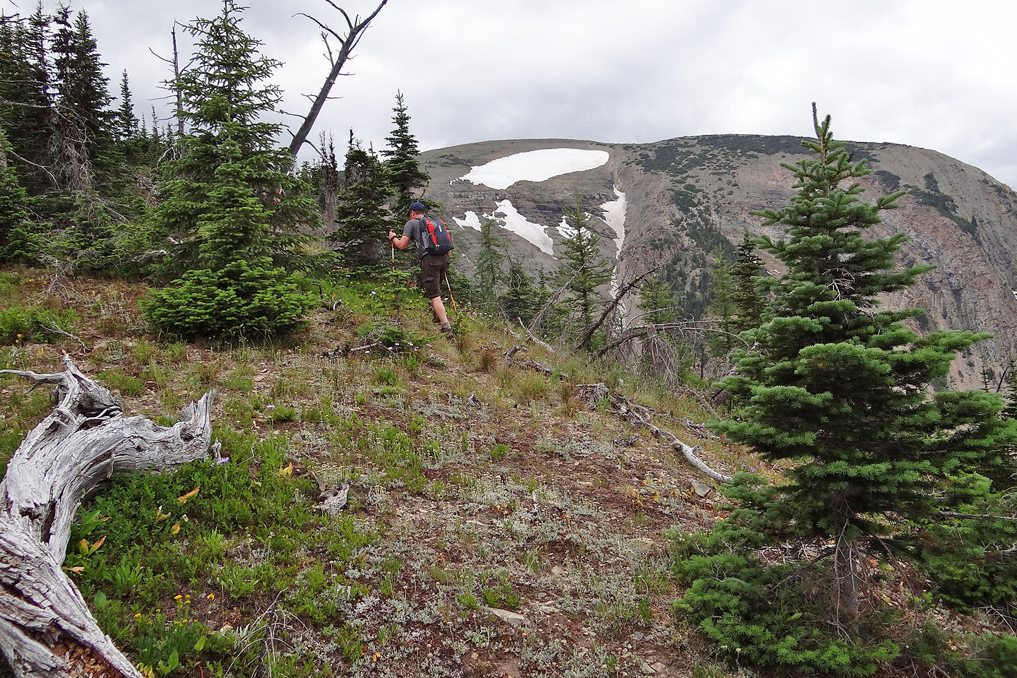
In a meadow on a high point, McCarty filled the view. We forged ahead but we would have
encountered far less bushwhacking if we had turned left here.
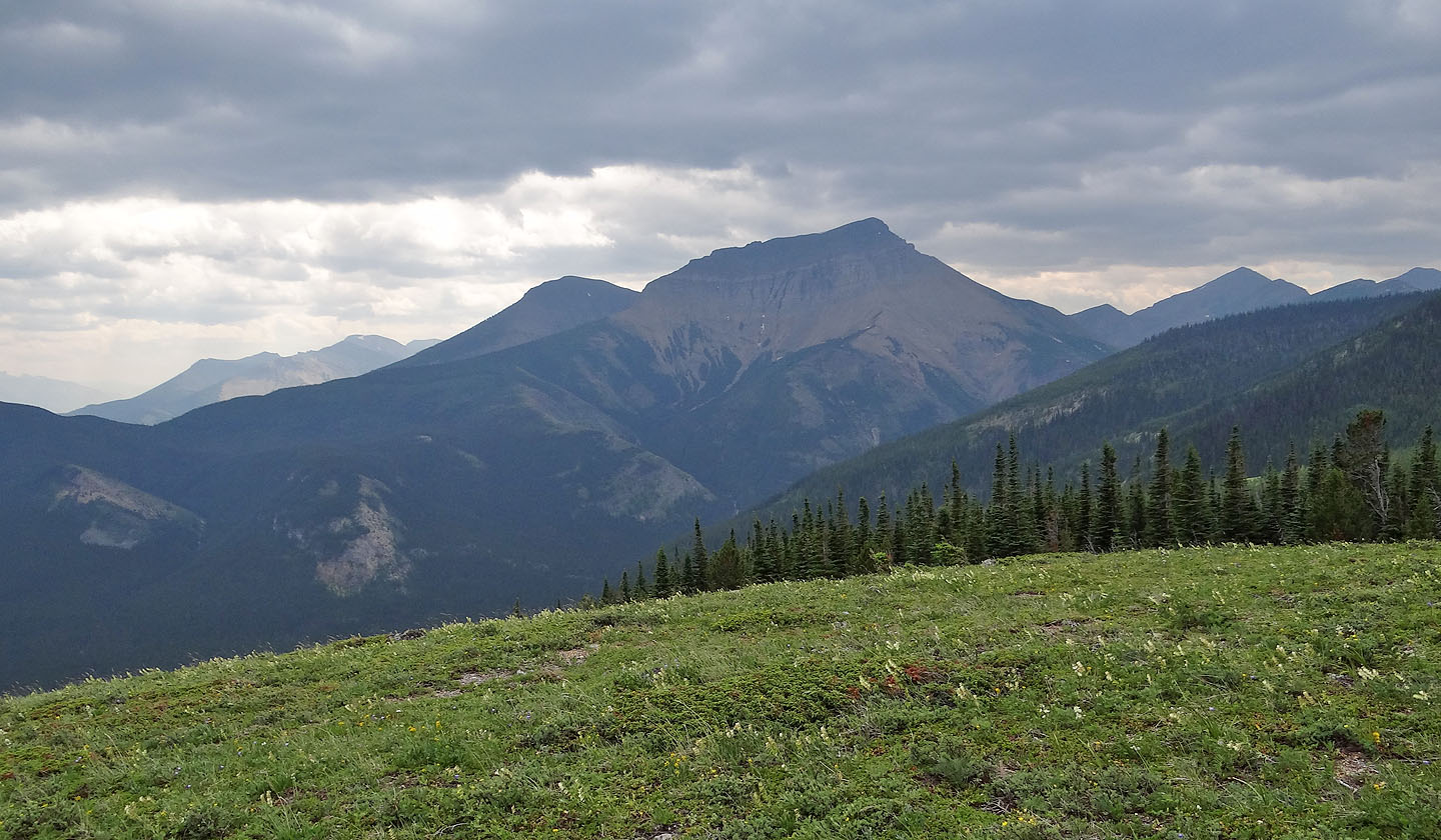
Syncline Mountain lies southeast
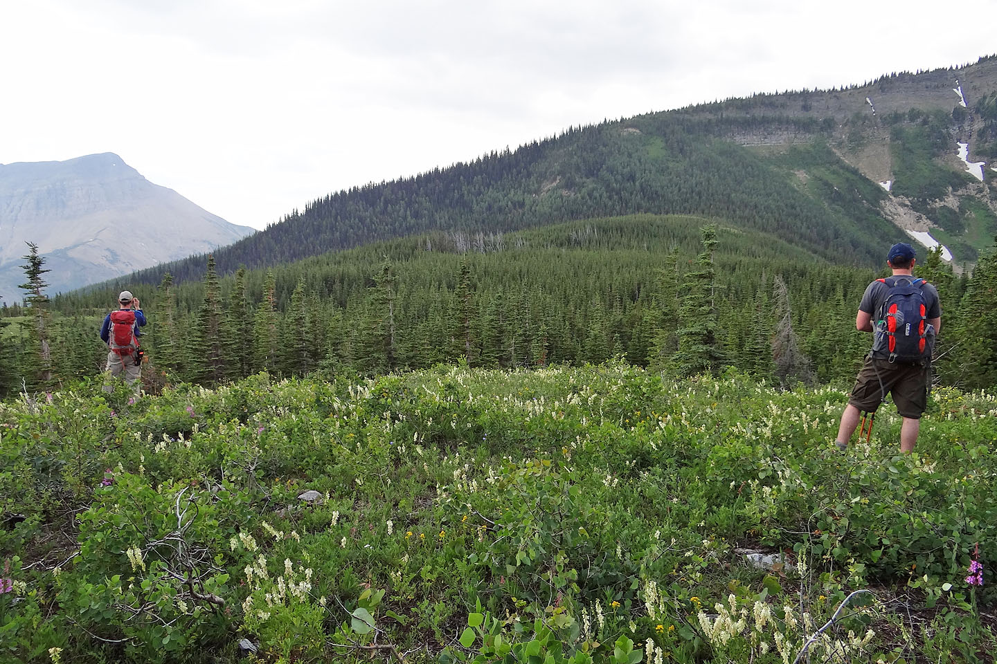
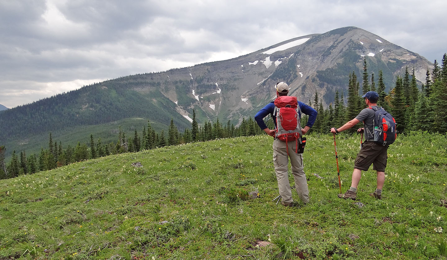
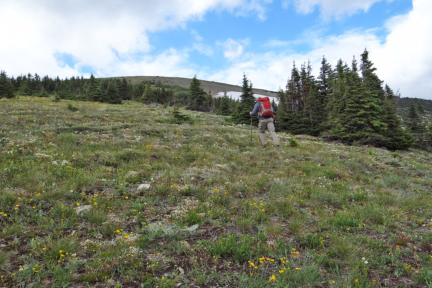
At the next clearing we considered the best way to gain the ridge in front of us
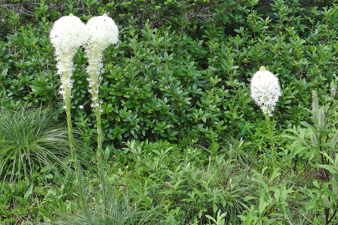
I was surprised to see bear grass here
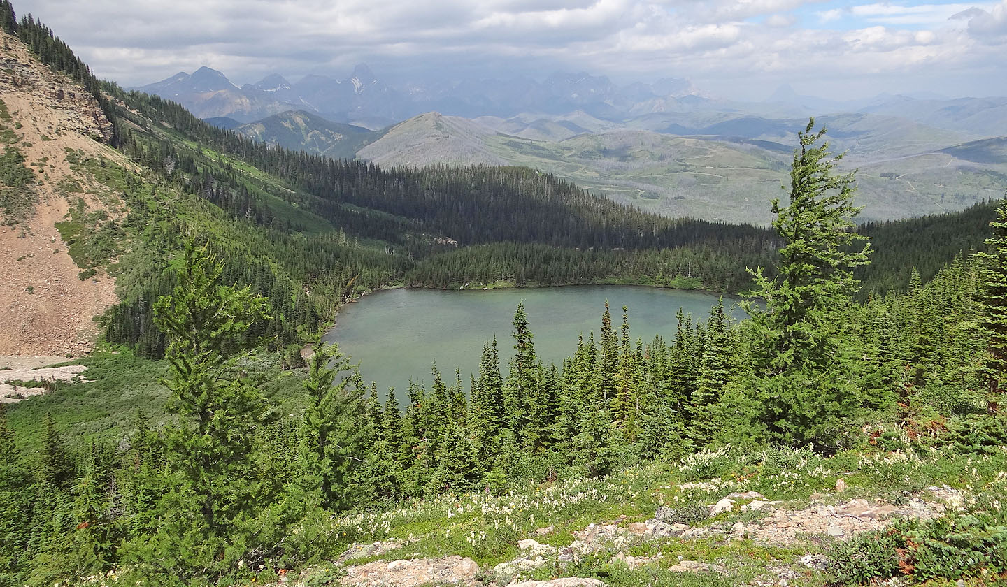
We dropped down the ridge a bit to get our first look at the unnamed lake
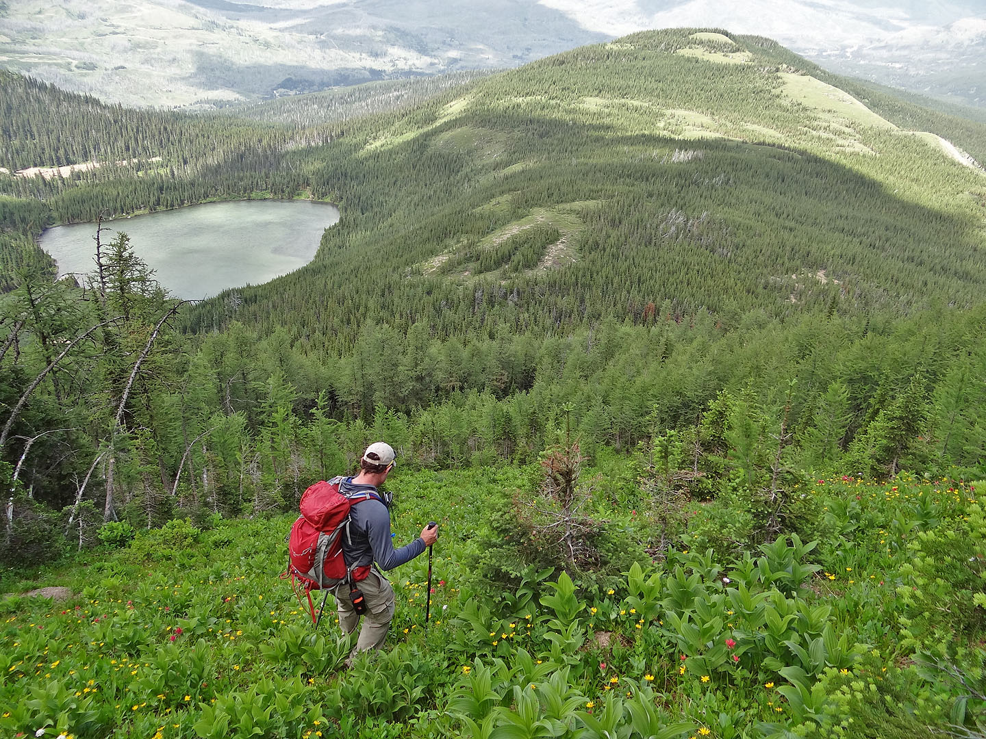
The ridge leading to the summit: we reached it by going up the clearing in the top left
Going up the clearing
After reaching the ridge we saw the summit (above the snow)
We'll soon be on the bald summit
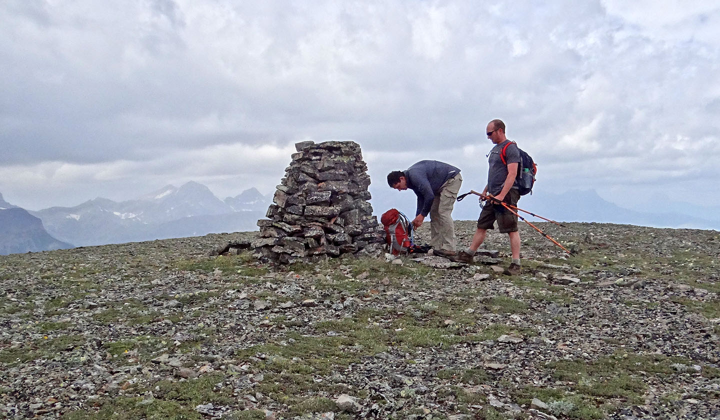
The summit cairn
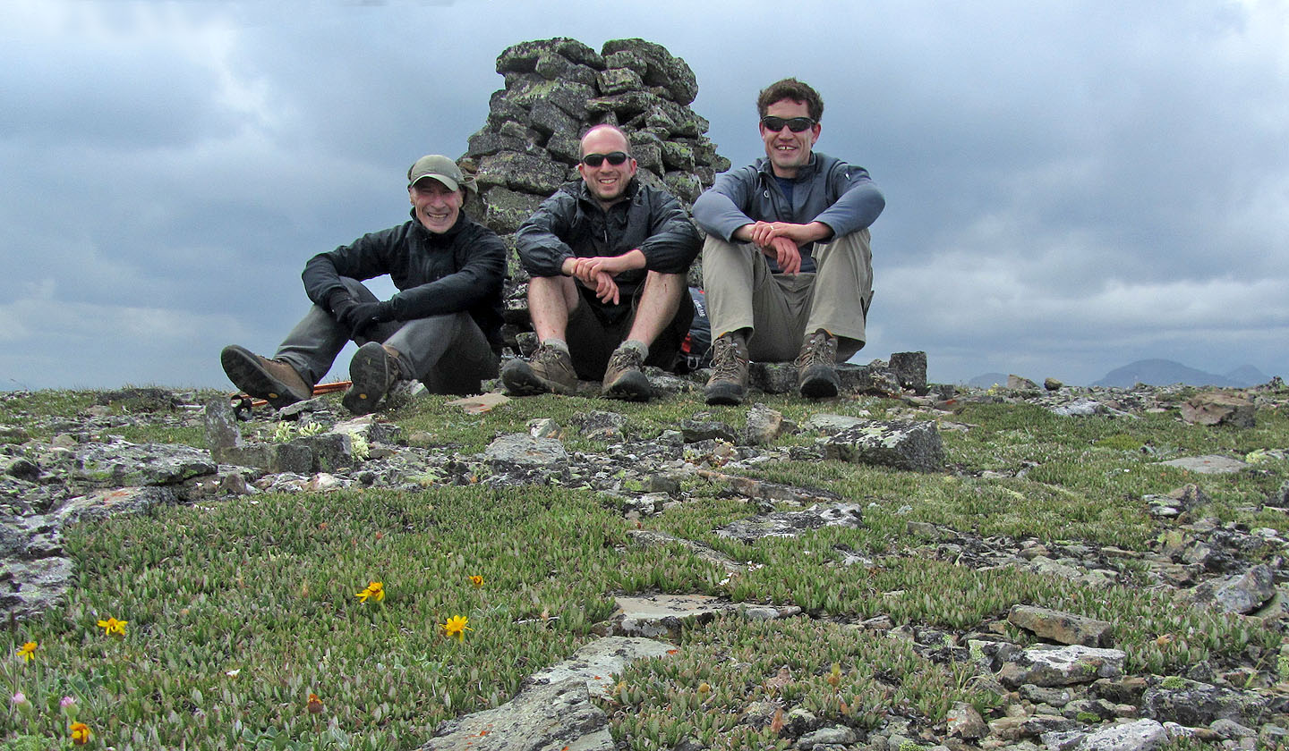
Posing on McCarty
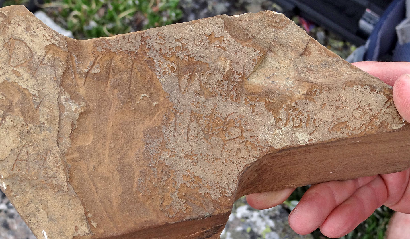 The "summit register" had engravings including one that read "July 29/60"
Heading back down
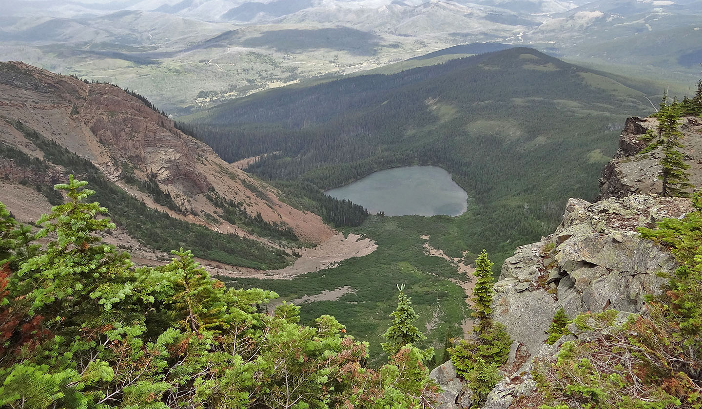
Another look at the lake
Coming down the steep clearing. Later we made our way to the strip of meadow (upper right).
Carbondale Lookout is on the skyline, centre (mouse over for a close-up)
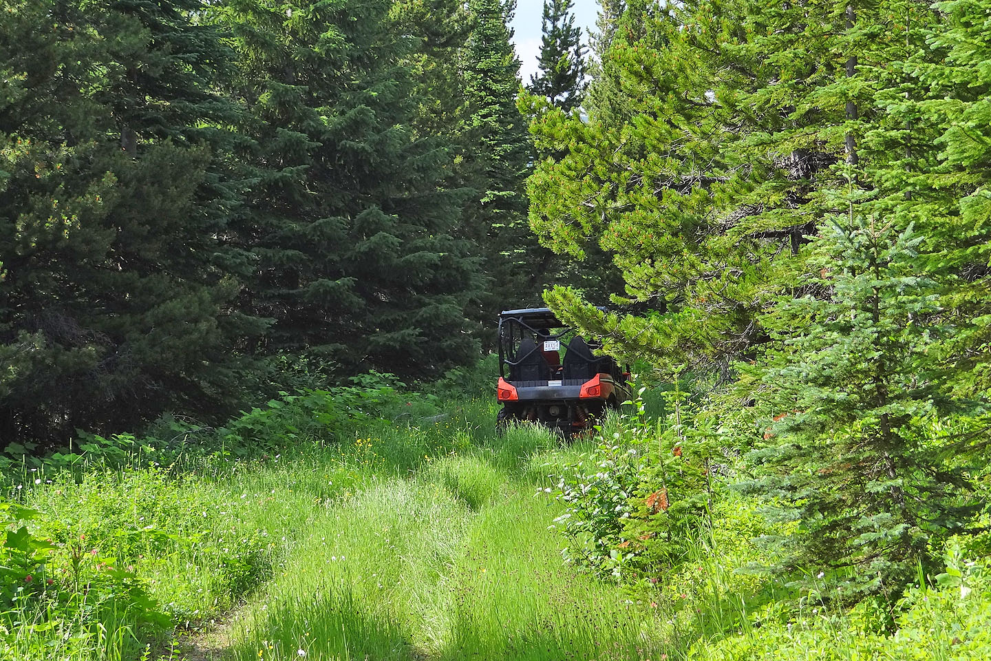
After we declined a lift, the ATV disappeared down the road
We headed back to Carbondale River Road (just visible above Dave and Jeff). Our vehicle was
parked at the foot of Cherry Hill on the right.
82 G/7 Flathead Range, 82 G/8 Beaver Mines