bobspirko.ca | Home | Canada Trips | US Trips | Hiking | Snowshoeing | MAP | About
Mount Sarrail
Kananaskis, Alberta
August 14, 2005
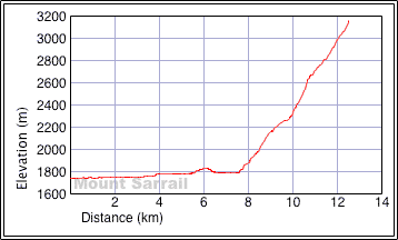
Distance: 24.6 km (15.3 mi)
Cumulative Elevation Gain: 1780 m (4898 ft)
Phil Schreiner was lucky to be allotted 5 of the 100 peaks for the Alberta Centennial Mountain Expedition in 2005. Dinah and I, in turn, were fortunate to have him invite us to do one of them: Mount Sarrail, peak 61.
Phil, along with his three teenage daughters and his nephew, Paul, would do it as a three-day trip, while Dinah and I gave ourselves a day to summit Mount Sarrail. Originally, Phil's daughters were to accompany us to the top, but in the end only Phil and Paul joined us.
Dinah and I hiked along the Upper Kananaskis lakeshore trail, a good path although it seemed to drag on forever. Before setting off, I had set a waypoint for the turnoff, and we used it to guide us to the unmarked crude trail leading to Aster Lake. This trail immediately led to a tiny meadow, and minutes later we were on the south shore of Hidden Lake. The water level was low enough for us to hike along the shore, although it was muddy in some spots.
From the lake, a short, steep trail leads out of the woods onto a scree slope. Soon after passing the upper waterfall, Mount Sarrail appeared. We left the trail where it drops down to cross a gully and angled toward the lower slopes of the mountain. After stumbling up the loose rock, we managed to gain the ridge.
On the ridge, we noticed three people ahead of us. One of them was coming down, and we intercepted him. It had taken him four and a half hours to summit starting from the car (it took Dinah and me six hours). The other two guys turned out to be Phil and his nephew Paul, and they were going up. We weren't able to catch up to them, but they waited on the summit for us.
Once on top we went through the formalities of bagging Mount Sarrail as a Centennial Peak. It was exciting to play a part in Alberta's Centennial, even if I was doing only one peak to Phil's five! Phil handed out flags and pins, and we all signed the new register.
After striking a group pose at the summit cairn for the camera, we headed back down. At the bottom of the ridge, Phil and Paul turned left onto the trail to return to their Aster Lake campsite. Dinah and I turned right and hiked back to the parking lot. For them, it would be a twenty-minute hike, but for us nearly three hours!
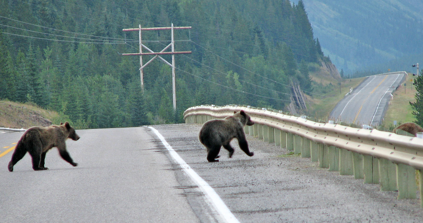
Two grizzly cubs follow their mother (barely visible) across the highway
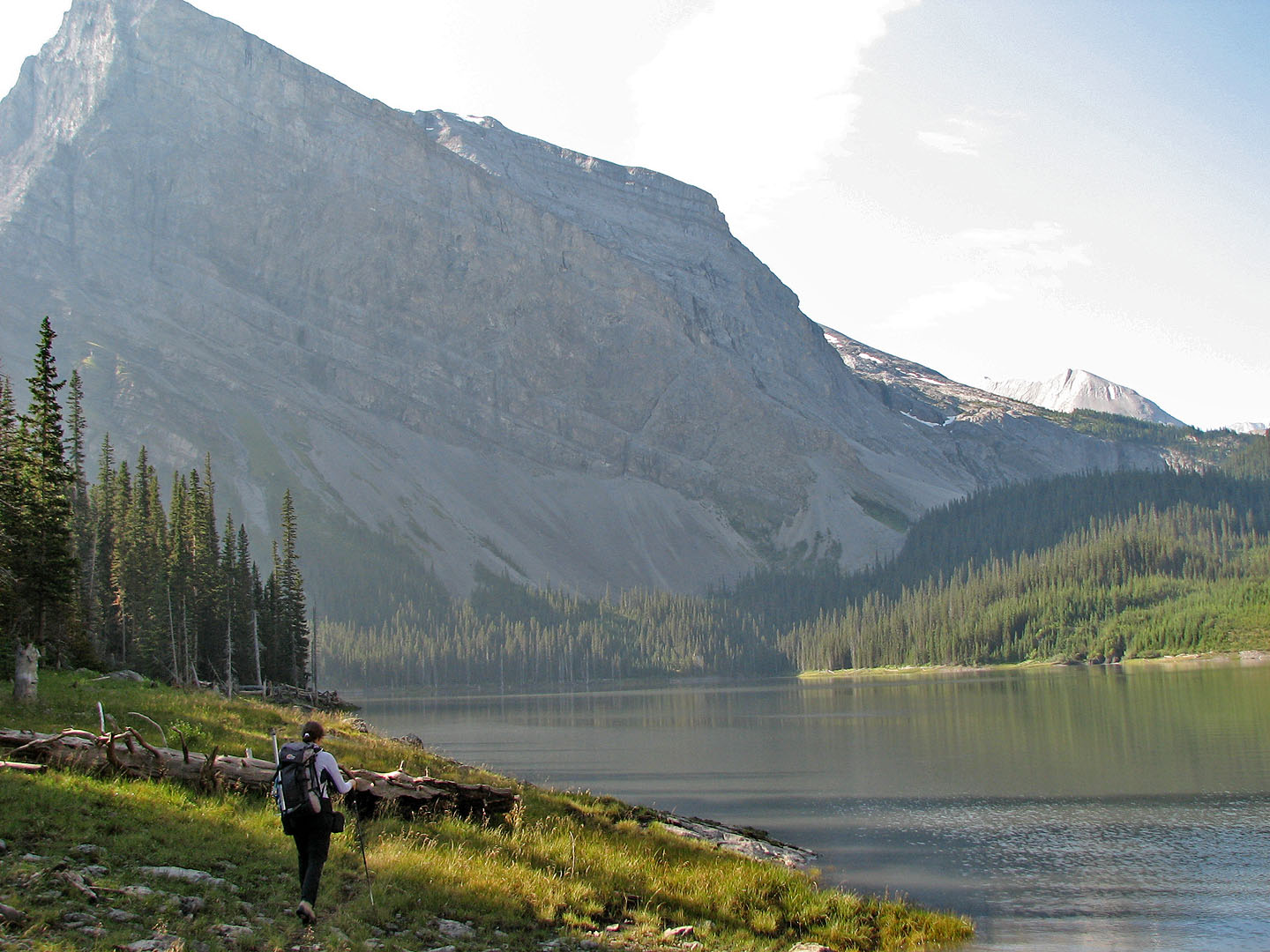
Hiking along the shore of Hidden Lake
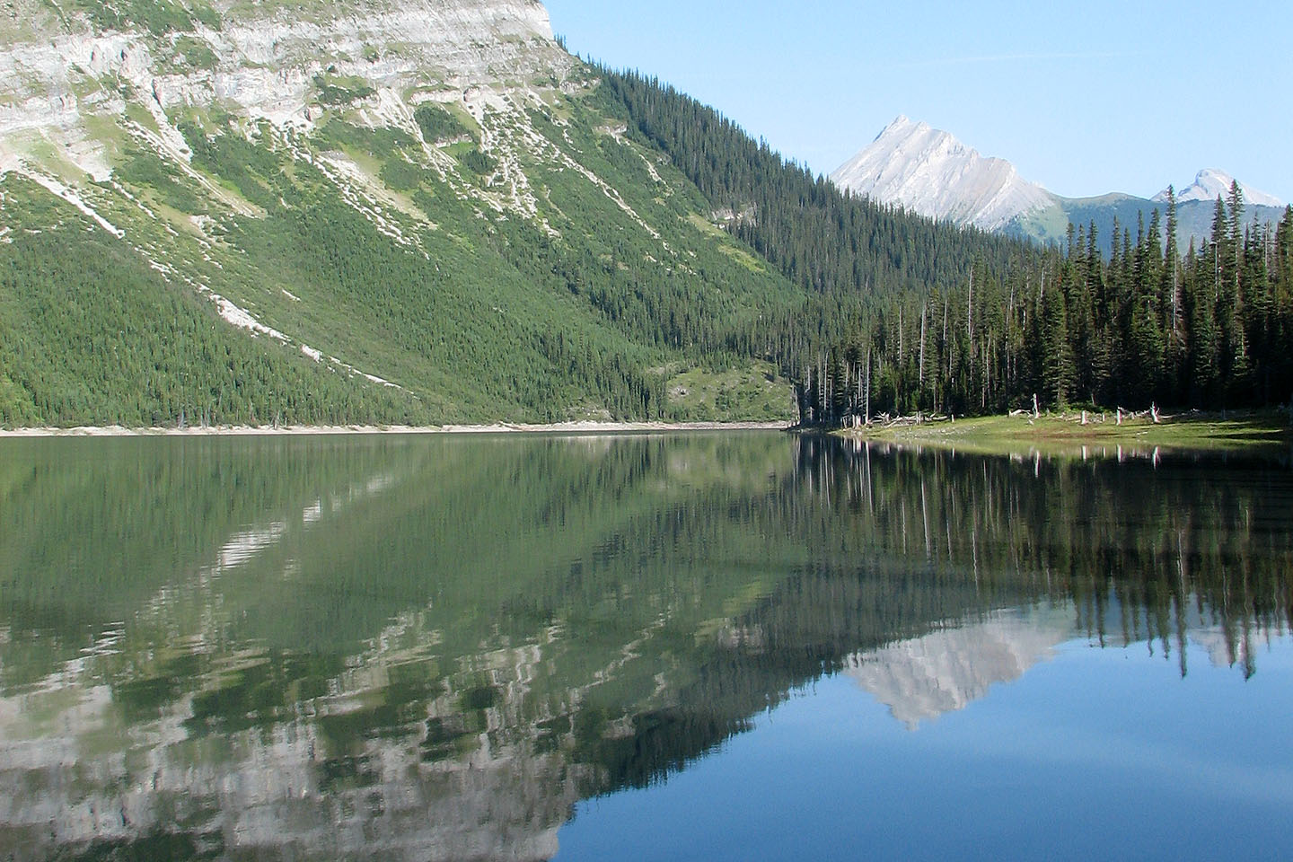
Looking south from the north end of Hidden Lake
 On the trail above Hidden Lake with
Mount Indefatigable in the background
On the trail above Hidden Lake with
Mount Indefatigable in the background
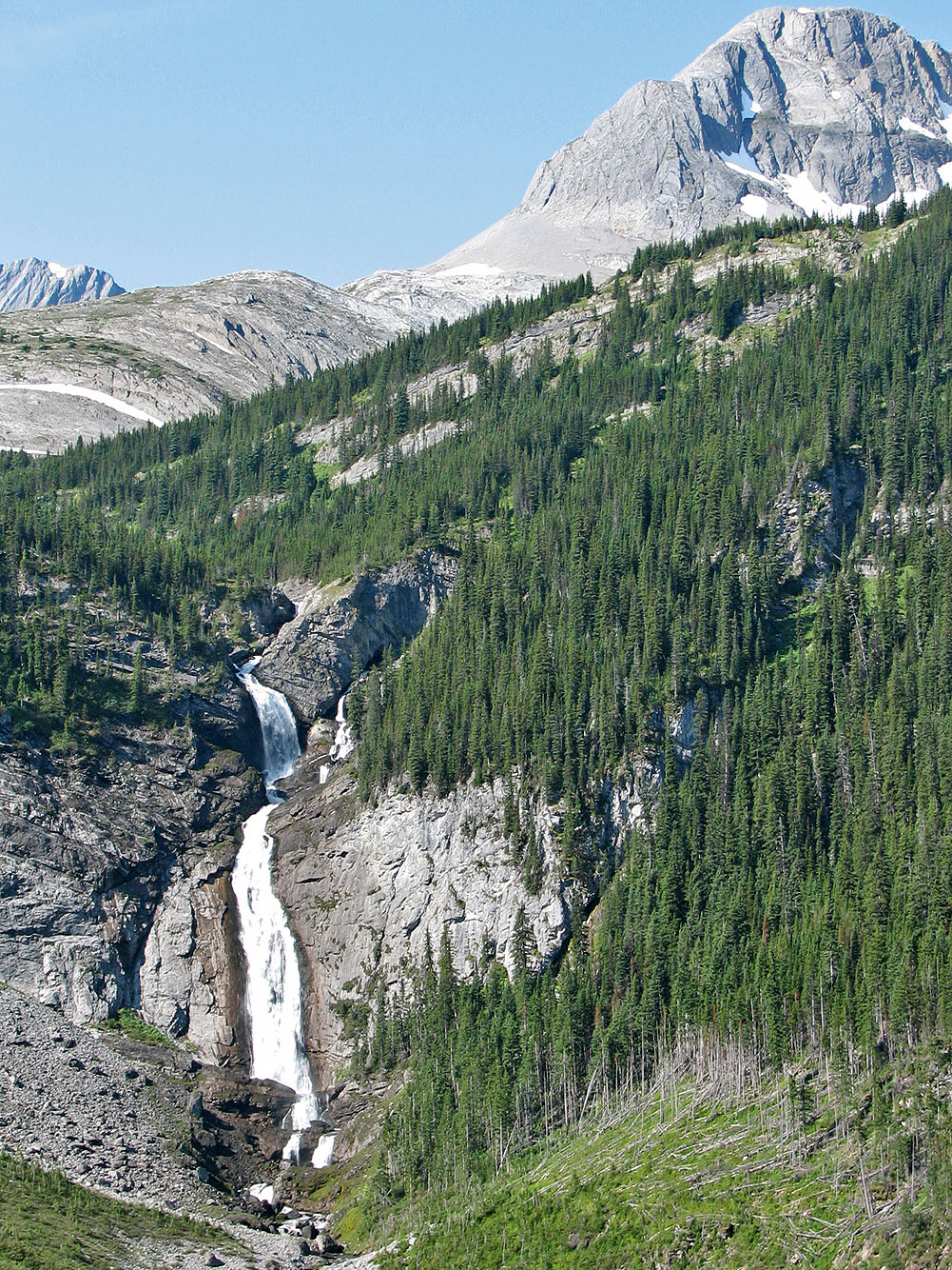
We passed the low waterfall
We started climbing after the high waterfall mentioned in the guidebook
Crossing the gully next to Mount Sarrail. The summit is left.
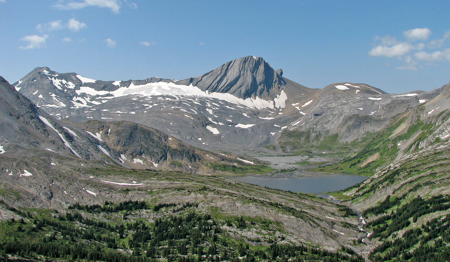
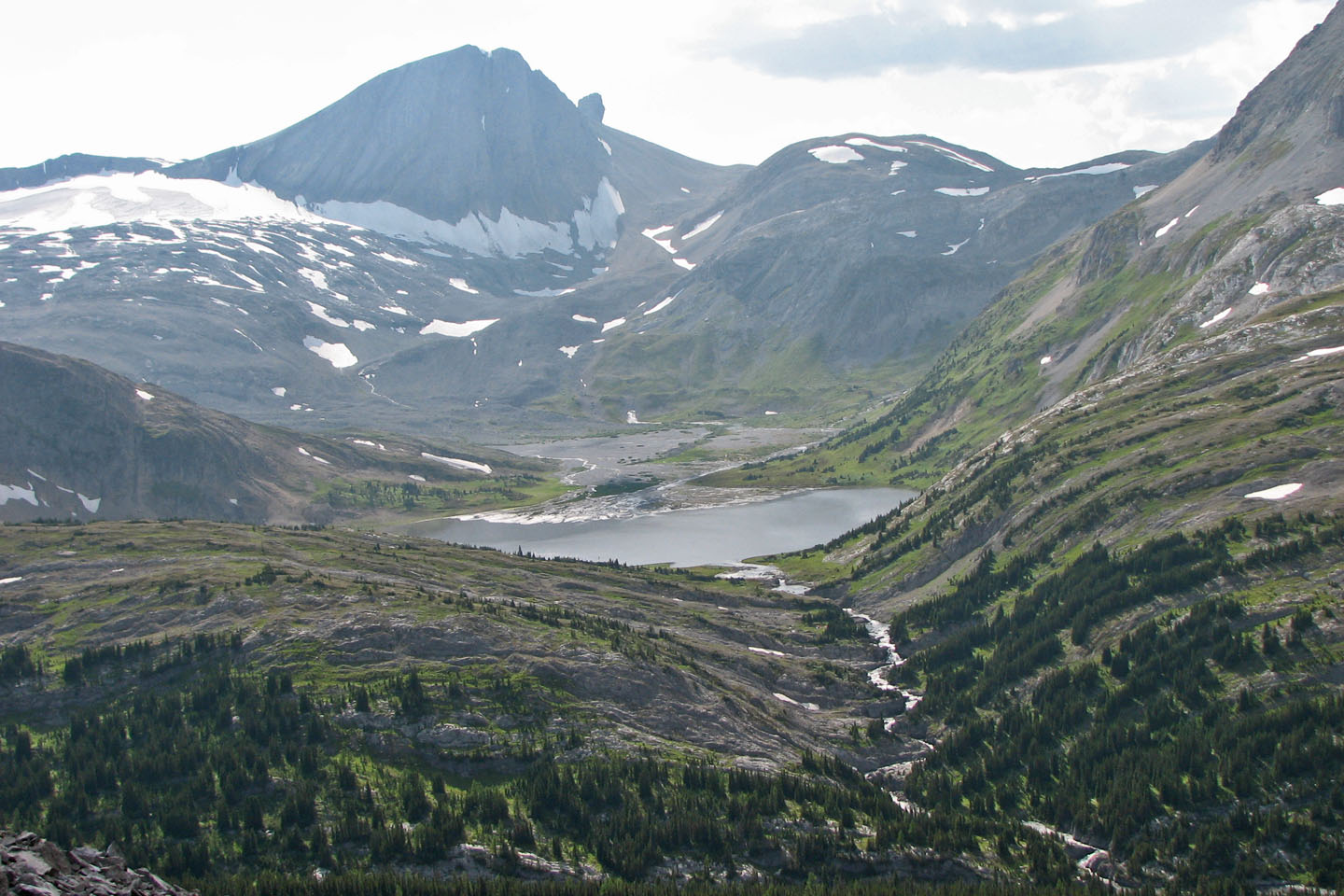
Mount Cordonnier and Warrior Mountain above Aster Lake
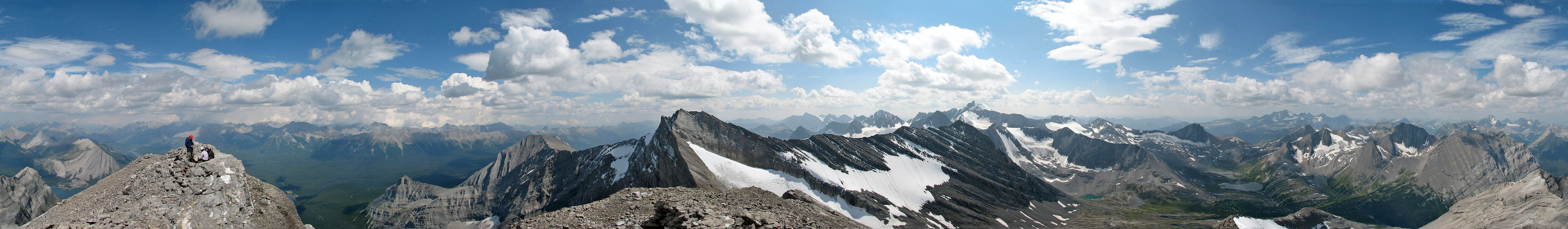
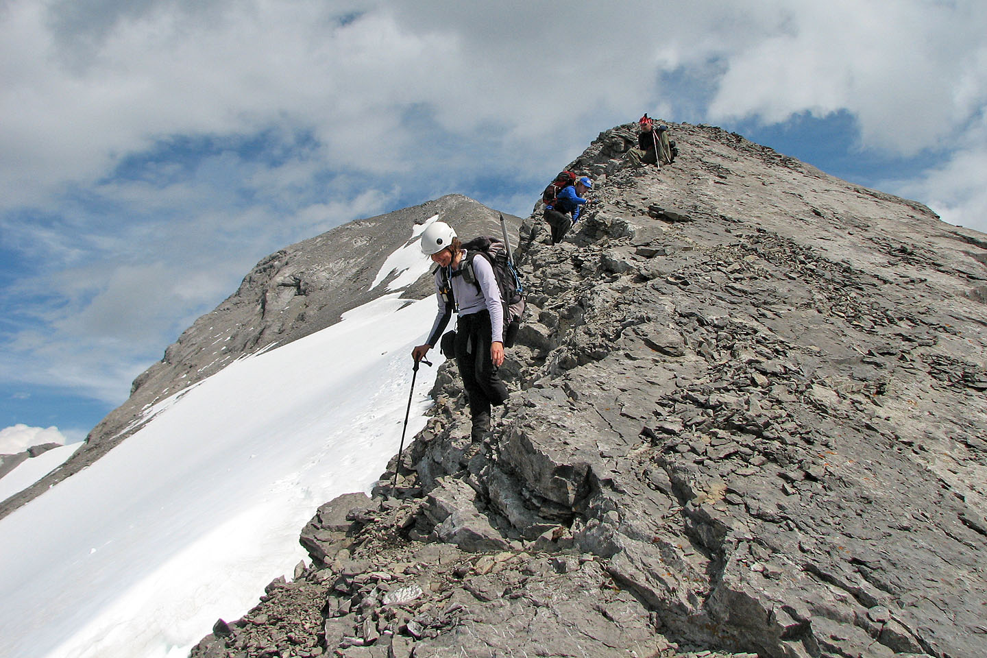
The summit was always in sight: there are no false summits!
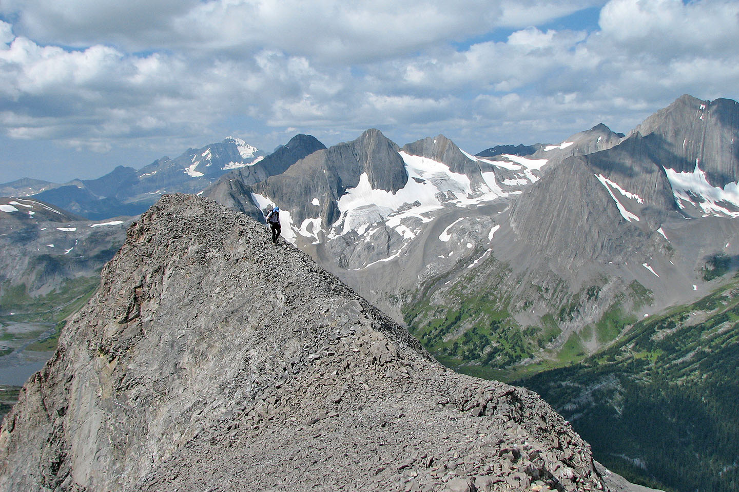
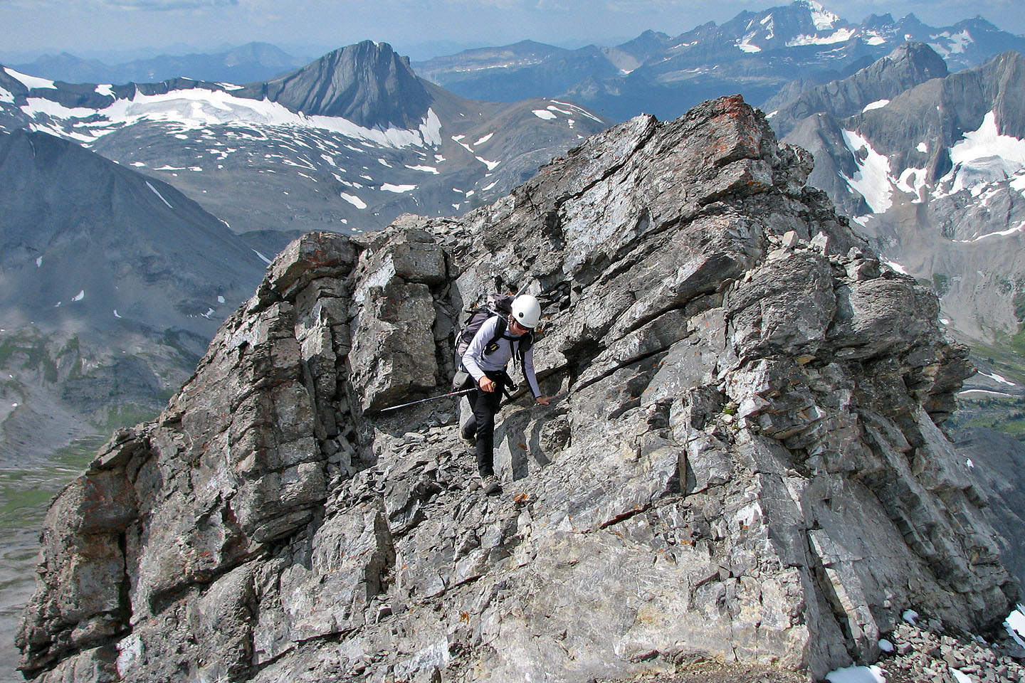
Following a narrow section of the ridge
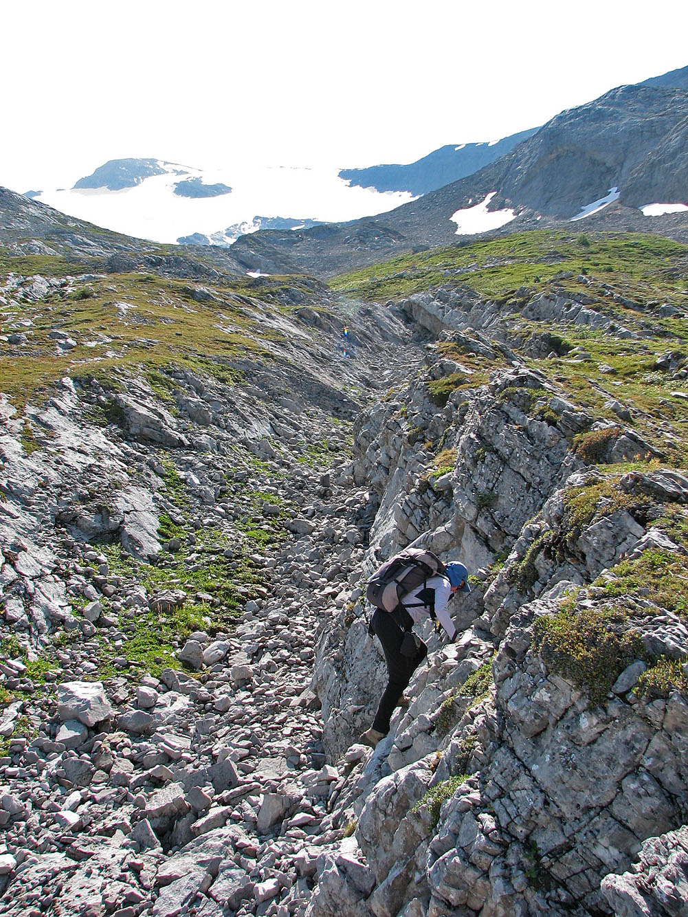
 One of two brief downclimbs
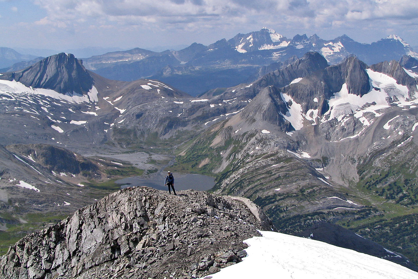
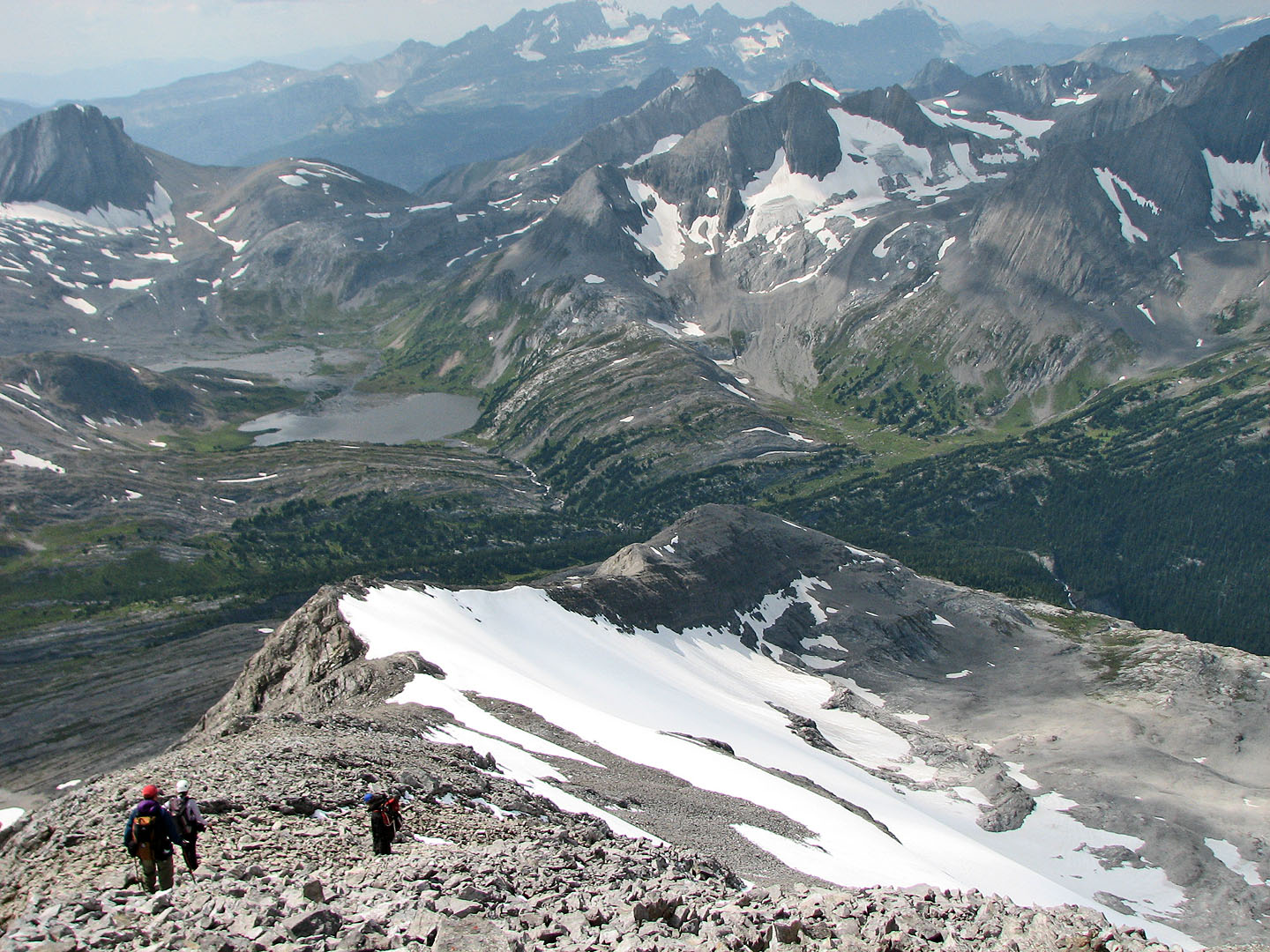
Expansive views behind us
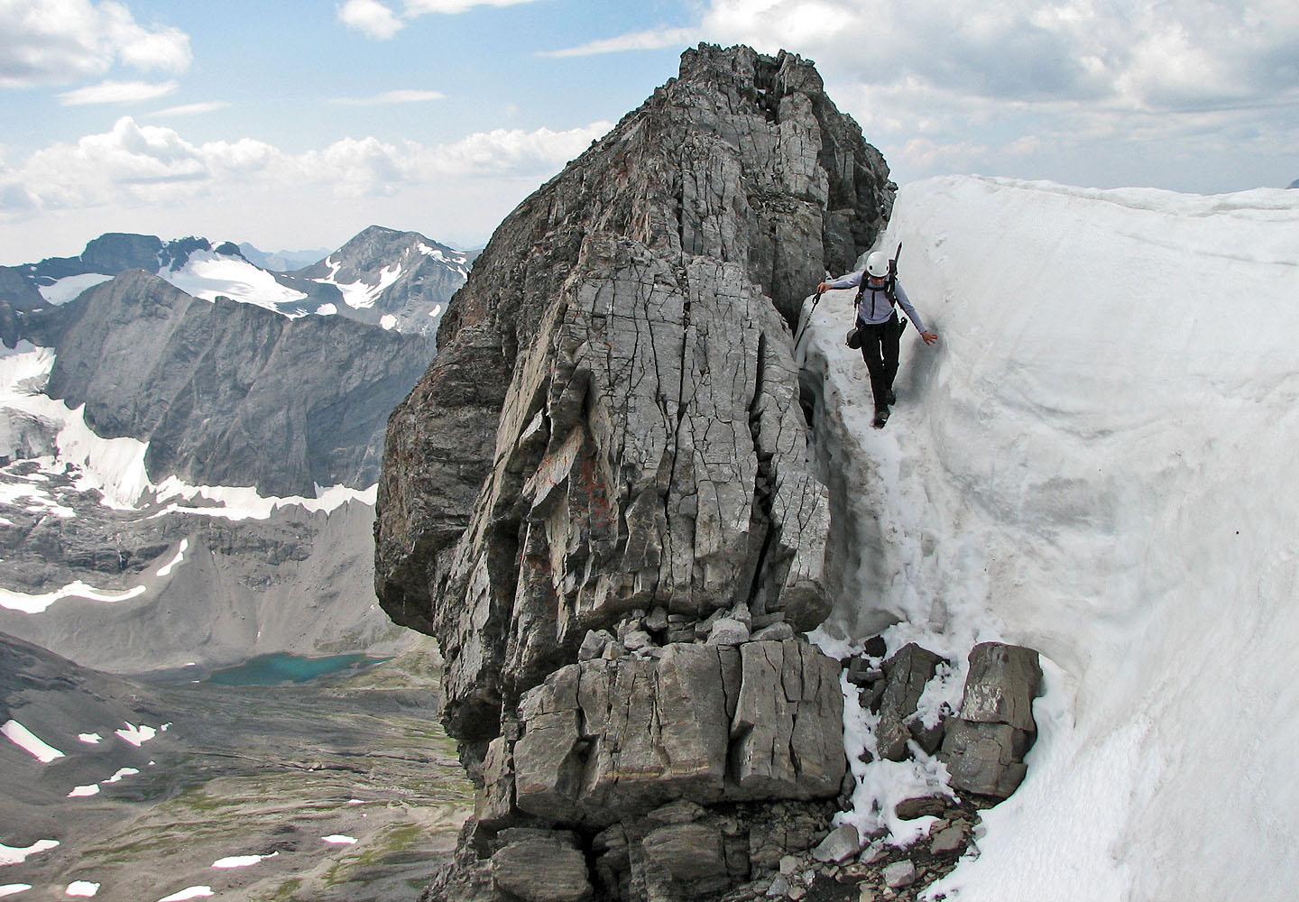
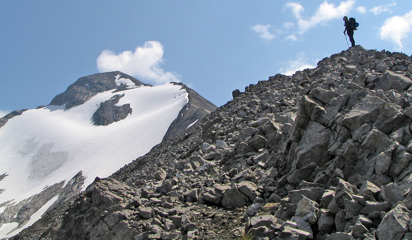
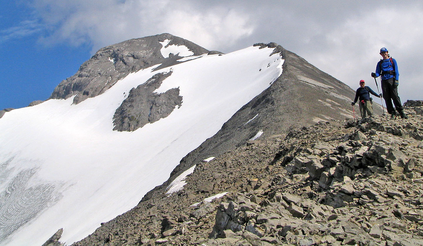
The glacier abuts the ridge near the summit
 Another view of the glacier abutment. Mount
Cordonnier and Warrior Mountain in the background.
Another view of the glacier abutment. Mount
Cordonnier and Warrior Mountain in the background.
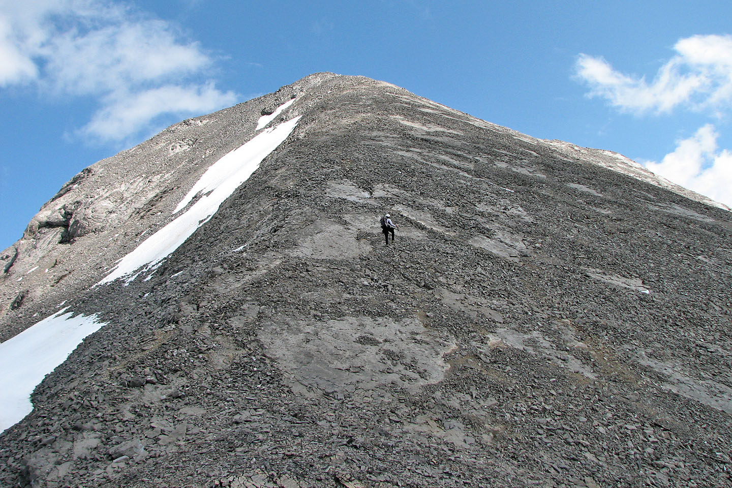
Heading to the summit
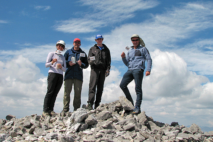
Celebrating an Alberta Centennial Summit, at least I am!
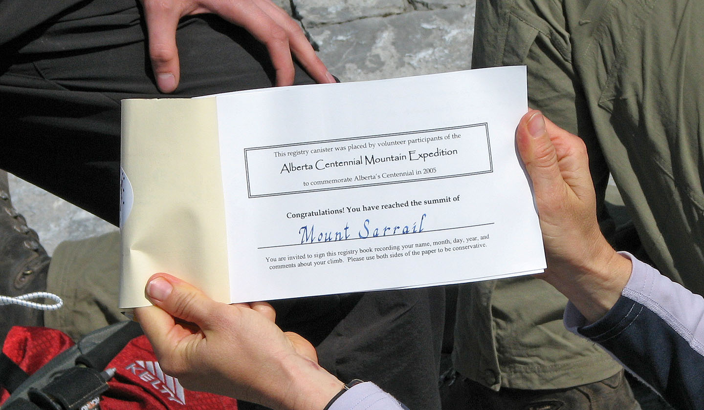
Centennial register for Mount Sarrail
Phil places the register on the summit cairn
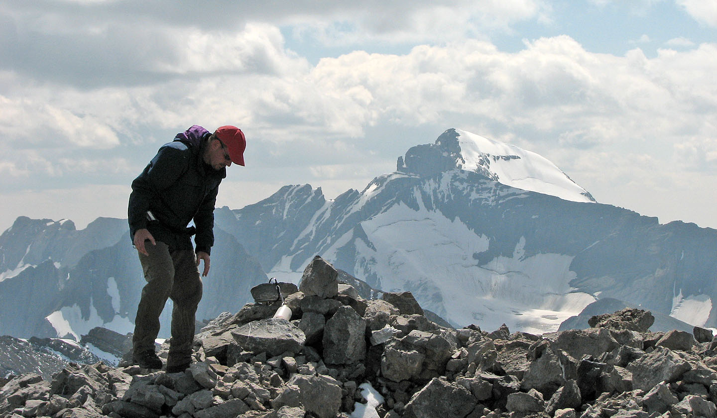
View from the summit as we headed back down. Aster Lake lies far below.
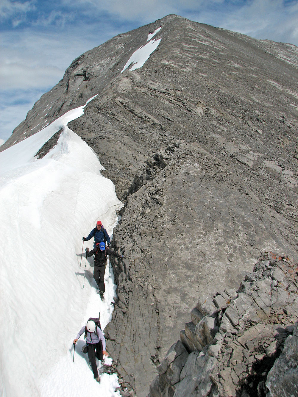
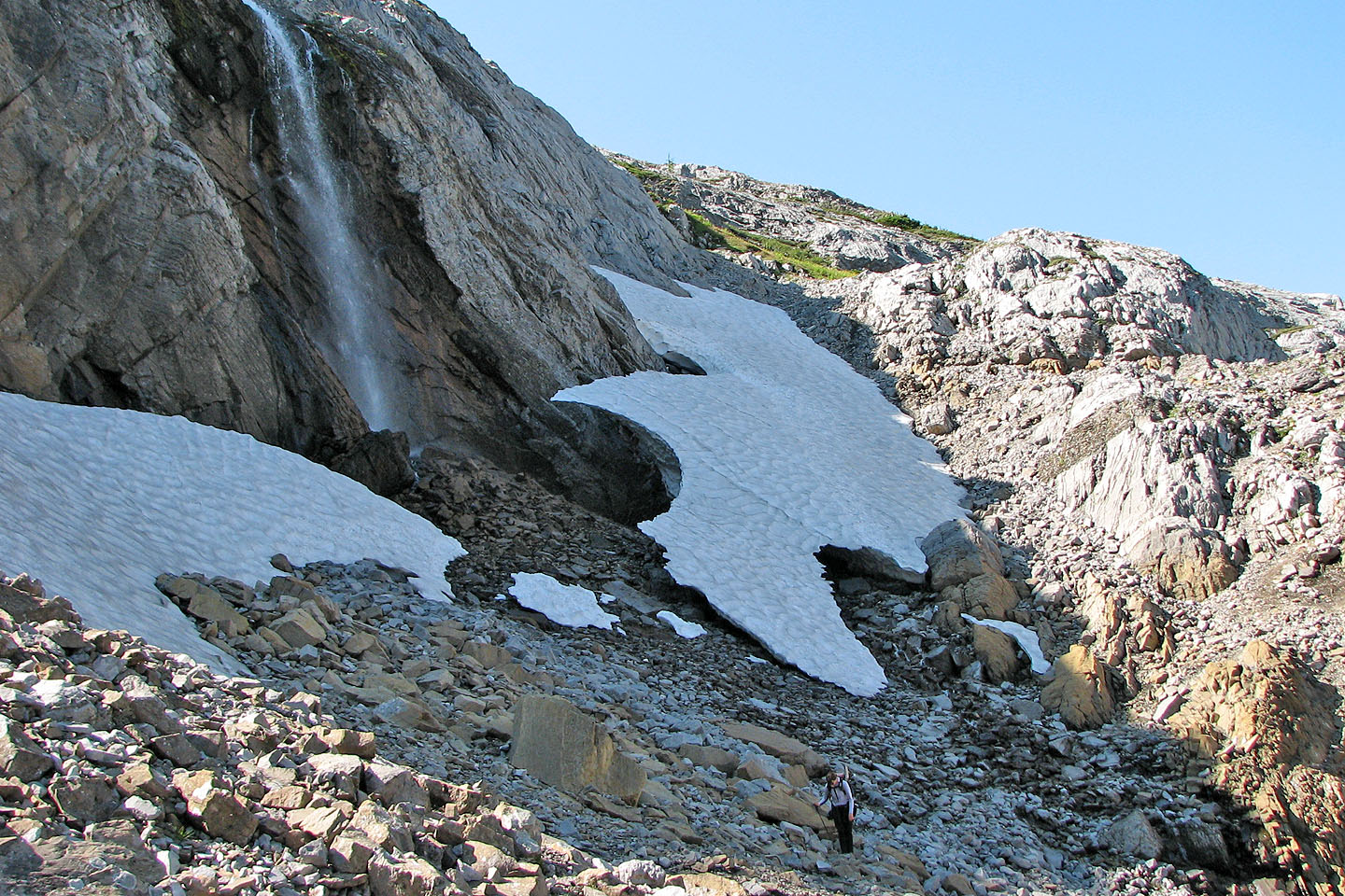
Negotiating the glacier abutment on the return
 Although rated "easy" I thought there
was one moderate scrambling section on the ridge
Although rated "easy" I thought there
was one moderate scrambling section on the ridge
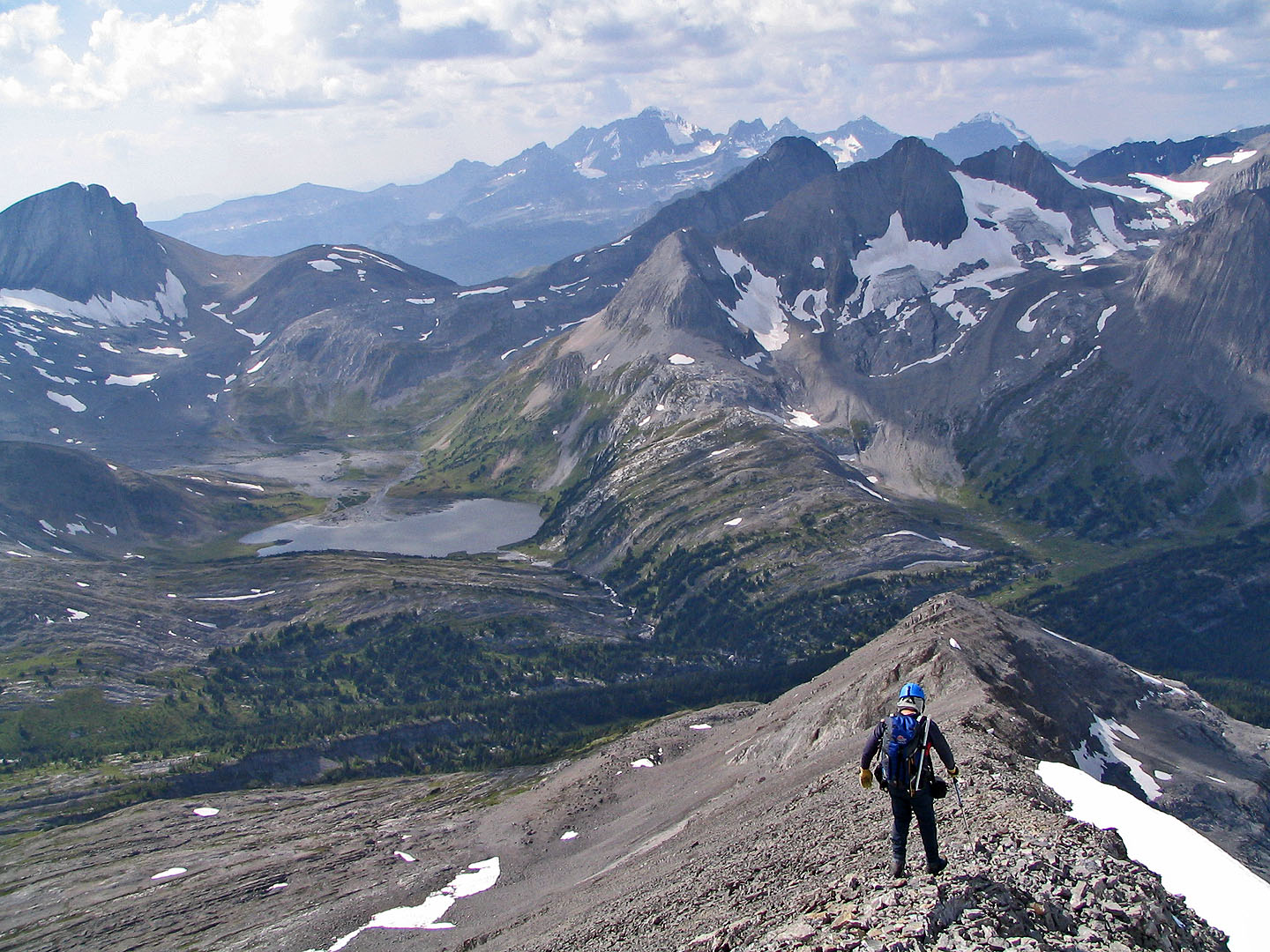
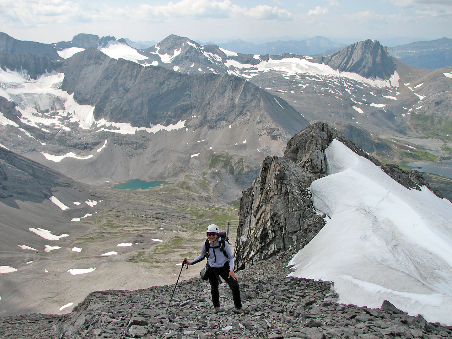
Continuing down the ridge
Looking back at the summit
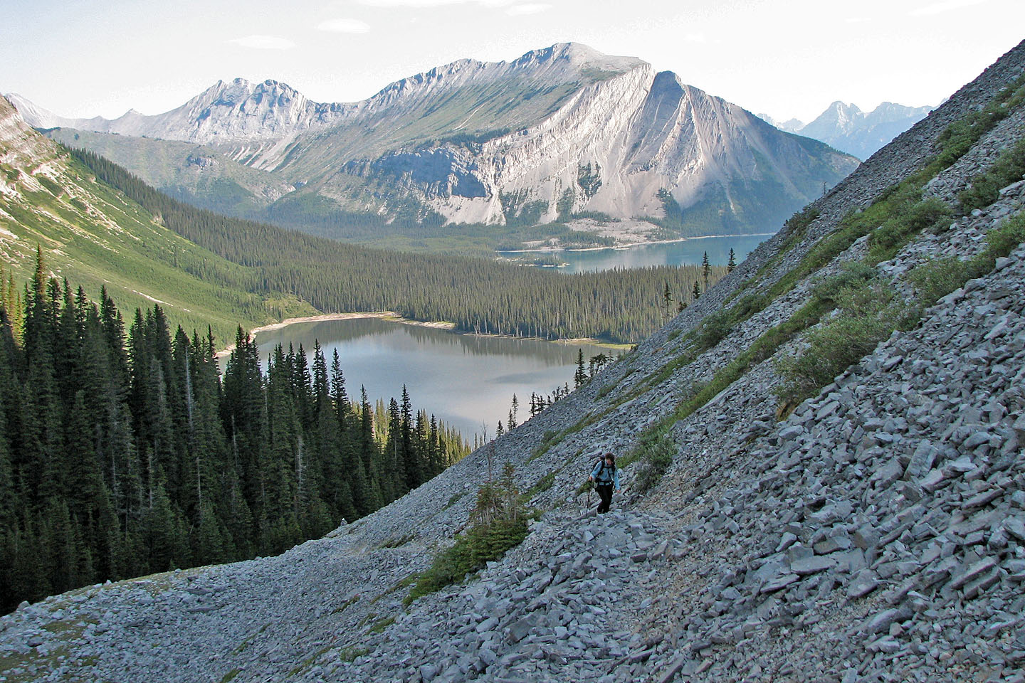
Aster Lake camp lies below the lake (mouse over)
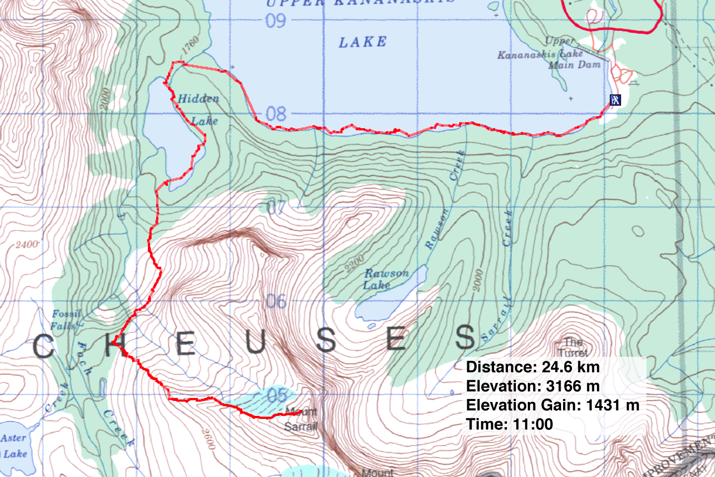 82 J/11 Kananaskis Lakes