bobspirko.ca | Home | Canada Trips | US Trips | Hiking | Snowshoeing | MAP | About
Mount Indefatigable South
Kananaskis, Alberta
August 17, 2019
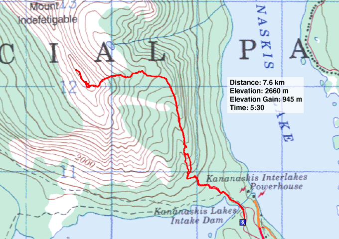
Distance: 7.6 km (4.7 mi)
Cumulative Elevation Gain: 950 m (3117 ft)
Although Indefatigable trail was decommissioned in 2005 and is no longer maintained, that hasn't stopped it from becoming popular. When Dinah and I did the north-to-south-peak traverse before the trail was decommissioned, we didn't see a soul. But on this trip to the south peak, we saw dozens of hikers.
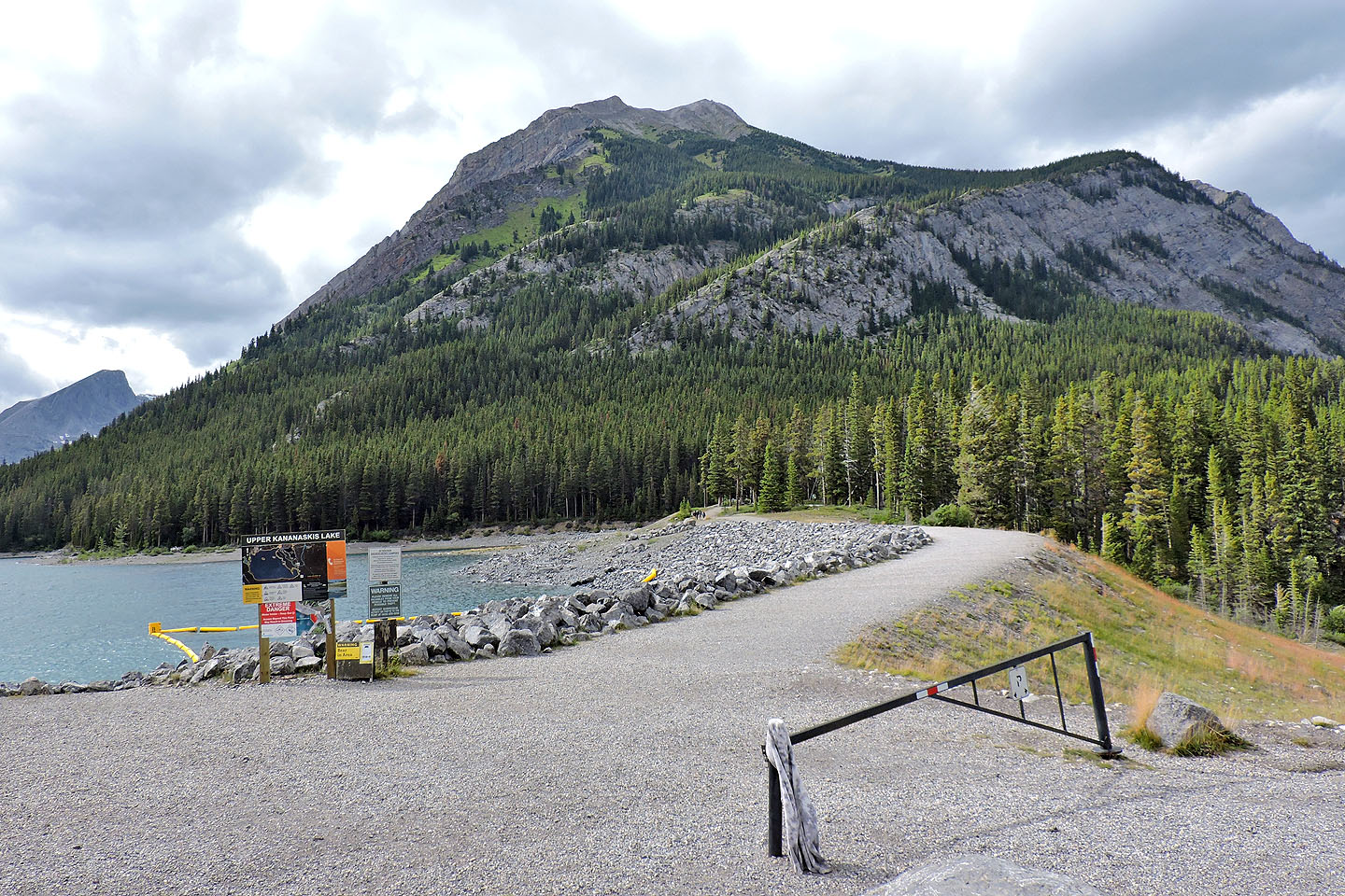
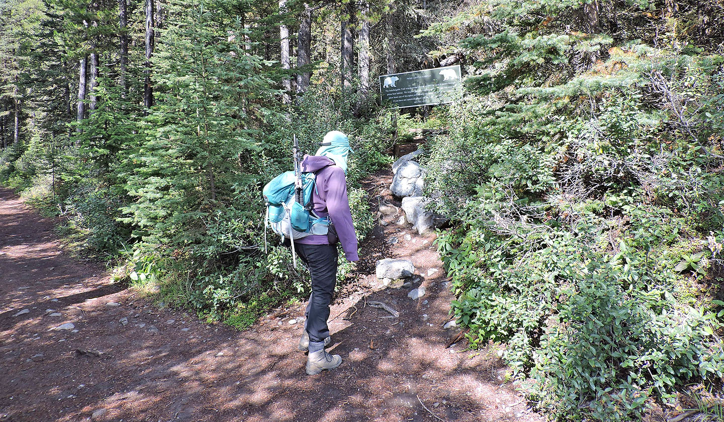
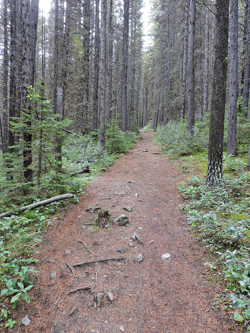
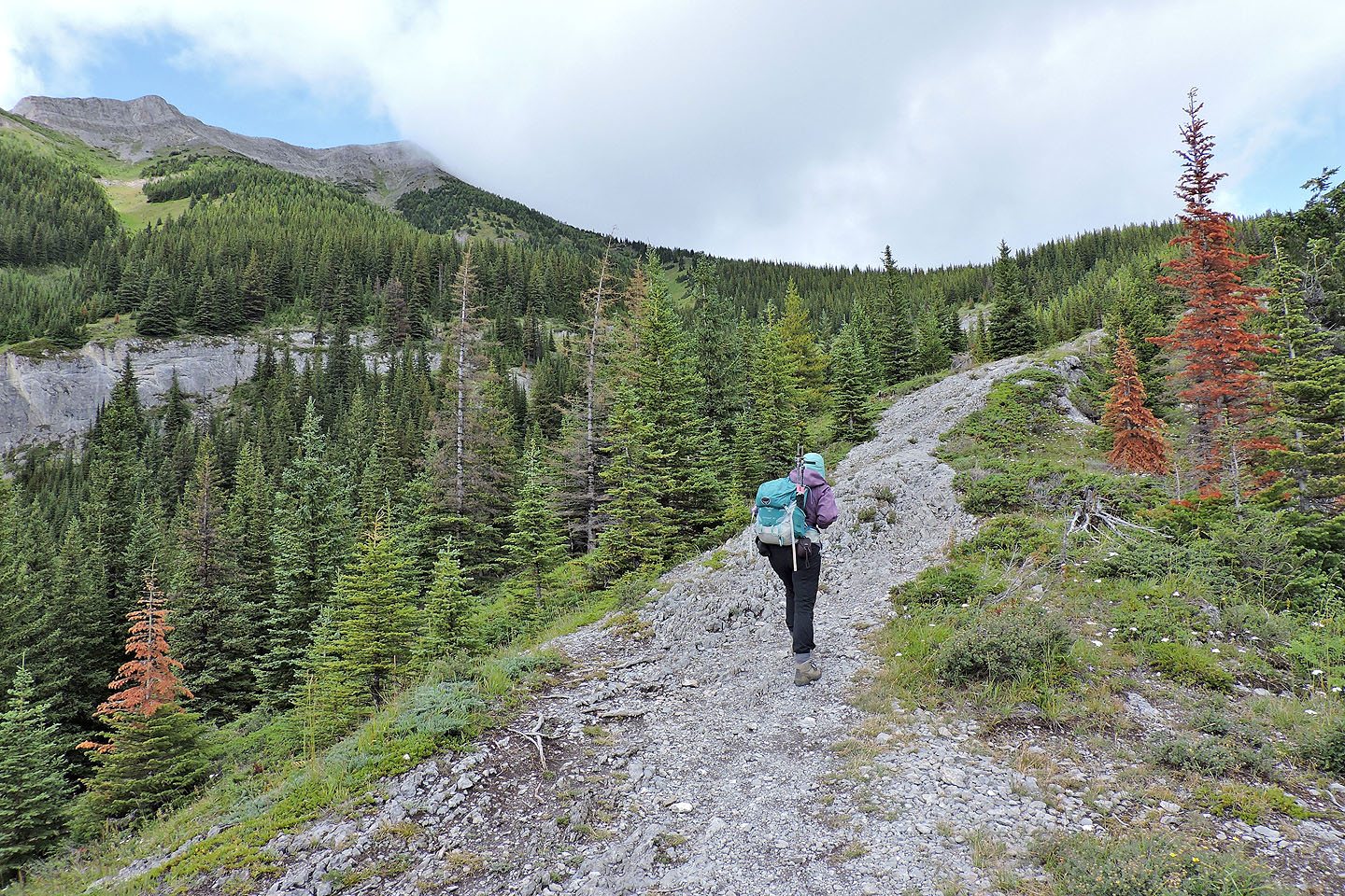
From the parking lot, we followed the trail as it briefly skirts the east shore of Upper Kananaskis Lake before coming to the side trail for Indefatigable. In a short time, the path became frustratingly braided, constantly splitting and rejoining so one can only guess which is the preferred fork. Most don't matter, but one does: it leaves the main trail and puts you onto a rocky spur for 300 m. It was mostly an offtrail hike with some easy scrambling, but before completing it, we took a shortcut back to the main trail. The spur route converges with the main trail at a viewpoint where a bench once stood before the trail was decommissioned.
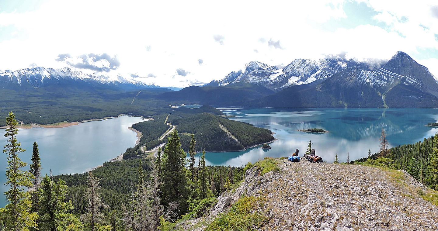
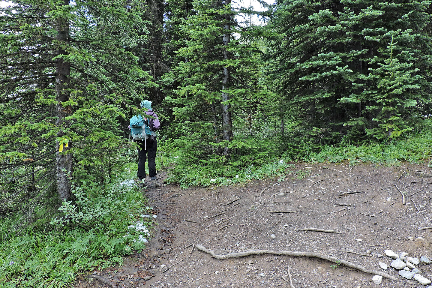
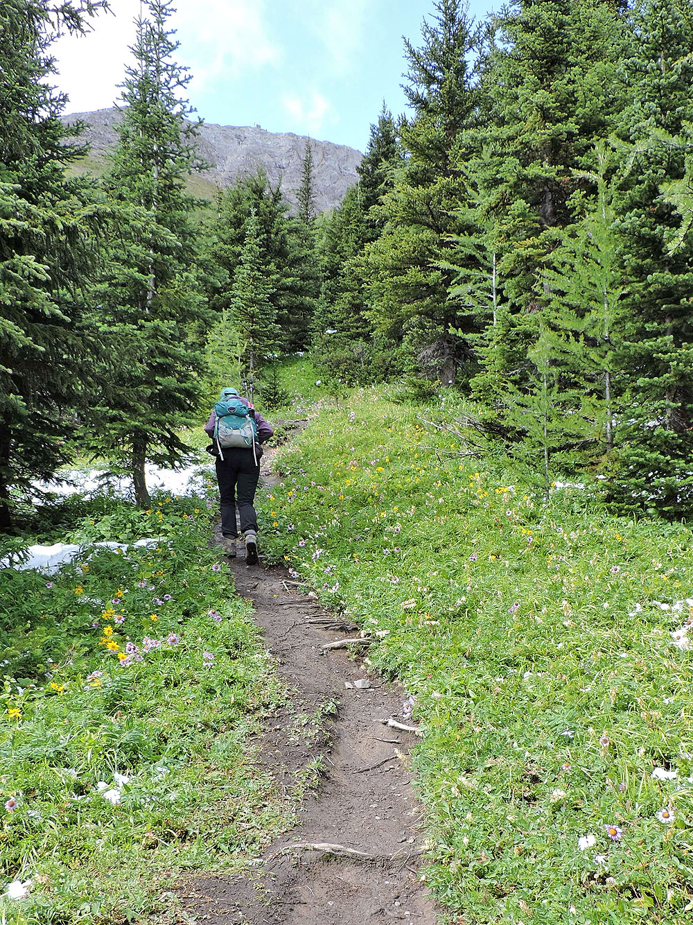
The hiking trail continues climbing the open spur and provides striking views of the deep blue waters of Lower and Upper Kananaskis Lakes. Soon after entering the trees, yellow flagging marks the junction for the south peak. The trail winds through trees – a few larches were starting to turn yellow – before climbing a grassy slope.
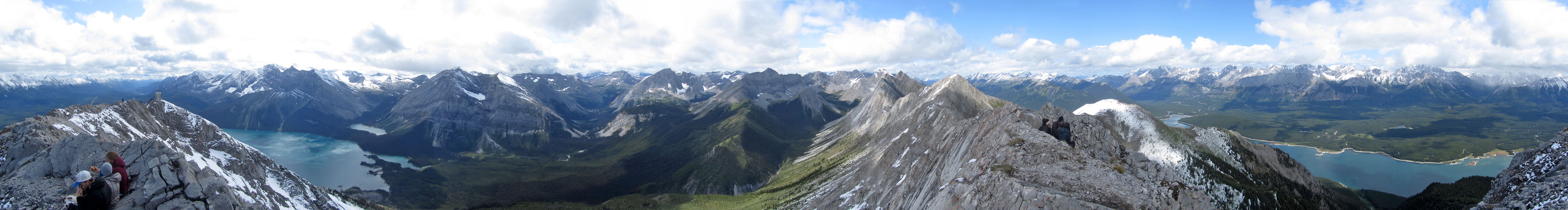
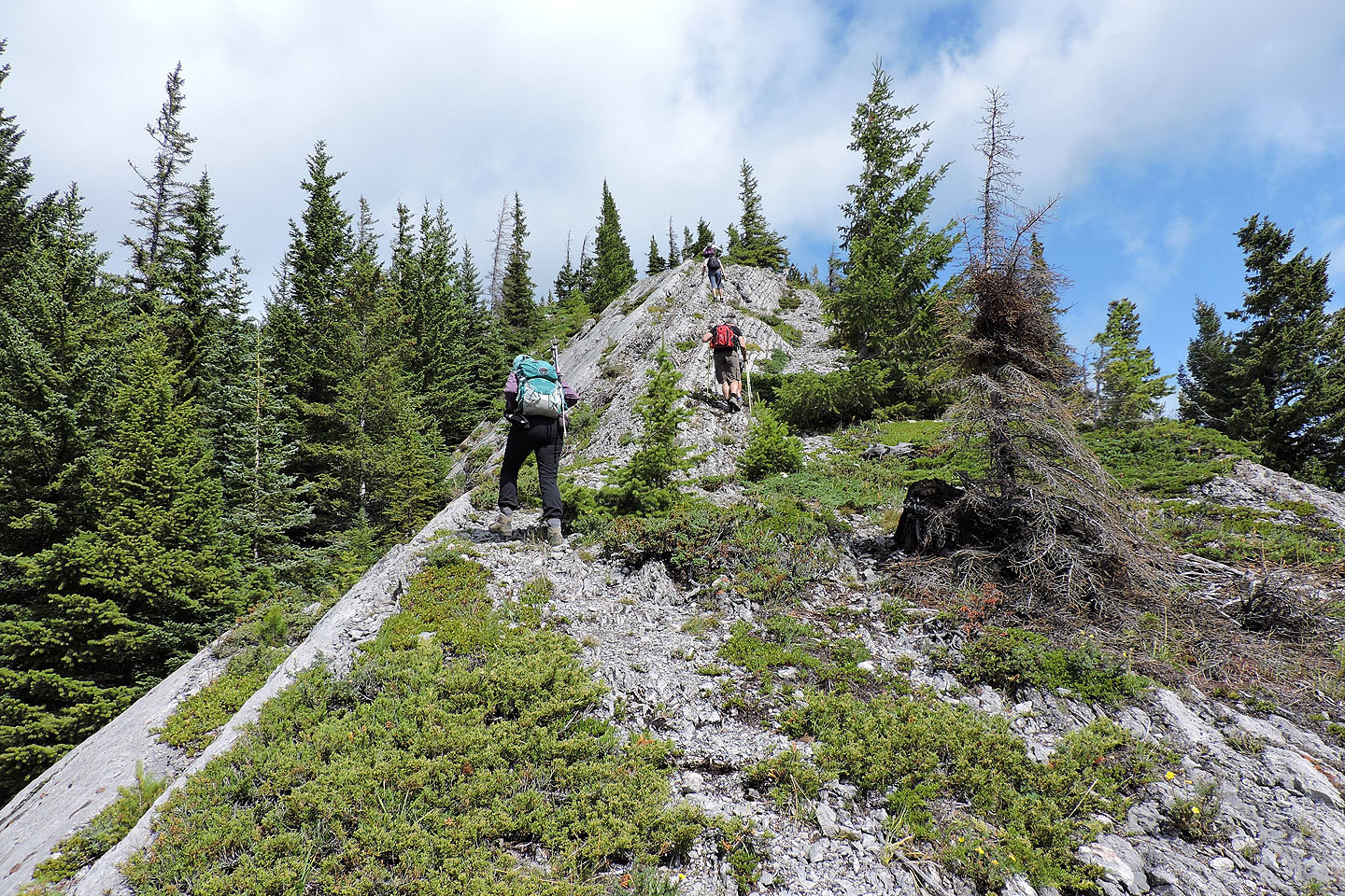
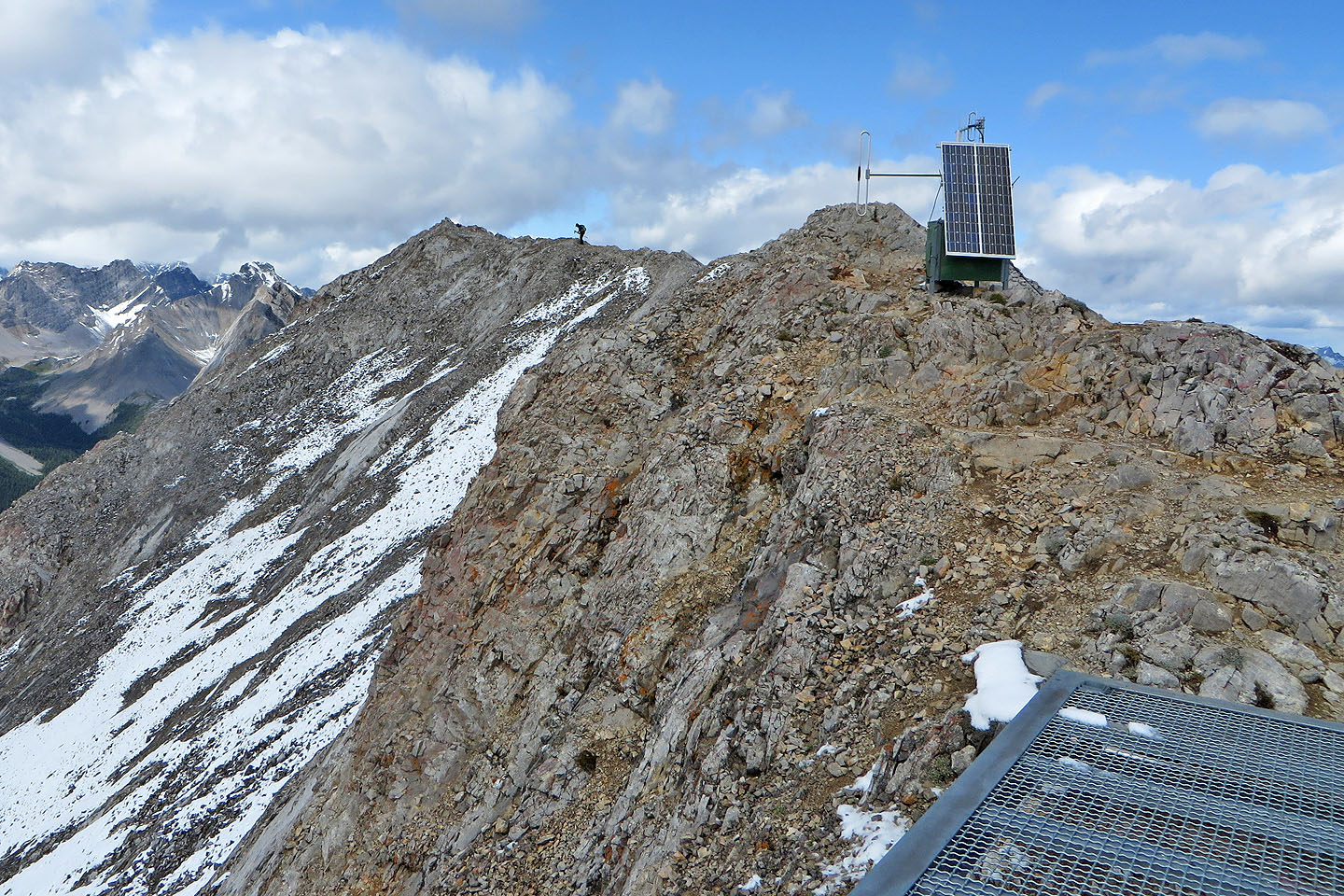
From there, we had a good view of the stony ridge leading to the summit. The trail follows the ridge for a time before turning left to climb a slope. The slope is topped by a cliff, so it's either go left or go right: trails run both ways. We went right, and although we had no trouble climbing a steep slope to gain the ridge, we learned later it's easier to go left (south). On the ridge crest, an obvious trail runs to a repeater station.
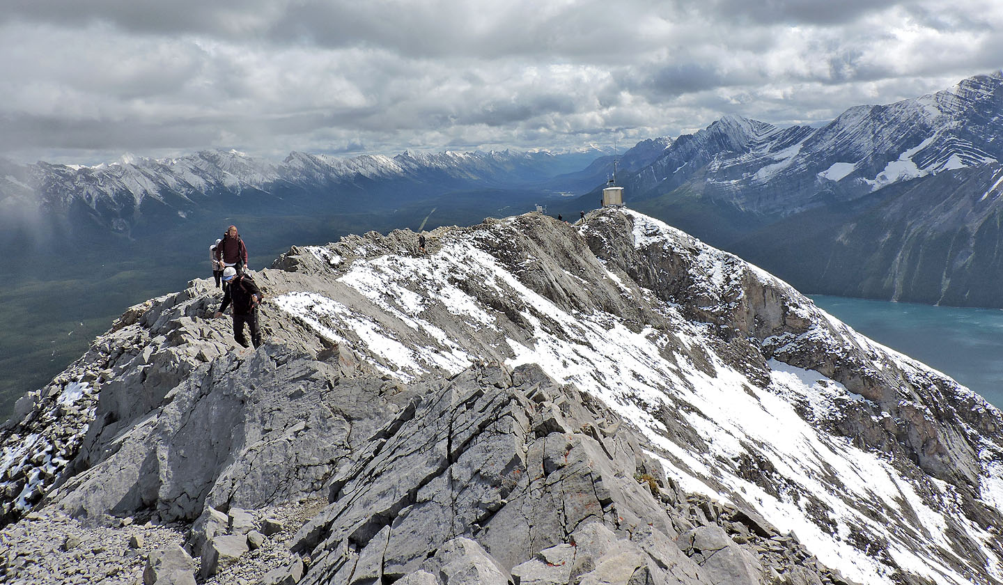
There were several hikers gathered there, including seven members of a soccer team, a fraction of the 21 that had started. They and most others stopped at the station. Beyond that, a narrow ridge with slight exposure discouraged most people from continuing to the summit 100 m away. Having done it, Dinah stayed back and took photos while I tagged the summit.
On our descent, we decided to follow the crest trail to see where it led. After passing the spot where we ascended, it didn't appear there could be a way down the cliff band, but a cairn marked a weakness. Some people went a little past it and scrambled down, but it's easier to climb down directly below the cairn. After getting down, we soon got back on the trail and followed it back.
Postscript: Although the trail is not closed, the environmental impact of hikers in this area is greater than that suggested by the mild warning sign at the trailhead. I only realized this when Bob St. John emailed me:
Why you shouldn’t go up the Mt. Indefatigable trail
Please read the article before deciding to ascend Mount Indefatigable. It was enough to change his mind about going. I wouldn't have gone if I had known.
Indefatigable South seen from the trailhead. The summit is the rounded point in the centre.
300 m from the parking lot, we came to Indefatigable trail (mouse over to read the sign)
Except for deadfall just after the sign, the trail was in good shape
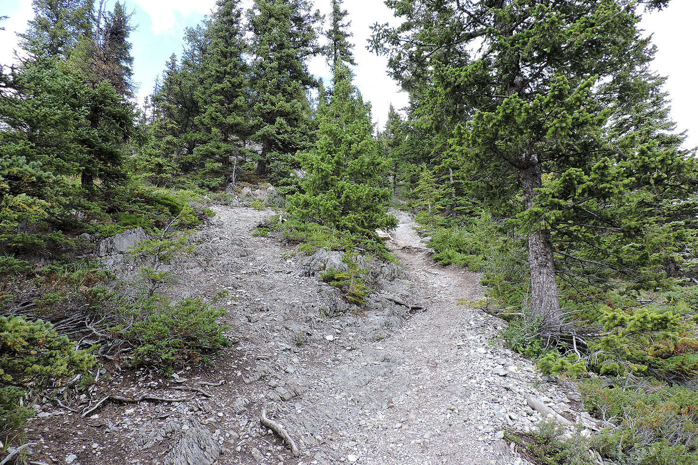
The trail splits here.
We kept right and it took us up the rock spur. Left is the main trail.
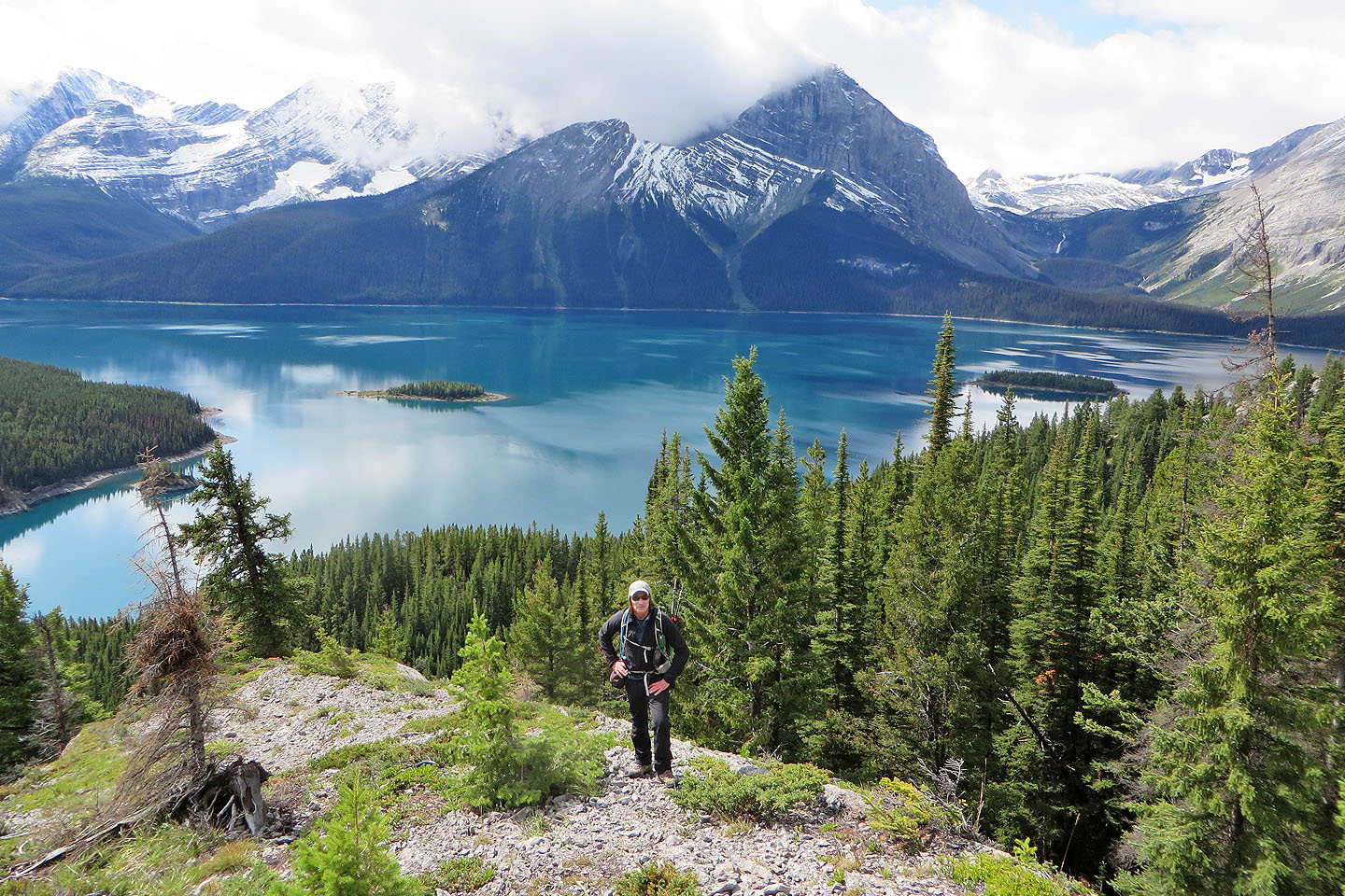
Starting up the spur with Lower Kananaskis Lake in the background
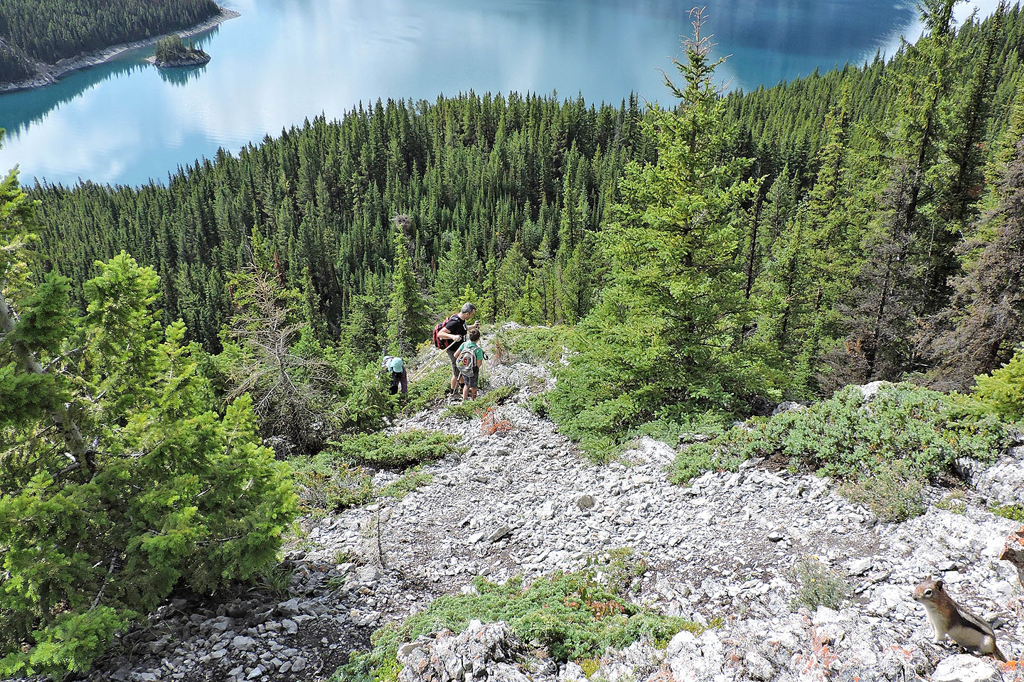
Dinah passes a family while a curious chipmunk looks on
Going up the spur
We left the spur here and took a side trail to the main trail
The main trail and spur trail meet at a viewpoint. A bench sat here before the trail was decommissioned.
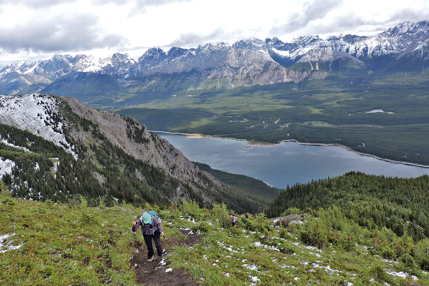
Continuing up the trail with the summit ridge far left
Yellow flagging marks the side trail to the south summit
A short time later, we could see the repeater station on the summit ridge
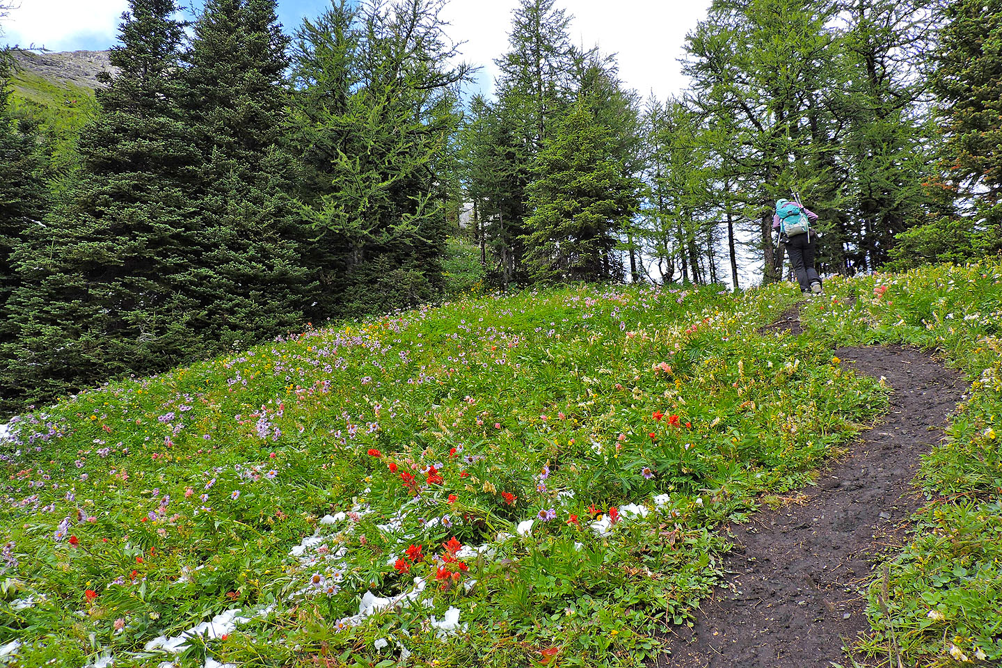
There were plenty of wildflowers in meadows
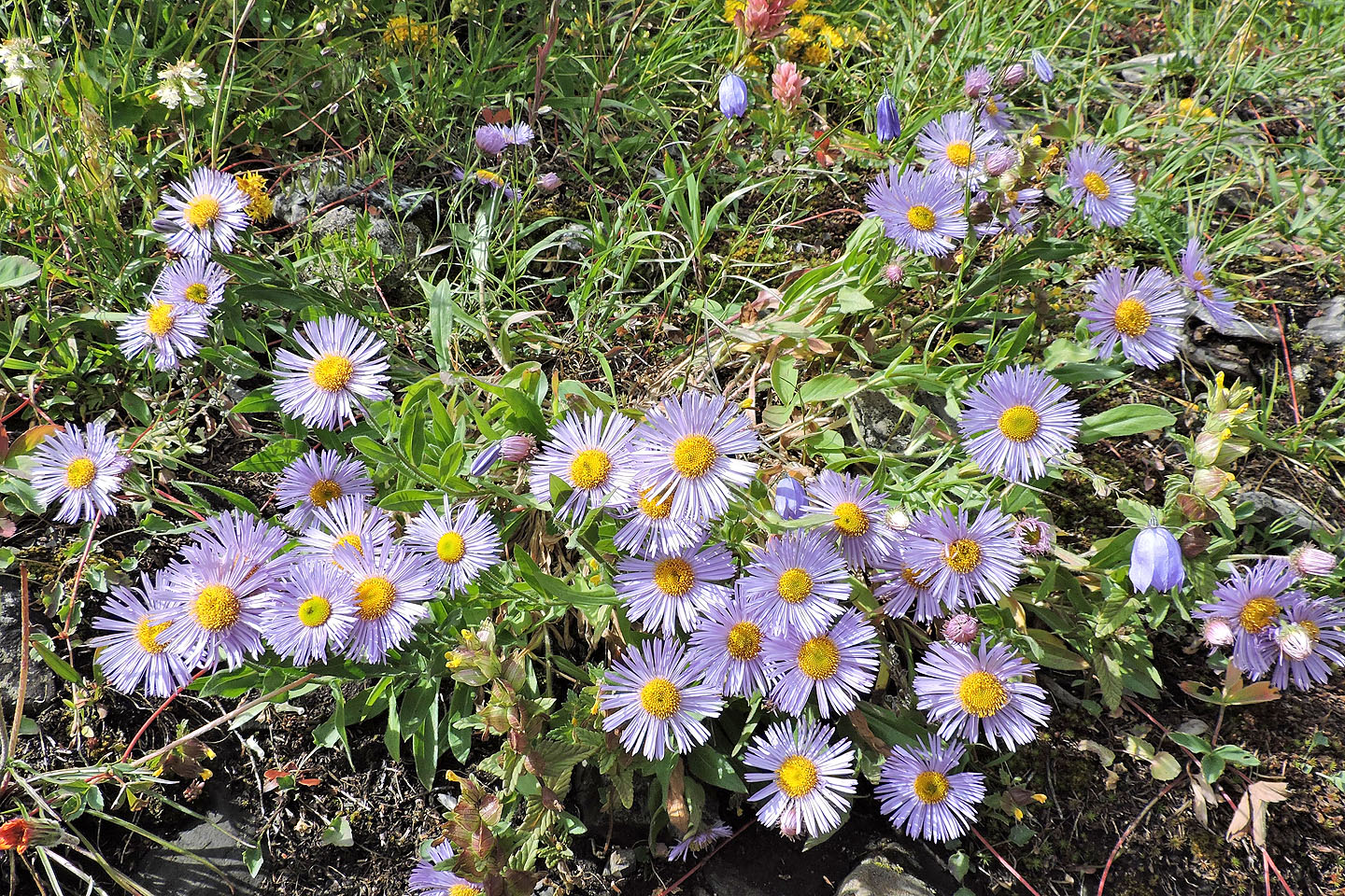
Purple fleabane
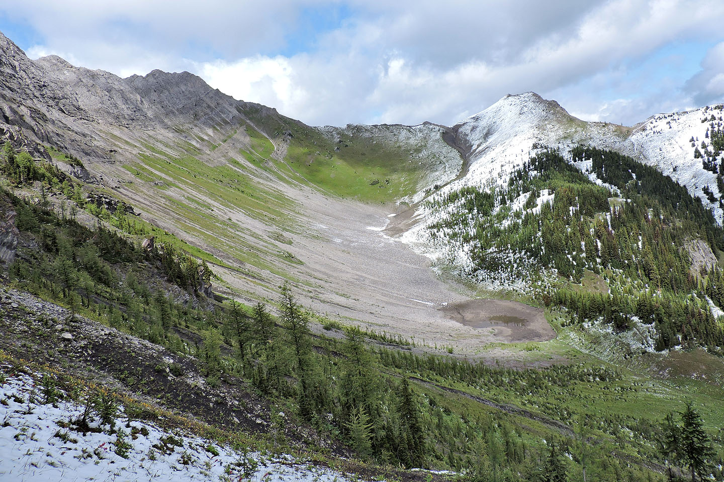
From a viewpoint, the north peak and an outlier can be seen
The summit came into view
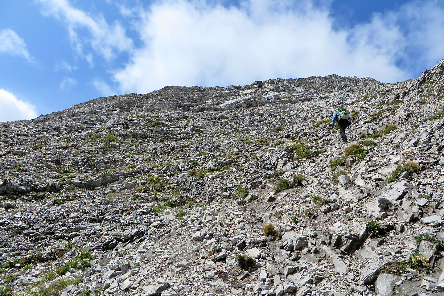
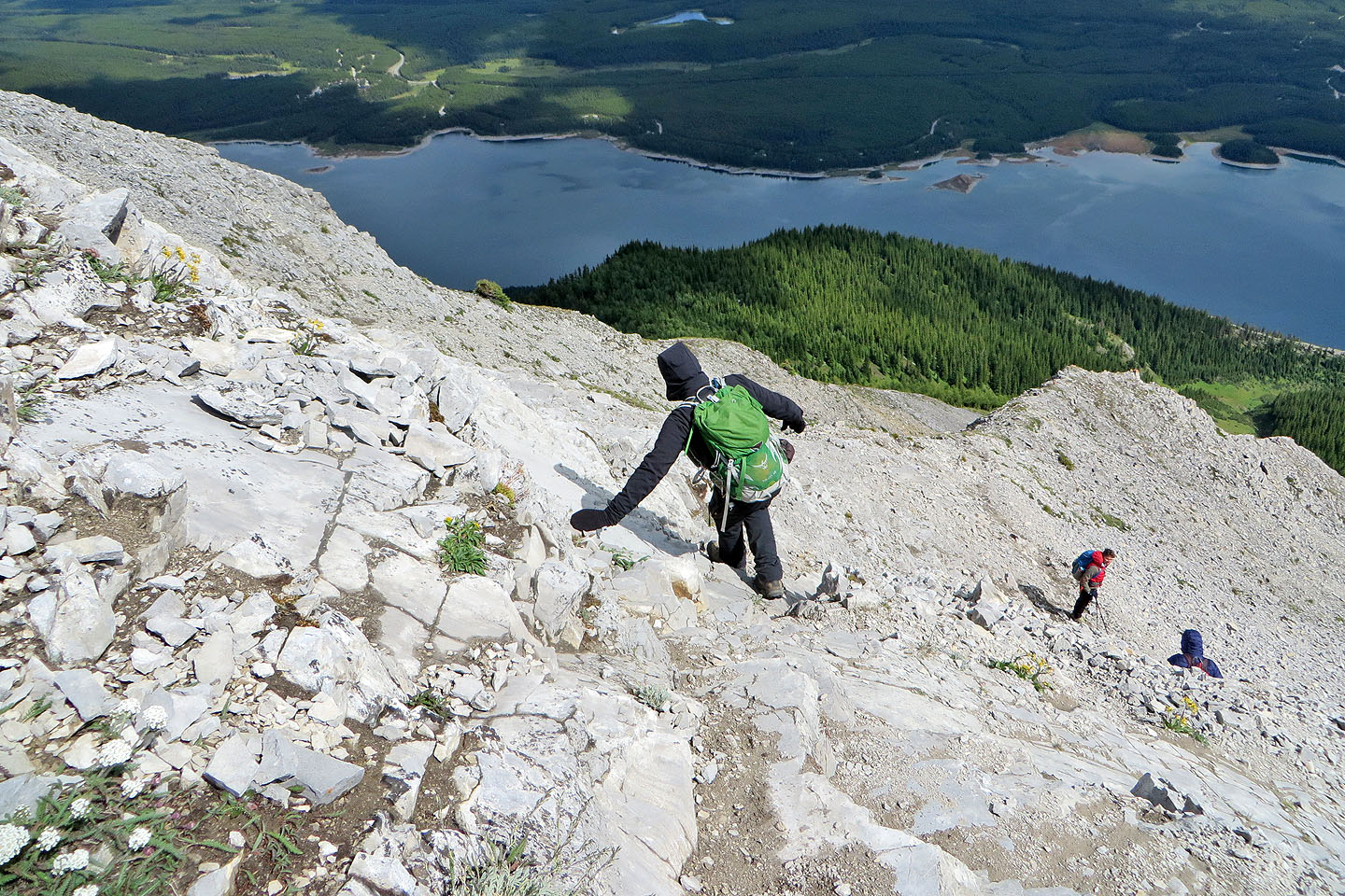
Above the treeline, the trail was slippery after recent precipitation
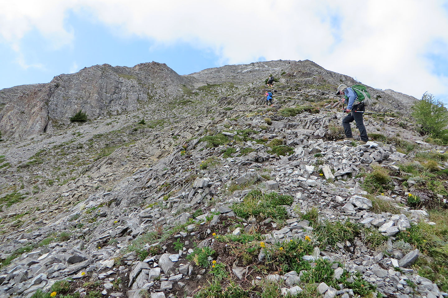
Once on the stoney crest, we follow bits of trail
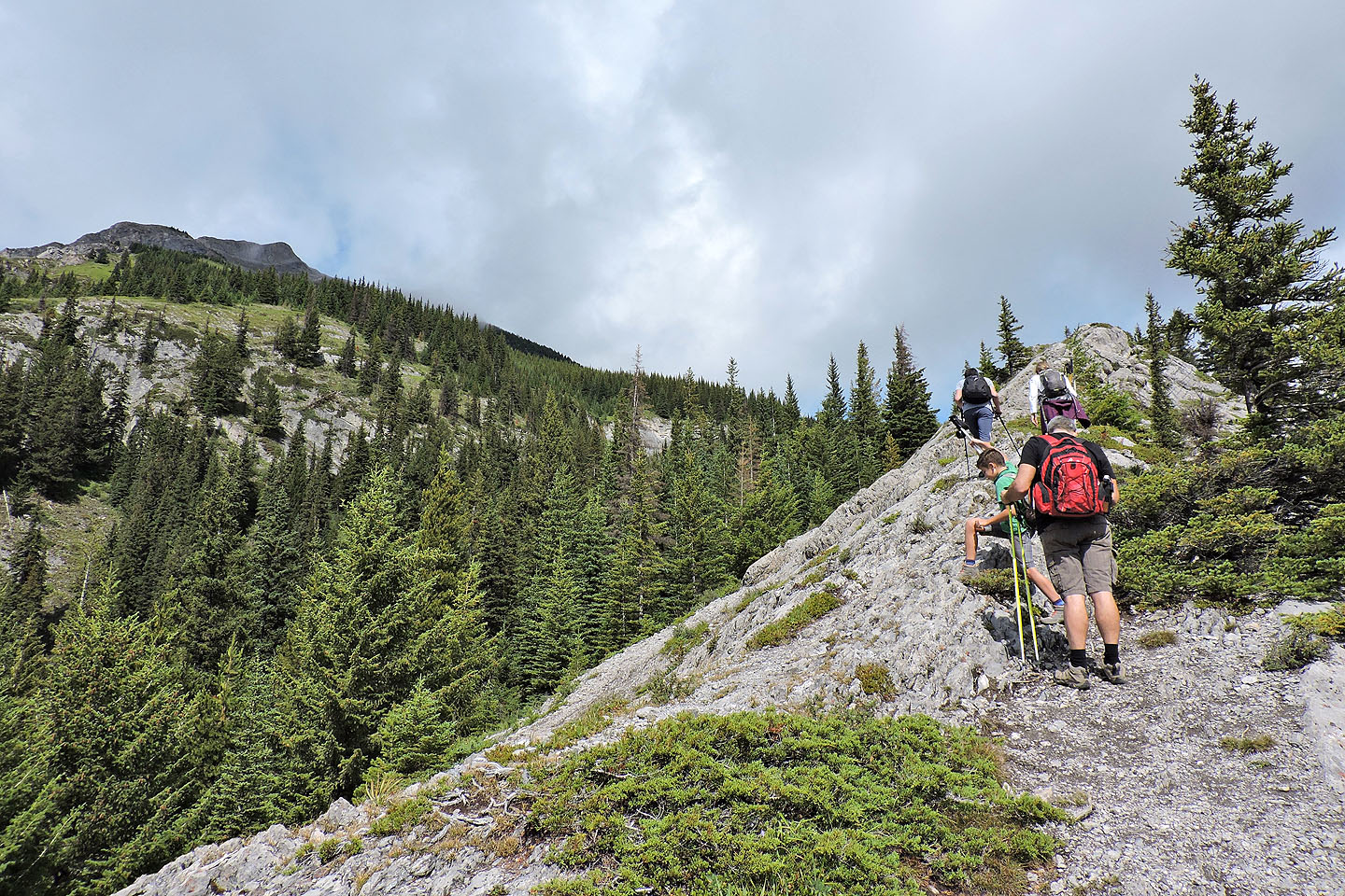
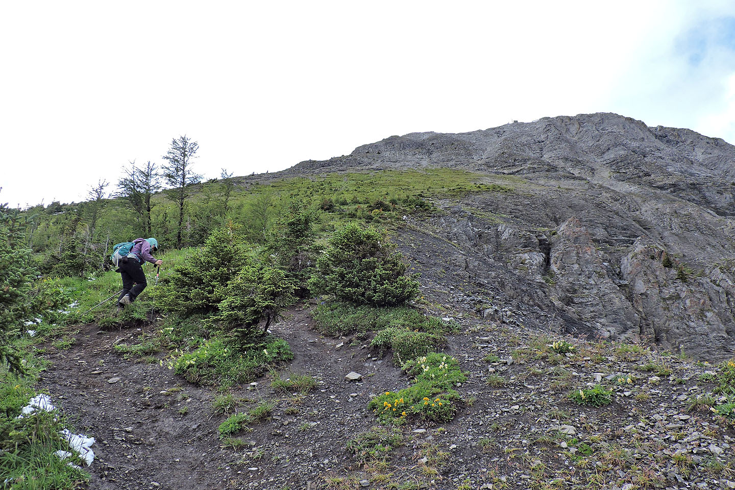
Higher up, the slope is riddled with trails. We kept right although later we realized it's better to go left.
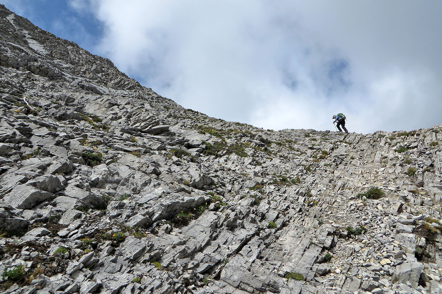
Past this point, around the corner, we climbed up a steep, little chute to the crest
Dinah follows behind me
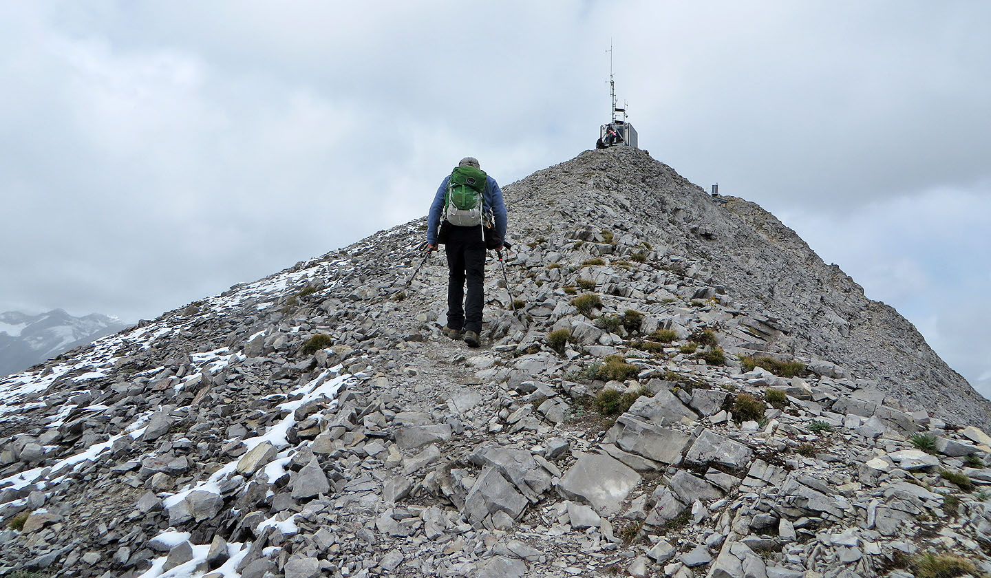
Once on the ridge, we followed a trail to the repeater station
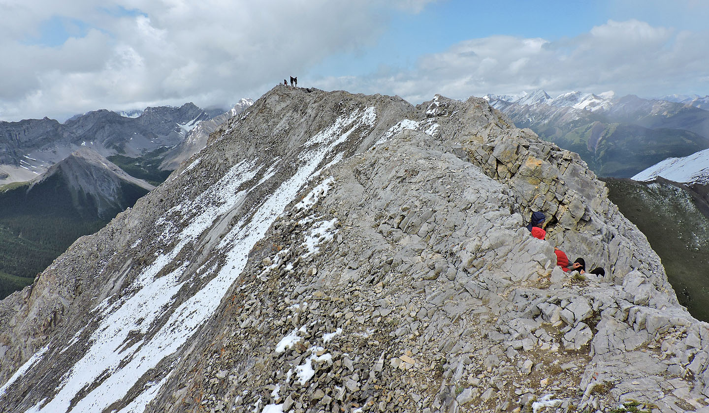
After the station, a narrow path starts along the ridge
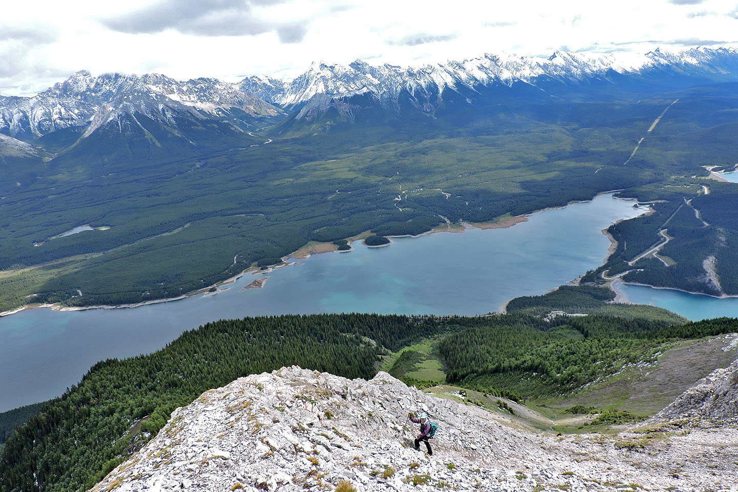
Dinah took this photo of me from the station
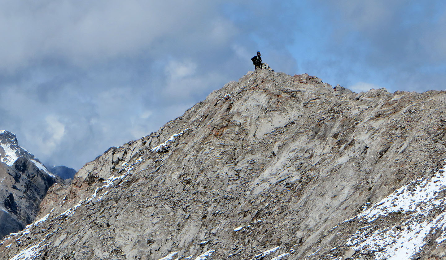
Standing on the summit
Looking back at the station from the summit
On our descent, we climbed down from a point marked by a cairn
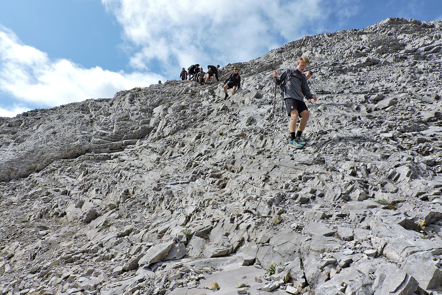
Looking back as the soccer team comes down
82 J/11 Kananaskis Lakes