bobspirko.ca | Home | Canada Trips | US Trips | Hiking | Snowshoeing | MAP | About
South End of Lawson
aka Little Lawson, South Lawson Peak
Kananaskis, Alberta
September 18, 2010
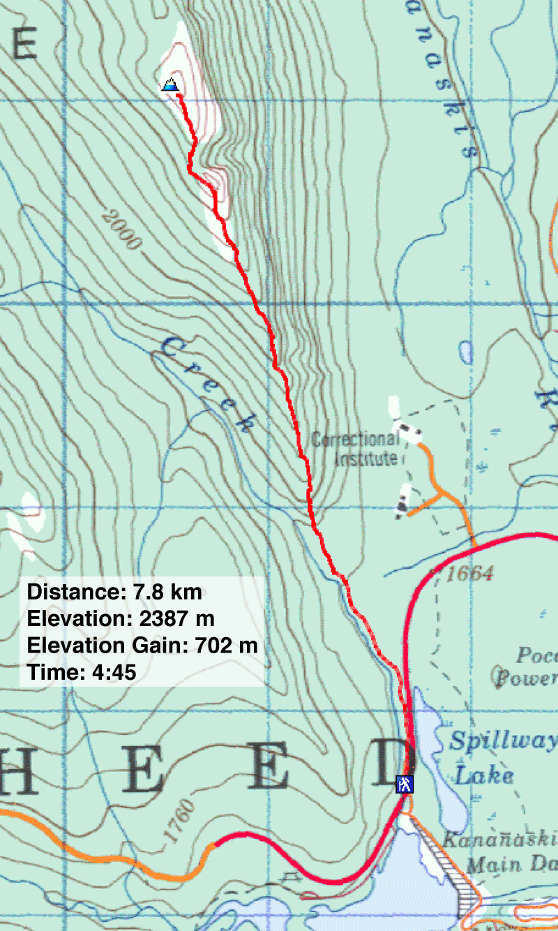
Distance: 7.8 km (4.8 mi)
Cumulative Elevation Gain: 717 m (2352 ft)
We were expecting poor weather when we planned to climb the South End of Lawson, but when Saturday rolled around the forecast had improved. After a succession of rainy days, this was a day of respite and we were blessed with morning blue skies.
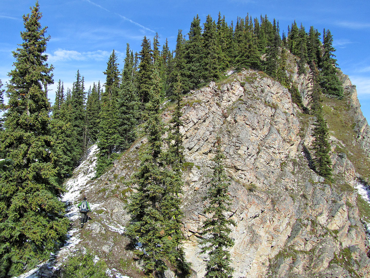
Following directions in Gillean Daffern's Kananaskis Country Trail Guide – our first trip in her fourth edition – we parked at the gate and walked up the TransAlta road. At the end of the road, after crossing a dry bed hidden in trees, we found the trail. Unfortunately it was vague throughout and we often lost it, but we always quickly regained it.
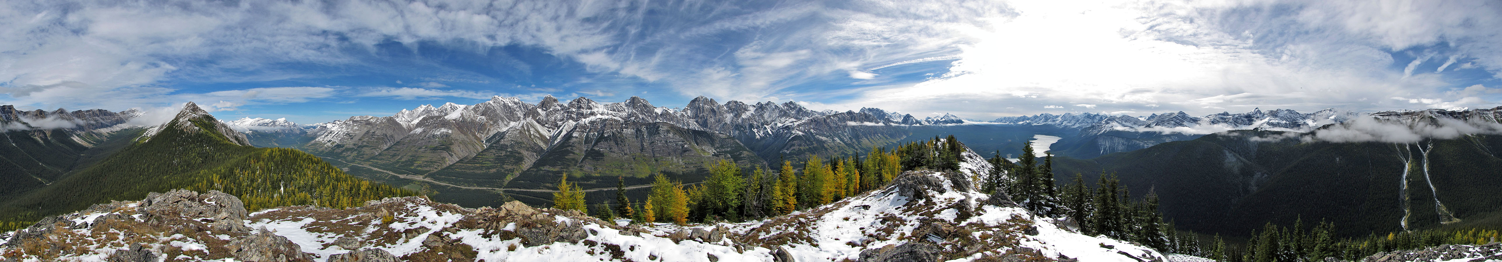
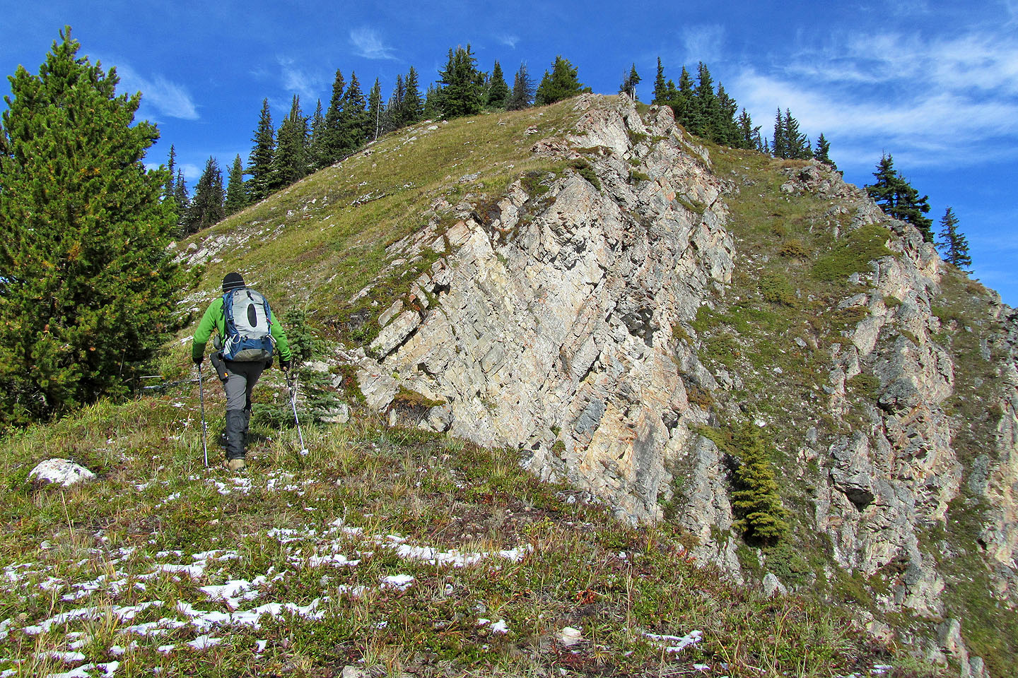
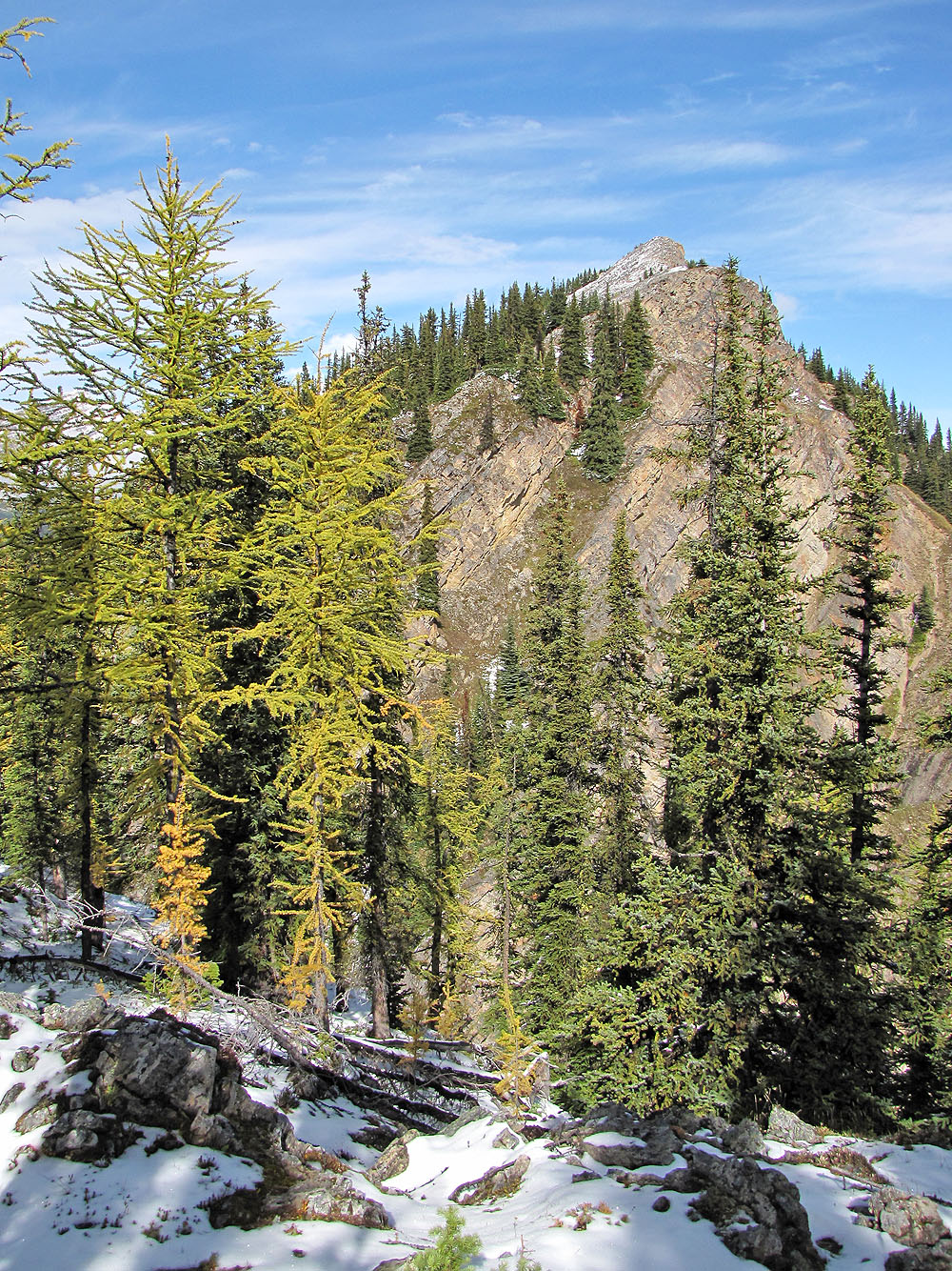
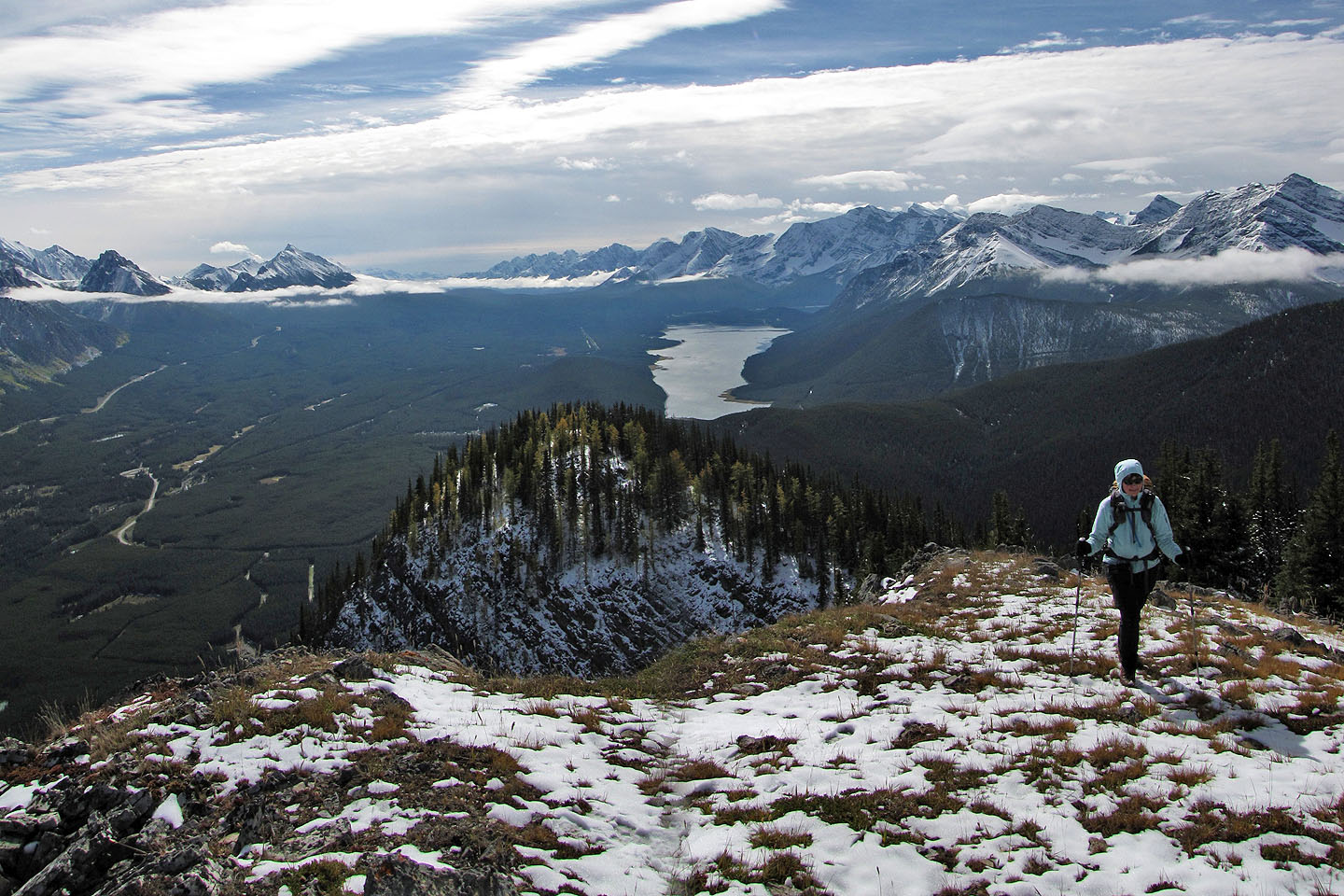
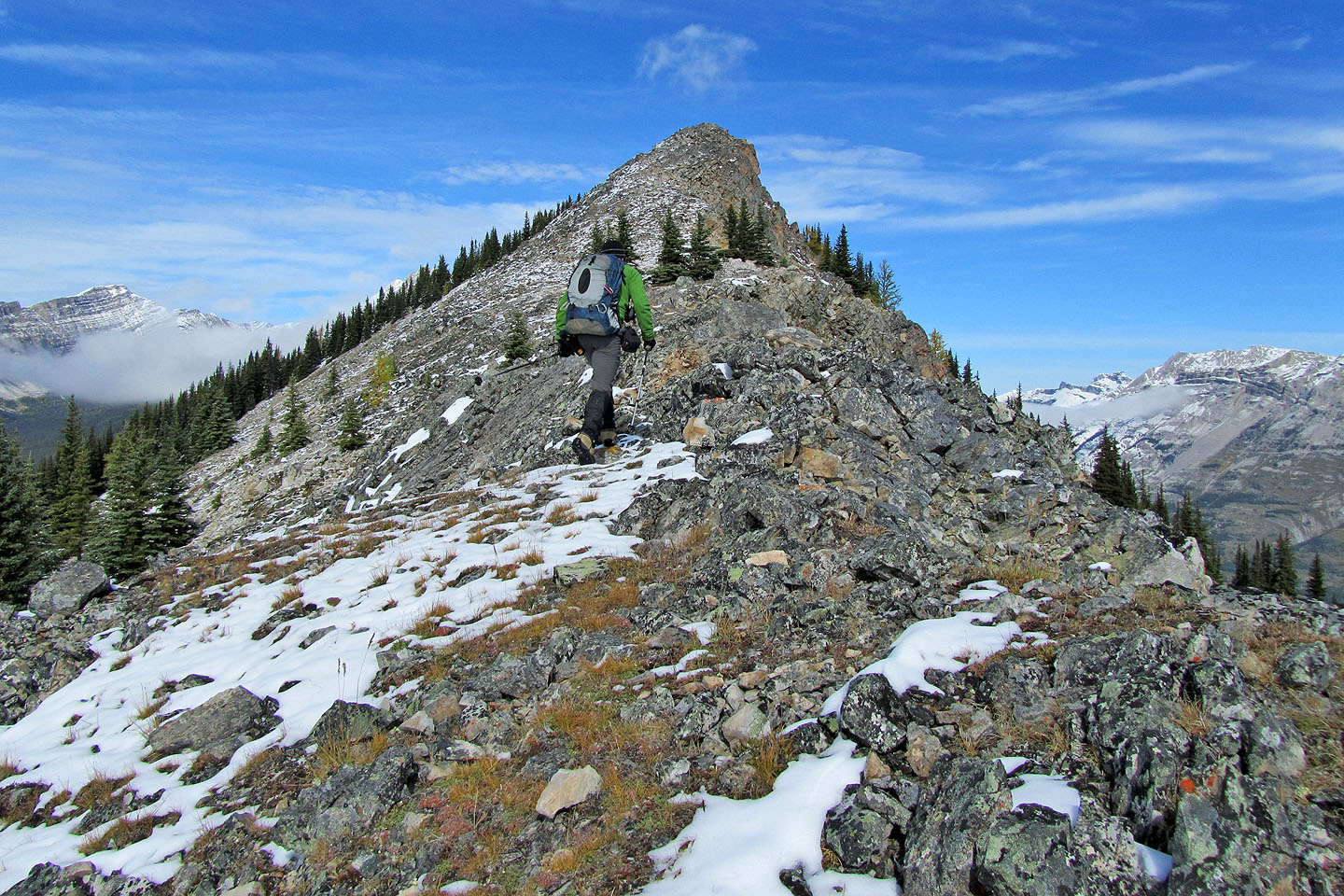
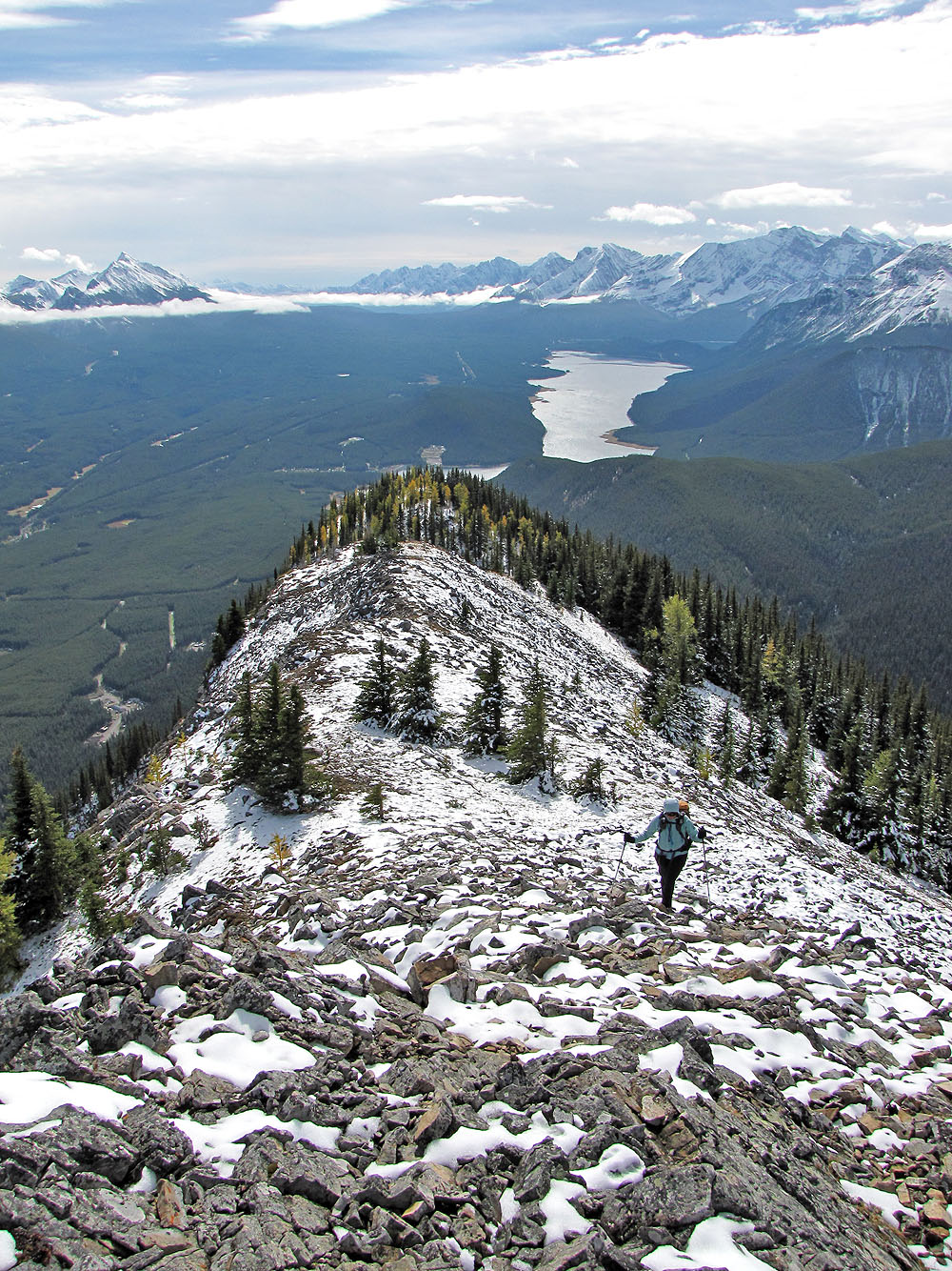
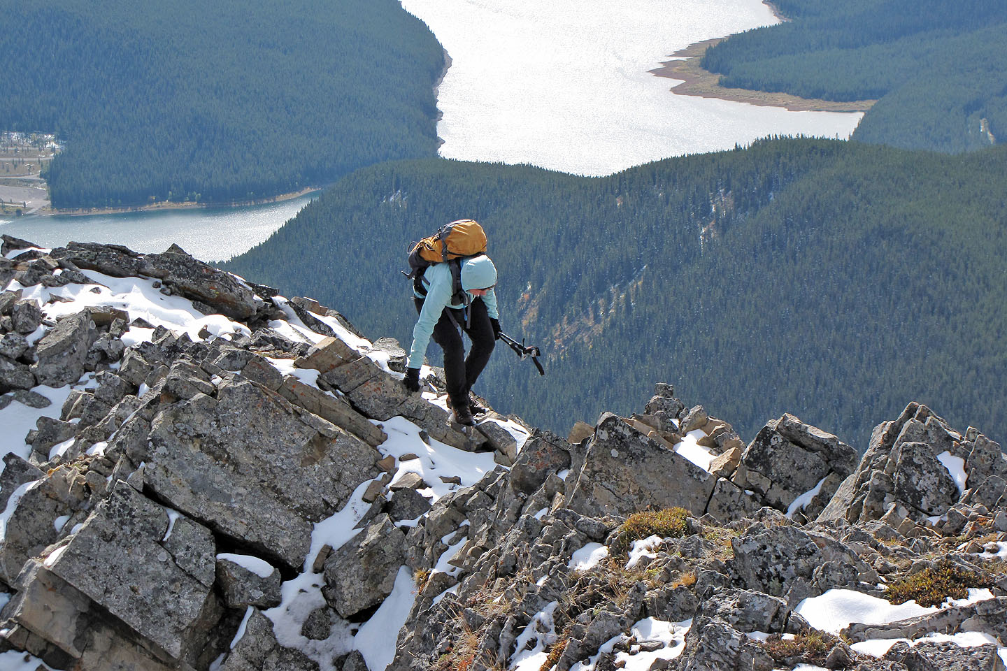
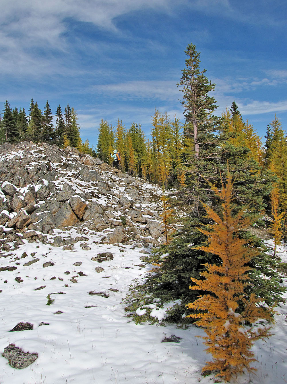
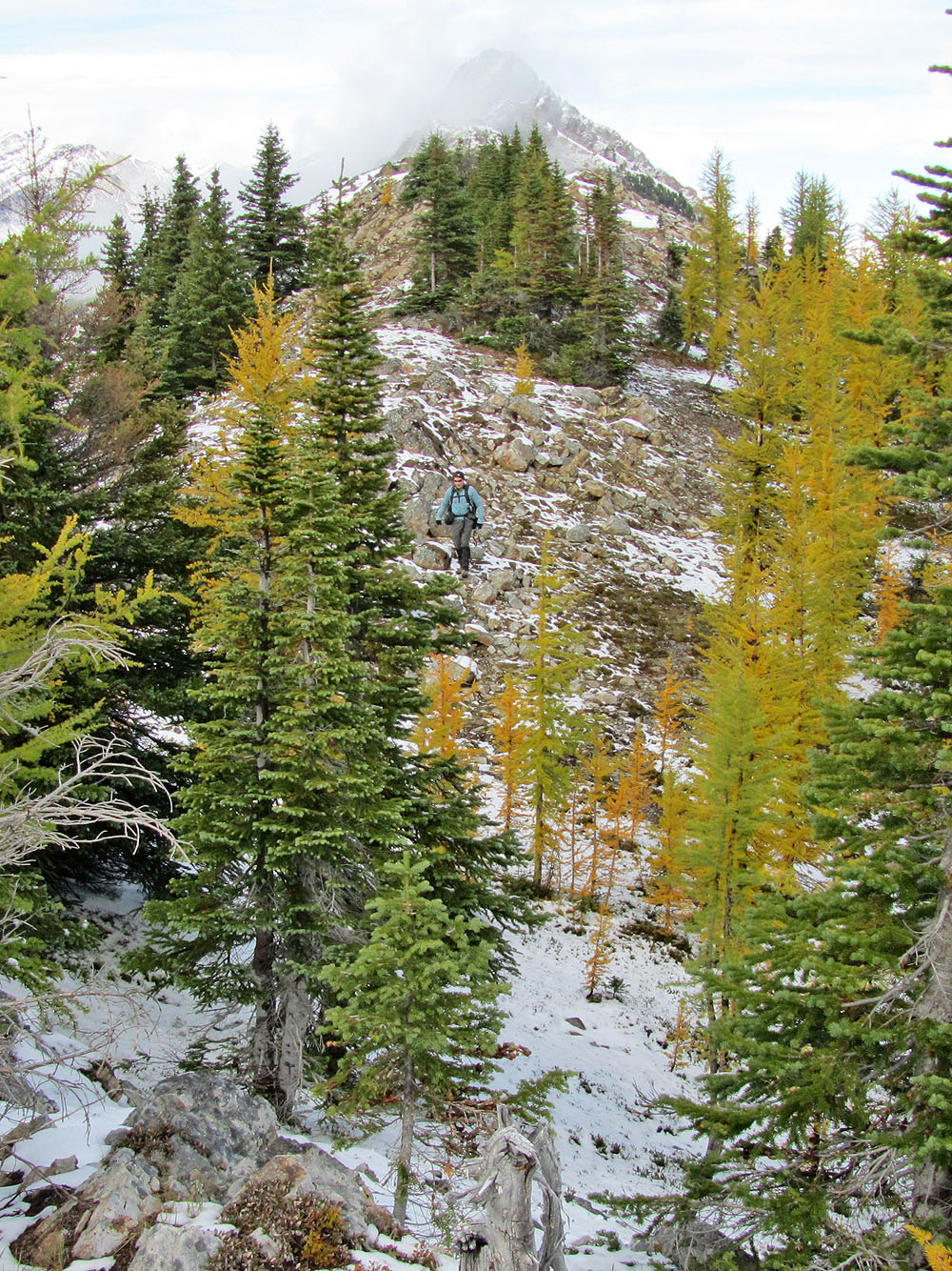
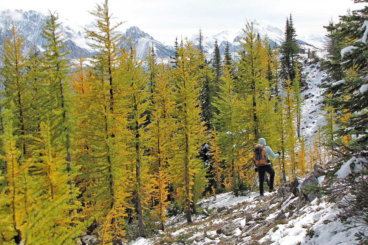
Initially, there wasn't much to see, but as we climbed higher, clearings offered expansive views to the south, revealing Kananaskis Lakes. The rocky false summit provided the best views, but we were more interested in the ridge traverse here since it requires a short scramble. We were curious how that would go, especially because we had encountered snow patches. But the crossing was snow-free and easy. From the false summit, we reached the true summit in five minutes. Here, competing with the mountain scenery, we saw larches taking on fall colours. We spent half an hour on top before turning around.
While checking our GPS receivers on the way back, we noticed that the road was longer than indicated in the guidebook. Later we learned the trailhead is actually a few hundred metres south of what's shown on the map, making the road 1.2 km long instead of .7 km. (Gillean is aware of the error.)
For a short hike, this was a surprisingly enjoyable outing. As Gillean suggests, the South End of Lawson is destined to become popular.
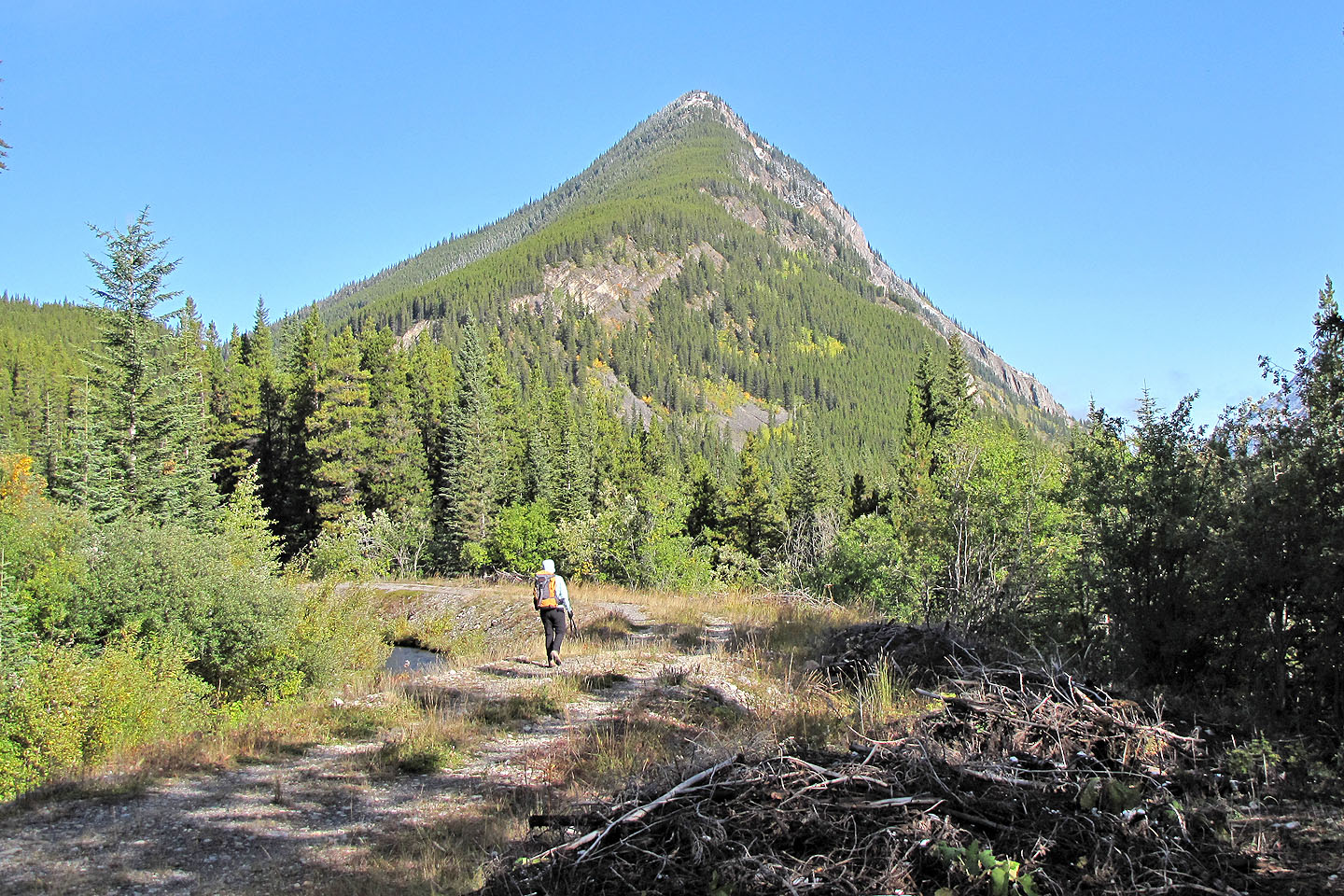
The South End of Lawson
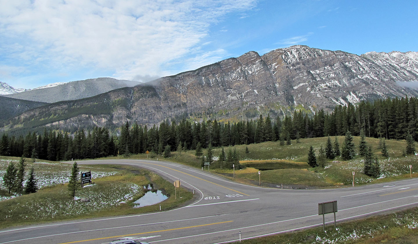
View of the South End of Lawson from the road
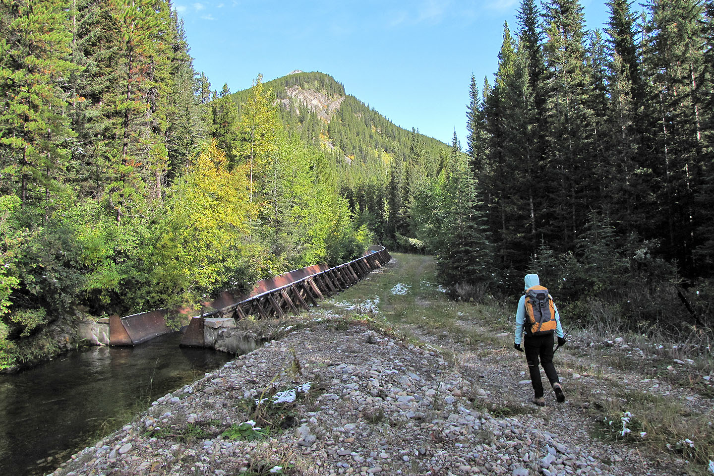
The flume
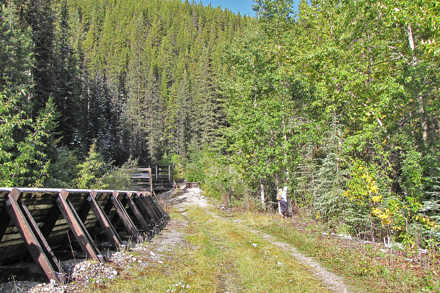
Looking for a place to exit the road
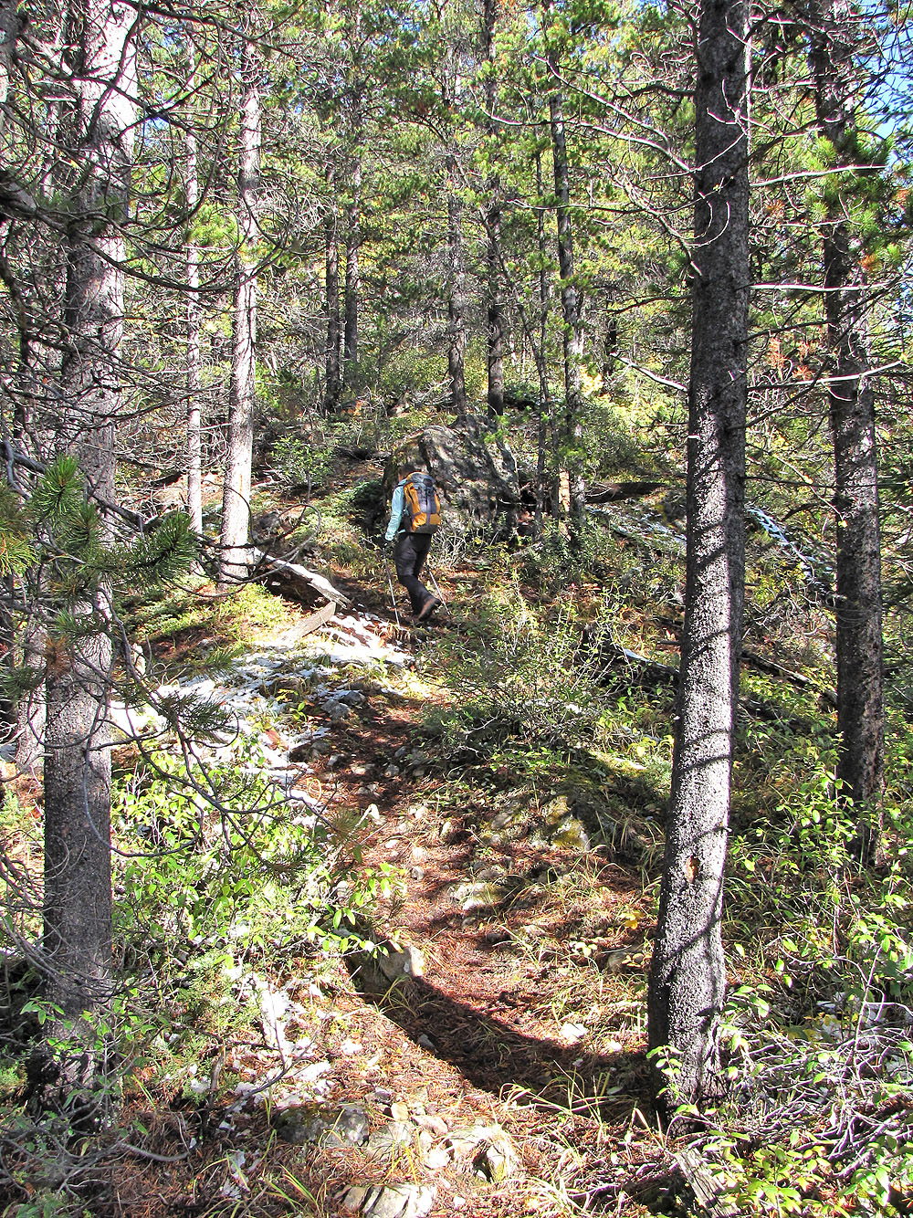
On the trail
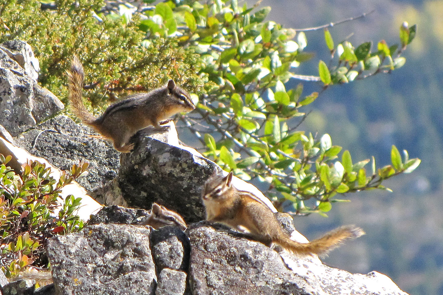
Three of a brood of four chipmunks we saw scampering on the rocks
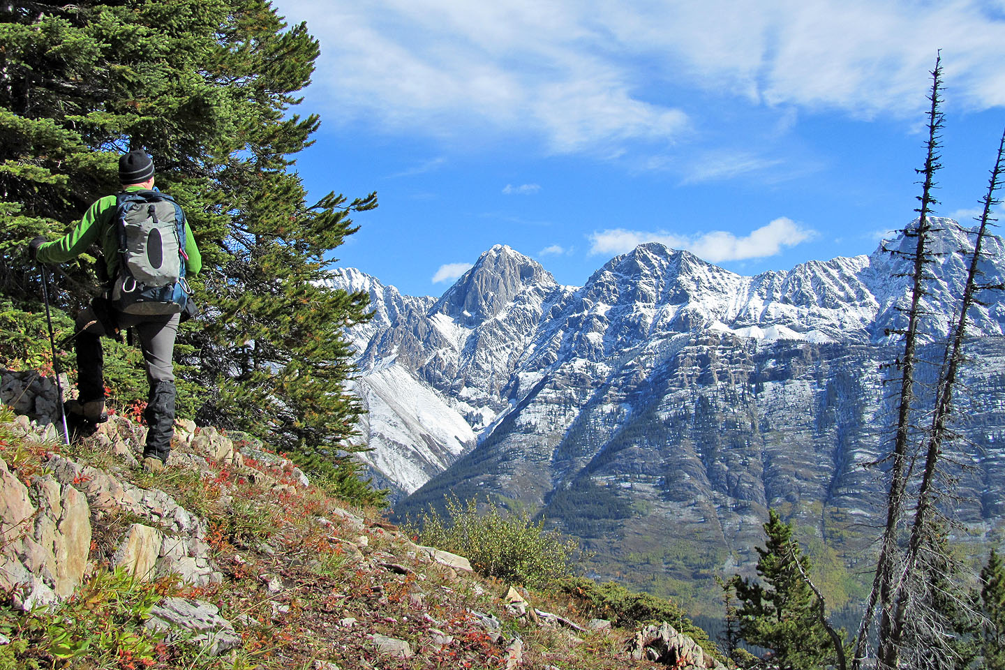
Mount Packenham and Mount Hood
Coming to a grassy slope
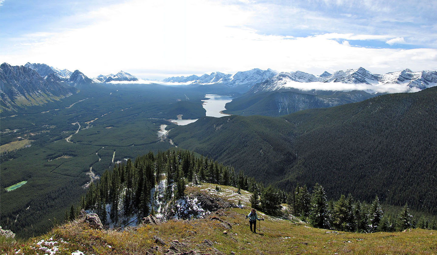
Dramatic views south
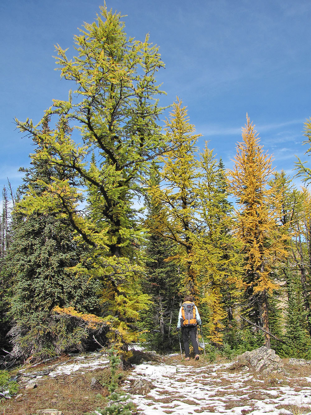
Larches
The ridge appears to end here but there's a col on the left
Crossing the col
Looking back
Coming up to the false summit
Looking back from below the false summit
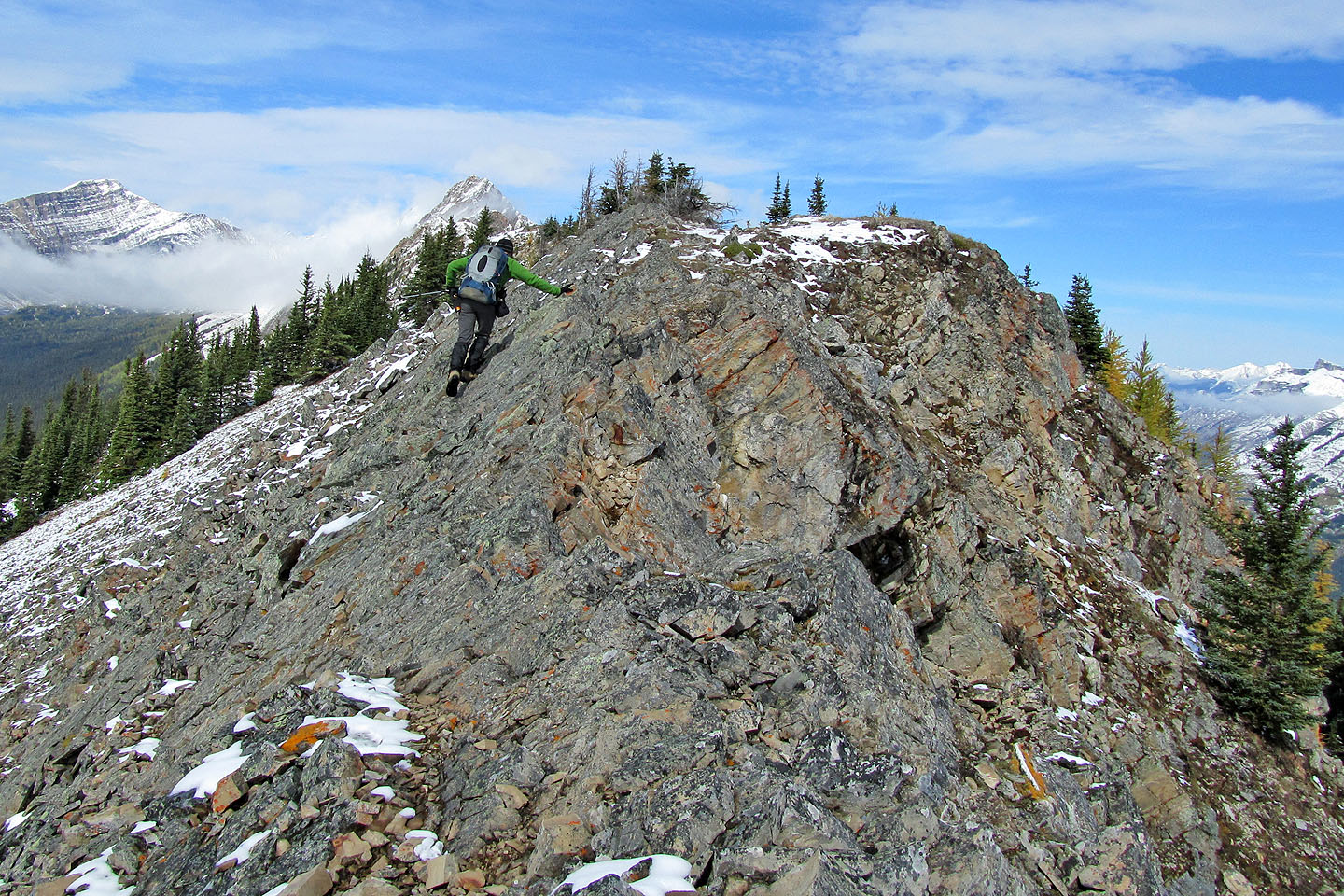
Traversing below the crest
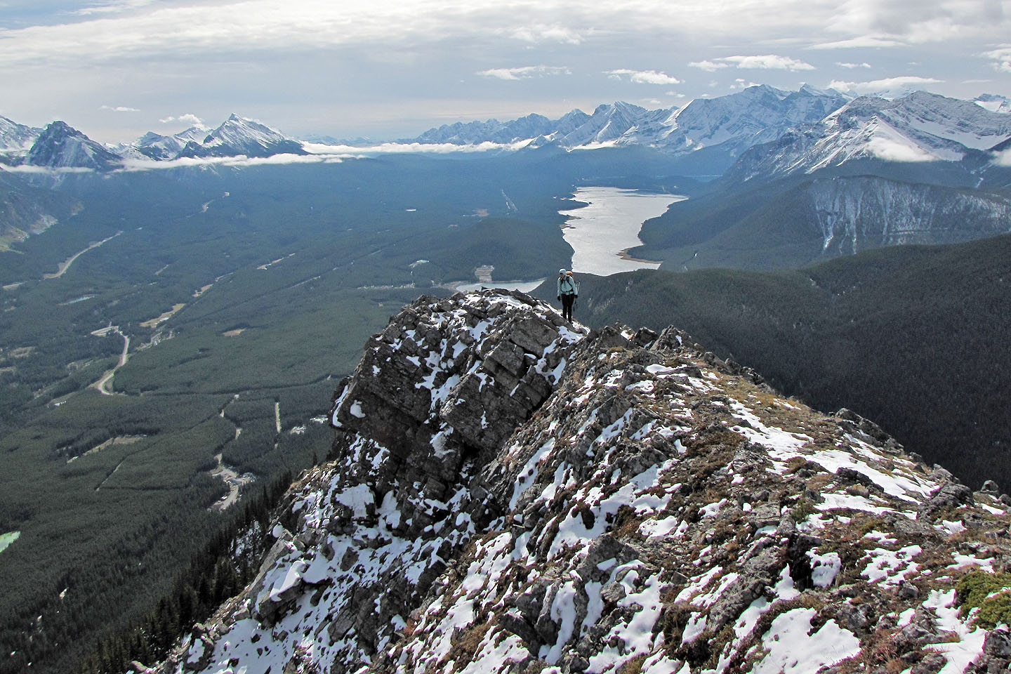
Dinah is poised to cross a narrow section
She starts across
Heading to the true summit
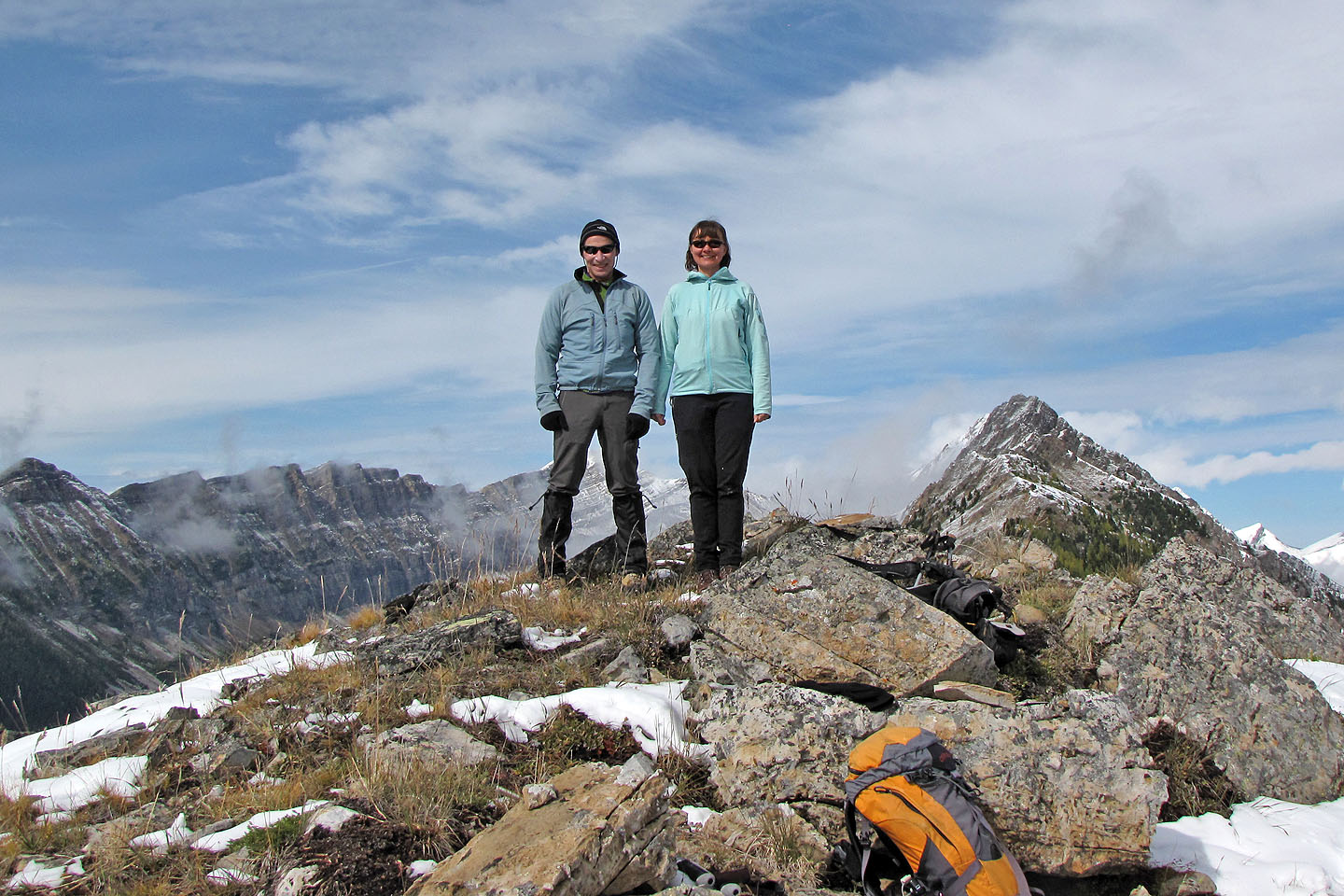
On the summit
Coming down the summit
Heading back to the false summit
82 J/11 Kananaskis Lakes