bobspirko.ca | Home | Canada Trips | US Trips | Hiking | Snowshoeing | MAP | About
Red Peak
Kananaskis, Alberta
August 17, 2013
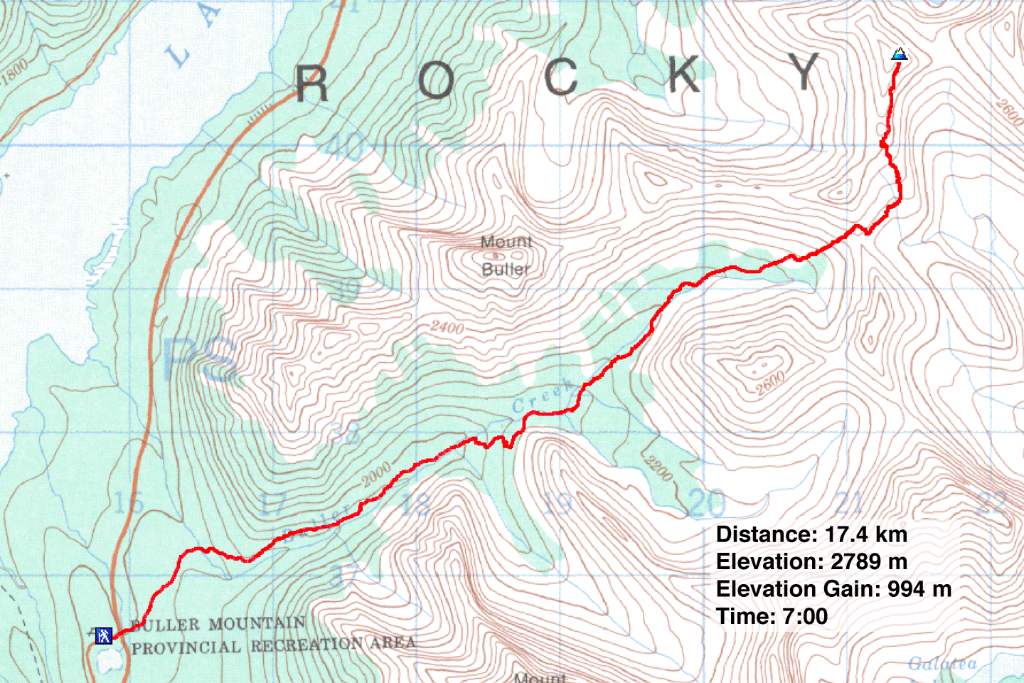
Distance: 17.4 km (10.8 mi)
Cumulative Elevation Gain: 1055 m (3461 ft)
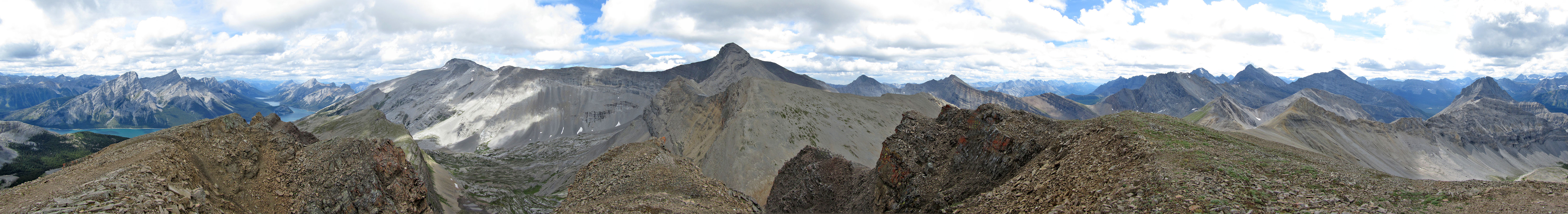
Overlooked in favour of taller peaks with official names, such as Mount Buller and Mount Engadine, Red Peak offers comparative scenery but an easier ascent, no more than a steep hike from North Buller Pass.
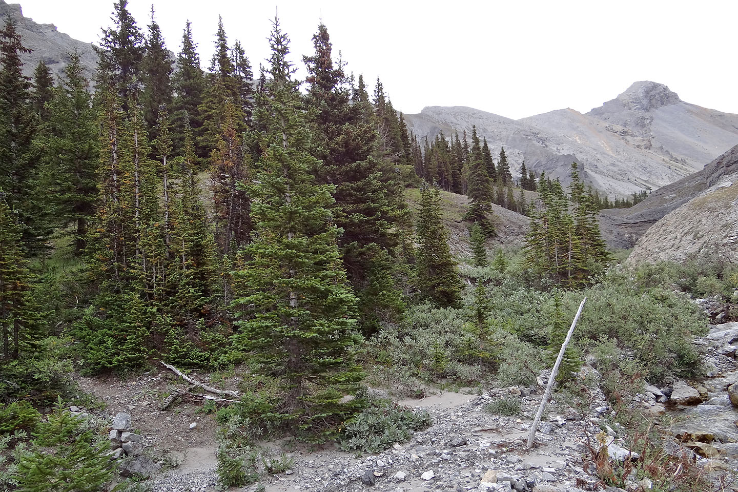
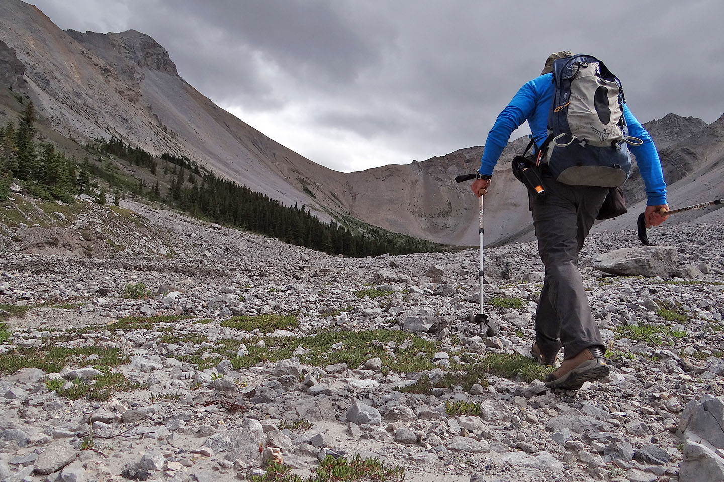
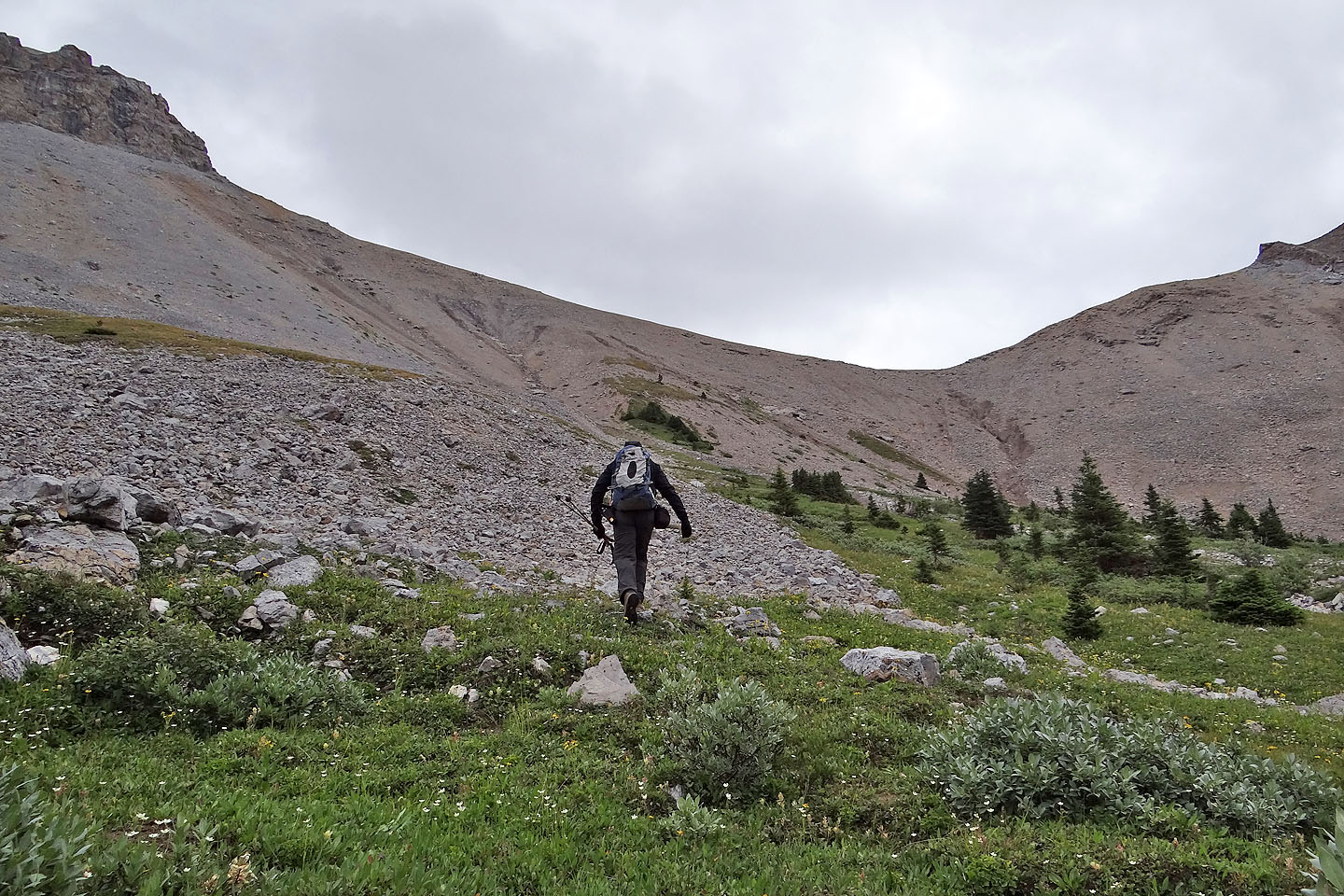
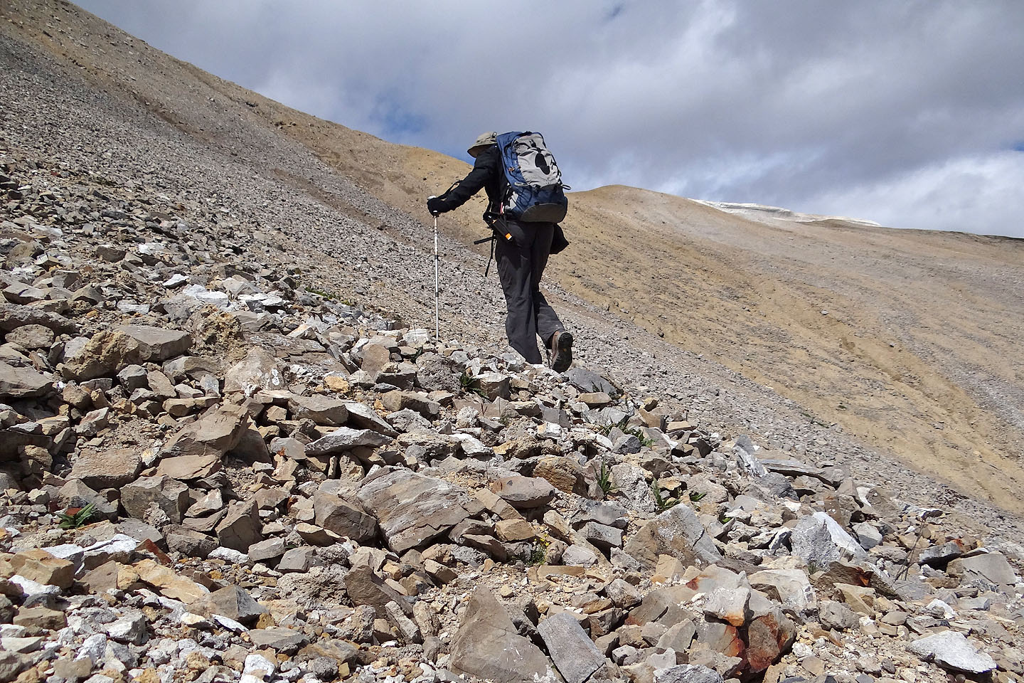
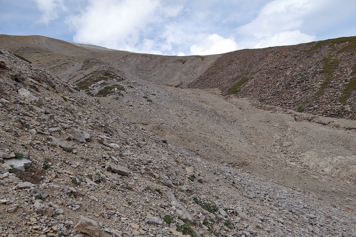
Buller Pass trail provides a good approach although it ends well short of North Buller Pass. An hour's hike brought me to the fork: right for South Buller Pass, left for North Buller Pass and Red Peak. After emerging from the forest, the trail became intermittent as it intertwined with Buller Creek. It completely disappeared after it reached a broad valley. By that time, however, I had North Buller Pass in my sights. It looked like an easy ascent albeit steep. I climbed a strip of vegetation as high as I could before traversing the scree to the pass. Actually, it's charitable to call it scree. The loose rock over hard-pack ground slid easily, like gravel on a sidewalk.
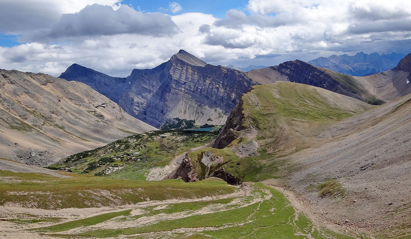
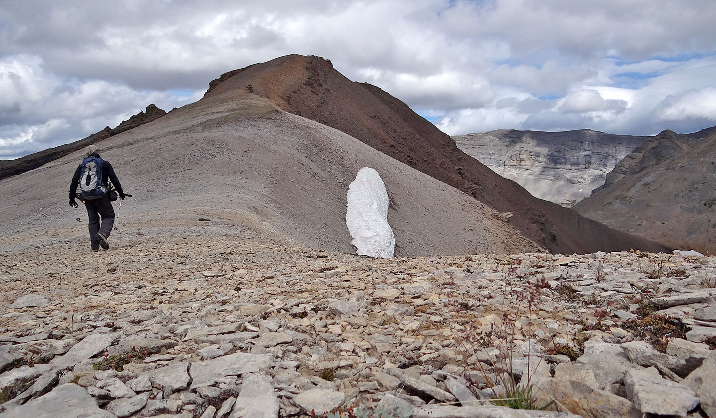
I ended up well above the pass, the first of two mistakes I made. I thought I could stay high and traverse under the intervening unnamed peak between the pass and Red Peak, but the cursed scree was too treacherous and the grade too steep, so I dropped down to the pass where I found faint sheep tracks. Because of the bend in the slope, I couldn't see the gully, and I made the mistake of ascending instead of descending slightly. I realized I was on the wrong side of a steep drainage I had to cross, so I was committed to climbing up miserable scree to the ridge crest. Cross the gully high or cross it low, but don't try crossing it mid-slope. (If Red Peak is climbed early in the season, it might be best to gain the crest soon like I did to bypass the insurmountable cornice on the west side of the ridge.) Here at last I could see the summit of Red Peak. It was a leisurely walk there.
After a short summit stay, I proceeded back along the ridge, stopping before where the gully topped out. I dropped down the slope to a point where I could easily cross the gully (my GPX track reflects my easier descent route) and made my way back to North Buller Pass.
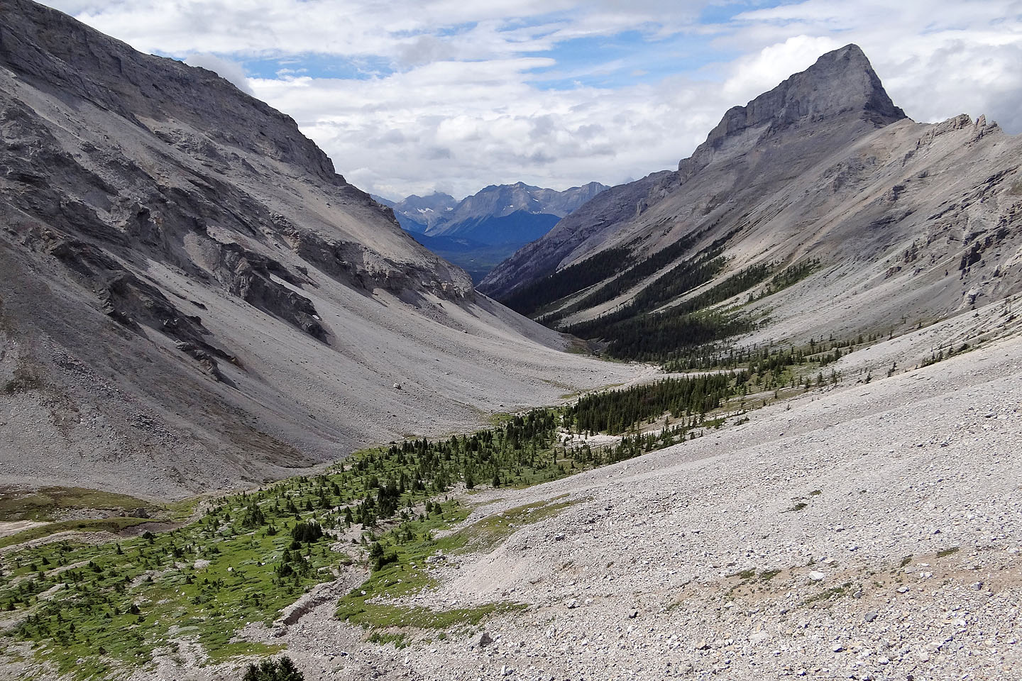
I should point out that not only did I enjoy the scenery along the summit ridge, but I also took delight in the scenery along the trail. As I dropped down the other side of the pass, I looked forward to seeing again the picturesque waterfalls alongside the trail.
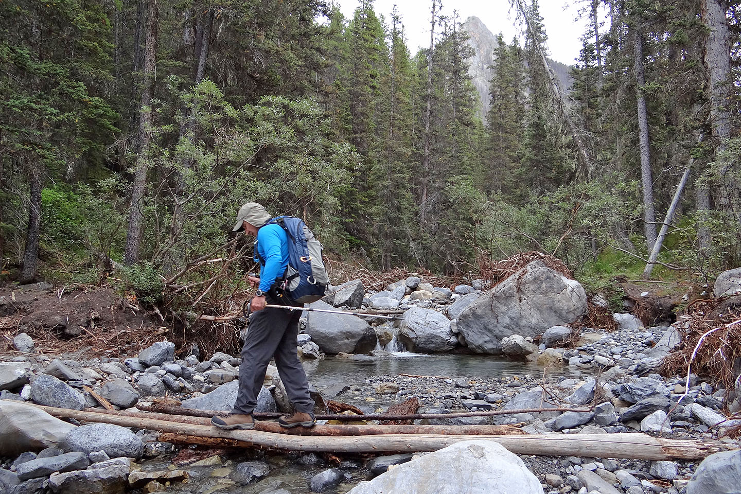
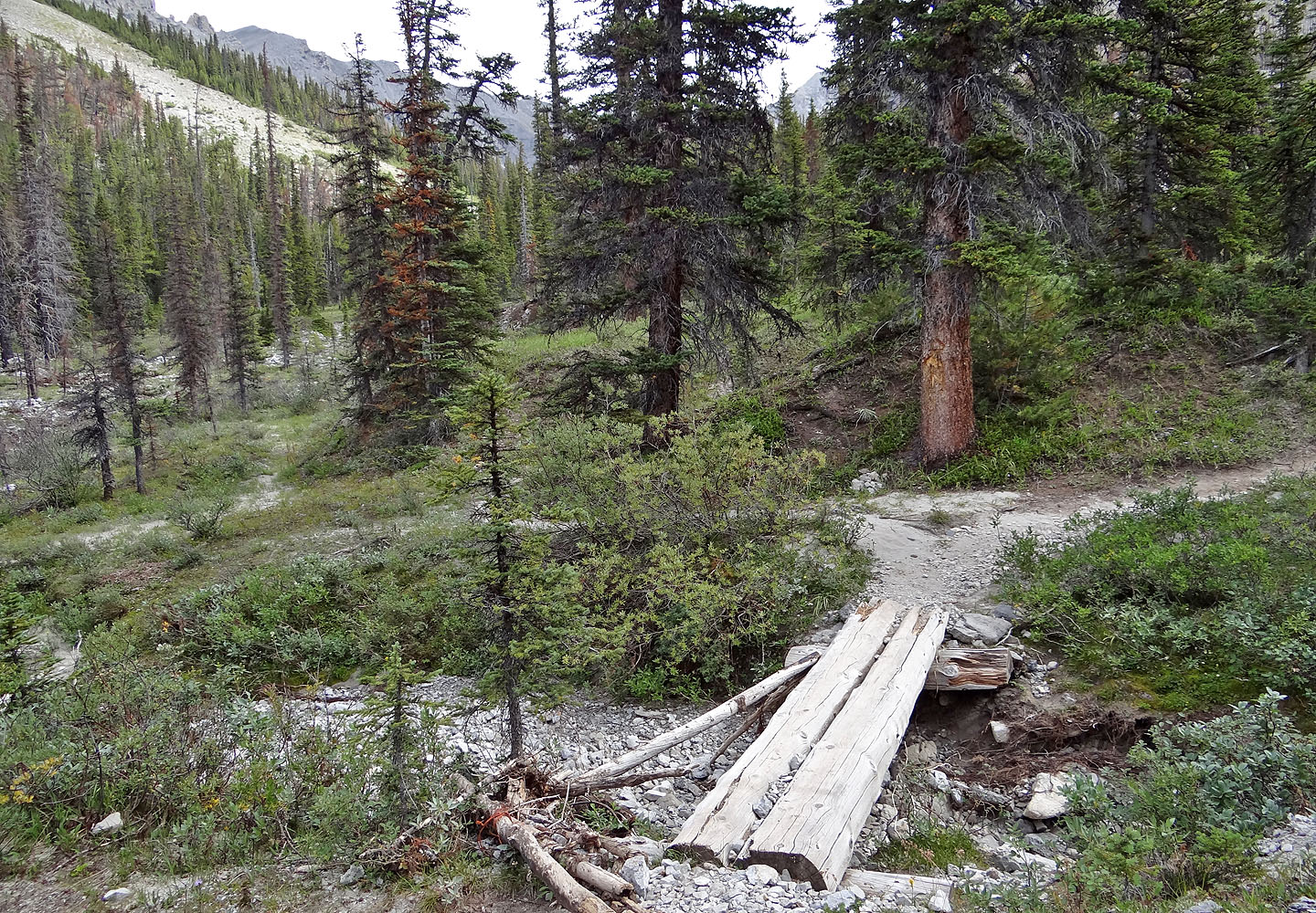
The second bridge was 100 m downstream
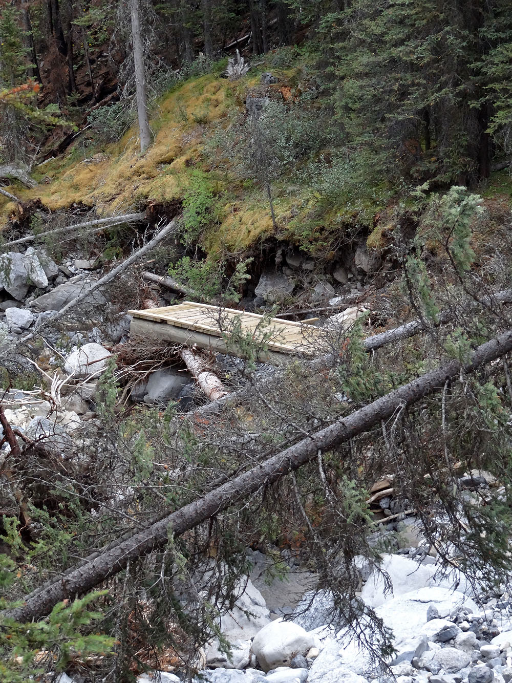
A new bridge was already in place
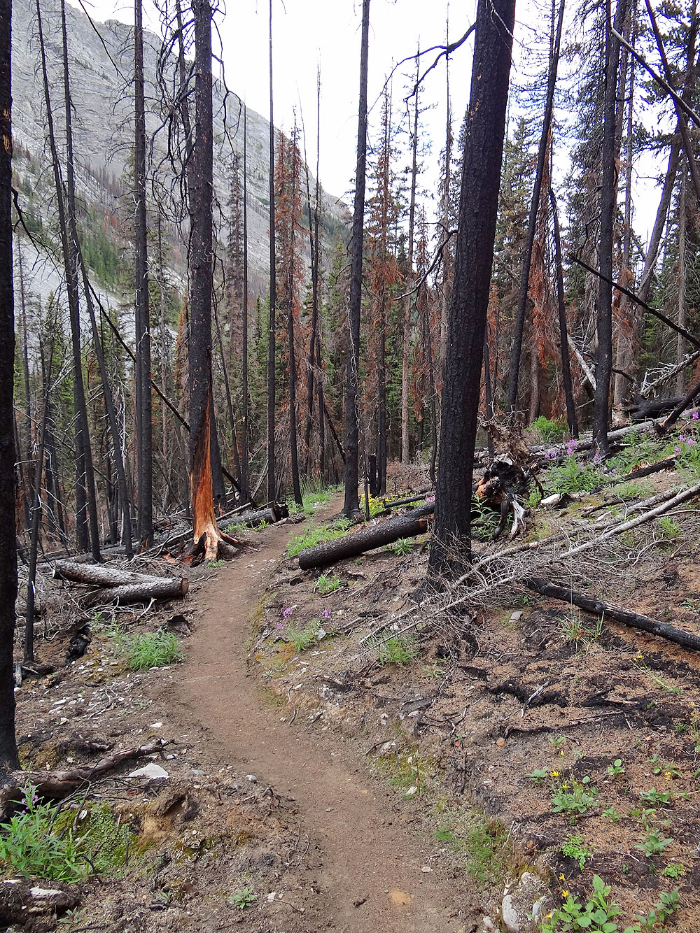
The trail passes through burned out areas
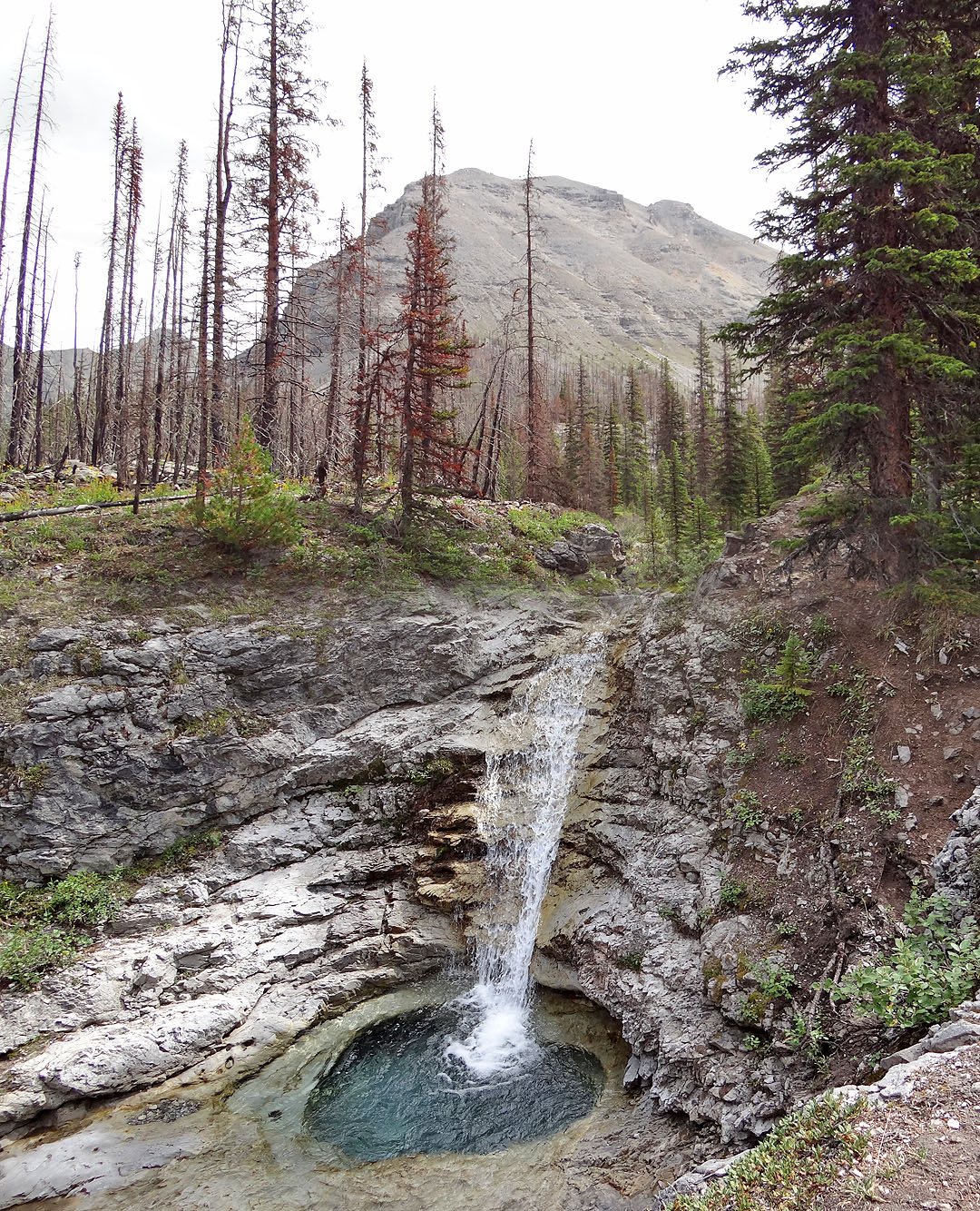
Waterfall and basin just before the fork
 The fork: left for North Buller Pass and right for South Buller Pass
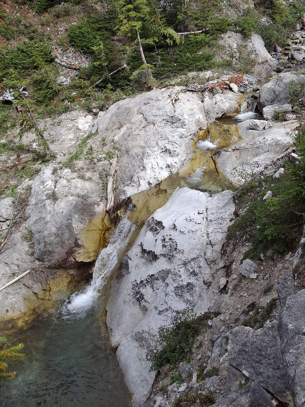
Another waterfall
The trail emerges from the forest and drops down to the creek
The trail goes left and climbs above the canyon ahead. Note the cairn bottom left.
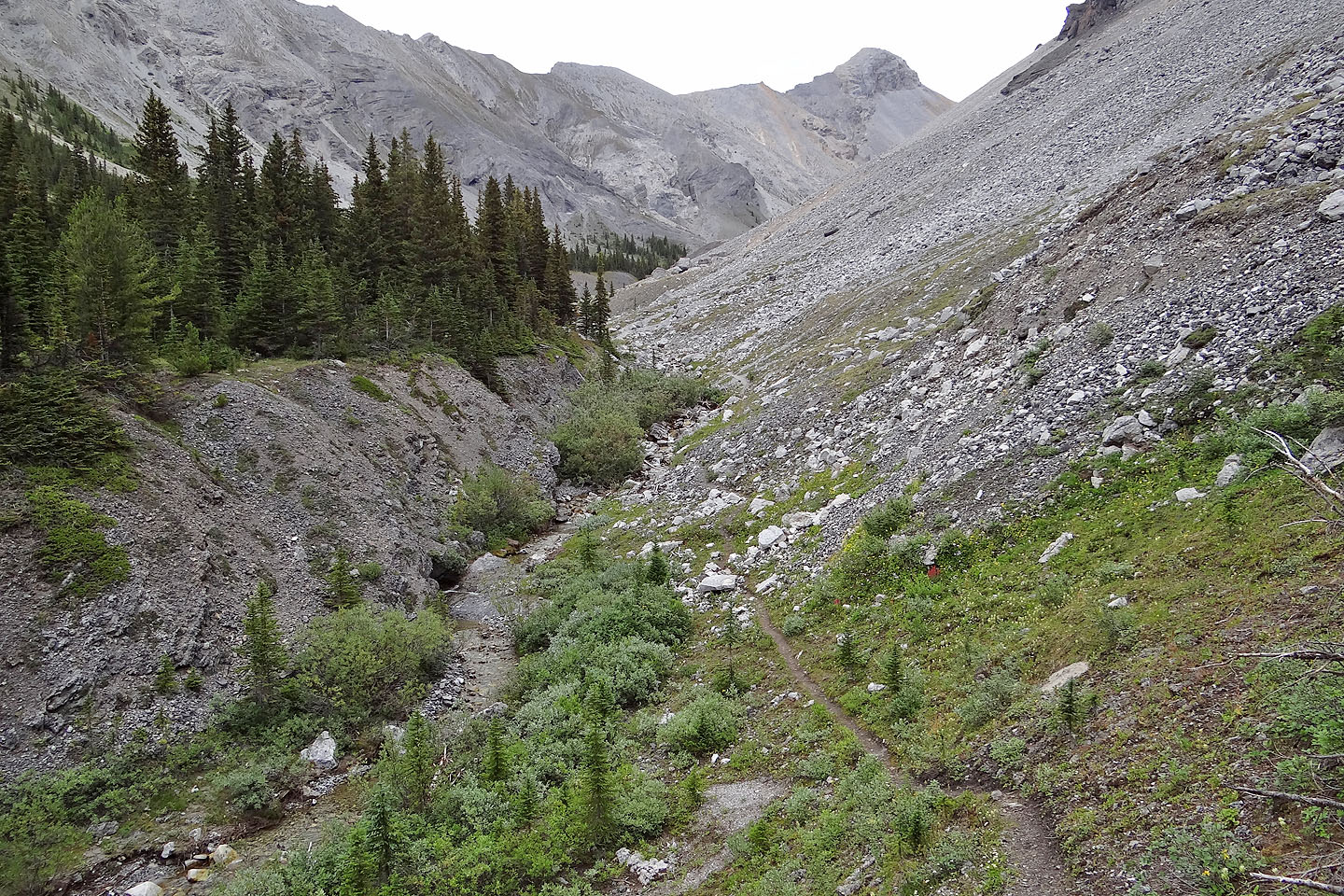
Heading to North Buller Pass
I'll ascend the slope directly above me and traverse to the col
Looking back after I started climbing. Mount Engadine and Mount Buller rise above Buller Creek.
Looking down the other side of the pass
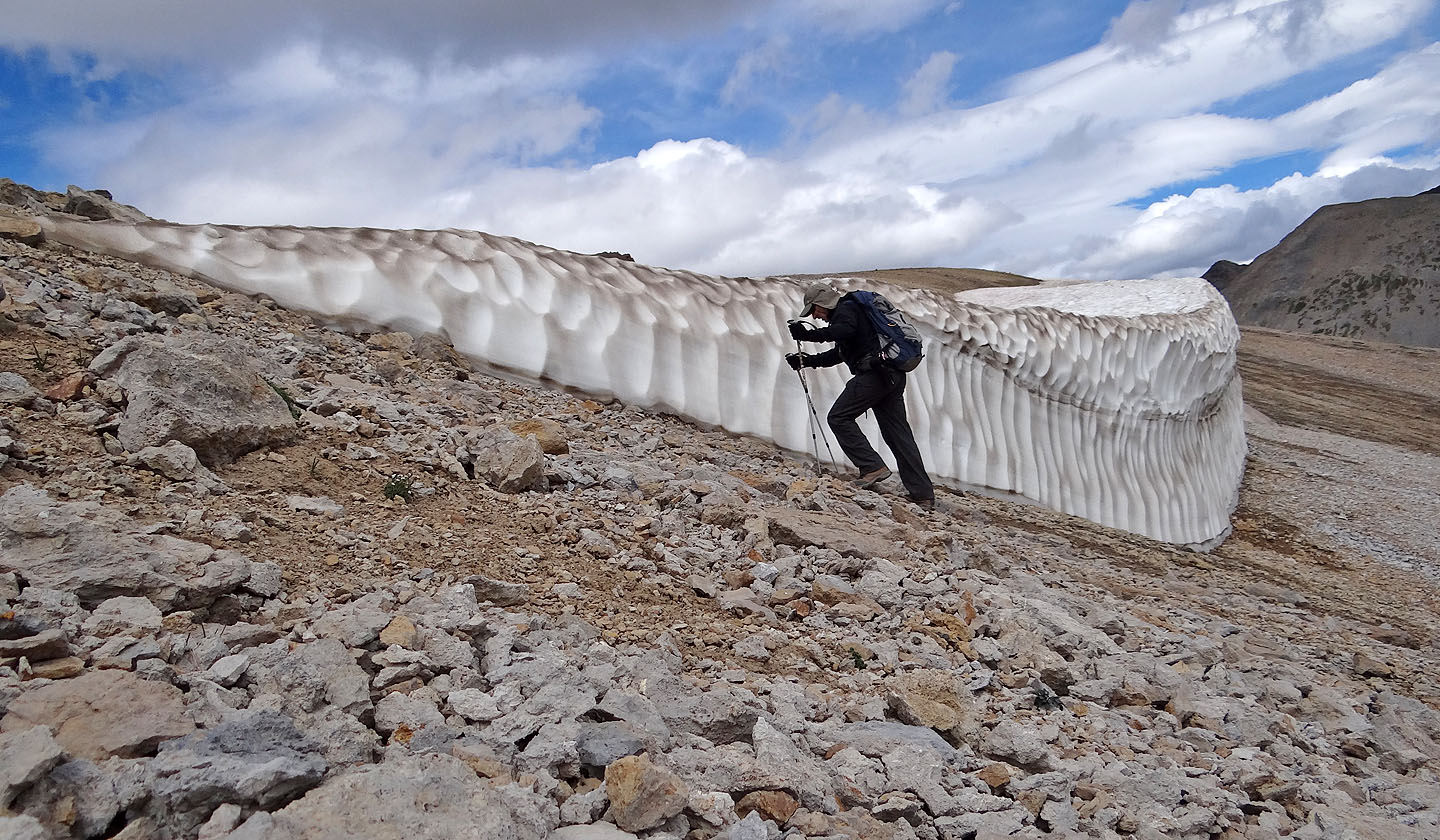
Heading to the summit ridge. Note the snow cornice on the ridge.
Bypassing the cornice
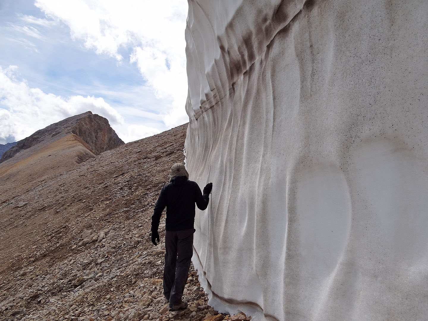
A close look at the cornice
On the ridge heading to the summit
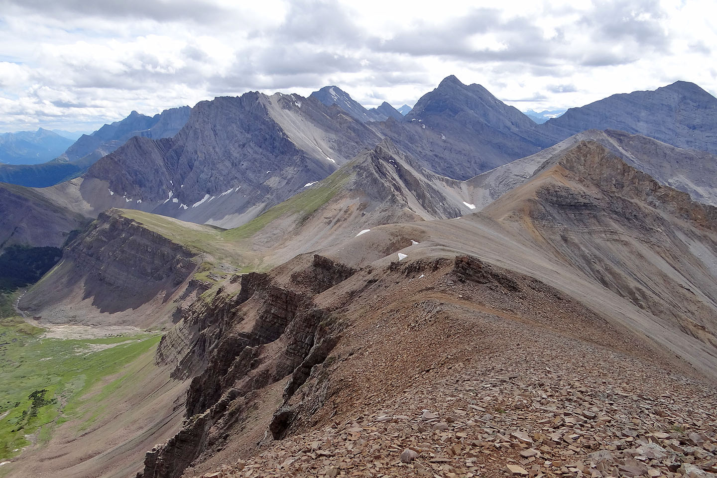
Looking back along the ridge
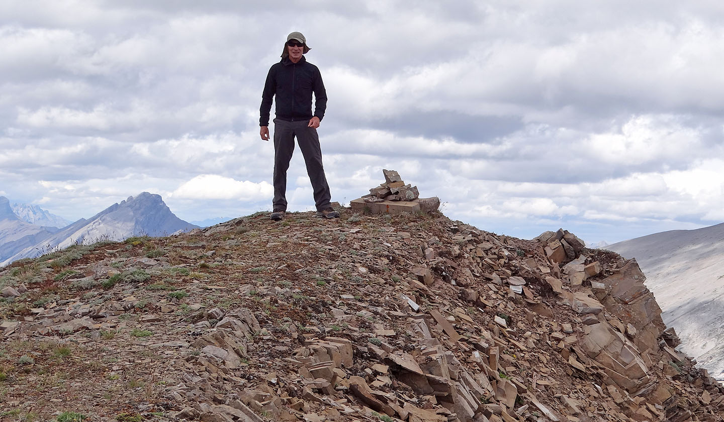
Obligatory summit pose
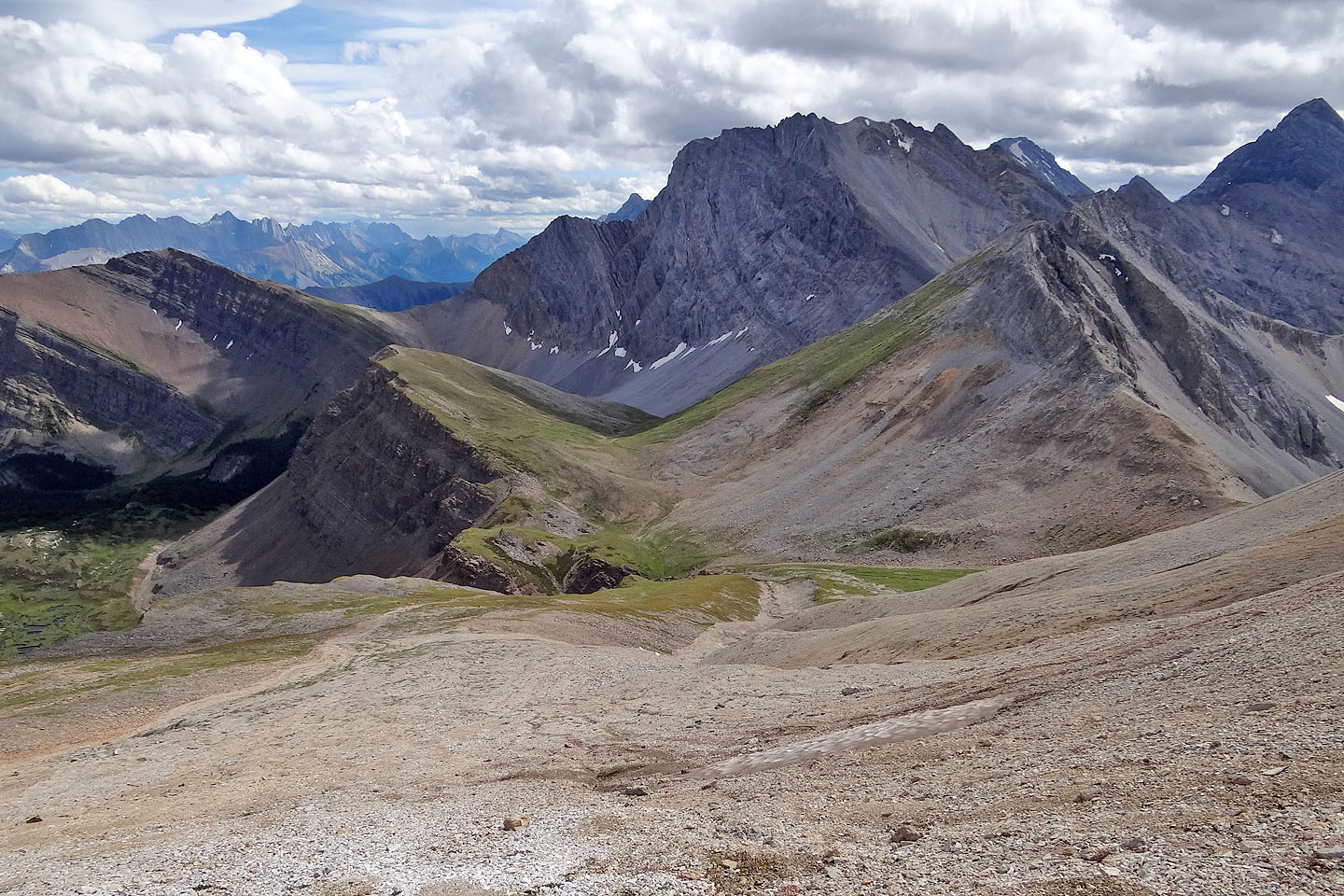
The descent route: I crossed the gully at the bottom and made my way back to the pass
Looking up the gully as I crossed below
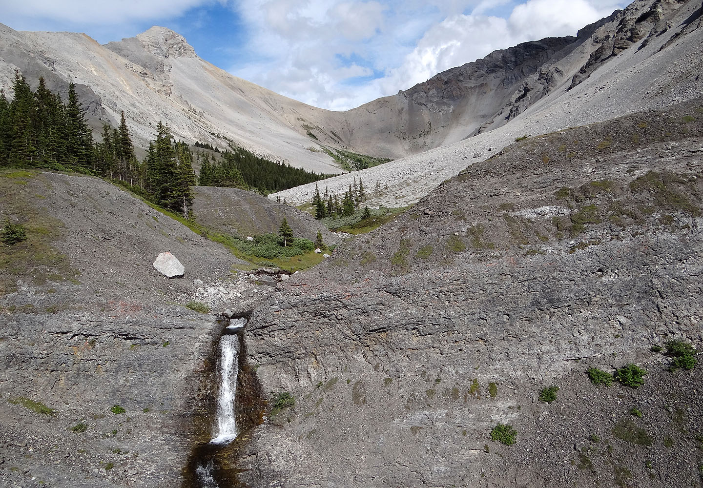
Looking back at North Buller Pass and the largest waterfall on the route
82 J/14 Spray Lakes Reservoir