bobspirko.ca | Home | Canada Trips | US Trips | Hiking | Snowshoeing | MAP | About
Stanley Glacier
Kootenay National Park, B.C.
October 5, 2020
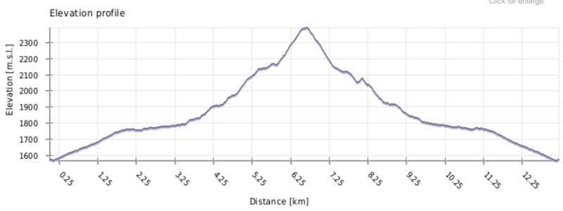
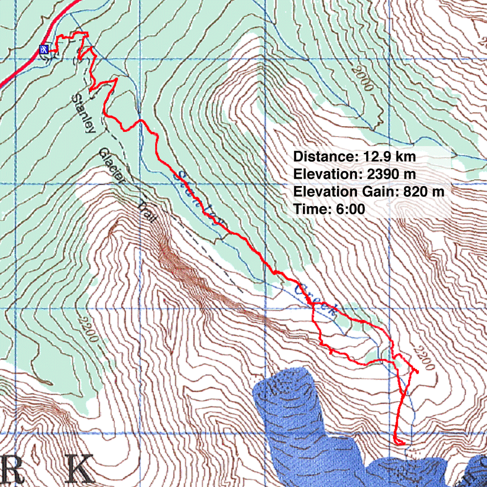
Distance: 12.9 km (8.0 mi)
Cumulative Elevation Gain: 831 m (2726 ft)
For a bit of effort, you can hike up a good trail and view Stanley Glacier from afar. For more effort on a rougher trail, you can reach the foot of the glacier, although I expect few do. However, there's more to this hike than the glacier. Dinah and I were surprised at how interesting and scenic the area is.
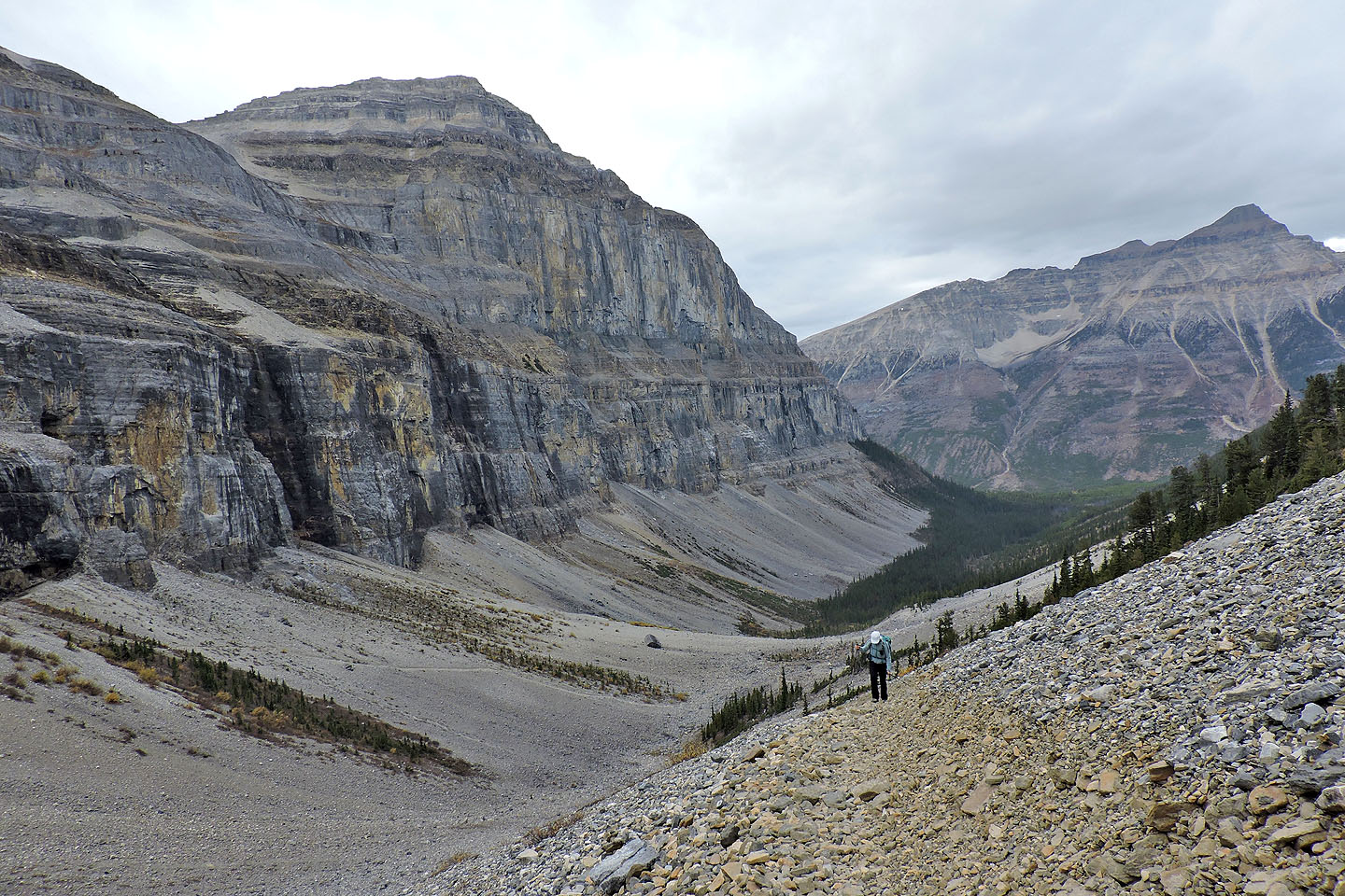
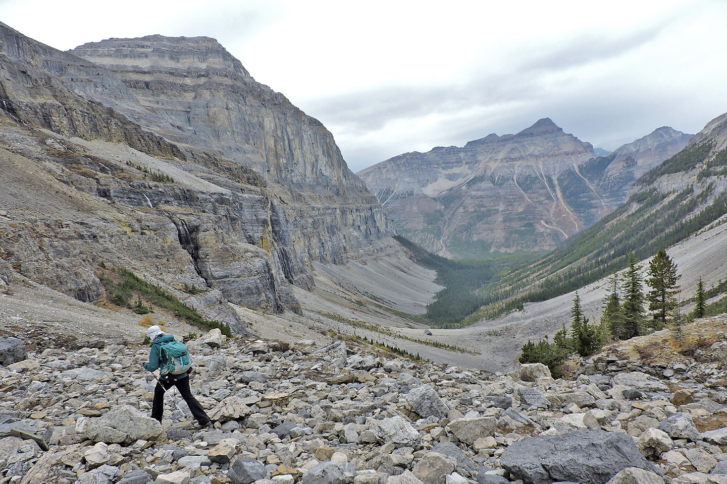
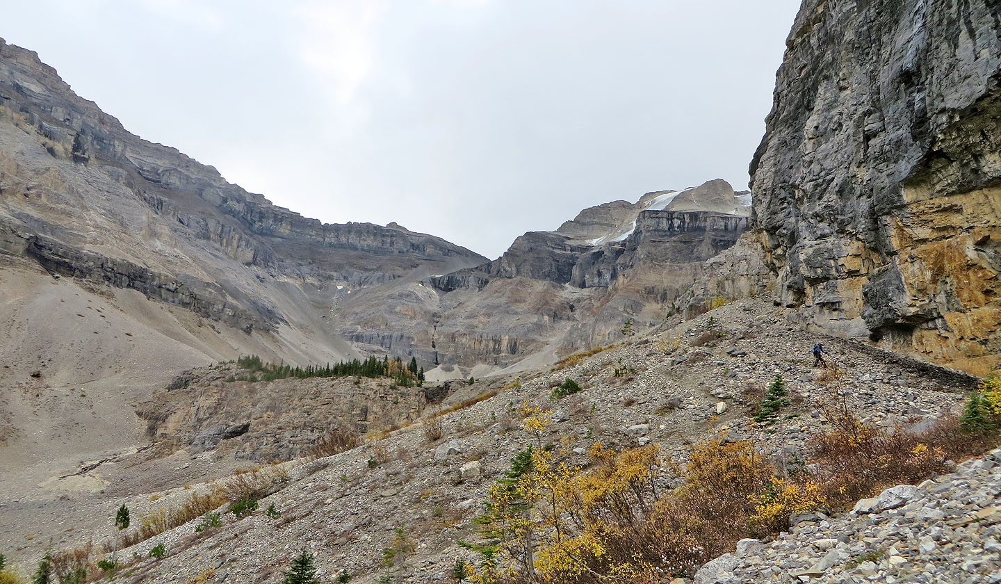
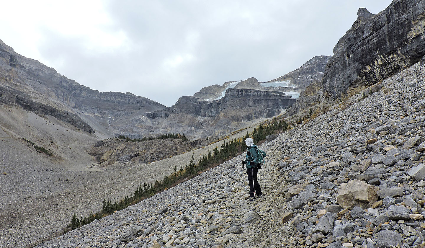
For the first couple of kilometres up the trail, there is little to see. Although wildfires ravaged the area in 1968 and 2003, the forest is re-establishing itself, and flourishing evergreens now limit the views. But after the trail climbs switchbacks, after it straightens out and reaches the edge of the forest, you have an unobstructed view of a scree-filled valley lined with tall cliffs. Next to Stanley Glacier, the most striking feature in the valley is the headwall: a wall of rock that bridges the valley like a dam, and that's where the main trails take you.
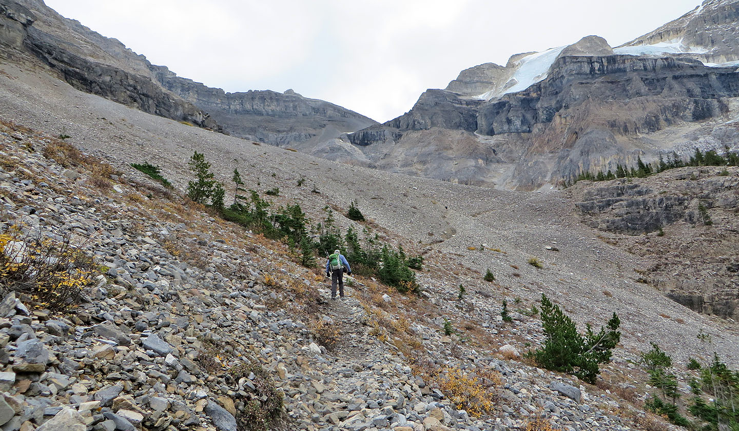
At 4.5 km, the maintained trail ends, but two unmaintained trails – virtually as good as the maintained trail – take over the job of getting you to the top of the headwall. Each trail reaches either side of the headwall. Paths on the headwall connect the two trails so you can easily make a loop.
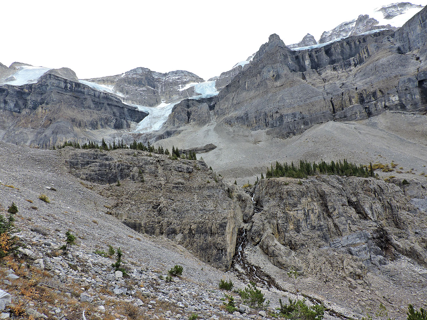
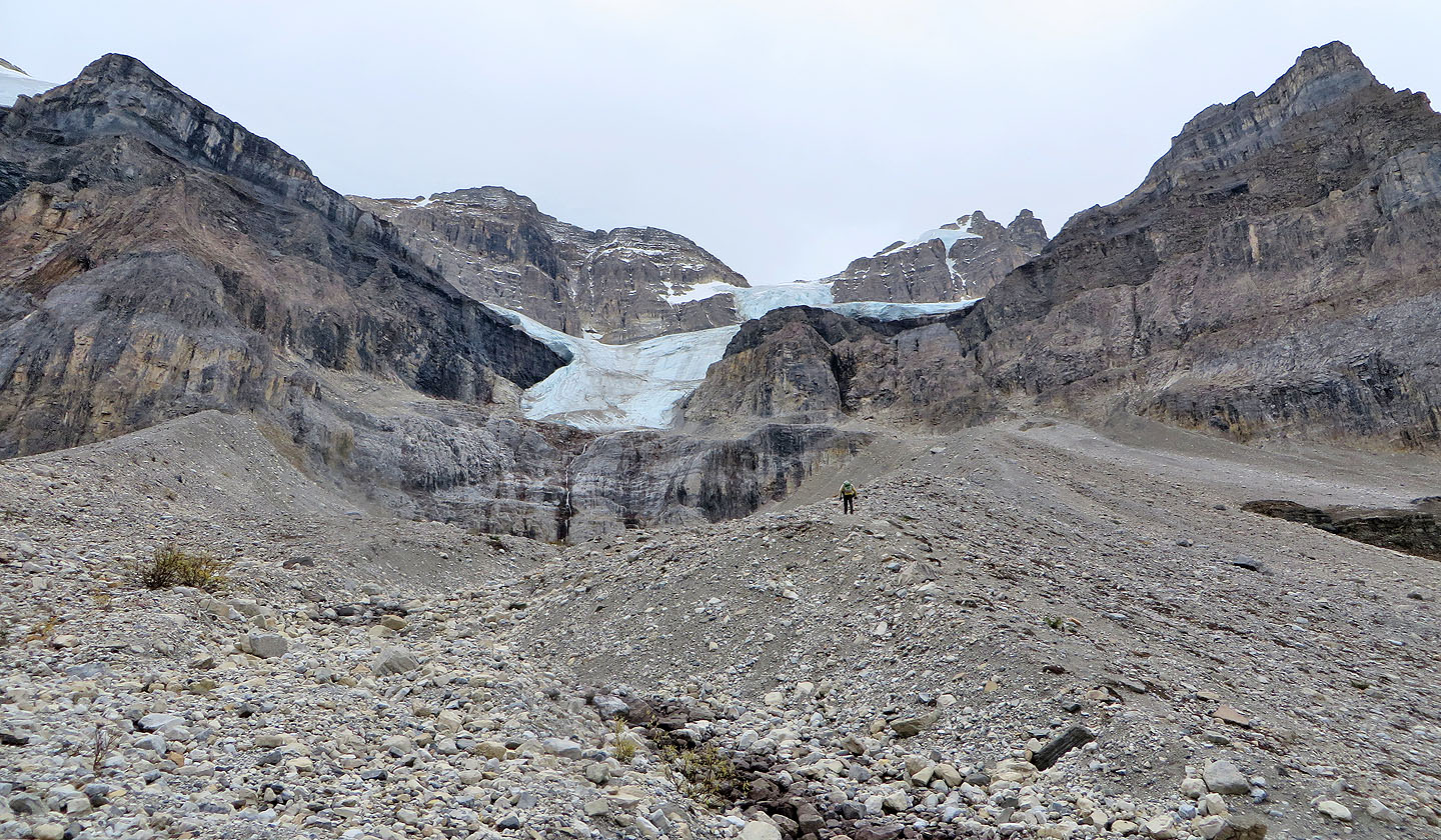
At the end of the maintained trail, we took the left trail on the north side of the valley and reached the headwall after hiking a kilometre from the trail fork. The headwall, bearing a miniature forest, is a great place to take a break. Afterwards we headed to the scree basin behind the headwall to look for fossils. But after searching for several minutes, we found nothing remarkable and turned our attention to the glacier.
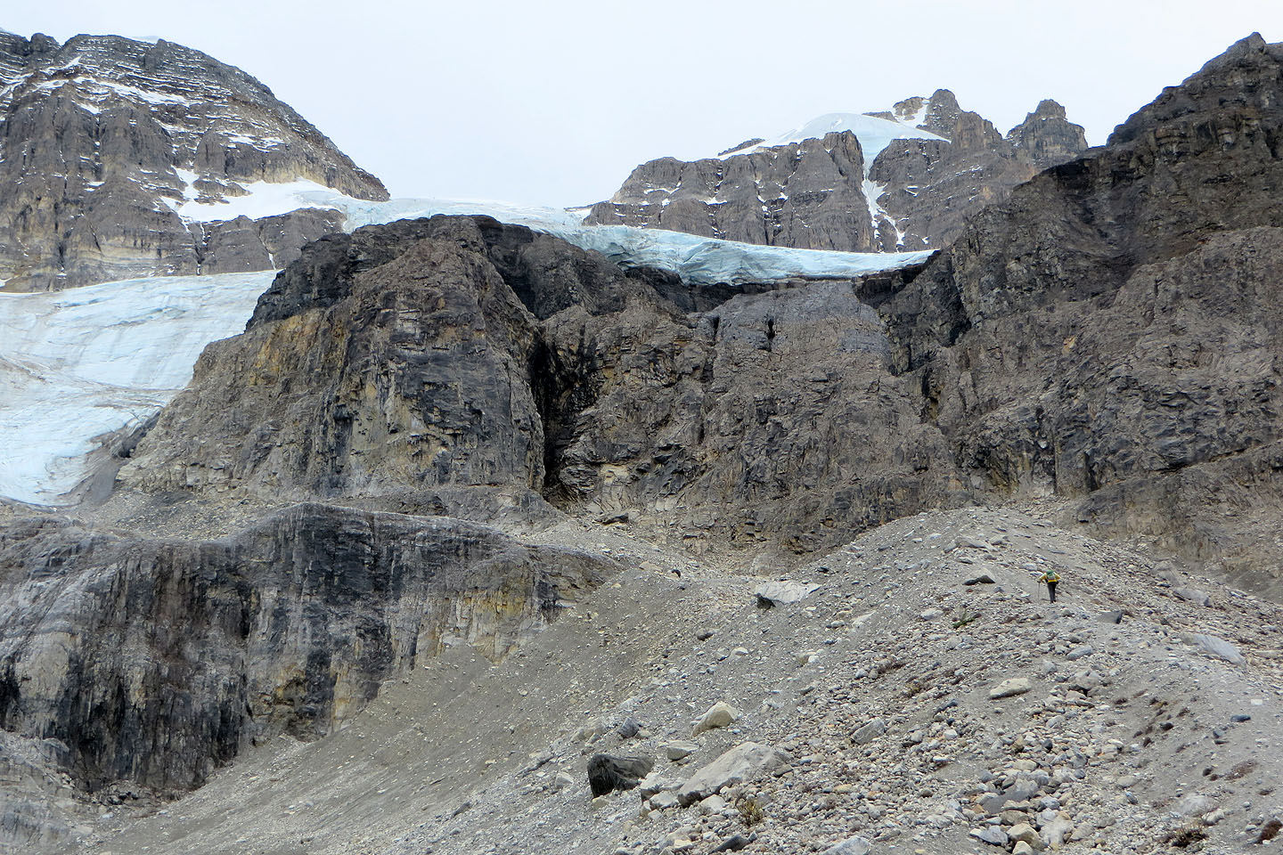
The foot of the glacier sits 200 m above the basin on a cliff. Fortunately, a lateral moraine makes a natural ramp to the clifftop. Dinah hung back, while I hiked up the moraine to the glacier.
It was steeper than it looked, and despite a trail, I endured loose rock underfoot. Still, it's only a hike, and after a time, I reached the clifftop and headed to the glacier. It's an amazing mass of ice and snow. I got within 100 m of the glacier, close enough to take photos and close enough to see I could go right up to it if I wanted. That was good enough for me; it was time to return and join Dinah.
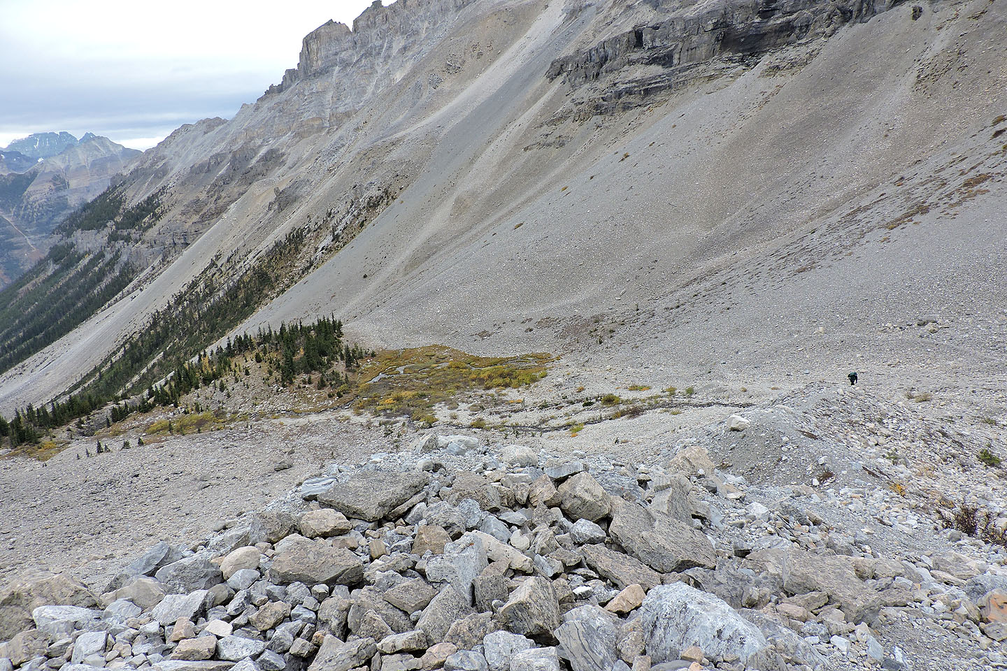
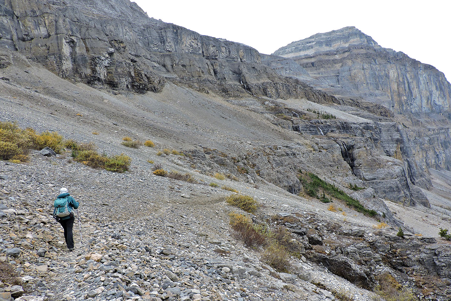
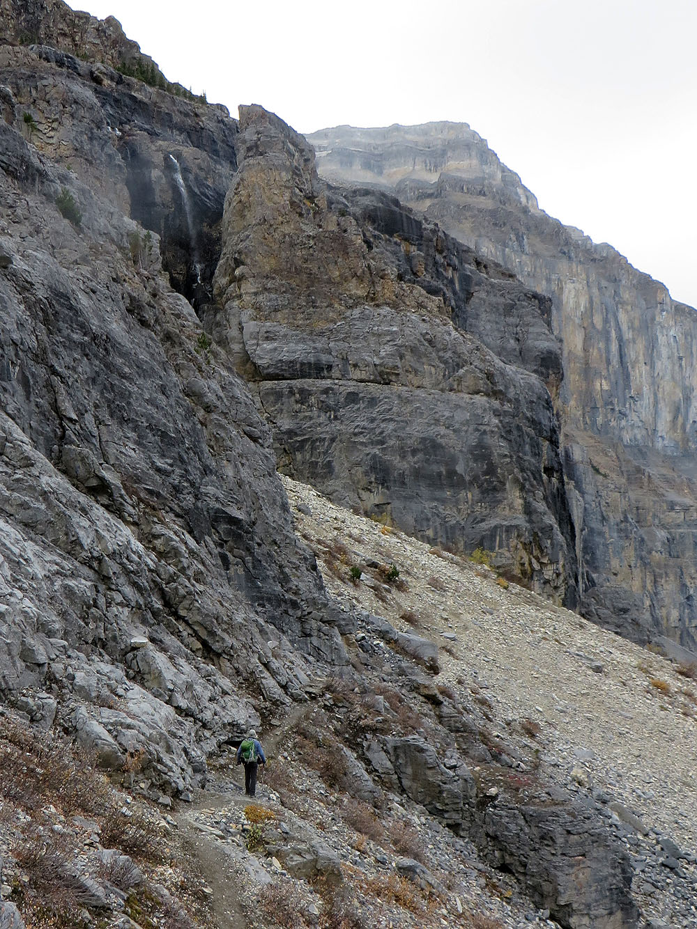
Taking advantage of another trail partway down the moraine, I quickly descended and met her at the headwall. We made our way to the trail on the south side of the valley. Like the north trail, the south trail cuts into a scree slope. However, it's more interesting as it passes a waterfall and shallow caves. The features are accessible and worth checking out.
We were soon back on the maintained trail, in time to watch a black bear travel high up a rocky slope. We've seen bears aplenty in meadows, so it was an unusual sight to see one above us on rocks. The bear was descending, dropping into the valley, seemingly heading to the headwall. Fortunately, we were headed the other way, back to the parking lot.
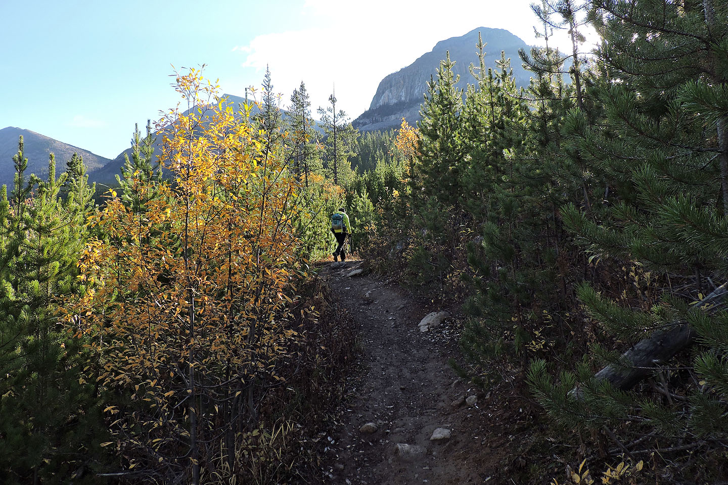
Hiking up one of the switchbacks at the start
Behind us is Mount Whymper
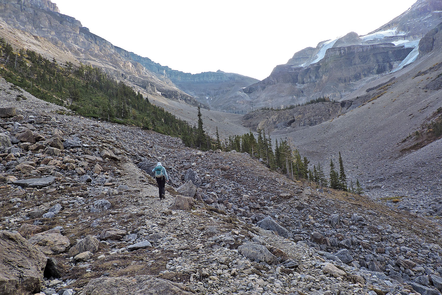
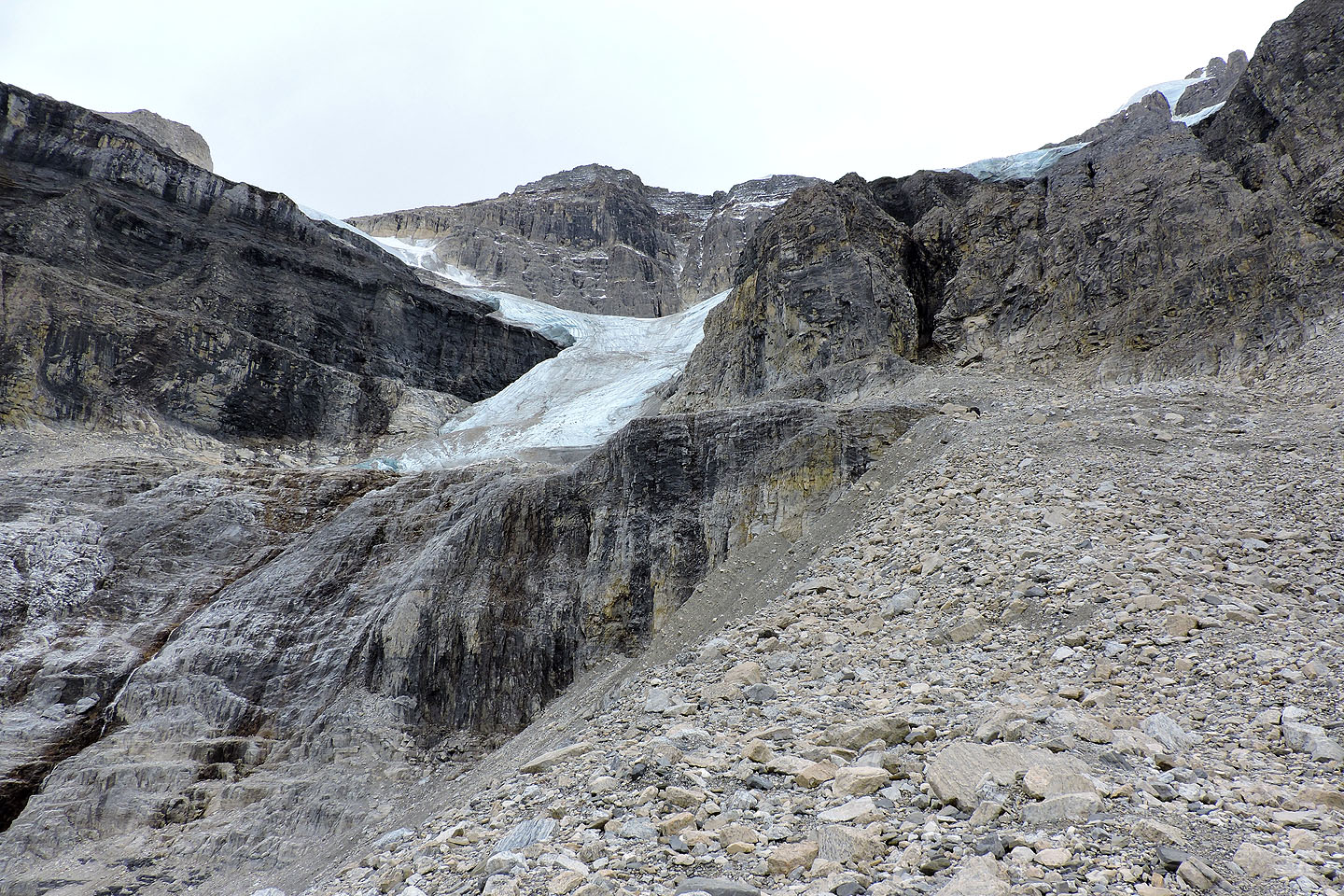
When we broke out of the trees, we had a clear view of the glacier and the headwall
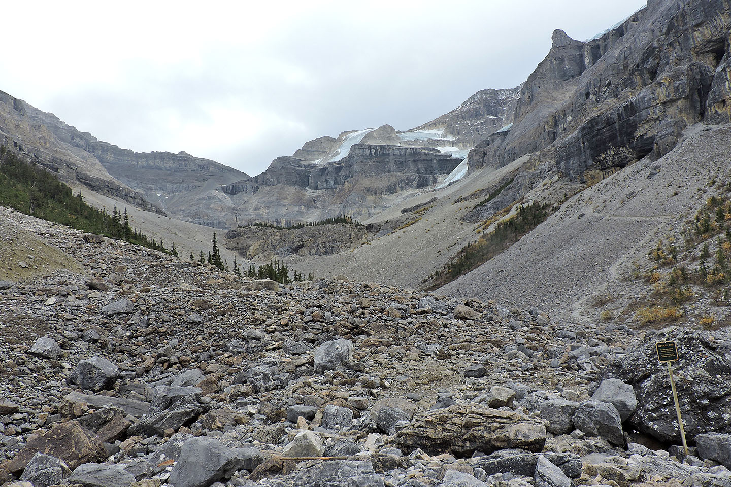
The maintained trail ends at a sign. Hike over the rocks on the left, and you will soon reach the north trail. Follow the south trail on the right, and you'll pass by the caves under the black cliff.
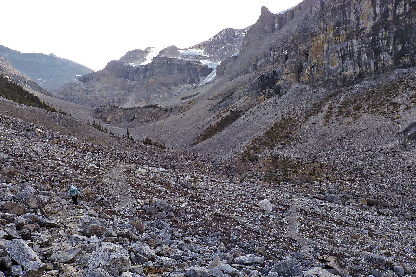
Starting up the north trail
Coming up to the headwall
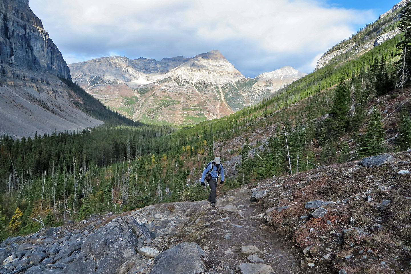
Looking back
A waterfall splits the headwall
The trail runs to the headwall

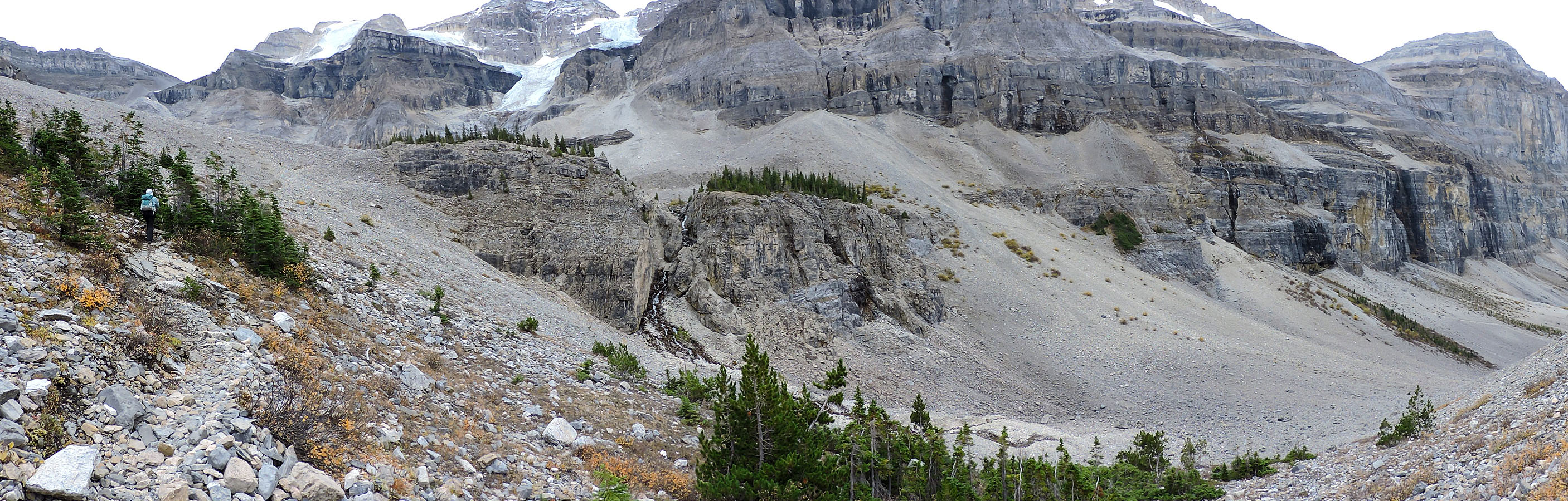
Panorama from the headwall
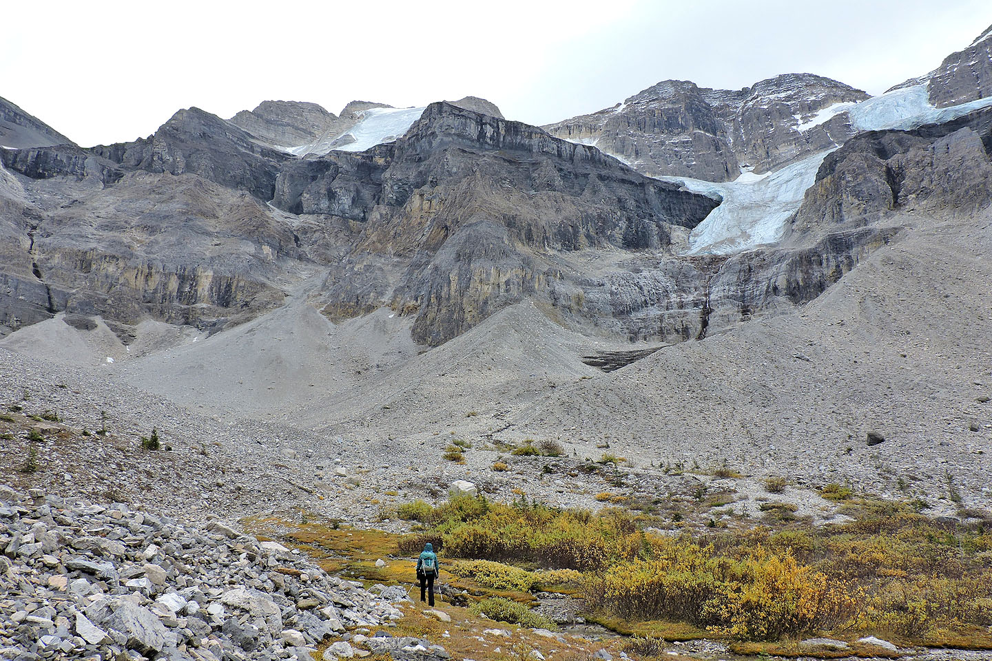
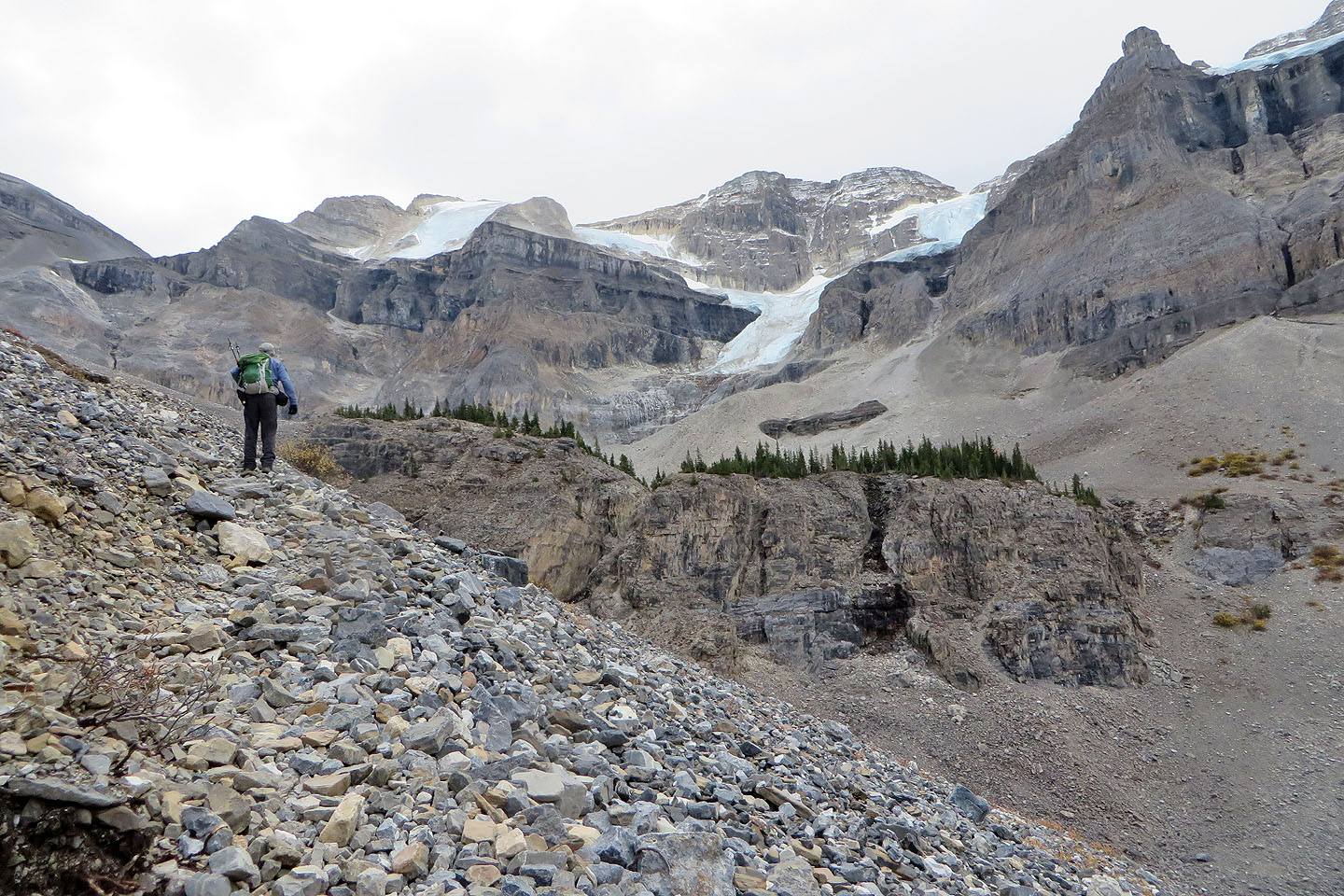
We headed to the basin first. Then I climbed the lateral moraine on the right to the glacier.
I started up the moraine
Looking back at Dinah at the foot of the moraine
Partway up the moraine
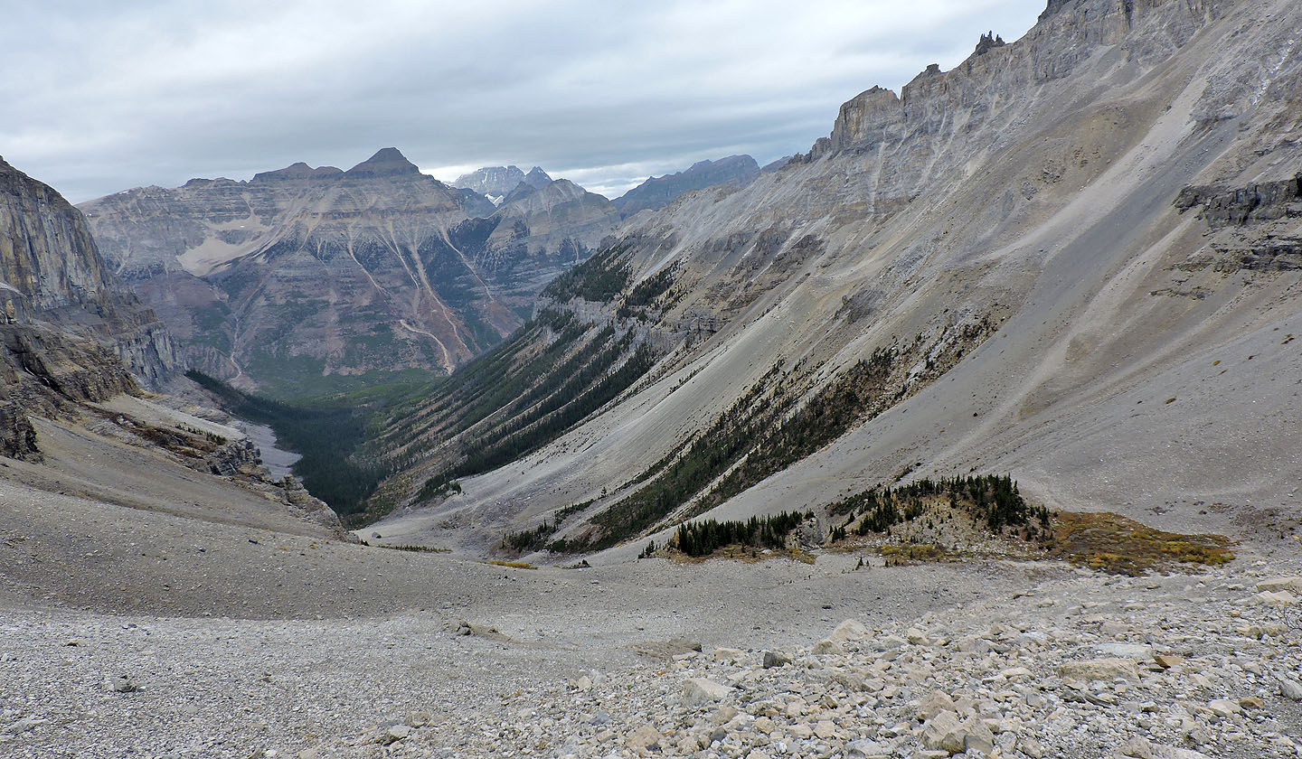
Looking down the valley
I'm still hiking up the moraine. Distances are deceiving as the view is foreshortened.

I stopped within 100 m of the glacier before turning around
I met Dinah back at the headwall, and we started down the south trail
The trail drops to the base of the cliffs on the right
The trail passes by a waterfall
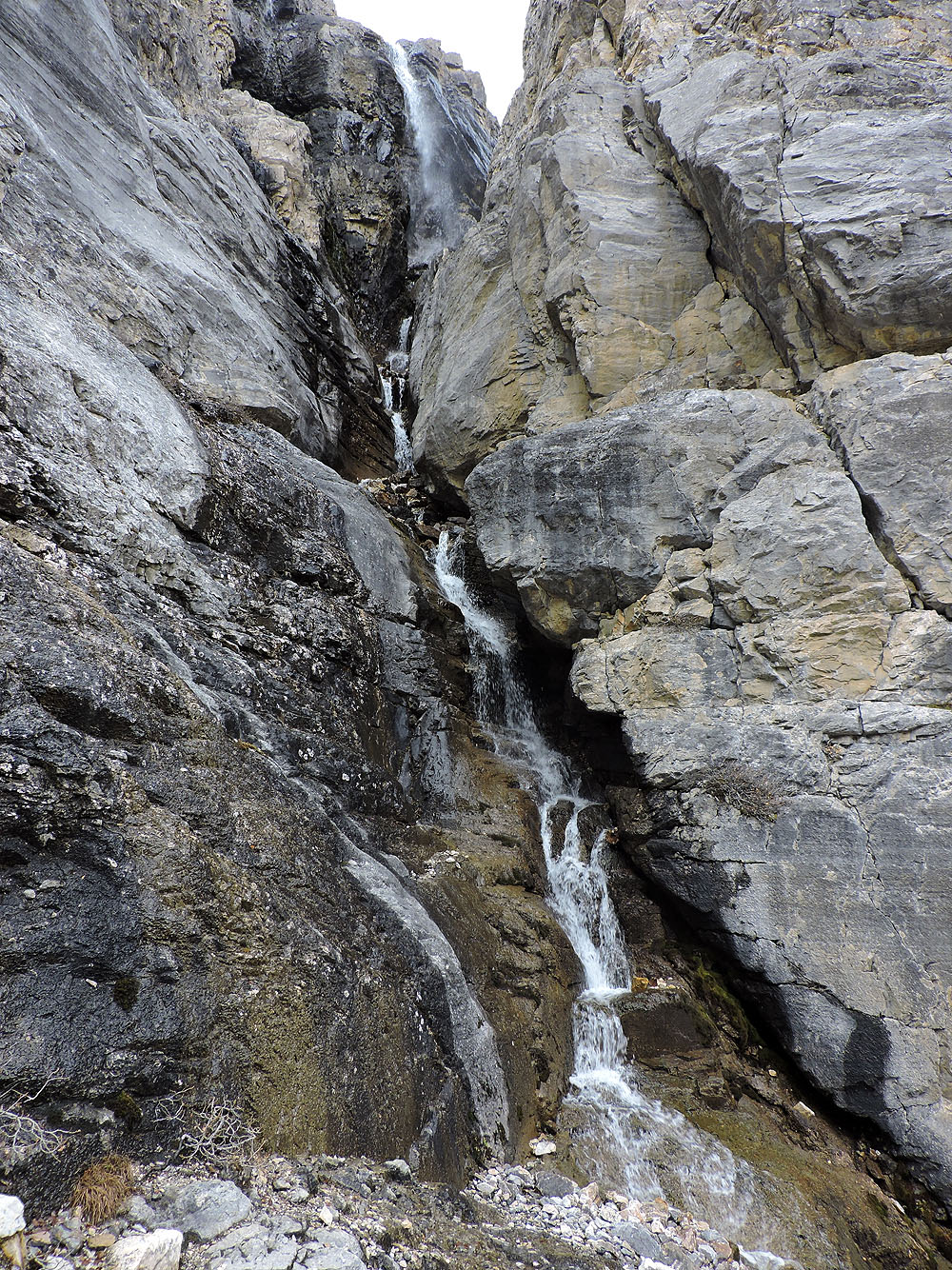
A trail allows you to climb up and get a close look
From the waterfall, we followed the trail to the caves
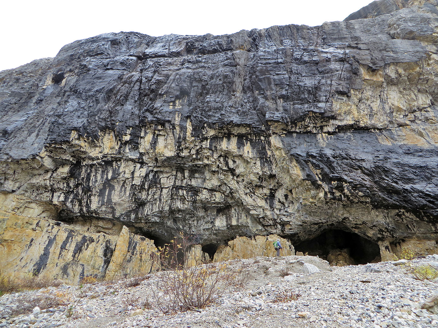
Stopping at the caves
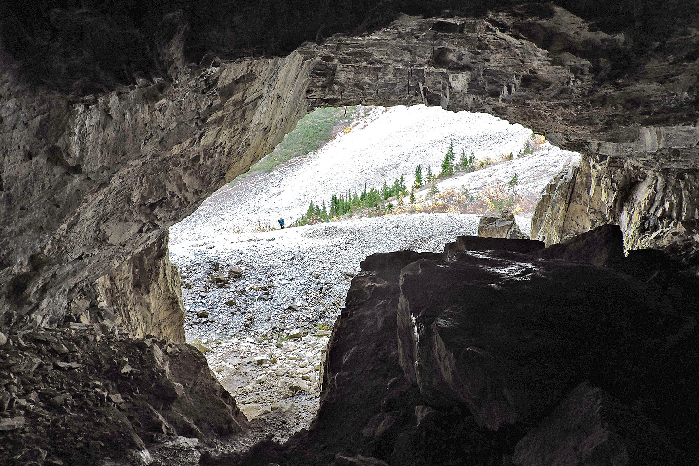
Looking back at Dinah from inside the largest cave
Dinah looks back at the headwall
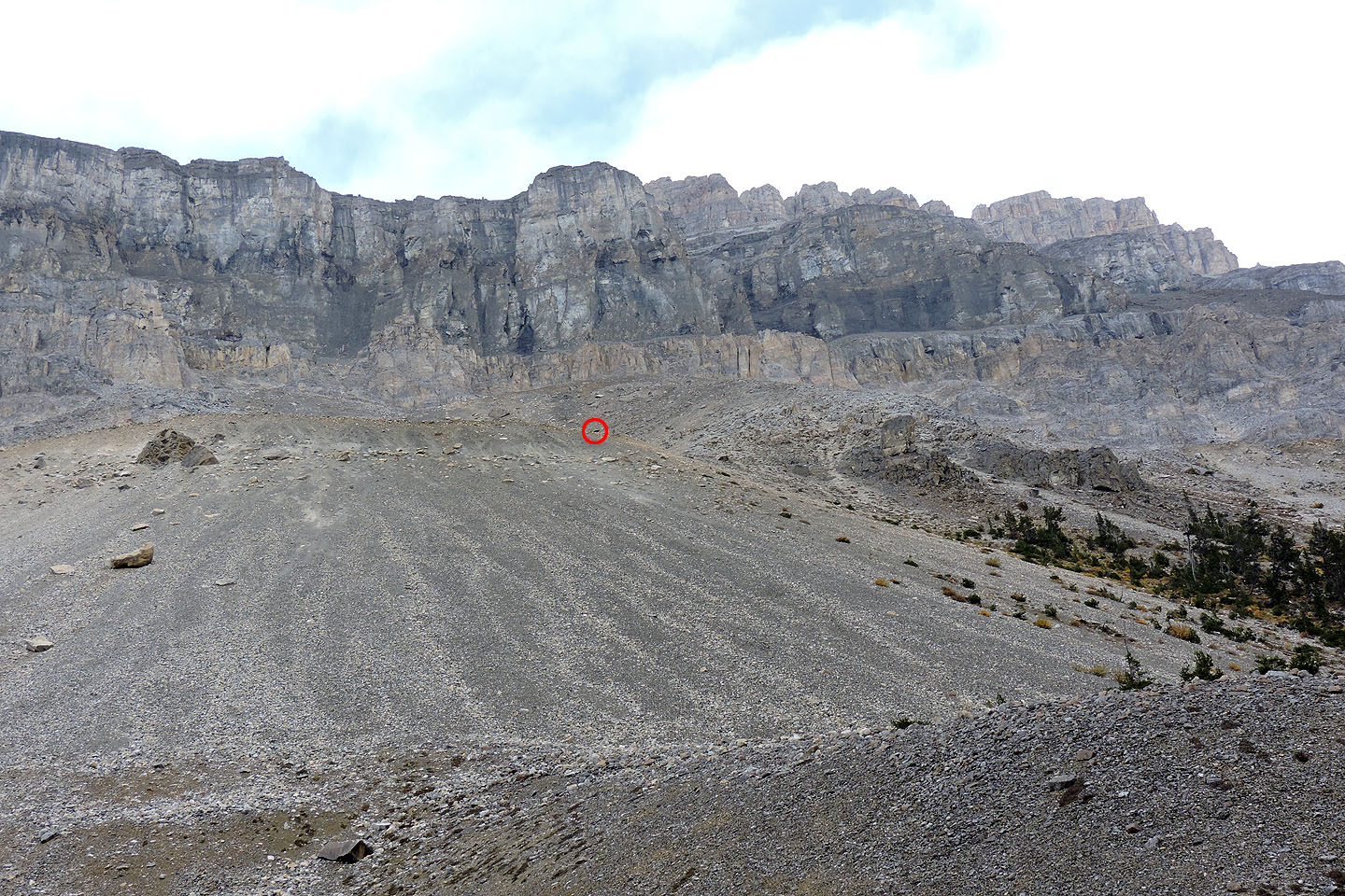
On the way back, we spotted a black bear travelling high up the slope
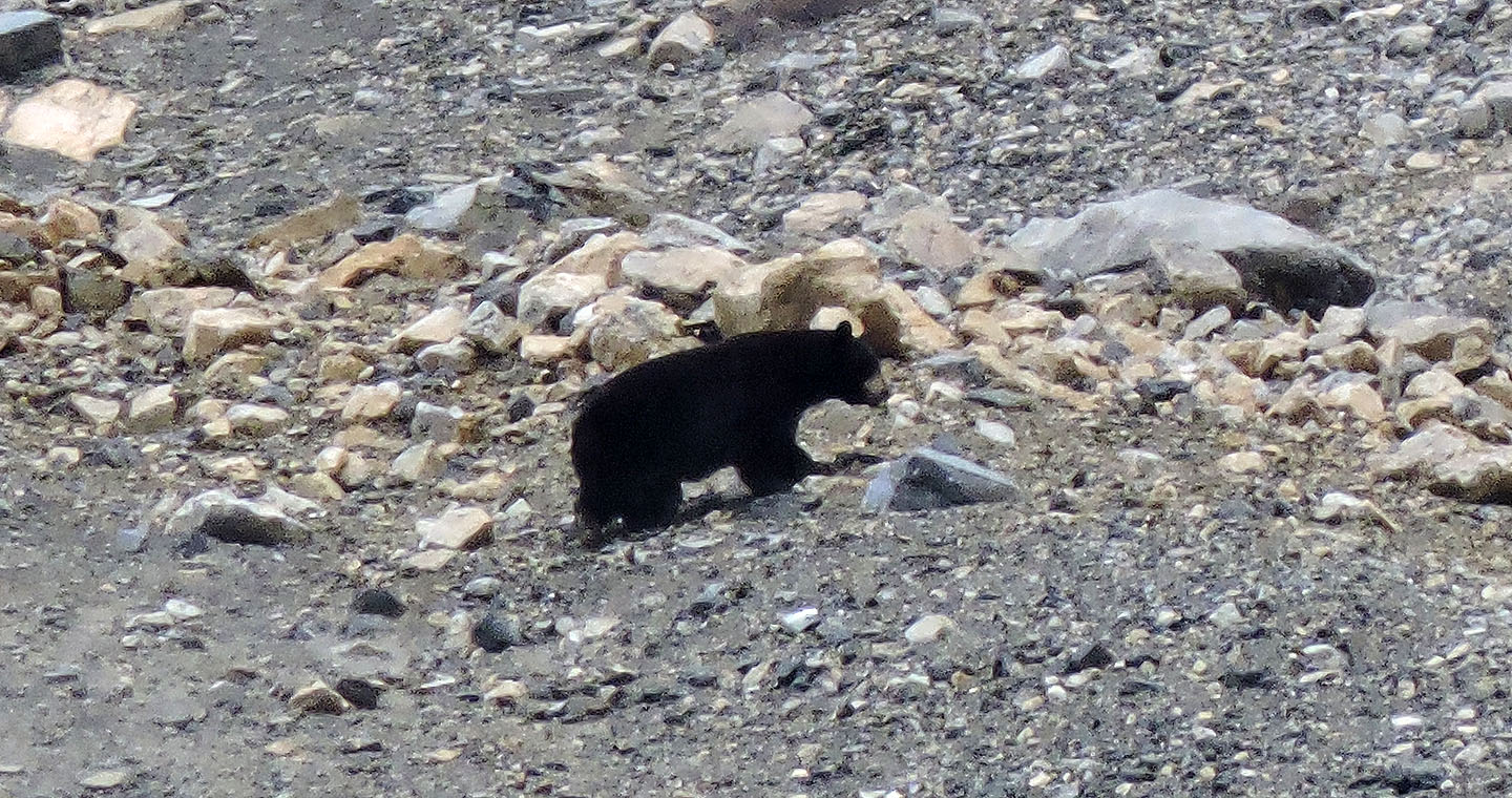
Close-up of the bear
82 N/1 Mount Goodsir