bobspirko.ca | Home | Canada Trips | US Trips | Hiking | Snowshoeing | MAP | About
Nihahi Ridge and
Compression Ridge
Kananaskis, Alberta
June 24, 2006
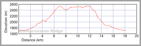
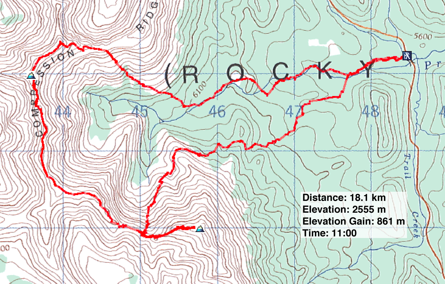
Distance: 18.1 km (11.2 mi)
Cumulative Elevation Gain: 1205 m
(3953 ft)
Caroline and Dinah assured me that we'd look back someday and laugh about this trip. I look forward to that day! Suffice to say, this trip didn't go according to plan, although we did summit Compression Ridge.
Nihahi Ridge and Compression Ridge are sometimes done together. But Dinah and I had done Nihahi, so there was no need to traverse that uninspiring ridge again. Caroline had done it too, so the three of us would only do Compression Ridge on this day.
We planned to do a car shuffle: we'd start at Prairie Creek and end up at Upper Canyon Creek. So Caroline dropped her car off at Upper Canyon Creek and drove back with us to Prairie Creek.
From the parking lot, we started up the trail that follows alongside Prairie Creek. When the trail crossed the creek, we continued a short way before breaking off the trail. We started following another creek until it turned south. Then we left the creek and aimed for the col that connects Nihahi and Compression Ridges. After a few ups and downs and some miserable bushwhacking, we reached the open slopes below the summit of Nihahi Ridge. From there we scrambled easily to the col.
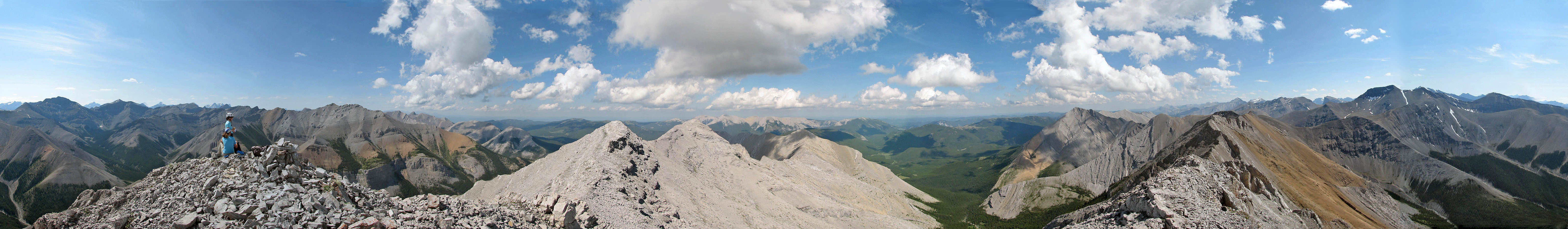
When I summited Nihahi Ridge two years ago, I couldn't take a panorama because of the rain. But today we had a blue sky, so while Dinah and Caroline relaxed on the col, I took an hour to run up and down the summit of Nihahi and get a panorama.
After rejoining the girls, we started up Compression Ridge. I was surprised how far we had to hike before we got our hands dirty. After some easy scrambling, we found ourselves looking at the summit. To reach it, however, required traversing some exposed ridges.
We traversed the ridges without difficulty, but after bagging the summit, our celebration was short-lived: Caroline realized she had left her car keys in my car! Furthermore, because of our leisurely pace, we had nearly run out of water. Continuing to the end of the ridge to Upper Canyon Creek and walking 6 or 7 km down the road to my car without water was unthinkable. We would take Kane's alternate descent route down the south slopes.
After leaving the summit, we stayed close to the ridge crest and passed both windows. Shortly after the second window, we came to a scree slope that extended to the valley bottom. It was an obvious descent route, with good scree too, so we took it. In a short time, we were in the forest at the bottom of the valley walking on soft, spongy moss. Even though we were mostly following Prairie Creek according to the map, we would see no sign of water for a long time. When we did reach the creek I drank thirstily from it. It was shockingly cold, and I could only drink small amounts. We continued on until we stumbled across a faint trail that led to the main trail that we had started up that morning. In retrospect, on our ascent we should've followed Prairie Creek all the way to the base of Nihahi summit to reach the col.
Even though we weren't able to do the entire traverse, we were pleased to get the summit. Using Prairie Creek for the approach and exit, and the south slopes for the descent provide a way to traverse the best part of Compression Ridge and bag the peak without doing Nihahi Ridge or using a car shuffle.
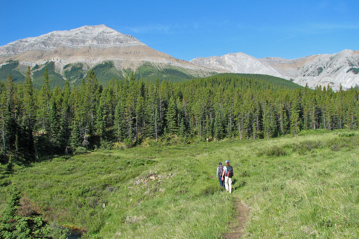
Starting on the trail
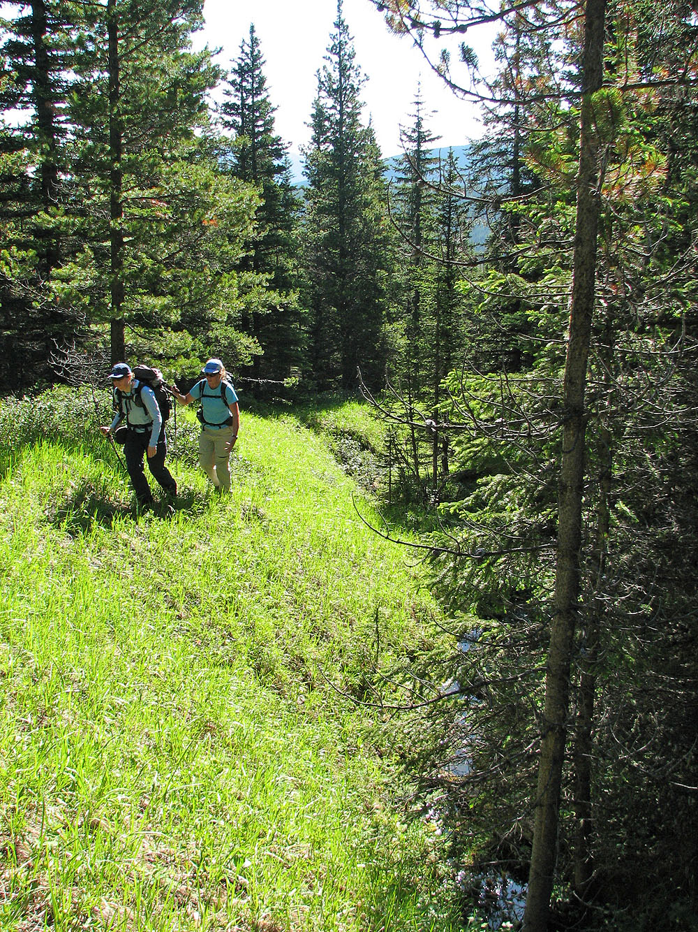
Enjoyable hike alongside the creek
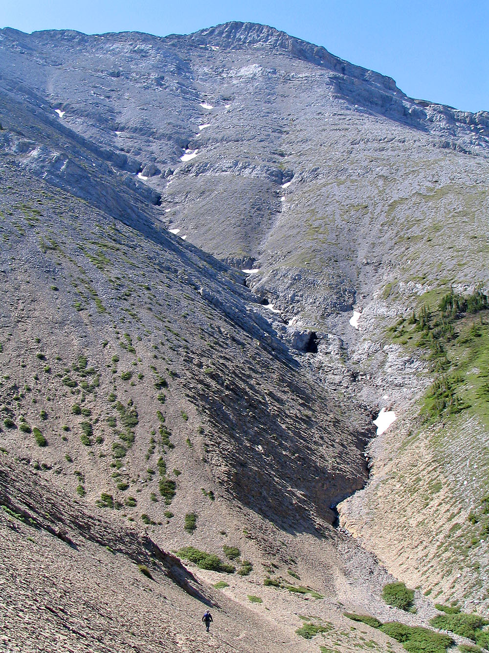
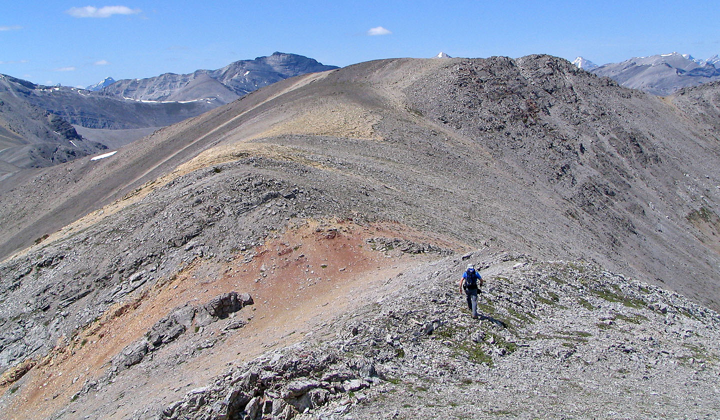
After going down and around the corner, we'll start ascending Nihahi-Compression col
Looking down at the girls (bottom right) after we started climbing
Heading up to the col
Looking down from the summit of Nihahi at the drainage we followed
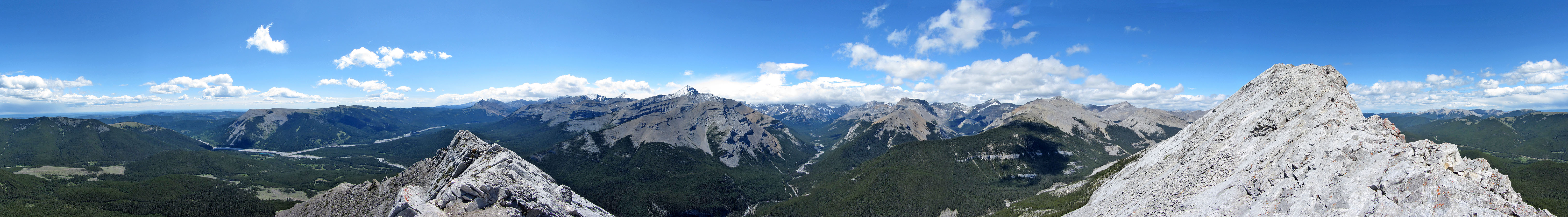
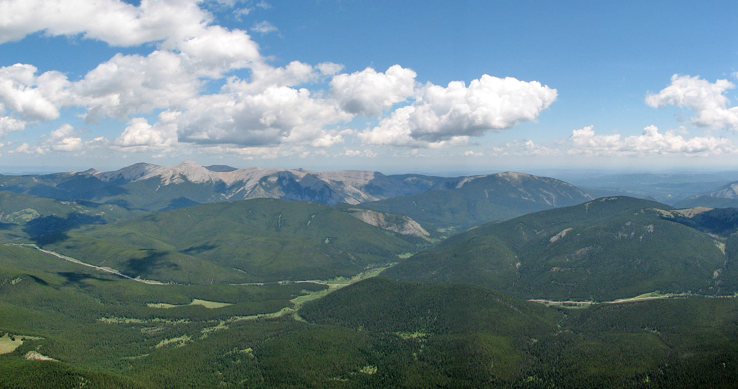
Summit panorama
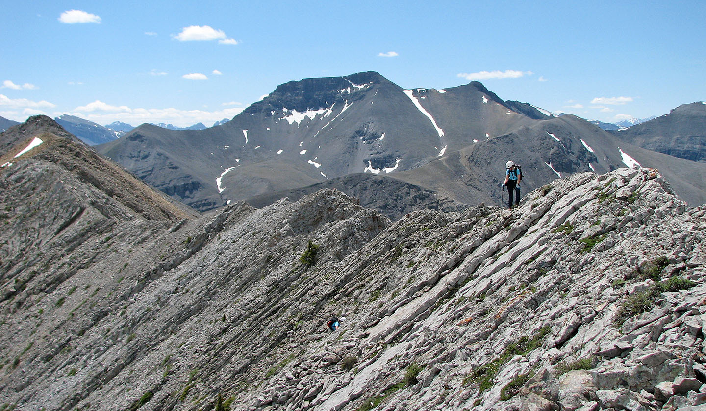
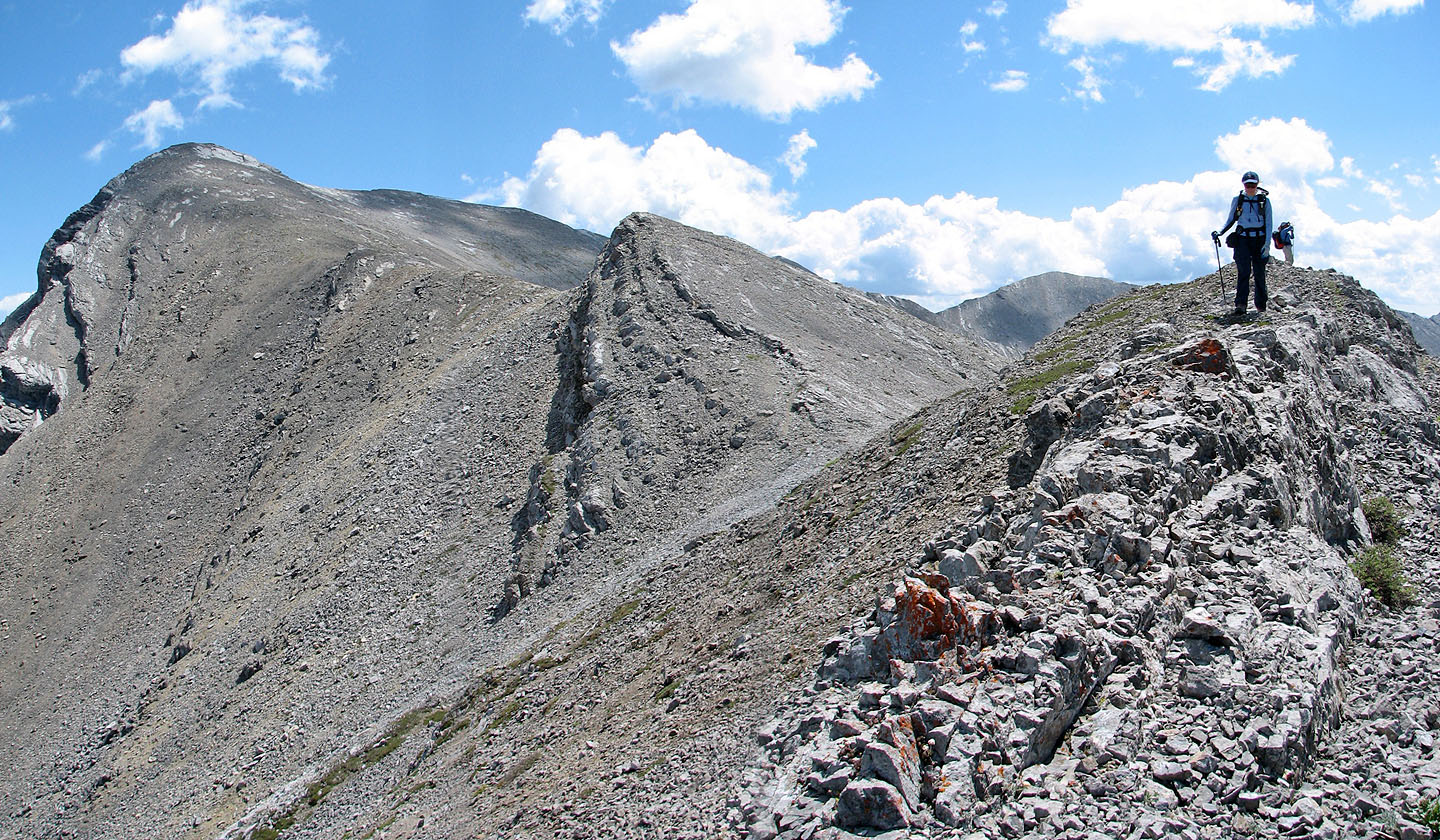 Looking back at the summit of
Nihahi Ridge (left) from the col
Looking back at the summit of
Nihahi Ridge (left) from the col
Starting up Compression Ridge
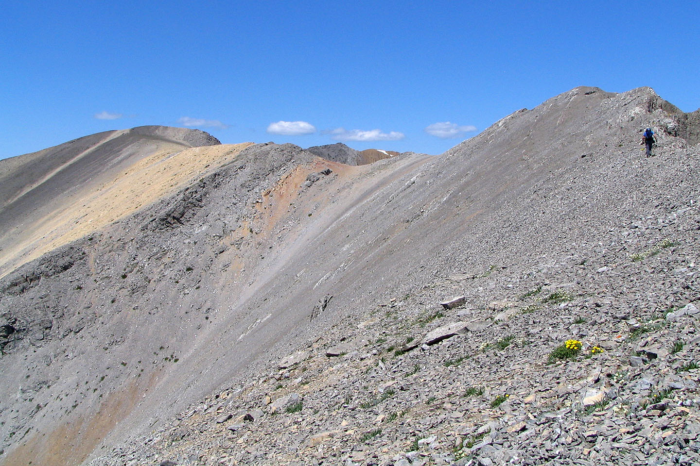
We'll soon hit colourful scree
Easy hiking along the next ridge section
The ridge became more complex. Dinah looks down at Carolyn as she regains the crest.
Scrambling down a short drop
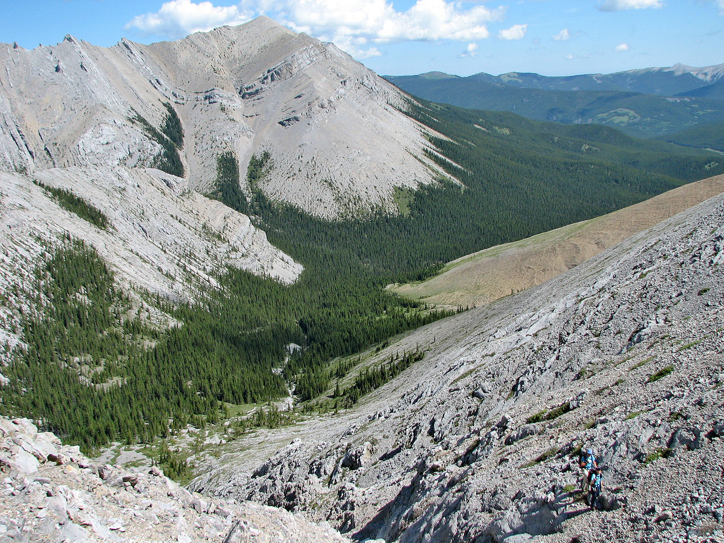
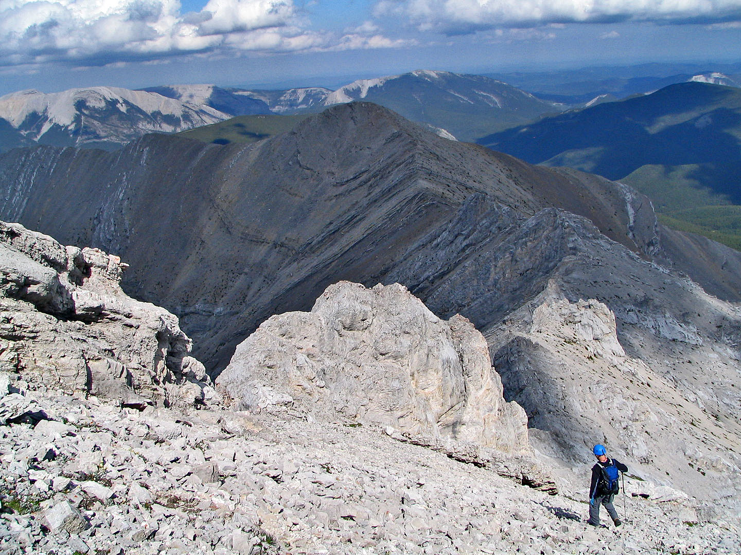
Mount Howard on the right
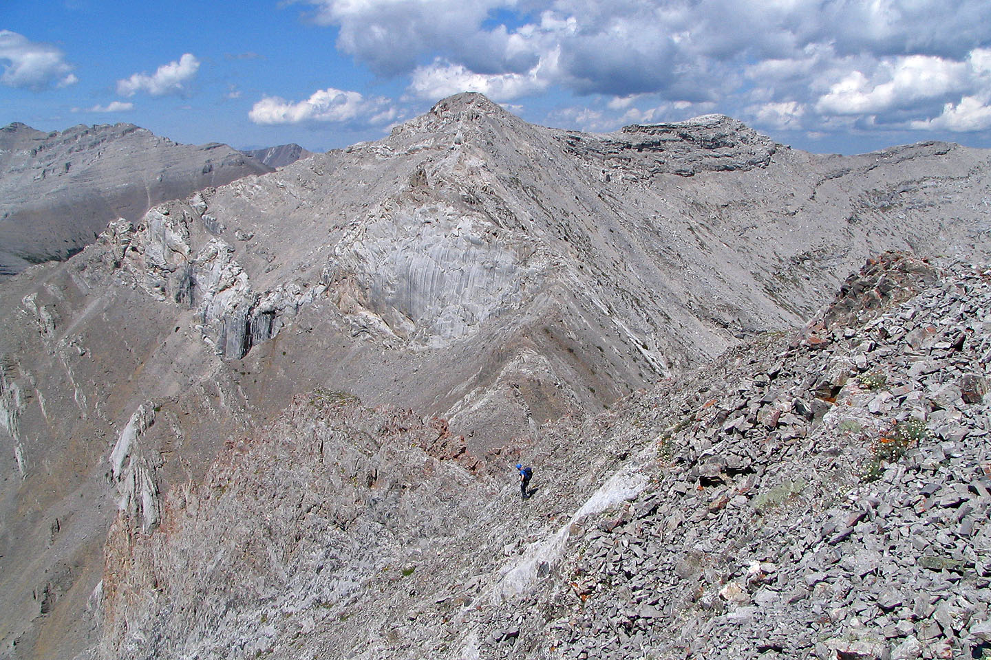
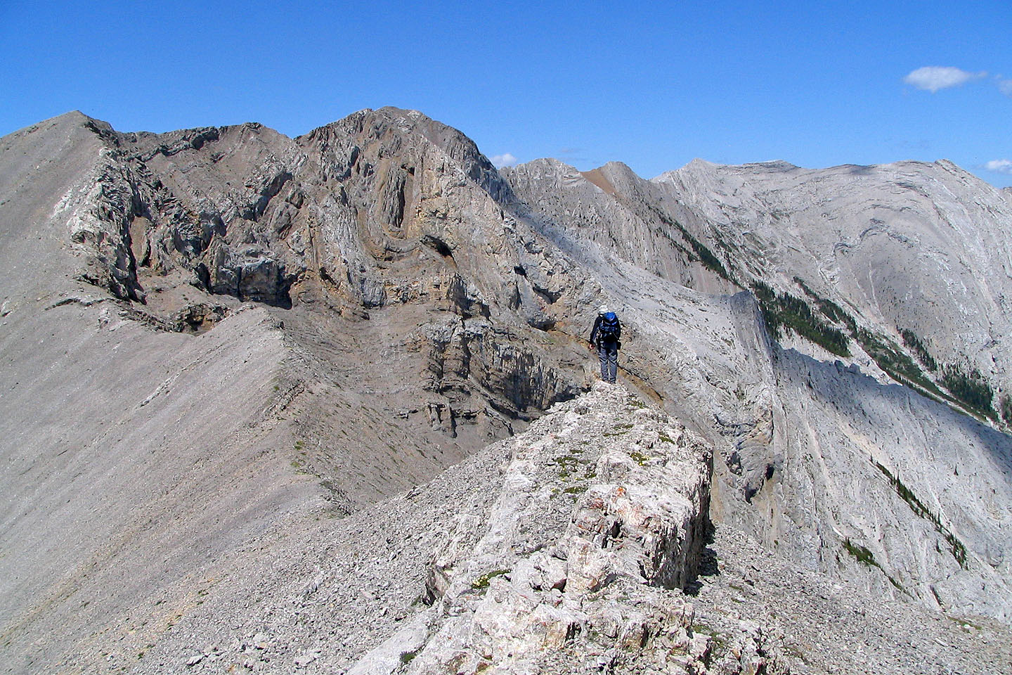
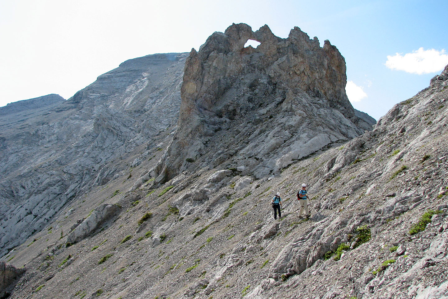
Approaching the rock fin. Above the fin are the exposed ridge and summit.
Going around the rock fin
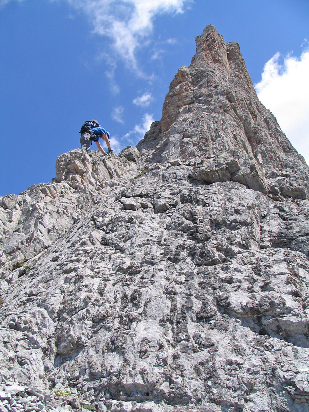
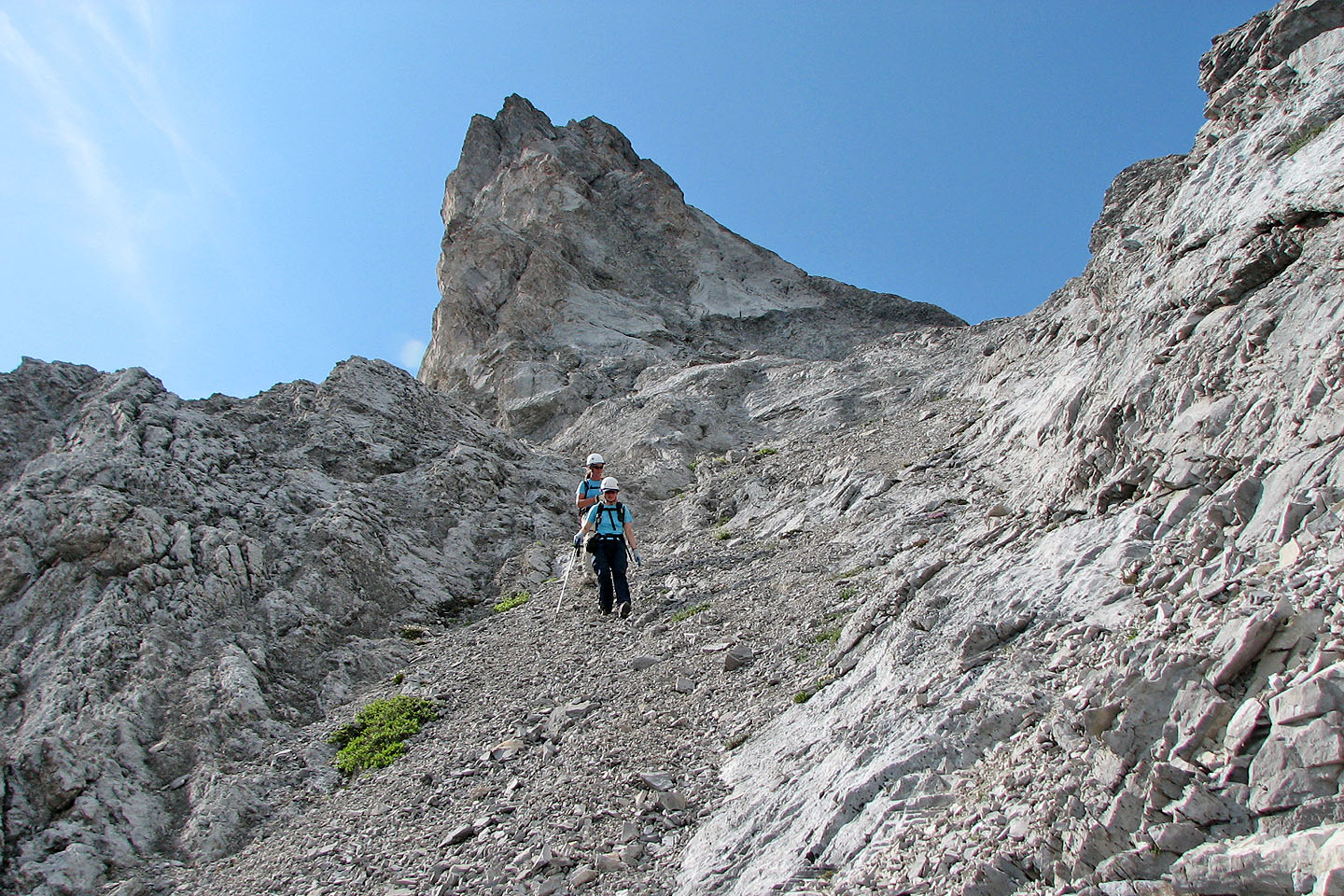
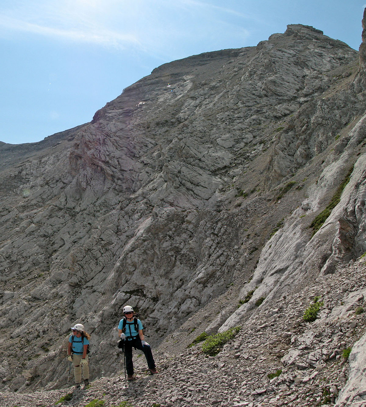
Almost at the exposed ridge
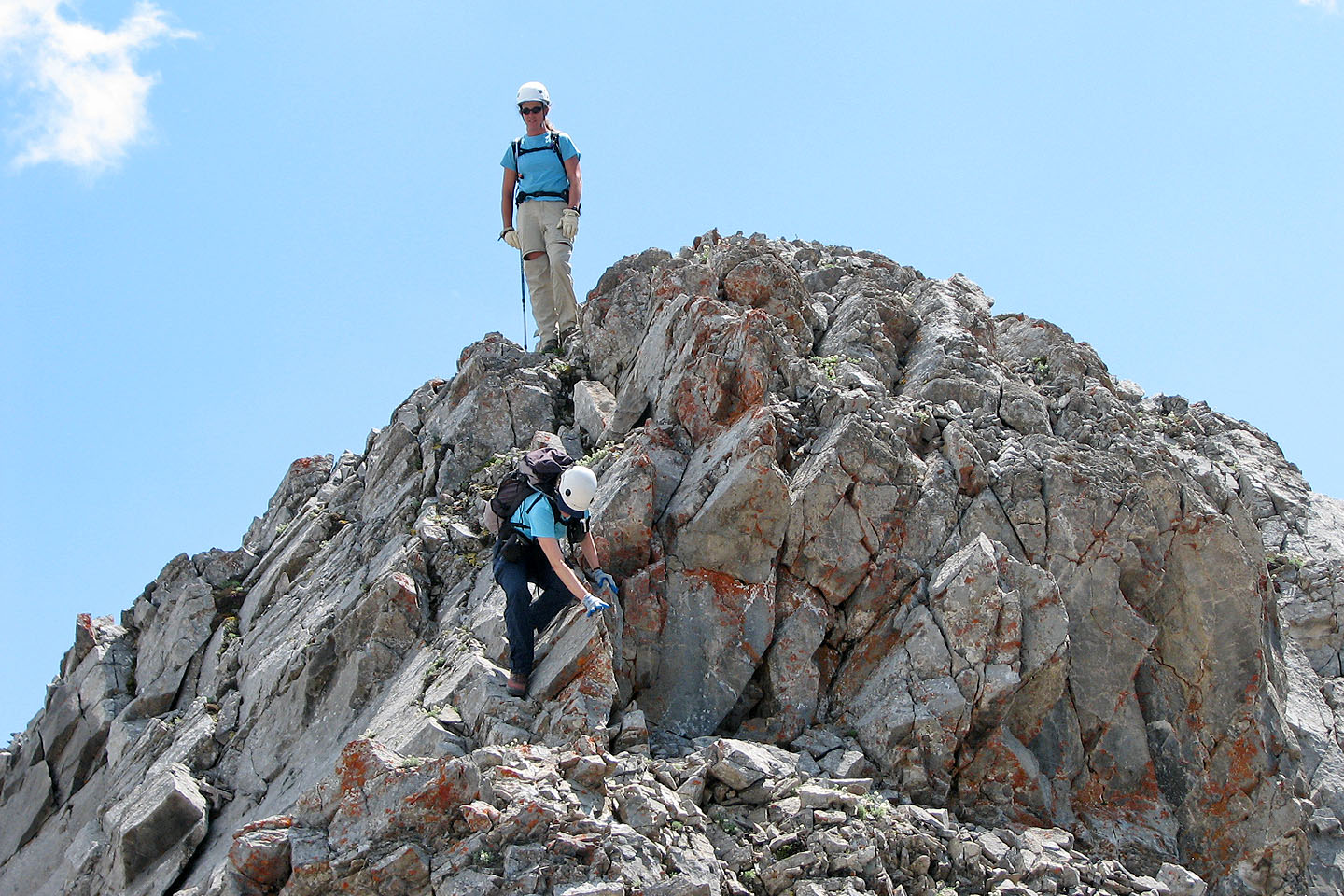
Climbing the exposed ridge
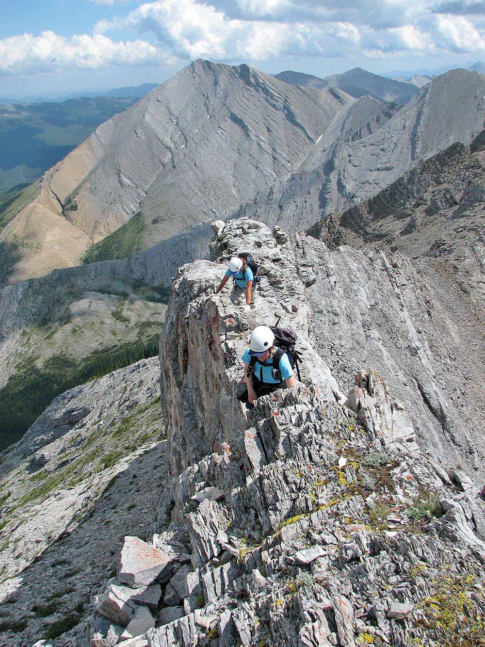
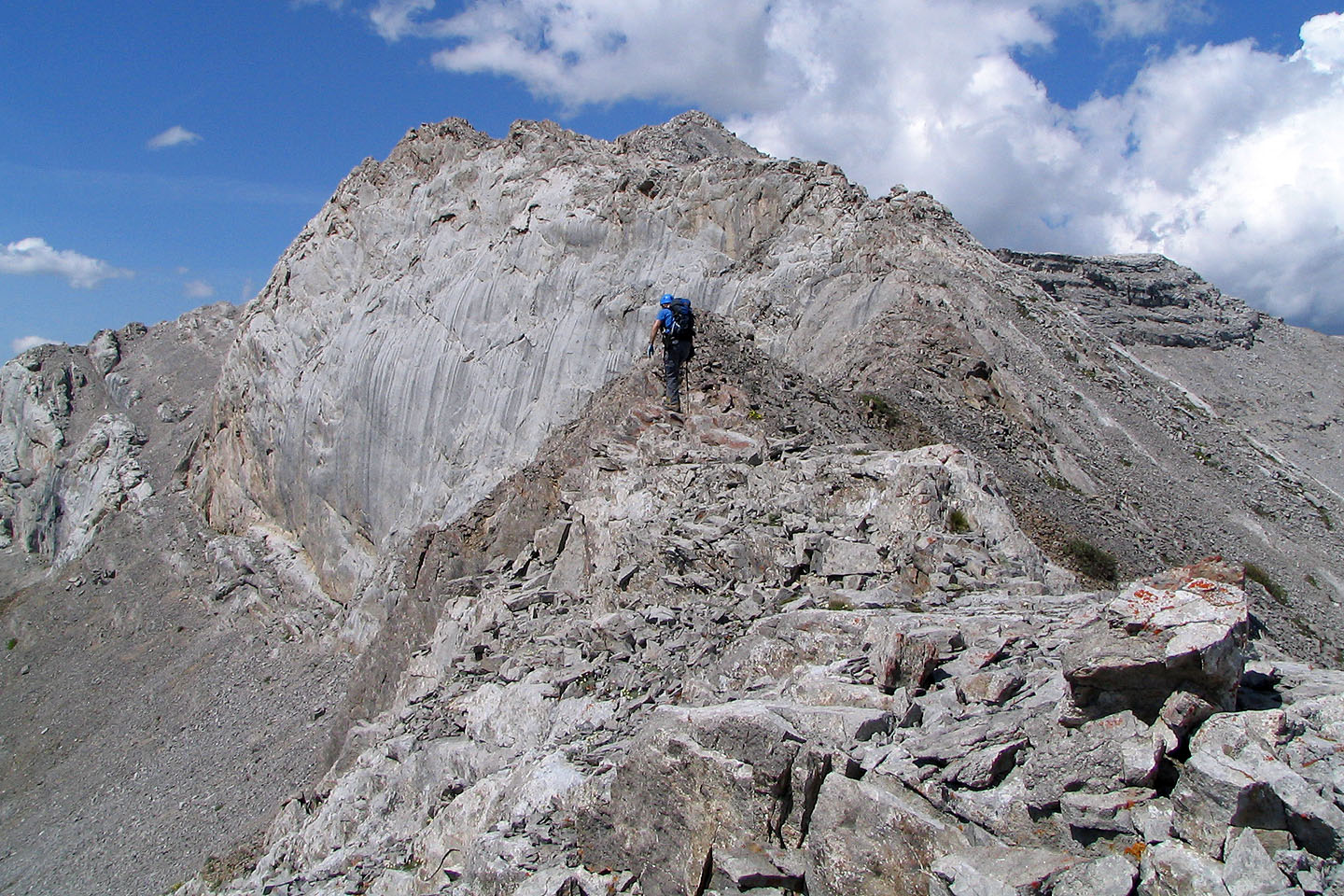
The ridge isn't too narrow
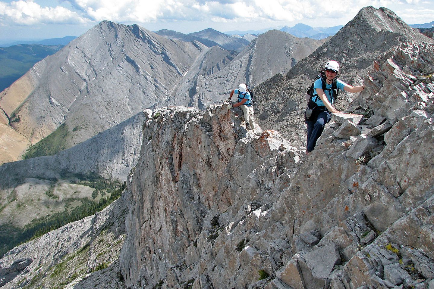
Almost at the end of the ridge. Mild exposure on this side.
My turn
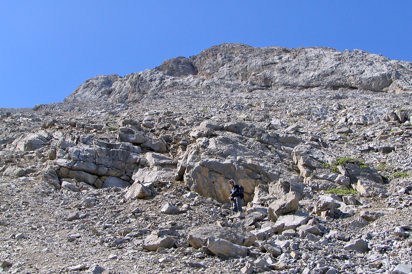
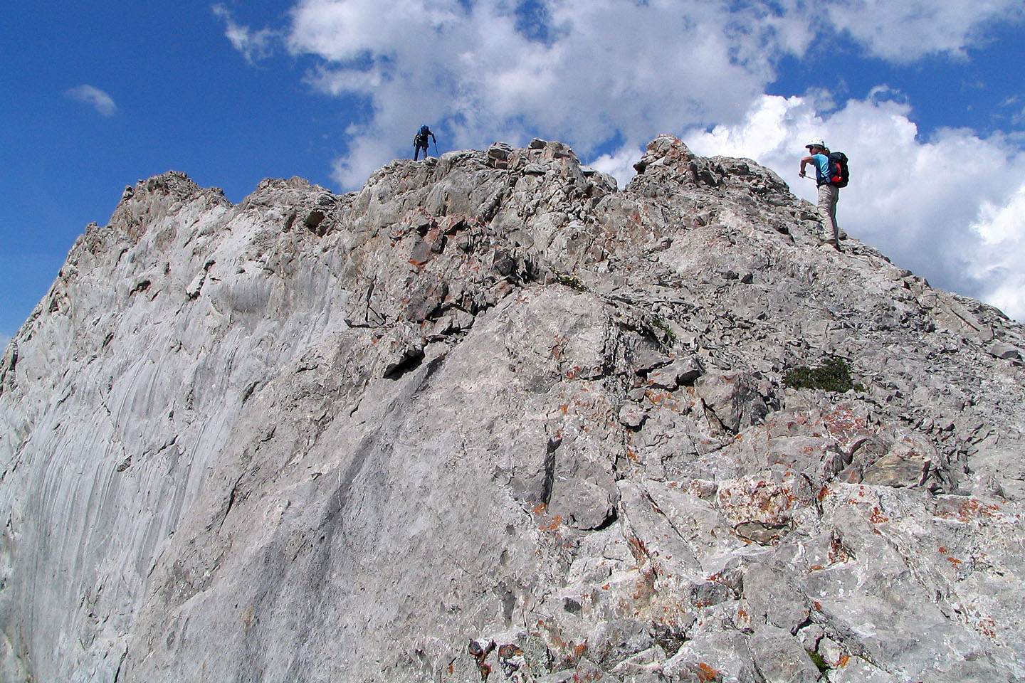
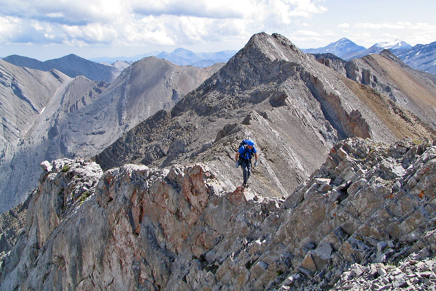
 The rest of the way to the summit was
easy
The rest of the way to the summit was
easy
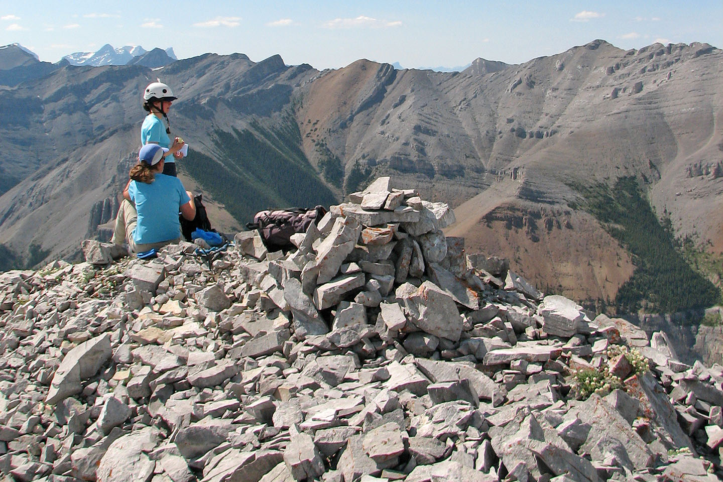
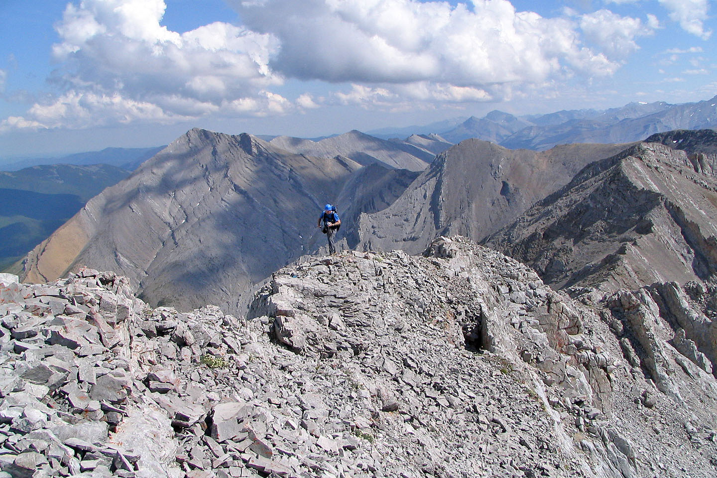
Relaxing on the summit
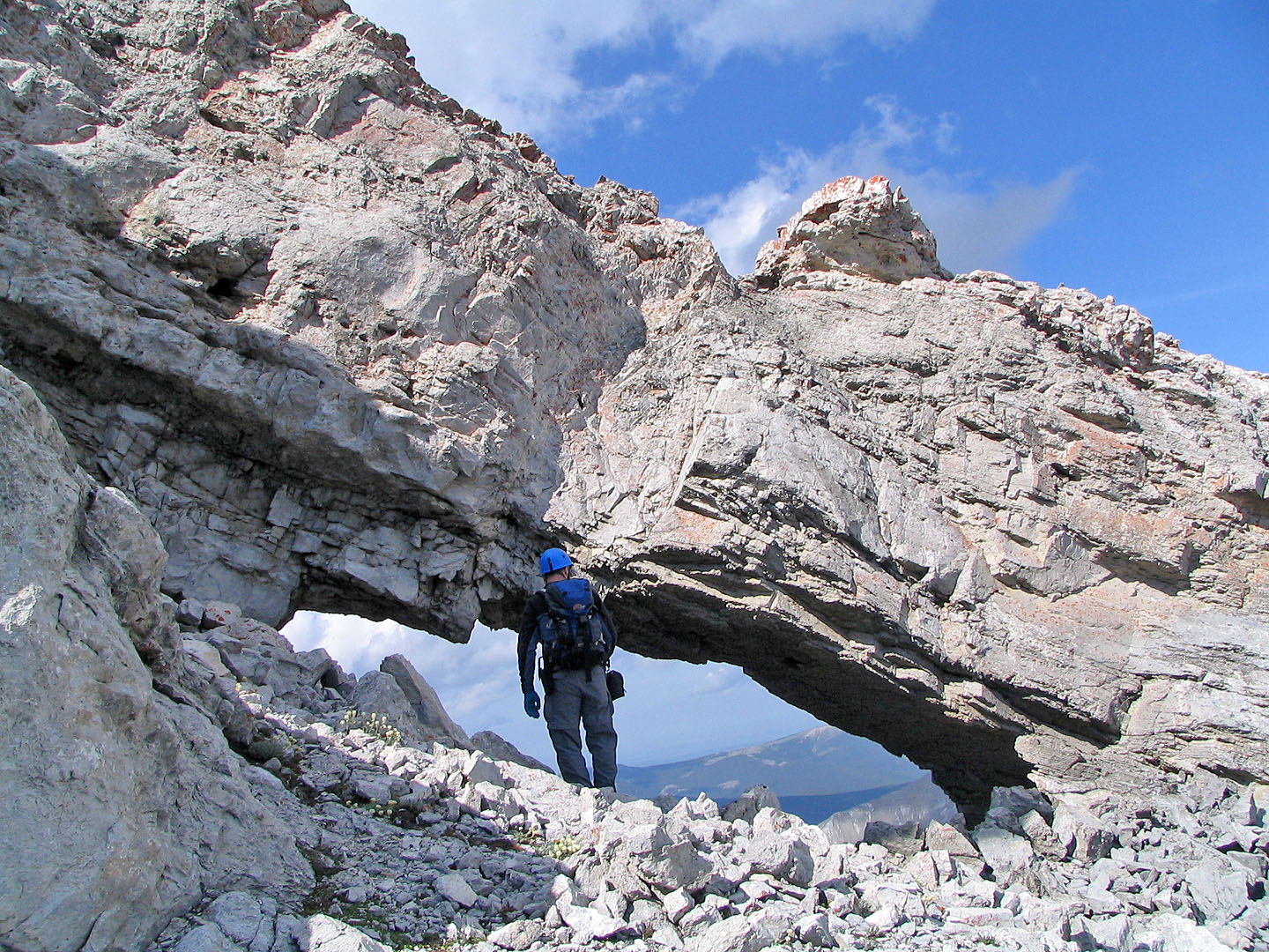
The first window after the summit
Starting down from the first window. Second window is above me.
Going past one of the pinnacles
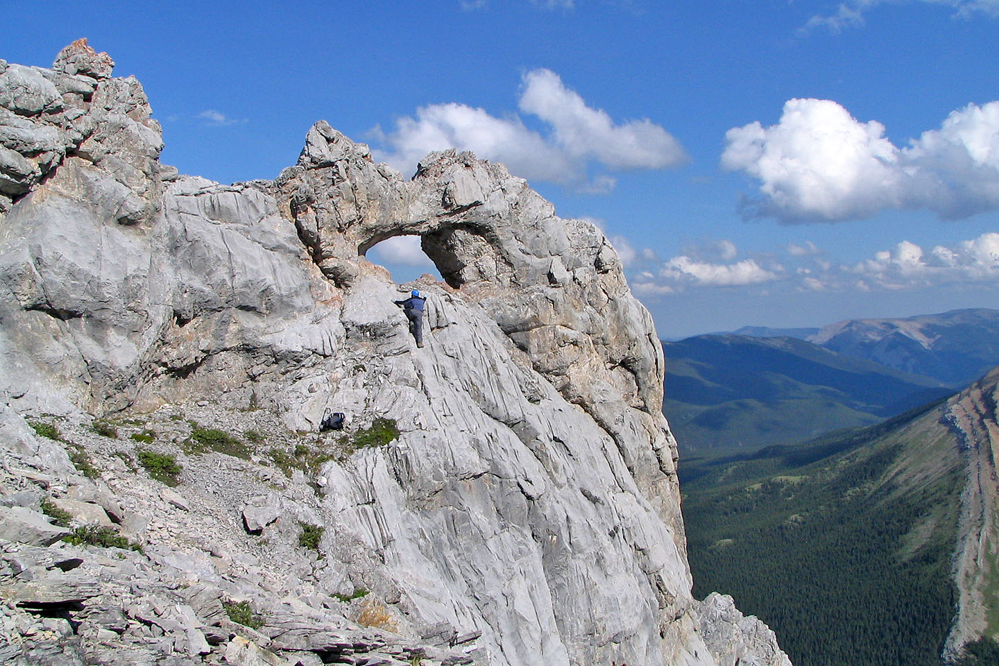
Climbing to the second window. Mouse over to see me standing it. Climbing back down was a bit hairy.
Looking back at the second window
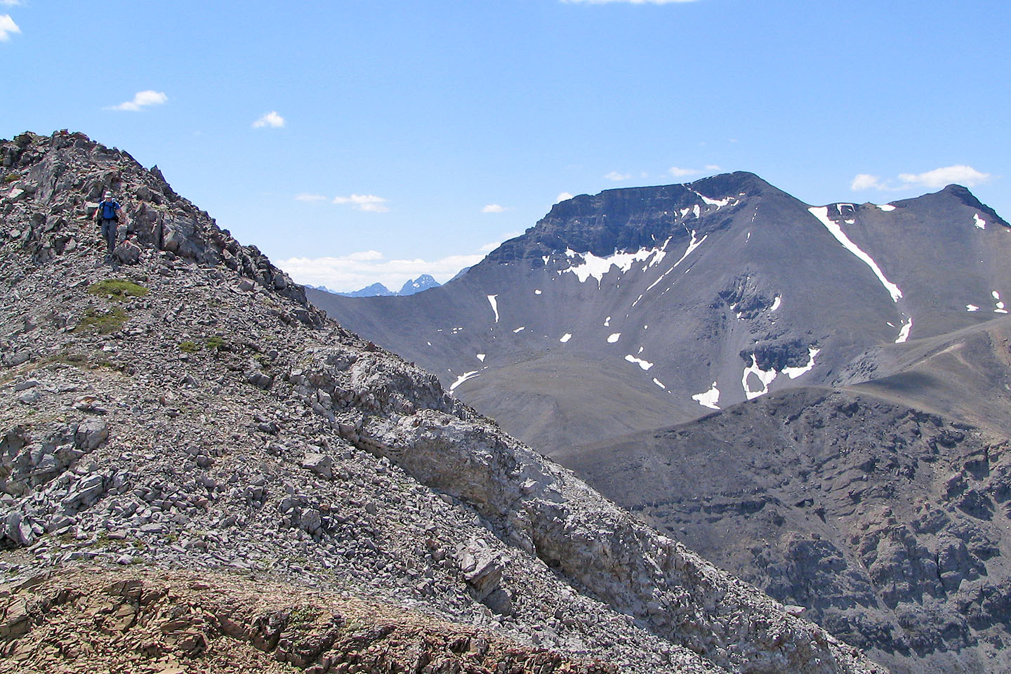
Continuing down the ridge
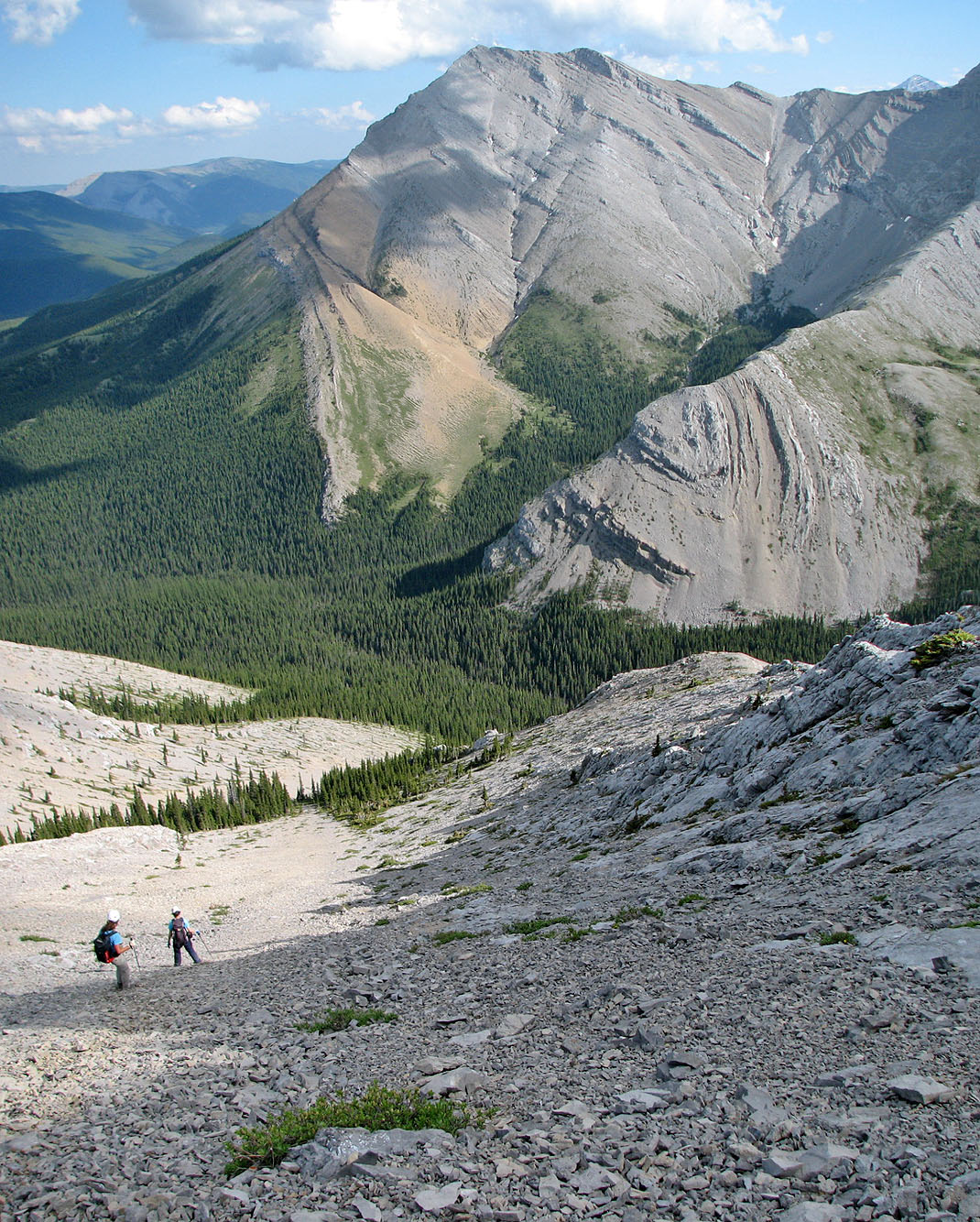
Descending the slopes to Prairie Creek
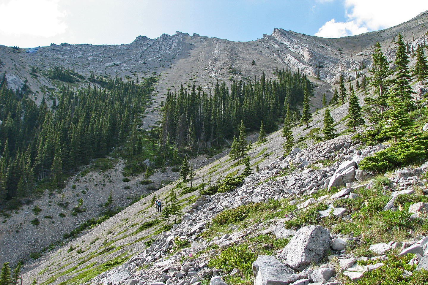
Looking back, you can see the see the corridor we took through the trees
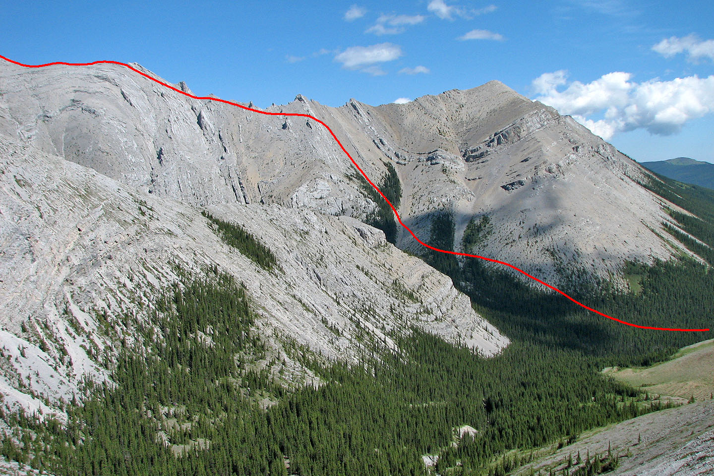
Our approximate descent route
82 J/15 Bragg Creek