bobspirko.ca | Home | Canada Trips | US Trips | Hiking | Snowshoeing | MAP | About
Copper Mountain
East of Searchlight, Nevada
November 22, 2011
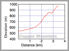
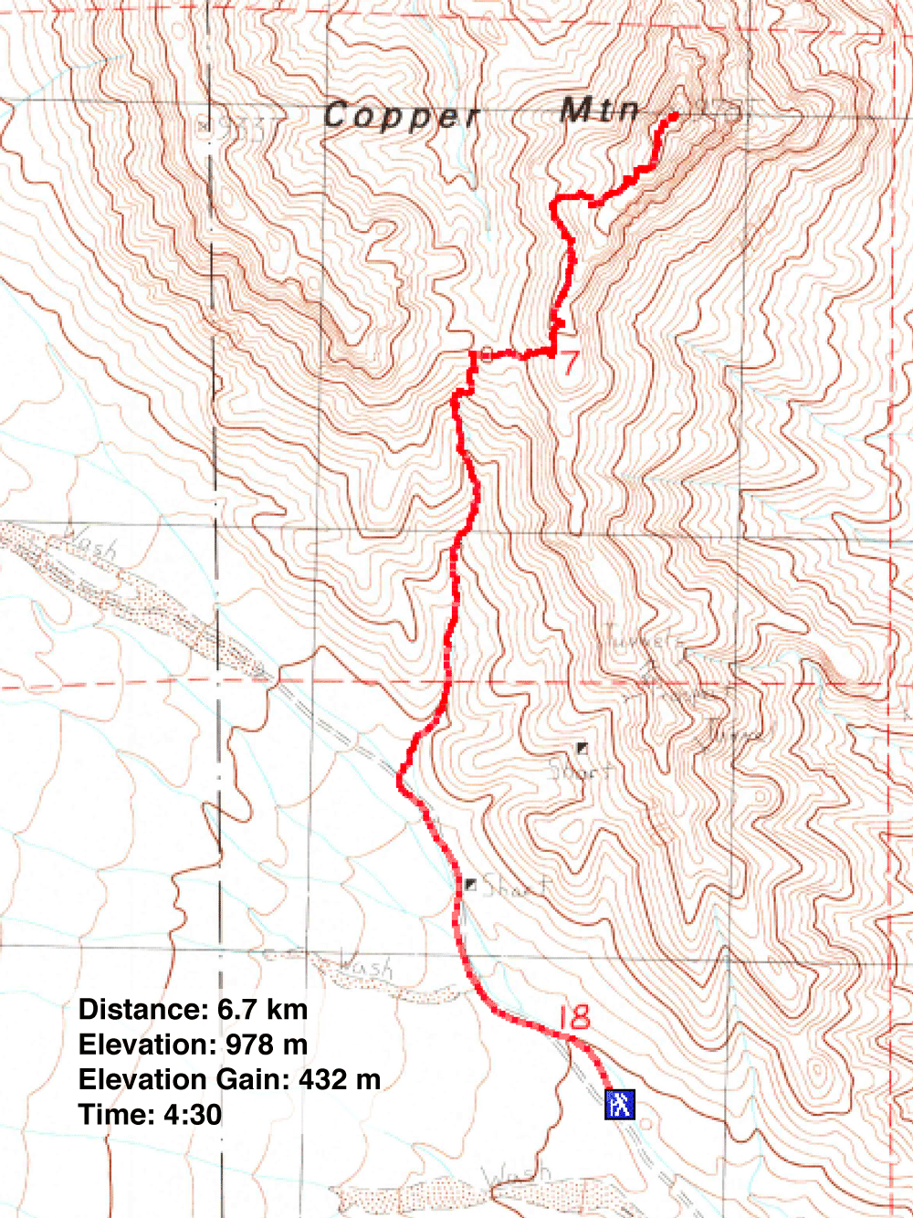
Distance: 6.7 km (4.2 mi)
Cumulative Elevation Gain: 500 m (1640 ft)
I came across Copper Mountain on Harlan Stockman's website, and even though his web page was sorely lacking a route description, Dinah and I were enticed to try it. (He has a link to a Summitpost posting, but that page is no longer extant.) The way up Copper appeared straightforward: just follow the south ridge. However, we wished to avoid the class 4 downclimb near the start of the ridge, so we decided to ascend a wash and gain the ridge midway.
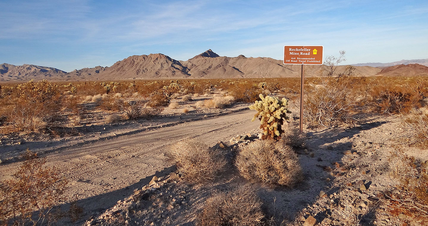
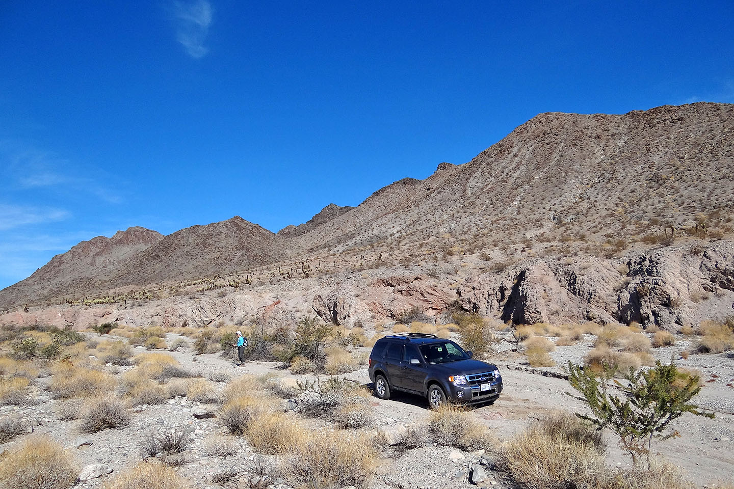
To reach the trailhead, we drove to the town of Searchlight and turned east onto Cottonwood Cove Road. We followed the road 7.8 miles before turning left on an unsigned road. After driving a couple of minutes, though, a sign told us we were on Rockefeller Mine Road, and we recognized Copper Mountain from afar.
Rockefeller Mine Road appeared to be in good shape but lacked places to turn around let alone to park. So when we found a parking spot about a kilometre from our ascent wash, we decided to stop there. We started walking up the road.
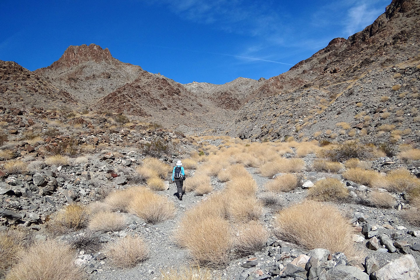
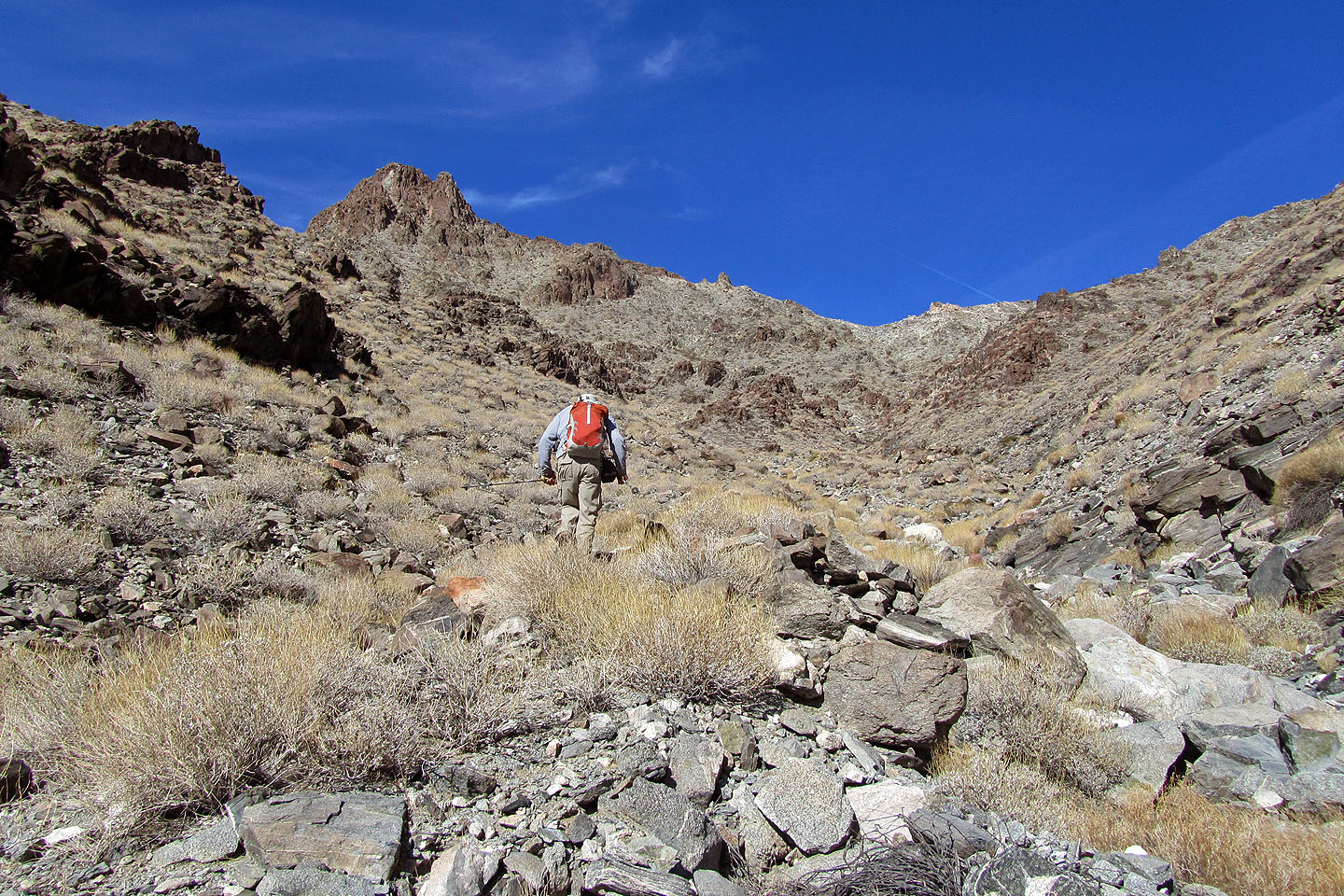
We made the mistake of taking the second wash and had to go around the end of a ridge before dropping into the correct wash. We started hiking up the wash to a saddle.
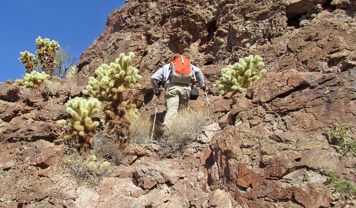
Just before reaching the saddle my lower leg accidentally bumped into a teddybear cholla cactus. There is nothing cuddly about teddybear cholla (pronounced chohl-ya). Of all cactus encounters, we're most apprehensive of this one. The spines are so sharp they can sink into the hard rubber at the end of a hiking pole. The cactus clings firmly like Velcro with needles, sticking to anything it touches. I once pulled out a cholla spine that was stuck a quarter of an inch in my shoulder, and it so resisted removal that it formed a quarter-inch volcano of skin as I tugged on it. But never does the plant offer up just one spine. As a way of propagating, stem segments break off easily, so when I knocked against the cactus, a three-inch piece was nailed to my lower leg. And since segments have densely bristled barbs, they leave no surface to grab. To extract the spines from my leg, I carefully pulled my pant leg away from my leg. The cactus was so firmly embedded that the process took a half-minute of slow, steady force – with pauses to catch my breath for the pain. Once clear of my leg, I used a forked stick to tug the segment free from my pants. When I pulled up my pant leg, I saw that my leg was swollen and had maybe two dozen puncture wounds. As you might guess, I was more careful with the cholla cactus after that.
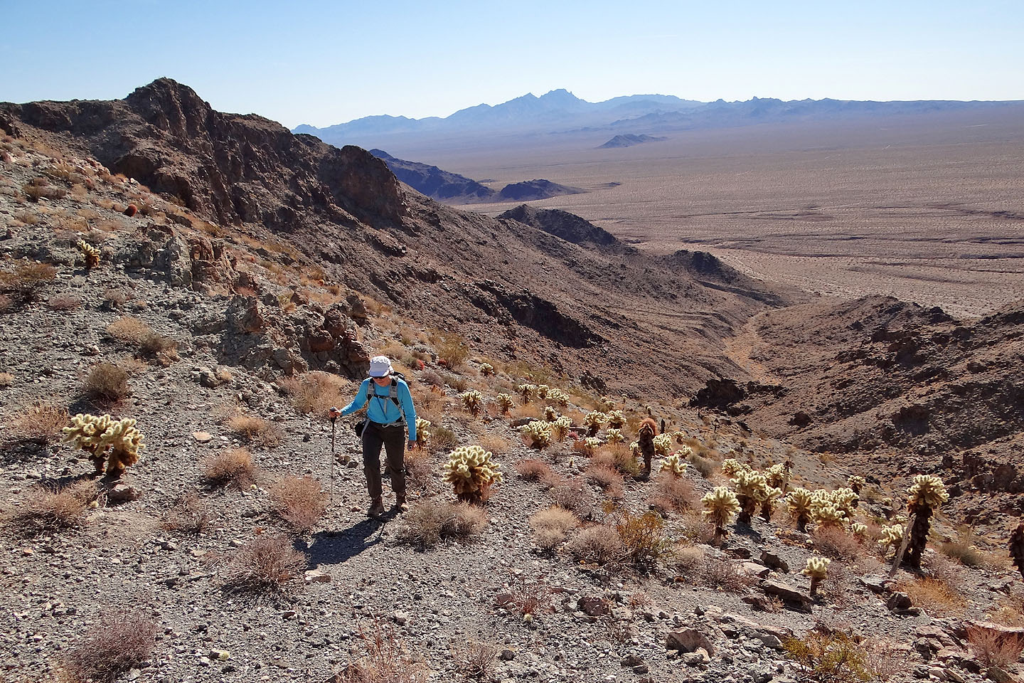
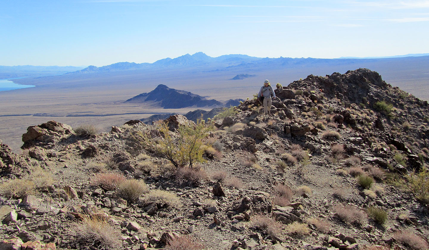
After the cactus encounter, we came to the saddle and headed to the ridge on our right. Once we gained the crest, however, we were dismayed to find a forest of teddybear cholla. We tried to skirt around them but our boots still managed to collect some cactus segments that were scattered on the ground.
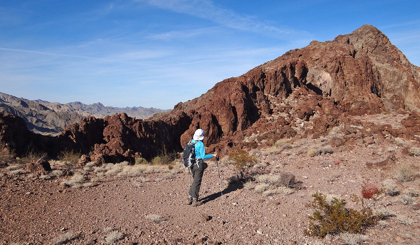
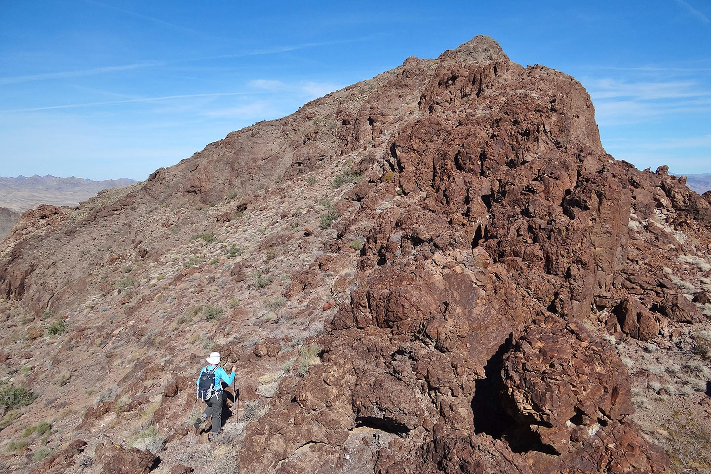
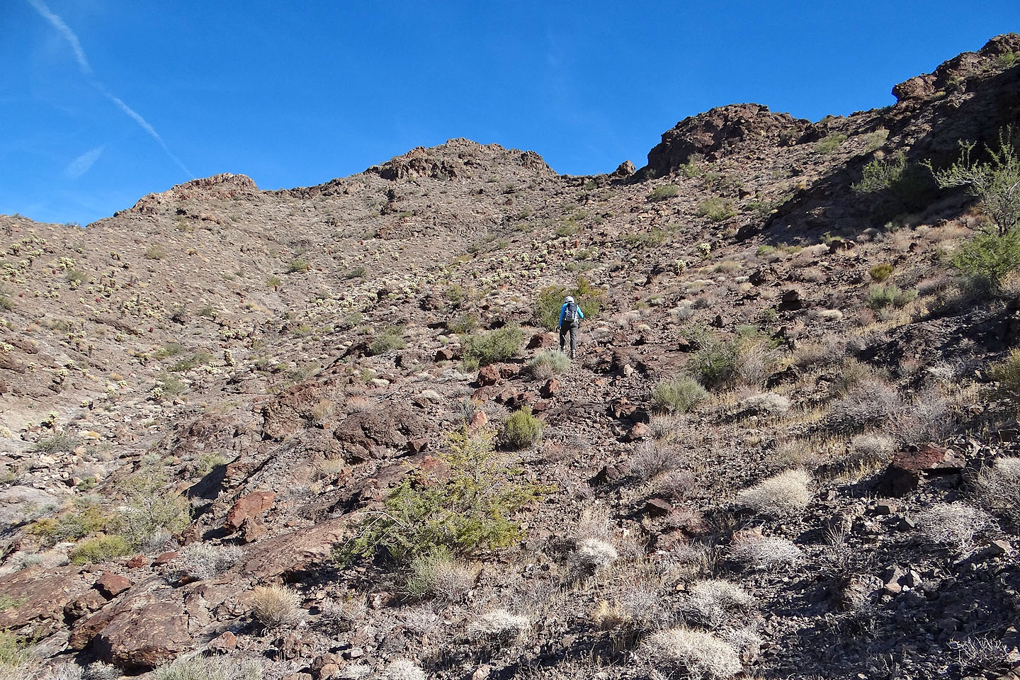
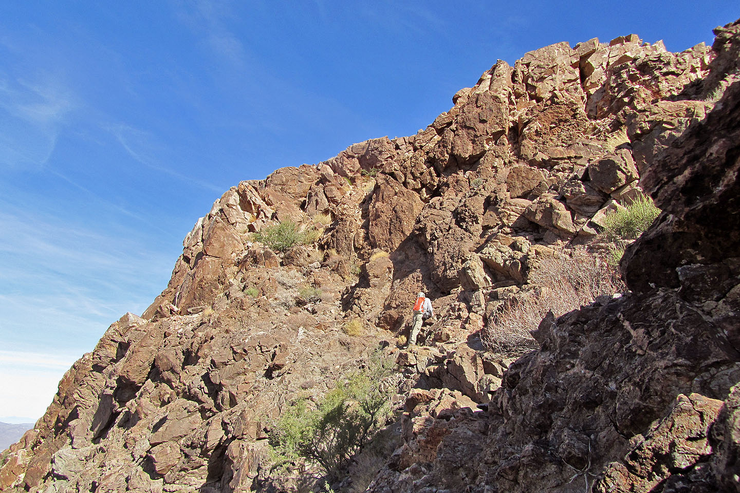
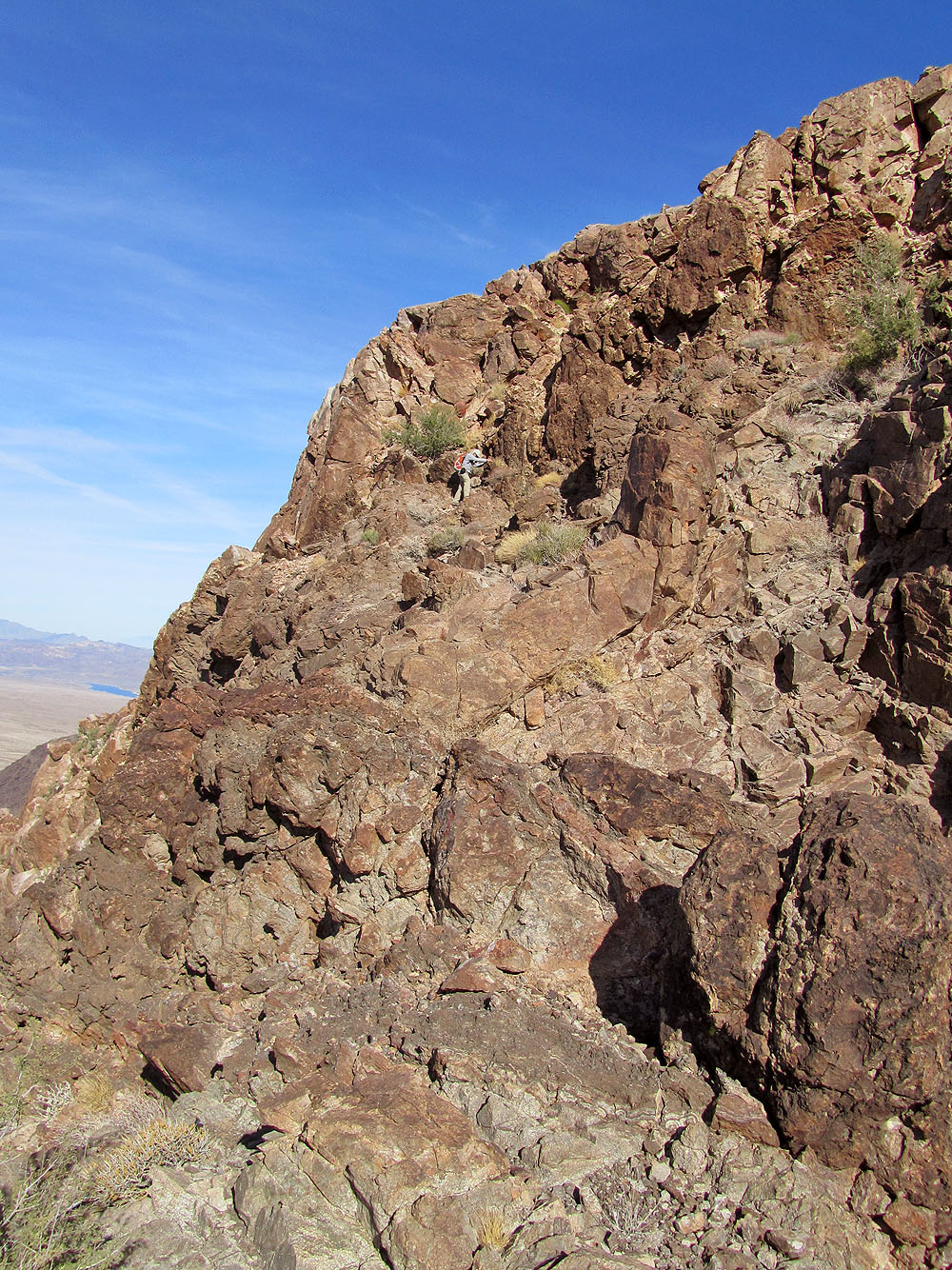
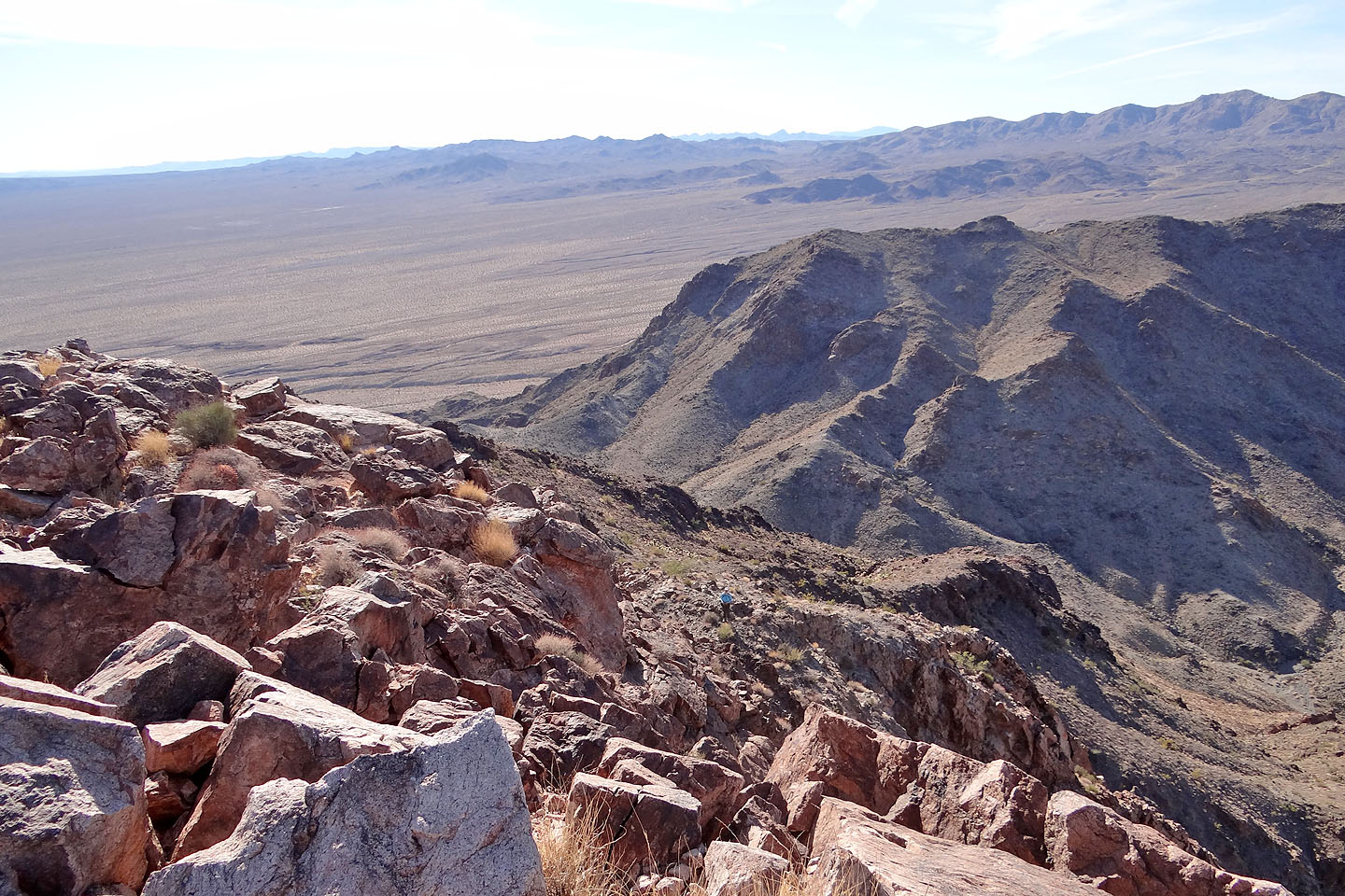
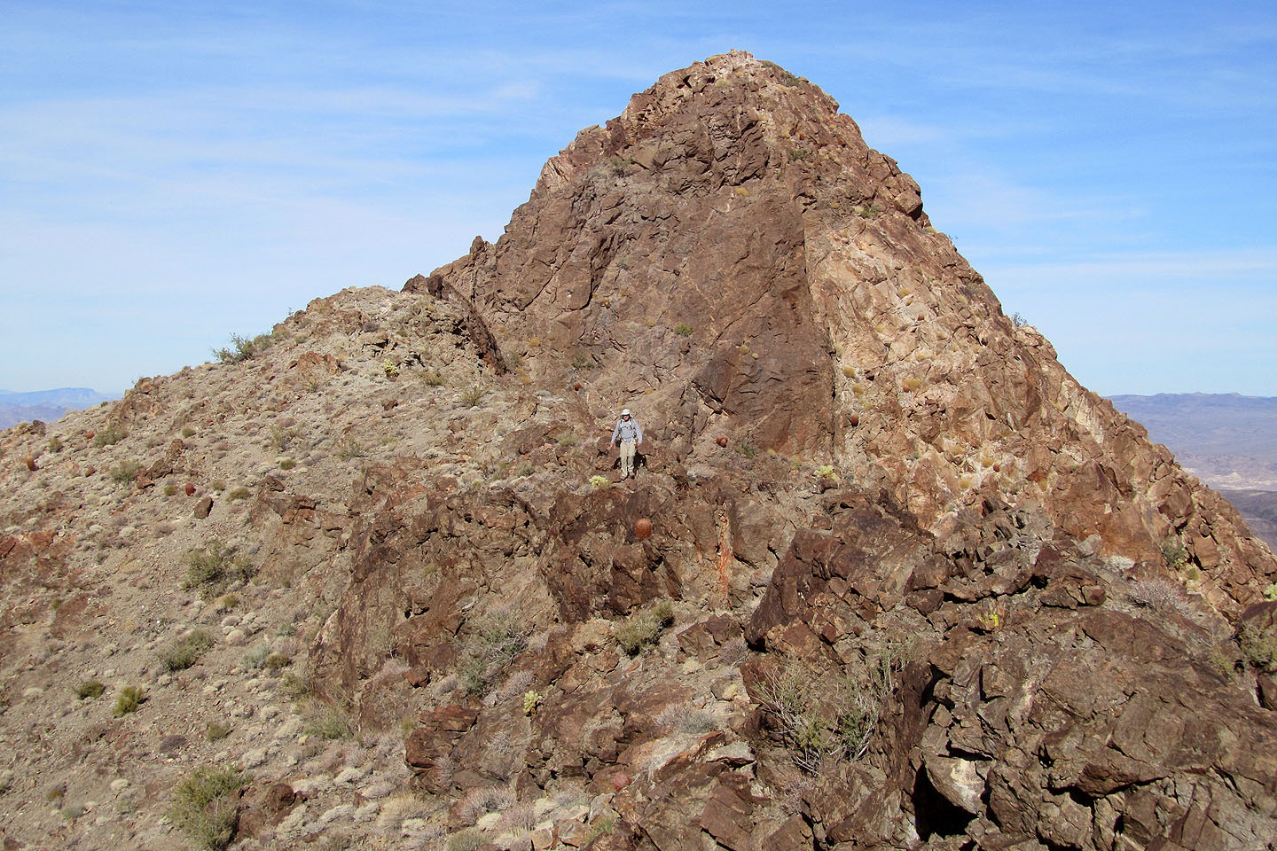
After climbing higher on the ridge we were confronted by steep rock, so we dropped down on the left side. Steep cliffs appeared to guard the entire west side of the ridge. We tried getting through the cliff band in a few places but had no luck. I continued to search for weaknesses while Dinah scouted all the way to the end of the cliff band. She had the right idea. After going around the corner, she found a broad bowl leading to the summit block. We hiked up to the base of the summit block. At first glance, it appeared impossibly steep, but on closer inspection, it looked feasible to traverse to below the summit and ascend a hidden chimney.
By now, our extensive routefinding had eroded Dinah's confidence. To her, the final summit push appeared formidable, so she hung back while I climbed up. Although steep, I didn't think it was difficult or exposed. I'm sure Dinah was more than capable of the task. I tagged the summit and then rejoined Dinah.
Our return down the mountain was unremarkable until we reached the road. As we exited the wash, we were surprised to see a park service SUV stop in front of us. A ranger got out, so we approached him. He said he had noticed our car that morning and was concerned. He had come back to check on us. We assured him we were fine, and he went on his way. The next time we park in an isolated area, we'll leave a note in the car explaining what we're doing, and when we expect to be back. Better that than having park service worry about us.
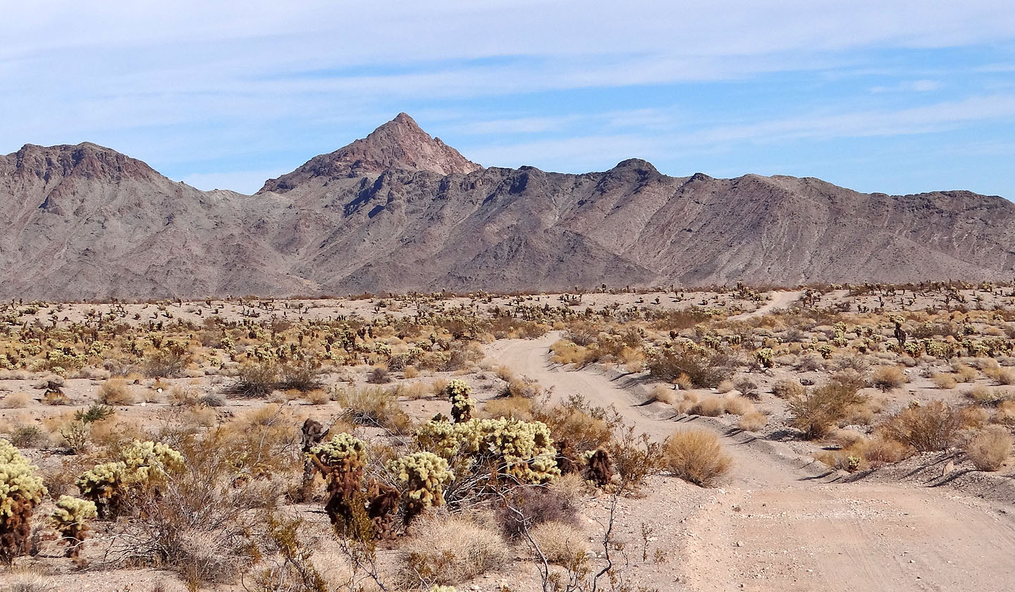
Copper Mountain seen from Rockefeller Mine Road
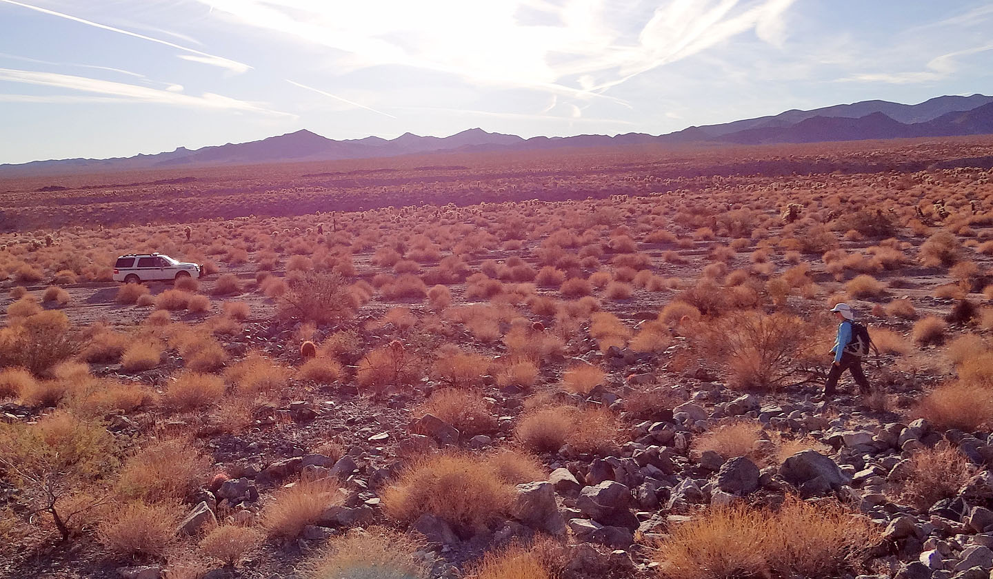
We hiked up the wash on the left
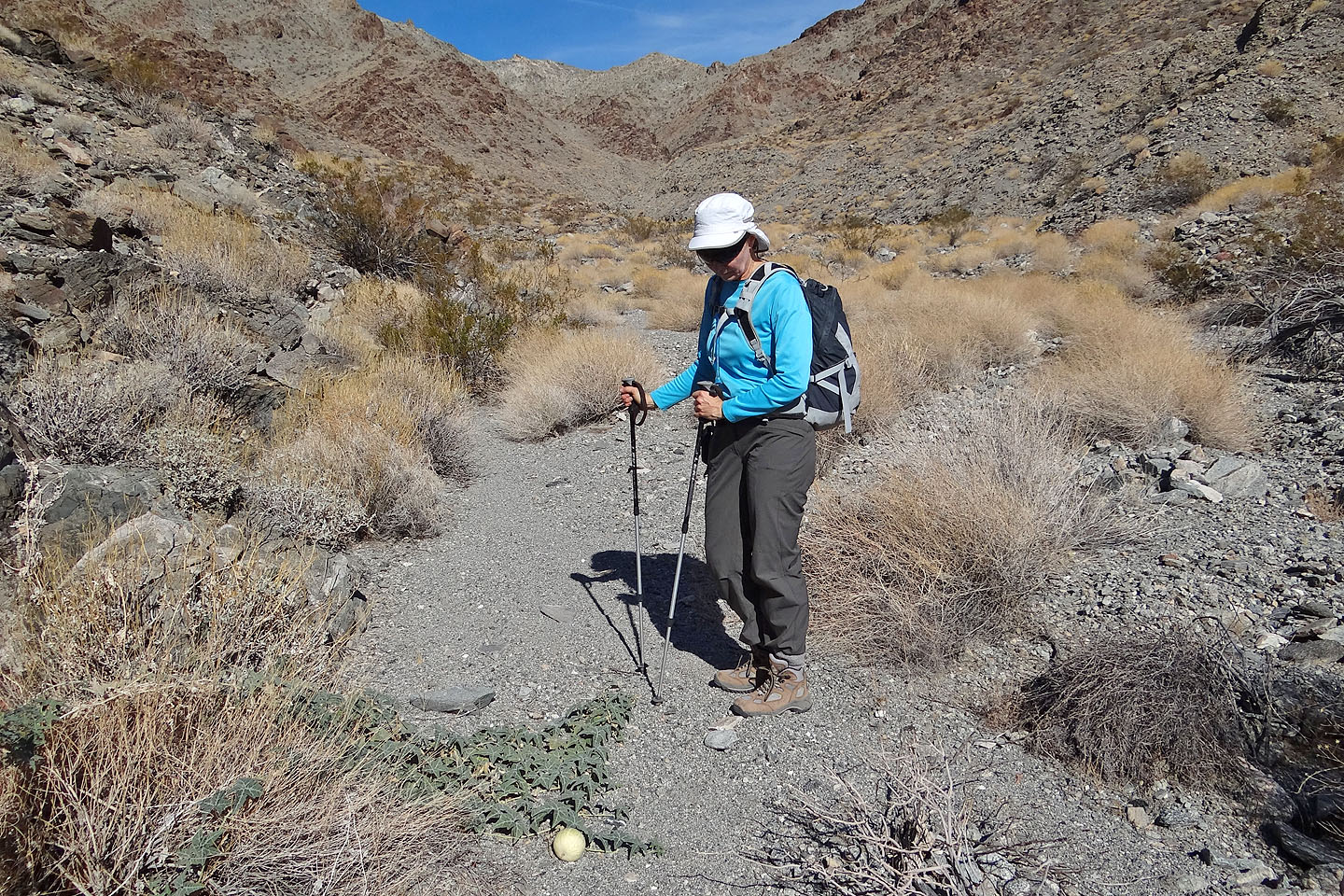
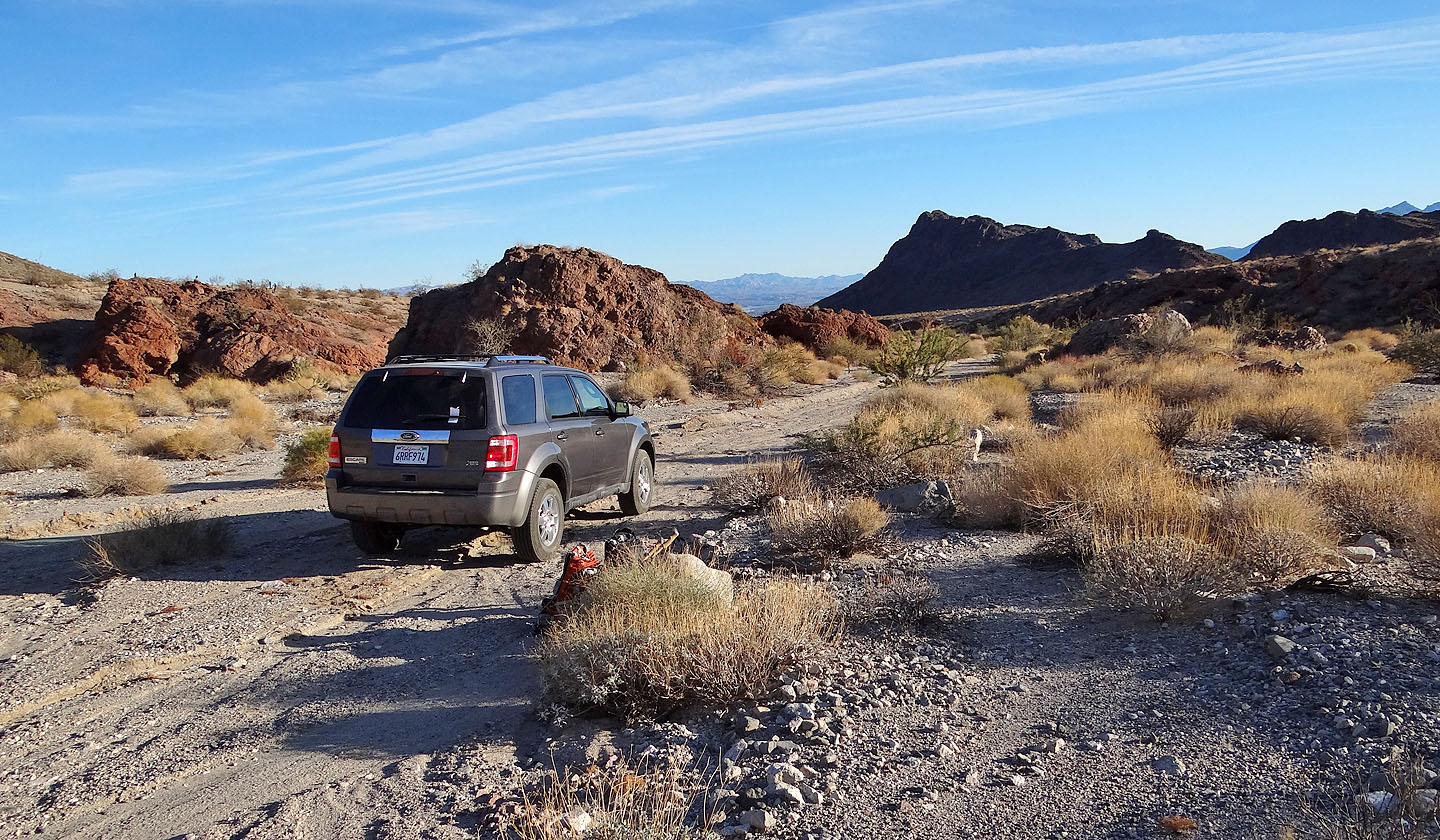
Starting up the road

Hiking up the wash to the saddle
We didn't know what this was (mouse over for a close-up) and later emailed
photos to Jim Boone.
Thanks to Jim, we learned it was a coyote melon. He
added it to his website. The fruit is is said to be inedible and distasteful.
The wash is covered in what appears to be snakeweed bushes
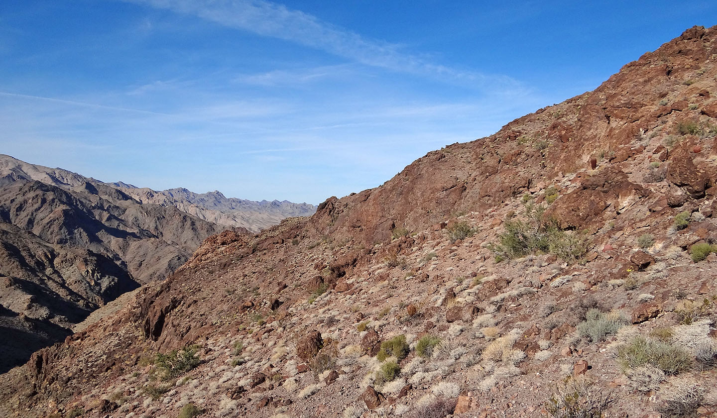
Looking back
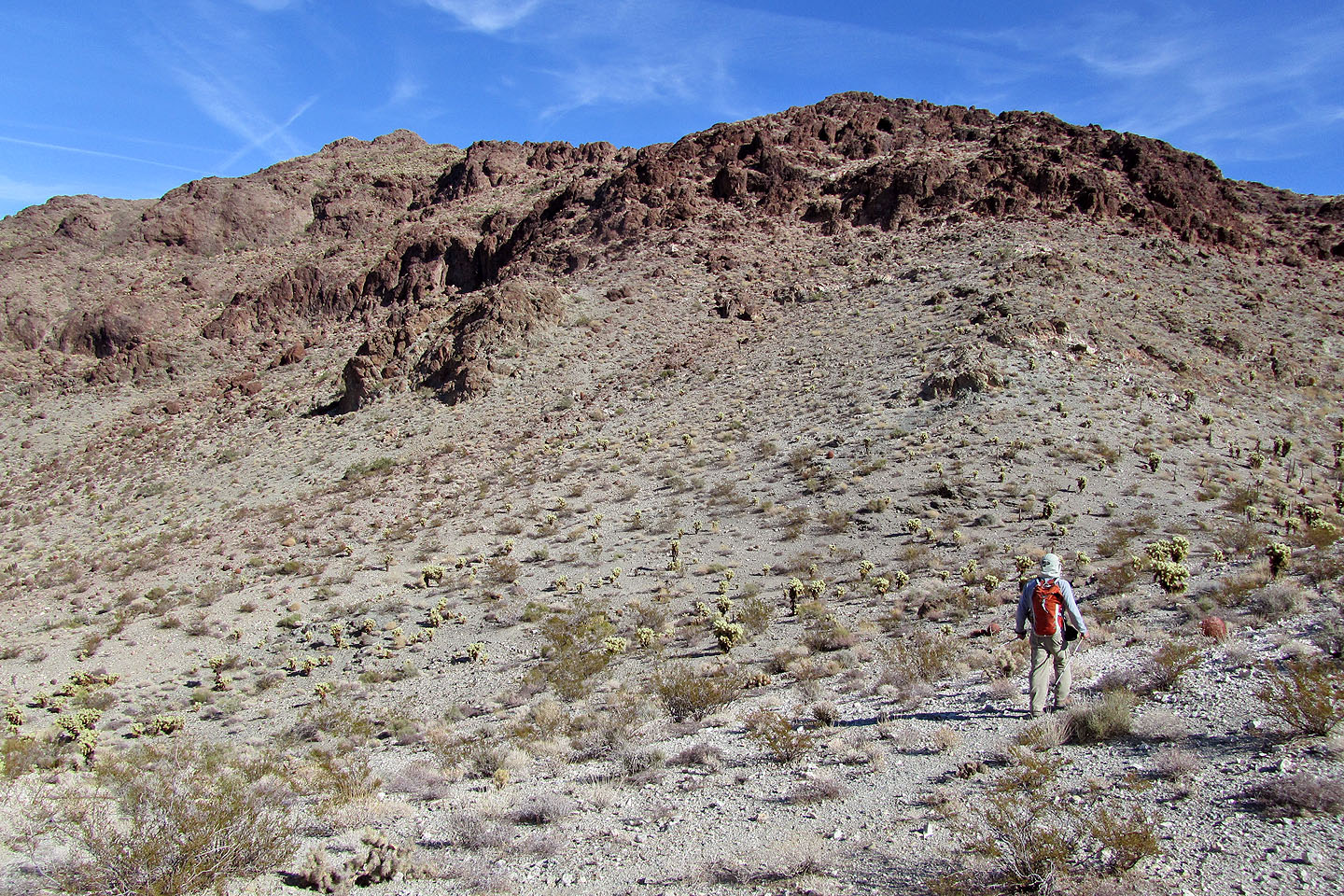
The bushes begin to disappear
We headed to the right side of the white outcrop on the skyline
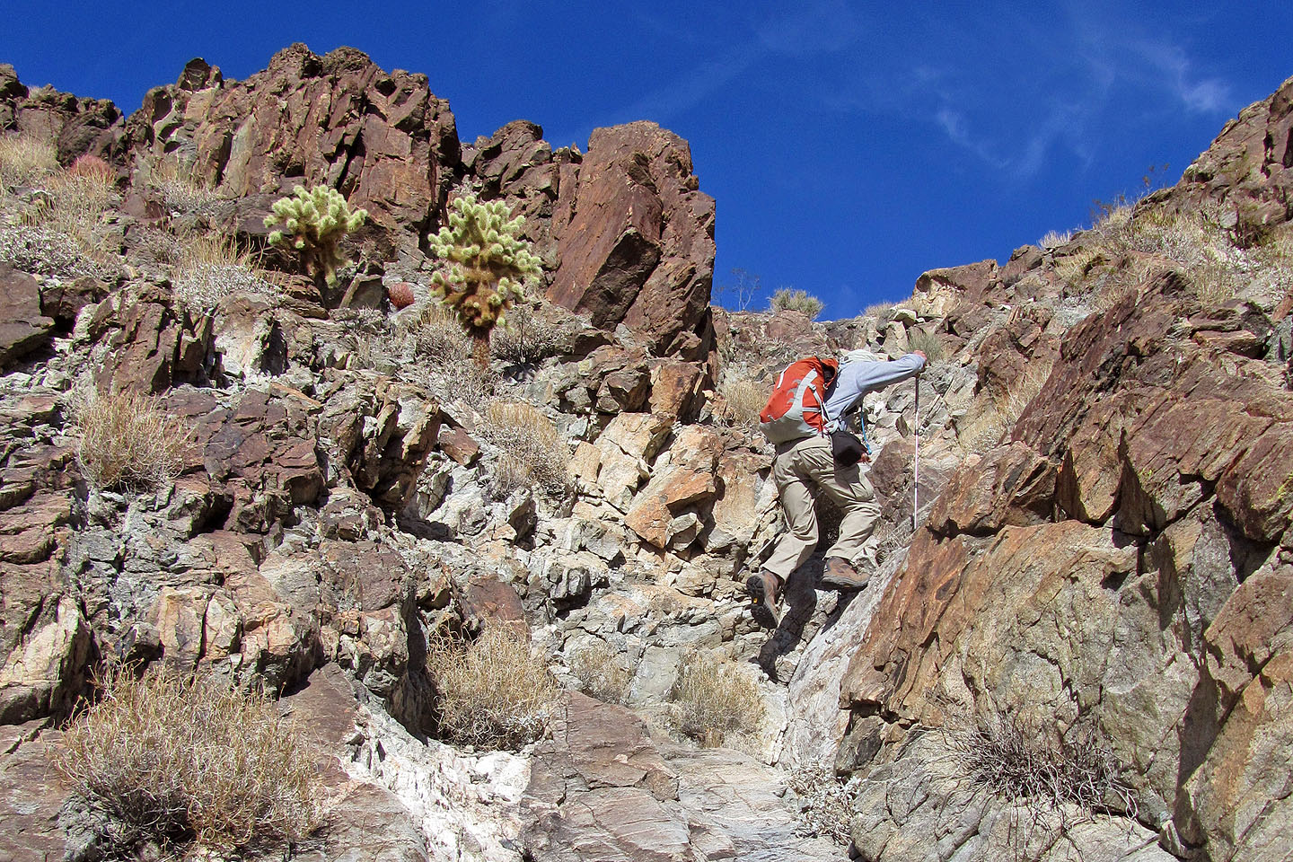
We started seeing cholla (mouse over over for a close-up)
Painful encounter with cholla (mouse over)
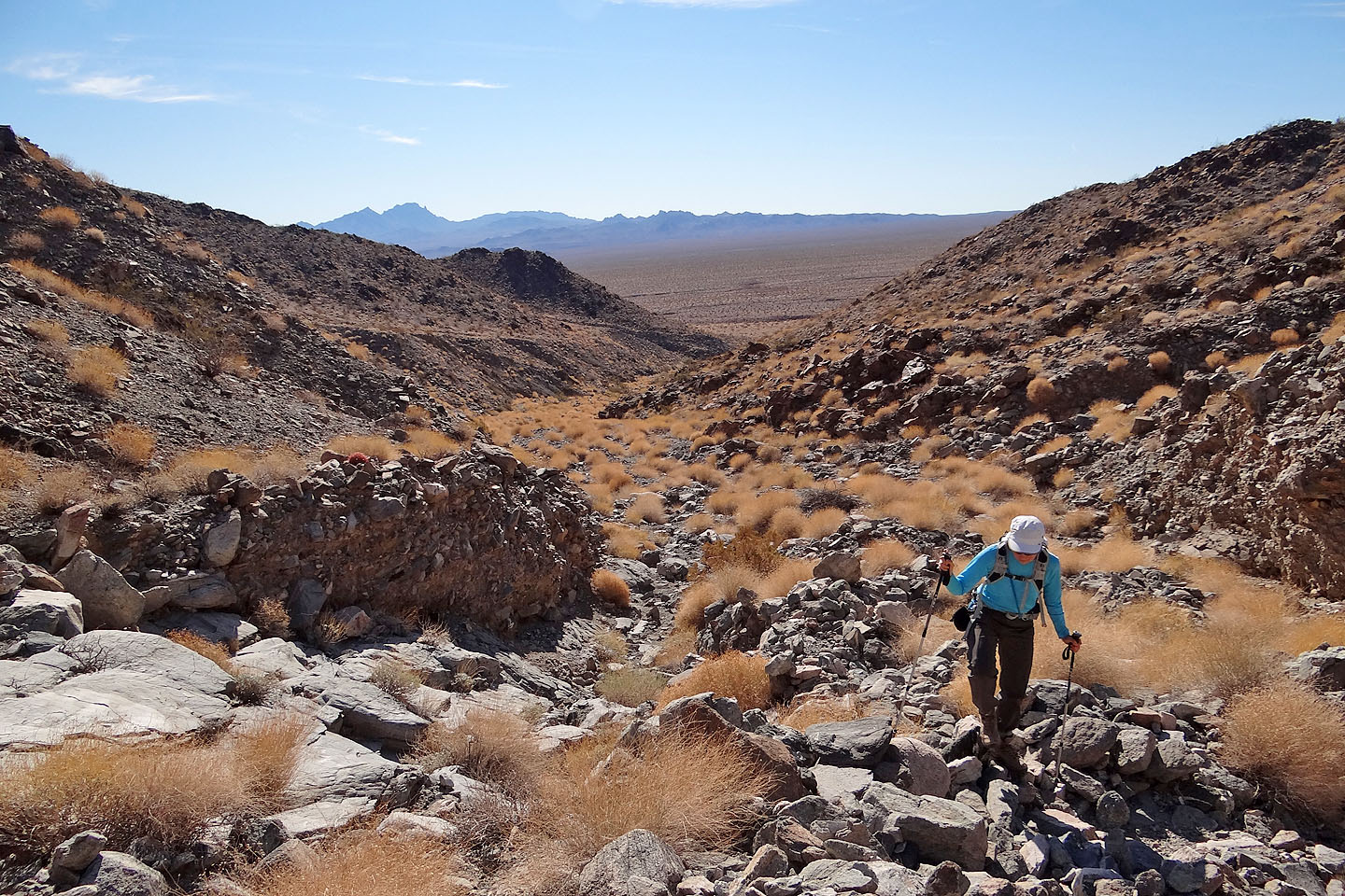
View from the saddle, looking down at our ascent wash
On the saddle, heading to the low point on our right
i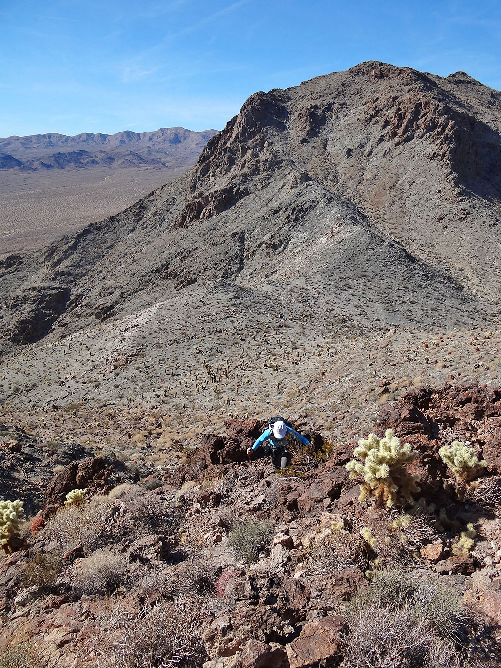
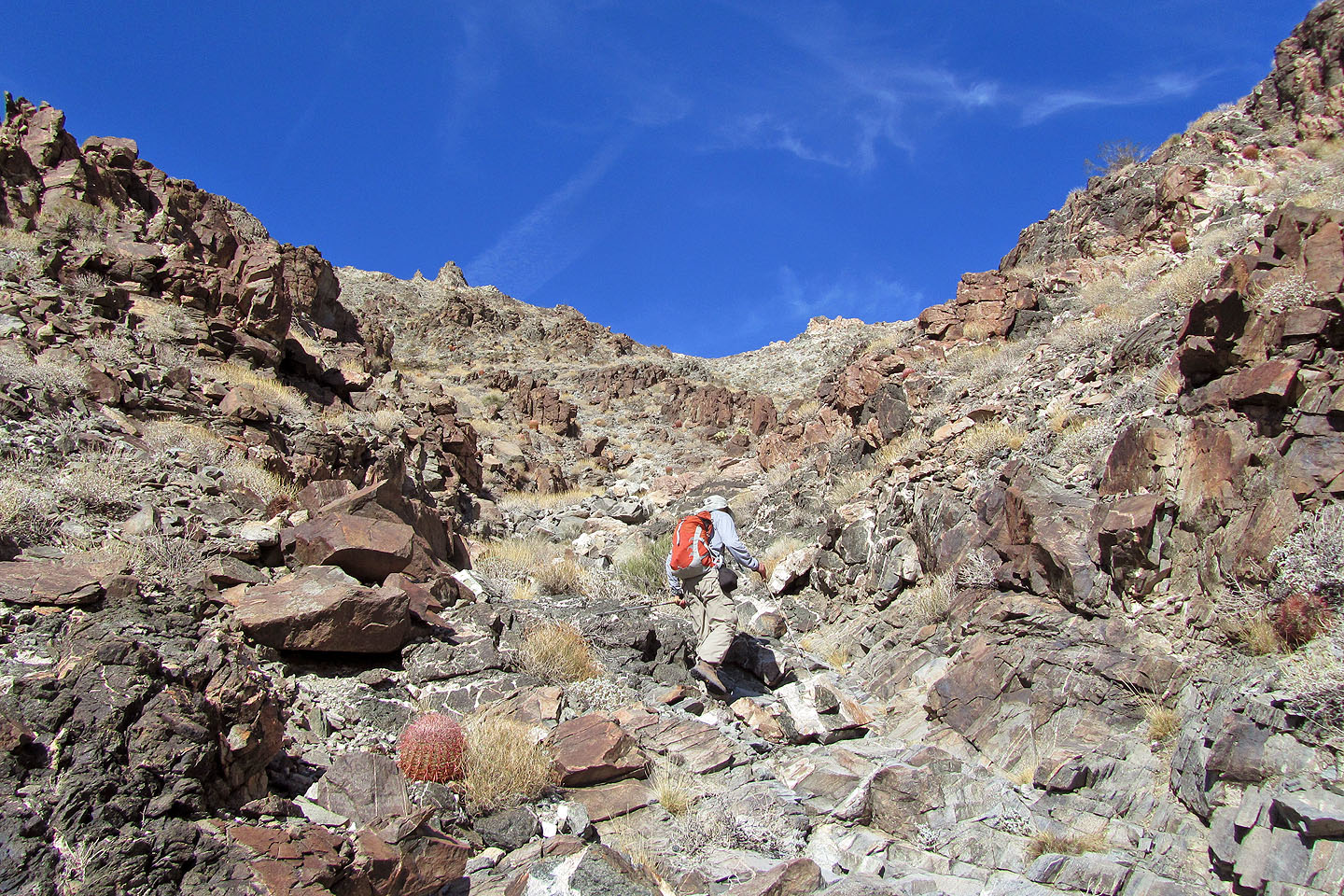
Ascending from the saddle
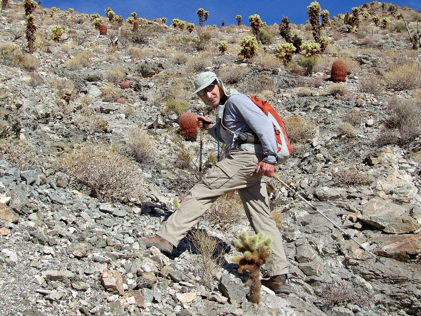
Facing a forest of cholla
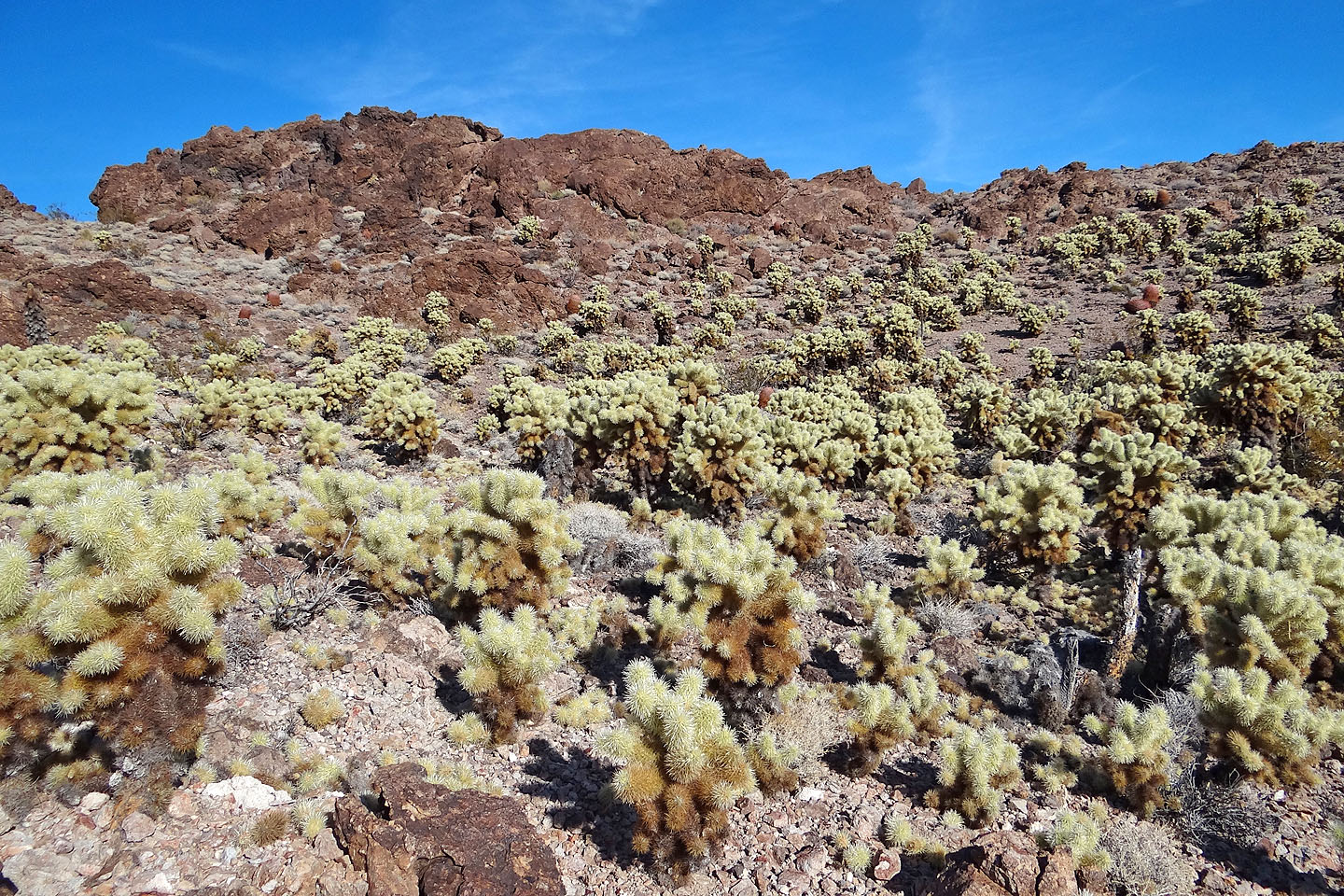
The forest presented an unusual challenge
We hit a wall on the ridge and ended up retreating and dropping over the left side behind Dinah
We tried to regain the ridge past the wall a few times but eventually gave up
We hiked to the end of the cliff band (centre, mouse over for a close-up) and then around it
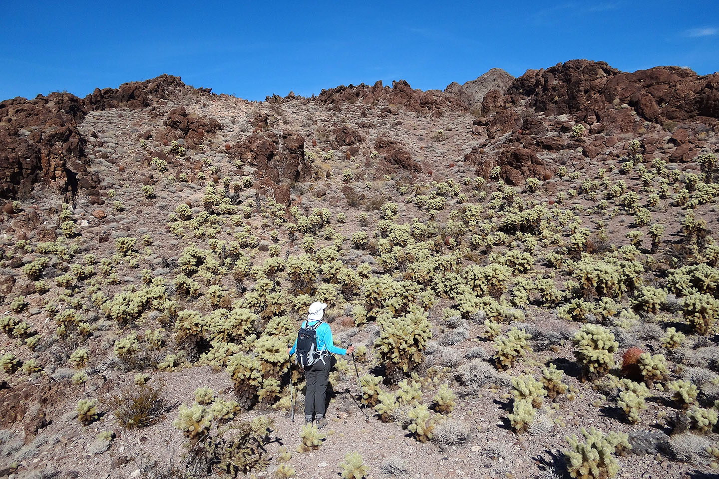
We carefully avoided the cholla
Around the corner we find a bowl. The summit block is on the far left.
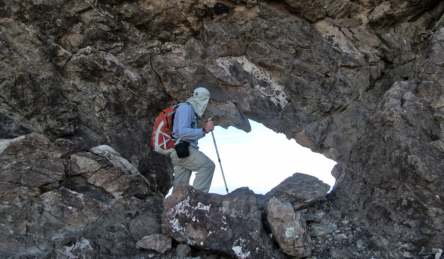
I check out a window (mouse over for the view)
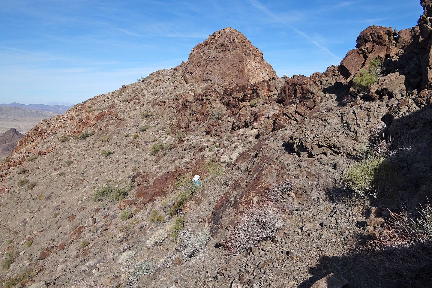
The summit block appears ahead
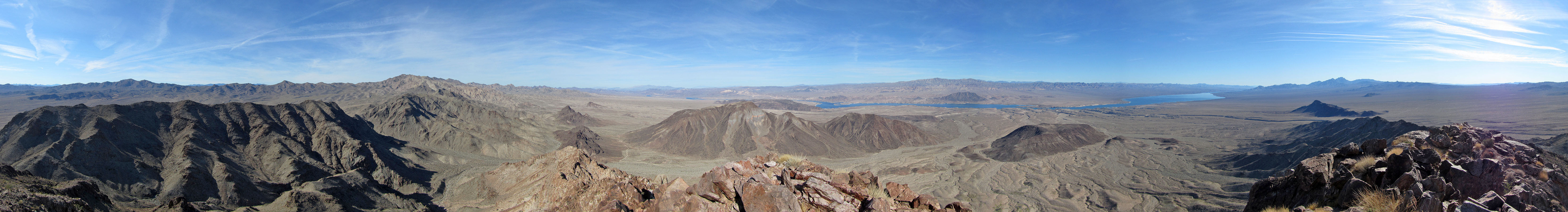
Looking south towards Spirit Mountain
Traversing to the hidden chute
At the bottom of the chute (mouse over to zoom in)
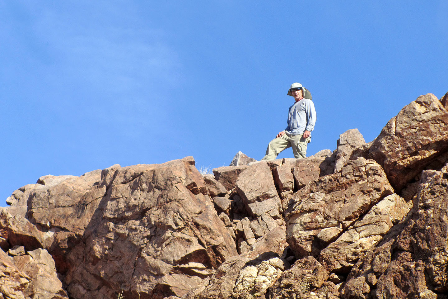
Standing on the summit (mouse over to zoom out)
Looking down at Dinah (mouse over)
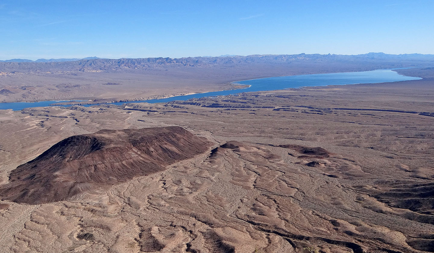
Black Mountain and Lake Mohave
Looking back at the summit as we descend
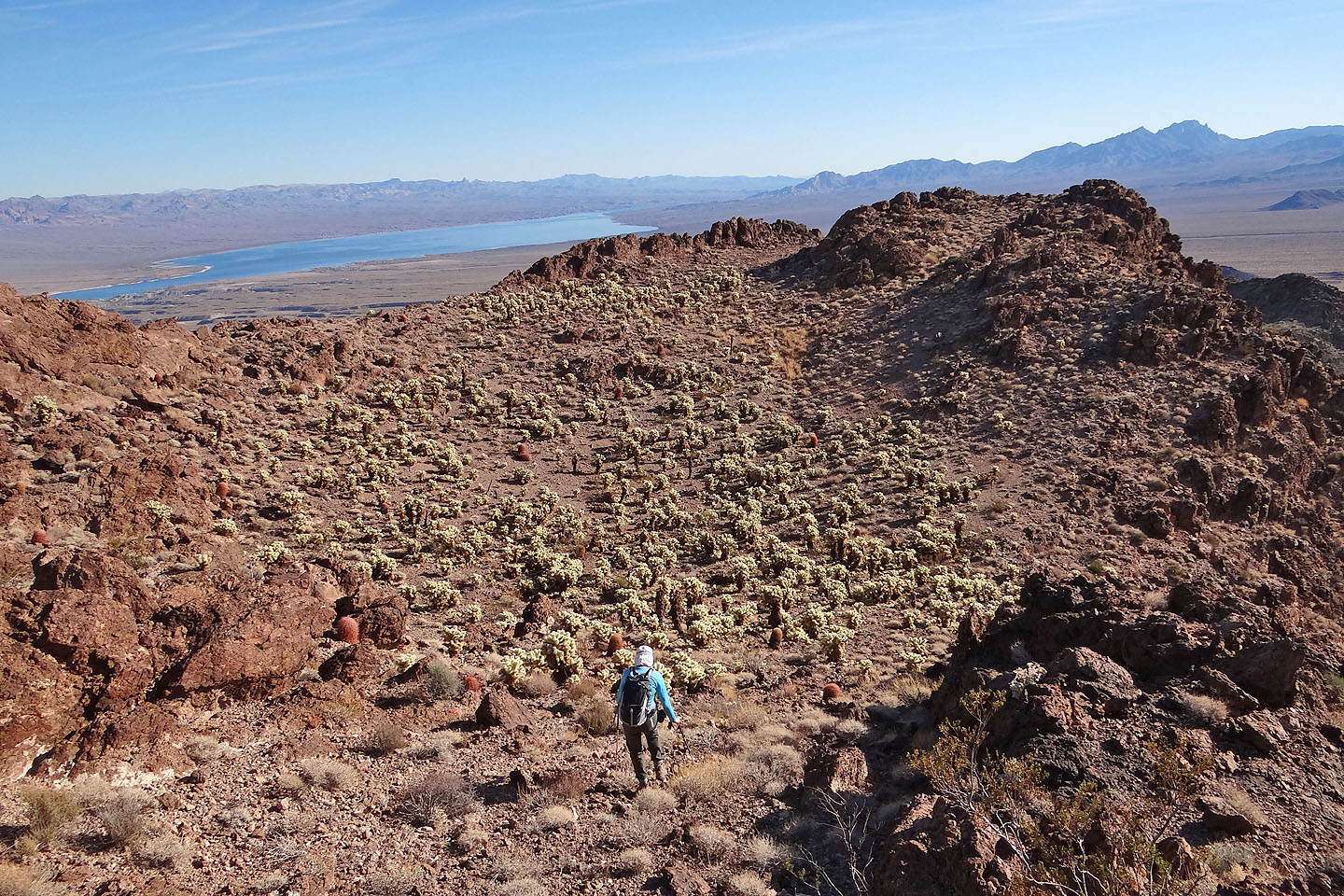
Back into the cholla forest
I happened to have my camera out when a ranger's SUV stopped on the road
The ranger left a note on our back window (mouse over)
Ireteba Peaks (4.2 mi, 3209 ft, 1417 ft)