bobspirko.ca | Home | Canada Trips | US Trips | Hiking | Snowshoeing | MAP | About
South Kaibab Trail to the Tipoff
Grand Canyon, Arizona
April 15, 2019
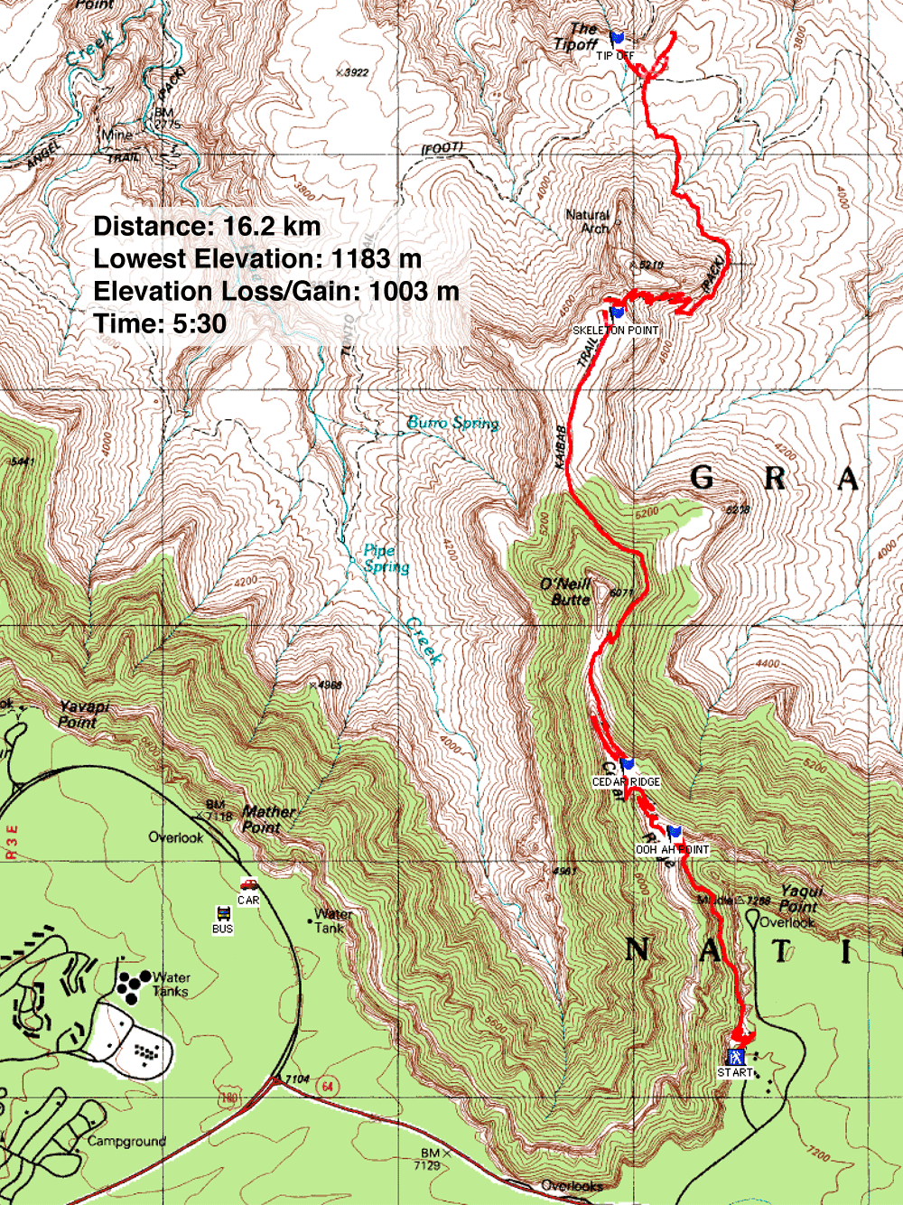
Distance: 16.2 km (10.1 mi)
Cumulative Elevation Gain: 1008 m (3307 ft)
Of the six million visitors that the Grand Canyon receives each year, 90% visit the South Rim because it's more accessible. Of the two most popular descent trails from the South Rim, South Kaibab is shorter and more scenic. Unlike Bright Angel, South Kaibab follows a ridgeline most of the way down. This was the path I chose. Dinah, on the other hand, hiked the rim trail to Hermit's Rest Viewpoint and saw more of the Grand Canyon than I did.
We came at the start of the peak season when the Grand Canyon is all about lineups: lineups at the gate entrance, lineups for shuttle buses, and lineups for restrooms at the visitor centre (men too!). After the park gate, we drove 11 km to the parking lot. Along the way, we were surprised to see elk roaming the forest lining the road.
Plenty of parking was still available when we arrived at 8:30 am. We parked near Mather Point, a 5-minute walk away, and got our first look at the Grand Canyon. Of course, we had seen photos, but they failed to capture its enormity. Its size is incomprehensible, truly breathtaking.
After walking along the rim and stopping at the visitor centre, we returned to our car, grabbed our packs and took shuttle buses to our respective destinations: Dinah to her rim hike and me to South Kaibab trailhead. I got to the trailhead just before 11:00 am.
There are four stops along South Kaibab: Ooh Aah Point, Cedar Ridge, Skeleton Point and the Tipoff. After the Tipoff, the trail continues down to the Black Bridge that crosses the Colorado River. Ambitious parties can hike “rim-to-rim,” down to the river and back up to the rim, or up the other side, up the North Kaibab Trail to the North Rim. My goal was more modest: I stopped at the Tipoff. The 1,000 m elevation loss would be enough for me, without dropping down another 420 m (1,400 ft) to reach the bridge.
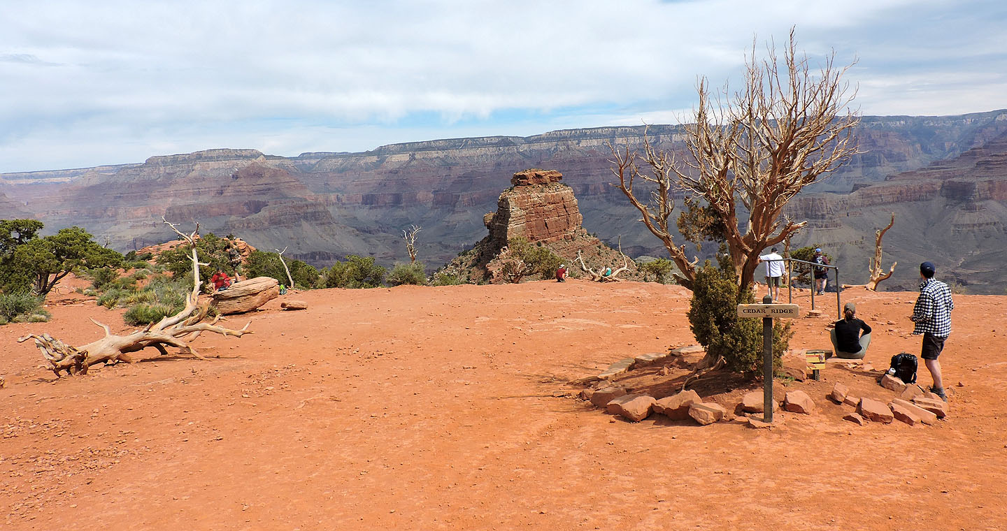
South Kaibab trail begins with a jolt, a vertiginous drop down a series of switchbacks. Then it levels off, running along the canyon side. 30 minutes after starting, I reached Ooh Aah Point. Several minutes later, I dropped down to Cedar Ridge. There I left the worst of the crowds behind; the rest of my plunge down the Grand Canyon was mostly and gratefully in solitude.
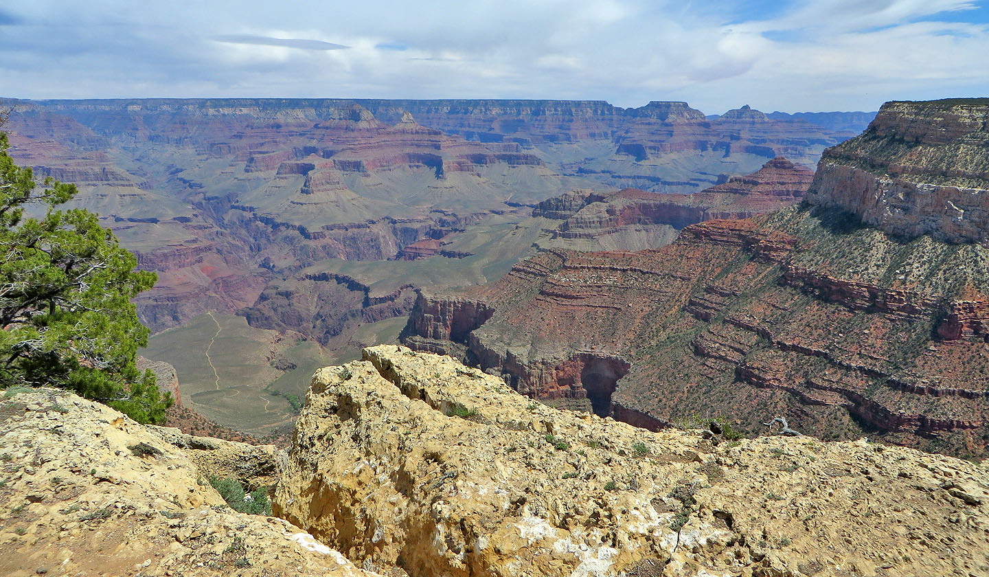
Free of the crowds, I enjoyed hiking down to the Tipoff, with scenery and grandeur on a scale I had never experienced before. At the Tipoff, I spent nearly an hour. I had lunch, wandered around and took photos. Dinah and I had brought CB radios, so I was able to reach her on the rim. I let her know I had reached the Tipoff, and we set a time to meet back at the visitor centre.
My climb back up to the rim was likewise engaging but much slower. And it was uncomfortably hot because the day had warmed up, and because of the low elevation. Just before I reached Skeleton Point, the temperature began to fluctuate, switching between dead-calm heat and gusts of cool wind.
When I got back to the bus stop at the trailhead, there was a line-up. The first bus filled, and I barely made the next bus. When I got back to the visitor centre at 5:00, the place was a zoo, tourists everywhere. The parking lot was overfull, so cars were parked along roads.
I soon got hold of Dinah. I beeped her on my radio just as she stepped off the bus. We met minutes later, both happy with our adventures, although wishing we had planned a longer stay.
The North Rim is 16 km away
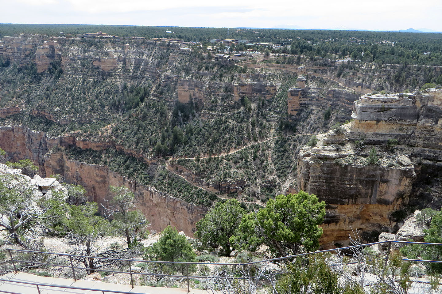
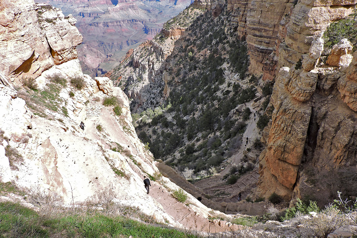
Looking down at Bright Angel trail
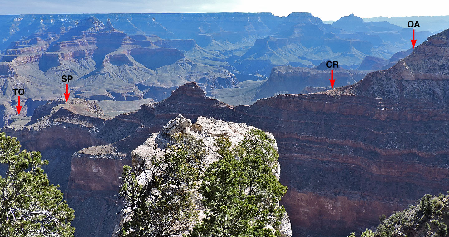
South Kaibab trail follows this ridge seen from Mather Point. The trail runs behind O'Neil Butte (centre). TO: Tipoff,
SP: Skeleton Point, CR: Cedar Ridge, OA: Ooh Aah Point.
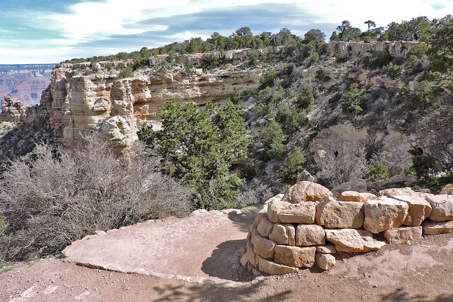
South Kaibab trail begins on the rim (of course!)
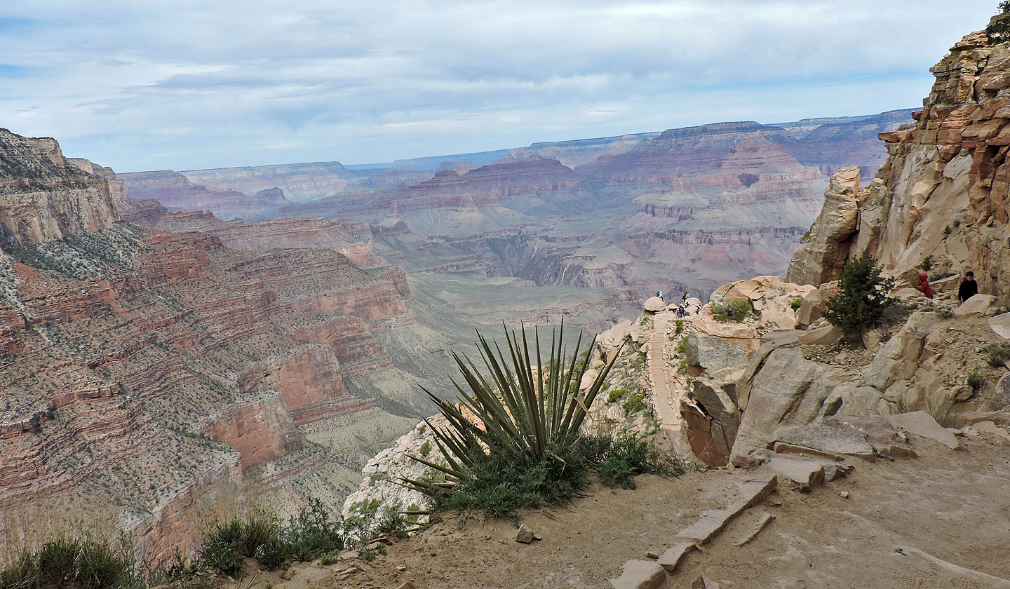
The trail immediately plummets down a series of switchbacks before traversing mid slope to Ooh Aah Point

Just before reaching Ooh Aah, I zoomed in to take a photo of the switchbacks
Ooh Aah is just ahead
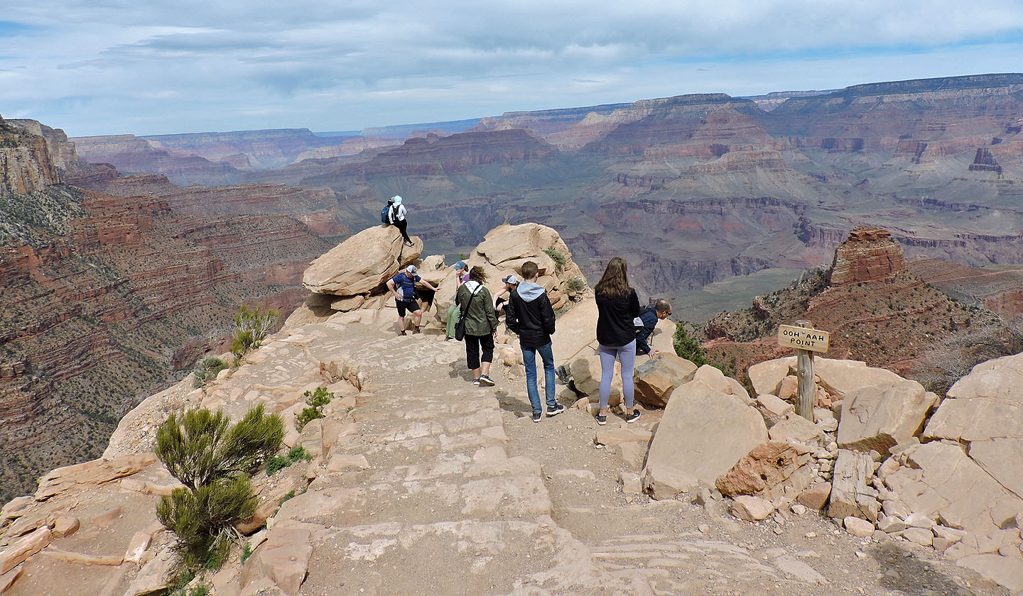
People peer over the edge at Ooh Aah Point
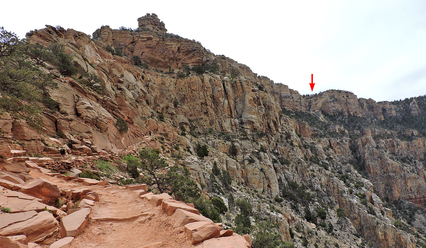
Looking back at the switchbacks
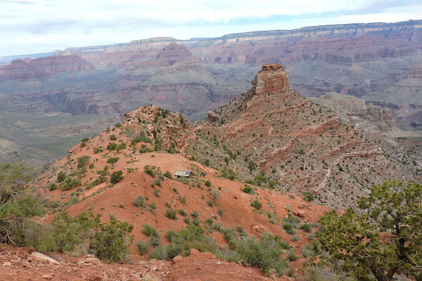
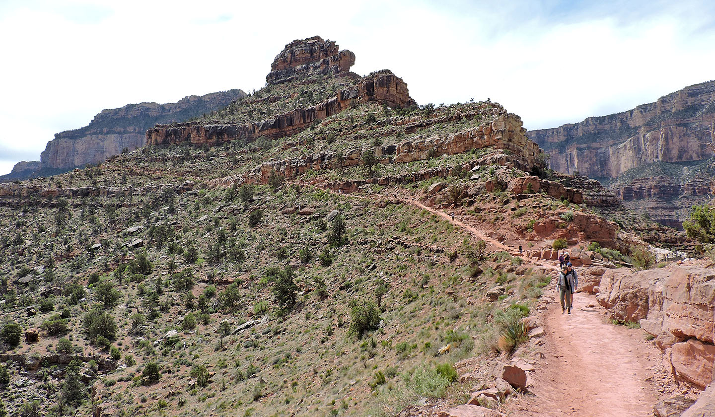
Next stop is Cedar Ridge, left. The trail continues down below O'Neill Butte.
I hiked out along the ridge on the left where I took the panorama at the top of this page
Looking back after hiking below Cedar Ridge
Just before O'Neill Butte, I had a chance to look over the edge. Note the trails below.
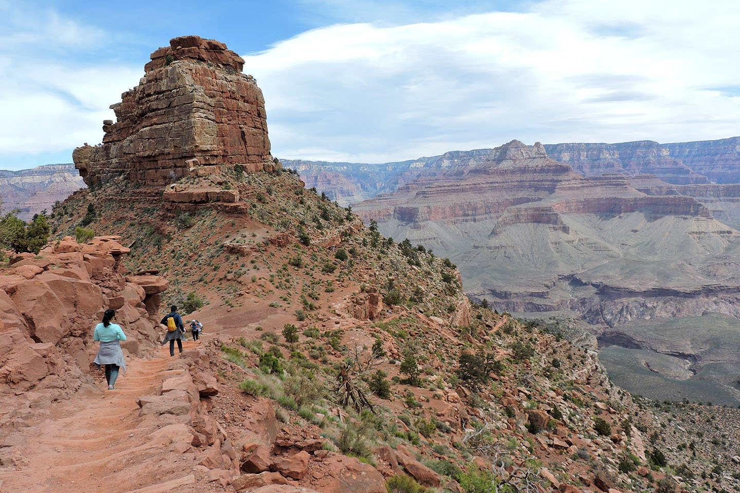
O'Neill Butte ahead
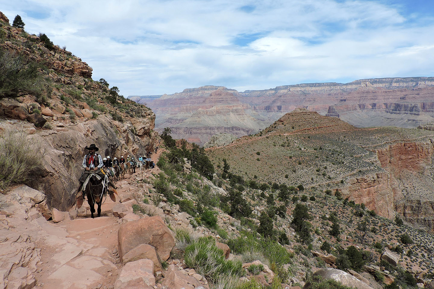
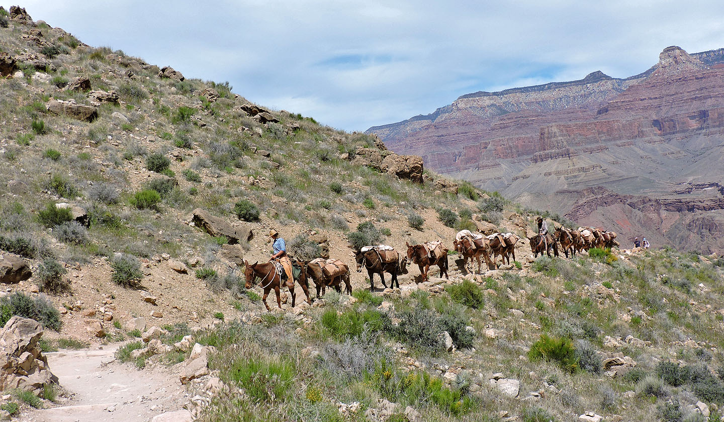
When you encounter a mule train, you must wait on the inside. Strangely, mules prefer to pass on the outside.
Looking back at O'Neill Butte
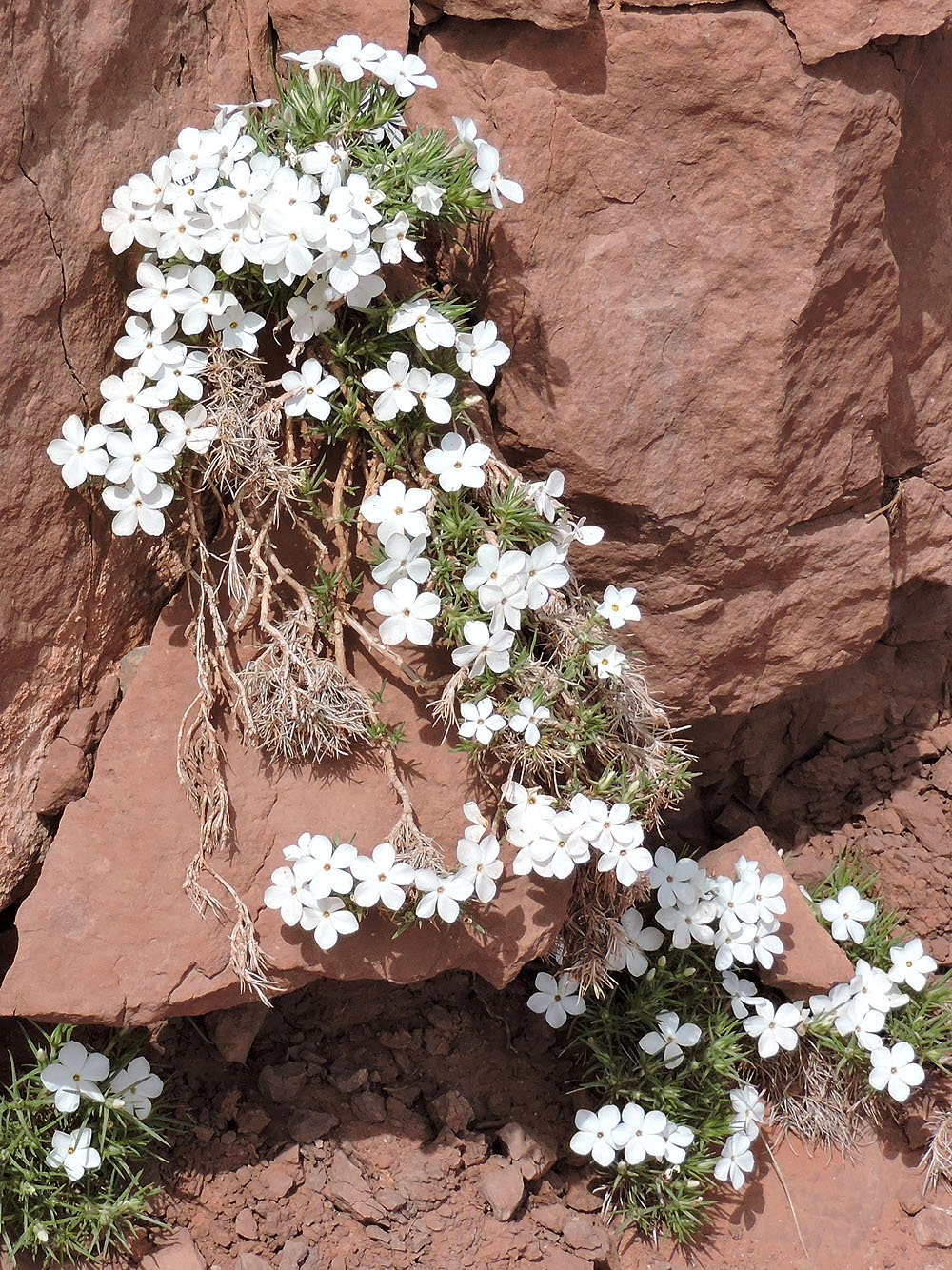
Mountain phlox
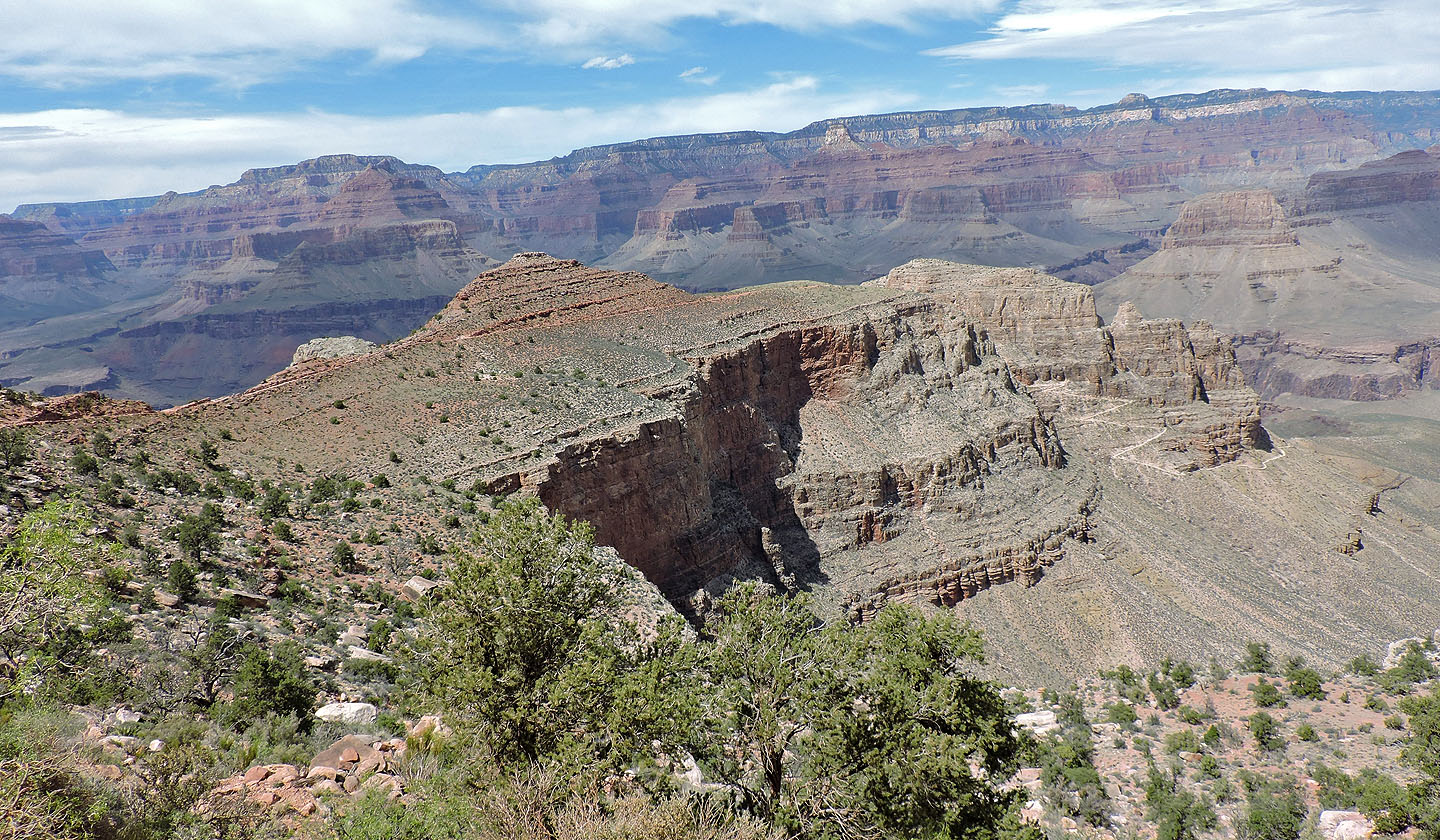
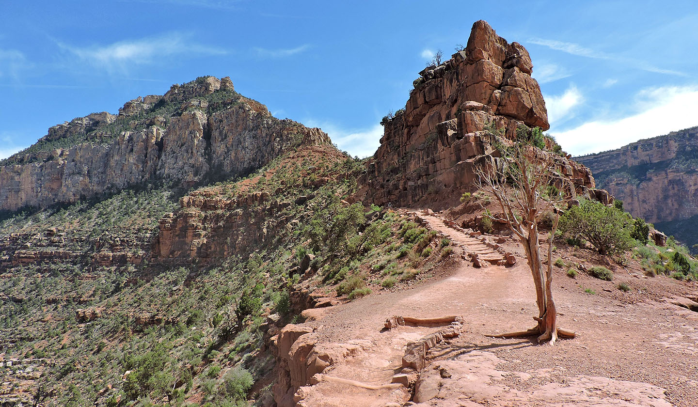
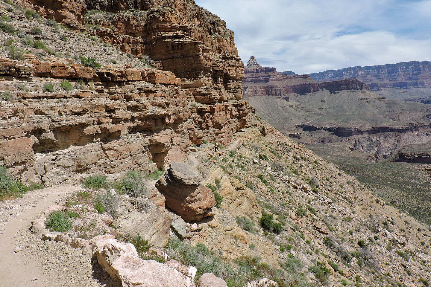
There's a long traverse to Skeleton Point followed by switchbacks starting down to the Tipoff
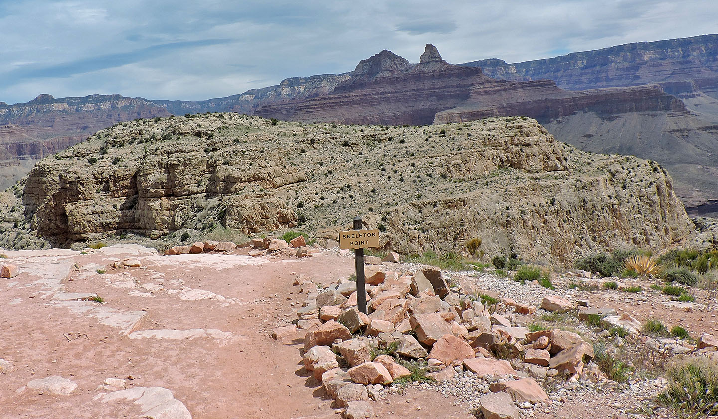
Skeleton Point
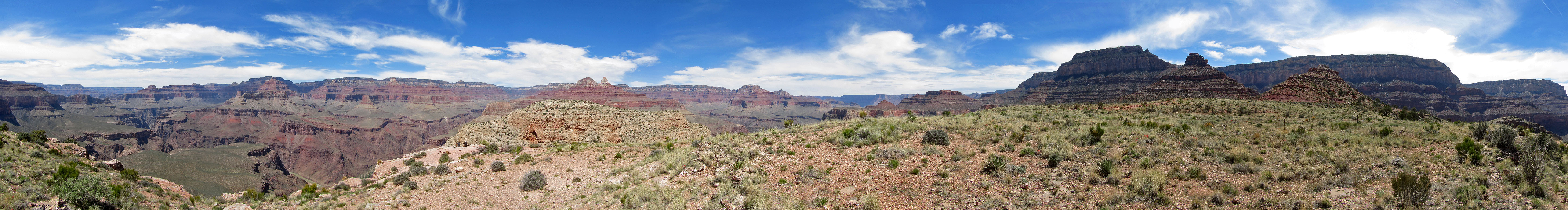
Panorama from Skeleton Point
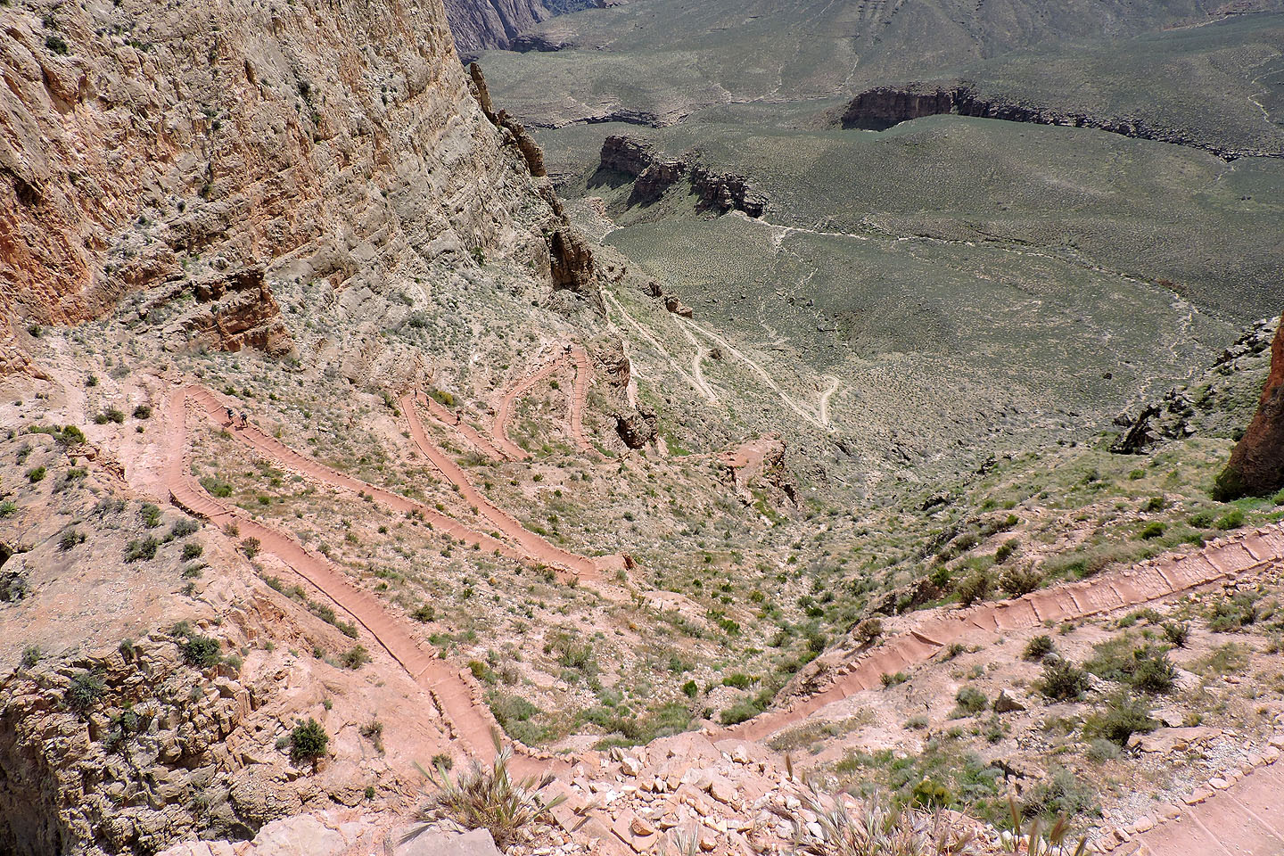
Looking down at the switchbacks – 20 in all – after Skeleton Point
Looking back at one of the switchbacks
The switchbacks mercifully end and the trail straightens out
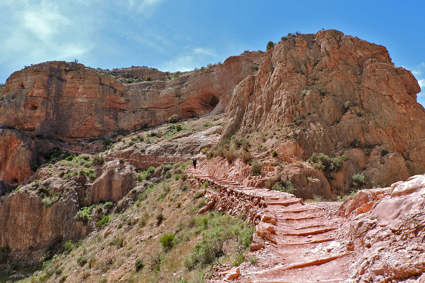
Around the next corner I could see the Tipoff toilets (black dot dead centre)
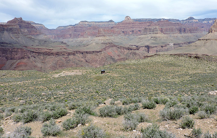
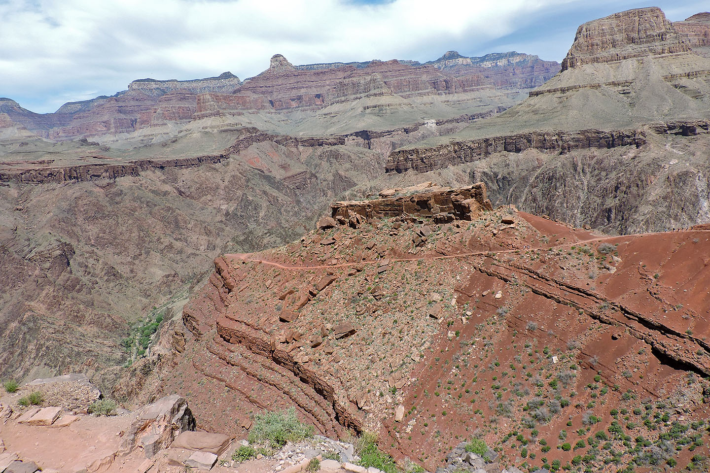
The trail drops down left of the toilets. On the right is a rock outcrop where I took a panorama.
I passed a caravan bearing supplies
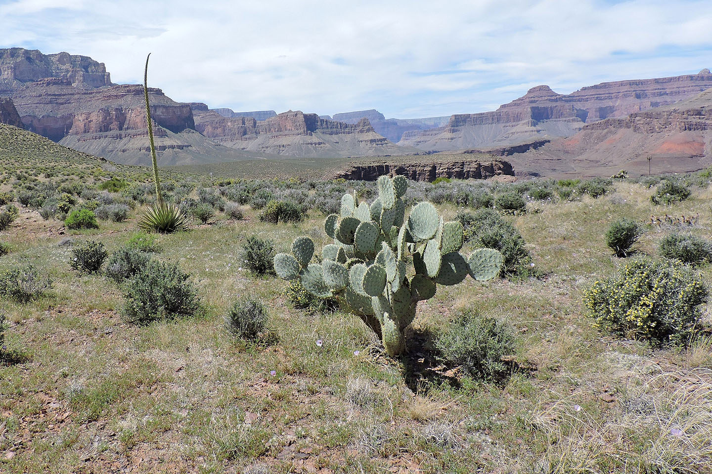
Desert plants include agave and pancake prickly pear cactus
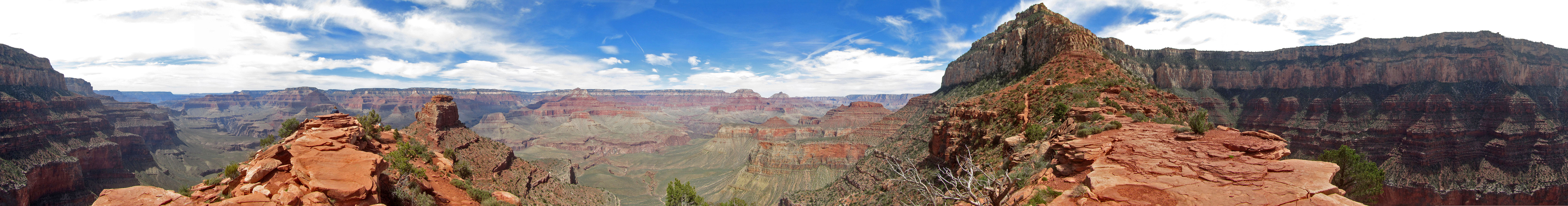
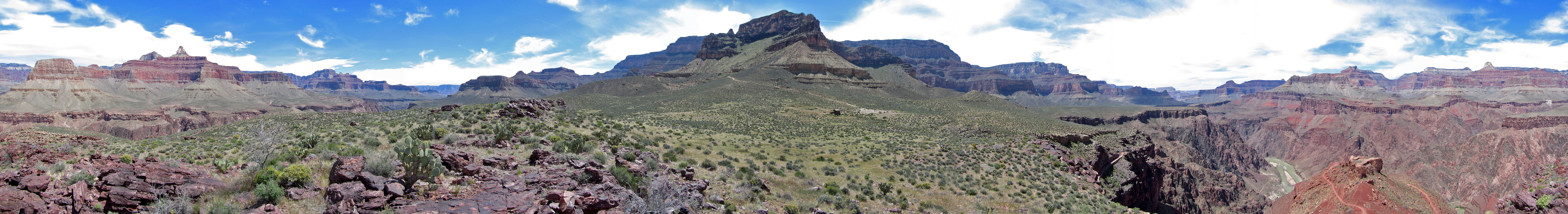 Panorama near the Tipoff
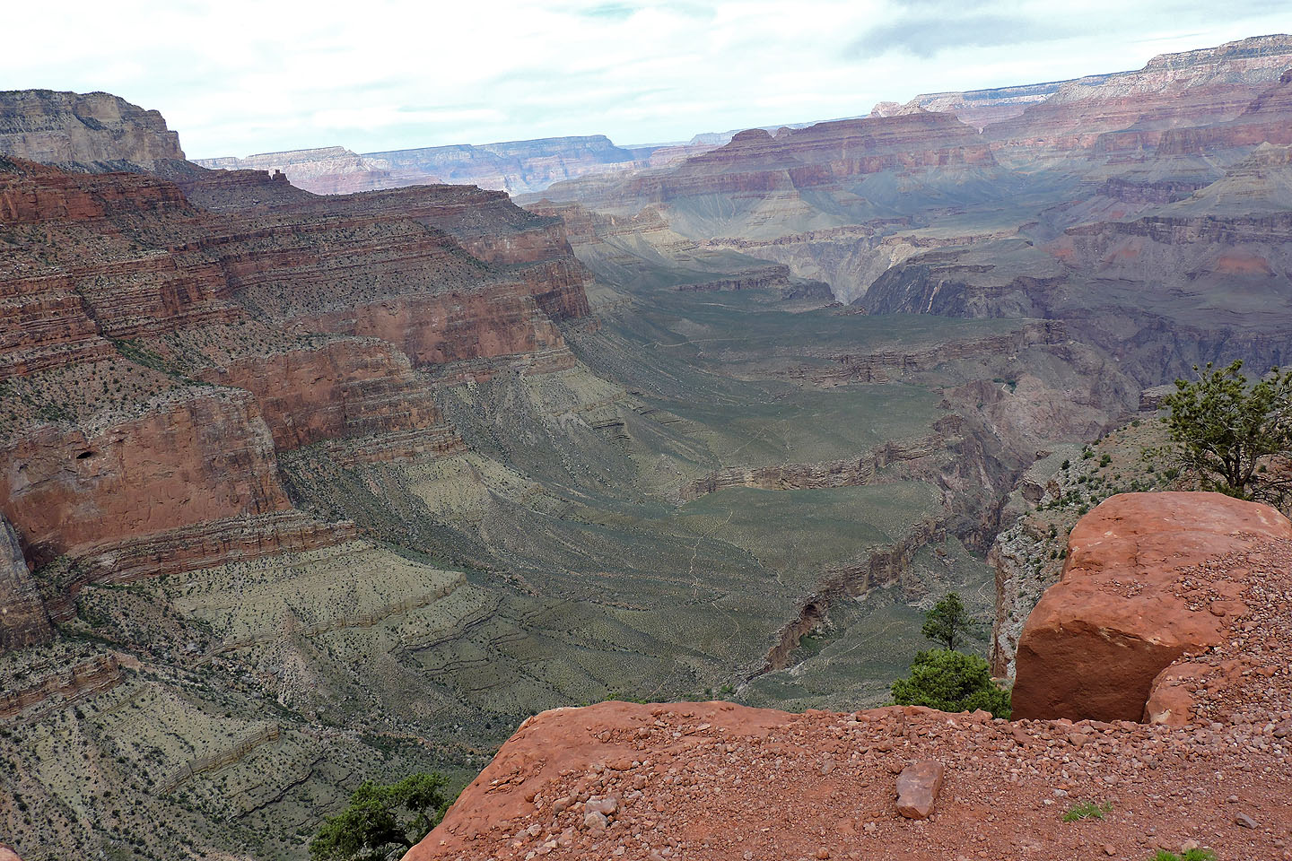
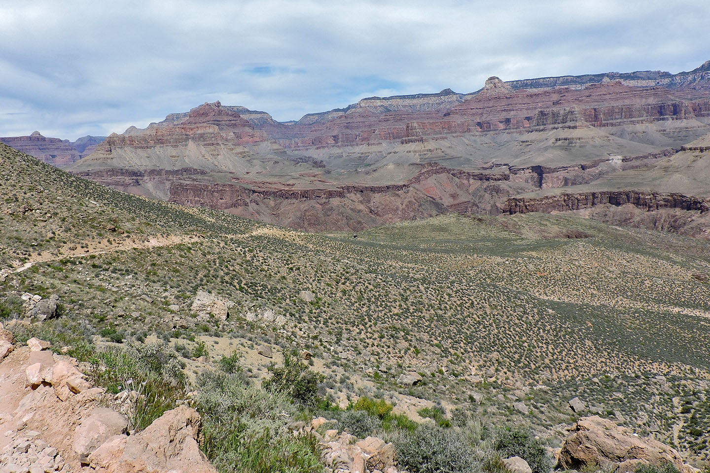
 After the Tipoff,
where one tips off the edge, South Kaibab trail continues down, first passing an outcrop called Train Wreck (centre) and eventually reaching the river. The green valley below is Phantom Ranch.
After the Tipoff,
where one tips off the edge, South Kaibab trail continues down, first passing an outcrop called Train Wreck (centre) and eventually reaching the river. The green valley below is Phantom Ranch.
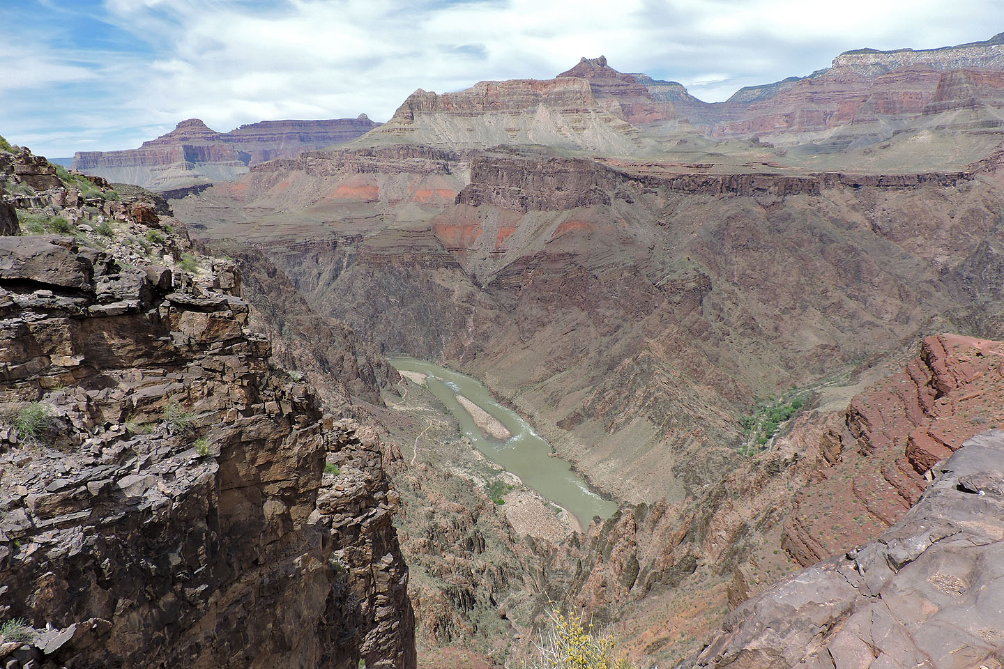
The Colorado River lies over 400 m below the Tipoff
Phantom Ranch (10.1 mi, 3881 ft, 3291 ft)