bobspirko.ca | Home | Canada Trips | US Trips | Hiking | Snowshoeing | MAP | About
Mount Shark
Kananaskis, Alberta
July 7, 2006
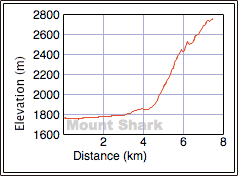
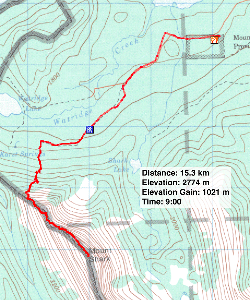
Distance: 15.3 km (9.5 mi)
Cumulative Elevation Gain: 1143 m (3750 ft)
Last week Dinah and I turned back on Mount Shark because of the threat of a thunderstorm. We wanted to try again, but I was put off by the bushwhacking and navigational problems using the guidebook approach. I figured there must be a better way. Like Kane's route, I wanted to follow the north ridge of Shark. But I plodded an approach that went more directly to the end of the ridge. Our ascent didn't work well, but we hammered out a solid approach on our descent (see map). It avoids Watridge Lake, so it's shorter and incurs little elevation loss. It also adds some easy scrambling. Also, unlike Kane's approach, there's is only light bushwhacking – short trees you can see over – so you can keep your route in sight.
We cycled up the main trail for 1.3 km before turning left onto a logging road that looks like a wide, grassy corridor. After the road does an "S" bend, it straightens out and Mount Shark lies ahead. We managed another 2 km before stopping at an old weather station. The road degrades after this point, so we set off on foot.
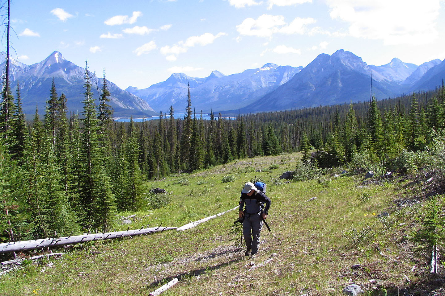
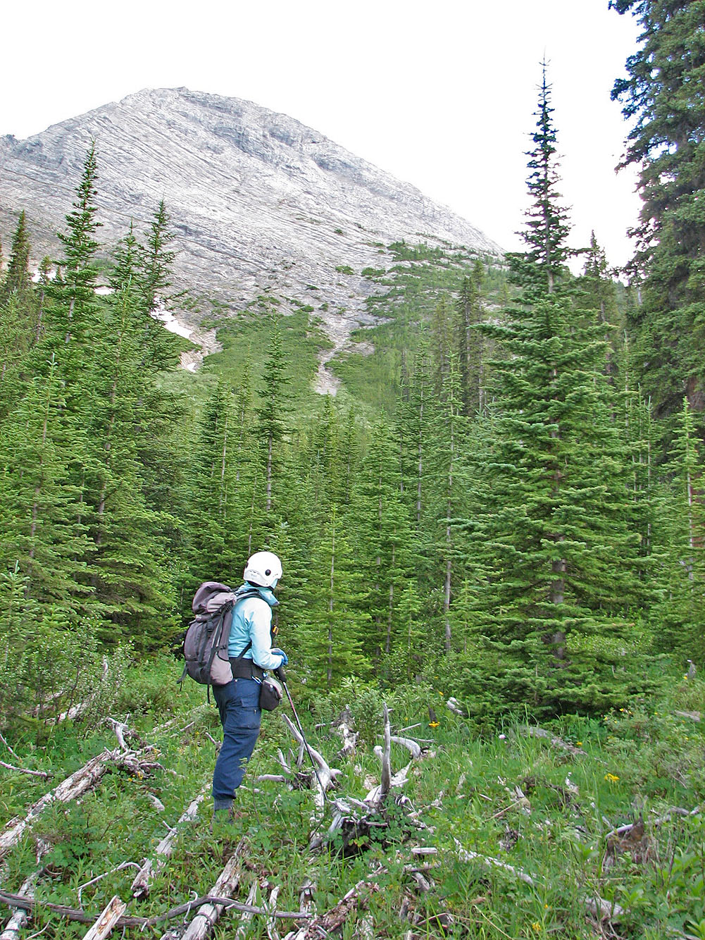
As we hiked up the road, I was dismayed how rapidly and utterly it degenerates. In some places, logs, streams, and vegetation hindered our progress, but generally the road provided a pleasant corridor. When we were adjacent to an open rocky drainage, I was tempted to bushwhack to it. Instead we pushed on, hoping to avoid bushwhacking by ascending a drainage that I had seen on Google Earth. That was a mistake, and we had a miserable time bushwhacking to the treeline. However, another drainage which we passed remained on my mind, and we used it on the descent.
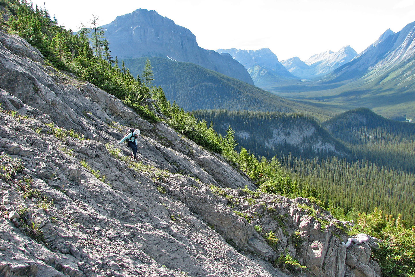
After emerging onto the open slopes, we ascended left of the ridge. When we were able to, we crossed over the crest. I would have liked to continue up the slabby ridge, but because of the strong winds, we decided to drop below the slabs and make our way to the col that splits the ridge.
Mount Shark shows its teeth if you stay close to the ridge. The scrambling is sometimes difficult and exposed, but routefinding is simplified because of the well-worked trails in some spots. Yet avoiding the difficult sections to do a moderate scramble requires psychic routefinding. It's hard to discern where you'll encounter difficulties or the best way to avoid them. We stayed close to the ridge, which would have been enjoyable save for the wind. Just before the summit, we had to downclimb a chimney.
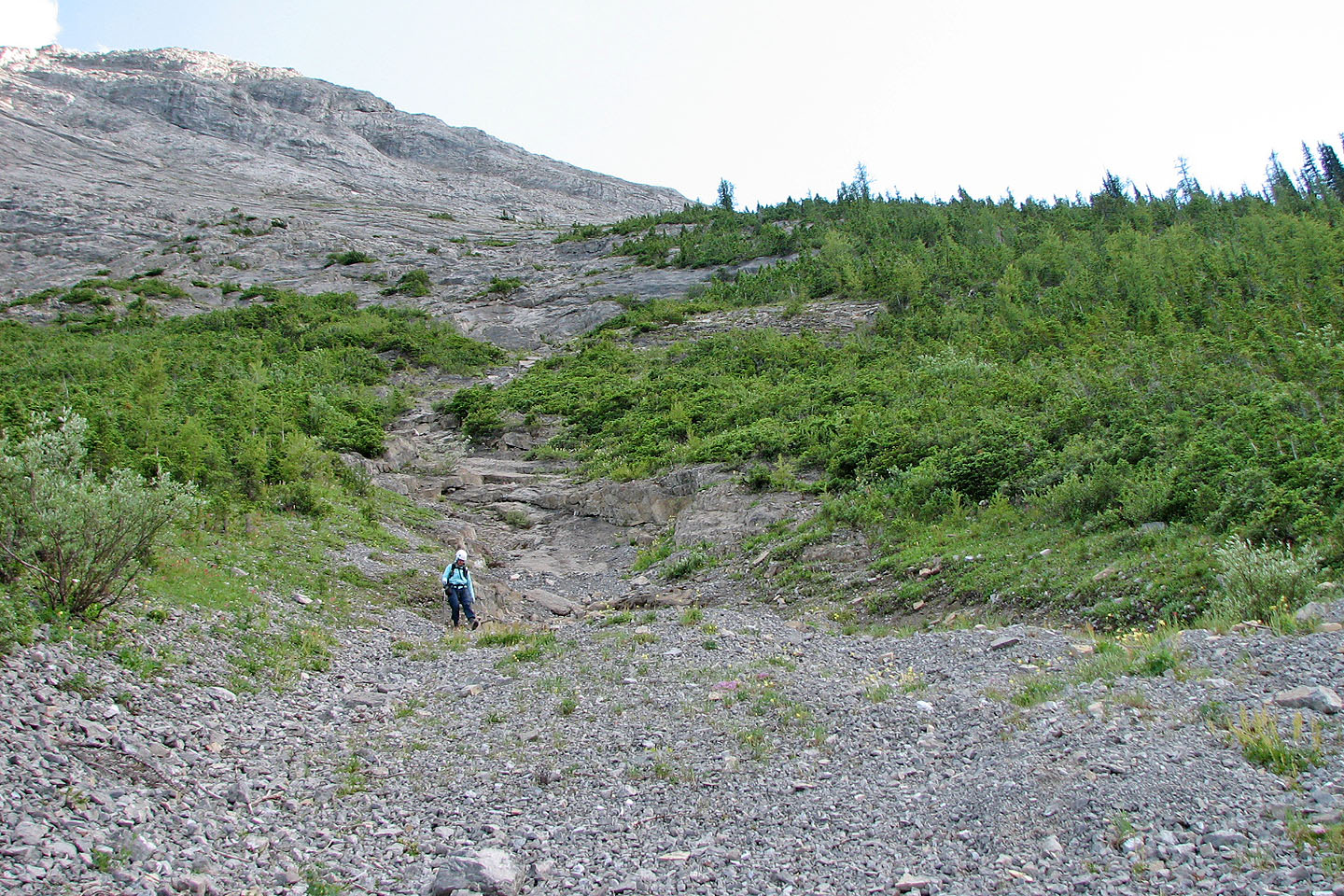
After relaxing on the summit, we retraced our steps back to the treeline. I didn't want to go through the bushwhacking hell we had done on our ascent, so from the treeline we worked our way east around the end of the ridge. We angled down but stayed near the treeline. This led us to the open, rocky drainage we saw earlier. We had no difficulty descending the drainage, although at one point we had to traverse high to avoid some slabs.
At the bottom of the drainage, the rocks gave way to a mix of short trees and bushes. We were pleasantly surprised to find the vegetation was thin and free of deadfall. Compared to the morning's bushwhacking, it was a quick and pleasant walk. If only we had used this route on our ascent!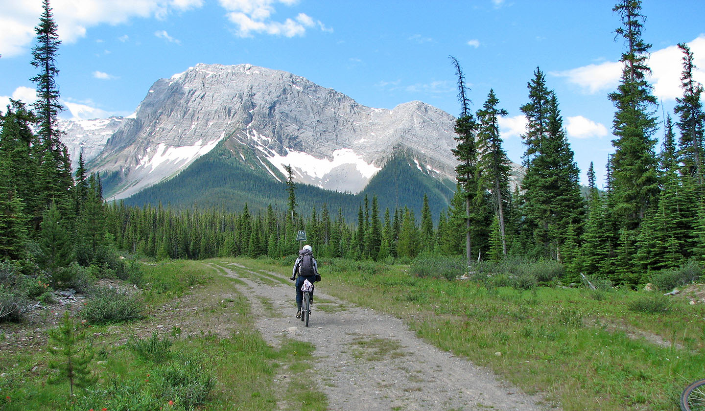
For a short way, we rode up the main trail towards Mount Shark
We biked as far as could and then continued on foot up the old road
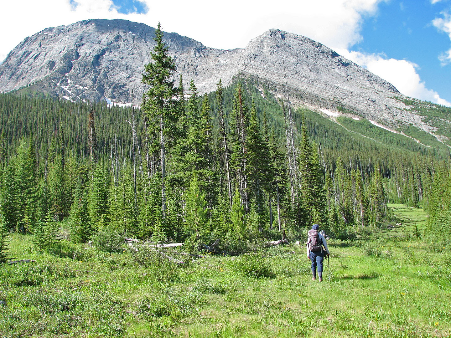
Much of the old logging road is a pleasant, wide corridor
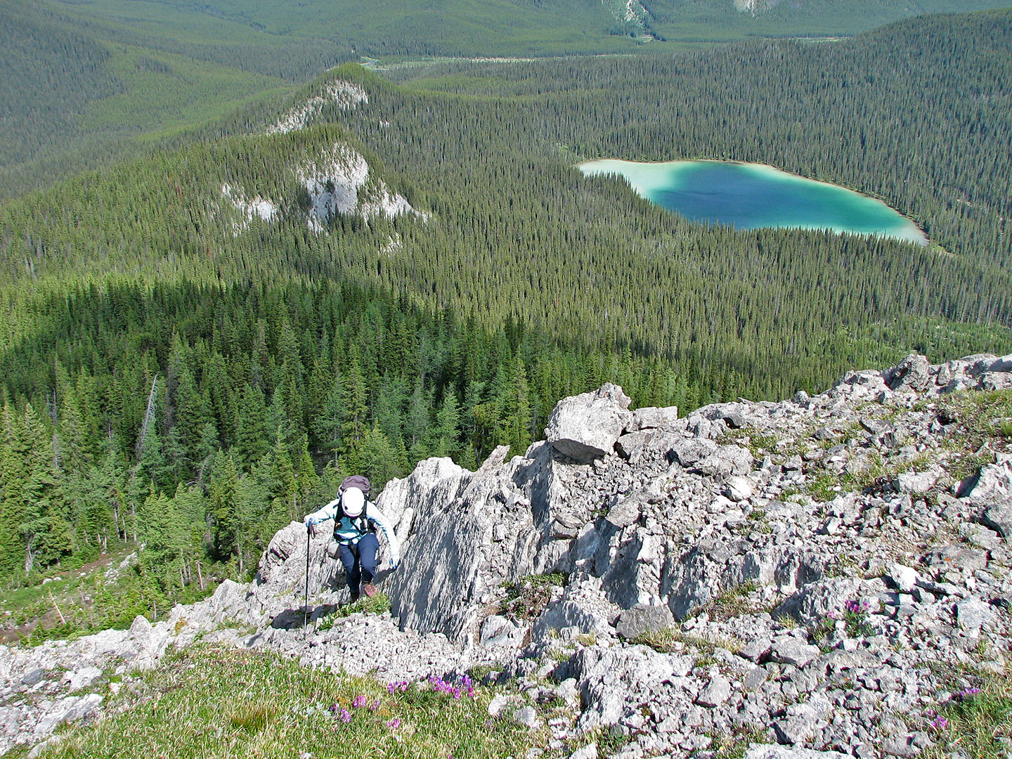
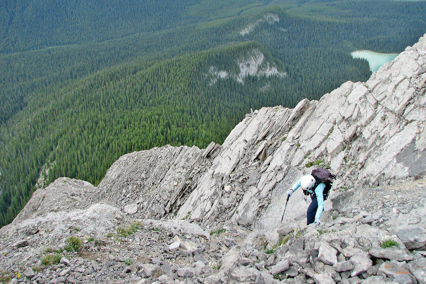
Watridge Lake seen from the lower slopes
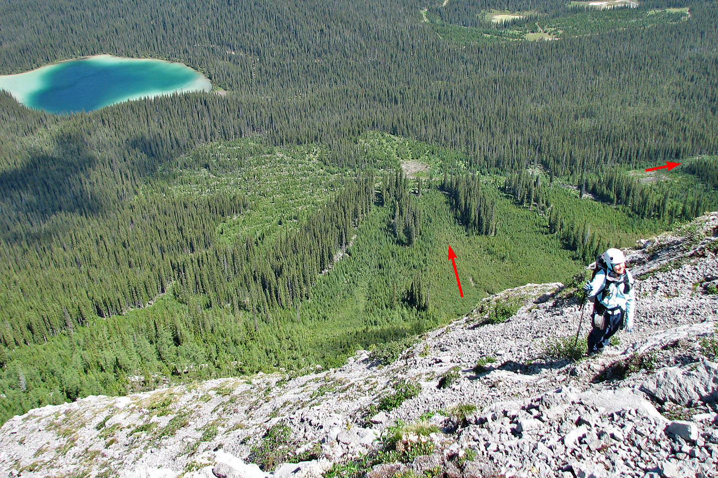
Our descent route makes a good approach. The road at the bottom runs to the Watridge Lake road.
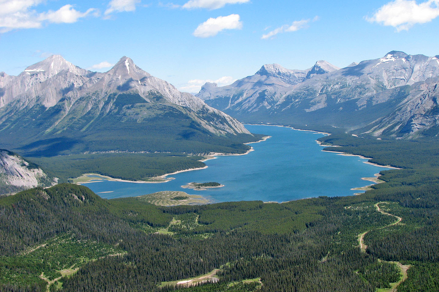
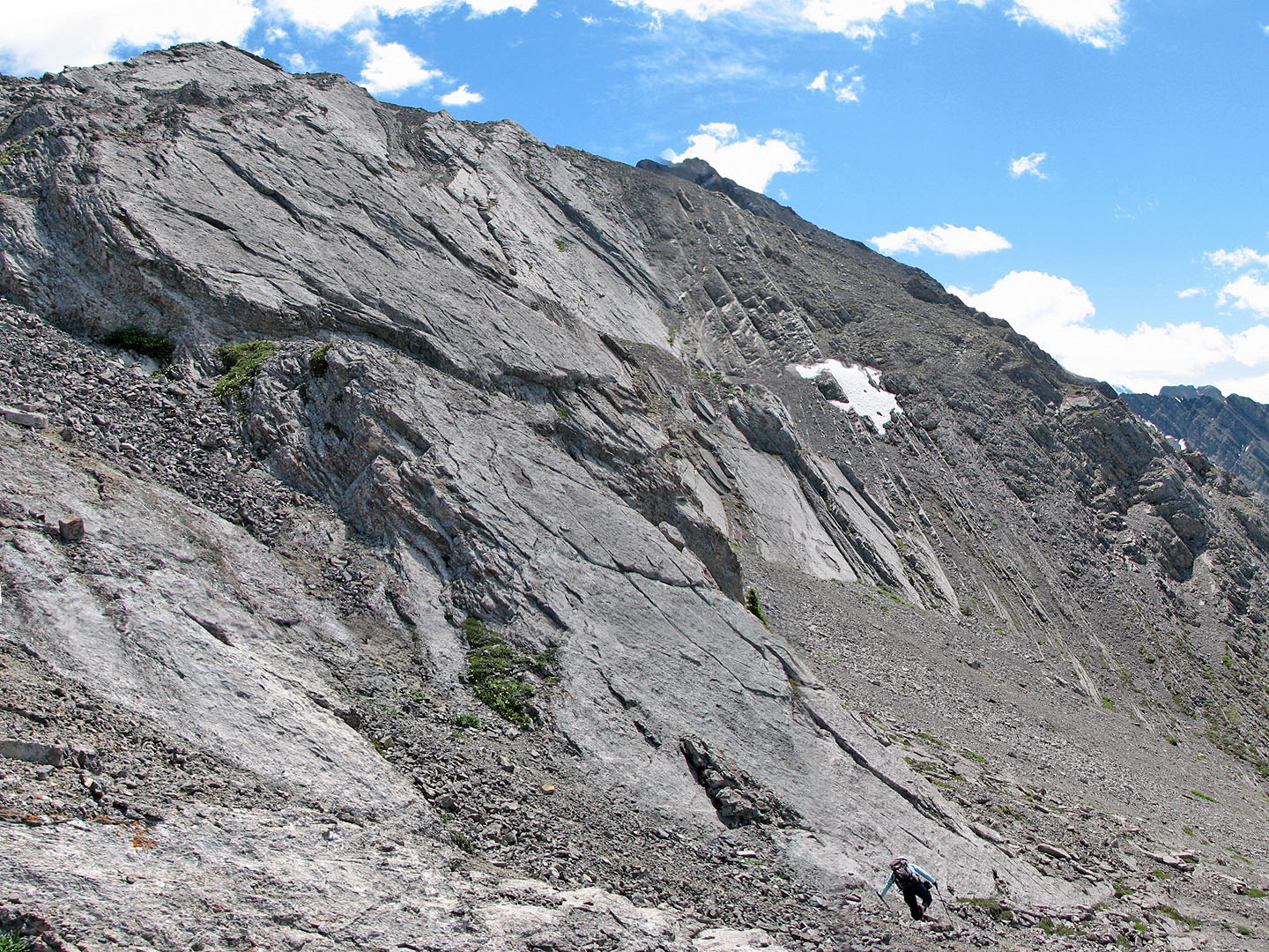
Looking across the valley
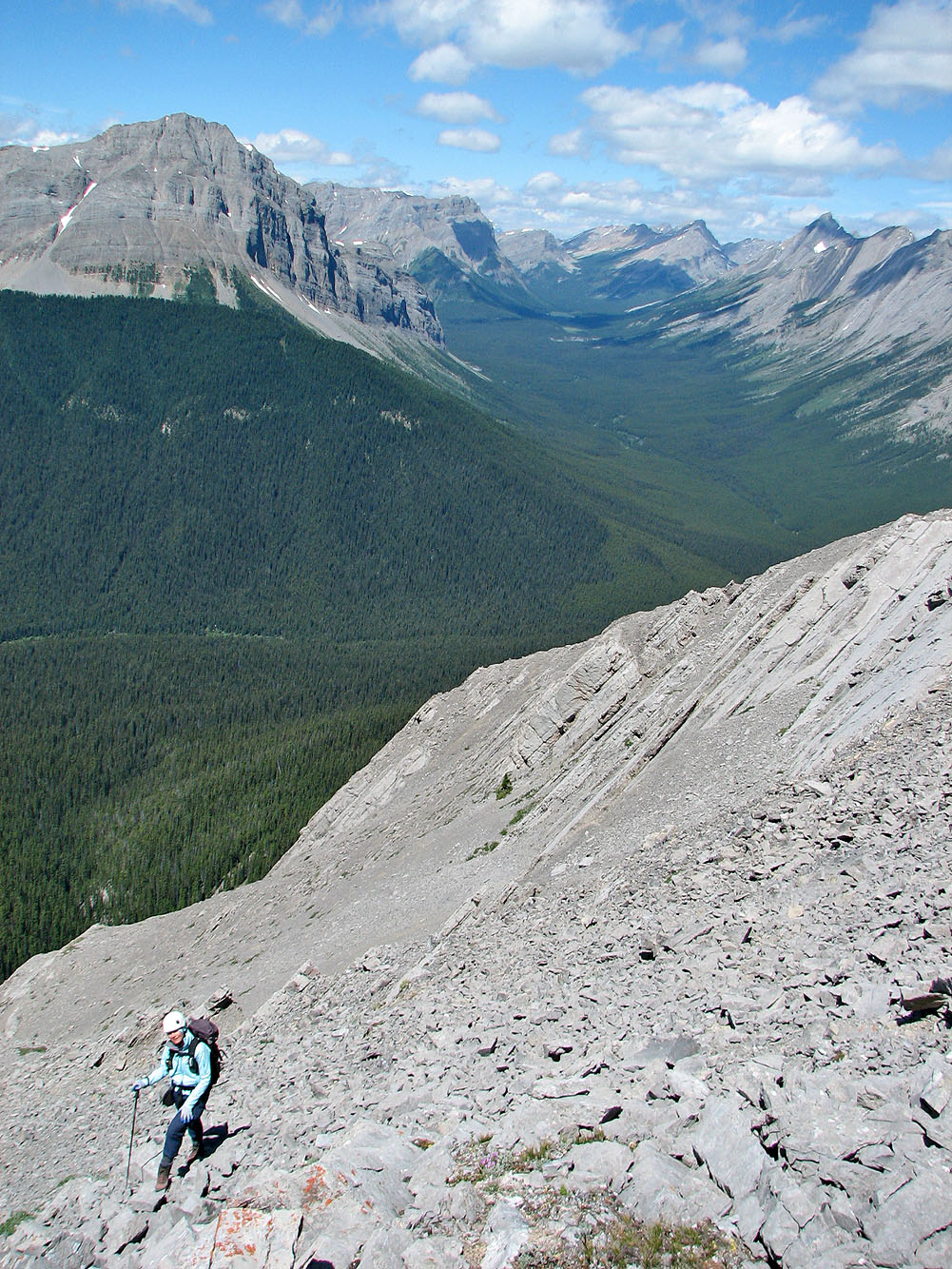
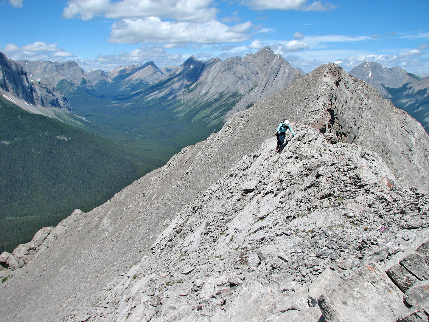
After gaining the ridge from the east side, we crossed over to the west side
Instead of following the ridge here, we dropped down below the slabs, ascended left
of the snow patch and then traversed right. This easy scramble
took us to the col after the first fin of Shark.
Looking back after ascending partway to the col
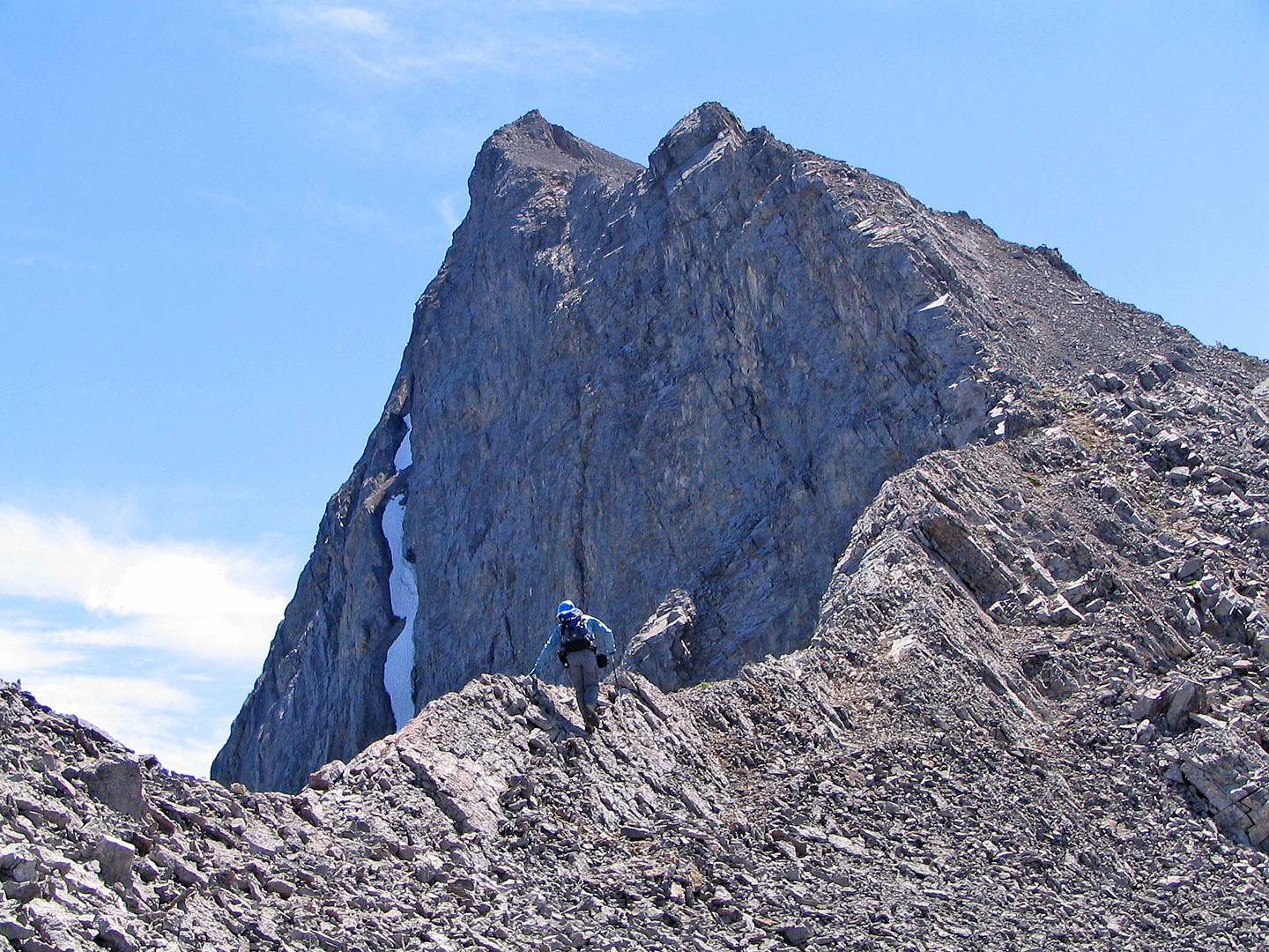
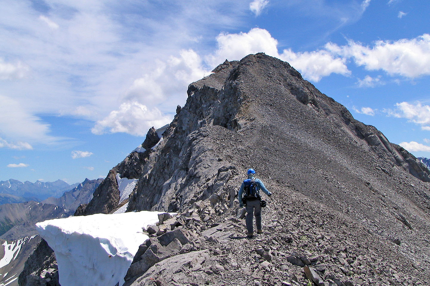
The false summit seen from the col
Looking back after leaving the col
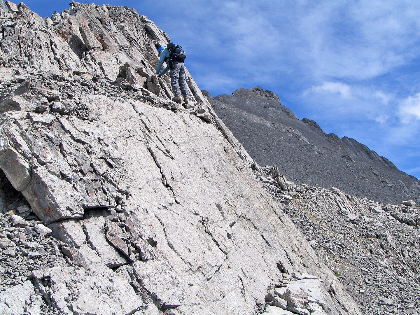
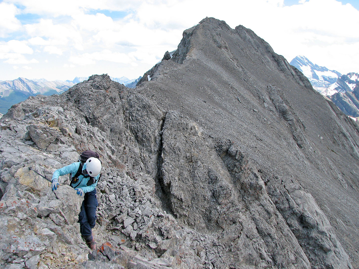
One of the trickier sections
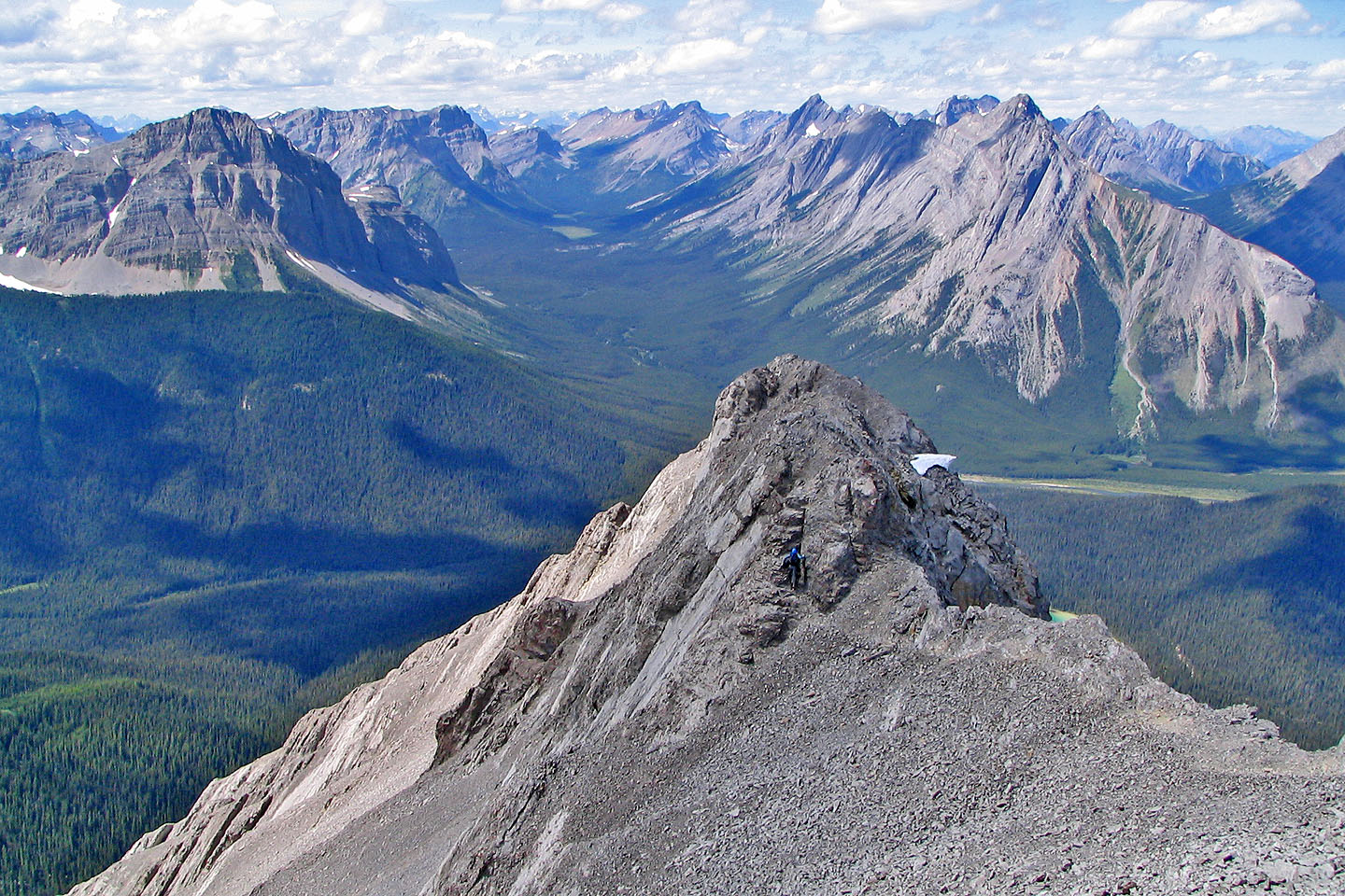
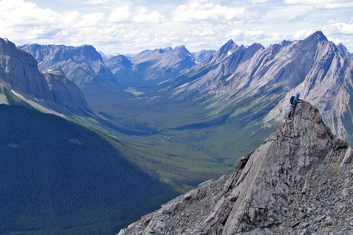
The summit cairn lies ahead. What can't be seen is the difficult,
exposed scrambling before it.
The chimney seen from the summit (mouse over for a close-up)
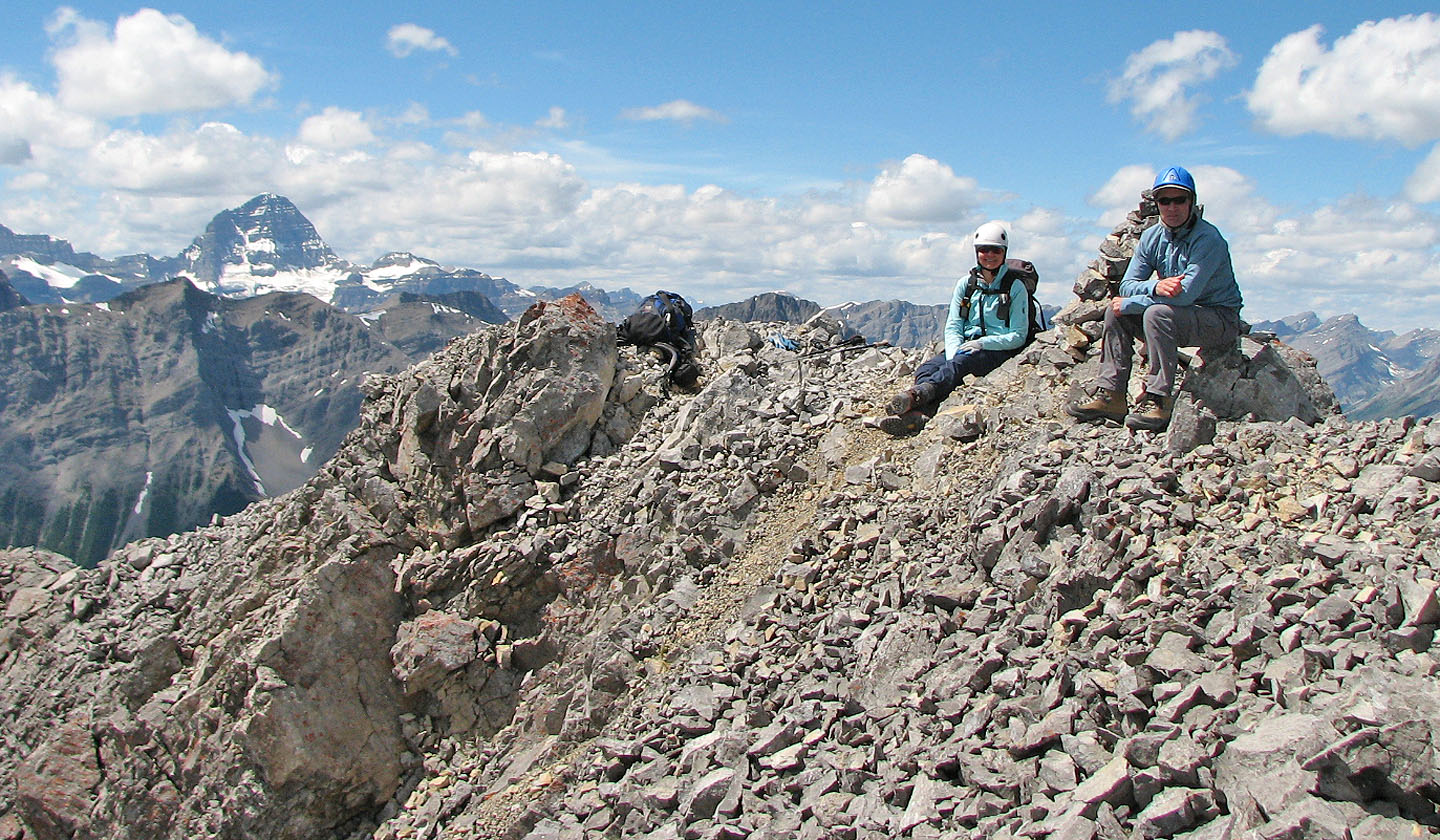
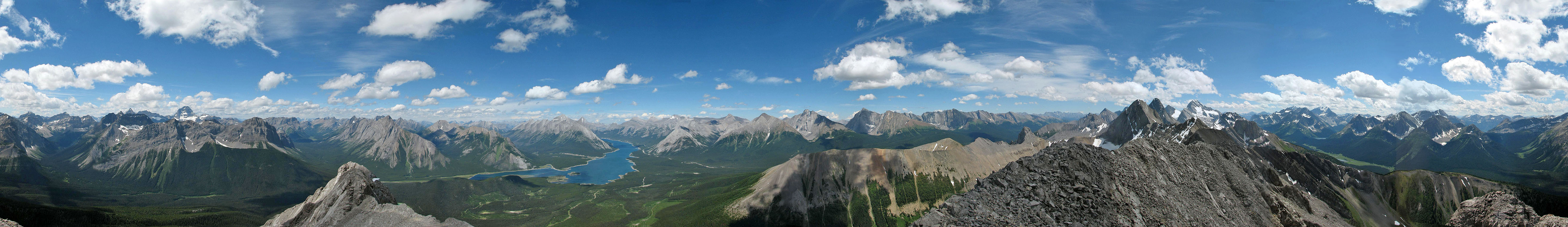
On the summit of Mount Shark. On the left, Mount Assiniboine rises above other peaks.
The summit is still in sight as we followed the ridge back
More exposed scrambling
From the col, we returned the same way, below the slabs
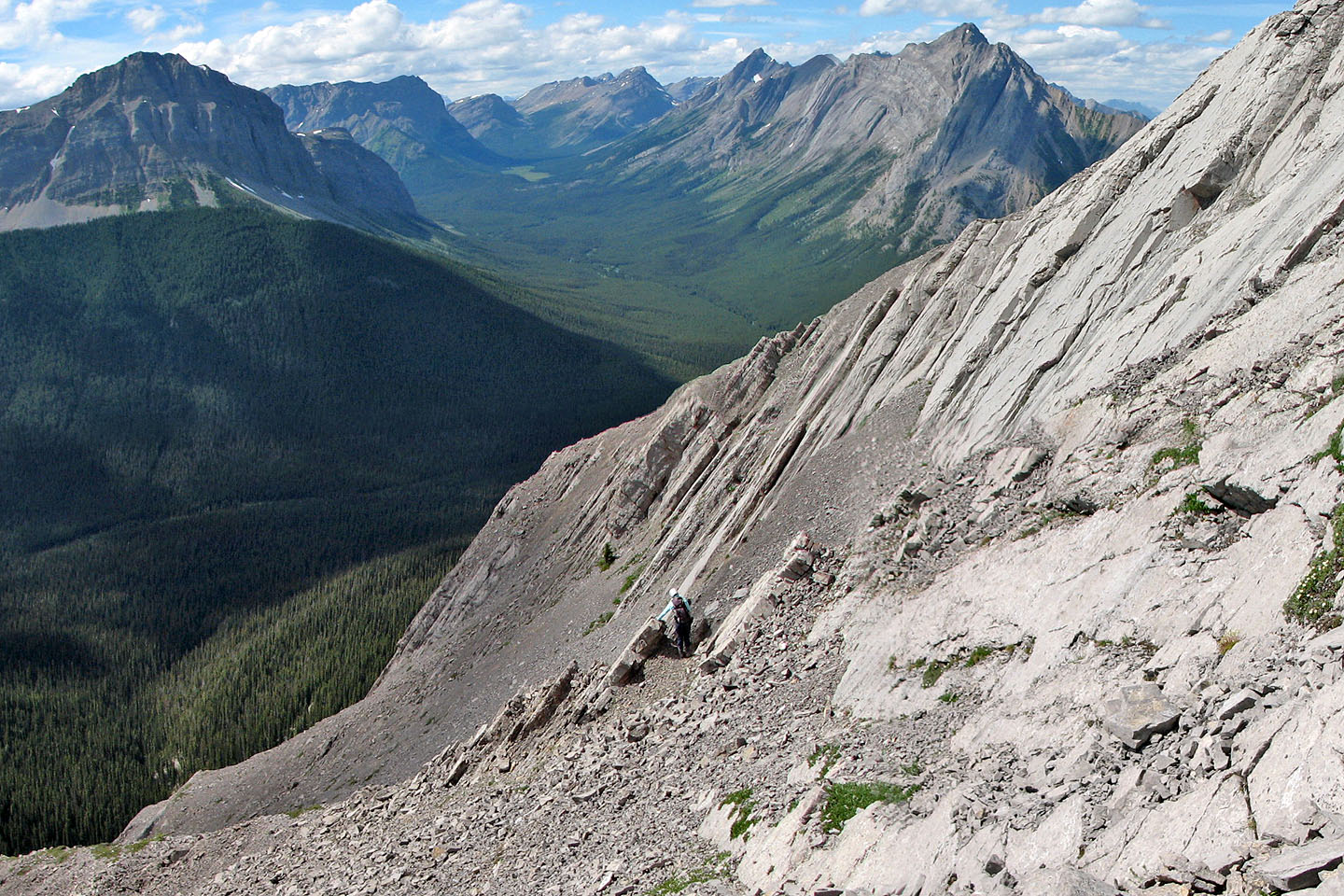
We reached the rocky drainage that will take us back to the logging road
Looking back up the drainage
The drainage where we should have started our ascent
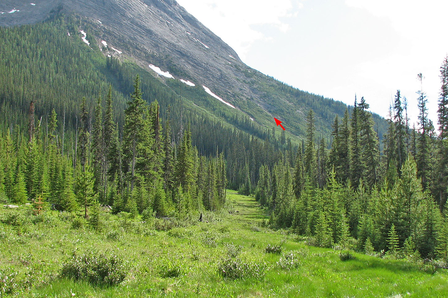
View of the drainage from the logging road
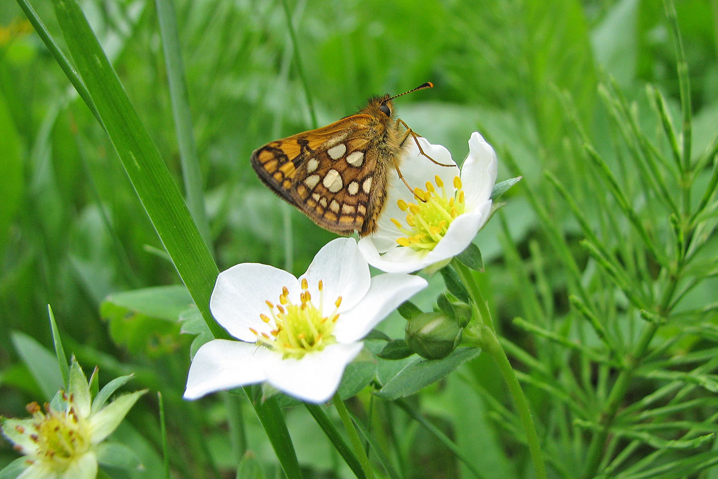
Arctic skipper butterfly on a few-flowered anemone
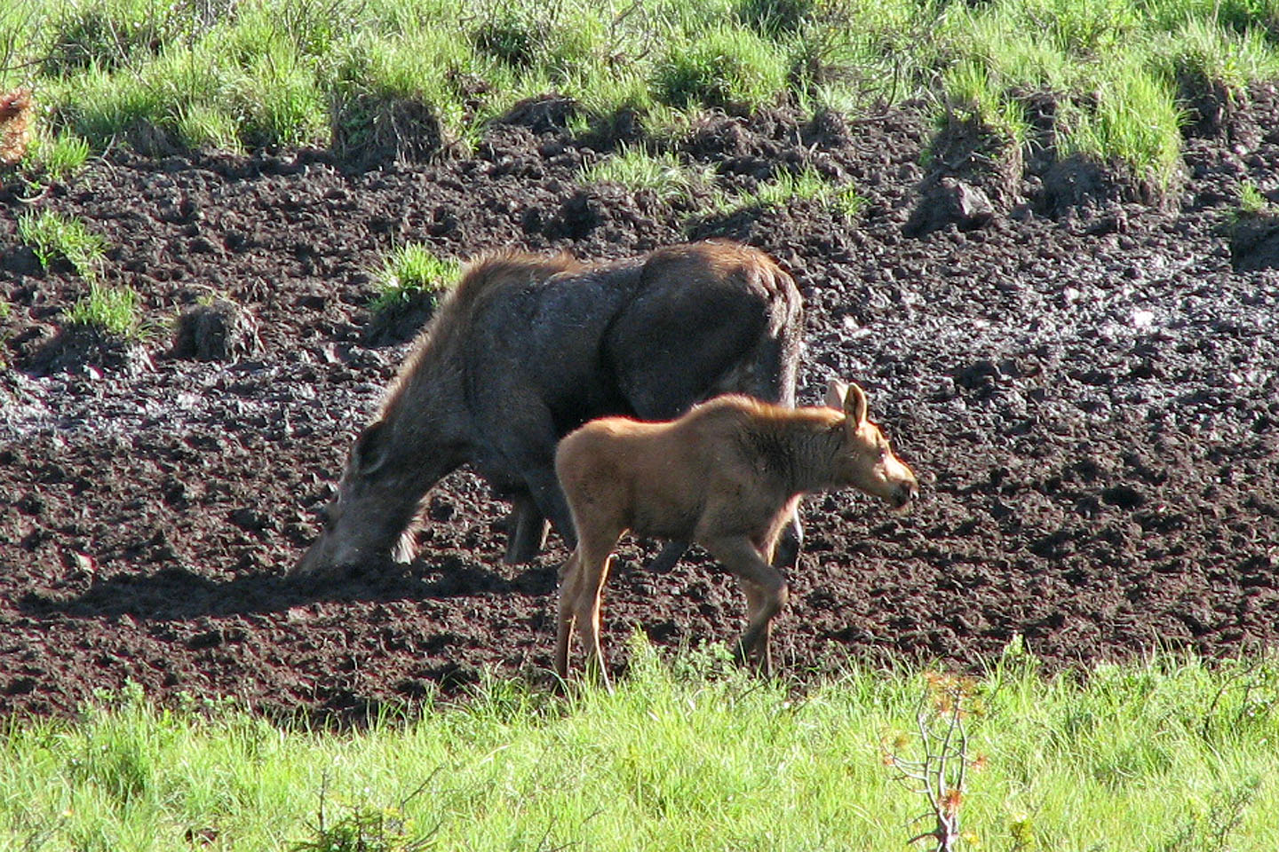
Mother moose and her calf
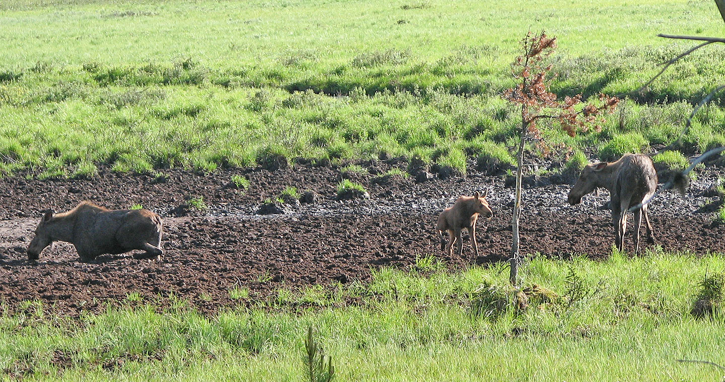
Violence by Engadine Lodge: the moose on the right
reared up and tried to strike the calf with his
front hooves.
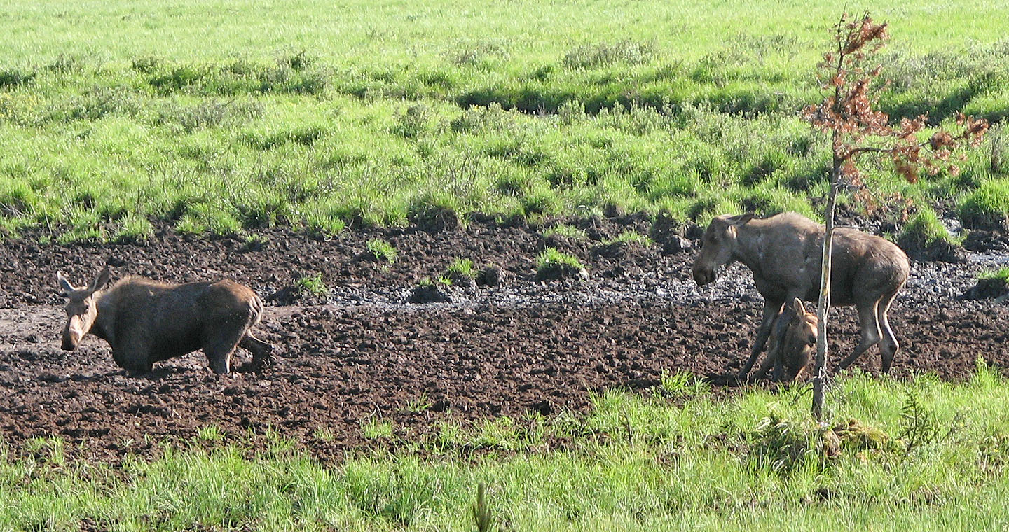
Fortunately, the calf received only a glancing blow and is now trying to extricate itself.
The mother turns after hearing the calf cry out. We could only guess as to why the attack
occurred.
82 J/14 Spray Lakes Reservoir