bobspirko.ca | Home | Canada Trips | US Trips | Hiking | Snowshoeing | MAP | About
Wendell East End
Kananaskis, Alberta
December 9, 2006
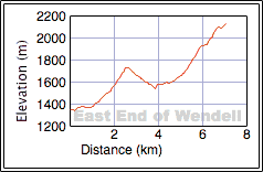
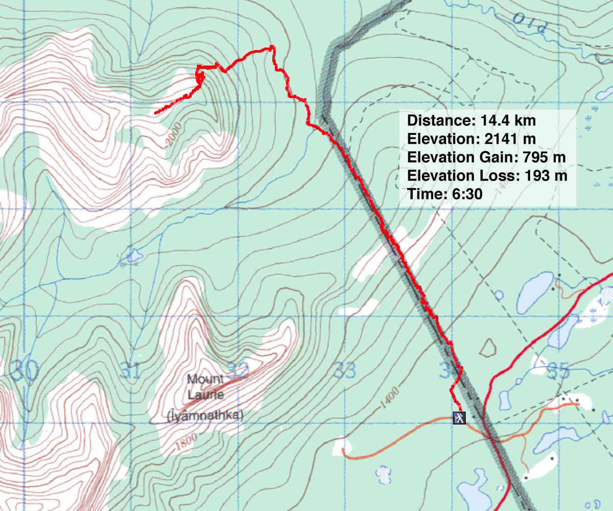
Distance: 14.4 km (8.9 mi)
Cumulative Elevation Gain: 1200 m (3937 ft)
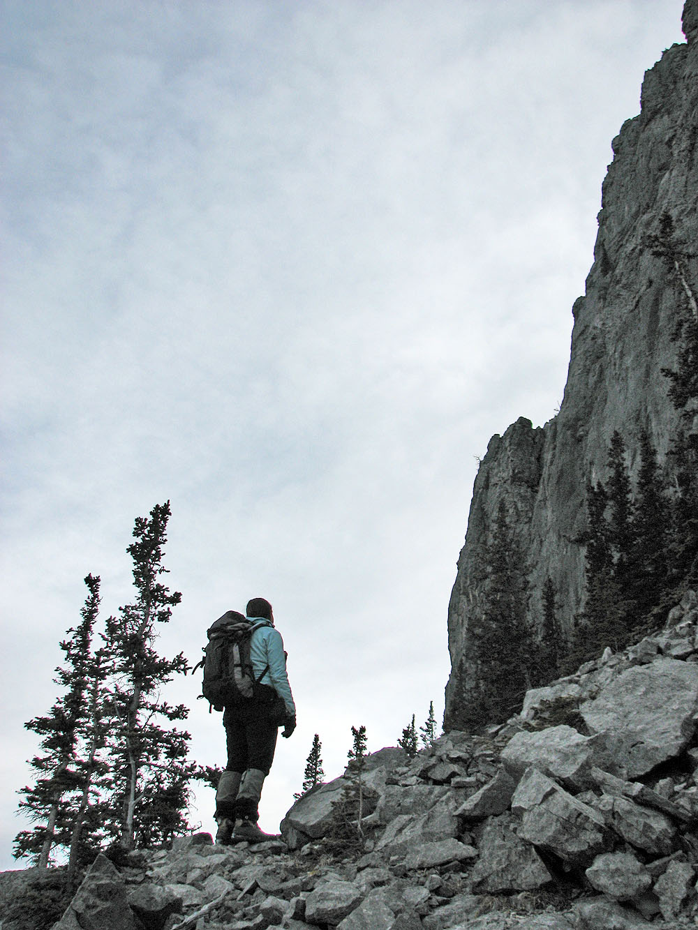
What began as an investigation for an approach to Association Peak became a reconnaissance for a route up the east end of Wendell Mountain. The reconnaissance led to a successful summit bid the following weekend and is the best late-season scramble I've done. I've put both the attempt and the successful ascent here – the complete route – on this page.
Here's how it unfolded. A month ago, on our hike up Association Hill, I noticed a trail that was worth investigating. I wanted to return to see if it led to Association Peak, although eight hours of daylight precluded an all-out assault on the mountain.
After hiking up the boundary cutline, we crossed the south fork of Old Fort Creek and took the unknown trail. Basically, this trail is a continuation of the cutline. It is a surprisingly good trail, although it seemed to have many unnecessary twists and turns. It also gained 100 m only to lose it all at Old Fort Creek.
We didn't go all the way to the creek, however. After reaching a small marsh, it seemed pointless to continue. We had followed the trail far enough to see where it went. We stopped to look around.
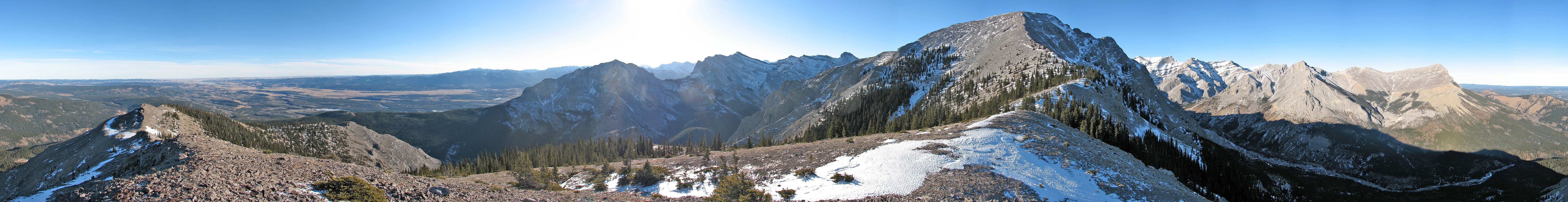
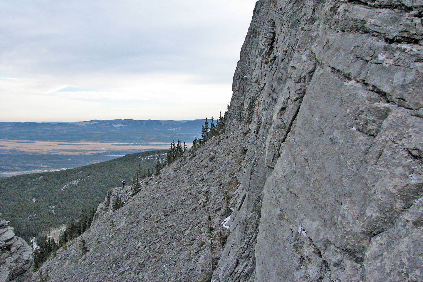
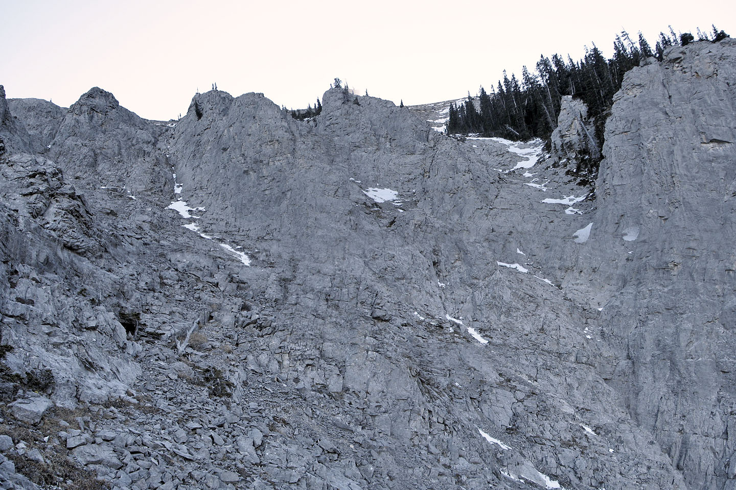
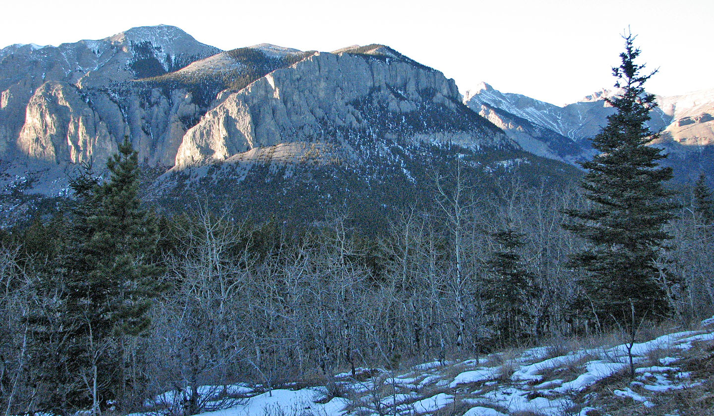
From the marsh, we had a clear view all around including the east end of Wendell Mountain. The entire end of the mountain appears guarded by huge cliffs, but I spied a break that required a closer look.
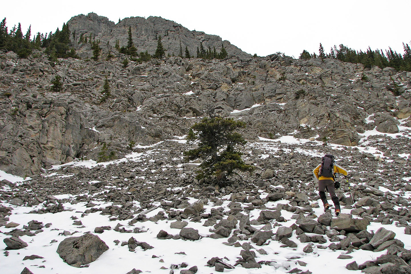
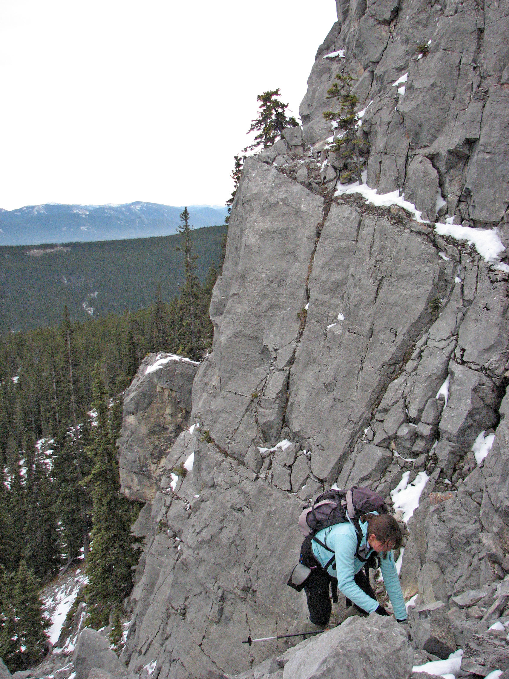
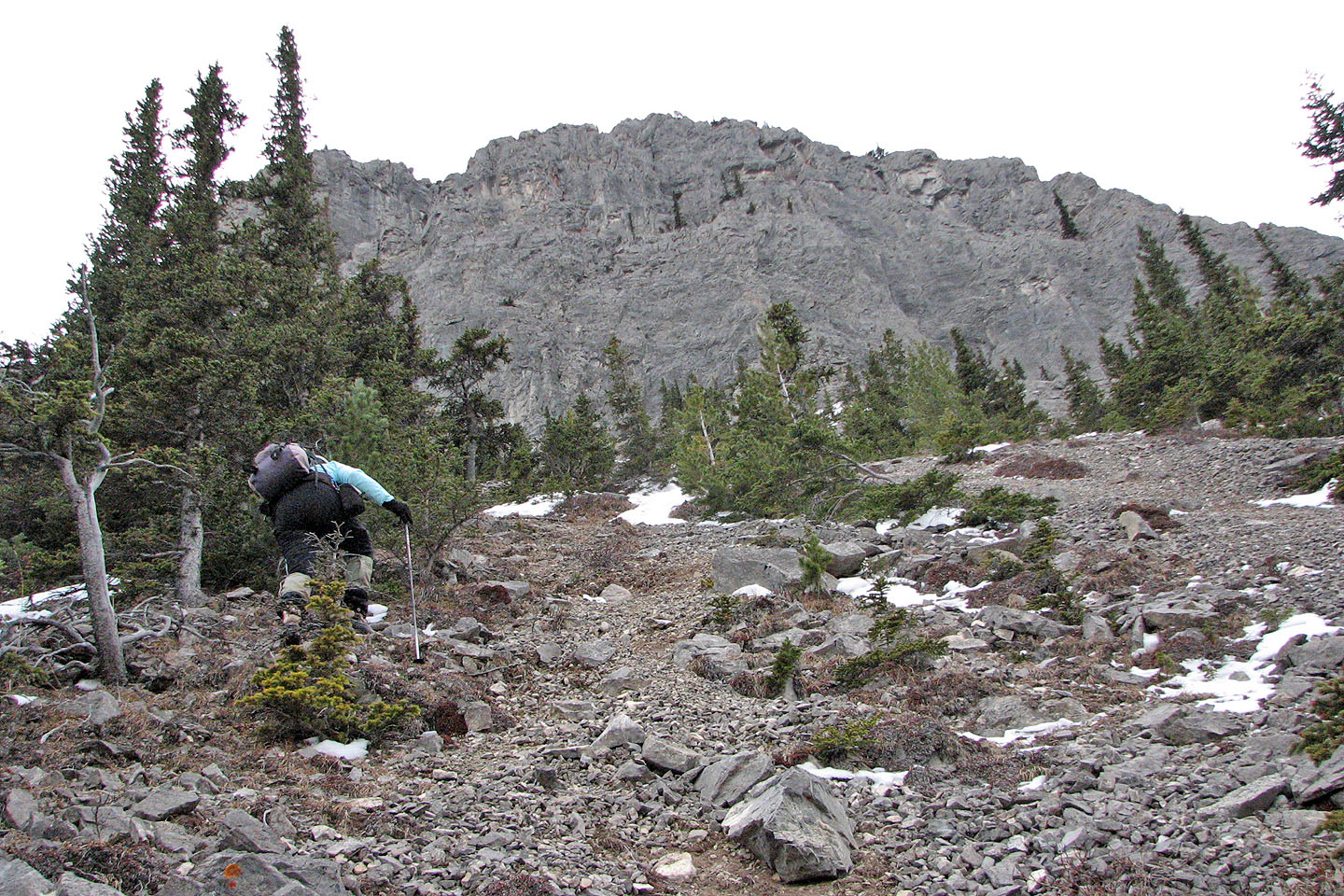
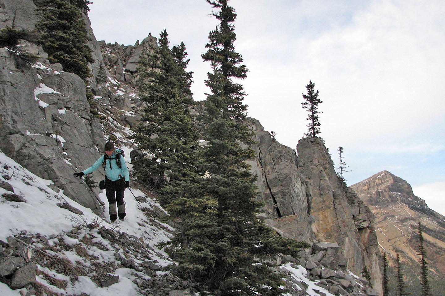
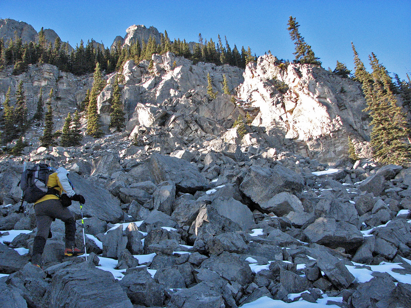
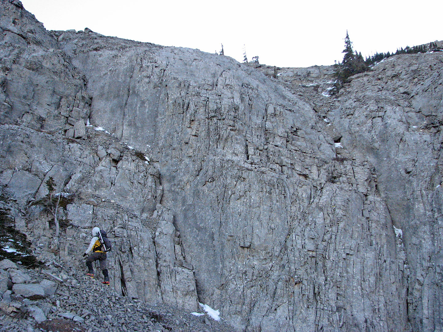
We turned around and headed back up the trail. After hiking a kilometre, and regaining 80 m, we left the trail and started up the wooded slope. In a short time, we were at the base of a crumbling cliff band that runs below the towering cliffs. We could have ascended nearly anywhere, but since we had no helmets and there were some snow patches, we spent time routefinding for the easiest way up.
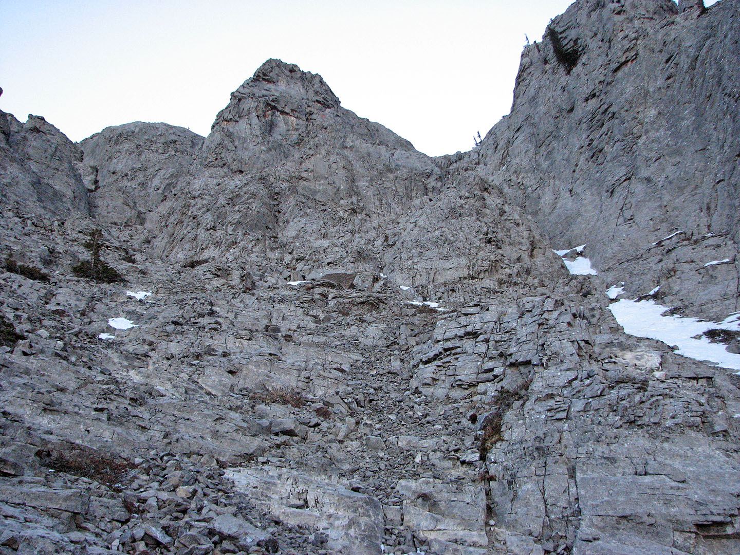
Above the cliff band, steep rubble led to the base of the huge cliffs guarding the top. Leaving Dinah behind, I scrambled up a chimney to view the gully we had studied from the marsh. A sheer rock face barred the way up to the gully, but on the left, it looked possible to continue. However, we turned back at this point. We were running short of daylight, and it wouldn't have been prudent to push on without helmets.
Even though we didn't get far, the way up looked promising.
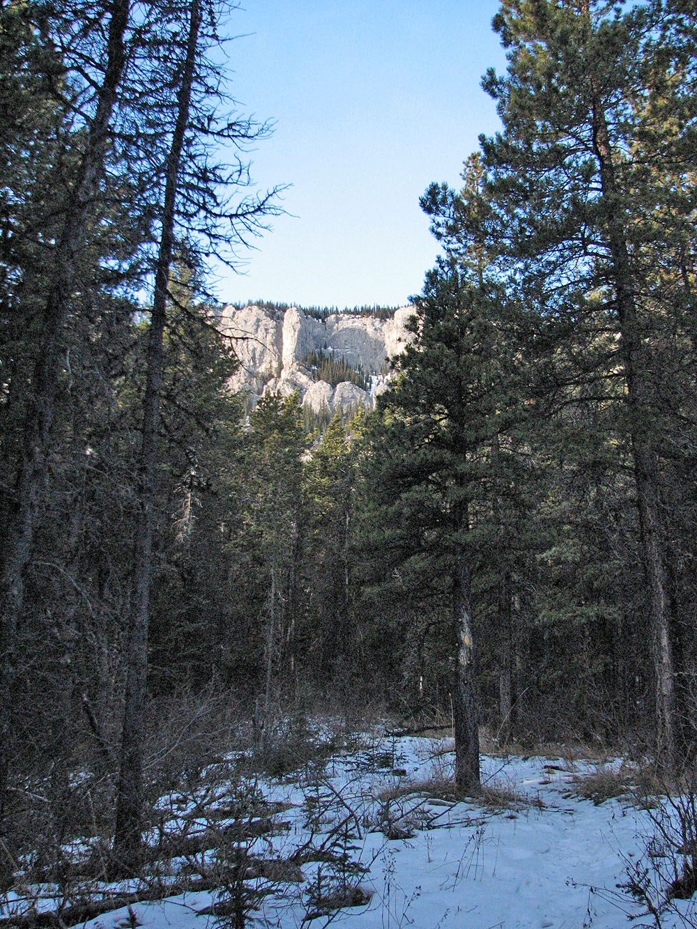
Looking at the break on the East End of Wendell from the marsh (mouse over)
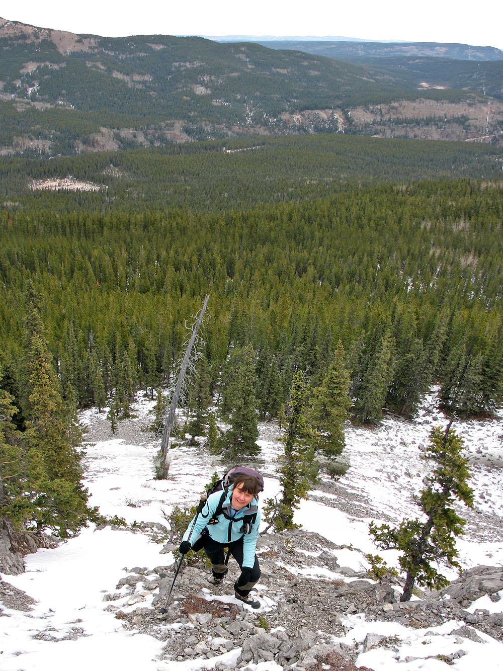
On the lower slopes
The rubble was short-lived and we soon reached solid rock
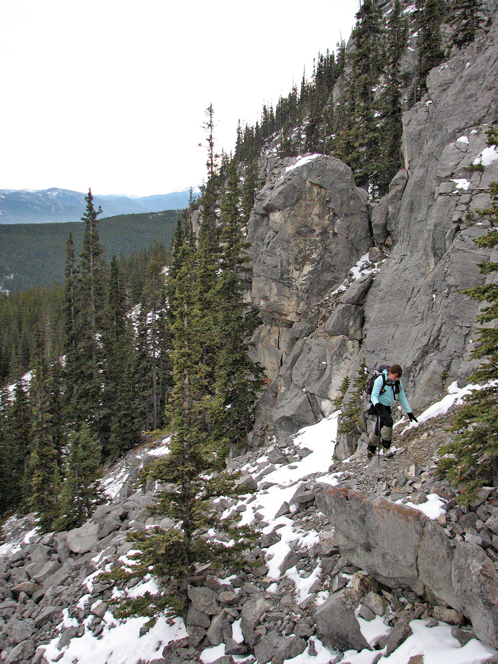
Negotiating the cliff band
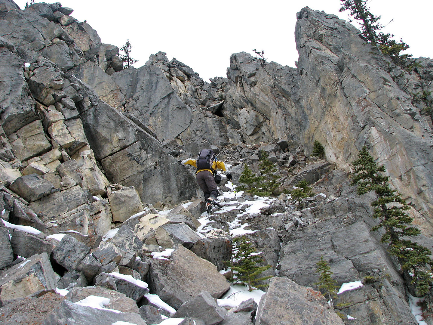
Going up a gap

Association Hill on the
right
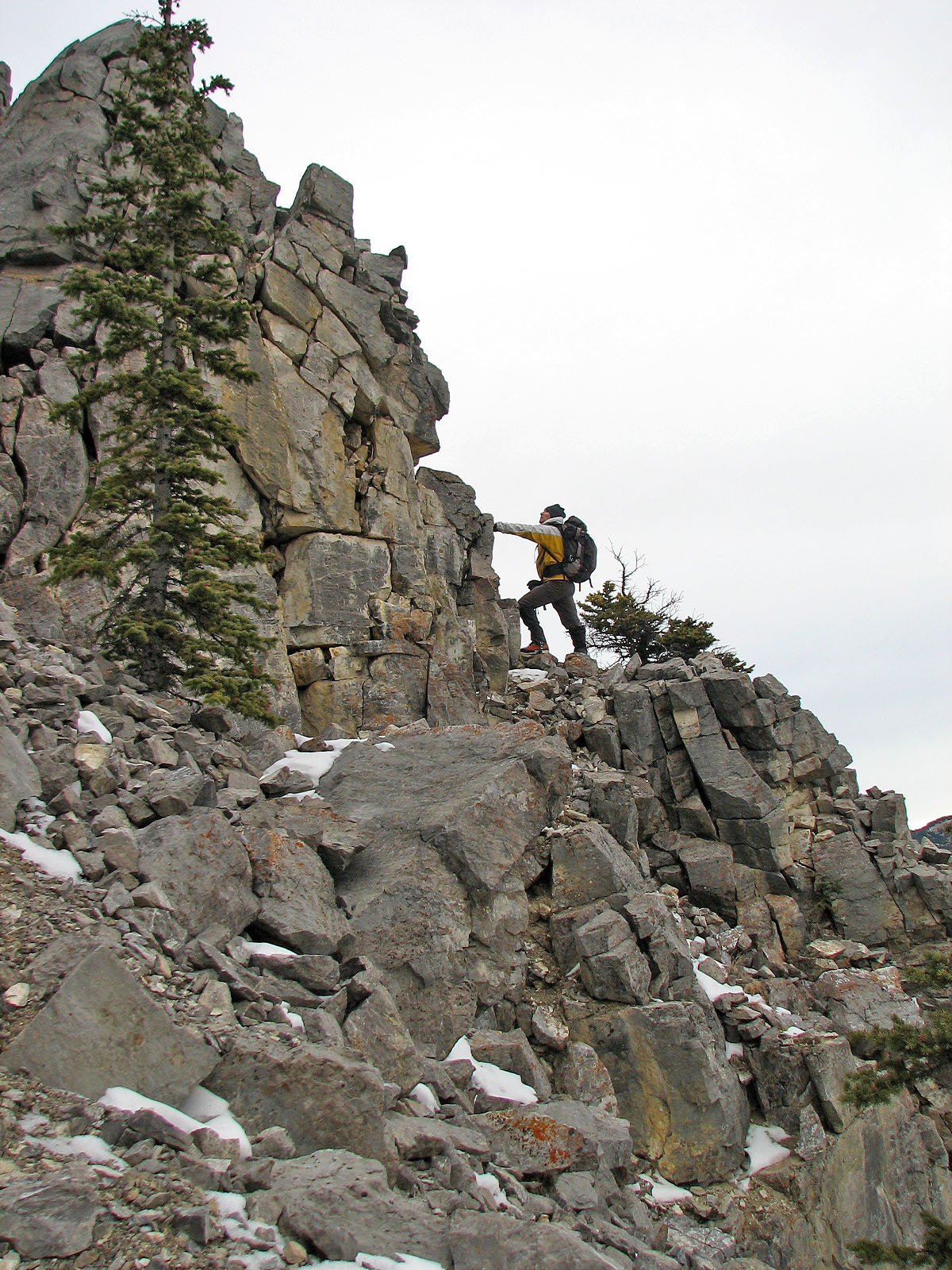
I went around this rock outcropping while...
... Dinah scrambled up on the left
Above the rock band were towering cliffs
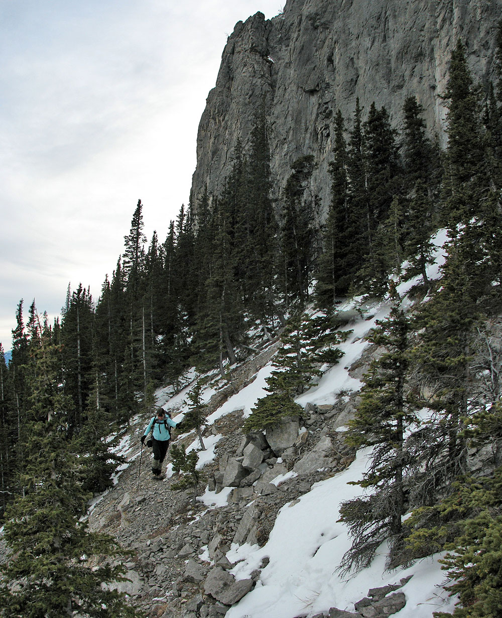
Near the base of the cliffs
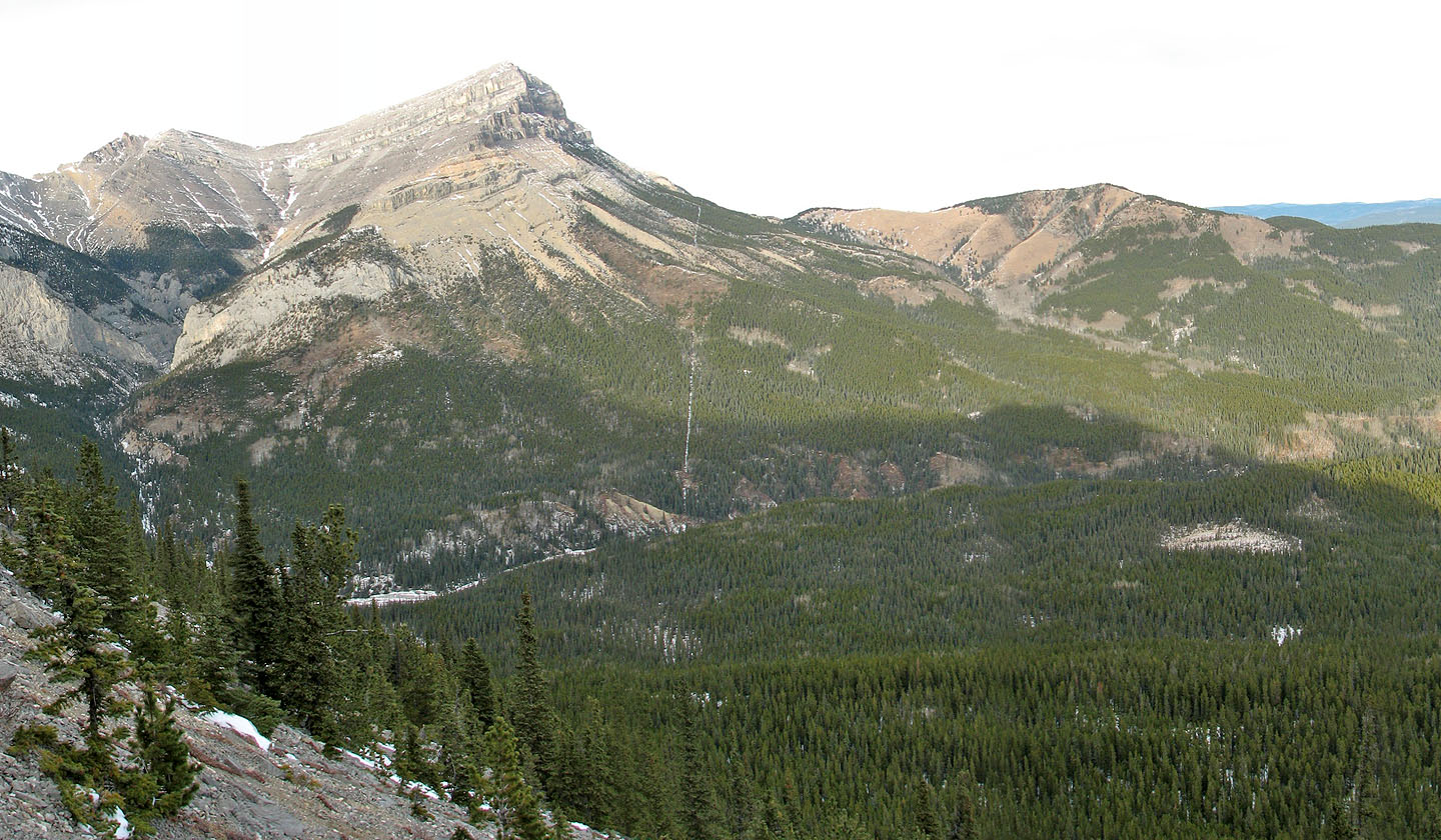
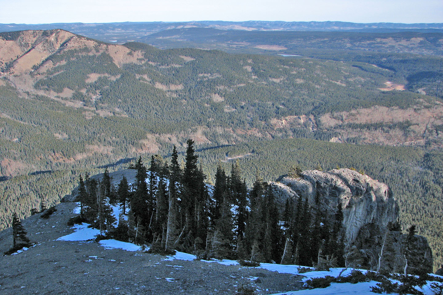
Association Peak and Association Hill. In the bottom right is the marsh
where we stopped to study the route.
Dinah looks at the cliffs that guard the top
While I go to check the gully Dinah waits on a rock outcropping (mouse over)
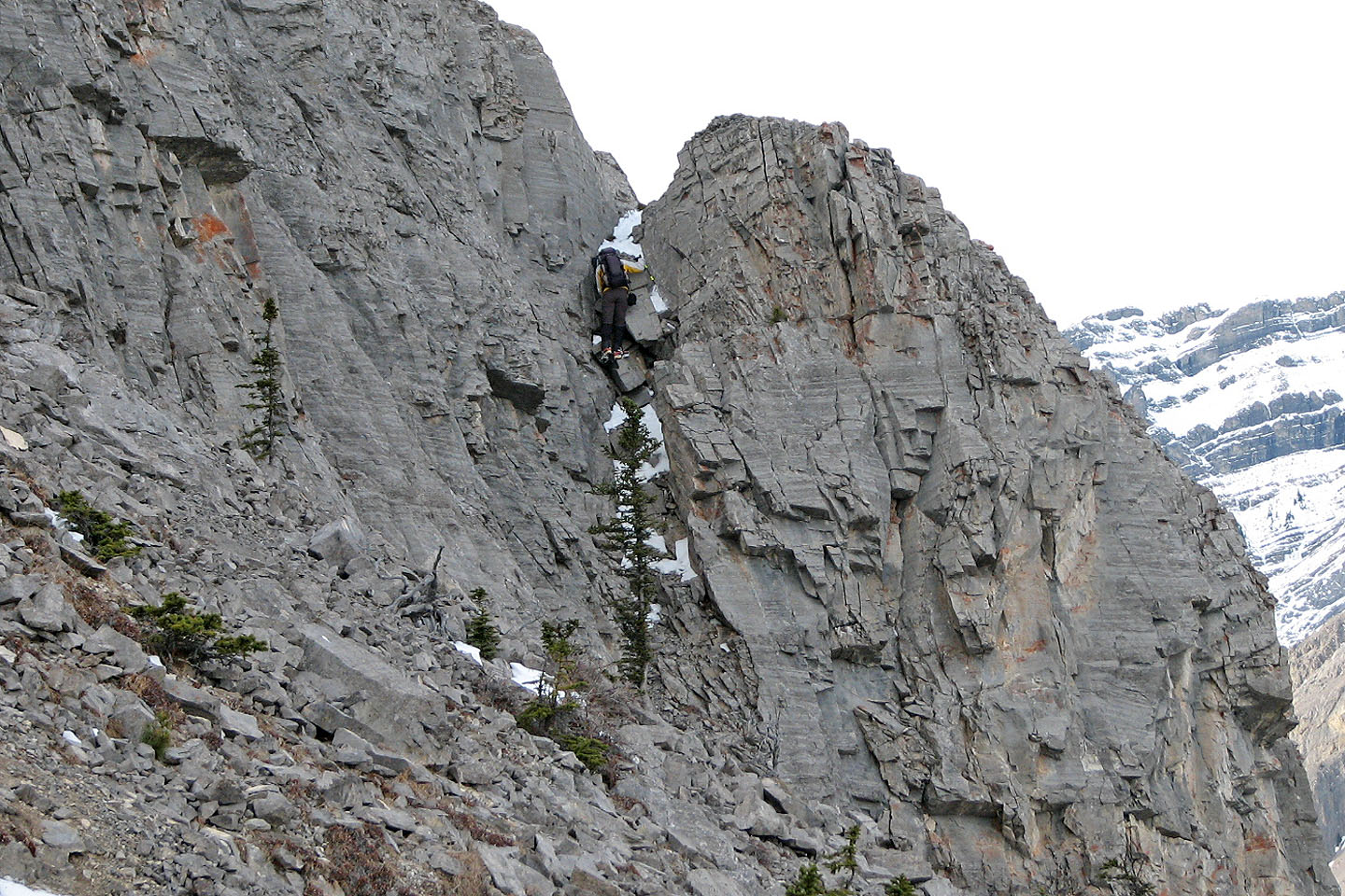
To reach the gully, I scrambled up this chimney
At the top of the chimney, I realized I couldn't reach the gully (right) I saw from the
marsh,
but the gully left of it looked promising. I turned back and returned a week later.
Working our way back through the lower cliff band
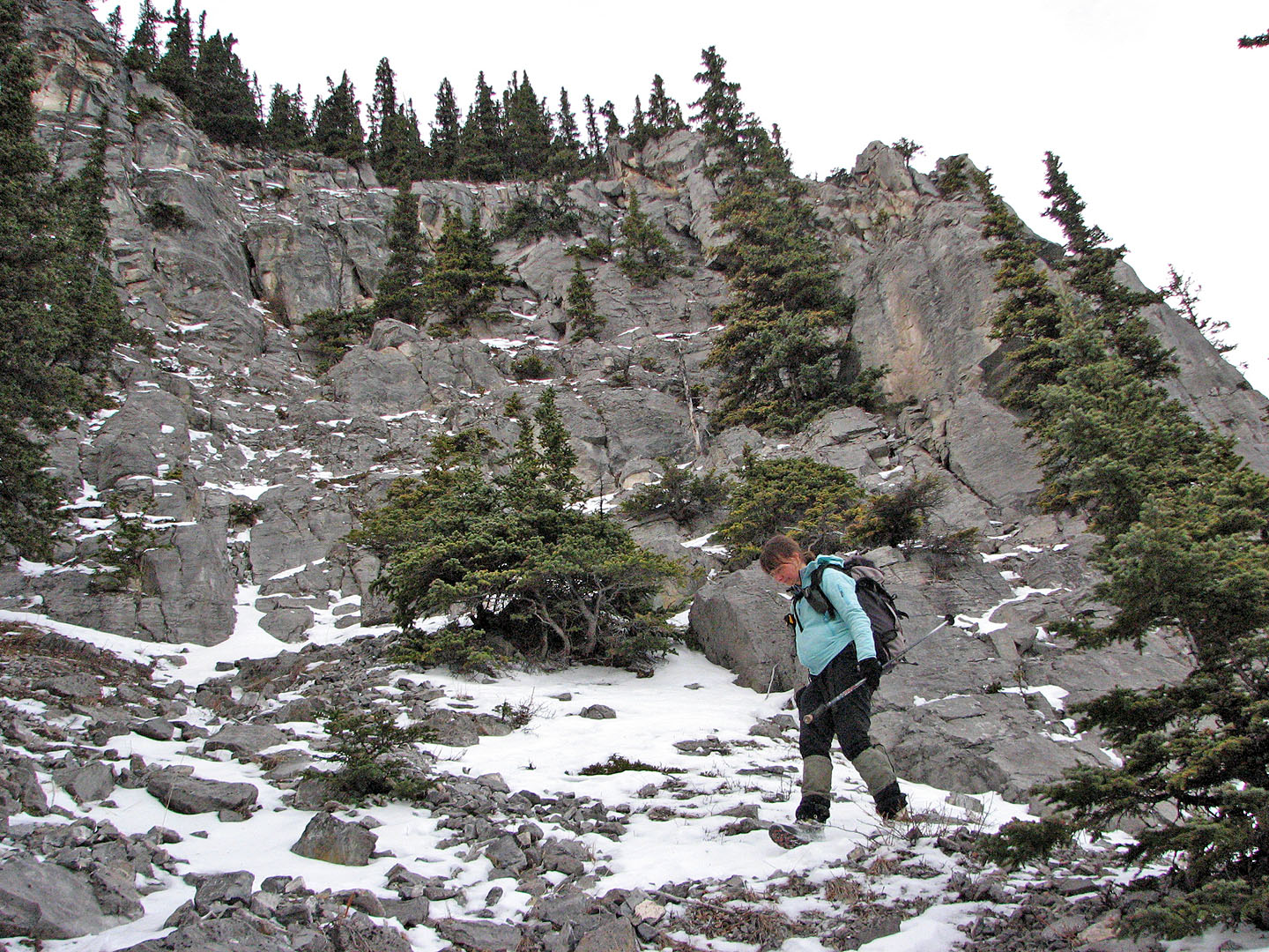
I wondered if there is a way up this section of the cliff band
We passed by a gnarled rampike
We still faced hiking over the east ridge of Yam
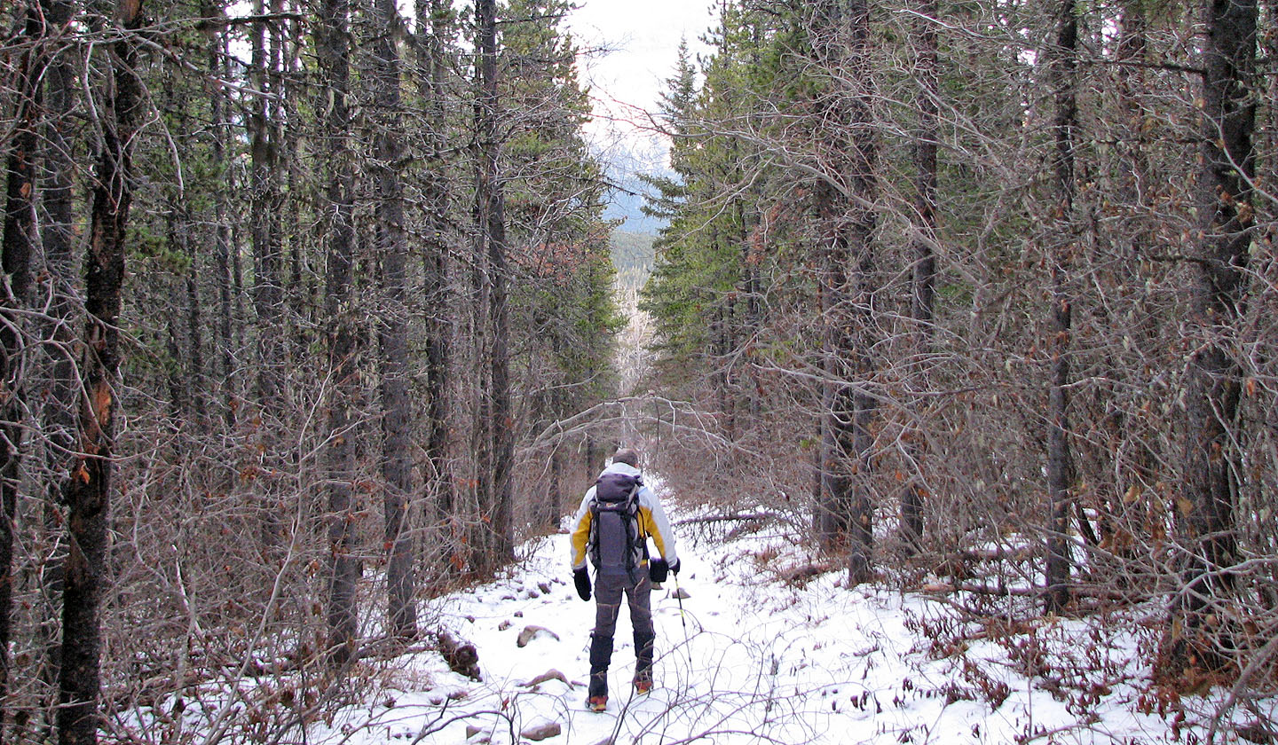
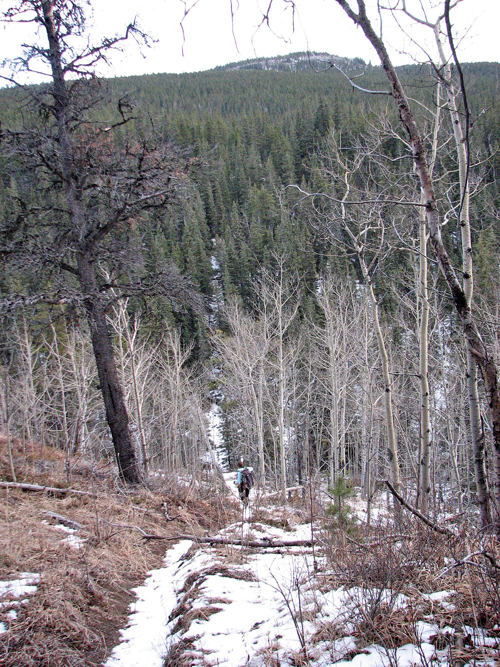
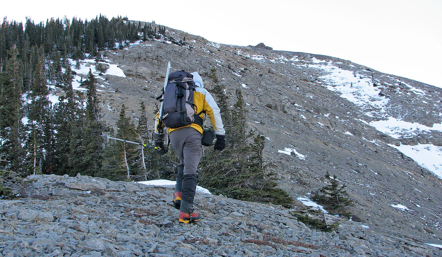
The trudge along the cutline
After Dinah and I explored a route up the East End of Wendell, I returned the following week to finish the climb. After parking at the south end of the Yamnuska parking lot, I crossed the road and started up a trail marked by a No Motorized Vehicles sign. The boundary cutline runs parallel to this trail 150 m away. To reach it, I turned right at the third intersection. I followed the cutline to the south fork of Old Fort Creek, crossed it, and headed up the other side. The trail comes to a T-intersection and I went right. I hiked up the trail until I reached a high point (I built a small cairn here).
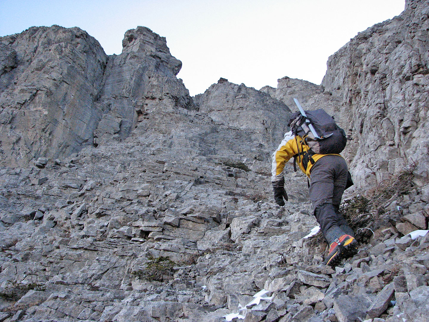
I left the trail and went straight up the slope. Angling right would place me on a rubbly slope, but better scrambling may be found straight up or even a bit left.
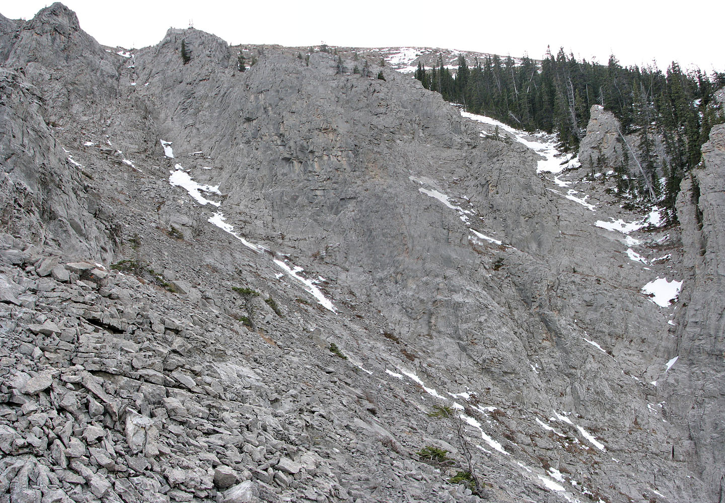
After gaining the cliff band, I worked my way right until I reached an open slope. I headed to the north end of the cliffs where I scrambled up the chimney.
I reached the chimney in about 2.5 hours. After the chimney, the terrain became more complex, but two gullies looked promising. I settled on ascending the one on the left. It rose steeply until it ended in a rock wall with a few breaks, only one of which looked good. A 2.5 m section of vertical rock provided some resistance, but after that I was tramping up the gentle shoulder that leads to the high point on the east end. I looked forward to not only reaching the top but also getting into the sun. I had been scrambling in the shade and longed to see sunshine.
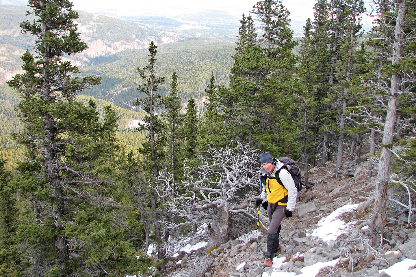
The hike to the high point was pleasant enough. I pondered continuing to the East Peak and descending its SW slopes to CMC Valley, although I had little reason to revisit the East Peak.
Also I had wet my pants. I better explain. I had forgotten to blow back the water in my water bladder, and the water had frozen in the tube. After drinking directly from the bladder, I didn't secure the lid properly and nearly all the water had drained, soaking the bottom of my pack and the back of my pants. An extended trip without water, not to mention dry spare clothing, was out of the question.
I returned to the end of the ridge to where I had scrambled up. I started down only to realize it ended in a drop off; I had picked the wrong spot! I climbed back up and found the proper spot a few metres away.
After that, I encountered no difficulties and arrived back below the lower cliff band. By now, the water I had lost had frozen. My ass was ice, my bum numb. But I was only minutes away from the trail that led back to my car.
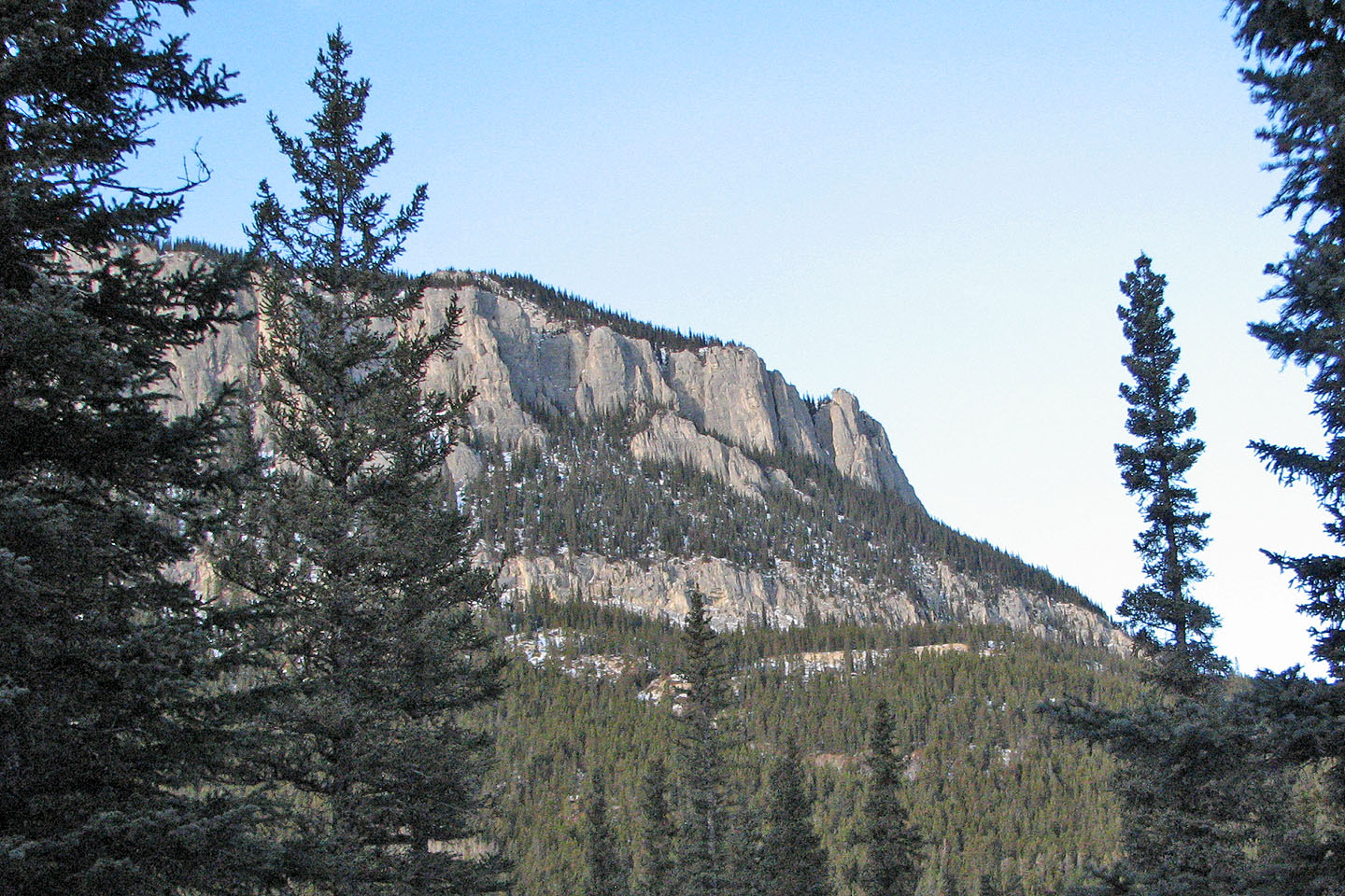
View of the cliff band and cliffs from the cutline
A glimpse of a curious alcove in the cliffs from the trail (mouse over)
 Heading to the cliff band
Terrain above the chimney
I ascended the gully on the left
Heading up the gully
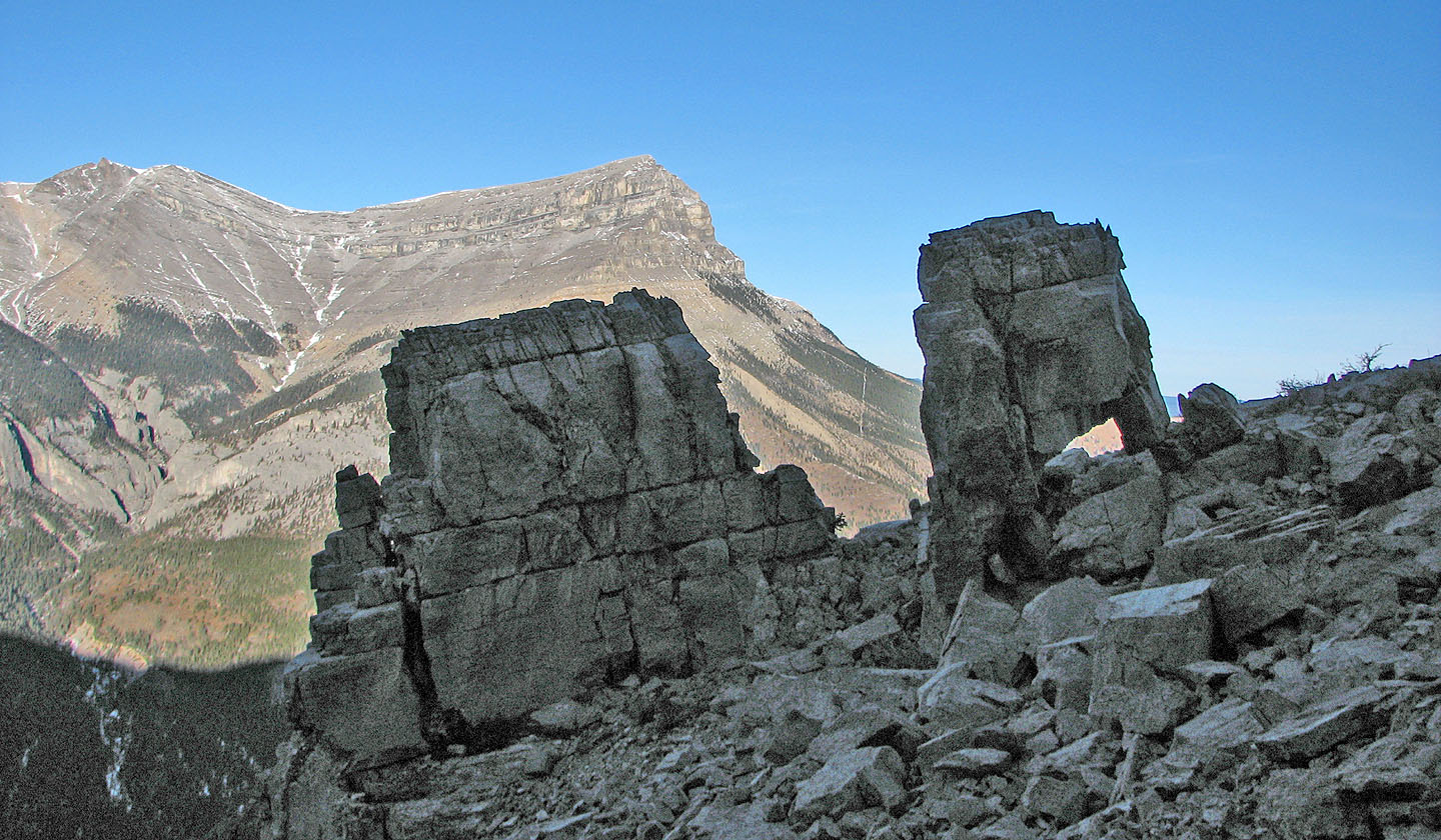
Two boulders, about 3 m high, one with two legs
View from the two-legged rock
Hiking to the false summit
Looking back to where I had scrambled up, on the left
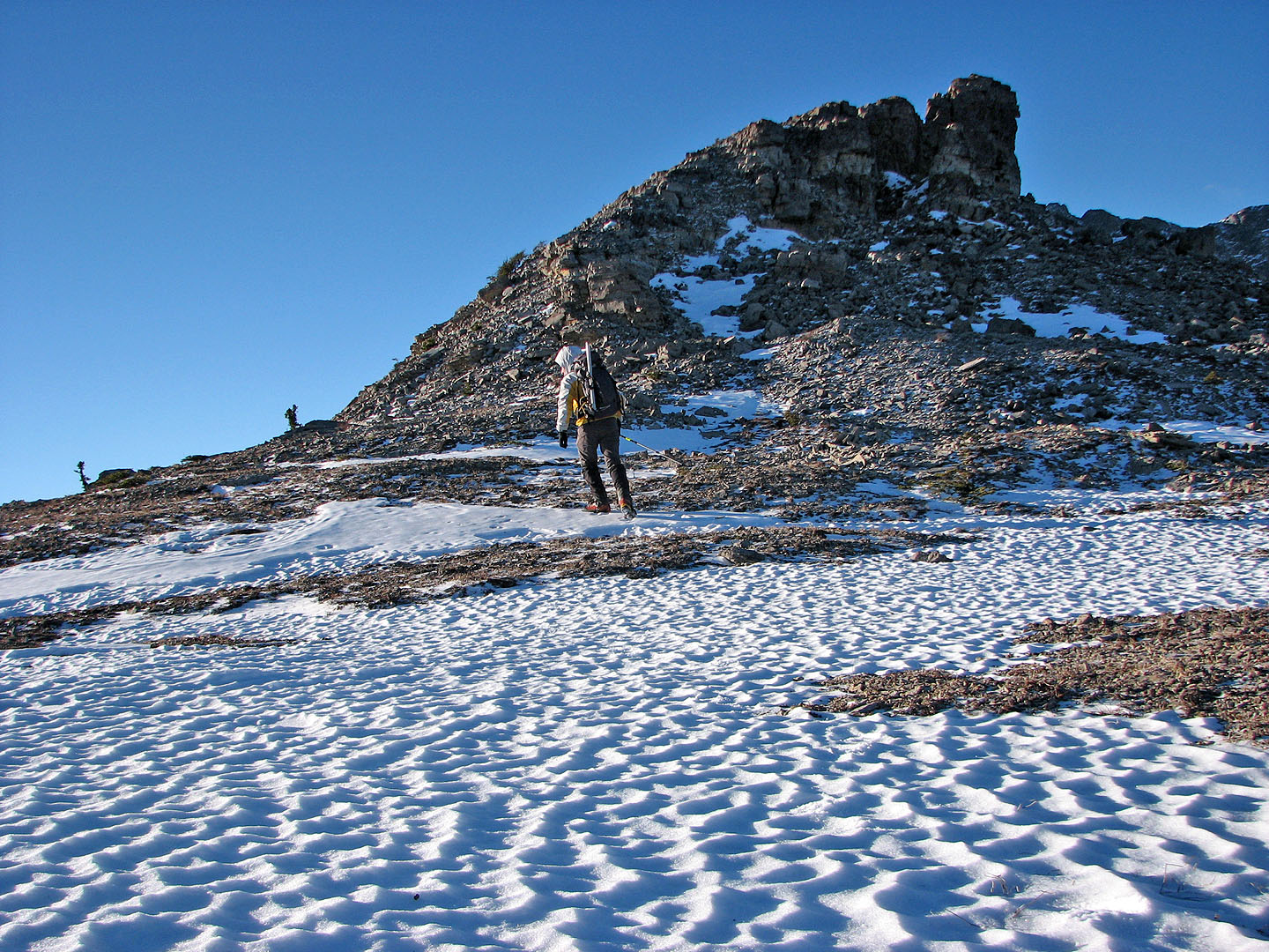
Approaching the false summit

Looking back at the false summit
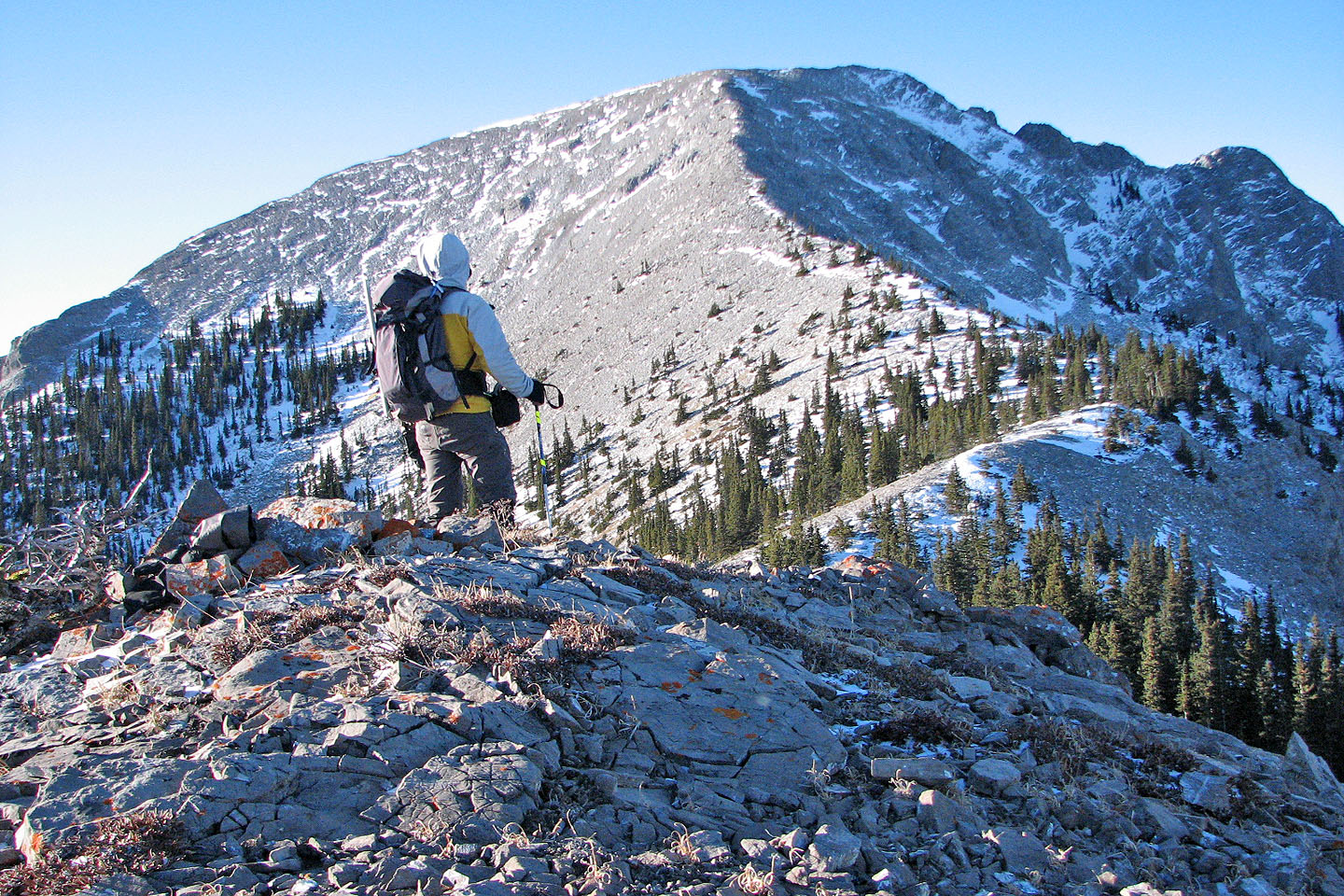
On the East End. The East Peak of Wendell was only 650 m away and 150 m higher.
Parting shot of the East End of Wendell from Yamnuska: I reached the centre
point
82 O/3 Canmore