bobspirko.ca | Home | Canada Trips | US Trips | Hiking | Snowshoeing | MAP | About
North End of Goat Range (Attempt)
Kananaskis, Alberta
July 17, 2010
When Dinah and I ascended the East End of Rundle a few weeks ago, I had a good look at the north section of
Goat Range. The ridge appears well guarded by cliffs – except at the north end where I noticed a break. We
could gain the ridge, but I couldn't tell if the peak at the north end could be reached. There was only one
way to find out, and it wasn't by Googling it.
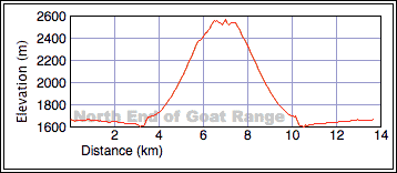
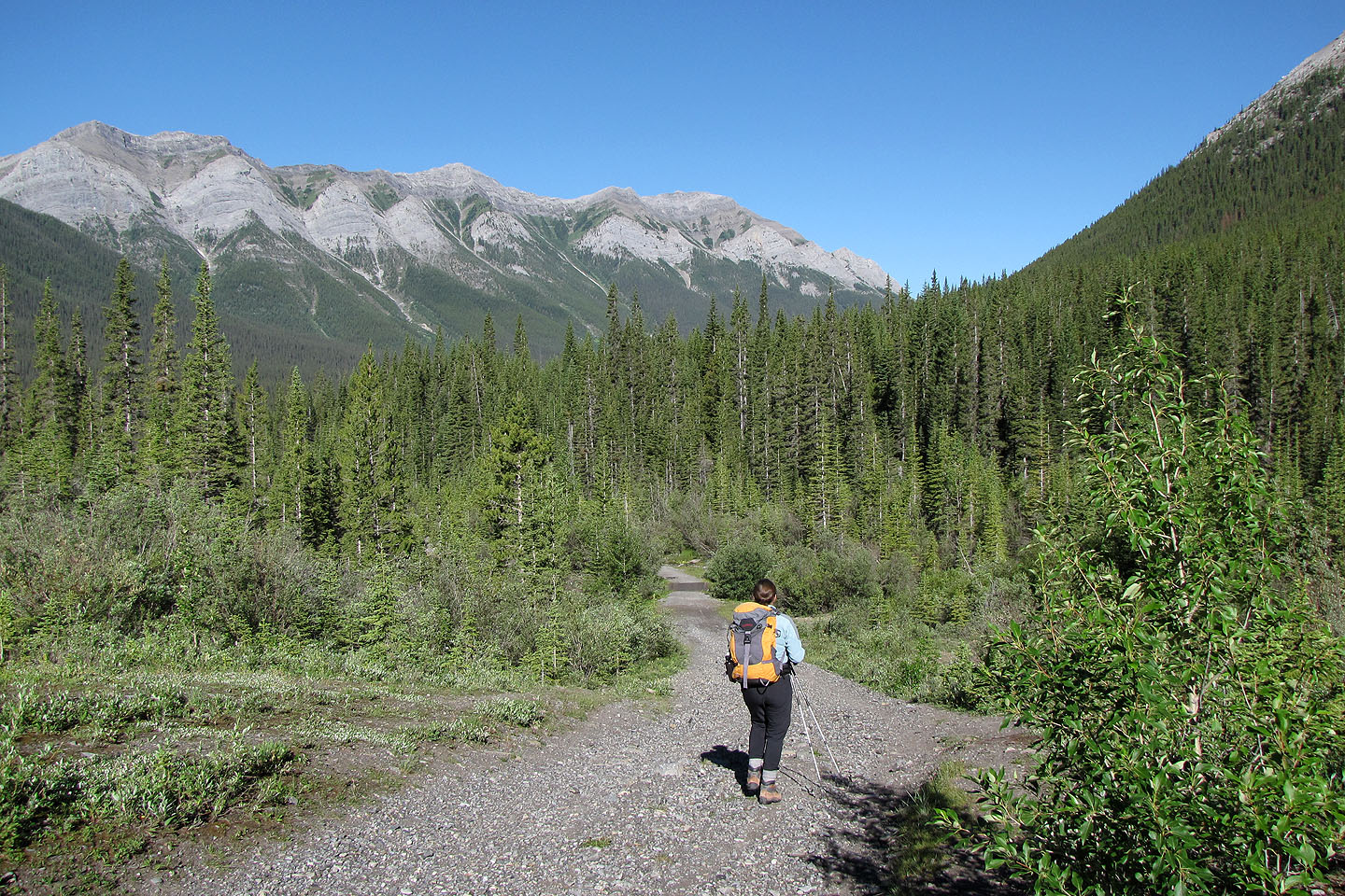
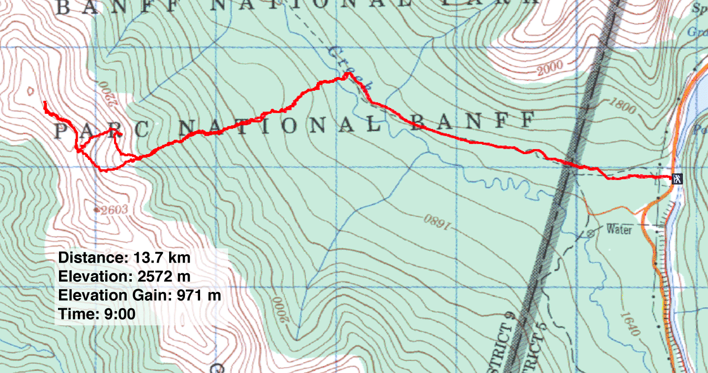
We hiked 3.1 km down Goat Creek Trail (I say “down” because we lost 60 m elevation) where there was a perfect
place to cross Goat Creek. Not only was it close to the trail and the creek shallow here, but it was beneath
the avalanche gully we wished to ascend. This gully leads to the break in the cliffs.
After we crossed the creek, I expected to bushwhack up the wooded slope, but it's better described as “moss
mashing.” An extraordinarily soft carpet of moss eased our way up what was the steepest part of our ascent.
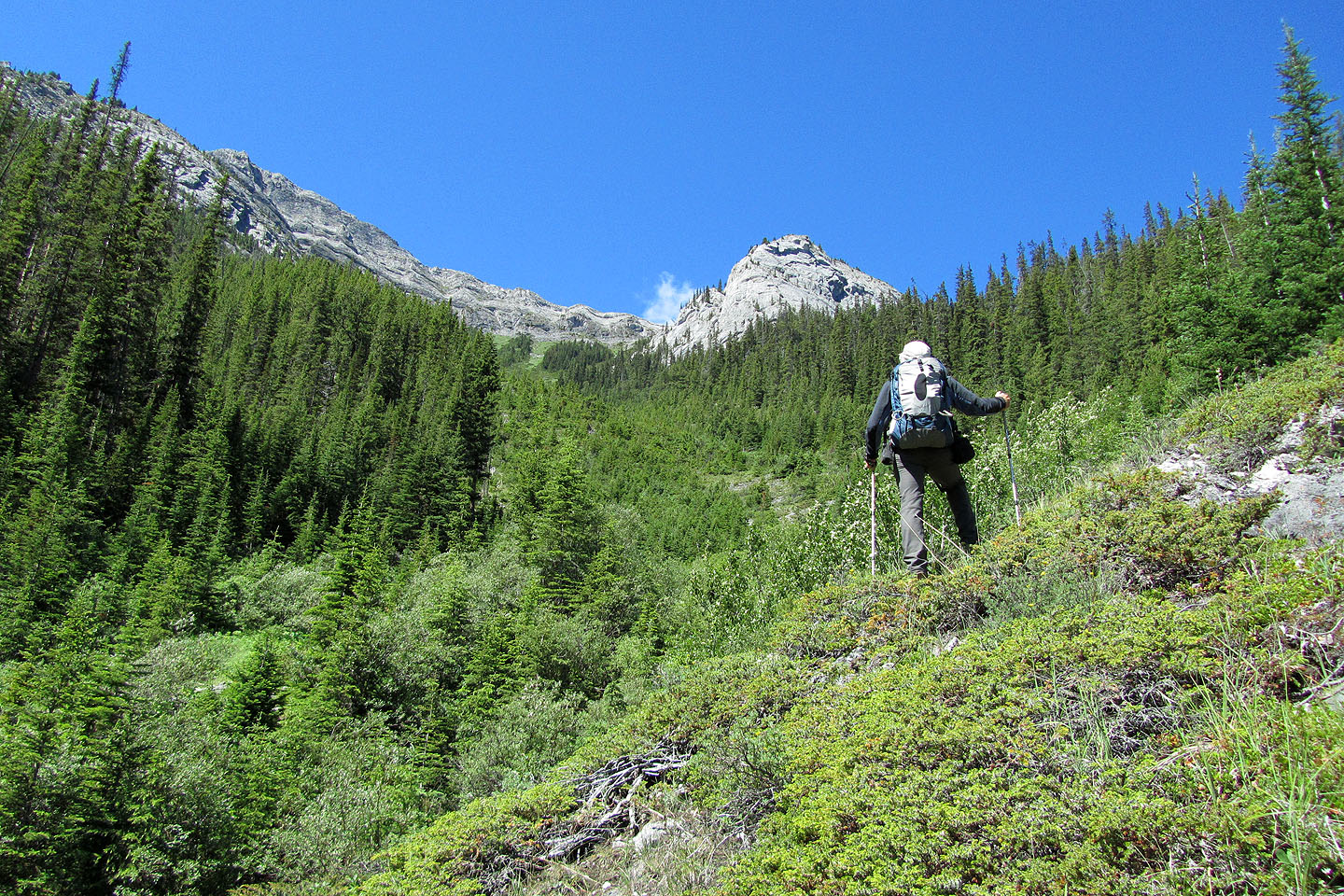
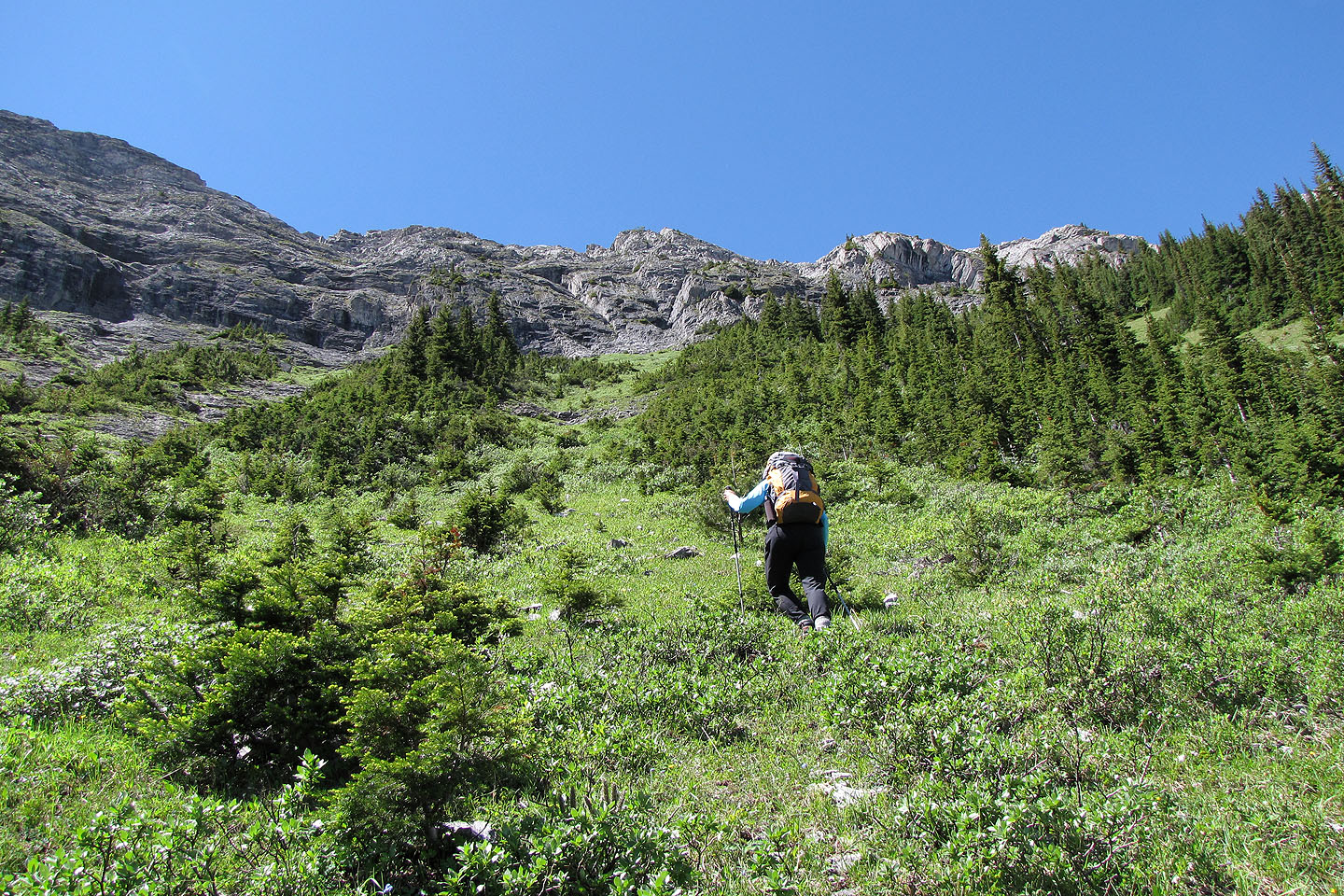
When we neared the bottom of the gully, the forest gave way to mixed vegetation: young trees and bushes. I was
hoping for grass, but no such luck. Although the bushwhacking was easy, it seemed interminable.
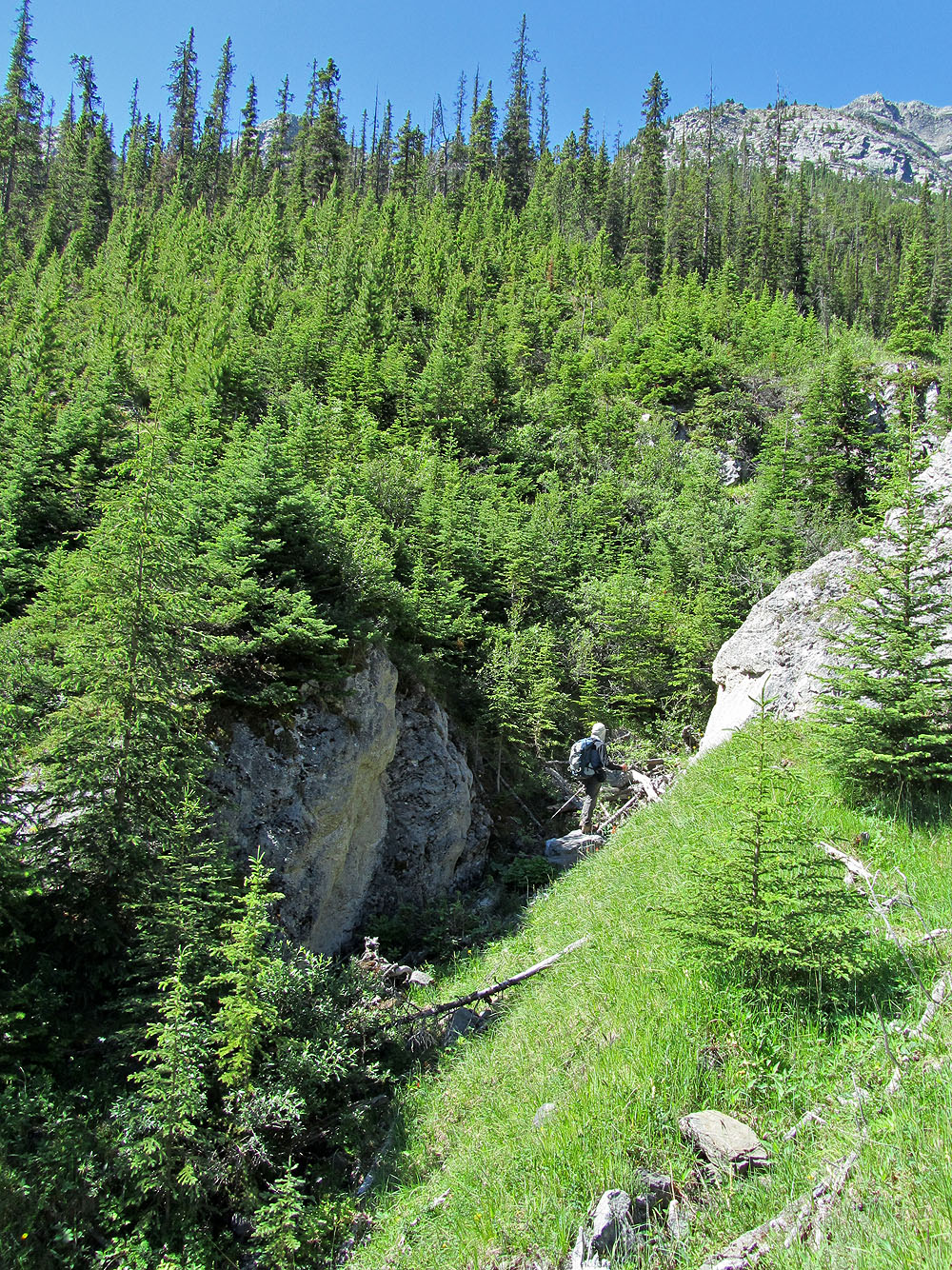
Eventually trees and bushes fell away, and we could see the cliff band ahead. Just before reaching it, we
turned right, followed the cliff base to the break and easily gained the ridge. We headed to the North End of
Goat Range.
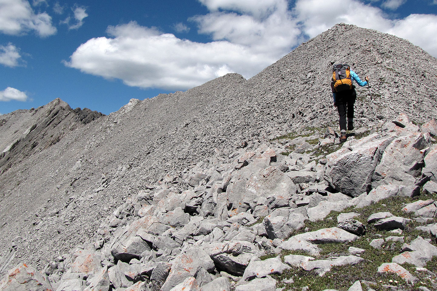
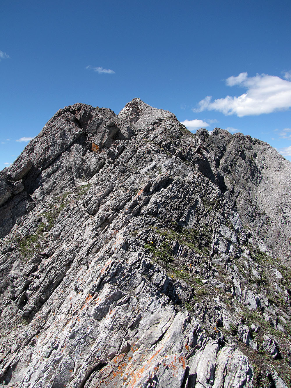
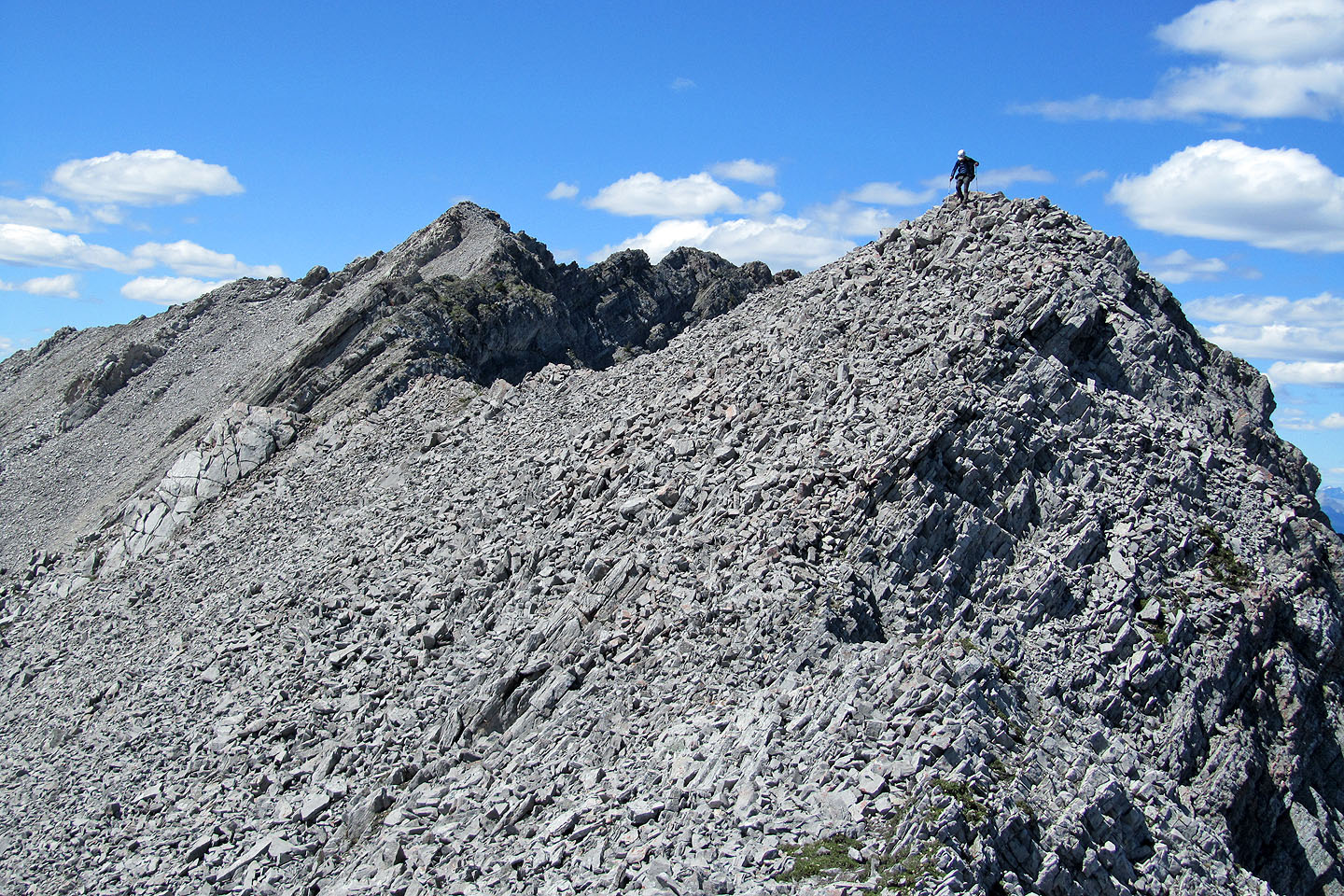
At first travel was easy. We hiked up talus to the first high point to find a cairn. The next high point was
also easily attained but beyond that, near the North End, the ridge turned jagged. We dropped down the left
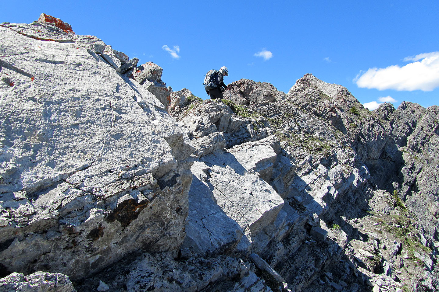
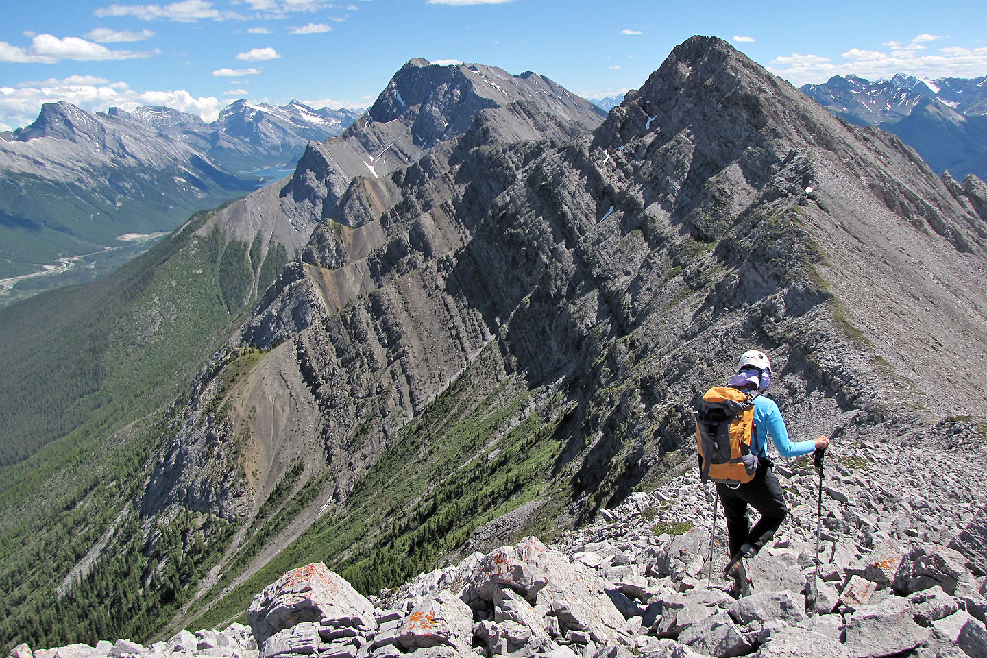
side and regained the ridge less than 200 m horizontally from the summit. When I came to a brief knife-edge, I
balked. An awkward move would get me by it, but the exposure on my right was extreme, and the drop on my left
was hardly better. Past that, there appeared to be more difficulties, although I couldn't be sure.
We retreated and dropped down. We searched for a way to traverse below the exposed ridge, but a route didn't
present itself in the steep, rugged slope, at least not without losing excessive elevation.
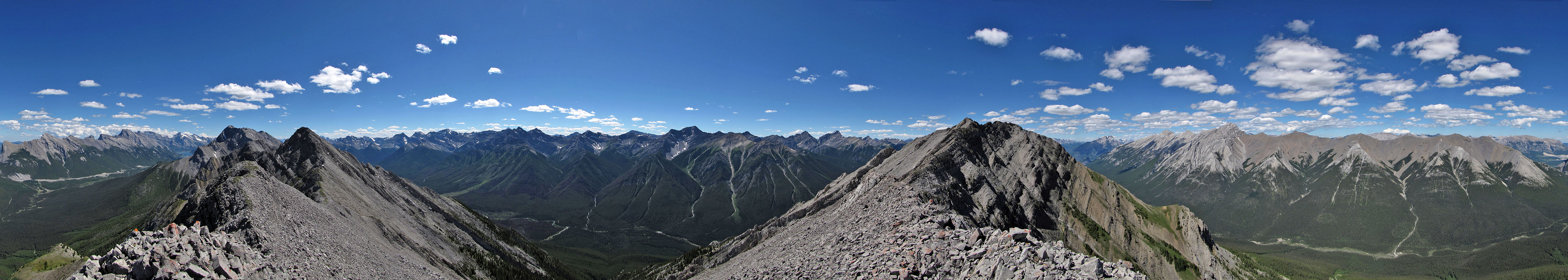
We gave up and followed the ridge back to the high point. En route to the North End, we had traversed below it, but now we climbed it. Although we didn't bag the North End of Goat Range, we were happy to reach this high point. The scenery was impressive. Mount Rundle looked striking from this angle and it was the first time we had set eyes on Sundance Range. The long climb through trees and up the gully was not without its rewards. More than anything else, I was struck by the vivid greenery of the area.
View of the north end of Goat Range from the Goat Creek Trailhead (mouse over for a close-up)
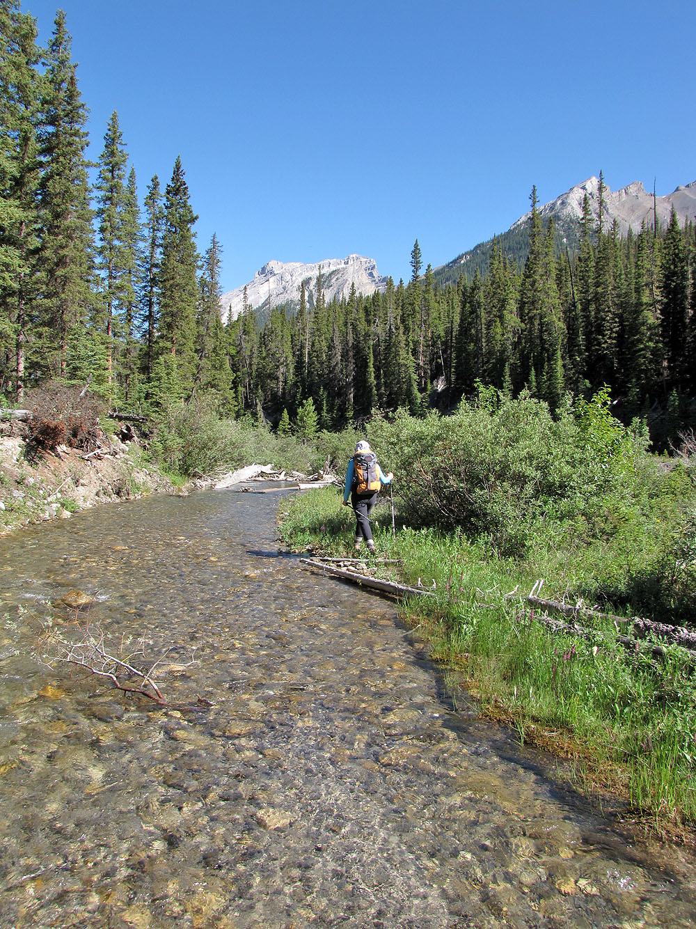
Goat Creek
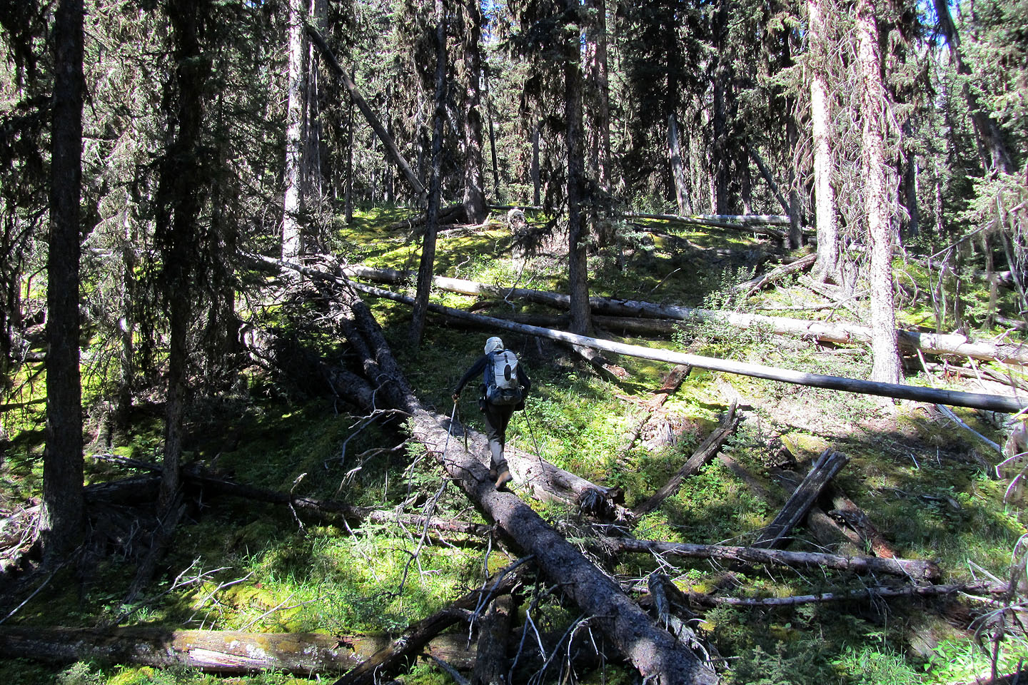
Negotiating deadfall
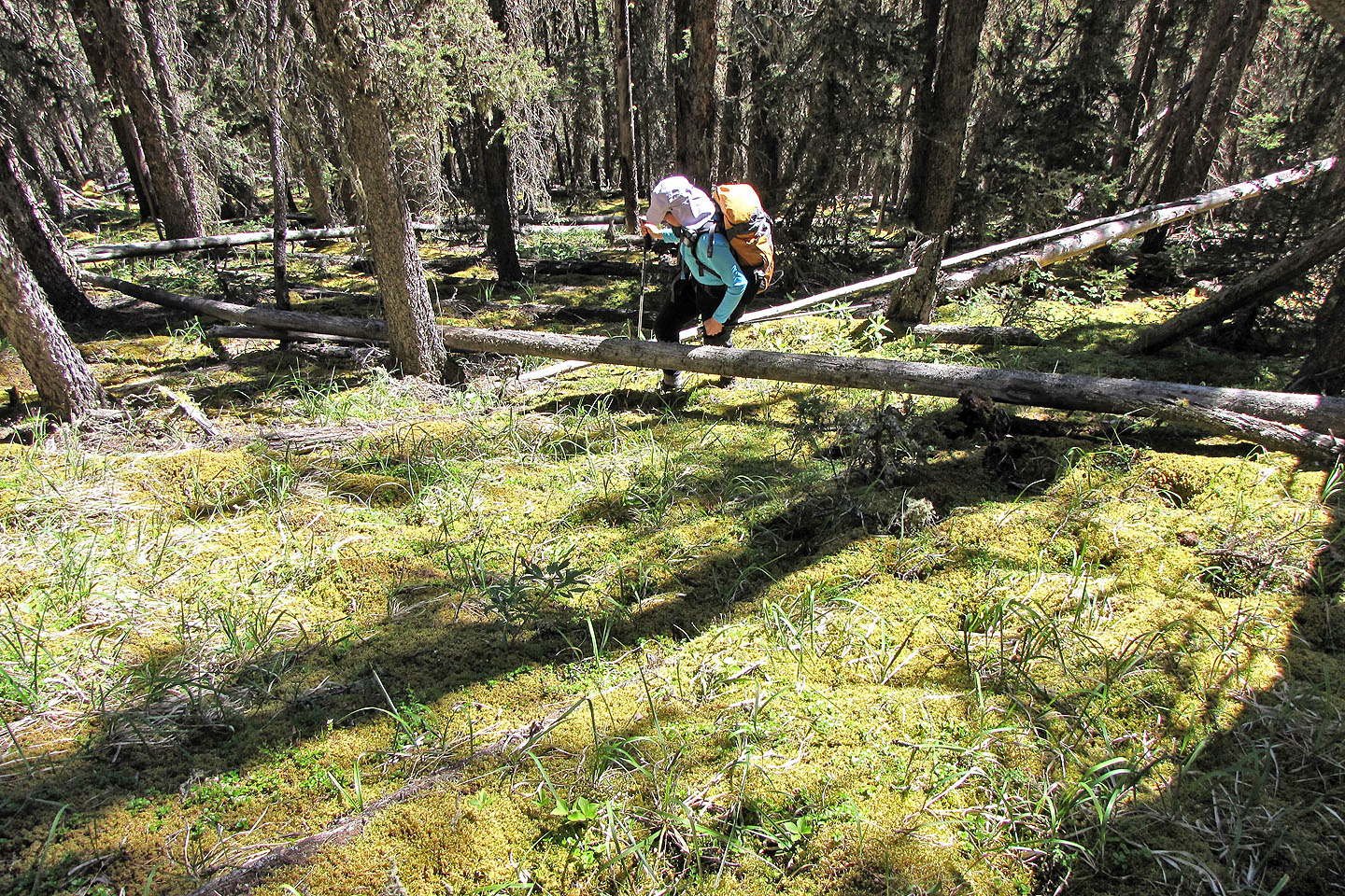
We enjoyed walking on the soft carpet of moss in the forest
Starting up a drainage
To our dismay, we faced bushwhacking up a mostly overgrown avalanche slope
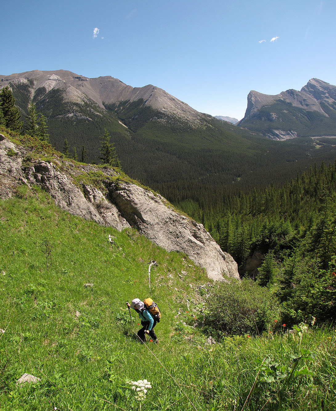
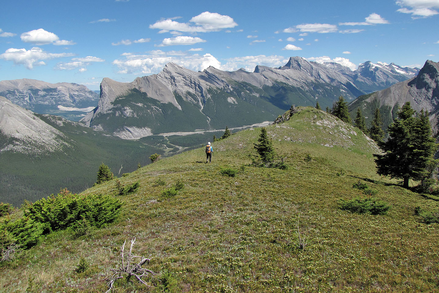
Looking back at the East End of Rundle and Ha Ling
We reach open ground, for the time being
Back in the bushes
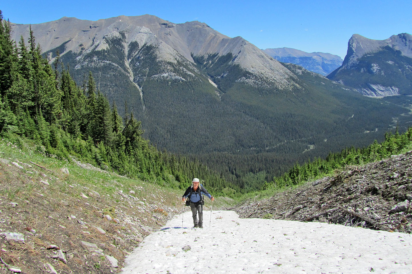
The snow-covered gully made travel easier
At the base of the cliffs we'll head right where there is a break
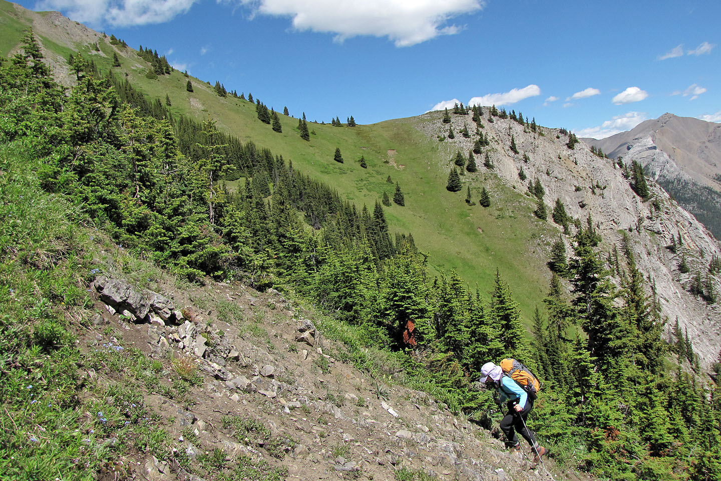
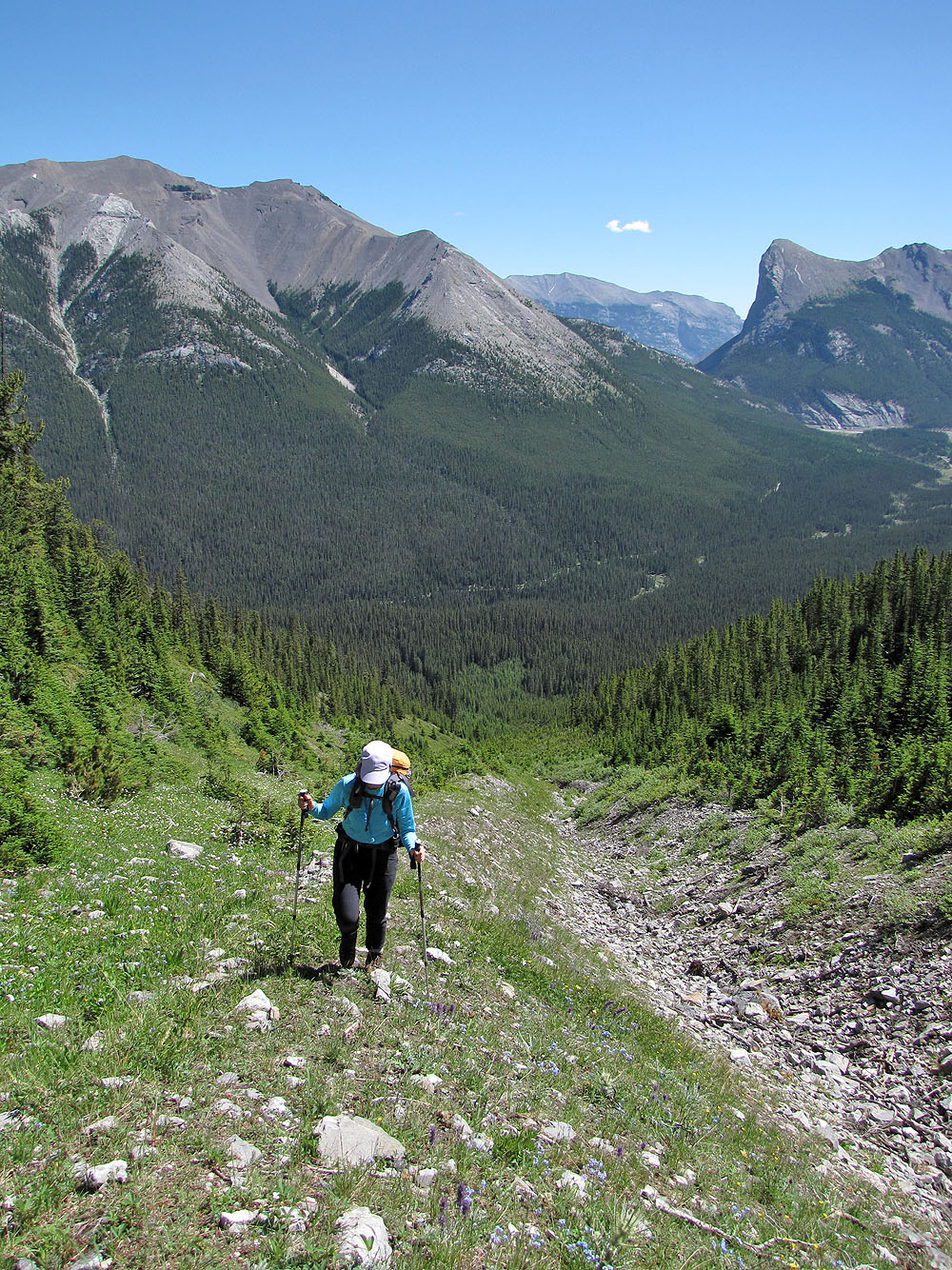
Steep grade throughout
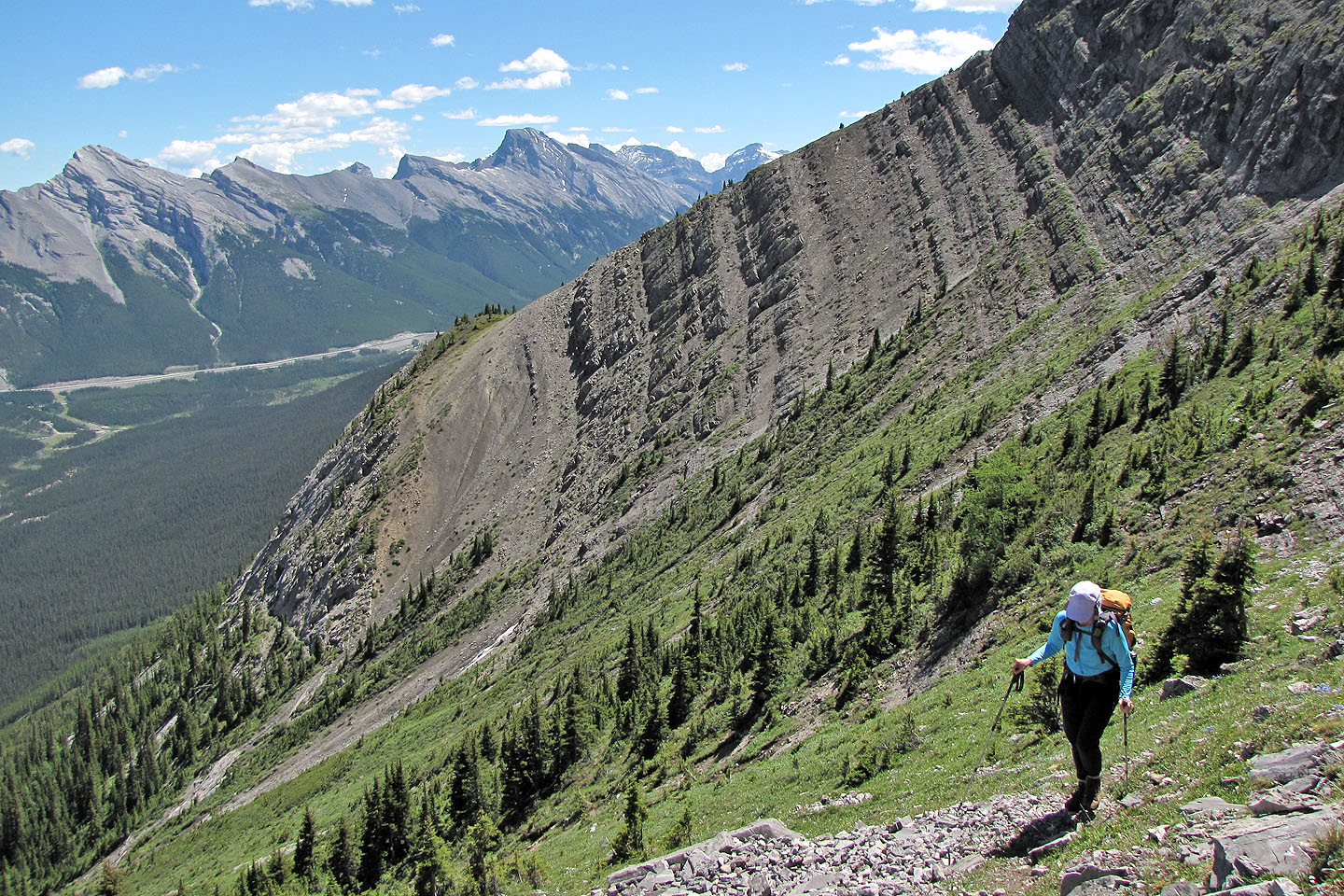
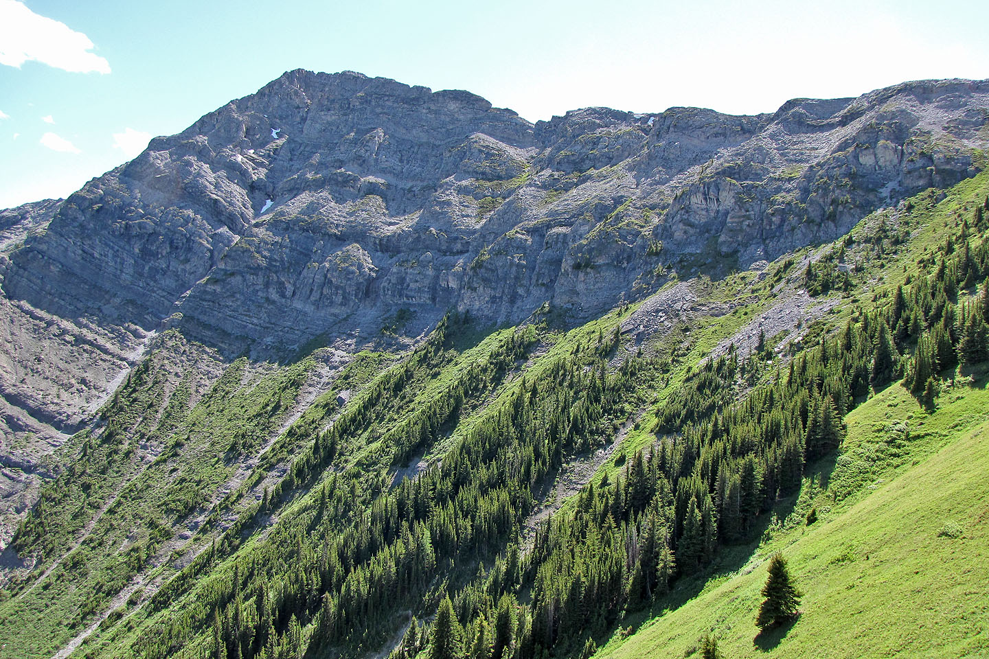
Traversing below the cliffs

On the ridge looking at the SE high point
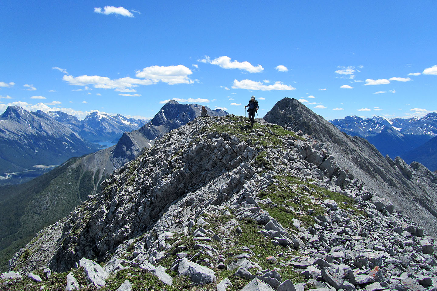
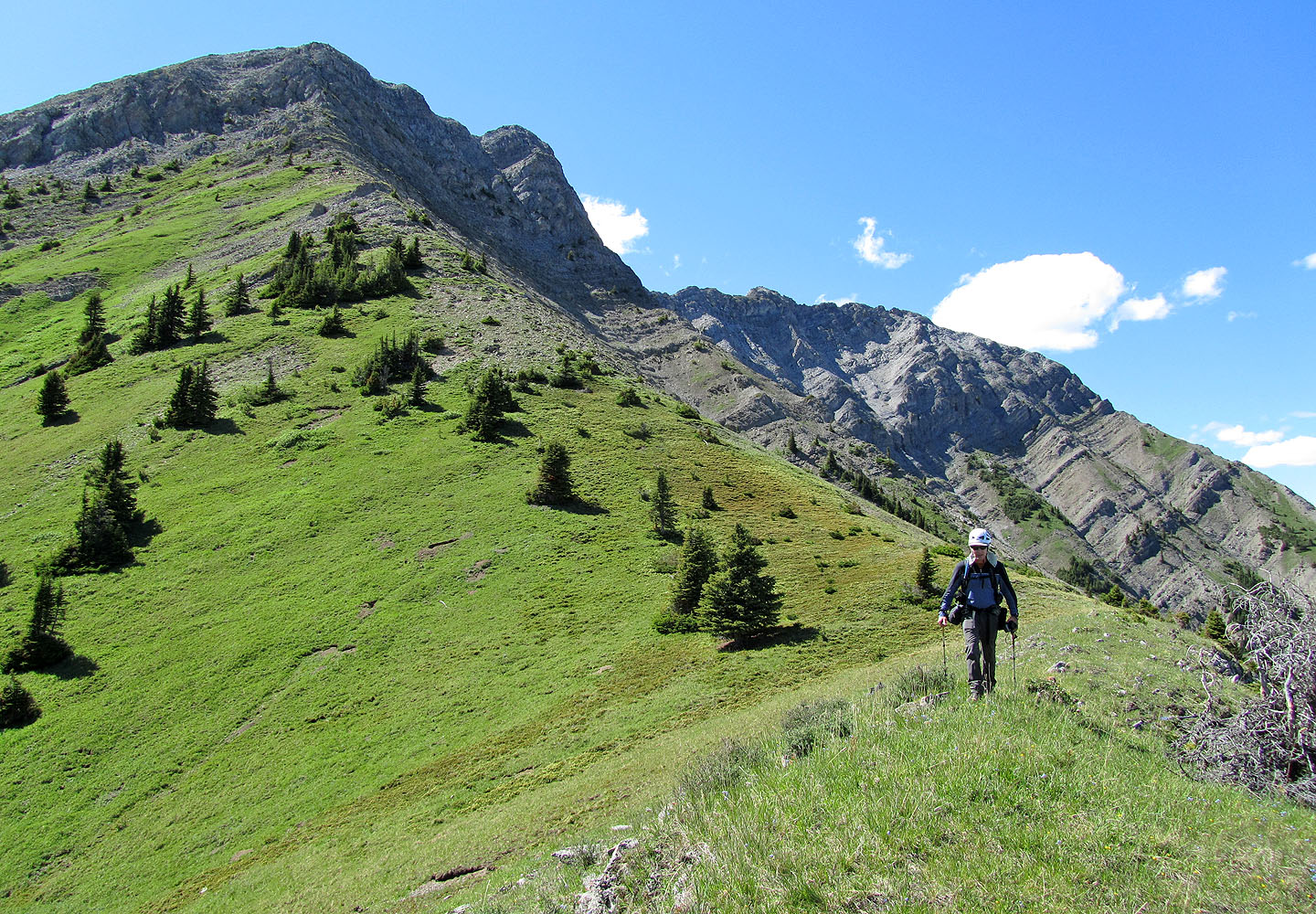
Following the ridge
North End (left), our high point (centre) and a cairned high point (right)
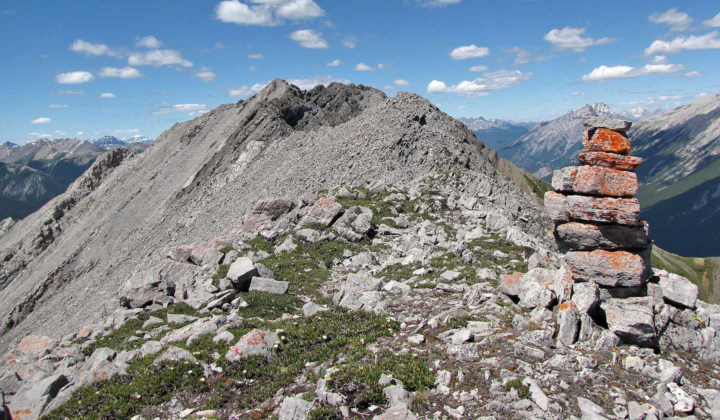
North End and the high point seen from the cairn
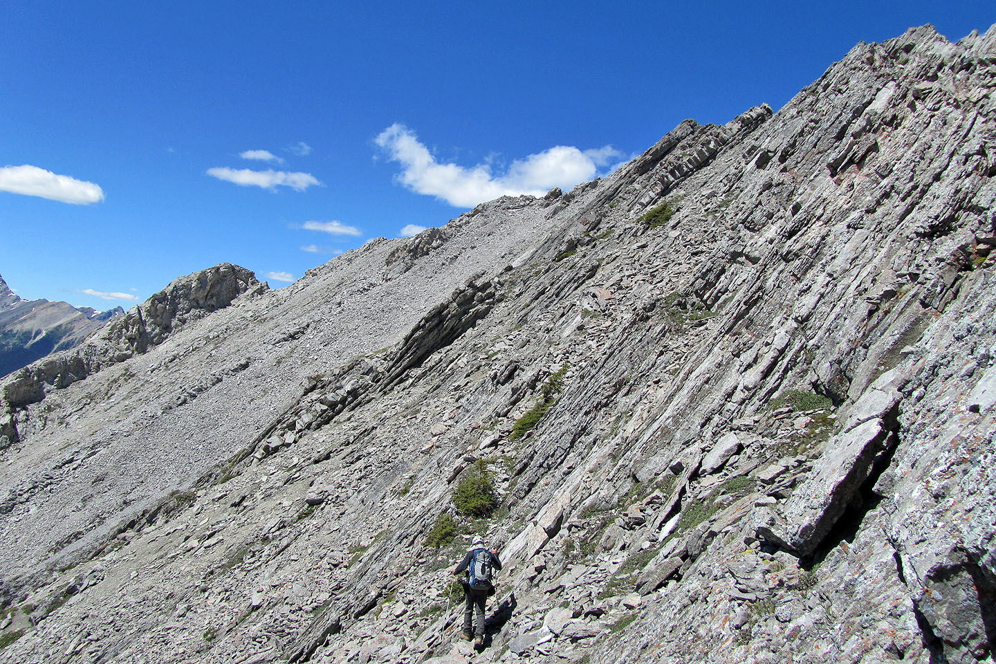
To reach the North End, we dropped down the steep, shattered west slopes
We regained the ridge only to turn back
View ahead from where I stopped
Coming down from our high point
Heading back
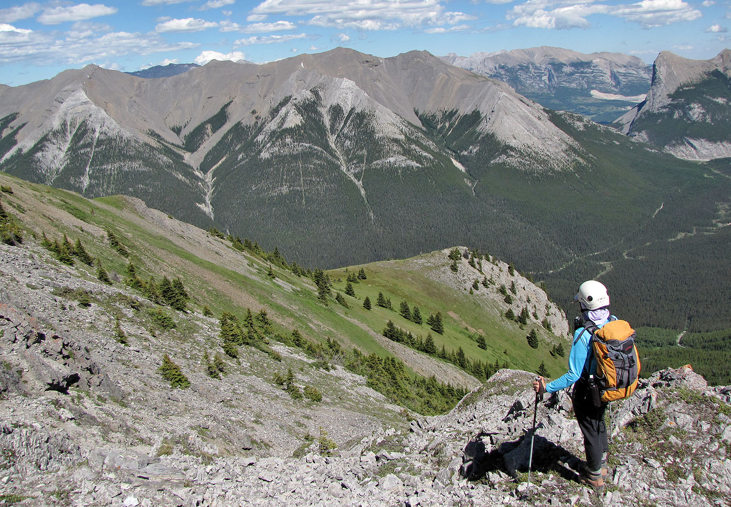
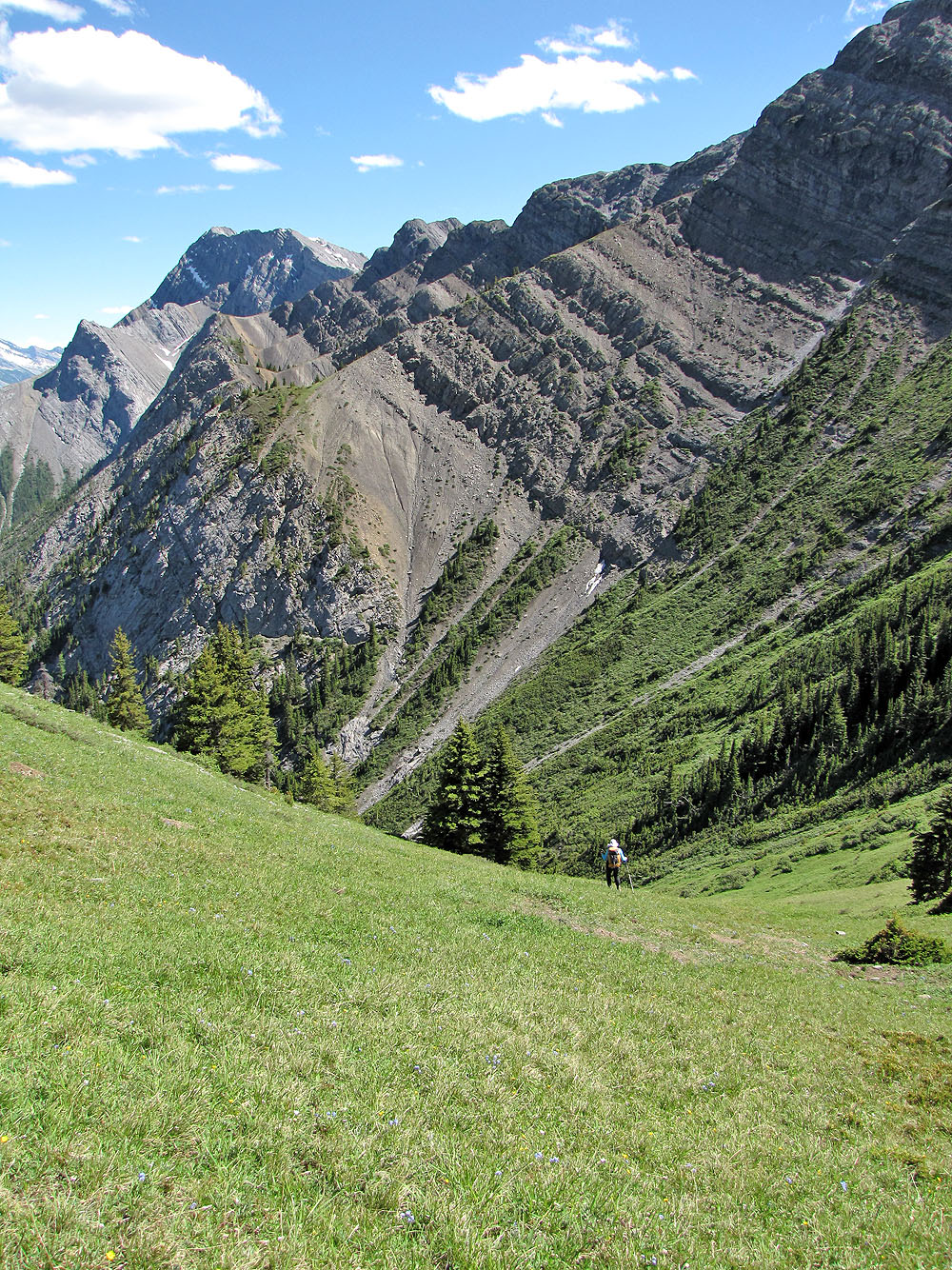
On our descent, we dropped down to the grassy shoulder below
We walk to the end of the shoulder. Mouse over for a close-up of Ha Ling and Lawrence Grassi.
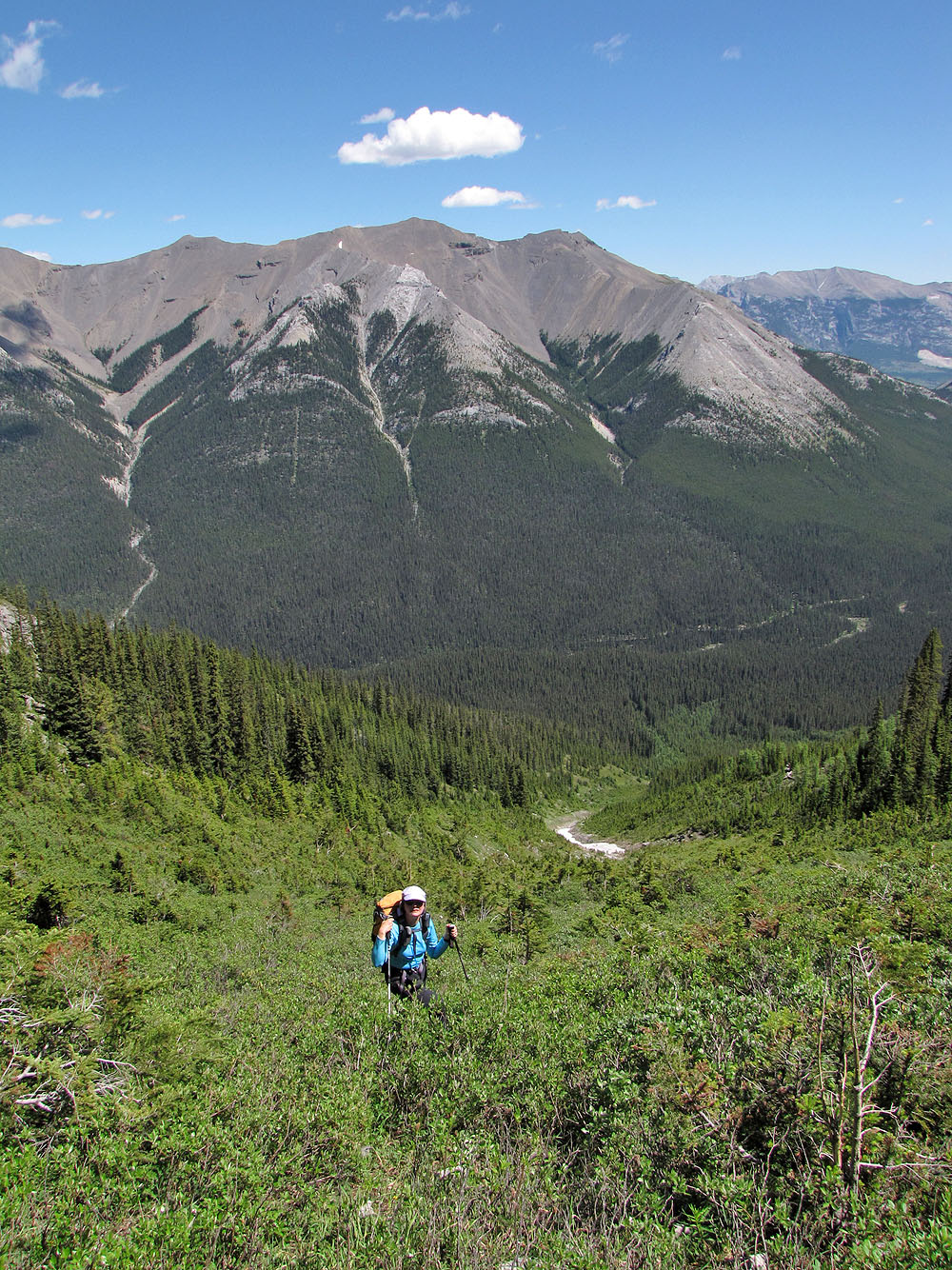
The slope was a gorgeous lush green. High point (centre) and North End (right).
Mount Rundle
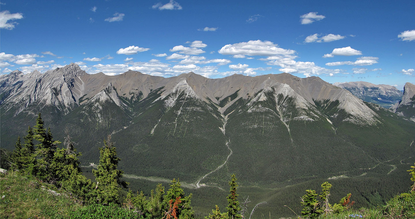
Avalanche gullies (we ascended the centre one)
Heading down
82 O/3 Canmore