bobspirko.ca | Home | Canada Trips | US Trips | Hiking | Snowshoeing | MAP | About

Indian Ridge
Jasper National Park, Alberta
August 19, 2005
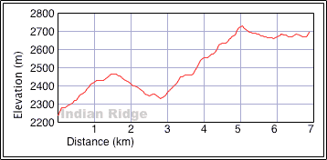
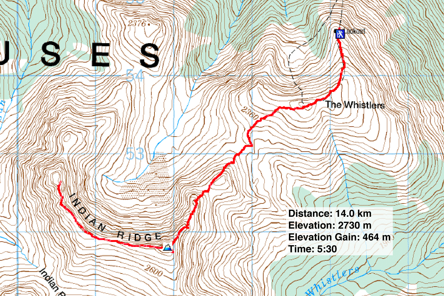
Distance: 14.0 km (8.7 mi)
Cumulative Elevation Gain: 845 m 2772 ft)
Two months earlier, our attempt on Indian Ridge offered more excitement than we wished for: Dinah injured her knee, and I was zapped by mini-lightning bolts. But this time around, Dinah and I had no difficulties in bagging this peak.
Like our last trip, we preferred ascending the first 1000 m using the tram rather than hiking up the trail. This time, however, our packs appeared to attract the attention of tourists who amused us with their questions. The moment I stepped off the tram, a woman in her 70s approached me and asked if I was going to hike down the trail. As if!
A moment later, another woman, this one middle-aged and waiting for her husband, accosted us and asked, "I saw two people walking fast up the trail. Is it safe to go that fast?" The woman admitted she turned back because she thought it might be too slippery. Apparently too, the effort tired her, and she wondered if with practice or training she would get better.
Now you must realize that the trail to Whistlers summit is 2 m wide, 1.5 km long and well worn with only a mild grade. We reached Whistlers summit in 20 minutes. We were glad to leave the tourists behind and continue in solitude. Much of the travel to the Indian Ridge summit is on a trail, and we reached the summit without incident.
Unfortunately a haze obscured the distant mountains, but we had no trouble making out Mount Edith Cavell and Mount Robson rising above lesser peaks. After a short stay on the top, we continued along the ridge to the west end. The first part was an easy hike, but the difficulties increased as we approached the west end.
Along the way, we ran into a couple coming toward us who had decided, at the toss of a pointed rock, to traverse Indian Ridge in reverse. We asked them about the crux at the west end. They found the climb difficult and said they wouldn't want to downclimb it.
Dinah stopped just short of the high point at the west end while I continued on to scope out the downclimb. The west side, where the couple climbed up and where Alan Kane suggests climbing down, was quite steep and covered with loose rock. It looked too dangerous to descend. The east side didn't look good either: it was steep, rugged and under snow, so we turned back.
It took only half an hour to return to Indian's summit. Continuing down, Dinah and I made our way back to the tram station where again we were forced to mingle with the crowds. Just before we reached the tram station, we were stopped by a middle-aged, overweight couple sitting on a rock. They had managed to walk about 250 m from the station before being forced to rest. The man wondered if it was worthwhile going all the way to Whistlers summit. "Is the view on the top the same? It's the same as what you see here, right?"
A little farther down the trail, a youth with a different outlook asked if we had seen what was on the other side of Whistler's summit. I said we did.
"Cool!" he said, and he started sprinting up the trail.
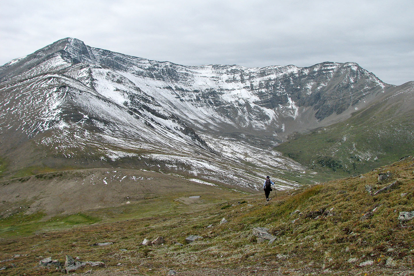
Indian Ridge after climbing over Whistlers summit
Looking back at Whistlers summit
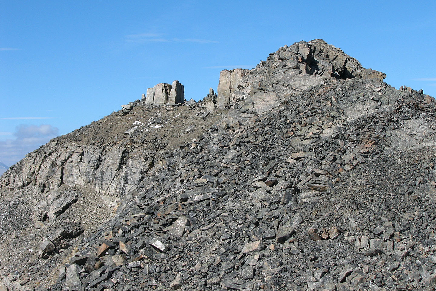
A couple more bumps before we reach the summit
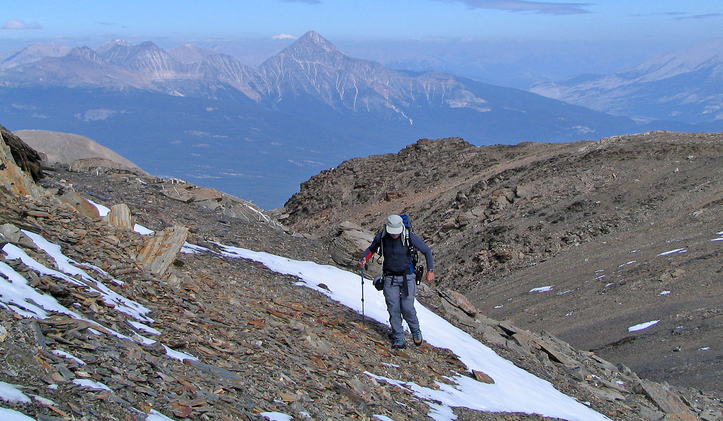
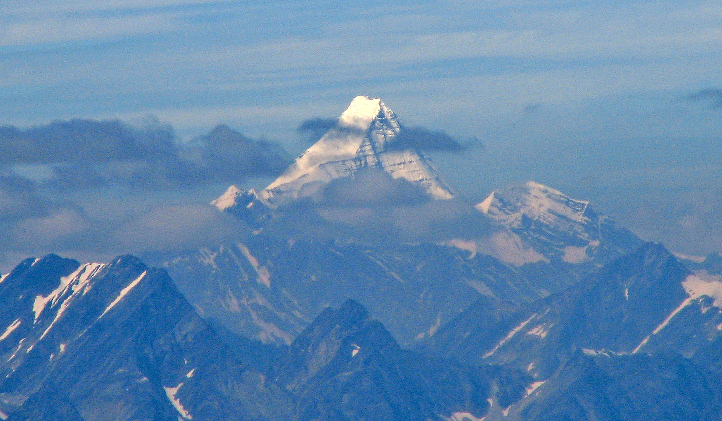
Pyramid Mountain in the background (mouse over for a close-up). I assume the haze is
from B.C. forest fires.
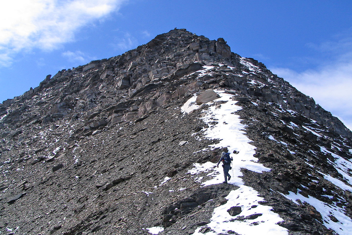
Coming up to the summit
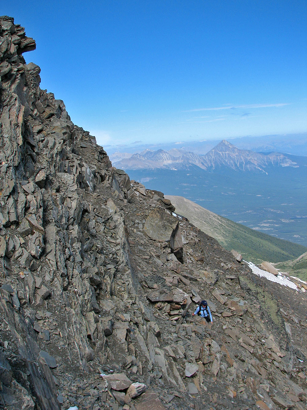
Just below the summit
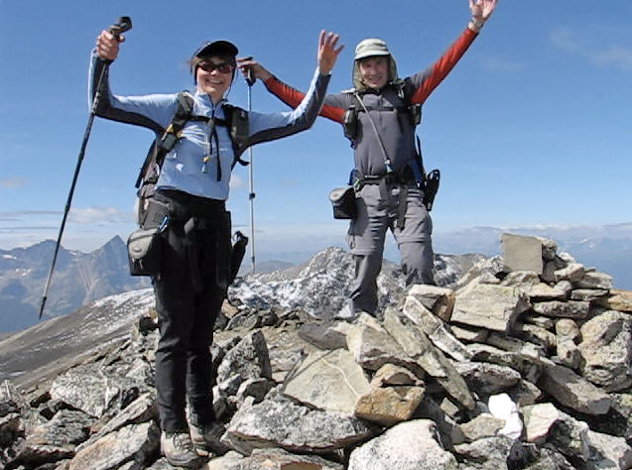
On the summit
Mount Robson, 3954 m
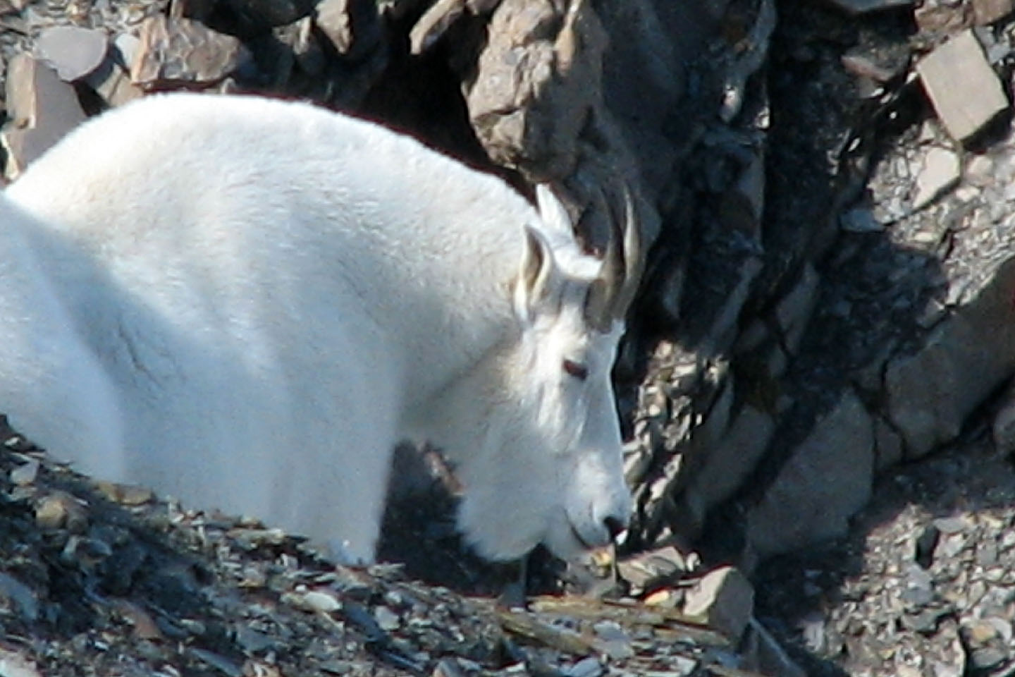
This mountain goat quickly climbed down from the ridge when we startled it
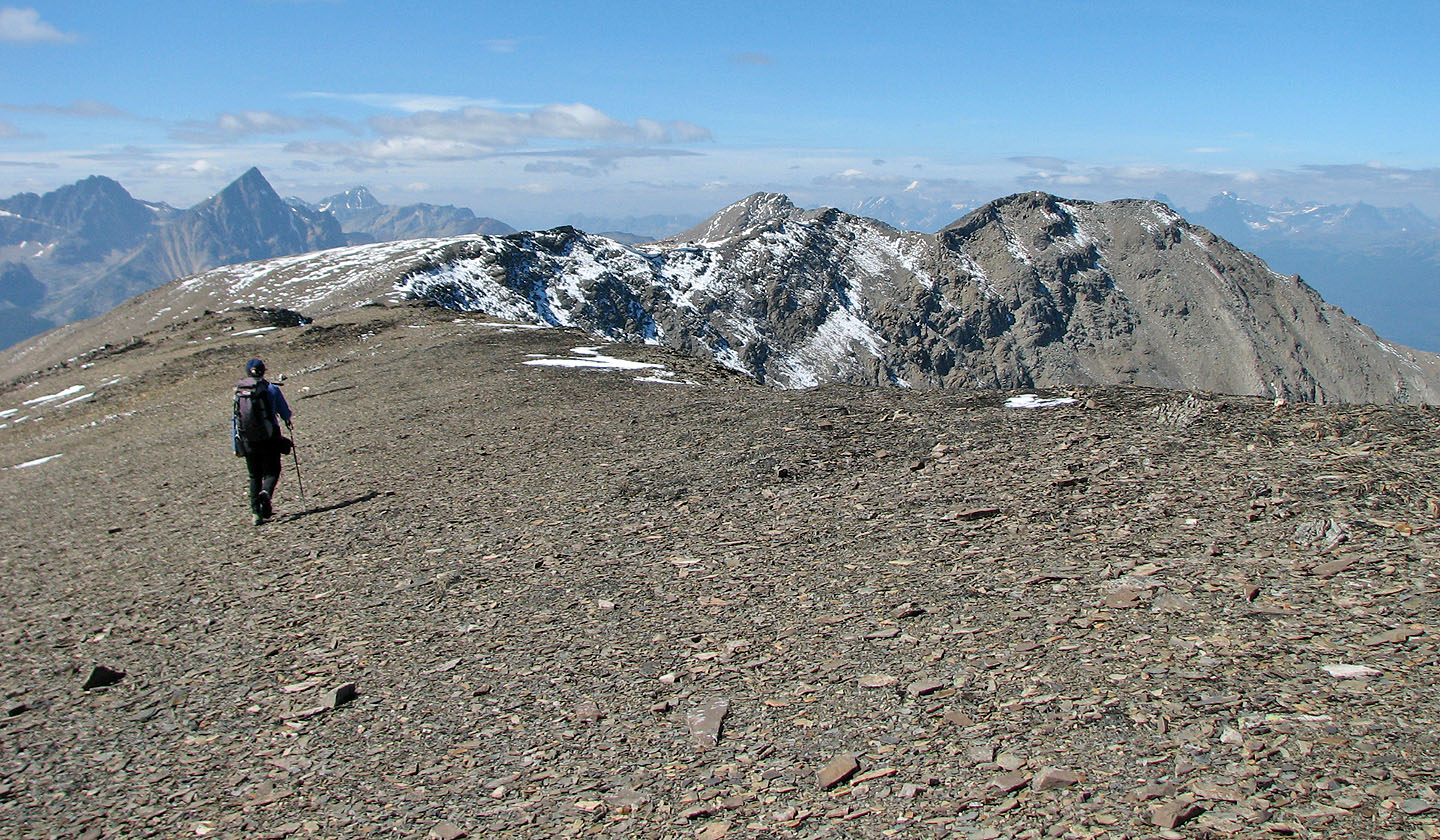
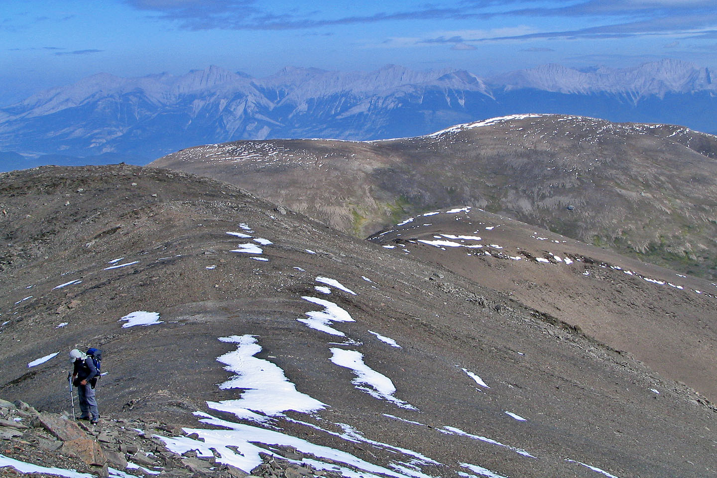
We set out for the west end of the ridge
 There's a few ups and downs along the way
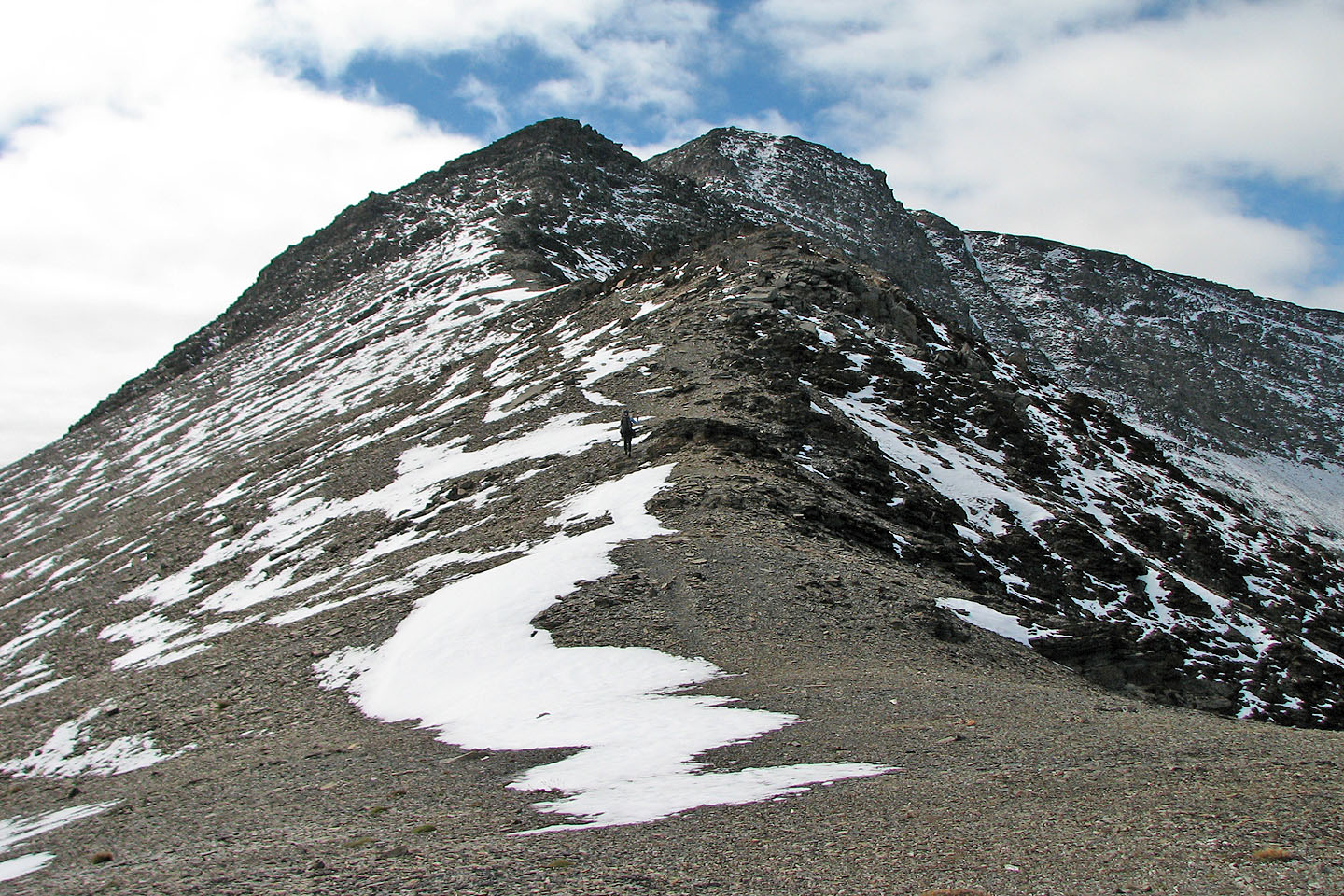
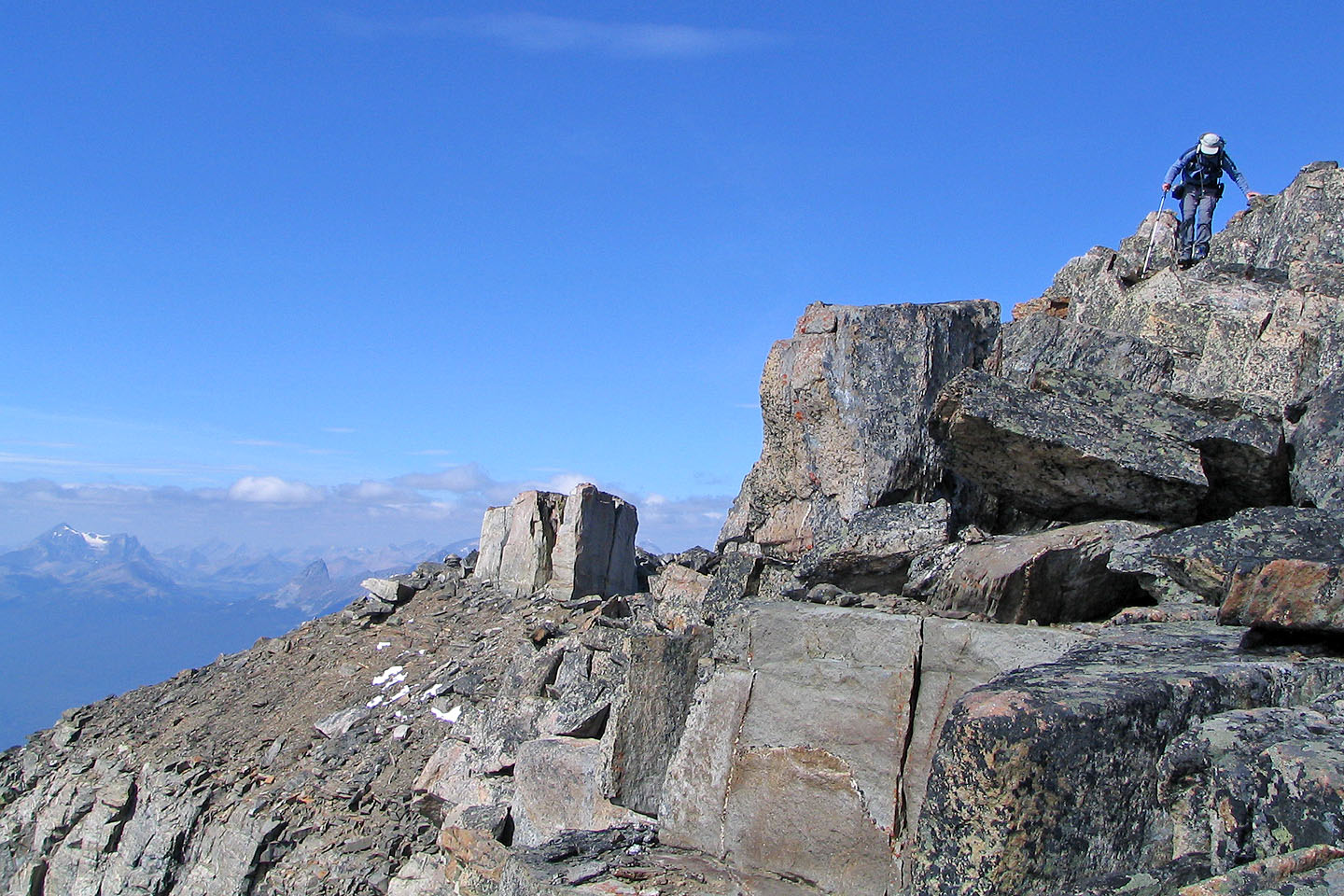
Coming up to the notch
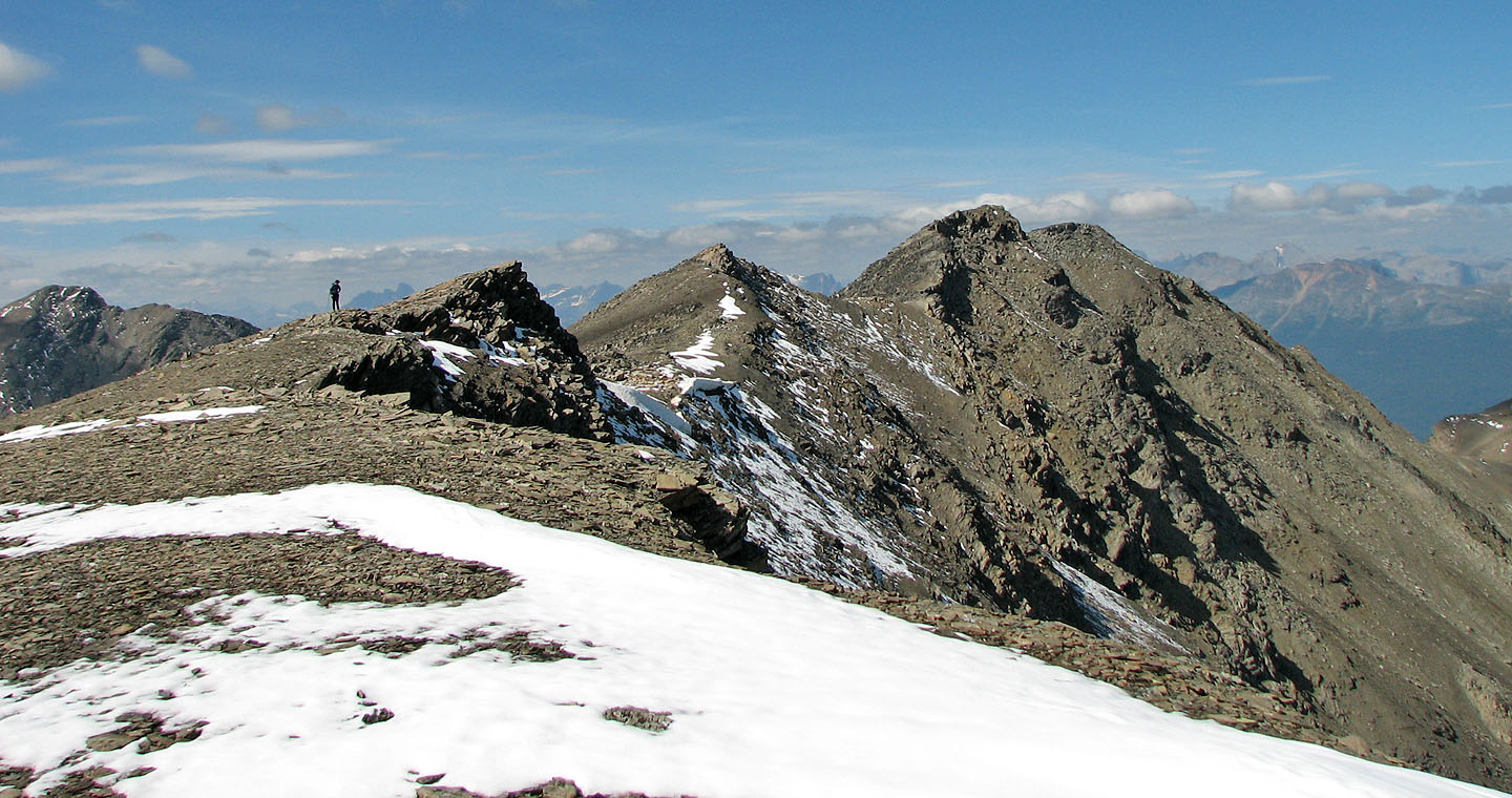
 We turned back at the notch on the west end
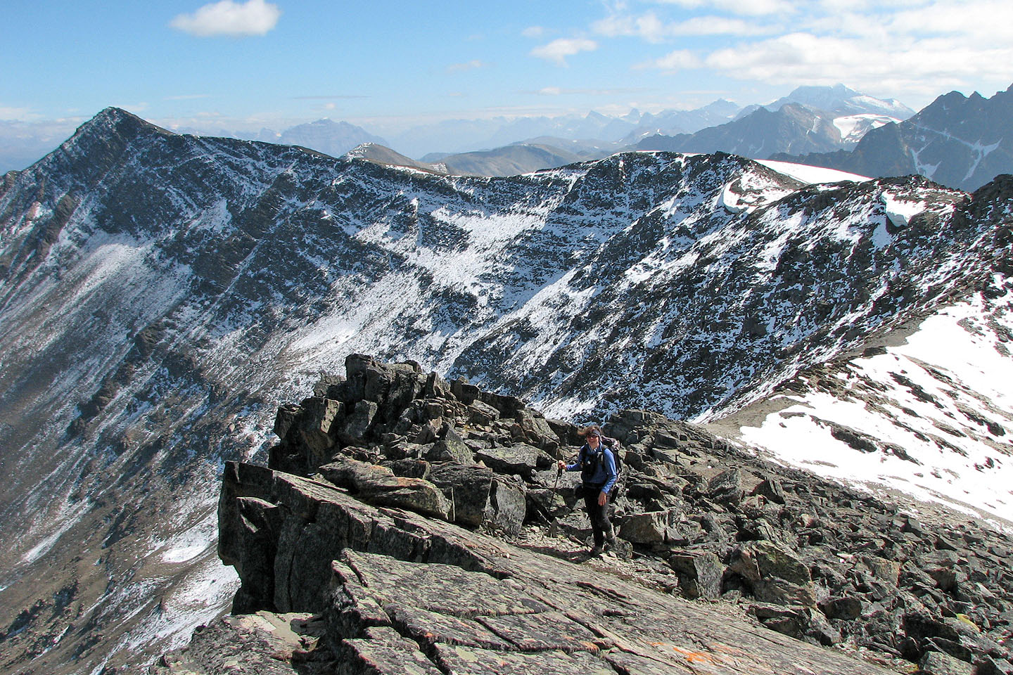
Looking back at the ridge leading to Indian summit
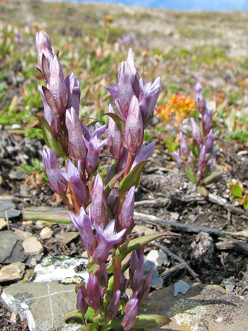
Genetian flowers
83 D/16 Jasper