bobspirko.ca | Home | Canada Trips | US Trips | Hiking | Snowshoeing | MAP | About
Pig’s Back
Kananaskis, Alberta
August 6, 2017
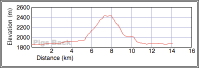
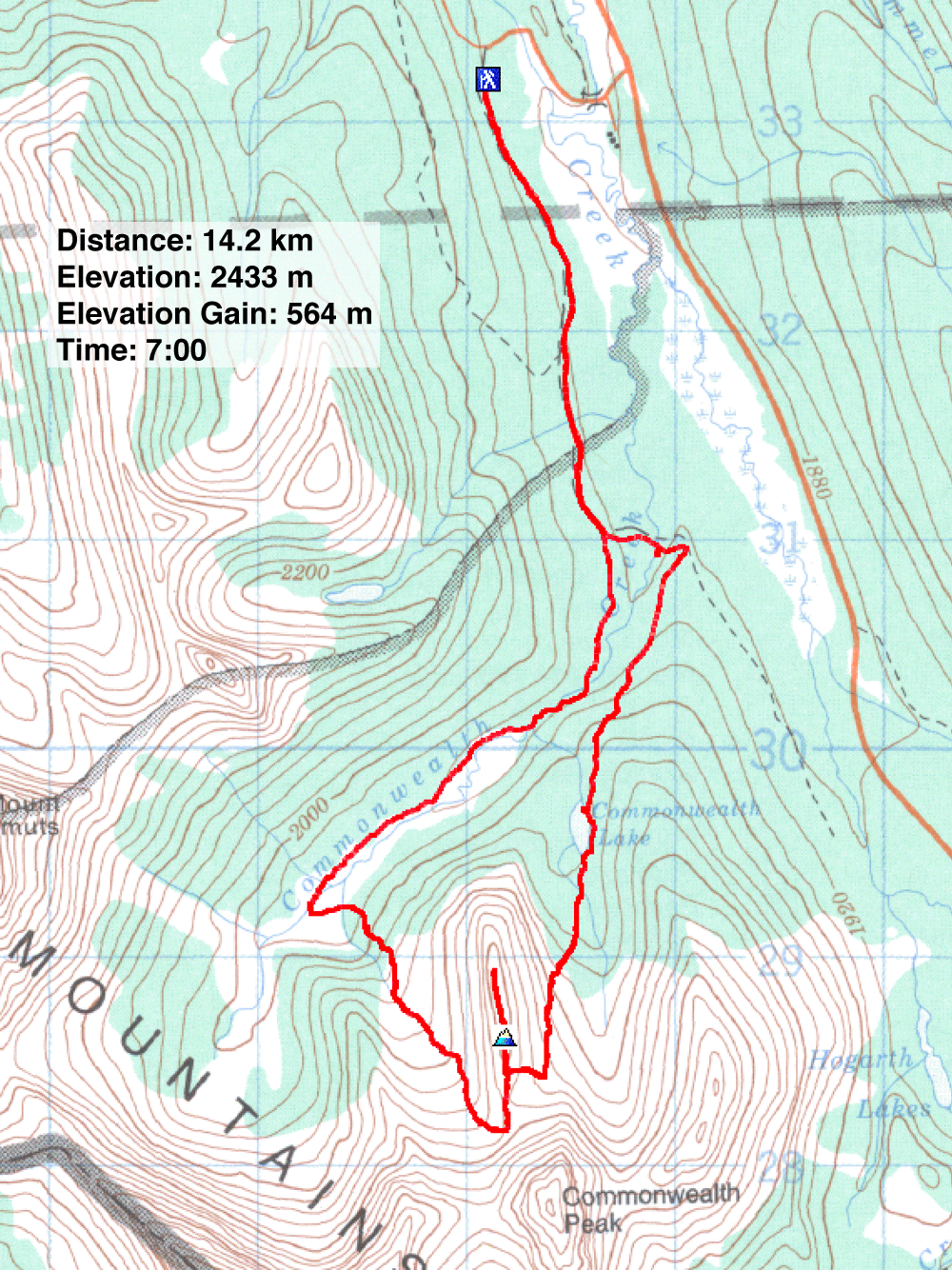
Distance: 14.2 km (8.8 mi)
Cumulative Elevation Gain: 588 m (1929 ft)
Although low in stature, Pig’s Back has a fewf things going for it. First, the summit ridge extends into the Commonwealth Creek Valley to offer surprisingly good views. Even haze from a forest fire didn’t keep us from enjoying the sights at the top. And second, Pig’s Back can be hiked in a loop.
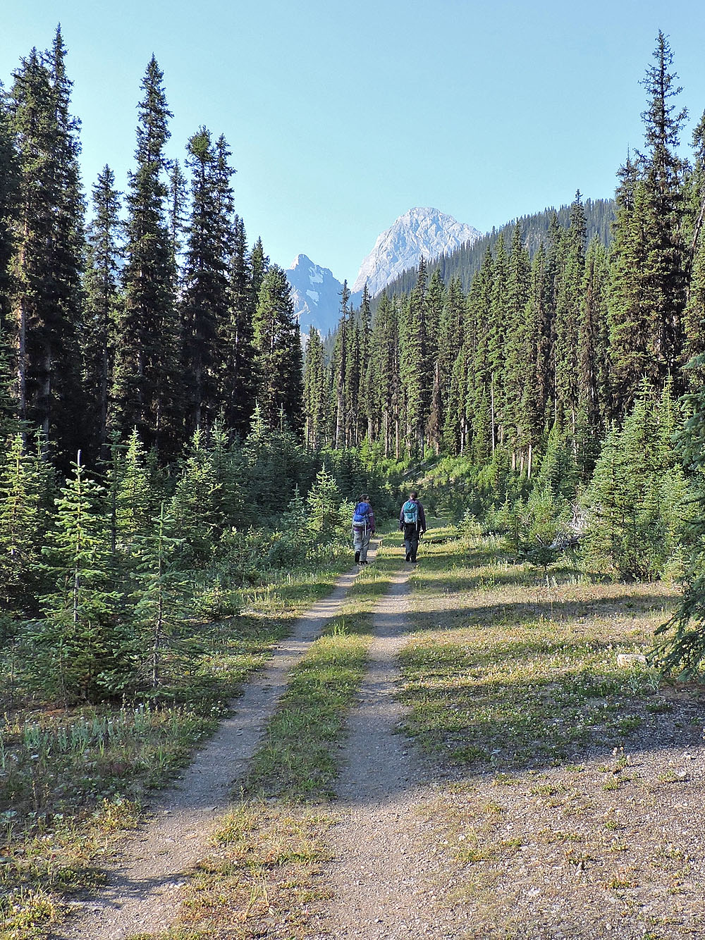
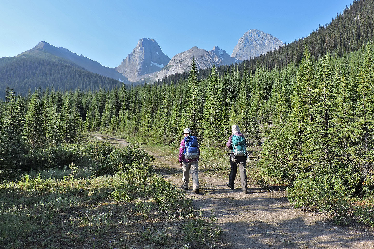
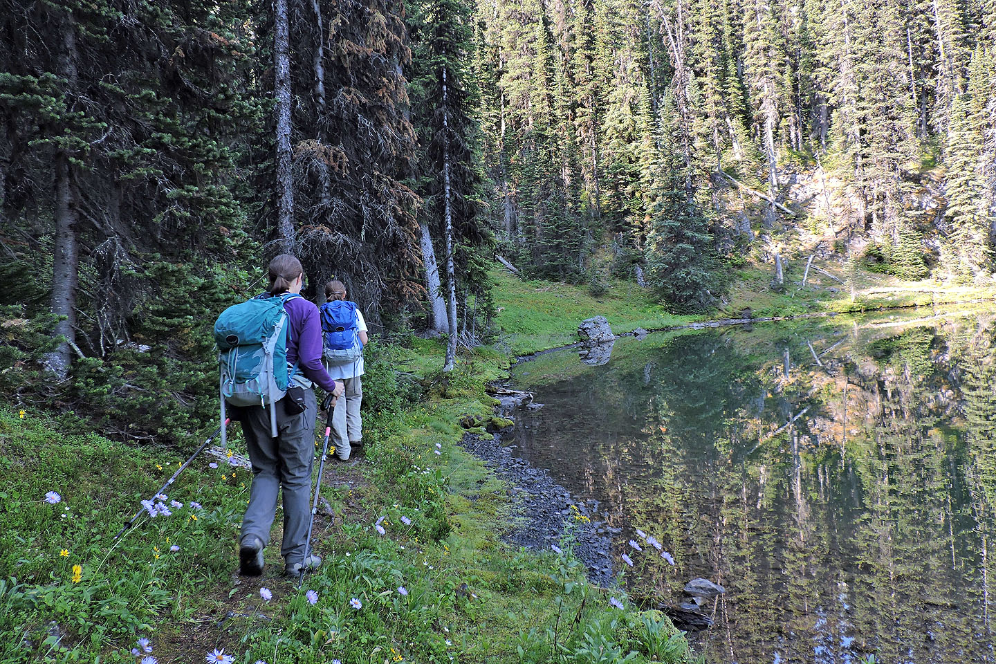
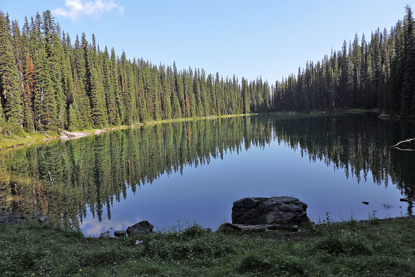
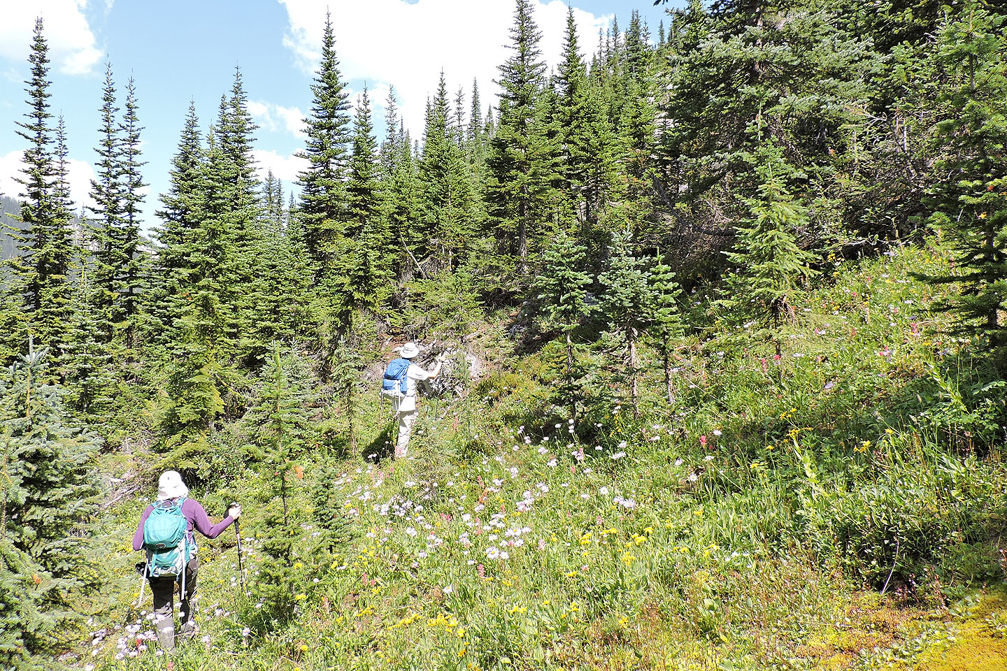
Following the usual route, Zora, Dinah and I hiked up the logging road to a Y intersection. We went left but would later return here on the main trail running alongside Commonwealth Creek. After crossing the creek, we followed the trail to a cutblock and turned right onto another trail. Being in trees, there was little to see until we came to Commonwealth Lake. And what a sight that was! Lacking even the slightest ripple, the entire surface acted as a huge mirror, so perfect that when seen from a distance, Dinah and I became disoriented. We thought we were gazing down into a valley before realizing it was a flawless reflection on the lake.
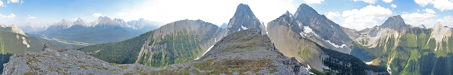
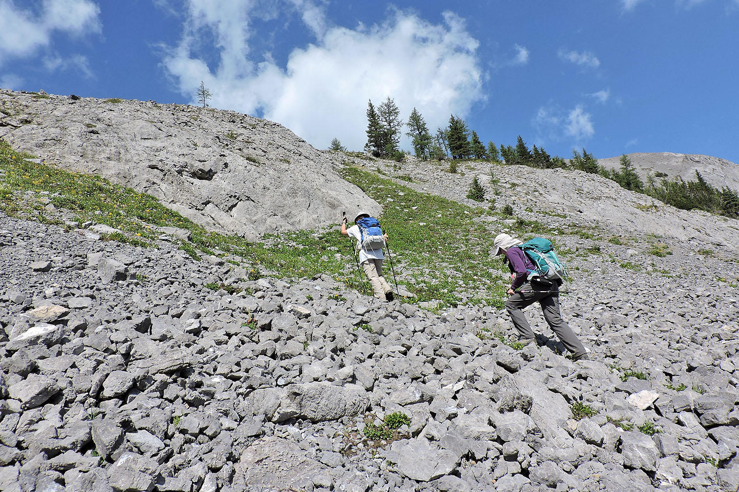
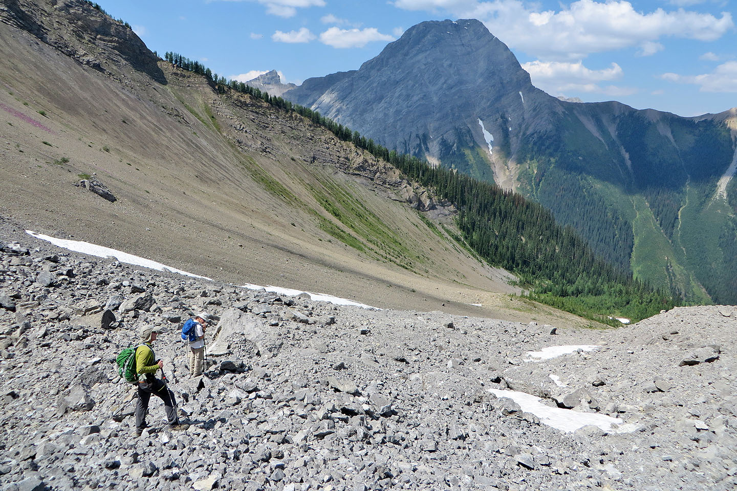
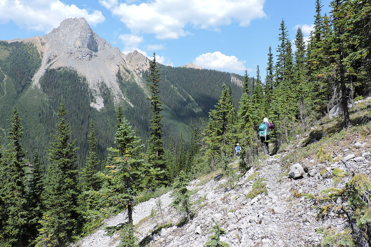
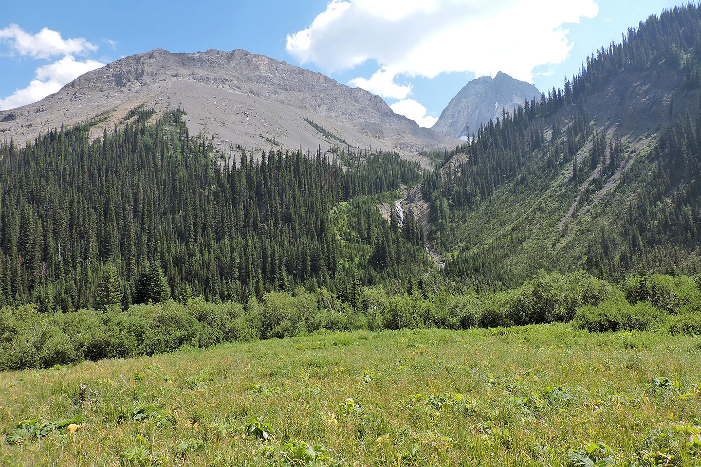
We continued past the lake, still in trees until the trail disappeared at the edge of a scree slope below the majestic east cliffs of Pig’s Back. Following the scree below the cliffs was the least favourite part of our trip. The side-sloping dragged on, and we were glad to reach the col that connects Commonwealth Peak to Pig’s Back. From the col, it’s a short hike to the summit. But there’s no point in stopping there. Most of the ridge is broad, flat and inviting. We ventured to the far end where I took a panorama.
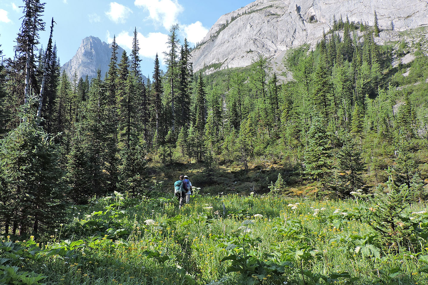
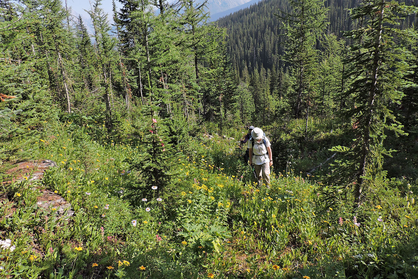
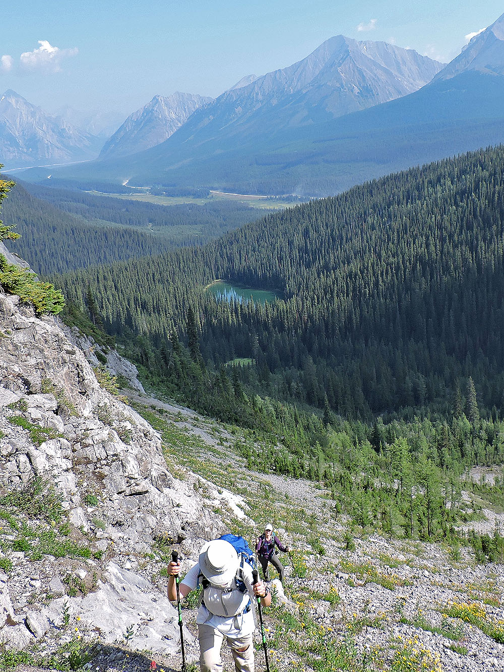
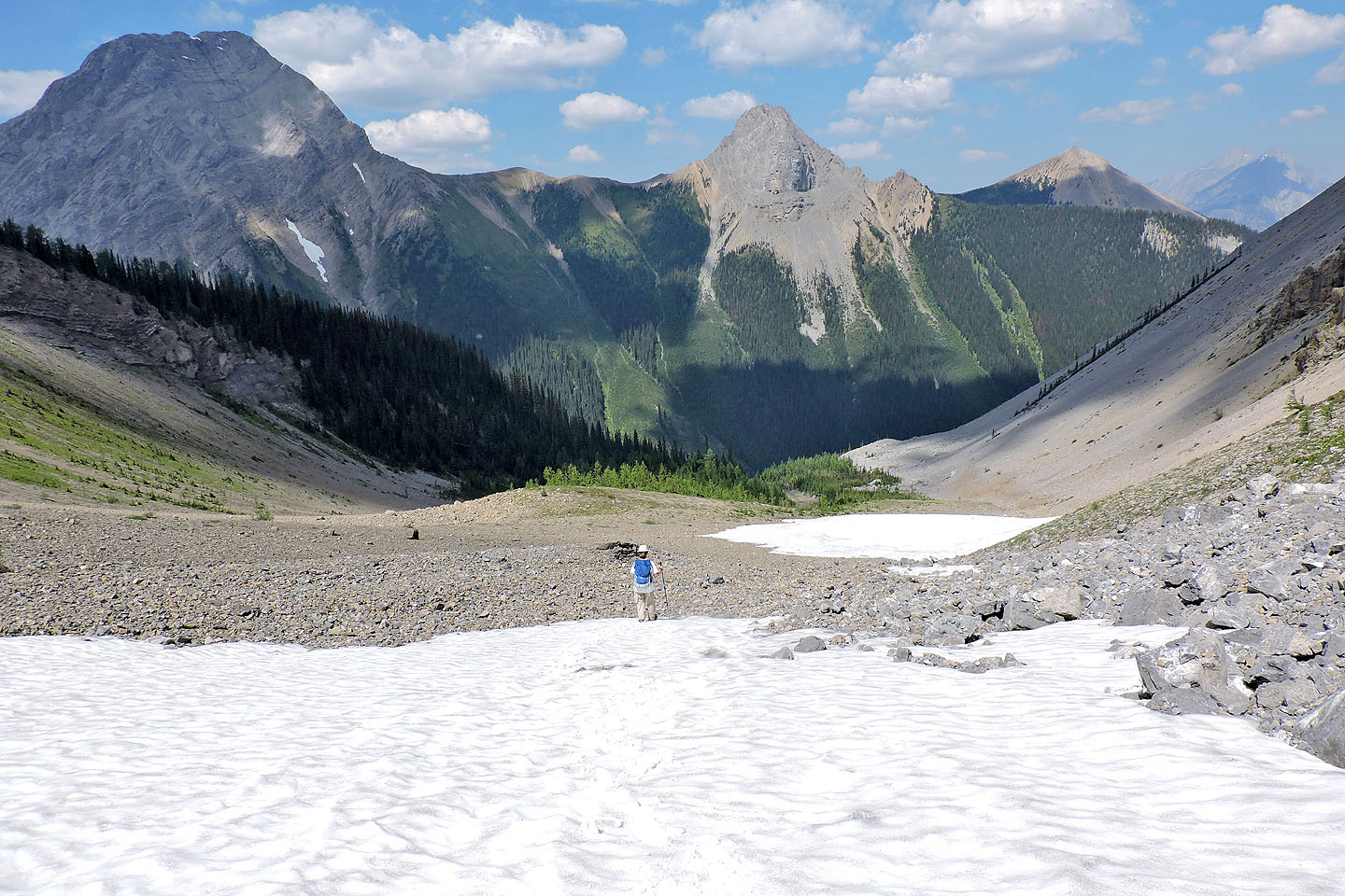
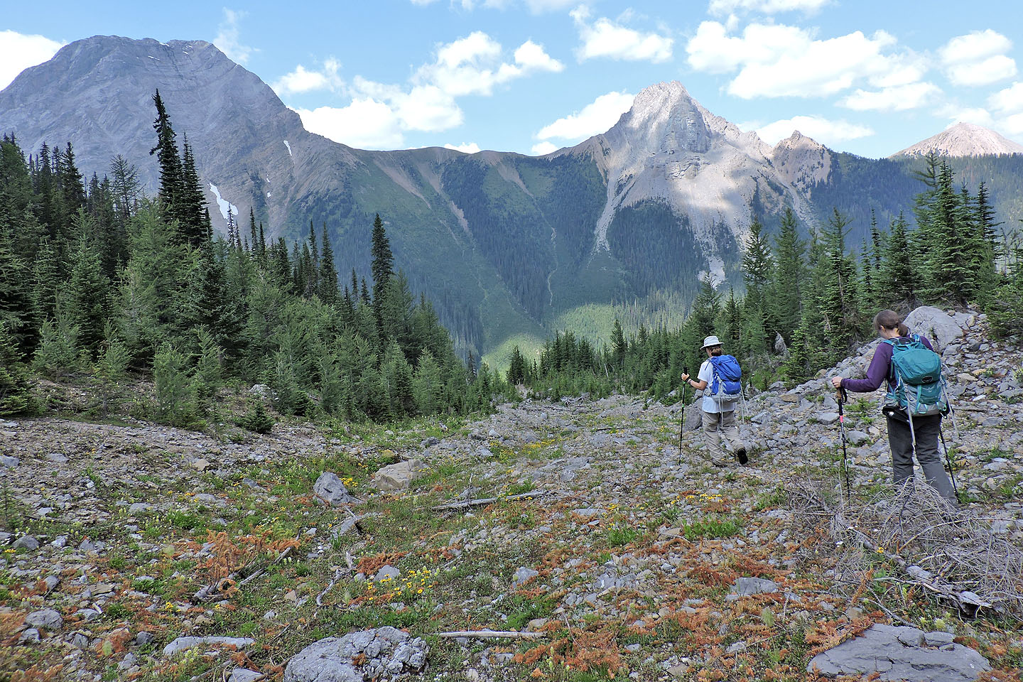
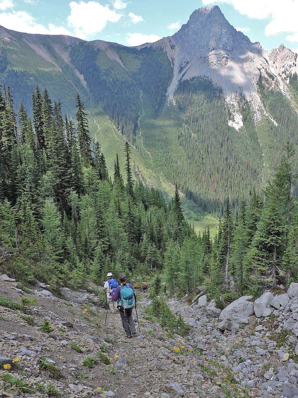
After lunch, we returned to the col and dropped down the west side to a basin. At the end of the basin, we started down a trail alongside a dry creek. When we reached a gushing side stream, we knew from the instructions in Kananaskis Country Trail Guide to traverse right and look for a trail in scree. However, the broad drainage was covered in trees and bushes. Not wanting to miss the trail by ending up below it, we angled up a bit. When we reached a scree bank on the other side, we descended and hit the trail at a 90° angle. After traversing for a time, the trail suddenly leaves the scree and drops down. That’s where the trail became interesting. Steep, bushy and sometimes vanishing completely, it’s a wonder we stayed on track. But we quickly followed it to the bottom. Strangely, we found flagging there, the least helpful place for it.
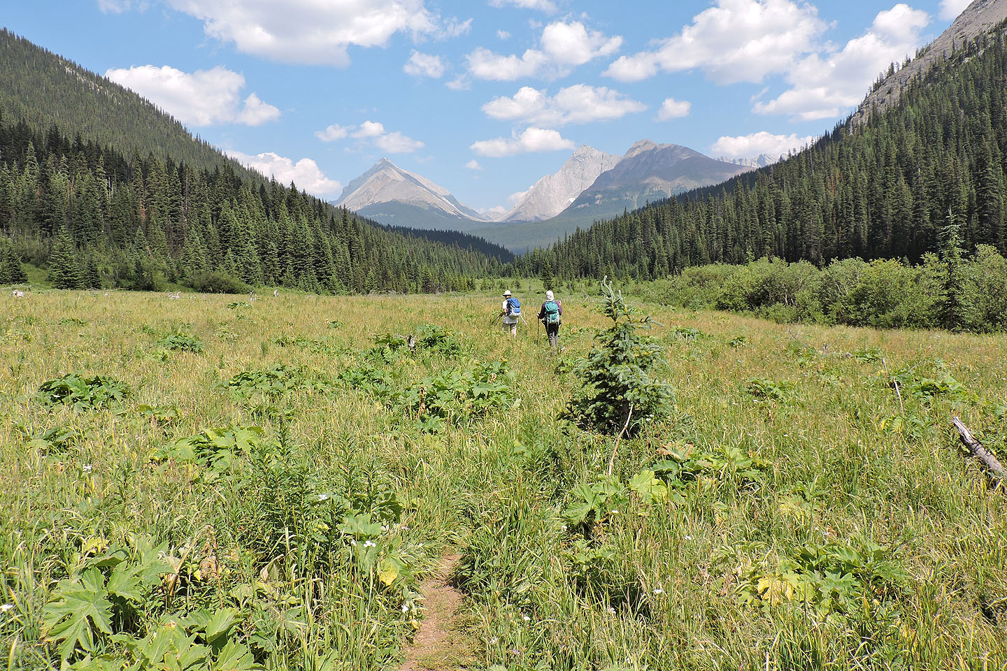
We appeared at the edge of a valley that was expansive, bushy and utterly flat. Running down the valley is Commonwealth Creek. The creek was lined with dense willows, but we headed west to a thin spot. Bushwhacking was gnarly but brief, and we stepped across two rivulets without getting our feet wet. We made our way to the main trail at the foot of an avalanche slope.
We followed the trail back to the logging road. Our pace slowed as we stopped long and often to pick tiny but prolific strawberries lining the road. It was a sweet finish after climbing a ridge with an odd name, Pig’s Back.
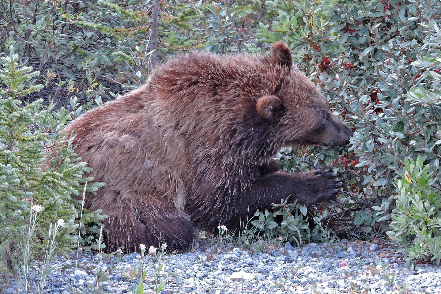
A juvenile grizzly gorges on roadside berries
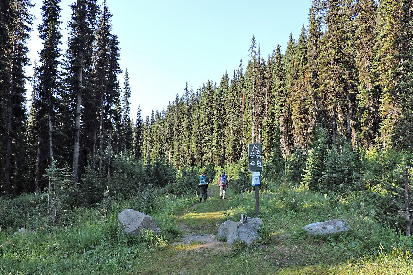
The trailhead just off of Mt. Shark Road
Walking up the road
Left to right are Commonwealth Ridge, Commonwealth Peak, Pig's Back, Pig's Tail and Mount Birdwood
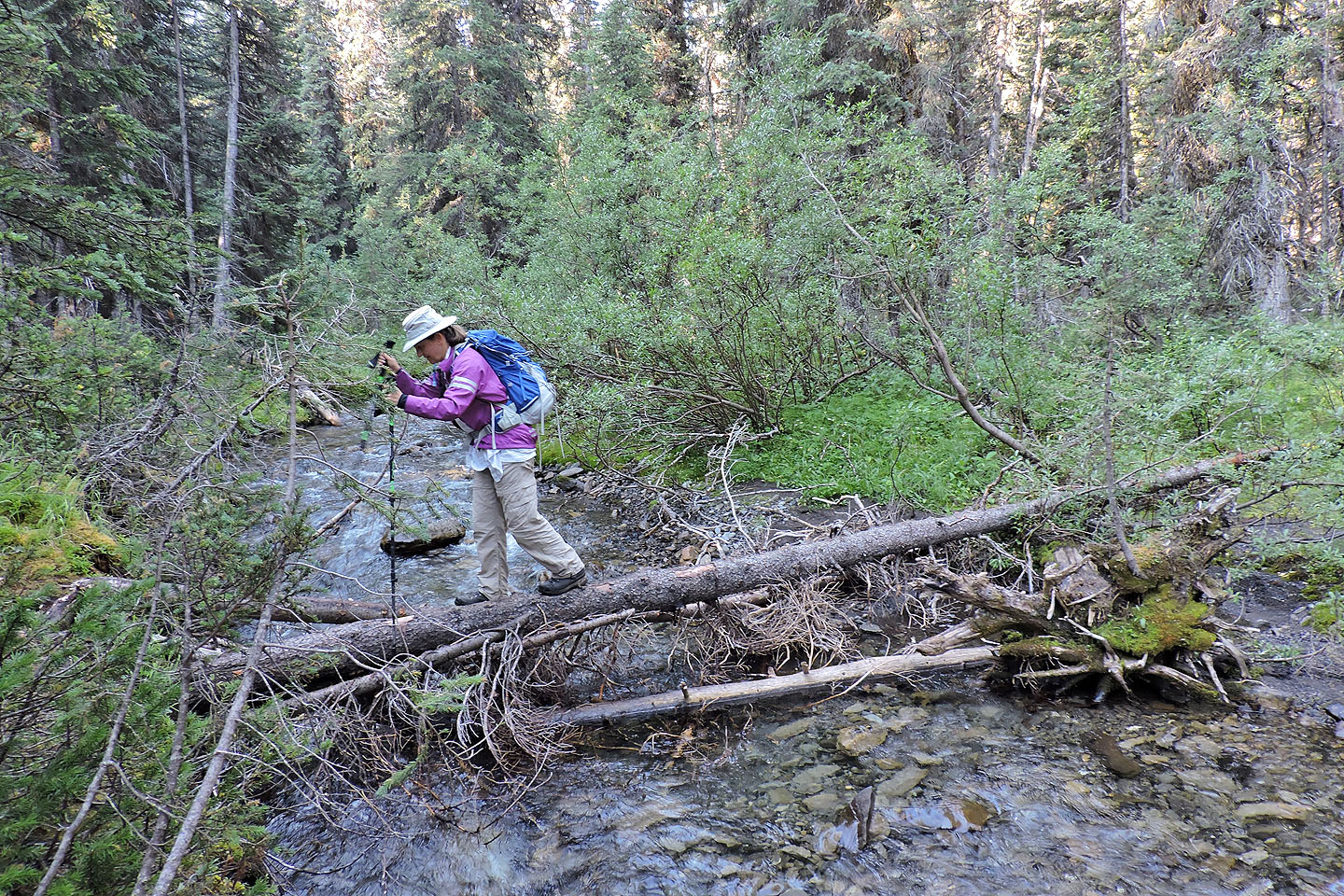
After walking upstream a short distance from the trail we crossed the creek using logs
At a cutblock, we turned right and looked for the trail to Commonwealth Lake
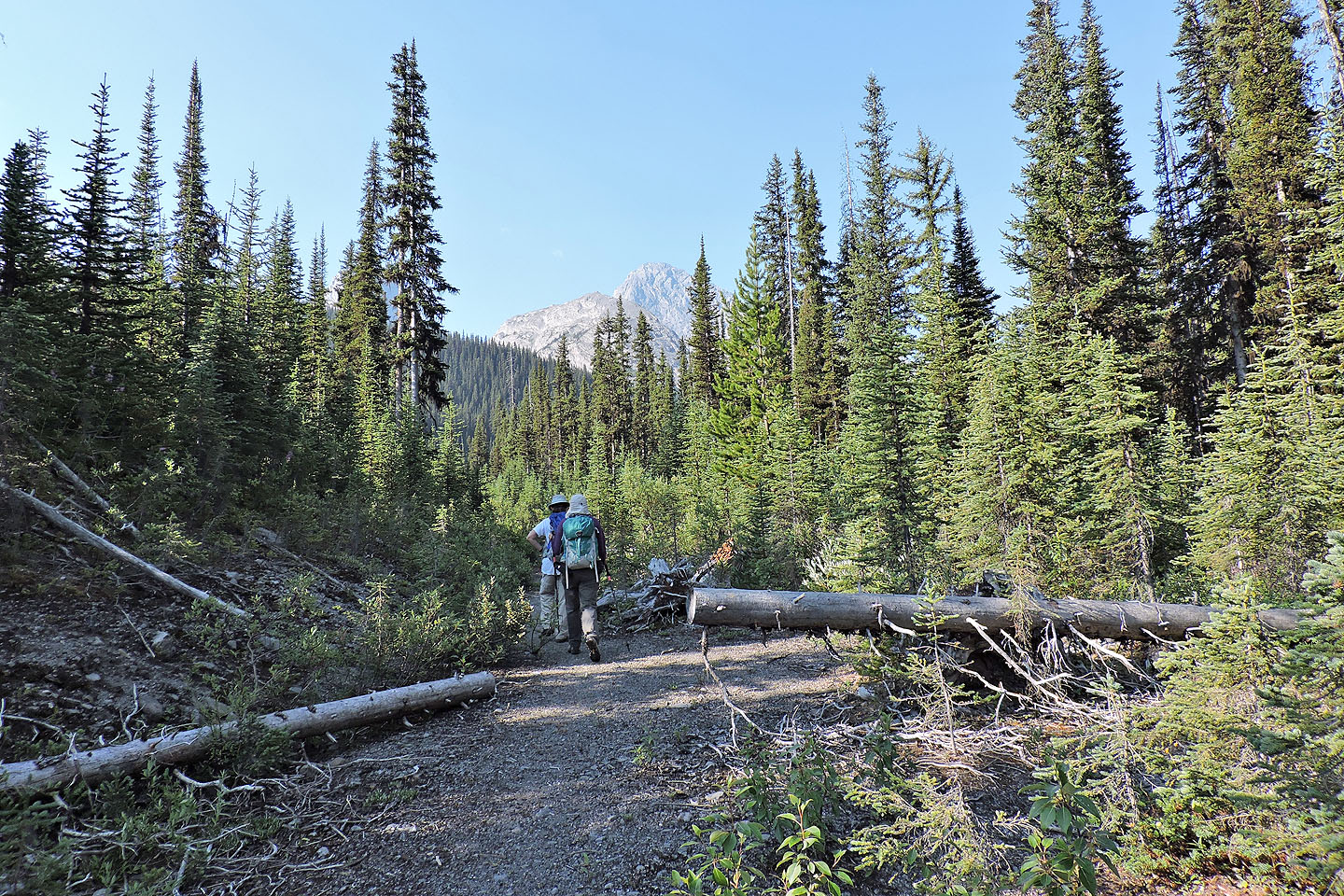
The trail is actually an old logging road
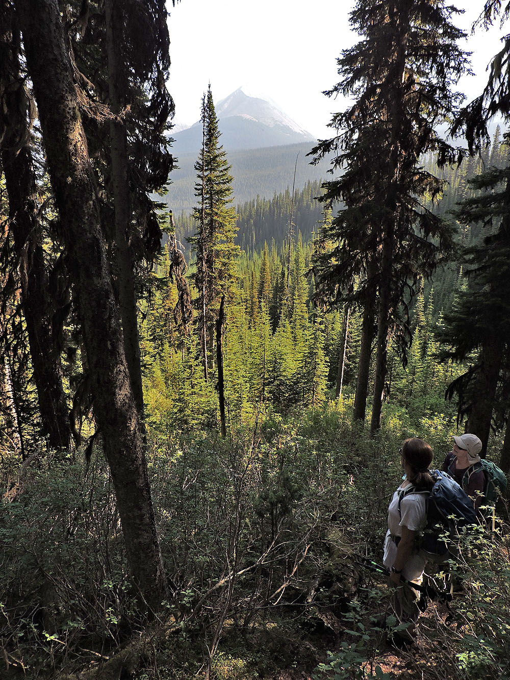
A smoky haze dulled our views
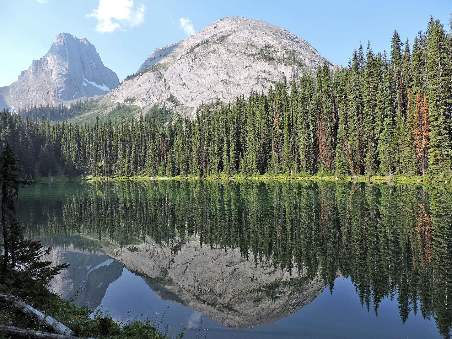
Pig's Back is reflected in Commonwealth Lake
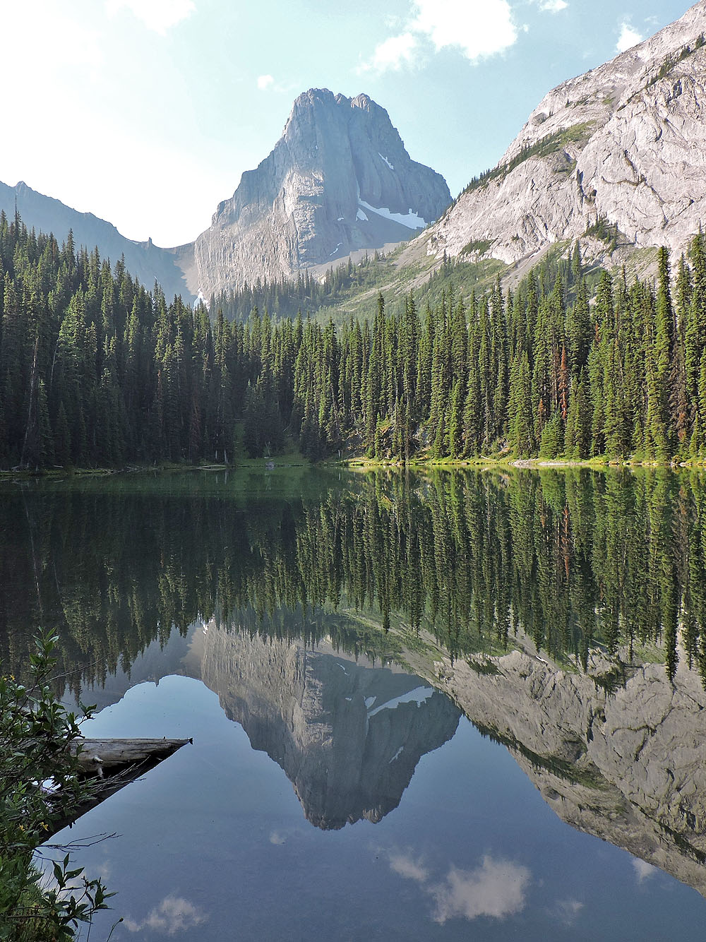
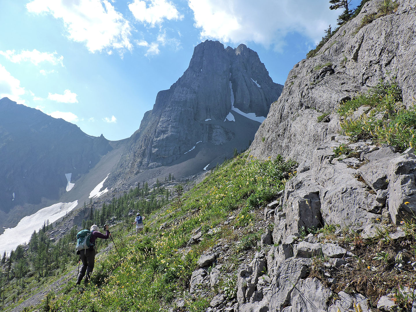
Commonwealth Peak
We reached the far end of the lake
The lake from the far end
The east cliffs of Pig's Back came into view
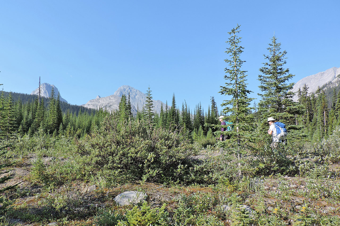
We followed a faint trail
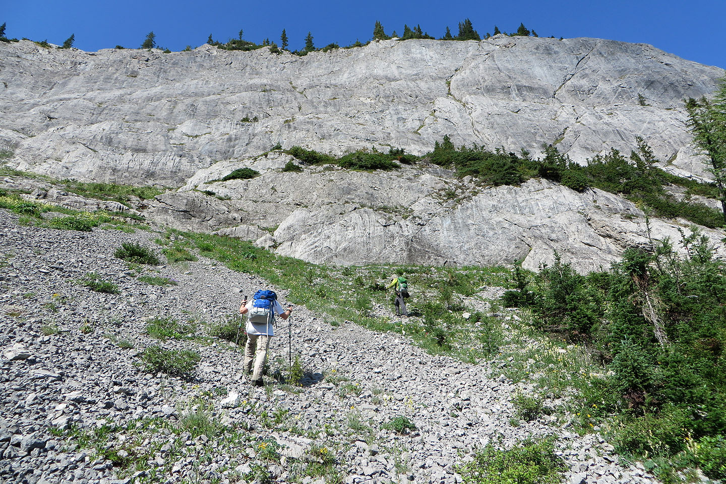
The trail ends at the bottom of a scree slope
Looking back at the lake
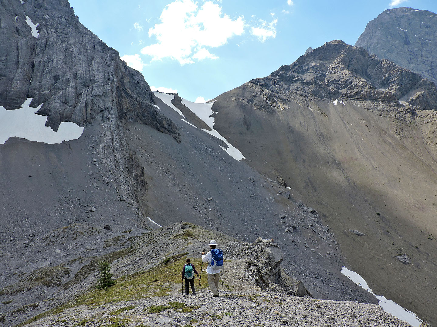
Heading to the col between Commonwealth Peak and Pig's Back
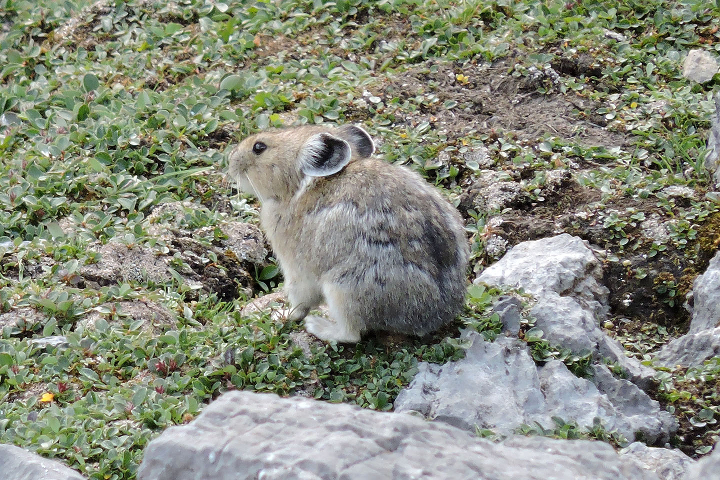
We came across this pika near the col
 Just before the col we started up the ridge
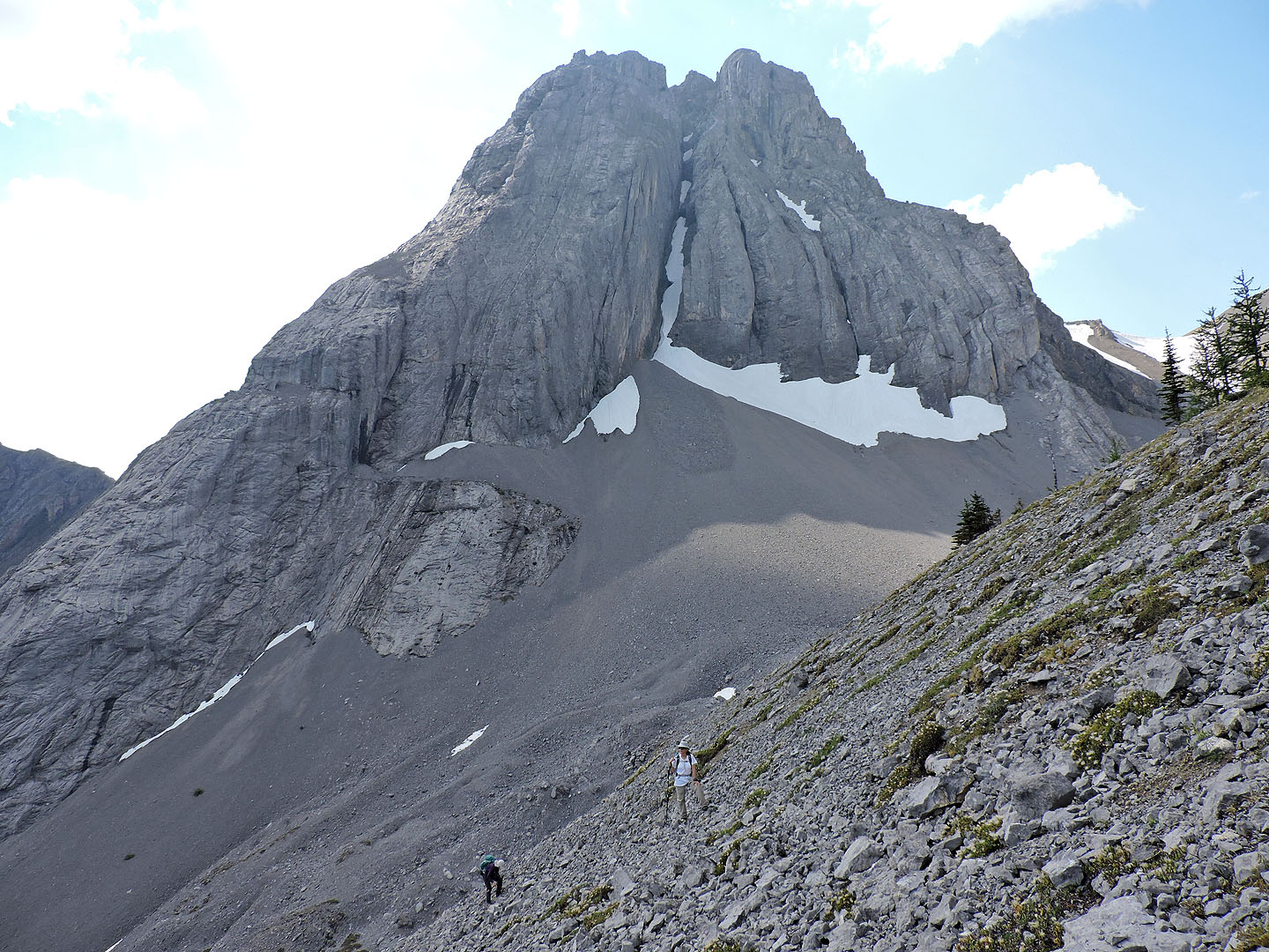
Commonwealth Peak looms behind us
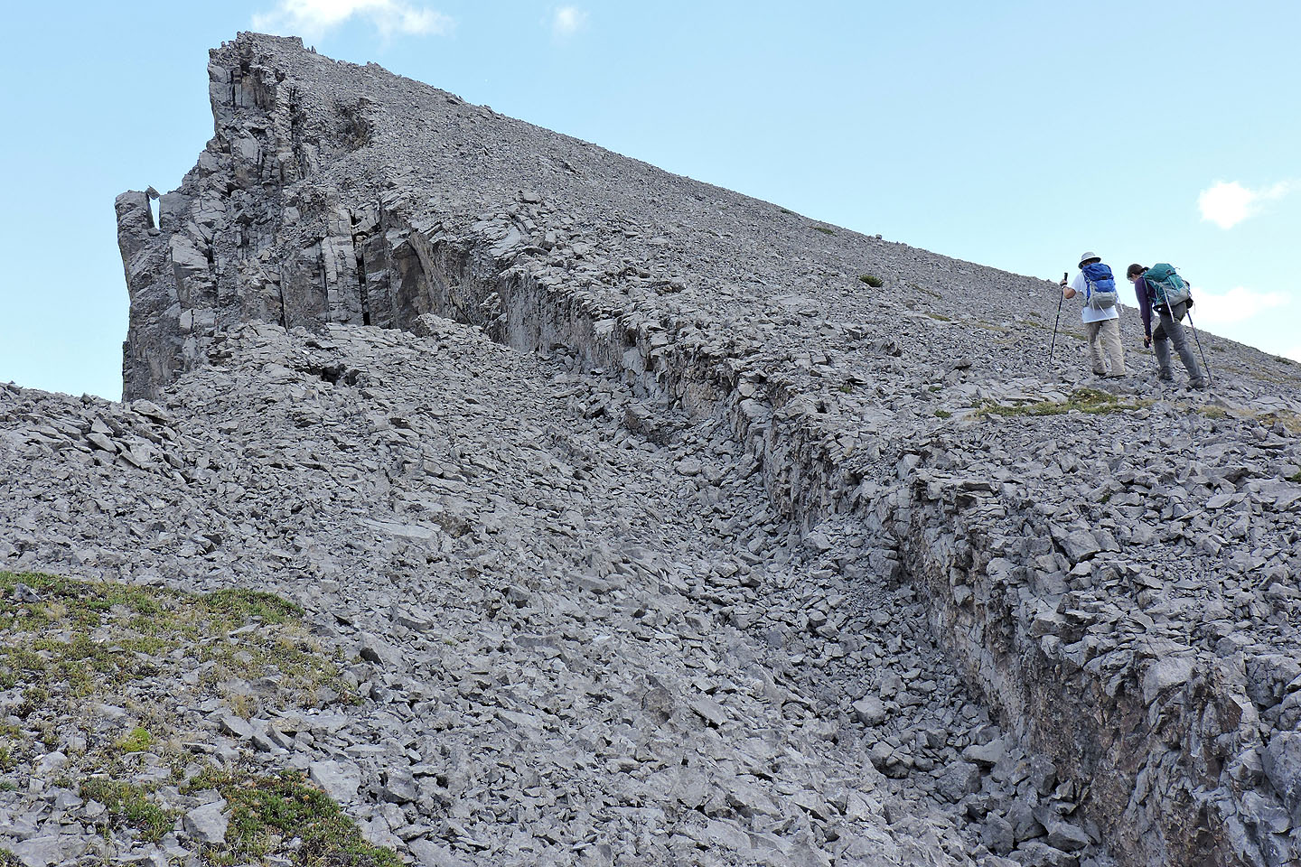
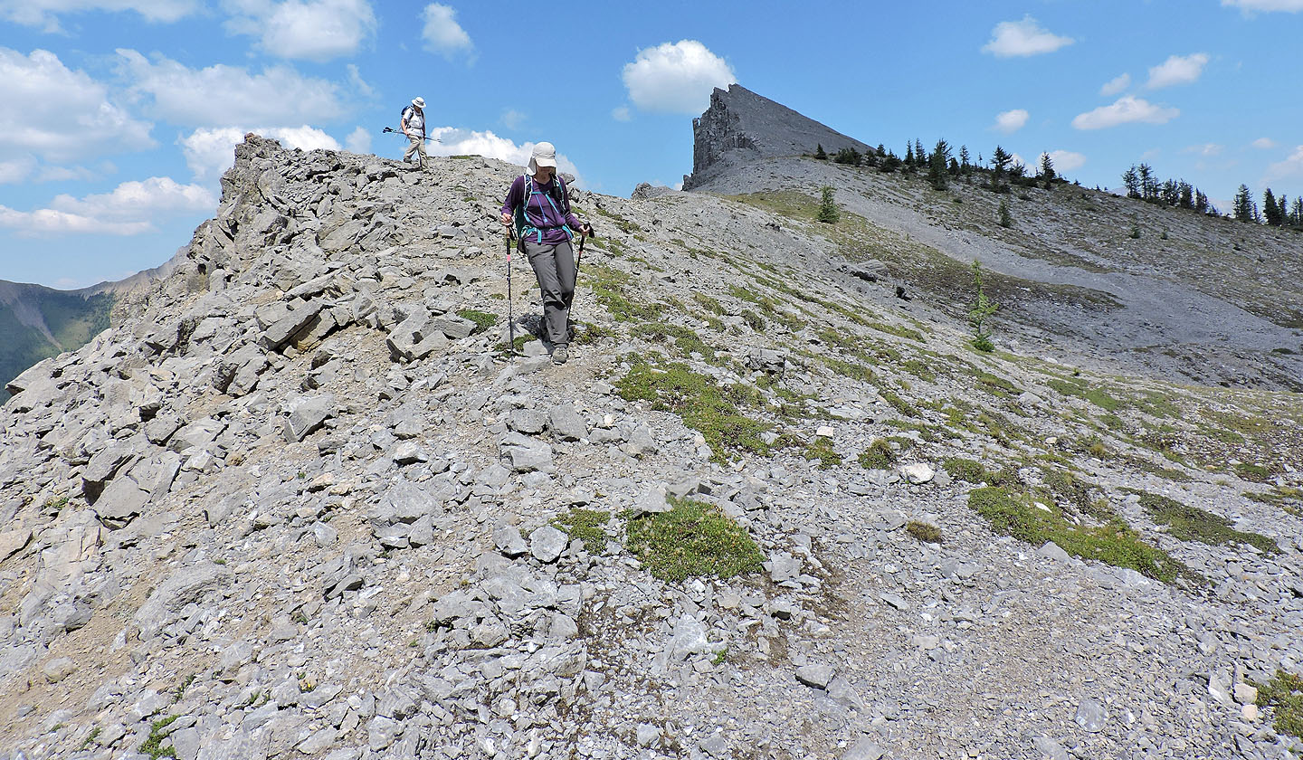
Heading to the summit
On the summit
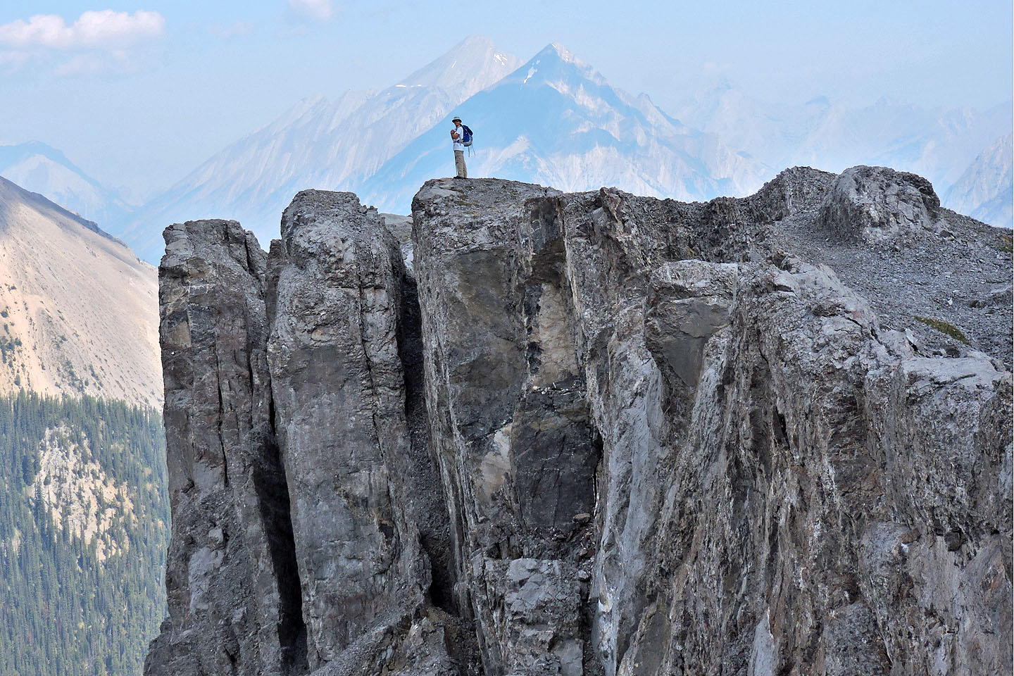
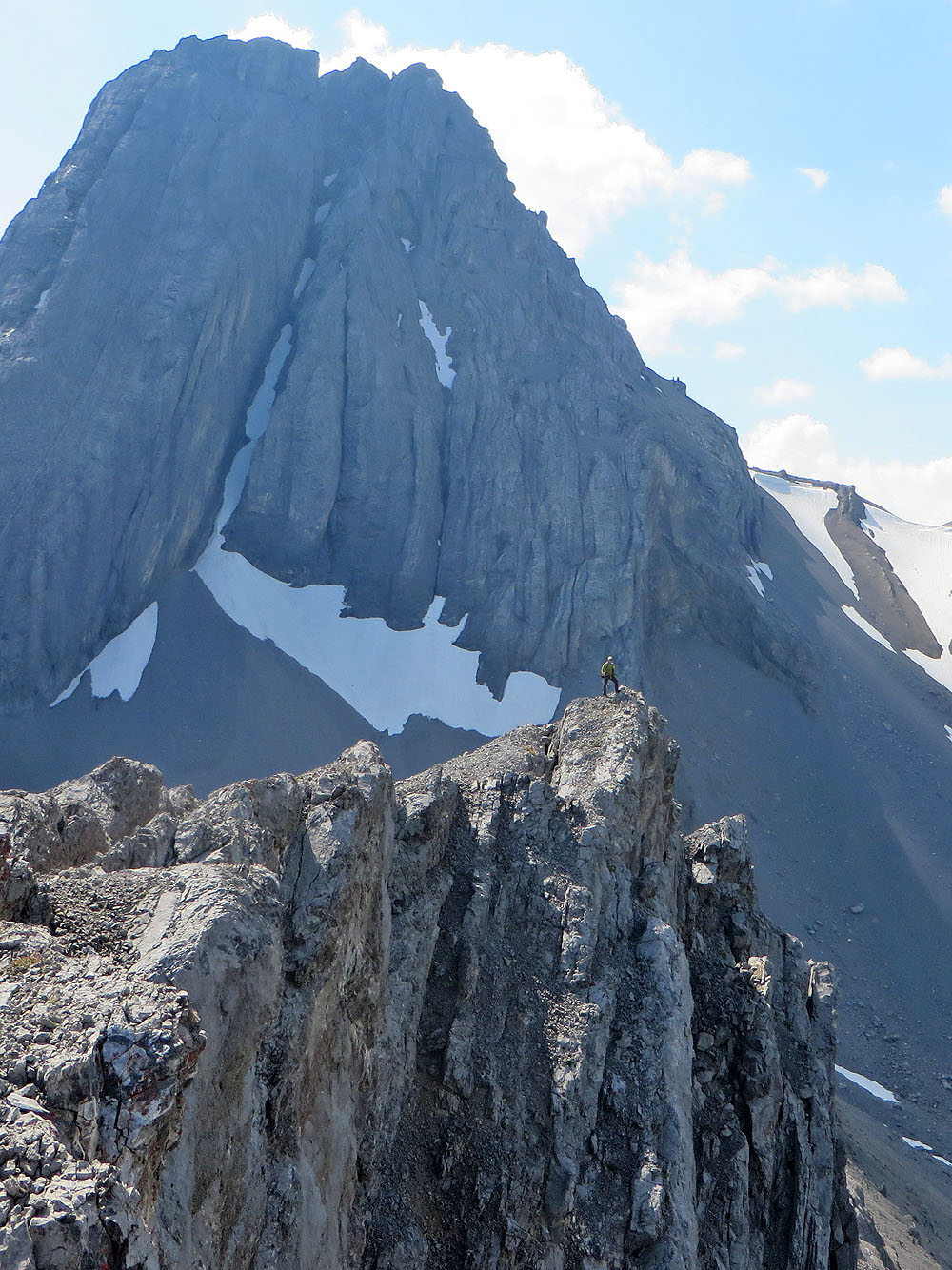
Zora stands on a high point
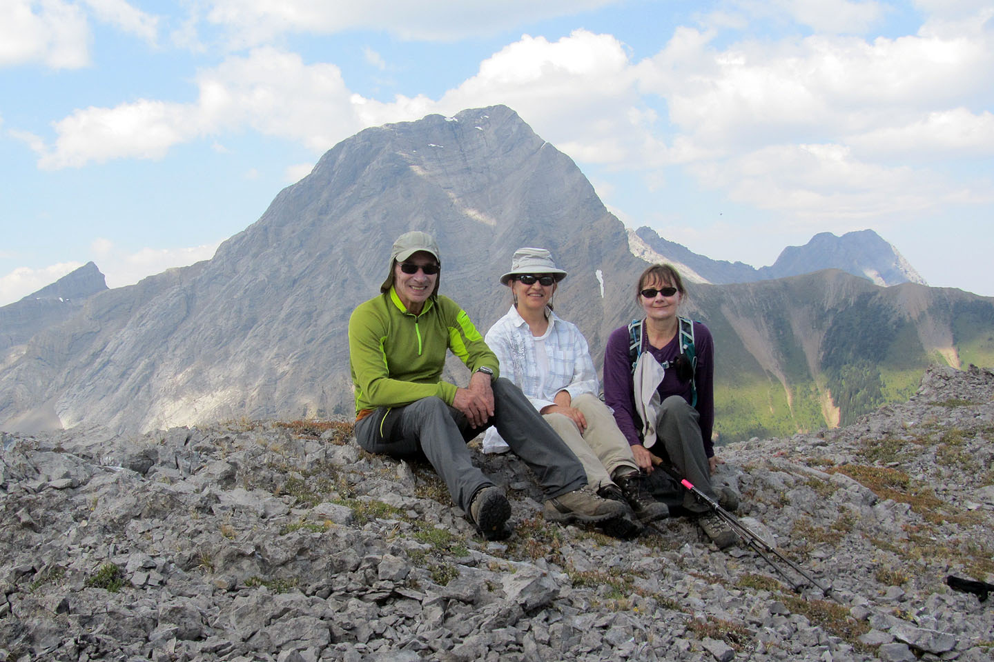
Relaxing on the summit ridge
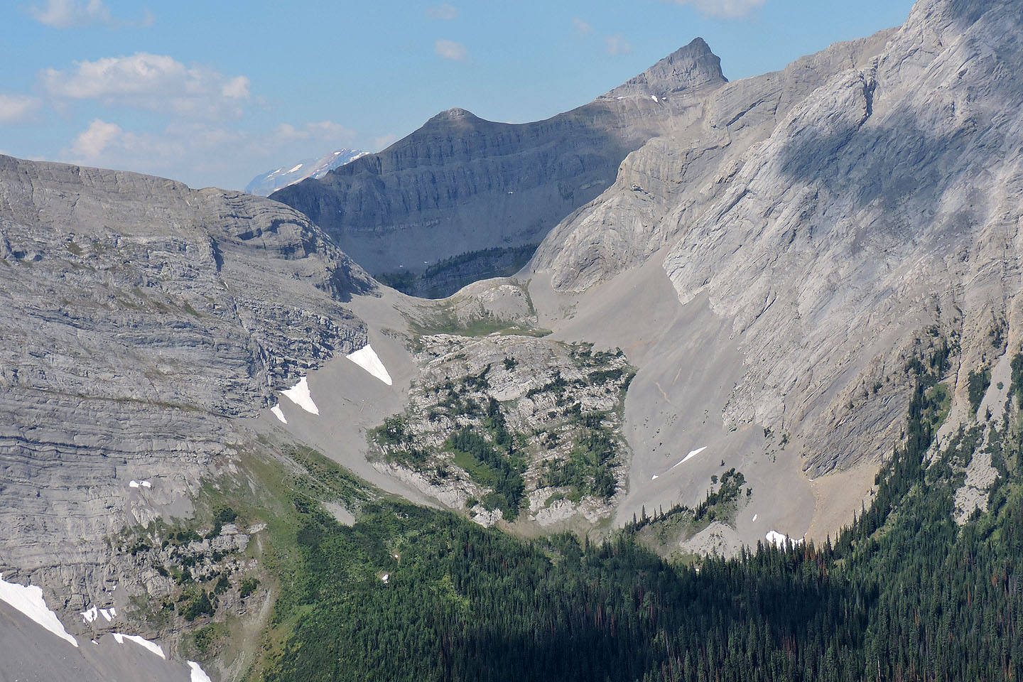
Smutwood Peak rises to a point above Smuts Pass
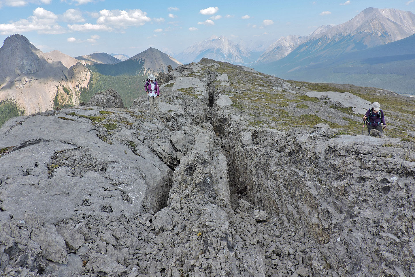
Huge fissures line the ridge
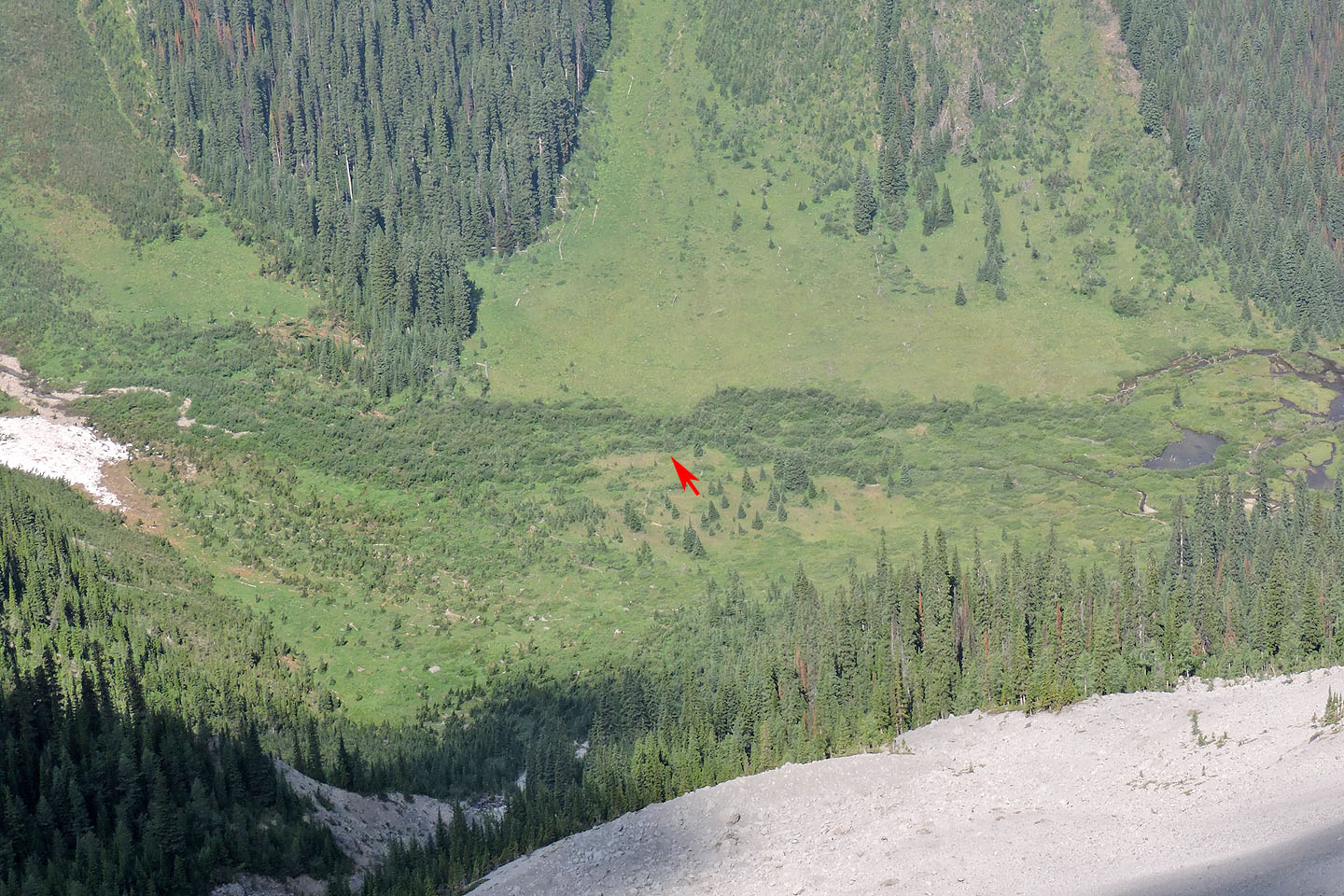
Looking down at the valley: on our return, we crossed Commonwealth Creek where bushwhacking was brief
Heading to the col
Looking back at the summit
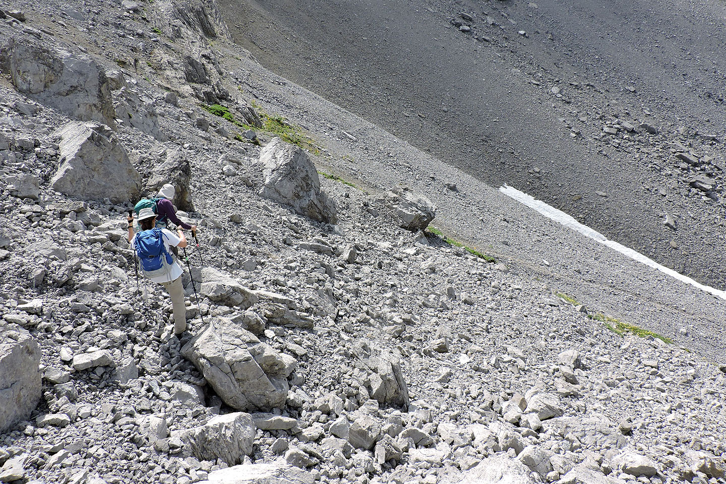
We followed a trail down the west side of the col
We made our way down to a basin
We headed to the drainage just right of Zora
At the end of the basin, we found a trail left of a dry creek. Mount Smuts and The Fist appear across the valley.
Ahead is a flowing side stream where we traversed right
We don't appear to be crossing a drainage but we soon came to a scree bank on the other side
On the trail on the other side of the drainage
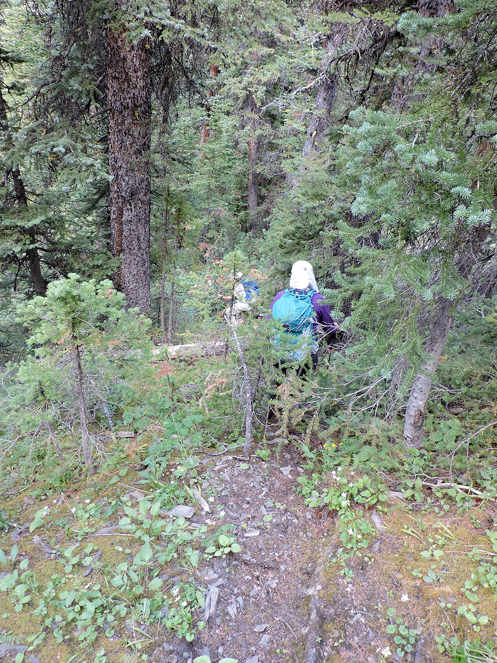
After leaving the scree, the trail plummets to the valley
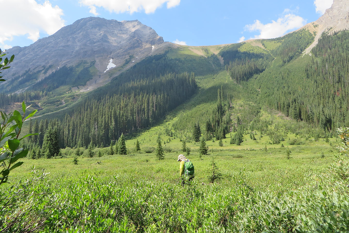
From the bottom of the trail, we headed west, crossed the creek and appeared at the bottom of the avalanche slope on the other side
Looking back at Pig's back, the wooded slope we descended, and the wall of brush we went through
On the main trail leading back to the trailhead
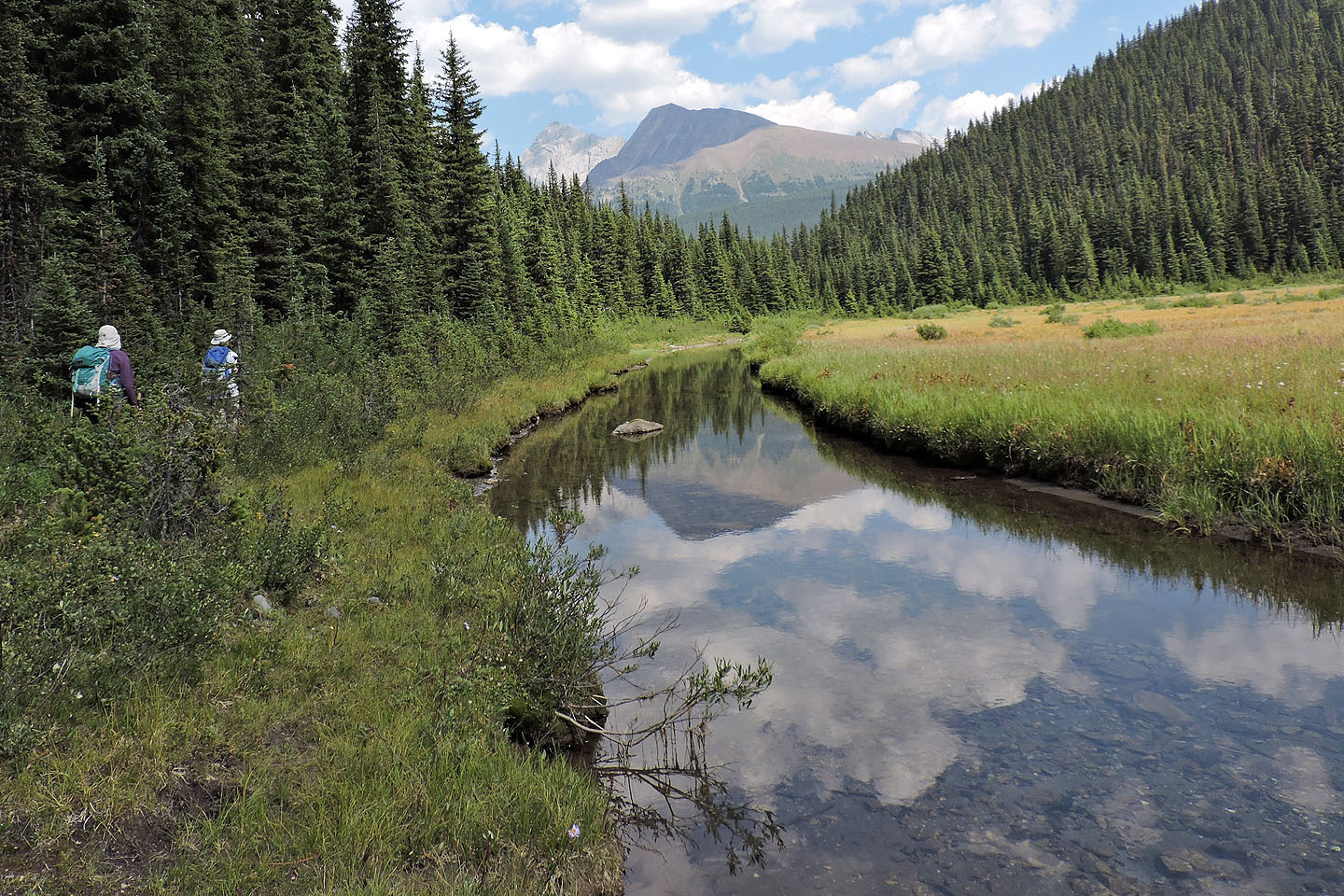
Commonwealth Creek
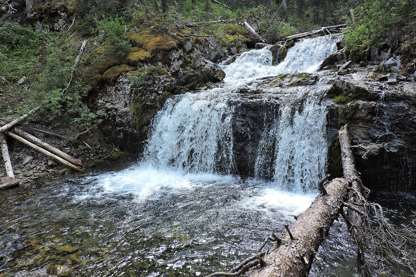
Waterfall
82 J/14 Spray Lakes Reservoir