bobspirko.ca | Home | Canada Trips | US Trips | Hiking | Snowshoeing | MAP | About
Piggy Plus Col and Piggy Minus
Kananaskis, Alberta
September 23, 2020
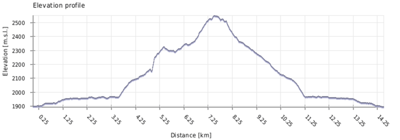
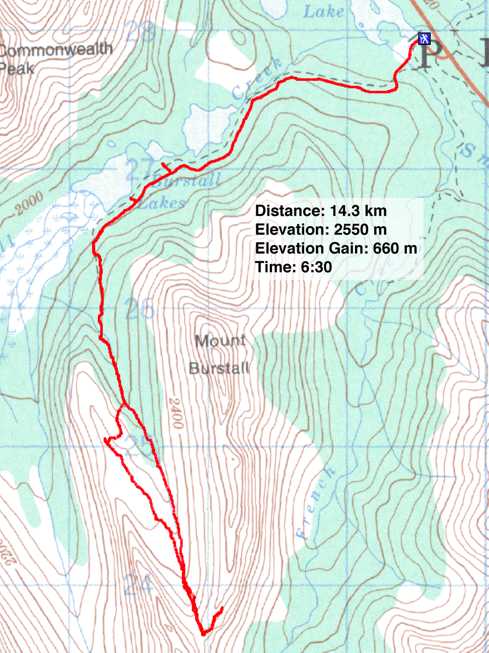
Distance: 14.3 km (8.9 mi)
Cumulative Elevation Gain: 697 m (2287 ft)
The bare bump on the north ridge of Piggy Plus makes a fine destination when the surrounding larches have turned yellow. And to extend the trip, Burstall-Piggy Plus Col can be tossed in. It is a scenic autumn hike. I wish it was my idea, but it came from Gillean's blog.
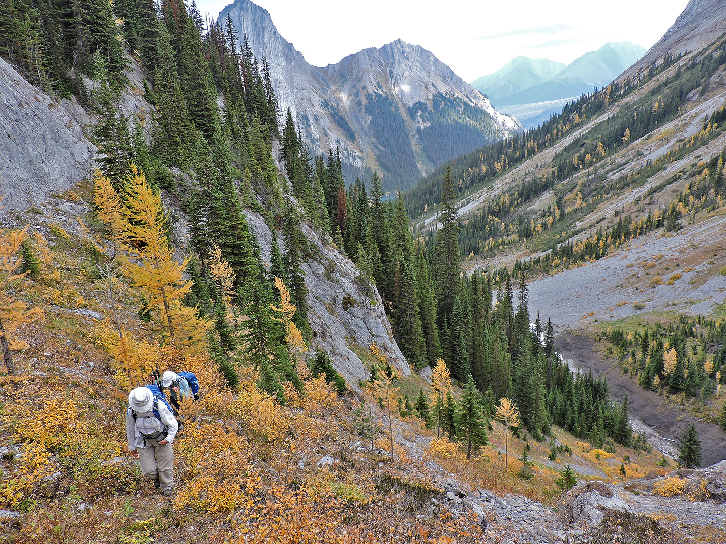
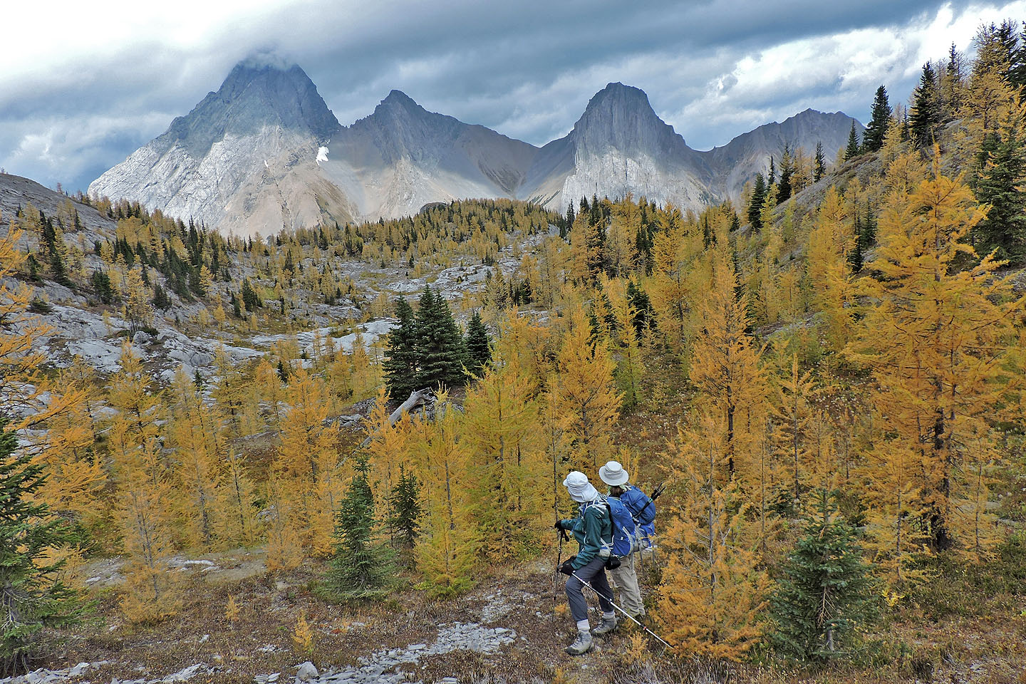
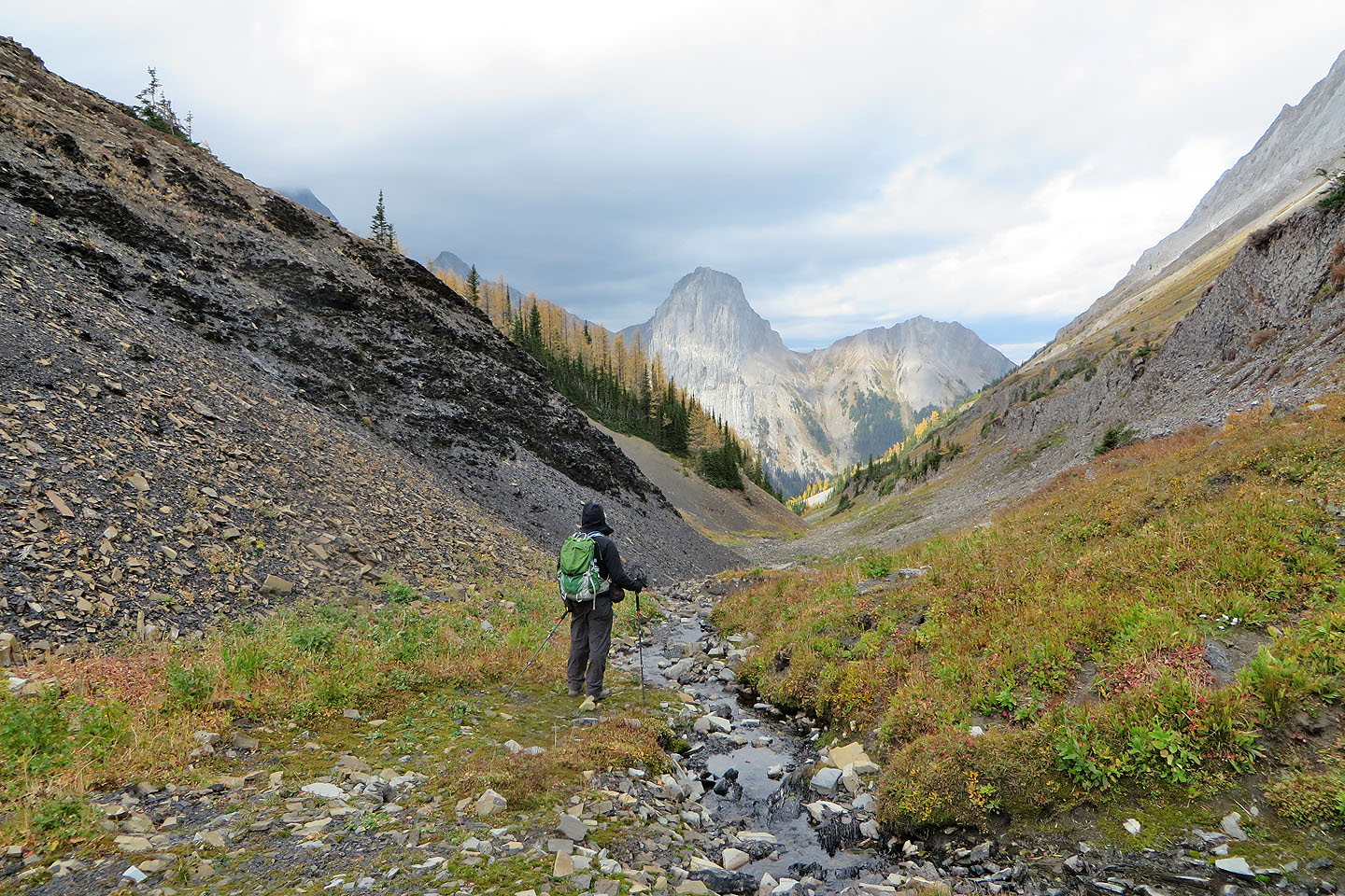
Following her directions, Zora, Dinah and I hiked 3.3 km up Burstall Pass trail to the path for Piggy Plus. The path eventually emerges from the forest and settles into a narrow drainage. To reach the viewpoint, Gillean suggests a U-shaped route: leave the drainage to follow a trail marked with cairns, hike south to a sunken meadow, and then northwest to the viewpoint. (Two weeks later, Sonny Bou followed our route and called this point "Piggy Minus," which seems appropriate.)
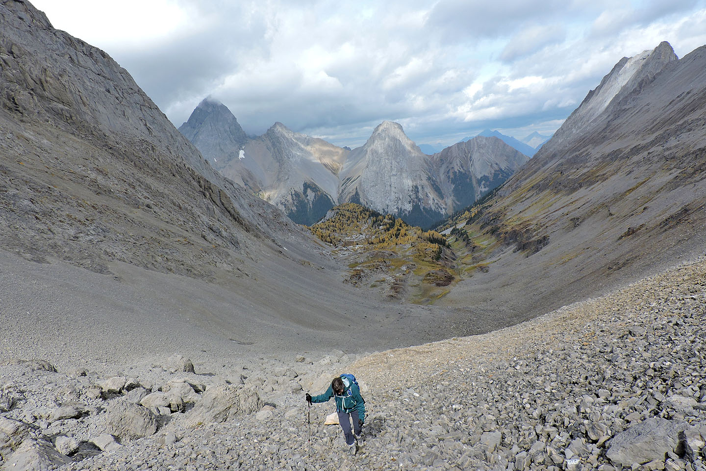
We took a more direct approach. 300 m before her exit, we ascended a short, broad gully. Although steep, much of the ground was lumpy, creating natural steps. At the top, we came to a long channel lined with a short cliff band on the right. We soon found a weakness. After a brief scramble, we were 100 m from the viewpoint. We were soon standing on a knoll with 360-degree views.
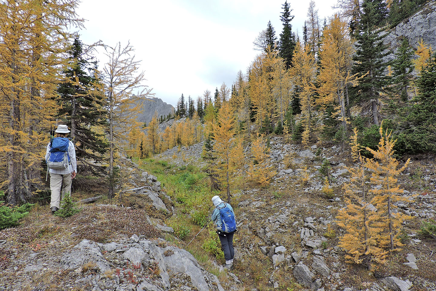
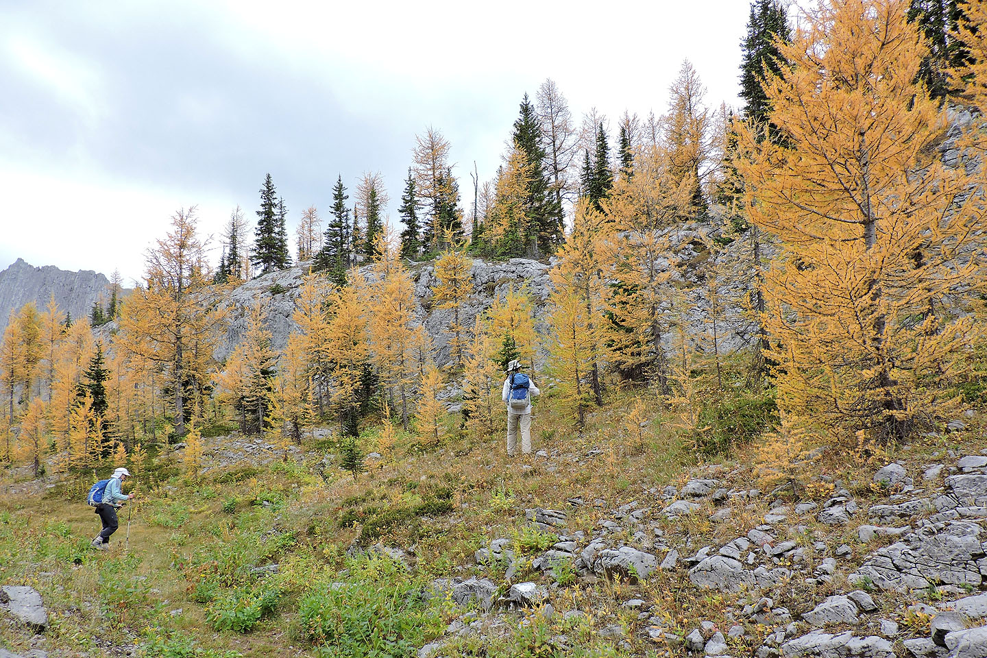
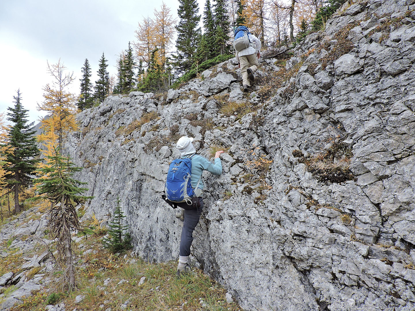
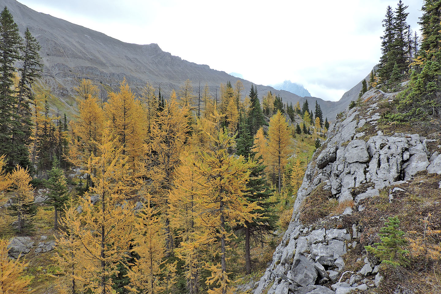
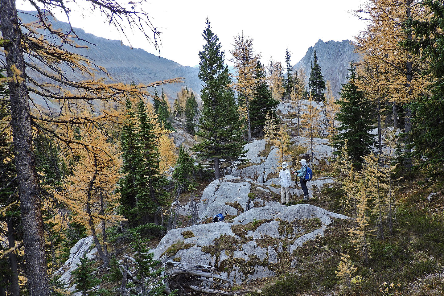
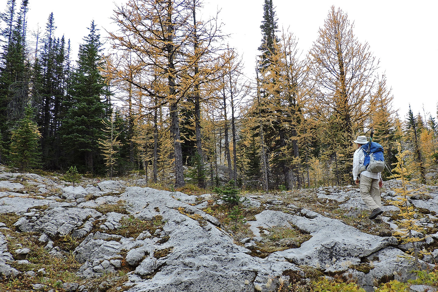
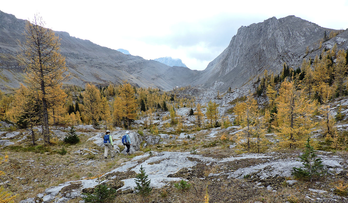
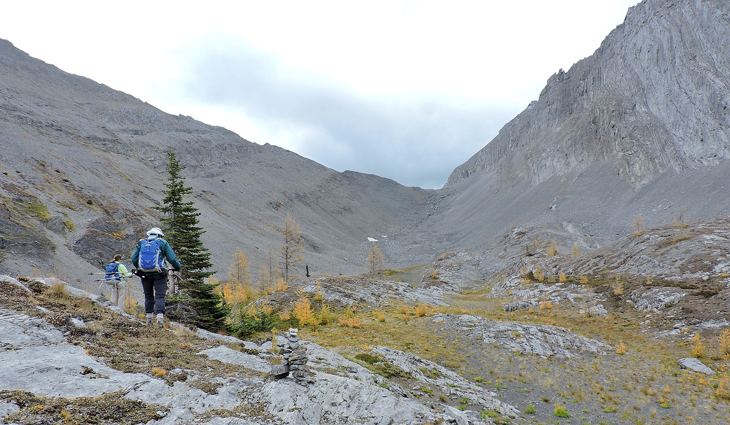
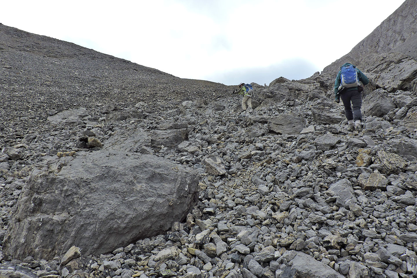
After a brief stay, we headed to Piggy Plus Col. We crossed a gently rolling landscape comprising larch stands interspersed with smooth rock slabs. One could hike anywhere in the broad basin while keeping the col in sight, but we were drawn to the yellow larches. At the end of the basin, we climbed a trail in scree to the col.
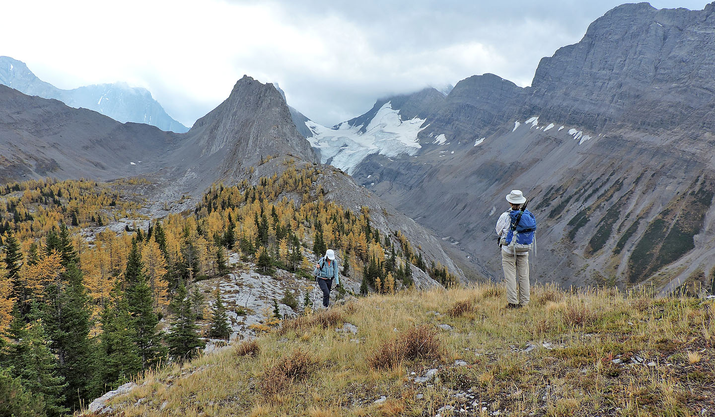
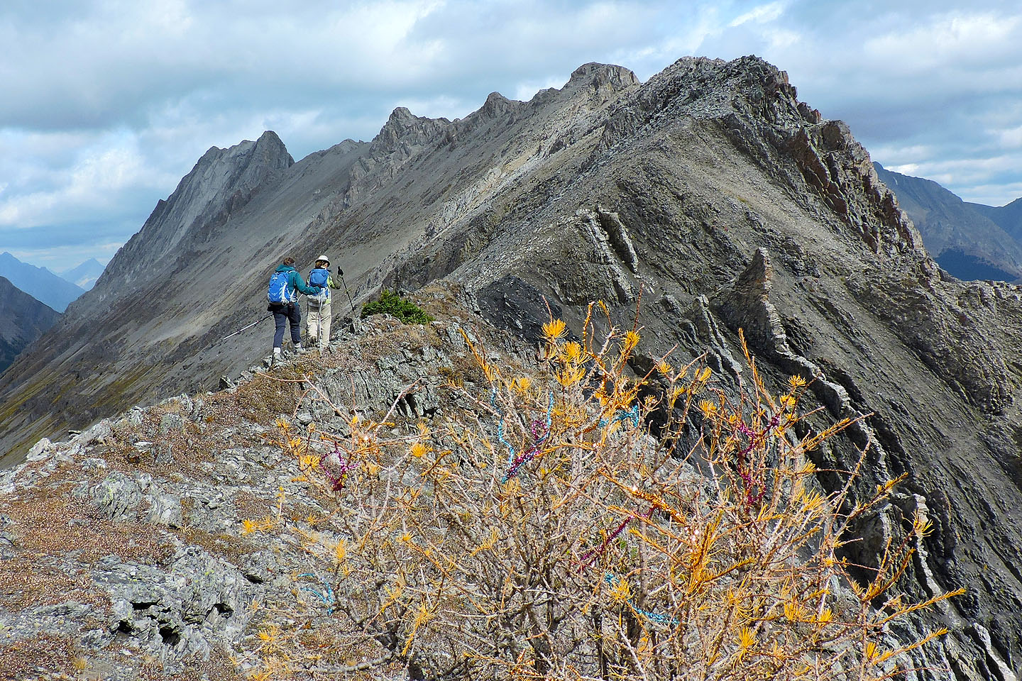
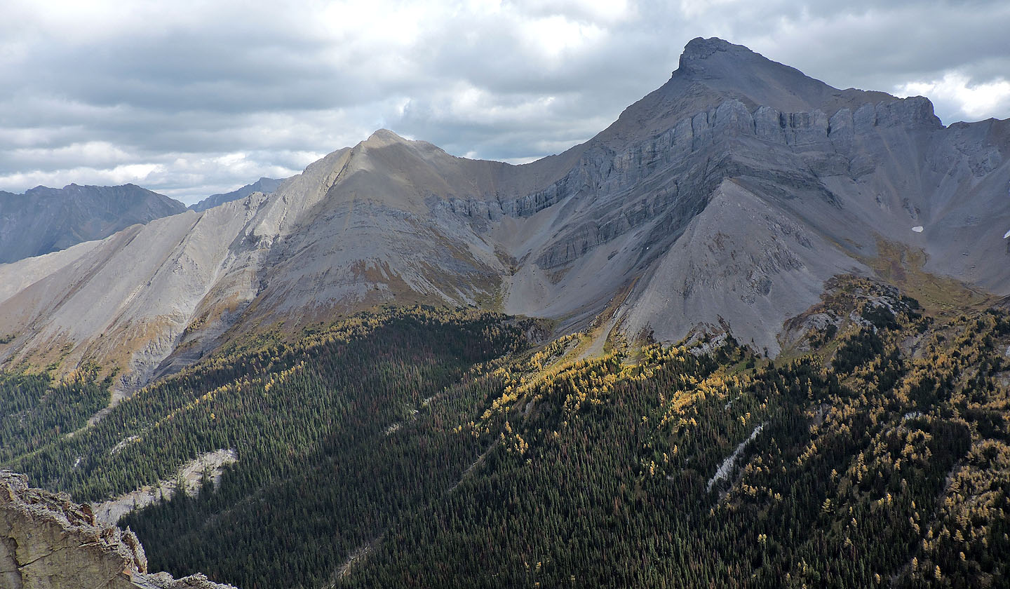
From the col, we could view French Glacier across the valley. On our right, Piggy Plus, a difficult, exposed scramble, rose above us. But the benign ridge on our left was more our style; it even offered a trail. We climbed 35 vertical metres up the ridge, an extension of Mount Burstall, before the trail disappeared in rocks. Faced with a narrower, rugged ridge and a strong wind, we went no further. Although the scenery from our perch above Piggy Plus Col didn't send us hog-wild, we relished the sight of French Glacier as well as Cegnfs, Mount Murray and other peaks.
Our return was simple. We retraced our steps back to the edge of the basin where we picked up the end of the drainage we had started up. We passed the trail leading to the sink, passed our ascent gully, and passed the last larches before continuing down to meet Burstall Pass trail.
Zora and Dinah get a head start up the trail
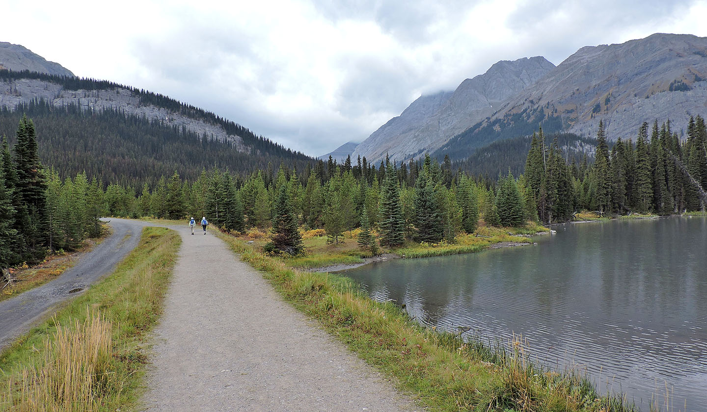
A brief side trail leads to a view of the last Burstall Lake
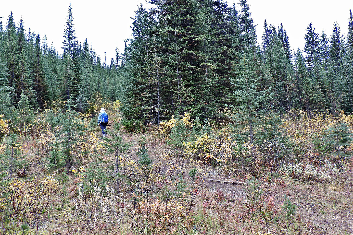
Starting up the path for Piggy Plus
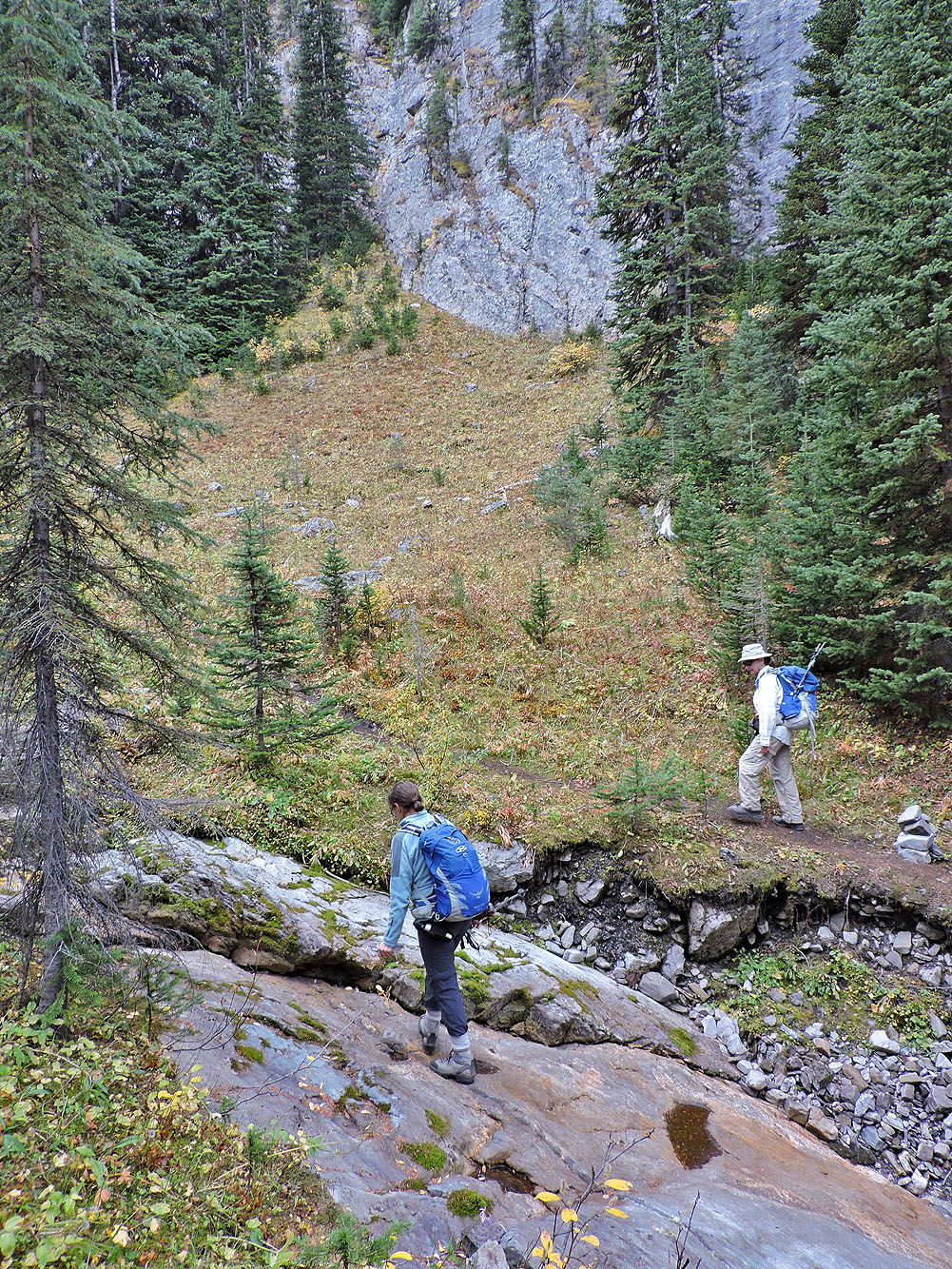
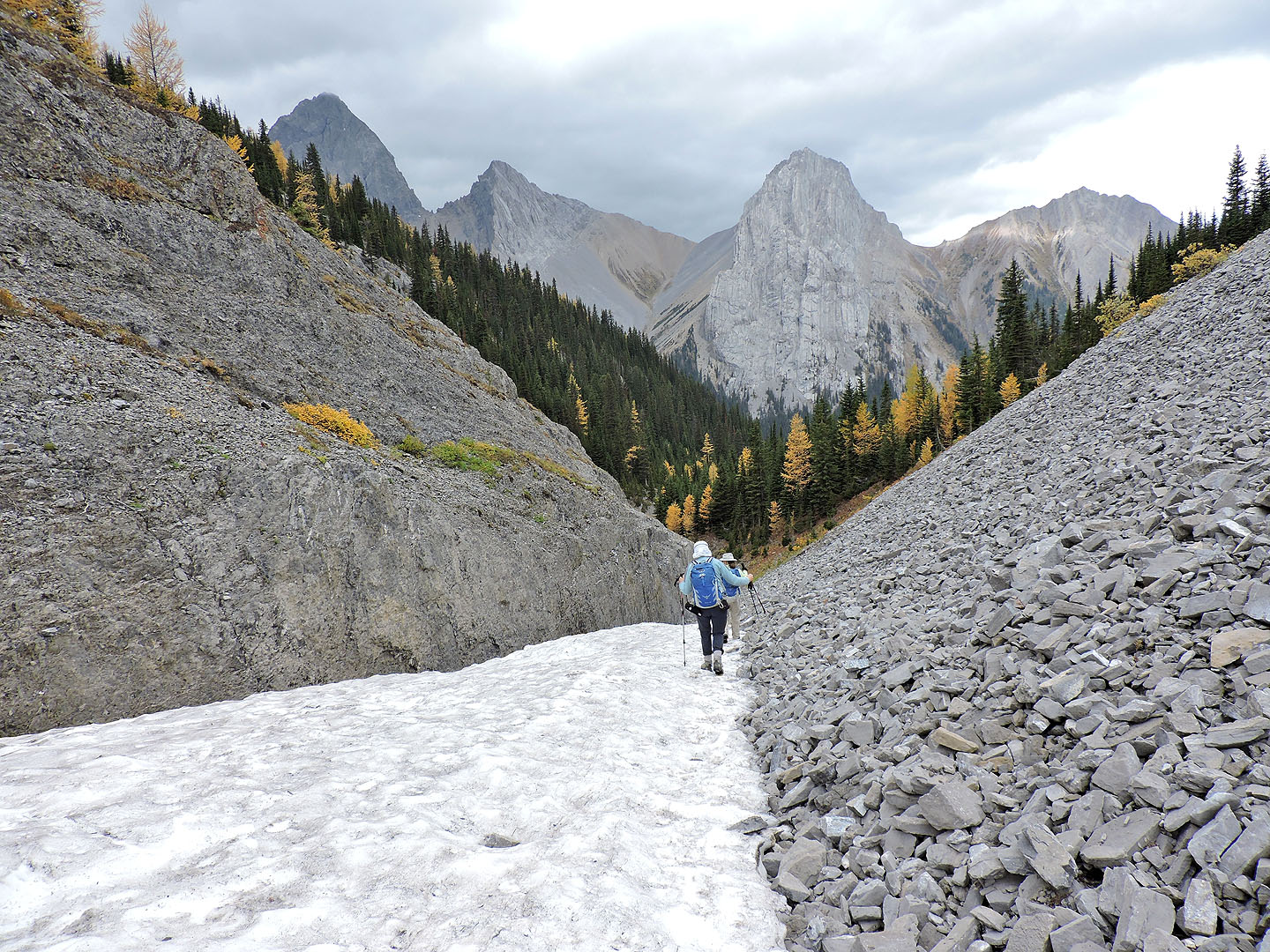
The trail crosses a creek bed
Lingering snow bridges the drainage
Starting up the gully from the drainage
Looking down the gully
After the climb levelled off, we entered a channel
We didn't go far before finding a weakness in the cliff band
We easily scrambled up
After scrambling up, we could see Piggy Plus Col in the distance
We stopped for a break on some rocks
Piggy Minus is visible through the trees
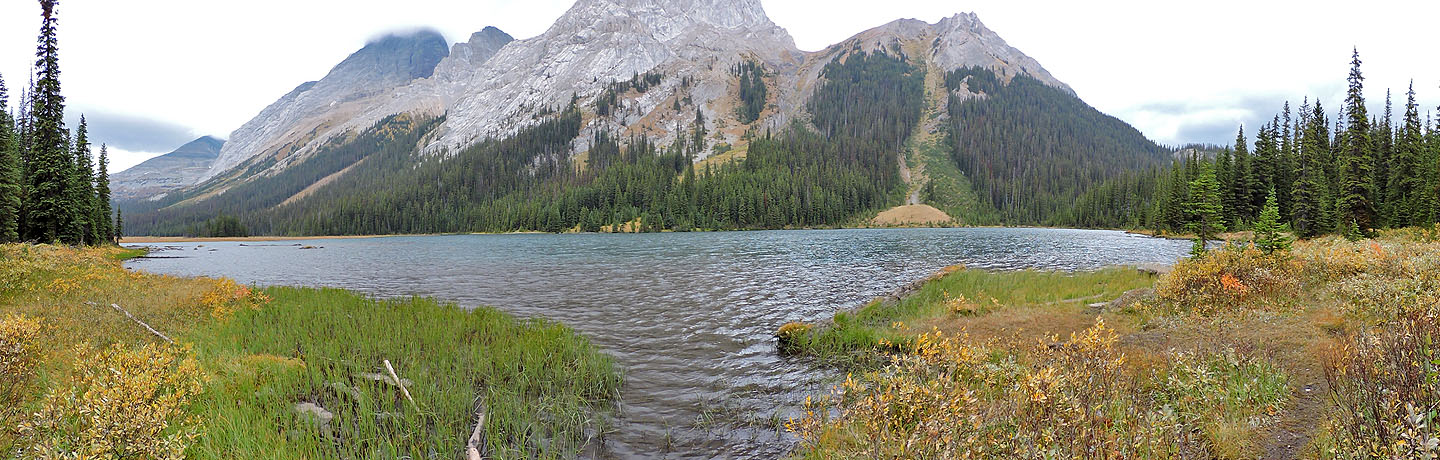
From the top, we had a view of Robertson Glacier
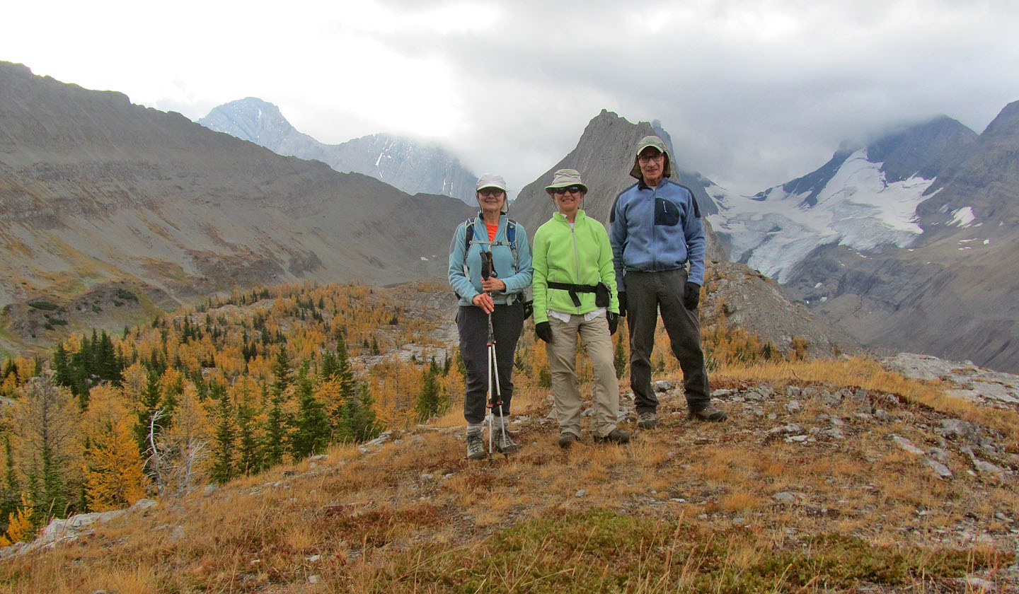
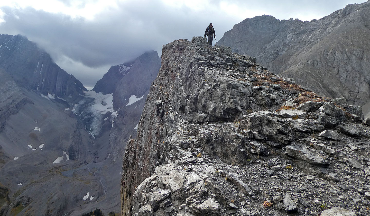
Standing on Piggy Minus
Heading to the col
Ahead is the sink/meadow that Gillean mentions
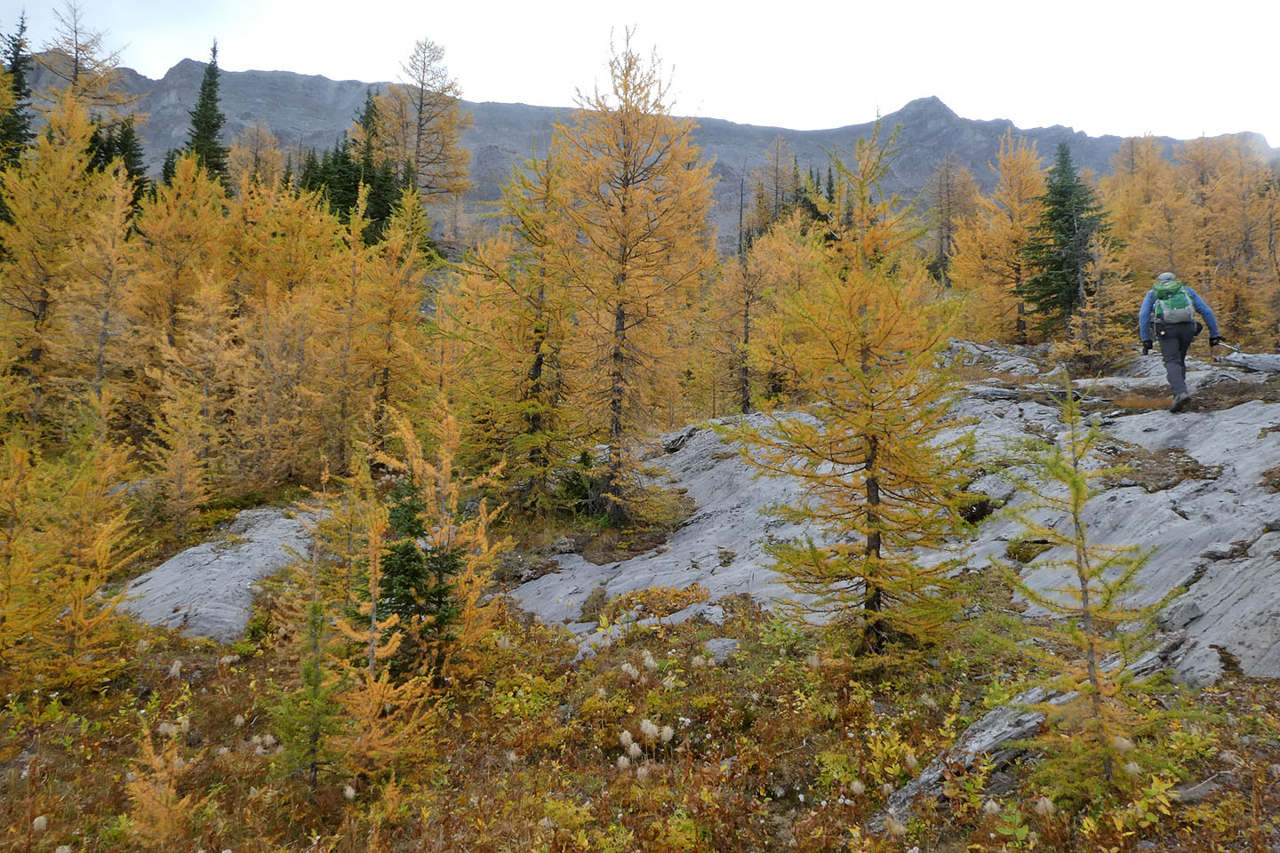
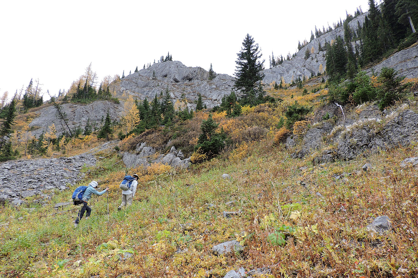
We could've kept to glades but instead ventured through the larches
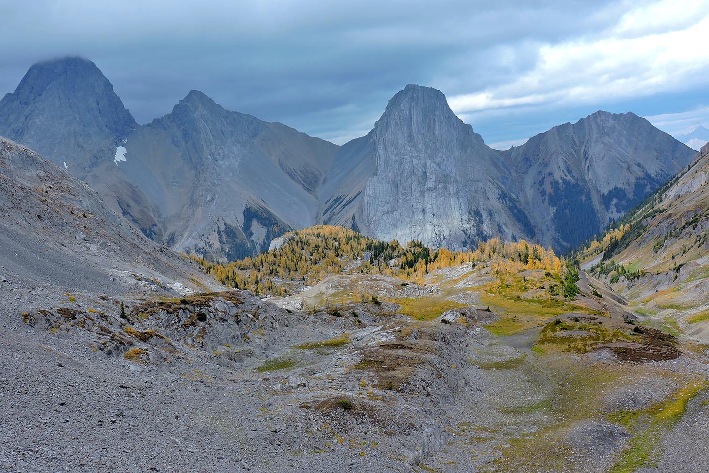
Looking back at the viewpoint bump above the evergreens in the centre. In the background: Mount Birdwood, Pigstail Peak, Commonwealth Peak and Commonwealth Ridge
Coming to the end of the larches
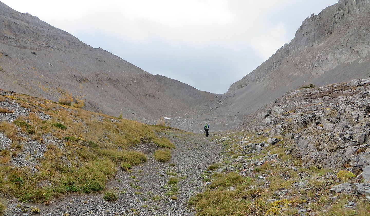
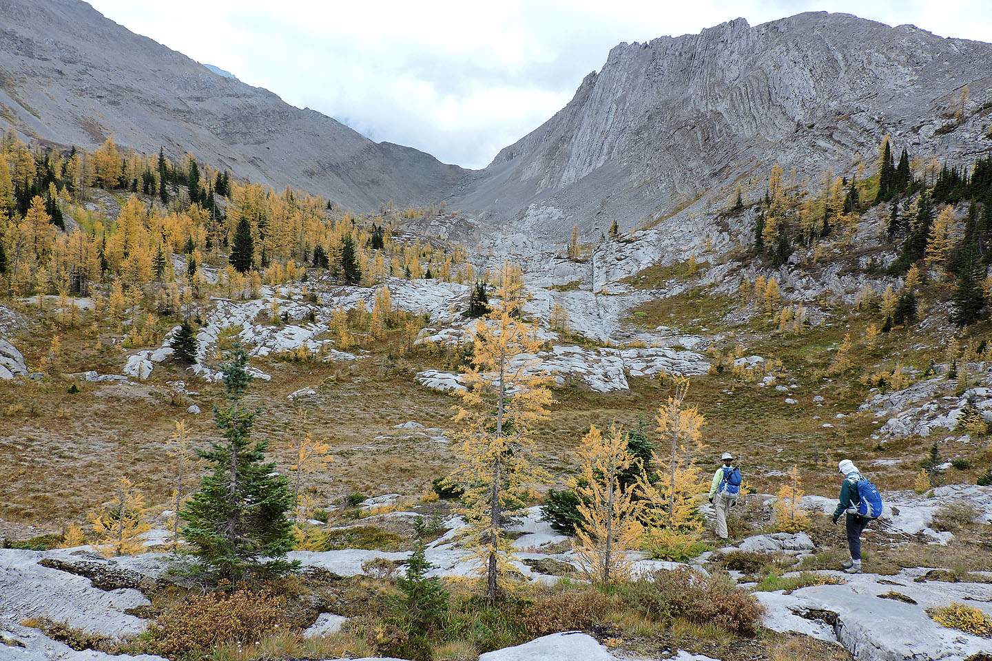
Nearing the edge of the scree below the col
Cairns marked a route to the col
Looking back from the col
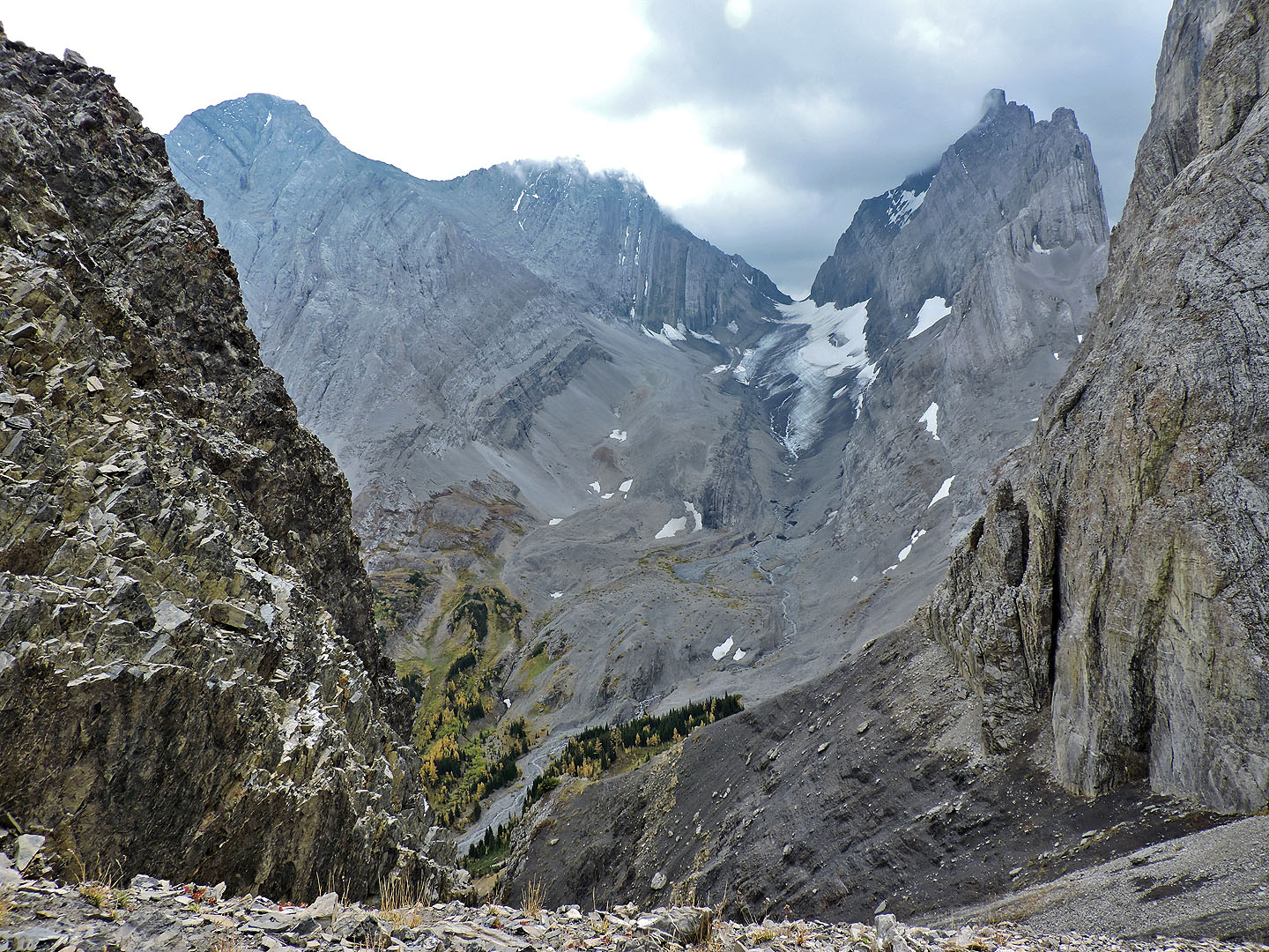
French Glacier seen from the col
While climbing above the col, we passed a decorated larch tree
We were fascinated by the rock flake on our right
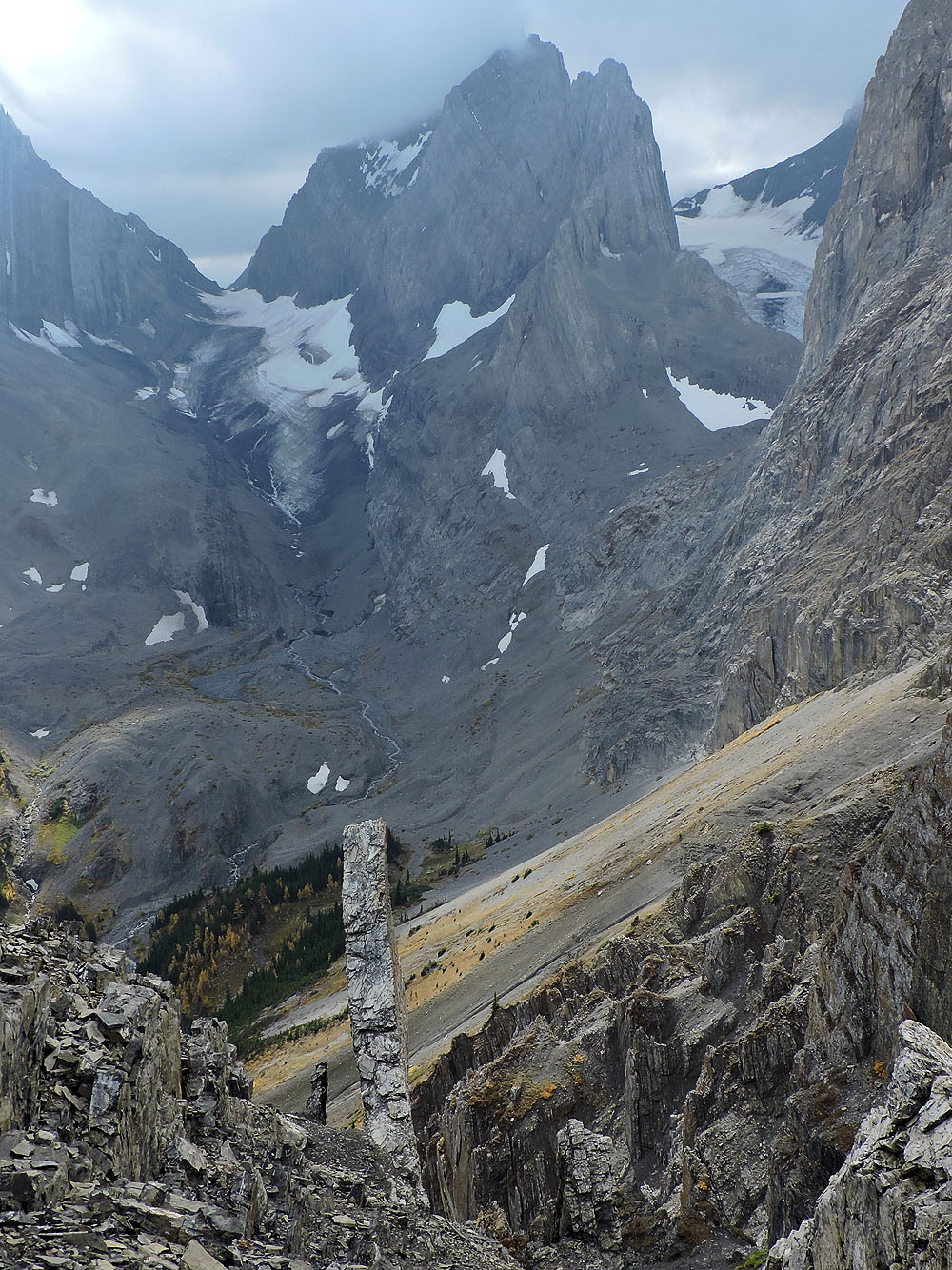
Looking down at the flake. French Glacier and Robertson Glacier in the background.
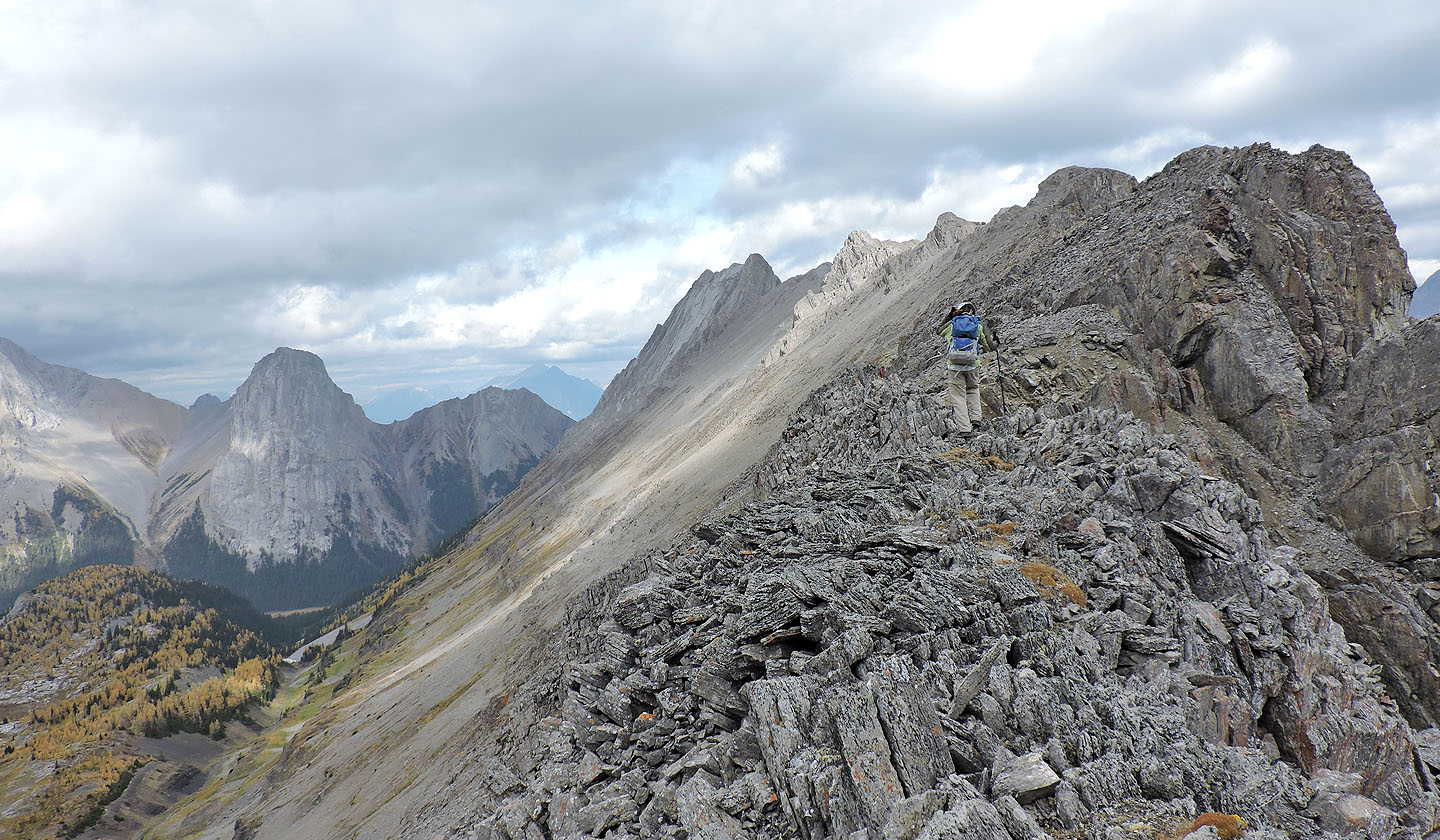
The ridge leads to Burstall Peak
Looking back at the col. Piggy Plus on the left.
Cegnfs and Mount Murray
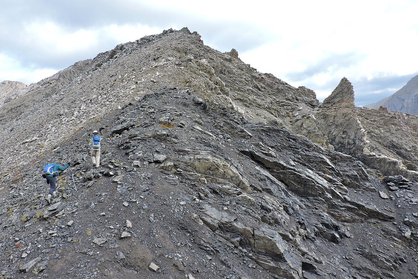
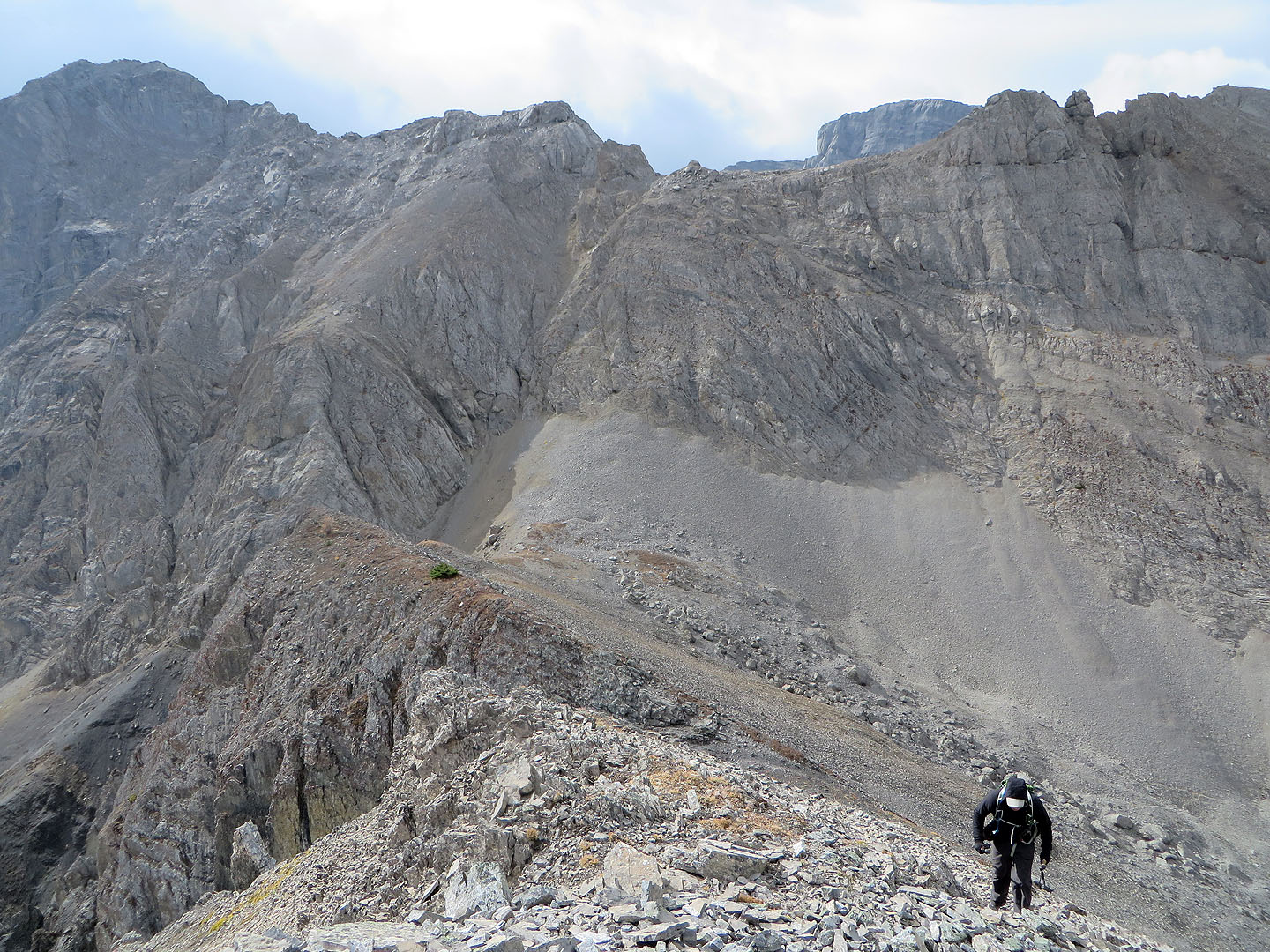
This is as far along the ridge as we got
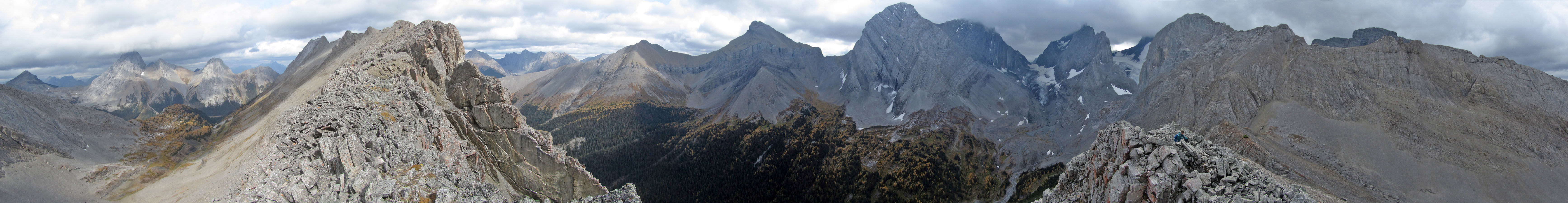
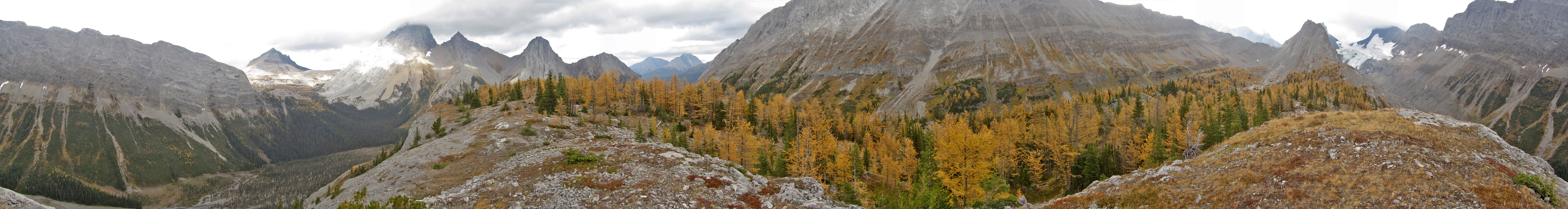
Panorama from our high point
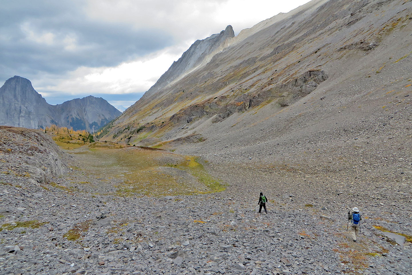
Coming down, we had a grand view of the basin
After reaching the bottom, we headed to the drainage
Back in the drainage
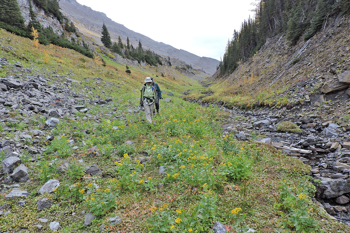
Despite being fall, there were lingering wildflowers
A trail heads toward the sink, the route that Gillean suggests
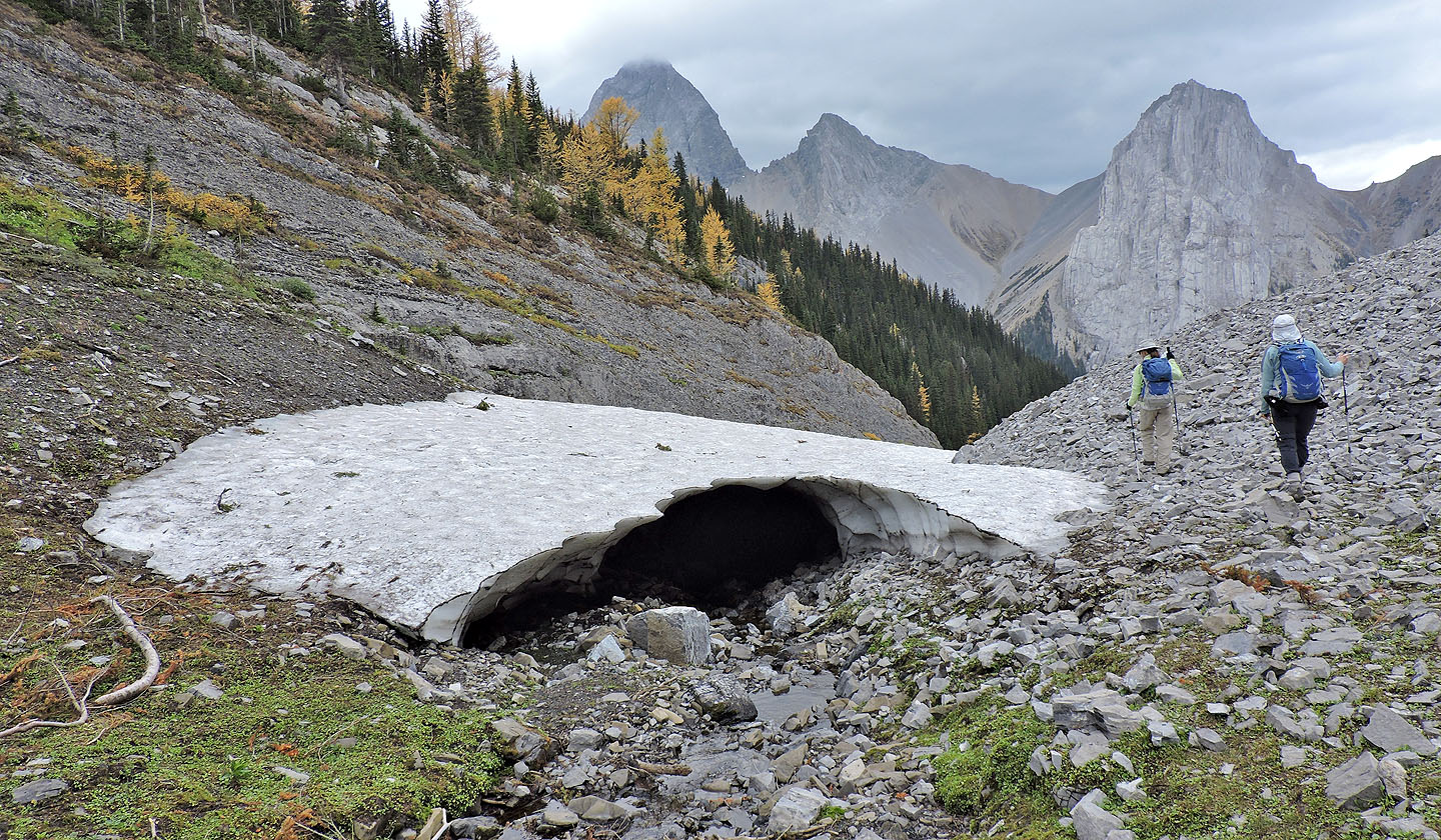
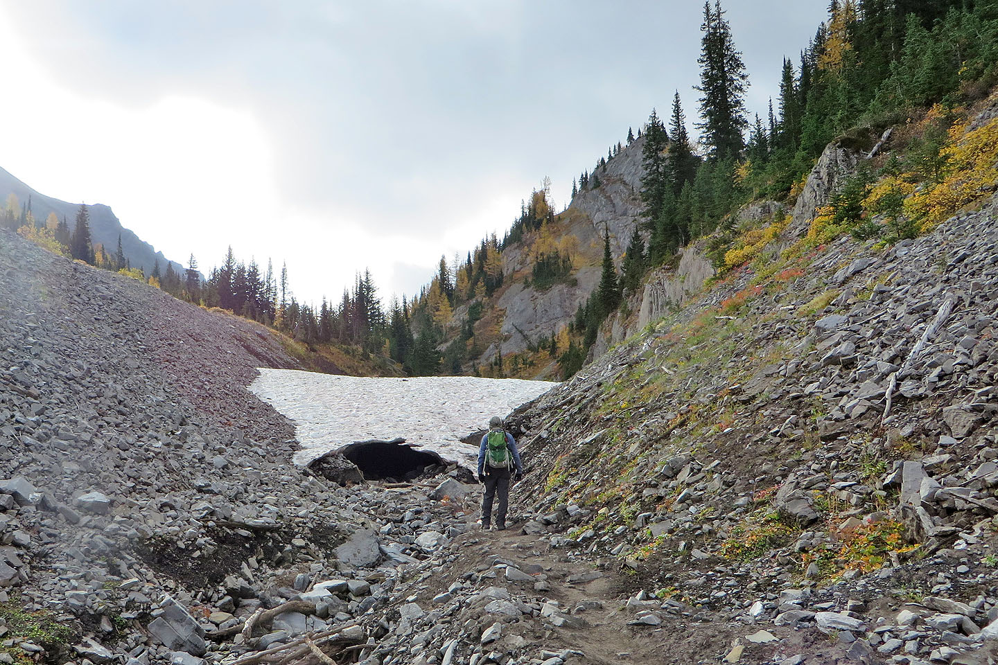
Passing snow on the way back
The snow stretched a long way
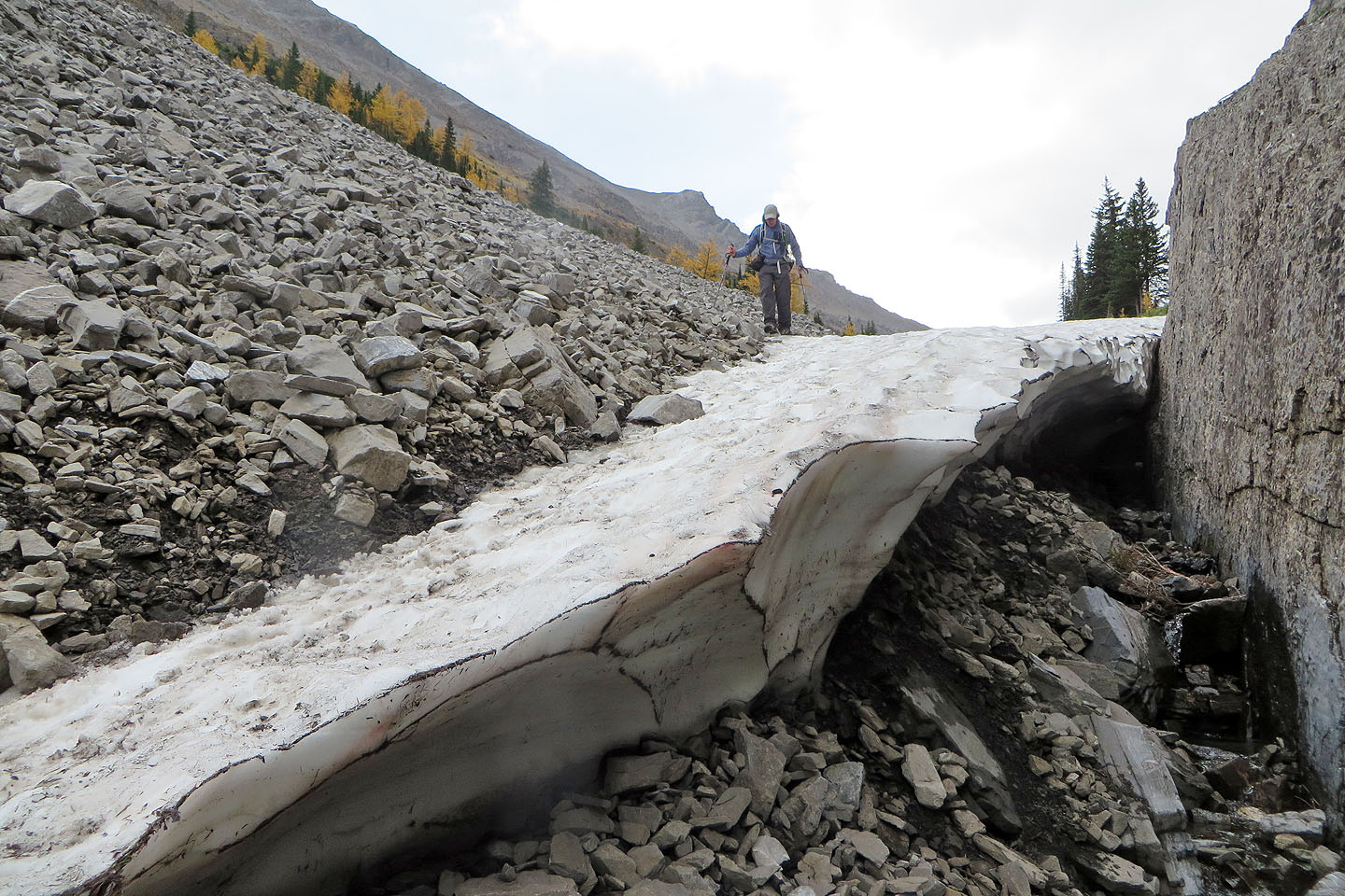
Reaching the end of the snow patch
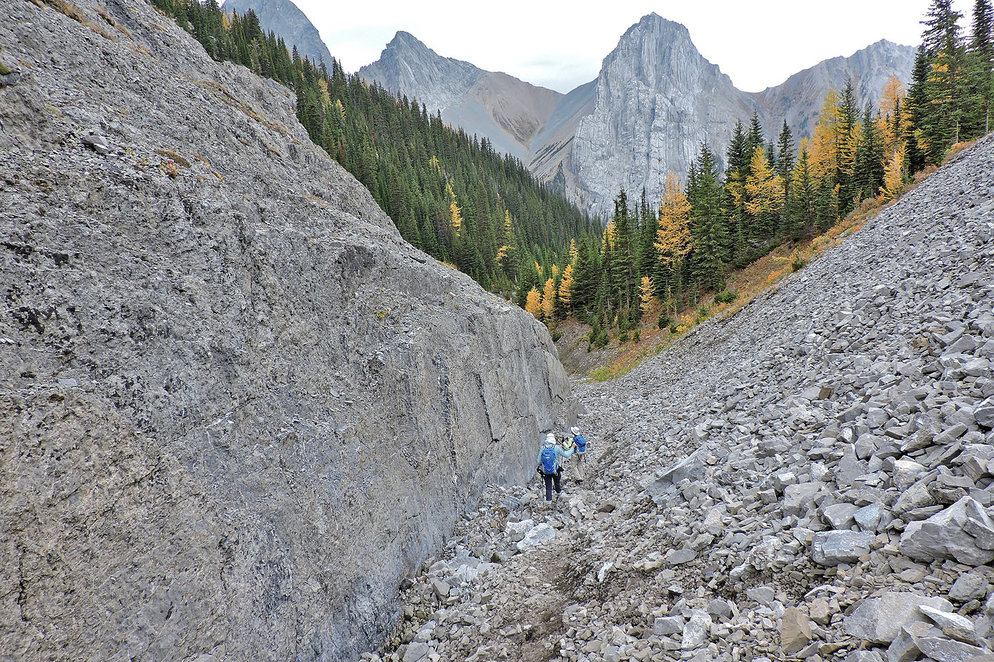
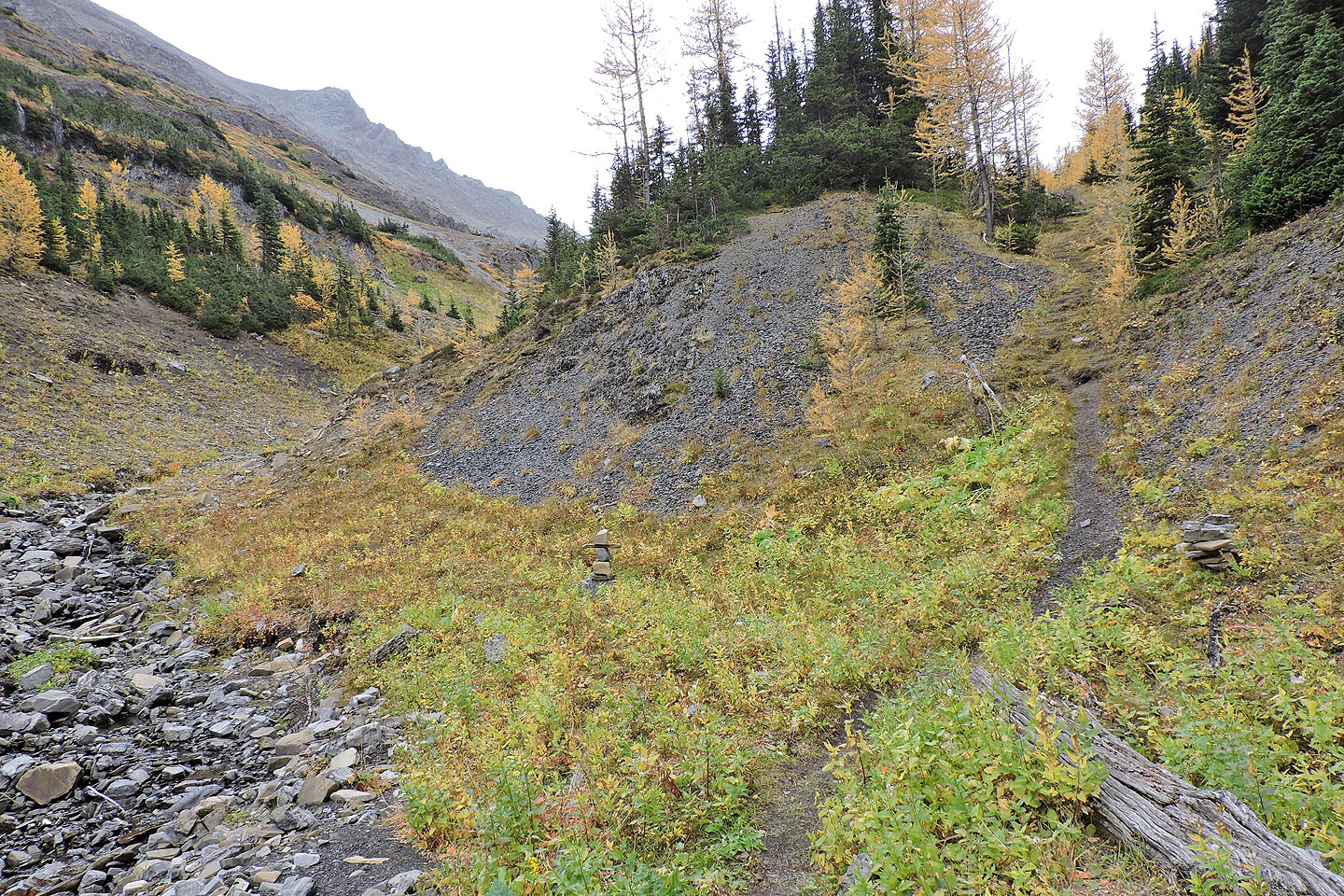
Around the corner is the gully we ascended early
82 J/14 Spray Lakes