bobspirko.ca | Home | Canada Trips | US Trips | Hiking | Snowshoeing | MAP | About
Fisera Ridge
Kananaskis, Alberta
September 21, 2019
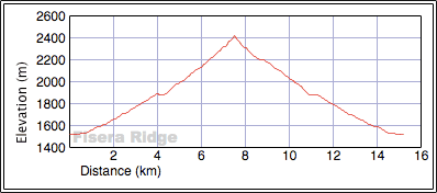
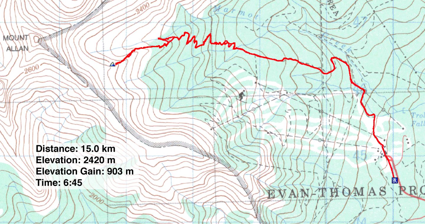
Distance: 15.0 km (9.3 mi)
Cumulative Elevation Gain: 910 m (2986 ft)
Wishing to avoid areas crammed with hikers during the larch season, such as Highwood Pass and Lake Louise, I turned to an objective that I suspected wasn't well known and not likely popular: Fisera Ridge.
Fisera isn't a ridge in the peakbagging sense. Being a spur running down the east side of Mount Allan, it bears no high point. But it has a good approach road and a serviceable trail to the treeline. Marmot Basin trail was better than expected. I was prepared for an ordeal after reading the Kananaskis Trail Report: “This trail was heavily damaged in the 2013 flood; expect washouts and challenging travel.” But aside from one washed-out bridge and a few bushy spots, the trail was in good shape.
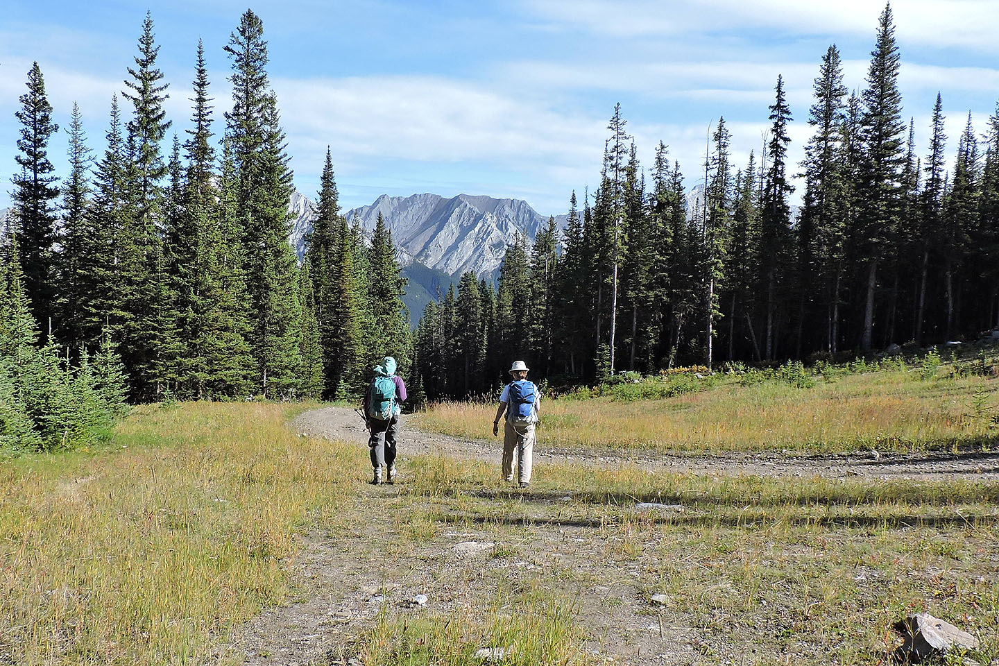
Dinah and I, along with Jonathan and Zora, parked at the gate for Nakiska Ski Area and started up the road. We soon left the ski premises behind and were walking up a gravel road. We stuck to the road, mindful of forks and junctions, before leaving it for an old road. That's where we found the collapsed bridge. We easily hopped the creek and then crossed a bridge, this one still standing.
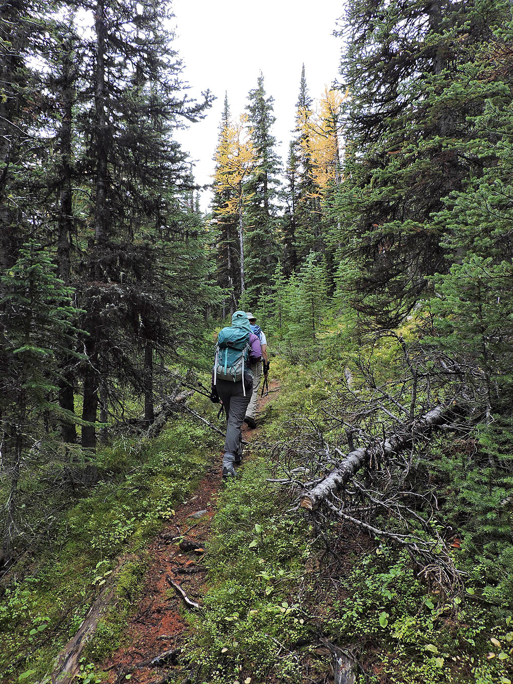
If there are any difficulties to be mentioned, it would be routefinding after the second bridge. We worked through a confusing mishmash of overgrown trails until they resolved into a single, clear path comprising switchbacks. This trail can be used to reach Fisera Ridge or Marmot Basin. Indeed, we mistakenly headed to Marmot Basin. We realized our error after coming to a spring. We backtracked a few dozen metres and found a trail to the ridge. When we passed a side trail going down the ridge, we realized it was a shortcut back to the main trail. We would use it on our way back.
Views from the trail were limited because of trees, but mushrooms provided a worthwhile distraction. We stopped frequently to take photos. Except for Dinah who thinks mushrooms are ugly, we all marvelled at the variety of fungi.
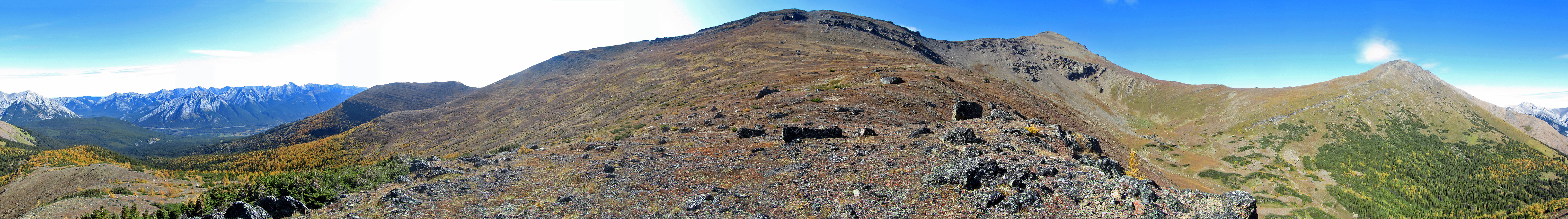
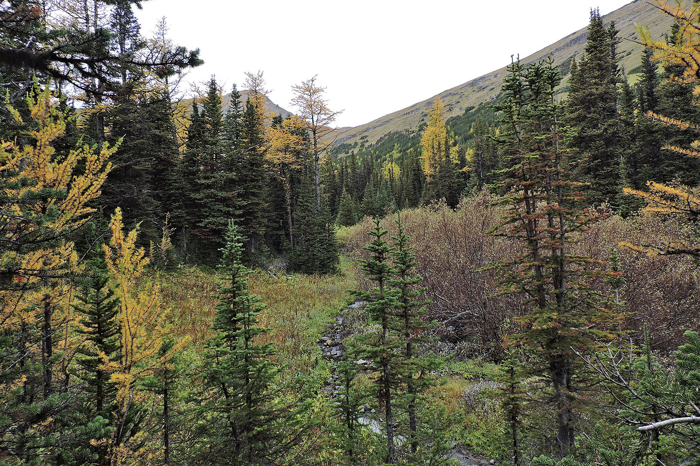
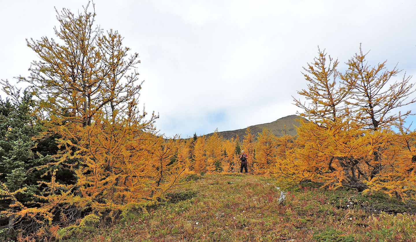
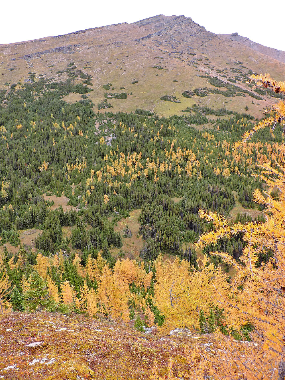
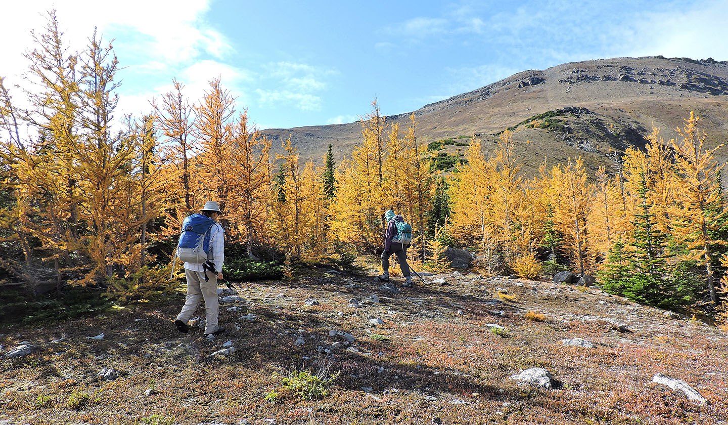
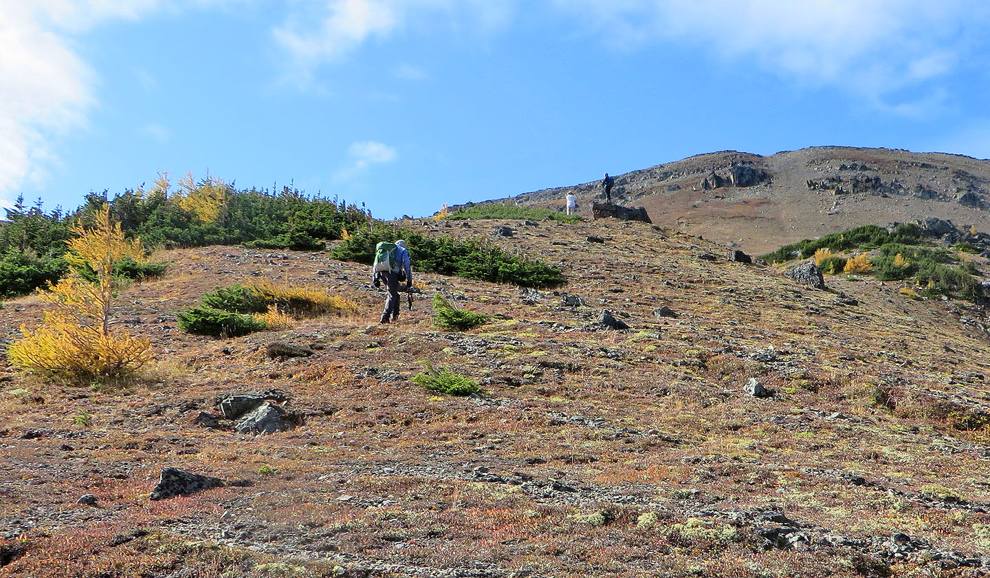
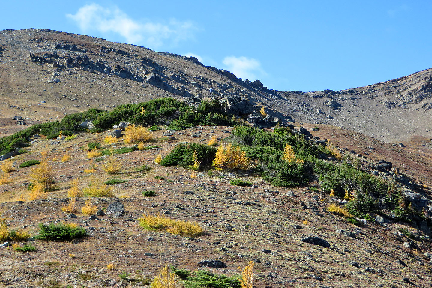
We also began seeing occasional larches dressed in fall splendour, foreshowing what lay ahead. Soon we were passing through a lovely yellow forest. We continued climbing until we came to a slope, open except for scattered stands of spruce and larches. We stopped for lunch by a solitary boulder. While the others relaxed, I hiked a little farther up the ridge to an outcrop. One could hike to the top of Mount Allan, but I turned around after taking a panorama.
We had the ridge to ourselves, but our solitude was broken when we started back down. We encountered two hikers, a father and his daughter, coming up. He had been up Fisera Ridge a few times. On this trip, they added orange and pink flagging to make it easier for skiers to follow the trail. We could have used that flagging on our ascent!
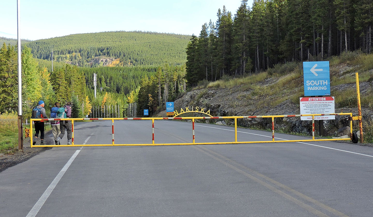
Starting up the road from the gate
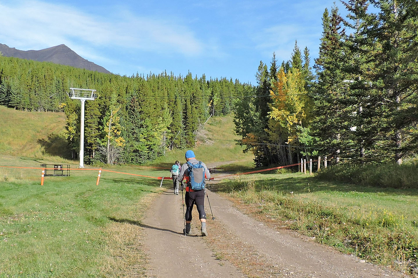
The road passes under a chairlift
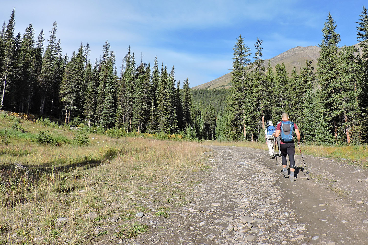
The main road turns left, but we kept going straight
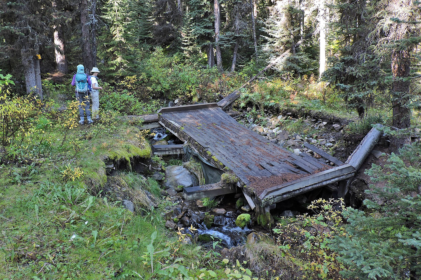
The first bridge was washed out. Dinah reads a sign that says, "Firearms must be unloaded and encased."
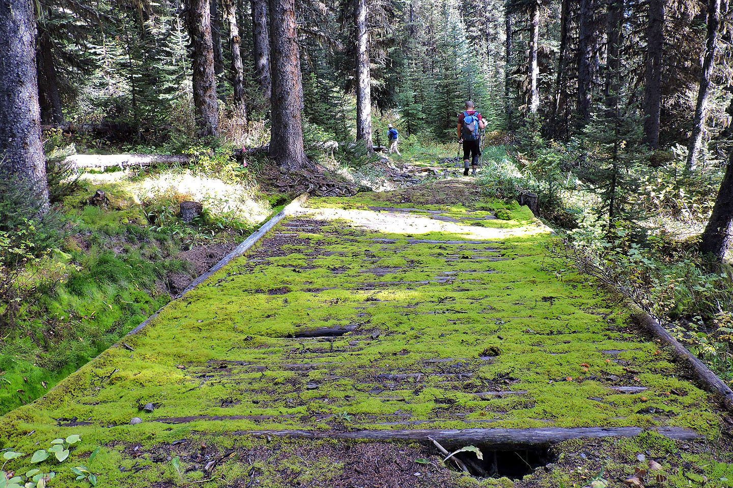
The second bridge was mostly intact
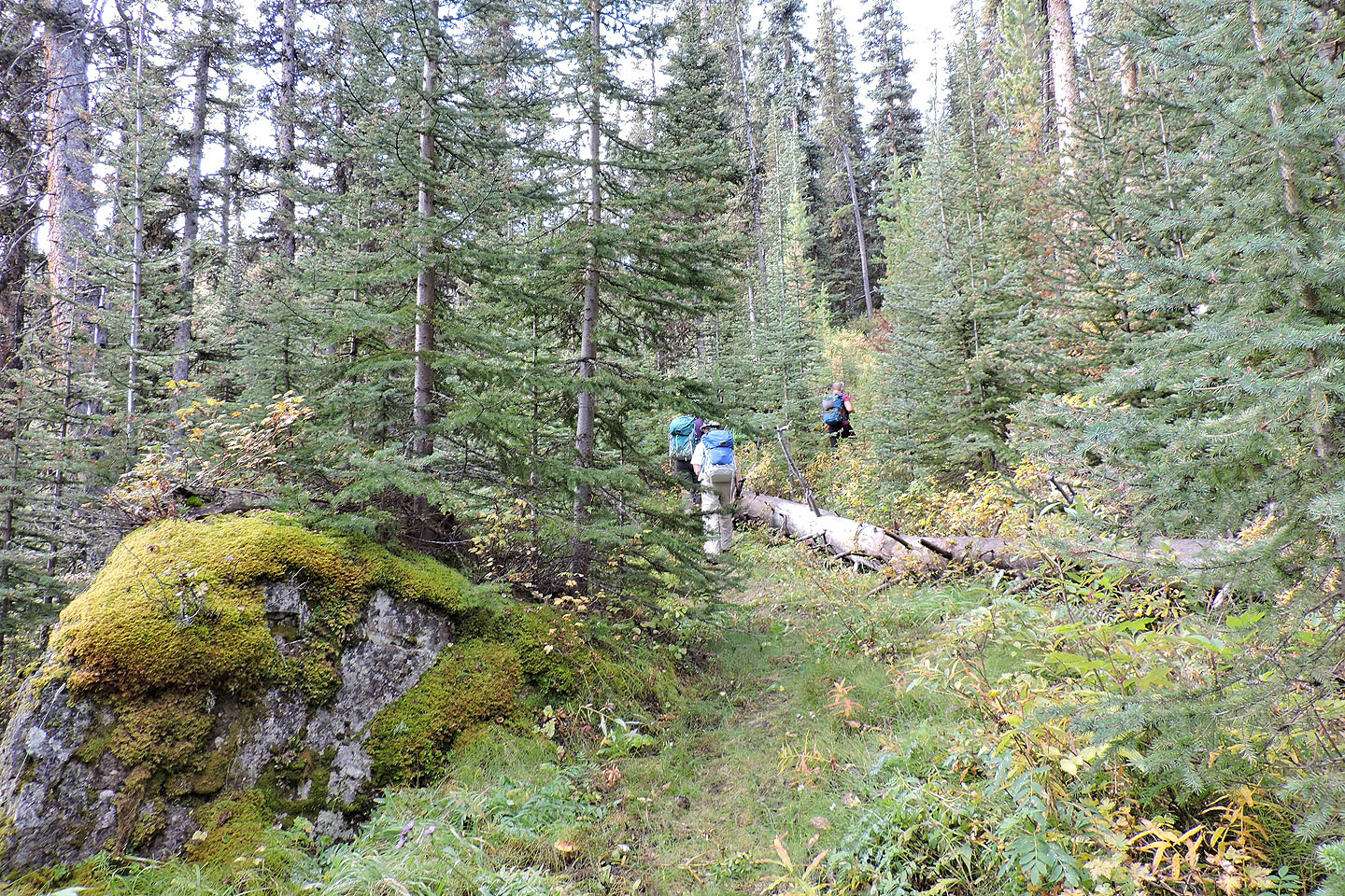
After the bridges, the route became a bushy trail
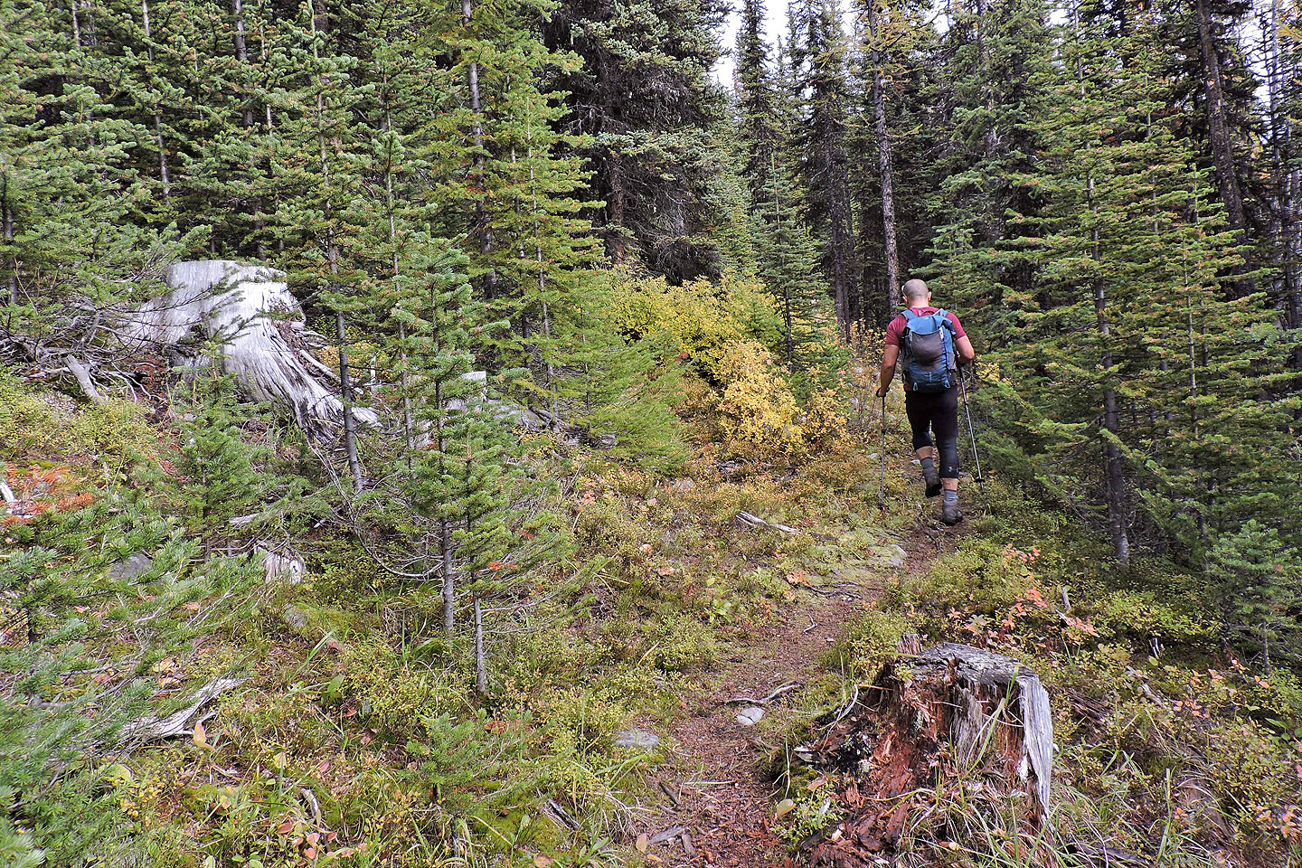
The trail became better defined when we hit the switchbacks
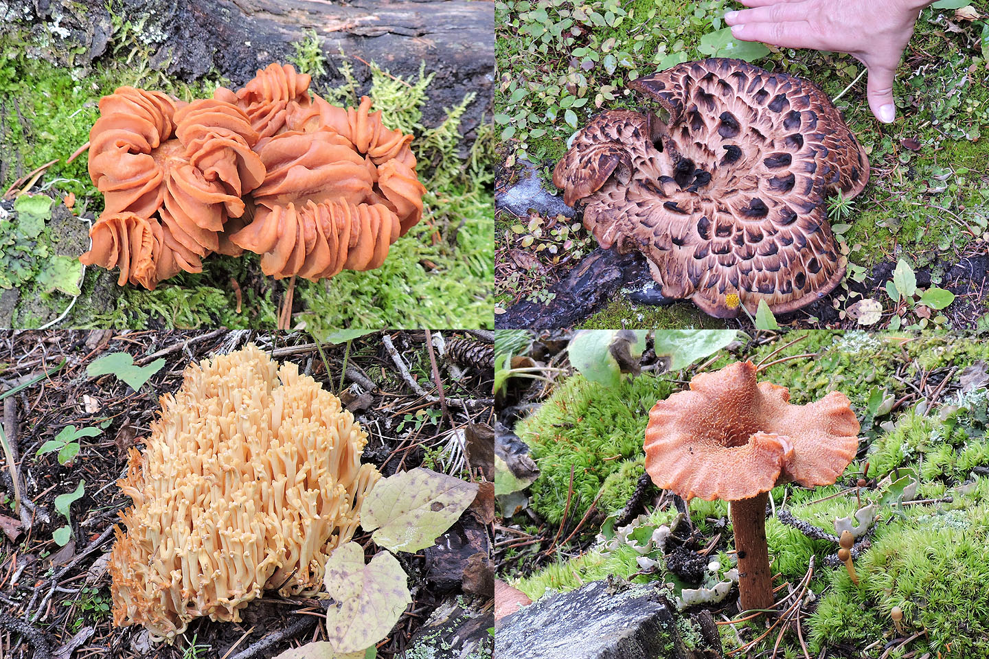
Quite the assortment of mushrooms
We began to see larches
We started down the trail to Marmot Basin before backtracking a bit to find the trail to Fisera Ridge
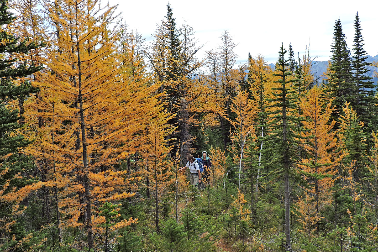
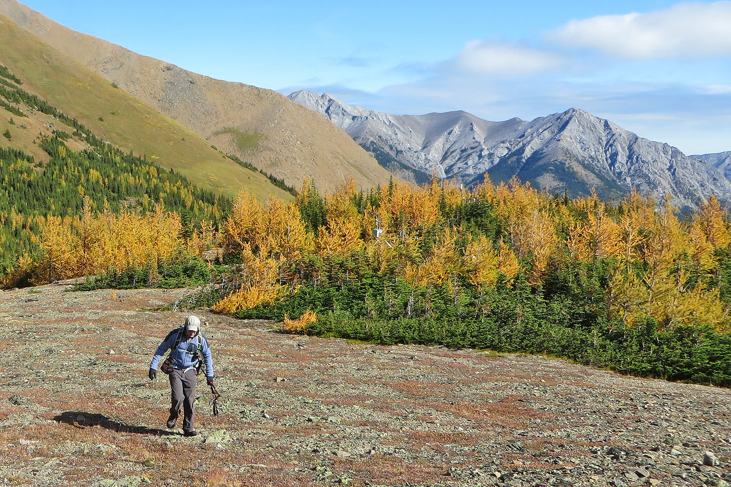
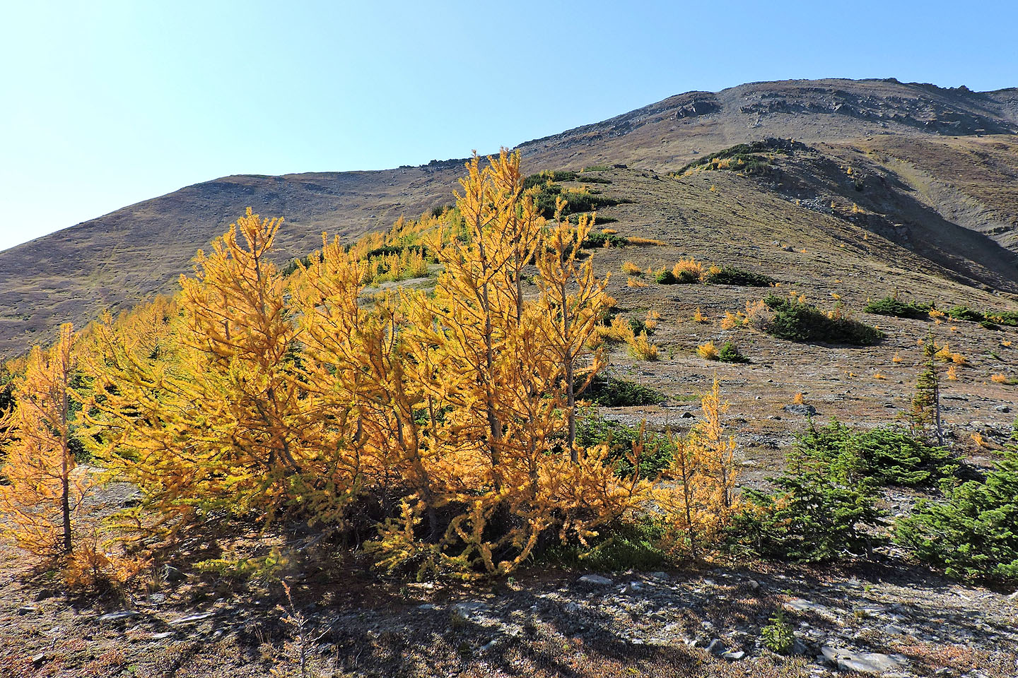
The larches start to really kick in
We continued hiking through the larches
Mount Collembola lies north
The larches appeared to be in their autumn prime
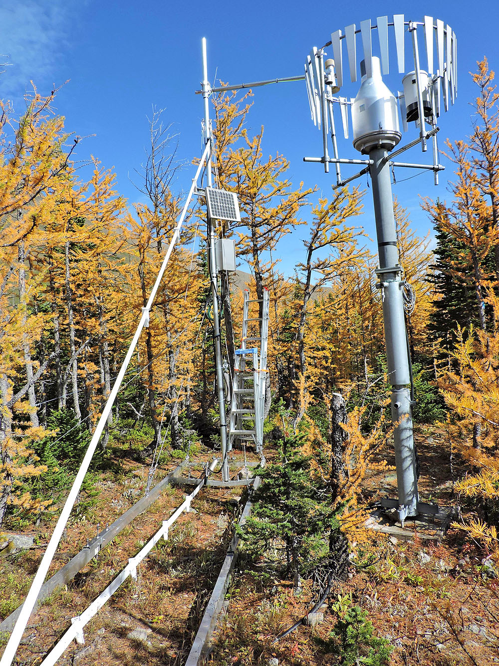
One of three hydrometeorological stations
The stations are barely visible in the larches
Jonathan stands on the boulder where we stopped for lunch
I continued up the ridge and took a panorama on an outcrop (mouse over for a close-up)
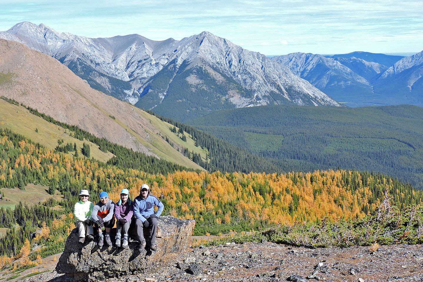
Zora, Jonathan, Dinah and me on the boulder
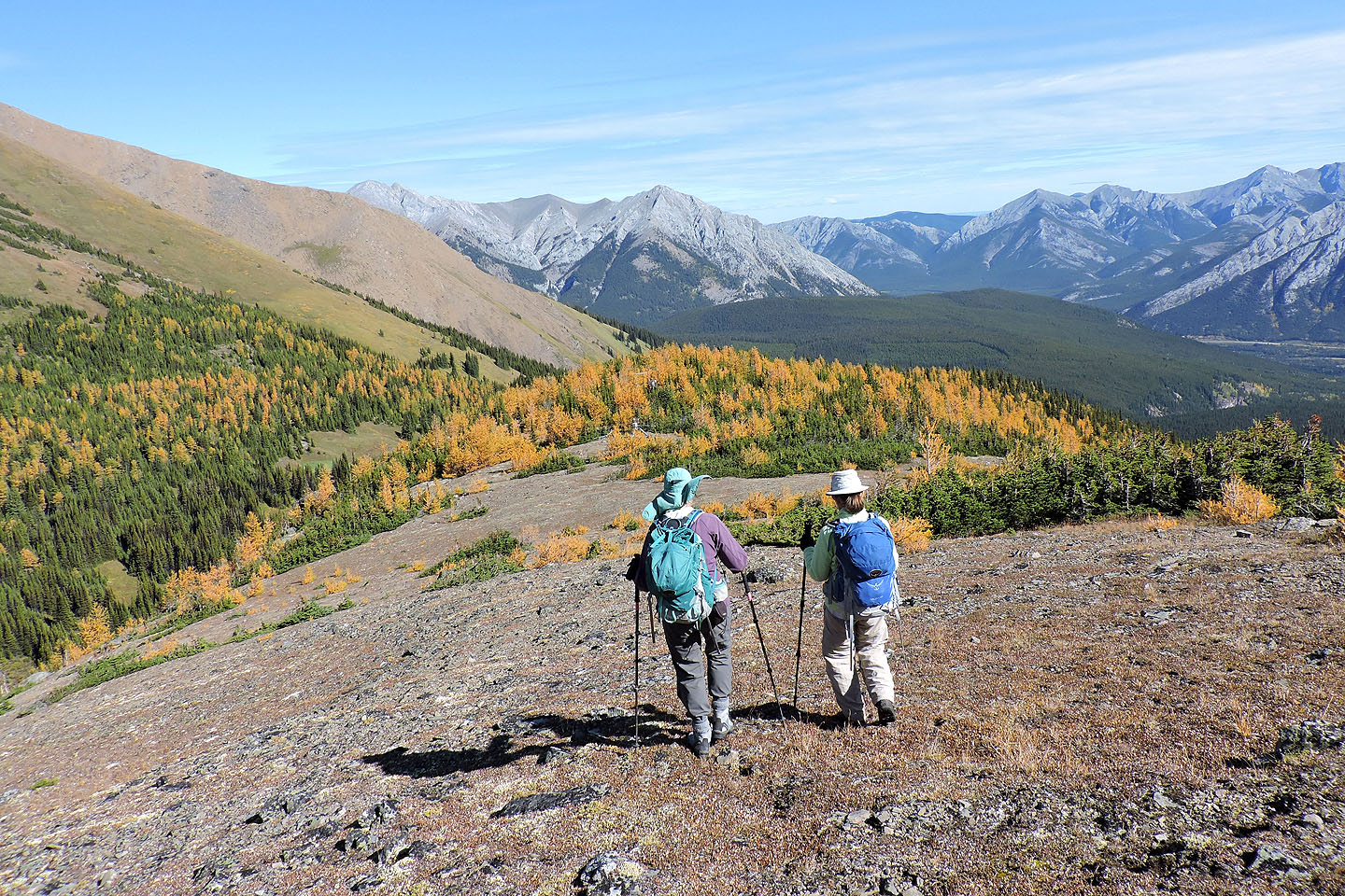
Starting back down
Looking back at Fisera Ridge
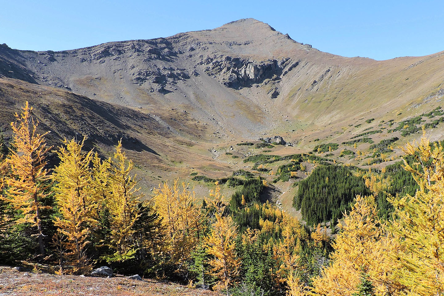
Marmot Basin lies below Mount Allan
We faced a long walk back down the road
82 J/14 Spray Lakes Reservoir