bobspirko.ca | Home | Canada Trips | US Trips | Hiking | Snowshoeing | MAP | About
C-Level Cirque
Banff, Alberta
October 27, 2019
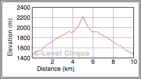
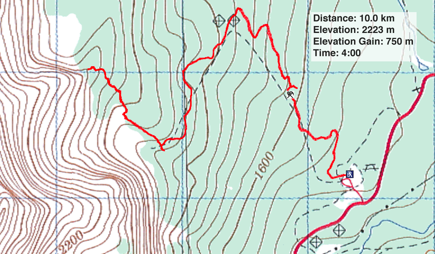
Distance: 10.0 km (6.2 mi)
Cumulative Elevation Gain: 753 m (2470 ft)
The hike to C-Level Cirque offers an opportunity not only to visit a scenic basin on the east slopes of Cascade Mountain but survey the ruins of a mine active a hundred years ago. In fact, “C-Level” refers to the upper workings of the Bankhead Coal Mine. A maintained trail runs through the forest and mine area before coming to the brink of the cirque. The trail then skirts the cirque to reach a boulder field. But this is not the end. The path continues up a treed spur to reach a clearing with a grand view of Lake Minnewanka.
Although the cirque is a popular trip in the summer, Dinah and I saw few hikers when we did it in winter conditions. Most hikers appeared to only go to the edge of the cirque, a round trip of 8 km and 450 m gain, but they miss the expansive views that don't kick in until going up the spur.
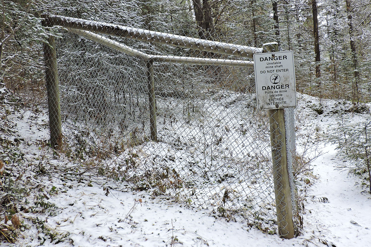
We parked at the Upper Bankhead parking lot and started up the broad path in the forest. After hiking over a kilometre, we started seeing evidence of the old mine: a foundation, a concrete building and several ventilation shafts. All the shafts were fenced for safety reasons. Beyond the mine, the path, now narrower, continues to ascend through trees.
Just before the cirque, we passed a side trail. This brief trail drops to a tarn, although at this time of the year, it was dry, not much to see. A couple of minutes later, we broke free of the trees and found ourselves at the edge of the cirque. We stopped not only to take in the view but to put on icers. The trail had become increasingly slippery with ice and snow. Afterwards, we continued to the boulder field at the end of the cirque.
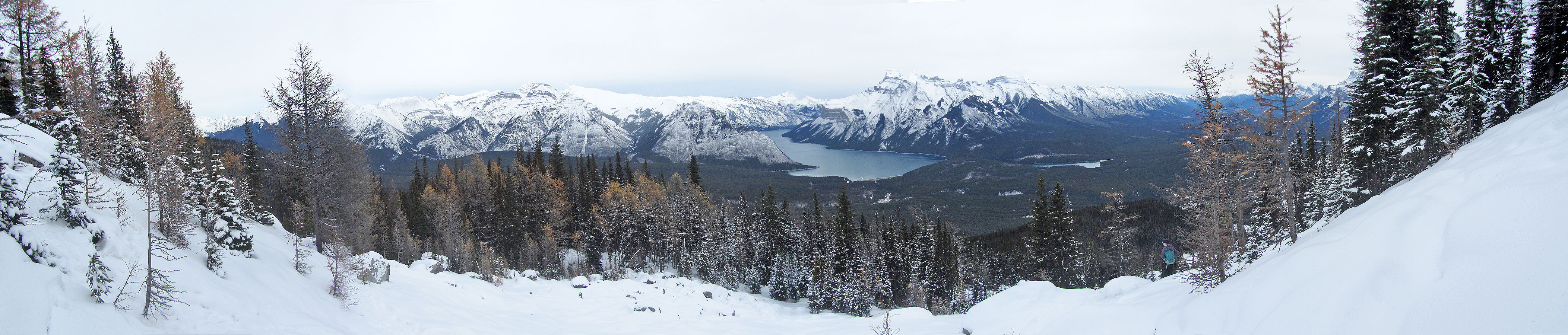
Some people might be content to stop at the boulders, but we pushed on, up the spur. The trail was hidden under snow, but we had no trouble following old tracks in the snow. The trail led to a clearing on the crest. From there we had a nice view of Bow Valley and Lake Minnewanka. It's possible to climb slightly higher to a cliff face, but trees prevent any worthwhile views. For a short time, we had the crest to ourselves. When a few others arrived, we headed back down.
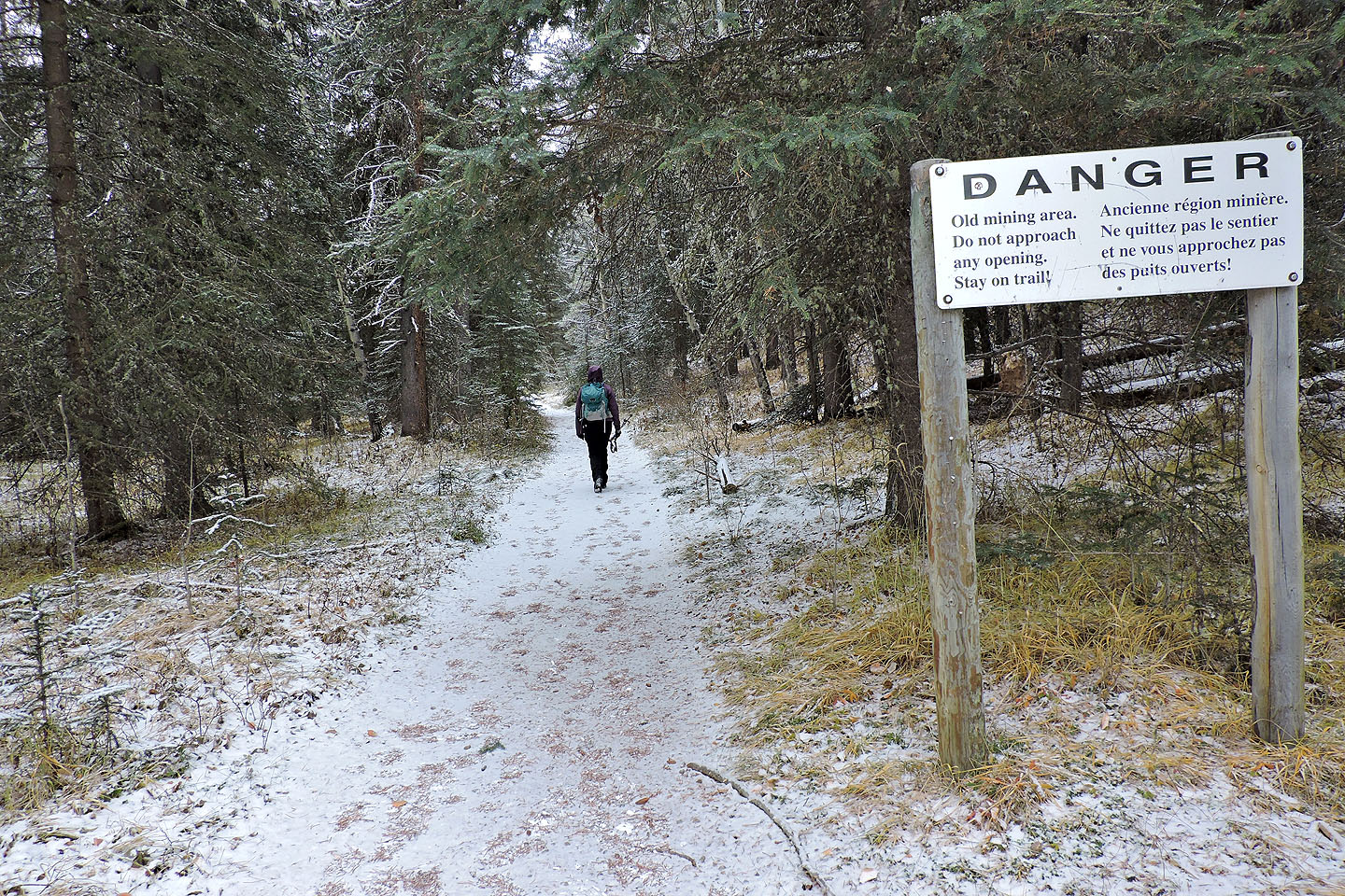
A warning sign is posted at the trailhead
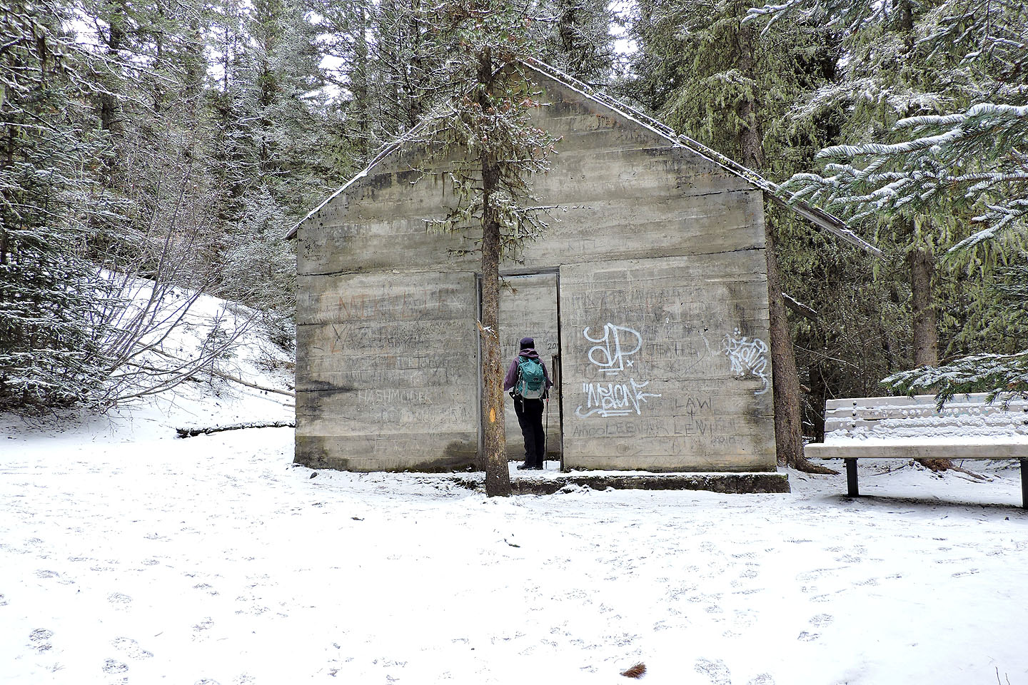
A concrete structure at 1.2 km
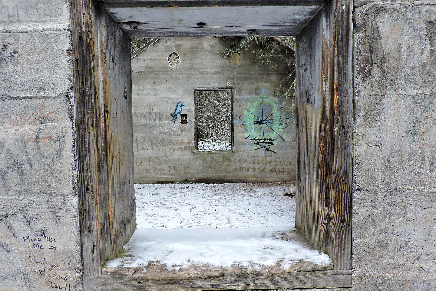
View of the second room from a window inside the first room
The first ventilation shaft is next to a cement foundation
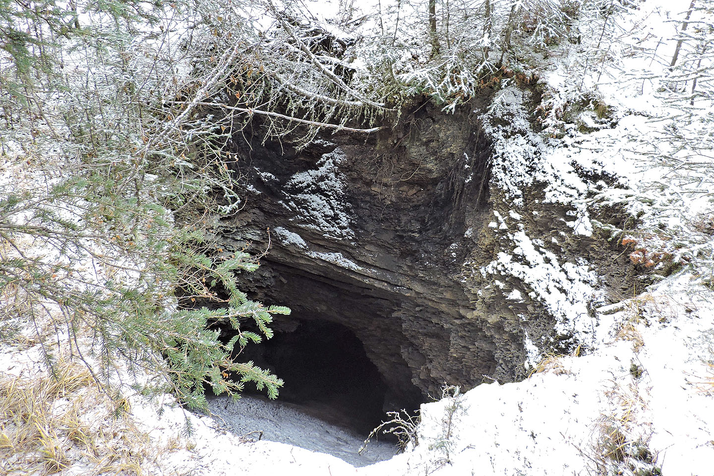 By holding my camera over the fence I was able to take a photo down the shaft
A short distance from the shaft, a slag pile extends to a viewpoint
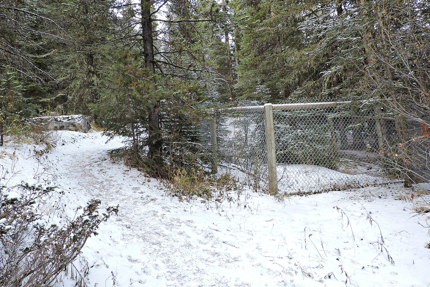
There are several fenced shafts along the trail and on side trails
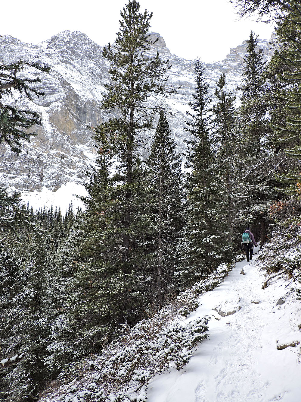
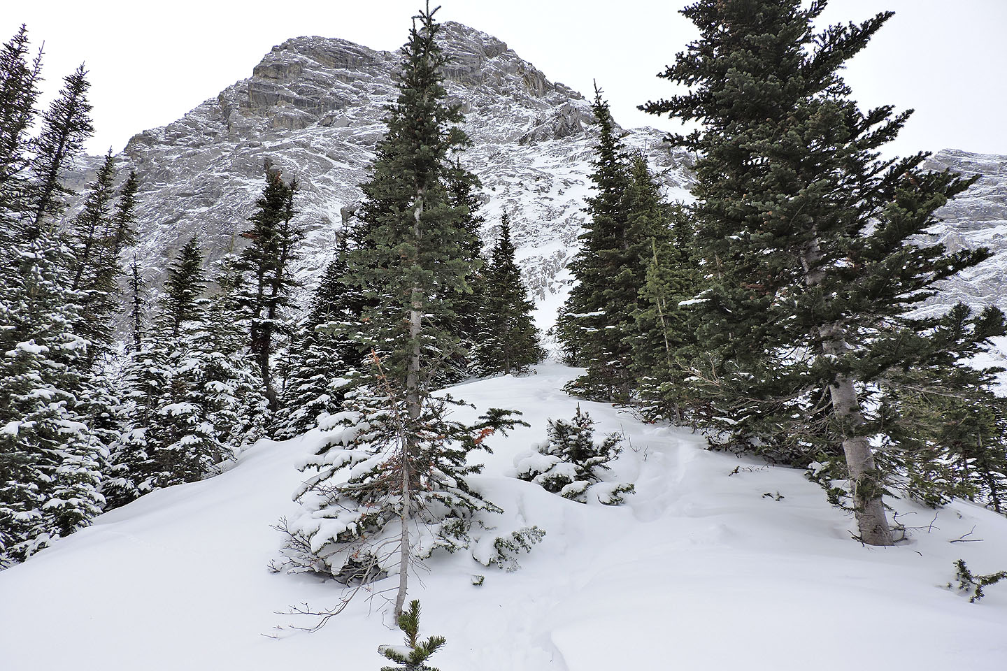
After the mine, the trail cuts into a slope
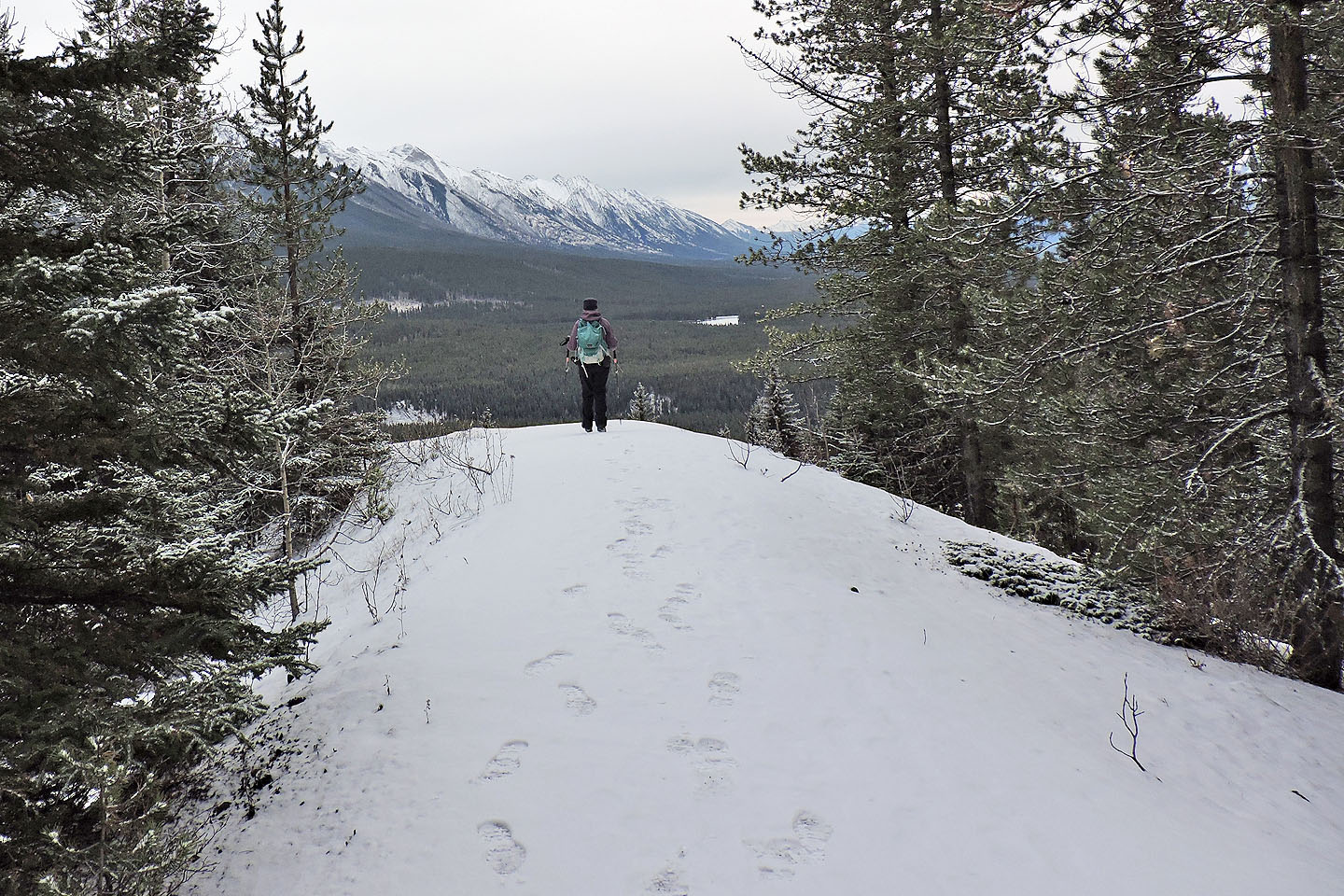
From the edge of the cirque the trail leads to the cliffs on the sky line
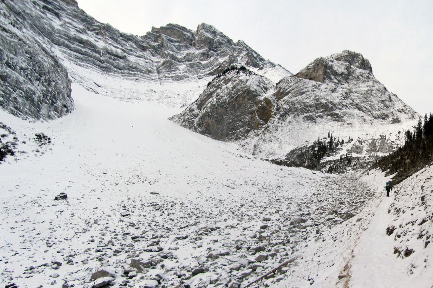
The trail follows the edge of the cirque
Looking back. The dry tarn is in the centre, half hidden in trees.
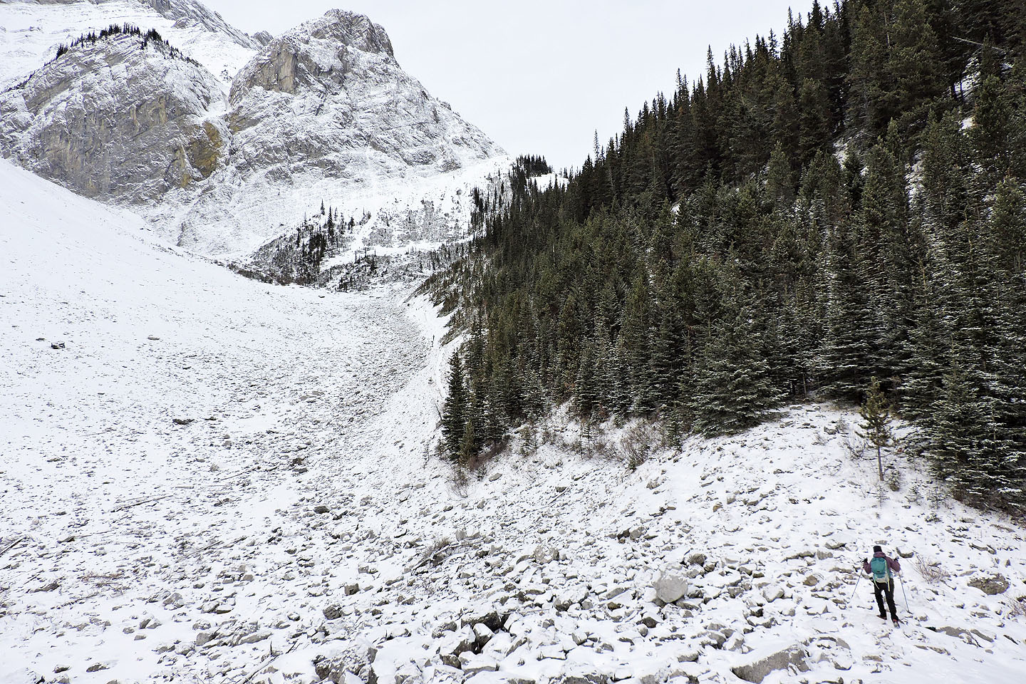
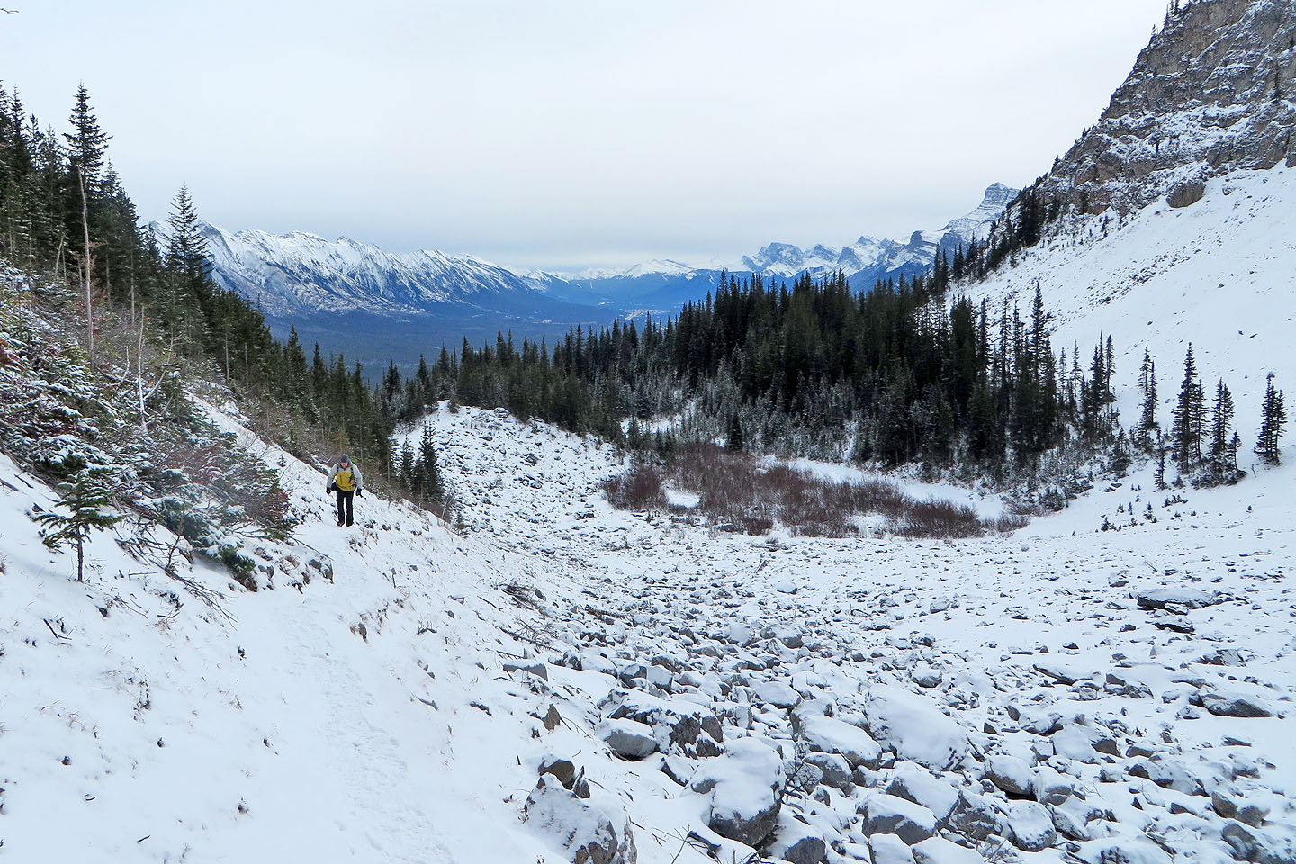
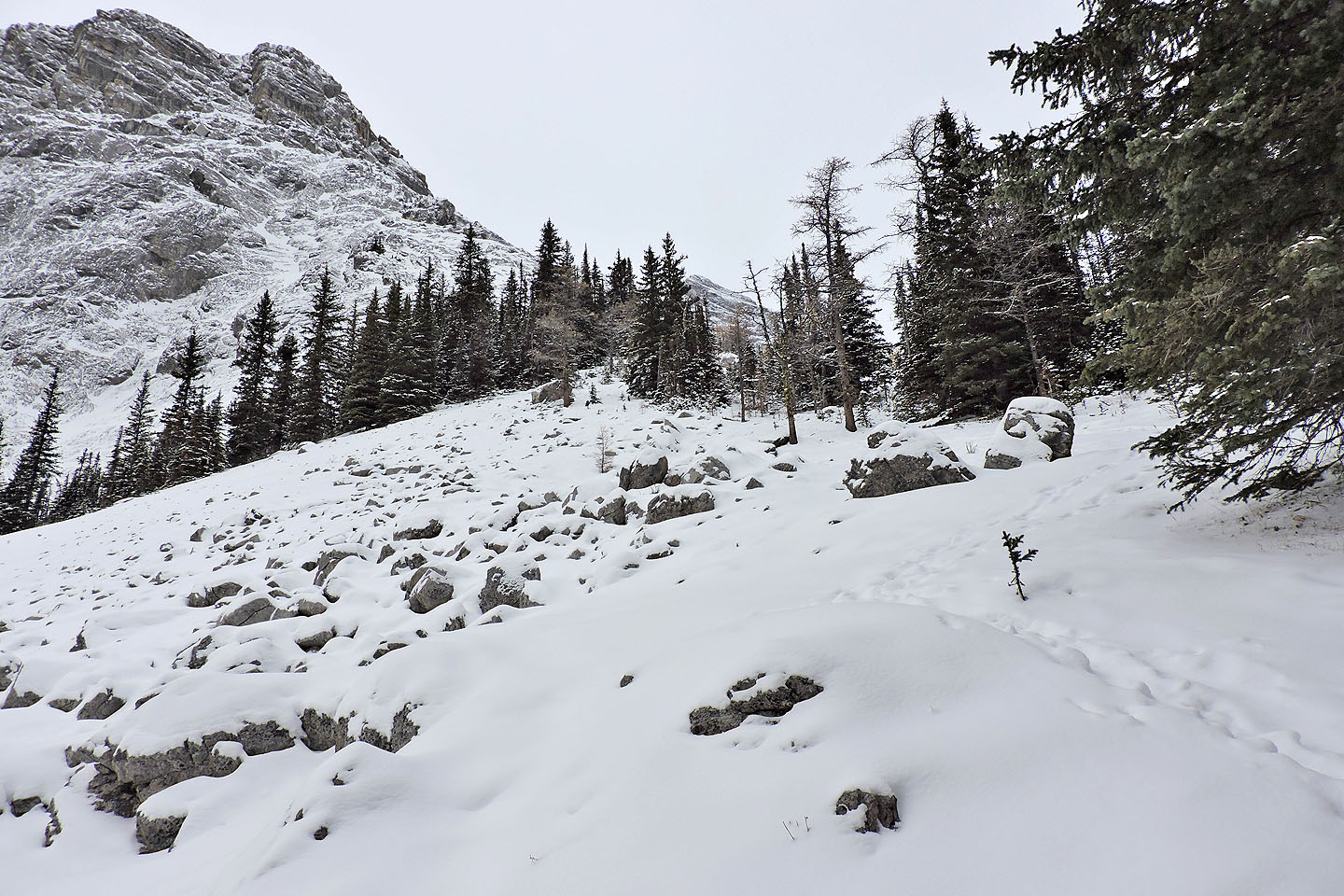
Arriving at the boulder field
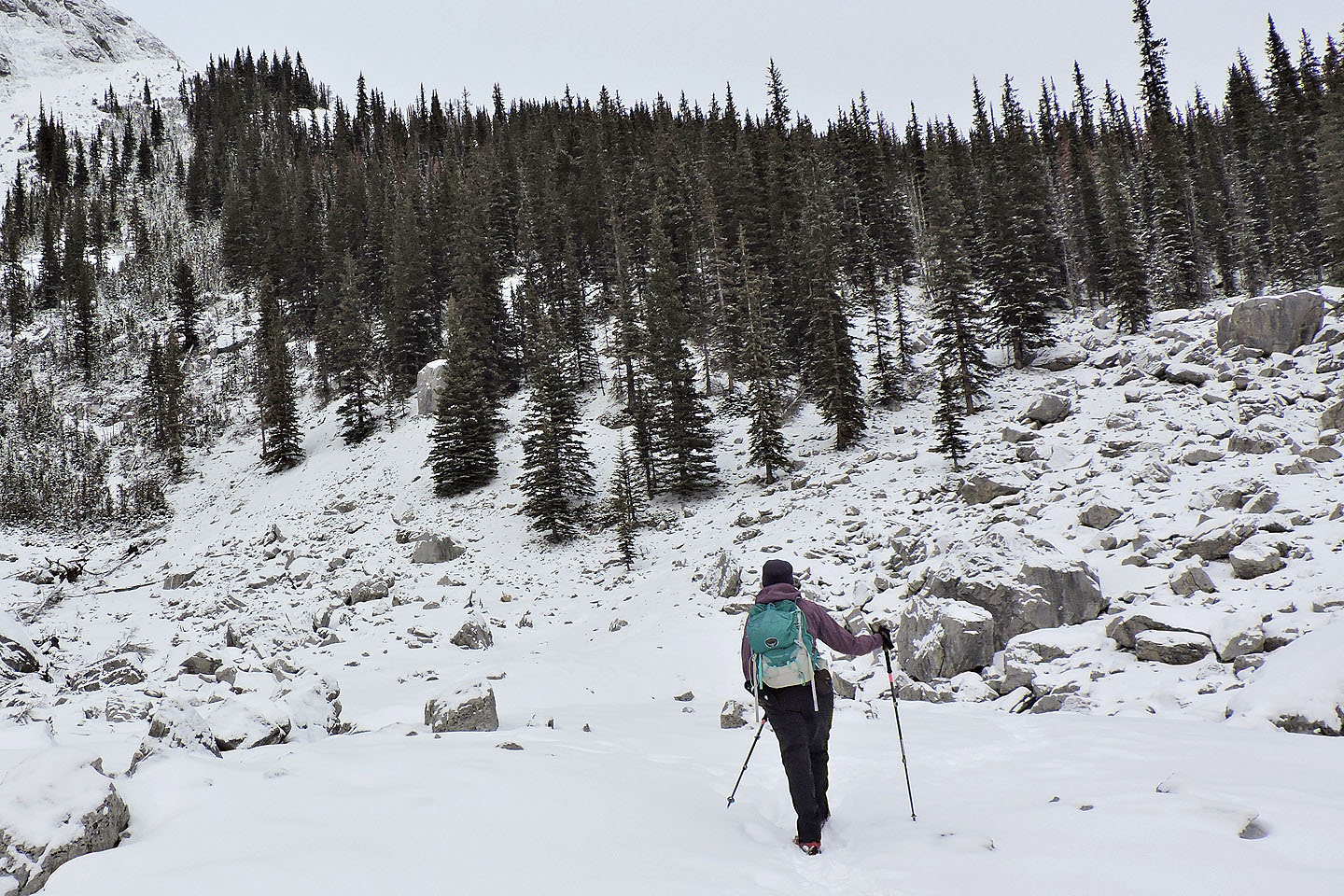
After the boulder field, the trail ascends a wooded slope
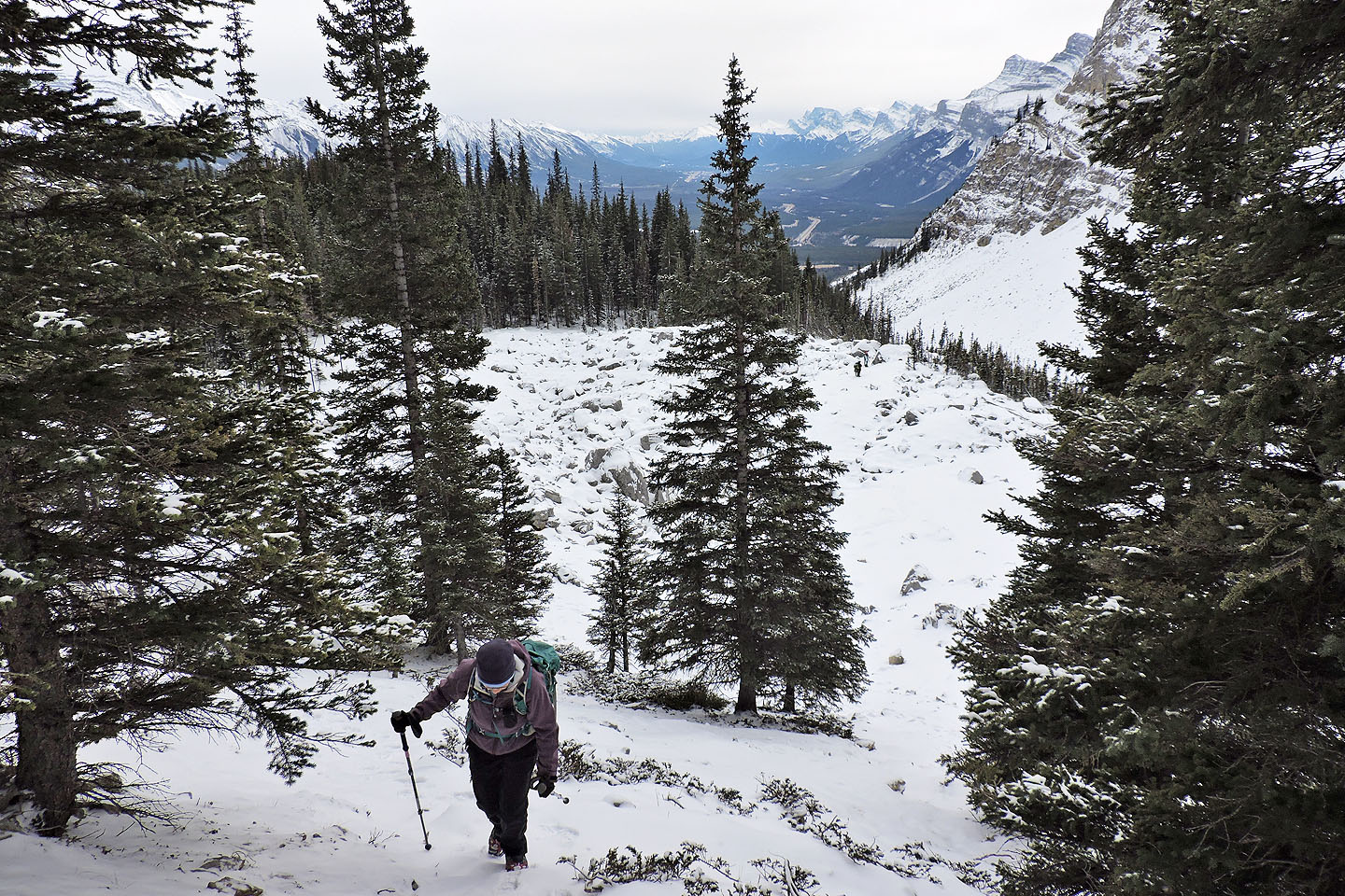
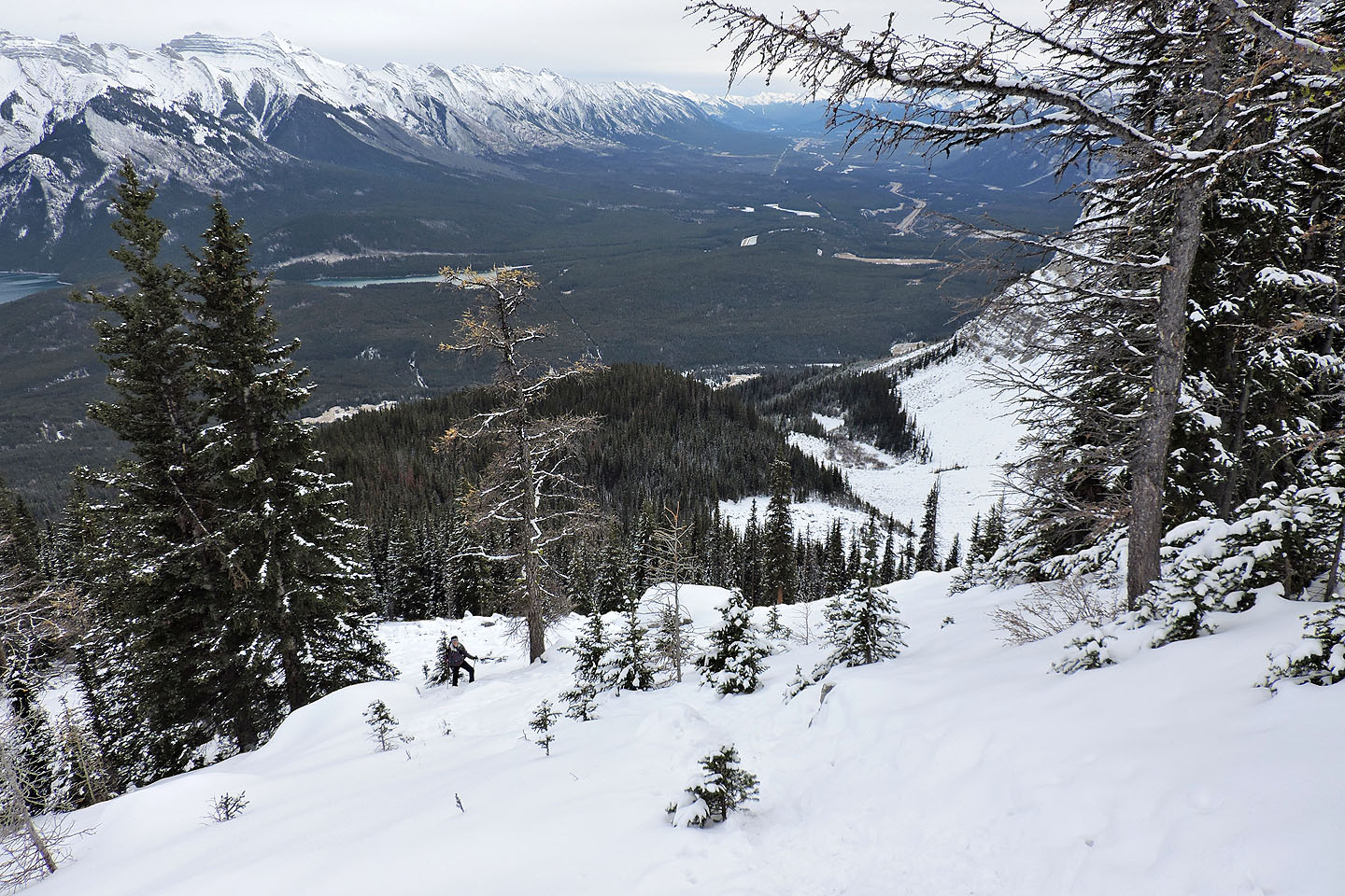
Looking back after starting up
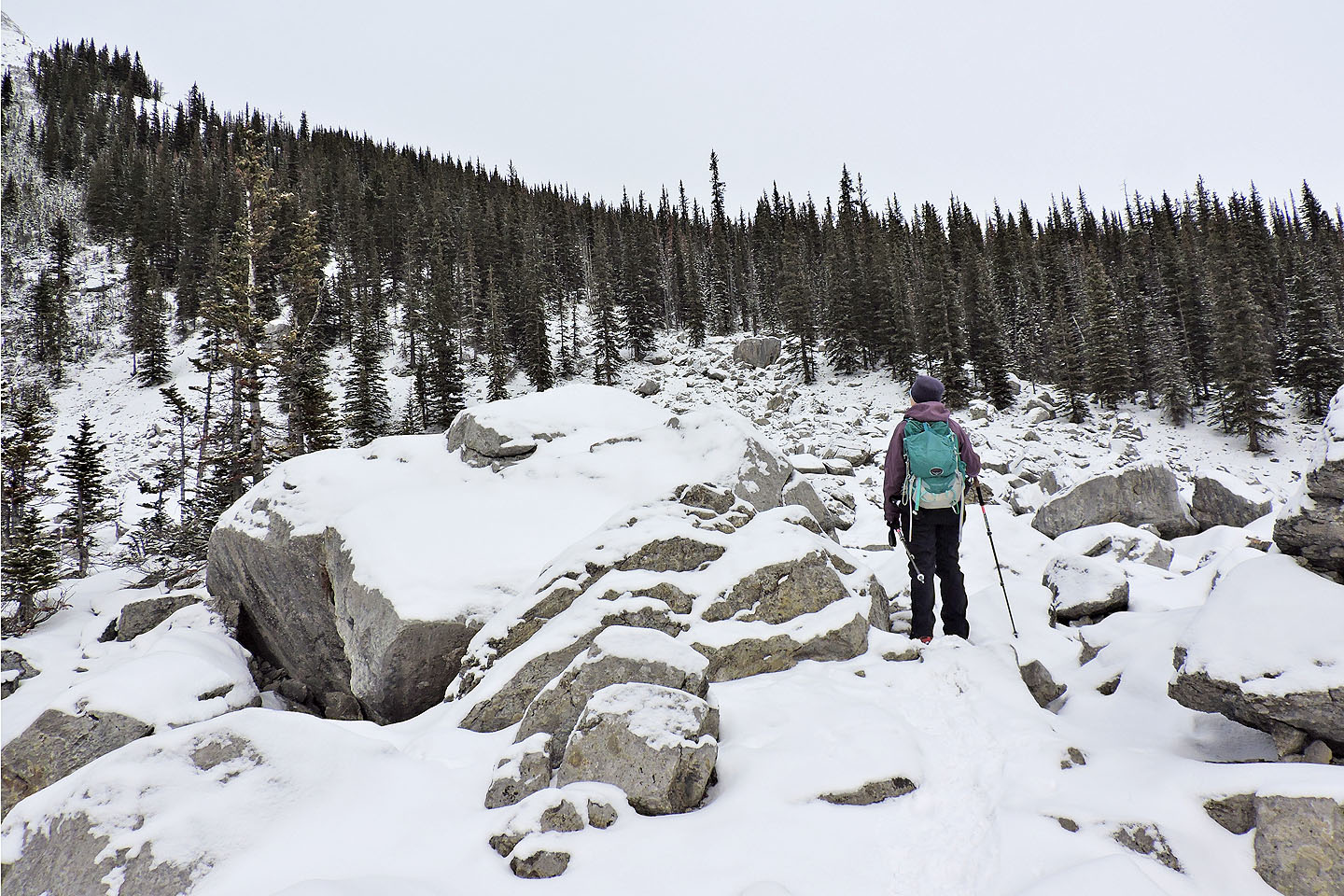
After the trees, the trail skirts a second boulder field
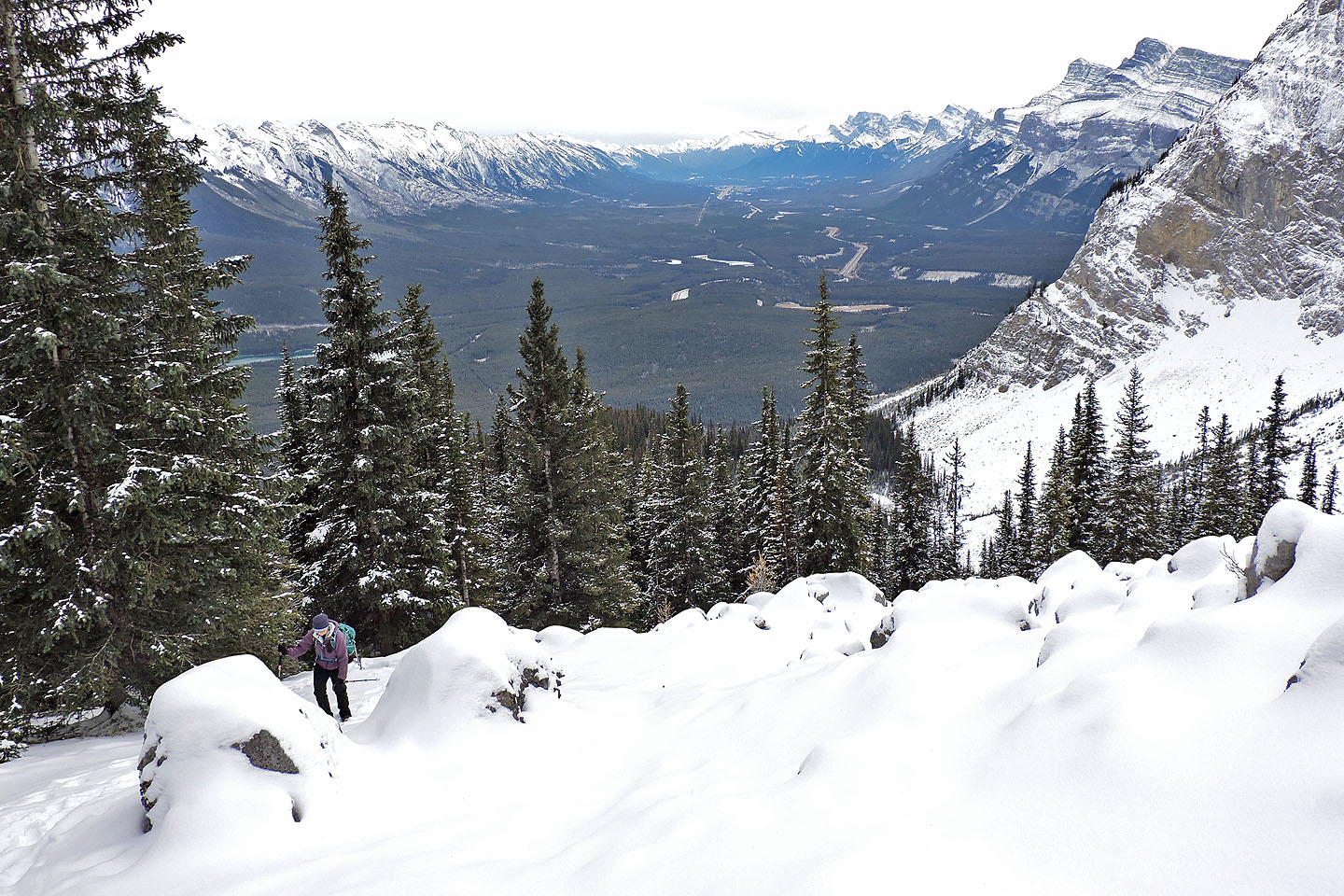
From the second boulder field we had views of Bow Valley
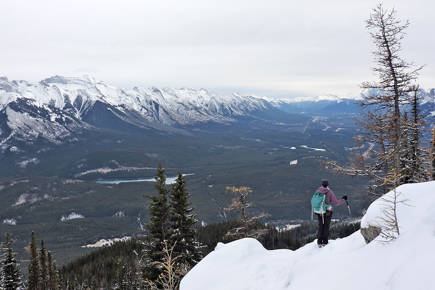
Looking back just before reaching the crest
The clearing on the crest is the logical end to the trip
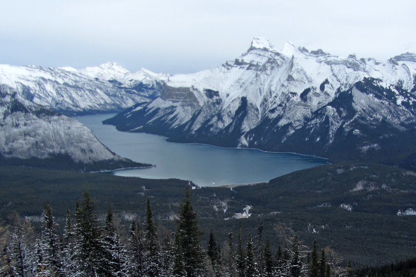
Lake Minnewanka
Another 50 m takes you to a cliff face although there is little to see because of trees
82 O/4 Banff